TS6 0NN - 4 bedroom detached house for sale in Flatts Lane, Normanby,…
View on Property Piper
4 bedroom detached house for sale in Flatts Lane,
Normanby, Middlesbrough,
TS6 0NN, TS6
Property Details
- Price: £325000
- Bedrooms: 4
- Bathrooms: 1
- Property Type: undefined
- Property SubType: undefined
Brochure Descriptions
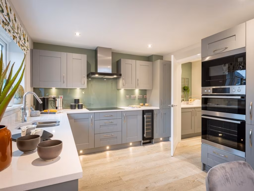
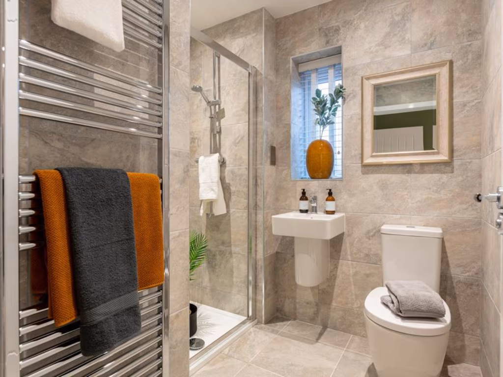
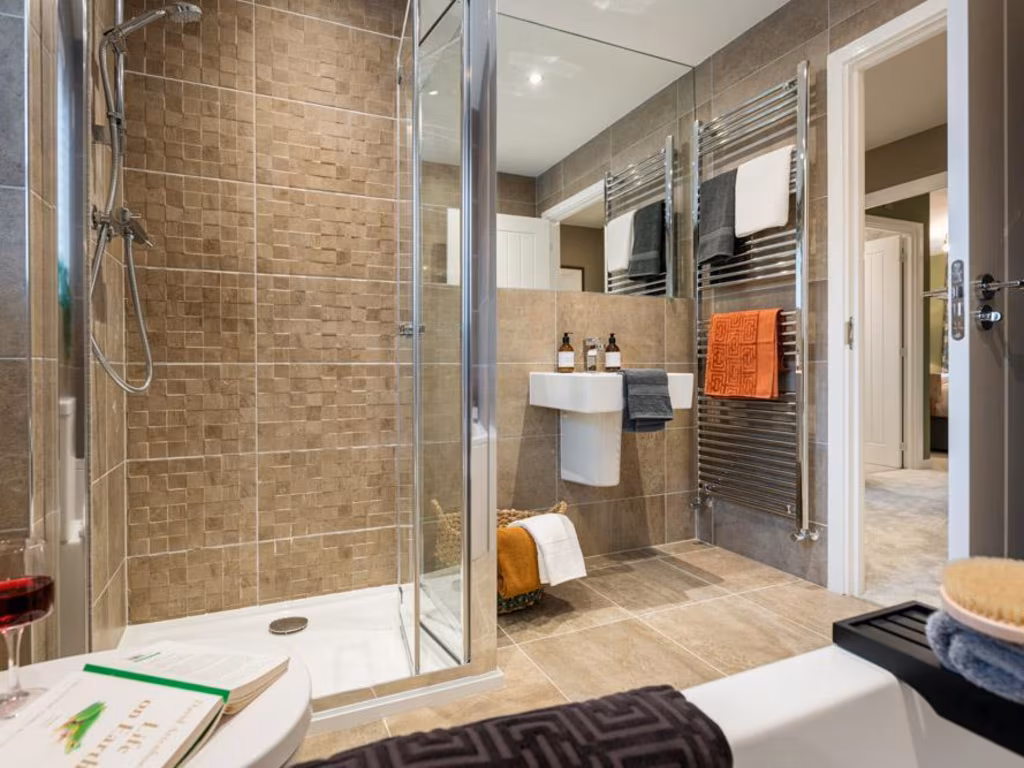
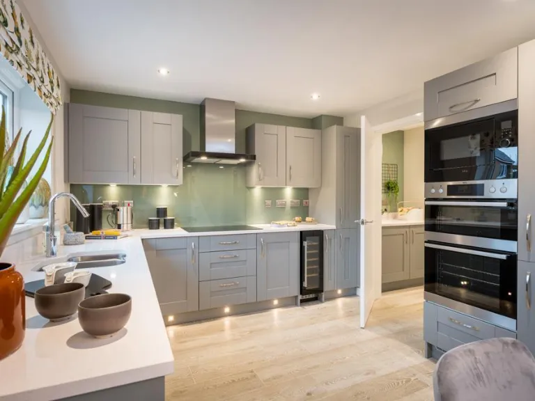
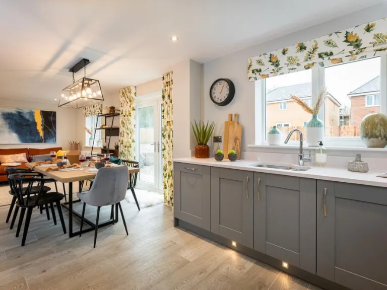
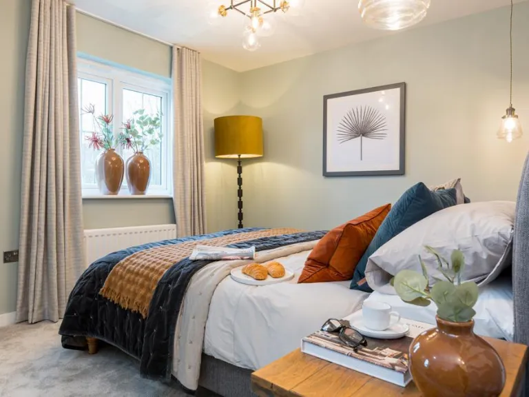
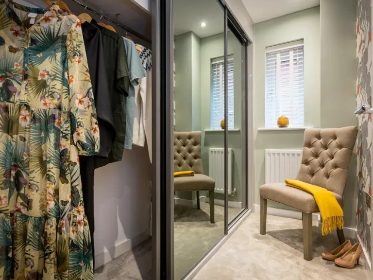
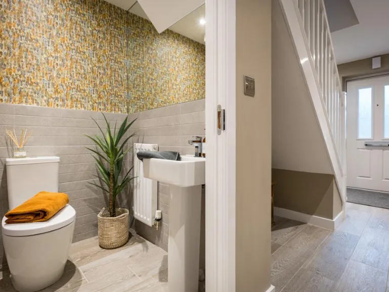
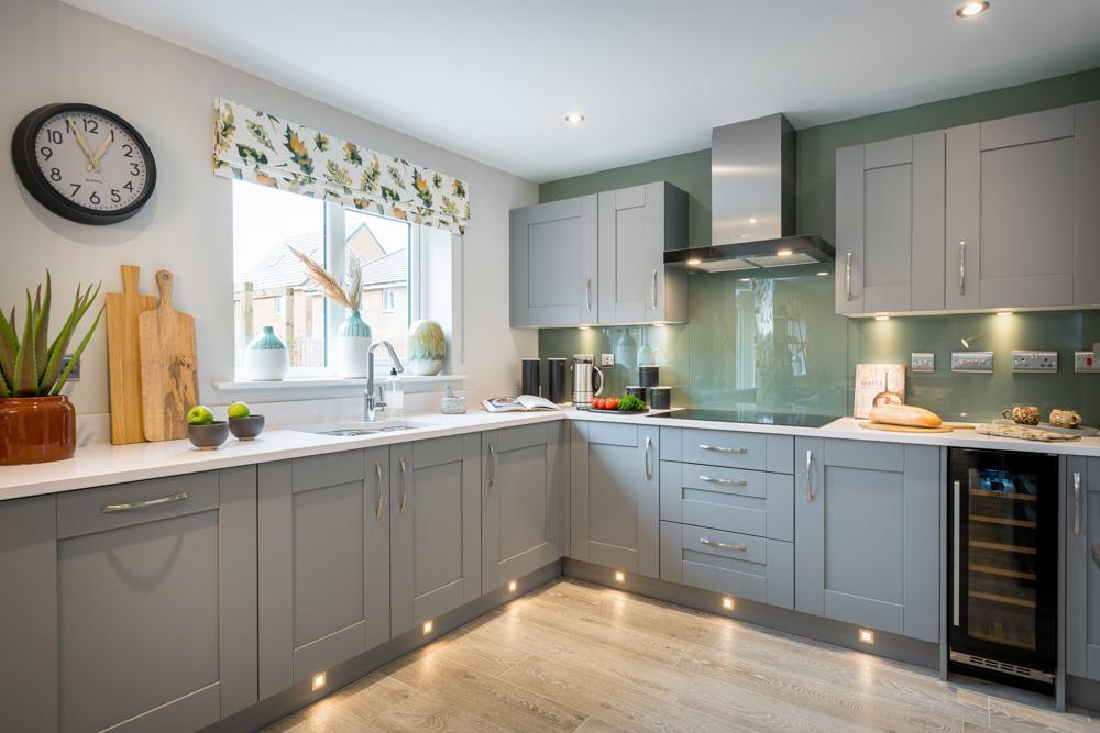
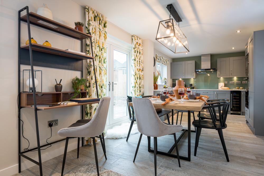
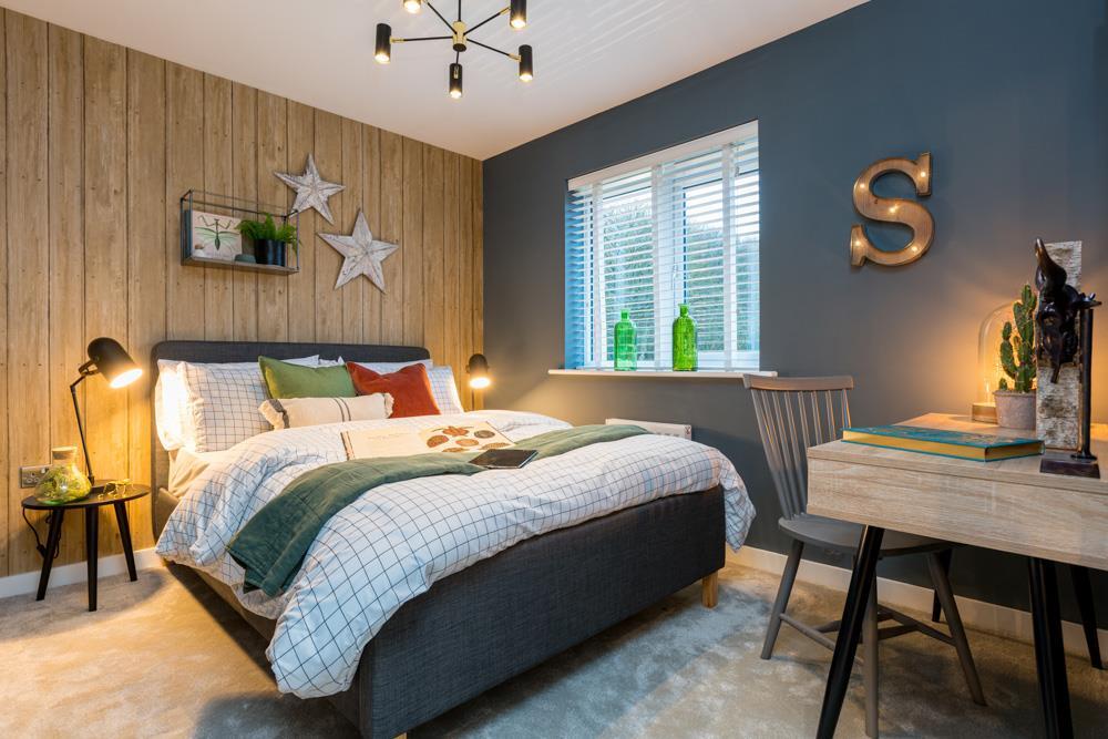
- The image primarily focuses on a comforting, domestic scene in what appears to be a modern, well-finished home. The partial view indicates a medium-sized window, which allows ample natural light, suggesting a bright interior. The property likely features contemporary and neutral finishes. The visible portion of the room suggests a family-oriented design with an appealing balance of space and comfort, suitable for a small to medium-sized family. However, due to the limited view and absence of external aspects or other rooms, a comprehensive size assessment is restricted.
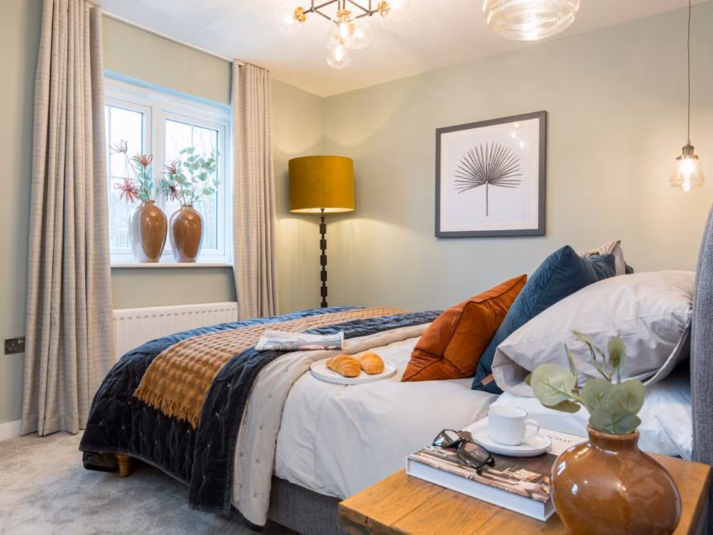
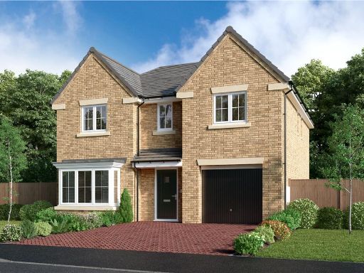
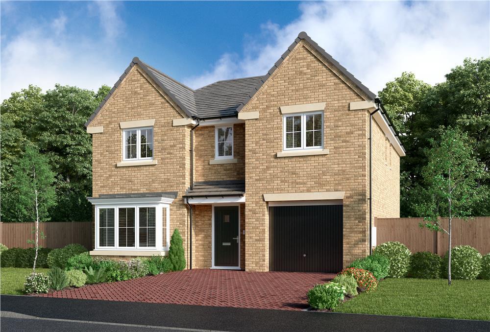
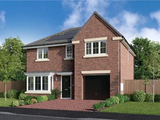
- Located in an outstanding tree-lined location on the edge of Yates Lane County Park, this property is nestled within a neighborhood that offers a rare blend of peace and tranquility with modern convenience. The property appears to include spacious new homes, emphasizing tree-lined paths that enhance the overall ambiance. It offers three or four generously sized bedrooms in houses typically found in high-standard residential developments. The houses likely offer energy efficiency, owing to their contemporary build. The community view suggests well-maintained greenery, contributing to a serene, suburban setting perfect for comfortable family living or for those looking for quietude. The overall property size can be inferred as large, appropriate for families seeking quality living space.
Image Descriptions
- detached house modern
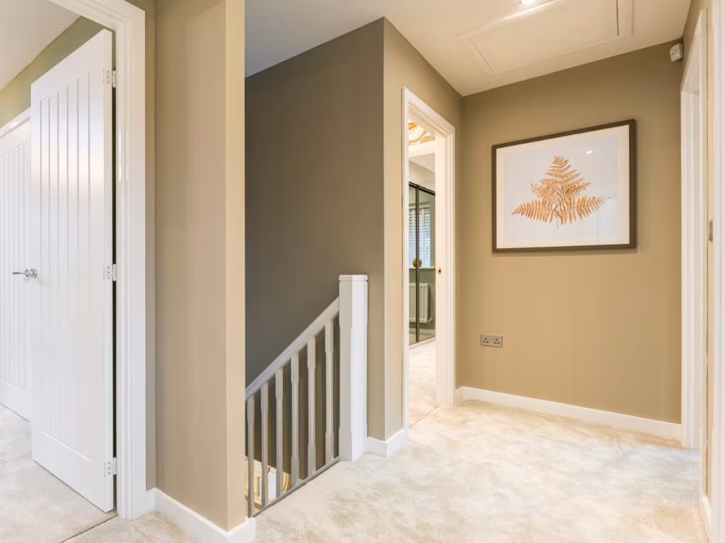
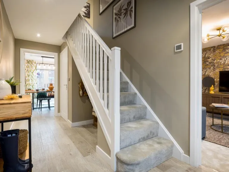
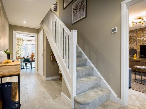
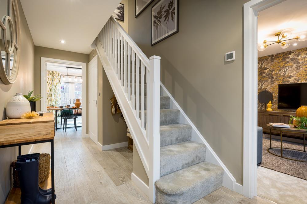
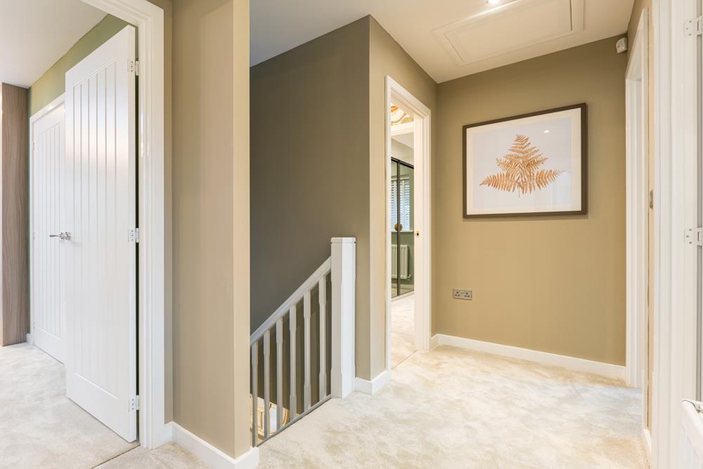
- hallway with staircase modern
Floorplan Description
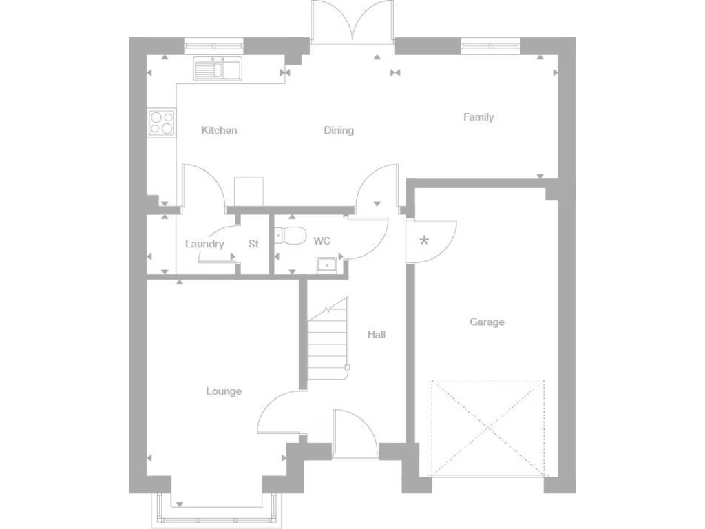
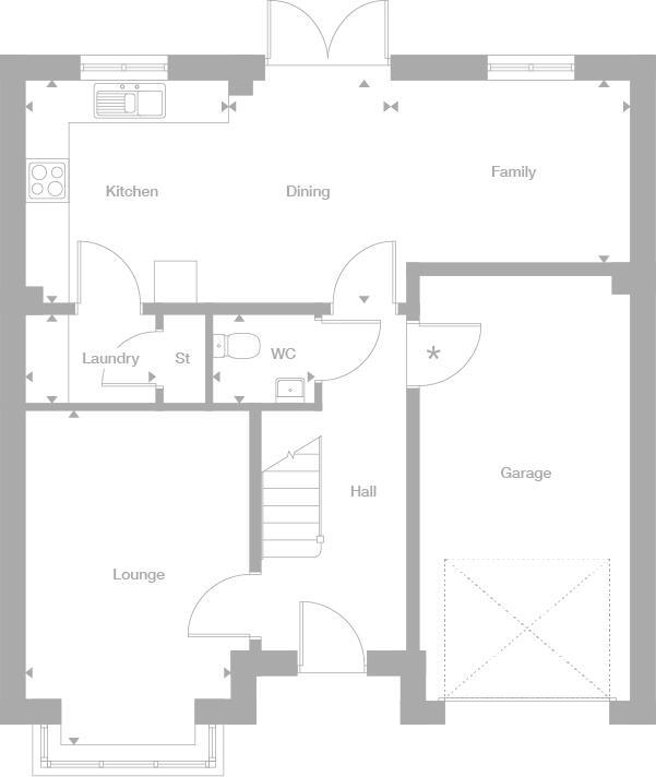
- A floor plan featuring a lounge, kitchen, dining area, family room, laundry room, and WC.
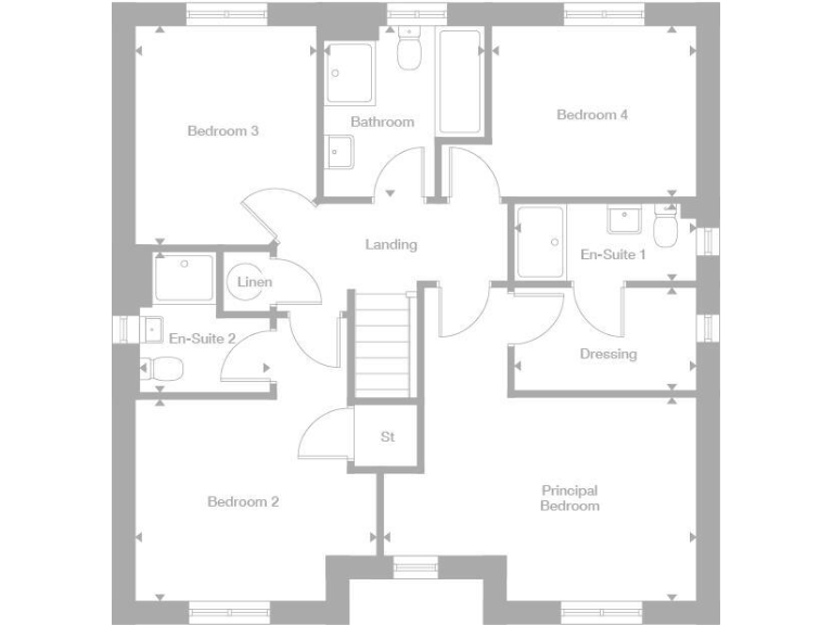
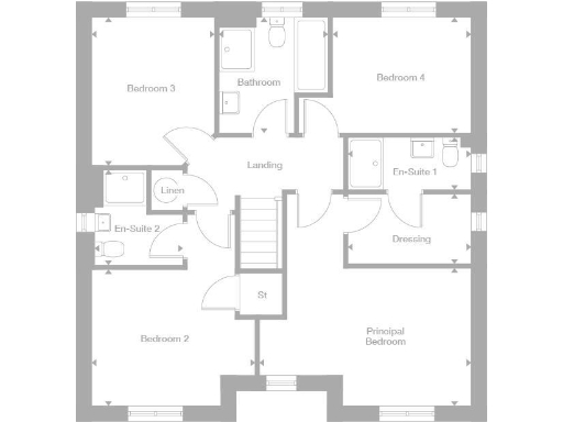
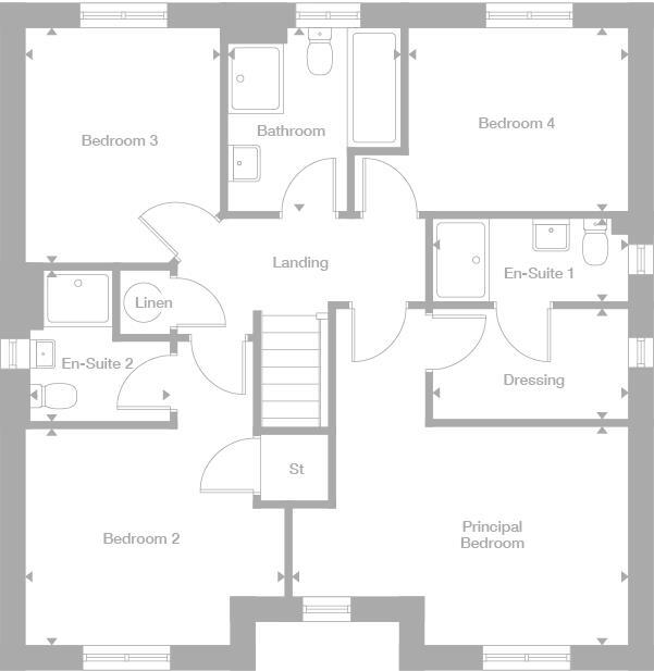
Rooms
- Bedroom 3:
- Bedroom 4:
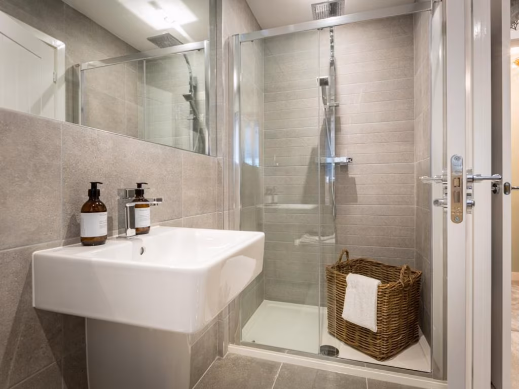
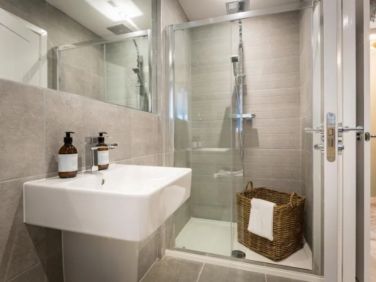
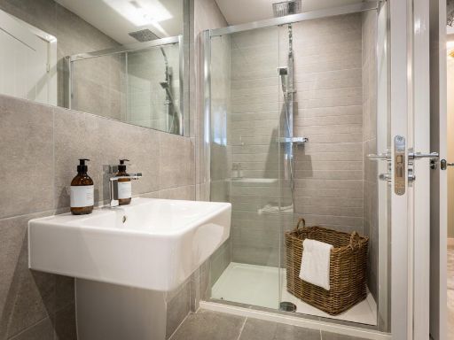
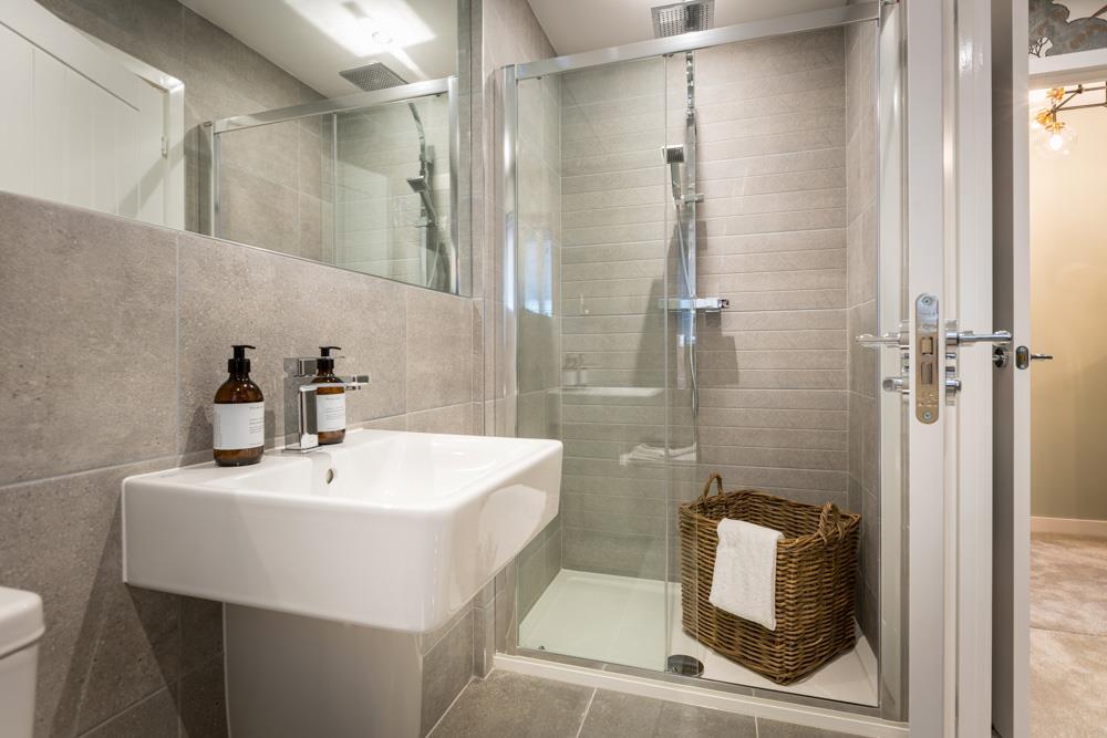
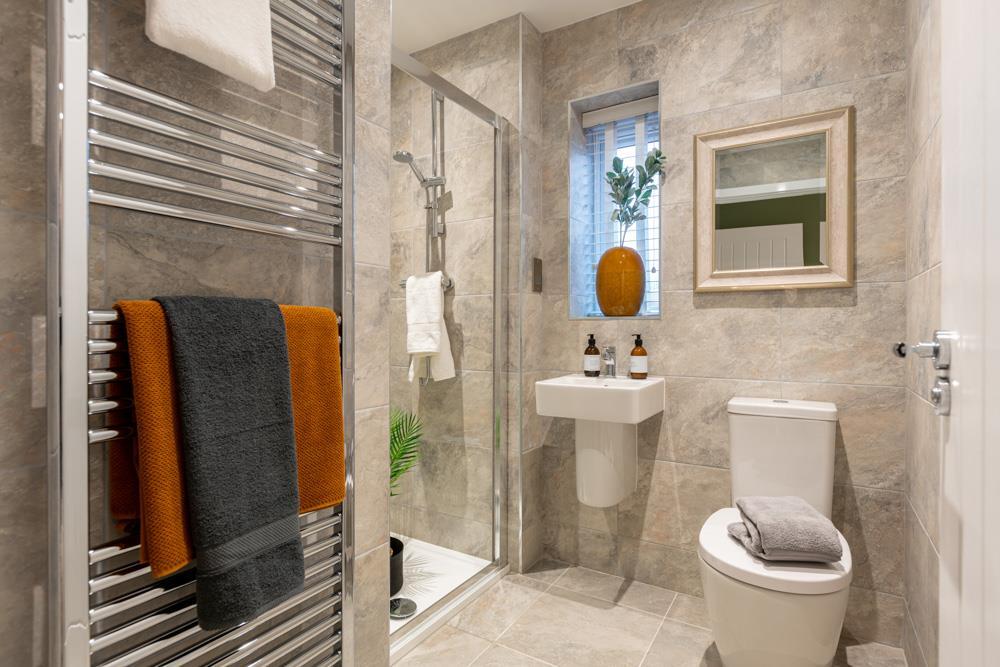
- Bathroom:
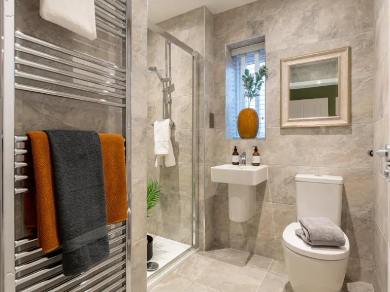
- En-Suite 1:
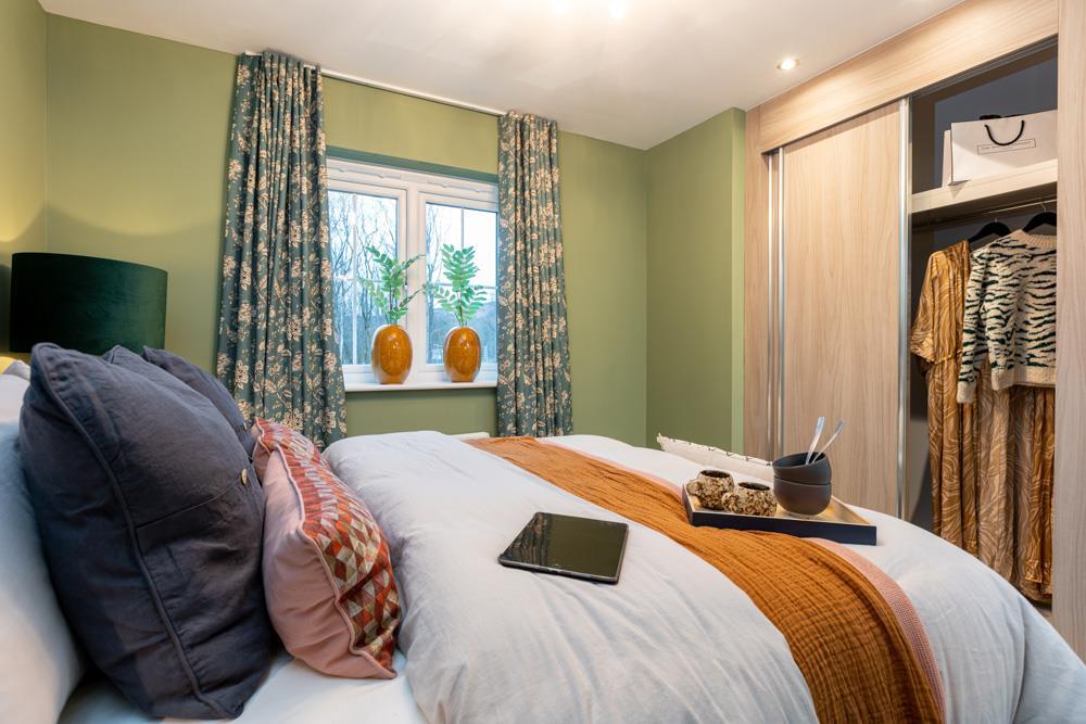
- Dressing:
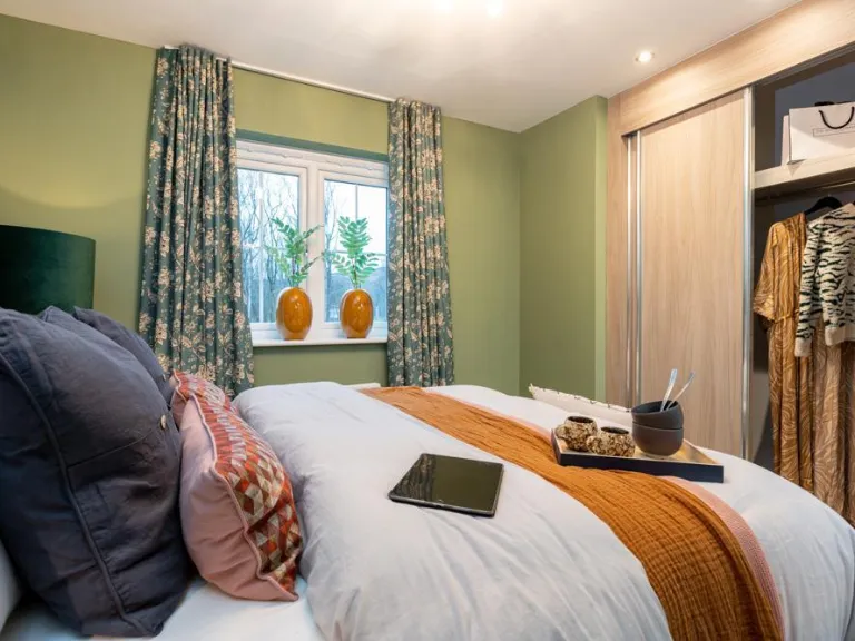
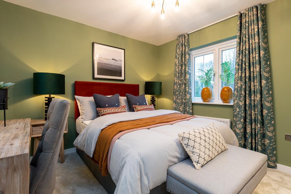
- Principal Bedroom:
- Bedroom 2:
- En-Suite 2:
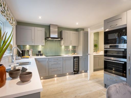
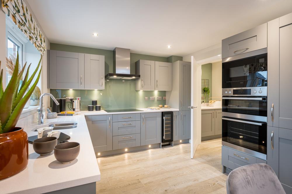
- Kitchen:
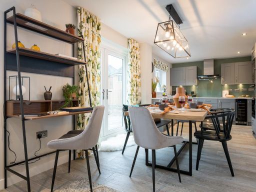
- Dining:
- Family:
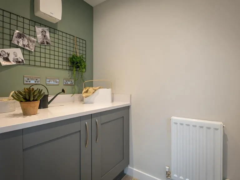
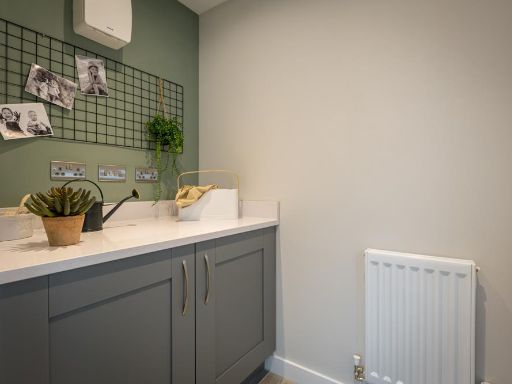
- Laundry:
- WC:
- Lounge:
Textual Property Features
- Is New Build
- Has Garden
- Success
Detected Visual Features
- modern
- detached
- brick
- garage
- driveway
- garden
- family home
- new build
- hallway
- staircase
- neutral decor
- recessed lighting
- laminate flooring
Nearby Schools
- Chandlers Ridge Academy
- Thorntree Academy
- Brambles Primary Academy
- Progress Schools - Tees Valley
- Whale Hill Primary School
- Outwood Alternative Provision Eston
- Outwood Academy Normanby
- St Margaret Clitherows RC Primary School
- Wilton Primary Academy
- St Mary's Catholic Primary School
- St Peter's Catholic College
- Grangetown Primary School
- St Bernadette's Catholic Primary School
- The Avenue Primary School
- Overfields Primary School
- Pennyman Primary Academy
- South Bank Community Primary School
- Nunthorpe Primary Academy
- Nunthorpe Academy
- Ormesby Primary School
- Normanby Primary School
- Outwood Academy Ormesby
- Bankfields Primary School
- Caedmon Primary School
- Saint Gabriel's Catholic Primary School
- Teesville Academy
- Caldicotes Primary Academy
Nearest Bars And Restaurants
- Id: 732235475
- Tags:
- TagsNormalized:
- Lat: 54.5563847
- Lon: -1.16465
- FullGeoHash: gcxnm7xvvxnp
- PartitionGeoHash: gcxn
- Images:
- FoodStandards: null
- Distance: 1764.5
,- Id: 984270353
- Tags:
- Amenity: pub
- Name: The Pied Piper
- TagsNormalized:
- Lat: 54.5436126
- Lon: -1.1749803
- FullGeoHash: gcxnm327sfr4
- PartitionGeoHash: gcxn
- Images:
- FoodStandards: null
- Distance: 1634.2
,- Id: 5141915224
- Tags:
- Addr:
- Housenumber: 36
- Postcode: TS6 0LN
- Street: Lambton Street
- Amenity: pub
- Internet_access: wlan
- Name: The Tiger Inn
- Phone: +44 1642 913037
- TagsNormalized:
- Lat: 54.5565952
- Lon: -1.1556774
- FullGeoHash: gcxnmewrny2q
- PartitionGeoHash: gcxn
- Images:
- FoodStandards: null
- Distance: 1548.9
,- Id: 5141915226
- Tags:
- Addr:
- Housenumber: 37
- Postcode: TS6 0LX
- Street: Cleveland Street
- Amenity: pub
- Internet_access: wlan
- Name: Cleveland Inn
- TagsNormalized:
- Lat: 54.5565048
- Lon: -1.1549034
- FullGeoHash: gcxnmexn8v9e
- PartitionGeoHash: gcxn
- Images:
- FoodStandards: null
- Distance: 1527.3
,- Id: 2642309932
- Tags:
- Amenity: restaurant
- Name: Norman Conquest
- TagsNormalized:
- Lat: 54.5489601
- Lon: -1.1537358
- FullGeoHash: gcxnmdrfsp0j
- PartitionGeoHash: gcxn
- Images:
- FoodStandards: null
- Distance: 701.6
}
Nearest General Shops
- Id: 256891816
- Tags:
- Name: Avenue Shops
- Shop: yes
- TagsNormalized:
- Lat: 54.5296498
- Lon: -1.1788066
- FullGeoHash: gcxnjnvd5z6p
- PartitionGeoHash: gcxn
- Images:
- FoodStandards: null
- Distance: 2403.3
,- Id: 2625795801
- Tags:
- Name: Rookwood News
- Shop: newsagent
- Website: http://www.rookwoodnews.co.uk/
- TagsNormalized:
- Lat: 54.5275162
- Lon: -1.1705033
- FullGeoHash: gcxnjq7tv39r
- PartitionGeoHash: gcxn
- Images:
- FoodStandards: null
- Distance: 2194.3
,- Id: 10614460135
- Tags:
- Brand: Heron Foods
- Brand:wikidata: Q5743472
- Name: Heron Foods
- Shop: supermarket
- TagsNormalized:
- Lat: 54.549929
- Lon: -1.1813347
- FullGeoHash: gcxnm4eb2gv1
- PartitionGeoHash: gcxn
- Images:
- FoodStandards: null
- Distance: 2179.1
}
Nearest Grocery shops
- Id: 2642309313
- Tags:
- Name: Co-operative Food
- Shop: supermarket
- TagsNormalized:
- Lat: 54.5576864
- Lon: -1.155944
- FullGeoHash: gcxnmeym89cs
- PartitionGeoHash: gcxn
- Images:
- FoodStandards: null
- Distance: 1670.7
,- Id: 2642309291
- Tags:
- Brand: Tesco Express
- Brand:wikidata: Q98456772
- Brand:wikipedia: en:Tesco
- Contact:
- Website: https://www.tesco.com/store-locator/middlesbrough/19-high-st
- Name: Tesco Express
- Shop: convenience
- TagsNormalized:
- tesco
- tesco express
- convenience
- shop
- Lat: 54.5574282
- Lon: -1.1558126
- FullGeoHash: gcxnmeyk59ex
- PartitionGeoHash: gcxn
- Images:
- FoodStandards: null
- Distance: 1640.8
,- Id: 255477822
- Tags:
- Addr:
- City: Middlesbrough
- Housenumber: 110
- Postcode: TS6 0TF
- Street: Bankfields Road
- Suburb: Eston
- Brand: Sainsbury's Local
- Brand:wikidata: Q13218434
- Brand:wikipedia: en:Sainsbury's Local
- Building: yes
- Name: Sainsbury's Local
- Opening_hours: Mo-Su 06:00-23:00
- Shop: convenience
- Website: https://stores.sainsburys.co.uk/4632/eston-local
- TagsNormalized:
- sainsburys
- sainsburys local
- convenience
- shop
- Lat: 54.5541472
- Lon: -1.146881
- FullGeoHash: gcxnmgkbgwps
- PartitionGeoHash: gcxn
- Images:
- FoodStandards: null
- Distance: 1240.3
}
Nearest Supermarkets
- Id: 972352361
- Tags:
- Addr:
- City: Middlesbrough
- Street: Trunk Road
- Suburb: South Bank
- Brand: ALDI
- Brand:wikidata: Q41171672
- Brand:wikipedia: en:Aldi
- Building: retail
- Contact:
- Website: https://www.aldi.co.uk/store/s-uk-E1398
- Name: Aldi
- Shop: supermarket
- TagsNormalized:
- aldi
- retail
- supermarket
- shop
- Lat: 54.5731695
- Lon: -1.1597541
- FullGeoHash: gcxnmwerzb0s
- PartitionGeoHash: gcxn
- Images:
- FoodStandards: null
- Distance: 3405.2
,- Id: 1736142117
- Tags:
- Brand: Tesco Extra
- Brand:wikidata: Q25172225
- Brand:wikipedia: en:Tesco Extra
- Name: Tesco Extra
- Opening_hours: Mo-Sa 06:00-24:00; Su 10:00-16:00
- Shop: supermarket
- Website: https://www.tesco.com/store-locator/middlesbrough/trunk-rd
- TagsNormalized:
- tesco
- tesco extra
- supermarket
- shop
- Lat: 54.5723063
- Lon: -1.1638732
- FullGeoHash: gcxnmw86xz1p
- PartitionGeoHash: gcxn
- Images:
- FoodStandards: null
- Distance: 3373.4
,- Id: 1736126872
- Tags:
- Addr:
- City: Middlesbrough
- Country: GB
- Postcode: TS3 0DY
- Street: Ormesby Road
- Suburb: Park End
- Brand: Asda
- Brand:wikidata: Q297410
- Brand:wikipedia: en:Asda
- Contact:
- Facebook: https://www.facebook.com/asda/
- Twitter: @asda
- Website: https://storelocator.asda.com/north-east/middlesbrough/377-ormesby-road-park-end
- Fhrs:
- Name: Asda
- Operator: Asda Stores Ltd
- Shop: supermarket
- TagsNormalized:
- Lat: 54.5491605
- Lon: -1.1908733
- FullGeoHash: gcxnkfkgfss9
- PartitionGeoHash: gcxn
- Images:
- FoodStandards:
- Id: 257670
- FHRSID: 257670
- LocalAuthorityBusinessID: 69489
- BusinessName: Asda
- BusinessType: Retailers - supermarkets/hypermarkets
- BusinessTypeID: 7840
- AddressLine1: Ormesby Road
- AddressLine2: Middlesbrough
- AddressLine3: null
- AddressLine4: null
- PostCode: TS3 0DY
- RatingValue: 5
- RatingKey: fhrs_5_en-GB
- RatingDate: 2021-09-21
- LocalAuthorityCode: 861
- LocalAuthorityName: Middlesbrough
- LocalAuthorityWebSite: http://www.middlesbrough.gov.uk
- LocalAuthorityEmailAddress: EHTS@middlesbrough.gov.uk
- Scores:
- Hygiene: 5
- Structural: 0
- ConfidenceInManagement: 0
- NewRatingPending: false
- Geocode:
- Longitude: -1.19135500000000
- Latitude: 54.54931800000000
- Distance: 2742
}
Nearest Religious buildings
- Id: 687749455
- Tags:
- Addr:
- City: Middlesbrough
- Housenumber: 2-4
- Postcode: TS6 9ER
- Street: Jubilee Road
- Suburb: Eston
- Amenity: place_of_worship
- Building: church
- Denomination: evangelical
- Name: Eston Congregational Church
- Religion: christian
- Service_times: Su 10:30
- TagsNormalized:
- place of worship
- church
- evangelical
- congregational
- christian
- Lat: 54.558893
- Lon: -1.143648
- FullGeoHash: gcxnmuphx4f1
- PartitionGeoHash: gcxn
- Images:
- FoodStandards: null
- Distance: 1797.3
,- Id: 687749456
- Tags:
- Addr:
- City: Middlesbrough
- Postcode: TS6 0LW
- Street: Cleveland Street
- Suburb: Normanby
- Amenity: place_of_worship
- Building: church
- Denomination: methodist
- Name: Normanby Methodist Church
- Phone: +44 1642 310562
- Religion: christian
- Website: http://memc.uk/m-normanby.html
- TagsNormalized:
- place of worship
- church
- methodist
- christian
- Lat: 54.5559473
- Lon: -1.1544781
- FullGeoHash: gcxnmex76tww
- PartitionGeoHash: gcxn
- Images:
- FoodStandards: null
- Distance: 1460.9
,- Id: 687749457
- Tags:
- Addr:
- City: Middlesbrough
- Postcode: TS6 0TA
- Street: Bankfields Road
- Suburb: Normanby
- Amenity: place_of_worship
- Building: church
- Denomination: salvation_army
- Name: Eston Salvation Army
- Phone: +44 1642 440834
- Religion: christian
- Website: https://www.salvationarmy.org.uk/eston
- TagsNormalized:
- place of worship
- church
- salvation army
- christian
- Lat: 54.5530873
- Lon: -1.1523229
- FullGeoHash: gcxnmg0fubtc
- PartitionGeoHash: gcxn
- Images:
- FoodStandards: null
- Distance: 1122.6
}
Nearest Medical buildings
- Id: 6428423992
- Tags:
- Amenity: dentist
- Healthcare: dentist
- Name: {my}dentist
- TagsNormalized:
- Lat: 54.5508654
- Lon: -1.1808433
- FullGeoHash: gcxnm4sju677
- PartitionGeoHash: gcxn
- Images:
- FoodStandards: null
- Distance: 2188.3
,- Id: 435311416
- Tags:
- Addr:
- City: Nunthorpe
- Housenumber: 93
- Postcode: TS7 0JS
- Street: Guisborough Road
- Amenity: pharmacy
- Area: yes
- Brand: Boots
- Brand:wikidata: Q6123139
- Brand:wikipedia: en:Boots UK
- Building: yes
- Healthcare: pharmacy
- Name: Boots
- Opening_hours: Mo-Fr 09:00-18:00; Sa 09:00-17:00
- TagsNormalized:
- pharmacy
- boots
- health
- healthcare
- Lat: 54.5283568
- Lon: -1.1688504
- FullGeoHash: gcxnjqsfey3y
- PartitionGeoHash: gcxn
- Images:
- FoodStandards: null
- Distance: 2055.2
,- Id: 411377160
- Tags:
- Amenity: doctors
- Building: yes
- Healthcare: doctor
- Name: Manor House Surgery, Normanby
- TagsNormalized:
- doctor
- doctors
- health
- healthcare
- surgery
- Lat: 54.5569579
- Lon: -1.1593129
- FullGeoHash: gcxnmegc641d
- PartitionGeoHash: gcxn
- Images:
- FoodStandards: null
- Distance: 1660.9
,- Id: 316122317
- Tags:
- Amenity: hospital
- Building: hospital
- Emergency: no
- Name: Flatts Lane Centre
- Operator: nhs
- TagsNormalized:
- Lat: 54.5456837
- Lon: -1.1469793
- FullGeoHash: gcxnmcsz9kqj
- PartitionGeoHash: gcxn
- Images:
- FoodStandards: null
- Distance: 334.4
}
Nearest Leisure Facilities
- Id: 59082287
- Tags:
- Leisure: pitch
- Sport: cricket
- TagsNormalized:
- pitch
- leisure
- cricket
- sports
- Lat: 54.5497693
- Lon: -1.1635107
- FullGeoHash: gcxnmd2z2np8
- PartitionGeoHash: gcxn
- Images:
- FoodStandards: null
- Distance: 1160.3
,- Id: 59454474
- Tags:
- Leisure: pitch
- Sport: multi
- TagsNormalized:
- Lat: 54.553347
- Lon: -1.1462169
- FullGeoHash: gcxnmgjk70yw
- PartitionGeoHash: gcxn
- Images:
- FoodStandards: null
- Distance: 1159.8
,- Id: 59454465
- Tags:
- TagsNormalized:
- Lat: 54.5531181
- Lon: -1.1467079
- FullGeoHash: gcxnmghfzy29
- PartitionGeoHash: gcxn
- Images:
- FoodStandards: null
- Distance: 1129
,- Id: 59454598
- Tags:
- TagsNormalized:
- Lat: 54.55242
- Lon: -1.146177
- FullGeoHash: gcxnmfvquhhk
- PartitionGeoHash: gcxn
- Images:
- FoodStandards: null
- Distance: 1059.3
,- Id: 3222320361
- Tags:
- TagsNormalized:
- Lat: 54.5438954
- Lon: -1.1489977
- FullGeoHash: gcxnmc7m4rj1
- PartitionGeoHash: gcxn
- Images:
- FoodStandards: null
- Distance: 97.2
}
Nearest Tourist attractions
- Id: 59537471
- Tags:
- TagsNormalized:
- Lat: 54.5440466
- Lon: -1.1887011
- FullGeoHash: gcxnkcqqj70p
- PartitionGeoHash: gcxn
- Images:
- FoodStandards: null
- Distance: 2520.4
,- Id: 295830443
- Tags:
- Name: Ormesby Hall
- Operator: National Trust
- Tourism: attraction
- Wikidata: Q7103392
- TagsNormalized:
- Lat: 54.5432284
- Lon: -1.1829538
- FullGeoHash: gcxnm16974tw
- PartitionGeoHash: gcxn
- Images:
- FoodStandards: null
- Distance: 2147.6
,- Id: 2184395170
- Tags:
- Name: Flatts Lane Country Park
- Tourism: picnic_site
- TagsNormalized:
- Lat: 54.543677
- Lon: -1.1496497
- FullGeoHash: gcxnmc6ggnr4
- PartitionGeoHash: gcxn
- Images:
- FoodStandards: null
- Distance: 63.1
}
Nearest Bus stations and stops
- Id: 3383500596
- Tags:
- Highway: bus_stop
- Local_ref: 1
- Name: Swans Corner
- Public_transport: platform
- Shelter: yes
- Source: survey
- TagsNormalized:
- Lat: 54.5338265
- Lon: -1.1632151
- FullGeoHash: gcxnjx8fx45f
- PartitionGeoHash: gcxn
- Images:
- FoodStandards: null
- Distance: 1352.9
,- Id: 614381300
- Tags:
- Highway: bus_stop
- Local_ref: 2
- Name: Swans Corner
- Public_transport: platform
- Shelter: yes
- Source: survey
- TagsNormalized:
- Lat: 54.5340501
- Lon: -1.1631913
- FullGeoHash: gcxnjx8gzev8
- PartitionGeoHash: gcxn
- Images:
- FoodStandards: null
- Distance: 1333
,- Id: 2308274351
- Tags:
- Bus: yes
- Highway: bus_stop
- Name: Ormesby Bank Top
- Public_transport: platform
- Ref: B
- Shelter: yes
- TagsNormalized:
- Lat: 54.5359723
- Lon: -1.1654496
- FullGeoHash: gcxnjrzr541f
- PartitionGeoHash: gcxn
- Images:
- FoodStandards: null
- Distance: 1291.3
,- Id: 3383500595
- Tags:
- Bench: no
- Highway: bus_stop
- Kerb: raised
- Local_ref: 1
- Name: Flatts Lane End
- Public_transport: platform
- Shelter: no
- Source: survey
- Tactile_paving: yes
- TagsNormalized:
- Lat: 54.5334241
- Lon: -1.145181
- FullGeoHash: gcxnjzw05r51
- PartitionGeoHash: gcxn
- Images:
- FoodStandards: null
- Distance: 1115.1
,- Id: 3383500594
- Tags:
- Highway: bus_stop
- Local_ref: 2
- Name: Flatts Lane End
- Public_transport: platform
- Source: survey; Bing
- TagsNormalized:
- Lat: 54.5331991
- Lon: -1.149907
- FullGeoHash: gcxnjz6wvjp5
- PartitionGeoHash: gcxn
- Images:
- FoodStandards: null
- Distance: 1102.2
}
Nearest Hotels
- Id: 304475369
- Tags:
- Brand: Premier Inn
- Brand:wikidata: Q2108626
- Building: retail
- Name: Premier Inn Middlesbrough Central South
- Operator: Whitbread
- Source: website
- Tourism: hotel
- TagsNormalized:
- premier
- inn
- retail
- hotel
- tourism
- Lat: 54.5514903
- Lon: -1.220213
- FullGeoHash: gcxnk4z3qyz4
- PartitionGeoHash: gcxn
- Images:
- FoodStandards: null
- Distance: 4644.9
,- Id: 814777603
- Tags:
- TagsNormalized:
- Lat: 54.5269248
- Lon: -1.1937487
- FullGeoHash: gcxnhy6dres2
- PartitionGeoHash: gcxn
- Images:
- FoodStandards: null
- Distance: 3366
,- Id: 68878528
- Tags:
- Addr:
- City: Upsall
- Postcode: TS14 6RW
- Street: Middlesbrough Road
- Brand: Greene King
- Brand:wikidata: Q5564162
- Building: yes
- Internet_access: wlan
- Internet_access:fee: customers
- Name: Cross Keys Inn Hotel
- Tourism: hotel
- Website: https://www.greenekinginns.co.uk/hotels/cross-keys-inn-hotel/
- TagsNormalized:
- greene king
- inn
- hotel
- tourism
- Lat: 54.5341084
- Lon: -1.1248213
- FullGeoHash: gcxnnrsujy87
- PartitionGeoHash: gcxn
- Images:
- FoodStandards: null
- Distance: 1889.3
}
Tags
- modern
- detached
- brick
- garage
- driveway
- garden
- family home
- new build
- hallway
- modern
- staircase
- neutral decor
- recessed lighting
- laminate flooring
Local Market Stats
- Average Price/sqft: £137
- Avg Income: £33100
- Rental Yield: 4.7%
- Social Housing: 35%
- Planning Success Rate: 95%
Similar Properties
 4 bedroom detached house for sale in Flatts Lane,
Normanby, Middlesbrough,
TS6 0NN, TS6 — £300,000 • 4 bed • 1 bath • 816 ft²
4 bedroom detached house for sale in Flatts Lane,
Normanby, Middlesbrough,
TS6 0NN, TS6 — £300,000 • 4 bed • 1 bath • 816 ft²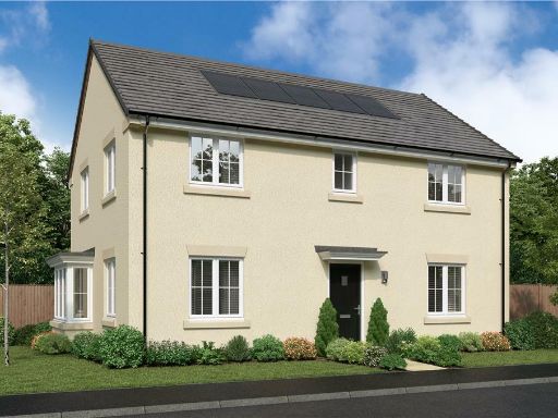 4 bedroom detached house for sale in Flatts Lane,
Normanby, Middlesbrough,
TS6 0NN, TS6 — £320,000 • 4 bed • 1 bath • 973 ft²
4 bedroom detached house for sale in Flatts Lane,
Normanby, Middlesbrough,
TS6 0NN, TS6 — £320,000 • 4 bed • 1 bath • 973 ft²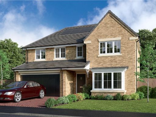 5 bedroom detached house for sale in Flatts Lane,
Normanby, Middlesbrough,
TS6 0NN, TS6 — £360,000 • 5 bed • 1 bath • 966 ft²
5 bedroom detached house for sale in Flatts Lane,
Normanby, Middlesbrough,
TS6 0NN, TS6 — £360,000 • 5 bed • 1 bath • 966 ft² 4 bedroom detached house for sale in Flatts Lane,
Normanby, Middlesbrough,
TS6 0NN, TS6 — £305,000 • 4 bed • 1 bath • 816 ft²
4 bedroom detached house for sale in Flatts Lane,
Normanby, Middlesbrough,
TS6 0NN, TS6 — £305,000 • 4 bed • 1 bath • 816 ft²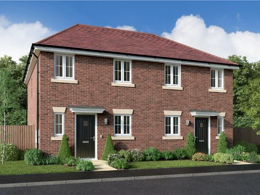 3 bedroom semi-detached house for sale in Flatts Lane,
Normanby, Middlesbrough,
TS6 0NN, TS6 — £190,000 • 3 bed • 1 bath • 524 ft²
3 bedroom semi-detached house for sale in Flatts Lane,
Normanby, Middlesbrough,
TS6 0NN, TS6 — £190,000 • 3 bed • 1 bath • 524 ft²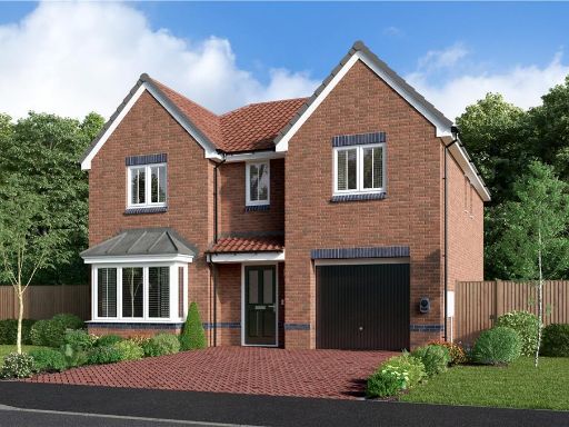 4 bedroom detached house for sale in Off Trunk Road (A1085),
Middlesbrough,
Cleveland
TS6 9TL, TS6 — £287,000 • 4 bed • 1 bath • 927 ft²
4 bedroom detached house for sale in Off Trunk Road (A1085),
Middlesbrough,
Cleveland
TS6 9TL, TS6 — £287,000 • 4 bed • 1 bath • 927 ft²
Meta
- {
"@context": "https://schema.org",
"@type": "Residence",
"name": "4 bedroom detached house for sale in Flatts Lane, Normanby,…",
"description": "",
"url": "https://propertypiper.co.uk/property/d2a85860-6cda-4783-ac3b-5556c426610f",
"image": "https://image-a.propertypiper.co.uk/bd50d52d-981f-4ce2-af03-065bb966fee3-1024.jpeg",
"address": {
"@type": "PostalAddress",
"streetAddress": "Flatts Lane, \r\nNormanby, Middlesbrough, \r\nTS6 0NN",
"postalCode": "TS6 0NN",
"addressLocality": "Redcar and Cleveland",
"addressRegion": "Redcar",
"addressCountry": "England"
},
"geo": {
"@type": "GeoCoordinates",
"latitude": 54.54311,
"longitude": -1.14966
},
"numberOfRooms": 4,
"numberOfBathroomsTotal": 1,
"floorSize": {
"@type": "QuantitativeValue",
"value": 927,
"unitCode": "FTK"
},
"offers": {
"@type": "Offer",
"price": 325000,
"priceCurrency": "GBP",
"availability": "https://schema.org/InStock"
},
"additionalProperty": [
{
"@type": "PropertyValue",
"name": "Feature",
"value": "modern"
},
{
"@type": "PropertyValue",
"name": "Feature",
"value": "detached"
},
{
"@type": "PropertyValue",
"name": "Feature",
"value": "brick"
},
{
"@type": "PropertyValue",
"name": "Feature",
"value": "garage"
},
{
"@type": "PropertyValue",
"name": "Feature",
"value": "driveway"
},
{
"@type": "PropertyValue",
"name": "Feature",
"value": "garden"
},
{
"@type": "PropertyValue",
"name": "Feature",
"value": "family home"
},
{
"@type": "PropertyValue",
"name": "Feature",
"value": "new build"
},
{
"@type": "PropertyValue",
"name": "Feature",
"value": "hallway"
},
{
"@type": "PropertyValue",
"name": "Feature",
"value": "modern"
},
{
"@type": "PropertyValue",
"name": "Feature",
"value": "staircase"
},
{
"@type": "PropertyValue",
"name": "Feature",
"value": "neutral decor"
},
{
"@type": "PropertyValue",
"name": "Feature",
"value": "recessed lighting"
},
{
"@type": "PropertyValue",
"name": "Feature",
"value": "laminate flooring"
}
]
}
High Res Floorplan Images
Compatible Floorplan Images
FloorplanImages Thumbnail