CV2 2PW - 1 bedroom maisonette for sale in 16 Blackshaw Drive, Walsgr…
View on Property Piper
1 bedroom maisonette for sale in 16 Blackshaw Drive, Walsgrave on Sowe, Coventry, West Midlands CV2 2PW, CV2
Property Details
- Price: £60000
- Bedrooms: 1
- Bathrooms: 1
- Property Type: undefined
- Property SubType: undefined
Image Descriptions
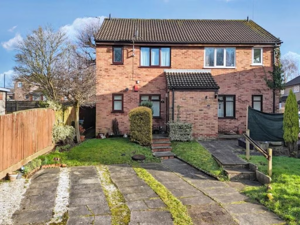
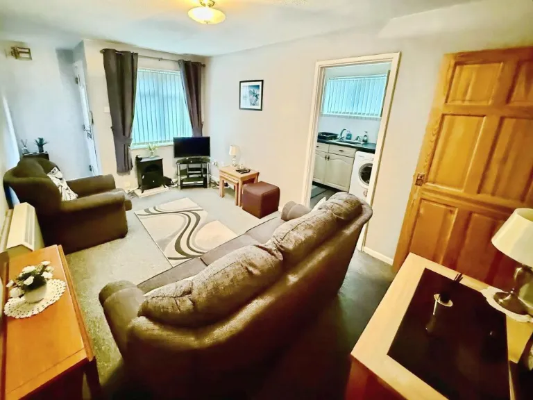
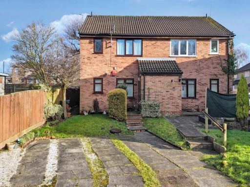
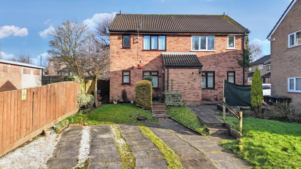
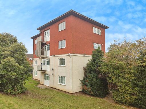
- semi-detached house Post-War
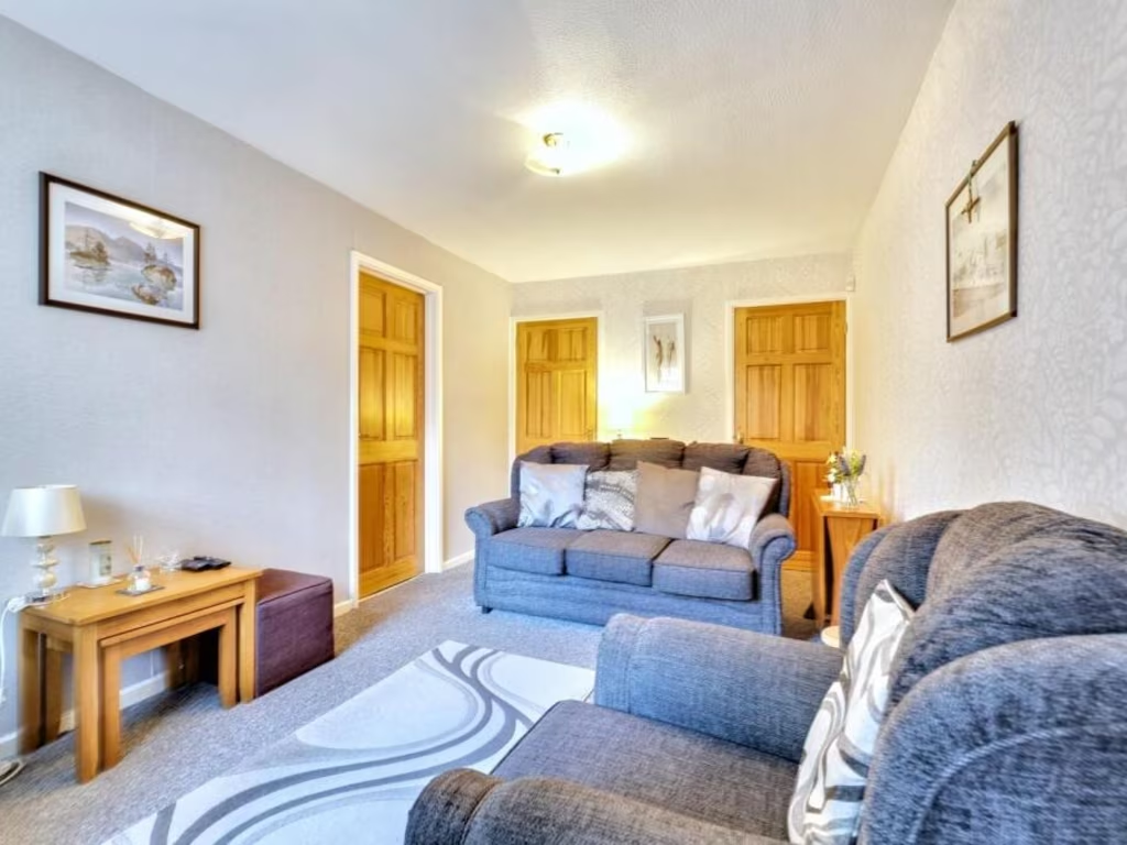
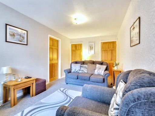
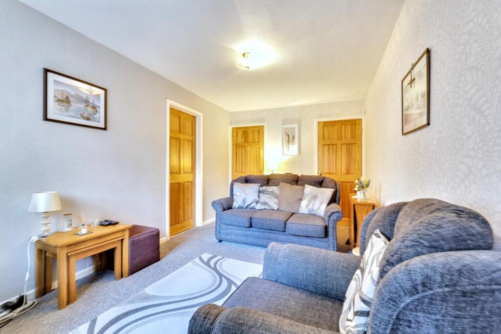
- living room contemporary
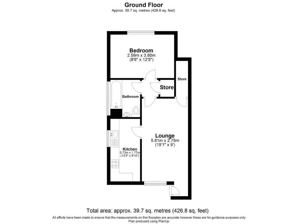
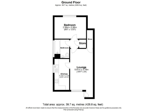
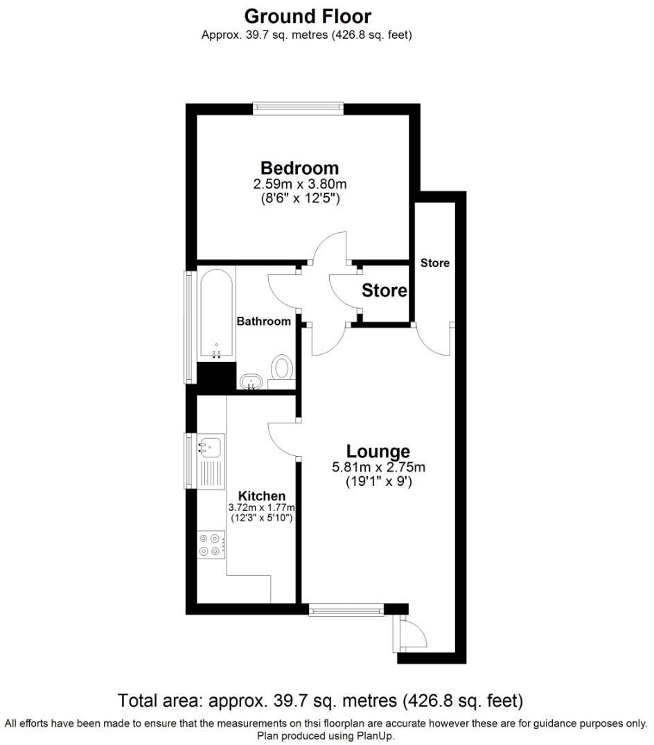
Floorplan Description
- Single-floor layout with bedroom, lounge, kitchen, bathroom and stores
Rooms
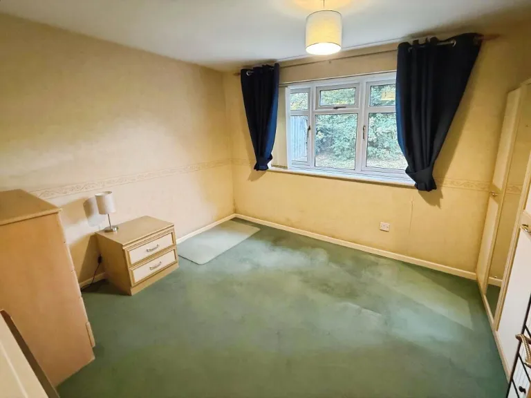
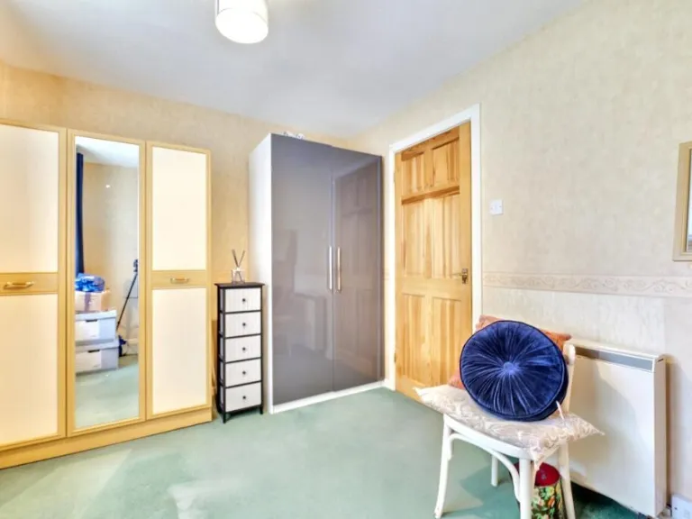
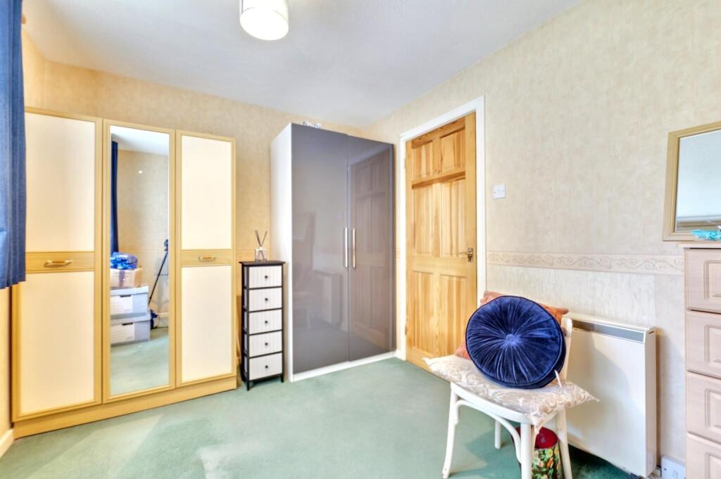
- Bedroom:
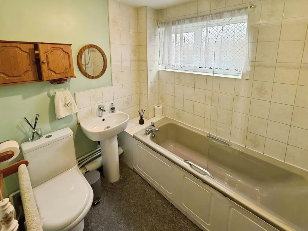
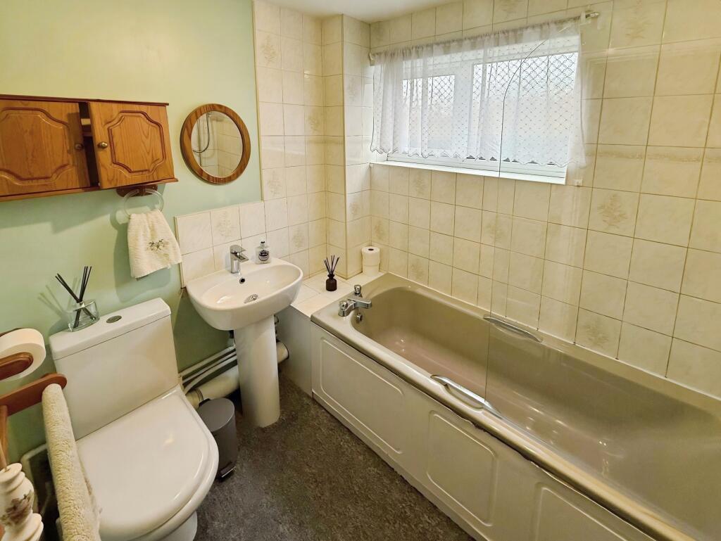
- Bathroom:
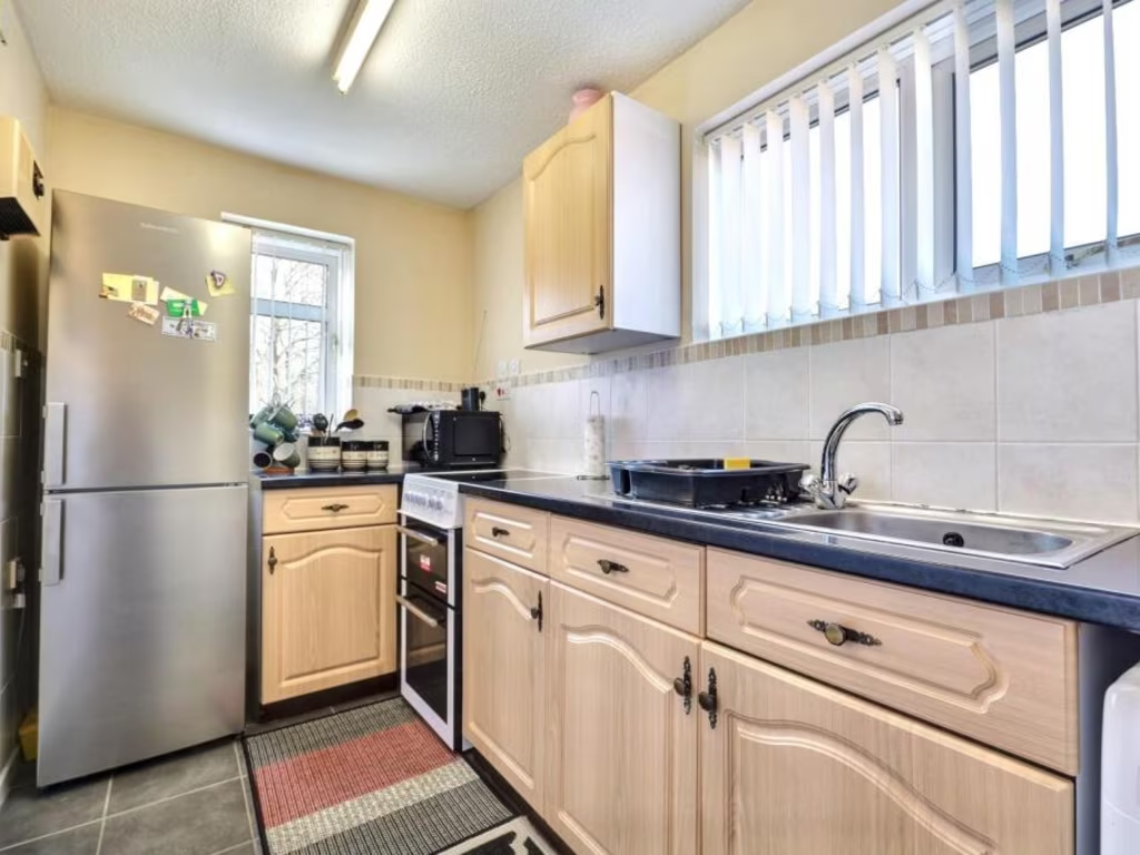
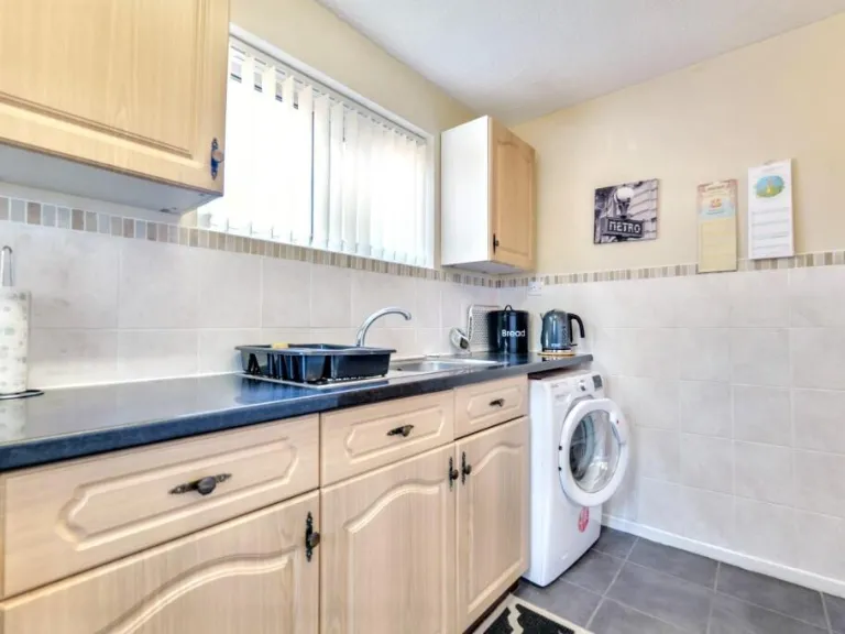
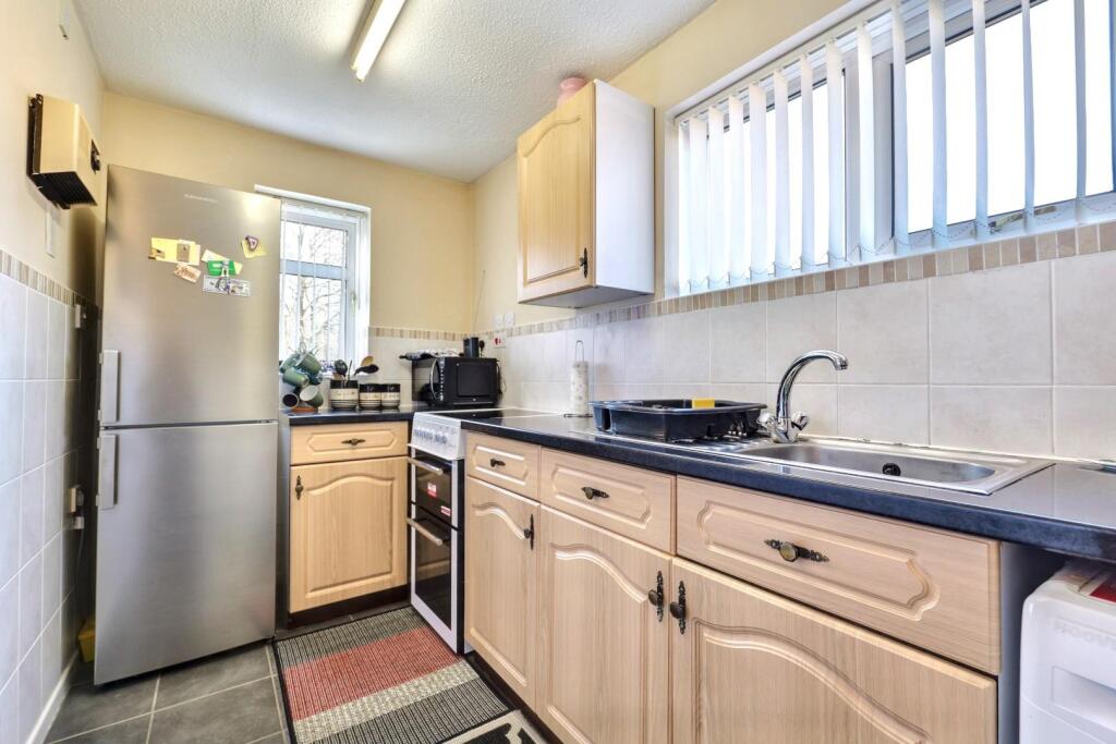
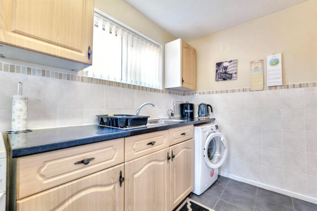
- Kitchen:
- Lounge:
- Store:
- Store:
Textual Property Features
- Is Public Notice
- Is Auction
- Has Garden
- Success
Detected Visual Features
- semi-detached
- Post-War
- suburban
- potential
- renovation
- driveway
- garden
- brick
- residential
- quiet neighborhood
- contemporary
- living room
- standard ceiling
- interior door
- medium size room
- connected kitchen
EPC Details
- Fully double glazed
- Cavity wall, as built, insulated (assumed)
- Room heaters, electric
- Low energy lighting in 60% of fixed outlets
- Solid, no insulation (assumed)
Nearby Schools
- Corpus Christi Catholic School
- Sowe Valley Primary School
- Ernesford Grange Community Academy
- Stoke Park School
- Lyng Hall School
- Henley Green Primary
- Grace Academy Coventry
- Alderman's Green Primary School
- Ernesford Grange Primary School
- Clifford Bridge Academy
- Pearl Hyde Community Primary School
- Wyken Croft Primary School
- St John Fisher Catholic Primary School
- SS Peter and Paul Catholic Primary School
- Whittle Academy
- Seva School
- Potters Green Primary School
- Richard Lee Primary School
- Caludon Castle School
- Walsgrave Church of England Academy
- Cardinal Wiseman Catholic School
- St Patrick's Catholic Primary School
- Moat House Primary School
- St Bartholomew's Church of England Academy
- St Gregory's Catholic Primary School
- Ravensdale Primary School
- Courthouse Green Primary School
Nearest General Shops
- Id: 151282177
- Tags:
- Brand:
- Building: yes
- Name: B&M
- Shop: variety_store
- TagsNormalized:
- Lat: 52.423699
- Lon: -1.4481034
- FullGeoHash: gcqfpp3w0tzc
- PartitionGeoHash: gcqf
- Images:
- FoodStandards: null
- Distance: 197.5
,- Id: 235448664
- Tags:
- Addr:
- City: Coventry
- Housename: Rose Petals Florist
- Housenumber: 2
- Postcode: CV2 2EX
- Street: Hinckley Road
- Building: yes
- Check_date: 16-10-2022
- Name: Rose Petals Florist
- Note: Fancy Dress also available from here - http://www.gladragsfancydress.co.uk/
- Opening_hours: Mo-Fr 10:00-16:00; Sa 10:00-14:00; Su off
- Phone: 02476 621888
- Shop: florist
- Source: survey;local knowledge;streetlevel imagery;Website
- Website: https://www.direct2florist.co.uk/rose-petals-florist-f89228/
- TagsNormalized:
- Lat: 52.4251735
- Lon: -1.4433677
- FullGeoHash: gcqfppsyz0ej
- PartitionGeoHash: gcqf
- Images:
- FoodStandards: null
- Distance: 186.2
,- Id: 10106687087
- Tags:
- Addr:
- City: Coventry
- Housename: GLAD RAGS FANCY DRESS
- Housenumber: 2
- Postcode: CV2 2EX
- Street: Hinckley Road
- Email: gladrags.fancydress@ntlworld.com
- Fax: 02476 262484
- Name: Glad Rags Fancy Dress
- Phone: 02476 262484
- Shop: party
- Website: http://www.gladragsfancydress.co.uk/
- TagsNormalized:
- Lat: 52.4251887
- Lon: -1.4433785
- FullGeoHash: gcqfppsyyg6z
- PartitionGeoHash: gcqf
- Images:
- FoodStandards: null
- Distance: 185.7
}
Nearest Grocery shops
- Id: 1103827116
- Tags:
- Brand: Londis
- Brand:wikidata: Q21008564
- Building: yes
- Name: Londis
- Shop: convenience
- TagsNormalized:
- Lat: 52.4301252
- Lon: -1.4392043
- FullGeoHash: gcqfr28585er
- PartitionGeoHash: gcqf
- Images:
- FoodStandards: null
- Distance: 738.1
,- Id: 494483757
- Tags:
- Addr:
- City: Coventry
- Postcode: CV2 1AB
- Street: Henley Road
- Brand: Costcutter
- Brand:wikidata: Q5175072
- Building: yes
- Name: Costcutter
- Opening_hours: Mo-Sa 07:00-22:00; Su 08:00-21:00
- Operator: Costcutter
- Payment:
- Cash: yes
- Credit_cards: yes
- Debit_cards: yes
- Phone: +44 24 7662 1967
- Shop: convenience
- Source: survey;local knowledge;aerial imagery;streetlevel imagery
- Website: https://store-locator.costcutter.co.uk/costcutter-48699fe277f1
- TagsNormalized:
- costcutter
- convenience
- shop
- Lat: 52.4282584
- Lon: -1.4535517
- FullGeoHash: gcqfqbm89z9r
- PartitionGeoHash: gcqf
- Images:
- FoodStandards: null
- Distance: 622.7
,- Id: 154071534
- Tags:
- Addr:
- City: Coventry
- Postcode: CV2 2HX
- Street: Woodway Lane
- Brand: Co-op Food
- Brand:wikidata: Q3277439
- Building: yes
- Name: Co-op Food
- Opening_hours: Monday 6am–10pm Tuesday 6am–10pm Wednesday 6am–10pm Thursday 6am–10pm Friday 6am–10pm Saturday 6am–10pm Sunday 6am–10pm
- Payment:
- Cash: yes
- Credit_cards: yes
- Debit_cards: yes
- Phone: 02476 602250
- Shop: convenience
- Website: https://shop.coop.co.uk/?utm_campaign=gmb-maps-site-click-Woodway-Lane&utm_medium=organic&utm_source=gmb
- Wheelchair: yes
- TagsNormalized:
- co-op
- co-op food
- food
- convenience
- shop
- Lat: 52.4301262
- Lon: -1.4475402
- FullGeoHash: gcqfr09gtggv
- PartitionGeoHash: gcqf
- Images:
- FoodStandards: null
- Distance: 579.8
}
Nearest Religious buildings
- Id: 156265420
- Tags:
- Amenity: place_of_worship
- Building: yes
- Denomination: baptist
- Name: Walsgrave Baptist Church
- Religion: christian
- Source: OS_OpenData_StreetView; survey; bing
- TagsNormalized:
- place of worship
- baptist
- church
- christian
- Lat: 52.4263863
- Lon: -1.4418863
- FullGeoHash: gcqfppyjcdex
- PartitionGeoHash: gcqf
- Images:
- FoodStandards: null
- Distance: 325.2
,- Id: 9743376155
- Tags:
- Addr:
- City: Coventry
- Postcode: CV2 2EX
- Street: Hinckley Road
- Amenity: social_facility
- Email: info@coventry.foodbank.org.uk
- Foodbank: Coventry
- Foodbank_url: https://www.givefood.org.uk/needs/at/coventry/
- Name: Walsgrave Baptist Church, Coventry Foodbank
- Network: Trussell Trust
- Parliamentary_constituency: Coventry North East
- Social_facility: food_bank
- Social_facility:for: under_privileged
- Source: give_food
- Telephone: 02476993770
- Url: https://www.givefood.org.uk/needs/at/coventry/walsgrave-baptist-church/
- TagsNormalized:
- social facility
- baptist
- church
- foodbank
- Lat: 52.426334
- Lon: -1.4419609
- FullGeoHash: gcqfppvvxbup
- PartitionGeoHash: gcqf
- Images:
- FoodStandards: null
- Distance: 318
,- Id: 154200899
- Tags:
- HE_ref: 1115404
- Amenity: place_of_worship
- Building: yes
- Denomination: anglican
- Heritage: 2
- Heritage:operator: Historic England
- Listed_status: Grade II*
- Name: St Mary's
- Religion: christian
- Source: bing;English Heritage
- Wikidata: Q7594446
- TagsNormalized:
- place of worship
- anglican
- christian
- church
- Lat: 52.4245654
- Lon: -1.4439909
- FullGeoHash: gcqfppse0x63
- PartitionGeoHash: gcqf
- Images:
- FoodStandards: null
- Distance: 150.3
}
Nearest Medical buildings
- Id: 613046603
- Tags:
- Leisure: park
- Name: University Hospital Community Gardens
- TagsNormalized:
- leisure
- hospital
- university
- Lat: 52.4199468
- Lon: -1.4410961
- FullGeoHash: gcqfpny8k42f
- PartitionGeoHash: gcqf
- Images:
- FoodStandards: null
- Distance: 655.1
,- Id: 154505148
- Tags:
- Amenity: hospital
- Healthcare: hospital
- Name: BMI Meriden Hospital
- Wikidata: Q7751074
- Wikipedia: en:The Meriden Hospital
- TagsNormalized:
- Lat: 52.4233953
- Lon: -1.4380762
- FullGeoHash: gcqfpr2u6mht
- PartitionGeoHash: gcqf
- Images:
- FoodStandards: null
- Distance: 572
,- Id: 154508310
- Tags:
- Amenity: hospital
- Emergency: yes
- Healthcare: hospital
- Name: University Hospital Coventry
- Source: bing
- Wikidata: Q7894765
- Wikipedia: en:University Hospital Coventry
- TagsNormalized:
- hospital
- health
- healthcare
- university
- Lat: 52.4215366
- Lon: -1.4398492
- FullGeoHash: gcqfppp994dw
- PartitionGeoHash: gcqf
- Images:
- FoodStandards: null
- Distance: 571.6
,- Id: 2078110
- Tags:
- Addr:
- Postcode: CV2 2TE
- Street: Clifford Bridge Road
- Amenity: hospital
- Building: yes
- Emergency: no
- Healthcare: hospital
- Name: Caludon Centre
- Type: multipolygon
- TagsNormalized:
- Lat: 52.4224592
- Lon: -1.4453191
- FullGeoHash: gcqfpp5wcwev
- PartitionGeoHash: gcqf
- Images:
- FoodStandards: null
- Distance: 286
}
Nearest Airports
- Id: 2437117
- Tags:
- Aerodrome: international
- Aerodrome:type: public
- Aeroway: aerodrome
- Ele: 104
- Iata: BHX
- Icao: EGBB
- Internet_access: wlan
- Is_in: Birmingham,England,UK
- Name: Birmingham Airport
- Ref: BHX
- Type: multipolygon
- Website: https://www.birminghamairport.co.uk/
- Wikidata: Q8719
- Wikipedia: en:Birmingham Airport
- TagsNormalized:
- airport
- international airport
- Lat: 52.4543817
- Lon: -1.7468974
- FullGeoHash: gcqf2jpbym6y
- PartitionGeoHash: gcqf
- Images:
- FoodStandards: null
- Distance: 20649.7
}
Nearest Leisure Facilities
- Id: 154071536
- Tags:
- Leisure: pitch
- Sport: bowls
- TagsNormalized:
- Lat: 52.4295882
- Lon: -1.4454877
- FullGeoHash: gcqfr0e2mxw7
- PartitionGeoHash: gcqf
- Images:
- FoodStandards: null
- Distance: 513.3
,- Id: 154071537
- Tags:
- Leisure: pitch
- Sport: bowls
- TagsNormalized:
- Lat: 52.4293258
- Lon: -1.4462361
- FullGeoHash: gcqfr06yuq8n
- PartitionGeoHash: gcqf
- Images:
- FoodStandards: null
- Distance: 482.5
,- Id: 154418877
- Tags:
- Leisure: pitch
- Sport: soccer
- TagsNormalized:
- Lat: 52.4248605
- Lon: -1.439536
- FullGeoHash: gcqfppxubqk4
- PartitionGeoHash: gcqf
- Images:
- FoodStandards: null
- Distance: 445.1
,- Id: 154418861
- Tags:
- TagsNormalized:
- Lat: 52.424533
- Lon: -1.4398107
- FullGeoHash: gcqfppxe1cr2
- PartitionGeoHash: gcqf
- Images:
- FoodStandards: null
- Distance: 429.3
,- Id: 188794103
- Tags:
- Leisure: park
- Name: Potters Green Corridor
- TagsNormalized:
- Lat: 52.4259967
- Lon: -1.4487394
- FullGeoHash: gcqfppc59fje
- PartitionGeoHash: gcqf
- Images:
- FoodStandards: null
- Distance: 211.4
}
Nearest Tourist attractions
- Id: 698568252
- Tags:
- Source: survey
- Tourism: picnic_site
- TagsNormalized:
- Lat: 52.4120109
- Lon: -1.4069131
- FullGeoHash: gcqfpvrd0dcx
- PartitionGeoHash: gcqf
- Images:
- FoodStandards: null
- Distance: 3023.8
,- Id: 513574690
- Tags:
- Addr:
- City: Coventry
- Street: Axholme Road
- Building: yes
- Name: Axholme House
- Source: Warwicks CC Aerial Imagery 2013
- Tourism: hostel
- TagsNormalized:
- Lat: 52.4144239
- Lon: -1.4535973
- FullGeoHash: gcqfnvv80sz3
- PartitionGeoHash: gcqf
- Images:
- FoodStandards: null
- Distance: 1280
,- Id: 193457121
- Tags:
- Castle_type: defensive
- Historic: castle
- Name: Caludon Castle
- Name:fa: قلعه کالادون
- Ruins: yes
- Source: survey
- Tourism: attraction
- Wikidata: Q5024019
- Wikipedia: en:Caludon Castle
- TagsNormalized:
- Lat: 52.4180137
- Lon: -1.4516617
- FullGeoHash: gcqfnyqvjcfx
- PartitionGeoHash: gcqf
- Images:
- FoodStandards: null
- Distance: 862.3
}
Nearest Hotels
- Id: 196895191
- Tags:
- Addr:
- City: Coventry
- Postcode: CV2 2SZ
- Street: Gielgud Way
- Brand: Premier Inn
- Brand:wikidata: Q2108626
- Brand:wikipedia: en:Premier Inn
- Building: yes
- Name: Premier Inn
- Tourism: hotel
- TagsNormalized:
- Lat: 52.4344828
- Lon: -1.4284832
- FullGeoHash: gcqfr3rv1bj9
- PartitionGeoHash: gcqf
- Images:
- FoodStandards: null
- Distance: 1594.1
,- Id: 142891699
- Tags:
- Addr:
- City: Coventry
- Postcode: CV2 2ST
- Street: Paradise Way
- Building: yes
- Contact:
- Facebook: https://www.facebook.com/doubletreecoventry/
- Instagram: https://www.instagram.com/doubletreecoventry/
- Email: reservations@doubletreecoventry.com
- Fax: +44-2476-841-088
- Name: DoubleTree by Hilton Hotel Coventry
- Operator: Hilton Hotels
- Phone: +44 2476 603 000
- Rooms: 172
- Smoking: yes
- Stars: 4
- Tourism: hotel
- Website: https://www.hilton.com/en/hotels/cvthndi-doubletree-coventry/
- Wheelchair: yes
- Wikidata: Q28609672
- TagsNormalized:
- Lat: 52.4367546
- Lon: -1.4327567
- FullGeoHash: gcqfr3udnre1
- PartitionGeoHash: gcqf
- Images:
- FoodStandards: null
- Distance: 1590.7
,- Id: 136406244
- Tags:
- Addr:
- City: Coventry
- Postcode: CV2 2HP
- Street: Hinckley Road
- Brand: Holiday Inn
- Brand:wikidata: Q2717882
- Brand:wikipedia: en:Holiday Inn
- Building: yes
- Name: Holiday Inn
- Tourism: hotel
- TagsNormalized:
- Lat: 52.4308738
- Lon: -1.4341891
- FullGeoHash: gcqfr2exuzr0
- PartitionGeoHash: gcqf
- Images:
- FoodStandards: null
- Distance: 1039.4
}
Tags
- semi-detached
- Post-War
- suburban
- potential
- renovation
- driveway
- garden
- brick
- residential
- quiet neighborhood
- contemporary
- living room
- standard ceiling
- interior door
- medium size room
- connected kitchen
Local Market Stats
- Average Price/sqft: £225
- Avg Income: £39800
- Rental Yield: 5.4%
- Social Housing: 11%
- Planning Success Rate: 78%
AirBnB Data
- 1km average: £64/night
- Listings in 1km: 1
Similar Properties
 1 bedroom flat for sale in 293 Tarquin Close, Willenhall, Coventry, West Midlands CV3 3BU, CV3 — £40,000 • 1 bed • 1 bath
 1 bedroom ground floor flat for sale in Flat 3, Breton Court, 2 Paladine Way, Stoke, Coventry, West Midlands CV3 1NF, CV3 — £48,000 • 1 bed • 1 bath • 406 ft²
 3 bedroom maisonette for sale in 91A Brownshill Green Road, Coventry CV6 2AQ, CV6 — £59,500 • 3 bed • 1 bath • 952 ft²
 2 bedroom maisonette for sale in Oakey Close, Longford, Coventry, CV6 — £75,000 • 2 bed • 1 bath • 585 ft²
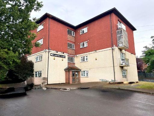 1 bedroom apartment for sale in Tarquin Close, Coventry, CV3 — £50,000 • 1 bed • 1 bath
 2 bedroom flat for sale in Flat 9, Spon Gate House, Upper Spon Street, Coventry, West Midlands CV1 3GW, CV1 — £50,000 • 2 bed • 1 bath
Meta
- {
"@context": "https://schema.org",
"@type": "Residence",
"name": "1 bedroom maisonette for sale in 16 Blackshaw Drive, Walsgr…",
"description": "",
"url": "https://propertypiper.co.uk/property/d24c17c2-97df-4207-8f5e-fe19020e0c39",
"image": "https://image-a.propertypiper.co.uk/ceeec9c3-95ae-4c8a-a688-e8e8d5e56859-1024.jpeg",
"address": {
"@type": "PostalAddress",
"streetAddress": "16 BLACKSHAW DRIVE WALSGRAVE ON SOWE COVENTRY",
"postalCode": "CV2 2PW",
"addressLocality": "Coventry",
"addressRegion": "Coventry North East",
"addressCountry": "England"
},
"geo": {
"@type": "GeoCoordinates",
"latitude": 52.424987,
"longitude": -1.4460973
},
"numberOfRooms": 1,
"numberOfBathroomsTotal": 1,
"floorSize": {
"@type": "QuantitativeValue",
"value": 426,
"unitCode": "FTK"
},
"offers": {
"@type": "Offer",
"price": 60000,
"priceCurrency": "GBP",
"availability": "https://schema.org/InStock"
},
"additionalProperty": [
{
"@type": "PropertyValue",
"name": "Feature",
"value": "semi-detached"
},
{
"@type": "PropertyValue",
"name": "Feature",
"value": "Post-War"
},
{
"@type": "PropertyValue",
"name": "Feature",
"value": "suburban"
},
{
"@type": "PropertyValue",
"name": "Feature",
"value": "potential"
},
{
"@type": "PropertyValue",
"name": "Feature",
"value": "renovation"
},
{
"@type": "PropertyValue",
"name": "Feature",
"value": "driveway"
},
{
"@type": "PropertyValue",
"name": "Feature",
"value": "garden"
},
{
"@type": "PropertyValue",
"name": "Feature",
"value": "brick"
},
{
"@type": "PropertyValue",
"name": "Feature",
"value": "residential"
},
{
"@type": "PropertyValue",
"name": "Feature",
"value": "quiet neighborhood"
},
{
"@type": "PropertyValue",
"name": "Feature",
"value": "contemporary"
},
{
"@type": "PropertyValue",
"name": "Feature",
"value": "living room"
},
{
"@type": "PropertyValue",
"name": "Feature",
"value": "standard ceiling"
},
{
"@type": "PropertyValue",
"name": "Feature",
"value": "interior door"
},
{
"@type": "PropertyValue",
"name": "Feature",
"value": "medium size room"
},
{
"@type": "PropertyValue",
"name": "Feature",
"value": "connected kitchen"
}
]
}
High Res Floorplan Images
Compatible Floorplan Images
FloorplanImages Thumbnail