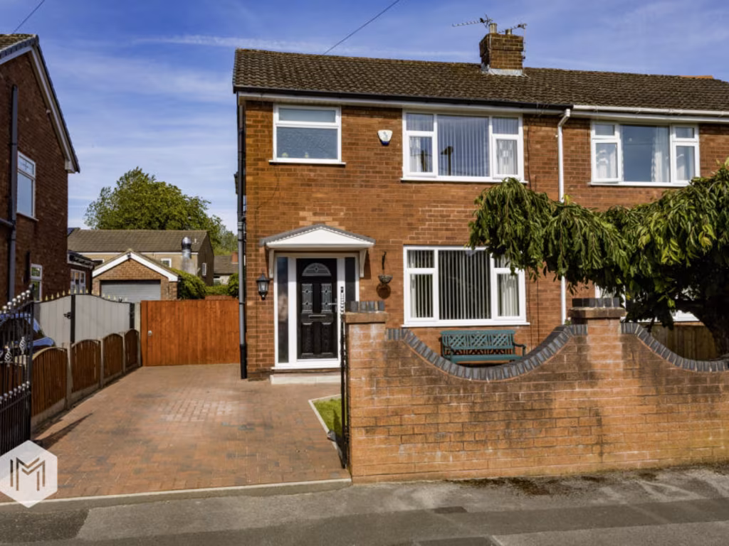
WN7 5DJ - 3 bedroom semidetached house for sale in Angus Avenue, Leig…
View on Property Piper
3 bedroom semi-detached house for sale in Angus Avenue, Leigh, Greater Manchester, Uk, WN7 5DJ, WN7
Property Details
- Price: £245000
- Bedrooms: 3
- Bathrooms: 2
- Property Type: undefined
- Property SubType: undefined
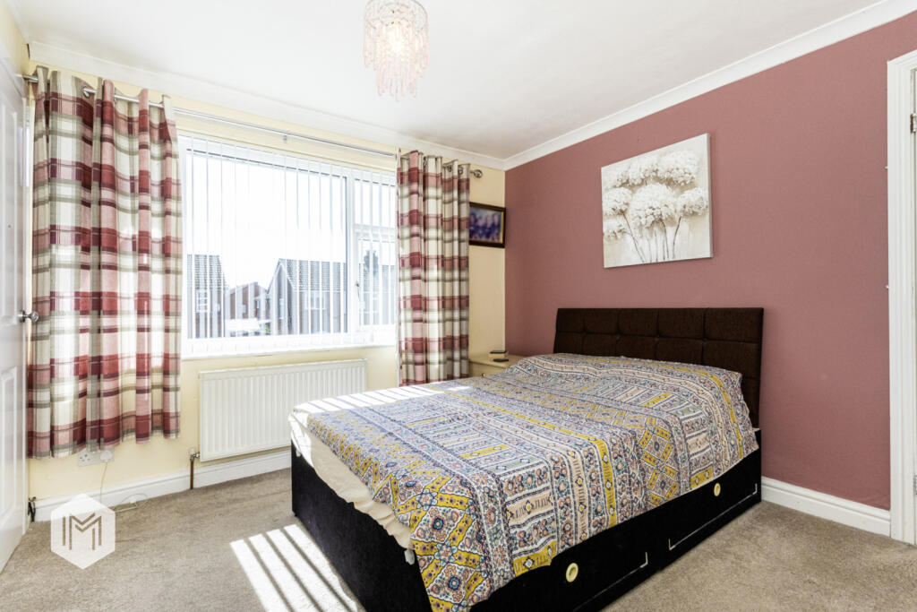
Image Descriptions
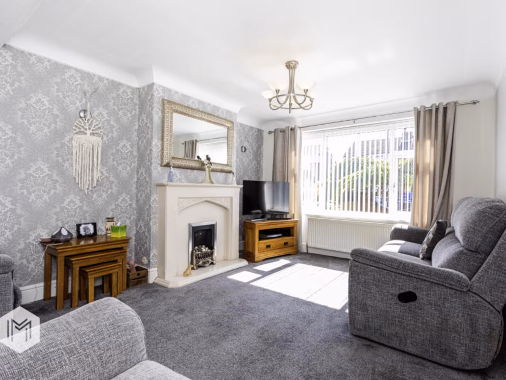
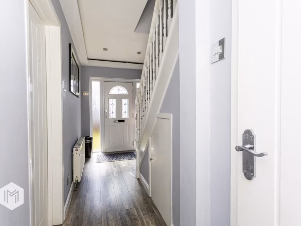
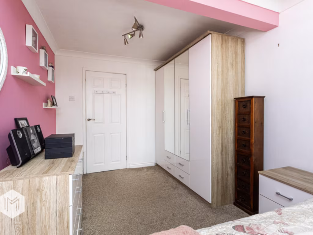
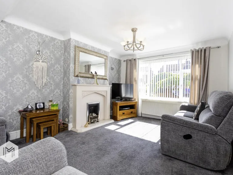
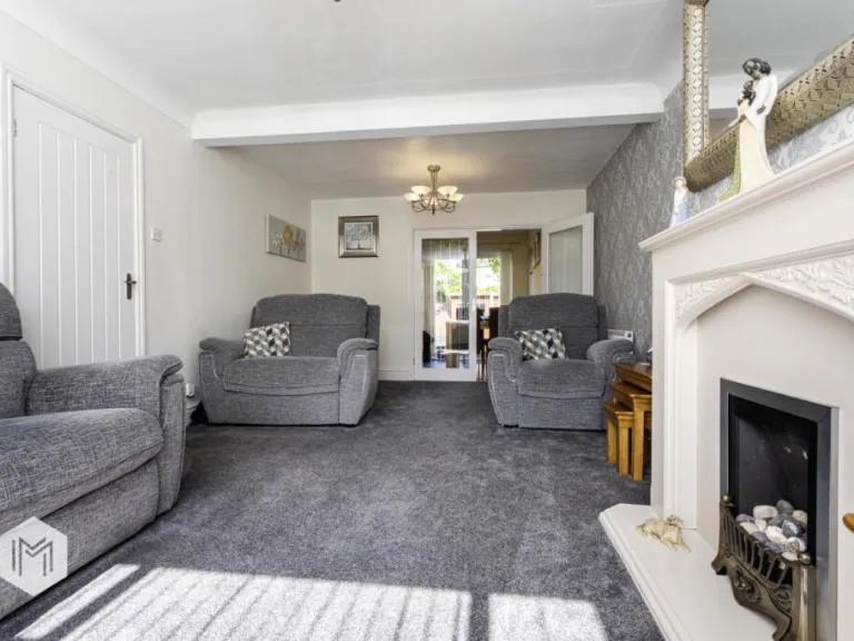
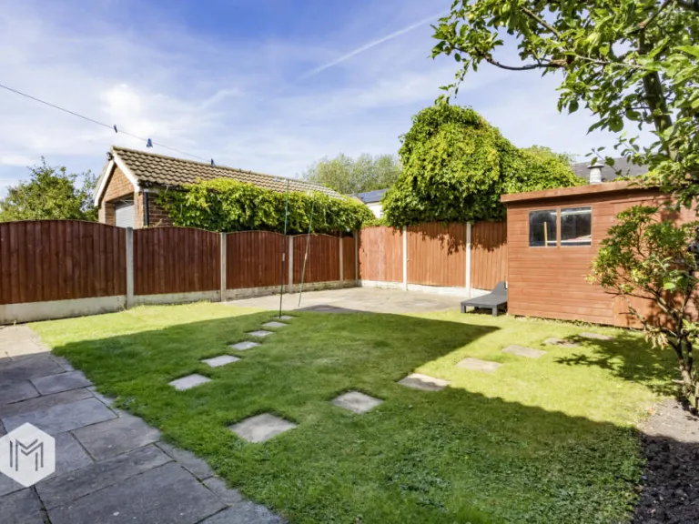
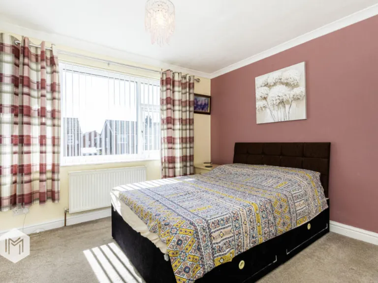
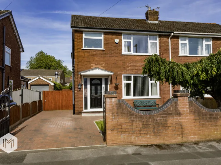
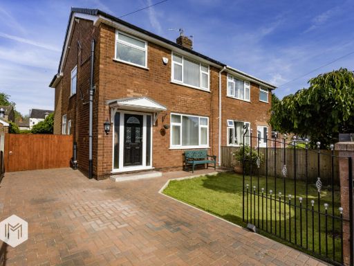
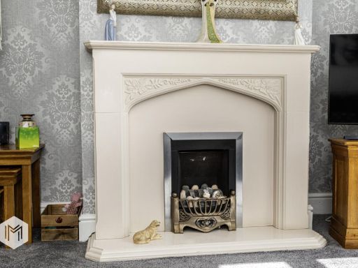
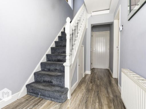
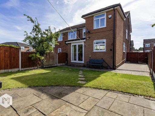
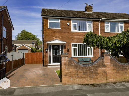
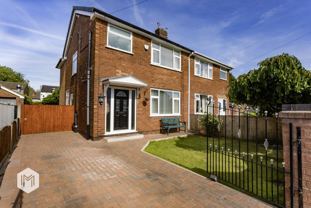
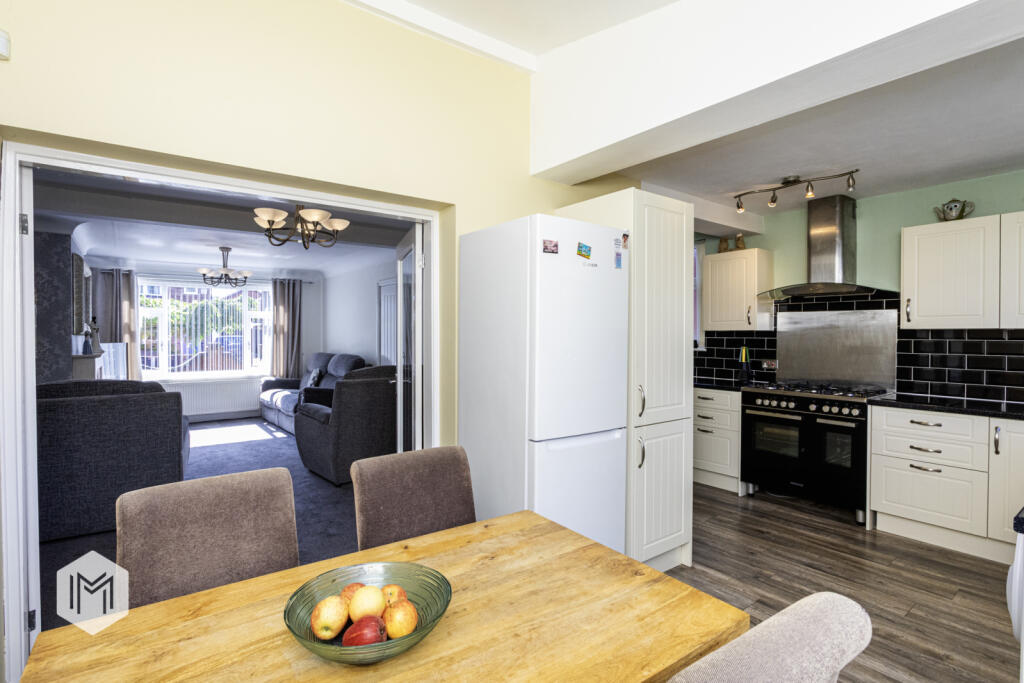
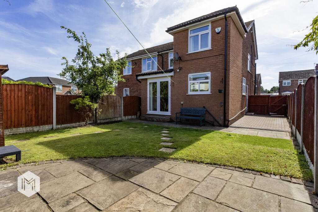
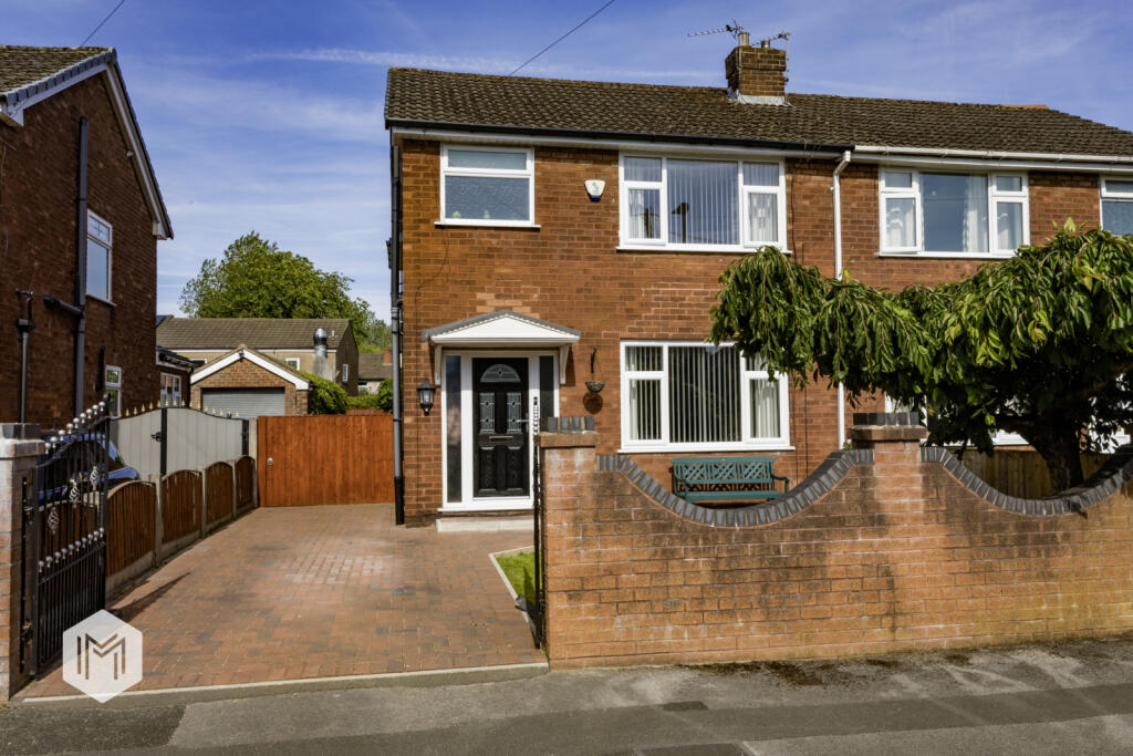
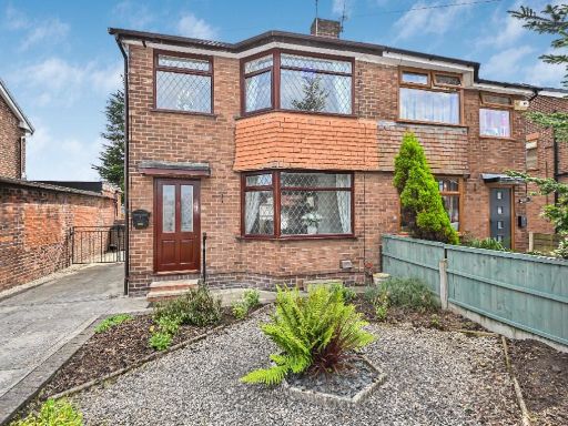
- semi-detached house post-war
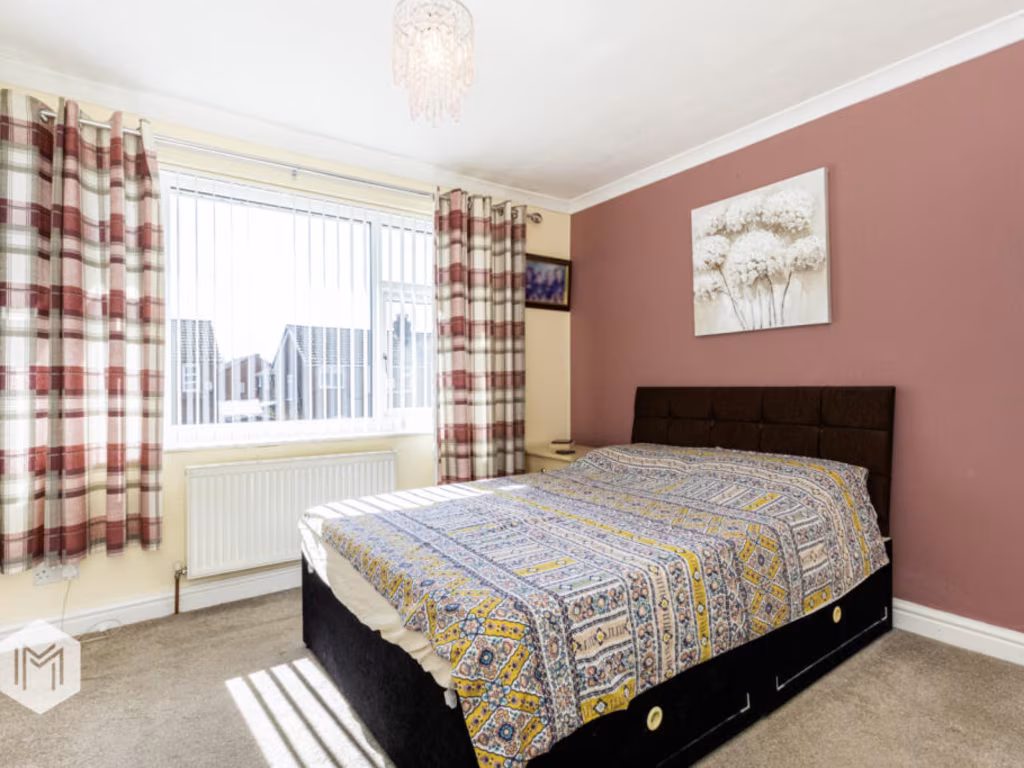
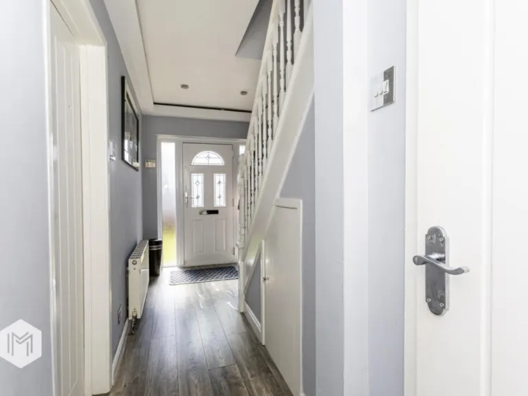
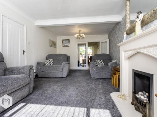
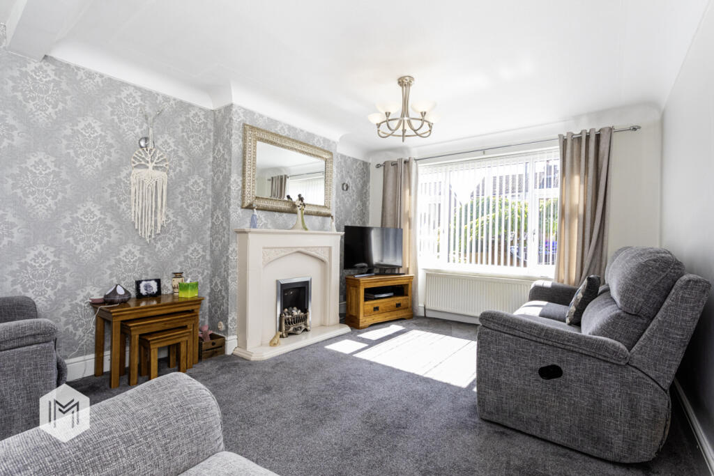
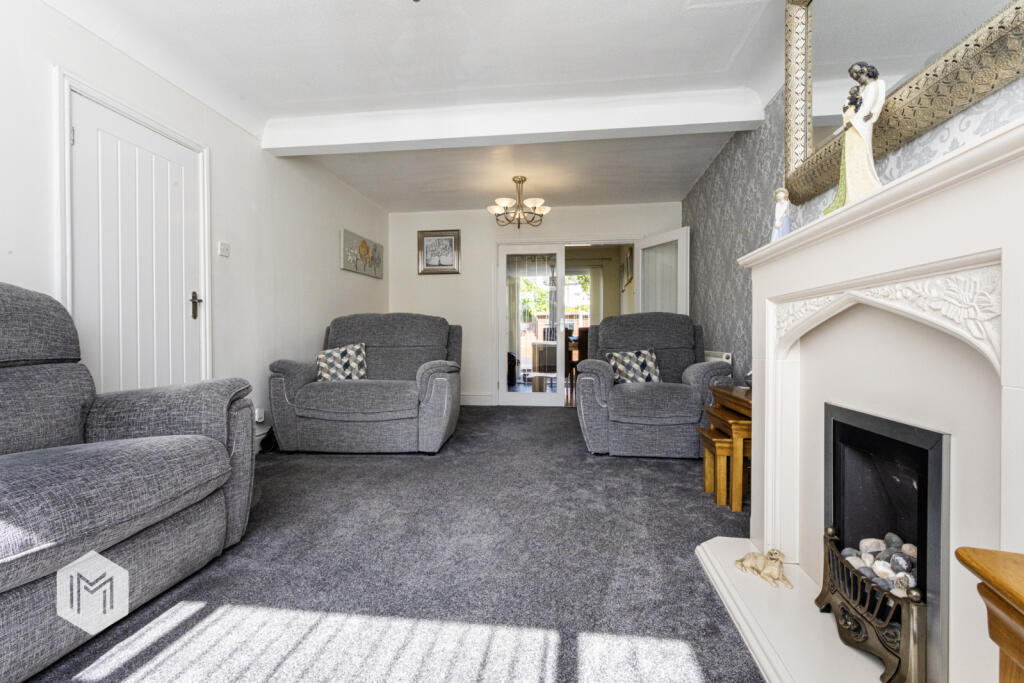
- Living Room Contemporary
Floorplan Description
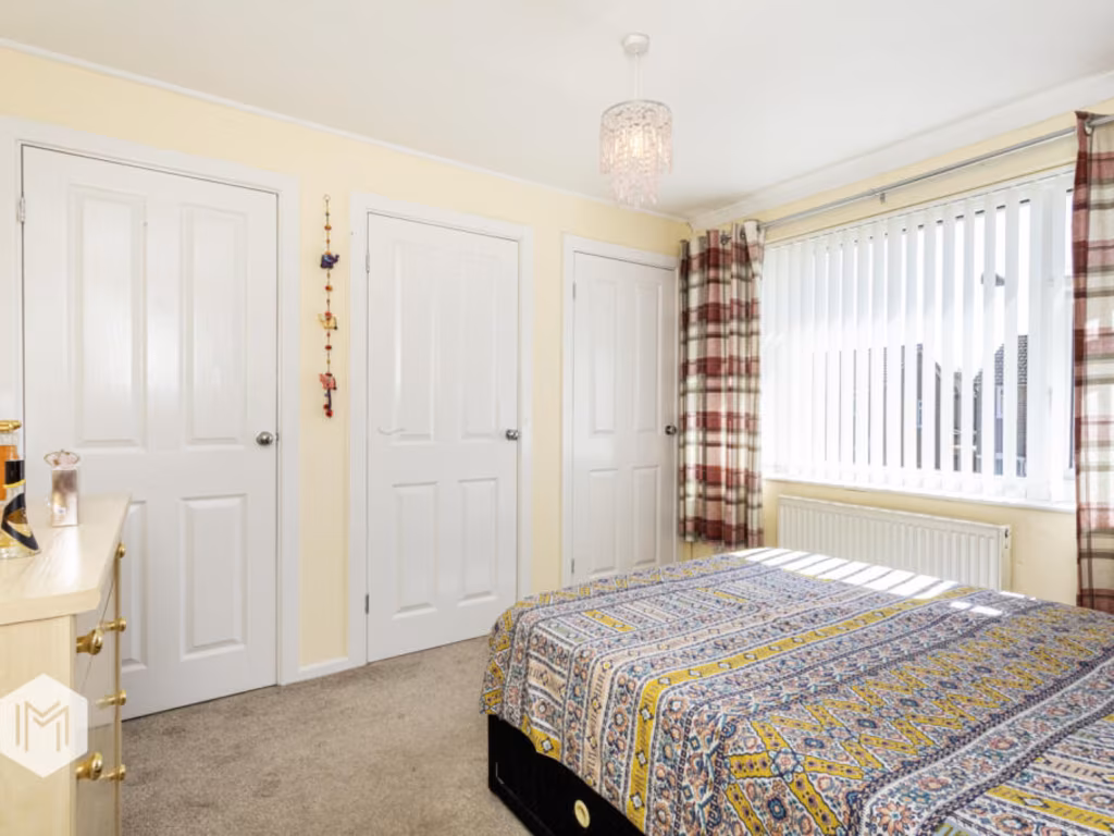
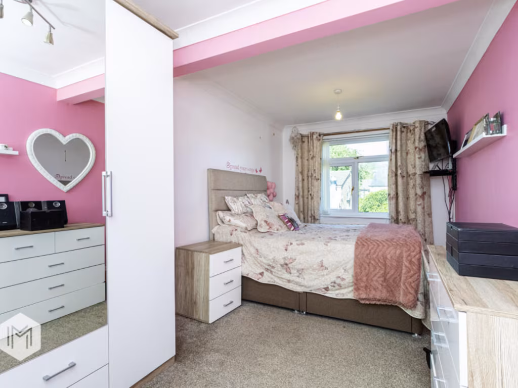
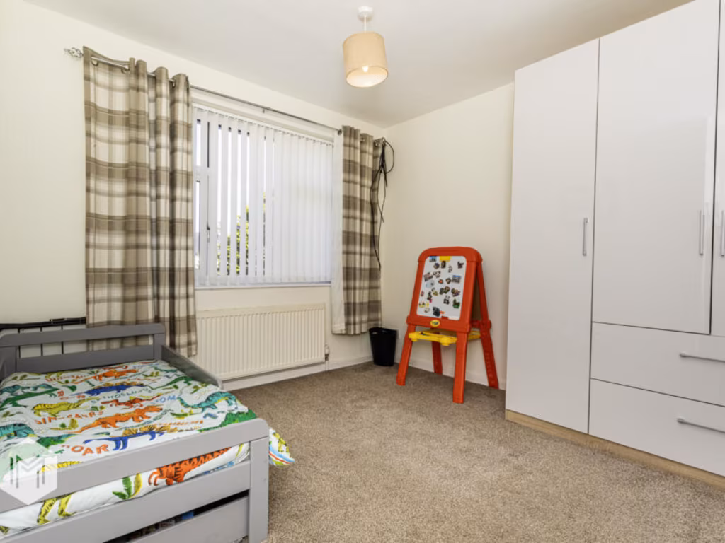
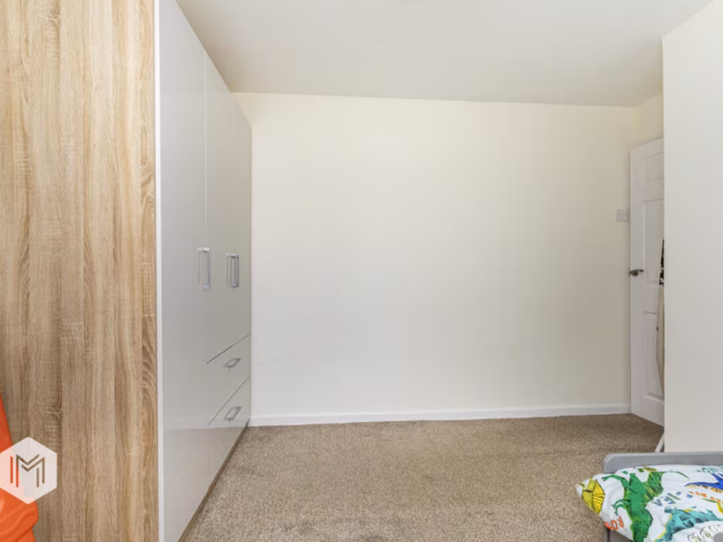
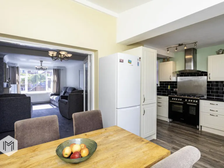
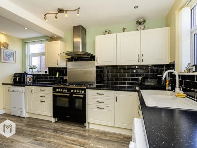
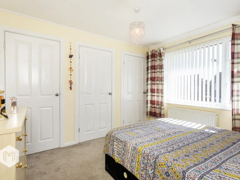
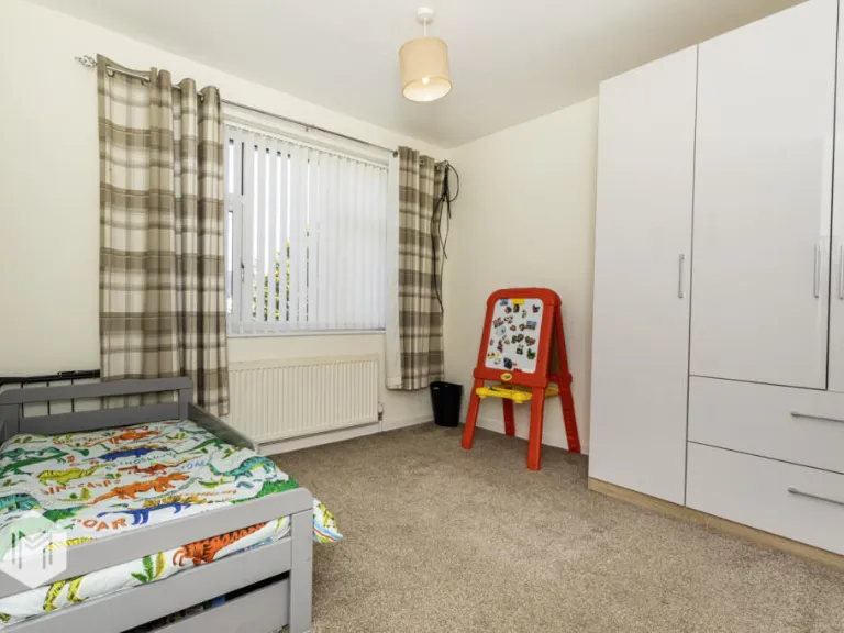
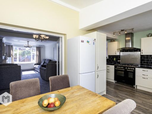
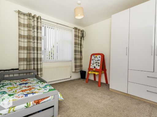
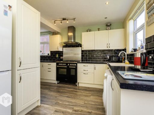
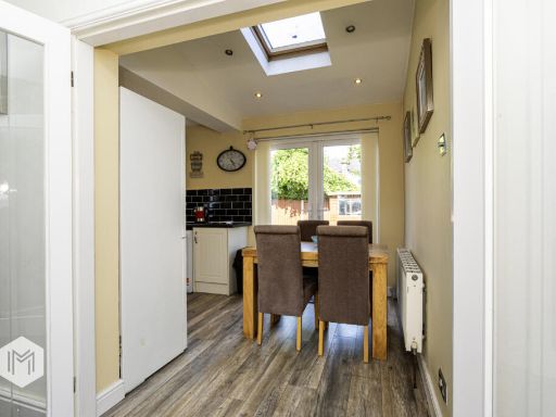
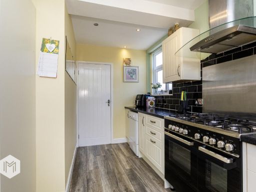
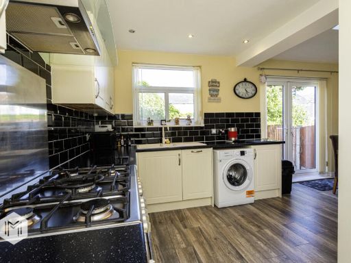
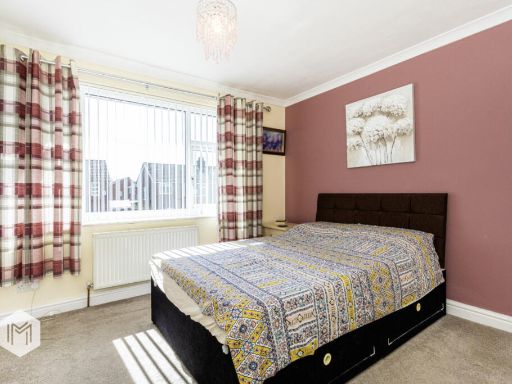
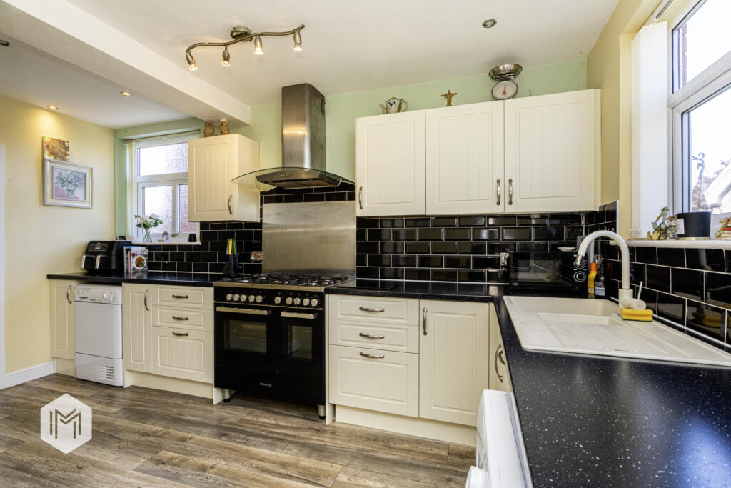
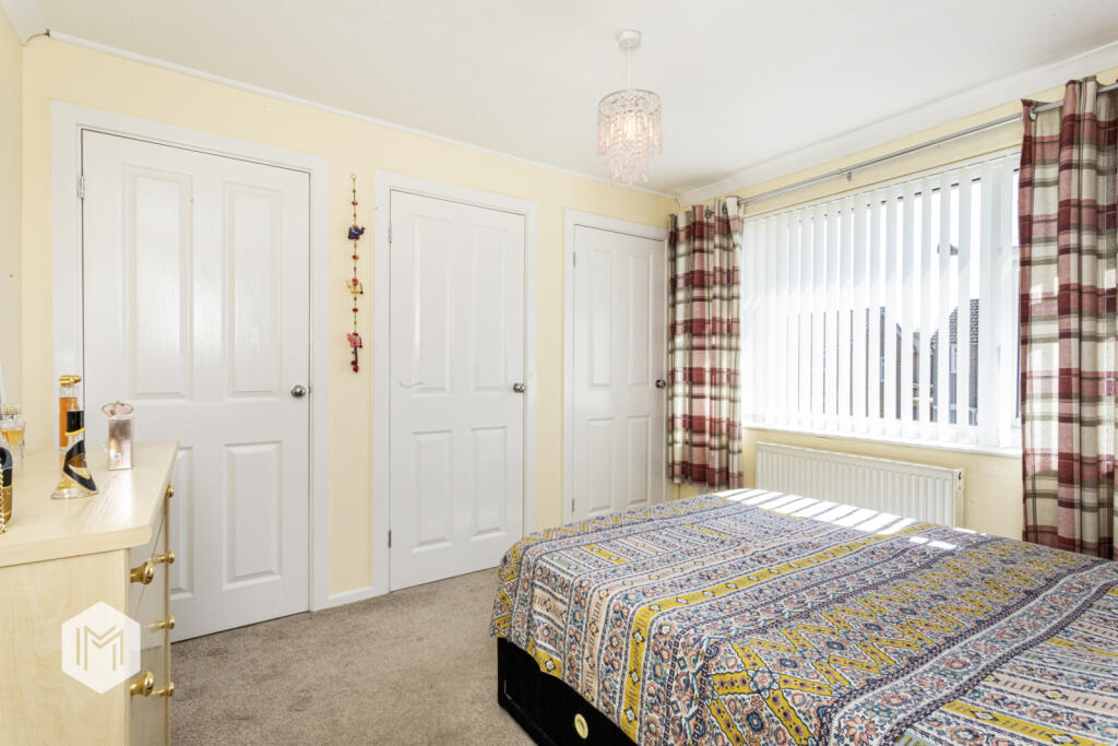
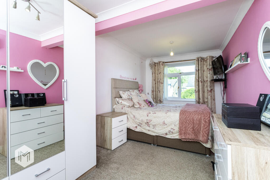
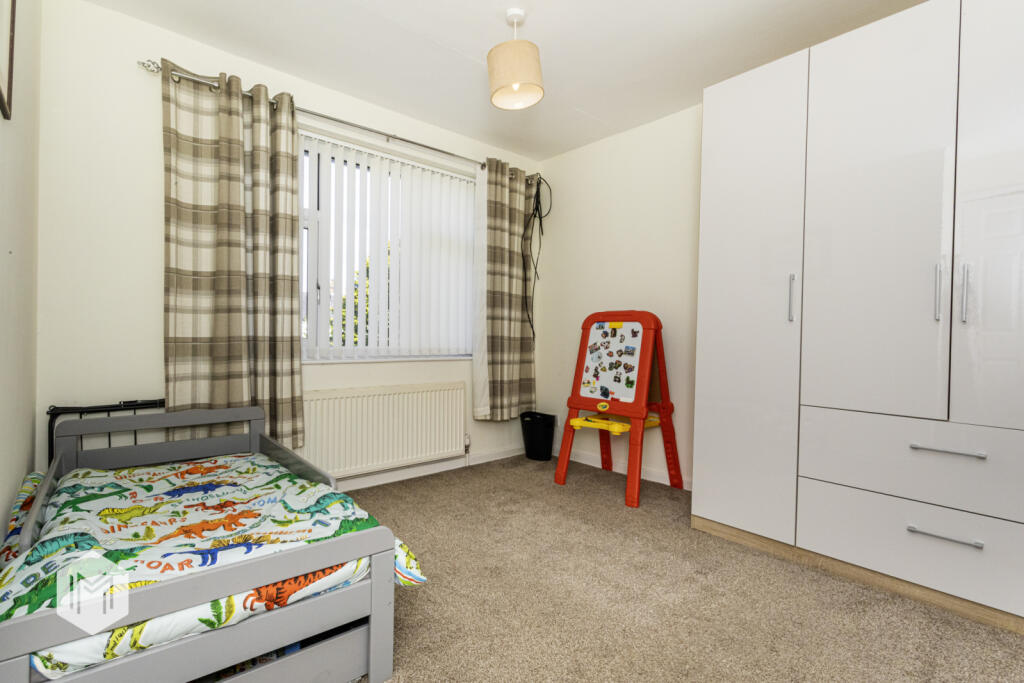
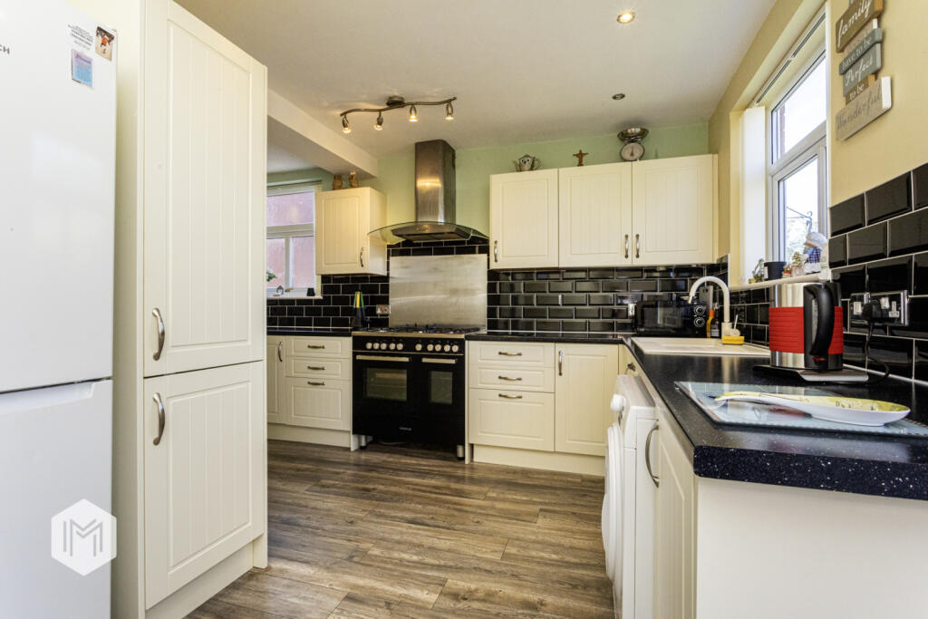
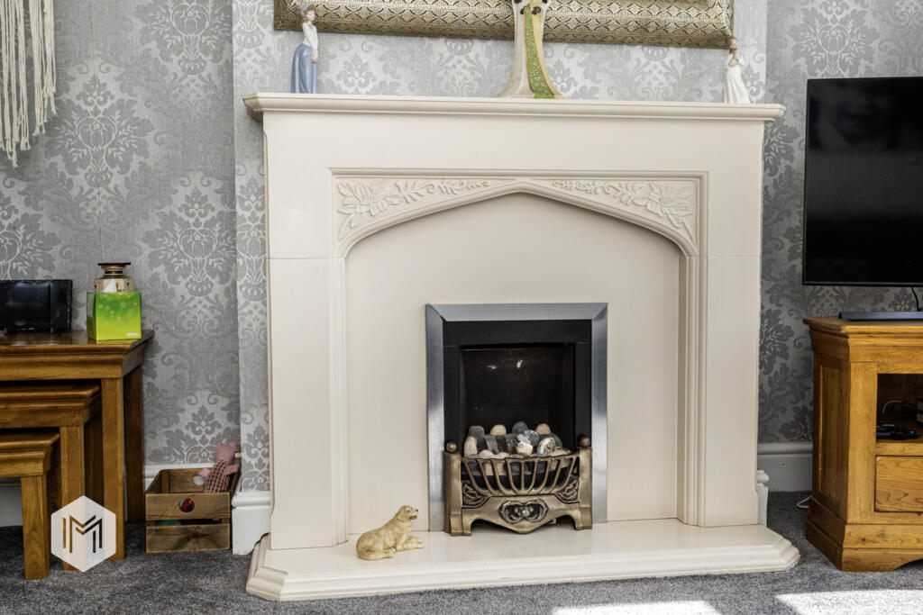
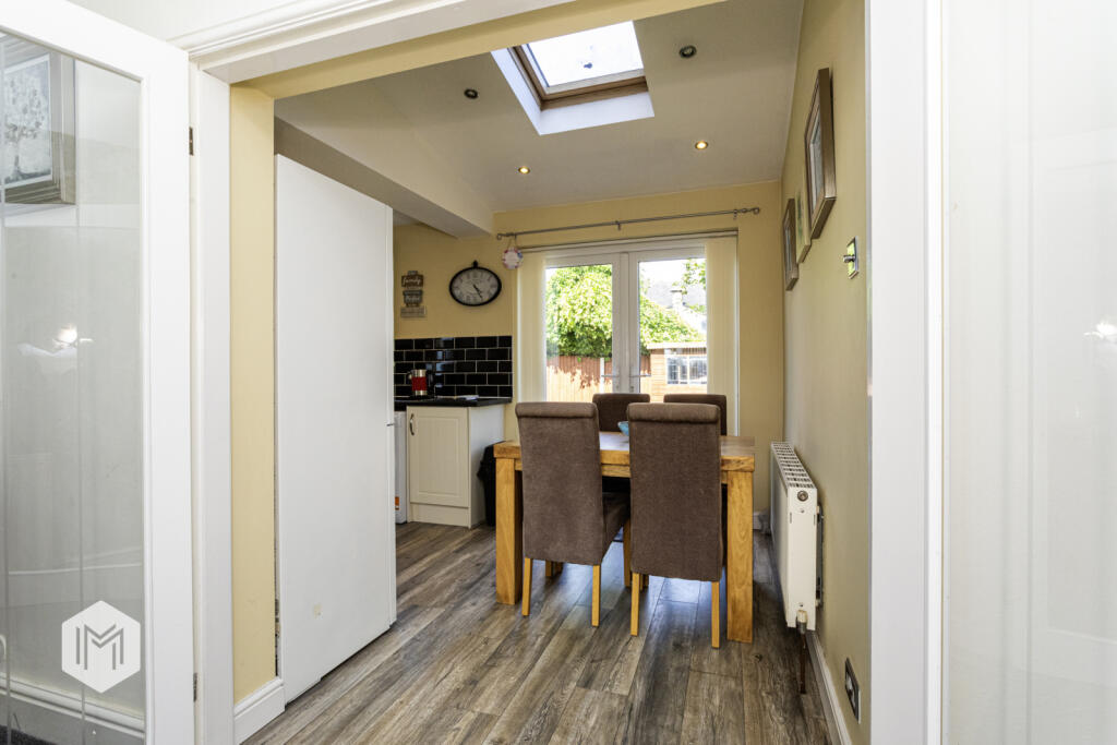
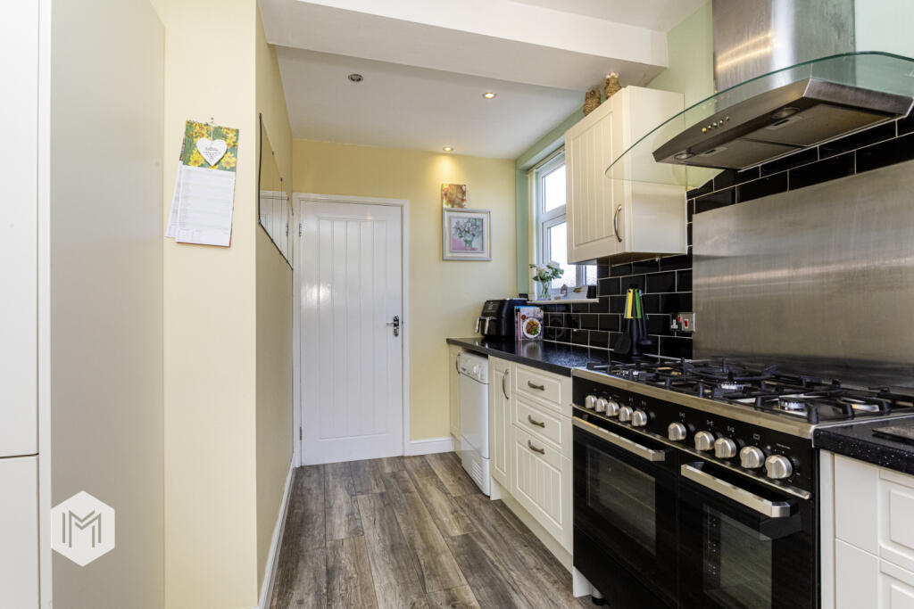
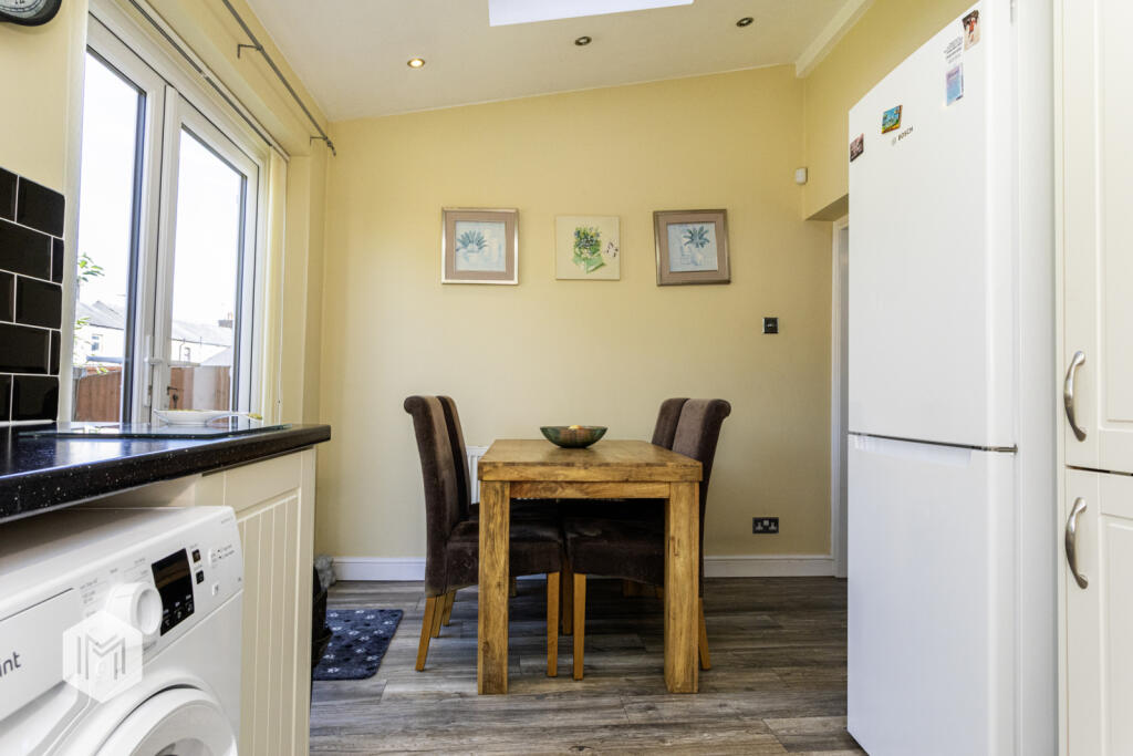
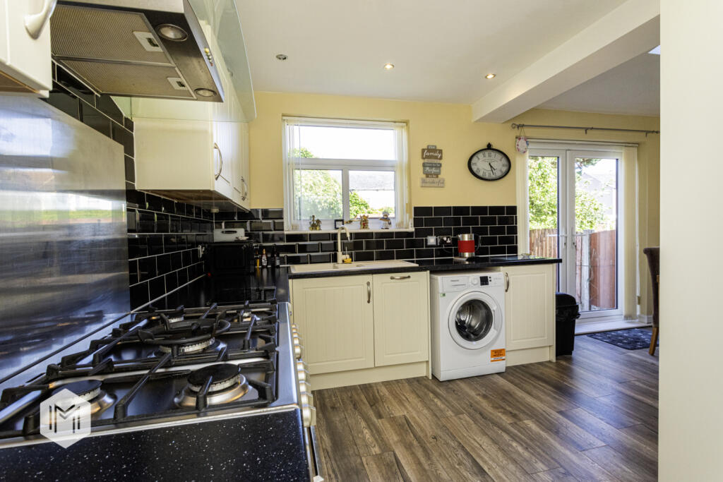
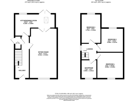
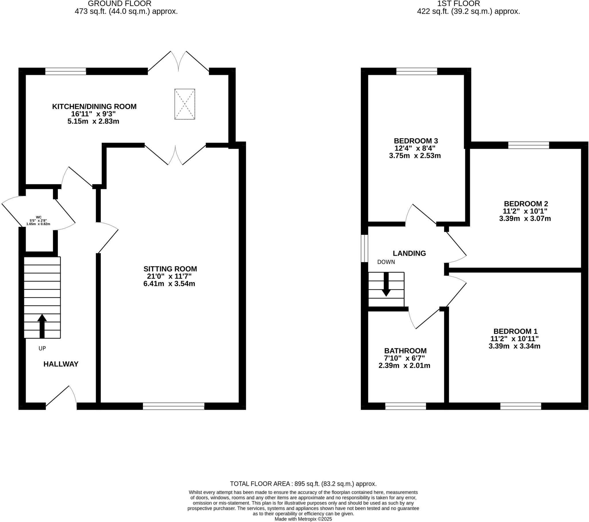
- A two-story property with an average-sized kitchen/dining area, a large sitting room, and three average-sized bedrooms.
Rooms
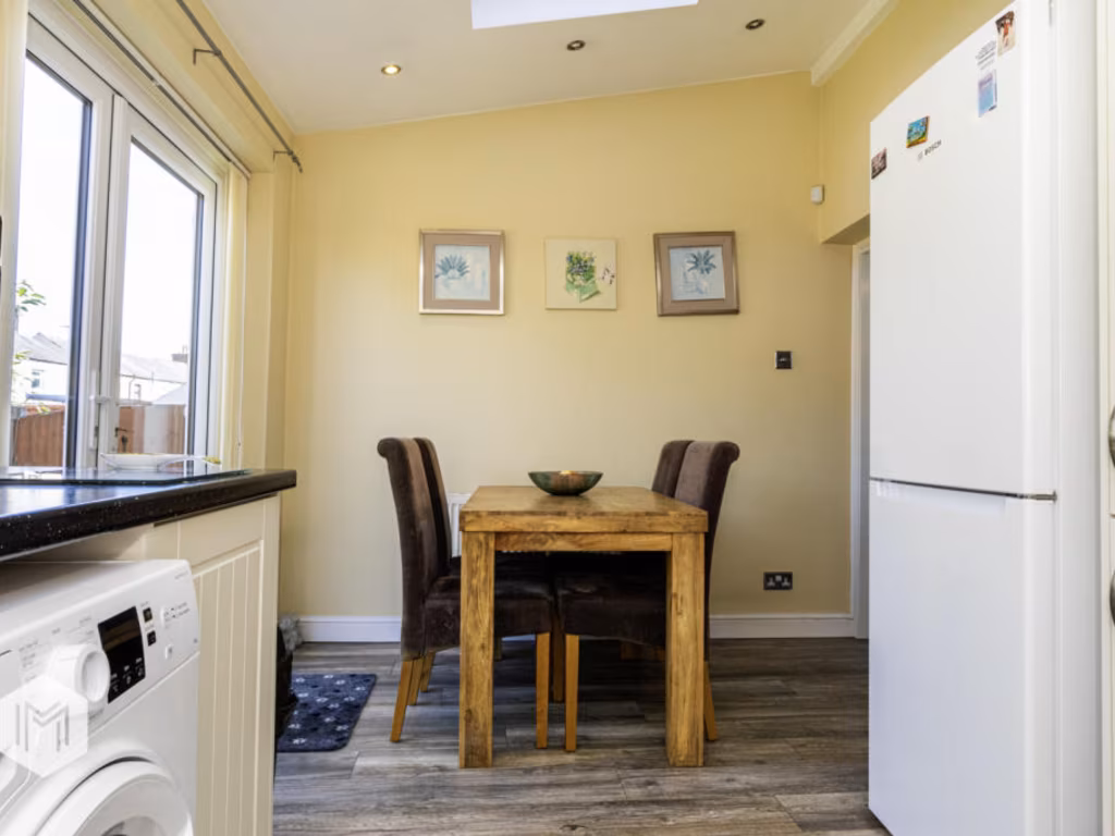
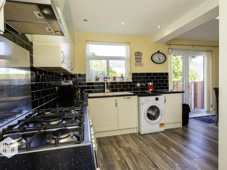
- Kitchen/Dining Room: average
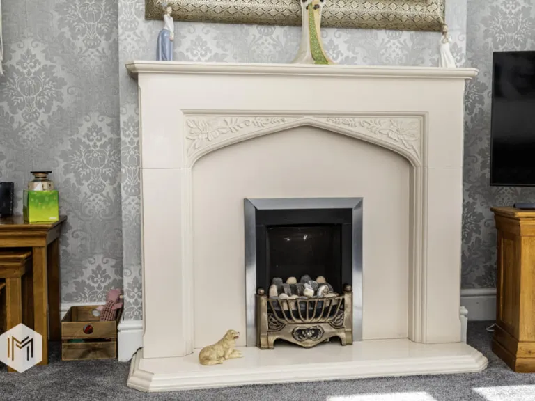
- Sitting Room: large
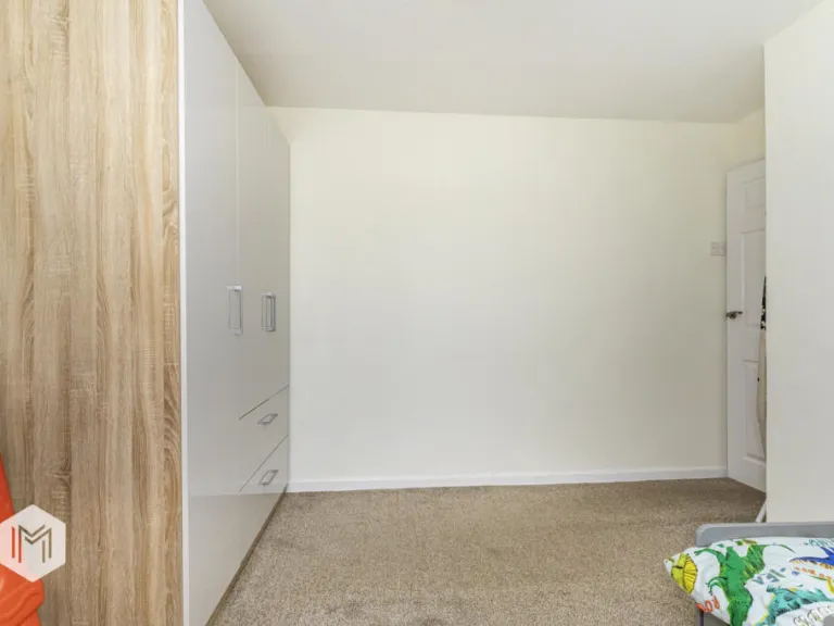
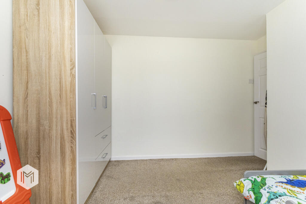
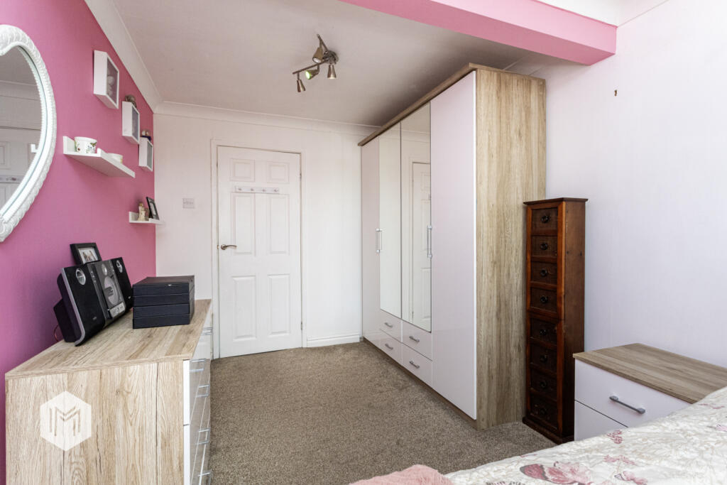
- Bedroom 3: average
- Bedroom 2: average
- Bedroom 1: average
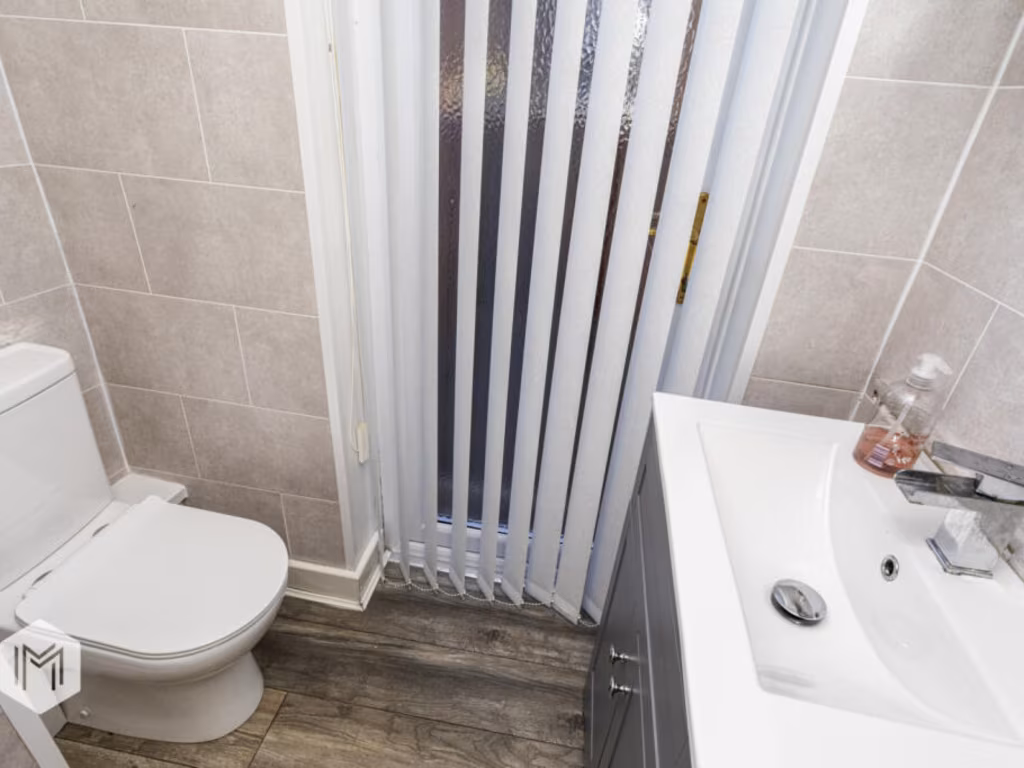
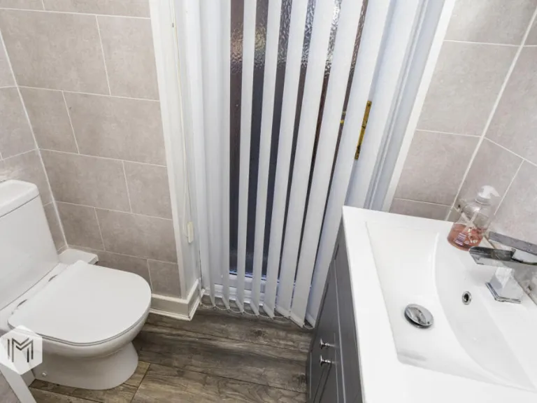
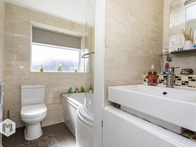
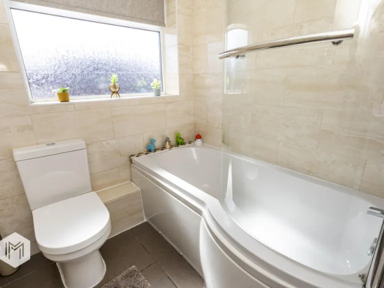
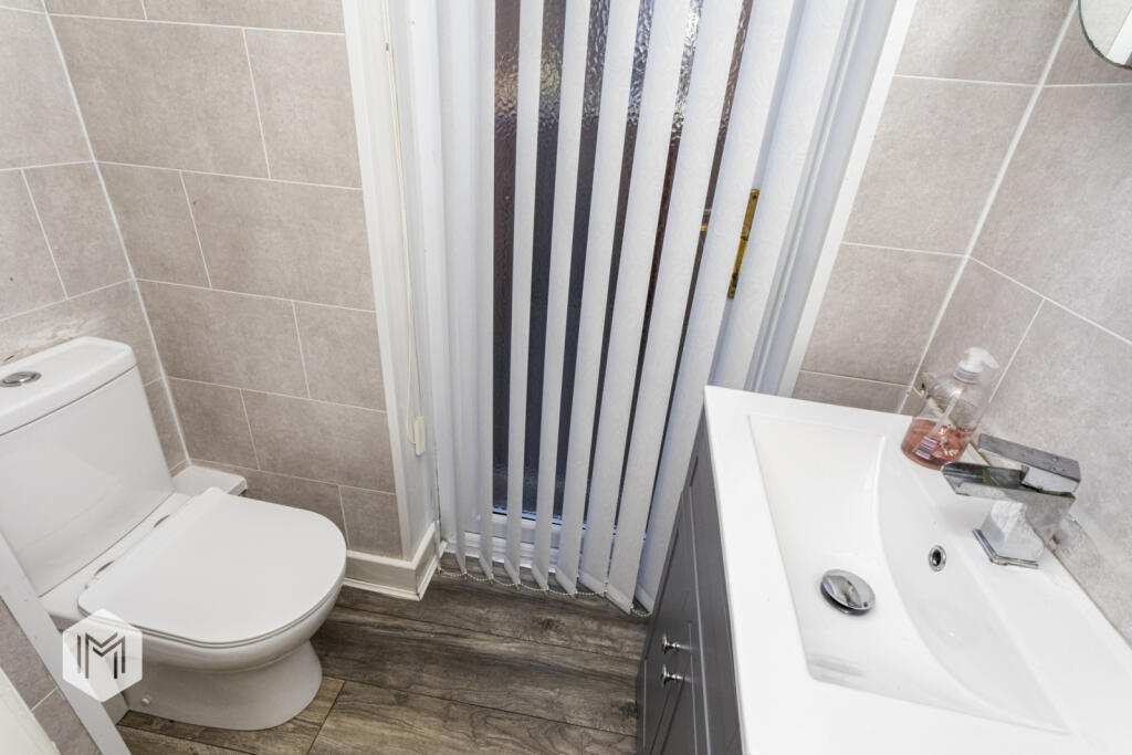
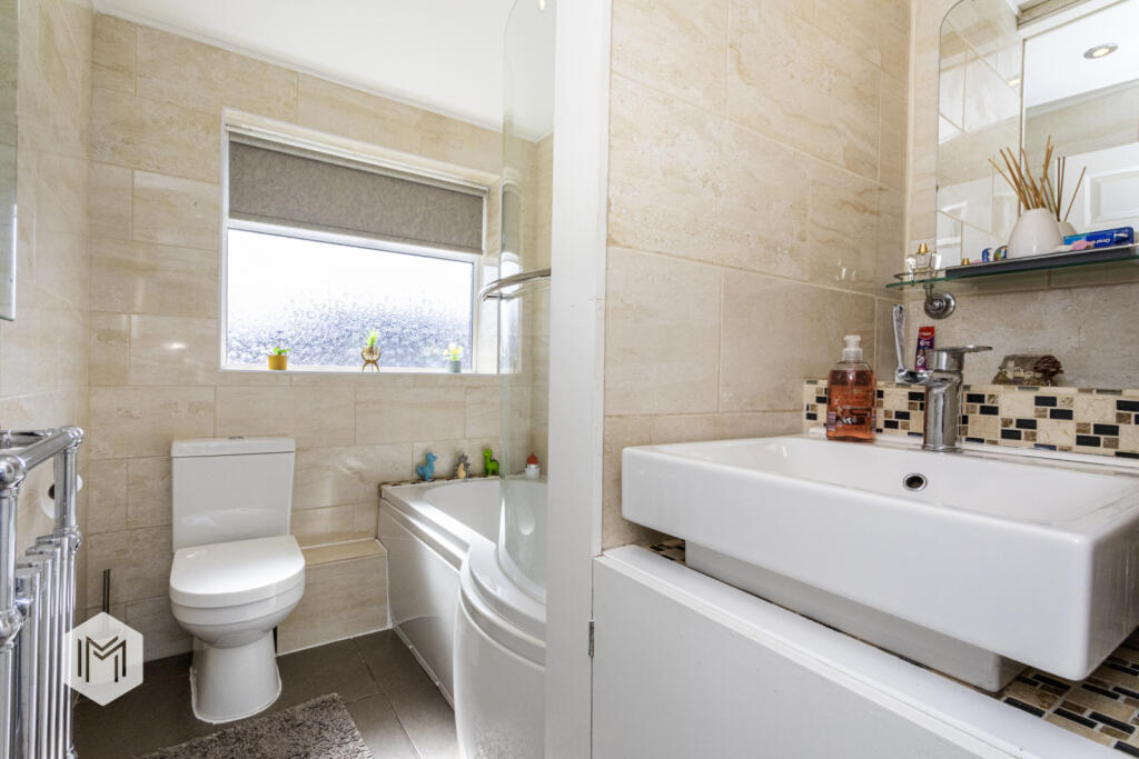
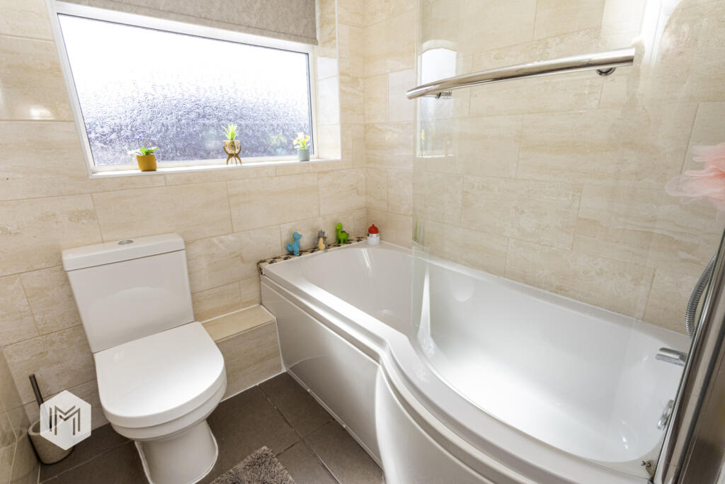
- Bathroom: small
- WC: small
Textual Property Features
Detected Visual Features
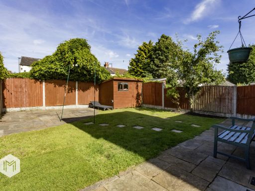
- semi-detached
- brick
- post-war
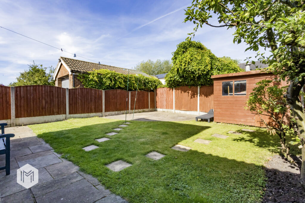
- driveway
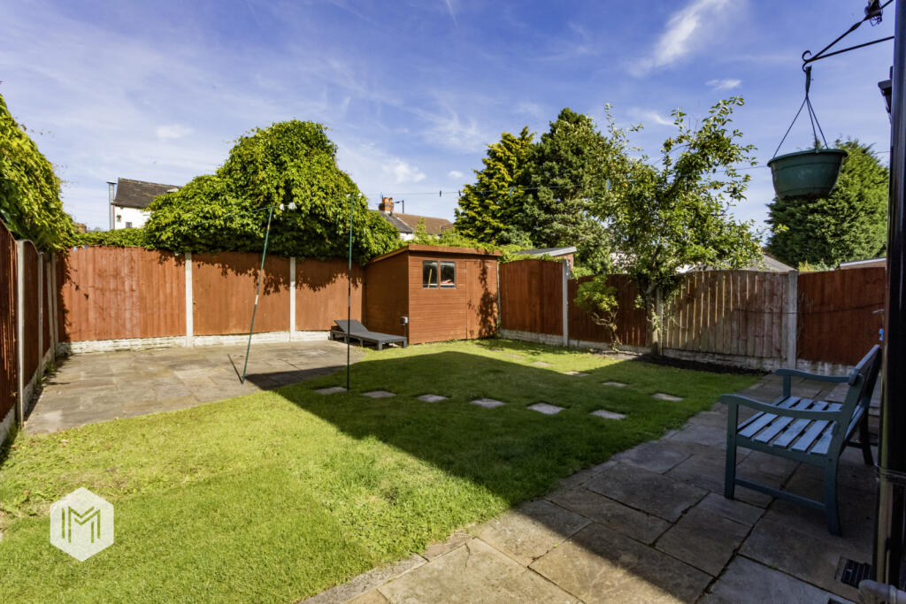
- garden
- two-story
- suburban
- living room
- contemporary
- standard ceiling
- decorative wallpaper
- chimney breast
- medium room
- natural light
- modern chandelier
- neutral colors
EPC Details
- Fully double glazed
- Cavity wall, filled cavity
- Boiler and radiators, mains gas
- Low energy lighting in 14% of fixed outlets
- Solid, no insulation (assumed)
Nearby Schools
- Hindley Green Community Primary School
- Outwood Academy Hindley
- St George's CofE Primary School
- Christ Church CofE Primary School, Pennington
- St Joseph's Catholic Primary School Leigh
- Leigh CofE Primary School
- Leigh St Peter's CofE Primary School
- St Thomas' CofE Primary School, Leigh
- Leigh St John's CofE Primary
- Westleigh St Paul's CofE Primary School
- St Michael's CofE Primary School, Howe Bridge
- Sacred Heart Catholic Primary School, Hindley Green
- St James CofE Primary School, Daisy Hill
- Lowton Junior and Infant School
- Lowton St Mary's CofE (Voluntary Aided) Primary School
- Gilded Hollins Community School
- Eatock Primary School
- Lowton Church of England High School
- Leigh St Mary's CofE Primary School
- Leigh Central Primary School
- Sacred Heart Catholic Primary School Leigh
- Newton Westpark Primary School
- Bickershaw CofE Primary School
- Twelve Apostles Catholic Primary School
- Leigh Westleigh Methodist Primary School
- The Westleigh School
- St John's Church of England Primary School, Hindley Green
- Green Meadow Independent Primary School
Nearest General Shops
- Id: 8892934547
- Tags:
- Brand: Marks & Spencer
- Brand:wikidata: Q714491
- Brand:wikipedia: en:Marks & Spencer
- Contact:
- Website: https://www.marksandspencer.com/stores/leigh-1269
- Description: Marks & Spencers Food Shop
- Name: Marks & Spencer
- Shop: department_store
- TagsNormalized:
- marks & spencer
- department store
- shop
- Lat: 53.5005888
- Lon: -2.5276007
- FullGeoHash: gcw0q7rrw8s7
- PartitionGeoHash: gcw0
- Images:
- FoodStandards: null
- Distance: 731.8
,- Id: 961950782
- Tags:
- Addr:
- City: Leigh
- Postcode: WN7 5AR
- Street: Leighbrook Way
- Brand: The Range
- Brand:wikidata: Q7759409
- Brand:wikipedia: en:The Range (retailer)
- Building: yes
- Name: The Range
- Shop: houseware
- Website: https://www.therange.co.uk/stores/leigh/
- TagsNormalized:
- Lat: 53.5029998
- Lon: -2.5276661
- FullGeoHash: gcw0q7zmt459
- PartitionGeoHash: gcw0
- Images:
- FoodStandards: null
- Distance: 587.4
,- Id: 55037480
- Tags:
- Building: yes
- Name: A B World Foods
- Shop: yes
- Website: https://abworldfoods.com/#united-kingdom-l
- TagsNormalized:
- Lat: 53.5051421
- Lon: -2.5279411
- FullGeoHash: gcw0qkr4n9qk
- PartitionGeoHash: gcw0
- Images:
- FoodStandards: null
- Distance: 530
}
Nearest Grocery shops
- Id: 987315221
- Tags:
- Building: yes
- Name: Mini Market
- Shop: convenience
- TagsNormalized:
- Lat: 53.4978365
- Lon: -2.5421975
- FullGeoHash: gcw0q4uz6x81
- PartitionGeoHash: gcw0
- Images:
- FoodStandards: null
- Distance: 888.6
,- Id: 1000647688
- Tags:
- Addr:
- City: Leigh
- Postcode: WN7 5AR
- Street: Leighbrook Way
- Brand: The Food Warehouse
- Brand:wikidata: Q87263899
- Building: yes
- Name: The Food Warehouse
- Shop: supermarket
- Website: https://www.thefoodwarehouse.com/store-locator/leigh
- TagsNormalized:
- food
- the food warehouse
- warehouse
- shop
- Lat: 53.5030613
- Lon: -2.52633
- FullGeoHash: gcw0qebmujxb
- PartitionGeoHash: gcw0
- Images:
- FoodStandards: null
- Distance: 668.4
,- Id: 998220661
- Tags:
- Addr:
- City: Leigh
- Housename: Easy Save Convenience Store
- Housenumber: 327
- Postcode: WN7 5EL
- Street: Wigan Road
- Brand: Premier
- Brand:wikidata: Q7240340
- Brand:wikipedia: en:Premier Stores
- Building: yes
- Name: Premier
- Phone: +44 1942 604489
- Shop: convenience
- Website: https://www.premier-stores.co.uk/our-stores/easy-save-convenience-store
- TagsNormalized:
- Lat: 53.504419
- Lon: -2.5347262
- FullGeoHash: gcw0qk4mbde5
- PartitionGeoHash: gcw0
- Images:
- FoodStandards: null
- Distance: 97.4
}
Nearest Religious buildings
- Id: 837534372
- Tags:
- Amenity: place_of_worship
- Building: church
- Denomination: anglican
- Name: St Paul
- Religion: christian
- Wikidata: Q105100885
- TagsNormalized:
- place of worship
- church
- anglican
- paul
- christian
- Lat: 53.5150466
- Lon: -2.5275511
- FullGeoHash: gcw0qqp7xz9r
- PartitionGeoHash: gcw0
- Images:
- FoodStandards: null
- Distance: 1256.4
,- Id: 421480226
- Tags:
- Amenity: place_of_worship
- Building: church
- Denomination: anglican
- Name: St Peter's
- Religion: christian
- Wikidata: Q7595302
- Wikipedia: en:St Peter's Church, Westleigh, Greater Manchester
- TagsNormalized:
- place of worship
- church
- anglican
- christian
- Lat: 53.4984392
- Lon: -2.5376634
- FullGeoHash: gcw0q704upvh
- PartitionGeoHash: gcw0
- Images:
- FoodStandards: null
- Distance: 728.4
,- Id: 4788301921
- Tags:
- Amenity: place_of_worship
- Name: Methodist Church
- Religion: christian
- TagsNormalized:
- place of worship
- church
- methodist
- christian
- Lat: 53.4990151
- Lon: -2.5318057
- FullGeoHash: gcw0q7hqkehz
- PartitionGeoHash: gcw0
- Images:
- FoodStandards: null
- Distance: 710.4
}
Nearest Medical buildings
- Id: 928103546
- Tags:
- Amenity: hospital
- Healthcare: hospital
- Name: NHS Atherleigh Park
- Operator: NHS
- Operator:wikidata: Q918396
- TagsNormalized:
- hospital
- health
- healthcare
- nhs
- Lat: 53.5011944
- Lon: -2.5234378
- FullGeoHash: gcw0qed7p9kr
- PartitionGeoHash: gcw0
- Images:
- FoodStandards: null
- Distance: 924.7
,- Id: 7497797182
- Tags:
- Amenity: pharmacy
- Brand: Asda
- Brand:wikidata: Q297410
- Brand:wikipedia: en:Asda
- Contact:
- Phone: +44 1942 266812
- Website: https://storelocator.asda.com/north-west/leigh/atherleigh-way/pharmacy
- Fixme: Location not accurate
- Healthcare: pharmacy
- Name: Asda
- Operator: Asda Stores Ltd
- TagsNormalized:
- pharmacy
- asda
- health
- healthcare
- Lat: 53.5042439
- Lon: -2.5247634
- FullGeoHash: gcw0qs1sb9zy
- PartitionGeoHash: gcw0
- Images:
- FoodStandards: null
- Distance: 743.3
,- Id: 677328531
- Tags:
- Amenity: doctors
- Fixme: Listed in the middle of the road
- Healthcare: doctor
- Name: Wigan Road Surgery
- TagsNormalized:
- doctor
- doctors
- health
- healthcare
- surgery
- Lat: 53.5023779
- Lon: -2.5336878
- FullGeoHash: gcw0q7g1by17
- PartitionGeoHash: gcw0
- Images:
- FoodStandards: null
- Distance: 318.7
,- Id: 677328059
- Tags:
- Amenity: pharmacy
- Fixme: Listed not over a building
- Healthcare: pharmacy
- TagsNormalized:
- Lat: 53.5024385
- Lon: -2.5337629
- FullGeoHash: gcw0q7ffr13m
- PartitionGeoHash: gcw0
- Images:
- FoodStandards: null
- Distance: 310.4
}
Nearest Airports
- Id: 1224469
- Tags:
- Addr:
- City: Manchester
- Country: GB
- Postcode: M90 1QX
- Aerodrome: international
- Aeroway: aerodrome
- Arp: yes
- Atis: 128.175
- Iata: MAN
- Icao: EGCC
- Name: Manchester Airport
- Note: rough sketched outline referring to Yahoo imagery - true boundary is where?
- Old_name: Ringway
- Operator: Manchester Airport PLC
- Size: 18720000
- Source:
- Tower_frequency: 118.625,119.400
- Type: multipolygon
- Website: https://www.manchesterairport.co.uk/
- Wikidata: Q8694
- Wikipedia: en:Manchester Airport
- TagsNormalized:
- airport
- international airport
- Lat: 53.3503197
- Lon: -2.2798822
- FullGeoHash: gcqrs05u4ukt
- PartitionGeoHash: gcqr
- Images:
- FoodStandards: null
- Distance: 24151.7
,- Id: 116737532
- Tags:
- Addr:
- City: Liverpool
- Country: GB
- Postcode: L24 1YD
- Street: Speke Hall Avenue
- Aerodrome: international
- Aerodrome:type: public
- Aeroway: aerodrome
- Iata: LPL
- Icao: EGGP
- Is_in: Liverpool,England,UK
- Name: Liverpool John Lennon Airport
- Old_name: Speke Airport
- Operator: Liverpool Airport plc
- Source: wikipedia
- Website: https://www.liverpoolairport.com/
- Wikidata: Q8727
- Wikipedia: en:Liverpool John Lennon Airport
- TagsNormalized:
- airport
- international airport
- Lat: 53.3357677
- Lon: -2.8518179
- FullGeoHash: gcmzrj7r7gdr
- PartitionGeoHash: gcmz
- Images:
- FoodStandards: null
- Distance: 28139.9
}
Nearest Leisure Facilities
- Id: 1052286916
- Tags:
- TagsNormalized:
- Lat: 53.4992735
- Lon: -2.5355855
- FullGeoHash: gcw0q71xue6m
- PartitionGeoHash: gcw0
- Images:
- FoodStandards: null
- Distance: 627.2
,- Id: 53626871
- Tags:
- TagsNormalized:
- Lat: 53.4994607
- Lon: -2.5355997
- FullGeoHash: gcw0q738unrc
- PartitionGeoHash: gcw0
- Images:
- FoodStandards: null
- Distance: 606.4
,- Id: 1078042905
- Tags:
- Leisure: pitch
- Sport: cricket
- TagsNormalized:
- pitch
- leisure
- cricket
- sports
- Lat: 53.5074737
- Lon: -2.5289453
- FullGeoHash: gcw0qkwrxk19
- PartitionGeoHash: gcw0
- Images:
- FoodStandards: null
- Distance: 543.7
,- Id: 13266670
- Tags:
- Leisure: park
- Name: Firs Park
- Type: multipolygon
- TagsNormalized:
- Lat: 53.5000543
- Lon: -2.5366092
- FullGeoHash: gcw0q72ukszn
- PartitionGeoHash: gcw0
- Images:
- FoodStandards: null
- Distance: 541.7
,- Id: 60106122
- Tags:
- Leisure: park
- Name: Westleigh Park
- Source: OS_OpenData_StreetView
- TagsNormalized:
- Lat: 53.5072497
- Lon: -2.531065
- FullGeoHash: gcw0qksymfm1
- PartitionGeoHash: gcw0
- Images:
- FoodStandards: null
- Distance: 414.6
}
Nearest Tourist attractions
- Id: 938615700
- Tags:
- Addr:
- City: Tyldesley
- Housenumber: 138
- Postcode: M29 8FJ
- Street: Elliott Street
- Building: yes
- Listed_status: Grade II
- Tourism: guest_house
- TagsNormalized:
- Lat: 53.5139108
- Lon: -2.468605
- FullGeoHash: gcw0rvfmjk48
- PartitionGeoHash: gcw0
- Images:
- FoodStandards: null
- Distance: 4564.1
,- Id: 2004753208
- Tags:
- Name: Leigh Town Hall Archives
- Operator: Wigan Council
- Tourism: museum
- Website: https://archives.wigan.gov.uk/
- TagsNormalized:
- Lat: 53.4973242
- Lon: -2.5192064
- FullGeoHash: gcw0qdvsd0p9
- PartitionGeoHash: gcw0
- Images:
- FoodStandards: null
- Distance: 1391.9
,- Id: 1131962212
- Tags:
- Addr:
- City: Leigh
- Housenumber: 63
- Street: Findlay Street
- Building: yes
- Description: Homeless hostel service
- Name: Riverside Project
- Operator: Springboard
- Source: survey;local knowledge
- Tourism: hostel
- Website: https://homeless.org.uk/homeless-england/service/riverside-railway-road-project/
- TagsNormalized:
- Lat: 53.4983577
- Lon: -2.5264561
- FullGeoHash: gcw0qe06929y
- PartitionGeoHash: gcw0
- Images:
- FoodStandards: null
- Distance: 961.7
}
Nearest Train stations
- Id: 6178577209
- Tags:
- Name: Westhoughton
- Naptan:
- Network: National Rail
- Public_transport: station
- Railway: station
- Ref:
- Source: npe
- Wikidata: Q2751556
- Wikipedia: en:Westhoughton railway station
- TagsNormalized:
- Lat: 53.5558849
- Lon: -2.523221
- FullGeoHash: gcw0wtd9ssw1
- PartitionGeoHash: gcw0
- Images:
- FoodStandards: null
- Distance: 5730.2
,- Id: 9777001563
- Tags:
- Name: Hindley
- Naptan:
- Network: National Rail
- Public_transport: station
- Railway: station
- Ref:
- Source: npe
- Train: yes
- Wikidata: Q2147566
- Wikipedia: en:Hindley railway station
- TagsNormalized:
- Lat: 53.542391
- Lon: -2.5748804
- FullGeoHash: gcw0t7j50cn5
- PartitionGeoHash: gcw0
- Images:
- FoodStandards: null
- Distance: 4898.3
,- Id: 6581364399
- Tags:
- Name: Atherton
- Naptan:
- Network: National Rail
- Old_name: Atherton Central
- Public_transport: station
- Railway: station
- Ref:
- Source: NPE
- Train: yes
- Wheelchair: yes
- Wikidata: Q2474672
- Wikipedia: en:Atherton railway station
- TagsNormalized:
- Lat: 53.5290757
- Lon: -2.4778339
- FullGeoHash: gcw0x8etqqcn
- PartitionGeoHash: gcw0
- Images:
- FoodStandards: null
- Distance: 4688.5
,- Id: 8257336106
- Tags:
- Name: Hag Fold
- Naptan:
- Network: National Rail
- Public_transport: station
- Railway: station
- Ref:
- Wikidata: Q2022284
- Wikipedia: en:Hag Fold railway station
- TagsNormalized:
- Lat: 53.5335276
- Lon: -2.4938302
- FullGeoHash: gcw0x32p3sc6
- PartitionGeoHash: gcw0
- Images:
- FoodStandards: null
- Distance: 4228.3
,- Id: 6569339484
- Tags:
- Name: Daisy Hill
- Naptan:
- Network: National Rail
- Public_transport: station
- Railway: station
- Ref:
- Train: yes
- Uic_ref: 7000641
- Wheelchair: no
- Wikidata: Q1822126
- Wikipedia: en:Daisy Hill railway station
- TagsNormalized:
- Lat: 53.539359
- Lon: -2.5151778
- FullGeoHash: gcw0wf8925gs
- PartitionGeoHash: gcw0
- Images:
- FoodStandards: null
- Distance: 4069.2
}
Nearest Hotels
- Id: 267439228
- Tags:
- Addr:
- City: Lane Head
- Housenumber: 322
- Postcode: WA3 1HD
- Street: Newton Road
- Brand: Travelodge
- Brand:wikidata: Q9361374
- Brand:wikipedia: en:Travelodge UK
- Building: yes
- Internet_access: wlan
- Internet_access:fee: customers
- Internet_access:ssid: Travelodge WiFi
- Name: Travelodge
- Phone: 0871 559 1851
- Tourism: hotel
- Wheelchair: limited
- TagsNormalized:
- Lat: 53.4668019
- Lon: -2.5694911
- FullGeoHash: gcw0jt2fww28
- PartitionGeoHash: gcw0
- Images:
- FoodStandards: null
- Distance: 4783.5
,- Id: 285940680
- Tags:
- Addr:
- City: Leigh
- Postcode: WN7 3XQ
- Street: Warrington Road
- Building: yes
- Name: The Greyhound Hotel
- Tourism: hotel
- TagsNormalized:
- Lat: 53.4807412
- Lon: -2.5014014
- FullGeoHash: gcw0ppfechez
- PartitionGeoHash: gcw0
- Images:
- FoodStandards: null
- Distance: 3527.7
,- Id: 37921978
- Tags:
- Brand: Holiday Inn Express
- Brand:wikidata: Q5880423
- Brand:wikipedia: en:Holiday Inn Express
- Building: yes
- Name: Holiday Inn Express
- Tourism: hotel
- TagsNormalized:
- Lat: 53.4884963
- Lon: -2.5325794
- FullGeoHash: gcw0q37c4d7u
- PartitionGeoHash: gcw0
- Images:
- FoodStandards: null
- Distance: 1838.7
}
Tags
- semi-detached
- brick
- post-war
- driveway
- garden
- two-story
- suburban
- living room
- contemporary
- standard ceiling
- decorative wallpaper
- chimney breast
- medium room
- natural light
- modern chandelier
- neutral colors
Local Market Stats
- Average Price/sqft: £175
- Avg Income: £36600
- Rental Yield: 5.1%
- Social Housing: 14%
- Planning Success Rate: 87%
Similar Properties
 3 bedroom semi-detached house for sale in Angus Avenue, Leigh, Greater Manchester, WN7 — £199,950 • 3 bed • 1 bath • 851 ft²
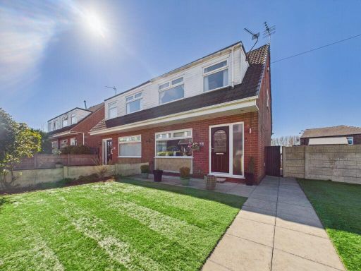 3 bedroom semi-detached house for sale in Newsham Walk, Springfield, Wigan, WN6 7NG, WN6 — £225,000 • 3 bed • 1 bath • 857 ft²
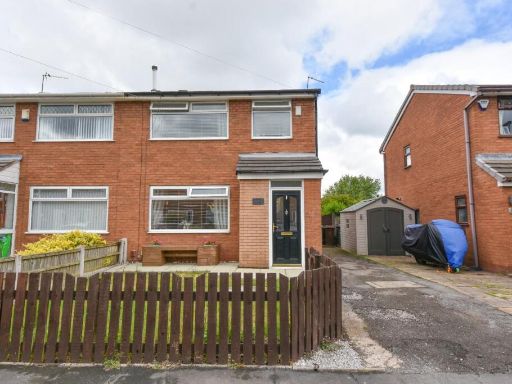 3 bedroom semi-detached house for sale in Brecon Drive, Hindley Green, Wigan, WN2 4RX, WN2 — £185,000 • 3 bed • 1 bath • 618 ft²
 3 bedroom semi-detached house for sale in Butts Avenue, Leigh, WN7 — £200,000 • 3 bed • 1 bath • 947 ft²
 3 bedroom semi-detached house for sale in Telford Crescent, Leigh, Greater Manchester, WN7 — £180,000 • 3 bed • 1 bath • 717 ft²
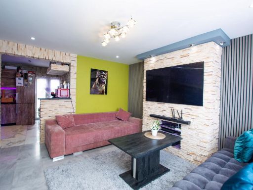 3 bedroom semi-detached house for sale in Douglas Road Leigh WN7 5HG, WN7 — £165,000 • 3 bed • 1 bath • 703 ft²
Meta
- {
"@context": "https://schema.org",
"@type": "Residence",
"name": "3 bedroom semidetached house for sale in Angus Avenue, Leig…",
"description": "",
"url": "https://propertypiper.co.uk/property/cd205146-3662-40cf-9131-7378b4a94835",
"image": "https://image-a.propertypiper.co.uk/13bbbdfd-f32e-477e-bd3f-ffbb6bc6eee0-1024.jpeg",
"address": {
"@type": "PostalAddress",
"streetAddress": "105 ANGUS AVENUE LEIGH",
"postalCode": "WN7 5DJ",
"addressLocality": "Wigan",
"addressRegion": "Leigh",
"addressCountry": "England"
},
"geo": {
"@type": "GeoCoordinates",
"latitude": 53.50491006743856,
"longitude": -2.5359461156636867
},
"numberOfRooms": 3,
"numberOfBathroomsTotal": 2,
"floorSize": {
"@type": "QuantitativeValue",
"value": 895,
"unitCode": "FTK"
},
"offers": {
"@type": "Offer",
"price": 245000,
"priceCurrency": "GBP",
"availability": "https://schema.org/InStock"
},
"additionalProperty": [
{
"@type": "PropertyValue",
"name": "Feature",
"value": "semi-detached"
},
{
"@type": "PropertyValue",
"name": "Feature",
"value": "brick"
},
{
"@type": "PropertyValue",
"name": "Feature",
"value": "post-war"
},
{
"@type": "PropertyValue",
"name": "Feature",
"value": "driveway"
},
{
"@type": "PropertyValue",
"name": "Feature",
"value": "garden"
},
{
"@type": "PropertyValue",
"name": "Feature",
"value": "two-story"
},
{
"@type": "PropertyValue",
"name": "Feature",
"value": "suburban"
},
{
"@type": "PropertyValue",
"name": "Feature",
"value": "living room"
},
{
"@type": "PropertyValue",
"name": "Feature",
"value": "contemporary"
},
{
"@type": "PropertyValue",
"name": "Feature",
"value": "standard ceiling"
},
{
"@type": "PropertyValue",
"name": "Feature",
"value": "decorative wallpaper"
},
{
"@type": "PropertyValue",
"name": "Feature",
"value": "chimney breast"
},
{
"@type": "PropertyValue",
"name": "Feature",
"value": "medium room"
},
{
"@type": "PropertyValue",
"name": "Feature",
"value": "natural light"
},
{
"@type": "PropertyValue",
"name": "Feature",
"value": "modern chandelier"
},
{
"@type": "PropertyValue",
"name": "Feature",
"value": "neutral colors"
}
]
}
High Res Floorplan Images
Compatible Floorplan Images
FloorplanImages Thumbnail