WN1 2QE - 3 bedroom town house for sale in Trevore Drive, Standish, W…
View on Property Piper
3 bedroom town house for sale in Trevore Drive, Standish, Wigan, WN1
Property Details
- Price: £200000
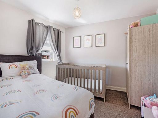
- Bedrooms: 3
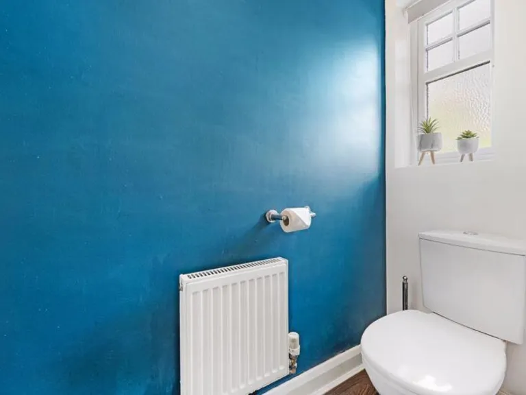
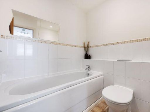
- Bathrooms: 2
- Property Type: undefined
- Property SubType: undefined
Brochure Descriptions
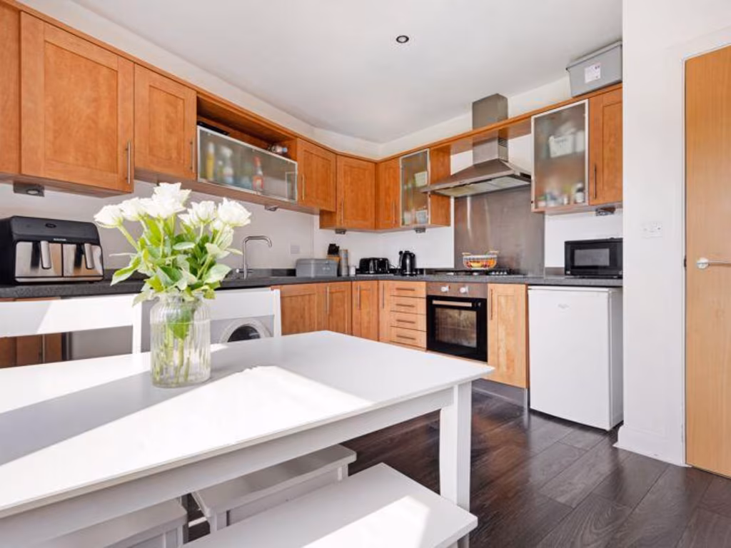
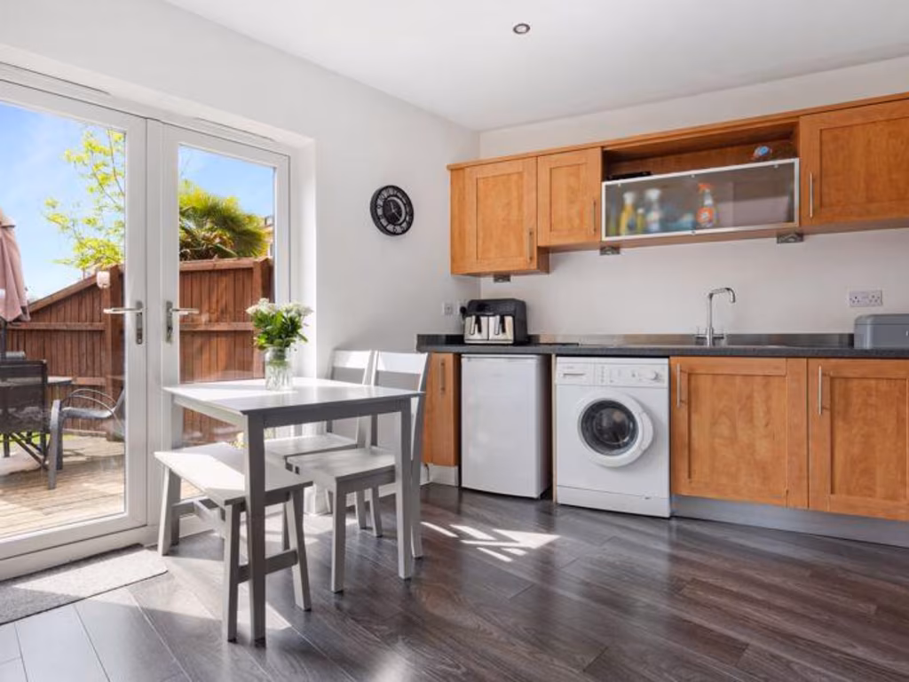
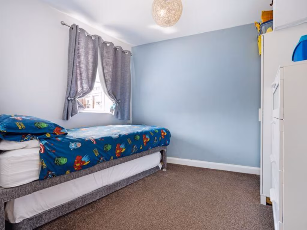
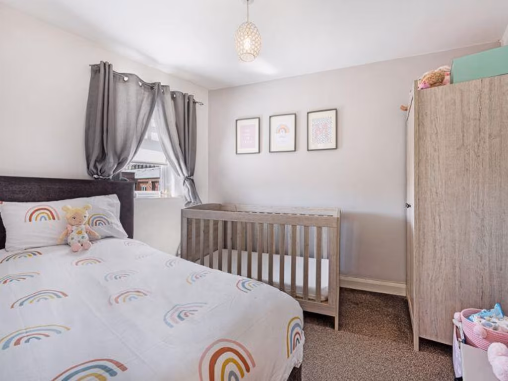
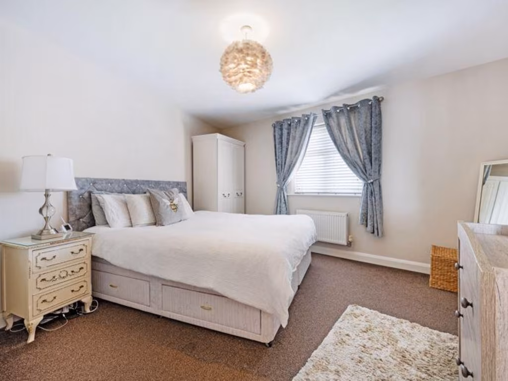
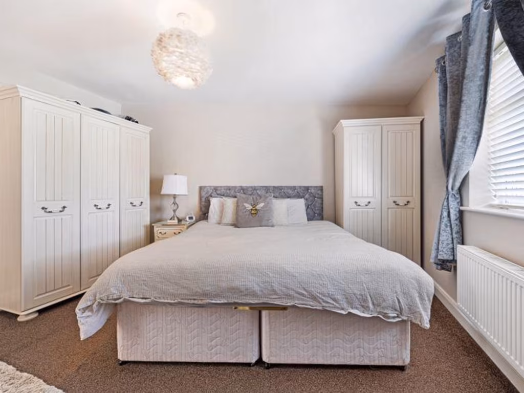
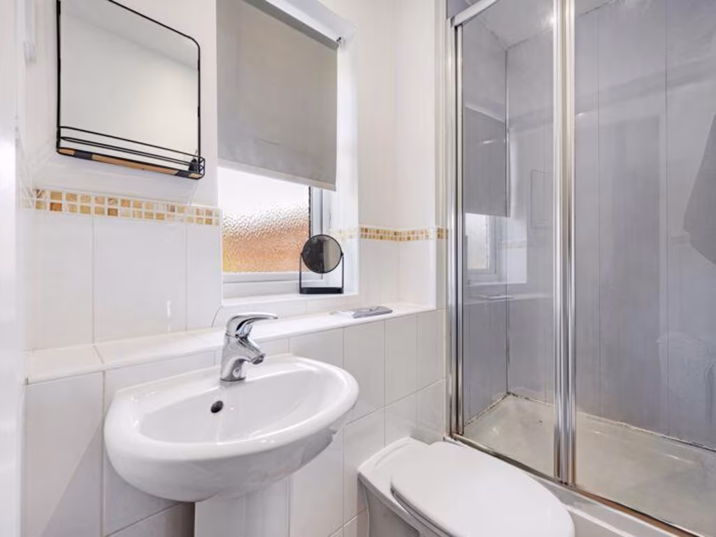
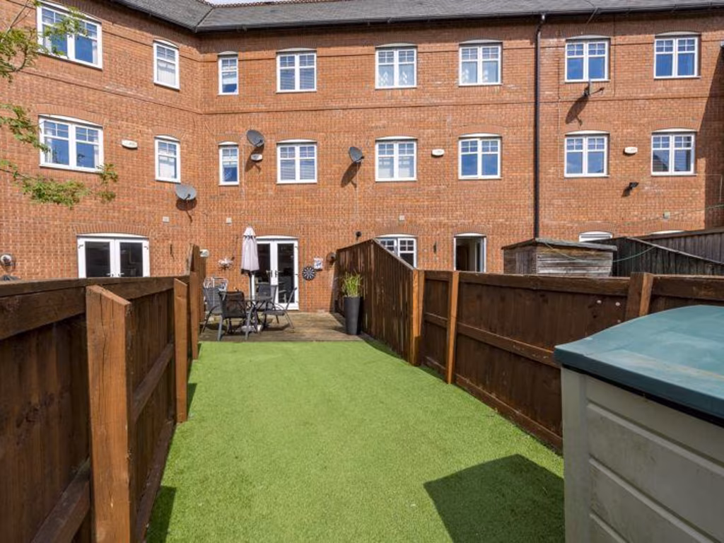
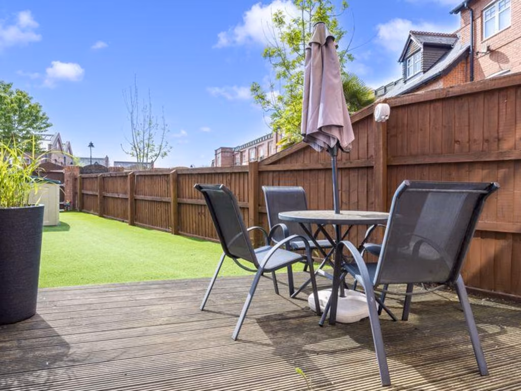
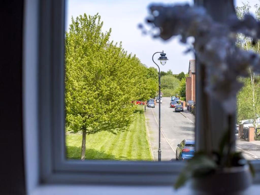
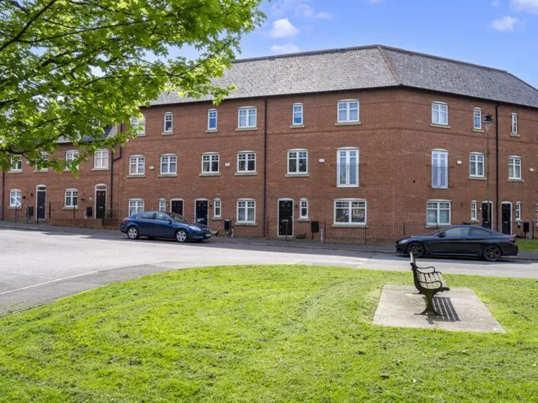
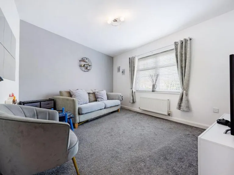
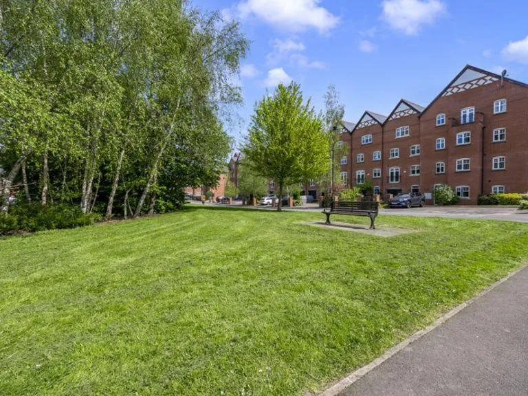
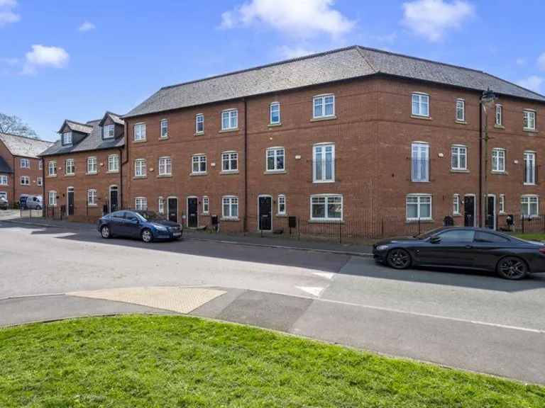
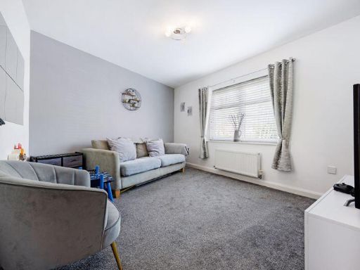
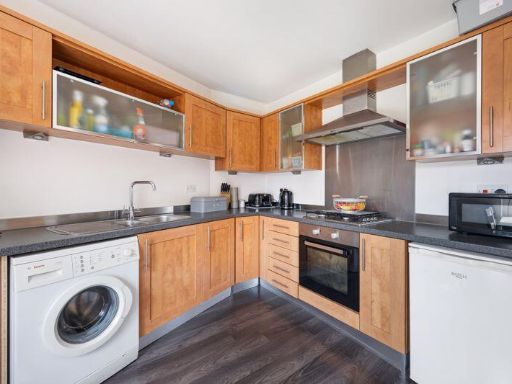
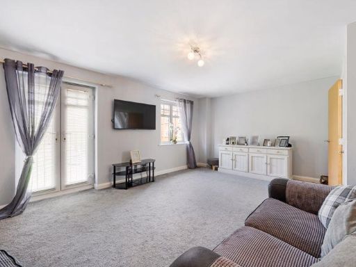
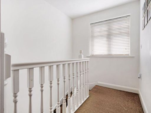
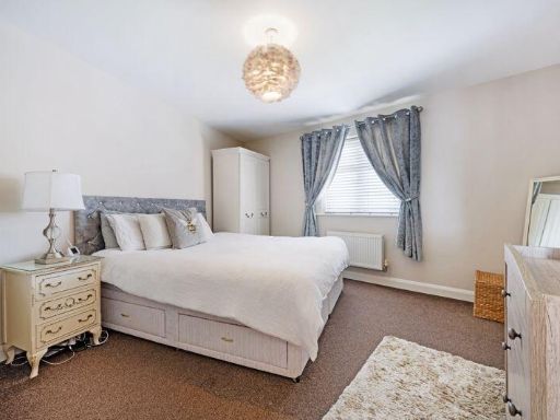
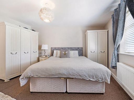
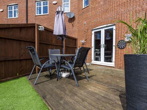
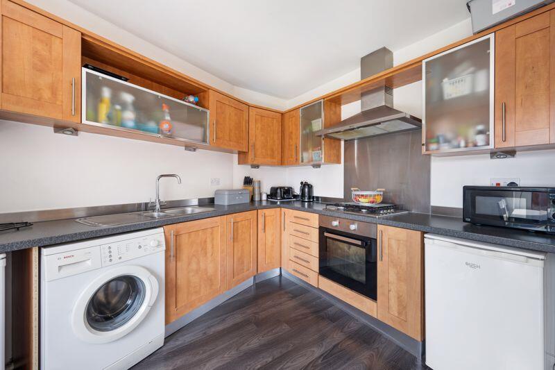
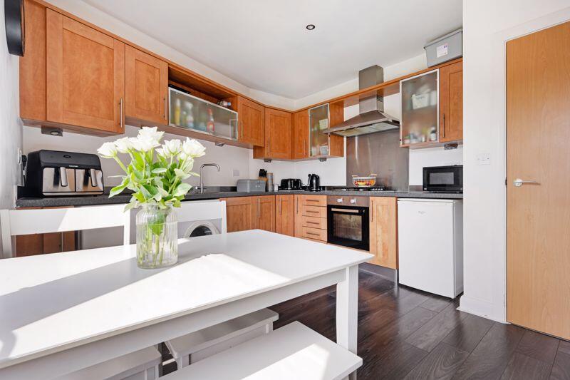
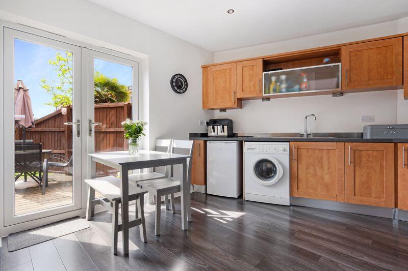
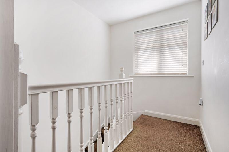
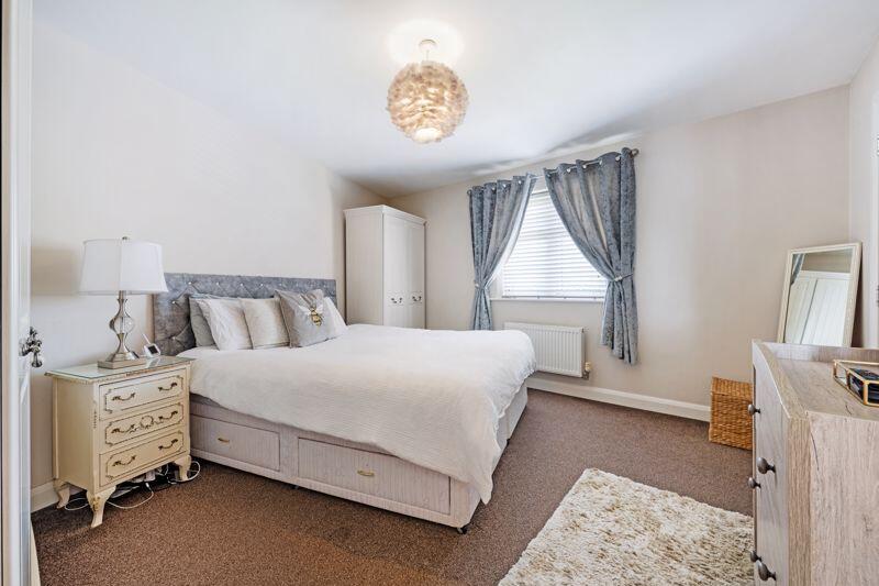
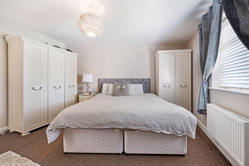
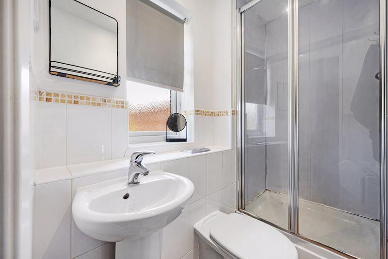
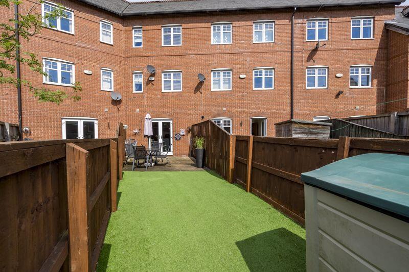
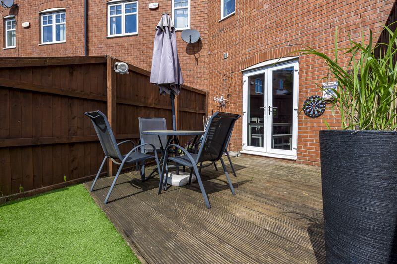
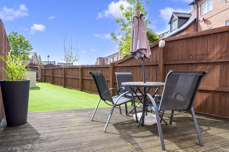
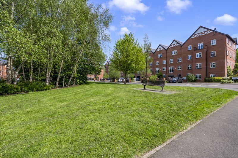
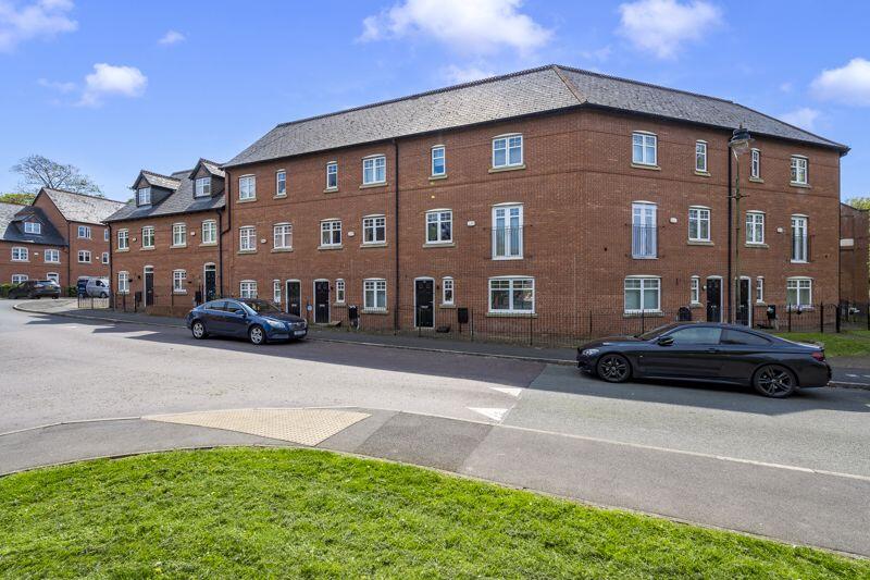
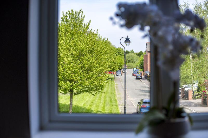
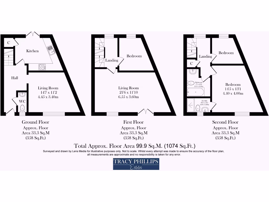
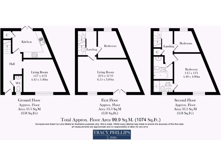
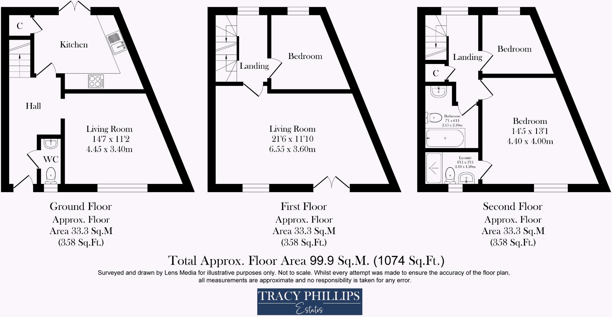
- This property is a three-floor apartment with an approximate total floor area of 1074 square feet. It features two bedrooms, each equipped with en-suites, making it ideal for families or professionals seeking privacy. The living areas provide a sense of spaciousness, with dimensions of 16'5" by 11'10" on the first floor and 16'3" by 11'7" on the second floor. The kitchen appears modern, well-equipped, and ample in size. The property boasts an attractive communal green space and provides a nice setting for outdoor leisure. The overall property size is average to large, suitable for modern living, complemented by the exterior view featuring a pleasant neighborhood.
Image Descriptions
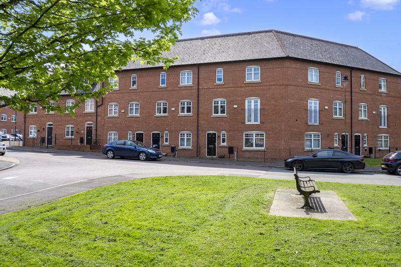
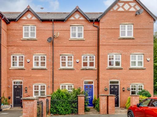
- a row of modern townhouses Contemporary
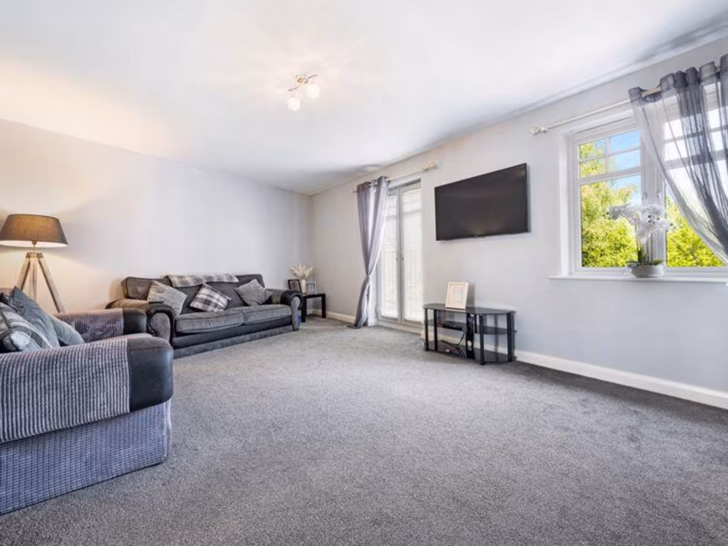
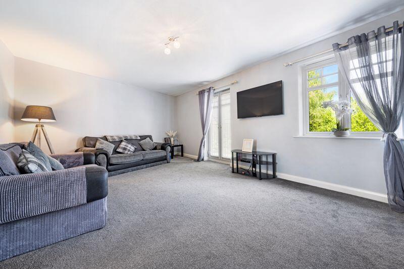
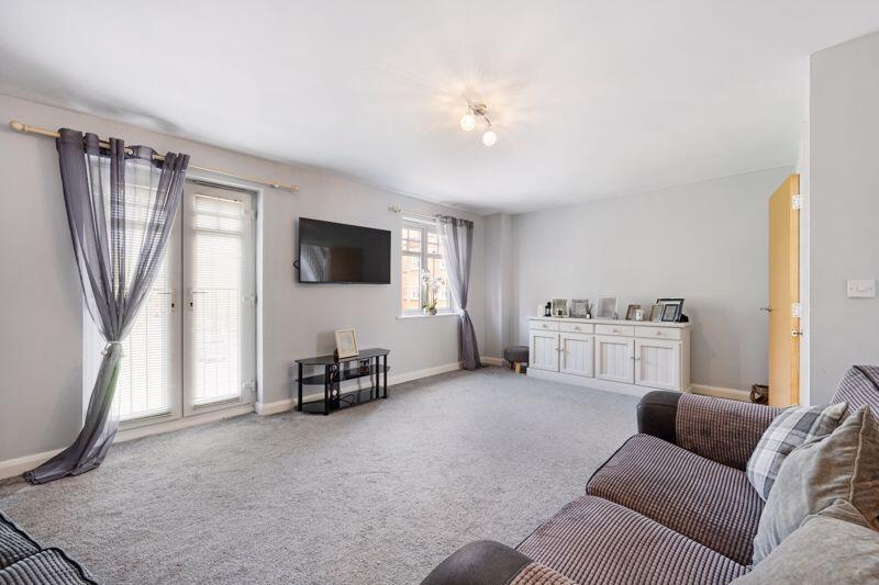
- living room contemporary
Floorplan Description
- A modern three-story property with multiple bathrooms and living areas.
Rooms
- Kitchen:
- Living Room: average
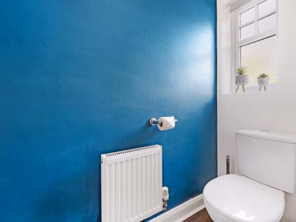
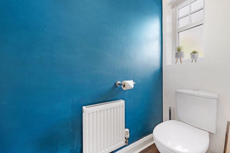
- WC:
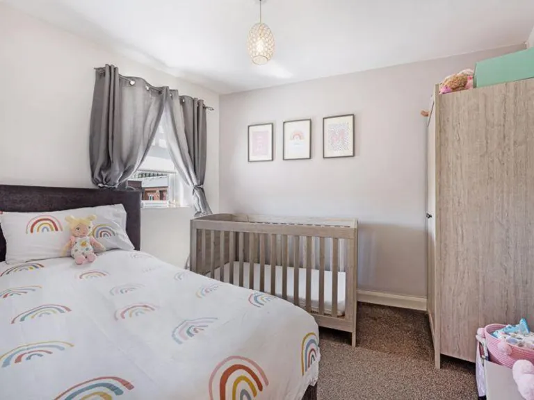
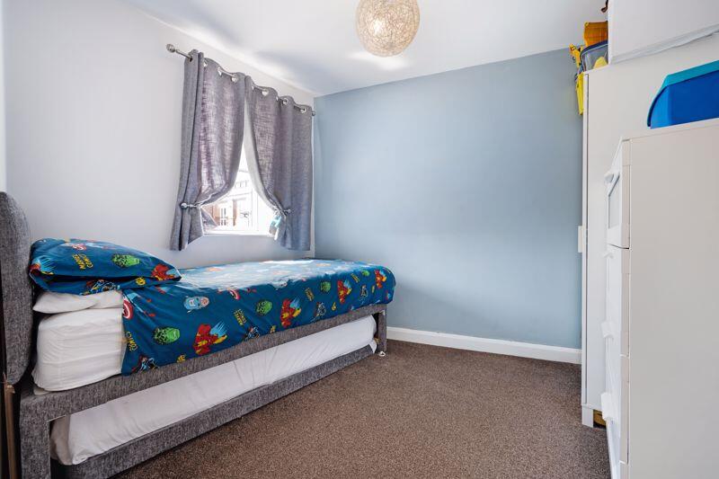
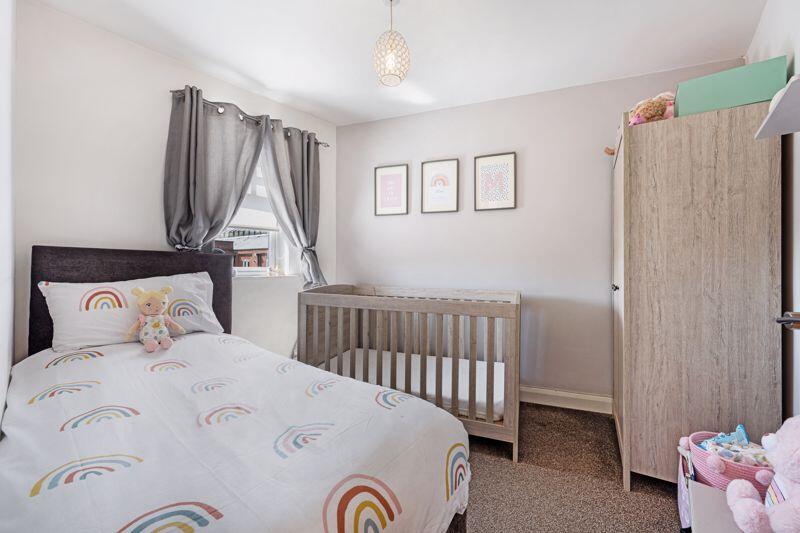
- Bedroom:
- Living Room: large
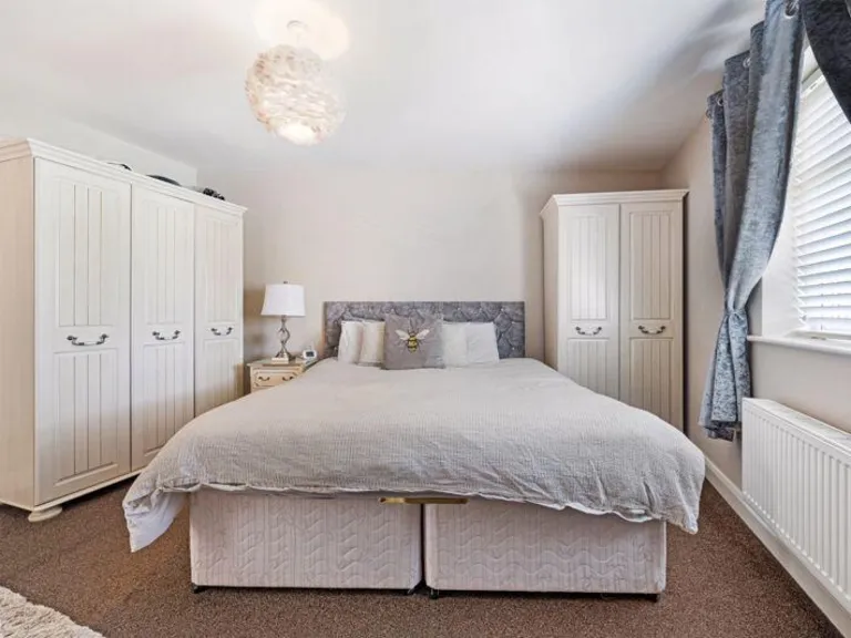
- Bedroom: large
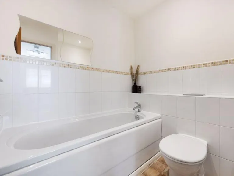
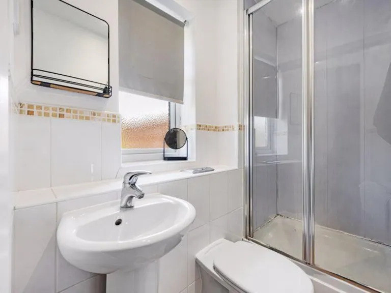
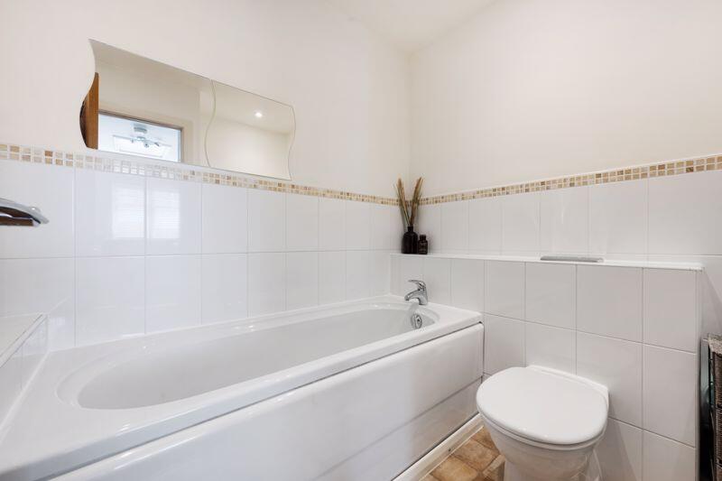
- Bathroom:
- En-suite:
Textual Property Features
Detected Visual Features
- modern townhouses
- brick exterior
- contemporary style
- three-story
- row housing
- residential area
- double-glazed windows
- sloping roofs
- living room
- standard ceiling
- medium room
- large window
- bright
- clean
- modern
EPC Details
- Fully double glazed
- Cavity wall, as built, insulated (assumed)
- Boiler and radiators, mains gas
- Low energy lighting in all fixed outlets
- Solid, insulated (assumed)
Nearby Schools
- Dean Trust Rose Bridge
- St Mary and St John Catholic Primary School
- St John Fisher Catholic High School
- Woodfield Primary School
- Adlington St Paul's Church of England Primary School
- Coppull Parish Church of England Primary School
- St Catharine's CofE Primary School
- Sacred Heart Catholic Primary School
- Holy Family Catholic Primary School, New Springs, Wigan
- Standish Lower Ground St Anne's CofE Primary School
- Millbrook Primary School
- Shevington High School
- Wood Fold Primary School
- Blackrod Anglican/Methodist Primary School
- Adlington Primary School
- Coppull Primary School and Nursery
- Progress Schools Wigan
- Mab's Cross Primary School
- St David Haigh and Aspull CofE Primary School
- Standish St Wilfrid's Church of England Primary Academy
- St Patrick's Catholic Primary School
- The Deanery Church of England High School and Sixth Form College
- Wigan St Andrew's CofE Junior and Infant School
- Canon Sharples Church of England Primary School and Nursery
- Beech Hill Community Primary School
- St Marie's Catholic Primary School Standish
- Standish Community High School
- Coppull St John's Church of England Voluntary Aided Primary School
Nearest Bars And Restaurants
- Id: 137560028
- Tags:
- Amenity: fast_food
- Building: yes
- Name: Rainbow Chinese Takeaway
- Takeaway: yes
- TagsNormalized:
- fast food
- food
- chinese
- takeaway
- Lat: 53.5850911
- Lon: -2.6613387
- FullGeoHash: gcw0g6y5f2fp
- PartitionGeoHash: gcw0
- Images:
- FoodStandards: null
- Distance: 1641.1
,- Id: 135207665
- Tags:
- Amenity: pub
- Building: yes
- Name: Potter's Bar
- TagsNormalized:
- Lat: 53.5858108
- Lon: -2.6613274
- FullGeoHash: gcw0g6ypfx4k
- PartitionGeoHash: gcw0
- Images:
- FoodStandards: null
- Distance: 1641
,- Id: 135207464
- Tags:
- Amenity: pub
- Building: pub
- Name: The Globe
- Opening_hours: Mo-Th 11:30-24:00; Fr-Sa 11:30-01:00; Su 12:00-24:00
- Source: http://www.whatpub.org/Guide/001000/Pub001745.htm
- TagsNormalized:
- Lat: 53.5847604
- Lon: -2.6605542
- FullGeoHash: gcw0g6y9ue74
- PartitionGeoHash: gcw0
- Images:
- FoodStandards: null
- Distance: 1590.4
,- Id: 141177475
- Tags:
- Amenity: pub
- Building: yes
- Name: Boar's Head
- TagsNormalized:
- Lat: 53.572537
- Lon: -2.6406267
- FullGeoHash: gcw0gbt4suwp
- PartitionGeoHash: gcw0
- Images:
- FoodStandards: null
- Distance: 1449.7
,- Id: 141161368
- Tags:
- Addr:
- City: Wigan
- Place: Standish
- Postcode: WN6 0XD
- Street: Rectory Lane
- Amenity: restaurant
- Building: yes
- Cuisine: international
- Name: The Owls at Standish
- Opening_hours: Mo-Sa 12:00-14:00, 17:30-22:00
- Outdoor_seating: yes
- Source: OS opendata streetview
- TagsNormalized:
- Lat: 53.588221
- Lon: -2.6460404
- FullGeoHash: gcw0gg3nnb3m
- PartitionGeoHash: gcw0
- Images:
- FoodStandards: null
- Distance: 707.7
}
Nearest General Shops
- Id: 9730859661
- Tags:
- Addr:
- Housenumber: 83
- Street: High Street
- Name: Bang and Loop
- Shop: hairdresser
- TagsNormalized:
- Lat: 53.5845069
- Lon: -2.6605959
- FullGeoHash: gcw0g6y87s5f
- PartitionGeoHash: gcw0
- Images:
- FoodStandards: null
- Distance: 1594.6
,- Id: 136005535
- Tags:
- Addr:
- Housenumber: 1
- Postcode: WN6 0DA
- Street: Grove Lane
- Contact:
- Name: R. Banks and Son
- Shop: funeral_directors
- Source: http://www.rbanksandson.co.uk/
- TagsNormalized:
- funeral
- funeral directors
- shop
- Lat: 53.5842785
- Lon: -2.6592789
- FullGeoHash: gcw0g6xx433z
- PartitionGeoHash: gcw0
- Images:
- FoodStandards: null
- Distance: 1509.6
,- Id: 8993552657
- Tags:
- Name: Hair by Vision
- Shop: hairdresser
- TagsNormalized:
- Lat: 53.585945
- Lon: -2.6376897
- FullGeoHash: gcw0ggp2c2hh
- PartitionGeoHash: gcw0
- Images:
- FoodStandards: null
- Distance: 104.4
}
Nearest Grocery shops
- Id: 9135931038
- Tags:
- Addr:
- City: Wigan
- Housenumber: 431
- Postcode: WN6 7PN
- Street: Gidlow Lane
- Fhrs:
- Name: V & D Local
- Shop: convenience
- Source:
- TagsNormalized:
- Lat: 53.5598168
- Lon: -2.6456303
- FullGeoHash: gcw0ey3883e0
- PartitionGeoHash: gcw0
- Images:
- FoodStandards:
- Id: 895536
- FHRSID: 895536
- LocalAuthorityBusinessID: 323960
- BusinessName: V & D Local
- BusinessType: Retailers - other
- BusinessTypeID: 4613
- AddressLine1: 431 Gidlow Lane
- AddressLine2: Wigan
- AddressLine3: null
- AddressLine4: null
- PostCode: WN6 7PN
- RatingValue: 4
- RatingKey: fhrs_4_en-GB
- RatingDate: 2016-06-24
- LocalAuthorityCode: 434
- LocalAuthorityName: Wigan
- LocalAuthorityWebSite: http://www.wigan.gov.uk/
- LocalAuthorityEmailAddress: comm@wigan.gov.uk
- Scores:
- Hygiene: 0
- Structural: 10
- ConfidenceInManagement: 10
- NewRatingPending: false
- Geocode:
- Longitude: -2.64561900000000
- Latitude: 53.55958300000000
- Distance: 2901.7
,- Id: 136011064
- Tags:
- Brand: Spar
- Brand:wikidata: Q610492
- Name: Spar
- Shop: convenience
- TagsNormalized:
- Lat: 53.5862221
- Lon: -2.6643259
- FullGeoHash: gcw0g75fkey9
- PartitionGeoHash: gcw0
- Images:
- FoodStandards: null
- Distance: 1840.7
,- Id: 141177635
- Tags:
- Addr:
- City: Wigan
- Housename: Boars Head Service Station
- Housenumber: 227
- Postcode: WN6 0AD
- Street: Wigan Road
- Brand: Spar
- Brand:wikidata: Q610492
- Brand:wikipedia: en:SPAR (retailer)
- Building: yes
- Name: Spar
- Shop: convenience
- TagsNormalized:
- Lat: 53.5729209
- Lon: -2.6411504
- FullGeoHash: gcw0gbsubsr9
- PartitionGeoHash: gcw0
- Images:
- FoodStandards: null
- Distance: 1415
}
Nearest Supermarkets
- Id: 853038420
- Tags:
- Addr:
- City: Wigan
- Country: GB
- Housenumber: 91
- Postcode: WN6 0JF
- Street: Preston Road
- Village: Standish
- Brand: Lidl
- Brand:wikidata: Q151954
- Brand:wikipedia: en:Lidl
- Building: supermarket
- Fhrs:
- Name: Lidl
- Opening_hours: Mo-Sa 08:00-22:00; Su 10:00-16:00
- Shop: supermarket
- TagsNormalized:
- Lat: 53.5887962
- Lon: -2.6669534
- FullGeoHash: gcw0g79cr7xk
- PartitionGeoHash: gcw0
- Images:
- FoodStandards:
- Id: 816090
- FHRSID: 816090
- LocalAuthorityBusinessID: 312282
- BusinessName: Lidl
- BusinessType: Retailers - supermarkets/hypermarkets
- BusinessTypeID: 7840
- AddressLine1: 91 Preston Road
- AddressLine2: Standish
- AddressLine3: Wigan
- AddressLine4: null
- PostCode: WN6 0JF
- RatingValue: 5
- RatingKey: fhrs_5_en-GB
- RatingDate: 2012-10-16
- LocalAuthorityCode: 434
- LocalAuthorityName: Wigan
- LocalAuthorityWebSite: http://www.wigan.gov.uk/
- LocalAuthorityEmailAddress: comm@wigan.gov.uk
- Scores:
- Hygiene: 0
- Structural: 0
- ConfidenceInManagement: 0
- NewRatingPending: false
- Geocode:
- Longitude: -2.66770500000000
- Latitude: 53.58929500000000
- Distance: 2047.8
,- Id: 135124025
- Tags:
- Brand: ALDI
- Brand:wikidata: Q41171672
- Brand:wikipedia: en:Aldi
- Building: yes
- Contact:
- Website: https://stores.aldi.co.uk/standish/2-preston-road
- Name: ALDI
- Shop: supermarket
- TagsNormalized:
- Lat: 53.5865276
- Lon: -2.6648831
- FullGeoHash: gcw0g75kpsz0
- PartitionGeoHash: gcw0
- Images:
- FoodStandards: null
- Distance: 1879.5
,- Id: 136012358
- Tags:
- Brand: Co-op Food
- Brand:wikidata: Q3277439
- Building: yes
- Name: Co-op Food
- Operator: The Co-operative Group
- Shop: supermarket
- TagsNormalized:
- co-op
- co-op food
- food
- supermarket
- shop
- Lat: 53.5870918
- Lon: -2.6633075
- FullGeoHash: gcw0g7hxkmvv
- PartitionGeoHash: gcw0
- Images:
- FoodStandards: null
- Distance: 1781.5
}
Nearest Religious buildings
- Id: 136031377
- Tags:
- Amenity: place_of_worship
- Building: yes
- Denomination: catholic
- Name: Saint Marie's
- Religion: christian
- TagsNormalized:
- place of worship
- catholic
- christian
- church
- Lat: 53.5842827
- Lon: -2.67054
- FullGeoHash: gcw0g4xr5fm0
- PartitionGeoHash: gcw0
- Images:
- FoodStandards: null
- Distance: 2251.3
,- Id: 135205137
- Tags:
- Amenity: place_of_worship
- Building: church
- Denomination: methodist
- Name: Standish Weslyan Methodist Chapel
- Religion: christian
- TagsNormalized:
- place of worship
- church
- methodist
- chapel
- christian
- Lat: 53.5855287
- Lon: -2.6636013
- FullGeoHash: gcw0g6uqmddc
- PartitionGeoHash: gcw0
- Images:
- FoodStandards: null
- Distance: 1790.3
,- Id: 135138181
- Tags:
- Amenity: place_of_worship
- Building: church
- Denomination: anglican
- Historic: yes
- Listed_status: Grade I
- Name: Saint Wilfrid's
- Religion: christian
- Wikidata: Q5117745
- Wikipedia: en:Church of St Wilfrid, Standish
- TagsNormalized:
- place of worship
- church
- anglican
- christian
- Lat: 53.5871293
- Lon: -2.661351
- FullGeoHash: gcw0g7npdhbv
- PartitionGeoHash: gcw0
- Images:
- FoodStandards: null
- Distance: 1653.7
}
Nearest Medical buildings
- Id: 9731091715
- Tags:
- Amenity: clinic
- Healthcare: clinic
- Healthcare:speciality: cosmetic
- Name: Natural Nurse Aesthetics
- TagsNormalized:
- clinic
- health
- healthcare
- cosmetics
- Lat: 53.586403
- Lon: -2.6637132
- FullGeoHash: gcw0g7h76vx2
- PartitionGeoHash: gcw0
- Images:
- FoodStandards: null
- Distance: 1801.5
,- Id: 9731101228
- Tags:
- Amenity: clinic
- Healthcare: clinic
- Healthcare:speciality: ear
- Name: Clear Ears
- TagsNormalized:
- Lat: 53.5857884
- Lon: -2.6627155
- FullGeoHash: gcw0g6vpf4zq
- PartitionGeoHash: gcw0
- Images:
- FoodStandards: null
- Distance: 1732.5
,- Id: 137555443
- Tags:
- Addr:
- City: Standish
- Housenumber: 49
- Postcode: WN6 0HD
- Street: High Street
- Amenity: clinic
- Loc_name: Standish Clinic
- Name: Standish Medical Practice
- Phone: +44 1257421909
- TagsNormalized:
- Lat: 53.584908
- Lon: -2.6623919
- FullGeoHash: gcw0g6v69ybd
- PartitionGeoHash: gcw0
- Images:
- FoodStandards: null
- Distance: 1711.1
,- Id: 548214332
- Tags:
- Amenity: clinic
- Building: yes
- Healthcare: clinic
- TagsNormalized:
- Lat: 53.5850018
- Lon: -2.6623742
- FullGeoHash: gcw0g6v760mf
- PartitionGeoHash: gcw0
- Images:
- FoodStandards: null
- Distance: 1709.6
}
Nearest Airports
- Id: 116737532
- Tags:
- Addr:
- City: Liverpool
- Country: GB
- Postcode: L24 1YD
- Street: Speke Hall Avenue
- Aerodrome: international
- Aerodrome:type: public
- Aeroway: aerodrome
- Iata: LPL
- Icao: EGGP
- Is_in: Liverpool,England,UK
- Name: Liverpool John Lennon Airport
- Old_name: Speke Airport
- Operator: Liverpool Airport plc
- Source: wikipedia
- Website: https://www.liverpoolairport.com/
- Wikidata: Q8727
- Wikipedia: en:Liverpool John Lennon Airport
- TagsNormalized:
- airport
- international airport
- Lat: 53.3357677
- Lon: -2.8518179
- FullGeoHash: gcmzrj7r7gdr
- PartitionGeoHash: gcmz
- Images:
- FoodStandards: null
- Distance: 31198.7
,- Id: 1224469
- Tags:
- Addr:
- City: Manchester
- Country: GB
- Postcode: M90 1QX
- Aerodrome: international
- Aeroway: aerodrome
- Arp: yes
- Atis: 128.175
- Iata: MAN
- Icao: EGCC
- Name: Manchester Airport
- Note: rough sketched outline referring to Yahoo imagery - true boundary is where?
- Old_name: Ringway
- Operator: Manchester Airport PLC
- Size: 18720000
- Source:
- Tower_frequency: 118.625,119.400
- Type: multipolygon
- Website: https://www.manchesterairport.co.uk/
- Wikidata: Q8694
- Wikipedia: en:Manchester Airport
- TagsNormalized:
- airport
- international airport
- Lat: 53.3503197
- Lon: -2.2798822
- FullGeoHash: gcqrs05u4ukt
- PartitionGeoHash: gcqr
- Images:
- FoodStandards: null
- Distance: 35214.6
}
Nearest Leisure Facilities
- Id: 1099846093
- Tags:
- TagsNormalized:
- Lat: 53.5869853
- Lon: -2.6527145
- FullGeoHash: gcw0gehqg60d
- PartitionGeoHash: gcw0
- Images:
- FoodStandards: null
- Distance: 1087.1
,- Id: 135077862
- Tags:
- Leisure: pitch
- Sport: soccer
- Surface: grass
- TagsNormalized:
- Lat: 53.580141
- Lon: -2.6499076
- FullGeoHash: gcw0g9yquwjw
- PartitionGeoHash: gcw0
- Images:
- FoodStandards: null
- Distance: 1058.3
,- Id: 971595205
- Tags:
- TagsNormalized:
- Lat: 53.5848305
- Lon: -2.6503045
- FullGeoHash: gcw0gdy472ms
- PartitionGeoHash: gcw0
- Images:
- FoodStandards: null
- Distance: 914.3
,- Id: 3425225
- Tags:
- Addr:
- City: Haigh Wigan
- Housename: Arley Hall
- Postcode: WN1 2UH
- Street: Arley Lane
- Description: 18 hole Par 70
- Golf:
- Leisure: golf_course
- Name: Wigan Golf Course
- Operator: info@wigangolfclub.co.uk
- Phone: +44 1257 421360
- Type: multipolygon
- Website: https://www.wigangolfclub.co.uk/
- TagsNormalized:
- Lat: 53.5902124
- Lon: -2.6276149
- FullGeoHash: gcw0u5y9s5sk
- PartitionGeoHash: gcw0
- Images:
- FoodStandards: null
- Distance: 797.4
,- Id: 971689792
- Tags:
- TagsNormalized:
- Lat: 53.5918523
- Lon: -2.6340915
- FullGeoHash: gcw0uh1gjjr5
- PartitionGeoHash: gcw0
- Images:
- FoodStandards: null
- Distance: 741.1
}
Nearest Tourist attractions
- Id: 1074094169
- Tags:
- Access: yes
- Name: South Picnic Area
- Tourism: picnic_site
- TagsNormalized:
- Lat: 53.5695188
- Lon: -2.604728
- FullGeoHash: gcw0u8p316n4
- PartitionGeoHash: gcw0
- Images:
- FoodStandards: null
- Distance: 2736.7
,- Id: 963211524
- Tags:
- Access: yes
- Name: North Picnic Area
- Tourism: picnic_site
- TagsNormalized:
- Lat: 53.5719665
- Lon: -2.6054307
- FullGeoHash: gcw0u8qz3465
- PartitionGeoHash: gcw0
- Images:
- FoodStandards: null
- Distance: 2532.4
,- Id: 685162806
- Tags:
- Name: Haigh Woodland Park
- Tourism: attraction
- TagsNormalized:
- Lat: 53.573587
- Lon: -2.6098957
- FullGeoHash: gcw0u8g8c02w
- PartitionGeoHash: gcw0
- Images:
- FoodStandards: null
- Distance: 2188.2
}
Nearest Train stations
- Id: 1305070561
- Tags:
- Name: Wigan North Western
- Naptan:
- Network: National Rail
- Public_transport: station
- Railway: station
- Ref:
- Train: yes
- Wikidata: Q2186551
- Wikipedia: en:Wigan North Western railway station
- TagsNormalized:
- Lat: 53.5433996
- Lon: -2.632996
- FullGeoHash: gcw0s568ytpg
- PartitionGeoHash: gcw0
- Images:
- FoodStandards: null
- Distance: 4669.3
,- Id: 30416942
- Tags:
- Name: Wigan Wallgate
- Naptan:
- Network: National Rail
- Public_transport: station
- Railway: station
- Ref:
- Source:
- Train: yes
- Wikidata: Q7999554
- Wikipedia: en:Wigan Wallgate railway station
- TagsNormalized:
- Lat: 53.5450582
- Lon: -2.6342351
- FullGeoHash: gcw0s59f9f7c
- PartitionGeoHash: gcw0
- Images:
- FoodStandards: null
- Distance: 4481.6
,- Id: 22404971
- Tags:
- Air_conditioning: no
- Internet_access: no
- Name: Blackrod
- Naptan:
- Network: National Rail
- Operator: Northern Rail
- Public_transport: station
- Railway: station
- Ref:
- Train: yes
- Wheelchair: yes
- Wikidata: Q1820371
- Wikipedia: en:Blackrod railway station
- TagsNormalized:
- Lat: 53.5912146
- Lon: -2.5698672
- FullGeoHash: gcw0vebxmy2p
- PartitionGeoHash: gcw0
- Images:
- FoodStandards: null
- Distance: 4444.9
,- Id: 7566962252
- Tags:
- Internet_access: no
- Name: Hall Drive
- Network: Haigh Woodland Park Miniature Railway
- Operator: Wigan District Model Engineering Society
- Public_transport: station
- Railway: station
- Usage: tourism
- TagsNormalized:
- Lat: 53.5689612
- Lon: -2.6047757
- FullGeoHash: gcw0sxzmb64k
- PartitionGeoHash: gcw0
- Images:
- FoodStandards: null
- Distance: 2774.6
,- Id: 2606101574
- Tags:
- Name: Walker Gardens
- Network: Haigh Woodland Park Miniature Railway
- Operator: Wigan District Model Engineering Society
- Public_transport: station
- Railway: station
- Usage: tourism
- TagsNormalized:
- Lat: 53.5712017
- Lon: -2.6032062
- FullGeoHash: gcw0ub26uguc
- PartitionGeoHash: gcw0
- Images:
- FoodStandards: null
- Distance: 2701.3
}
Nearest Hotels
- Id: 1083806036
- Tags:
- Brand: Premier Inn
- Brand:wikidata: Q2108626
- Building: yes
- Internet_access: wlan
- Internet_access:fee: customers
- Internet_access:operator: Virgin Media
- Internet_access:ssid: Premier Inn Free Wi-Fi
- Name: Premier Inn
- Tourism: hotel
- TagsNormalized:
- Lat: 53.5884997
- Lon: -2.6818088
- FullGeoHash: gcw0fgrptk6k
- PartitionGeoHash: gcw0
- Images:
- FoodStandards: null
- Distance: 3012.5
,- Id: 288046719
- Tags:
- Addr:
- City: Standish
- Postcode: WN1 2XN
- Street: Chorley Road
- Building: house
- Name: Kilhey Court
- Tourism: hotel
- Website: https://www.macdonaldhotels.co.uk/kilhey-court
- TagsNormalized:
- Lat: 53.5925227
- Lon: -2.634807
- FullGeoHash: gcw0uh1rhd3d
- PartitionGeoHash: gcw0
- Images:
- FoodStandards: null
- Distance: 806.2
,- Id: 971309243
- Tags:
- Addr:
- City: Wigan
- Place: Standish
- Postcode: WN1 2XN
- Street: Chorley Road
- Landuse: retail
- Name: Kilhey Court
- Operator: MacDonald Hotels
- Stars: 4
- Tourism: hotel
- TagsNormalized:
- Lat: 53.5920081
- Lon: -2.6347165
- FullGeoHash: gcw0uh1kndku
- PartitionGeoHash: gcw0
- Images:
- FoodStandards: null
- Distance: 750.5
}
Tags
- modern townhouses
- brick exterior
- contemporary style
- three-story
- row housing
- residential area
- double-glazed windows
- sloping roofs
- contemporary style
- living room
- standard ceiling
- medium room
- large window
- bright
- clean
- modern
Local Market Stats
- Average Price/sqft: £168
- Avg Income: £38500
- Rental Yield: 3.8%
- Social Housing: 7%
- Planning Success Rate: 87%
Similar Properties
 3 bedroom town house for sale in Gardinar Close, Standish, WN1 — £200,000 • 3 bed • 2 bath • 865 ft²
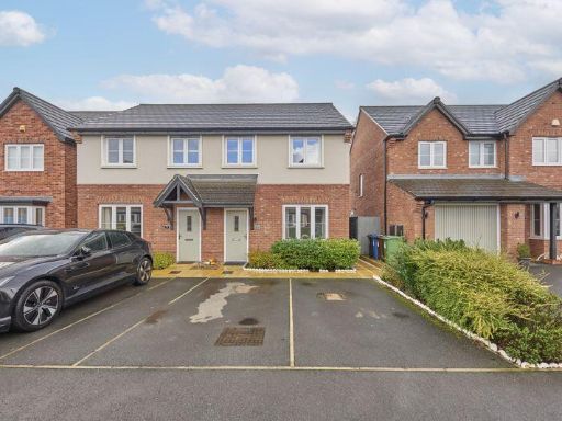 3 bedroom semi-detached house for sale in Buttercup Meadow Standish, WN6 — £250,000 • 3 bed • 3 bath • 829 ft²
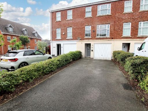 3 bedroom terraced house for sale in Runfield Close, Leigh, WN7 — £225,000 • 3 bed • 3 bath • 1166 ft²
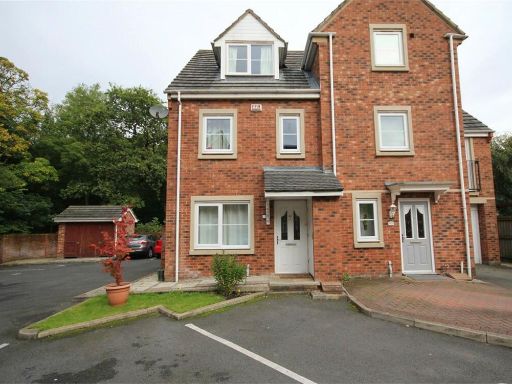 3 bedroom town house for sale in Catherine Way, Newton-Le-Willows, WA12 — £170,000 • 3 bed • 3 bath • 783 ft²
 4 bedroom detached house for sale in Meadow Brook, Pemberton, Wigan, WN5 — £260,000 • 4 bed • 2 bath • 1050 ft²
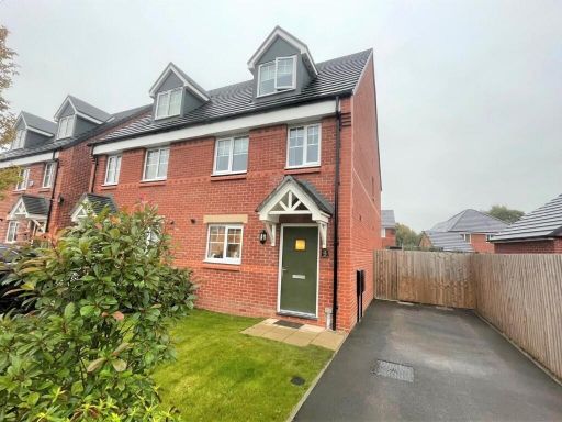 3 bedroom semi-detached house for sale in North Meadow Close, WA3 — £295,000 • 3 bed • 3 bath • 790 ft²
Meta
- {
"@context": "https://schema.org",
"@type": "Residence",
"name": "3 bedroom town house for sale in Trevore Drive, Standish, W…",
"description": "",
"url": "https://propertypiper.co.uk/property/ccdca228-03d7-4f22-b1e1-1f01f5f3566e",
"image": "https://image-a.propertypiper.co.uk/afb9968c-650a-42a9-88ce-d44085387e93-1024.jpeg",
"address": {
"@type": "PostalAddress",
"streetAddress": "22 Trevore Drive, Standish",
"postalCode": "WN1 2QE",
"addressLocality": "Wigan",
"addressRegion": "Wigan",
"addressCountry": "England"
},
"geo": {
"@type": "GeoCoordinates",
"latitude": 53.58534032392898,
"longitude": -2.63647996523522
},
"numberOfRooms": 3,
"numberOfBathroomsTotal": 2,
"floorSize": {
"@type": "QuantitativeValue",
"value": 1074,
"unitCode": "FTK"
},
"offers": {
"@type": "Offer",
"price": 200000,
"priceCurrency": "GBP",
"availability": "https://schema.org/InStock"
},
"additionalProperty": [
{
"@type": "PropertyValue",
"name": "Feature",
"value": "modern townhouses"
},
{
"@type": "PropertyValue",
"name": "Feature",
"value": "brick exterior"
},
{
"@type": "PropertyValue",
"name": "Feature",
"value": "contemporary style"
},
{
"@type": "PropertyValue",
"name": "Feature",
"value": "three-story"
},
{
"@type": "PropertyValue",
"name": "Feature",
"value": "row housing"
},
{
"@type": "PropertyValue",
"name": "Feature",
"value": "residential area"
},
{
"@type": "PropertyValue",
"name": "Feature",
"value": "double-glazed windows"
},
{
"@type": "PropertyValue",
"name": "Feature",
"value": "sloping roofs"
},
{
"@type": "PropertyValue",
"name": "Feature",
"value": "contemporary style"
},
{
"@type": "PropertyValue",
"name": "Feature",
"value": "living room"
},
{
"@type": "PropertyValue",
"name": "Feature",
"value": "standard ceiling"
},
{
"@type": "PropertyValue",
"name": "Feature",
"value": "medium room"
},
{
"@type": "PropertyValue",
"name": "Feature",
"value": "large window"
},
{
"@type": "PropertyValue",
"name": "Feature",
"value": "bright"
},
{
"@type": "PropertyValue",
"name": "Feature",
"value": "clean"
},
{
"@type": "PropertyValue",
"name": "Feature",
"value": "modern"
}
]
}
High Res Floorplan Images
Compatible Floorplan Images
FloorplanImages Thumbnail