LS29 6NN - 4 bedroom detached house for sale in Wentworth Close, Menst…
View on Property Piper
4 bedroom detached house for sale in Wentworth Close, Menston, LS29
Property Details
- Price: £700000
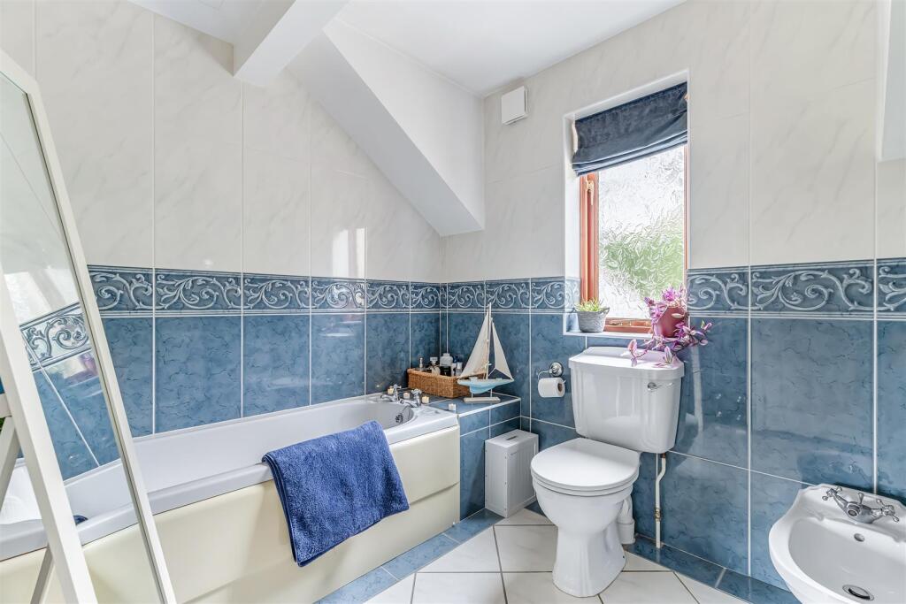
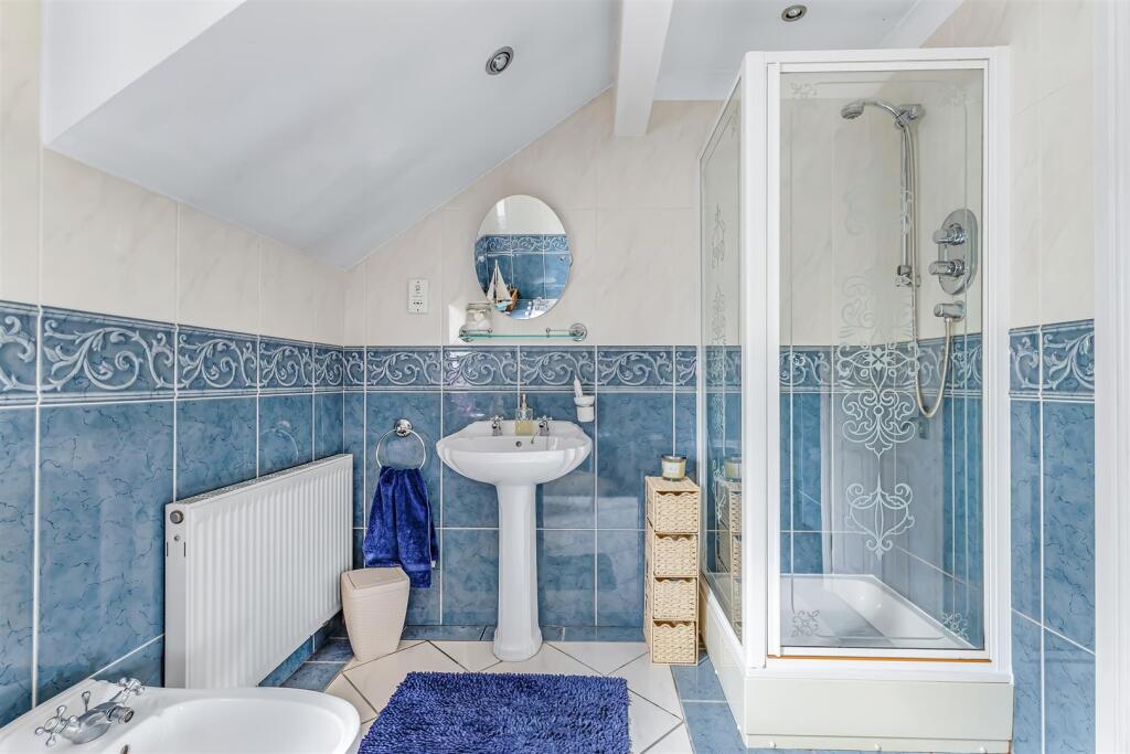
- Bedrooms: 4
- Bathrooms: 2
- Property Type: undefined
- Property SubType: undefined
Brochure Descriptions
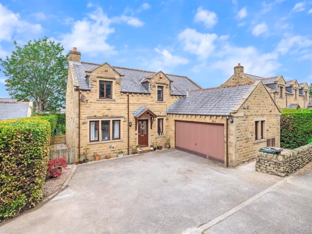
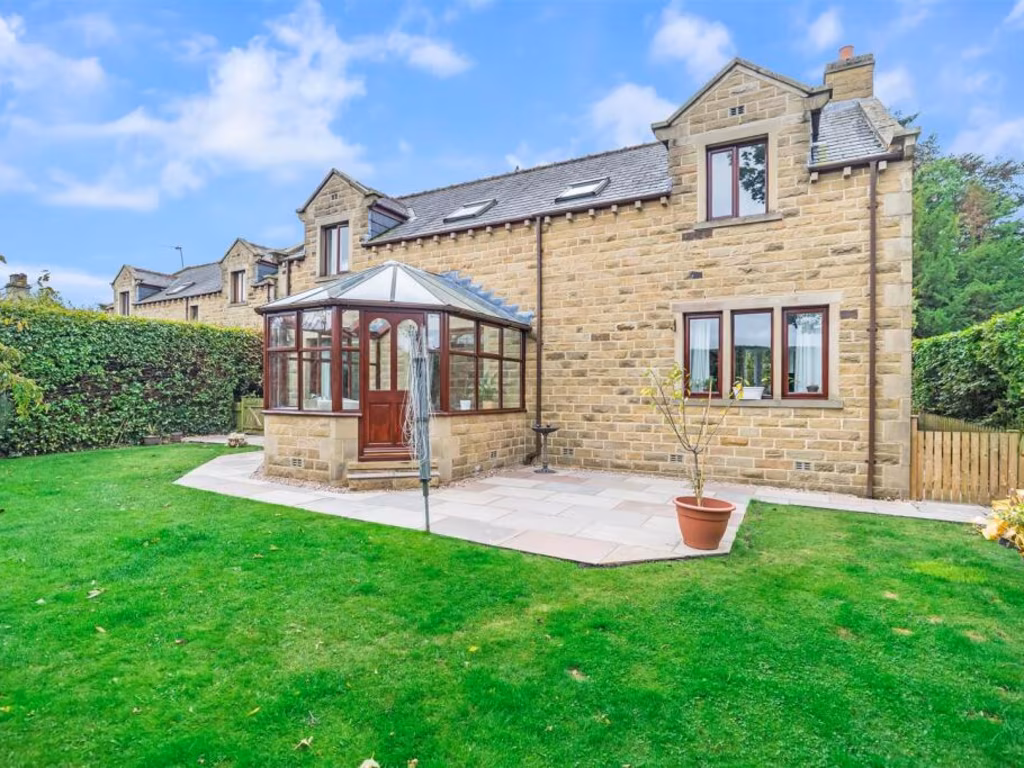
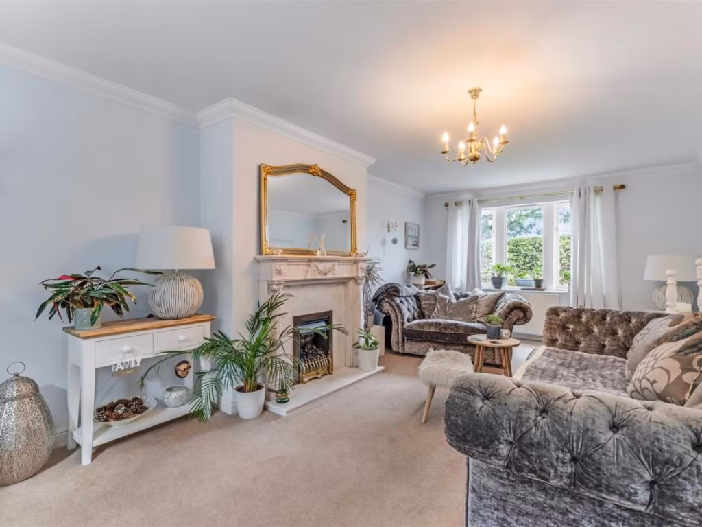
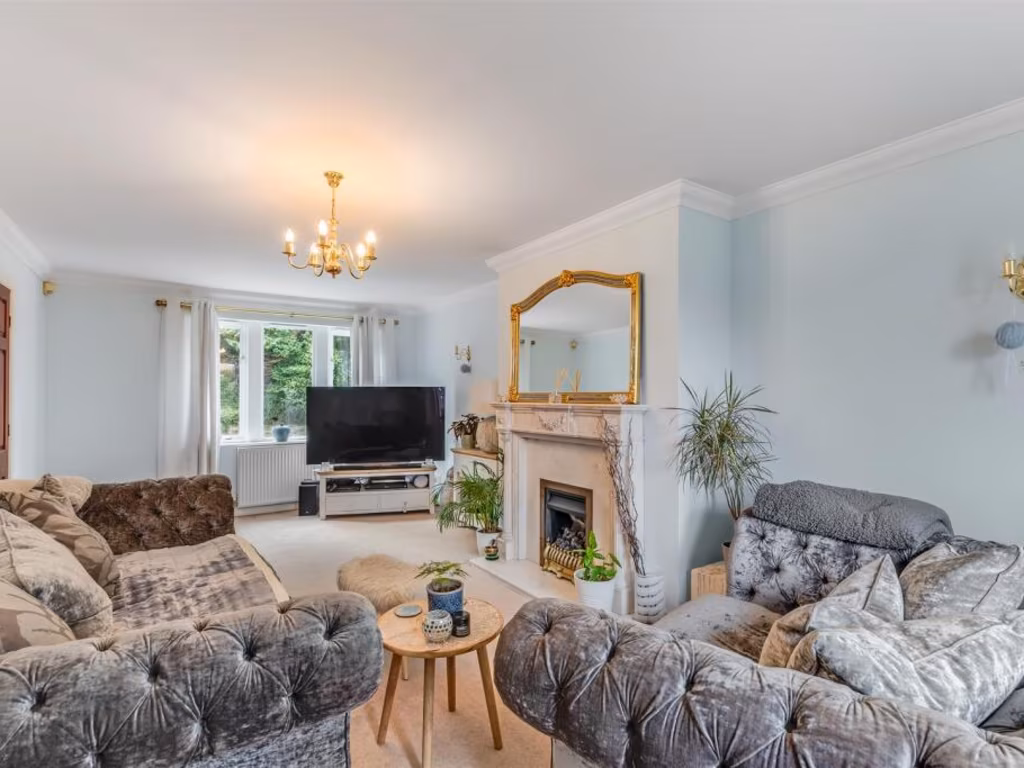
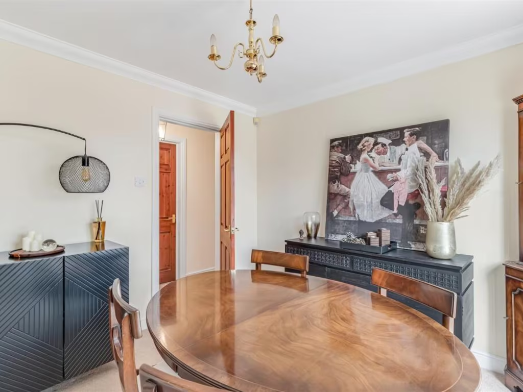
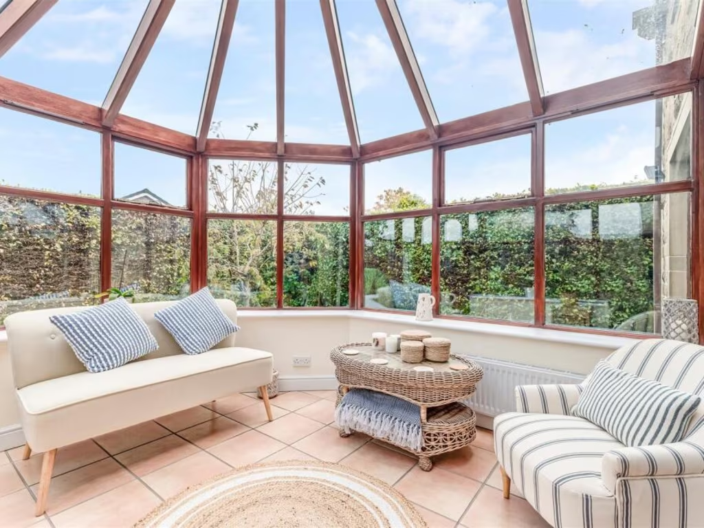
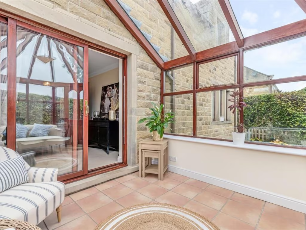
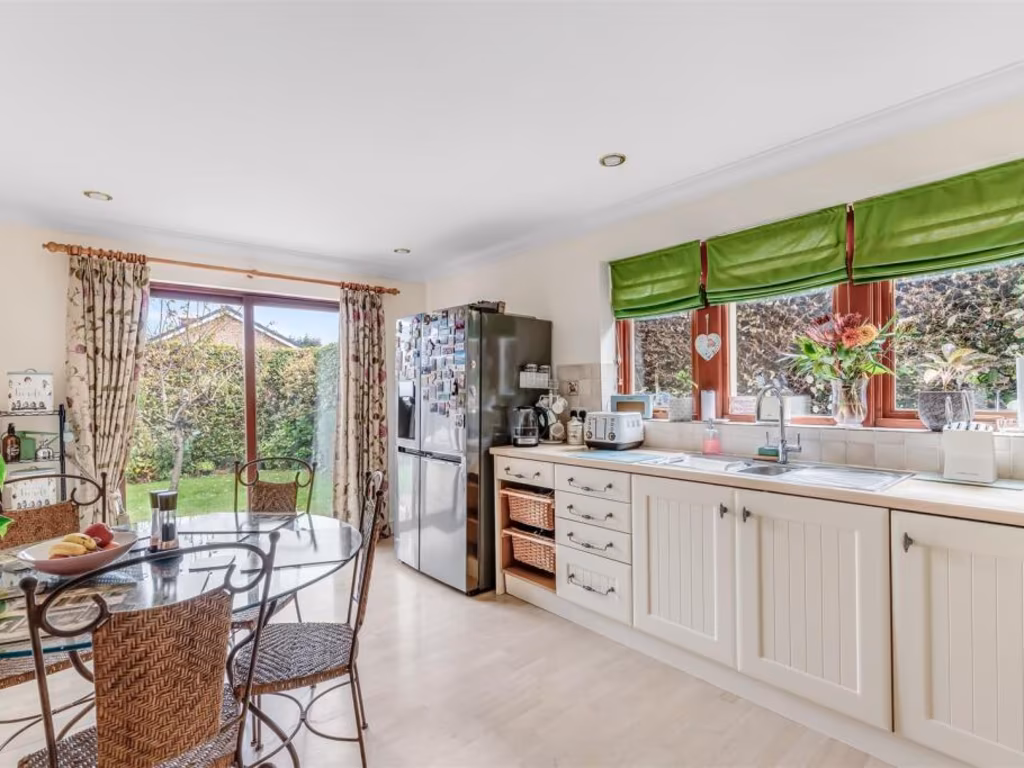
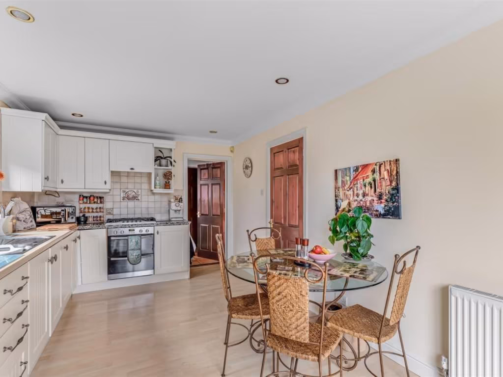
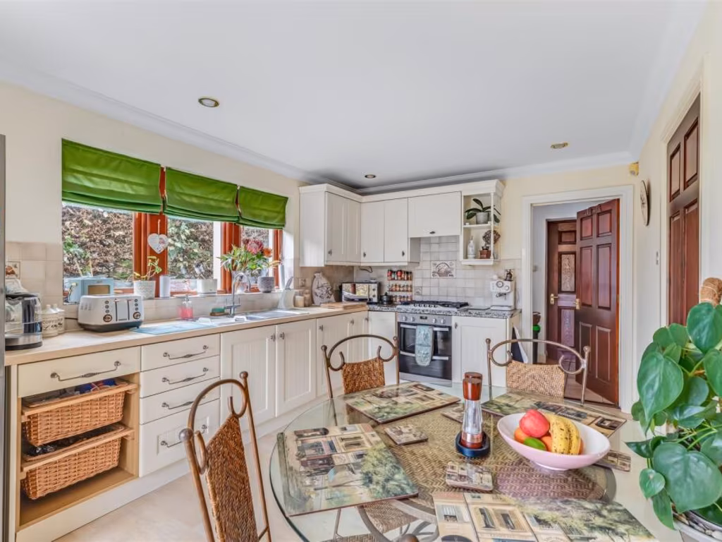
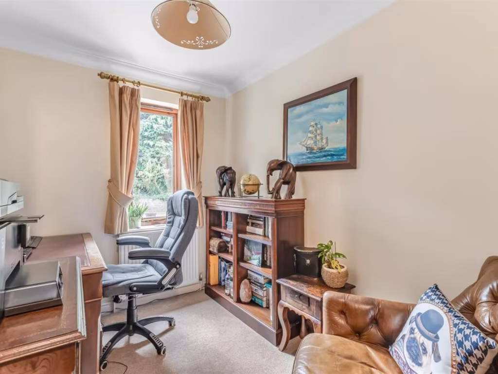
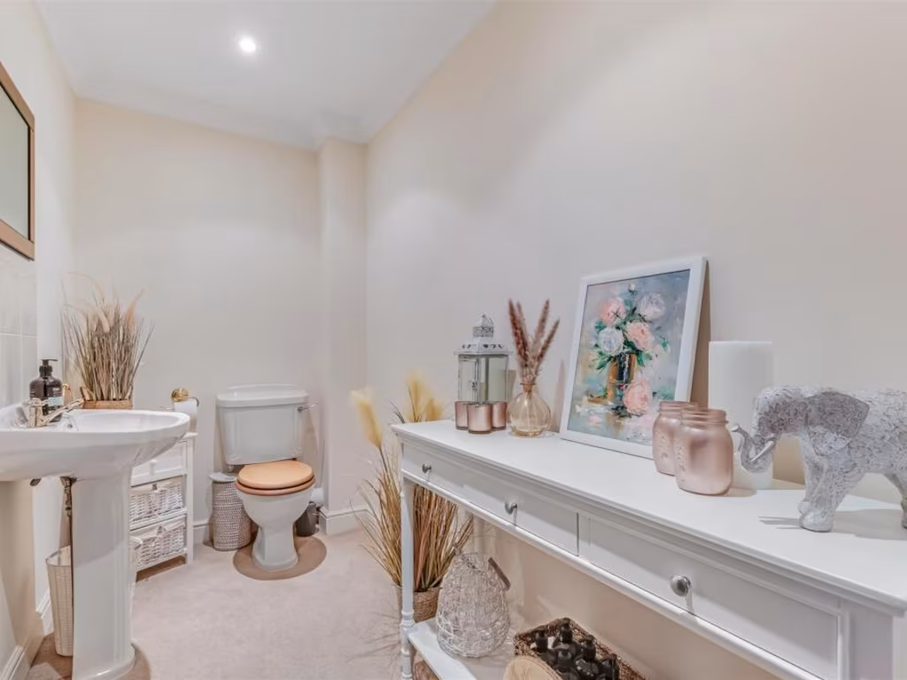
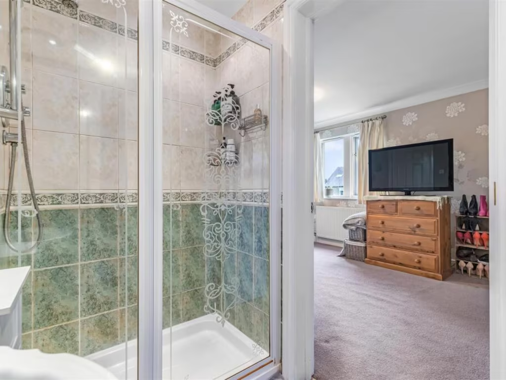
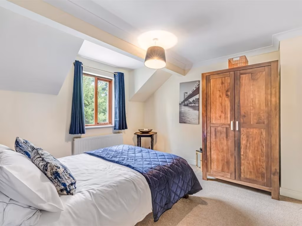
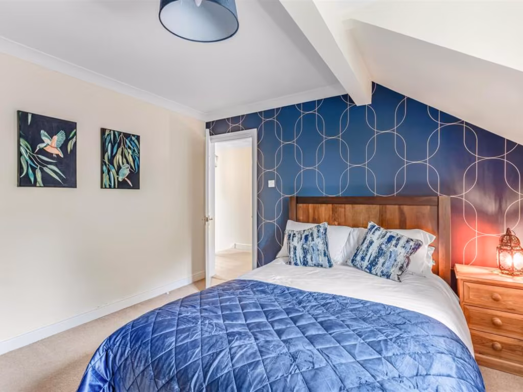
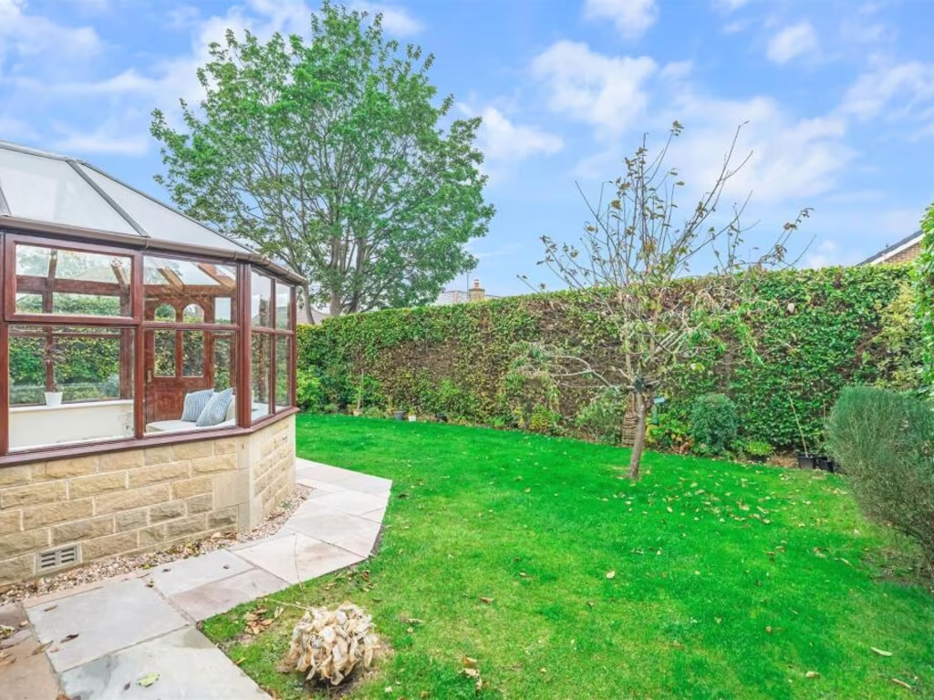
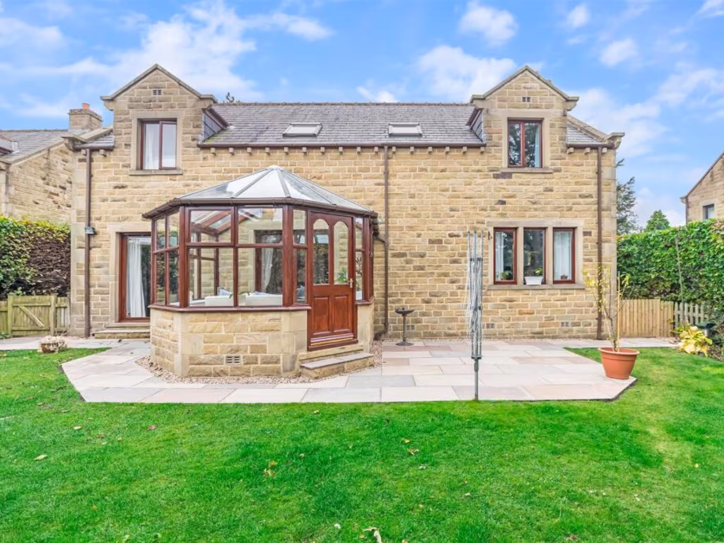
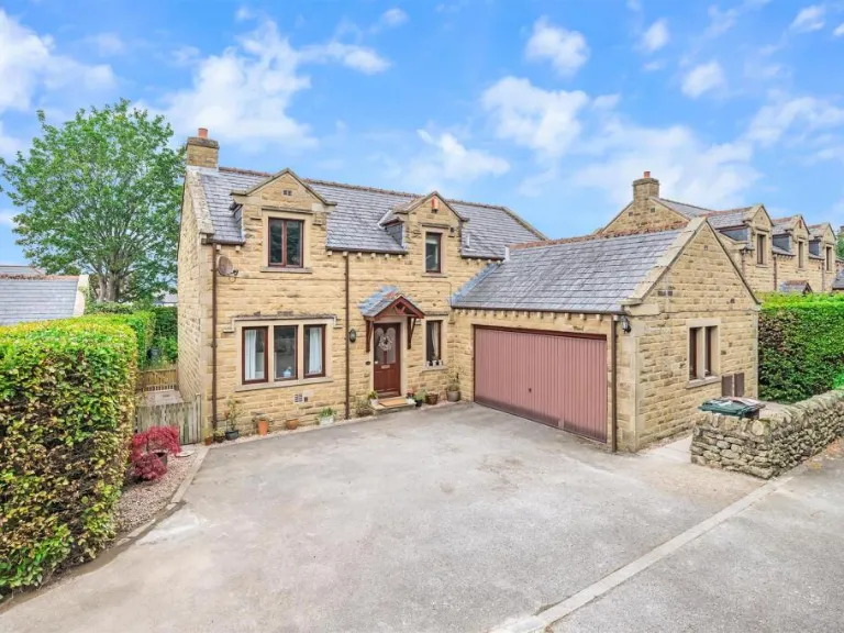
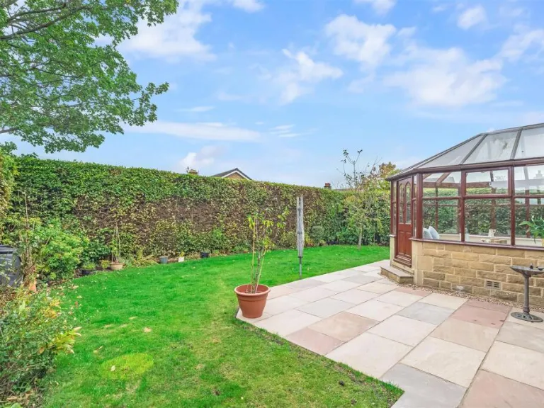
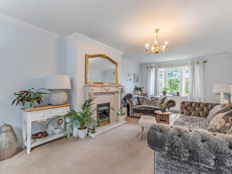
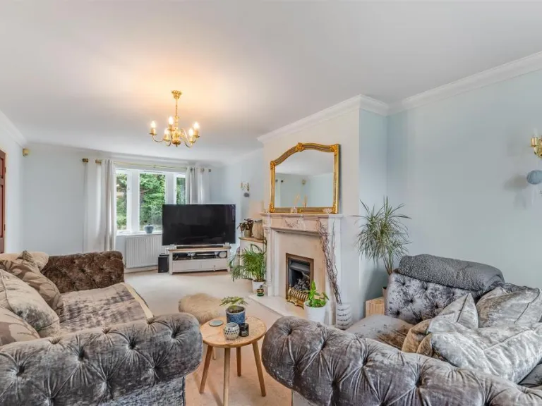
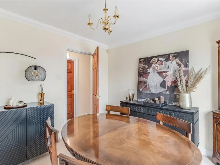
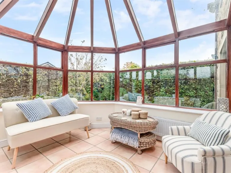
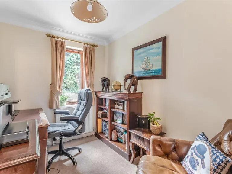
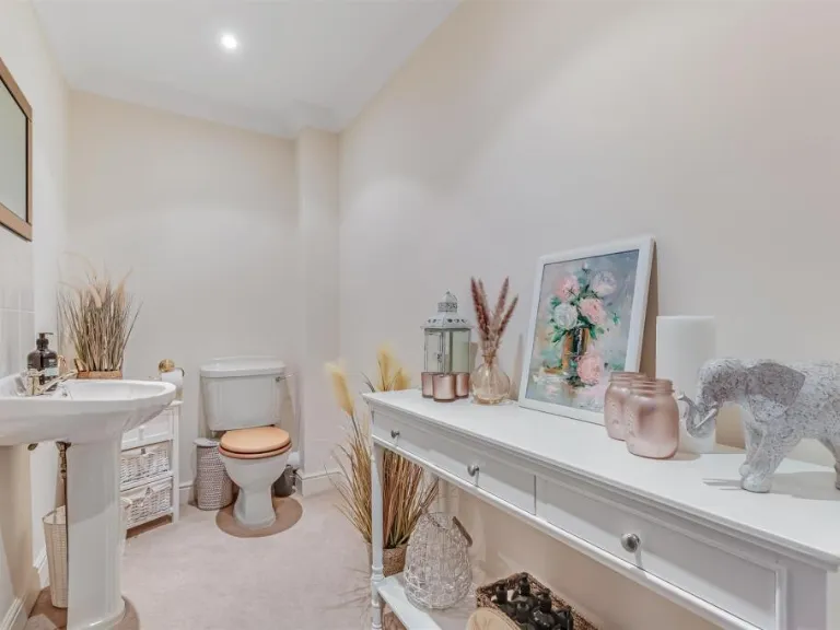
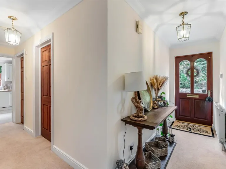
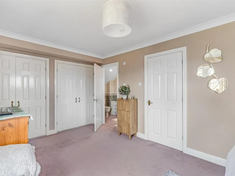
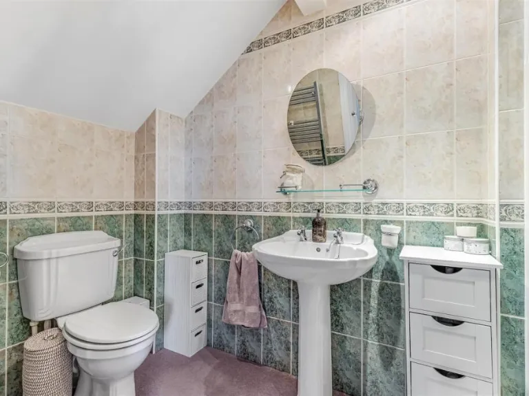
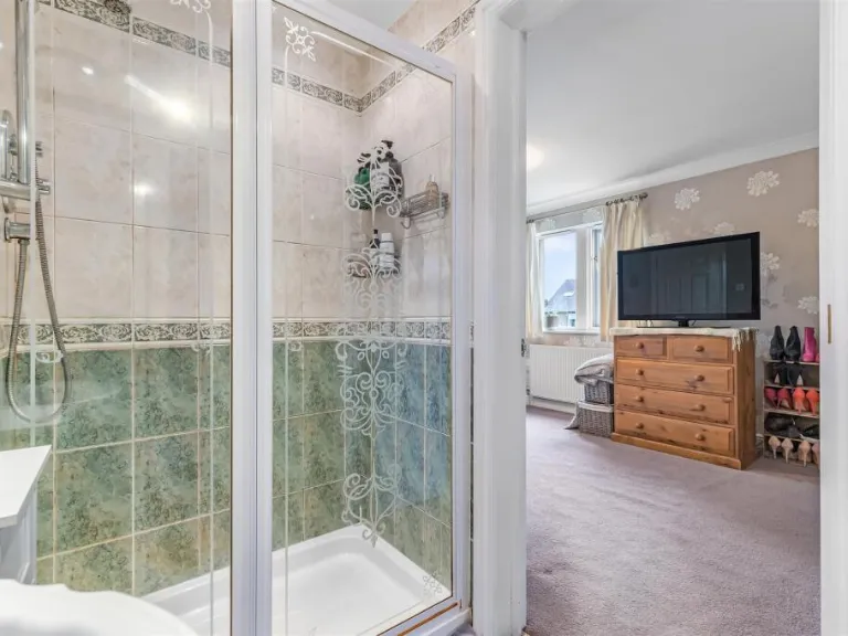
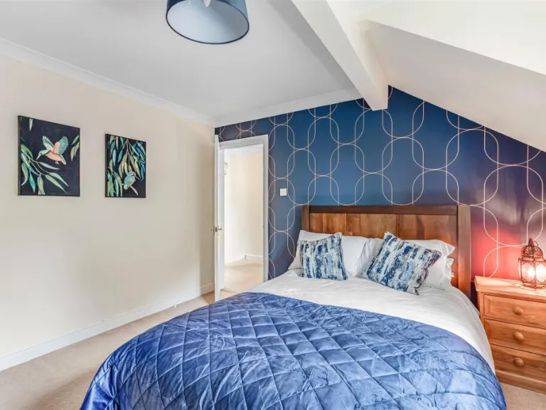
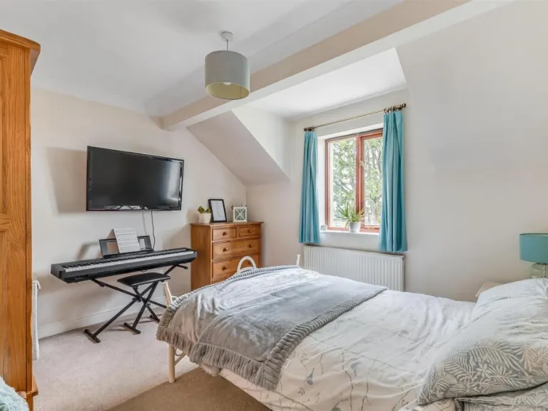
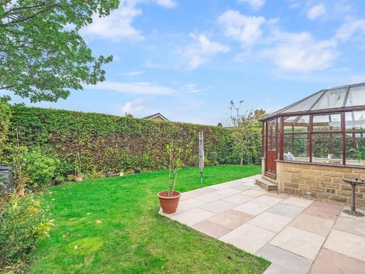
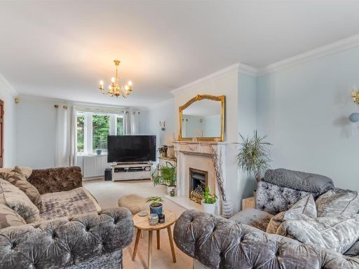
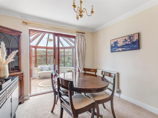
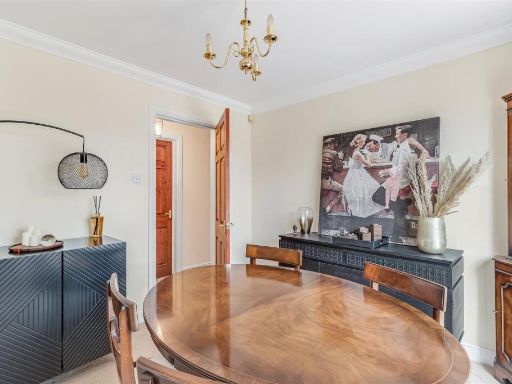
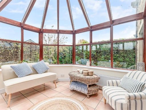
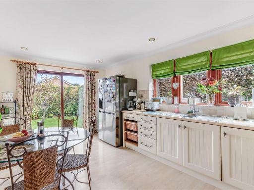
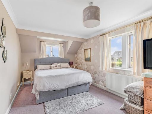
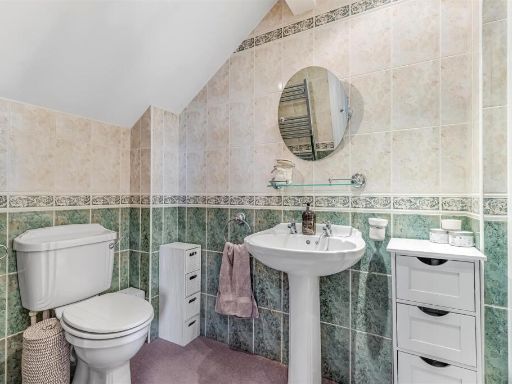
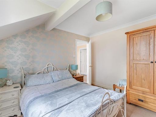
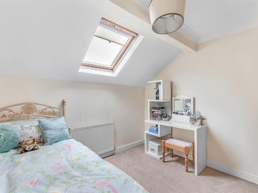
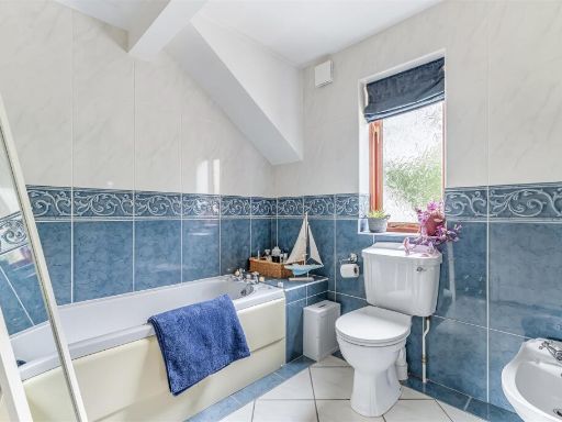
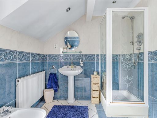
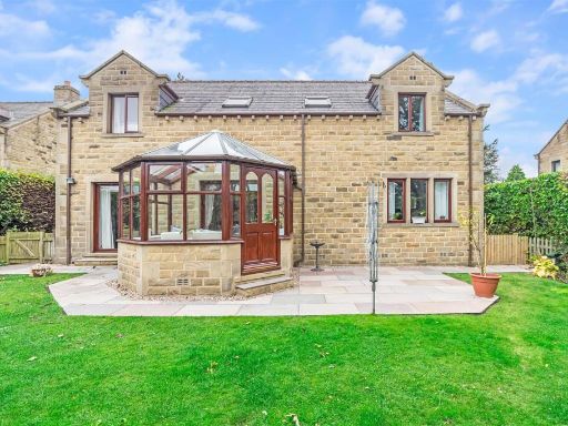
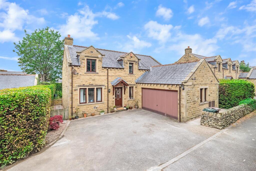
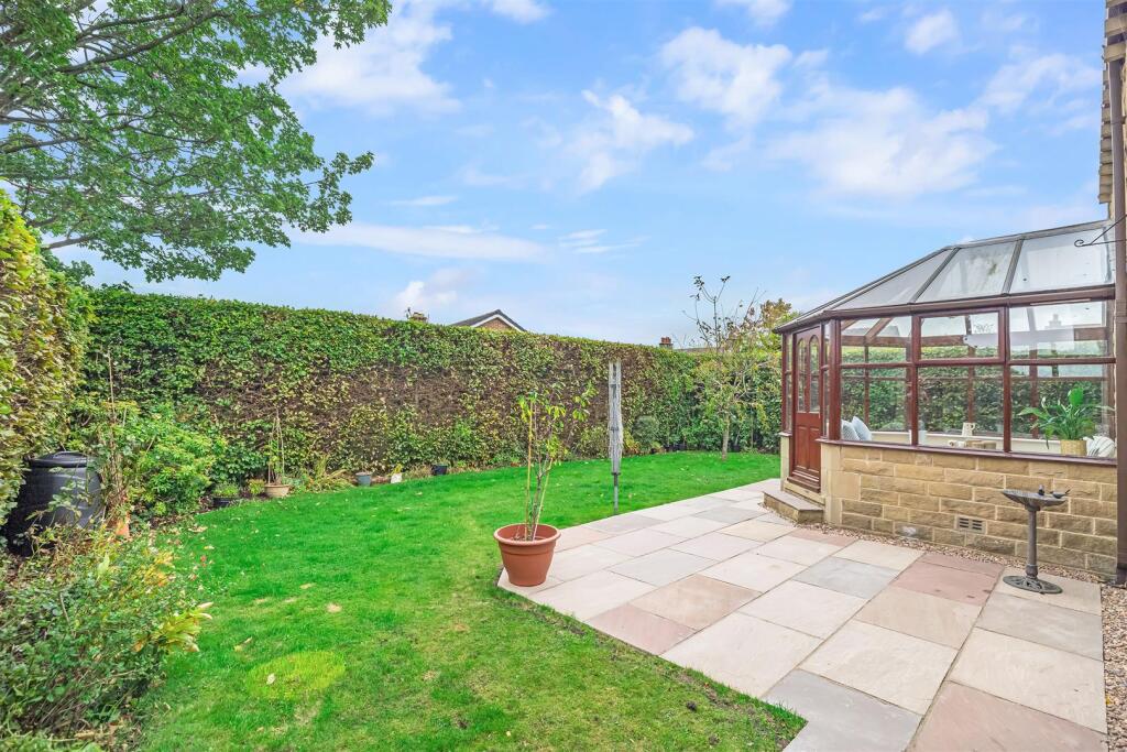
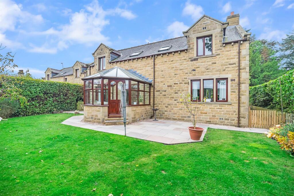
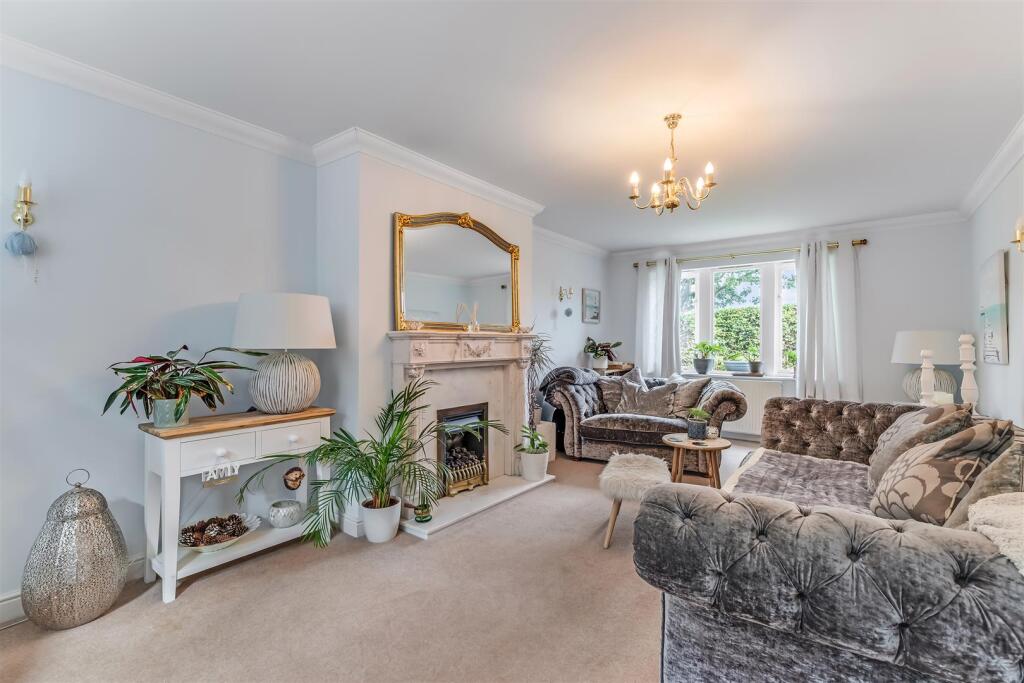
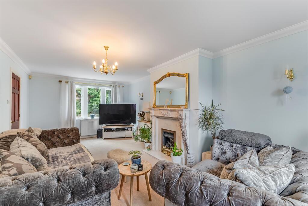
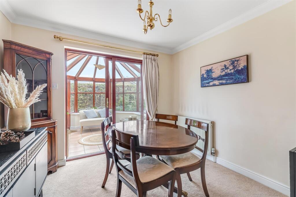
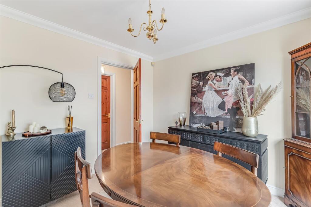
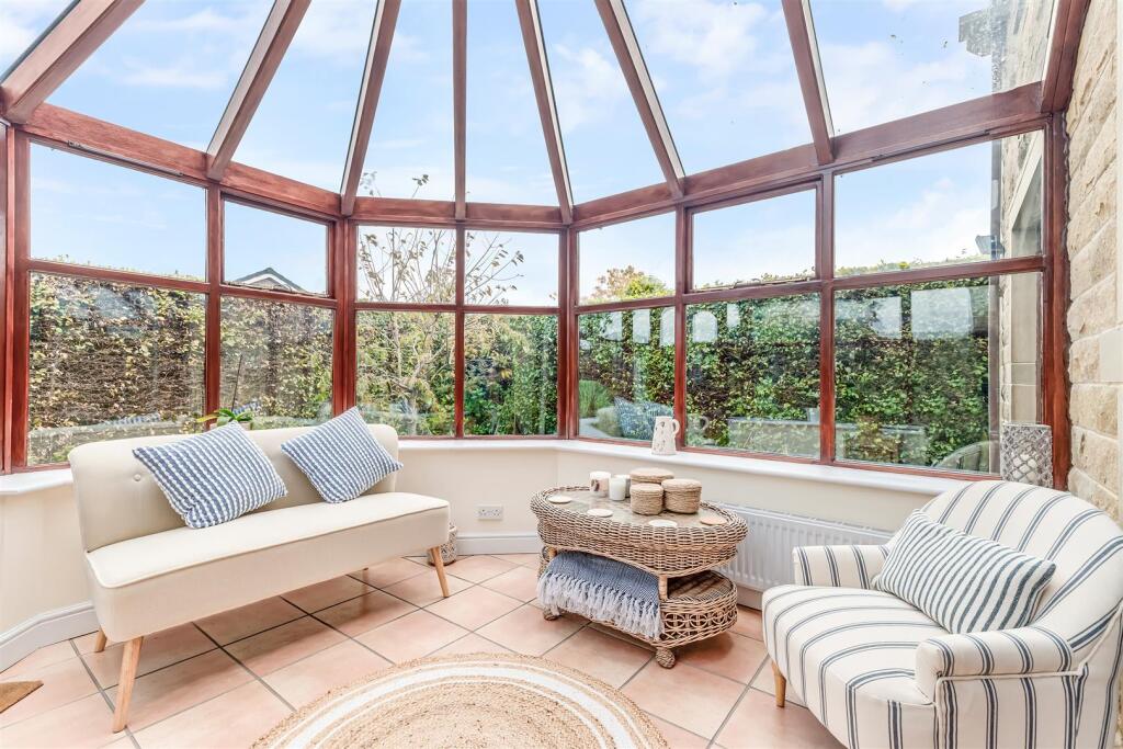
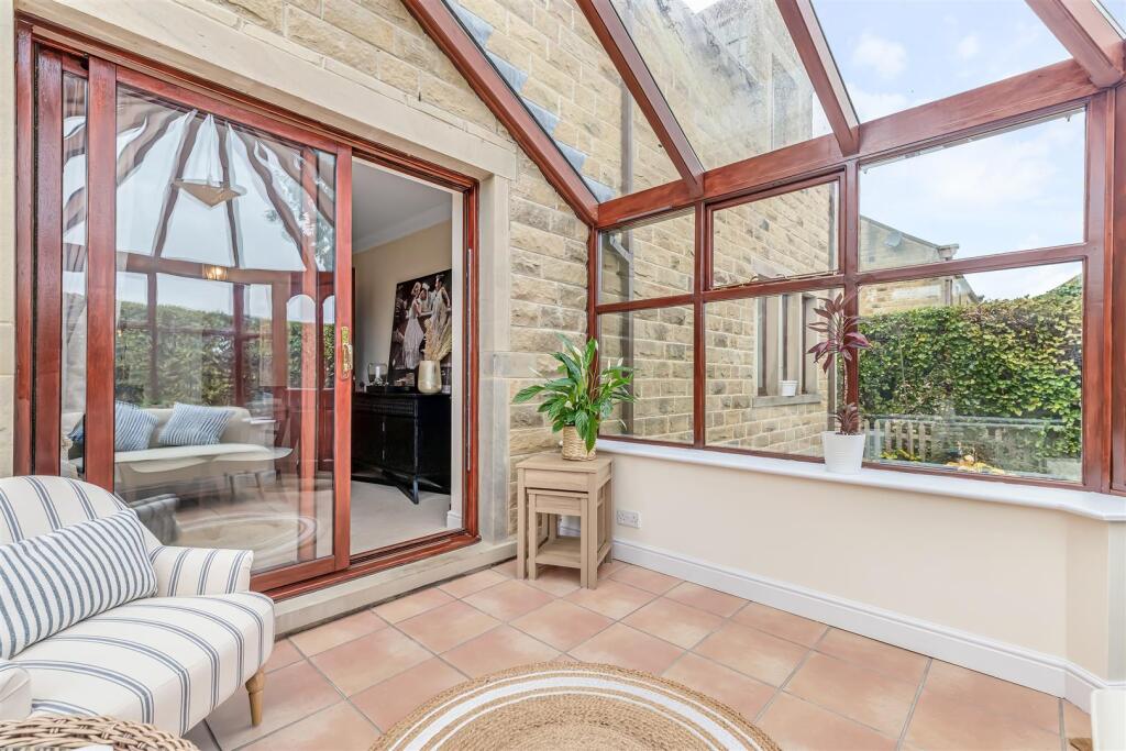
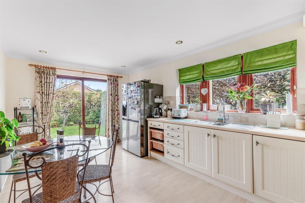
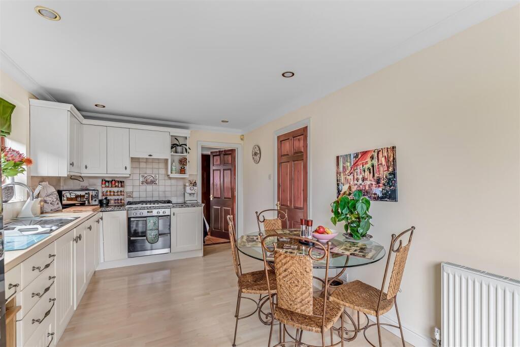
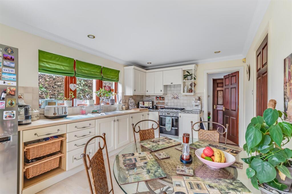
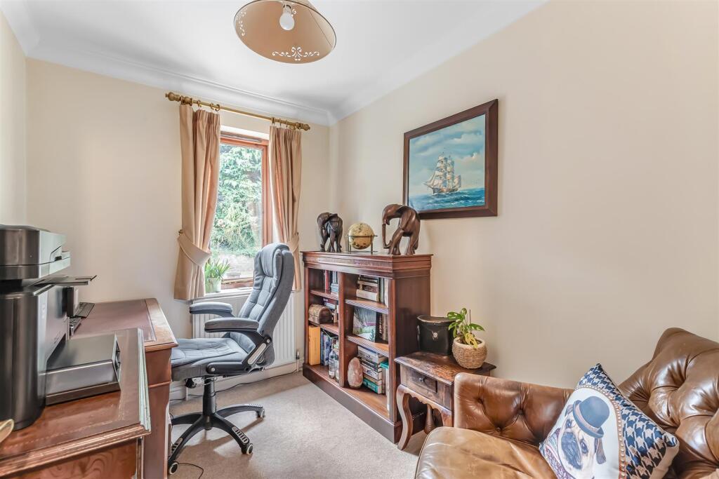
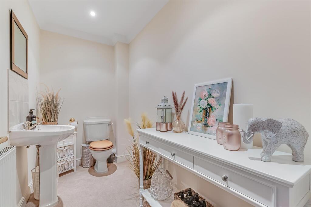
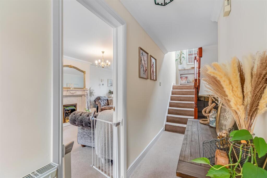
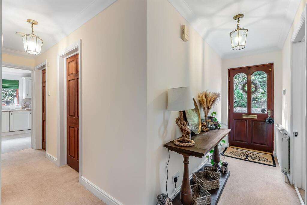
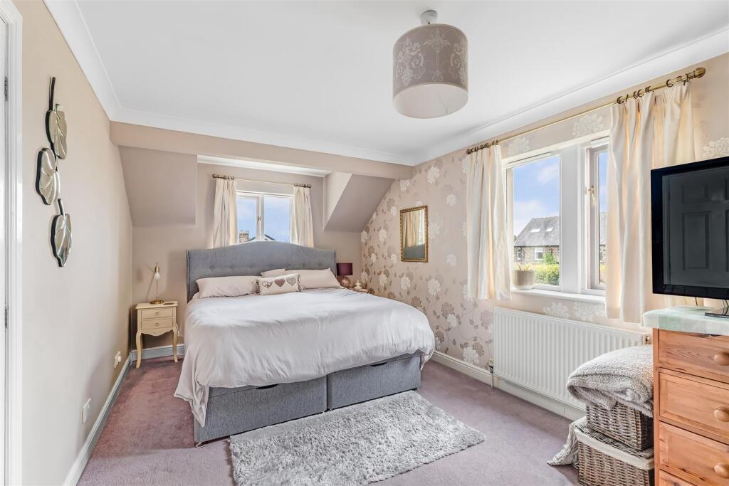
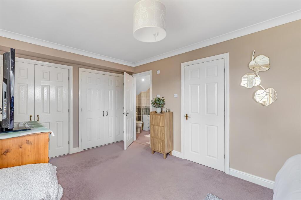
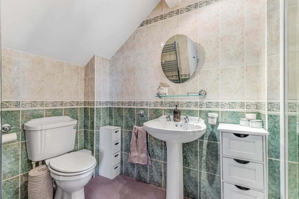
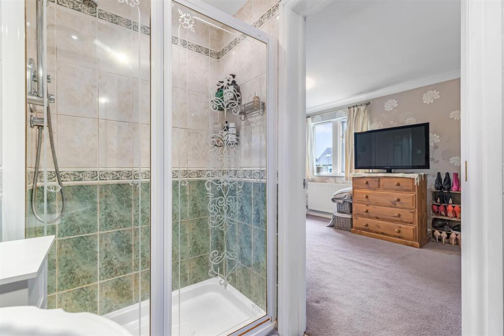
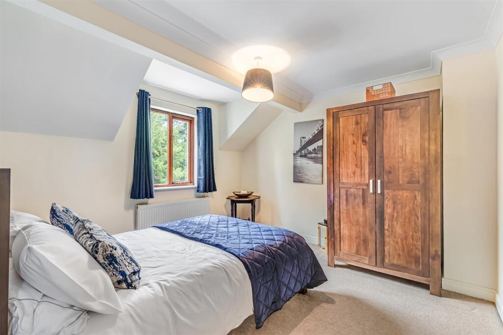
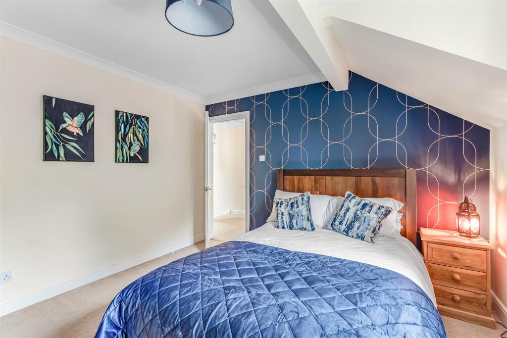
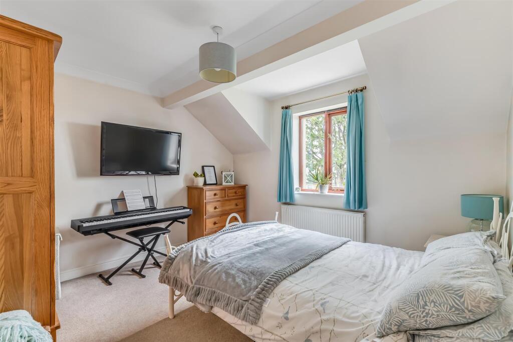
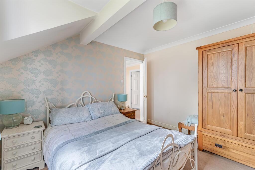
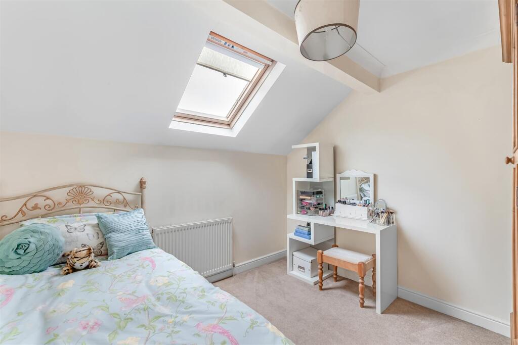
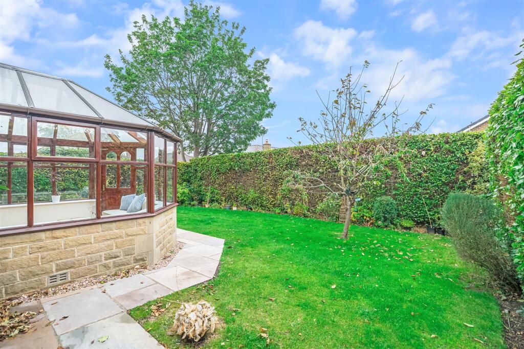
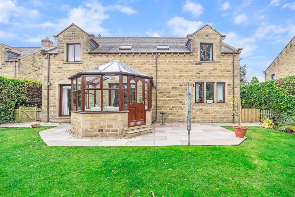
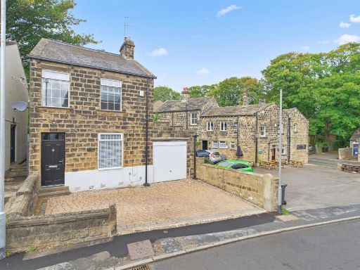
- Detached stone-built family house located in an enviable central cul-de-sac in Menston. The property presents a double garage with electric up & over door and a wide driveway providing multiple off-street parking spaces. Accommodation includes three reception rooms (one presented as a conservatory), a dining kitchen with access to a utility/boot room, a ground-floor cloakroom and a study ideal for home working. The principal bedroom benefits from recessed wardrobes and an en-suite shower room, with three further double bedrooms and a generous family bathroom. Externally there is an enclosed, private lawned garden with Indian sandstone patio (medium to large garden by suburban standards) and well-maintained hedging providing privacy. Constructed in traditional stone with a slate roof, the home is presented in a style consistent with higher-value suburban stock. EPC rating C; Council Tax band G. Overall the property is suited to a growing family seeking good internal space, off-street parking and a private garden in a quiet cul-de-sac close to local amenities, schools and transport links.
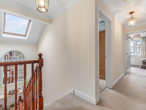
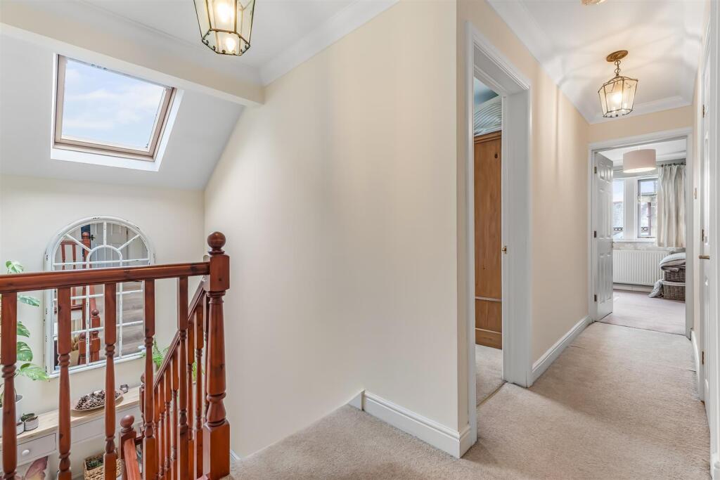
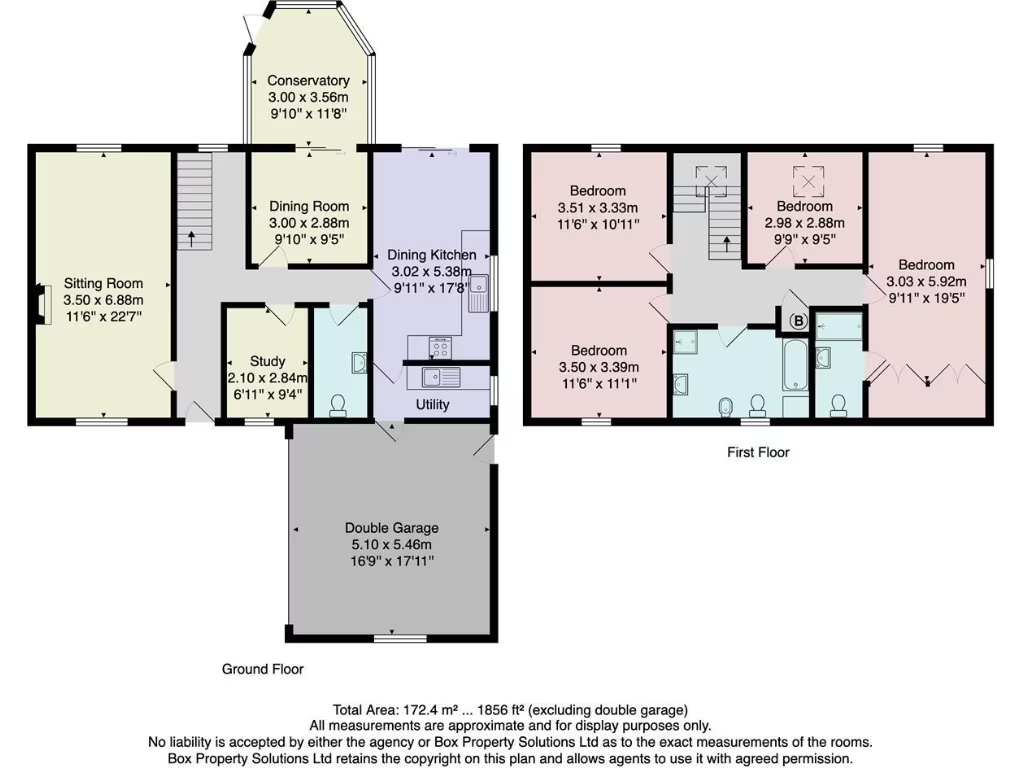
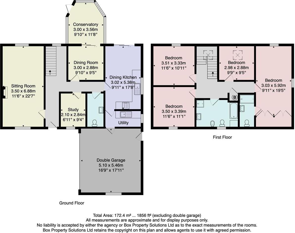
- Substantial detached family house shown by a detailed floor plan extending to approximately 172.4 m² (c. 1,856 sq ft). Accommodation is arranged over two floors and includes a large sitting room, separate dining room, conservatory, a spacious dining kitchen with adjoining utility, a ground-floor study and an integral double garage. The first floor provides four well-proportioned bedrooms and separate bathroom facilities (principal bedroom with en-suite-style arrangement shown). The layout and room sizes indicate generous reception space and family accommodation suitable for long-term occupation. The plan includes an Energy Performance Rating graphic showing current 74 with potential 81. The map inset places the property in Menston close to Menston Park, suggesting pleasant park/green views and a suburban village setting. Garden appears average in size for this type of property; the double garage and overall footprint indicate a large overall property. Measurements are approximate and should be verified by survey.
Image Descriptions
- detached stone house modern rustic
- garden and conservatory modern
Rooms
- Conservatory:
- Dining Room:
- Dining Kitchen:
- Sitting Room:
- Study:
- Utility:
- Double Garage:
- Bedroom:
- Bedroom:
- Bedroom:
- Bedroom:
Textual Property Features
Detected Visual Features
- detached house
- stone construction
- modern rustic
- garage
- driveway
- well-maintained
- gabled roof
- garden
- conservatory
- patio
- modern
- landscaped
- outdoor space
- greenery
- privacy
EPC Details
- Fully double glazed
- Cavity wall, filled cavity
- Boiler and radiators, mains gas
- Low energy lighting in all fixed outlets
- Suspended, no insulation (assumed)
Nearby Schools
- Baildon Church of England Primary School
- Yeadon Westfield Infant School
- Guiseley School
- Queensway Primary School
- Ashfield Primary School
- Otley the Whartons Primary School
- Idle CofE Primary School
- Thackley Primary School
- Hoyle Court Primary School
- Ss. Peter and Paul Catholic Primary School, a Voluntary Academy
- Menston Primary School
- Burley and Woodhead CofE Primary School
- Otley Prince Henry's Grammar School Specialist Language College
- St Anthony's Catholic Primary School, A Voluntary Academy
- Hawksworth Church of England Primary School
- St. Oswald's CofE Primary School
- St. Mary's Menston, a Catholic Voluntary Academy
- Otley All Saints CofE Primary School
- Westgate Primary School
- Burley Oaks Primary School
- Thorpe Primary
- Immanuel College
- Sandal Primary School
- Yeadon Westfield Junior School
- Tranmere Park Primary School
- Guiseley Primary School
- St Joseph's Catholic Primary School, Otley
- Ghyll Royd School and Pre-School
- Askwith Community Primary School
Nearest General Shops
- Id: 9656631520
- Tags:
- Addr:
- Housenumber: 50
- Street: Cleasby Road
- Name: Aspire
- Shop: hairdresser
- TagsNormalized:
- Lat: 53.8890992
- Lon: -1.7372172
- FullGeoHash: gcwf86nyzbhy
- PartitionGeoHash: gcwf
- Images:
- FoodStandards: null
- Distance: 142.9
,- Id: 9656631519
- Tags:
- Addr:
- Housenumber: 52a
- Street: Cleasby Road
- Shop: vacant
- TagsNormalized:
- Lat: 53.8889601
- Lon: -1.7372762
- FullGeoHash: gcwf86nvyw2b
- PartitionGeoHash: gcwf
- Images:
- FoodStandards: null
- Distance: 129.4
,- Id: 747728289
- Tags:
- Facebook: https://www.facebook.com/pickardsdeli/
- Name: Pickard's Deli
- Outdoor_seating: yes
- Shop: deli
- Source: survey
- Twitter: pickardspies
- TagsNormalized:
- Lat: 53.8887761
- Lon: -1.7371348
- FullGeoHash: gcwf86phcgfq
- PartitionGeoHash: gcwf
- Images:
- FoodStandards: null
- Distance: 124.2
}
Nearest Religious buildings
- Id: 261521055
- Tags:
- Addr:
- City: Menston
- Postcode: LS29 6PF
- Street: Burley Road
- Amenity: place_of_worship
- Denomination: mormon
- Name: The Church of Jesus Christ of Latter-day Saints
- Religion: christian
- Source: survey;Bing
- Website: https://mormon.org/meetinghouse
- TagsNormalized:
- place of worship
- mormon
- church
- christian
- Lat: 53.8934986
- Lon: -1.7326535
- FullGeoHash: gcwf8e426hrc
- PartitionGeoHash: gcwf
- Images:
- FoodStandards: null
- Distance: 713.6
,- Id: 60659863
- Tags:
- Amenity: place_of_worship
- Building: church
- Denomination: anglican
- Name: Menston Parish Church
- Religion: christian
- Source: survey
- Wikidata: Q105081202
- TagsNormalized:
- place of worship
- church
- anglican
- parish
- christian
- Lat: 53.8921416
- Lon: -1.7453446
- FullGeoHash: gcwf86c06x2d
- PartitionGeoHash: gcwf
- Images:
- FoodStandards: null
- Distance: 618.4
,- Id: 6743167
- Tags:
- Amenity: place_of_worship
- Building: church
- Denomination: methodist
- Name: Menston Methodist Church
- Religion: christian
- Type: multipolygon
- TagsNormalized:
- place of worship
- church
- methodist
- christian
- Lat: 53.8911019
- Lon: -1.7447517
- FullGeoHash: gcwf869d2mdb
- PartitionGeoHash: gcwf
- Images:
- FoodStandards: null
- Distance: 511.5
}
Nearest Airports
- Id: 11519546
- Tags:
- Addr:
- City: Leeds
- Postcode: LS19 7TU
- Aerodrome: international
- Aerodrome:type: public
- Aeroway: aerodrome
- Iata: LBA
- Icao: EGNM
- Name: Leeds Bradford Airport
- Operator: Leeds Bradford Airport Limited
- Operator:type: private
- Ref: LBA
- Type: multipolygon
- Website: https://www.leedsbradfordairport.co.uk/
- Wikidata: Q8699
- Wikipedia: en:Leeds Bradford Airport
- TagsNormalized:
- airport
- international airport
- Lat: 53.8667047
- Lon: -1.660138
- FullGeoHash: gcwf6nph7cx3
- PartitionGeoHash: gcwf
- Images:
- Q8699-1
- Q8699-2
- Q8699-3
- Q8699-4
- FoodStandards: null
- Distance: 5678.1
}
Nearest Leisure Facilities
- Id: 9083882541
- Tags:
- Covered: no
- Leisure: picnic_table
- TagsNormalized:
- picnic
- picnic table
- leisure
- Lat: 53.8879725
- Lon: -1.7351954
- FullGeoHash: gcwf8d02pn0t
- PartitionGeoHash: gcwf
- Images:
- FoodStandards: null
- Distance: 232.8
,- Id: 358279983
- Tags:
- Access: yes
- Barrier: fence
- Leisure: playground
- TagsNormalized:
- Lat: 53.8880977
- Lon: -1.7351908
- FullGeoHash: gcwf8d02zj7z
- PartitionGeoHash: gcwf
- Images:
- FoodStandards: null
- Distance: 232.2
,- Id: 9083882552
- Tags:
- Covered: no
- Leisure: picnic_table
- TagsNormalized:
- picnic
- picnic table
- leisure
- Lat: 53.8879773
- Lon: -1.7352923
- FullGeoHash: gcwf8d02hz03
- PartitionGeoHash: gcwf
- Images:
- FoodStandards: null
- Distance: 226.4
,- Id: 91075563
- Tags:
- Leisure: pitch
- Name: Menston Crown Green Bowls Club
- Source: Bing;survey
- Sport: bowls
- TagsNormalized:
- pitch
- leisure
- bowls
- club
- sports
- Lat: 53.8896281
- Lon: -1.738732
- FullGeoHash: gcwf86mcudg3
- PartitionGeoHash: gcwf
- Images:
- FoodStandards: null
- Distance: 161.7
,- Id: 902315872
- Tags:
- Access: customers
- Leisure: playground
- TagsNormalized:
- Lat: 53.8886256
- Lon: -1.7375033
- FullGeoHash: gcwf86ngcpzt
- PartitionGeoHash: gcwf
- Images:
- FoodStandards: null
- Distance: 94.9
}
Nearest Tourist attractions
- Id: 806008136
- Tags:
- Addr:
- City: Menston
- Postcode: LS29 6BG
- Street: West Chevin Road
- Cabins: yes
- Camp_site: serviced
- Caravans: yes
- Drinking_water: yes
- Fee: yes
- Name: Clarion Lodge Campsite
- Phone: +44 1943 876 300
- Power_supply: yes
- Shower: yes
- Swimming_pool: no
- Tents: yes
- Toilets: yes
- Tourism: camp_site
- Website: www.clarionlodgecampsite.co.uk
- TagsNormalized:
- Lat: 53.8929088
- Lon: -1.7175965
- FullGeoHash: gcwf8fvkcn75
- PartitionGeoHash: gcwf
- Images:
- FoodStandards: null
- Distance: 1481.7
,- Id: 220311709
- Tags:
- Building: residential
- Name: Chevin End
- Source: Bing
- Source:name: os_25k_firstseries
- Tourism: guest_house
- TagsNormalized:
- residential
- guest house
- tourism
- Lat: 53.8917821
- Lon: -1.7218313
- FullGeoHash: gcwf8fdnqkmd
- PartitionGeoHash: gcwf
- Images:
- FoodStandards: null
- Distance: 1177.9
,- Id: 220310989
- Tags:
- Building: yes
- Name: Water Lilies
- Source: Bing
- Tourism: gallery
- TagsNormalized:
- Lat: 53.8900244
- Lon: -1.725536
- FullGeoHash: gcwf8drs0hej
- PartitionGeoHash: gcwf
- Images:
- FoodStandards: null
- Distance: 888.9
}
Nearest Train stations
- Id: 3713696172
- Tags:
- Name: Bingley
- Naptan:
- Network: National Rail
- Public_transport: station
- Railway: station
- Ref:
- Source: GPX
- Wikidata: Q672653
- Wikipedia: en:Bingley railway station
- TagsNormalized:
- Lat: 53.8487153
- Lon: -1.837164
- FullGeoHash: gcwdq4y5wbp4
- PartitionGeoHash: gcwd
- Images:
- FoodStandards: null
- Distance: 7804
,- Id: 538084632
- Tags:
- Name: Shipley
- Naptan:
- Network: National Rail
- Public_transport: station
- Railway: station
- Ref:
- Wikidata: Q4762414
- Wikipedia: en:Shipley railway station
- TagsNormalized:
- Lat: 53.8335128
- Lon: -1.7736115
- FullGeoHash: gcwdr8h6zy5k
- PartitionGeoHash: gcwd
- Images:
- FoodStandards: null
- Distance: 6494.2
,- Id: 3711563943
- Tags:
- Name: Ben Rhydding
- Naptan:
- Network: National Rail
- Public_transport: station
- Railway: station
- Ref:
- Source: OS 1:25k;Bing
- Wikidata: Q4886351
- Wikipedia: en:Ben Rhydding railway station
- TagsNormalized:
- Lat: 53.9257438
- Lon: -1.7974707
- FullGeoHash: gcwdz0gh5zhx
- PartitionGeoHash: gcwd
- Images:
- FoodStandards: null
- Distance: 5679.5
,- Id: 3890669432
- Tags:
- Name: Apperley Bridge
- Naptan:
- Network: National Rail
- Public_transport: station
- Railway: station
- Ref:
- Train: yes
- Wheelchair: yes
- Wikipedia: en:Apperley Bridge railway station
- TagsNormalized:
- Lat: 53.8420442
- Lon: -1.7070712
- FullGeoHash: gcwf31suwke2
- PartitionGeoHash: gcwf
- Images:
- FoodStandards: null
- Distance: 5533.6
,- Id: 3711563945
- Tags:
- Name: Guiseley
- Name:lt: Gaislis
- Naptan:
- Network: National Rail
- Public_transport: station
- Railway: station
- Ref:
- Wheelchair: yes
- Wheelchair:description: Transfer between platforms is via Oxford Road (about 500 metres). The entrance to platform 2 uses a relatively narrow path, 40 metres long.
- Wikidata: Q2407772
- Wikipedia: en:Guiseley railway station
- TagsNormalized:
- Lat: 53.8760658
- Lon: -1.7151179
- FullGeoHash: gcwf2zz4ffe6
- PartitionGeoHash: gcwf
- Images:
- FoodStandards: null
- Distance: 2051.4
}
Nearest Hotels
- Id: 27670175
- Tags:
- Addr:
- City: Otley
- Country: GB
- Housename: Chevin Lodge
- Postcode: LS21 3NU
- Street: York Gate
- Fhrs:
- Name: Chevin Country Park Hotel And Spa
- Source: landsat
- Tourism: hotel
- Website: www.chevincountrypark-hotel.co.uk
- TagsNormalized:
- Lat: 53.8906053
- Lon: -1.6786386
- FullGeoHash: gcwf9f3xsbuq
- PartitionGeoHash: gcwf
- Images:
- FoodStandards: null
- Distance: 3947.3
,- Id: 21029699
- Tags:
- Accommodation: yes
- Addr:
- Postcode: LS21 3AS
- Street: Westgate
- Town: Otley
- Amenity: pub
- Fhrs:
- Is_in:
- County: West Yorkshire
- Town: Otley
- Name: The Black Horse Hotel
- Tourism: guest_house
- Website: theblackhorsehotel.org.uk
- TagsNormalized:
- bar
- pub
- hotel
- guest house
- tourism
- Lat: 53.9057132
- Lon: -1.6946046
- FullGeoHash: gcwf9mnp8c70
- PartitionGeoHash: gcwf
- Images:
- FoodStandards: null
- Distance: 3487.5
,- Id: 329959063
- Tags:
- Addr:
- City: Shipley
- Postcode: BD17 7QW
- Street: Hollins Hill
- Village: Baildon
- Brand: Marriott
- Building: yes
- Fhrs:
- Name: Hollins Hall Hotel
- Source: Bing
- Source:addr: FHRS Open Data
- Tourism: hotel
- Url: http://www.marriott.com/hotels/hotel-information/golf-courses/lbags-hollins-hall-marriott-hotel-and-country-club/
- TagsNormalized:
- Lat: 53.8621564
- Lon: -1.7367568
- FullGeoHash: gcwf2mr3f9sq
- PartitionGeoHash: gcwf
- Images:
- FoodStandards: null
- Distance: 2895.9
}
Tags
- detached house
- stone construction
- modern rustic
- garage
- driveway
- well-maintained
- gabled roof
- garden
- conservatory
- patio
- modern
- landscaped
- outdoor space
- greenery
- privacy
Local Market Stats
- Average Price/sqft: £347
- Avg Income: £58700
- Rental Yield: 3.3%
- Social Housing: 3%
- Planning Success Rate: 87%
Similar Properties
 2 bedroom detached house for sale in Derry Hill, Menston, LS29 — £395,000 • 2 bed • 1 bath • 1128 ft²
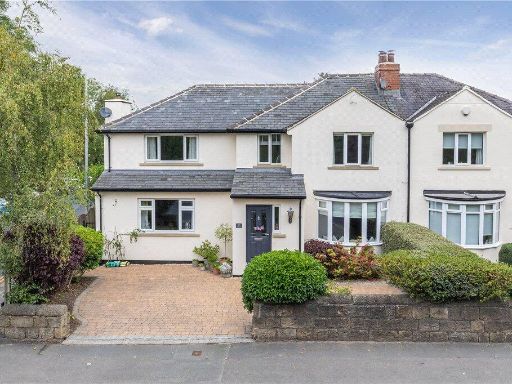 4 bedroom semi-detached house for sale in Bingley Road, Menston, Ilkley, West Yorkshire, LS29 — £625,000 • 4 bed • 2 bath • 1578 ft²
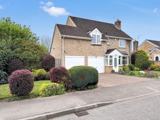 4 bedroom detached house for sale in Ellar Gardens, Menston, LS29 — £570,000 • 4 bed • 3 bath • 1746 ft²
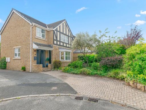 5 bedroom detached house for sale in Ellar Gardens, Menston, Ilkley, West Yorkshire, LS29 — £572,500 • 5 bed • 3 bath • 1280 ft²
 4 bedroom detached house for sale in Bradford Road, Menston, Ilkley, West Yorkshire, LS29 — £450,000 • 4 bed • 1 bath • 957 ft²
 3 bedroom bungalow for sale in Park Road, Menston, Ilkley, West Yorkshire, LS29 — £575,000 • 3 bed • 2 bath • 1437 ft²
Meta
- {
"@context": "https://schema.org",
"@type": "Residence",
"name": "4 bedroom detached house for sale in Wentworth Close, Menst…",
"description": "",
"url": "https://propertypiper.co.uk/property/cba6f29f-7cd6-4863-9bb8-85e05b53a7a4",
"image": "https://image-a.propertypiper.co.uk/b50ffa12-d593-48f3-bddf-bcd833c8db9f-1024.jpeg",
"address": {
"@type": "PostalAddress",
"streetAddress": "23 WENTWORTH CLOSE MENSTON ILKLEY",
"postalCode": "LS29 6NN",
"addressLocality": "Bradford",
"addressRegion": "Shipley",
"addressCountry": "England"
},
"geo": {
"@type": "GeoCoordinates",
"latitude": 53.888173967725436,
"longitude": -1.7387313573858394
},
"numberOfRooms": 4,
"numberOfBathroomsTotal": 2,
"floorSize": {
"@type": "QuantitativeValue",
"value": 1856,
"unitCode": "FTK"
},
"offers": {
"@type": "Offer",
"price": 700000,
"priceCurrency": "GBP",
"availability": "https://schema.org/InStock"
},
"additionalProperty": [
{
"@type": "PropertyValue",
"name": "Feature",
"value": "detached house"
},
{
"@type": "PropertyValue",
"name": "Feature",
"value": "stone construction"
},
{
"@type": "PropertyValue",
"name": "Feature",
"value": "modern rustic"
},
{
"@type": "PropertyValue",
"name": "Feature",
"value": "garage"
},
{
"@type": "PropertyValue",
"name": "Feature",
"value": "driveway"
},
{
"@type": "PropertyValue",
"name": "Feature",
"value": "well-maintained"
},
{
"@type": "PropertyValue",
"name": "Feature",
"value": "gabled roof"
},
{
"@type": "PropertyValue",
"name": "Feature",
"value": "garden"
},
{
"@type": "PropertyValue",
"name": "Feature",
"value": "conservatory"
},
{
"@type": "PropertyValue",
"name": "Feature",
"value": "patio"
},
{
"@type": "PropertyValue",
"name": "Feature",
"value": "modern"
},
{
"@type": "PropertyValue",
"name": "Feature",
"value": "landscaped"
},
{
"@type": "PropertyValue",
"name": "Feature",
"value": "outdoor space"
},
{
"@type": "PropertyValue",
"name": "Feature",
"value": "greenery"
},
{
"@type": "PropertyValue",
"name": "Feature",
"value": "privacy"
}
]
}
High Res Floorplan Images
Compatible Floorplan Images
FloorplanImages Thumbnail