OX3 8HZ - 3 bedroom semidetached house for sale in Risinghurst, Oxfor…
View on Property Piper
3 bedroom semi-detached house for sale in Risinghurst, Oxford, OX3
Property Details
- Price: £500000
- Bedrooms: 3
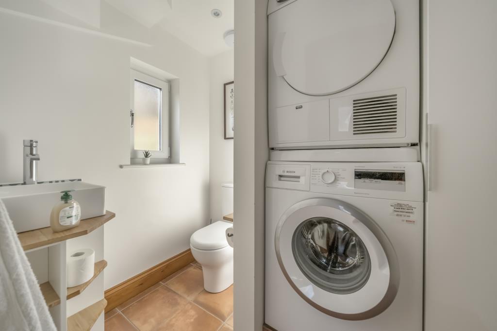
- Bathrooms: 1
- Property Type: undefined
- Property SubType: undefined
Image Descriptions
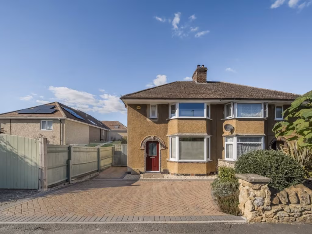
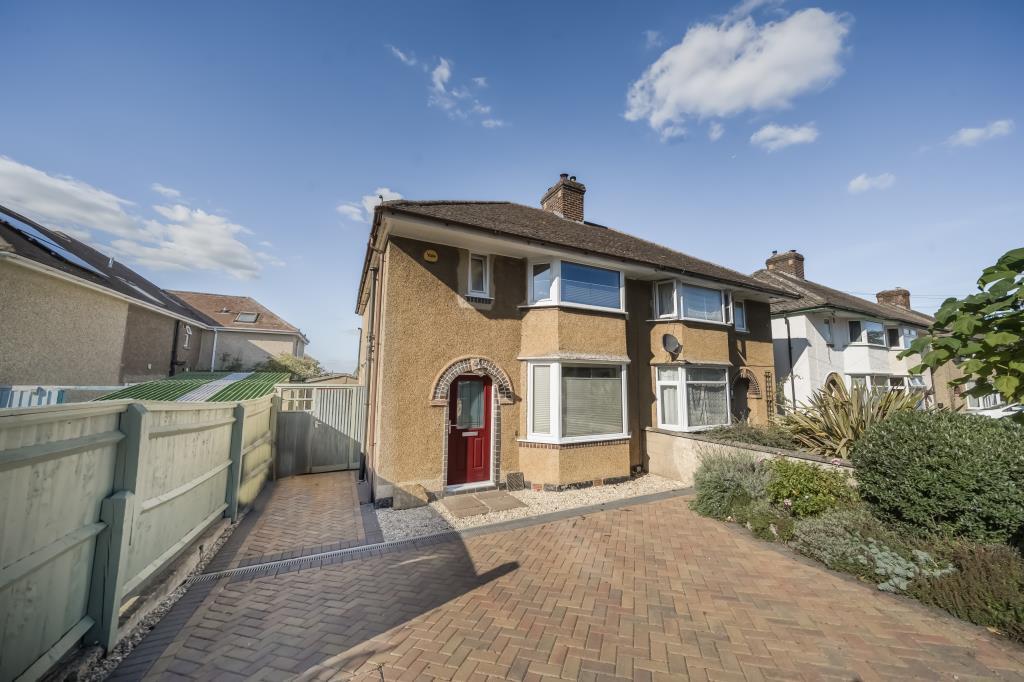
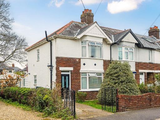
- exterior of a semi-detached house mid-20th century
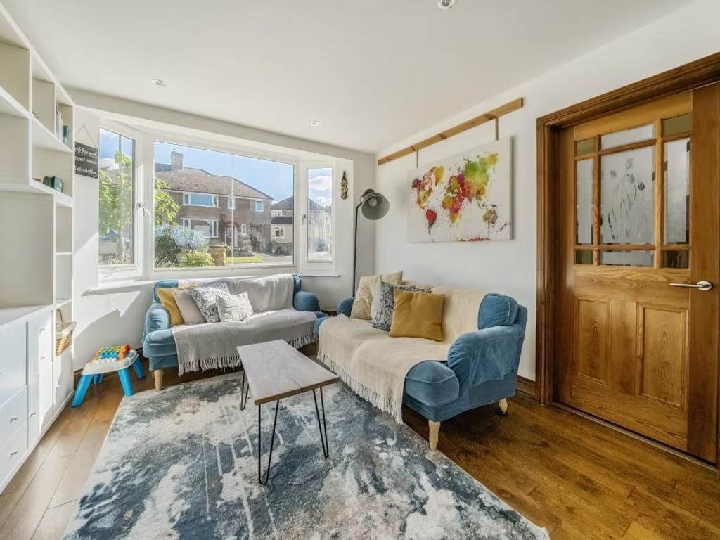
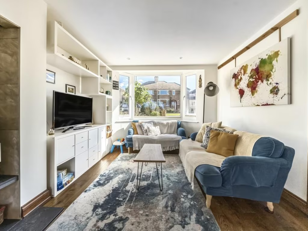
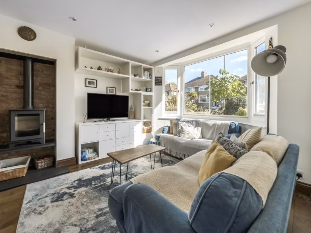
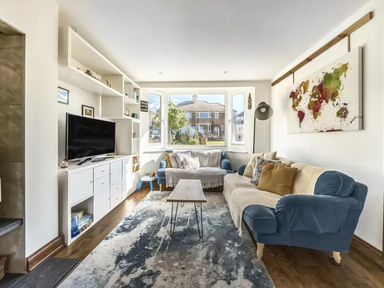
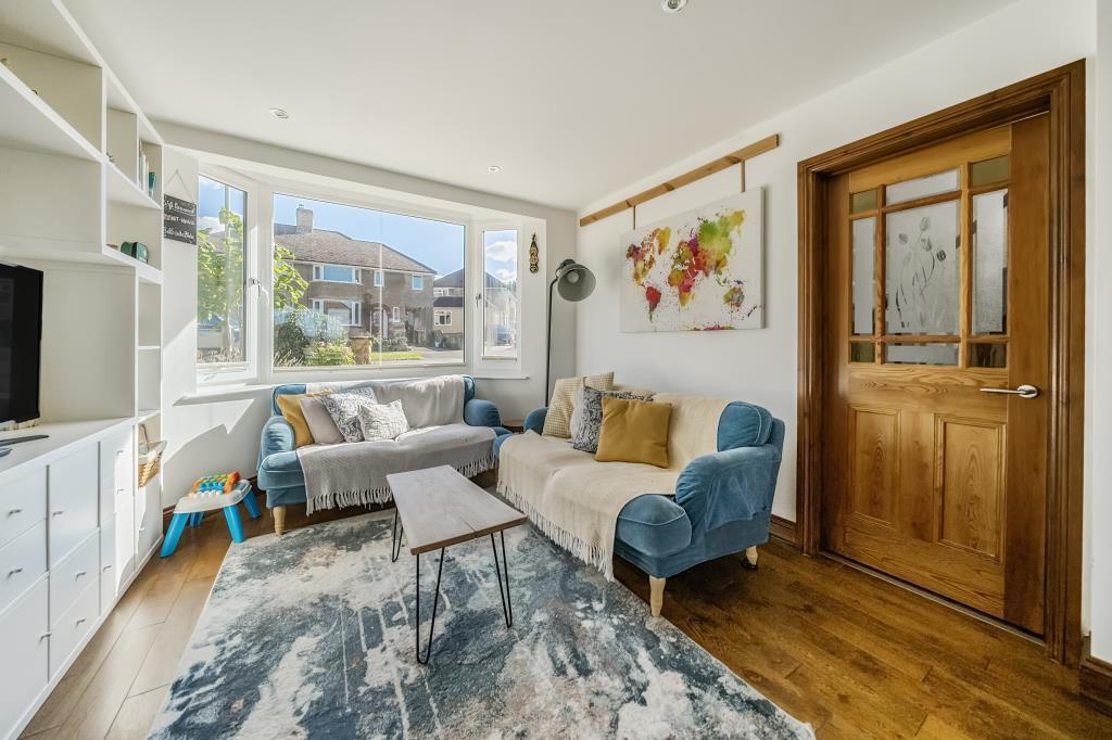
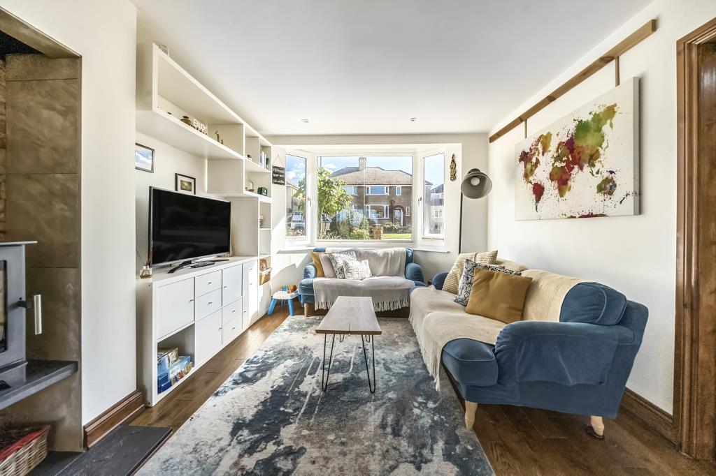
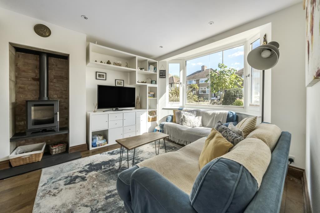
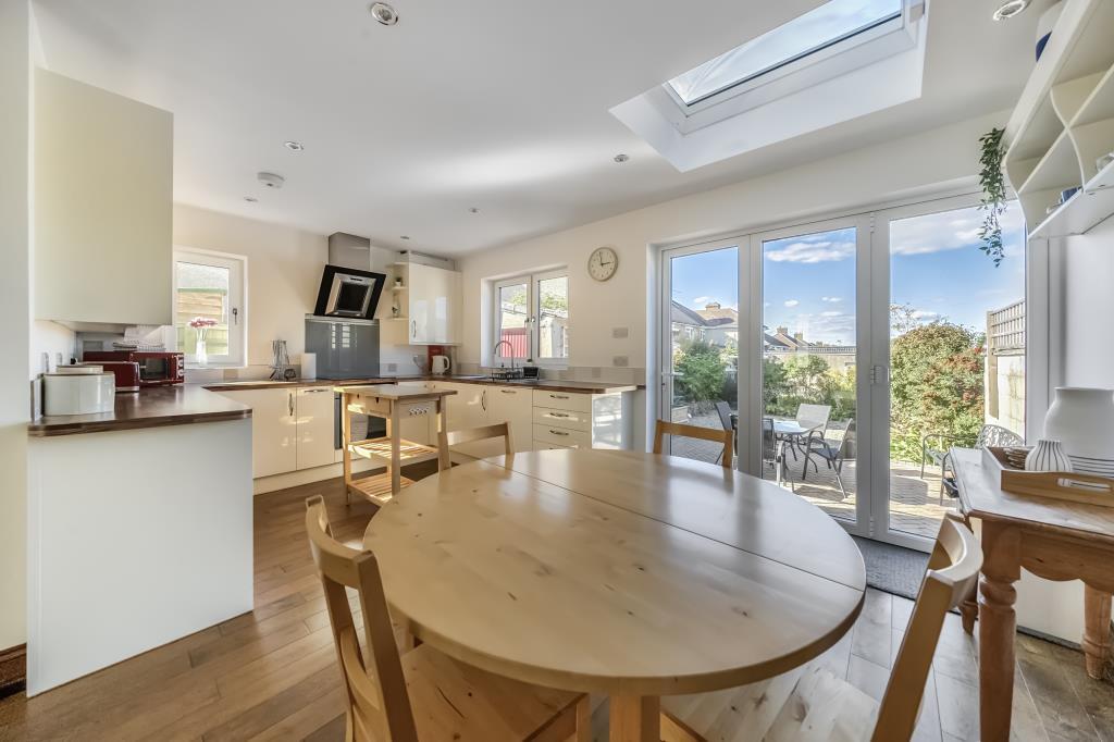
- living room modern
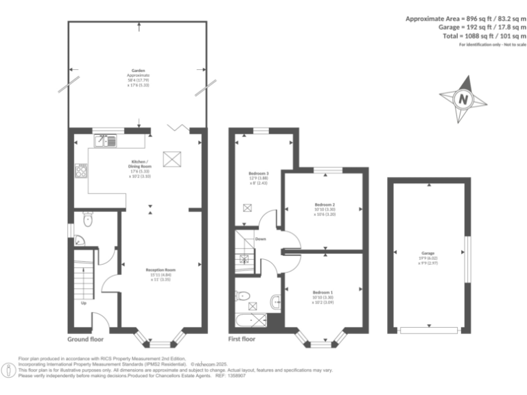
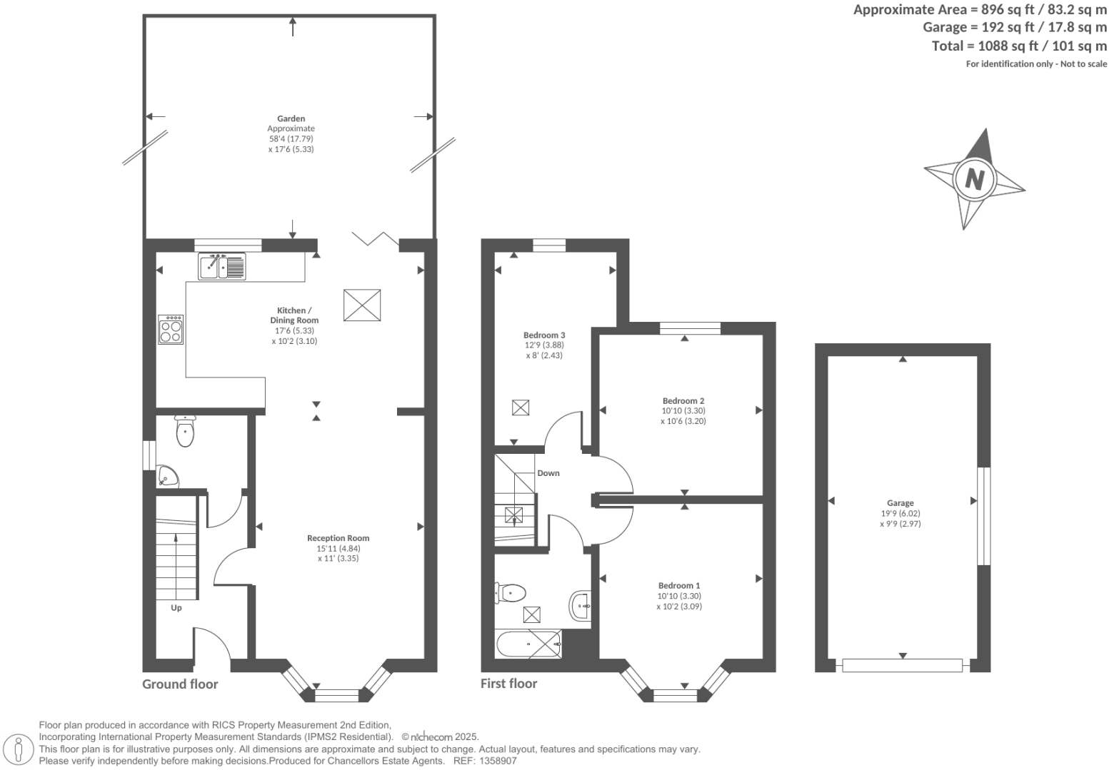
Rooms
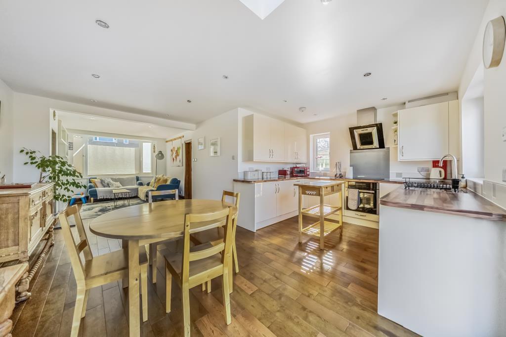
- Reception Room:
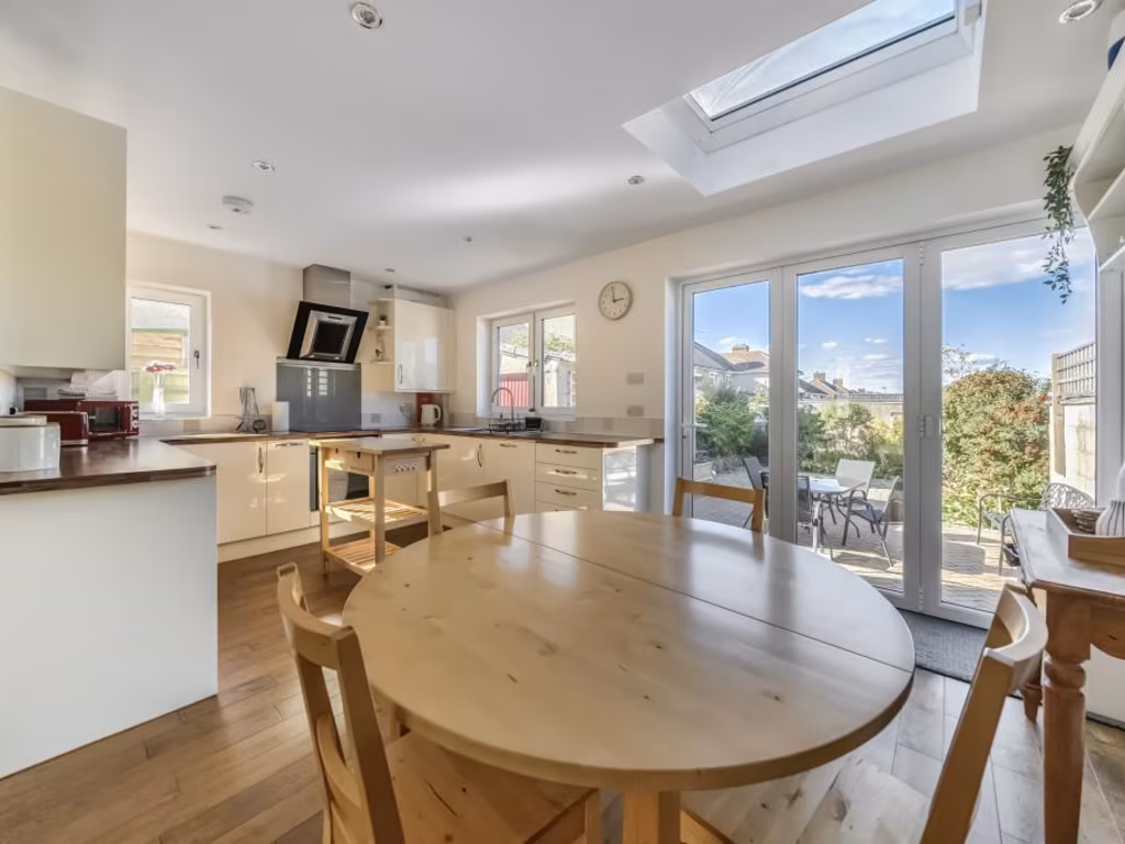
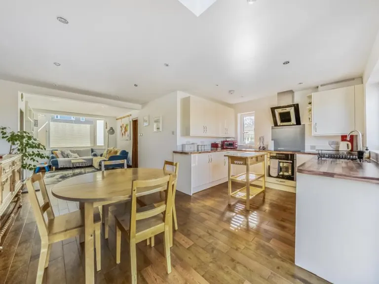
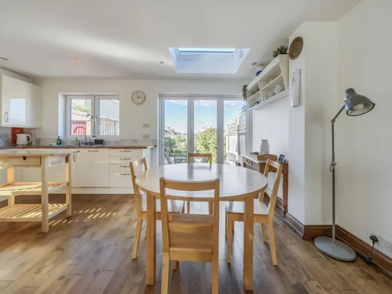
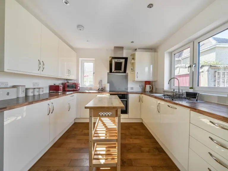
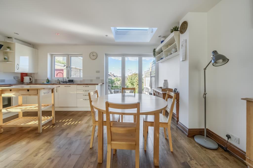
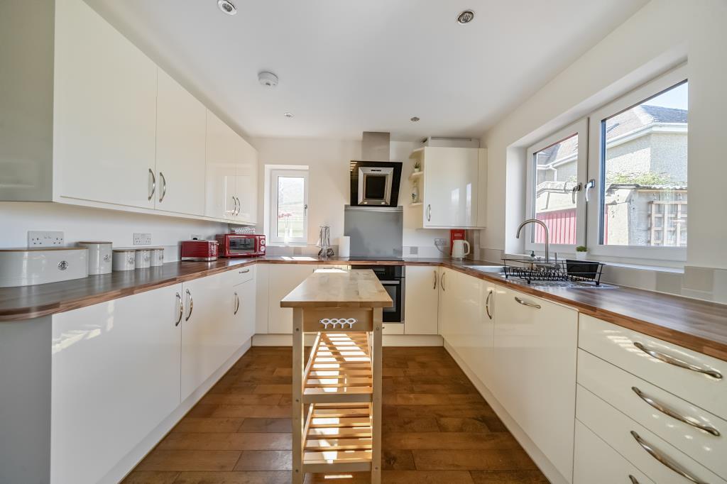
- Kitchen / Dining Room:
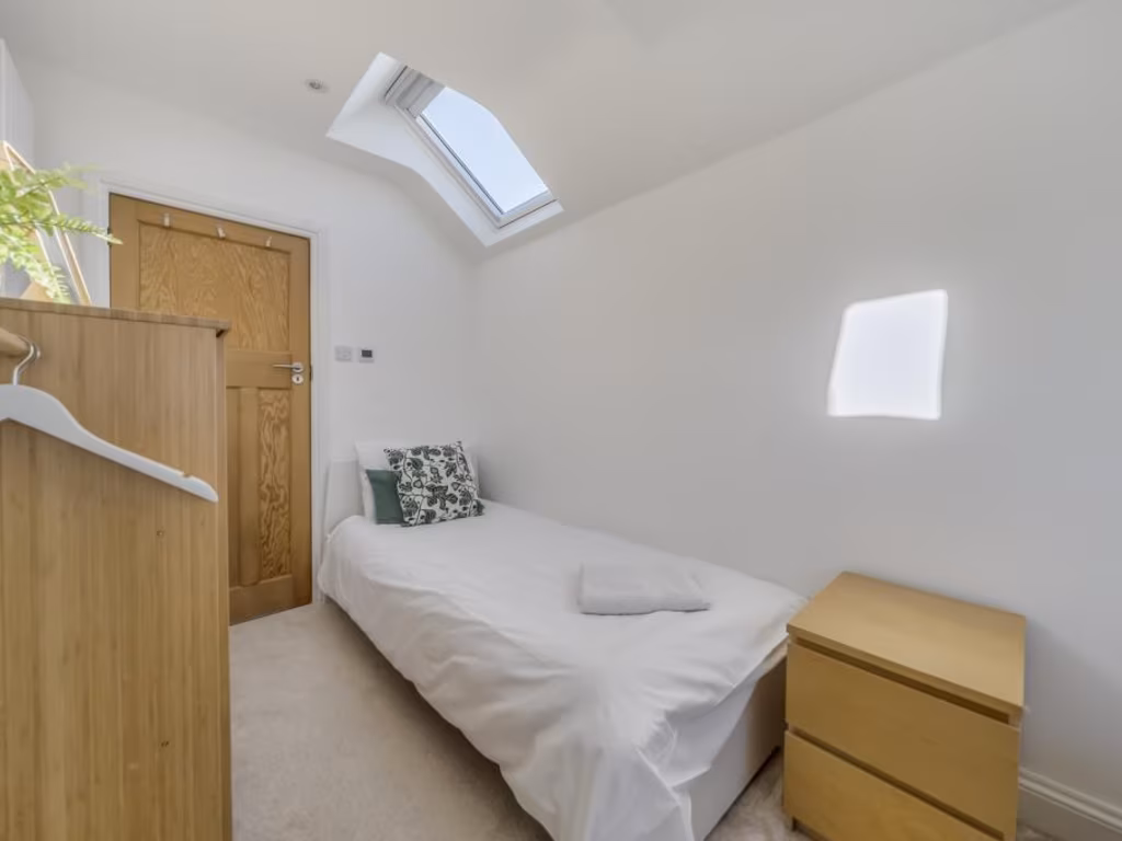
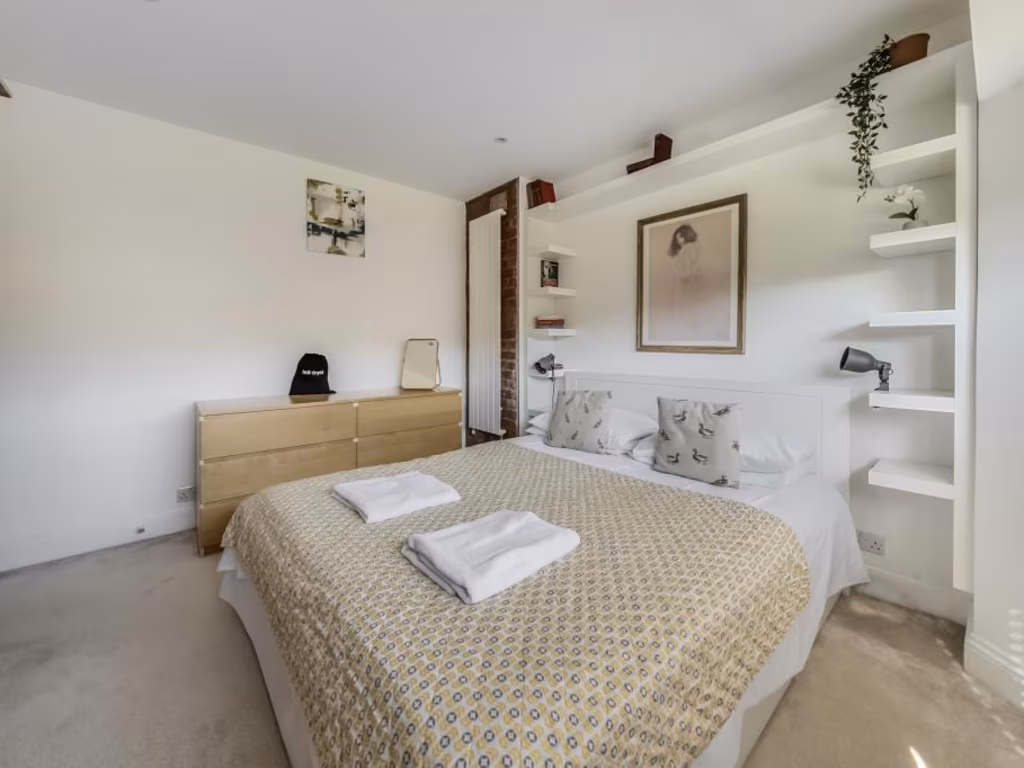
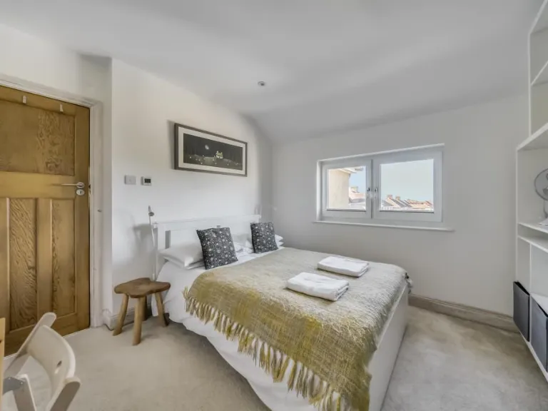
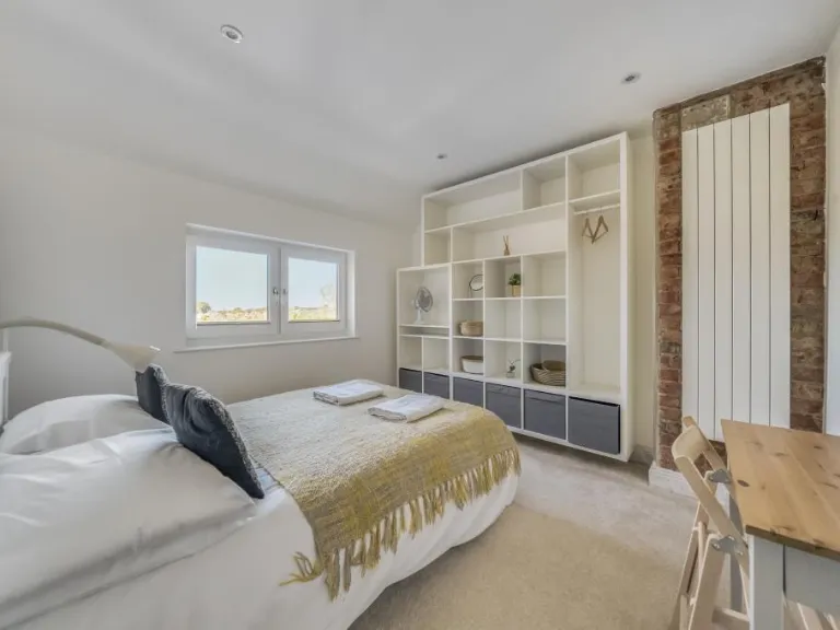
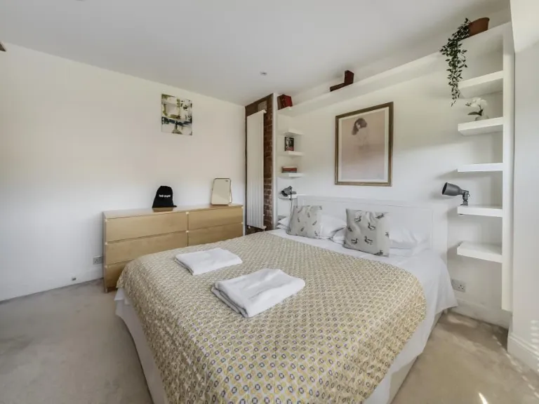
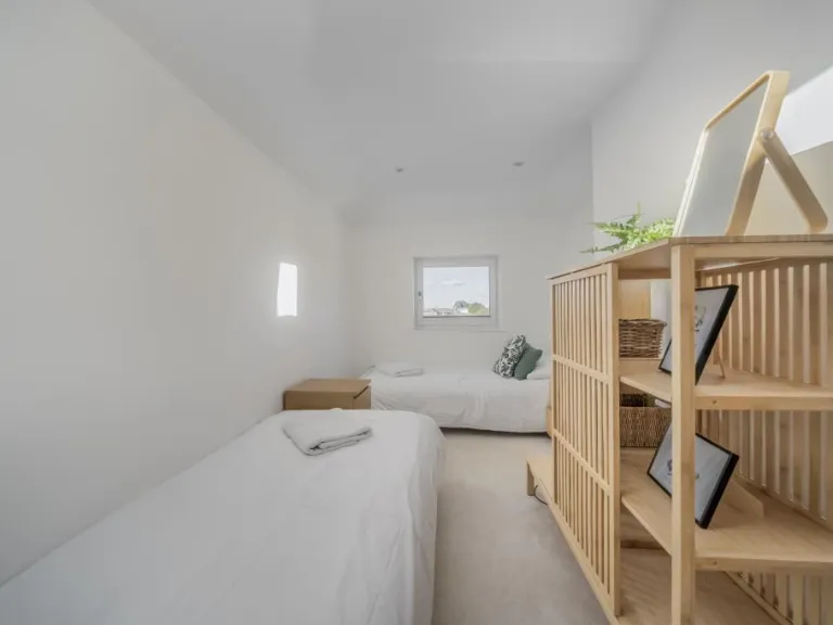
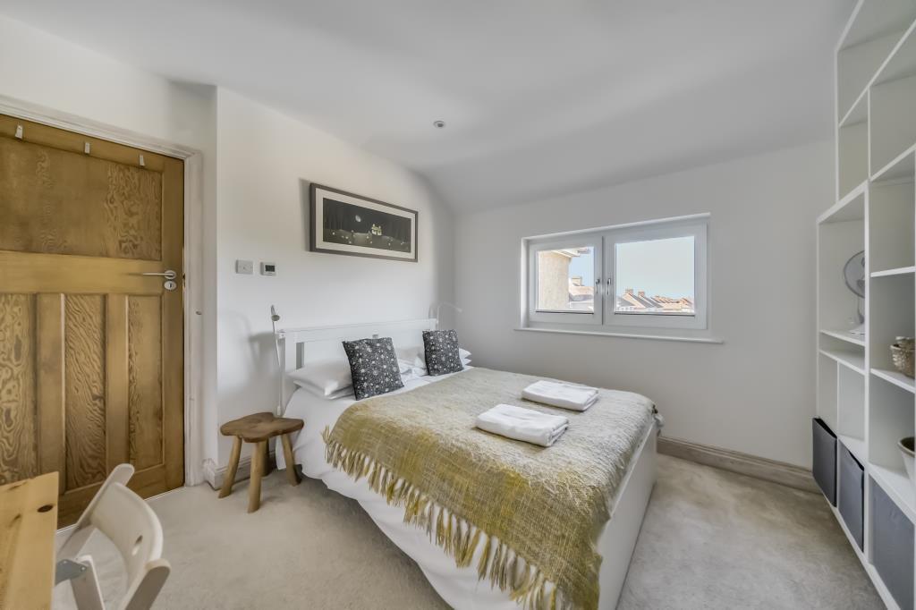
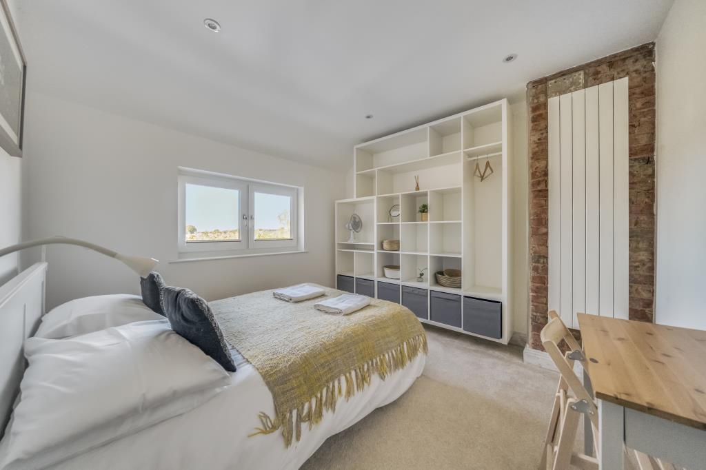
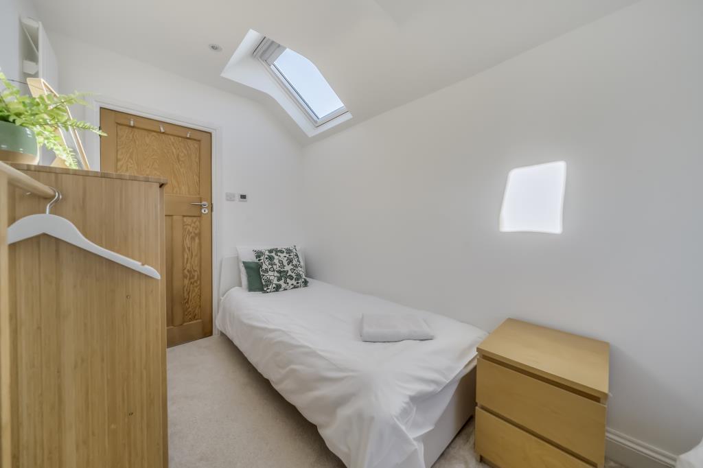
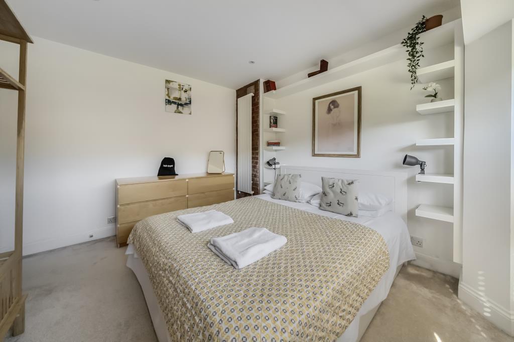
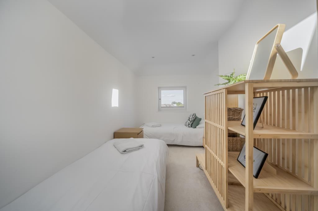
- Bedroom 3:
- Bedroom 2:
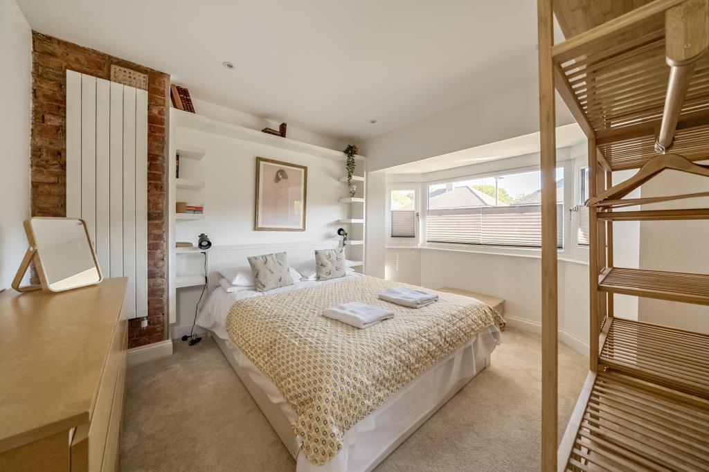
- Bedroom 1:
Textual Property Features
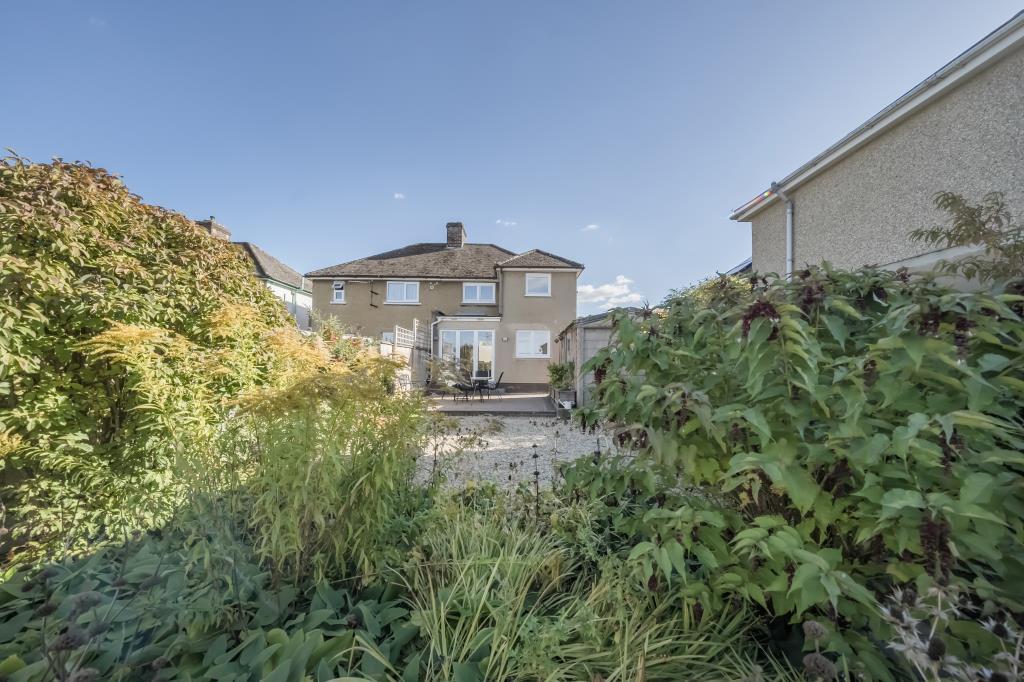
- Has Garden
- Chain Free
- Success
Detected Visual Features
- semi-detached
- 1940s
- brown facade
- bay window
- paved driveway
- red door
- arquette brickwork
- chimneys
- suburban
- modern
- living room
- large window
- natural light
- wooden flooring
EPC Details
- Fully double glazed
- Solid brick, as built, no insulation (assumed)
- Boiler and radiators, mains gas
- Low energy lighting in 55% of fixed outlets
- Suspended, no insulation (assumed)
Nearby Schools
- Pegasus School
- Orchard Meadow Primary School
- Tyndale Community School
- Wood Farm Primary School
- Cheney School
- Windmill Primary School
- Bayards Hill School
- New Marston Primary School
- Barton Park Primary School
- Beckley Church of England Primary School
- St John Fisher Catholic Primary School, Littlemore
- Our Lady's Roman Catholic Primary School
- Kings Education (Oxford)
- Greyfriars Catholic School
- Horspath Church of England Primary School
- Headington School
- St Andrew's Church of England Primary School, Oxford
- Oxford Montessori Schools
- St Frideswide Church of England Primary School
- Sandhills Community Primary School
- Windale Primary School
- Church Cowley St James Church of England Primary School
- St Christopher's Church of England School, Cowley
- Oxford Spires Academy
- St Joseph's Catholic Primary School, Oxford
Nearest General Shops
- Id: 227101495
- Tags:
- Addr:
- City: Oxford
- Housenumber: 7
- Postcode: OX3 8DH
- Street: The Roundway
- Building: retail
- Name: Oxford Tatoo Makers
- Phone: +44 1865 750784
- Shop: tattoo
- Source:
- TagsNormalized:
- Lat: 51.7620379
- Lon: -1.1958455
- FullGeoHash: gcpnkycpwz0z
- PartitionGeoHash: gcpn
- Images:
- FoodStandards: null
- Distance: 676.7
,- Id: 7792597372
- Tags:
- Name: Lumiere Medispa Cosmetic Skincare
- Shop: beauty
- TagsNormalized:
- Lat: 51.7624893
- Lon: -1.1943019
- FullGeoHash: gcpnkz466erg
- PartitionGeoHash: gcpn
- Images:
- FoodStandards: null
- Distance: 638.3
,- Id: 830010347
- Tags:
- Building: retail
- Name: Gracie J's
- Shop: beauty
- TagsNormalized:
- Lat: 51.7598842
- Lon: -1.1895729
- FullGeoHash: gcpnkytg0vwp
- PartitionGeoHash: gcpn
- Images:
- FoodStandards: null
- Distance: 218.5
}
Nearest Grocery shops
- Id: 227101491
- Tags:
- Addr:
- City: Oxford
- Housenumber: 2
- Postcode: OX3 8DH
- Street: The Roundway
- Building: retail
- Name: Headington Superstore
- Shop: convenience
- Source:
- TagsNormalized:
- Lat: 51.7622993
- Lon: -1.1956217
- FullGeoHash: gcpnkz135zzy
- PartitionGeoHash: gcpn
- Images:
- FoodStandards: null
- Distance: 684.9
,- Id: 227101489
- Tags:
- Addr:
- City: Oxford
- Housenumber: 8
- Postcode: OX3 8DH
- Street: The Roundway
- Building: retail
- Name: Khair Din Groceries & Butchers
- Shop: greengrocer
- TagsNormalized:
- retail
- butcher
- grocer
- greengrocer
- shop
- Lat: 51.7619993
- Lon: -1.1958866
- FullGeoHash: gcpnkycptb43
- PartitionGeoHash: gcpn
- Images:
- FoodStandards: null
- Distance: 676.1
,- Id: 834805053
- Tags:
- Addr:
- City: Oxford
- Country: GB
- Hamlet: Risinghurst
- Housenumber: 46
- Postcode: OX3 8HR
- Street: Downside Road
- Village: Headington
- Amenity: post_office
- Building: retail
- Name: Risinghurst Post Office
- Opening_hours:
- Post_office: Mo,Tu,Th,Fr 09:00-13:00,14:00-17:30; We 09:00-13:00; Sa 09:00-12:30
- Ref:
- Shop: convenience
- TagsNormalized:
- office
- post office
- retail
- convenience
- shop
- Lat: 51.7598955
- Lon: -1.1894769
- FullGeoHash: gcpnkytg5pve
- PartitionGeoHash: gcpn
- Images:
- FoodStandards: null
- Distance: 217.3
}
Nearest Supermarkets
- Id: 8400778203
- Tags:
- Brand:
- Name: Co-op Food
- Not:
- Operator: Gather & Gather
- Operator:wikipedia: en:The Co-operative Group
- Shop: supermarket
- TagsNormalized:
- co-op
- co-op food
- food
- supermarket
- shop
- Lat: 51.7552707
- Lon: -1.225213
- FullGeoHash: gcpnkjgb63wz
- PartitionGeoHash: gcpn
- Images:
- FoodStandards: null
- Distance: 2552.1
,- Id: 158616937
- Tags:
- Brand: ALDI
- Brand:wikidata: Q41171672
- Brand:wikipedia: en:Aldi
- Building: retail
- Contact:
- Website: https://stores.aldi.co.uk/oxford/horspath-driftway-retail-park
- Name: Aldi
- Opening_hours: Mo-Sa 08:00-22:00; Su 10:00-16:00
- Shop: supermarket
- Source: survey
- Wheelchair: yes
- TagsNormalized:
- aldi
- retail
- supermarket
- shop
- Lat: 51.7413521
- Lon: -1.1971875
- FullGeoHash: gcpnkg0ppx07
- PartitionGeoHash: gcpn
- Images:
- FoodStandards: null
- Distance: 1953.3
,- Id: 82274284
- Tags:
- Addr:
- Housenumber: 9,11
- Postcode: OX3 9HP
- Brand: Waitrose
- Brand:wikidata: Q771734
- Brand:wikipedia: en:Waitrose
- Building: supermarket
- Fhrs:
- Name: Waitrose
- Official_name: Waitrose & Partners
- Opening_hours: Mo-Th 08:30-20:00; Fr 08:30-21:00; Sa 08:30-19:00; Su 10:00-16:00
- Operator: Waitrose & Partners
- Shop: supermarket
- Source:
- Addr: survey
- Geometry: Bing
- Source:addr:postcode: FSA Food Hygiene Ratings Database
- TagsNormalized:
- Lat: 51.7607656
- Lon: -1.2106573
- FullGeoHash: gcpnkqy2mdh3
- PartitionGeoHash: gcpn
- Images:
- FoodStandards:
- Id: 269168
- FHRSID: 269168
- LocalAuthorityBusinessID: 09/00025/COM
- BusinessName: Waitrose
- BusinessType: Retailers - supermarkets/hypermarkets
- BusinessTypeID: 7840
- AddressLine1: 9 - 11 Old High Street
- AddressLine2: Oxford
- AddressLine3: Oxfordshire
- AddressLine4: null
- PostCode: OX3 9HP
- RatingValue: 5
- RatingKey: fhrs_5_en-GB
- RatingDate: 2018-08-01
- LocalAuthorityCode: 269
- LocalAuthorityName: Oxford City
- LocalAuthorityWebSite: http://www.oxford.gov.uk
- LocalAuthorityEmailAddress: foodsafety@oxford.gov.uk
- Scores:
- Hygiene: 0
- Structural: 0
- ConfidenceInManagement: 0
- NewRatingPending: false
- Geocode:
- Longitude: -1.21112400000000
- Latitude: 51.76140300000000
- Distance: 1560.6
}
Nearest Religious buildings
- Id: 82274289
- Tags:
- Amenity: place_of_worship
- Building: chapel
- Denomination: pentecostal
- Name: Cornerstone Christian Centre
- Operator: Assemblies of God
- Religion: christian
- Source: Bing;OS_OpenData_StreetView
- TagsNormalized:
- place of worship
- chapel
- pentecostal
- christian
- church
- Lat: 51.7586023
- Lon: -1.1995517
- FullGeoHash: gcpnkwqe8qv3
- PartitionGeoHash: gcpn
- Images:
- FoodStandards: null
- Distance: 769.3
,- Id: 82274271
- Tags:
- Amenity: place_of_worship
- Building: church
- Denomination: anglican
- Name: Holy Trinity Church
- Religion: christian
- Source: photograph
- Wikidata: Q16246860
- TagsNormalized:
- place of worship
- church
- anglican
- christian
- Lat: 51.7577557
- Lon: -1.1979792
- FullGeoHash: gcpnkwpwv0cy
- PartitionGeoHash: gcpn
- Images:
- FoodStandards: null
- Distance: 659.6
,- Id: 145435339
- Tags:
- Addr:
- Postcode: OX3 8HW
- Street: Collinwood Road
- Amenity: place_of_worship
- Building: church
- Denomination: united_reformed
- Name: Collinwood Road United Reformed Church
- Religion: christian
- Source:
- TagsNormalized:
- place of worship
- church
- united reformed
- christian
- Lat: 51.7619533
- Lon: -1.1913915
- FullGeoHash: gcpnkyurnx6n
- PartitionGeoHash: gcpn
- Images:
- FoodStandards: null
- Distance: 479.5
}
Nearest Medical buildings
- Id: 364769145
- Tags:
- Amenity: doctors
- Healthcare: doctor
- Name: Barton Surgery
- Phone: +44 1865 744221
- TagsNormalized:
- doctor
- doctors
- health
- healthcare
- surgery
- Lat: 51.7678298
- Lon: -1.1963591
- FullGeoHash: gcpnsb0c6ycv
- PartitionGeoHash: gcpn
- Images:
- FoodStandards: null
- Distance: 1216.7
,- Id: 894729268
- Tags:
- Amenity: pharmacy
- Dispensing: yes
- Healthcare: pharmacy
- Name: Barton Pharmacy
- Phone: +441865 763108
- TagsNormalized:
- Lat: 51.7675074
- Lon: -1.1959583
- FullGeoHash: gcpnkzcps4uf
- PartitionGeoHash: gcpn
- Images:
- FoodStandards: null
- Distance: 1172.3
,- Id: 227101497
- Tags:
- Addr:
- City: Oxford
- Housenumber: 3
- Postcode: OX3 8DH
- Street: The Roundway
- Amenity: pharmacy
- Building: retail
- Dispensing: yes
- Healthcare: pharmacy
- Name: Roundway Pharmacy
- Phone: +44 1865 766994
- Source:
- TagsNormalized:
- pharmacy
- retail
- health
- healthcare
- Lat: 51.7622643
- Lon: -1.1957259
- FullGeoHash: gcpnkz13196j
- PartitionGeoHash: gcpn
- Images:
- FoodStandards: null
- Distance: 687.4
,- Id: 7792597373
- Tags:
- Amenity: dentist
- Healthcare: dentist
- Name: 310 Dental Care
- TagsNormalized:
- dentist
- health
- healthcare
- dental
- Lat: 51.7624872
- Lon: -1.1942462
- FullGeoHash: gcpnkz46k4cr
- PartitionGeoHash: gcpn
- Images:
- FoodStandards: null
- Distance: 635.7
}
Nearest Leisure Facilities
- Id: 959100035
- Tags:
- Leisure: pitch
- Sport: cricket
- TagsNormalized:
- pitch
- leisure
- cricket
- sports
- Lat: 51.7591971
- Lon: -1.1850579
- FullGeoHash: gcpnmn3p4jsv
- PartitionGeoHash: gcpn
- Images:
- FoodStandards: null
- Distance: 263.2
,- Id: 24231344
- Tags:
- Created_by: osm2go v0.6.14
- Leisure: pitch
- Lit: no
- Source: yahoo_imagery
- Sport: basketball
- Surface: asphalt
- TagsNormalized:
- pitch
- leisure
- basketball
- sports
- Lat: 51.7576335
- Lon: -1.1913499
- FullGeoHash: gcpnkyhqpd1n
- PartitionGeoHash: gcpn
- Images:
- FoodStandards: null
- Distance: 207.8
,- Id: 830692515
- Tags:
- Access: yes
- Leisure: playground
- Name: Richards Way Children's Ball Park
- Surface: grass
- TagsNormalized:
- Lat: 51.757614
- Lon: -1.1913232
- FullGeoHash: gcpnkyhtbnt1
- PartitionGeoHash: gcpn
- Images:
- FoodStandards: null
- Distance: 206.6
,- Id: 1115229738
- Tags:
- Access: private
- Leisure: swimming_pool
- TagsNormalized:
- swimming
- swimming pool
- pool
- leisure
- Lat: 51.7566987
- Lon: -1.1891781
- FullGeoHash: gcpnkyn0d5ut
- PartitionGeoHash: gcpn
- Images:
- FoodStandards: null
- Distance: 160
,- Id: 135899676
- Tags:
- Leisure: playground
- Source:
- TagsNormalized:
- Lat: 51.7575502
- Lon: -1.1870071
- FullGeoHash: gcpnkyptsdxm
- PartitionGeoHash: gcpn
- Images:
- FoodStandards: null
- Distance: 111.7
}
Nearest Tourist attractions
- Id: 825405417
- Tags:
- Addr:
- City: Oxford
- Country: GB
- Housenumber: 265
- Postcode: OX3 9EH
- Street: London Road
- Building: detached
- Guest_house: bed_and_breakfast
- Internet_access: yes
- Name: Mulberry Guest House
- Phone: +44 1865 767 114
- Smoking: no
- Tourism: guest_house
- Website: http://www.mulberryguesthouse.co.uk/
- TagsNormalized:
- detached
- guest house
- tourism
- Lat: 51.7624539
- Lon: -1.2019626
- FullGeoHash: gcpnkxhf0hz8
- PartitionGeoHash: gcpn
- Images:
- FoodStandards: null
- Distance: 1053.2
,- Id: 252141995
- Tags:
- Cemetery: grave
- Name: Grave of C. S. Lewis
- Tourism: attraction
- TagsNormalized:
- Lat: 51.7573158
- Lon: -1.1981485
- FullGeoHash: gcpnkwps1ngw
- PartitionGeoHash: gcpn
- Images:
- FoodStandards: null
- Distance: 675.4
,- Id: 830022005
- Tags:
- Addr:
- City: Oxford
- Country: GB
- Housename: The Kilns
- Street: Lewis Close
- Building: detached
- Building:levels: 1
- Name: The Kilns - CS Lewis's Home
- Roof:
- Tourism: attraction
- Wikidata: Q7744401
- TagsNormalized:
- detached
- attraction
- tourism
- Lat: 51.7567951
- Lon: -1.1899515
- FullGeoHash: gcpnkyj90jgu
- PartitionGeoHash: gcpn
- Images:
- FoodStandards: null
- Distance: 175.9
}
Nearest Train stations
- Id: 9768081
- Tags:
- Name: Culham
- Naptan:
- Network: National Rail
- Public_transport: station
- Railway: station
- Ref:
- Source: NPE
- Wikidata: Q2740729
- Wikipedia: en:Culham railway station
- TagsNormalized:
- Lat: 51.653894
- Lon: -1.2365831
- FullGeoHash: gcpjgg799x8z
- PartitionGeoHash: gcpj
- Images:
- FoodStandards: null
- Distance: 12048.7
,- Id: 21623338
- Tags:
- Name: Radley
- Naptan:
- Network: National Rail
- Public_transport: station
- Railway: station
- Ref:
- Wikidata: Q4386081
- Wikipedia: en:Radley railway station
- TagsNormalized:
- Lat: 51.6856231
- Lon: -1.2402569
- FullGeoHash: gcpn5c0fefmr
- PartitionGeoHash: gcpn
- Images:
- FoodStandards: null
- Distance: 8810.6
,- Id: 14724359
- Tags:
- Name: Islip
- Naptan:
- Network: National Rail
- Public_transport: station
- Railway: station
- Ref:
- Wikidata: Q1847555
- Wikipedia: en:Islip railway station
- TagsNormalized:
- Lat: 51.826163
- Lon: -1.2376466
- FullGeoHash: gcpngfdv29pb
- PartitionGeoHash: gcpn
- Images:
- FoodStandards: null
- Distance: 8295.7
,- Id: 3824689657
- Tags:
- Name: Oxford Parkway
- Naptan:
- Network: National Rail
- Public_transport: station
- Railway: station
- Ref:
- Train: yes
- Wikidata: Q7973289
- Wikipedia: en:Oxford Parkway railway station
- TagsNormalized:
- Lat: 51.8037471
- Lon: -1.275093
- FullGeoHash: gcpndyxd8nms
- PartitionGeoHash: gcpn
- Images:
- FoodStandards: null
- Distance: 7834.1
,- Id: 6481707942
- Tags:
- Name: Oxford
- Name:cy: Rhydychen
- Naptan:
- Network: National Rail
- Platforms: 3
- Public_transport: station
- Railway: station
- Ref:
- Wheelchair: yes
- Wikidata: Q1880536
- Wikipedia: en:Oxford railway station
- TagsNormalized:
- Lat: 51.7534512
- Lon: -1.2699542
- FullGeoHash: gcpn7j7jxyt9
- PartitionGeoHash: gcpn
- Images:
- FoodStandards: null
- Distance: 5636.2
}
Nearest Hotels
- Id: 123658649
- Tags:
- Addr:
- Housenumber: 102
- Postcode: OX4 1AR
- Street: St Clements Street
- Amenity: pub
- Building: yes
- Name: Old Black Horse Inn
- Phone: +44 1865 244691
- Source: Bing
- Tourism: hotel
- Website: https://www.oldblackhorse.com/
- TagsNormalized:
- Lat: 51.7499978
- Lon: -1.2427882
- FullGeoHash: gcpn7sz18fvc
- PartitionGeoHash: gcpn
- Images:
- FoodStandards: null
- Distance: 3848.9
,- Id: 9458888138
- Tags:
- Brand: Premier Inn
- Brand:wikidata: Q2108626
- Brand:wikipedia: en:Premier Inn
- Internet_access: wlan
- Internet_access:fee: customers
- Internet_access:operator: Virgin Media
- Internet_access:ssid: Premier Inn Free Wi-Fi
- Name: Premier Inn
- Tourism: hotel
- TagsNormalized:
- Lat: 51.731321
- Lon: -1.203597
- FullGeoHash: gcpnk97sf1jj
- PartitionGeoHash: gcpn
- Images:
- FoodStandards: null
- Distance: 3151.4
,- Id: 132647571
- Tags:
- Addr:
- Housenumber: 76
- Postcode: OX3 9AJ
- Building: commercial
- Cuisine: asian
- Name: Mount Pleasant
- Phone: +44 1865 762749
- Source: survey
- Source:geometry: Bing
- Tourism: hotel
- TagsNormalized:
- Lat: 51.7592182
- Lon: -1.2136403
- FullGeoHash: gcpnkqkr21s5
- PartitionGeoHash: gcpn
- Images:
- FoodStandards: null
- Distance: 1741.4
}
Tags
- semi-detached
- 1940s
- brown facade
- bay window
- paved driveway
- red door
- arquette brickwork
- chimneys
- suburban
- modern
- living room
- large window
- natural light
- wooden flooring
Local Market Stats
- Average Price/sqft: £471
- Avg Income: £66100
- Rental Yield: 4.4%
- Social Housing: 9%
- Planning Success Rate: 82%
AirBnB Data
- 1km average: £111/night
- Listings in 1km: 2
Similar Properties
 3 bedroom semi-detached house for sale in East Oxford, Oxford, OX4 — £390,000 • 3 bed • 2 bath • 710 ft²
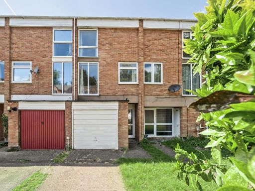 3 bedroom terraced house for sale in Headington, Oxford, OX3 — £375,000 • 3 bed • 2 bath • 936 ft²
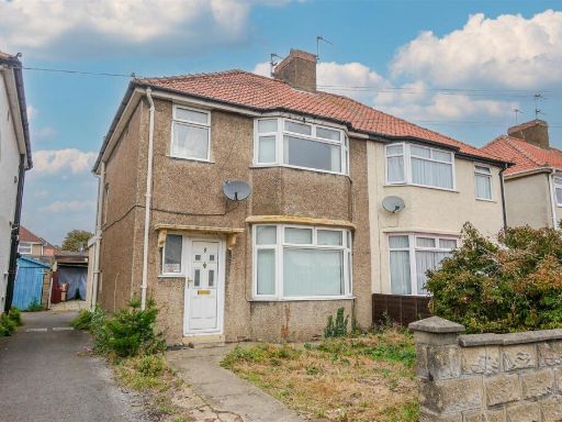 3 bedroom semi-detached house for sale in Napier Road, Oxford, OX4 — £425,000 • 3 bed • 1 bath • 884 ft²
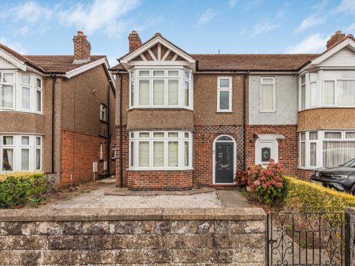 3 bedroom semi-detached house for sale in Horspath Road, Oxford, OX4 — £500,000 • 3 bed • 2 bath • 1081 ft²
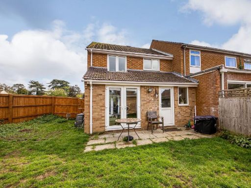 3 bedroom terraced house for sale in Bowgrave Copse, Abingdon, OX14 — £400,000 • 3 bed • 1 bath • 893 ft²
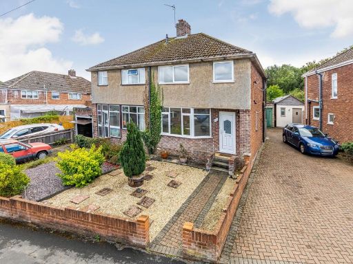 3 bedroom semi-detached house for sale in Bagley Close, Kennington, OX1 — £350,000 • 3 bed • 1 bath • 840 ft²
Meta
- {
"@context": "https://schema.org",
"@type": "Residence",
"name": "3 bedroom semidetached house for sale in Risinghurst, Oxfor…",
"description": "",
"url": "https://propertypiper.co.uk/property/c8b022fb-a469-4d6c-a6ae-010850091032",
"image": "https://image-a.propertypiper.co.uk/6e6ac571-11f5-4287-bad0-bdeecfcd3dc2-1024.jpeg",
"address": {
"@type": "PostalAddress",
"streetAddress": "5 GROVELANDS ROAD HEADINGTON OXFORD",
"postalCode": "OX3 8HZ",
"addressLocality": "Oxford",
"addressRegion": "Oxford East",
"addressCountry": "England"
},
"geo": {
"@type": "GeoCoordinates",
"latitude": 51.758056502863795,
"longitude": -1.1884086379323715
},
"numberOfRooms": 3,
"numberOfBathroomsTotal": 1,
"floorSize": {
"@type": "QuantitativeValue",
"value": 1088,
"unitCode": "FTK"
},
"offers": {
"@type": "Offer",
"price": 500000,
"priceCurrency": "GBP",
"availability": "https://schema.org/InStock"
},
"additionalProperty": [
{
"@type": "PropertyValue",
"name": "Feature",
"value": "semi-detached"
},
{
"@type": "PropertyValue",
"name": "Feature",
"value": "1940s"
},
{
"@type": "PropertyValue",
"name": "Feature",
"value": "brown facade"
},
{
"@type": "PropertyValue",
"name": "Feature",
"value": "bay window"
},
{
"@type": "PropertyValue",
"name": "Feature",
"value": "paved driveway"
},
{
"@type": "PropertyValue",
"name": "Feature",
"value": "red door"
},
{
"@type": "PropertyValue",
"name": "Feature",
"value": "arquette brickwork"
},
{
"@type": "PropertyValue",
"name": "Feature",
"value": "chimneys"
},
{
"@type": "PropertyValue",
"name": "Feature",
"value": "suburban"
},
{
"@type": "PropertyValue",
"name": "Feature",
"value": "modern"
},
{
"@type": "PropertyValue",
"name": "Feature",
"value": "living room"
},
{
"@type": "PropertyValue",
"name": "Feature",
"value": "large window"
},
{
"@type": "PropertyValue",
"name": "Feature",
"value": "natural light"
},
{
"@type": "PropertyValue",
"name": "Feature",
"value": "wooden flooring"
}
]
}
High Res Floorplan Images
Compatible Floorplan Images
FloorplanImages Thumbnail