CO2 7WE - 2 bedroom apartment for sale in Lancer House, Butt Road, Co…
View on Property Piper
2 bedroom apartment for sale in Lancer House, Butt Road, Colchester, CO2
Property Details
- Price: £338000
- Bedrooms: 2
- Bathrooms: 1
- Property Type: undefined
- Property SubType: undefined
Brochure Descriptions
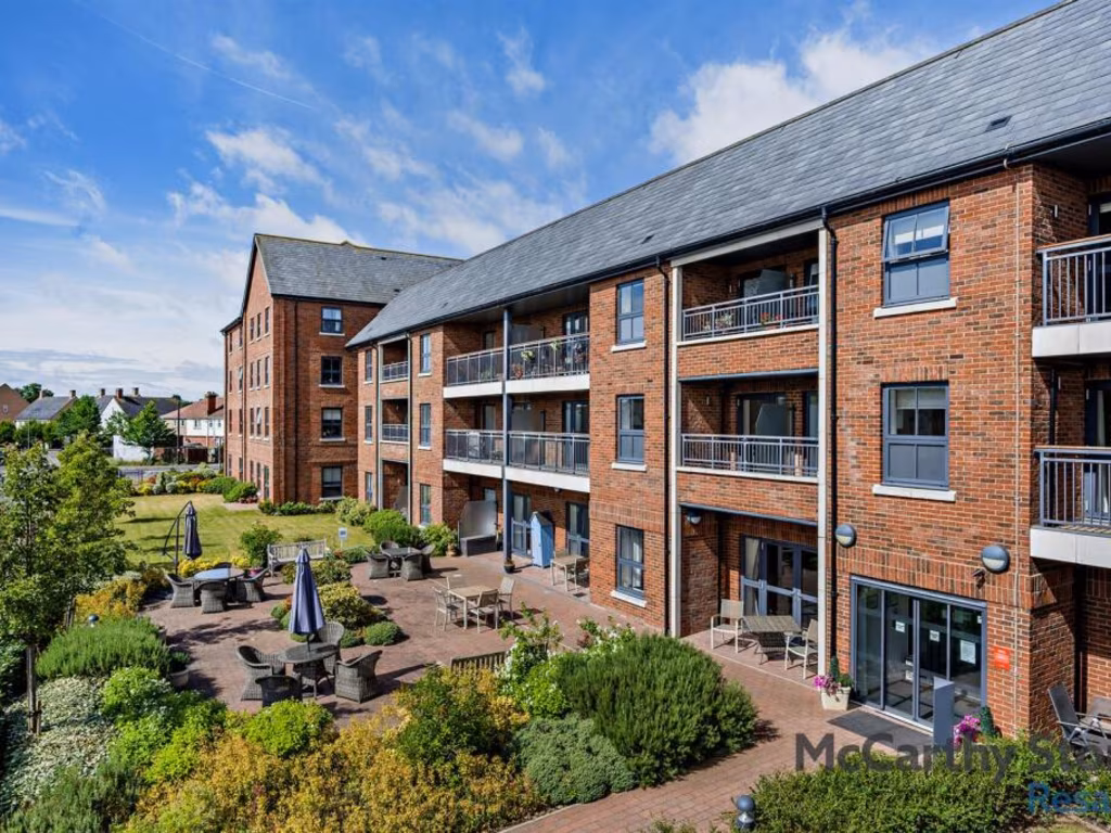
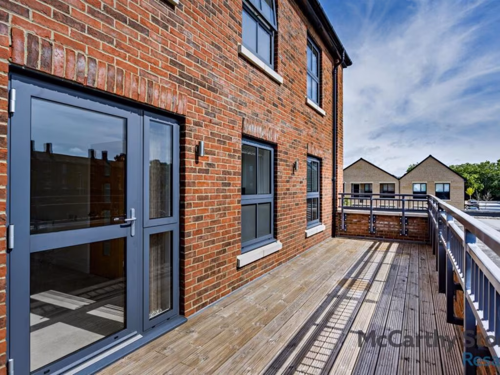
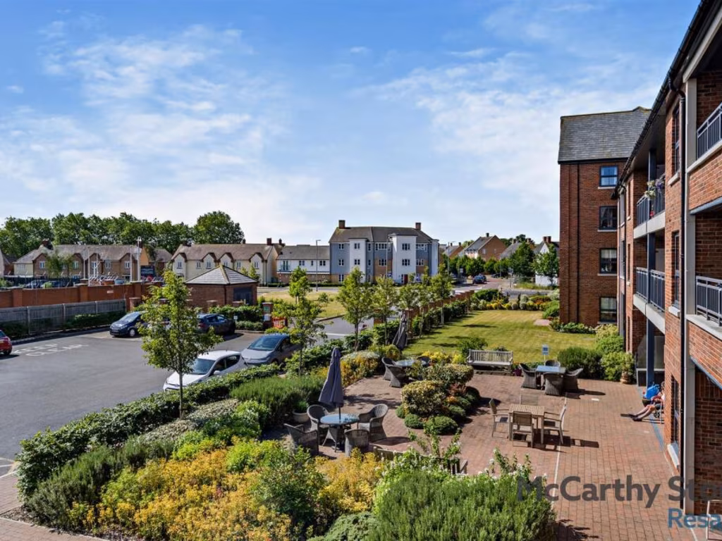
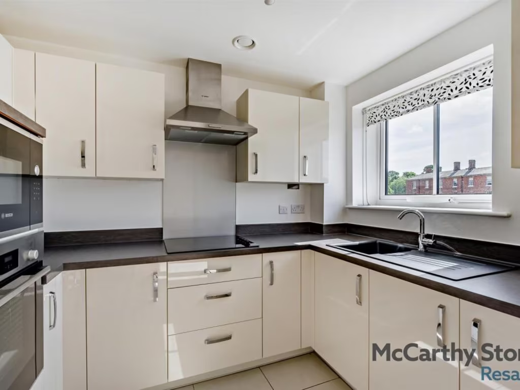
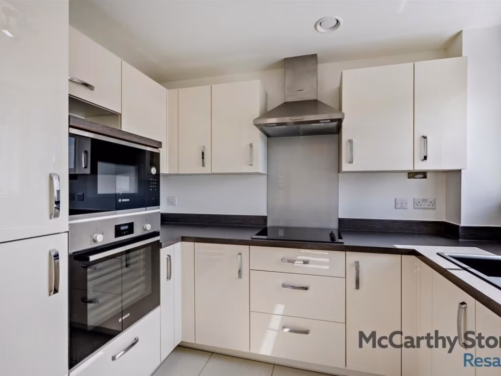
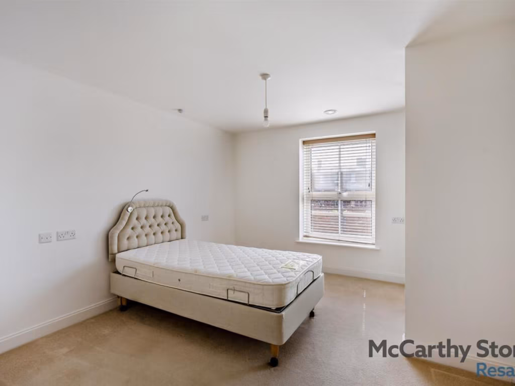
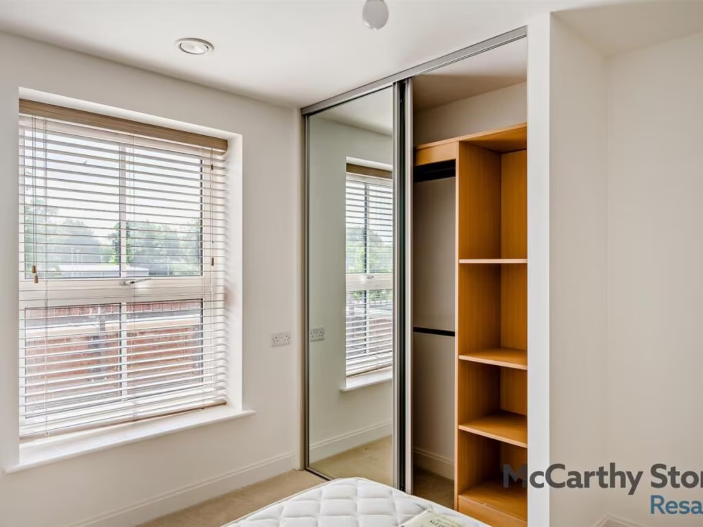
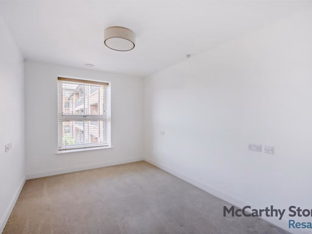
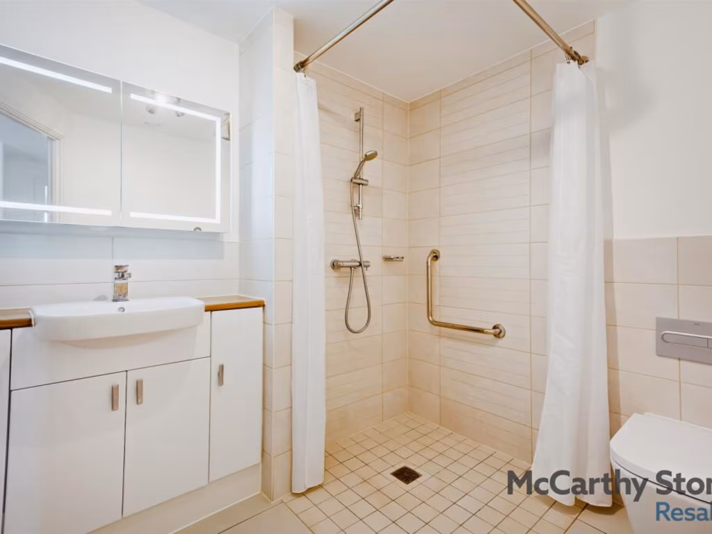
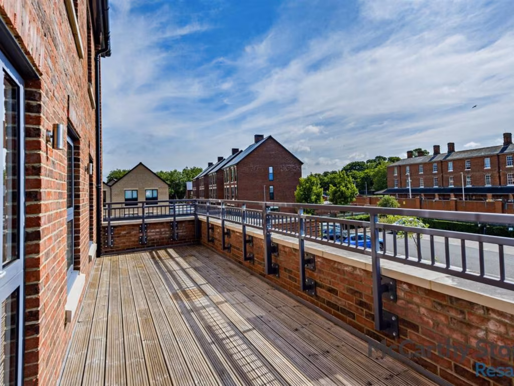
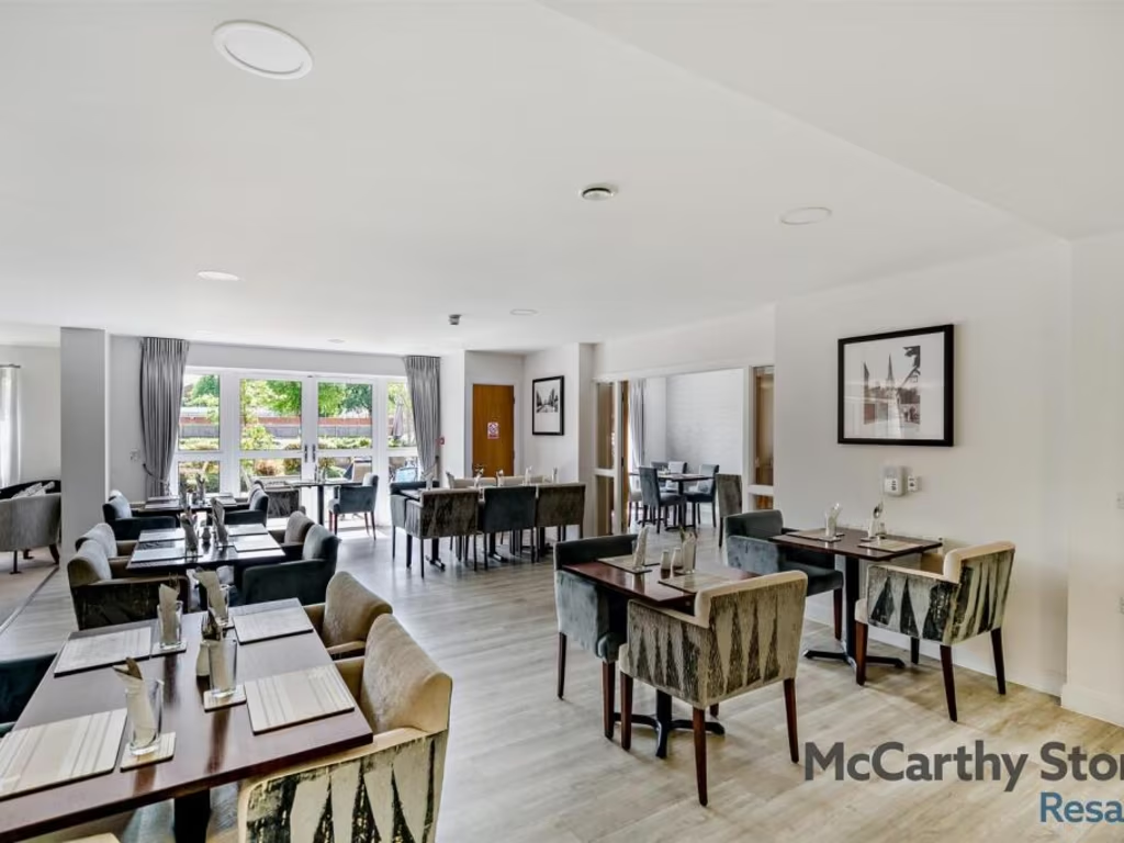
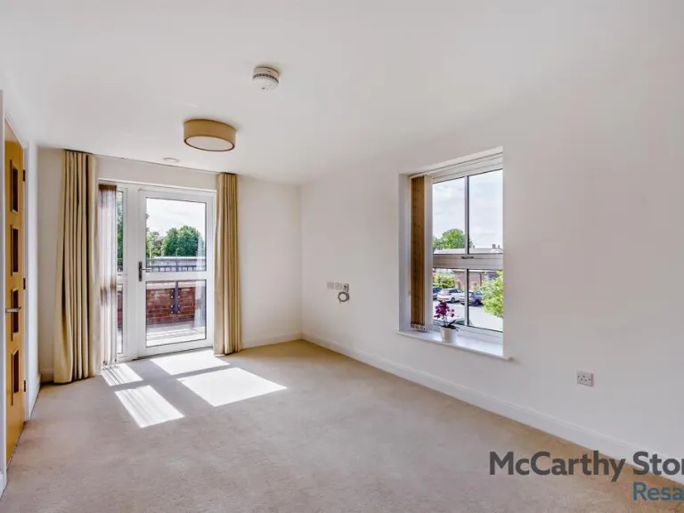
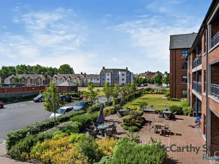
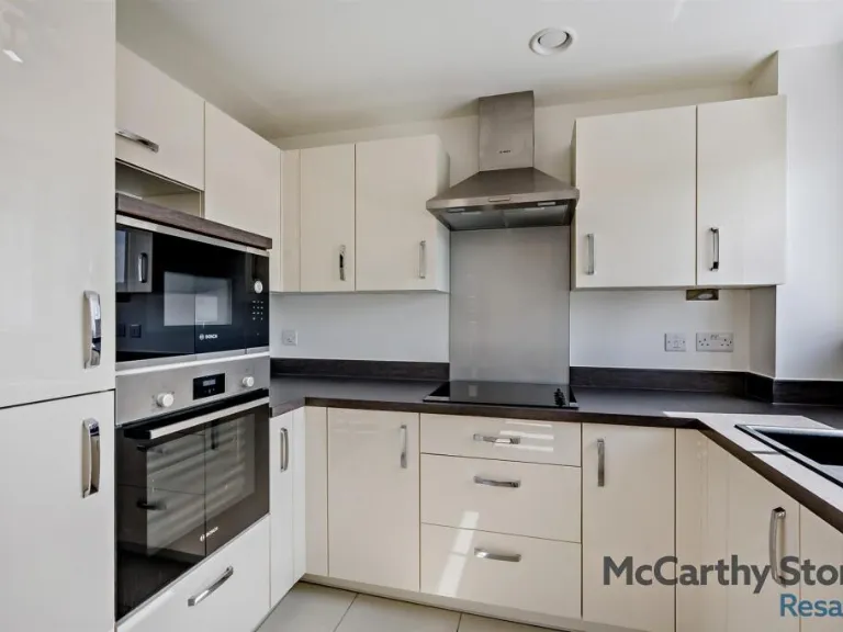
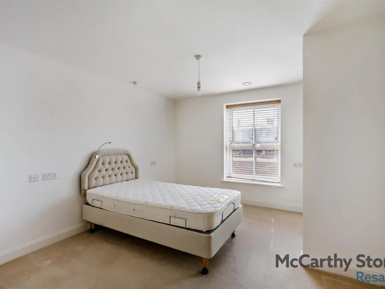
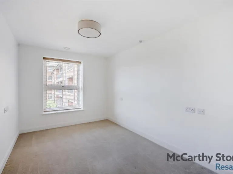
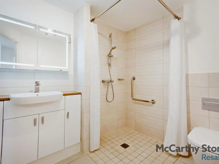
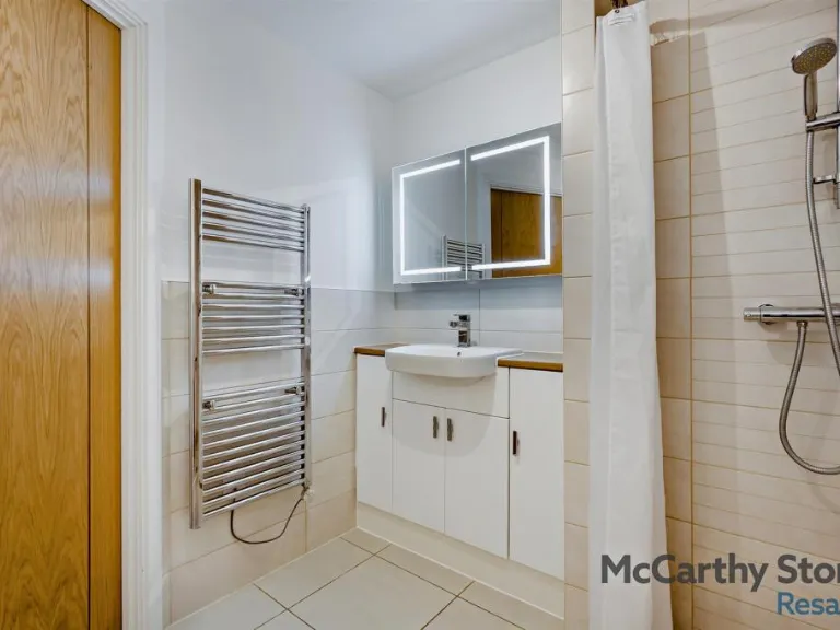
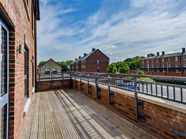
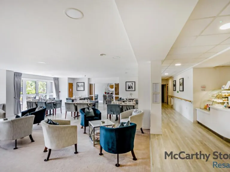
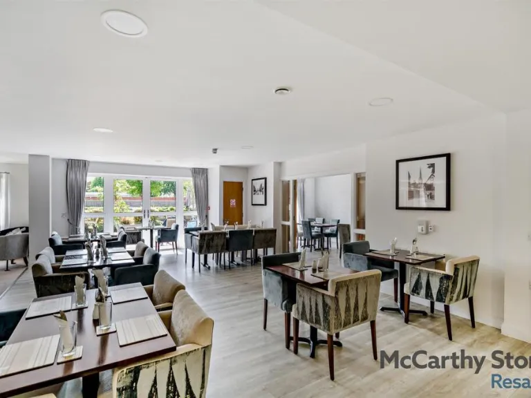
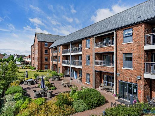
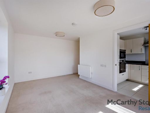
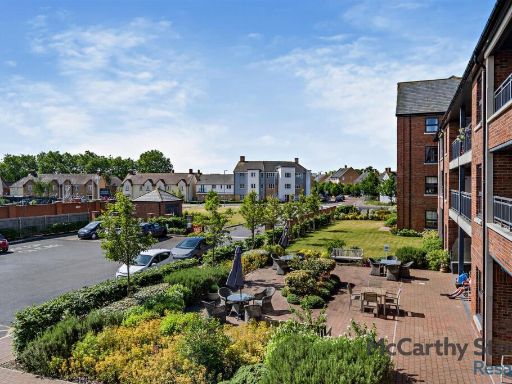
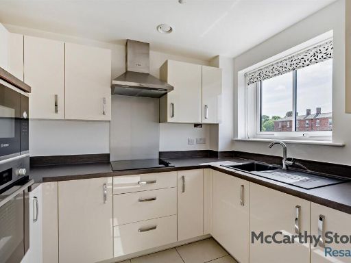
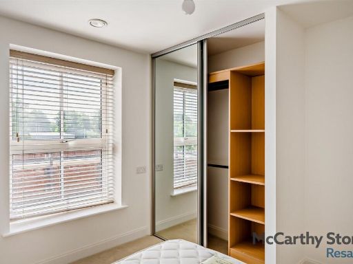
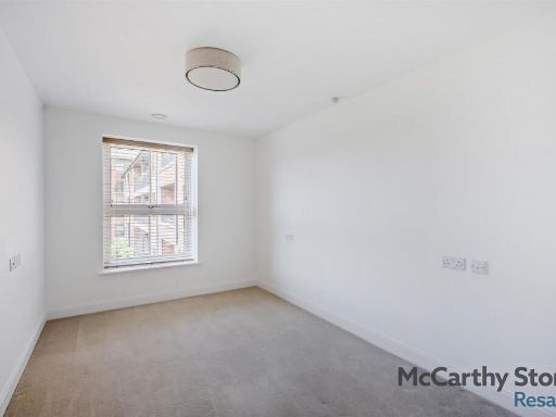
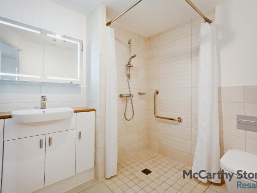
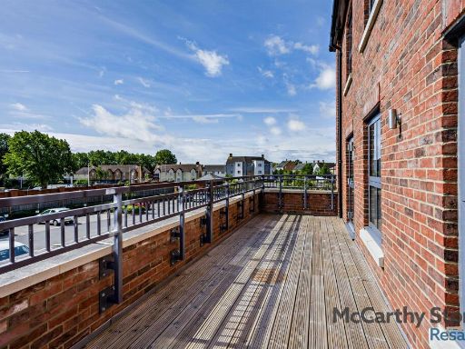
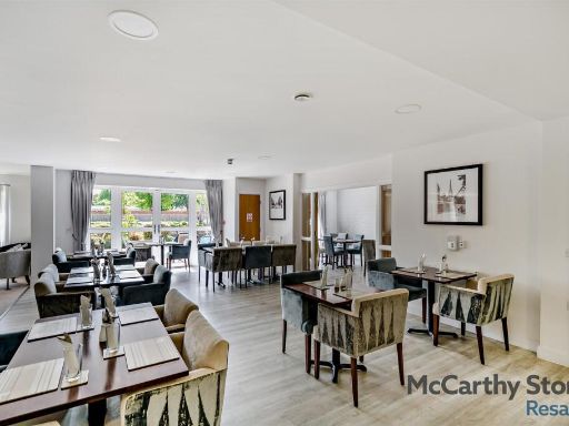
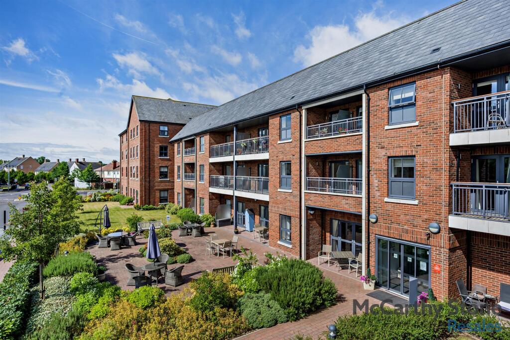
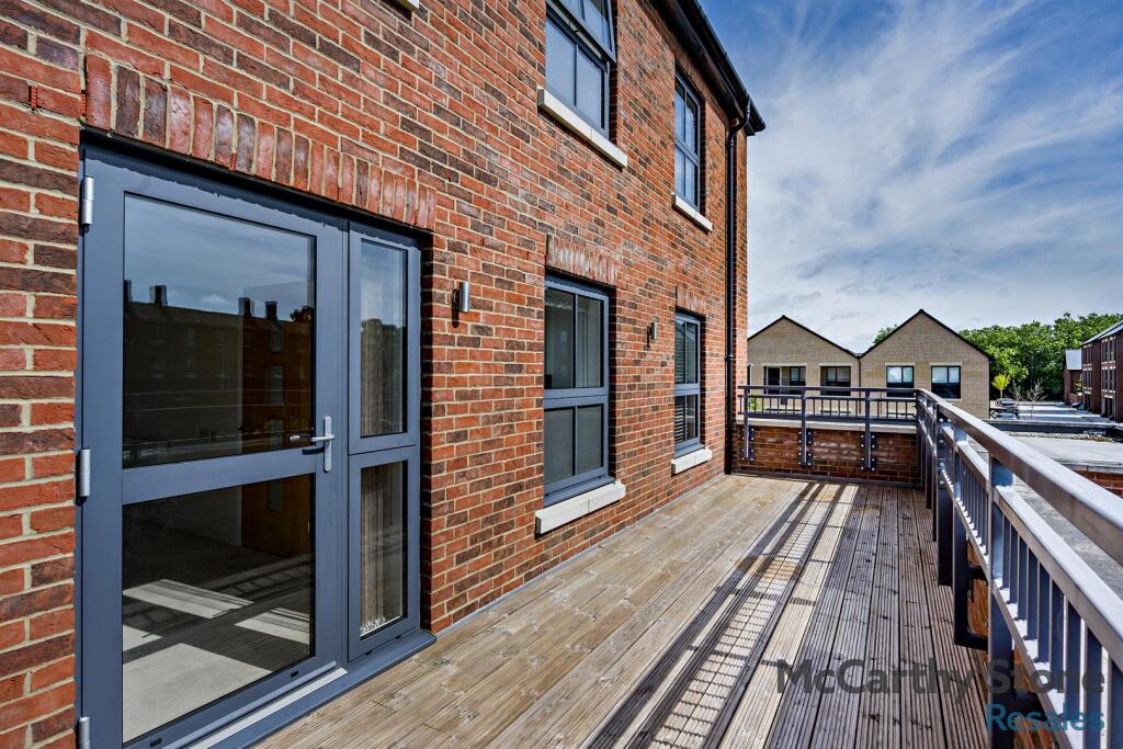
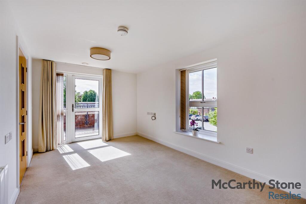
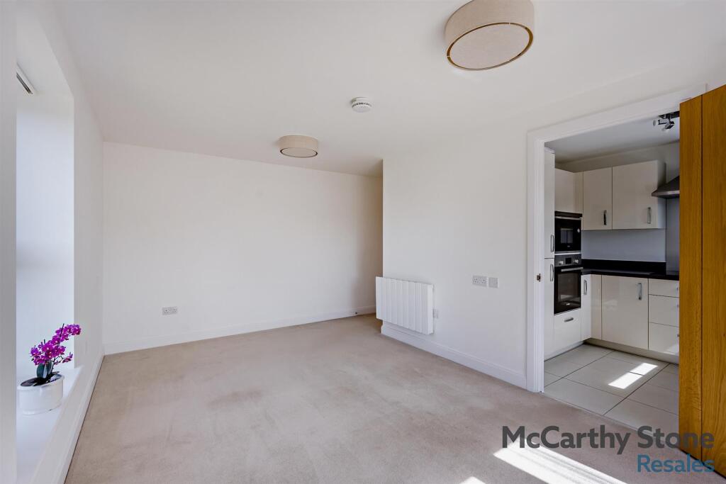
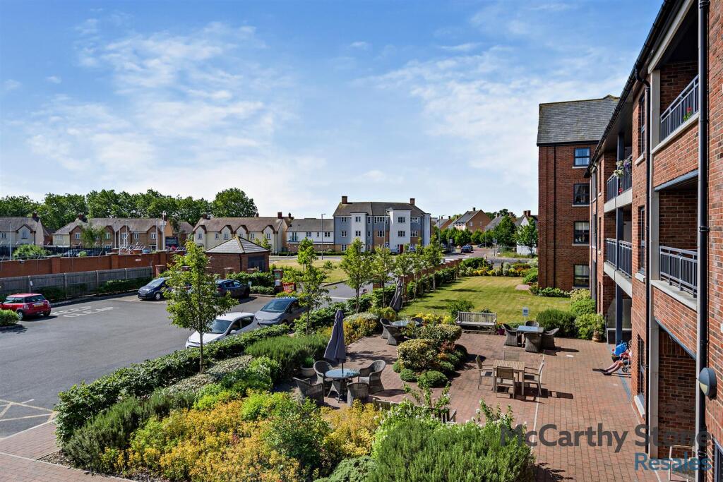
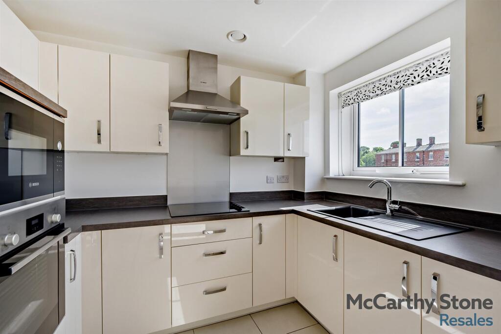
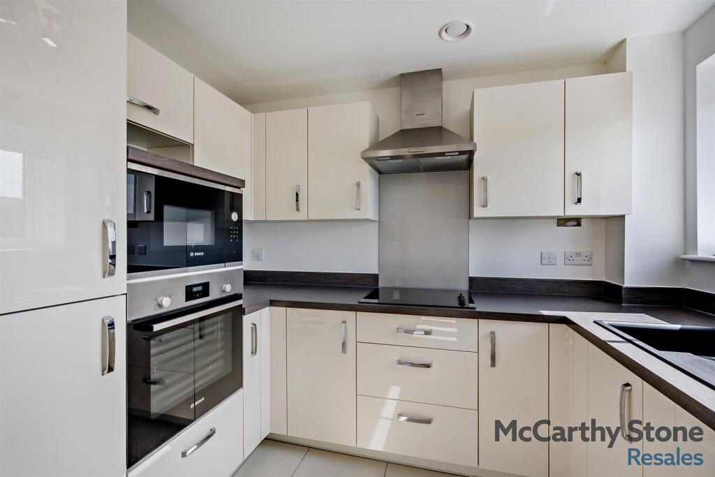
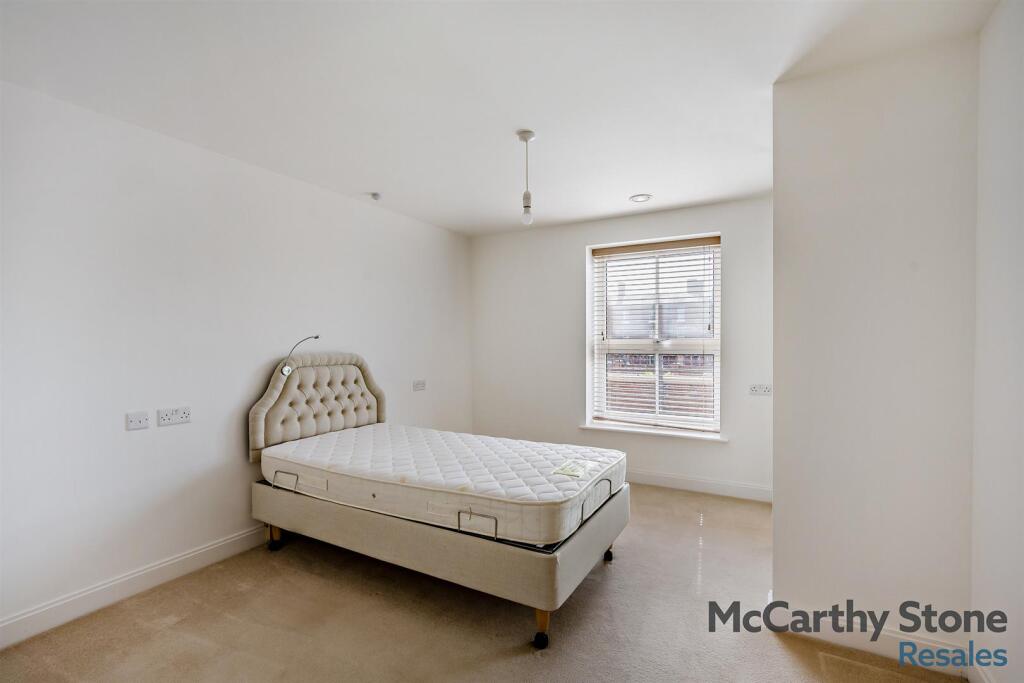
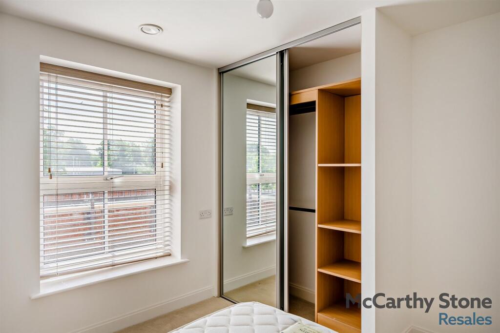
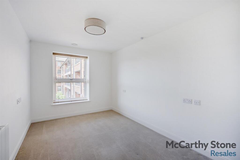
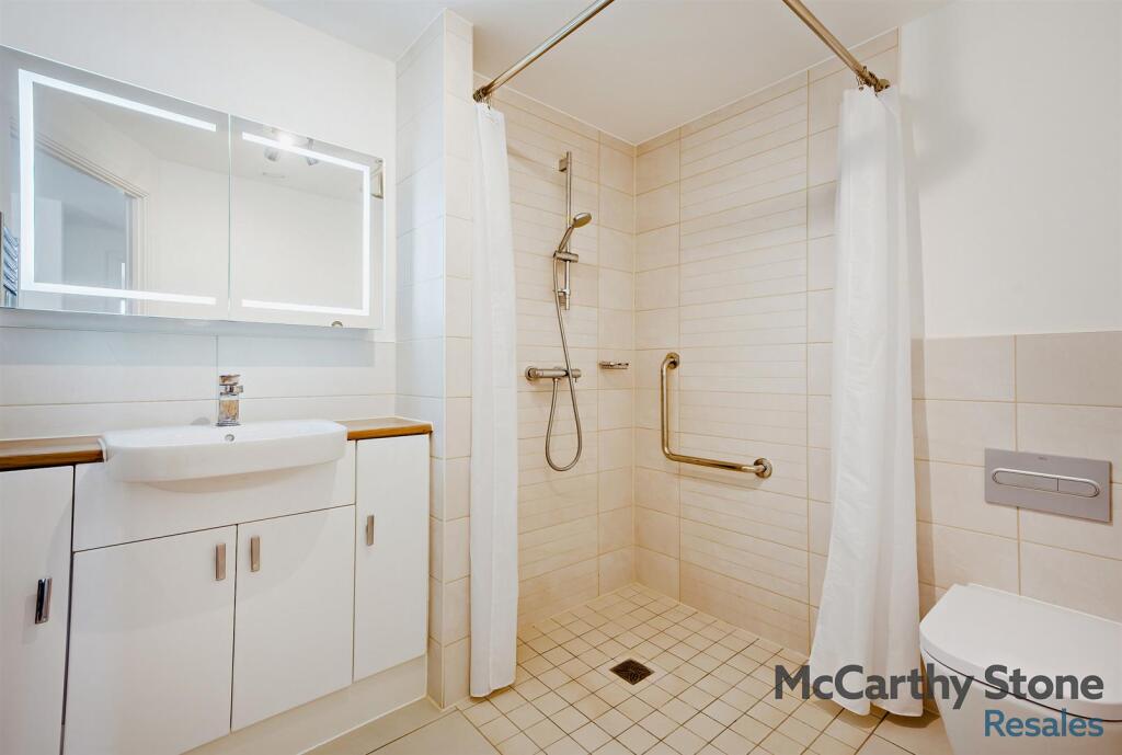
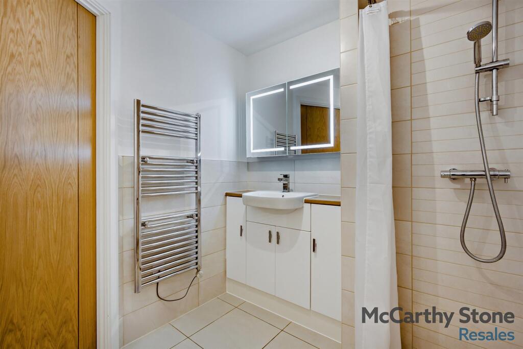
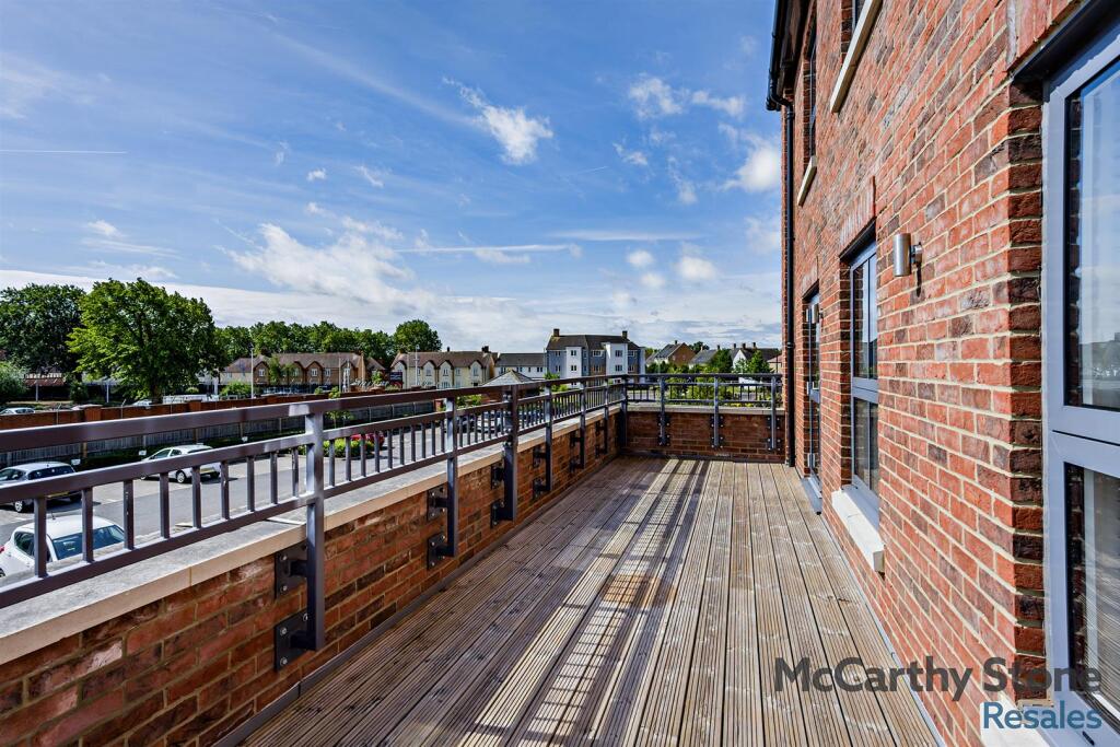
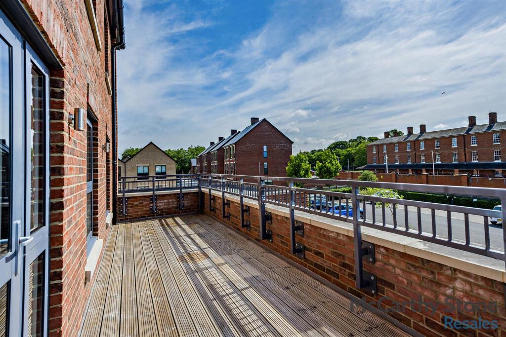
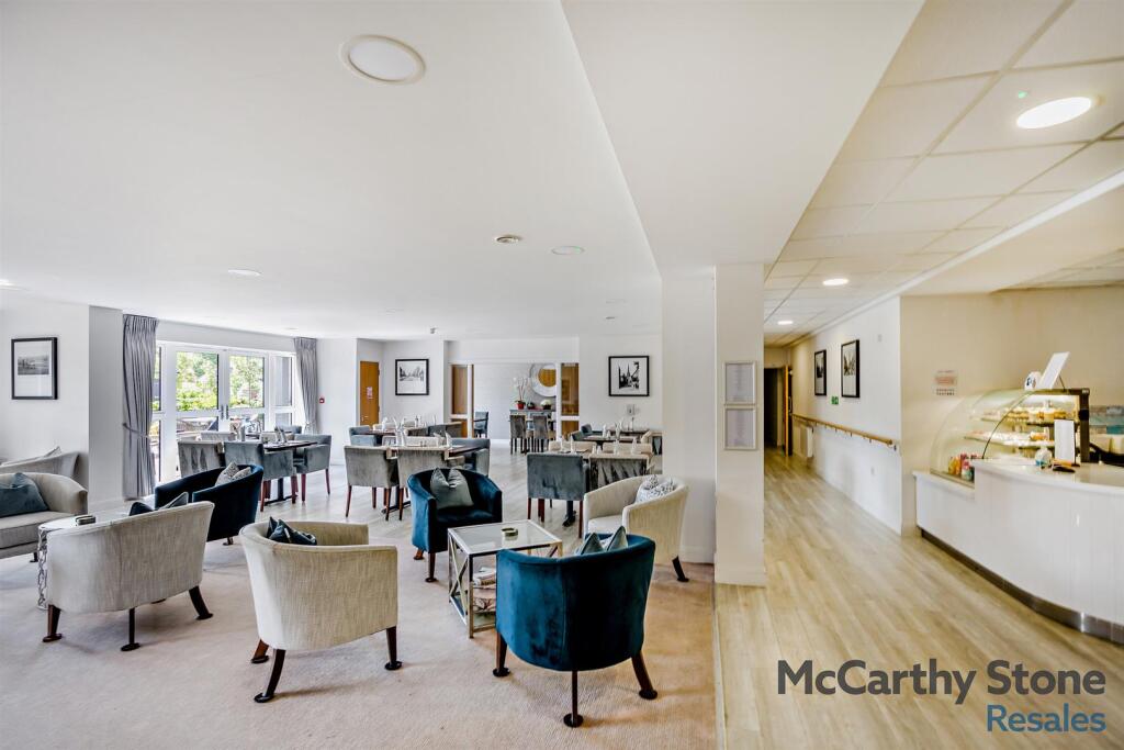
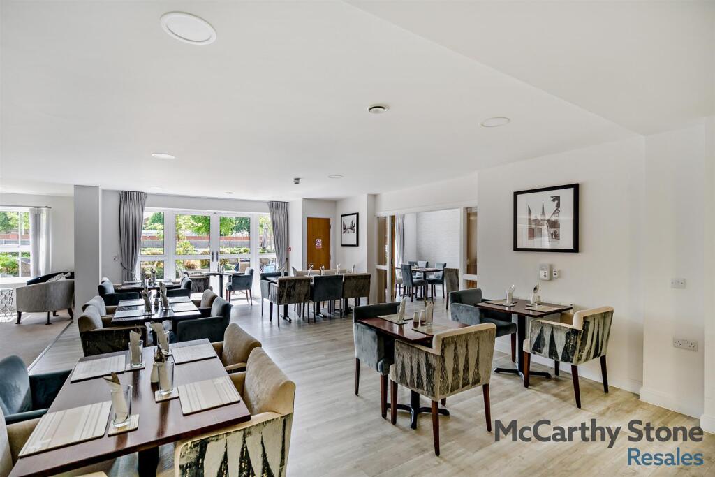
- This is a modern, two-bedroom apartment located on the first floor of Lancer House, part of a retirement development in Colchester. The apartment features two double bedrooms, one with an integrated wet room, a wet room, and a compact utility space. The living area includes a modern kitchen with integrated appliances, flowing seamlessly into a bright and spacious open-plan lounge that provides access to a generous balcony through a double-glazed door. The balcony offers scenic views of the communal gardens and the town, enhancing the overall appeal. The property benefits from excellent amenities typical of a retirement complex, including an on-site bistro and a homeowner's lounge for social events. The apartment also has allocated parking and convenient access to local transport and community services.
Image Descriptions
- residential apartment building with garden modern
- modern apartment building modern
Floorplan Description
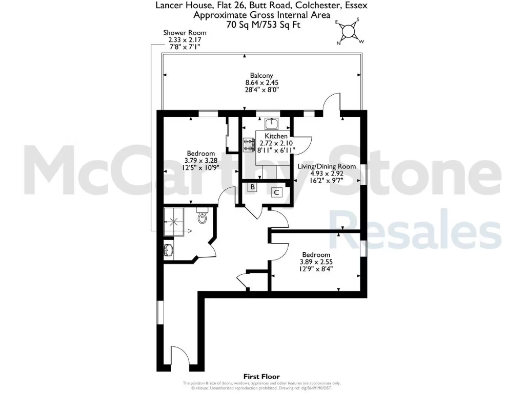
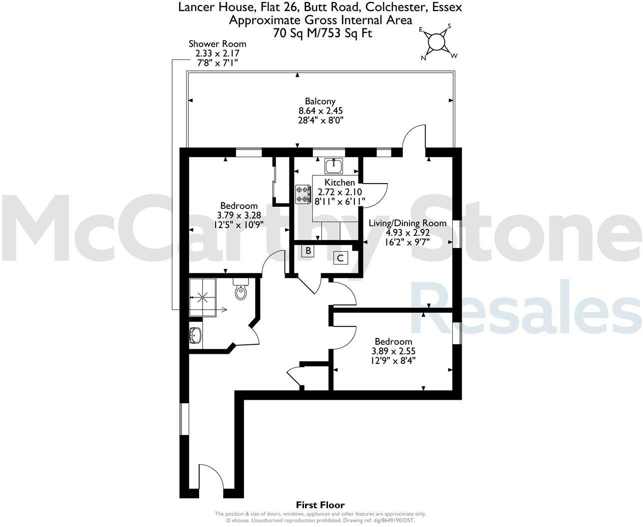
- A flat with two bedrooms, a shower room, a kitchen, a living/dining room, and a balcony.
Rooms
- Shower Room:
- Balcony:
- Kitchen:
- Living/Dining Room:
- Bedroom:
- Bedroom:
Textual Property Features
Detected Visual Features
- apartment
- modern
- brick exterior
- balconies
- garden
- outdoor seating
- residential
- multi-story
- brick facade
- balcony
- double-glazed windows
- wooden deck
- urban
- contemporary
EPC Details
- High performance glazing
- Average thermal transmittance 0.17 W/m-¦K
- Room heaters, electric
- Low energy lighting in all fixed outlets
- (other premises below)
Nearby Schools
- Monkwick Infant and Nursery School
- King's Ford Infant School and Nursery
- Prettygate Junior School
- Oxford House School
- St Mary's School for Girls
- St Thomas More's Catholic Primary School, Colchester
- St James' Church of England Primary School
- St Helena School
- Braiswick Primary School
- St Michael's Primary School and Nursery, Colchester
- Monkwick Junior School
- Prettygate Infant School
- St. George's School
- Hamilton Primary School
- St John's Green Primary School
- Colchester Prep & High School
- North Primary School and Nursery
- Cherry Tree Academy
- Montgomery Infant School and Nursery, Colchester
- Montgomery Junior School, Colchester
- Gosbecks Primary School
- Paxman Academy
- Philip Morant School and College
- St Benedict's Catholic College
- Colchester County High School for Girls
- The Thomas Lord Audley School
- Iceni Academy
- Colchester Royal Grammar School
Nearest General Shops
- Id: 395860649
- Tags:
- Addr:
- City: Colchester
- Housenumber: 84
- Postcode: CO3 3AL
- Street: Maldon Road
- Building: shop
- Name: Maldon Road Garage
- Shop: car_repair
- Source:
- Website: www.maldonroadgarage.com
- TagsNormalized:
- shop
- garage
- car repair
- repair
- Lat: 51.8849287
- Lon: 0.8904981
- FullGeoHash: u10xhm27w5ex
- PartitionGeoHash: u10x
- Images:
- FoodStandards: null
- Distance: 526.4
,- Id: 430022371
- Tags:
- Building: yes
- Name: Wilco Motorist Discount Store
- Shop: car_repair
- TagsNormalized:
- Lat: 51.8836673
- Lon: 0.8912612
- FullGeoHash: u10xhm0urbsd
- PartitionGeoHash: u10x
- Images:
- FoodStandards: null
- Distance: 419.4
,- Id: 5217414066
- Tags:
- Addr:
- City: Colchester
- County: Essex
- Housename: Ireton Road Garage
- Postcode: CO3 3AT
- Street: Ireton Road
- Description: IRETON ROAD GARAGE IN COLCHESTER, ESSEX. Established in 1994, a family run garage providing MOT's, Services, Repairs and Tyres.
- Name: Ireton Road Garage
- Opening_hours: Mo-Fr 08:00-17:30; Sa 08:00-12:00
- Phone: +44 1206 766681
- Service: repair;tyres
- Shop: car_repair
- Website: https://www.iretonroadgarage.co.uk
- TagsNormalized:
- garage
- car repair
- repair
- shop
- Lat: 51.8831784
- Lon: 0.8851057
- FullGeoHash: u10xhjh92mqw
- PartitionGeoHash: u10x
- Images:
- FoodStandards: null
- Distance: 370.4
}
Nearest Grocery shops
- Id: 521847322
- Tags:
- Addr:
- City: Colchester
- Housenumber: 66
- Postcode: CO3 3DA
- Street: Butt Road
- Amenity: fast_food
- Building: shop
- Name: Pizza Bros
- Source:
- TagsNormalized:
- Lat: 51.8858479
- Lon: 0.8947535
- FullGeoHash: u10xhme8cr0d
- PartitionGeoHash: u10x
- Images:
- FoodStandards: null
- Distance: 754.8
,- Id: 521847320
- Tags:
- Addr:
- City: Colchester
- Housenumber: 68
- Postcode: CO3 3DA
- Street: Butt Road
- Amenity: fast_food
- Building: shop
- Name: Grill Bros
- Source:
- TagsNormalized:
- Lat: 51.8858159
- Lon: 0.8947285
- FullGeoHash: u10xhme8b9jg
- PartitionGeoHash: u10x
- Images:
- FoodStandards: null
- Distance: 750.9
,- Id: 270560379
- Tags:
- Addr:
- Housename: Budgens
- Housenumber: 87
- Postcode: CO2 7XA
- Street: Drury Road
- Brand: Budgens
- Brand:wikidata: Q4985016
- Brand:wikipedia: en:Budgens
- Building: shop
- Name: Budgens
- Opening_hours: Mo-Sa 06:30-23:00; Su 07:00-23:00
- Phone: +44 1206 575606
- Shop: convenience
- Source: Knowledge
- Website: https://www.budgens.co.uk/our-stores/colchester
- Wheelchair: yes
- TagsNormalized:
- Lat: 51.8797337
- Lon: 0.8800483
- FullGeoHash: u10xhh2v6e7d
- PartitionGeoHash: u10x
- Images:
- FoodStandards: null
- Distance: 560.8
}
Nearest Supermarkets
- Id: 190078239
- Tags:
- Addr:
- City: Colchester
- Postcode: CO1 2FJ
- Street: Magdalen Street
- Alt_name: ALDI Colchester
- Brand: ALDI
- Brand:wikidata: Q41171672
- Brand:wikipedia: en:Aldi
- Building: yes
- Contact:
- Website: https://stores.aldi.co.uk/colchester/magdalen-street
- Level: 0
- Name: Aldi
- Shop: supermarket
- TagsNormalized:
- Lat: 51.8852548
- Lon: 0.9089954
- FullGeoHash: u10xhtmvt0s0
- PartitionGeoHash: u10x
- Images:
- FoodStandards: null
- Distance: 1528.8
,- Id: 190077795
- Tags:
- Addr:
- City: Colchester
- Housenumber: 11-14
- Postcode: CO1 1LG
- Street: Priory Walk
- Alt_name: Sainsbury's Colchester Superstore
- Brand: Sainsbury's
- Brand:wikidata: Q152096
- Brand:wikipedia: en:Sainsbury's
- Building: yes
- Name: Sainsbury's
- Shop: supermarket
- TagsNormalized:
- sainsburys
- supermarket
- shop
- Lat: 51.8889523
- Lon: 0.9032889
- FullGeoHash: u10xhw1g01v1
- PartitionGeoHash: u10x
- Images:
- FoodStandards: null
- Distance: 1407.2
,- Id: 35801895
- Tags:
- Building: yes
- Landuse: retail
- Name: Co-op Local
- Shop: supermarket
- TagsNormalized:
- retail
- co-op
- supermarket
- shop
- Lat: 51.8797457
- Lon: 0.9055259
- FullGeoHash: u10xhs7mkm91
- PartitionGeoHash: u10x
- Images:
- FoodStandards: null
- Distance: 1195.7
}
Nearest Religious buildings
- Id: 395436771
- Tags:
- Addr:
- City: Colchester
- Housename: The Citadel
- Postcode: CO3 3DA
- Street: Butt Road
- Amenity: place_of_worship
- Building: yes
- Denomination: salvation_army
- Name: The Salvation Army Family Worship and Community Centre
- Religion: christian
- Source:
- TagsNormalized:
- place of worship
- salvation army
- community centre
- the salvation army
- christian
- church
- Lat: 51.8864823
- Lon: 0.8954334
- FullGeoHash: u10xhmsh9j7e
- PartitionGeoHash: u10x
- Images:
- FoodStandards: null
- Distance: 839.2
,- Id: 150699094
- Tags:
- Amenity: place_of_worship
- Denomination: anglican
- Name: Christ Church, Colchester
- Religion: christian
- Wikidata: Q105083492
- TagsNormalized:
- place of worship
- anglican
- church
- christian
- Lat: 51.8832788
- Lon: 0.8835053
- FullGeoHash: u10xhj5650jm
- PartitionGeoHash: u10x
- Images:
- FoodStandards: null
- Distance: 449.5
,- Id: 395911188
- Tags:
- Addr:
- City: Colchester
- Housename: Colchester New Road
- Housenumber: 175-181
- Postcode: CO3 3BL
- Street: Maldon Road
- Amenity: place_of_worship
- Building: church
- Denomination: swedenborg
- Name: Colchester New Church
- Religion: christian
- Source:
- Url: http://newchurch.org.uk/?page_id=415
- Wikidata: Q5142098
- Wikipedia: en:Colchester New Church
- TagsNormalized:
- place of worship
- church
- christian
- Lat: 51.8820136
- Lon: 0.8826156
- FullGeoHash: u10xhhfdwkmf
- PartitionGeoHash: u10x
- Images:
- FoodStandards: null
- Distance: 418.5
}
Nearest Medical buildings
- Id: 219413044
- Tags:
- Addr:
- Postcode: CO2 7UW
- Street: Ypres Road
- Amenity: doctors
- Building: yes
- Name: Portland Medical Practice
- Opening_hours: 08:00-18:30
- Phone: +44 844 3878890
- Website: www.portlandandelmsteadsurgeries.co.uk
- TagsNormalized:
- Lat: 51.8778172
- Lon: 0.8992874
- FullGeoHash: u10xhknf4yj3
- PartitionGeoHash: u10x
- Images:
- FoodStandards: null
- Distance: 818.2
,- Id: 685919500
- Tags:
- Addr:
- City: Colchester
- Housename: Creffield Lodge
- Housenumber: 20
- Postcode: CO3 3JA
- Street: Creffield Road
- Amenity: dentist
- Building: yes
- Healthcare: dentist
- Name: Creffield Lodge Dental Practice
- TagsNormalized:
- dentist
- health
- healthcare
- dental
- Lat: 51.8852184
- Lon: 0.8890136
- FullGeoHash: u10xhjrm798x
- PartitionGeoHash: u10x
- Images:
- FoodStandards: null
- Distance: 536.4
,- Id: 395860650
- Tags:
- Addr:
- City: Colchester
- Housename: St Runwalds
- Housenumber: 94a
- Postcode: CO3 3AP
- Street: Maldon Road
- Amenity: veterinary
- Building: yes
- Name: St Runwald's Veterinary Surgery
- Source:
- Website: https://www.strunwalds.co.uk/
- TagsNormalized:
- Lat: 51.8844819
- Lon: 0.8897823
- FullGeoHash: u10xhjrcj2my
- PartitionGeoHash: u10x
- Images:
- FoodStandards: null
- Distance: 465
,- Id: 8806299292
- Tags:
- Amenity: pharmacy
- Dispensing: yes
- Healthcare: pharmacy
- Name: Cavalry Road Pharmacy
- TagsNormalized:
- Lat: 51.8823518
- Lon: 0.8931824
- FullGeoHash: u10xhkfksem5
- PartitionGeoHash: u10x
- Images:
- FoodStandards: null
- Distance: 407
}
Nearest Leisure Facilities
- Id: 265749562
- Tags:
- TagsNormalized:
- Lat: 51.8813187
- Lon: 0.8955766
- FullGeoHash: u10xhksns6y2
- PartitionGeoHash: u10x
- Images:
- FoodStandards: null
- Distance: 519.9
,- Id: 32562905
- Tags:
- Access: yes
- Leisure: playground
- TagsNormalized:
- Lat: 51.8813172
- Lon: 0.894166
- FullGeoHash: u10xhkenedd2
- PartitionGeoHash: u10x
- Images:
- FoodStandards: null
- Distance: 425.3
,- Id: 568706397
- Tags:
- Access: yes
- Leisure: playground
- TagsNormalized:
- Lat: 51.8773208
- Lon: 0.8899724
- FullGeoHash: u10xh7bp3ce8
- PartitionGeoHash: u10x
- Images:
- FoodStandards: null
- Distance: 367.3
,- Id: 568709124
- Tags:
- TagsNormalized:
- Lat: 51.8778036
- Lon: 0.8855151
- FullGeoHash: u10xhhhf1gxb
- PartitionGeoHash: u10x
- Images:
- FoodStandards: null
- Distance: 342.7
,- Id: 986983440
- Tags:
- Access: private
- Leisure: playground
- Name: Currently fenced off.
- TagsNormalized:
- Lat: 51.8810233
- Lon: 0.8920746
- FullGeoHash: u10xhk9sfgen
- PartitionGeoHash: u10x
- Images:
- FoodStandards: null
- Distance: 278.1
}
Nearest Tourist attractions
- Id: 367248452
- Tags:
- Name: Greenview Hoise B&B
- Tourism: guest_house
- TagsNormalized:
- Lat: 51.8862627
- Lon: 0.9004324
- FullGeoHash: u10xhmxems7j
- PartitionGeoHash: u10x
- Images:
- FoodStandards: null
- Distance: 1064.5
,- Id: 5035089991
- Tags:
- Name: Headgate Interpretation Panel
- Tourism: attraction
- TagsNormalized:
- Lat: 51.8879094
- Lon: 0.8964352
- FullGeoHash: u10xhmuubrqs
- PartitionGeoHash: u10x
- Images:
- FoodStandards: null
- Distance: 1008.4
,- Id: 4639541721
- Tags:
- Name: Arthur Askey Plaque.
- Note: In this building opened in 1910 as the Headgate Electric Theatre Arthur Askey C.B.E. comedian made his first proffesional appearance 31st March 1924
- Tourism: attraction
- TagsNormalized:
- Lat: 51.8877322
- Lon: 0.8966531
- FullGeoHash: u10xhmugvw34
- PartitionGeoHash: u10x
- Images:
- FoodStandards: null
- Distance: 1000.8
}
Nearest Train stations
- Id: 8235194539
- Tags:
- Name: Thompson Green station (MR2)
- Public_transport: station
- Railway: station
- Train: yes
- Usage: tourism
- TagsNormalized:
- Lat: 51.9250992
- Lon: 0.7609321
- FullGeoHash: u10x3kdjeh01
- PartitionGeoHash: u10x
- Images:
- FoodStandards: null
- Distance: 10042.2
,- Id: 2013212330
- Tags:
- Name: Marks Tey
- Naptan:
- Network: National Rail
- Old_name: Marks Tey Junction
- Public_transport: station
- Railway: station
- Ref:
- Source: NPE
- Start_date: 1844
- Tiploc: MRKSTEY
- Wikidata: Q2025932
- Wikipedia: en:Marks Tey railway station
- TagsNormalized:
- Lat: 51.8808094
- Lon: 0.782551
- FullGeoHash: u10x1u9gdgb6
- PartitionGeoHash: u10x
- Images:
- FoodStandards: null
- Distance: 7248
,- Id: 1643615541
- Tags:
- Name: Hythe (Colchester)
- Naptan:
- Network: National Rail
- Public_transport: station
- Railway: station
- Ref:
- Train: yes
- Wikidata: Q2552020
- Wikipedia: en:Hythe railway station (Essex)
- TagsNormalized:
- Lat: 51.8858134
- Lon: 0.9275278
- FullGeoHash: u10xjje2ubwu
- PartitionGeoHash: u10x
- Images:
- FoodStandards: null
- Distance: 2769
,- Id: 8061429385
- Tags:
- Name: Colchester
- Naptan:
- Network: National Rail
- Public_transport: station
- Railway: station
- Ref:
- Start_date: 1843-03-29
- Train: yes
- Wikidata: Q2750618
- Wikipedia: en:Colchester railway station
- TagsNormalized:
- Lat: 51.9005793
- Lon: 0.8924554
- FullGeoHash: u10xk21yg9ny
- PartitionGeoHash: u10x
- Images:
- Q2750618-1
- Q2750618-2
- Q2750618-3
- FoodStandards: null
- Distance: 2260.6
,- Id: 26579230
- Tags:
- Name: Colchester Town
- Naptan:
- Network: National Rail
- Old_name: St Botolph's
- Operator: Abellio Greater Anglia
- Platforms: 1
- Public_transport: station
- Railway: station
- Ref:
- Wikidata: Q4489756
- Wikipedia: en:Colchester Town railway station
- TagsNormalized:
- Lat: 51.8865086
- Lon: 0.9054279
- FullGeoHash: u10xhtekcfpz
- PartitionGeoHash: u10x
- Images:
- FoodStandards: null
- Distance: 1365.8
}
Nearest Hotels
- Id: 687270772
- Tags:
- Addr:
- City: Colchester
- Postcode: CO1 1DJ
- Street: High Street
- Building: yes
- Name: Red Lion
- Tourism: hotel
- Wheelchair: limited
- Wikidata: Q17536531
- TagsNormalized:
- Lat: 51.8895765
- Lon: 0.9002875
- FullGeoHash: u10xhqpwdnph
- PartitionGeoHash: u10x
- Images:
- FoodStandards: null
- Distance: 1315.5
,- Id: 1029488224
- Tags:
- Addr:
- City: Colchester
- Housenumber: 51
- Postcode: CO1 1PY
- Street: North Hill
- Name: The North Hill Hotel
- Phone: +44 1206 574001
- Tourism: hotel
- Website: http://northhillhotel.com/
- Wheelchair: no
- TagsNormalized:
- Lat: 51.8911047
- Lon: 0.8961708
- FullGeoHash: u10xhqkxd712
- PartitionGeoHash: u10x
- Images:
- FoodStandards: null
- Distance: 1309.2
,- Id: 4639541700
- Tags:
- Name: Blue Ivy
- Tourism: hotel
- TagsNormalized:
- Lat: 51.8905787
- Lon: 0.8965168
- FullGeoHash: u10xhqkud2gr
- PartitionGeoHash: u10x
- Images:
- FoodStandards: null
- Distance: 1267
}
Tags
- apartment
- modern
- brick exterior
- balconies
- garden
- outdoor seating
- residential
- multi-story
- modern
- apartment
- brick facade
- balcony
- double-glazed windows
- wooden deck
- urban
- contemporary
Local Market Stats
- Average Price/sqft: £309
- Avg Income: £46200
- Rental Yield: 5.2%
- Social Housing: 11%
- Planning Success Rate: 83%
AirBnB Data
- 1km average: £82/night
- Listings in 1km: 3
Similar Properties
 1 bedroom apartment for sale in 28 Lancer House, Butt Road, Colchester, CO2 — £240,000 • 1 bed • 1 bath • 560 ft²
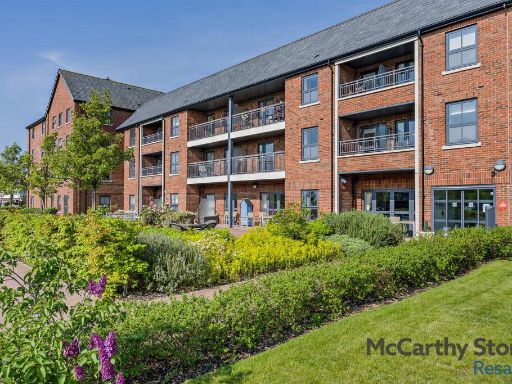 1 bedroom apartment for sale in Lancer House, Butt Road, Colchester, CO2 — £240,000 • 1 bed • 1 bath • 549 ft²
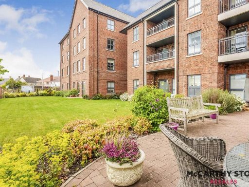 2 bedroom apartment for sale in Lancer House, Butt Road, Colchester, CO2 — £350,000 • 2 bed • 1 bath • 818 ft²
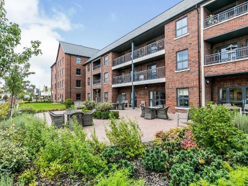 1 bedroom apartment for sale in Lancer House, Butt Road, Colchester, CO2 — £240,000 • 1 bed • 1 bath • 595 ft²
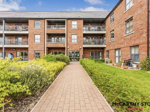 2 bedroom apartment for sale in Lancer House, Butt Road, Colchester, CO2 — £279,000 • 2 bed • 1 bath • 879 ft²
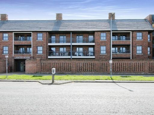 1 bedroom apartment for sale in Lancer House, Butt Road, Colchester, CO2 — £250,000 • 1 bed • 2 bath • 712 ft²
Meta
- {
"@context": "https://schema.org",
"@type": "Residence",
"name": "2 bedroom apartment for sale in Lancer House, Butt Road, Co…",
"description": "",
"url": "https://propertypiper.co.uk/property/c6816185-bacc-4abd-a28b-17cbe41e8794",
"image": "https://image-a.propertypiper.co.uk/d9388987-d0f0-4a7c-99fe-f78cad75c6e0-1024.jpeg",
"address": {
"@type": "PostalAddress",
"streetAddress": "Flat 26 Lancer House, Butt Road, COLCHESTER",
"postalCode": "CO2 7WE",
"addressLocality": "Colchester",
"addressRegion": "Colchester",
"addressCountry": "England"
},
"geo": {
"@type": "GeoCoordinates",
"latitude": 51.88042417042622,
"longitude": 0.888141538378769
},
"numberOfRooms": 2,
"numberOfBathroomsTotal": 1,
"floorSize": {
"@type": "QuantitativeValue",
"value": 753,
"unitCode": "FTK"
},
"offers": {
"@type": "Offer",
"price": 338000,
"priceCurrency": "GBP",
"availability": "https://schema.org/InStock"
},
"additionalProperty": [
{
"@type": "PropertyValue",
"name": "Feature",
"value": "apartment"
},
{
"@type": "PropertyValue",
"name": "Feature",
"value": "modern"
},
{
"@type": "PropertyValue",
"name": "Feature",
"value": "brick exterior"
},
{
"@type": "PropertyValue",
"name": "Feature",
"value": "balconies"
},
{
"@type": "PropertyValue",
"name": "Feature",
"value": "garden"
},
{
"@type": "PropertyValue",
"name": "Feature",
"value": "outdoor seating"
},
{
"@type": "PropertyValue",
"name": "Feature",
"value": "residential"
},
{
"@type": "PropertyValue",
"name": "Feature",
"value": "multi-story"
},
{
"@type": "PropertyValue",
"name": "Feature",
"value": "modern"
},
{
"@type": "PropertyValue",
"name": "Feature",
"value": "apartment"
},
{
"@type": "PropertyValue",
"name": "Feature",
"value": "brick facade"
},
{
"@type": "PropertyValue",
"name": "Feature",
"value": "balcony"
},
{
"@type": "PropertyValue",
"name": "Feature",
"value": "double-glazed windows"
},
{
"@type": "PropertyValue",
"name": "Feature",
"value": "wooden deck"
},
{
"@type": "PropertyValue",
"name": "Feature",
"value": "urban"
},
{
"@type": "PropertyValue",
"name": "Feature",
"value": "contemporary"
}
]
}
High Res Floorplan Images
Compatible Floorplan Images
FloorplanImages Thumbnail