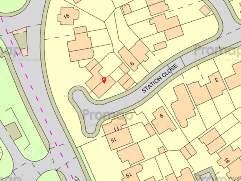
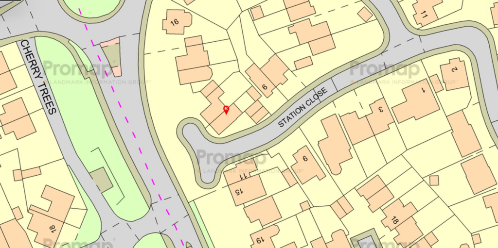
SG16 6FL - 4 bedroom semidetached house for sale in Station Close, Hen…
View on Property Piper
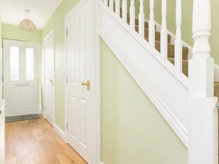
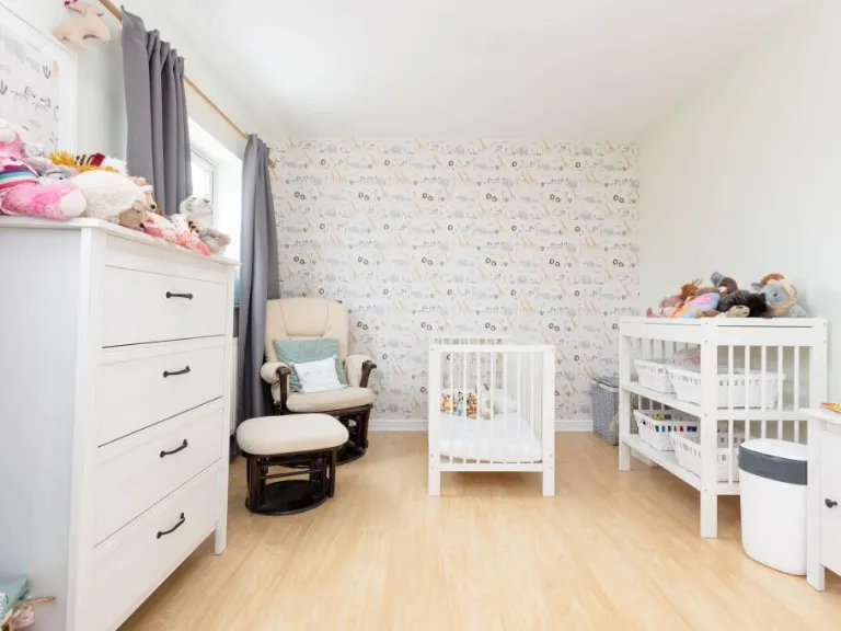
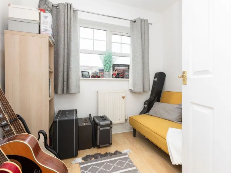
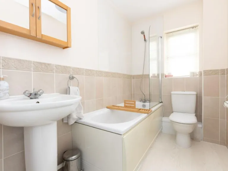
4 bedroom semi-detached house for sale in Station Close, Henlow, SG16
Property Details
- Price: £425000
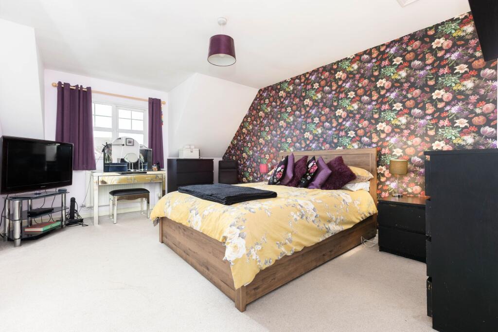
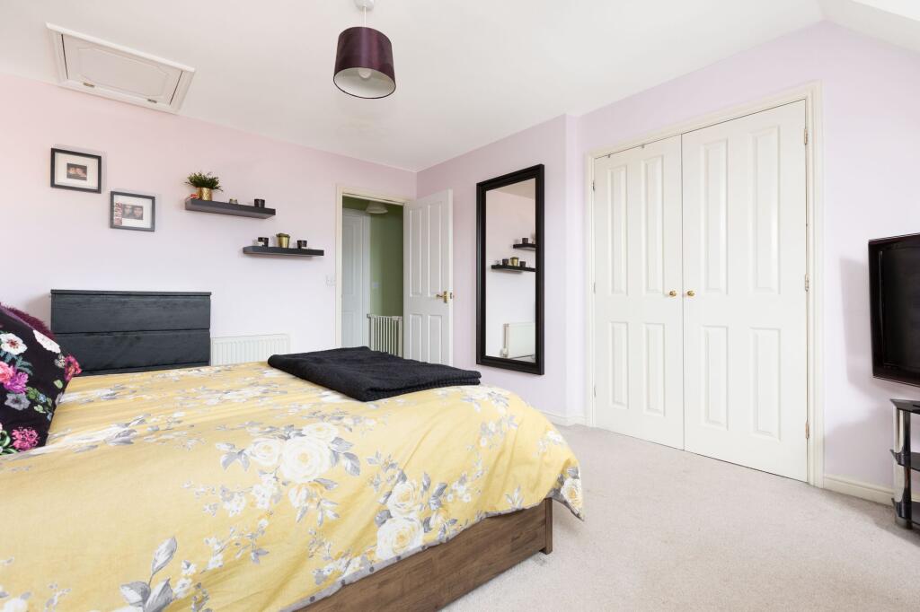
- Bedrooms: 4
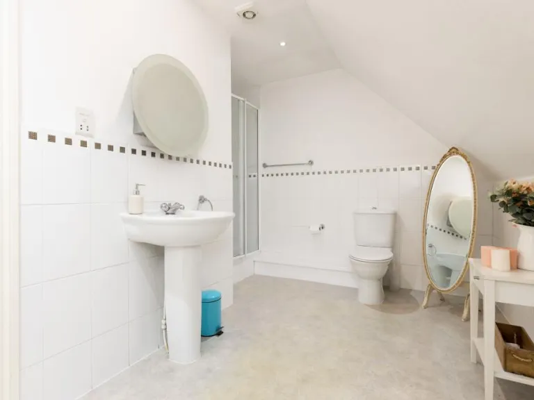
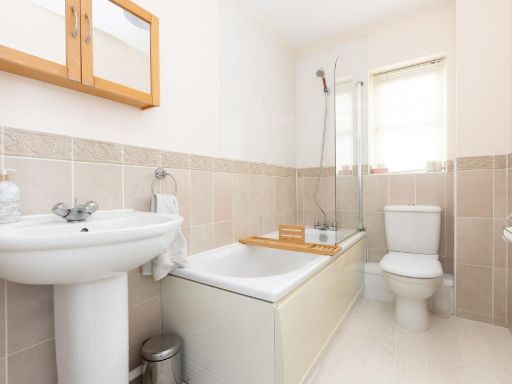
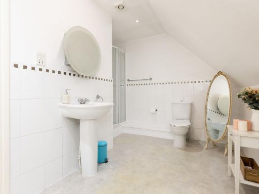
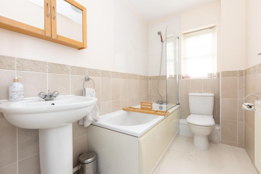
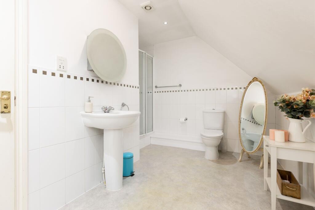
- Bathrooms: 2
- Property Type: undefined
- Property SubType: undefined
Image Descriptions
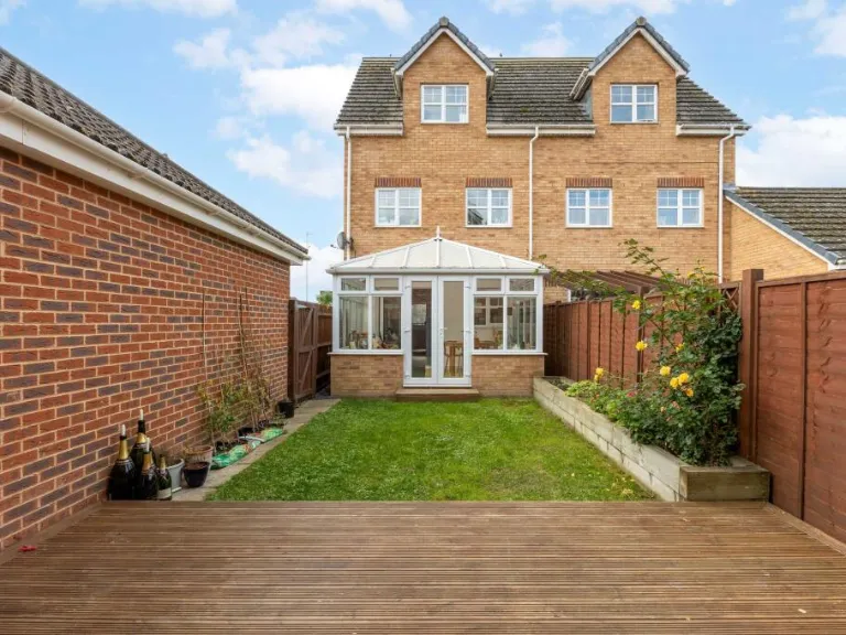
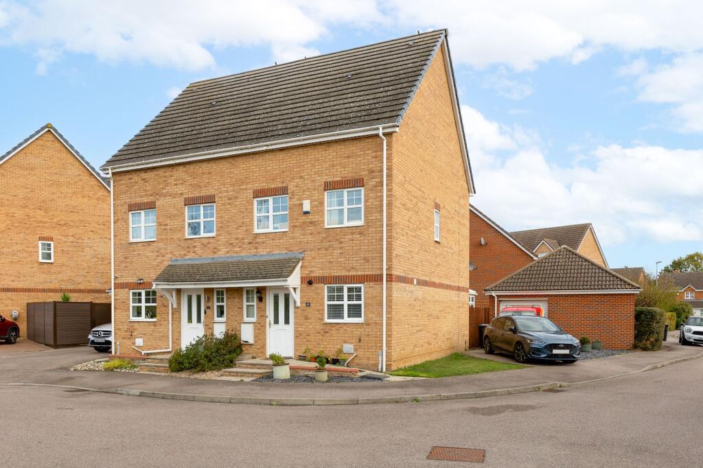
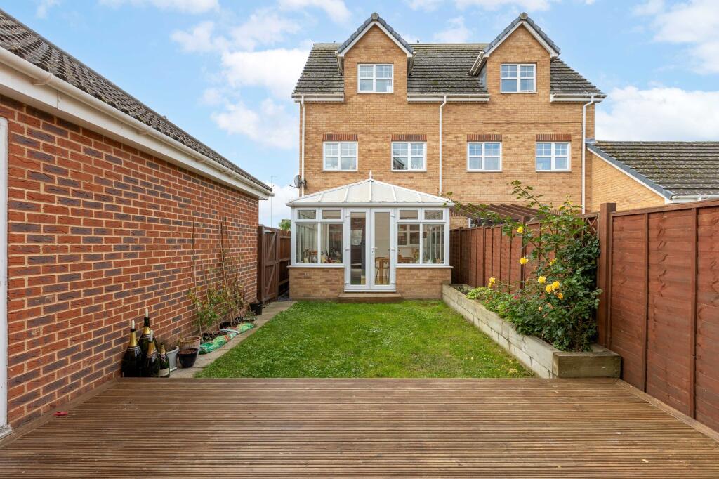
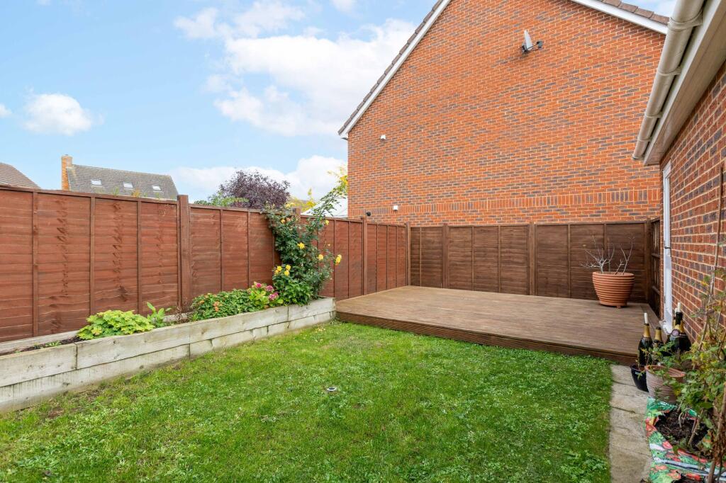
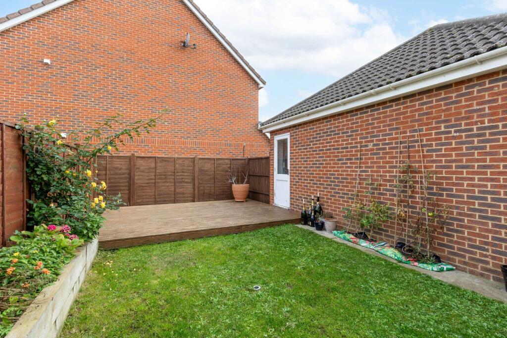
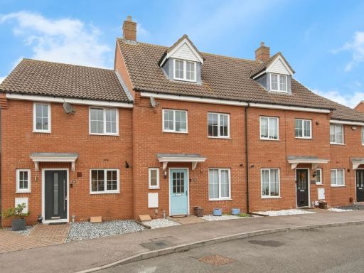
- exterior of a semi-detached house modern
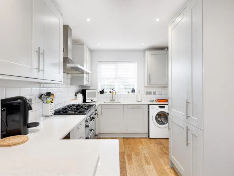
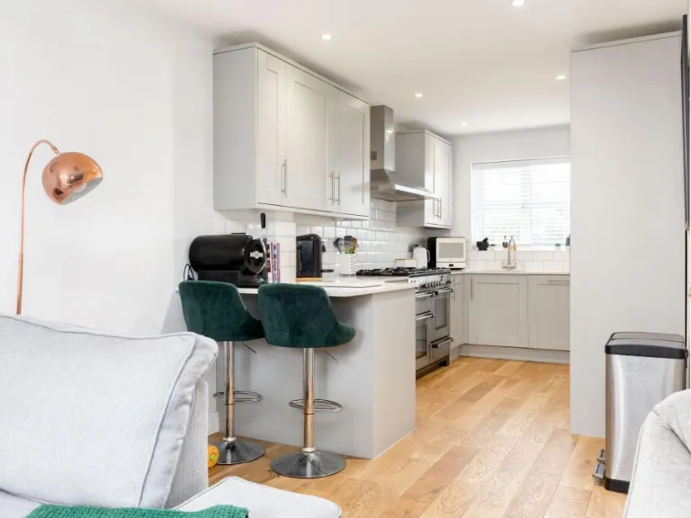
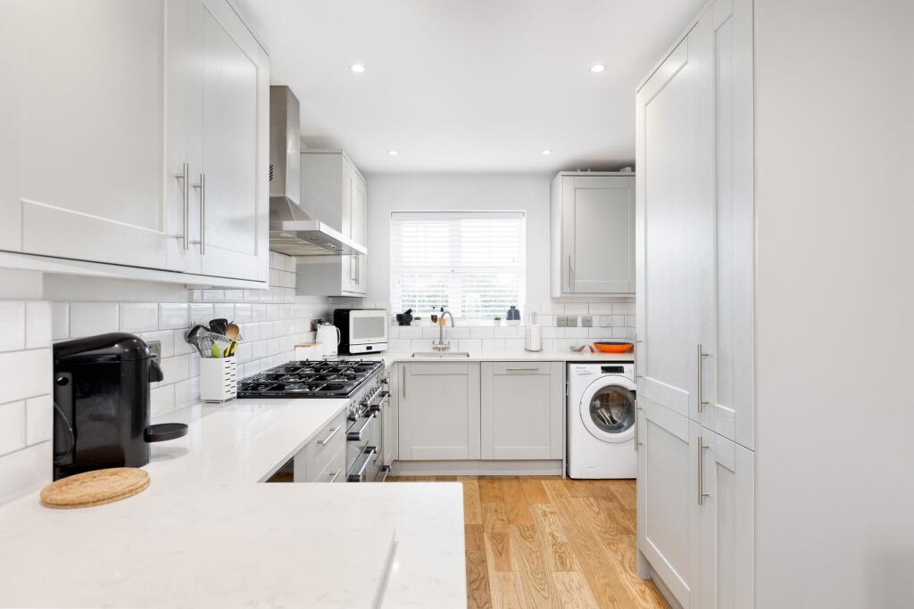
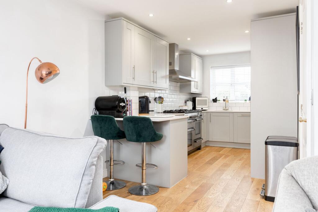
- kitchen modern
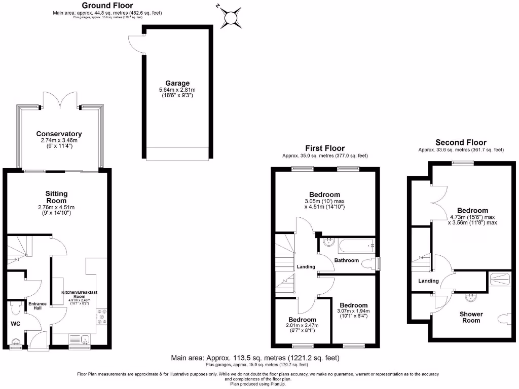
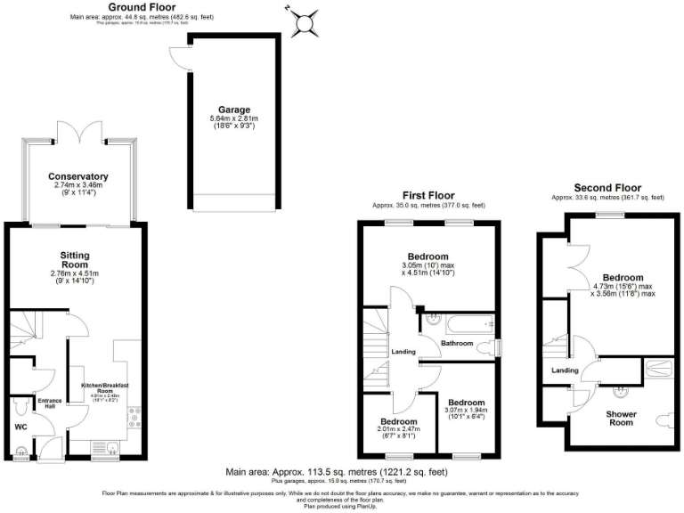
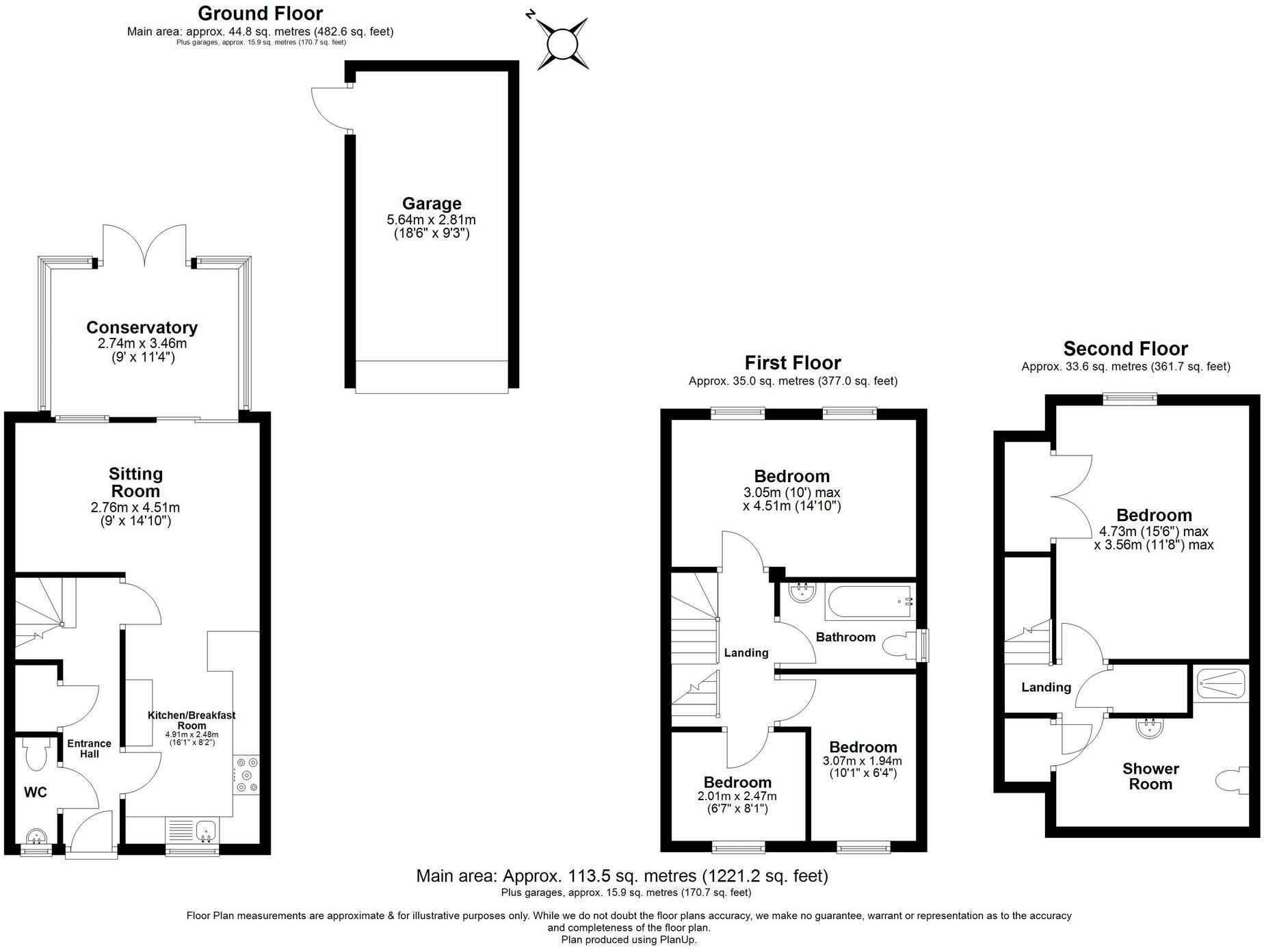
Floorplan Description
- Three-floor residential property (excluding garage)
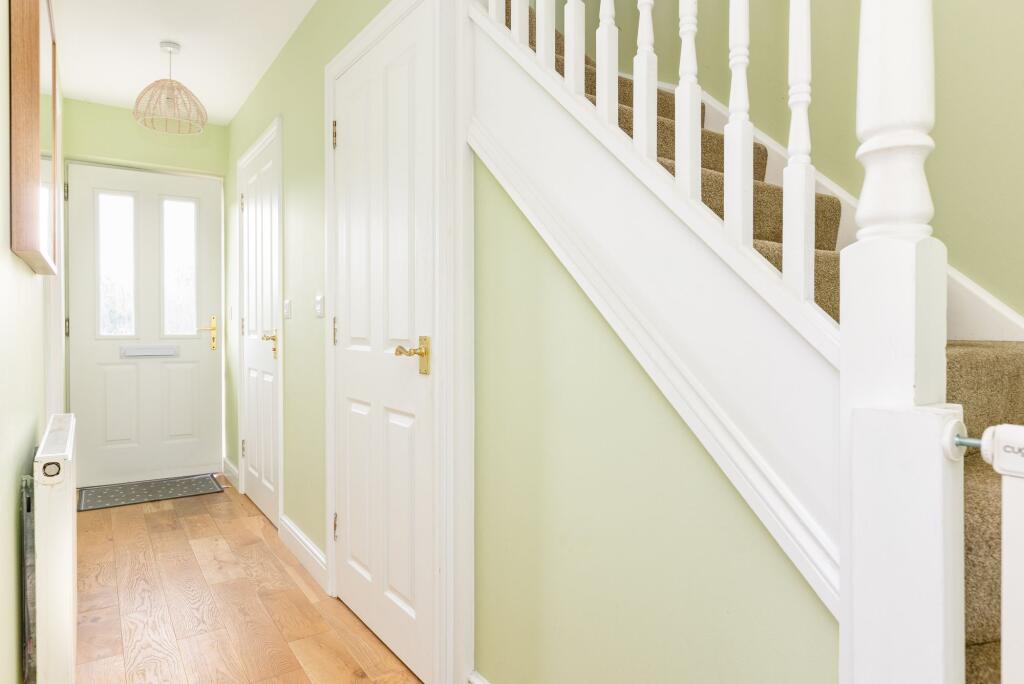
Rooms
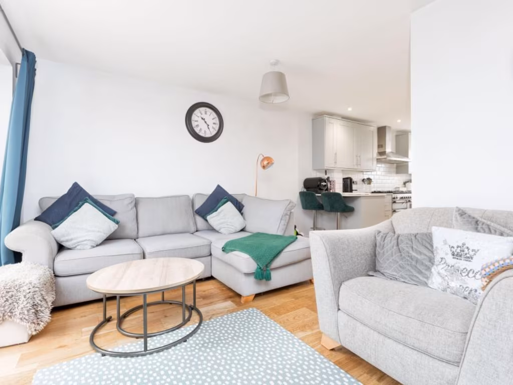
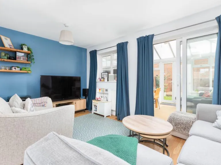
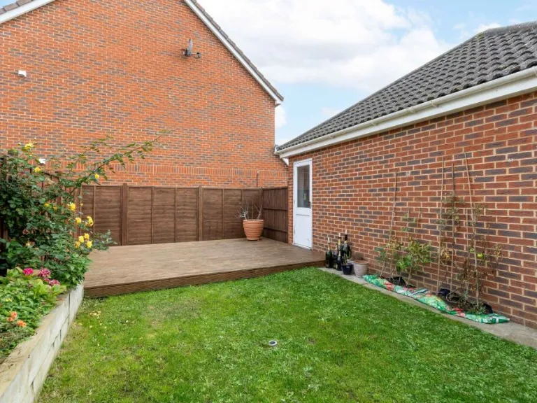
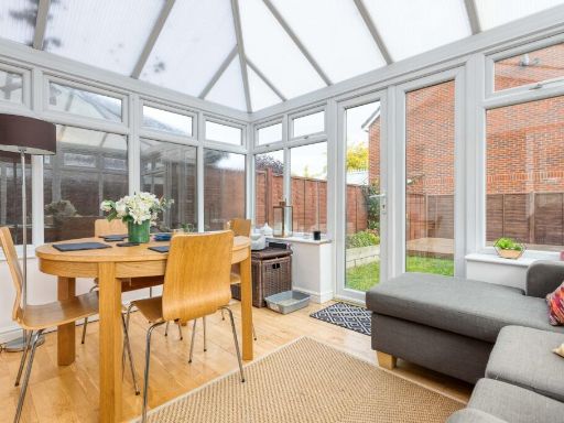
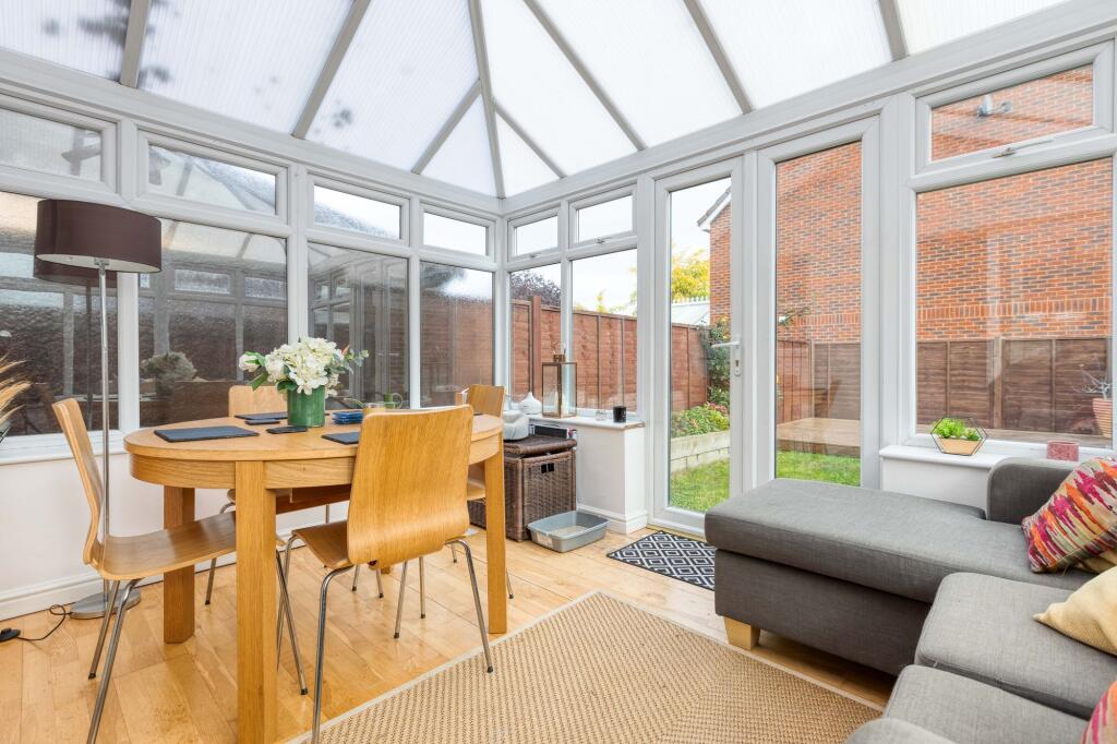
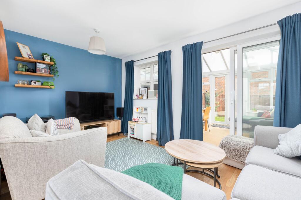
- Conservatory:
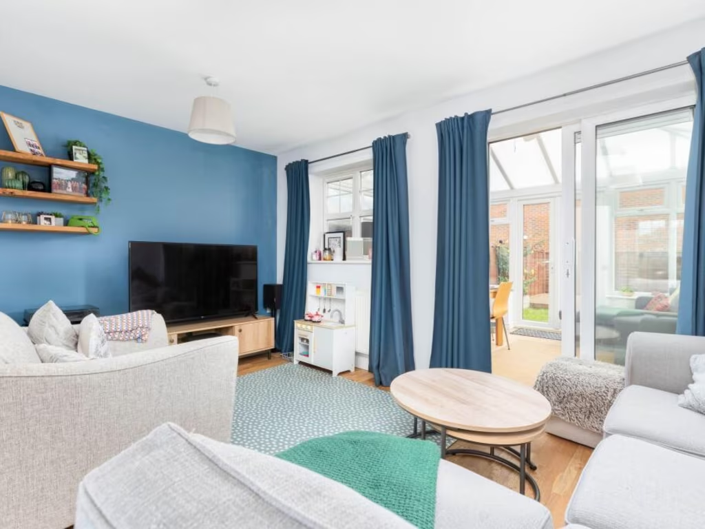
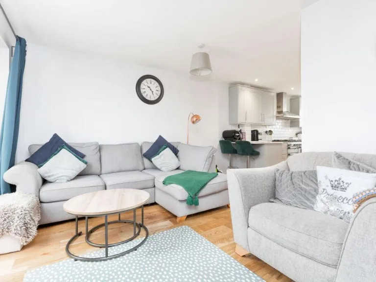
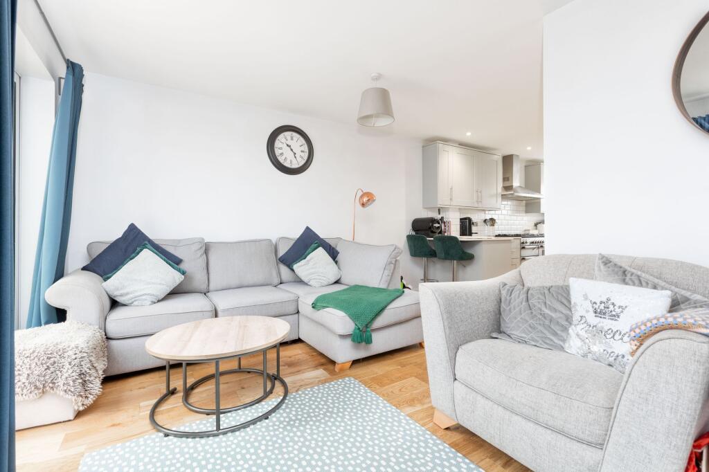
- Sitting Room:
- Kitchen/Breakfast Room:
- Garage:
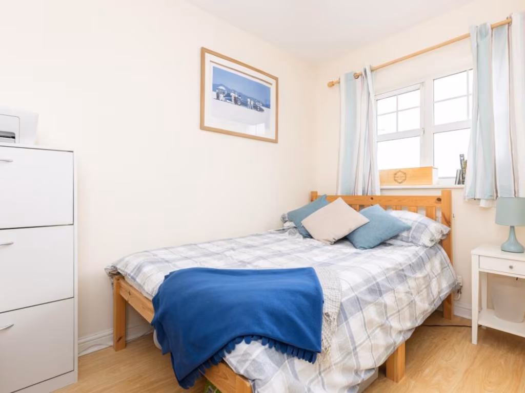
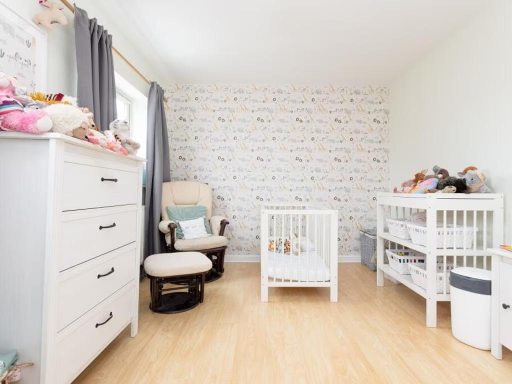
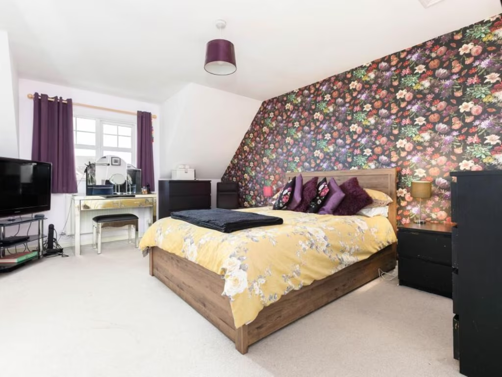
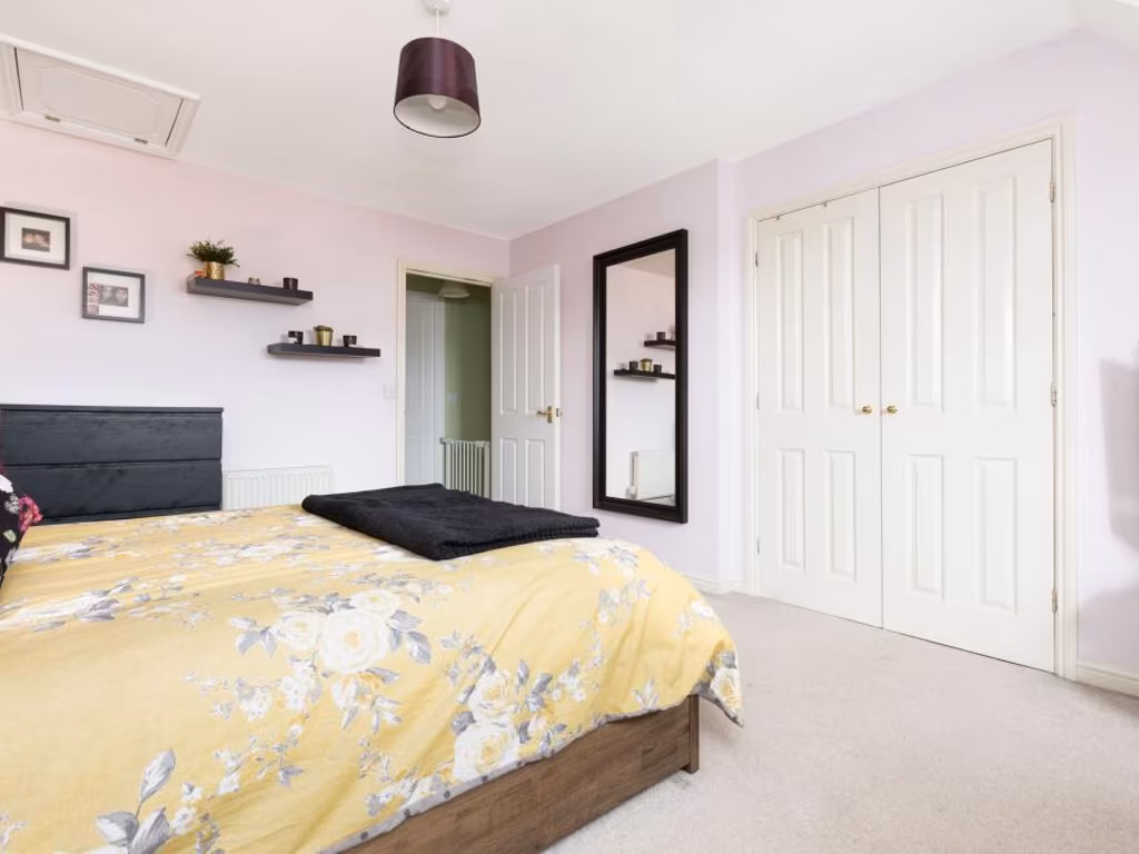
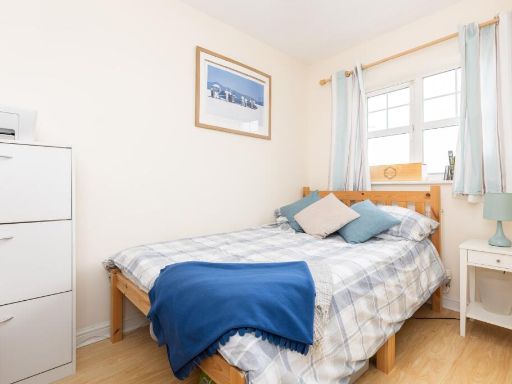
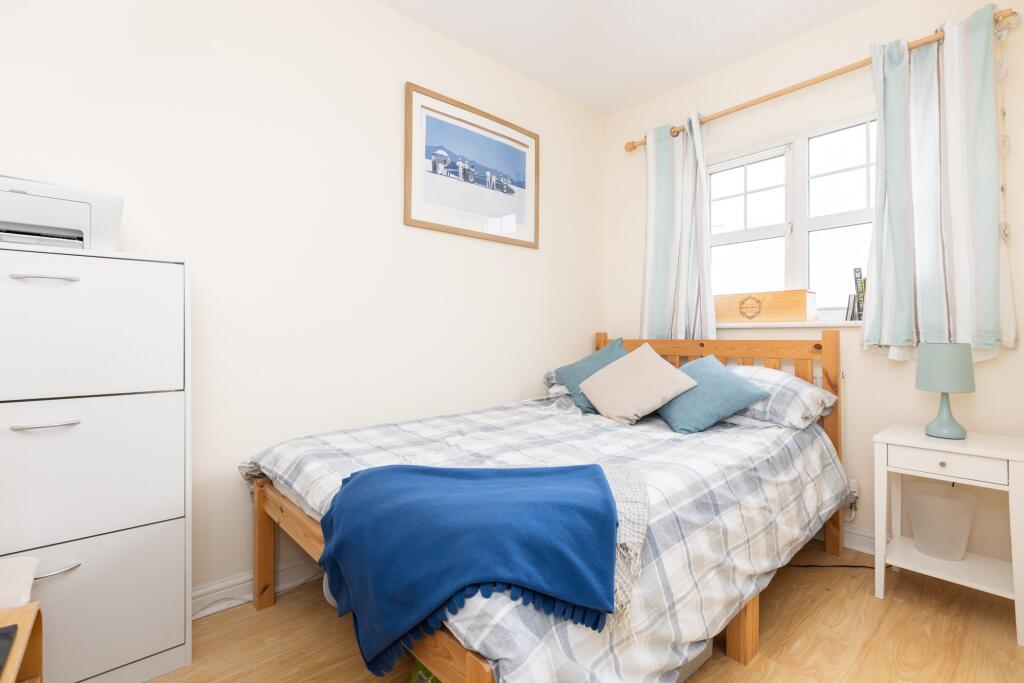
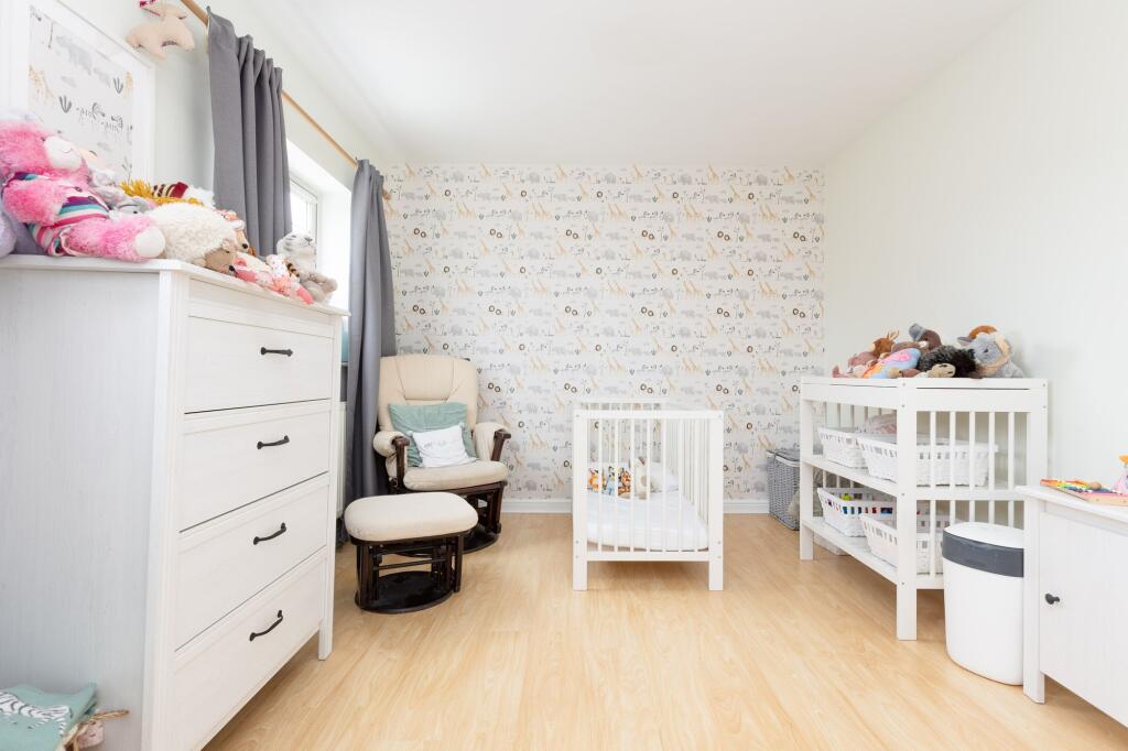
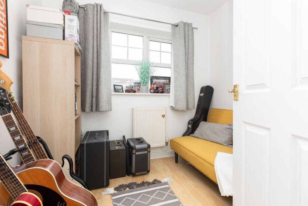
- Bedroom:
- Bedroom:
- Bedroom:
- Bedroom:
Textual Property Features
Detected Visual Features
- semi-detached
- modern
- brick
- two-story
- pitched roof
- driveway
- suburban
- modern kitchen
- neutral decor
- bright
- white cabinets
- wood flooring
- subway tile backsplash
- integrated appliances
- recessed lighting
EPC Details
- Fully double glazed
- Cavity wall, as built, insulated (assumed)
- Boiler and radiators, mains gas
- Low energy lighting in 69% of fixed outlets
- Solid, insulated (assumed)
Nearby Schools
- Clifton All Saints Academy
- Samuel Whitbread Academy
- Langford Village Academy
- Strathmore Infant and Nursery School
- Derwent Primary School
- Gothic Mede Academy
- Henlow Church of England Academy
- Icknield Infant and Nursery School
- Highbury Infant School and Nursery
- Hitchin Girls' School
- Hitchin Boys' School
- Oughton Primary and Nursery School
- Pirton School
- Stondon Lower School
- Meppershall Church of England Academy
- Etonbury Academy
- Raynsford Church of England Academy
- St Andrew's Church of England Voluntary Aided Primary School, Hitchin
- Samuel Lucas Junior Mixed and Infant School
- Wilshere-Dacre Junior Academy
- Highover Junior Mixed and Infant School
- Our Lady Catholic Primary School
- Campton Academy
- Robert Bloomfield Academy
- Shefford Lower School
- Fearnhill School
- Wilbury Junior School
- Fairfield Park Lower School
- The Priory School
- Ickleford Primary School
Nearest General Shops
- Id: 2093496254
- Tags:
- Addr:
- City: Henlow
- Country: GB
- Housenumber: 247
- Postcode: SG16 6DP
- Street: Hitchin Road
- Fhrs:
- Authority: Central Bedfordshire
- Id: 818212
- Local_authority_id: 69992
- Name: Henlow Barbers
- Shop: hairdresser
- TagsNormalized:
- Lat: 52.0078729
- Lon: -0.3036971
- FullGeoHash: gcpzc5dzg65n
- PartitionGeoHash: gcpz
- Images:
- FoodStandards: null
- Distance: 639
,- Id: 6751254830
- Tags:
- Name: Benedicts Funeral Directors
- Shop: funeral_directors
- TagsNormalized:
- funeral
- funeral directors
- shop
- Lat: 52.0077117
- Lon: -0.3041571
- FullGeoHash: gcpzc5dwbshh
- PartitionGeoHash: gcpz
- Images:
- FoodStandards: null
- Distance: 632.9
,- Id: 2093504534
- Tags:
- Name: Henlow Car Centre
- Shop: car_repair
- TagsNormalized:
- Lat: 52.0066908
- Lon: -0.3044156
- FullGeoHash: gcpzc5d2ftg6
- PartitionGeoHash: gcpz
- Images:
- FoodStandards: null
- Distance: 536.9
}
Nearest Religious buildings
- Id: 612243783
- Tags:
- Amenity: place_of_worship
- Building: church
- Denomination: anglican
- Name: Saint Peter's Church, Holwell
- Religion: christian
- Wikidata: Q26397284
- TagsNormalized:
- place of worship
- church
- anglican
- christian
- Lat: 51.9860232
- Lon: -0.3045319
- FullGeoHash: gcpz9pf0xche
- PartitionGeoHash: gcpz
- Images:
- FoodStandards: null
- Distance: 1840.9
,- Id: 765132948
- Tags:
- Amenity: place_of_worship
- Building: church
- Denomination: anglican
- Name: All Saints Church, Stondon
- Religion: christian
- Wikidata: Q26598841
- TagsNormalized:
- place of worship
- church
- anglican
- christian
- Lat: 52.0065347
- Lon: -0.325922
- FullGeoHash: gcpzbed8j2wz
- PartitionGeoHash: gcpz
- Images:
- FoodStandards: null
- Distance: 1781.6
,- Id: 364144941
- Tags:
- Amenity: place_of_worship
- Created_by: Potlatch 0.10f
- Denomination: baptist
- Name: Stondon Baptist Church
- Religion: christian
- TagsNormalized:
- place of worship
- baptist
- church
- christian
- Lat: 52.0032314
- Lon: -0.317939
- FullGeoHash: gcpzbfbkz2zq
- PartitionGeoHash: gcpz
- Images:
- FoodStandards: null
- Distance: 1178.9
}
Nearest Airports
- Id: 495488524
- Tags:
- Aerodrome: international
- Aerodrome:type: public
- Aeroway: aerodrome
- Alt_name: Stansted
- Iata: STN
- Icao: EGSS
- Is_in: Essex,England,UK
- Name: London Stansted Airport
- Ref: STN
- Source: Gagravarr_Airports
- Website: https://www.stanstedairport.com/
- Wikidata: Q8709
- Wikipedia: en:London Stansted Airport
- TagsNormalized:
- airport
- international airport
- Lat: 51.8869677
- Lon: 0.2429264
- FullGeoHash: u10pjt8zkxg4
- PartitionGeoHash: u10p
- Images:
- FoodStandards: null
- Distance: 39415.5
,- Id: 110273499
- Tags:
- Addr:
- Country: GB
- Postcode: LU2 9LY
- Aerodrome: international
- Aerodrome:type: public
- Aeroway: aerodrome
- Alt_name: London Luton
- Iata: LTN
- Icao: EGGW
- Name: London Luton Airport
- Website: https://www.london-luton.co.uk/
- Wikidata: Q8712
- Wikipedia: en:Luton Airport
- TagsNormalized:
- airport
- international airport
- Lat: 51.8780363
- Lon: -0.3701408
- FullGeoHash: gcpxps47rngh
- PartitionGeoHash: gcpx
- Images:
- FoodStandards: null
- Distance: 14625.1
}
Nearest Leisure Facilities
- Id: 203467087
- Tags:
- Barrier: fence
- Leisure: park
- TagsNormalized:
- Lat: 52.0017424
- Lon: -0.3046089
- FullGeoHash: gcpzc4dhn57h
- PartitionGeoHash: gcpz
- Images:
- FoodStandards: null
- Distance: 273.3
,- Id: 203467086
- Tags:
- Barrier: fence
- Leisure: playground
- TagsNormalized:
- Lat: 52.0017562
- Lon: -0.3045765
- FullGeoHash: gcpzc4dhnvgq
- PartitionGeoHash: gcpz
- Images:
- FoodStandards: null
- Distance: 270.8
,- Id: 1010166429
- Tags:
- TagsNormalized:
- Lat: 52.0002553
- Lon: -0.3025344
- FullGeoHash: gcpzc47eqqnj
- PartitionGeoHash: gcpz
- Images:
- FoodStandards: null
- Distance: 268.9
,- Id: 203467092
- Tags:
- TagsNormalized:
- Lat: 52.0017362
- Lon: -0.2988305
- FullGeoHash: gcpzc4wkhdpz
- PartitionGeoHash: gcpz
- Images:
- FoodStandards: null
- Distance: 152.7
,- Id: 72105799
- Tags:
- TagsNormalized:
- Lat: 52.0026958
- Lon: -0.3000189
- FullGeoHash: gcpzc4v99j1e
- PartitionGeoHash: gcpz
- Images:
- FoodStandards: null
- Distance: 60
}
Nearest Tourist attractions
- Id: 6751166457
- Tags:
- Addr:
- City: Henlow
- Country: GB
- Housename: Poplars Farm
- Housenumber: 1
- Postcode: SG16 6BH
- Street: Clifton Road
- Fhrs:
- Authority: Central Bedfordshire
- Id: 877216
- Local_authority_id: 159519
- Name: Poplars Farm Bed & Breakfast
- Tourism: guest_house
- TagsNormalized:
- bed
- farm
- guest house
- tourism
- Lat: 52.0286751
- Lon: -0.2893648
- FullGeoHash: gcpzcrt3121b
- PartitionGeoHash: gcpz
- Images:
- FoodStandards:
- Id: 877216
- FHRSID: 877216
- LocalAuthorityBusinessID: 159519
- BusinessName: Poplars Farm Bed & Breakfast
- BusinessType: Hotel/bed & breakfast/guest house
- BusinessTypeID: 7842
- AddressLine1: Poplars Farm
- AddressLine2: 1 Clifton Road
- AddressLine3: Henlow
- AddressLine4: null
- PostCode: SG16 6BH
- RatingValue: 5
- RatingKey: fhrs_5_en-GB
- RatingDate: 2019-07-16
- LocalAuthorityCode: 702
- LocalAuthorityName: Central Bedfordshire
- LocalAuthorityWebSite: http://www.centralbedfordshire.gov.uk
- LocalAuthorityEmailAddress: env.health@centralbedfordshire.gov.uk
- Scores:
- Hygiene: 5
- Structural: 5
- ConfidenceInManagement: 5
- NewRatingPending: false
- Geocode:
- Longitude: -0.29040100000000
- Latitude: 52.02939400000000
- Distance: 3022.4
,- Id: 675555971
- Tags:
- Addr:
- City: Meppershall
- Country: GB
- Housenumber: 90
- Postcode: SG17 5LU
- Street: Fildyke Road
- Building: yes
- Fhrs:
- Authority: Central Bedfordshire
- Id: 1173199
- Local_authority_id: 130510
- Name: Old Joe's B & B
- Tourism: guest_house
- TagsNormalized:
- Lat: 52.0142817
- Lon: -0.3338712
- FullGeoHash: gcpzbkuvhhzs
- PartitionGeoHash: gcpz
- Images:
- FoodStandards: null
- Distance: 2621.9
,- Id: 41814158
- Tags:
- Addr:
- City: Lower Stondon
- Country: GB
- Postcode: SG16 6EA
- Street: Bedford Road
- Name: Henlow Greyhound Racing
- Tourism: attraction
- TagsNormalized:
- Lat: 52.0090272
- Lon: -0.3077318
- FullGeoHash: gcpzbgzyt36e
- PartitionGeoHash: gcpz
- Images:
- FoodStandards: null
- Distance: 876.1
}
Nearest Train stations
- Id: 7209357138
- Tags:
- Name: Sandy
- Naptan:
- Network: National Rail
- Public_transport: station
- Railway: station
- Ref:
- Wikidata: Q3151015
- Wikipedia: en:Sandy railway station
- TagsNormalized:
- Lat: 52.1249106
- Lon: -0.2809477
- FullGeoHash: gcrb9953t7w5
- PartitionGeoHash: gcrb
- Images:
- FoodStandards: null
- Distance: 13688
,- Id: 7140195250
- Tags:
- Name: Stevenage
- Naptan:
- Network: National Rail
- Public_transport: station
- Railway: station
- Ref:
- Wheelchair: yes
- Wikidata: Q19970
- Wikipedia: en:Stevenage railway station
- TagsNormalized:
- Lat: 51.9018356
- Lon: -0.207144
- FullGeoHash: gcpz723nj5qj
- PartitionGeoHash: gcpz
- Images:
- FoodStandards: null
- Distance: 12893.8
,- Id: 20981580
- Tags:
- Name: Baldock
- Naptan:
- Network: National Rail
- Public_transport: station
- Railway: station
- Ref:
- Wheelchair: no
- Wikidata: Q19953
- Wikipedia: en:Baldock railway station
- TagsNormalized:
- Lat: 51.9929714
- Lon: -0.1875624
- FullGeoHash: gcpzg9p3j2r7
- PartitionGeoHash: gcpz
- Images:
- FoodStandards: null
- Distance: 7821.2
,- Id: 2089152132
- Tags:
- Name: Letchworth Garden City
- Naptan:
- Network: National Rail
- Old_name: Letchworth
- Operator: First Capital Connect
- Platforms: 2
- Public_transport: station
- Railway: station
- Ref:
- Wikidata: Q2582397
- Wikipedia: en:Letchworth Garden City railway station
- TagsNormalized:
- Lat: 51.9803536
- Lon: -0.2289056
- FullGeoHash: gcpzdy9rd05x
- PartitionGeoHash: gcpz
- Images:
- FoodStandards: null
- Distance: 5498.2
,- Id: 21264536
- Tags:
- Name: Arlesey
- Naptan:
- Network: National Rail
- Public_transport: station
- Railway: station
- Ref:
- Source:
- Wikidata: Q4567224
- Wikipedia: en:Arlesey railway station
- TagsNormalized:
- Lat: 52.0258212
- Lon: -0.266464
- FullGeoHash: gcpzczjbqgyp
- PartitionGeoHash: gcpz
- Images:
- FoodStandards: null
- Distance: 3505
}
Nearest Bus stations and stops
- Id: 9526802076
- Tags:
- Bus: yes
- Highway: bus_stop
- Public_transport: platform
- Shelter: yes
- TagsNormalized:
- Lat: 52.0092679
- Lon: -0.2634599
- FullGeoHash: gcpzf5bpuynp
- PartitionGeoHash: gcpz
- Images:
- FoodStandards: null
- Distance: 2665
,- Id: 9526802075
- Tags:
- Bus: yes
- Highway: bus_stop
- Public_transport: platform
- Shelter: no
- TagsNormalized:
- Lat: 52.0093101
- Lon: -0.2635366
- FullGeoHash: gcpzfh005nhg
- PartitionGeoHash: gcpz
- Images:
- FoodStandards: null
- Distance: 2661.3
,- Id: 9522431403
- Tags:
- Bus: yes
- Highway: bus_stop
- Public_transport: platform
- Shelter: yes
- TagsNormalized:
- Lat: 52.0071428
- Lon: -0.3040961
- FullGeoHash: gcpzc5ded41d
- PartitionGeoHash: gcpz
- Images:
- FoodStandards: null
- Distance: 572.8
,- Id: 9522431414
- Tags:
- Bus: yes
- Highway: bus_stop
- Public_transport: platform
- Shelter: yes
- TagsNormalized:
- Lat: 52.0042374
- Lon: -0.3022621
- FullGeoHash: gcpzc55fsu3p
- PartitionGeoHash: gcpz
- Images:
- FoodStandards: null
- Distance: 226.9
,- Id: 9522442019
- Tags:
- Bus: yes
- Highway: bus_stop
- Public_transport: platform
- TagsNormalized:
- Lat: 52.0033854
- Lon: -0.3019912
- FullGeoHash: gcpzc4ujejej
- PartitionGeoHash: gcpz
- Images:
- FoodStandards: null
- Distance: 136.5
}
Nearest Hotels
- Id: 62173586
- Tags:
- Addr:
- City: Henlow
- Country: GB
- Postcode: SG16 6DB
- Street: Coach Road
- Building: yes
- Fhrs:
- Authority: Central Bedfordshire
- Id: 450232
- Local_authority_id: 1563
- Name: Henlow Grange
- Operator: Champneys Health Resorts
- Tourism: hotel
- Wikidata: Q5714738
- Wikipedia: en:Henlow Grange
- TagsNormalized:
- Lat: 52.0315686
- Lon: -0.2763947
- FullGeoHash: gcrb18n9ze3h
- PartitionGeoHash: gcrb
- Images:
- FoodStandards: null
- Distance: 3645.6
,- Id: 155623571
- Tags:
- Addr:
- City: Meppershall
- Country: GB
- Housenumber: 16
- Postcode: SG17 5JF
- Street: Hitchin Road
- Amenity: pub
- Building: yes
- Fhrs:
- Authority: Central Bedfordshire
- Id: 450260
- Local_authority_id: 1611
- Food: yes
- Name: The Airman Hotel
- Old_name: Carrage House
- Source: Bing
- Tourism: hotel
- Website: https://www.theairmanhotel.com/
- TagsNormalized:
- Lat: 52.0250149
- Lon: -0.3162746
- FullGeoHash: gcpzbycewm8w
- PartitionGeoHash: gcpz
- Images:
- FoodStandards: null
- Distance: 2727.8
,- Id: 2093504533
- Tags:
- Name: Bird in Hand
- Tourism: hotel
- TagsNormalized:
- Lat: 52.0073198
- Lon: -0.3047858
- FullGeoHash: gcpzc5dh9gp4
- PartitionGeoHash: gcpz
- Images:
- FoodStandards: null
- Distance: 610.7
}
Tags
- semi-detached
- modern
- brick
- two-story
- pitched roof
- driveway
- suburban
- modern kitchen
- neutral decor
- bright
- white cabinets
- wood flooring
- subway tile backsplash
- integrated appliances
- recessed lighting
Similar Properties
 4 bedroom terraced house for sale in St. Johns Road, Arlesey, Bedfordshire, SG15 — £385,000 • 4 bed • 2 bath • 1101 ft²
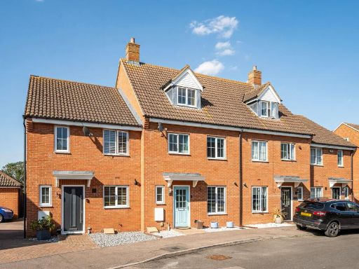 4 bedroom town house for sale in St Johns Road, Arlesey, SG15 — £385,000 • 4 bed • 2 bath • 1119 ft²
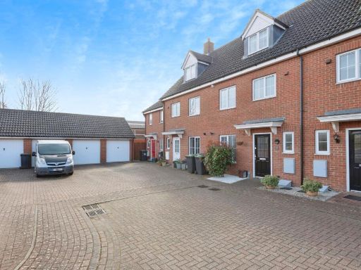 4 bedroom terraced house for sale in St. Johns Road, Arlesey, Bedfordshire, SG15 — £400,000 • 4 bed • 2 bath • 1255 ft²
 3 bedroom end of terrace house for sale in Clifton Road, Henlow, Bedfordshire, SG16 — £430,000 • 3 bed • 1 bath • 1341 ft²
 5 bedroom end of terrace house for sale in The Granary, Arlesey, Bedfordshire, SG15 — £490,000 • 5 bed • 2 bath • 1684 ft²
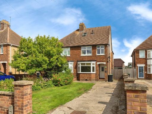 4 bedroom semi-detached house for sale in High Street, ARLESEY, SG15 — £450,000 • 4 bed • 2 bath • 1104 ft²
Meta
- {
"@context": "https://schema.org",
"@type": "Residence",
"name": "4 bedroom semidetached house for sale in Station Close, Hen…",
"description": "",
"url": "https://propertypiper.co.uk/property/c60e2803-926f-400b-bb32-b3f8c9a2ddbf",
"image": "https://image-a.propertypiper.co.uk/cd3c3eb6-58e7-4943-80ee-102f6be7285d-1024.jpeg",
"address": {
"@type": "PostalAddress",
"streetAddress": "8 STATION CLOSE HENLOW",
"postalCode": "SG16 6FL",
"addressLocality": "Central Bedfordshire",
"addressRegion": "Mid Bedfordshire",
"addressCountry": "England"
},
"geo": {
"@type": "GeoCoordinates",
"latitude": 52.00241595352949,
"longitude": -0.3007689843305482
},
"numberOfRooms": 4,
"numberOfBathroomsTotal": 2,
"floorSize": {
"@type": "QuantitativeValue",
"value": 1221,
"unitCode": "FTK"
},
"offers": {
"@type": "Offer",
"price": 425000,
"priceCurrency": "GBP",
"availability": "https://schema.org/InStock"
},
"additionalProperty": [
{
"@type": "PropertyValue",
"name": "Feature",
"value": "semi-detached"
},
{
"@type": "PropertyValue",
"name": "Feature",
"value": "modern"
},
{
"@type": "PropertyValue",
"name": "Feature",
"value": "brick"
},
{
"@type": "PropertyValue",
"name": "Feature",
"value": "two-story"
},
{
"@type": "PropertyValue",
"name": "Feature",
"value": "pitched roof"
},
{
"@type": "PropertyValue",
"name": "Feature",
"value": "driveway"
},
{
"@type": "PropertyValue",
"name": "Feature",
"value": "suburban"
},
{
"@type": "PropertyValue",
"name": "Feature",
"value": "modern kitchen"
},
{
"@type": "PropertyValue",
"name": "Feature",
"value": "neutral decor"
},
{
"@type": "PropertyValue",
"name": "Feature",
"value": "bright"
},
{
"@type": "PropertyValue",
"name": "Feature",
"value": "white cabinets"
},
{
"@type": "PropertyValue",
"name": "Feature",
"value": "wood flooring"
},
{
"@type": "PropertyValue",
"name": "Feature",
"value": "subway tile backsplash"
},
{
"@type": "PropertyValue",
"name": "Feature",
"value": "integrated appliances"
},
{
"@type": "PropertyValue",
"name": "Feature",
"value": "recessed lighting"
}
]
}
High Res Floorplan Images
Compatible Floorplan Images
FloorplanImages Thumbnail