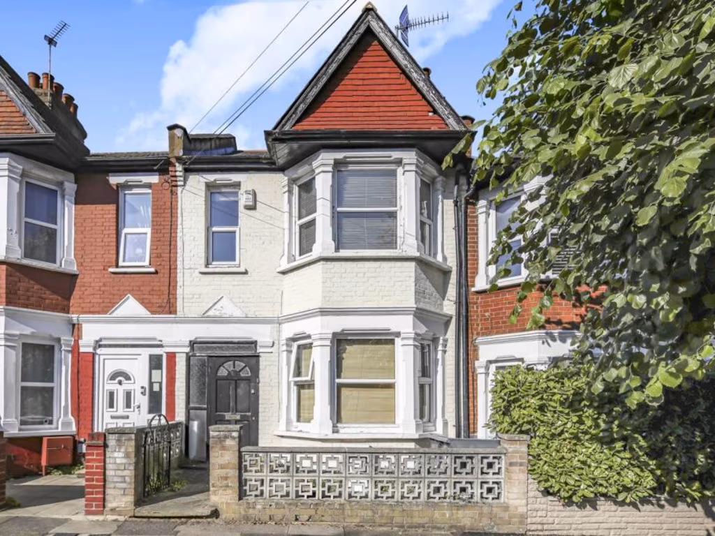
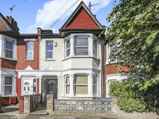
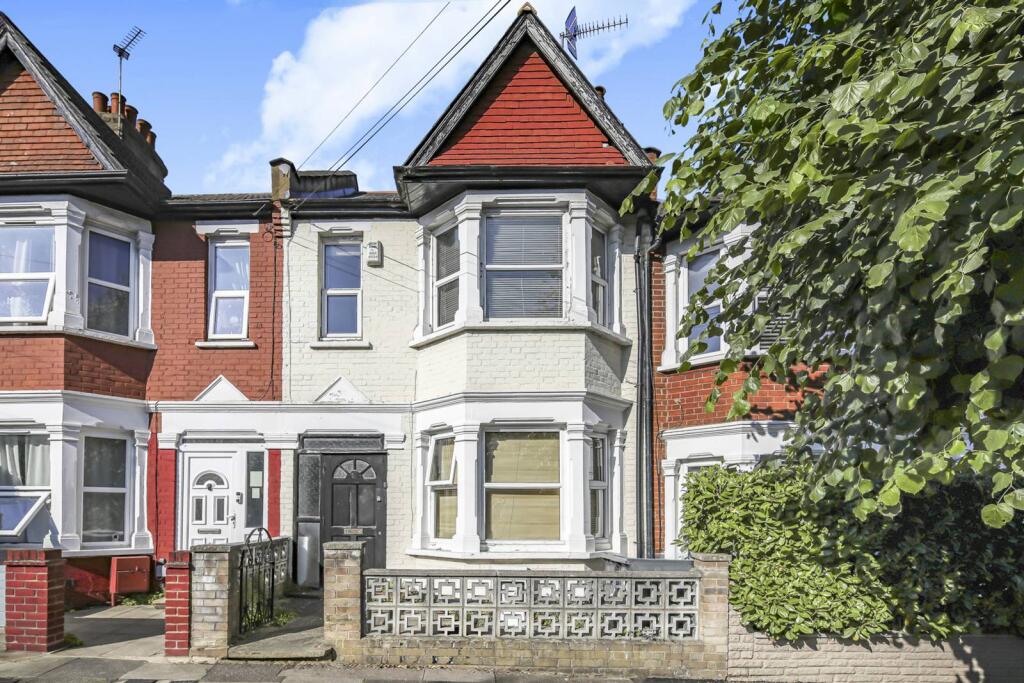
N22 5BE - 3 bedroom terraced house for sale in Dunbar Road, Wood Gree…
View on Property Piper
3 bedroom terraced house for sale in Dunbar Road, Wood Green, London, N22
Property Details
- Price: £650000
- Bedrooms: 3
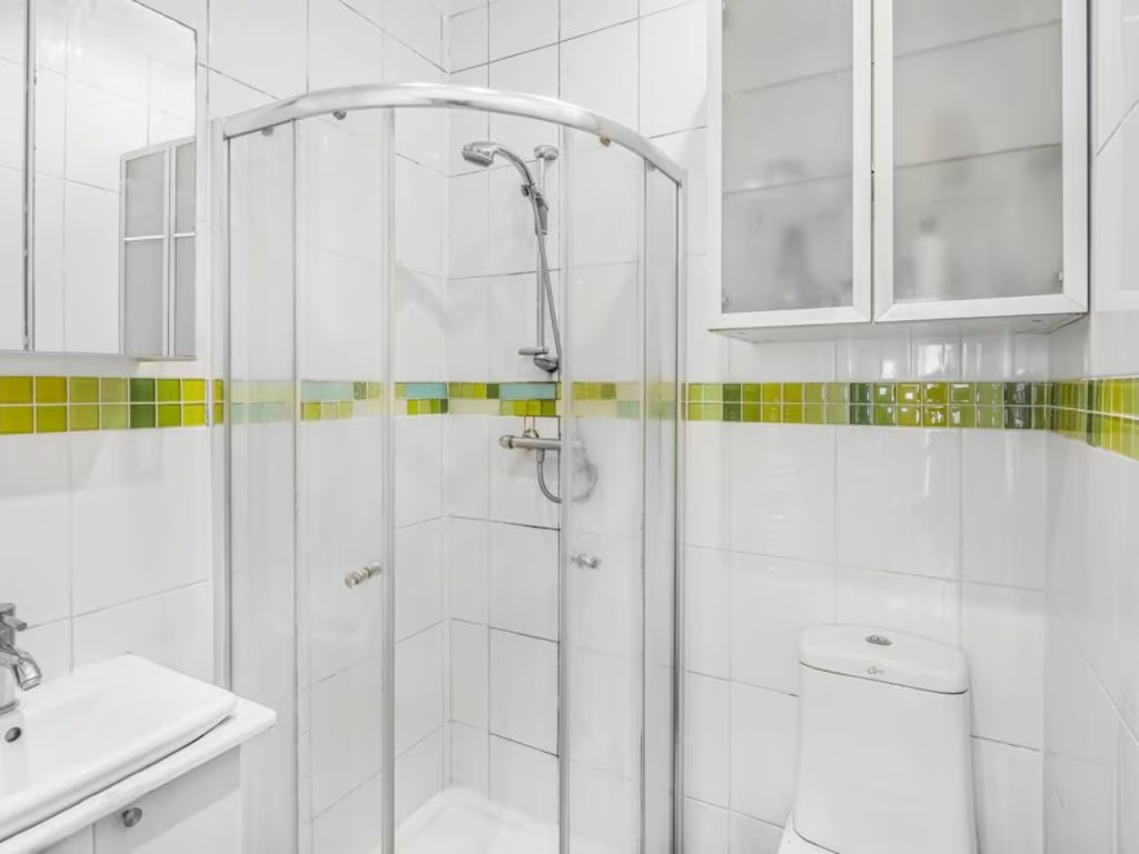
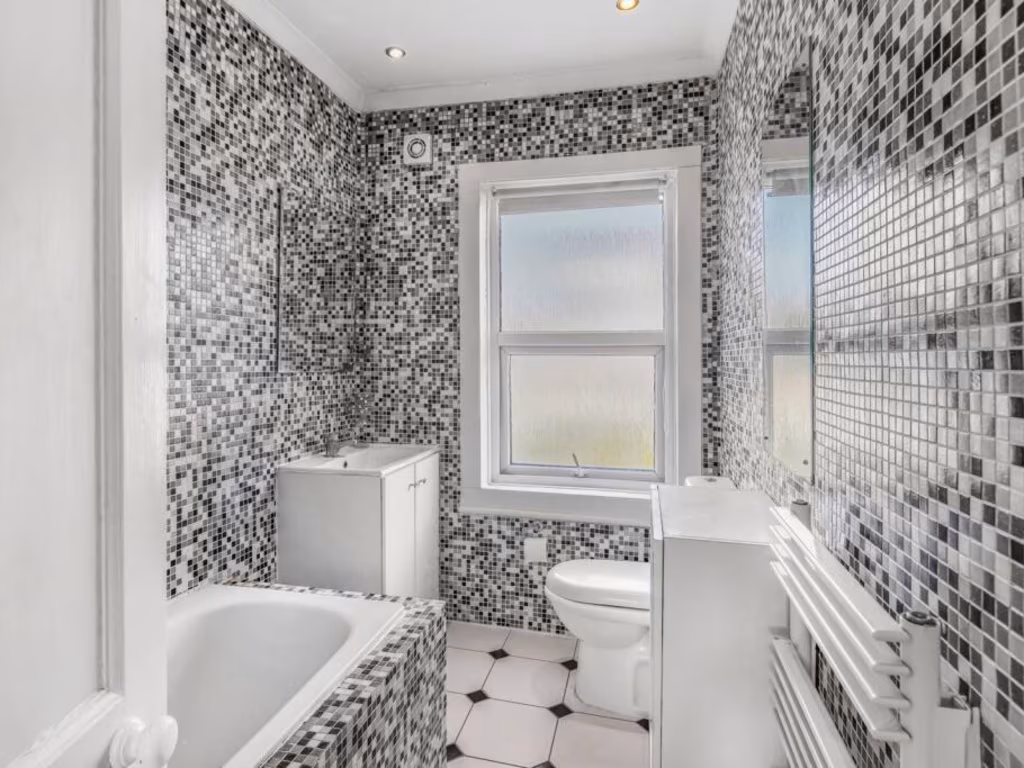
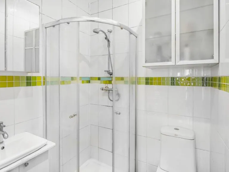
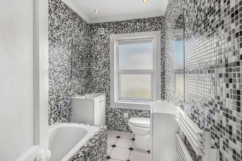
- Bathrooms: 1
- Property Type: undefined
- Property SubType: undefined
Image Descriptions
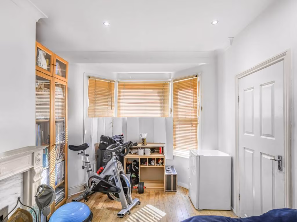
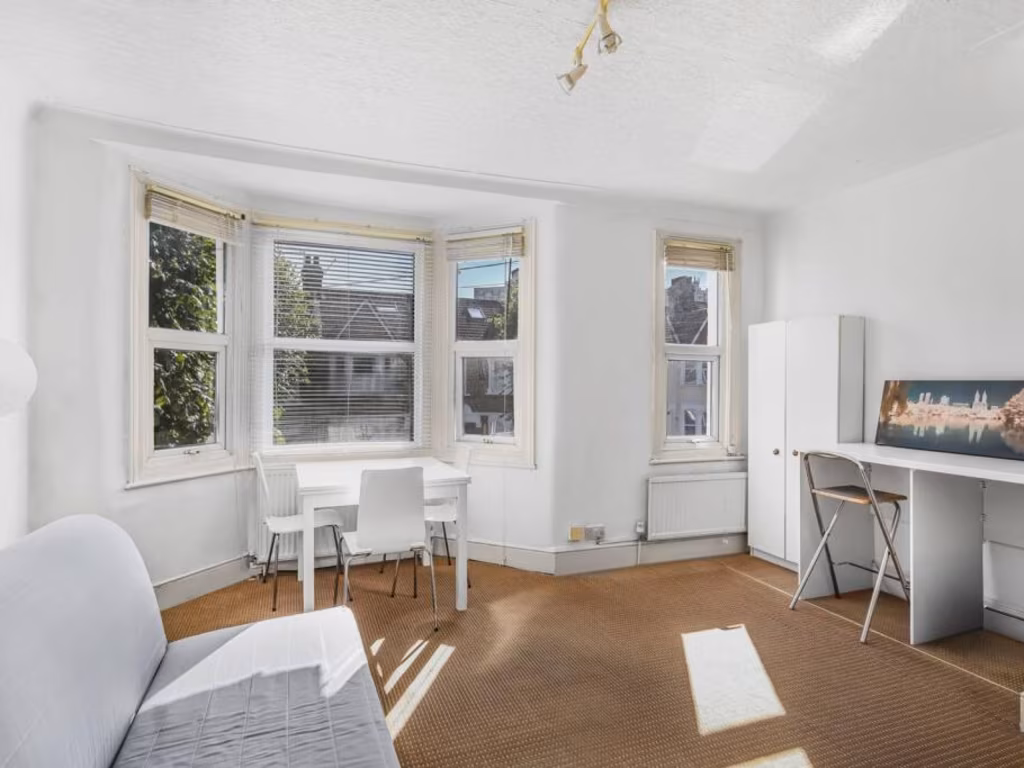
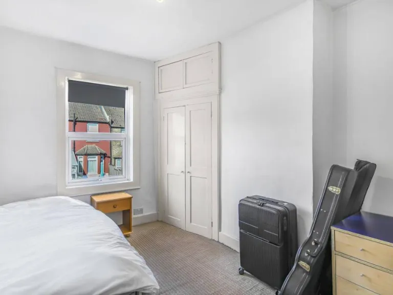
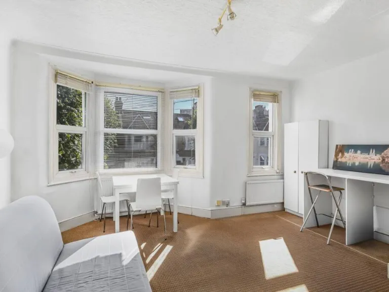
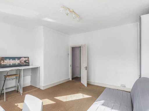
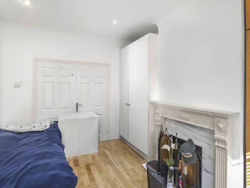
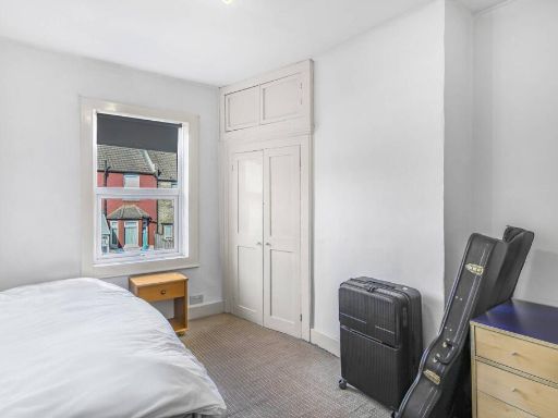
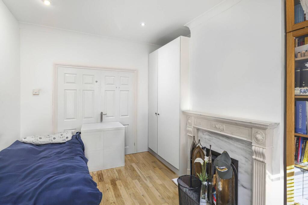
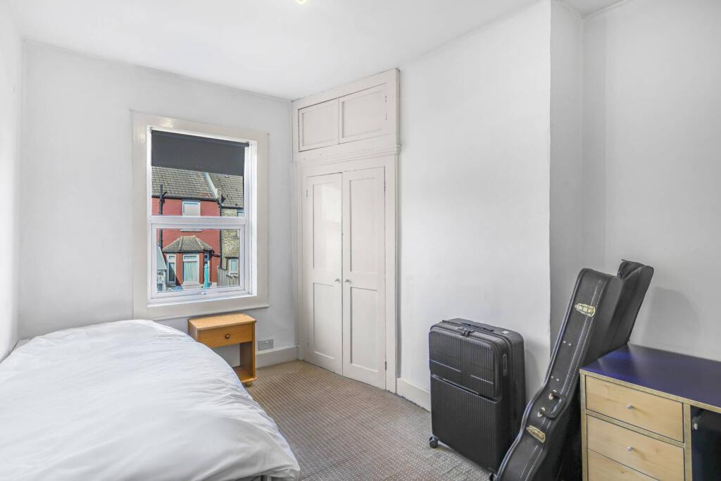
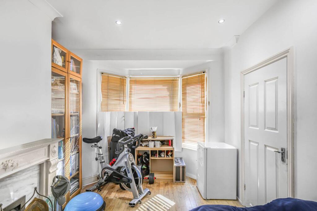
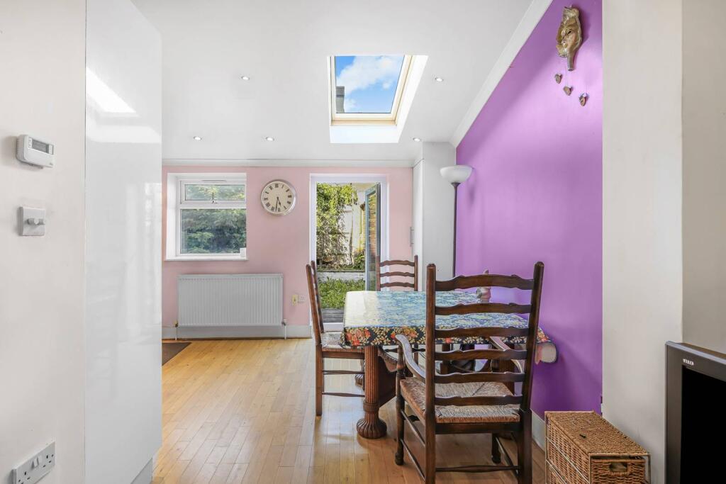
- residential bedroom early 20th-century
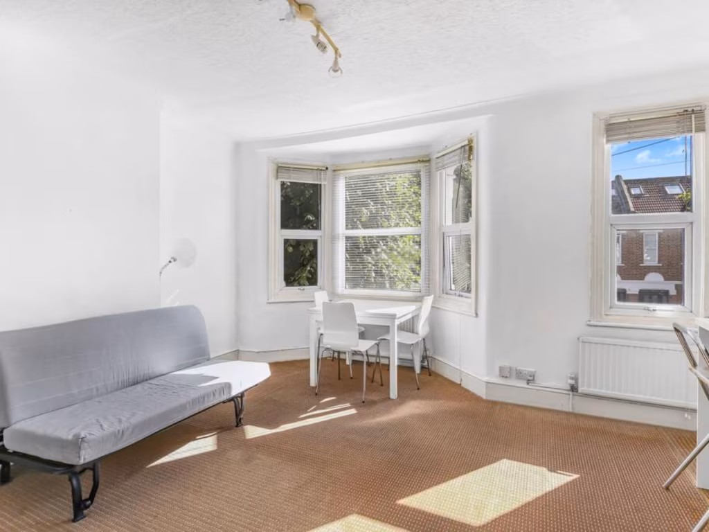
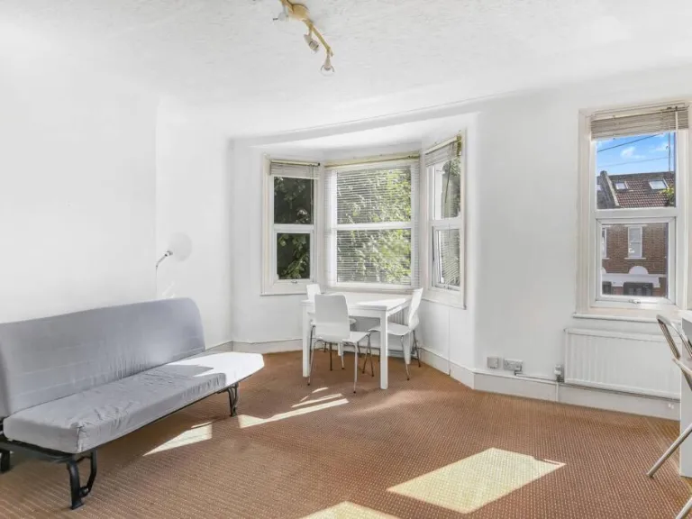
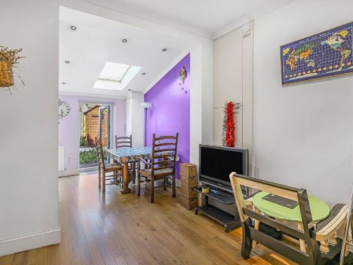
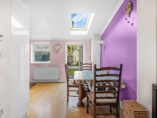
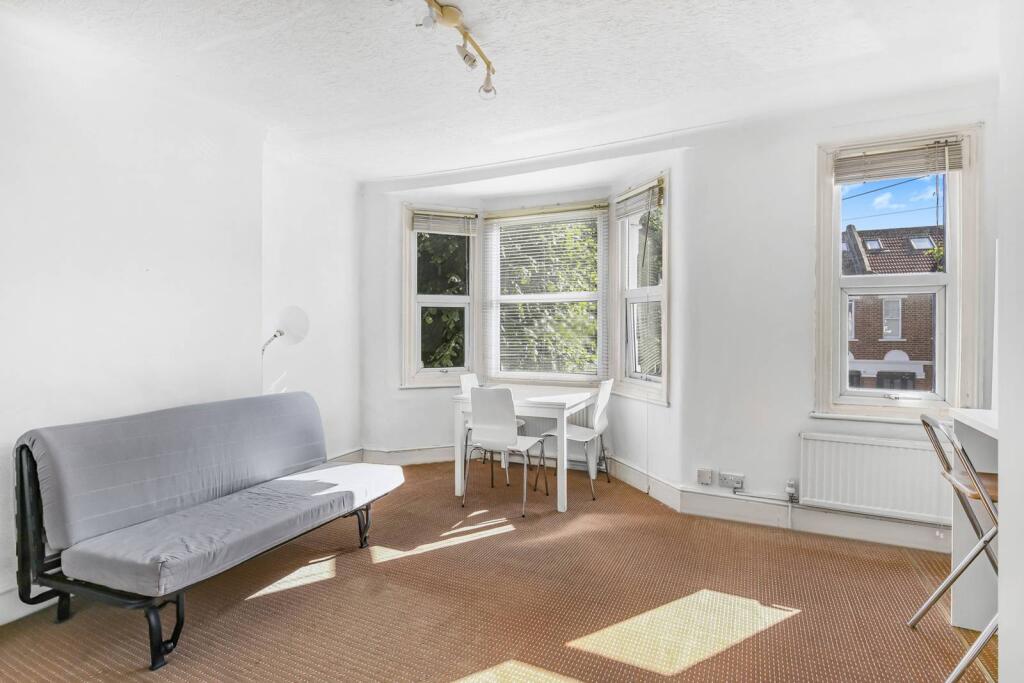
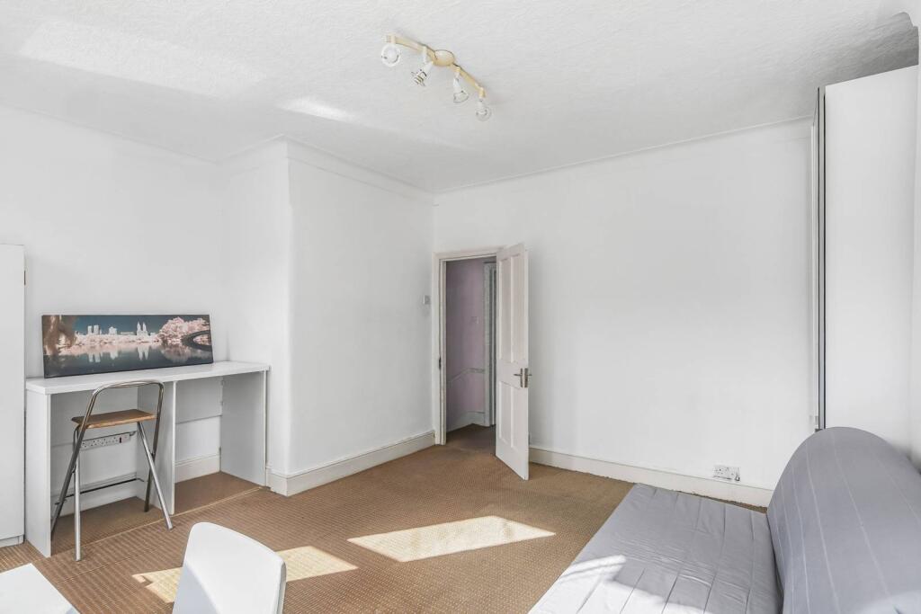
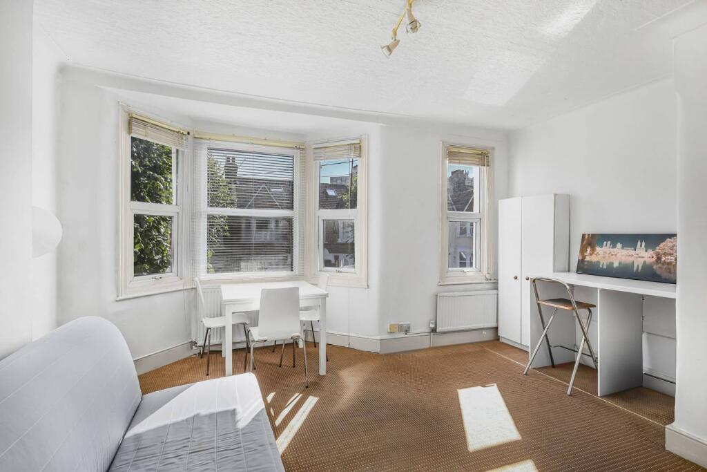
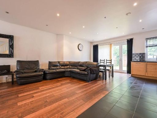
- living room Victorian
Floorplan Description
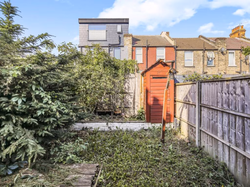
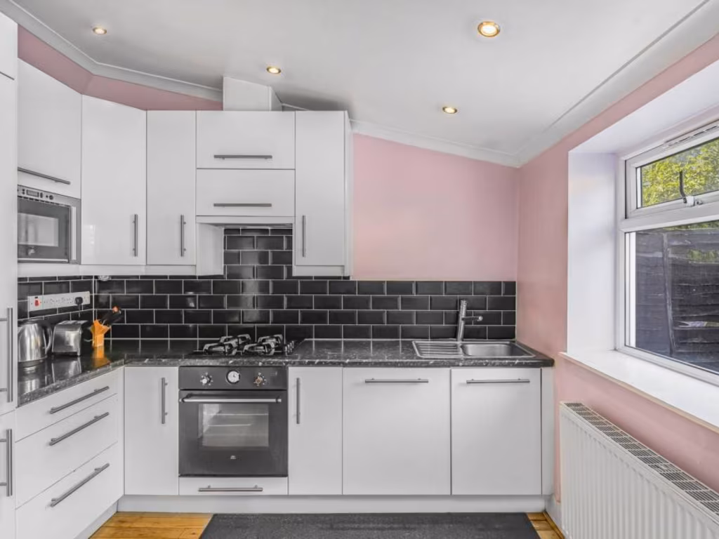
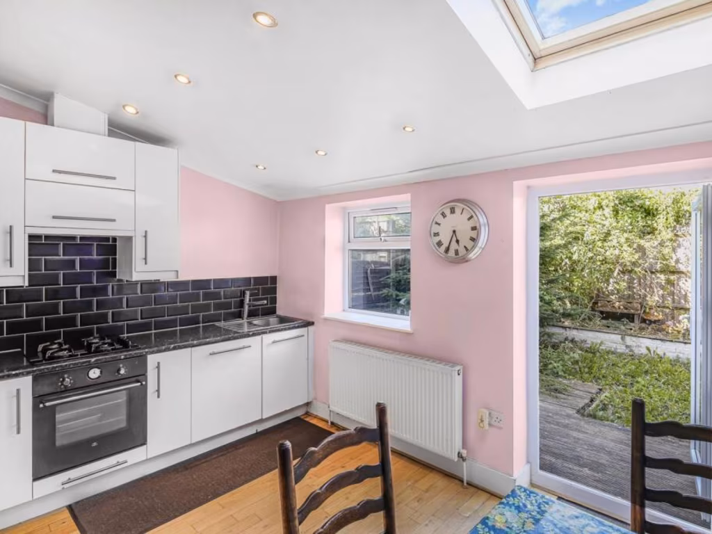
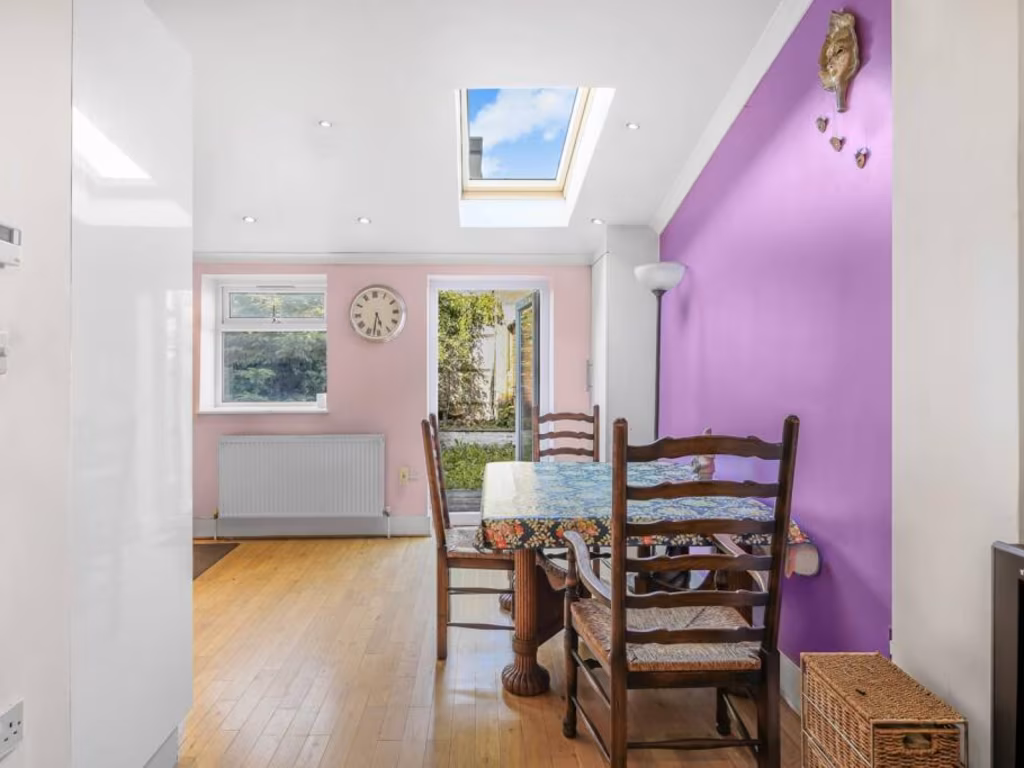
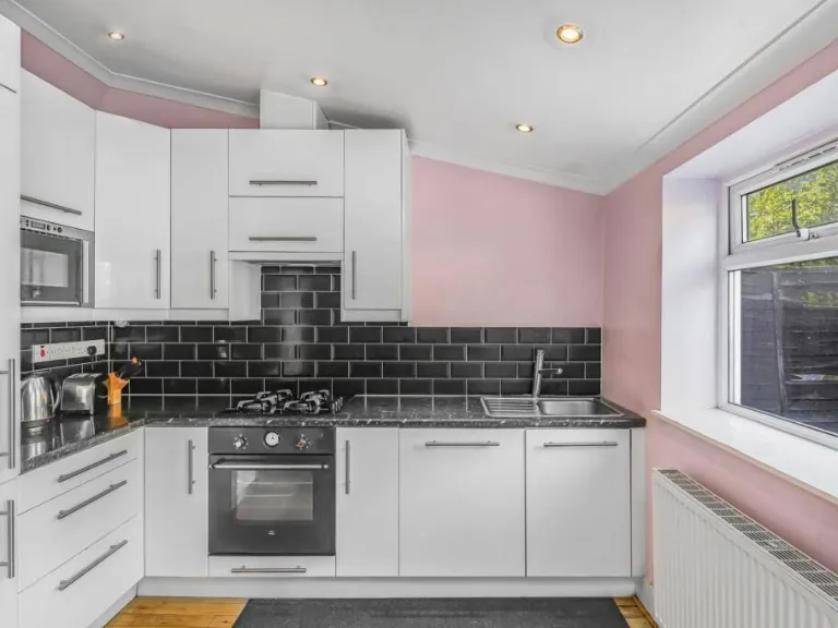
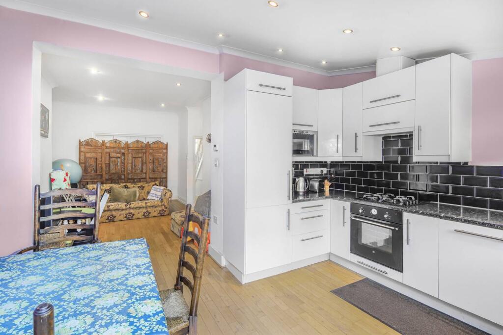
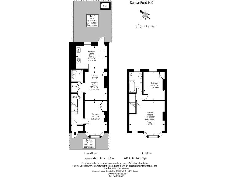
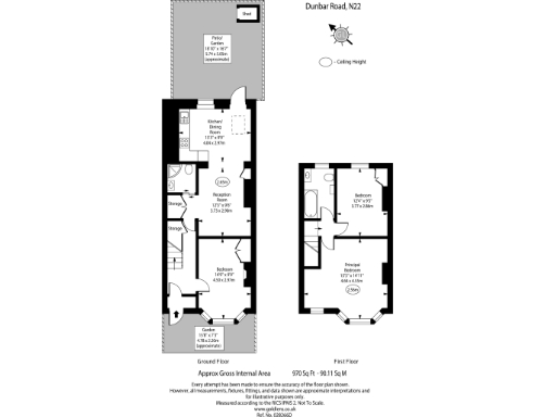
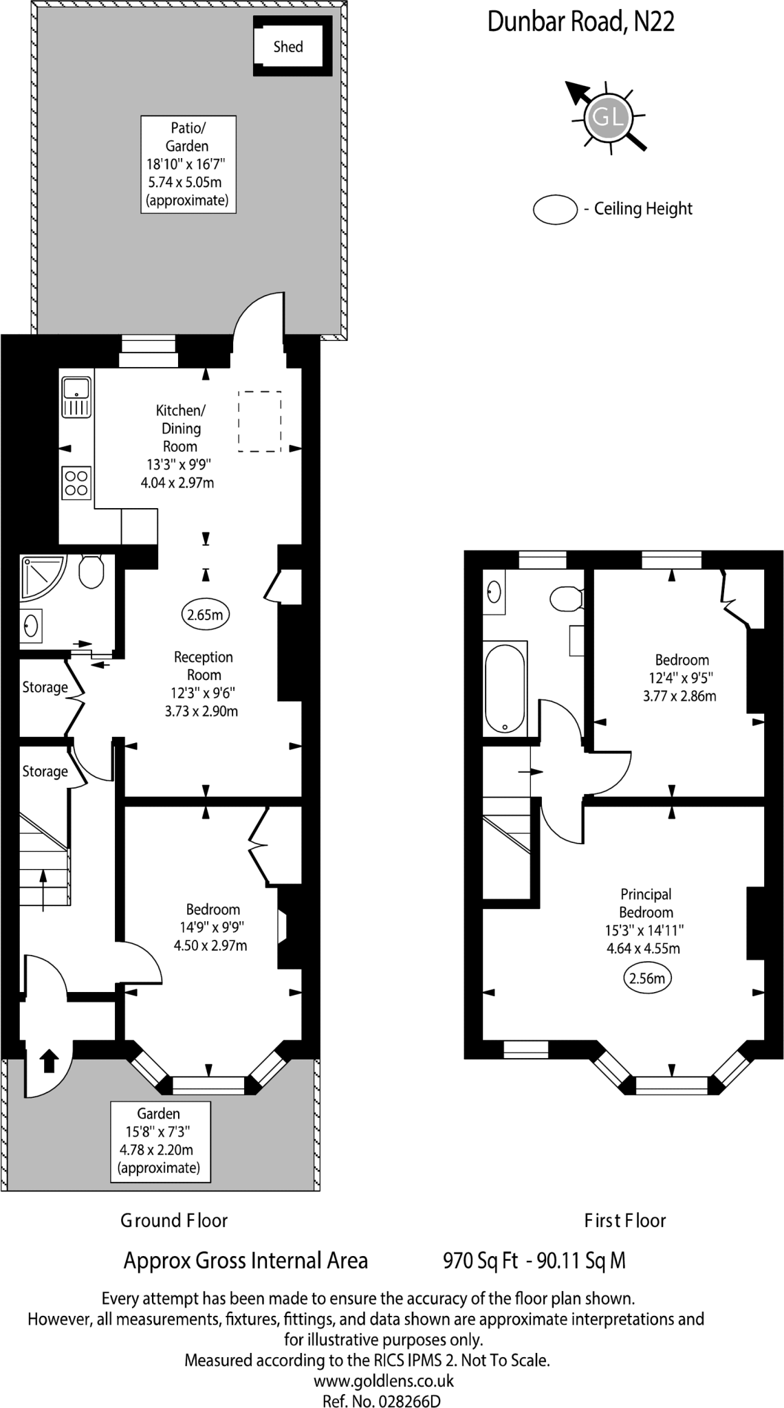
- Two-story property with a separate kitchen and reception room, containing three bedrooms and a shared bathroom.
- Two-story house with garden on Dunbar Road, containing a kitchen/dining room, reception room, two bedrooms, and a principal bedroom.
Rooms
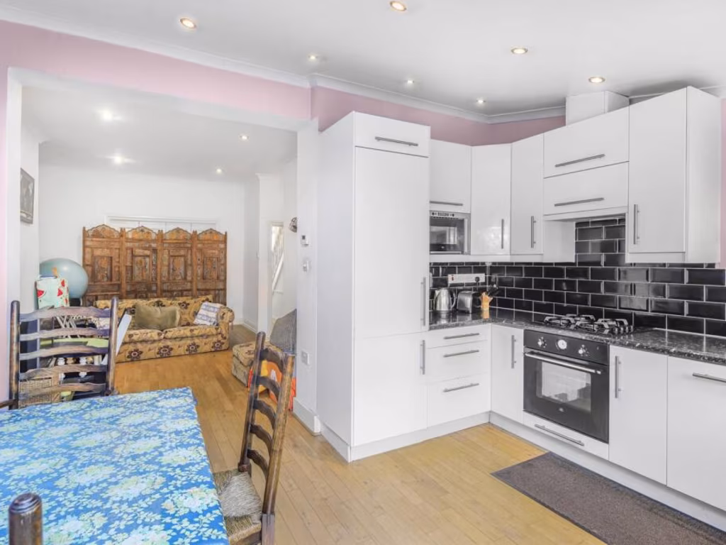
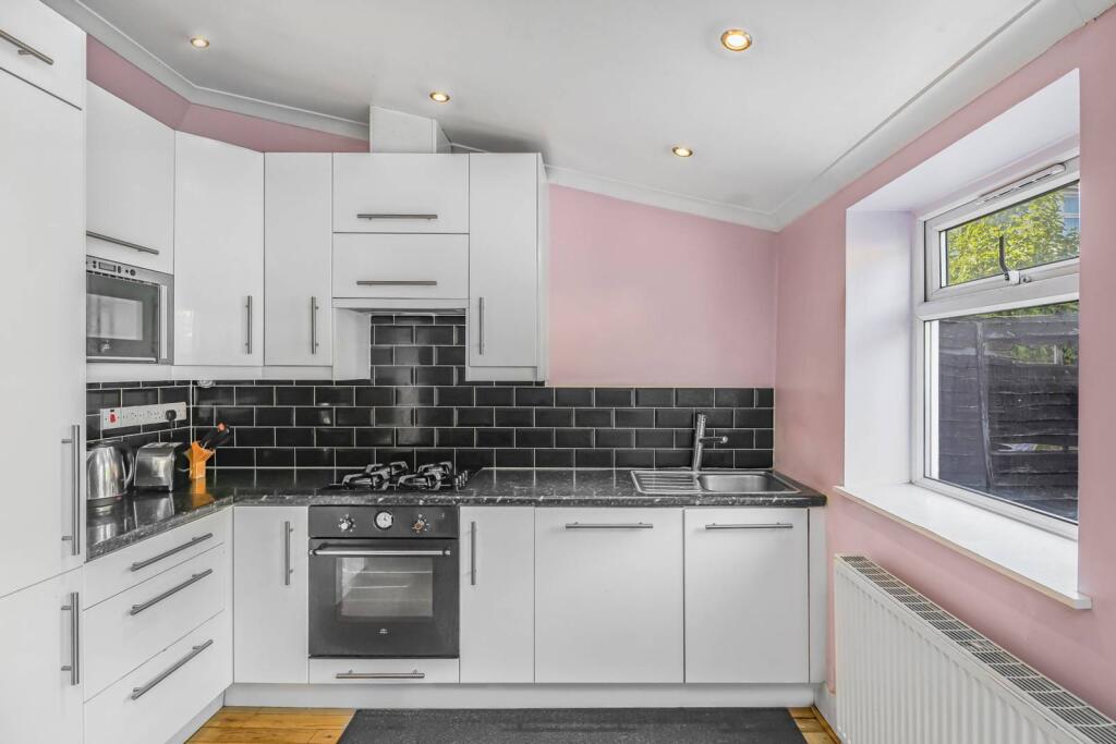
- Kitchen/Dining Room: average
- Reception Room: average
- Bedroom: average
- Bedroom: average
- Principal Bedroom: large
- Kitchen/Dining Room: average
- Reception Room: average
- Bedroom (Ground Floor): average
- Bedroom: average
- Principal Bedroom: large
Textual Property Features
Detected Visual Features
- residential
- bedroom
- early 20th-century
- standard ceiling
- medium size
- white walls
- built-in wardrobe
- wooden trim
- victorian
- sash window
- urban view
- Victorian
- bay windows
- natural light
- north-facing
EPC Details
- Fully double glazed
- Solid brick, as built, no insulation (assumed)
- Boiler and radiators, mains gas
- Low energy lighting in all fixed outlets
- Suspended, no insulation (assumed)
Nearby Schools
- St Mary's CofE Primary School
- Trinity Primary Academy
- St Michael at Bowes CofE Junior School
- Hazelwood Junior School
- Greek Secondary School of London
- Earlham Primary School
- Footsteps Trust
- St Anne's Catholic High School for Girls
- North Harringay Primary School
- Park View School
- Harris Primary Academy Philip Lane
- Noel Park Primary School
- St Paul's Catholic Primary School
- Heartlands High School
- Lordship Lane Primary School
- St Thomas More Catholic School
- Tottenhall Infant School
- West Green Primary School
- St John Vianney RC Primary School
- Belmont Infant School
- Belmont Junior School
- Alexandra Primary School
- St Michael's CofE Primary School
- Mulberry Academy Woodside
- Oakthorpe Primary School
- Hazelwood Infant School
Nearest Bars And Restaurants
- Id: 459786528
- Tags:
- Amenity: restaurant
- Cuisine: indian
- Name: Paramount
- TagsNormalized:
- Lat: 51.598082
- Lon: -0.1103695
- FullGeoHash: gcpvt3pss5ws
- PartitionGeoHash: gcpv
- Images:
- FoodStandards: null
- Distance: 636.3
,- Id: 459786455
- Tags:
- Amenity: restaurant
- Cuisine: caribbean
- Name: Brown Eagle
- TagsNormalized:
- Lat: 51.5986555
- Lon: -0.110668
- FullGeoHash: gcpvt3prvnxc
- PartitionGeoHash: gcpv
- Images:
- FoodStandards: null
- Distance: 624.7
,- Id: 459786566
- Tags:
- Amenity: restaurant
- Cuisine: fish_and_chips
- Name: Fryer's Delight
- TagsNormalized:
- Lat: 51.5973377
- Lon: -0.1092322
- FullGeoHash: gcpvt902q8ys
- PartitionGeoHash: gcpv
- Images:
- FoodStandards: null
- Distance: 621.4
,- Id: 7629294612
- Tags:
- Addr:
- City: London
- Housenumber: 242
- Postcode: N22 8JX
- Street: High Road
- Amenity: cafe
- Cuisine: coffee_shop;sandwich
- Name: Kenilly's Café
- Opening_hours: Mo-Th 06:30-18:00; Sa 08:00-1800; Su 10:00-16:00
- Opening_hours:covid19: same
- Outdoor_seating: yes
- TagsNormalized:
- Lat: 51.6007354
- Lon: -0.111444
- FullGeoHash: gcpvt3wu54m2
- PartitionGeoHash: gcpv
- Images:
- FoodStandards: null
- Distance: 621.2
,- Id: 519547890
- Tags:
- Amenity: dead_pub
- Name: The Freemasons
- TagsNormalized:
- Lat: 51.5990568
- Lon: -0.102888
- FullGeoHash: gcpvt9m46935
- PartitionGeoHash: gcpv
- Images:
- FoodStandards: null
- Distance: 220
}
Nearest General Shops
- Id: 38769659
- Tags:
- Addr:
- City: London
- Housenumber: 232-4
- Postcode: N22 8HH
- Street: High Road
- Amenity: restaurant
- Building: yes
- Cuisine: turkish
- Name: Nivan Restaurant
- Shop: vacant
- Smoking: no
- TagsNormalized:
- Lat: 51.5985861
- Lon: -0.1105071
- FullGeoHash: gcpvt3px8cxg
- PartitionGeoHash: gcpv
- Images:
- FoodStandards: null
- Distance: 618
,- Id: 459786568
- Tags:
- TagsNormalized:
- Lat: 51.5973544
- Lon: -0.1090756
- FullGeoHash: gcpvt90867gr
- PartitionGeoHash: gcpv
- Images:
- FoodStandards: null
- Distance: 612
,- Id: 519547892
- Tags:
- Brand: William Hill
- Brand:wikidata: Q4053147
- Name: William Hill
- Shop: bookmaker
- TagsNormalized:
- william hill
- bookmaker
- shop
- Lat: 51.599386
- Lon: -0.1018299
- FullGeoHash: gcpvt9mu5nwn
- PartitionGeoHash: gcpv
- Images:
- FoodStandards: null
- Distance: 186.6
}
Nearest Grocery shops
- Id: 459786565
- Tags:
- Name: Wood Green News
- Shop: convenience
- TagsNormalized:
- Lat: 51.597332
- Lon: -0.1093112
- FullGeoHash: gcpvt902hzgd
- PartitionGeoHash: gcpv
- Images:
- FoodStandards: null
- Distance: 625.9
,- Id: 459786567
- Tags:
- Name: Brabant Food Express
- Shop: convenience
- TagsNormalized:
- Lat: 51.5973463
- Lon: -0.1091514
- FullGeoHash: gcpvt9082d6z
- PartitionGeoHash: gcpv
- Images:
- FoodStandards: null
- Distance: 616.5
,- Id: 5532883991
- Tags:
- Brand: Tesco Express
- Brand:wikidata: Q98456772
- Contact:
- Website: https://www.tesco.com/store-locator/london/646-lordship-ln
- Name: Tesco Express
- Shop: convenience
- TagsNormalized:
- tesco
- tesco express
- convenience
- shop
- Lat: 51.5990354
- Lon: -0.1029792
- FullGeoHash: gcpvt9m40mm5
- PartitionGeoHash: gcpv
- Images:
- FoodStandards: null
- Distance: 223.3
}
Nearest Supermarkets
- Id: 191473149
- Tags:
- Addr:
- City: London
- Country: GB
- Housenumber: 54-58
- Postcode: N22 6BX
- Street: High Road
- Suburb: Wood Green
- Brand: Sainsbury's
- Brand:wikidata: Q152096
- Brand:wikipedia: en:Sainsbury's
- Building: supermarket
- Name: Sainsbury's
- Shop: supermarket
- TagsNormalized:
- sainsburys
- supermarket
- shop
- Lat: 51.5925644
- Lon: -0.1050534
- FullGeoHash: gcpvt85s2p4d
- PartitionGeoHash: gcpv
- Images:
- FoodStandards: null
- Distance: 956.8
,- Id: 5534218615
- Tags:
- Addr:
- Housenumber: 88-96
- Postcode: N22 6HE
- Street: High Road
- Unit: Unit 8
- Brand: Lidl
- Brand:wikidata: Q151954
- Brand:wikipedia: en:Lidl
- Fhrs:
- Name: Lidl
- Shop: supermarket
- Source:
- Wheelchair: yes
- TagsNormalized:
- Lat: 51.5938278
- Lon: -0.106645
- FullGeoHash: gcpvt867ffxd
- PartitionGeoHash: gcpv
- Images:
- FoodStandards:
- Id: 422998
- FHRSID: 422998
- LocalAuthorityBusinessID: PI/000130676
- BusinessName: Lidl
- BusinessType: Retailers - supermarkets/hypermarkets
- BusinessTypeID: 7840
- AddressLine1: Units 7-8
- AddressLine2: 88-96 High Road
- AddressLine3: Wood Green
- AddressLine4: London
- PostCode: N22 6HE
- RatingValue: 5
- RatingKey: fhrs_5_en-GB
- RatingDate: 2022-03-12
- LocalAuthorityCode: 514
- LocalAuthorityName: Haringey
- LocalAuthorityWebSite: http://www.haringey.gov.uk
- LocalAuthorityEmailAddress: frontline@haringey.gov.uk
- Scores:
- Hygiene: 0
- Structural: 0
- ConfidenceInManagement: 0
- NewRatingPending: false
- Geocode:
- Longitude: null
- Latitude: null
- Distance: 850.1
,- Id: 191447440
- Tags:
- Addr:
- Country: GB
- Postcode: N22 6SU
- Brand: Morrisons
- Brand:wikidata: Q922344
- Brand:wikipedia: en:Morrisons
- Contact:
- Website: https://my.morrisons.com/storefinder/313
- Name: Morrisons
- Shop: supermarket
- Toilets:
- Wheelchair: yes
- TagsNormalized:
- Lat: 51.5963565
- Lon: -0.1106628
- FullGeoHash: gcpvt2z6t3gz
- PartitionGeoHash: gcpv
- Images:
- FoodStandards: null
- Distance: 767.8
}
Nearest Religious buildings
- Id: 577027264
- Tags:
- Amenity: place_of_worship
- Building: yes
- Name: Zion Church of Christ Apostolic Pentecostal
- Religion: christian
- TagsNormalized:
- place of worship
- church
- pentecostal
- christian
- Lat: 51.6038276
- Lon: -0.0964419
- FullGeoHash: gcpvtf1y0dxw
- PartitionGeoHash: gcpv
- Images:
- FoodStandards: null
- Distance: 520.1
,- Id: 78188253
- Tags:
- Amenity: place_of_worship
- Building: yes
- Denomination: baptist
- Name: Eldon Road Baptist Church
- Note: The website shows the location very clearly but gives the address as 'Boundary Road' which seems wrong.
- Religion: christian
- Source: OS;website
- Url: http://www.findachurch.co.uk/churches/tq/tq39/eldonroadbc/
- TagsNormalized:
- place of worship
- baptist
- church
- christian
- Lat: 51.5992611
- Lon: -0.0974193
- FullGeoHash: gcpvtc353zqv
- PartitionGeoHash: gcpv
- Images:
- FoodStandards: null
- Distance: 399.3
,- Id: 903447300
- Tags:
- Amenity: place_of_worship
- Building: yes
- Name: Eritrean Bethel Church
- TagsNormalized:
- Lat: 51.602034
- Lon: -0.1007114
- FullGeoHash: gcpvt9yetk24
- PartitionGeoHash: gcpv
- Images:
- FoodStandards: null
- Distance: 165.5
}
Nearest Medical buildings
- Id: 2462804568
- Tags:
- Amenity: doctors
- Name: Staunton Group Practice
- Source: survey
- Url: http://www.morumhouse.nhs.uk
- TagsNormalized:
- Lat: 51.5989934
- Lon: -0.1120395
- FullGeoHash: gcpvt3q3vm92
- PartitionGeoHash: gcpv
- Images:
- FoodStandards: null
- Distance: 698.8
,- Id: 459786529
- Tags:
- Amenity: pharmacy
- Healthcare: pharmacy
- Name: Numark Pharmacy Express
- TagsNormalized:
- Lat: 51.5980425
- Lon: -0.1103381
- FullGeoHash: gcpvt3pskumb
- PartitionGeoHash: gcpv
- Images:
- FoodStandards: null
- Distance: 636.7
,- Id: 459786456
- Tags:
- Amenity: pharmacy
- Name: Lloyds
- TagsNormalized:
- Lat: 51.5987564
- Lon: -0.1107082
- FullGeoHash: gcpvt3r2s33g
- PartitionGeoHash: gcpv
- Images:
- FoodStandards: null
- Distance: 622.6
,- Id: 38771881
- Tags:
- Addr:
- City: London
- Postcode: N22 5NJ
- Street: Stuart Crescent
- Amenity: doctors
- Building: yes
- Healthcare: doctor
- Name: Stuart Crescent Health Centre
- Opening_hours: Mo-Tu 08:30-18:30; Th 08:30-13:30; Fr 08:30-18:30
- Operator: National Health Service
- TagsNormalized:
- doctor
- doctors
- health
- healthcare
- health centre
- Lat: 51.6001713
- Lon: -0.1102979
- FullGeoHash: gcpvt3x8vc5g
- PartitionGeoHash: gcpv
- Images:
- FoodStandards: null
- Distance: 549.3
}
Nearest Airports
- Id: 121158889
- Tags:
- Aerodrome: continental
- Aeroway: aerodrome
- Fhrs:
- Authority: City of London Corporation
- Iata: LCY
- Icao: EGLC
- Name: London City Airport
- Operator: London City Airport Limited
- Ref: LCY
- Website: https://www.londoncityairport.com/
- Wikidata: Q8982
- Wikipedia: en:London City Airport
- TagsNormalized:
- airport
- continental airport
- Lat: 51.5042658
- Lon: 0.0539987
- FullGeoHash: u10j10p64702
- PartitionGeoHash: u10j
- Images:
- FoodStandards: null
- Distance: 15256.6
,- Id: 14001268
- Tags:
- Access: yes
- Aerodrome: international
- Aerodrome:type: public
- Aeroway: aerodrome
- Alt_name: London Heathrow
- Alt_name_2: London Heathrow Airport
- Ele: 25
- Iata: LHR
- Icao: EGLL
- Int_name: Heathrow Airport
- Name: London Heathrow Airport
- Note: area still approx
- Old_name: London Airport
- Operator: Heathrow Airport Limited
- Rank_aci:
- Ref: LHR
- Short_name: Heathrow
- Type: multipolygon
- Website: https://www.heathrow.com/
- Wikidata: Q8691
- Wikipedia: en:Heathrow Airport
- TagsNormalized:
- airport
- international airport
- Lat: 51.4677522
- Lon: -0.4547736
- FullGeoHash: gcpsv9kv7h2h
- PartitionGeoHash: gcps
- Images:
- FoodStandards: null
- Distance: 28520.5
}
Nearest Leisure Facilities
- Id: 990580269
- Tags:
- Leisure: pitch
- Sport: tennis
- TagsNormalized:
- Lat: 51.6005348
- Lon: -0.099416
- FullGeoHash: gcpvt9xdgky5
- PartitionGeoHash: gcpv
- Images:
- FoodStandards: null
- Distance: 217.1
,- Id: 1127607590
- Tags:
- TagsNormalized:
- Lat: 51.6027574
- Lon: -0.101404
- FullGeoHash: gcpvt9ypv55w
- PartitionGeoHash: gcpv
- Images:
- FoodStandards: null
- Distance: 206.8
,- Id: 589438012
- Tags:
- Addr:
- City: Wood Green
- Street: Perth Road
- Leisure: park
- Name: Chapman's Green
- TagsNormalized:
- Lat: 51.6001442
- Lon: -0.0998751
- FullGeoHash: gcpvt9x28sp9
- PartitionGeoHash: gcpv
- Images:
- FoodStandards: null
- Distance: 203.3
,- Id: 1066938318
- Tags:
- Access: private
- Garden:
- Leisure: garden
- TagsNormalized:
- Lat: 51.6019033
- Lon: -0.1043319
- FullGeoHash: gcpvt9u4bgur
- PartitionGeoHash: gcpv
- Images:
- FoodStandards: null
- Distance: 162.4
,- Id: 1066938320
- Tags:
- Access: private
- Garden:
- Leisure: garden
- TagsNormalized:
- Lat: 51.601642
- Lon: -0.1037585
- FullGeoHash: gcpvt9u3q720
- PartitionGeoHash: gcpv
- Images:
- FoodStandards: null
- Distance: 113.3
}
Nearest Tourist attractions
- Id: 7501619886
- Tags:
- Name: Tottenham Cemetery lake
- Tourism: attraction
- TagsNormalized:
- cemetery
- lake
- attraction
- tourism
- Lat: 51.6033589
- Lon: -0.0825224
- FullGeoHash: gcpvw45gm56f
- PartitionGeoHash: gcpv
- Images:
- FoodStandards: null
- Distance: 1401.5
,- Id: 399270325
- Tags:
- Name: Picnic Area
- Surface: grass
- Tourism: picnic_site
- TagsNormalized:
- Lat: 51.5914472
- Lon: -0.09346
- FullGeoHash: gcpvmzgvynz4
- PartitionGeoHash: gcpv
- Images:
- FoodStandards: null
- Distance: 1232.5
,- Id: 9792388117
- Tags:
- Addr:
- Housenumber: 2
- Postcode: N22 6UJ
- Street: Coburg Road
- Unit: Unit C
- Name: Kidz Adventure Playzone
- Opening_hours: Mo-Su 10:00-18:30
- Tourism: attraction
- Website: http://www.kidz-adventure-zone.com/
- TagsNormalized:
- Lat: 51.5945025
- Lon: -0.1130322
- FullGeoHash: gcpvt2mxy0m5
- PartitionGeoHash: gcpv
- Images:
- FoodStandards: null
- Distance: 1028.5
}
Nearest Hotels
- Id: 832779342
- Tags:
- Addr:
- City: London
- Housenumber: 70
- Postcode: N13 6BE
- Street: Green Lanes
- Building: yes
- Building:levels: 4
- Internet_access: wlan
- Internet_access:fee: no
- Name: Forest House
- Rooms: 28
- Tourism: hotel
- Website: http://www.foresthouselondon.co.uk/
- TagsNormalized:
- Lat: 51.6117921
- Lon: -0.1091893
- FullGeoHash: gcpvte8krxqs
- PartitionGeoHash: gcpv
- Images:
- FoodStandards: null
- Distance: 1285
,- Id: 9622359524
- Tags:
- Brand: Travelodge
- Brand:wikidata: Q9361374
- Brand:wikipedia: en:Travelodge UK
- Internet_access: wlan
- Internet_access:fee: customers
- Internet_access:ssid: Travelodge WiFi
- Name: Travelodge
- Tourism: hotel
- TagsNormalized:
- Lat: 51.5949482
- Lon: -0.108567
- FullGeoHash: gcpvt88fq5qw
- PartitionGeoHash: gcpv
- Images:
- FoodStandards: null
- Distance: 795.8
,- Id: 1148054869
- Tags:
- Addr:
- City: London
- Housenumber: 13-27
- Postcode: N22 6UW
- Street: Station Road
- Contact:
- Website: https://www.greenrooms.london/
- Fhrs:
- Name: Green Rooms
- Tourism: hotel
- TagsNormalized:
- Lat: 51.5968481
- Lon: -0.1107943
- FullGeoHash: gcpvt2zm6m9g
- PartitionGeoHash: gcpv
- Images:
- FoodStandards: null
- Distance: 739
}
Tags
- residential
- bedroom
- early 20th-century
- standard ceiling
- medium size
- white walls
- built-in wardrobe
- wooden trim
- victorian
- sash window
- urban view
- Victorian
- bay windows
- natural light
- north-facing
- white walls
Local Market Stats
- Average Price/sqft: £626
- Avg Income: £55800
- Rental Yield: 4.2%
- Social Housing: 20%
- Planning Success Rate: 80%
AirBnB Data
- 1km average: £182/night
- Listings in 1km: 16
Similar Properties
 3 bedroom terraced house for sale in Grainger Road N22, Tottenham, London, N22 — £575,000 • 3 bed • 1 bath • 1089 ft²
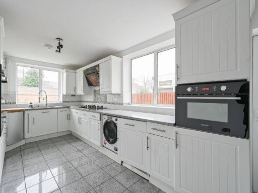 3 bedroom house for sale in Princes Avenue, Wood Green, London, N13 — £600,000 • 3 bed • 3 bath • 1222 ft²
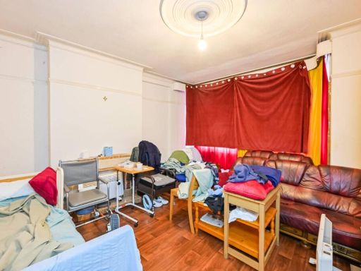 3 bedroom terraced house for sale in Boundary Road, London, N22 6AJ, Wood Green, London, N22 — £575,000 • 3 bed • 1 bath • 1122 ft²
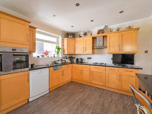 3 bedroom semi-detached house for sale in GOSPATRICK ROAD, Tottenham, London, N17 — £550,000 • 3 bed • 2 bath • 1065 ft²
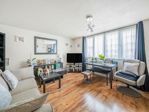 3 bedroom maisonette for sale in Acacia Road, Wood Green, London, N22 — £475,000 • 3 bed • 2 bath • 909 ft²
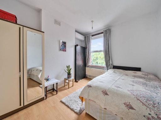 3 bedroom house for sale in Dagmar Road, Wood Green, London, N22 — £1,025,000 • 3 bed • 1 bath • 1283 ft²
Meta
- {
"@context": "https://schema.org",
"@type": "Residence",
"name": "3 bedroom terraced house for sale in Dunbar Road, Wood Gree…",
"description": "",
"url": "https://propertypiper.co.uk/property/c229d8e8-e5c1-4406-b4ac-7a646d620b22",
"image": "https://image-a.propertypiper.co.uk/afc70fa7-e2f8-476c-8f63-9ff90fc856e9-1024.jpeg",
"address": {
"@type": "PostalAddress",
"streetAddress": "58 DUNBAR ROAD LONDON ",
"postalCode": "N22 5BE",
"addressLocality": "Haringey",
"addressRegion": "Hornsey and Wood Green",
"addressCountry": "England"
},
"geo": {
"@type": "GeoCoordinates",
"latitude": 51.601017450314,
"longitude": -0.10246186582973028
},
"numberOfRooms": 3,
"numberOfBathroomsTotal": 1,
"floorSize": {
"@type": "QuantitativeValue",
"value": 970,
"unitCode": "FTK"
},
"offers": {
"@type": "Offer",
"price": 650000,
"priceCurrency": "GBP",
"availability": "https://schema.org/InStock"
},
"additionalProperty": [
{
"@type": "PropertyValue",
"name": "Feature",
"value": "residential"
},
{
"@type": "PropertyValue",
"name": "Feature",
"value": "bedroom"
},
{
"@type": "PropertyValue",
"name": "Feature",
"value": "early 20th-century"
},
{
"@type": "PropertyValue",
"name": "Feature",
"value": "standard ceiling"
},
{
"@type": "PropertyValue",
"name": "Feature",
"value": "medium size"
},
{
"@type": "PropertyValue",
"name": "Feature",
"value": "white walls"
},
{
"@type": "PropertyValue",
"name": "Feature",
"value": "built-in wardrobe"
},
{
"@type": "PropertyValue",
"name": "Feature",
"value": "wooden trim"
},
{
"@type": "PropertyValue",
"name": "Feature",
"value": "victorian"
},
{
"@type": "PropertyValue",
"name": "Feature",
"value": "sash window"
},
{
"@type": "PropertyValue",
"name": "Feature",
"value": "urban view"
},
{
"@type": "PropertyValue",
"name": "Feature",
"value": "Victorian"
},
{
"@type": "PropertyValue",
"name": "Feature",
"value": "bay windows"
},
{
"@type": "PropertyValue",
"name": "Feature",
"value": "natural light"
},
{
"@type": "PropertyValue",
"name": "Feature",
"value": "north-facing"
},
{
"@type": "PropertyValue",
"name": "Feature",
"value": "white walls"
}
]
}
High Res Floorplan Images
Compatible Floorplan Images
FloorplanImages Thumbnail