Summary - FOXGLOVE HOUSE MILL HILL ROAD HATFIELD DONCASTER DN7 6BQ
1 bed 1 bath Farm Land
Large strategic parcel suitable for agriculture or future planning opportunities.
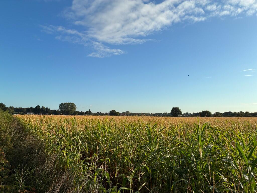
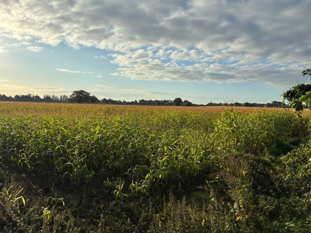
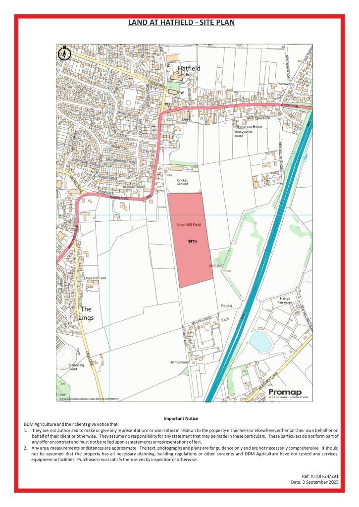
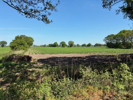
17.50 acres of arable land, freehold with vacant possession
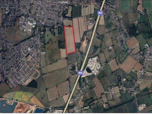
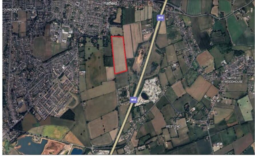
A substantial 17.50‑acre rectangular arable block on the edge of Hatfield, offered freehold with vacant possession. The holding sits immediately adjacent to the M18 corridor and has direct access from Carr Side Lane, making it practical for continued farming use or as a strategic landholding near town infrastructure. Soils are classified as Newport 1 (deep, well drained, sandy/coarse loam) and the parcel is Grade 3, suitable for cereals, sugar beet and potatoes.
The land lies within a Nitrate Vulnerable Zone and has previously been used to activate Basic Payment Scheme entitlements; prospective purchasers should satisfy themselves on current scheme status. Sporting, timber and mineral rights are included insofar as owned. Doncaster East Internal Drainage Board rates are modest; a copy of the LPIS map and a five‑year back‑cropping schedule are available on request.
Important constraints are stated openly: the sale is subject to a development clawback retaining 25% of any uplift above existing use value for 50 years. The site is sold VAT exclusive; purchasers must indemnify vendors against any VAT liability. The local area shows higher crime and relative deprivation statistics and broadband speeds are slow, though mobile signal is excellent. Any alternative-use potential is subject to planning consent and the clawback provision.
This parcel will suit growers seeking additional acreage, investors wanting a strategic urban‑edge holding, or buyers prepared to engage with planning potential. Early entry can be permitted subject to exchange of contracts and a double deposit (20%). Offers are invited by informal tender; purchasers should review the LPIS map, drainage obligations and all wayleaves/easements before bidding.
 Land for sale in Land at Epworth, North Lincolnshire, DN9 — £395,000 • 1 bed • 1 bath
 4 bedroom detached house for sale in High Street, Hatfield, Doncaster, DN7 — £525,000 • 4 bed • 2 bath • 2153 ft²
 5 bedroom detached house for sale in Tudworth Road, Hatfield, Doncaster, South Yorkshire, DN7 — £2,950,000 • 5 bed • 5 bath • 11571 ft²
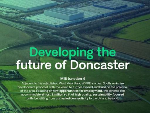 Light industrial facility for sale in Wmpe, Holme Wood Lane, Armthorpe, Doncaster, DN3 3EH, DN3 — POA • 1 bed • 1 bath
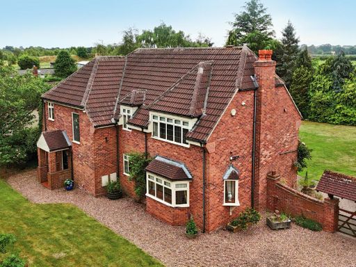 4 bedroom detached house for sale in Hatfield YORKSHIRE, DN7 — £850,000 • 4 bed • 2 bath • 2518 ft²
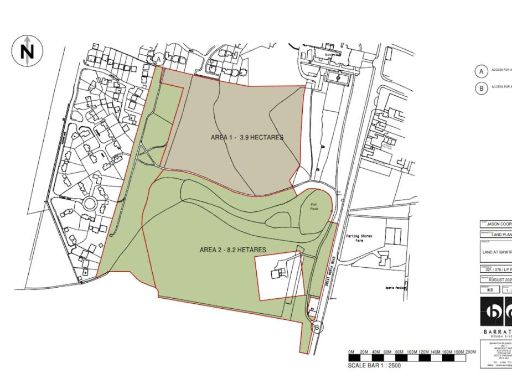 Land for sale in Land & Woodland, Bawtry Hall, South Parade, Bawtry, Doncaster, DN10 6JH, DN10 — POA • 1 bed • 1 bath