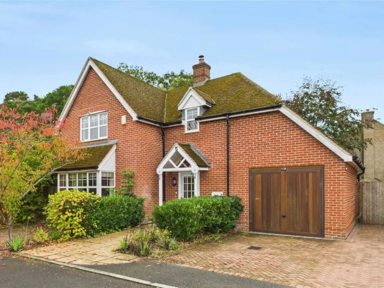
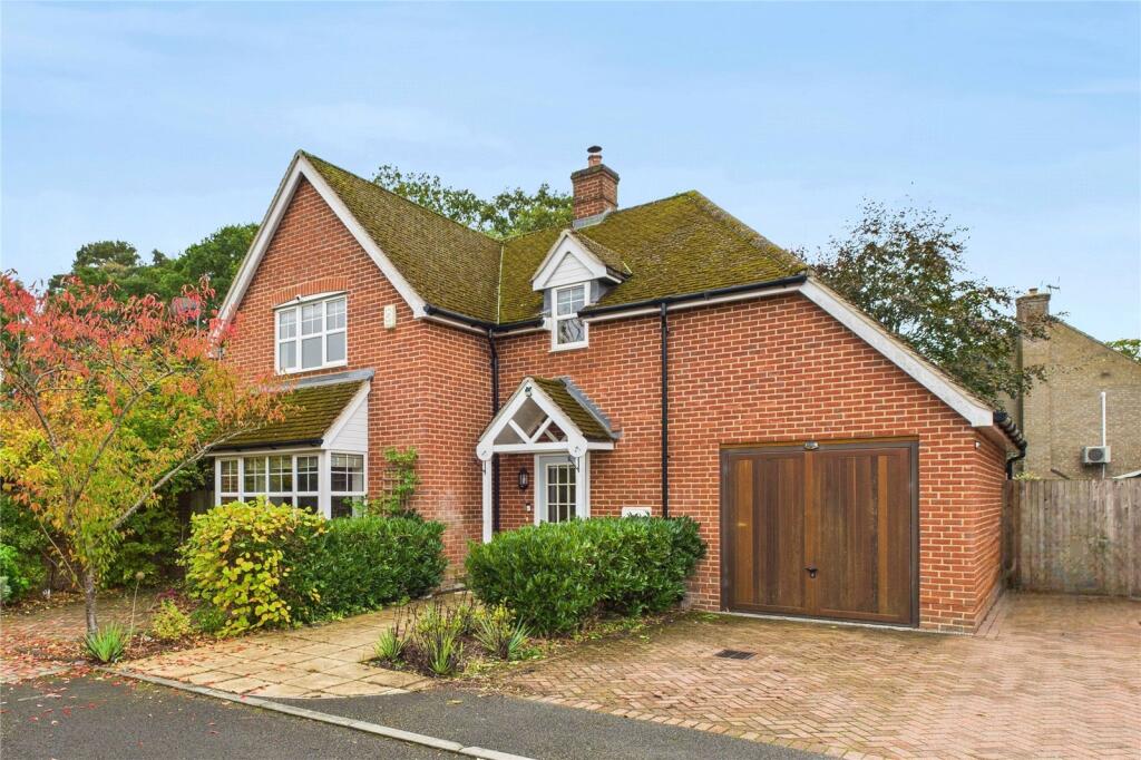
RG26 5GE - 4 bedroom detached house for sale in Stanley Close, Baughur…
View on Property Piper
4 bedroom detached house for sale in Stanley Close, Baughurst, Tadley, Hampshire, RG26
Property Details
- Price: £575000
- Bedrooms: 4
- Bathrooms: 3
- Property Type: undefined
- Property SubType: undefined
Brochure Descriptions
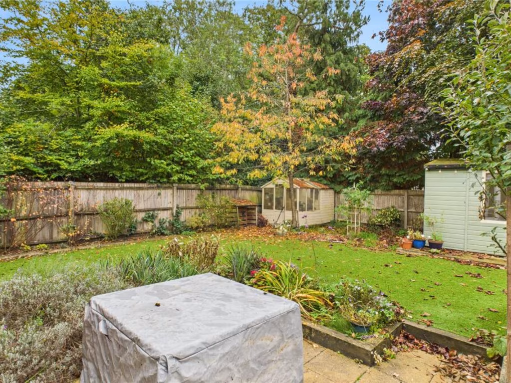
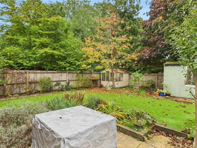
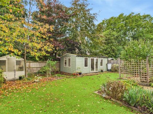
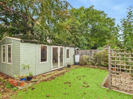
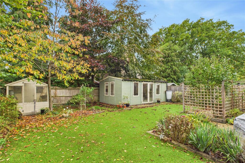
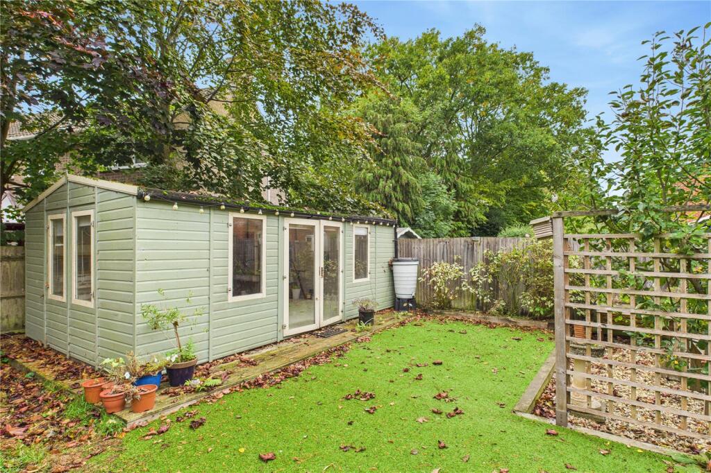
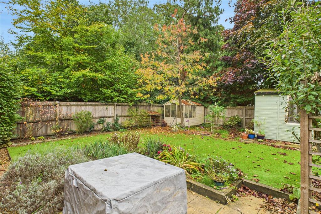
- Residential single-family plot located on a cul-de-sac (Stanley Close) in Baughurst, Tadley. Aerial plan shows an irregular/triangular rear garden and footprint highlighted in purple indicating a detached or semi-detached dwelling set back from the street with private garden space to the rear. Plot size appears modest-to-average for the locality with a proportionally larger rear garden area relative to the building footprint. Immediate setting is suburban with neighbouring houses closely spaced, mature trees to the rear providing partial screening and privacy. No significant long-distance views are visible from the imagery. Overall impression for valuation: a standard suburban family property on a good-sized infill plot in a cul-de-sac location — suitable for owner-occupation or modest uplift through garden/plot optimisation. (Description based solely on the provided images and labelled address.)
Image Descriptions
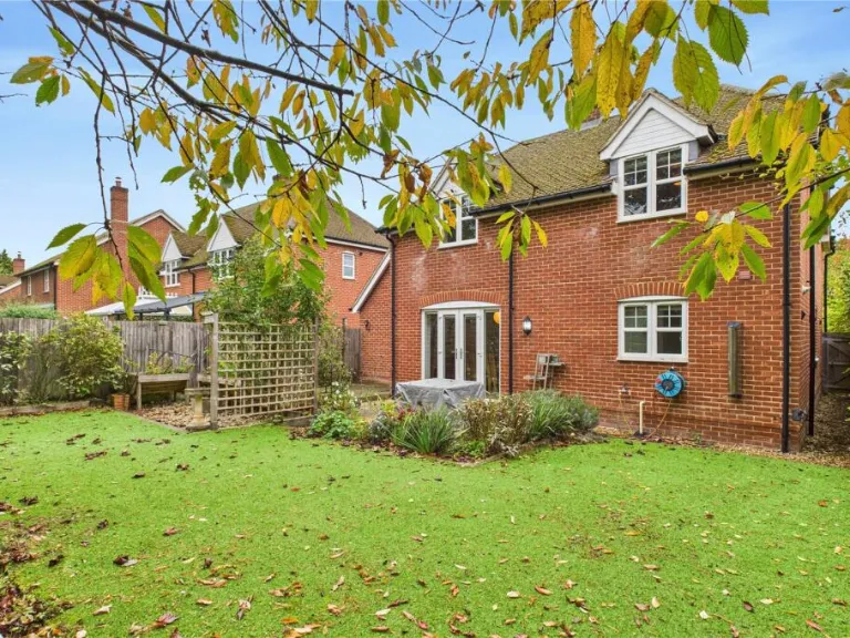
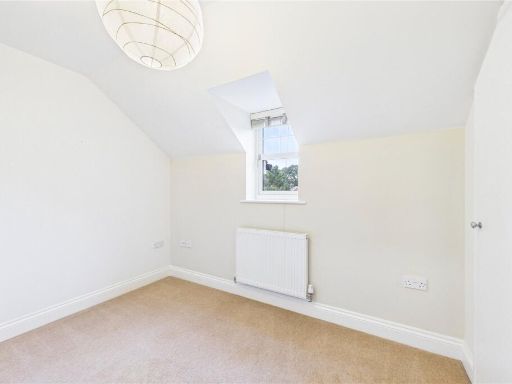
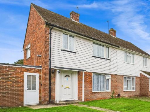
- exterior modern cottage
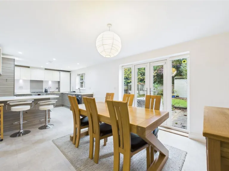
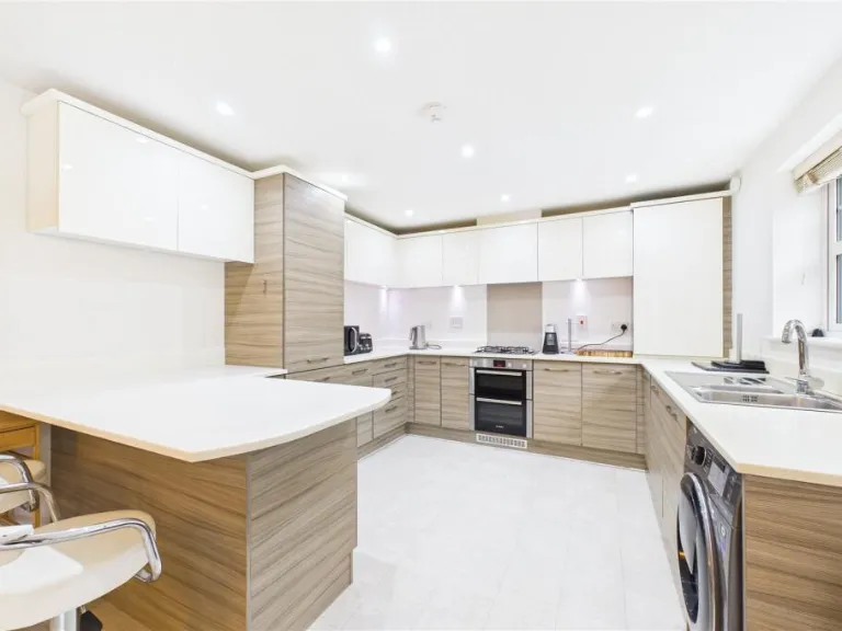
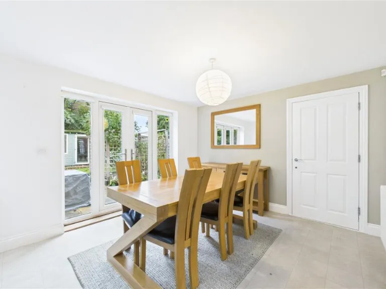
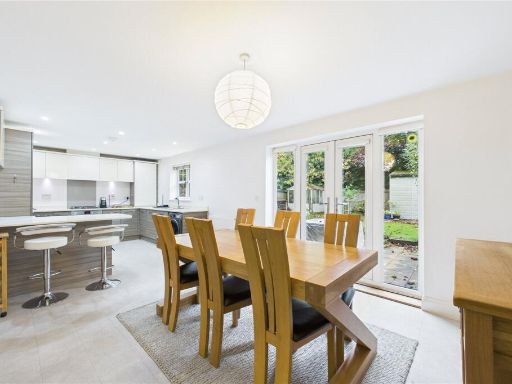
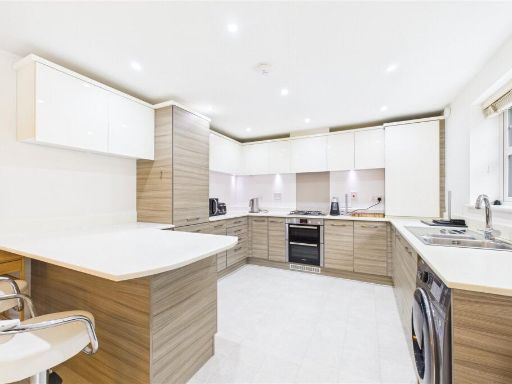
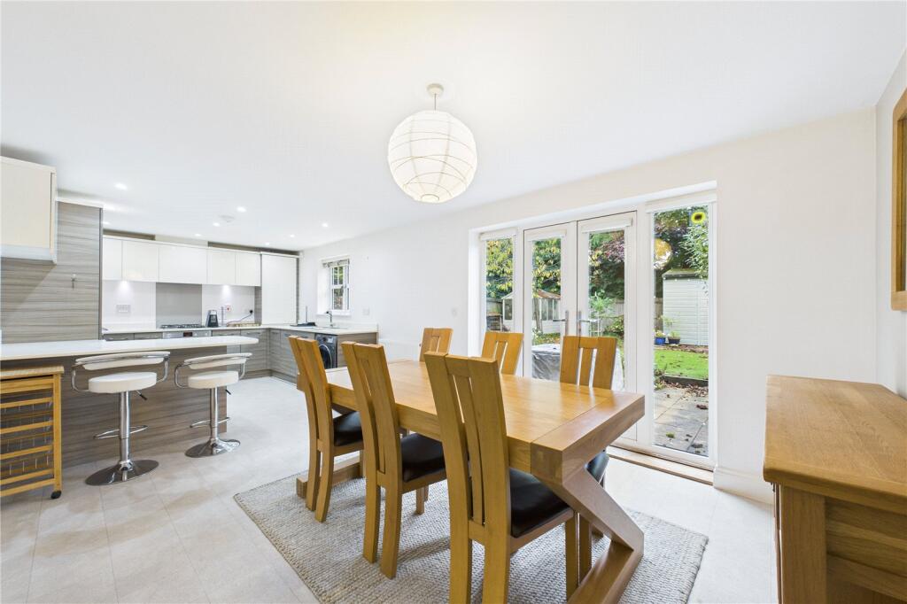
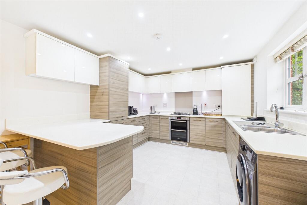
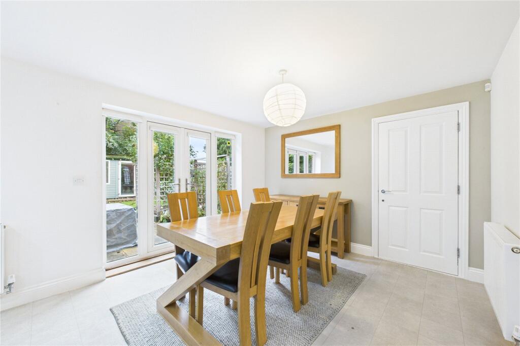
- modern kitchen-diner contemporary
Floorplan Description
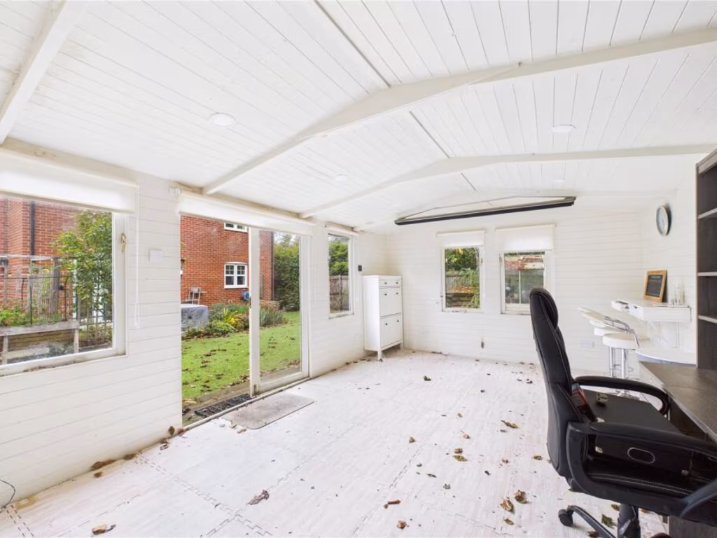
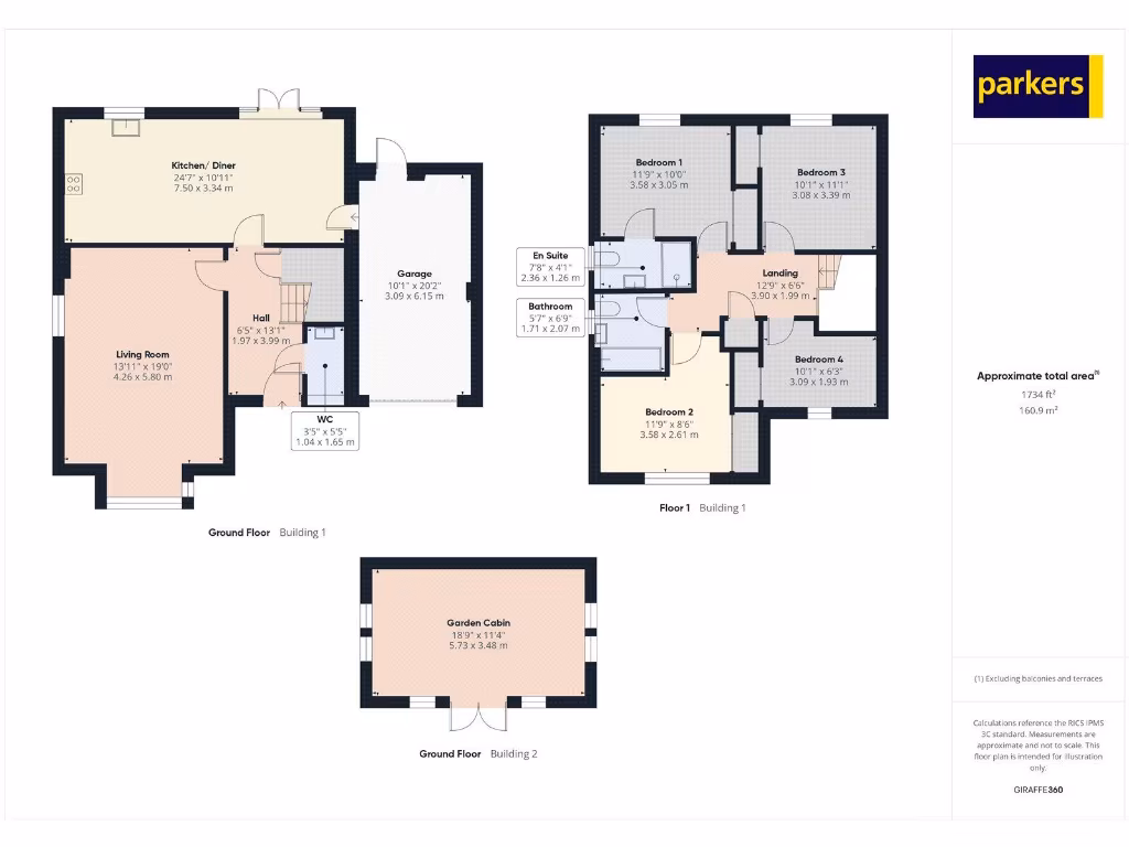
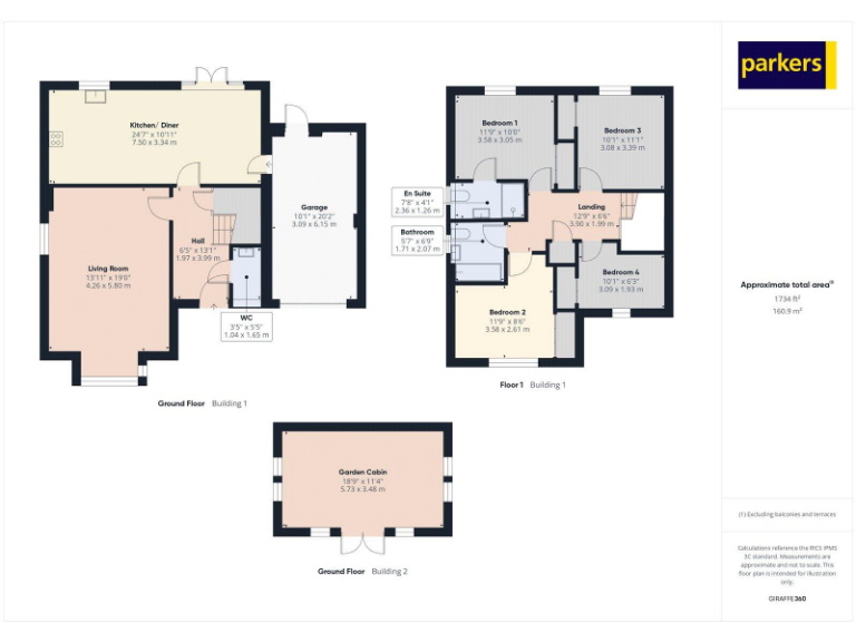
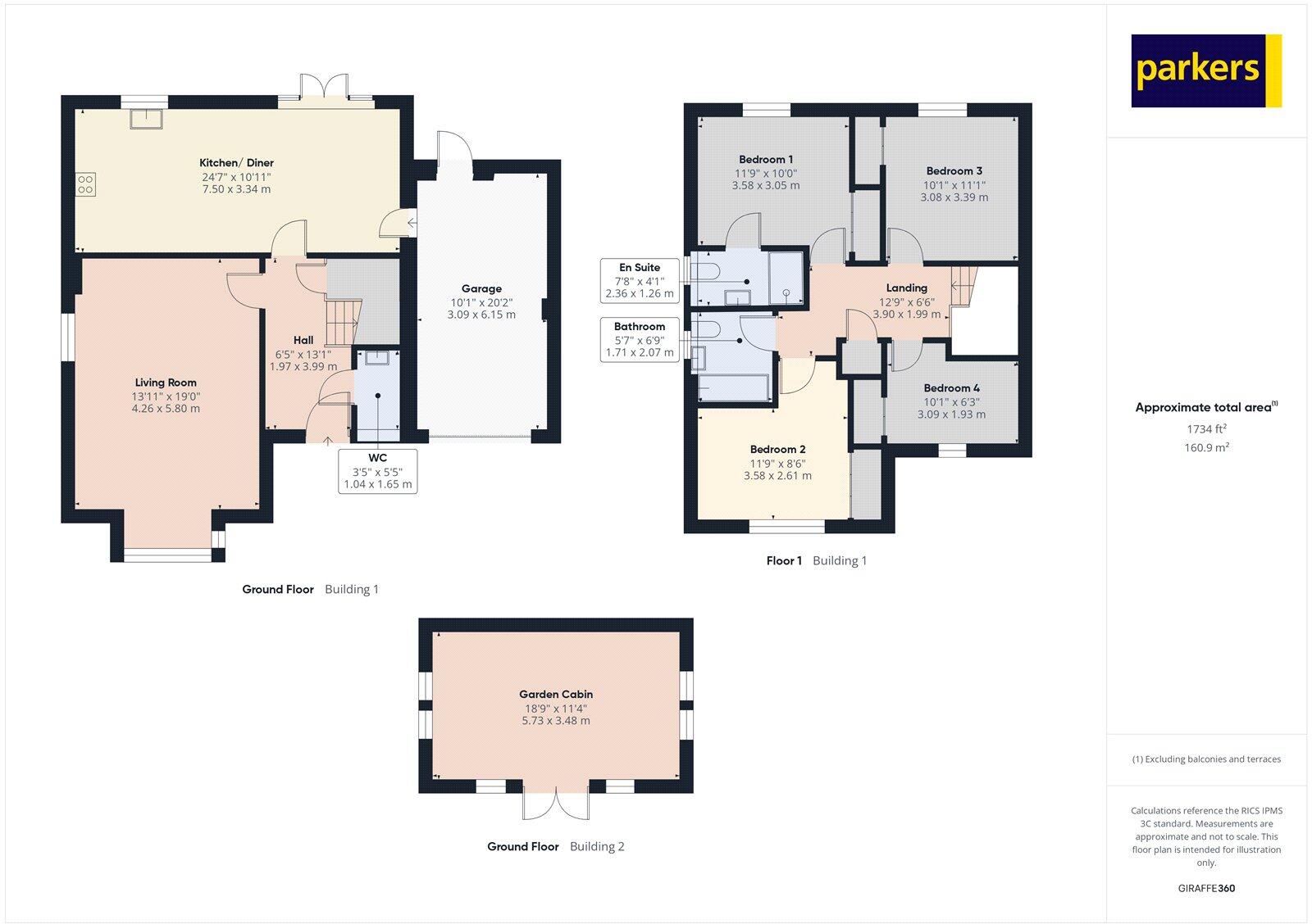
- Two-storey residential property (main building only) with separate garden cabin and attached garage; totals exclude the garage.
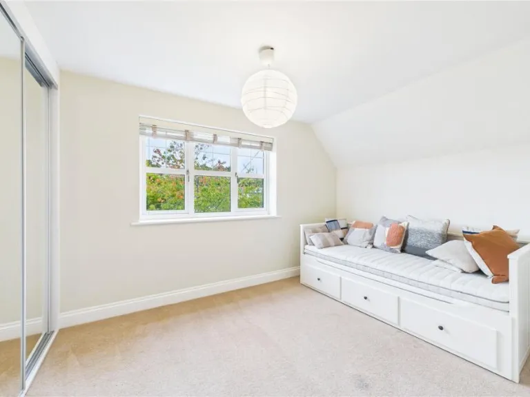
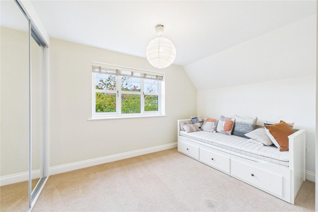
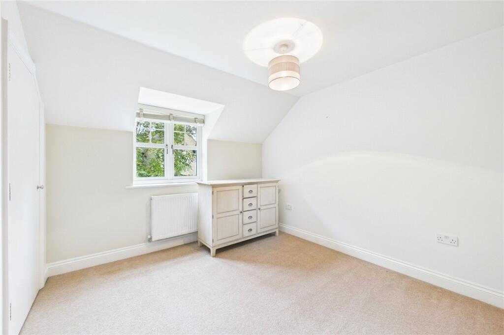
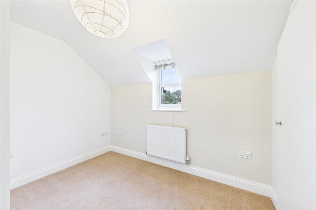
Rooms
- Kitchen/ Diner:
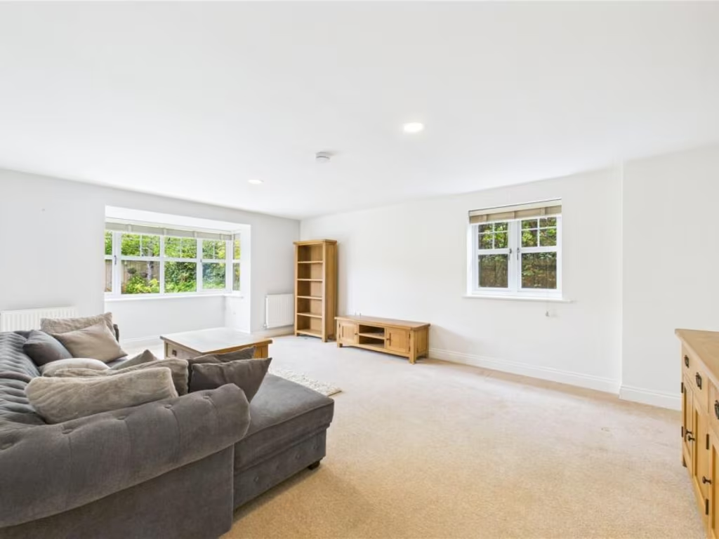
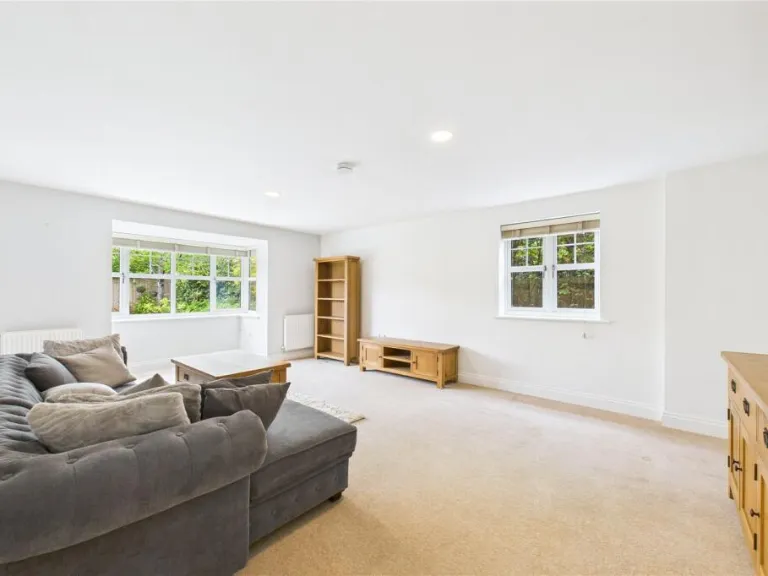
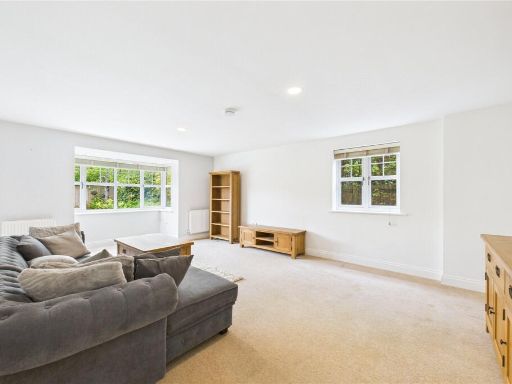
- Living Room:
- Hall:
- WC:
- Garage:
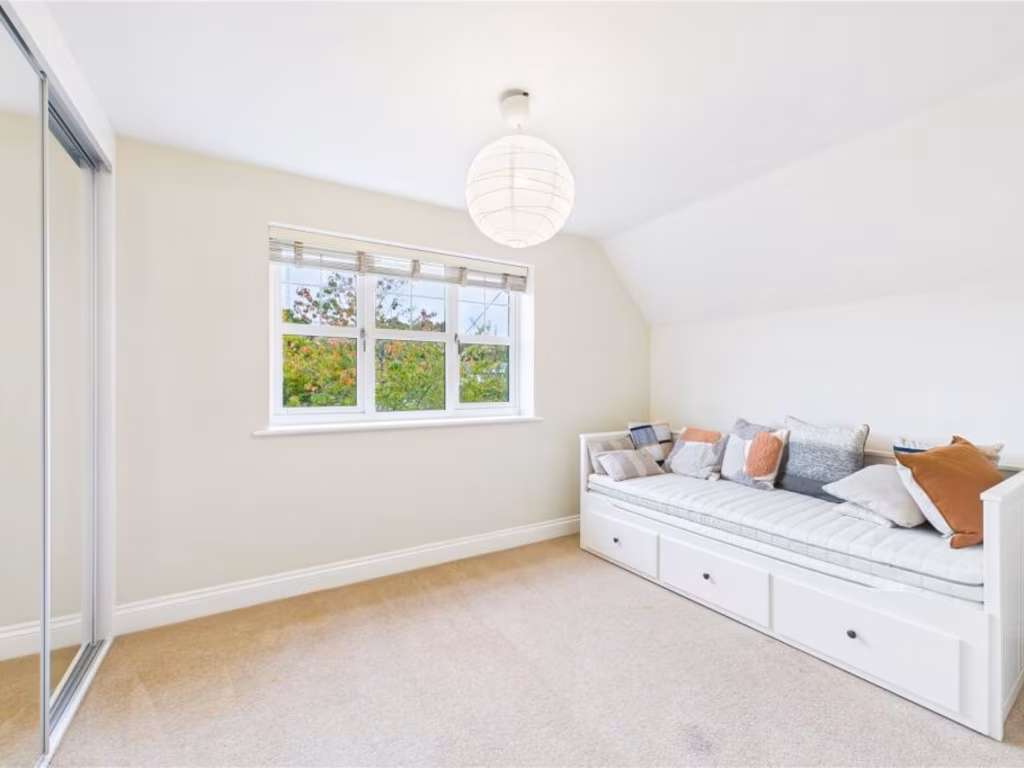
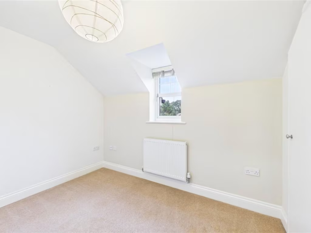
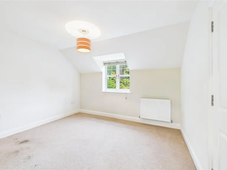
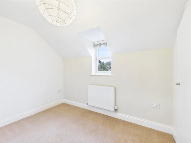
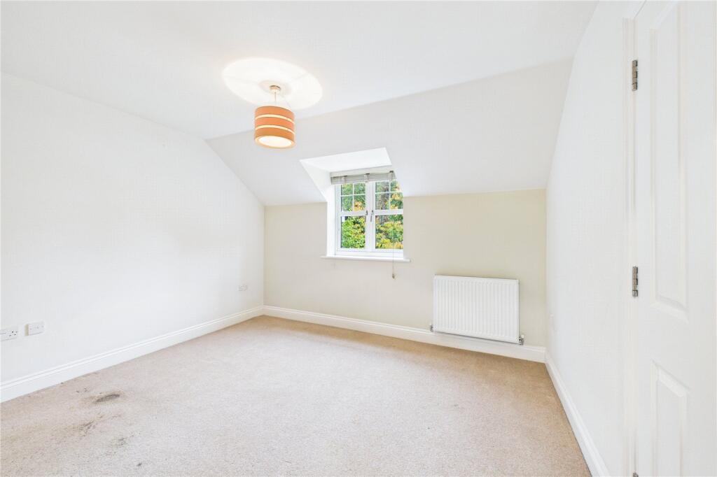
- Bedroom 1:
- Bedroom 2:
- Bedroom 3:
- Bedroom 4:
- Landing:
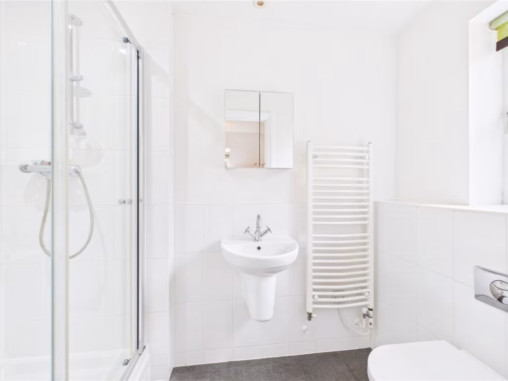
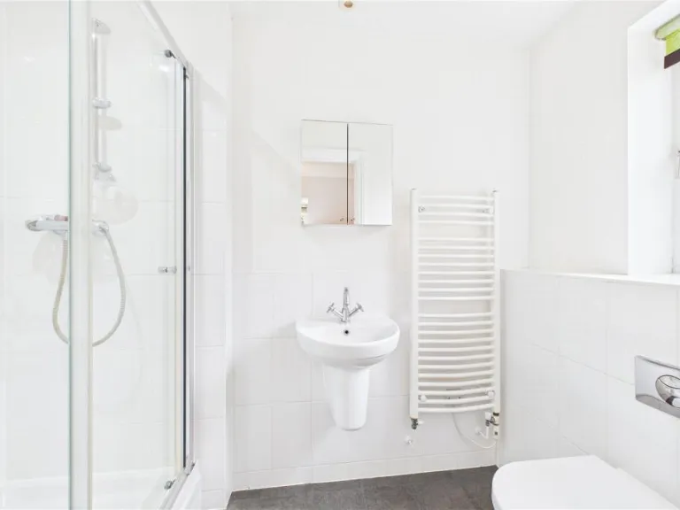
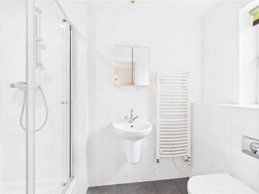
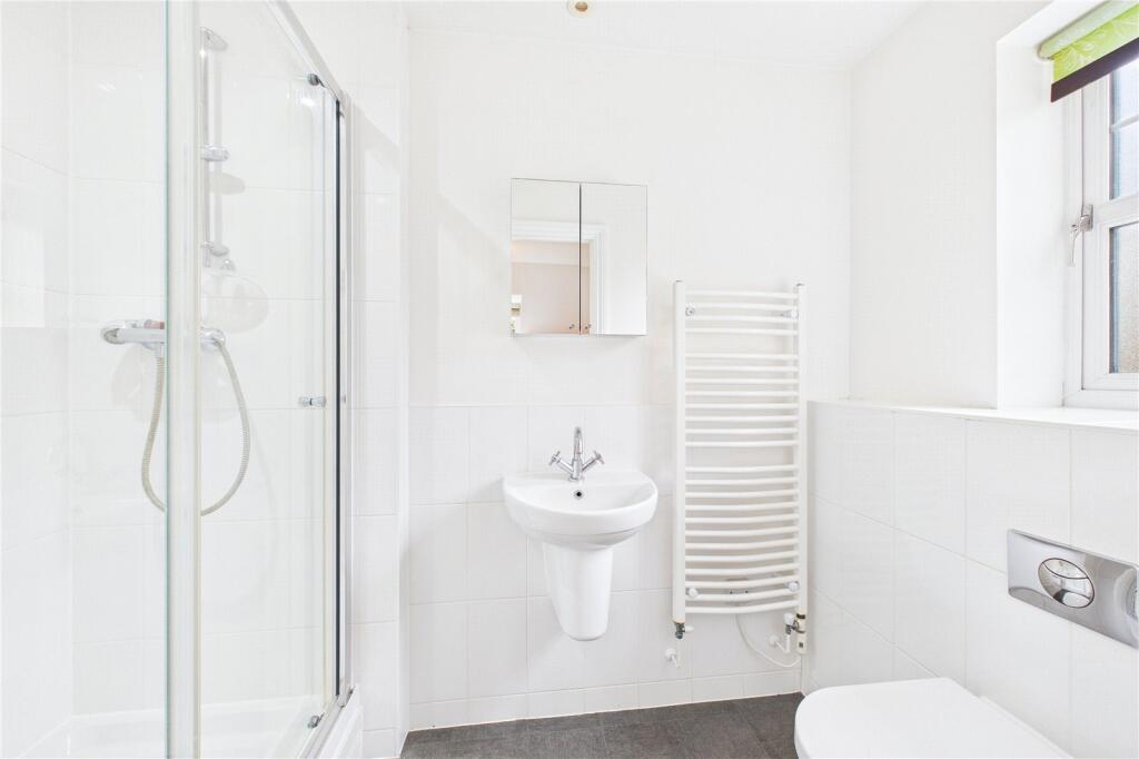
- En Suite:
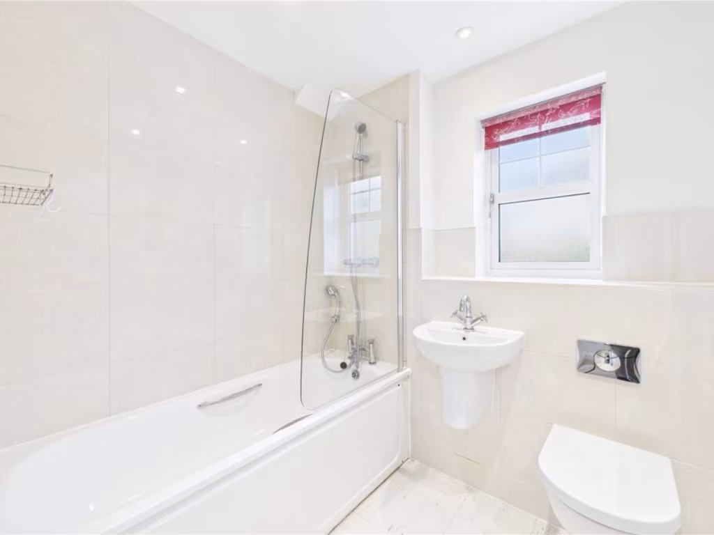
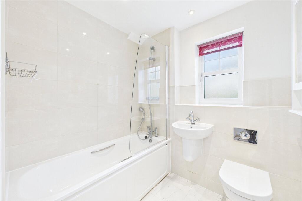
- Bathroom:
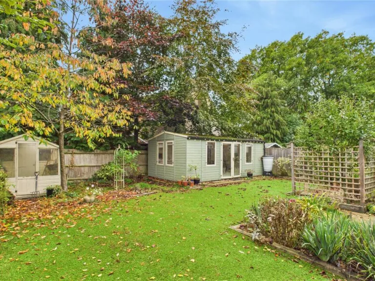
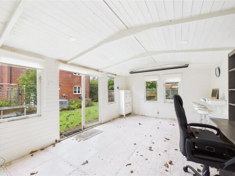
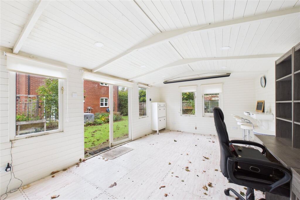
- Garden Cabin:
Textual Property Features
- Has Garden
- Chain Free
- Success
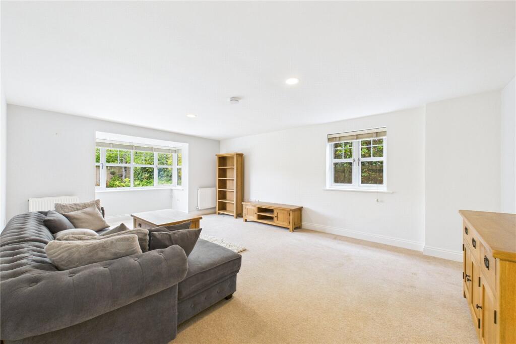
Detected Visual Features
- detached
- modern design
- brick exterior
- pitched roof
- integrated garage
- garden
- driveway
- residential
- suburban
- family home
- modern
- contemporary
- kitchen-diner
- open plan
- bright
- double doors
- garden view
- well-maintained
EPC Details
- Fully double glazed
- Cavity wall, as built, insulated (assumed)
- Boiler and radiators, mains gas
- Low energy lighting in all fixed outlets
- Solid, insulated (assumed)
Nearby Schools
- Kingsclere Church of England Primary School
- Bramley Church of England Primary School
- Tadley Community Primary School
- Mortimer St. John's C.E. Infant School
- Brimpton C.E. Primary School
- Mrs Bland's Infant School
- Bucklebury C.E. Primary School
- Everest Community Academy
- Sherborne St John Church of England Primary School
- Ashford Hill Primary School
- Silchester Church of England Primary School
- Aldermaston C.E. Primary School
- Spurcroft Primary School
- Francis Baily Primary School
- Elstree School
- The Priory Primary School
- Bishopswood Junior School
- Bishopswood Infant School
- The Willink School
- Sulhamstead and Ufton Nervet School
- Woolhampton C.E. Primary School
- Beenham Primary School
- Grantham Farm Montessori School
- Cheam School
- Burnham Copse Primary School
- The Hurst School
- Padworth College
- Kennet School
Nearest Bars And Restaurants
- Id: 207594515
- Tags:
- Amenity: pub
- Created_by: JOSM
- Name: The Ambassador Club
- TagsNormalized:
- Lat: 51.357663
- Lon: -1.1563751
- FullGeoHash: gcphjtmund21
- PartitionGeoHash: gcph
- Images:
- FoodStandards: null
- Distance: 411.6
,- Id: 224687479
- Tags:
- Amenity: cafe
- Created_by: JOSM
- Name: Gina's Cafe
- TagsNormalized:
- Lat: 51.3584798
- Lon: -1.163495
- FullGeoHash: gcphjt8bbde1
- PartitionGeoHash: gcph
- Images:
- FoodStandards: null
- Distance: 227.2
,- Id: 419359403
- Tags:
- Amenity: cafe
- Building: yes
- TagsNormalized:
- Lat: 51.3584871
- Lon: -1.1634146
- FullGeoHash: gcphjt8bf7zh
- PartitionGeoHash: gcph
- Images:
- FoodStandards: null
- Distance: 225.6
,- Id: 224672170
- Tags:
- Amenity: pub
- Name: The Cricketers
- TagsNormalized:
- Lat: 51.3569277
- Lon: -1.164856
- FullGeoHash: gcphjmpzbchq
- PartitionGeoHash: gcph
- Images:
- FoodStandards: null
- Distance: 195.9
,- Id: 417939076
- Tags:
- Amenity: pub
- Building: yes
- TagsNormalized:
- Lat: 51.3569013
- Lon: -1.164782
- FullGeoHash: gcphjmpzds79
- PartitionGeoHash: gcph
- Images:
- FoodStandards: null
- Distance: 190.4
}
Nearest General Shops
- Id: 4200060415
- Tags:
- Male: yes
- Name: Tadley Barbers
- Shop: hairdresser
- TagsNormalized:
- Lat: 51.3567203
- Lon: -1.1480437
- FullGeoHash: gcphjvhn8ds9
- PartitionGeoHash: gcph
- Images:
- FoodStandards: null
- Distance: 974.1
,- Id: 4200060414
- Tags:
- Name: Tadley Computers
- Shop: yes
- TagsNormalized:
- Lat: 51.3567037
- Lon: -1.1480994
- FullGeoHash: gcphjv5yrr7n
- PartitionGeoHash: gcph
- Images:
- FoodStandards: null
- Distance: 970.3
,- Id: 248047259
- Tags:
- Created_by: JOSM
- Name: Pedal On
- Shop: bicycle
- TagsNormalized:
- Lat: 51.3564117
- Lon: -1.1557726
- FullGeoHash: gcphjtnku912
- PartitionGeoHash: gcph
- Images:
- FoodStandards: null
- Distance: 438.2
}
Nearest Grocery shops
- Id: 133303285
- Tags:
- Created_by: Potlatch 0.5d
- Name: Koala Store
- Shop: convenience
- TagsNormalized:
- Lat: 51.3473775
- Lon: -1.1395187
- FullGeoHash: gcphn5d0pkcm
- PartitionGeoHash: gcph
- Images:
- FoodStandards: null
- Distance: 1874.5
,- Id: 717950565
- Tags:
- Brand: Shell Select
- Brand:wikidata: Q154950
- Brand:wikipedia: en:Royal Dutch Shell
- Building: yes
- Name: Shell Select
- Shop: convenience
- TagsNormalized:
- shell
- shell select
- convenience
- shop
- Lat: 51.3606626
- Lon: -1.1485194
- FullGeoHash: gcphjvgtt93y
- PartitionGeoHash: gcph
- Images:
- FoodStandards: null
- Distance: 1041.9
,- Id: 419867186
- Tags:
- Building: yes
- Name: The Co-operative
- Shop: convenience
- TagsNormalized:
- Lat: 51.3570976
- Lon: -1.1521383
- FullGeoHash: gcphjv30c0zk
- PartitionGeoHash: gcph
- Images:
- FoodStandards: null
- Distance: 691.6
}
Nearest Supermarkets
- Id: 221442519
- Tags:
- Addr:
- City: Burghfield Common
- Postcode: RG7 3JB
- Street: Reading Road
- Alt_name: Tesco Burghfield Common Express
- Brand: Tesco Express
- Brand:wikidata: Q98456772
- Brand:wikipedia: en:Tesco
- Building: yes
- Contact:
- Website: https://www.tesco.com/store-locator/burghfield-common/reading-rd
- Name: Tesco Express
- Opening_hours: Mo-Su 06:00-23:00
- Operator: Tesco
- Payment:
- All: yes
- Cash: yes
- Debit_cards: yes
- Visa: yes
- Shop: supermarket
- Source:
- Building: OS_OpenData_StreetView
- TagsNormalized:
- tesco
- tesco express
- supermarket
- shop
- Lat: 51.3933159
- Lon: -1.0665632
- FullGeoHash: gcphrez7g22y
- PartitionGeoHash: gcph
- Images:
- FoodStandards: null
- Distance: 7783.2
,- Id: 236370652
- Tags:
- Addr:
- Housenumber: 30a
- Postcode: RG26 3JE
- Street: Mulfords Hill
- Alt_name: Sainsbury's Tadley Superstore
- Brand: Sainsbury's
- Brand:wikidata: Q152096
- Building: yes
- Name: Sainsbury's
- Opening_hours: Mo-Sa 07:00-22:00; Su 10:00-16:00
- Shop: supermarket
- Source: Bing
- Wheelchair: yes
- TagsNormalized:
- sainsburys
- supermarket
- shop
- Lat: 51.3557108
- Lon: -1.1413756
- FullGeoHash: gcphnj0bsn2e
- PartitionGeoHash: gcph
- Images:
- FoodStandards: null
- Distance: 1440.8
,- Id: 224687495
- Tags:
- Brand: Tesco Express
- Brand:wikidata: Q98456772
- Contact:
- Website: https://www.tesco.com/store-locator/tadley/heath-end-rd
- Name: Tesco Express
- Opening_hours: Mo-Su 06:00-22:00
- Shop: supermarket
- TagsNormalized:
- tesco
- tesco express
- supermarket
- shop
- Lat: 51.3565088
- Lon: -1.1661783
- FullGeoHash: gcphjmnv6547
- PartitionGeoHash: gcph
- Images:
- FoodStandards: null
- Distance: 285.5
}
Nearest Religious buildings
- Id: 414215987
- Tags:
- Amenity: place_of_worship
- Building: yes
- Name: Tadley Common Methodist Church
- Religion: christian
- TagsNormalized:
- place of worship
- church
- common
- methodist
- christian
- Lat: 51.3546994
- Lon: -1.1524135
- FullGeoHash: gcphjubffcf4
- PartitionGeoHash: gcph
- Images:
- FoodStandards: null
- Distance: 704.5
,- Id: 414226462
- Tags:
- Amenity: place_of_worship
- Building: yes
- Denomination: anglican
- Name: Saint Mary's Church
- Religion: christian
- Wikidata: Q105104490
- TagsNormalized:
- place of worship
- anglican
- church
- christian
- Lat: 51.3545918
- Lon: -1.1541931
- FullGeoHash: gcphjszd1mg0
- PartitionGeoHash: gcph
- Images:
- FoodStandards: null
- Distance: 592.6
,- Id: 415350746
- Tags:
- Amenity: place_of_worship
- Building: yes
- Denomination: catholic
- Name: St. Michaels Catholic Church
- Religion: christian
- TagsNormalized:
- place of worship
- catholic
- church
- christian
- Lat: 51.3558093
- Lon: -1.1556458
- FullGeoHash: gcphjtn3r88p
- PartitionGeoHash: gcph
- Images:
- FoodStandards: null
- Distance: 455.7
}
Nearest Medical buildings
- Id: 403182930
- Tags:
- Amenity: doctors
- Building: yes
- TagsNormalized:
- Lat: 51.348487
- Lon: -1.1403378
- FullGeoHash: gcphn59ws5y8
- PartitionGeoHash: gcph
- Images:
- FoodStandards: null
- Distance: 1760.7
,- Id: 416746176
- Tags:
- Addr:
- Amenity: doctors
- Building: yes
- Name: Holmwood Health Centre
- TagsNormalized:
- doctor
- doctors
- health
- health centre
- Lat: 51.3569894
- Lon: -1.1454113
- FullGeoHash: gcphjvmbjuxq
- PartitionGeoHash: gcph
- Images:
- FoodStandards: null
- Distance: 1157.5
,- Id: 206163061
- Tags:
- Amenity: pharmacy
- Dispensing: yes
- Name: Holmwood Pharmacy
- TagsNormalized:
- Lat: 51.3568478
- Lon: -1.1454638
- FullGeoHash: gcphjvjzkf26
- PartitionGeoHash: gcph
- Images:
- FoodStandards: null
- Distance: 1153.5
,- Id: 414216376
- Tags:
- Amenity: veterinary
- Building: yes
- Name: Donnington Grove Veterinary Surgery
- TagsNormalized:
- Lat: 51.3544854
- Lon: -1.1529696
- FullGeoHash: gcphjub3tcgt
- PartitionGeoHash: gcph
- Images:
- FoodStandards: null
- Distance: 675.9
}
Nearest Leisure Facilities
- Id: 22996304
- Tags:
- Created_by: JOSM
- Leisure: playground
- TagsNormalized:
- Lat: 51.3593426
- Lon: -1.1689144
- FullGeoHash: gcphjmsvf76k
- PartitionGeoHash: gcph
- Images:
- FoodStandards: null
- Distance: 562.2
,- Id: 488325946
- Tags:
- Landcover: grass
- Landuse: recreation_ground
- Leisure: park
- TagsNormalized:
- Lat: 51.3547415
- Lon: -1.1668682
- FullGeoHash: gcphjky7418j
- PartitionGeoHash: gcph
- Images:
- FoodStandards: null
- Distance: 394.3
,- Id: 22995967
- Tags:
- Leisure: park
- Name: Wigmore Road Open Space
- TagsNormalized:
- Lat: 51.3554681
- Lon: -1.1591612
- FullGeoHash: gcphjsgzm94g
- PartitionGeoHash: gcph
- Images:
- FoodStandards: null
- Distance: 240.5
,- Id: 22995968
- Tags:
- TagsNormalized:
- Lat: 51.3553492
- Lon: -1.1593574
- FullGeoHash: gcphjsgy94bq
- PartitionGeoHash: gcph
- Images:
- FoodStandards: null
- Distance: 236.9
,- Id: 629510109
- Tags:
- TagsNormalized:
- outdoor
- outdoor seating
- leisure
- Lat: 51.3567279
- Lon: -1.1648026
- FullGeoHash: gcphjmpyd5un
- PartitionGeoHash: gcph
- Images:
- FoodStandards: null
- Distance: 189.9
}
Nearest Hotels
- Id: 203707176
- Tags:
- Addr:
- City: Kingsclere
- Postcode: RG26 5RT
- Description: 9 hole Par 34 Park Course & 9 hole Par 36 Woods Course & 9 hole Par 35 Lakes Course
- Email: info@sandfordspringsgolf.co.uk
- Golf:
- Course: 27_hole
- Par: 34 + 36 + 35
- Leisure: golf_course
- Name: Sandford Springs Hotel & Golf Club
- Phone: +44 1635 296800
- Source: Bing
- Website: https://www.sandfordsprings.co.uk/
- Wikidata: Q7416218
- Wikipedia: en:Sandford Springs Golf Club
- TagsNormalized:
- golf
- golf course
- leisure
- hotel
- club
- Lat: 51.3250451
- Lon: -1.2250729
- FullGeoHash: gcp5up7yj9z7
- PartitionGeoHash: gcp5
- Images:
- FoodStandards: null
- Distance: 5611.9
,- Id: 420869150
- Tags:
- Amenity: restaurant
- Building: yes
- Name: Broomsquire Hotel
- TagsNormalized:
- Lat: 51.3572336
- Lon: -1.1370786
- FullGeoHash: gcphnjk184hx
- PartitionGeoHash: gcph
- Images:
- FoodStandards: null
- Distance: 1736.7
,- Id: 207518955
- Tags:
- Created_by: JOSM
- Name: The Broomsquire Hotel
- Old_name: Treacle Mine
- Tourism: hotel
- TagsNormalized:
- Lat: 51.3572355
- Lon: -1.1372051
- FullGeoHash: gcphnj7ct4w6
- PartitionGeoHash: gcph
- Images:
- FoodStandards: null
- Distance: 1728
}
Tags
- detached
- modern design
- brick exterior
- pitched roof
- integrated garage
- garden
- driveway
- residential
- suburban
- family home
- modern
- contemporary
- kitchen-diner
- open plan
- bright
- double doors
- garden view
- well-maintained
Local Market Stats
- Average Price/sqft: £374
- Avg Income: £58300
- Rental Yield: 3.2%
- Social Housing: 7%
- Planning Success Rate: 87%
Similar Properties
 3 bedroom semi-detached house for sale in Long Grove, Baughurst, Tadley, Hampshire, RG26 — £350,000 • 3 bed • 2 bath • 872 ft²
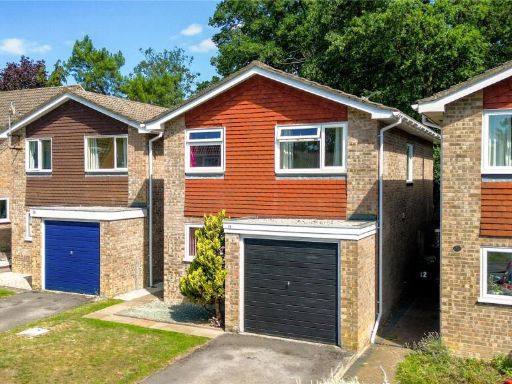 4 bedroom detached house for sale in Adam Close, Baughurst, Tadley, Hampshire, RG26 — £440,000 • 4 bed • 2 bath • 1105 ft²
 4 bedroom semi-detached house for sale in Stratfield Avenue, Tadley, Hampshire, RG26 — £425,000 • 4 bed • 3 bath • 1154 ft²
 4 bedroom detached house for sale in Warblington Close, TADLEY, Hampshire, RG26 — £600,000 • 4 bed • 3 bath • 1695 ft²
 5 bedroom detached house for sale in Cedar Close, Tadley, Hampshire, RG26 — £825,000 • 5 bed • 2 bath • 2600 ft²
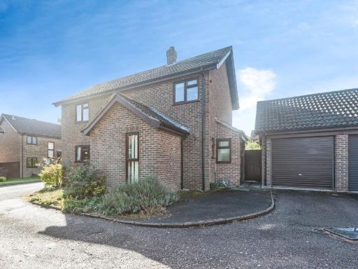 4 bedroom detached house for sale in Ramptons Meadow, Tadley, Hampshire, RG26 — £550,000 • 4 bed • 1 bath • 1335 ft²
Meta
- {
"@context": "https://schema.org",
"@type": "Residence",
"name": "4 bedroom detached house for sale in Stanley Close, Baughur…",
"description": "",
"url": "https://propertypiper.co.uk/property/b6abcc68-36b5-4b86-8679-23fd1cb637e4",
"image": "https://image-a.propertypiper.co.uk/746e728a-d978-4386-9807-c6b9f0e96fae-1024.jpeg",
"address": {
"@type": "PostalAddress",
"streetAddress": "1 STANLEY CLOSE BAUGHURST TADLEY",
"postalCode": "RG26 5GE",
"addressLocality": "Basingstoke and Deane",
"addressRegion": "North West Hampshire",
"addressCountry": "England"
},
"geo": {
"@type": "GeoCoordinates",
"latitude": 51.356639937373274,
"longitude": -1.1620720240754143
},
"numberOfRooms": 4,
"numberOfBathroomsTotal": 3,
"floorSize": {
"@type": "QuantitativeValue",
"value": 1186,
"unitCode": "FTK"
},
"offers": {
"@type": "Offer",
"price": 575000,
"priceCurrency": "GBP",
"availability": "https://schema.org/InStock"
},
"additionalProperty": [
{
"@type": "PropertyValue",
"name": "Feature",
"value": "detached"
},
{
"@type": "PropertyValue",
"name": "Feature",
"value": "modern design"
},
{
"@type": "PropertyValue",
"name": "Feature",
"value": "brick exterior"
},
{
"@type": "PropertyValue",
"name": "Feature",
"value": "pitched roof"
},
{
"@type": "PropertyValue",
"name": "Feature",
"value": "integrated garage"
},
{
"@type": "PropertyValue",
"name": "Feature",
"value": "garden"
},
{
"@type": "PropertyValue",
"name": "Feature",
"value": "driveway"
},
{
"@type": "PropertyValue",
"name": "Feature",
"value": "residential"
},
{
"@type": "PropertyValue",
"name": "Feature",
"value": "suburban"
},
{
"@type": "PropertyValue",
"name": "Feature",
"value": "family home"
},
{
"@type": "PropertyValue",
"name": "Feature",
"value": "modern"
},
{
"@type": "PropertyValue",
"name": "Feature",
"value": "contemporary"
},
{
"@type": "PropertyValue",
"name": "Feature",
"value": "kitchen-diner"
},
{
"@type": "PropertyValue",
"name": "Feature",
"value": "open plan"
},
{
"@type": "PropertyValue",
"name": "Feature",
"value": "bright"
},
{
"@type": "PropertyValue",
"name": "Feature",
"value": "double doors"
},
{
"@type": "PropertyValue",
"name": "Feature",
"value": "garden view"
},
{
"@type": "PropertyValue",
"name": "Feature",
"value": "well-maintained"
}
]
}
High Res Floorplan Images
Compatible Floorplan Images
FloorplanImages Thumbnail