SG19 1DY - 3 bedroom detached bungalow for sale in All Saints Way, San…
View on Property Piper
3 bedroom detached bungalow for sale in All Saints Way, Sandy, SG19
Property Details
- Price: £425000
- Bedrooms: 3
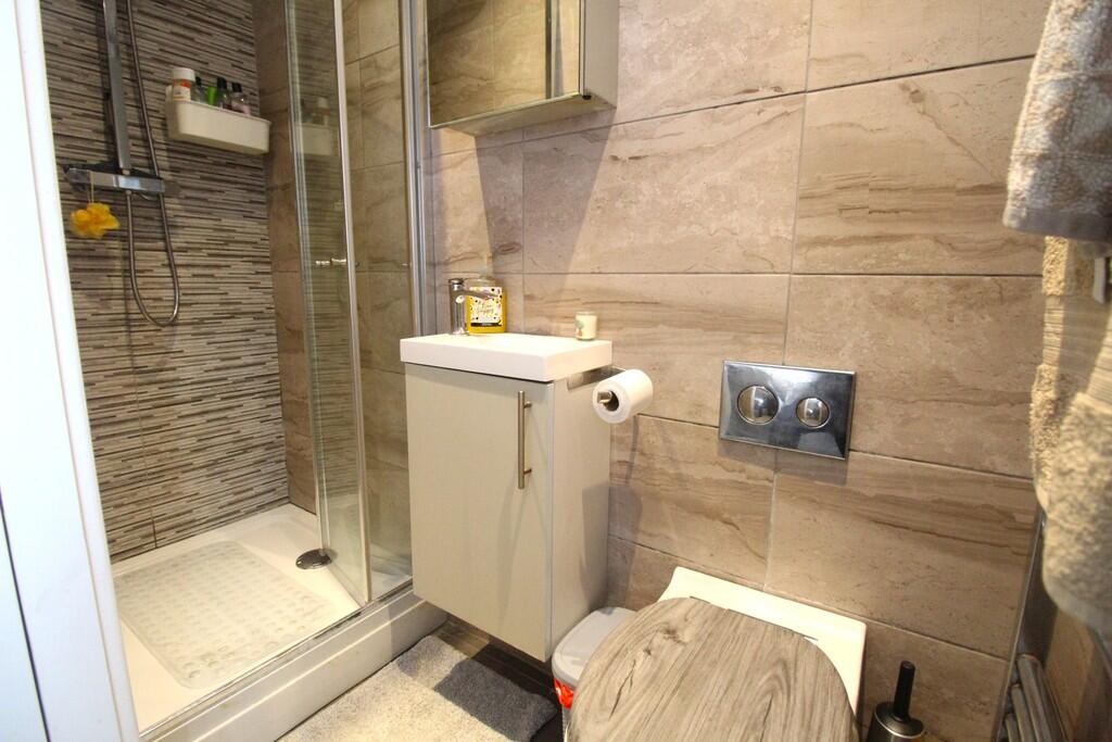
- Bathrooms: 2
- Property Type: undefined
- Property SubType: undefined
Brochure Descriptions
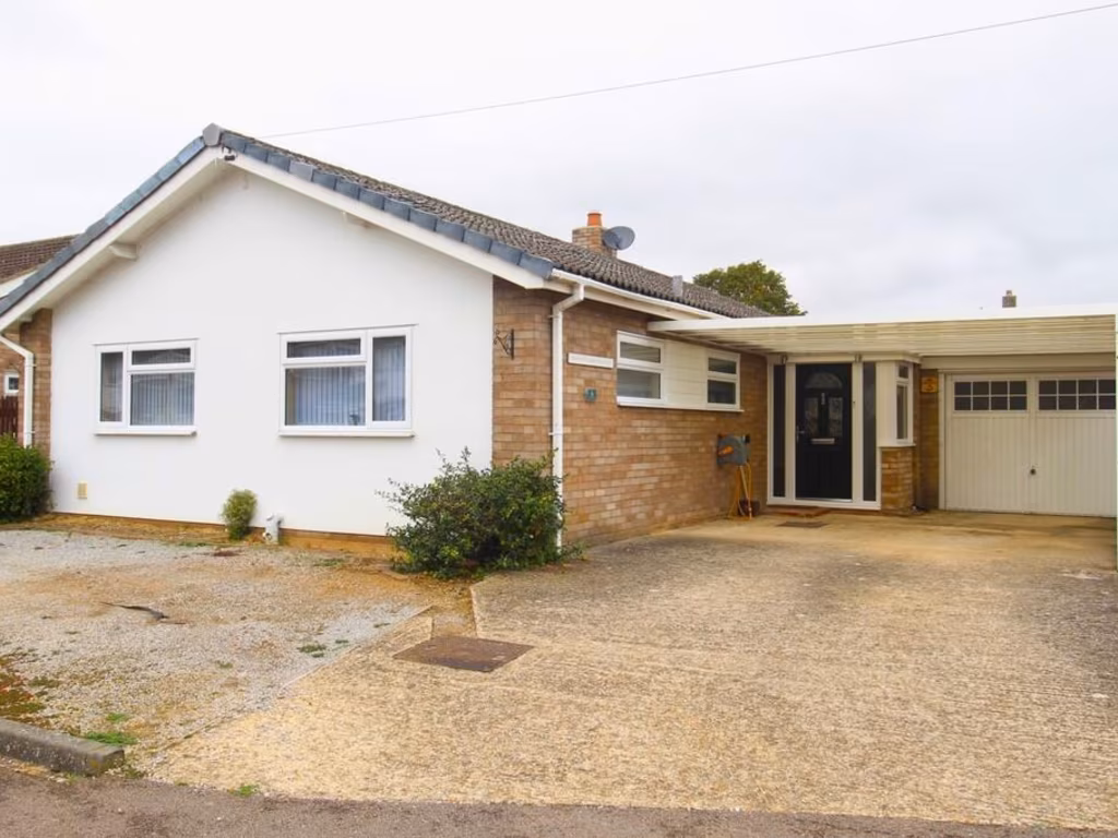
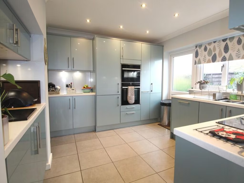
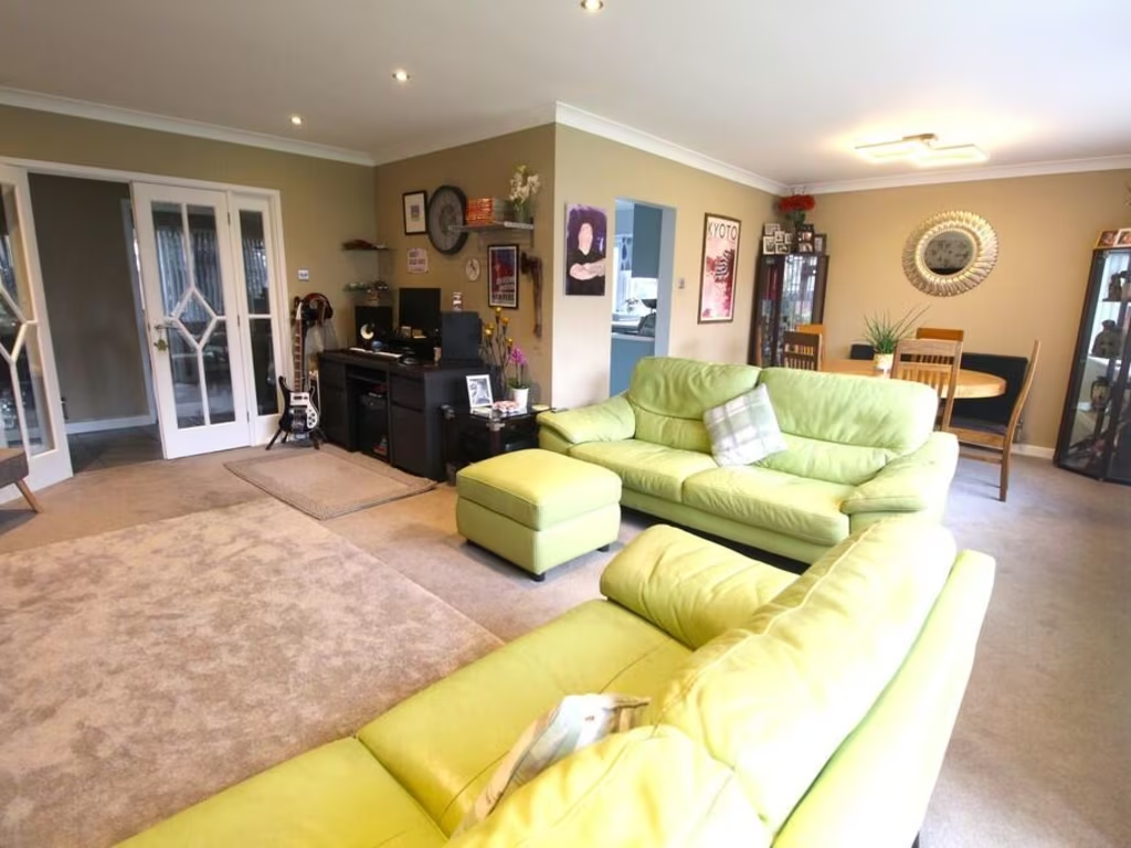
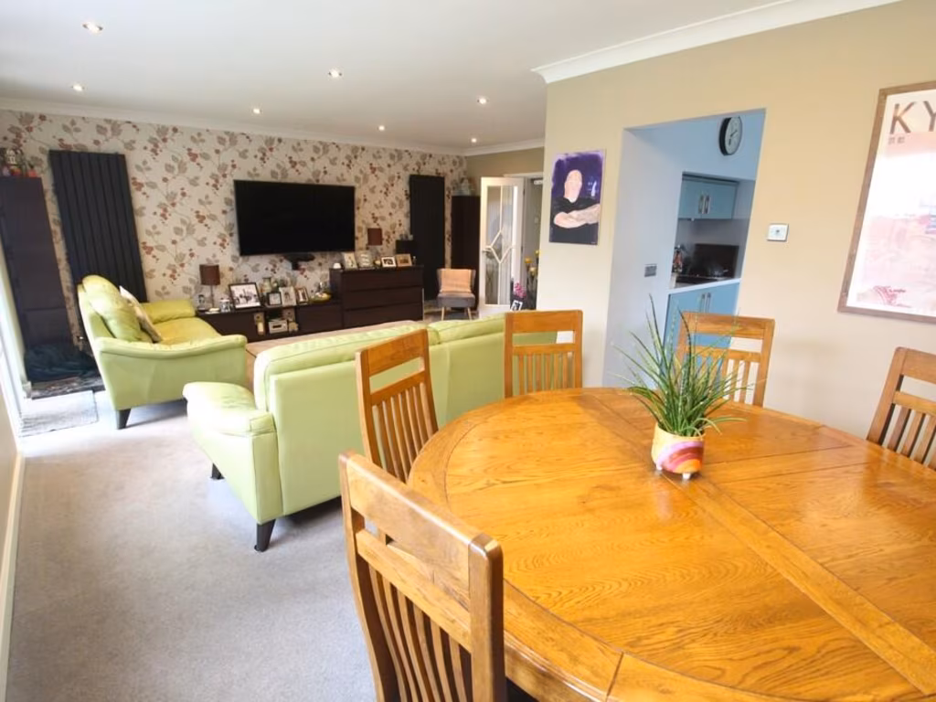
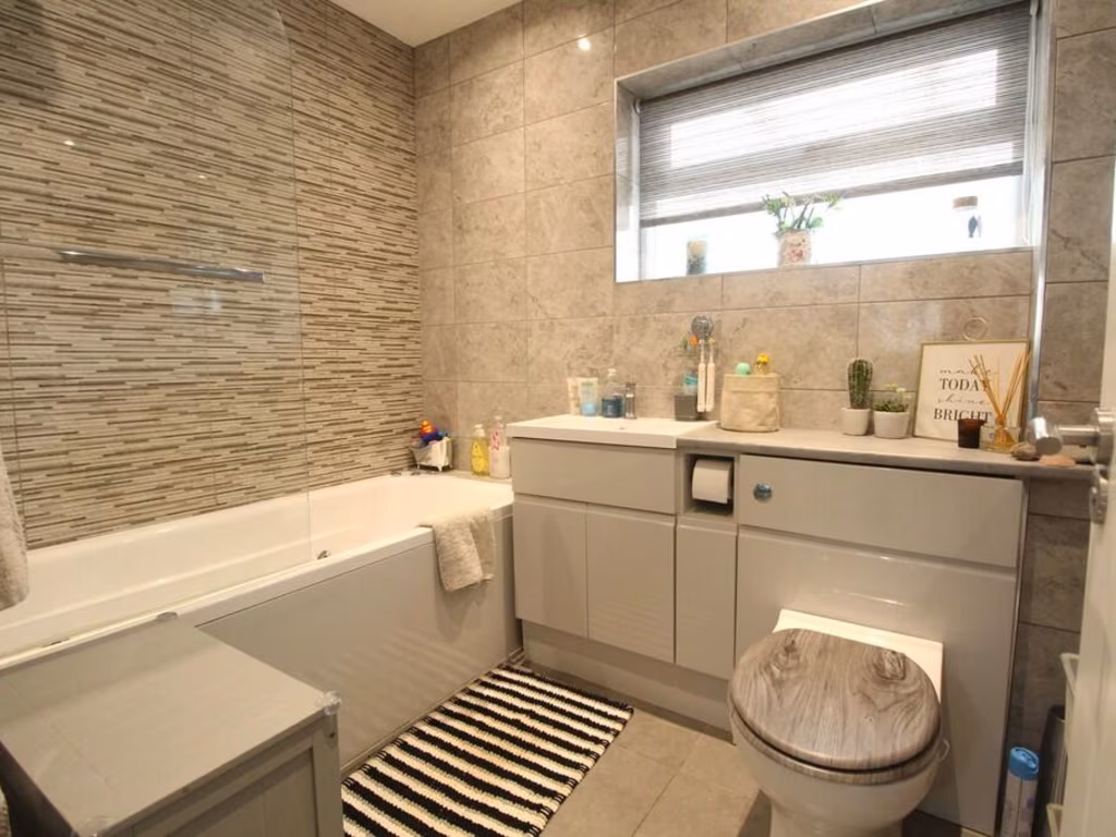
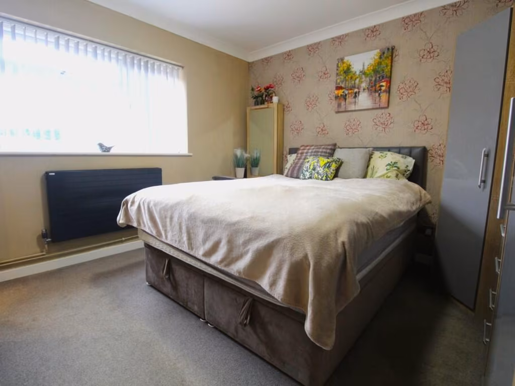
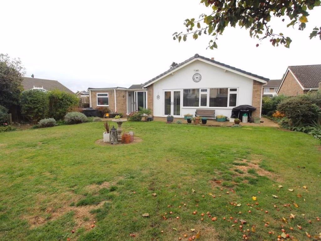
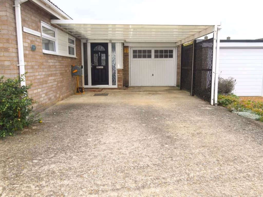
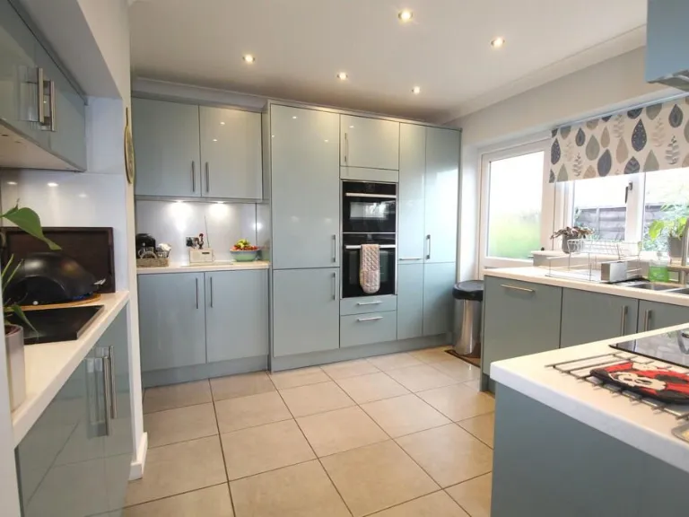
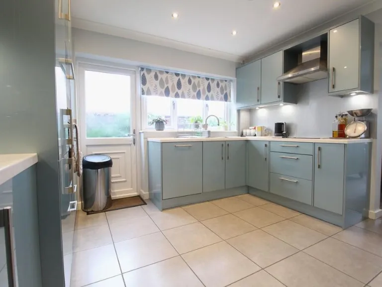
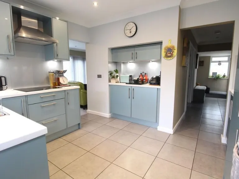
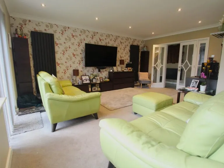
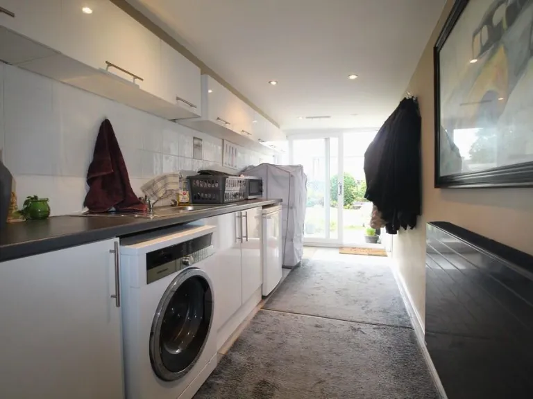
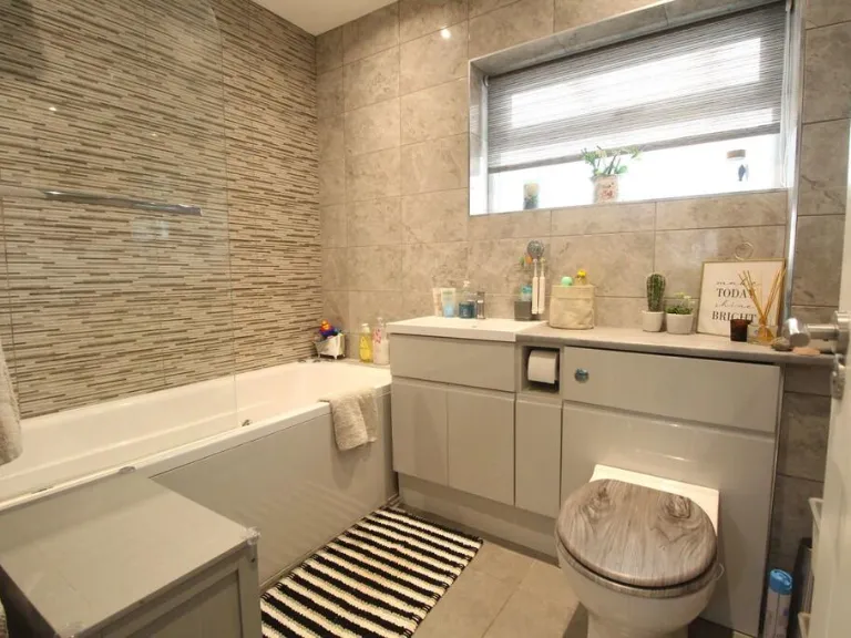
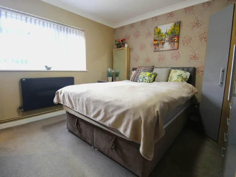
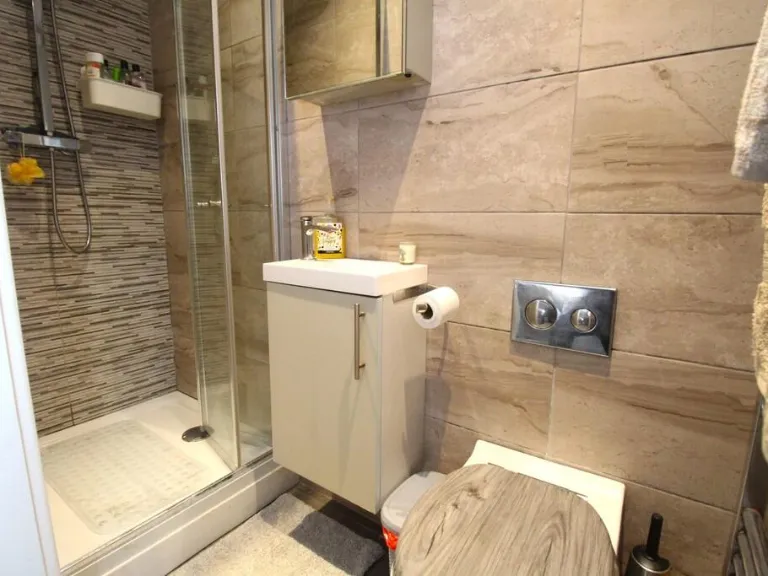
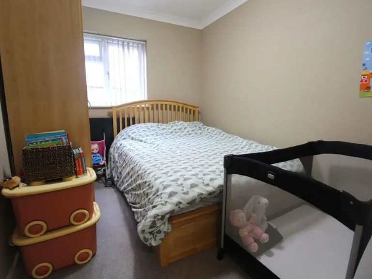
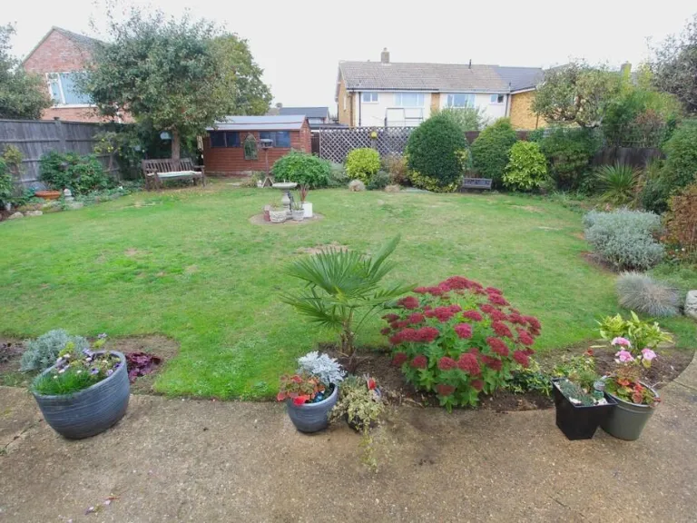
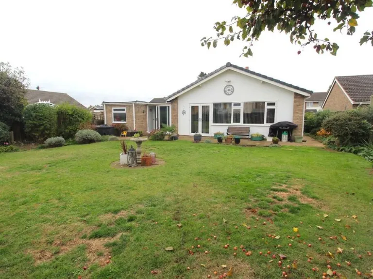
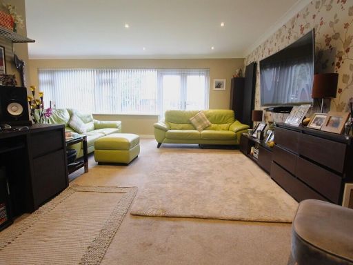
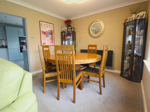
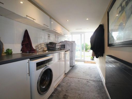
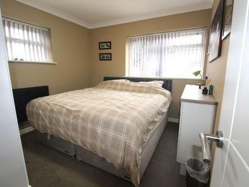
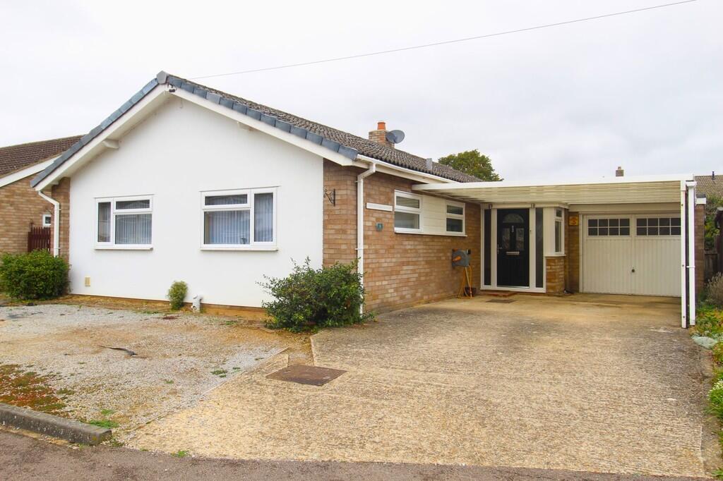
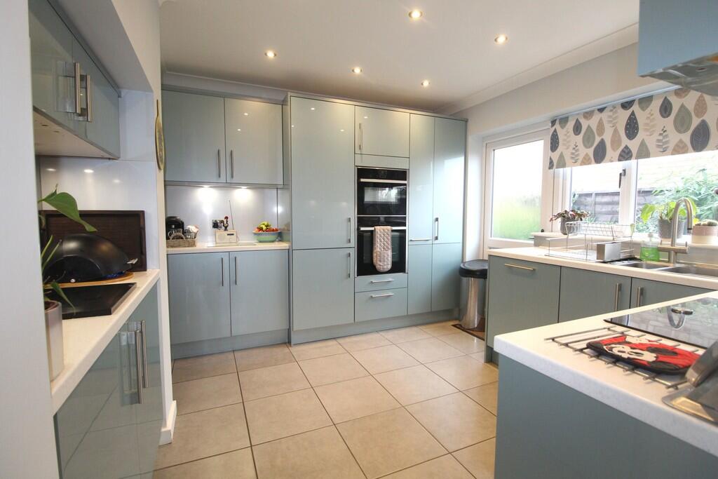
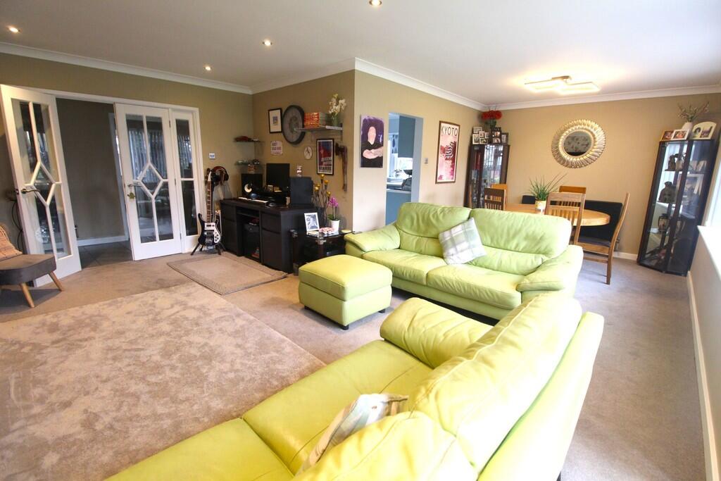
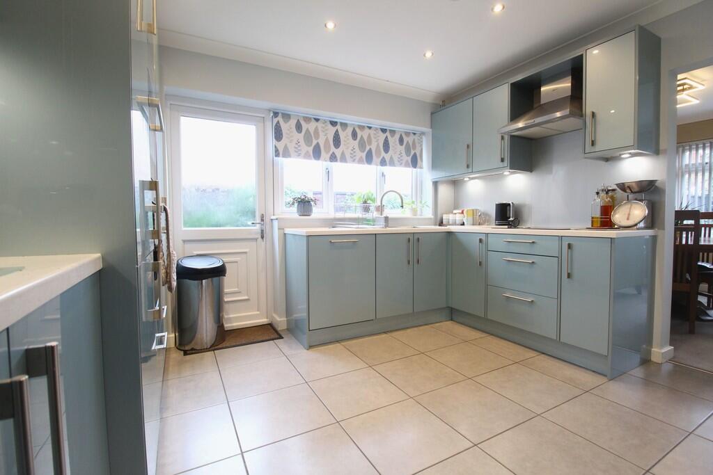
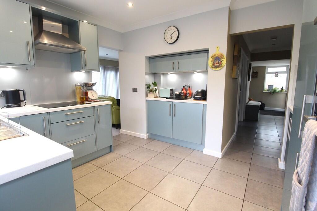
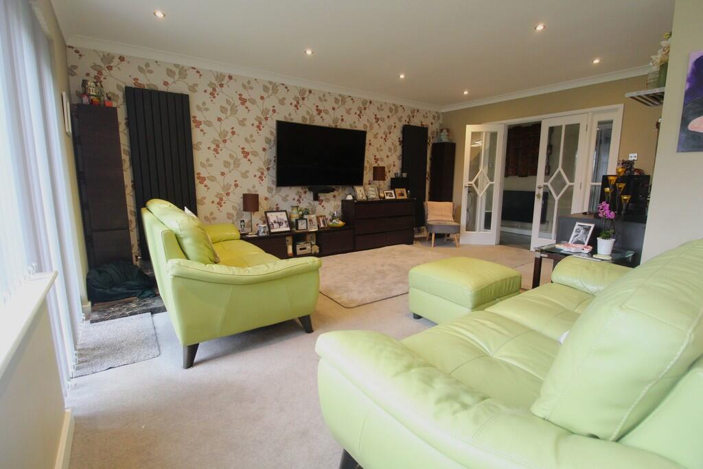
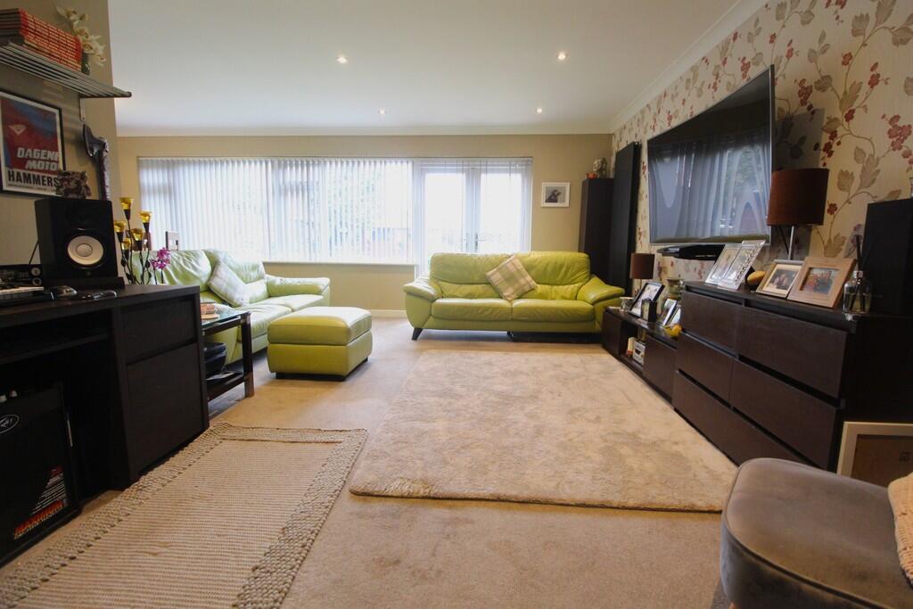
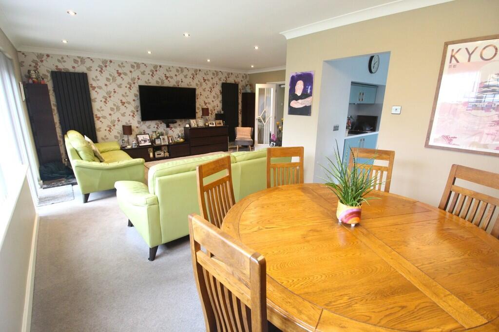
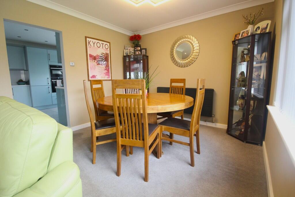
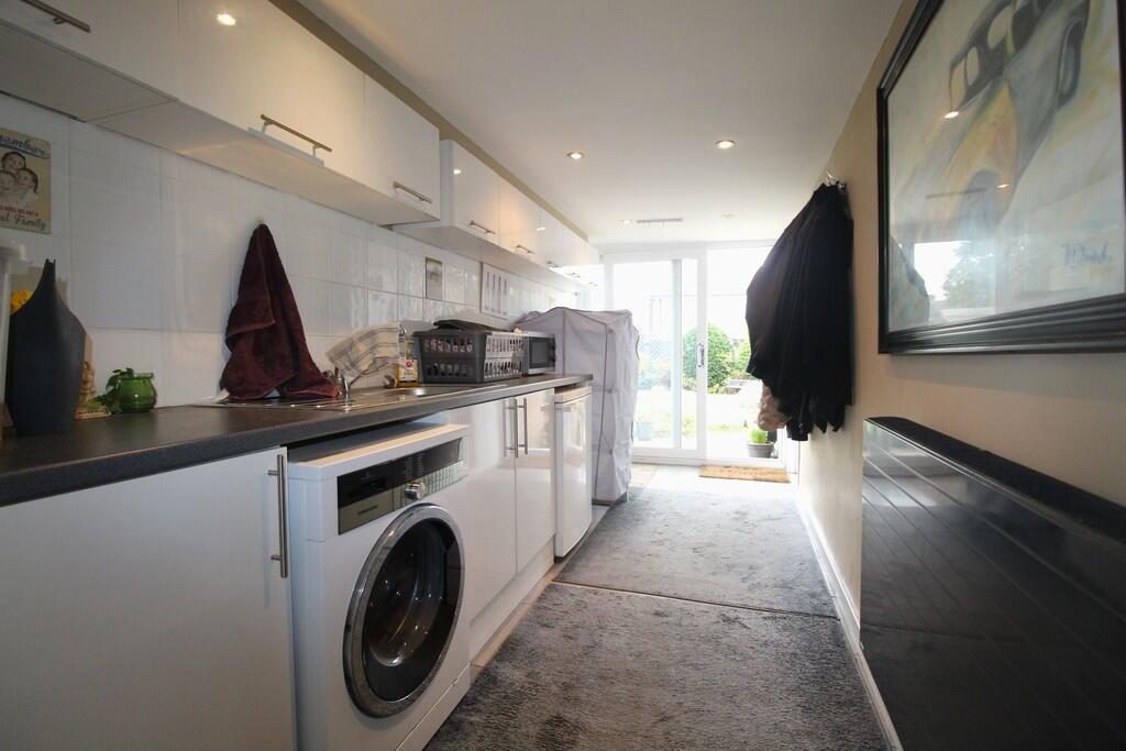
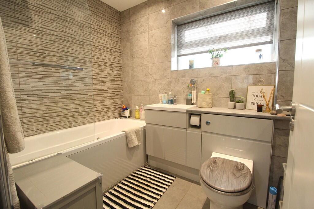
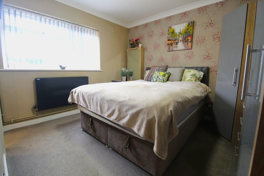
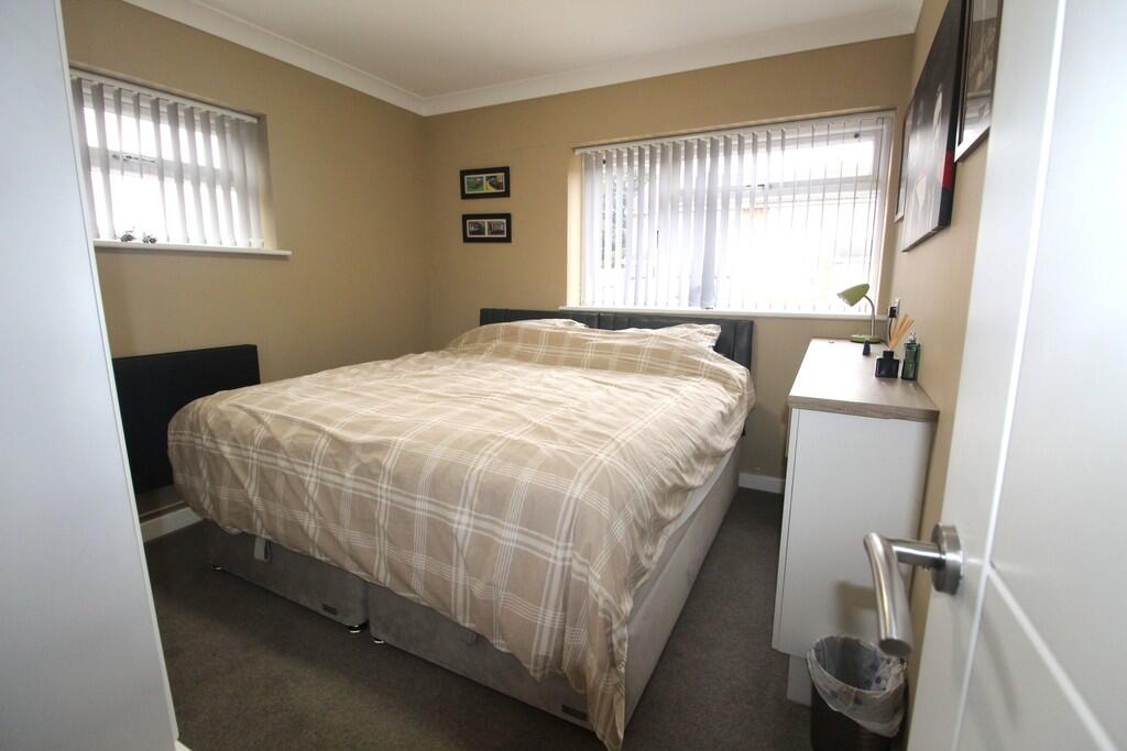
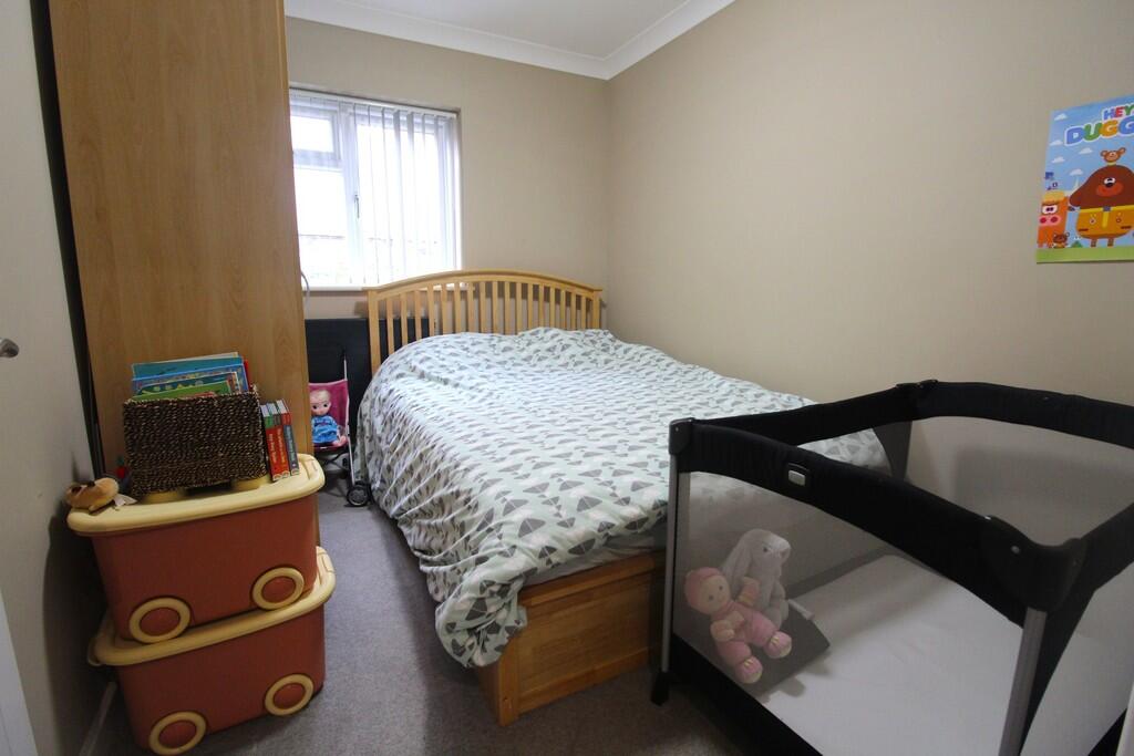
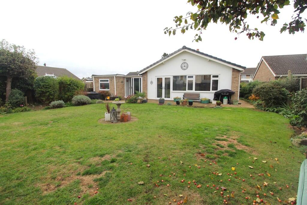
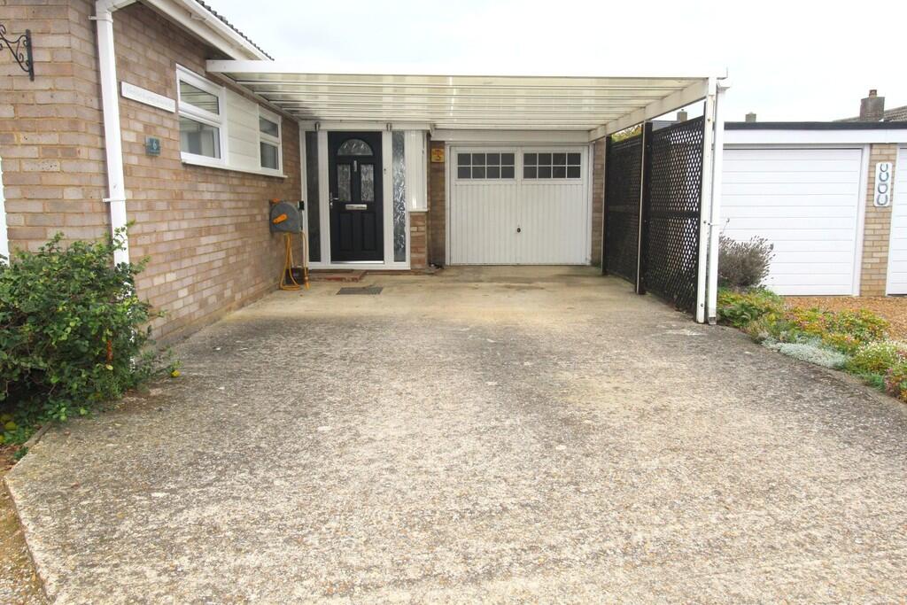
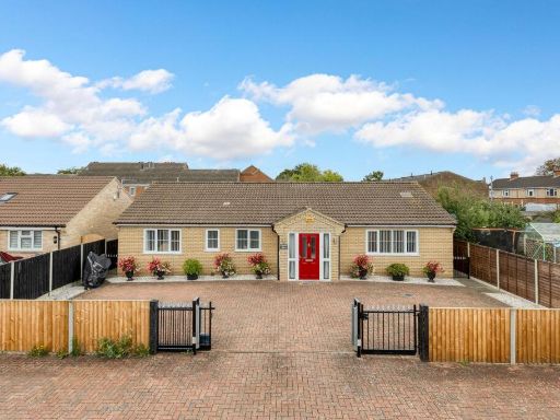
- Detached, single‑storey three double‑bedroom bungalow presented in good order following modernisation. Property benefits from a re‑fitted modern kitchen, re‑fitted family bathroom and an en‑suite to the master bedroom, plus a 15ft utility room. Generous L‑shaped lounge/diner (circa 23ft x 17ft) offering a spacious reception area. Externally there is a garage with covered carport and a wide driveway providing off‑road parking for 3–4 vehicles. Garden appears average in size for a bungalow plot. Overall a well‑presented, improved detached bungalow suitable for buyers seeking single‑level accommodation in a residential street setting. No notable views (urban/suburban location).
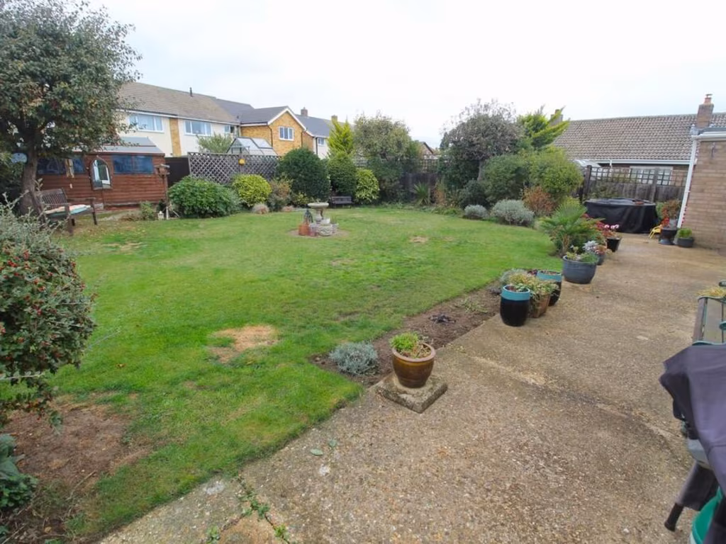
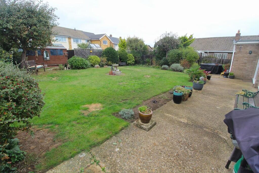
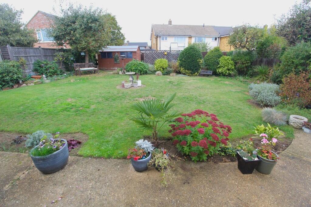
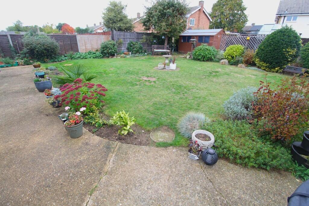
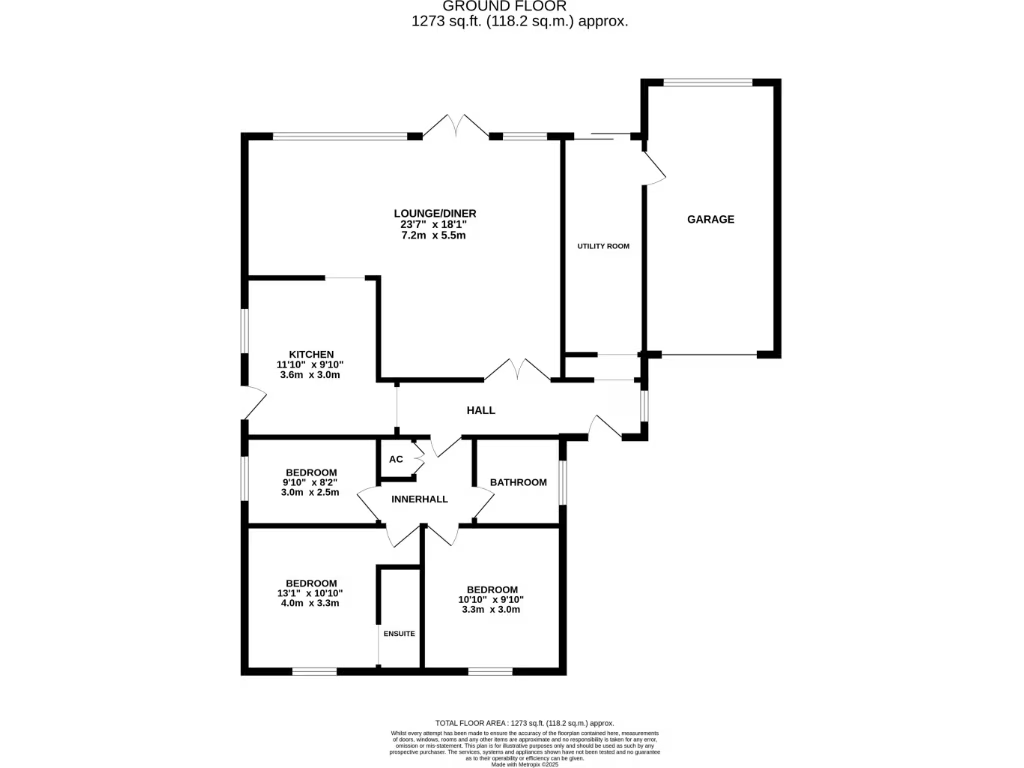
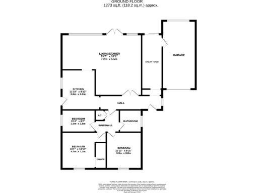
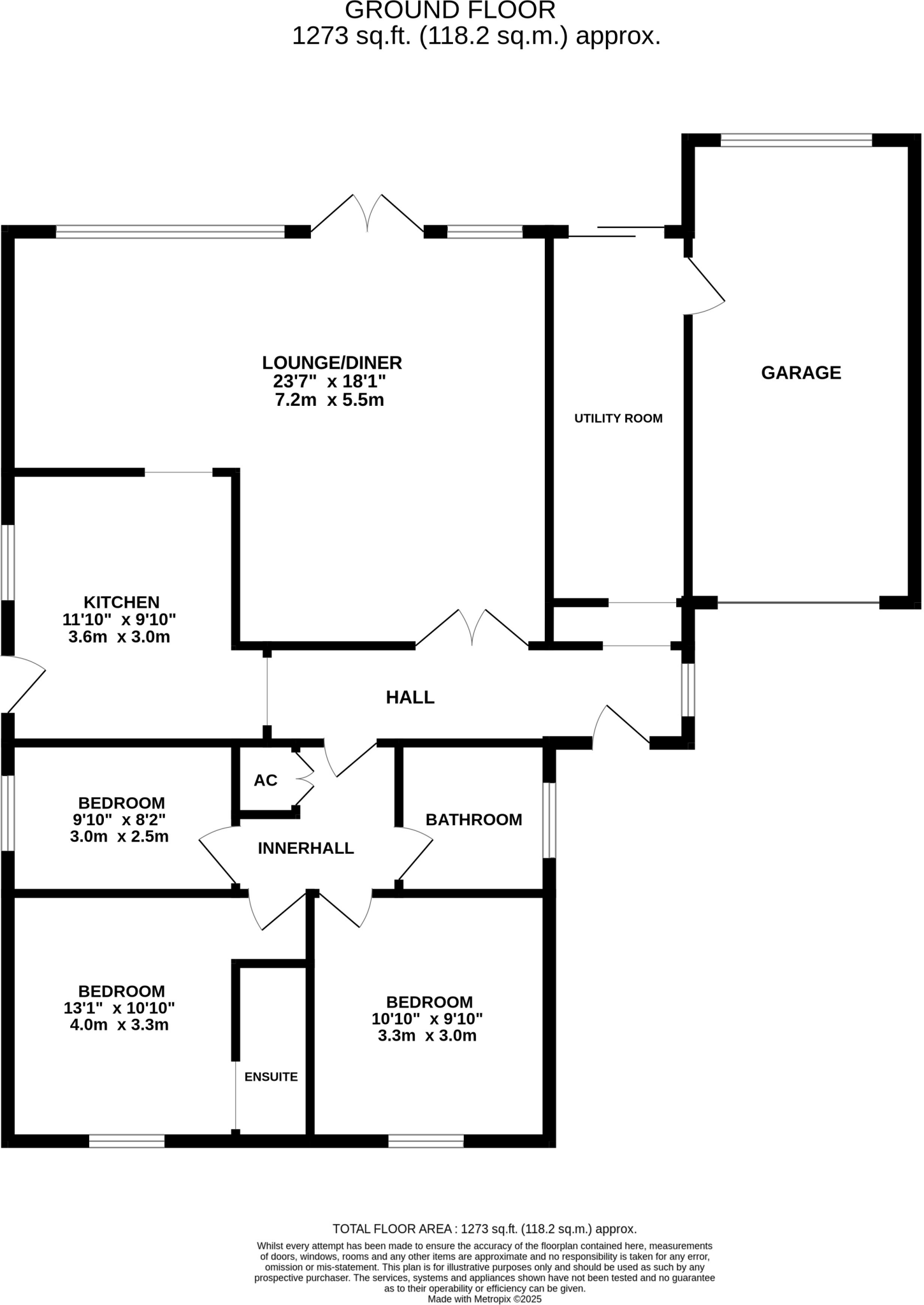
- Single‑storey detached bungalow shown on the floorplan with an internal layout comprising a large lounge/diner, kitchen, utility room, three bedrooms (one with ensuite), separate family bathroom, inner hall and an attached larger‑than‑average garage. Externally the plot includes a driveway providing off‑road parking for 2–3 vehicles plus a shingled area/car port for an additional vehicle, external tap and access to the garage. Rear garden is described as larger than average with generous patio, lawn with established shrub/tree borders, pathway to the side, timber shed and greenhouse — suitable for vegetable growing. Overall room sizes indicate a spacious lounge/diner (approx 23'7" x 18'1") and modest to generous bedroom proportions. Property appears to be on a medium to large garden plot for this property type. Presented floor area on the plan: approximately 1,273 sq ft (118.2 sq m).
Image Descriptions
- single storey detached house Mid-century modern bungalow
- kitchen modern
Floorplan Description
- Ground floor plan with lounge/diner, kitchen, utility, bathroom, inner hall and three bedrooms (plus garage and ensuite shown).
Rooms
- LOUNGE/DINER:
- KITCHEN:
- BEDROOM:
- BEDROOM:
- BEDROOM:
Textual Property Features
Detected Visual Features
- bungalow
- detached
- brickwork
- white siding
- single storey
- carport
- mid-century modern
- driveway
- suburban
- modern kitchen
- integrated appliances
- glossy cabinetry
- tile flooring
- natural light
Nearby Schools
- Biggleswade Academy
- Stratton Upper School
- Lawnside Academy
- Edward Peake CofE VC Middle School
- St Swithun's Church of England VC Primary School
- Potton Primary School
- Moggerhanger Primary School
- Great Barford Church of England Primary Academy
- Wilden CofE VA Primary School
- Southill Lower School
- St Andrew's CofE VC Lower School
- OneSchool Global UK - Biggleswade Campus
- Dunton CofE VC Lower School
- Caldecote Church of England Academy
- Northill CofE Academy
- Robert Peel Primary School
- Gamlingay Village Primary
- Sutton CofE VA Lower School
- Sheerhatch Primary School
- Sandy Secondary School
- Maple Tree Primary School
- Everton Heath Primary School
- John Donne Church of England Primary School
- Roxton Church of England Academy
Nearest General Shops
- Id: 741577627
- Tags:
- Addr:
- City: Sandy
- Country: GB
- Housename: Sandy Filling Station
- Postcode: SG19 1NA
- Street: Great North Road
- Fhrs:
- Authority: Central Bedfordshire
- Id: 1173468
- Local_authority_id: 78211
- Name: The Co-operative
- Shop: supermarket
- TagsNormalized:
- Lat: 52.1277471
- Lon: -0.2999173
- FullGeoHash: gcrb91td5km7
- PartitionGeoHash: gcrb
- Images:
- FoodStandards: null
- Distance: 625.7
,- Id: 669589970
- Tags:
- Addr:
- City: Sandy
- Country: GB
- Housenumber: 65-65
- Postcode: SG19 1DH
- Street: London Road
- Building: yes
- Fhrs:
- Authority: Central Bedfordshire
- Id: 451137
- Local_authority_id: 80402
- Name: Central Oriental Superstore
- Shop: supermarket
- TagsNormalized:
- Lat: 52.1348342
- Lon: -0.2997897
- FullGeoHash: gcrb94veqmkx
- PartitionGeoHash: gcrb
- Images:
- FoodStandards: null
- Distance: 294.9
,- Id: 8590993
- Tags:
- Name: Windmill Autos
- Note: used cars
- Shop: car
- TagsNormalized:
- Lat: 52.1330317
- Lon: -0.2999549
- FullGeoHash: gcrb94t8ft3r
- PartitionGeoHash: gcrb
- Images:
- FoodStandards: null
- Distance: 225
}
Nearest Religious buildings
- Id: 103026964
- Tags:
- Amenity: place_of_worship
- Building: church
- Denomination: anglican
- Name: St Swithun's Church
- Religion: christian
- Wikidata: Q17551140
- TagsNormalized:
- place of worship
- church
- anglican
- christian
- Lat: 52.1275135
- Lon: -0.2864532
- FullGeoHash: gcrb93x2v0v4
- PartitionGeoHash: gcrb
- Images:
- FoodStandards: null
- Distance: 926.5
,- Id: 802787749
- Tags:
- Addr:
- City: Sandy
- Country: GB
- Postcode: SG19 1EL
- Street: Bedford Road
- Amenity: place_of_worship
- Denomination: baptist
- Fhrs:
- Authority: Central Bedfordshire
- Id: 451190
- Local_authority_id: 83399
- Name: Sandy Baptist Church
- Religion: christian
- TagsNormalized:
- place of worship
- baptist
- church
- christian
- Lat: 52.129371
- Lon: -0.2897323
- FullGeoHash: gcrb93v58epf
- PartitionGeoHash: gcrb
- Images:
- FoodStandards: null
- Distance: 622.1
,- Id: 511516019
- Tags:
- Addr:
- City: Sandy
- Housenumber: 81A
- Postcode: SG19 1BP
- Street: St. Neots Road
- Amenity: place_of_worship
- Building: church
- Denomination: methodist
- Name: Sandy Methodist Church
- Religion: christian
- Website: https://www.northbedsmethodist.org.uk
- TagsNormalized:
- place of worship
- church
- methodist
- christian
- Lat: 52.135144
- Lon: -0.296284
- FullGeoHash: gcrb96bm0p4x
- PartitionGeoHash: gcrb
- Images:
- FoodStandards: null
- Distance: 239
}
Nearest Medical buildings
- Id: 6773091543
- Tags:
- Amenity: dentist
- Healthcare: dentist
- Name: Sandy Dental Care
- TagsNormalized:
- dentist
- health
- healthcare
- dental
- Lat: 52.129385
- Lon: -0.2877045
- FullGeoHash: gcrb93y7xvxy
- PartitionGeoHash: gcrb
- Images:
- FoodStandards: null
- Distance: 732
,- Id: 669858463
- Tags:
- Addr:
- City: Sandy
- Postcode: SG19 1JQ
- Amenity: doctors
- Building: yes
- Healthcare: doctor
- Name: Sandy Health Centre
- Wheelchair: yes
- Wheelchair:description: Good Access into Reception and Doctor Rooms. Couple of fire doors in corridor to some Rooms.
- TagsNormalized:
- doctor
- doctors
- health
- healthcare
- health centre
- Lat: 52.1300151
- Lon: -0.2872362
- FullGeoHash: gcrb93yz6gjh
- PartitionGeoHash: gcrb
- Images:
- FoodStandards: null
- Distance: 724.1
,- Id: 802787745
- Tags:
- Amenity: doctors
- Healthcare: doctor
- Name: Kings Road Surgery
- TagsNormalized:
- doctor
- doctors
- health
- healthcare
- surgery
- Lat: 52.1282053
- Lon: -0.2895178
- FullGeoHash: gcrb93thv9zb
- PartitionGeoHash: gcrb
- Images:
- FoodStandards: null
- Distance: 722.9
,- Id: 6772993625
- Tags:
- Amenity: dentist
- Healthcare: dentist
- Name: Cloves
- TagsNormalized:
- Lat: 52.1293241
- Lon: -0.2889732
- FullGeoHash: gcrb93ve66mf
- PartitionGeoHash: gcrb
- Images:
- FoodStandards: null
- Distance: 665.5
}
Nearest Airports
- Id: 110273499
- Tags:
- Addr:
- Country: GB
- Postcode: LU2 9LY
- Aerodrome: international
- Aerodrome:type: public
- Aeroway: aerodrome
- Alt_name: London Luton
- Iata: LTN
- Icao: EGGW
- Name: London Luton Airport
- Website: https://www.london-luton.co.uk/
- Wikidata: Q8712
- Wikipedia: en:Luton Airport
- TagsNormalized:
- airport
- international airport
- Lat: 51.8780363
- Lon: -0.3701408
- FullGeoHash: gcpxps47rngh
- PartitionGeoHash: gcpx
- Images:
- FoodStandards: null
- Distance: 28794.1
,- Id: 495488524
- Tags:
- Aerodrome: international
- Aerodrome:type: public
- Aeroway: aerodrome
- Alt_name: Stansted
- Iata: STN
- Icao: EGSS
- Is_in: Essex,England,UK
- Name: London Stansted Airport
- Ref: STN
- Source: Gagravarr_Airports
- Website: https://www.stanstedairport.com/
- Wikidata: Q8709
- Wikipedia: en:London Stansted Airport
- TagsNormalized:
- airport
- international airport
- Lat: 51.8869677
- Lon: 0.2429264
- FullGeoHash: u10pjt8zkxg4
- PartitionGeoHash: u10p
- Images:
- FoodStandards: null
- Distance: 45960.3
}
Nearest Leisure Facilities
- Id: 511517040
- Tags:
- Building: yes
- Leisure: sports_centre
- Name: Sandy Sports Centre
- Wheelchair: yes
- TagsNormalized:
- sports
- sports centre
- leisure
- Lat: 52.1375501
- Lon: -0.2898253
- FullGeoHash: gcrb97kgnxf8
- PartitionGeoHash: gcrb
- Images:
- FoodStandards: null
- Distance: 687.6
,- Id: 66389816
- Tags:
- Leisure: pitch
- Sport: bowls
- TagsNormalized:
- Lat: 52.1285438
- Lon: -0.2908357
- FullGeoHash: gcrb93snz0ch
- PartitionGeoHash: gcrb
- Images:
- FoodStandards: null
- Distance: 635.8
,- Id: 756554135
- Tags:
- Leisure: pitch
- Sport: basketball
- TagsNormalized:
- pitch
- leisure
- basketball
- sports
- Lat: 52.1285355
- Lon: -0.2920856
- FullGeoHash: gcrb93eq9zm4
- PartitionGeoHash: gcrb
- Images:
- FoodStandards: null
- Distance: 587.1
,- Id: 756554134
- Tags:
- TagsNormalized:
- Lat: 52.1284677
- Lon: -0.2925713
- FullGeoHash: gcrb93dyqden
- PartitionGeoHash: gcrb
- Images:
- FoodStandards: null
- Distance: 576.7
,- Id: 900177160
- Tags:
- Barrier: hedge
- Leisure: playground
- Source: OS Open Greenspace
- TagsNormalized:
- Lat: 52.1309397
- Lon: -0.2940069
- FullGeoHash: gcrb961utps8
- PartitionGeoHash: gcrb
- Images:
- FoodStandards: null
- Distance: 292.6
}
Nearest Tourist attractions
- Id: 3891471186
- Tags:
- Addr:
- City: Sandy
- Country: GB
- Housename: Highfield Farm
- Postcode: SG19 2AQ
- Street: Tempsford Road
- Fhrs:
- Authority: Central Bedfordshire
- Id: 1173480
- Local_authority_id: 80931
- Name: Highfield Farm
- Phone: +44 1767 682 332
- Tourism: guest_house
- Website: https://www.highfield-farm.co.uk/
- TagsNormalized:
- Lat: 52.1496696
- Lon: -0.2967547
- FullGeoHash: gcrb9jxcv558
- PartitionGeoHash: gcrb
- Images:
- FoodStandards: null
- Distance: 1852.8
,- Id: 670406844
- Tags:
- TagsNormalized:
- Lat: 52.1229736
- Lon: -0.2767684
- FullGeoHash: gcrb98wqqfd8
- PartitionGeoHash: gcrb
- Images:
- FoodStandards: null
- Distance: 1757.3
,- Id: 59747906
- Tags:
- Foot: yes
- Highway: footway
- Tourism: attraction
- TagsNormalized:
- Lat: 52.1209674
- Lon: -0.2900453
- FullGeoHash: gcrb92kf9kw9
- PartitionGeoHash: gcrb
- Images:
- FoodStandards: null
- Distance: 1412.8
}
Nearest Bus stations and stops
- Id: 9062433328
- Tags:
- Bus: yes
- Highway: bus_stop
- Public_transport: platform
- TagsNormalized:
- Lat: 52.1363371
- Lon: -0.2967319
- FullGeoHash: gcrb95pujtss
- PartitionGeoHash: gcrb
- Images:
- FoodStandards: null
- Distance: 370.3
,- Id: 9062433329
- Tags:
- Bus: yes
- Highway: bus_stop
- Public_transport: platform
- TagsNormalized:
- Lat: 52.1356015
- Lon: -0.2951499
- FullGeoHash: gcrb96cpfs82
- PartitionGeoHash: gcrb
- Images:
- FoodStandards: null
- Distance: 306.3
,- Id: 9062433332
- Tags:
- Bus: yes
- Highway: bus_stop
- Public_transport: platform
- TagsNormalized:
- Lat: 52.1316668
- Lon: -0.2929692
- FullGeoHash: gcrb9668vr43
- PartitionGeoHash: gcrb
- Images:
- FoodStandards: null
- Distance: 292.6
,- Id: 9062433374
- Tags:
- Bus: yes
- Highway: bus_stop
- Public_transport: platform
- TagsNormalized:
- Lat: 52.1313758
- Lon: -0.2981272
- FullGeoHash: gcrb94nzm0u1
- PartitionGeoHash: gcrb
- Images:
- FoodStandards: null
- Distance: 207.2
,- Id: 9062433331
- Tags:
- Bus: yes
- Highway: bus_stop
- Public_transport: platform
- TagsNormalized:
- Lat: 52.1330555
- Lon: -0.29447
- FullGeoHash: gcrb969943gm
- PartitionGeoHash: gcrb
- Images:
- FoodStandards: null
- Distance: 149.5
}
Nearest Hotels
- Id: 951318819
- Tags:
- Addr:
- City: Biggleswade
- Country: GB
- Housenumber: 23
- Postcode: SG18 0JE
- Street: High Street
- Amenity: pub
- Brand: Wetherspoon
- Brand:wikidata: Q6109362
- Brand:wikipedia: en:Wetherspoons
- Building: yes
- Fhrs:
- Authority: Central Bedfordshire
- Id: 964728
- Local_authority_id: 153343
- Name: The Crown Hotel
- Toilets:
- TagsNormalized:
- Lat: 52.0871137
- Lon: -0.265075
- FullGeoHash: gcrb3fnvrm9z
- PartitionGeoHash: gcrb
- Images:
- FoodStandards: null
- Distance: 5540.2
,- Id: 551064257
- Tags:
- Building: yes
- Name: River lodge
- Tourism: hotel
- TagsNormalized:
- Lat: 52.1258702
- Lon: -0.2960452
- FullGeoHash: gcrb930rjwkx
- PartitionGeoHash: gcrb
- Images:
- FoodStandards: null
- Distance: 794.7
,- Id: 120009142
- Tags:
- Addr:
- City: Sandy
- Country: GB
- Postcode: SG19 1NA
- Street: Girtford Bridge
- Brand: Days Inn
- Brand:wikidata: Q1047239
- Building: yes
- Fhrs:
- Authority: Central Bedfordshire
- Id: 451065
- Local_authority_id: 78838
- Name: Days Inn Sandy
- Source: Bing
- Tourism: hotel
- TagsNormalized:
- Lat: 52.1269427
- Lon: -0.2995681
- FullGeoHash: gcrb91mv7w3v
- PartitionGeoHash: gcrb
- Images:
- FoodStandards: null
- Distance: 702.9
}
Tags
- bungalow
- detached
- brickwork
- white siding
- single storey
- carport
- mid-century modern
- driveway
- suburban
- modern kitchen
- integrated appliances
- glossy cabinetry
- tile flooring
- natural light
Local Market Stats
- Average Price/sqft: £342
- Avg Income: £49100
- Rental Yield: 3%
- Social Housing: 12%
- Planning Success Rate: 87%
Similar Properties
 3 bedroom detached bungalow for sale in St. Neots Road, Sandy, SG19 — £425,000 • 3 bed • 2 bath • 1177 ft²
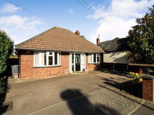 3 bedroom detached bungalow for sale in St. Neots Road, Sandy, SG19 , SG19 — £420,000 • 3 bed • 2 bath • 1200 ft²
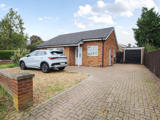 2 bedroom detached bungalow for sale in Western Way, Sandy, Bedfordshire, SG19 — £325,000 • 2 bed • 1 bath • 534 ft²
 3 bedroom bungalow for sale in All Saints Way, Sandy, Bedfordshire, SG19 — £375,000 • 3 bed • 1 bath • 1193 ft²
 3 bedroom bungalow for sale in Barkers Lane, Bedford, MK41 — £420,000 • 3 bed • 1 bath • 1360 ft²
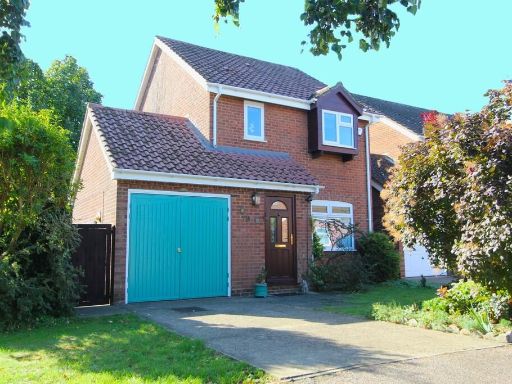 3 bedroom detached house for sale in Coopers Close, Sandy, SG19 — £399,950 • 3 bed • 1 bath • 792 ft²
Meta
- {
"@context": "https://schema.org",
"@type": "Residence",
"name": "3 bedroom detached bungalow for sale in All Saints Way, San…",
"description": "",
"url": "https://propertypiper.co.uk/property/b51d0d71-cd19-465f-8361-68d64b671dbf",
"image": "https://image-a.propertypiper.co.uk/355dafb5-bcca-4238-93e7-f97ef39348fc-1024.jpeg",
"address": {
"@type": "PostalAddress",
"streetAddress": "\n 6 All Saints Way,SANDY,SG19 1DY\n ",
"postalCode": "SG19 1DY",
"addressLocality": "Central Bedfordshire",
"addressRegion": "North East Bedfordshire",
"addressCountry": "England"
},
"geo": {
"@type": "GeoCoordinates",
"latitude": 52.1330068,
"longitude": -0.2966589
},
"numberOfRooms": 3,
"numberOfBathroomsTotal": 2,
"floorSize": {
"@type": "QuantitativeValue",
"value": 1273,
"unitCode": "FTK"
},
"offers": {
"@type": "Offer",
"price": 425000,
"priceCurrency": "GBP",
"availability": "https://schema.org/InStock"
},
"additionalProperty": [
{
"@type": "PropertyValue",
"name": "Feature",
"value": "bungalow"
},
{
"@type": "PropertyValue",
"name": "Feature",
"value": "detached"
},
{
"@type": "PropertyValue",
"name": "Feature",
"value": "brickwork"
},
{
"@type": "PropertyValue",
"name": "Feature",
"value": "white siding"
},
{
"@type": "PropertyValue",
"name": "Feature",
"value": "single storey"
},
{
"@type": "PropertyValue",
"name": "Feature",
"value": "carport"
},
{
"@type": "PropertyValue",
"name": "Feature",
"value": "mid-century modern"
},
{
"@type": "PropertyValue",
"name": "Feature",
"value": "driveway"
},
{
"@type": "PropertyValue",
"name": "Feature",
"value": "suburban"
},
{
"@type": "PropertyValue",
"name": "Feature",
"value": "modern kitchen"
},
{
"@type": "PropertyValue",
"name": "Feature",
"value": "integrated appliances"
},
{
"@type": "PropertyValue",
"name": "Feature",
"value": "glossy cabinetry"
},
{
"@type": "PropertyValue",
"name": "Feature",
"value": "tile flooring"
},
{
"@type": "PropertyValue",
"name": "Feature",
"value": "natural light"
}
]
}
High Res Floorplan Images
Compatible Floorplan Images
FloorplanImages Thumbnail