SW9 8BZ - 1 bedroom flat for sale in Tunstall Road, Brixton, SW9
View on Property Piper
1 bedroom flat for sale in Tunstall Road, Brixton, SW9
Property Details
- Price: £400000
- Bedrooms: 1
- Bathrooms: 1
- Property Type: undefined
- Property SubType: undefined
Brochure Descriptions
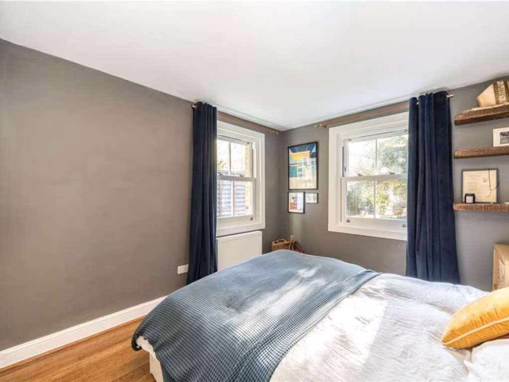
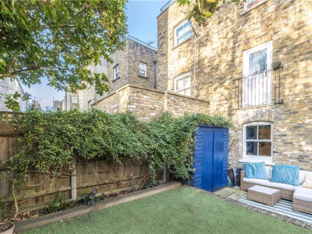
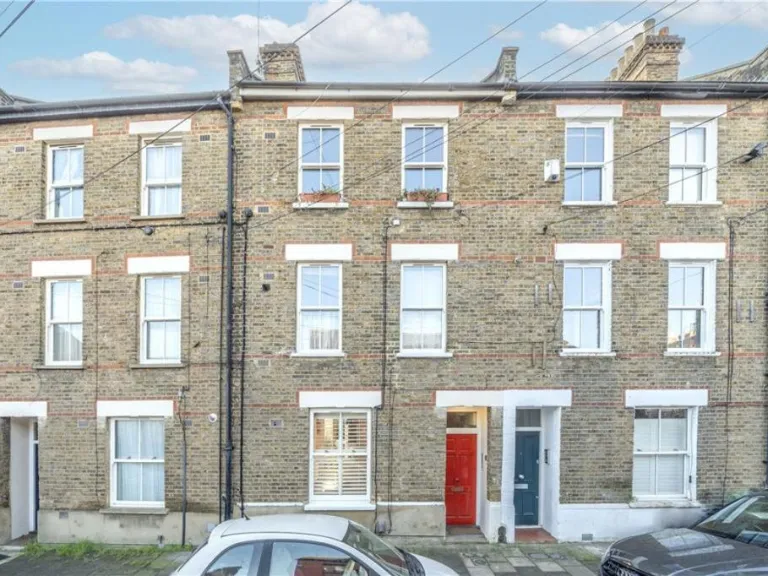
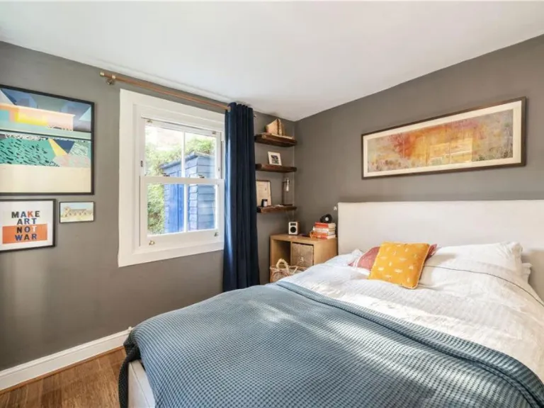
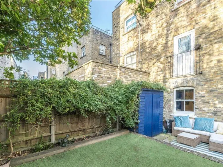
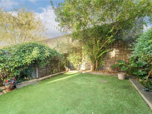
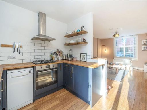
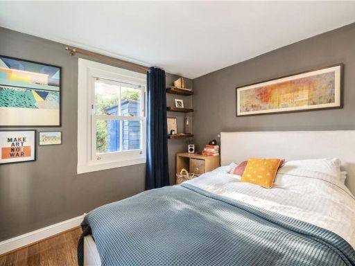
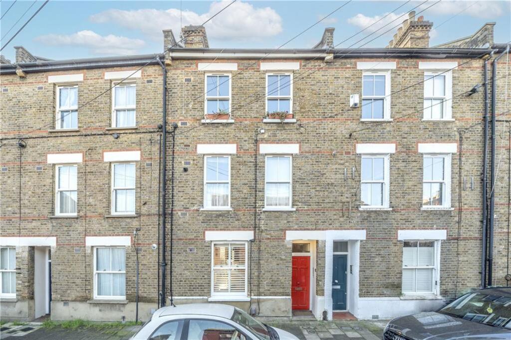
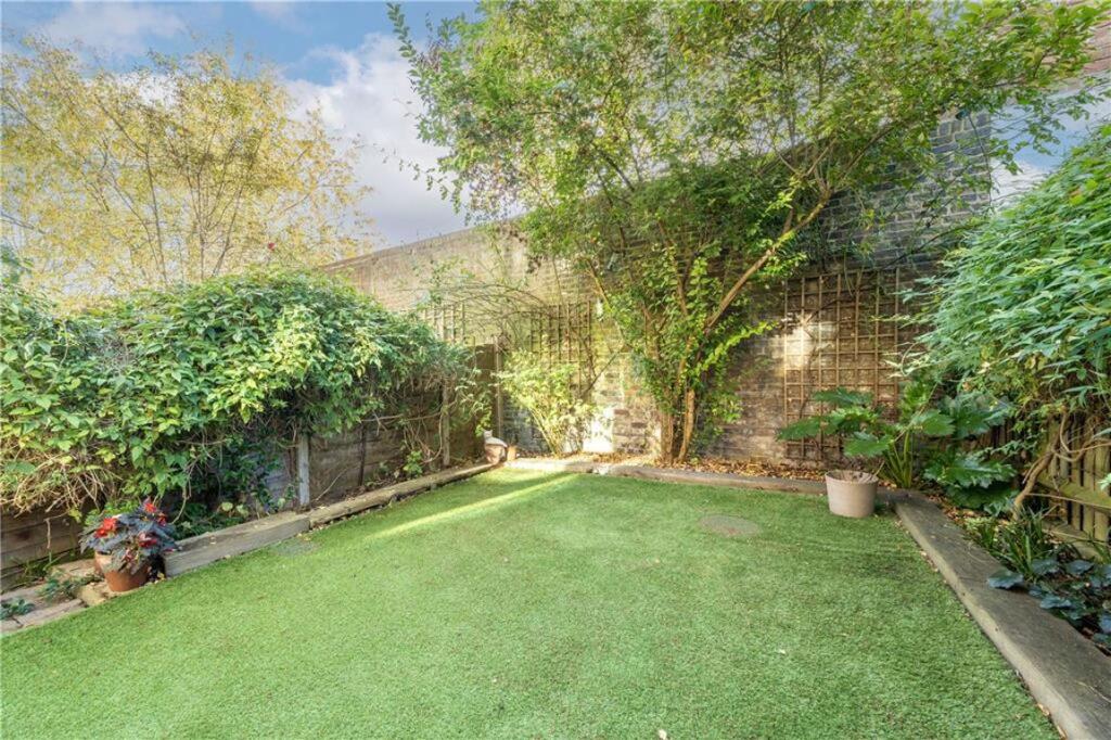
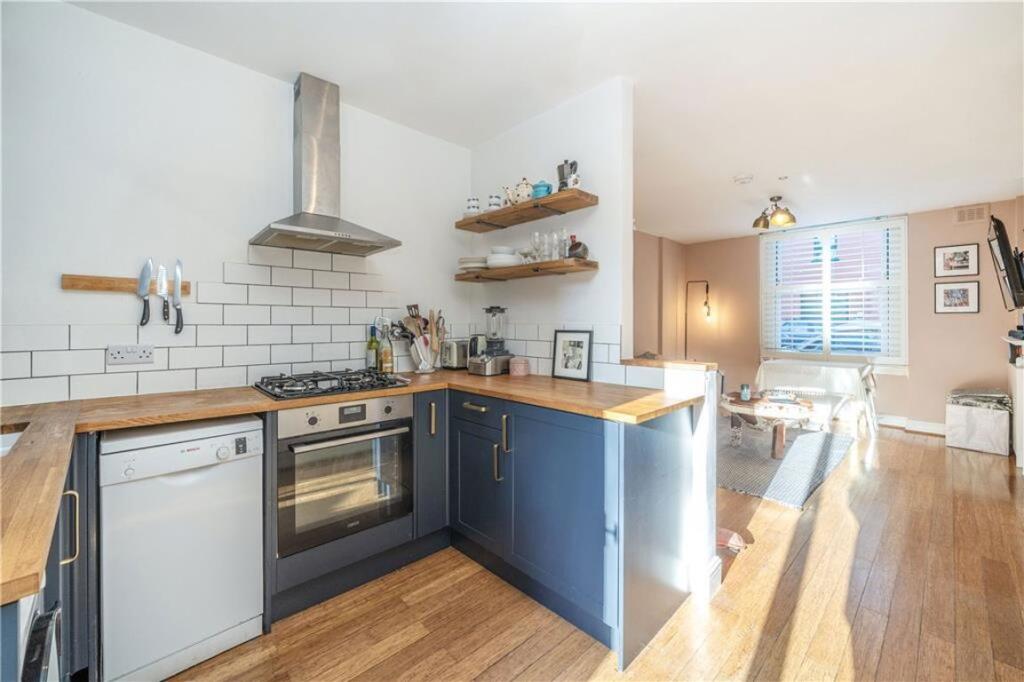
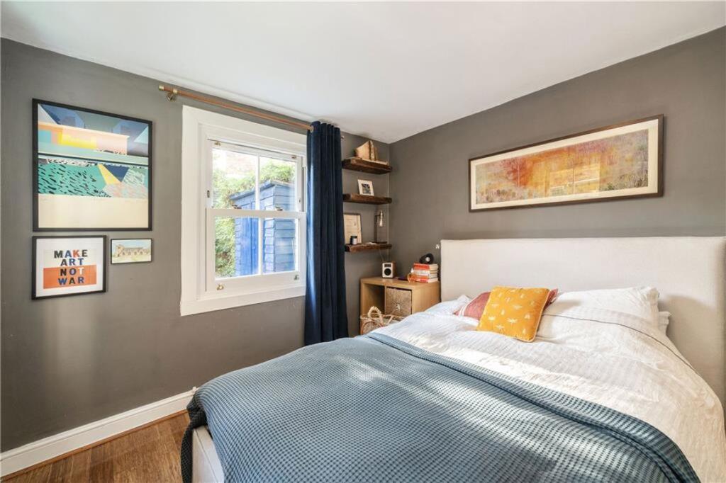
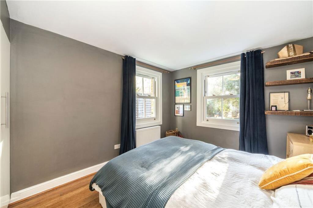
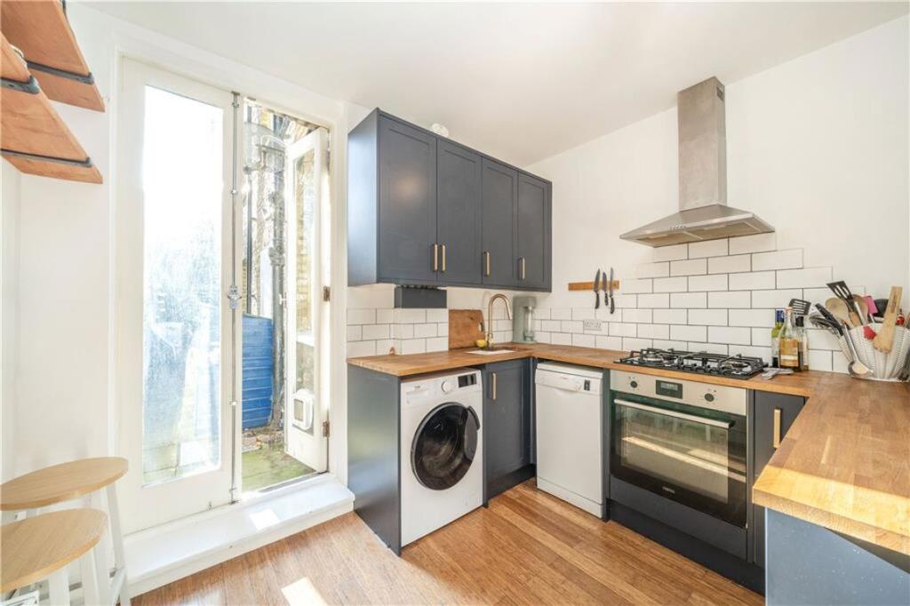
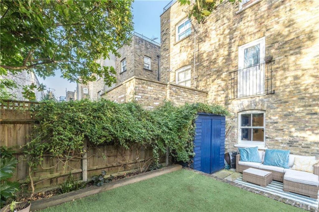
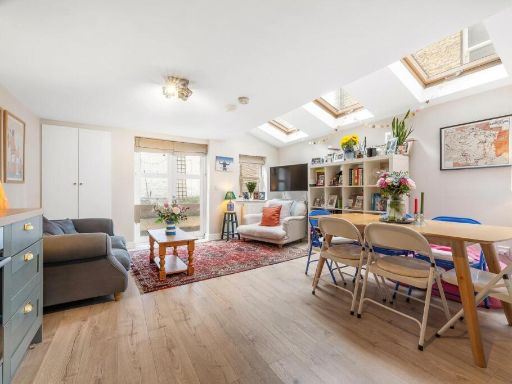
- Mid-terrace Victorian period house presented over three storeys. Brick façade with sash-style windows and two separate entrance doors at ground level. Internally appears to offer one double bedroom, one bathroom and an open-plan kitchen/reception with modern fitted kitchen units and timber flooring. Rear garden of small-to-average size, landscaped with lawn and mature screening offering good privacy. Overall the property is a compact urban residence suited to a single occupant or couple, likely refurbished to a good standard with period external features retained. Appropriate for owner-occupier or buy-to-let; proximity to local services implied by SW9 location.
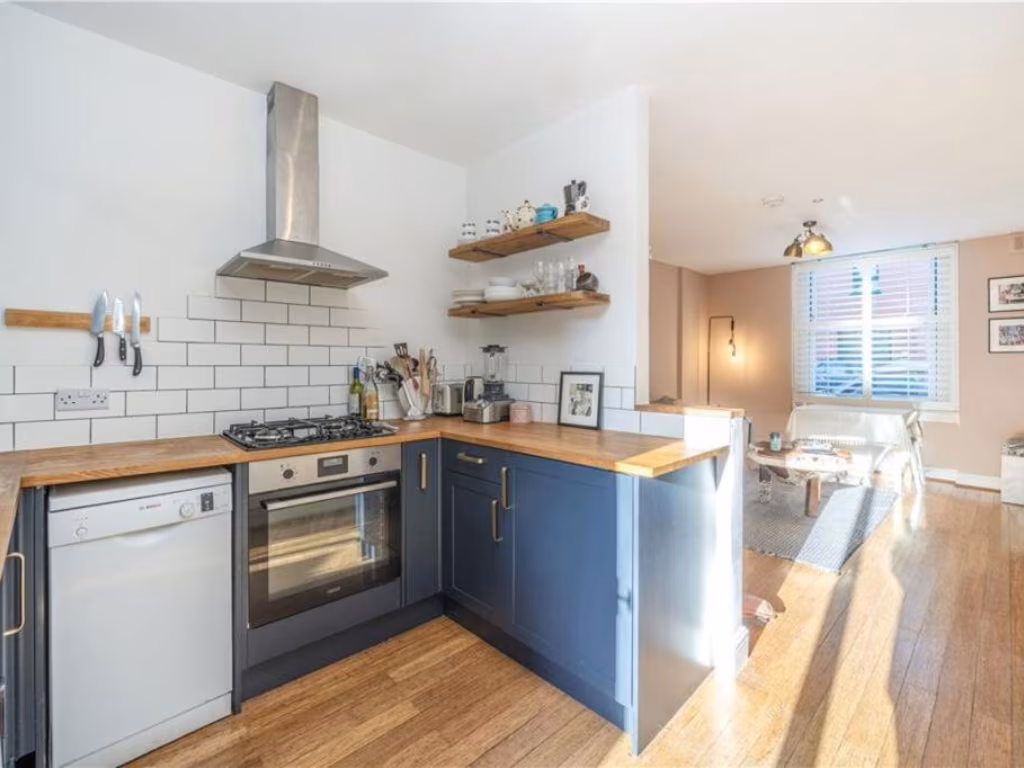
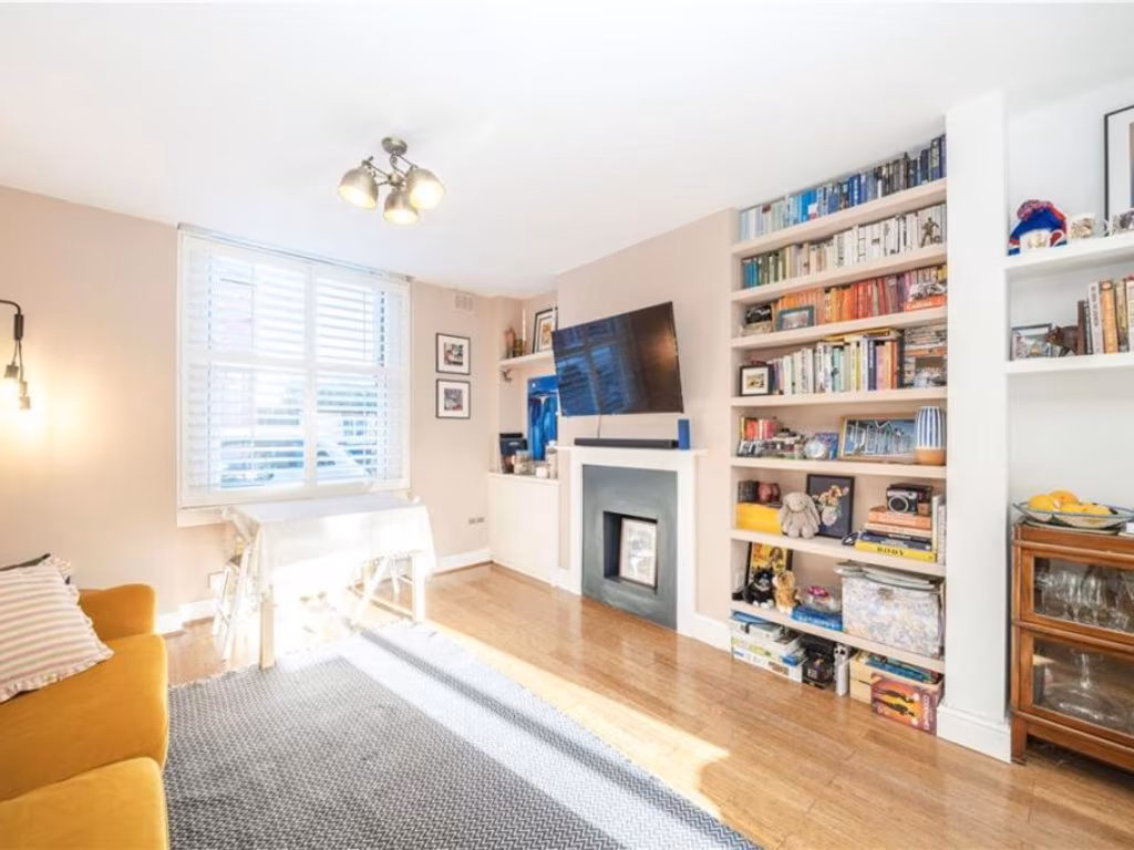
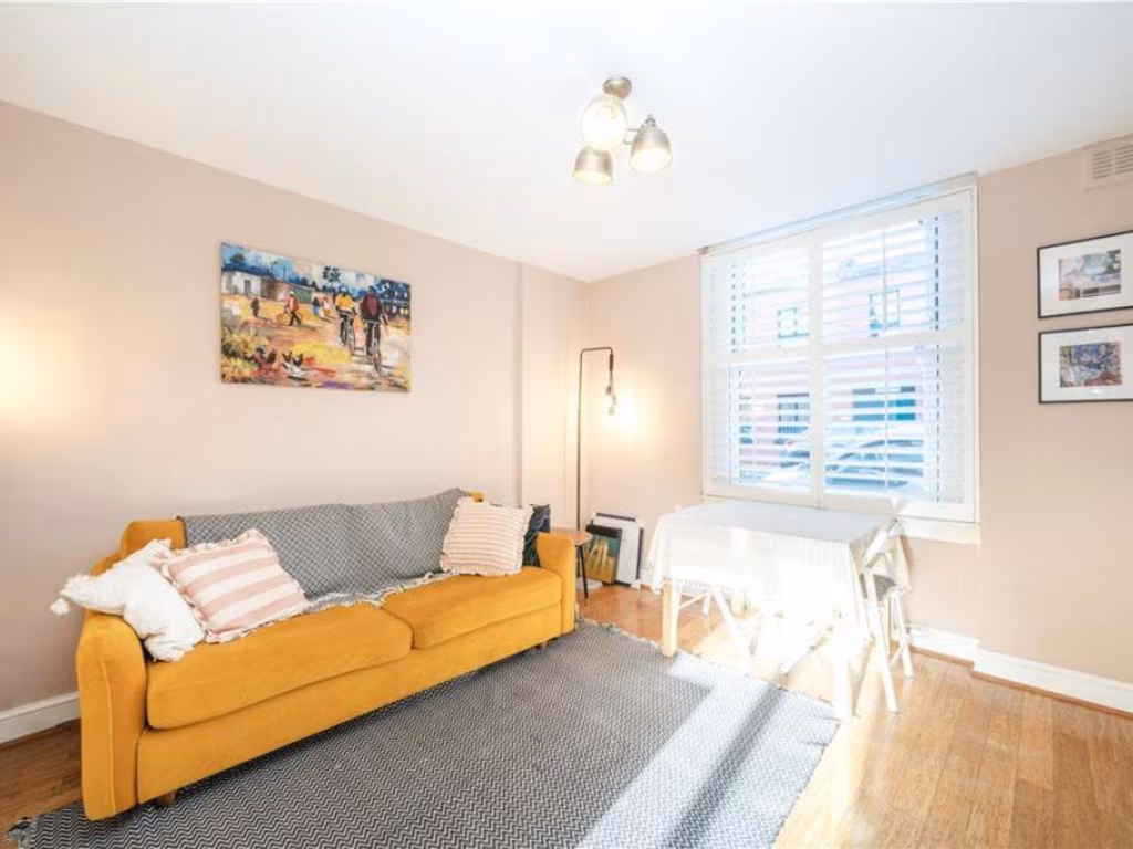
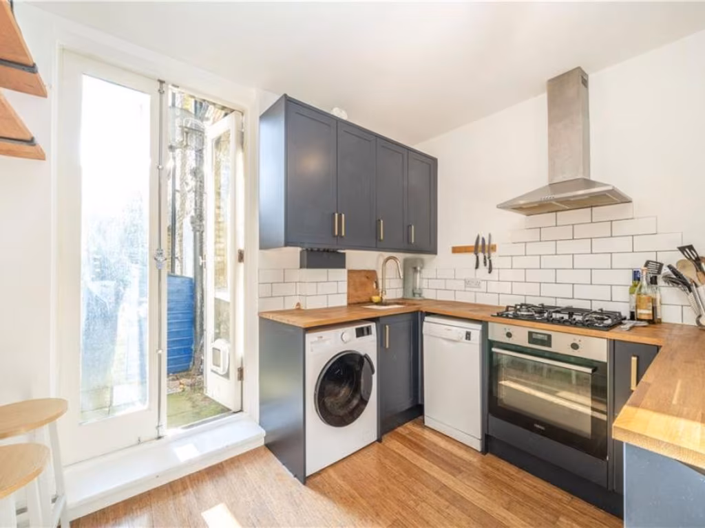
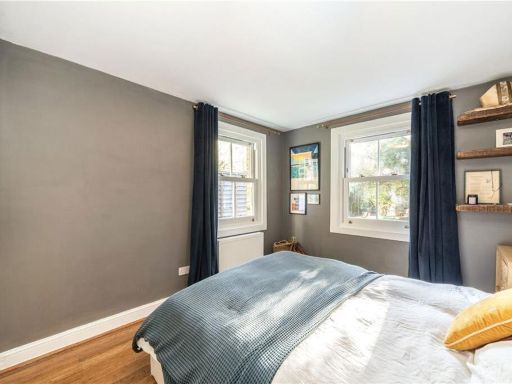
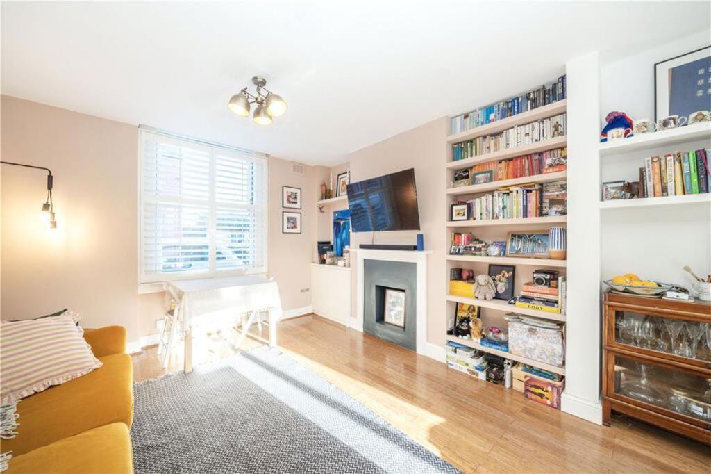
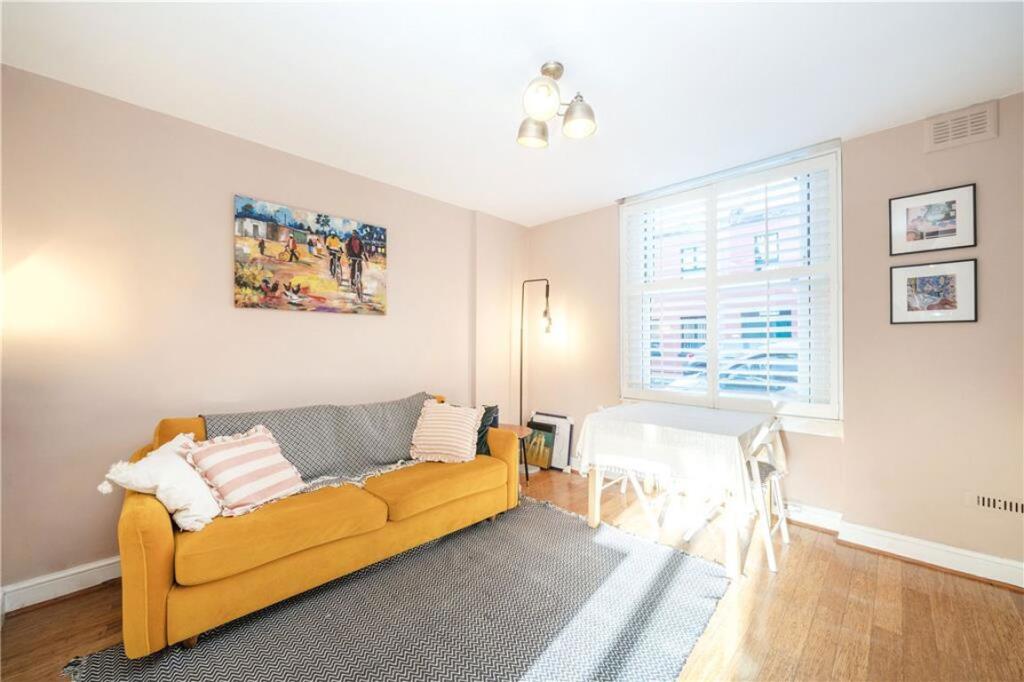
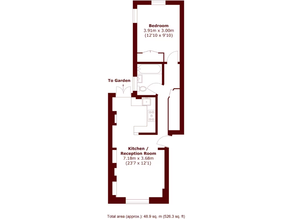
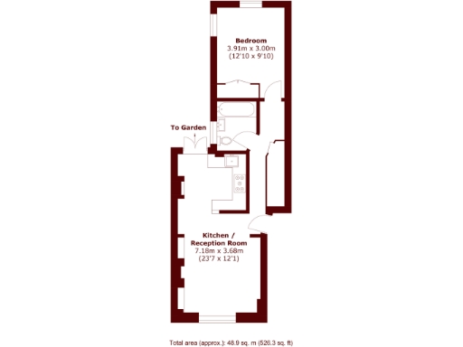
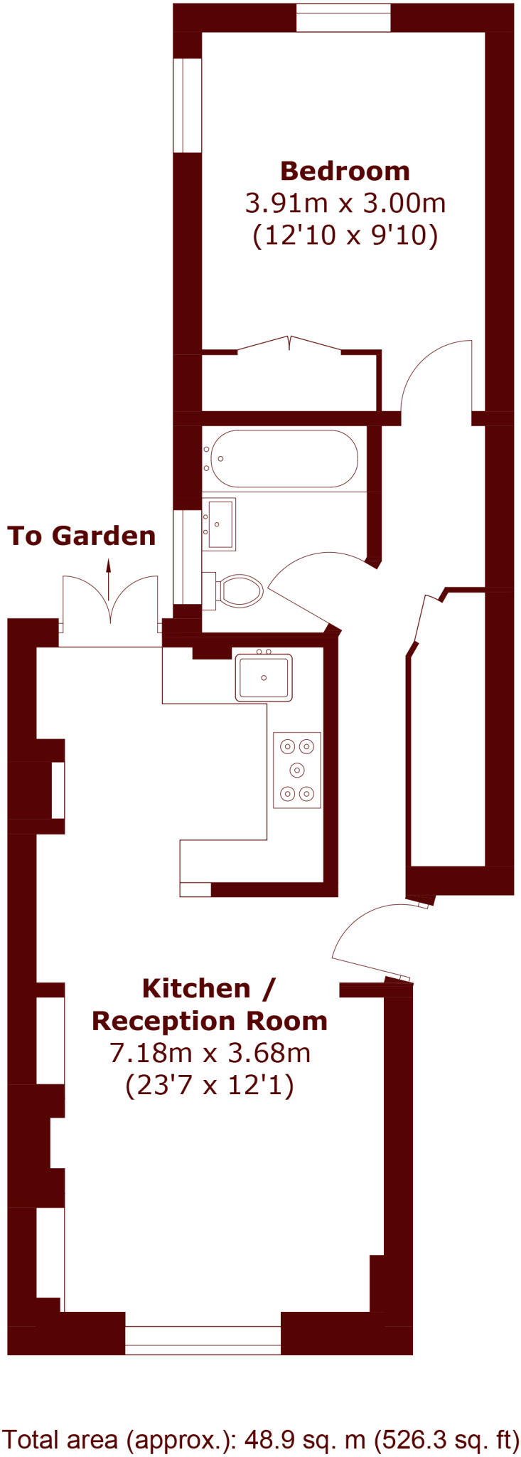
- Long, narrow one-bedroom ground-floor flat arranged in a linear plan. The principal reception / kitchen is to the front (open-plan kitchen/reception room 7.18 x 3.68 m) followed by a centrally located bathroom and a rear double bedroom (3.91 x 3.00 m) with access to a small garden. Overall internal footprint is compact — suitable for a single occupant or couple. Garden size appears small to average for a terraced property. The accommodation, at approximately 48.9 sq. m, suggests a modest city/suburban flat with efficient use of space; likely good rental yield potential but limited by single bedroom and narrow plan. No exceptional views are shown.
Image Descriptions
- Victorian terrace house Victorian
- back garden
Rooms
- Bedroom:
- Kitchen / Reception Room:
Textual Property Features
Detected Visual Features
- Victorian
- terrace
- three-story
- brickwork
- red door
- chimneys
- period
- historical
- urban
- dense housing
- garden
- outdoor space
- urban garden
- brick wall
- trees
- greenery
- low maintenance
EPC Details
- Fully double glazed
- Solid brick, as built, no insulation (assumed)
- Boiler and radiators, mains gas
- Low energy lighting in all fixed outlets
- Suspended, no insulation (assumed)
Nearby Schools
- The Orchard School
- Holy Trinity Church of England Primary School
- Richard Atkins Primary School
- St Jude's Church of England Primary School
- Trinity Academy
- Sudbourne Primary School
- Stockwell Primary School
- St John's Angell Town Church of England Primary School
- Platanos College
- Hill Mead Primary School
- Allen Edwards Primary School
- Glenbrook Primary School
- Corpus Christi Catholic Primary School
- Ark Evelyn Grace Academy
- St Helen's Catholic Primary School
- St Andrew's Church of England Primary School
- Christ Church Primary SW9
- Reay Primary School
- Jubilee Primary School
- Iqra Primary School
- Kings Avenue School
- Jessop Primary School
- Larkhall Primary Campus
- Van Gogh Primary
Nearest General Shops
- Id: 326309773
- Tags:
- Name: Bilal Mobile
- Shop: mobile_phone
- TagsNormalized:
- Lat: 51.4620306
- Lon: -0.1156054
- FullGeoHash: gcpuv27u41y6
- PartitionGeoHash: gcpu
- Images:
- FoodStandards: null
- Distance: 106.7
,- Id: 184724447
- Tags:
- Addr:
- Housenumber: 472-488
- Street: Brixton Road
- Building: yes
- Building:levels: 3
- Building:material: brick
- Name: Morleys
- Postal_code: SW9 8EH
- Roof:
- Shop: department_store
- Wikidata: Q6912573
- TagsNormalized:
- Lat: 51.4624072
- Lon: -0.1155506
- FullGeoHash: gcpuv27y72p0
- PartitionGeoHash: gcpu
- Images:
- FoodStandards: null
- Distance: 102.3
,- Id: 326309779
- Tags:
- Brand: Specsavers
- Brand:wikidata: Q2000610
- Brand:wikipedia: en:Specsavers
- Building: retail
- Building:levels: 3
- Building:material: brick
- Contact:
- Website: https://www.specsavers.co.uk/stores/brixton
- Name: Specsavers
- Roof:
- Shop: optician
- Source: Bing;photograph
- TagsNormalized:
- savers
- specsavers
- retail
- optician
- shop
- Lat: 51.4621282
- Lon: -0.115641
- FullGeoHash: gcpuv27u9k5b
- PartitionGeoHash: gcpu
- Images:
- FoodStandards: null
- Distance: 100.7
}
Nearest Religious buildings
- Id: 361412447
- Tags:
- Amenity: place_of_worship
- Building: church
- Denomination: anglican
- Name: St Paul's, Brixton
- Religion: christian
- Wikidata: Q105074877
- TagsNormalized:
- place of worship
- church
- anglican
- christian
- Lat: 51.4631118
- Lon: -0.1207843
- FullGeoHash: gcpuv2843e2e
- PartitionGeoHash: gcpu
- Images:
- FoodStandards: null
- Distance: 272.1
,- Id: 321923640
- Tags:
- Amenity: place_of_worship
- Level: 1
- Name: The Power of Prayer Ministry
- Phone: +44 20 7095 9343
- Religion: christian
- TagsNormalized:
- place of worship
- christian
- church
- Lat: 51.4607656
- Lon: -0.1185503
- FullGeoHash: gcpuv21sttfr
- PartitionGeoHash: gcpu
- Images:
- FoodStandards: null
- Distance: 210
,- Id: 300676750
- Tags:
- Amenity: place_of_worship
- Building: church
- Building:levels: 3
- Building:material: brick
- Denomination: pentecostal
- Name: Universal Pentecostal Church
- Religion: christian
- TagsNormalized:
- place of worship
- church
- pentecostal
- christian
- Lat: 51.4610261
- Lon: -0.117405
- FullGeoHash: gcpuv24w0q83
- PartitionGeoHash: gcpu
- Images:
- FoodStandards: null
- Distance: 154.8
}
Nearest Airports
- Id: 260720166
- Tags:
- Aerodrome: international
- Aeroway: aerodrome
- Alt_name: Gatwick Airport
- Ele: 62
- Iata: LGW
- Icao: EGKK
- Internet_access: wlan
- Internet_access:fee: no
- Internet_access:ssid: Gatwick FREE Wi-Fi
- Name: London Gatwick Airport
- Operator: Gatwick Airport Limited
- Ref: LGW
- Website: https://www.gatwickairport.com/
- Wikidata: Q8703
- Wikipedia: en:Gatwick Airport
- TagsNormalized:
- airport
- international airport
- Lat: 51.1540917
- Lon: -0.1883773
- FullGeoHash: gcpg58qf4mzd
- PartitionGeoHash: gcpg
- Images:
- FoodStandards: null
- Distance: 34639.1
,- Id: 121158889
- Tags:
- Aerodrome: continental
- Aeroway: aerodrome
- Fhrs:
- Authority: City of London Corporation
- Iata: LCY
- Icao: EGLC
- Name: London City Airport
- Operator: London City Airport Limited
- Ref: LCY
- Website: https://www.londoncityairport.com/
- Wikidata: Q8982
- Wikipedia: en:London City Airport
- TagsNormalized:
- airport
- continental airport
- Lat: 51.5042658
- Lon: 0.0539987
- FullGeoHash: u10j10p64702
- PartitionGeoHash: u10j
- Images:
- FoodStandards: null
- Distance: 12725
,- Id: 14001268
- Tags:
- Access: yes
- Aerodrome: international
- Aerodrome:type: public
- Aeroway: aerodrome
- Alt_name: London Heathrow
- Alt_name_2: London Heathrow Airport
- Ele: 25
- Iata: LHR
- Icao: EGLL
- Int_name: Heathrow Airport
- Name: London Heathrow Airport
- Note: area still approx
- Old_name: London Airport
- Operator: Heathrow Airport Limited
- Rank_aci:
- Ref: LHR
- Short_name: Heathrow
- Type: multipolygon
- Website: https://www.heathrow.com/
- Wikidata: Q8691
- Wikipedia: en:Heathrow Airport
- TagsNormalized:
- airport
- international airport
- Lat: 51.4677522
- Lon: -0.4547736
- FullGeoHash: gcpsv9kv7h2h
- PartitionGeoHash: gcps
- Images:
- FoodStandards: null
- Distance: 23404.4
}
Nearest Leisure Facilities
- Id: 14014801
- Tags:
- Building: yes
- Created_by: Potlatch 0.5d
- Leisure: sports_centre
- Name: Ferndale Community Sports Centre
- TagsNormalized:
- sports
- sports centre
- leisure
- Lat: 51.4633549
- Lon: -0.1172333
- FullGeoHash: gcpuv2deu28t
- PartitionGeoHash: gcpu
- Images:
- FoodStandards: null
- Distance: 107.3
,- Id: 632989143
- Tags:
- Leisure: sports_centre
- Name: Ferndale Community Sports Centre
- TagsNormalized:
- sports
- sports centre
- leisure
- Lat: 51.4632235
- Lon: -0.1177232
- FullGeoHash: gcpuv2d70b5j
- PartitionGeoHash: gcpu
- Images:
- FoodStandards: null
- Distance: 103.6
,- Id: 804891489
- Tags:
- Leisure: pitch
- Sport: tennis
- TagsNormalized:
- Lat: 51.4629805
- Lon: -0.1181297
- FullGeoHash: gcpuv29cx6uh
- PartitionGeoHash: gcpu
- Images:
- FoodStandards: null
- Distance: 100.1
,- Id: 2252801301
- Tags:
- Amenity: bicycle_parking
- Bicycle_parking: stands
- Capacity: 20
- Covered: no
- Name: Ferndale Community Sports Centre
- Source: survey ch
- TagsNormalized:
- bicycle
- sports
- sports centre
- Lat: 51.4631914
- Lon: -0.1171177
- FullGeoHash: gcpuv2ddyfnw
- PartitionGeoHash: gcpu
- Images:
- FoodStandards: null
- Distance: 88.4
,- Id: 804891490
- Tags:
- Leisure: pitch
- Sport: tennis
- TagsNormalized:
- Lat: 51.4631045
- Lon: -0.1175897
- FullGeoHash: gcpuv2d67fnb
- PartitionGeoHash: gcpu
- Images:
- FoodStandards: null
- Distance: 87.6
}
Nearest Tourist attractions
- Id: 4384901986
- Tags:
- Addr:
- City: London
- Housenumber: 187
- Postcode: SW9 8BA
- Street: Ferndale Road
- Name: The Chocolate Museum
- Opening_hours: We-Fr 14:00-19:00; Sa 11:00-18:00
- Phone: +44 7723434235
- Tourism: museum
- Website: https://www.thechocolatemuseum.co.uk/
- TagsNormalized:
- Lat: 51.4639484
- Lon: -0.1163525
- FullGeoHash: gcpuv2er0z36
- PartitionGeoHash: gcpu
- Images:
- FoodStandards: null
- Distance: 178.6
,- Id: 6270240837
- Tags:
- Amenity: weathervane
- Artist_name: Maggi Hambling
- Artwork_subject: Grey Heron
- Artwork_type: sculpture
- Name: The Brixton Heron
- Start_date: 2010
- Tourism: artwork
- Wikidata: Q61677278
- TagsNormalized:
- Lat: 51.4615593
- Lon: -0.1152009
- FullGeoHash: gcpuv2k179gy
- PartitionGeoHash: gcpu
- Images:
- FoodStandards: null
- Distance: 157.3
,- Id: 4596880090
- Tags:
- Name: David Bowie mural
- Name:en: David Bowie mural
- Name:ru: Стена памяти Боуи
- Tourism: attraction
- TagsNormalized:
- Lat: 51.4626168
- Lon: -0.1156652
- FullGeoHash: gcpuv27z2z1f
- PartitionGeoHash: gcpu
- Images:
- FoodStandards: null
- Distance: 97.5
}
Nearest Hotels
- Id: 1149802788
- Tags:
- Name: The Windmill
- Operator: Youngs
- Tourism: hotel
- TagsNormalized:
- Lat: 51.4577709
- Lon: -0.1442608
- FullGeoHash: gcpusxwgnrxr
- PartitionGeoHash: gcpu
- Images:
- FoodStandards: null
- Distance: 1955.7
,- Id: 3050942006
- Tags:
- Name: London Hotel
- Tourism: hotel
- TagsNormalized:
- Lat: 51.4615782
- Lon: -0.1130331
- FullGeoHash: gcpuv2m9qjkr
- PartitionGeoHash: gcpu
- Images:
- FoodStandards: null
- Distance: 291.4
,- Id: 321544987
- Tags:
- Addr:
- City: Brixton, London
- Housename: Premier Inn
- Housenumber: 434
- Postcode: SW9 8HH
- Street: Coldharbour Lane
- Brand: Premier Inn
- Brand:wikidata: Q2108626
- Brand:wikipedia: en:Premier Inn
- Building: hotel
- Internet_access: wlan
- Internet_access:fee: customers
- Internet_access:operator: Virgin Media
- Internet_access:ssid: Premier Inn Free Wi-Fi
- Name: Premier Inn
- Tourism: hotel
- TagsNormalized:
- Lat: 51.4617338
- Lon: -0.1146709
- FullGeoHash: gcpuv2k6rfrp
- PartitionGeoHash: gcpu
- Images:
- FoodStandards: null
- Distance: 179.2
}
Tags
- Victorian
- terrace
- three-story
- brickwork
- red door
- chimneys
- period
- historical
- urban
- dense housing
- garden
- outdoor space
- urban garden
- brick wall
- trees
- greenery
- low maintenance
Local Market Stats
- Average Price/sqft: £725
- Avg Income: £57000
- Rental Yield: 5.3%
- Social Housing: 44%
- Planning Success Rate: 71%
AirBnB Data
- 1km average: £132/night
- Listings in 1km: 69
Similar Properties
 2 bedroom flat for sale in Tunstall Road, SW9 — £575,000 • 2 bed • 1 bath • 636 ft²
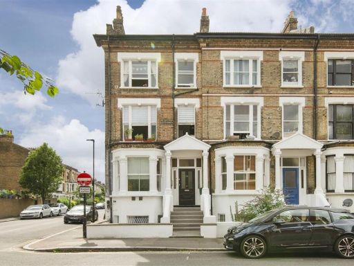 2 bedroom flat for sale in Stockwell Road, SW9 — £425,000 • 2 bed • 2 bath • 514 ft²
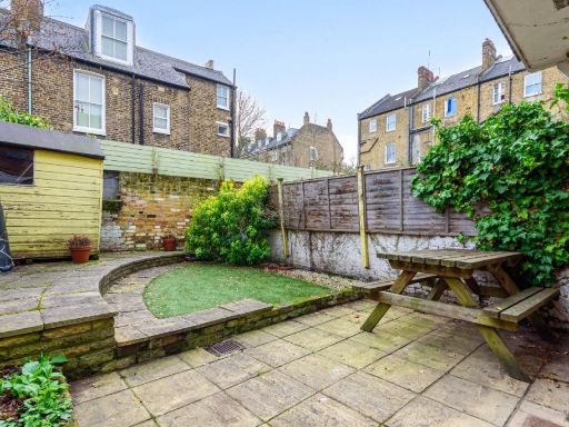 1 bedroom flat for sale in Kellett Road, Brixton, London, SW2 — £500,000 • 1 bed • 1 bath • 612 ft²
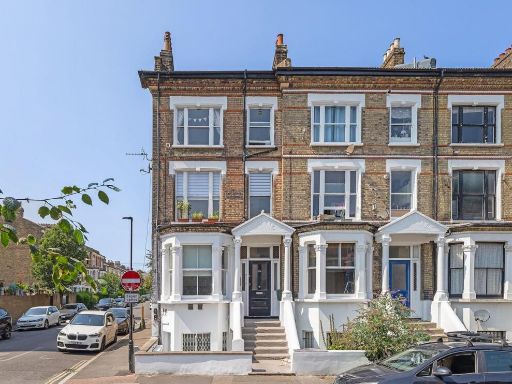 2 bedroom flat for sale in Stockwell Road, SW9 — £450,000 • 2 bed • 1 bath • 624 ft²
 1 bedroom flat for sale in Stockwell Road, Brixton, SW9 — £425,000 • 1 bed • 1 bath • 462 ft²
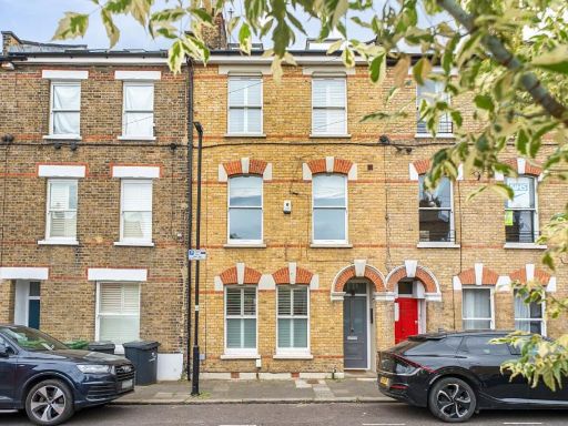 2 bedroom flat for sale in Tunstall Road, Brixton, London, SW9 — £599,950 • 2 bed • 1 bath • 702 ft²
Meta
- {
"@context": "https://schema.org",
"@type": "Residence",
"name": "1 bedroom flat for sale in Tunstall Road, Brixton, SW9",
"description": "",
"url": "https://propertypiper.co.uk/property/b2e764c7-fc62-4c03-9e08-091274b9f3bd",
"image": "https://image-a.propertypiper.co.uk/84dfbec1-c64a-4d72-bbaa-955bacb93ab8-1024.jpeg",
"address": {
"@type": "PostalAddress",
"streetAddress": "23a Tunstall Road",
"postalCode": "SW9 8BZ",
"addressLocality": "Lambeth",
"addressRegion": "Vauxhall",
"addressCountry": "England"
},
"geo": {
"@type": "GeoCoordinates",
"latitude": 51.46239871464956,
"longitude": -0.11702774391572512
},
"numberOfRooms": 1,
"numberOfBathroomsTotal": 1,
"floorSize": {
"@type": "QuantitativeValue",
"value": 526,
"unitCode": "FTK"
},
"offers": {
"@type": "Offer",
"price": 400000,
"priceCurrency": "GBP",
"availability": "https://schema.org/InStock"
},
"additionalProperty": [
{
"@type": "PropertyValue",
"name": "Feature",
"value": "Victorian"
},
{
"@type": "PropertyValue",
"name": "Feature",
"value": "terrace"
},
{
"@type": "PropertyValue",
"name": "Feature",
"value": "three-story"
},
{
"@type": "PropertyValue",
"name": "Feature",
"value": "brickwork"
},
{
"@type": "PropertyValue",
"name": "Feature",
"value": "red door"
},
{
"@type": "PropertyValue",
"name": "Feature",
"value": "chimneys"
},
{
"@type": "PropertyValue",
"name": "Feature",
"value": "period"
},
{
"@type": "PropertyValue",
"name": "Feature",
"value": "historical"
},
{
"@type": "PropertyValue",
"name": "Feature",
"value": "urban"
},
{
"@type": "PropertyValue",
"name": "Feature",
"value": "dense housing"
},
{
"@type": "PropertyValue",
"name": "Feature",
"value": "garden"
},
{
"@type": "PropertyValue",
"name": "Feature",
"value": "outdoor space"
},
{
"@type": "PropertyValue",
"name": "Feature",
"value": "urban garden"
},
{
"@type": "PropertyValue",
"name": "Feature",
"value": "brick wall"
},
{
"@type": "PropertyValue",
"name": "Feature",
"value": "trees"
},
{
"@type": "PropertyValue",
"name": "Feature",
"value": "greenery"
},
{
"@type": "PropertyValue",
"name": "Feature",
"value": "low maintenance"
}
]
}
High Res Floorplan Images
Compatible Floorplan Images
FloorplanImages Thumbnail