CM77 7PY - 4 bedroom detached house for sale in Maylands Drive, Braint…
View on Property Piper
4 bedroom detached house for sale in Maylands Drive, Braintree, CM77
Property Details
- Price: £565000
- Bedrooms: 4
- Bathrooms: 2
- Property Type: undefined
- Property SubType: undefined
Brochure Descriptions
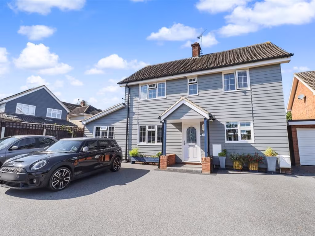
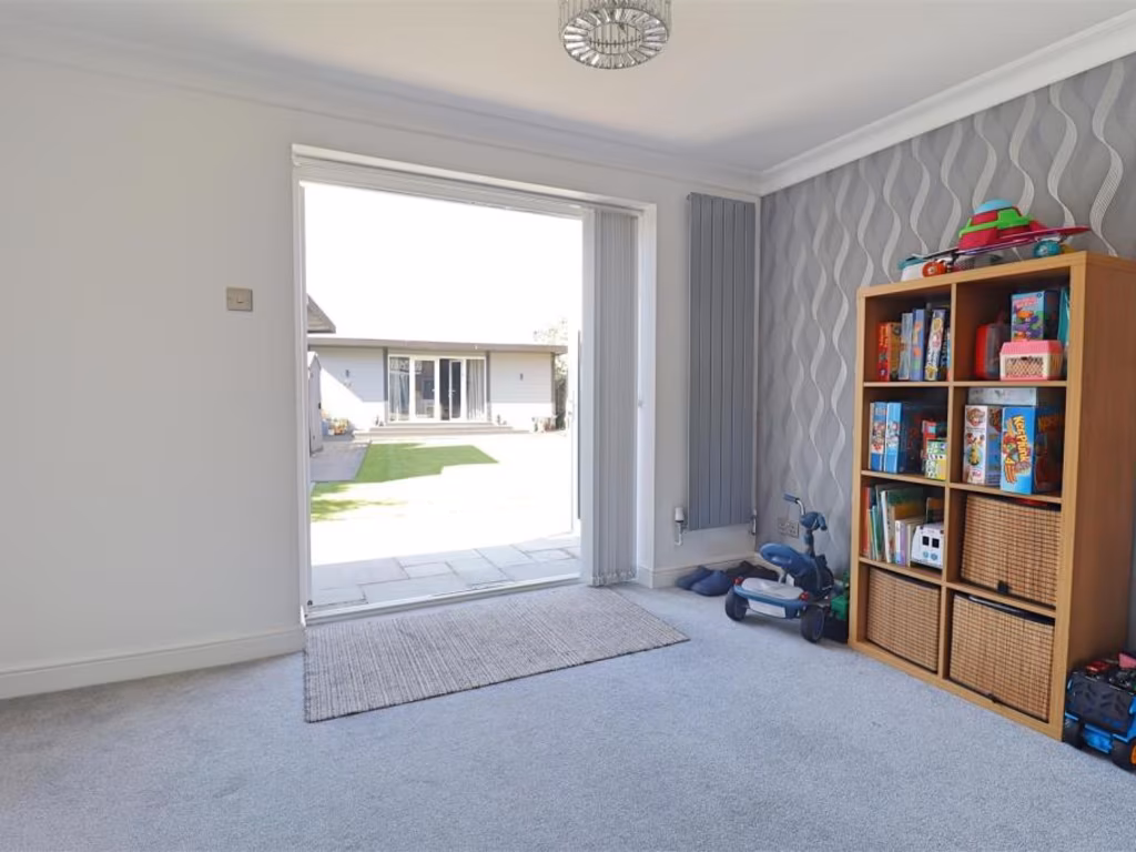
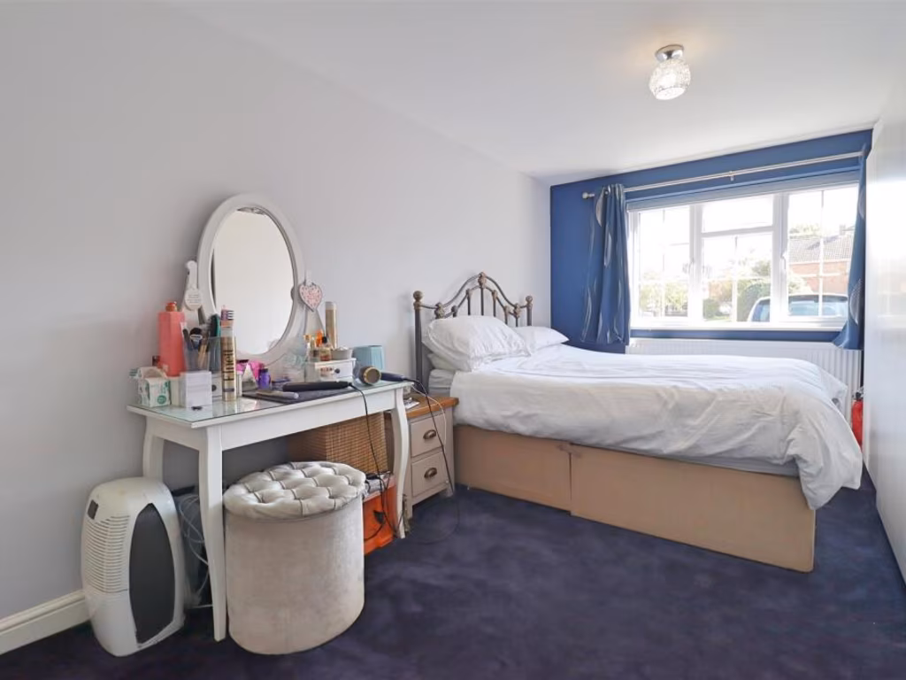
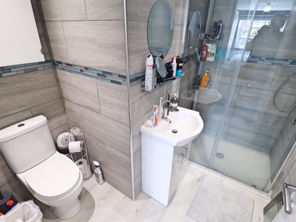
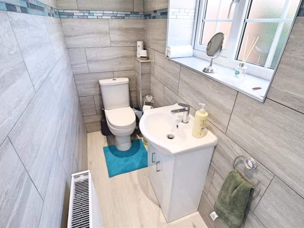
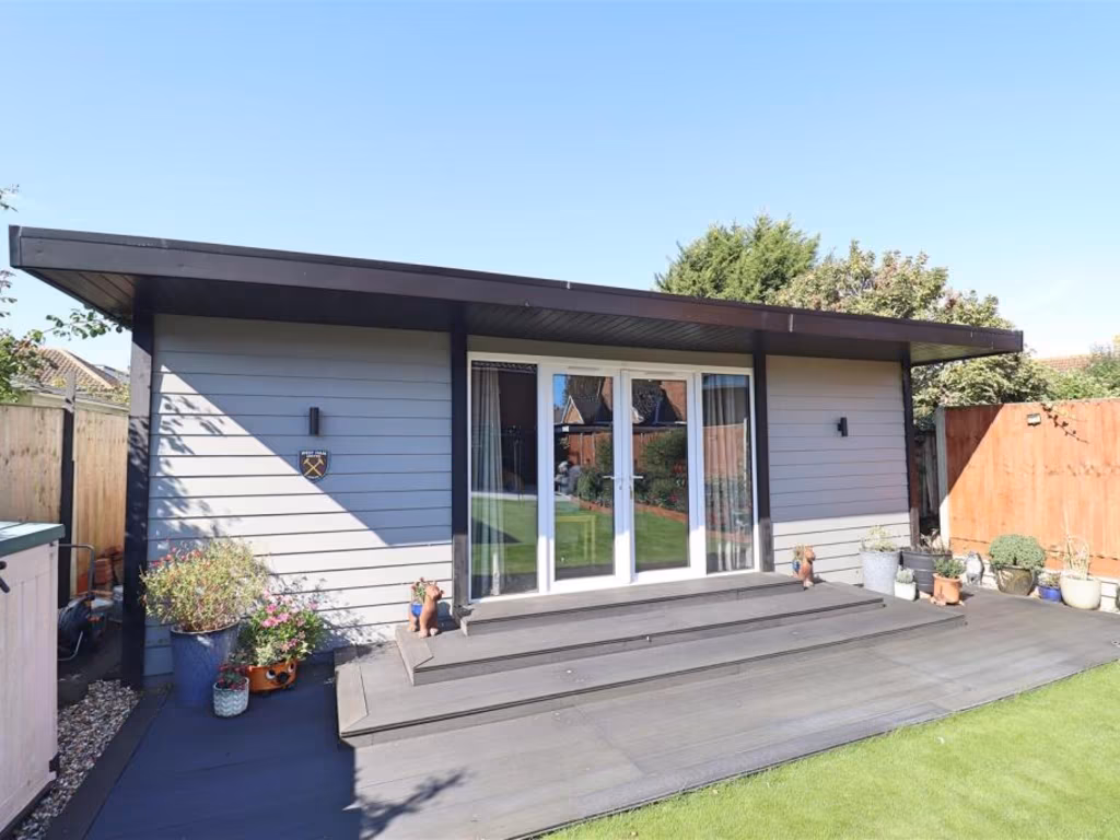
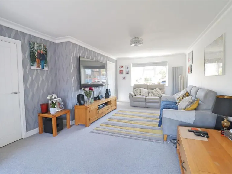
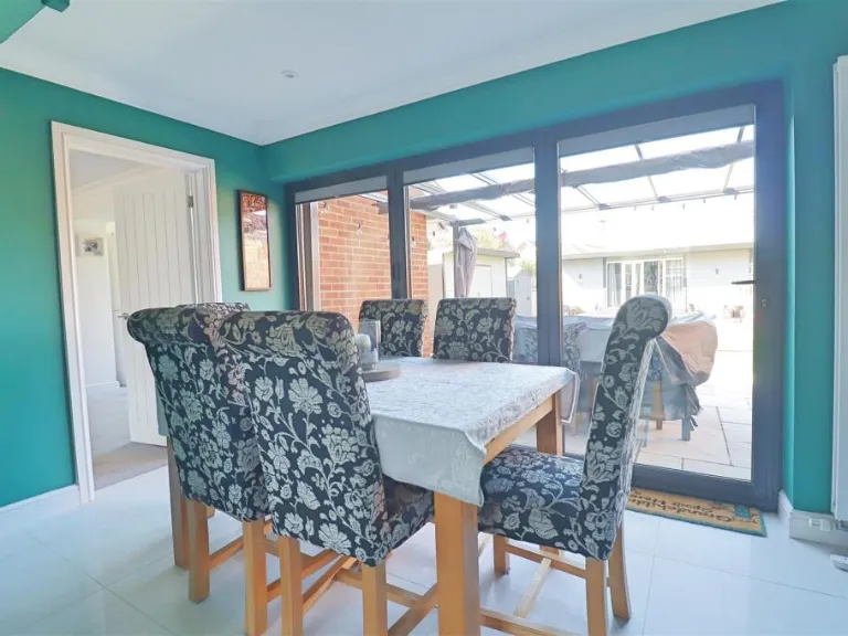
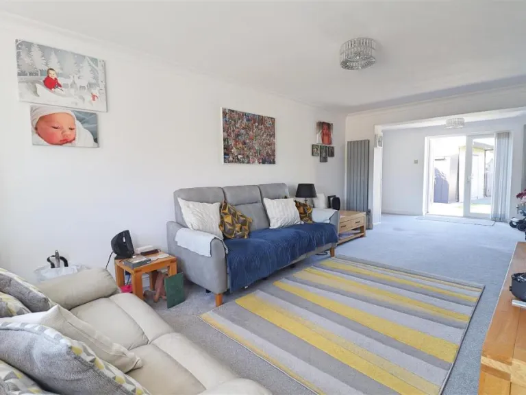
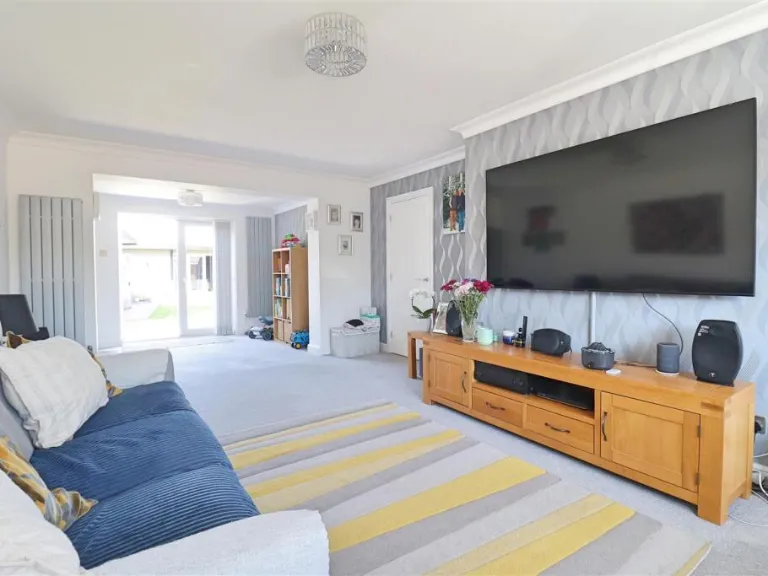
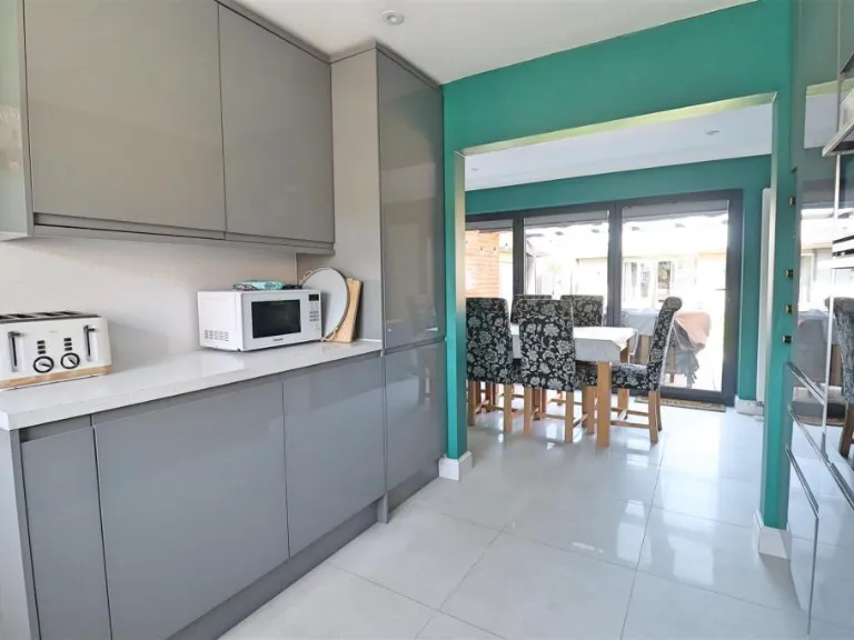
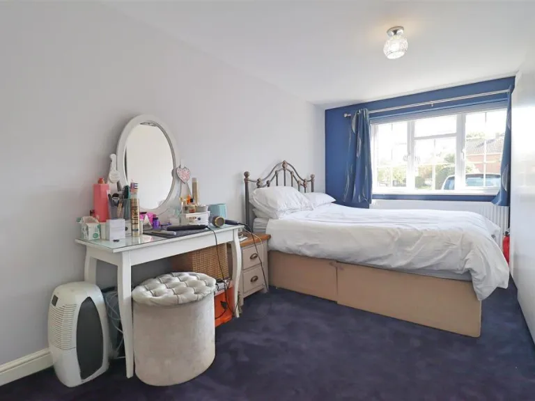
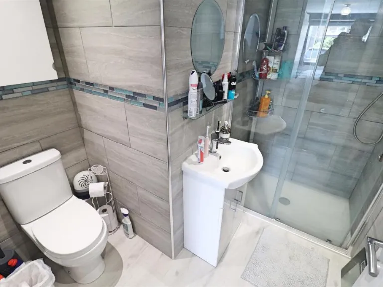
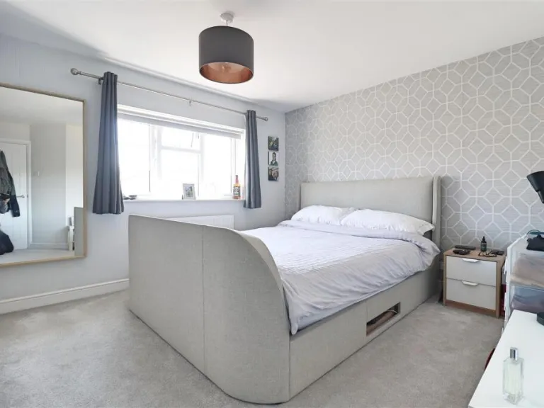
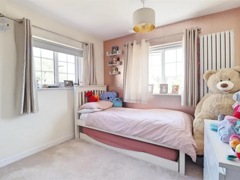
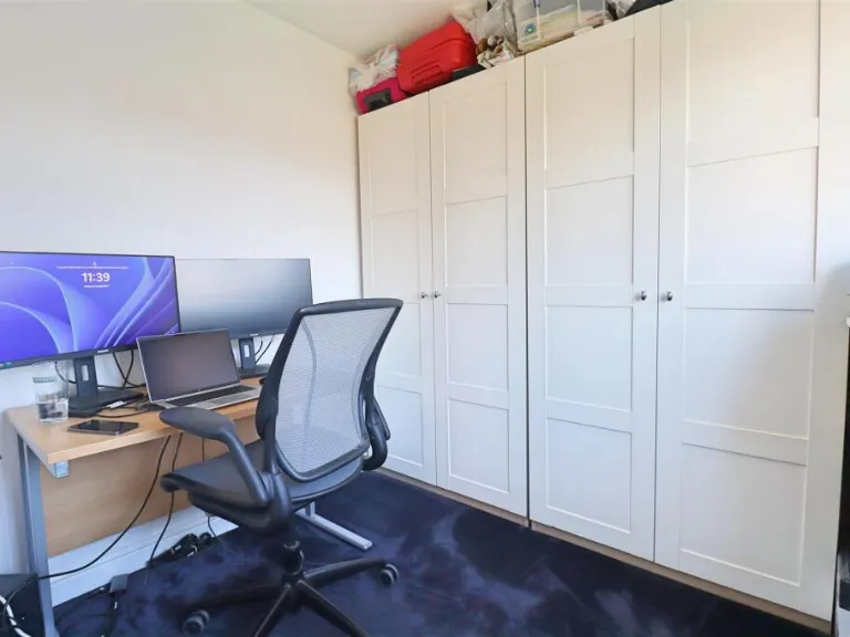
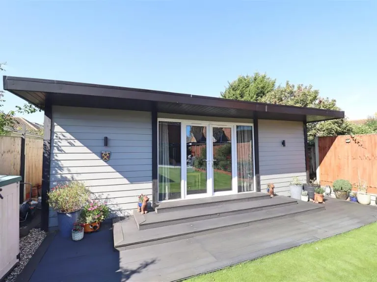
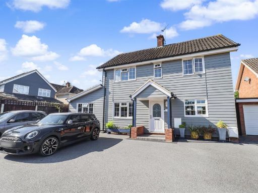
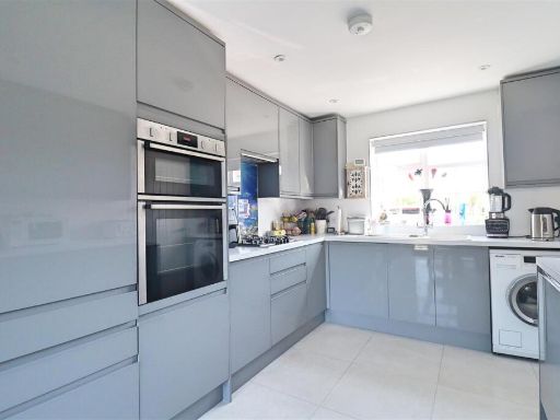
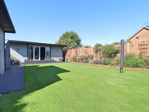
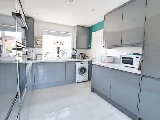
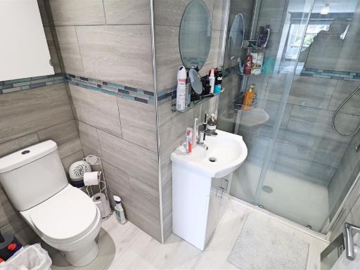
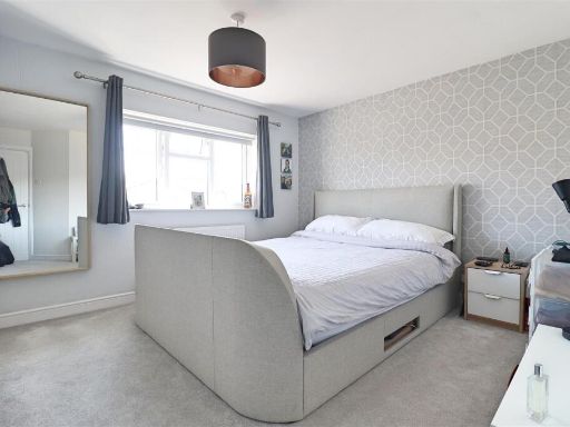
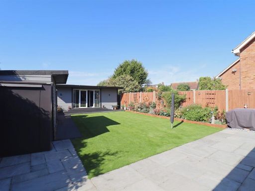
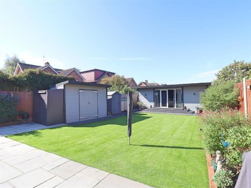
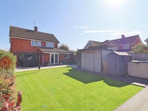
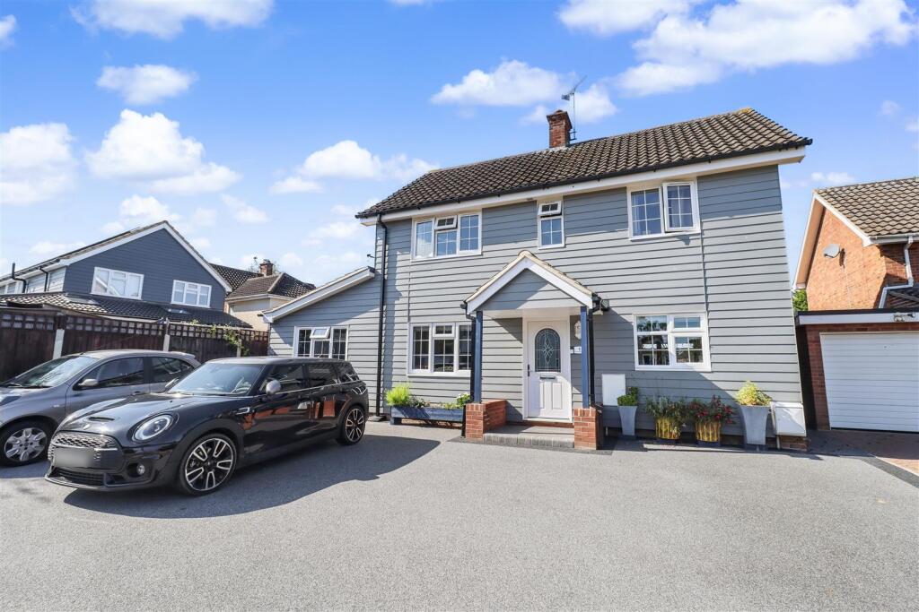
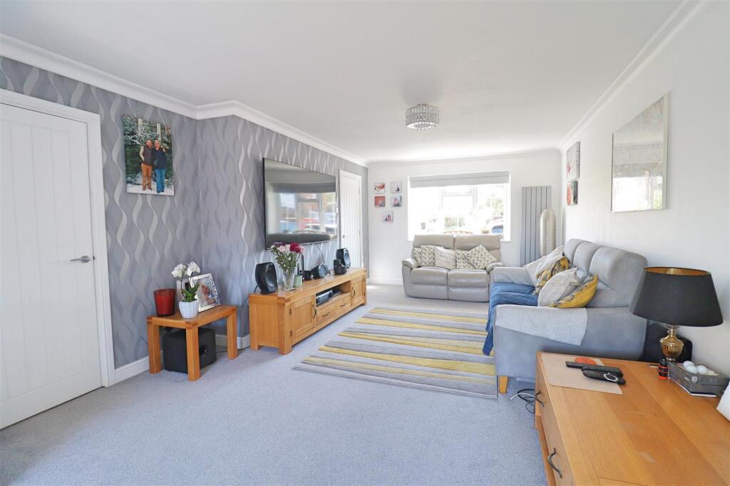
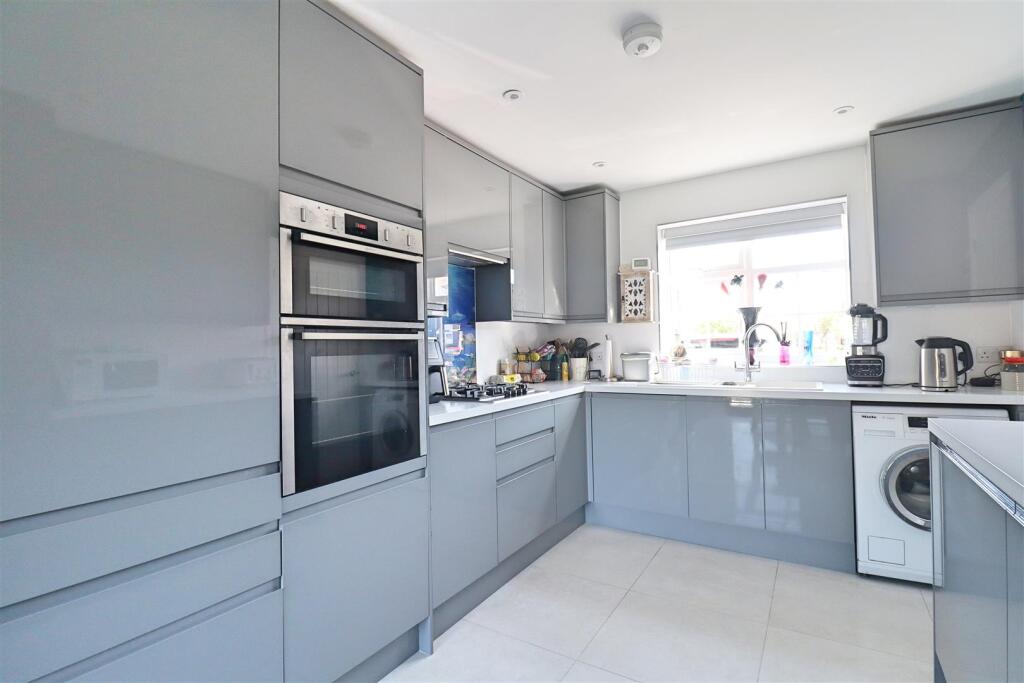
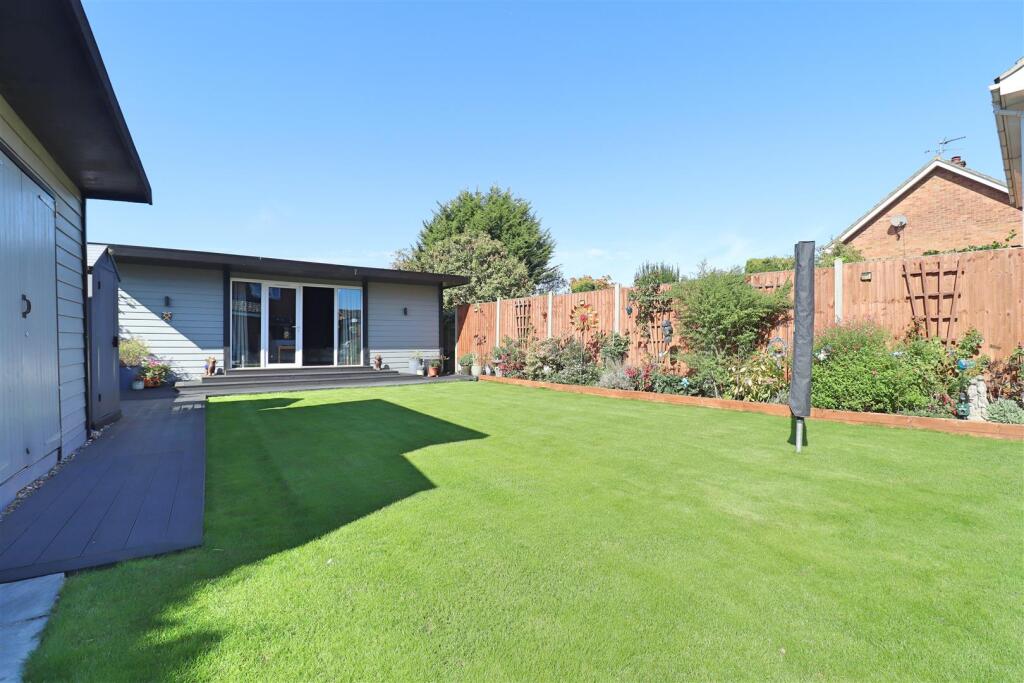
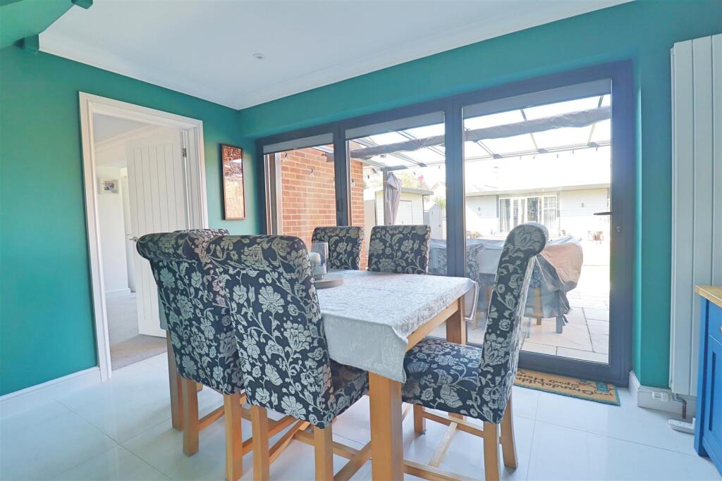
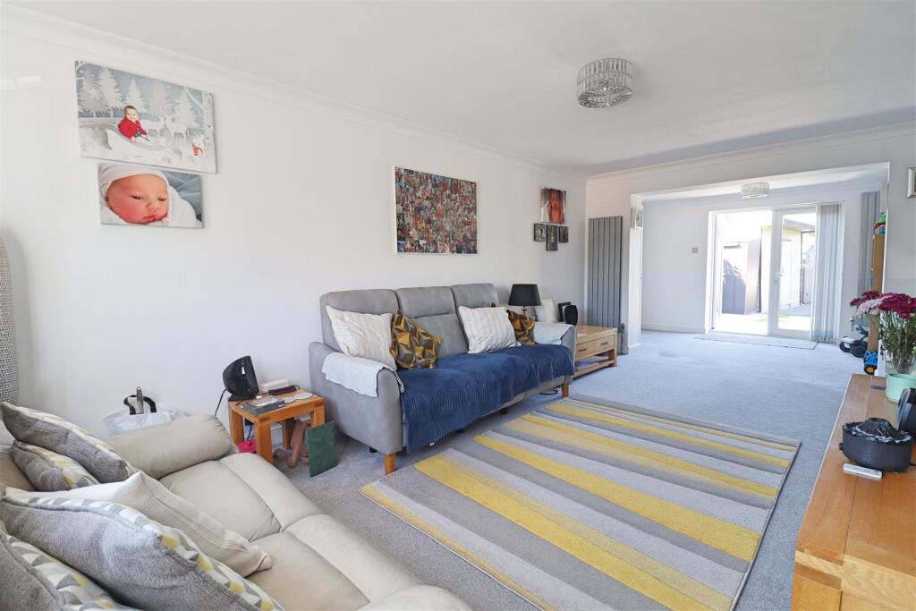
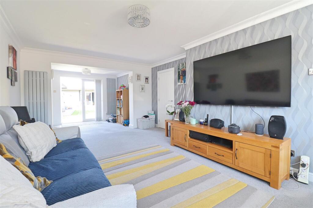
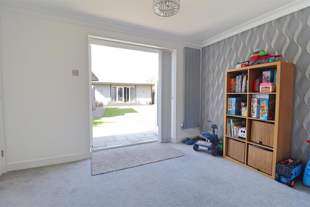
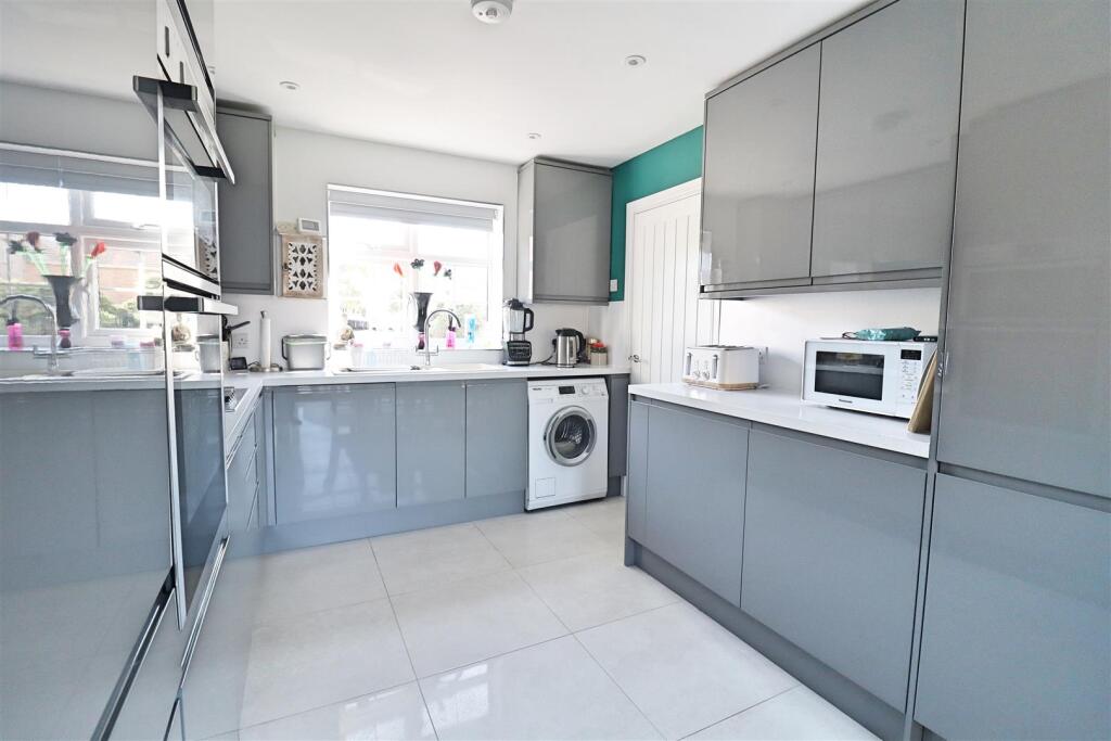
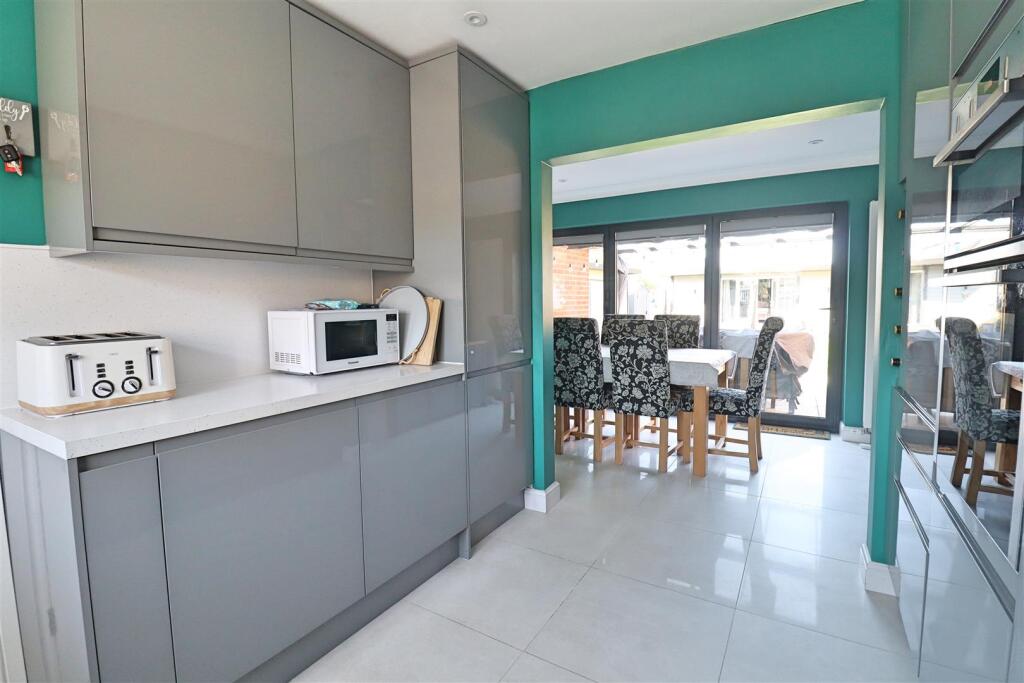
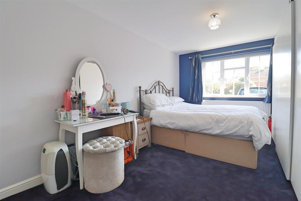
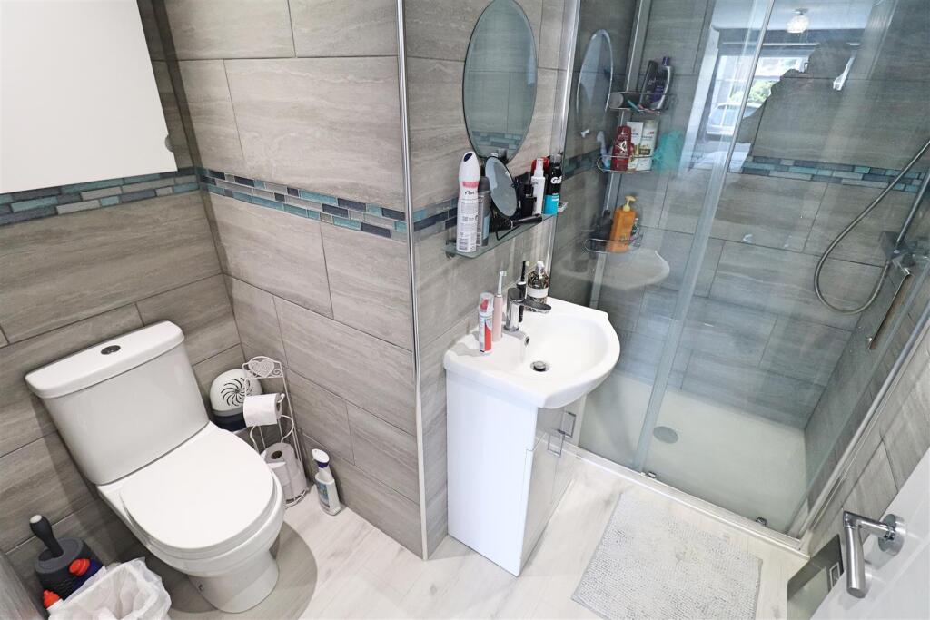
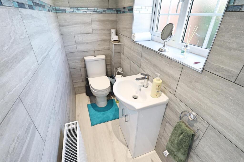
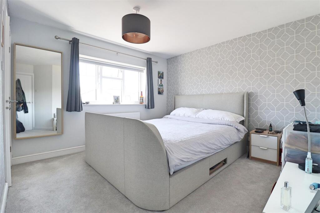
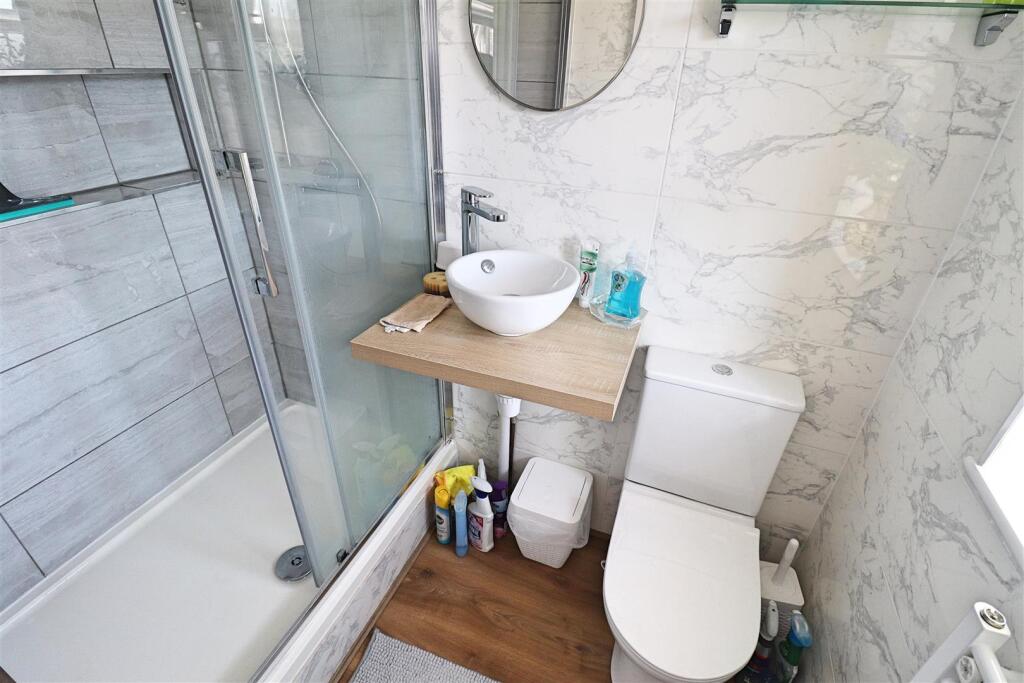
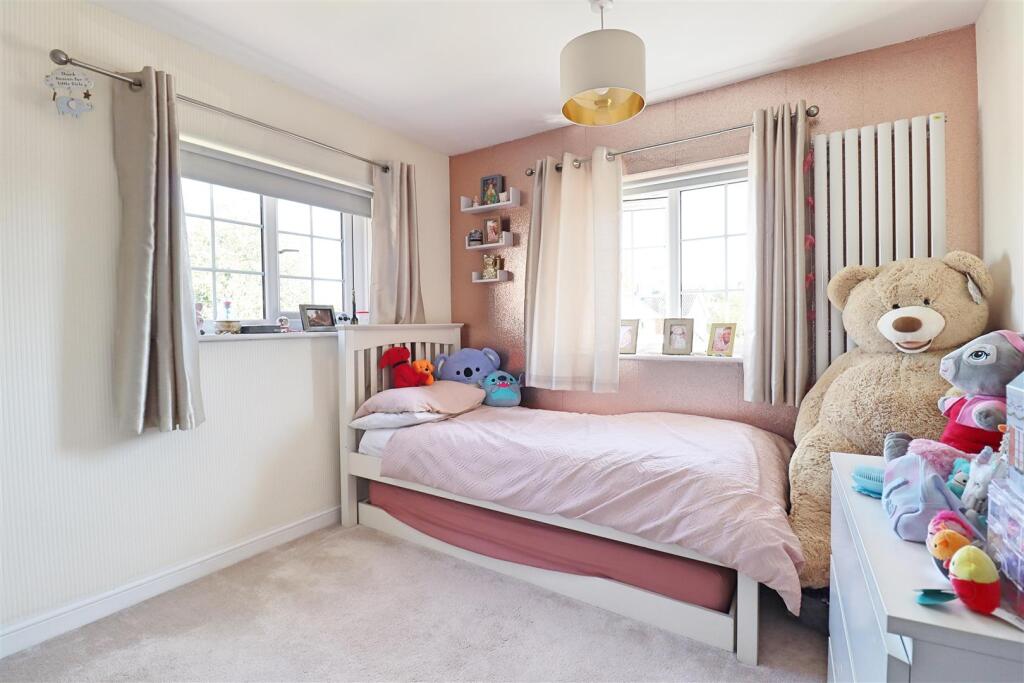
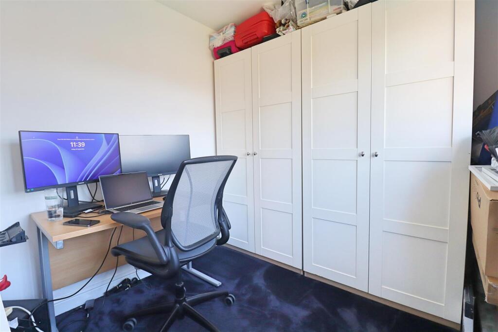
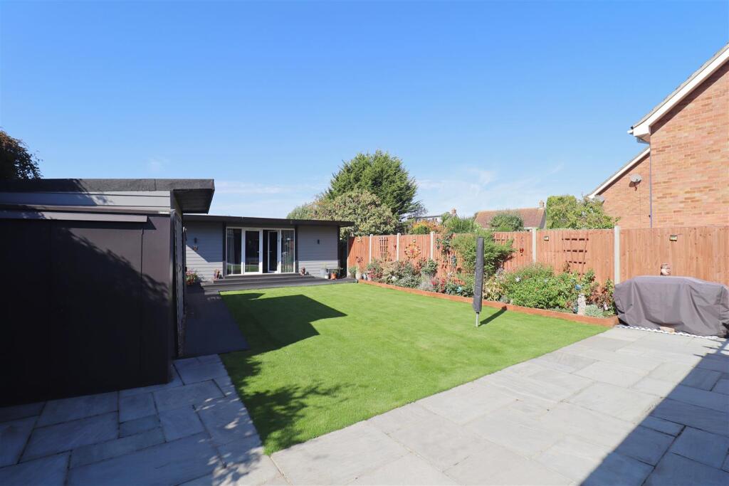
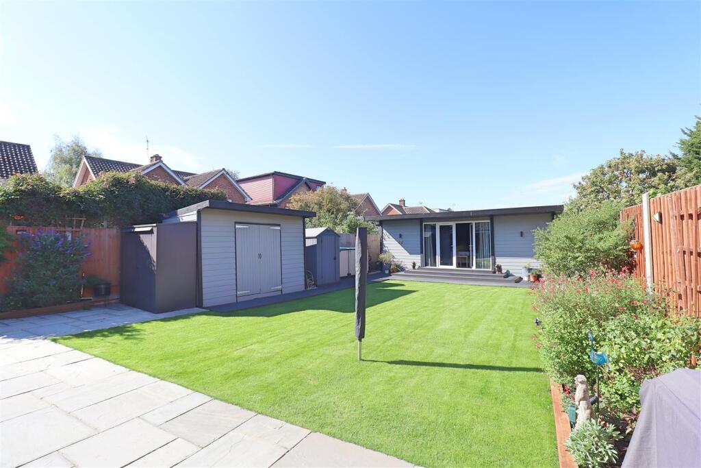
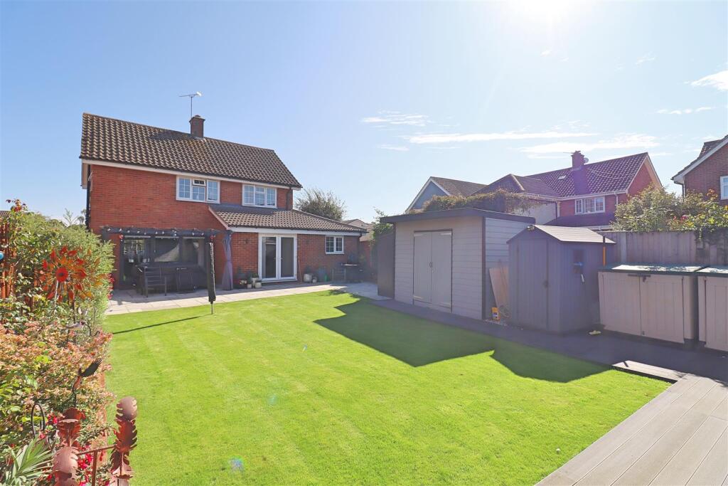
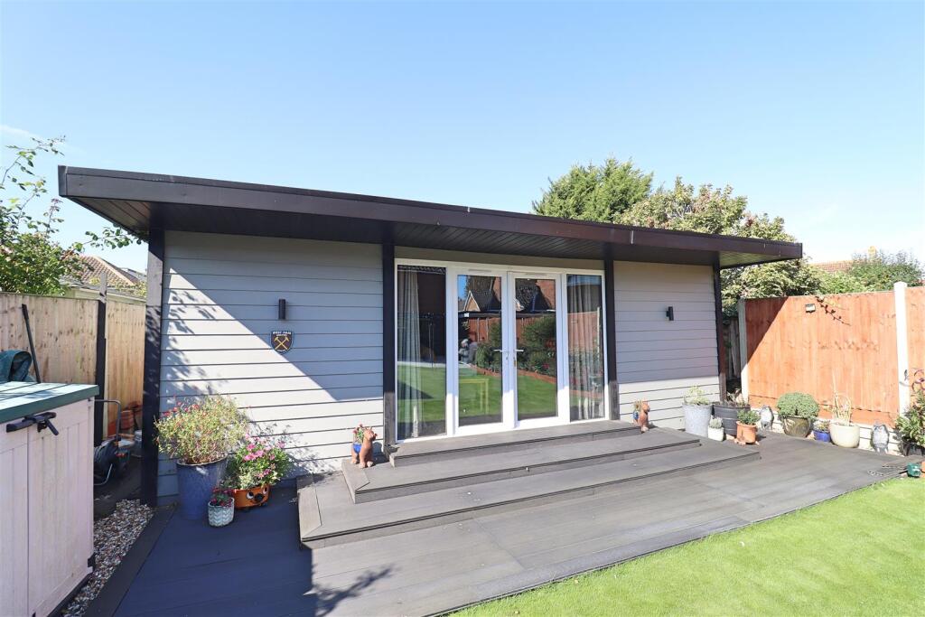
- Detached, fully renovated family home presented to a high standard. The property is marketed as a 3/4 bedroom, 2 bathroom, 2 reception detached house with versatile accommodation including a ground-floor bedroom with en-suite (or annexe/office potential). The finish is modern throughout with a contemporary kitchen and living space. Externally the plot benefits from a generous, landscaped rear garden (noted to include a 22' insulated garden room) and scope for further extension to the rear (STPP). The front provides a recently laid resin-bound driveway offering off-road parking for multiple vehicles and there is an attached garage. Overall plot size and garden are large for the street; the house footprint and internal living area are medium-large. Convenient location with easy access towards Chelmsford and the A120/ Stansted corridor; viewing strongly advised to appreciate the finish and space on offer.
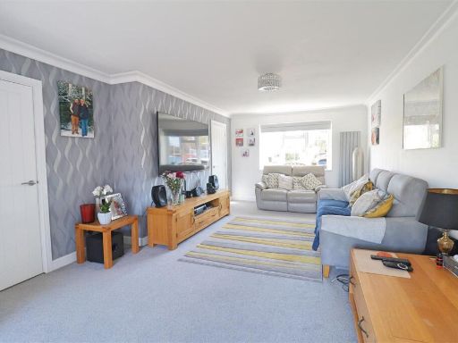
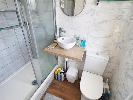
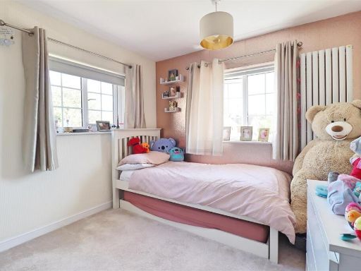
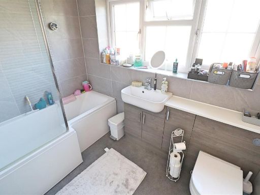
- Four-bedroom, two-storey residential property (likely townhouse/semi-detached) presented with a practical family layout. Ground floor comprises an entrance hall, lounge with rear patio doors, kitchen fitted with integrated appliances and dining room opening to the rear; ground-floor bedroom with ensuite. First floor has three further bedrooms (one with ensuite) and a family bathroom. Exterior includes an enclosed rear garden with paved patio, a well-manicured lawn and side access, plus a sizable outbuilding (approx. 22'1" x 12'8") with power connected. Front of property provides a resin driveway with parking for multiple vehicles. No notable external views (no sea, river or exceptional countryside vistas visible). Room sizes are generally average for family accommodation; the garden and outbuilding provide useful additional space. Overall condition and fittings appear modern with tiled and carpeted flooring and inset spotlights noted.
Image Descriptions
- detached house modern
- living room contemporary
Textual Property Features
Detected Visual Features
- modern
- detached house
- paved driveway
- two-story
- gabled roof
- porch
- double glazing
- contemporary
- living room
- feature wall
- coving
- modern design
- ample natural light
EPC Details
- Fully double glazed
- Cavity wall, filled cavity
- Boiler and radiators, mains gas
- Low energy lighting in 67% of fixed outlets
- Solid, no insulation (assumed)
Nearby Schools
- Beckers Green Primary School
- Great Waltham Church of England Voluntary Controlled Primary School
- Terling Church of England Voluntary Aided Primary School
- White Notley Church of England Voluntary Controlled Primary School
- St Michael's Church of England Voluntary Aided Primary School
- Rayne Primary and Nursery School
- Great Bradfords Junior School
- Great Bradfords Infant and Nursery School
- Tabor Academy
- Stisted Church of England Primary Academy
- Felsted Primary School
- Powers Hall Academy
- Cressing Primary School
- Notley Green Primary School
- John Ray Junior School
- Lyons Hall School
- Bocking Primary School
- Ford End Church of England Primary School
- Acorn Academy
- Great Leighs Primary School
- Silver End Academy
- White Court School
- Notley High School and Braintree Sixth Form
- Alec Hunter Academy
- St Francis Catholic Primary School, Braintree
- John Bunyan Primary School and Nursery
- Shalford Primary School
- Felsted School
Nearest General Shops
- Id: 546893181
- Tags:
- Addr:
- City: Braintree
- Postcode: CM7 2QF
- Street: Rayne Road
- Brand: National Tyres and Autocare
- Brand:wikidata: Q6979055
- Building: yes
- Name: National Tyres and Autocare
- Opening_hours: Mo-Fr 08:30-18:00; Su 08:30-17:00
- Operator: Halfords
- Phone: +44 1376 329297
- Shop: car_repair
- Short_name: National Tyres
- Website: https://www.national.co.uk/
- TagsNormalized:
- national tyres and autocare
- tyres
- car repair
- repair
- shop
- Lat: 51.8782161
- Lon: 0.5379244
- FullGeoHash: u10rhhpsw83t
- PartitionGeoHash: u10r
- Images:
- FoodStandards: null
- Distance: 1477.9
,- Id: 918748530
- Tags:
- Building: yes
- Name: Avenues
- Opening_hours: Mo-Sa 07:00-22:00
- Opening_hours:covid19: closed
- Payment:
- Cash: yes
- Credit_cards: yes
- Mastercard: yes
- Visa: yes
- Shop: hairdresser
- TagsNormalized:
- Lat: 51.8685599
- Lon: 0.5561742
- FullGeoHash: u10rhdkurb3e
- PartitionGeoHash: u10r
- Images:
- FoodStandards: null
- Distance: 1452.1
,- Id: 918748532
- Tags:
- Building: yes
- Name: Challis Pharmacy
- Opening_hours: Mo-Sa 08:00-17:30
- Opening_hours:covid19: open
- Shop: chemist
- TagsNormalized:
- Lat: 51.8681879
- Lon: 0.5555945
- FullGeoHash: u10rhdkd4712
- PartitionGeoHash: u10r
- Images:
- FoodStandards: null
- Distance: 1402.8
}
Nearest Grocery shops
- Id: 3843410381
- Tags:
- Addr:
- City: Braintree
- Postcode: CM77 7AE
- Street: Priory Lane
- Brand: Co-op Food
- Brand:wikidata: Q3277439
- Brand:wikipedia: en:Co-op Food
- Name: Co-op Food
- Opening_hours: Mo-Sa 07:30-21:00; Su 08:00-21:00
- Operator: The Co-operative Group
- Operator:wikidata: Q117202
- Phone: +44 1376 334644
- Shop: convenience
- Website: https://www.coop.co.uk/
- TagsNormalized:
- co-op
- co-op food
- food
- convenience
- shop
- Lat: 51.8657389
- Lon: 0.5282775
- FullGeoHash: u10rh1bevf2r
- PartitionGeoHash: u10r
- Images:
- FoodStandards: null
- Distance: 525.4
,- Id: 664909032
- Tags:
- Brand: Spar
- Brand:wikidata: Q610492
- Building: yes
- Name: Spar
- Shop: convenience
- TagsNormalized:
- Lat: 51.8607122
- Lon: 0.5354018
- FullGeoHash: u10rh0vyec2w
- PartitionGeoHash: u10r
- Images:
- FoodStandards: null
- Distance: 476.3
,- Id: 746246670
- Tags:
- Addr:
- City: Braintree
- Postcode: CM77 7AB
- Street: Notley Cross
- Brand: M&S Simply Food
- Brand:wikidata: Q714491
- Brand:wikipedia: en:Marks & Spencer
- Building: retail
- Contact:
- Website: https://www.marksandspencer.com/stores/braintree-bp-1864
- Name: M&S Simply Food
- Opening_hours: 24/7
- Phone: +44 1376 327773
- Shop: convenience
- TagsNormalized:
- m&s simply food
- food
- retail
- convenience
- shop
- Lat: 51.8678999
- Lon: 0.5389003
- FullGeoHash: u10rh622mm34
- PartitionGeoHash: u10r
- Images:
- FoodStandards: null
- Distance: 386.3
}
Nearest Religious buildings
- Id: 144343880
- Tags:
- Amenity: place_of_worship
- Denomination: anglican
- Name: St Peter and St Paul, Black Notley
- Religion: christian
- Wikidata: Q17557479
- TagsNormalized:
- place of worship
- anglican
- paul
- christian
- church
- Lat: 51.8572891
- Lon: 0.5564193
- FullGeoHash: u10rh8m4te26
- PartitionGeoHash: u10r
- Images:
- FoodStandards: null
- Distance: 1652.7
,- Id: 534920602
- Tags:
- Amenity: place_of_worship
- Religion: christian
- TagsNormalized:
- place of worship
- christian
- church
- Lat: 51.8764957
- Lon: 0.5476404
- FullGeoHash: u10rh7yf2zwq
- PartitionGeoHash: u10r
- Images:
- FoodStandards: null
- Distance: 1514.8
,- Id: 151298240
- Tags:
- Amenity: place_of_worship
- Building: church
- Denomination: anglican;methodist;united_reformed;baptist
- Name: The Church in Great Notley
- Religion: christian
- Wikidata: Q105107573
- TagsNormalized:
- place of worship
- church
- anglican
- methodist
- united reformed
- baptist
- christian
- Lat: 51.8657446
- Lon: 0.5275686
- FullGeoHash: u10rh1b5v5x9
- PartitionGeoHash: u10r
- Images:
- FoodStandards: null
- Distance: 573.6
}
Nearest Medical buildings
- Id: 1693859187
- Tags:
- Amenity: pharmacy
- Brand: Boots
- Brand:wikidata: Q6123139
- Dispensing: yes
- Drive_through: no
- Healthcare: pharmacy
- Name: Boots
- TagsNormalized:
- pharmacy
- boots
- health
- healthcare
- Lat: 51.8465365
- Lon: 0.6224046
- FullGeoHash: u10qynm5znft
- PartitionGeoHash: u10q
- Images:
- FoodStandards: null
- Distance: 6289.7
,- Id: 130073956
- Tags:
- Addr:
- City: Braintree
- Country: GB
- Housename: St Michael's House
- Postcode: CM7 1EY
- Street: St Michael's Lane
- Amenity: dentist
- Building: yes
- Healthcare: dentist
- Name: Dr R Patel
- TagsNormalized:
- Lat: 51.8777261
- Lon: 0.5504731
- FullGeoHash: u10rhs0cdvn6
- PartitionGeoHash: u10r
- Images:
- FoodStandards: null
- Distance: 1736.9
,- Id: 715548760
- Tags:
- Addr:
- City: Braintree
- Street: Chadwick Drive
- Amenity: hospital
- Emergency: no
- Healthcare: hospital
- Healthcare:speciality: maternity
- Name: Braintree Community Hospital
- Operator: NHS
- Operator:type: government
- Operator:wikidata: Q918396
- TagsNormalized:
- hospital
- health
- healthcare
- maternity
- Lat: 51.8795775
- Lon: 0.5408639
- FullGeoHash: u10rhk3u7n1q
- PartitionGeoHash: u10r
- Images:
- FoodStandards: null
- Distance: 1658.7
,- Id: 546893183
- Tags:
- Addr:
- City: Braintree
- Postcode: CM7 2AE
- Street: Mace Avenue
- Amenity: doctors
- Building: yes
- Healthcare: doctor
- Name: Blandford Medical Centre
- Opening_hours: Mo-Fr 08:00-18:30; Sa-Su off
- Operator: NHS England
- Phone: +44 1376 347100
- Website: http://www.blandfordmedicalcentre.co.uk/
- TagsNormalized:
- doctor
- doctors
- health
- healthcare
- Lat: 51.8789889
- Lon: 0.5408255
- FullGeoHash: u10rhk3c40kx
- PartitionGeoHash: u10r
- Images:
- FoodStandards: null
- Distance: 1594.2
}
Nearest Airports
- Id: 495488524
- Tags:
- Aerodrome: international
- Aerodrome:type: public
- Aeroway: aerodrome
- Alt_name: Stansted
- Iata: STN
- Icao: EGSS
- Is_in: Essex,England,UK
- Name: London Stansted Airport
- Ref: STN
- Source: Gagravarr_Airports
- Website: https://www.stanstedairport.com/
- Wikidata: Q8709
- Wikipedia: en:London Stansted Airport
- TagsNormalized:
- airport
- international airport
- Lat: 51.8869677
- Lon: 0.2429264
- FullGeoHash: u10pjt8zkxg4
- PartitionGeoHash: u10p
- Images:
- FoodStandards: null
- Distance: 20255.4
}
Nearest Leisure Facilities
- Id: 319566775
- Tags:
- TagsNormalized:
- Lat: 51.8662137
- Lon: 0.5319791
- FullGeoHash: u10rh1gqs502
- PartitionGeoHash: u10r
- Images:
- FoodStandards: null
- Distance: 297.6
,- Id: 830372813
- Tags:
- TagsNormalized:
- Lat: 51.8673381
- Lon: 0.5337738
- FullGeoHash: u10rh4htjude
- PartitionGeoHash: u10r
- Images:
- FoodStandards: null
- Distance: 297.1
,- Id: 830372810
- Tags:
- TagsNormalized:
- Lat: 51.8674778
- Lon: 0.534622
- FullGeoHash: u10rh4jmcweh
- PartitionGeoHash: u10r
- Images:
- FoodStandards: null
- Distance: 289.1
,- Id: 830372811
- Tags:
- TagsNormalized:
- Lat: 51.8665587
- Lon: 0.5348118
- FullGeoHash: u10rh4j2w52d
- PartitionGeoHash: u10r
- Images:
- FoodStandards: null
- Distance: 188.2
,- Id: 888264125
- Tags:
- TagsNormalized:
- Lat: 51.866611
- Lon: 0.5363193
- FullGeoHash: u10rh4n8cjhd
- PartitionGeoHash: u10r
- Images:
- FoodStandards: null
- Distance: 183.6
}
Nearest Tourist attractions
- Id: 4195908298
- Tags:
- Name: John Ray Garden
- Tourism: attraction
- TagsNormalized:
- Lat: 51.8837687
- Lon: 0.5539758
- FullGeoHash: u10rht5kue6r
- PartitionGeoHash: u10r
- Images:
- FoodStandards: null
- Distance: 2431.6
,- Id: 382474329
- Tags:
- Name: Friends of Flitch Way railway carriage museum
- Tourism: museum
- TagsNormalized:
- Lat: 51.8731961
- Lon: 0.5066241
- FullGeoHash: u10r5e0zm0w7
- PartitionGeoHash: u10r
- Images:
- FoodStandards: null
- Distance: 2203.3
,- Id: 3414742549
- Tags:
- Name: Braintree Museum
- Tourism: museum
- Wikidata: Q85400375
- TagsNormalized:
- Lat: 51.8783949
- Lon: 0.5541701
- FullGeoHash: u10rhs5t91ep
- PartitionGeoHash: u10r
- Images:
- FoodStandards: null
- Distance: 1951.3
}
Nearest Train stations
- Id: 55420748
- Tags:
- Name: Cressing
- Naptan:
- Network: National Rail
- Public_transport: station
- Railway: station
- Ref:
- Train: yes
- Wikidata: Q1886114
- Wikipedia: en:Cressing railway station
- TagsNormalized:
- Lat: 51.852306
- Lon: 0.5779203
- FullGeoHash: u10qvpkvdd2t
- PartitionGeoHash: u10q
- Images:
- FoodStandards: null
- Distance: 3216
,- Id: 187038971
- Tags:
- Amenity: shelter
- Building: train_station
- TagsNormalized:
- shelter
- station
- train
- train station
- Lat: 51.8692466
- Lon: 0.5682988
- FullGeoHash: u10rhftb626k
- PartitionGeoHash: u10r
- Images:
- FoodStandards: null
- Distance: 2279
,- Id: 55420882
- Tags:
- Addr:
- Postcode: CM77 8YH
- Street: Chapel Hill Retail Park
- Name: Braintree Freeport
- Naptan:
- Network: National Rail
- Note: FIXME location approximate, judged from landsat
- Public_transport: station
- Railway: station
- Ref:
- Train: yes
- Wikidata: Q2540597
- Wikipedia: en:Braintree Freeport railway station
- TagsNormalized:
- Lat: 51.8692939
- Lon: 0.5681965
- FullGeoHash: u10rhft8xcnn
- PartitionGeoHash: u10r
- Images:
- FoodStandards: null
- Distance: 2273.2
,- Id: 1997260503
- Tags:
- Name: Braintree
- Name:lt: Breintris
- Naptan:
- Network: National Rail
- Old_name: Braintree and Bocking
- Public_transport: station
- Railway: station
- Ref:
- Train: yes
- Wikidata: Q2716690
- Wikipedia: en:Braintree railway station (England)
- TagsNormalized:
- Lat: 51.8753105
- Lon: 0.5567303
- FullGeoHash: u10rhet7sfb0
- PartitionGeoHash: u10r
- Images:
- FoodStandards: null
- Distance: 1837.4
,- Id: 187033767
- Tags:
- Amenity: cafe
- Building: train_station
- Name: Cafe Alexander
- TagsNormalized:
- cafe
- station
- train
- train station
- Lat: 51.8753588
- Lon: 0.5565999
- FullGeoHash: u10rhet7ceyb
- PartitionGeoHash: u10r
- Images:
- FoodStandards: null
- Distance: 1833.8
}
Nearest Hotels
- Id: 104310066
- Tags:
- Brand: Premier Inn
- Brand:wikidata: Q2108626
- Brand:wikipedia: en:Premier Inn
- Building: yes
- Internet_access: wlan
- Internet_access:fee: customers
- Internet_access:operator: Virgin Media
- Internet_access:ssid: Premier Inn Free Wi-Fi
- Name: Premier Inn
- Tourism: hotel
- Wheelchair: yes
- TagsNormalized:
- Lat: 51.8691903
- Lon: 0.5819277
- FullGeoHash: u10rj4rxzvus
- PartitionGeoHash: u10r
- Images:
- FoodStandards: null
- Distance: 3199.3
,- Id: 10661255737
- Tags:
- Brand: Travelodge
- Brand:wikidata: Q9361374
- Internet_access: wlan
- Internet_access:fee: customers
- Internet_access:ssid: Travelodge WiFi
- Name: Travelodge
- Tourism: hotel
- TagsNormalized:
- Lat: 51.8774746
- Lon: 0.5545117
- FullGeoHash: u10rhs5b1n1y
- PartitionGeoHash: u10r
- Images:
- FoodStandards: null
- Distance: 1890.1
,- Id: 146338280
- Tags:
- Addr:
- Brand: Holiday Inn Express
- Brand:wikidata: Q5880423
- Brand:wikipedia: en:Holiday Inn Express
- Building: hotel
- Key: FLP BP Alt Tues
- Name: Holiday Inn Express
- Source:
- Tourism: hotel
- TagsNormalized:
- Lat: 51.8684265
- Lon: 0.5365901
- FullGeoHash: u10rh4qerrqx
- PartitionGeoHash: u10r
- Images:
- FoodStandards: null
- Distance: 385.9
}
Tags
- modern
- detached house
- paved driveway
- two-story
- gabled roof
- porch
- double glazing
- contemporary
- living room
- feature wall
- coving
- modern design
- ample natural light
Local Market Stats
- Average Price/sqft: £368
- Avg Income: £52400
- Rental Yield: 3.8%
- Social Housing: 9%
- Planning Success Rate: 72%
Similar Properties
 4 bedroom detached house for sale in Graham Close, Billericay, CM12 — £875,000 • 4 bed • 2 bath • 1506 ft²
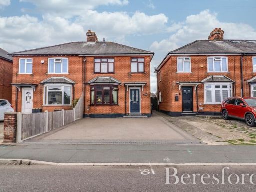 4 bedroom semi-detached house for sale in Coggeshall Road, Braintree, CM7 — £400,000 • 4 bed • 2 bath • 1281 ft²
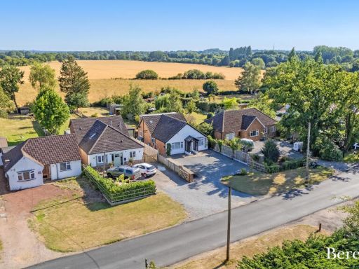 4 bedroom detached house for sale in Marlen, Chelmsford Road, CM4 — £775,000 • 4 bed • 3 bath • 1300 ft²
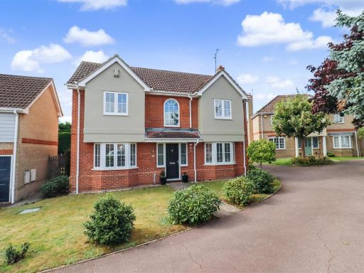 4 bedroom detached house for sale in Westergreen Meadow, Braintree, CM7 — £650,000 • 4 bed • 2 bath • 1166 ft²
 4 bedroom detached house for sale in Willingale Road, Braintree, CM7 9, CM7 — £520,000 • 4 bed • 4 bath • 1316 ft²
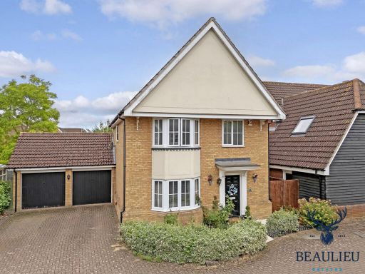 4 bedroom detached house for sale in Clevedon Close, Braintree, CM77 7, CM77 — £539,000 • 4 bed • 2 bath • 1666 ft²
Meta
- {
"@context": "https://schema.org",
"@type": "Residence",
"name": "4 bedroom detached house for sale in Maylands Drive, Braint…",
"description": "",
"url": "https://propertypiper.co.uk/property/b12cc1b8-5119-467d-8bec-f0012c3c7766",
"image": "https://image-a.propertypiper.co.uk/48719068-94e9-42b0-9d23-ce441d9c65a9-1024.jpeg",
"address": {
"@type": "PostalAddress",
"streetAddress": "1 MAYLANDS DRIVE BRAINTREE",
"postalCode": "CM77 7PY",
"addressLocality": "Braintree",
"addressRegion": "Braintree",
"addressCountry": "England"
},
"geo": {
"@type": "GeoCoordinates",
"latitude": 51.8649877,
"longitude": 0.5358322
},
"numberOfRooms": 4,
"numberOfBathroomsTotal": 2,
"floorSize": {
"@type": "QuantitativeValue",
"value": 969,
"unitCode": "FTK"
},
"offers": {
"@type": "Offer",
"price": 565000,
"priceCurrency": "GBP",
"availability": "https://schema.org/InStock"
},
"additionalProperty": [
{
"@type": "PropertyValue",
"name": "Feature",
"value": "modern"
},
{
"@type": "PropertyValue",
"name": "Feature",
"value": "detached house"
},
{
"@type": "PropertyValue",
"name": "Feature",
"value": "paved driveway"
},
{
"@type": "PropertyValue",
"name": "Feature",
"value": "two-story"
},
{
"@type": "PropertyValue",
"name": "Feature",
"value": "gabled roof"
},
{
"@type": "PropertyValue",
"name": "Feature",
"value": "porch"
},
{
"@type": "PropertyValue",
"name": "Feature",
"value": "double glazing"
},
{
"@type": "PropertyValue",
"name": "Feature",
"value": "contemporary"
},
{
"@type": "PropertyValue",
"name": "Feature",
"value": "living room"
},
{
"@type": "PropertyValue",
"name": "Feature",
"value": "feature wall"
},
{
"@type": "PropertyValue",
"name": "Feature",
"value": "coving"
},
{
"@type": "PropertyValue",
"name": "Feature",
"value": "modern design"
},
{
"@type": "PropertyValue",
"name": "Feature",
"value": "ample natural light"
}
]
}