NR33 8WJ - 2 bedroom house for sale in Abbeydale, Carlton Colville, NR…
View on Property Piper
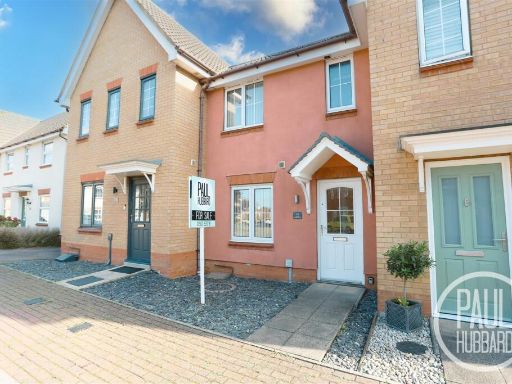
2 bedroom house for sale in Abbeydale, Carlton Colville, NR33
Property Details
- Price: £220000
- Bedrooms: 2
- Bathrooms: 1
- Property Type: undefined
- Property SubType: undefined
Image Descriptions
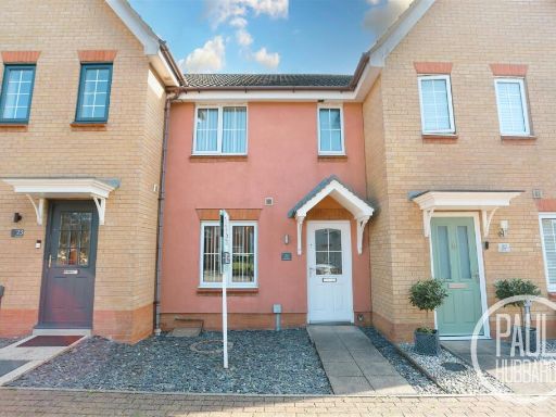
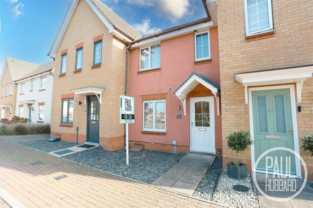
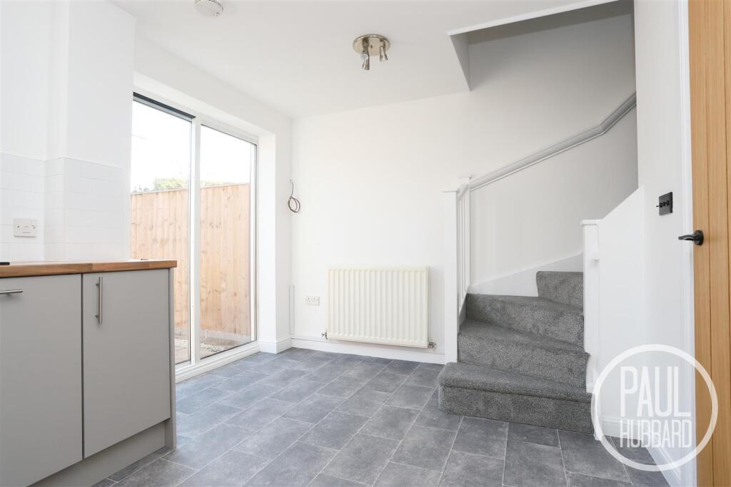
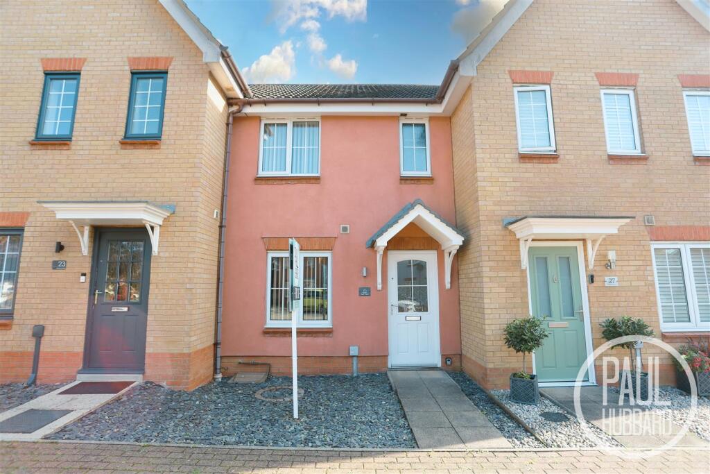
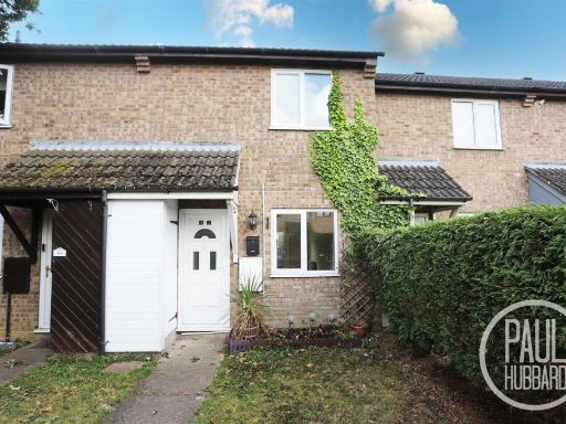
- terraced house contemporary
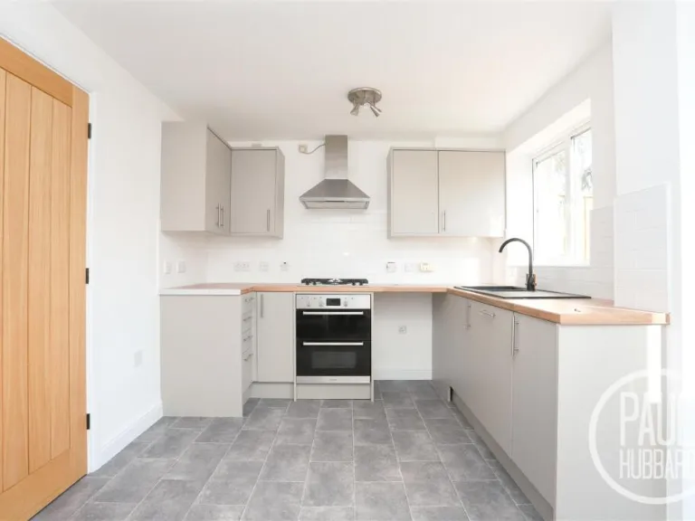
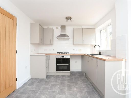
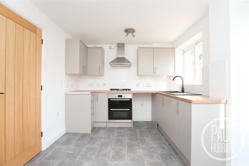
- kitchen modern
Floorplan Description
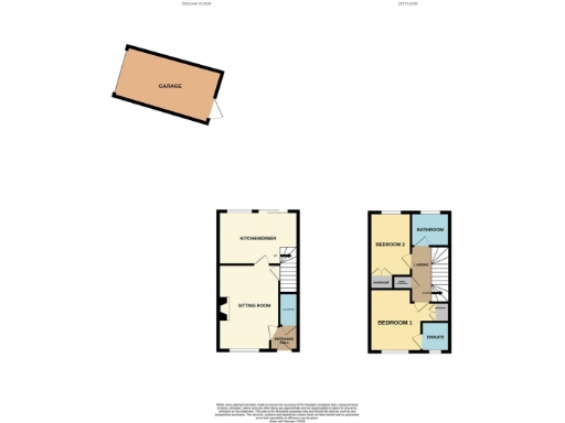
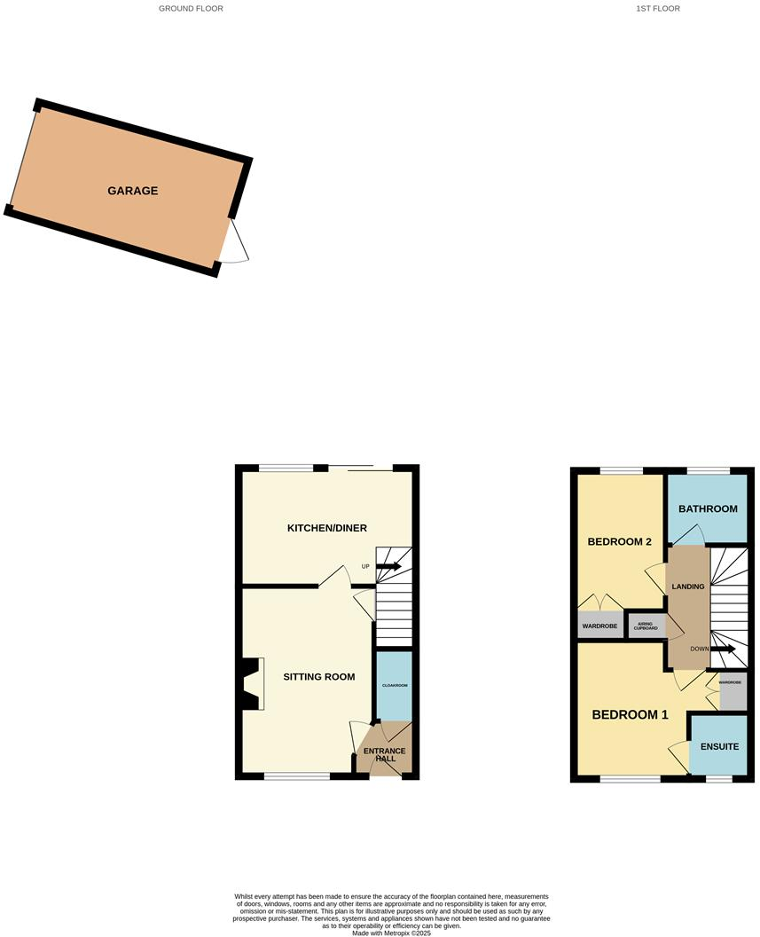
- Two-storey house floorplan with a separate garage.
Rooms
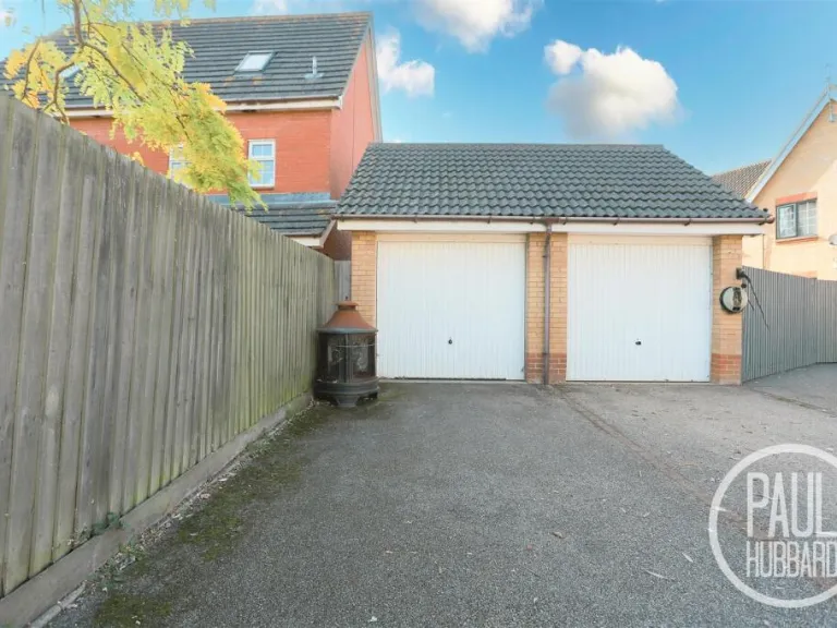
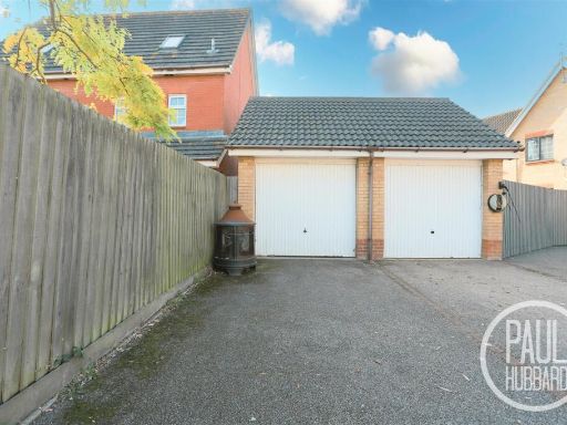
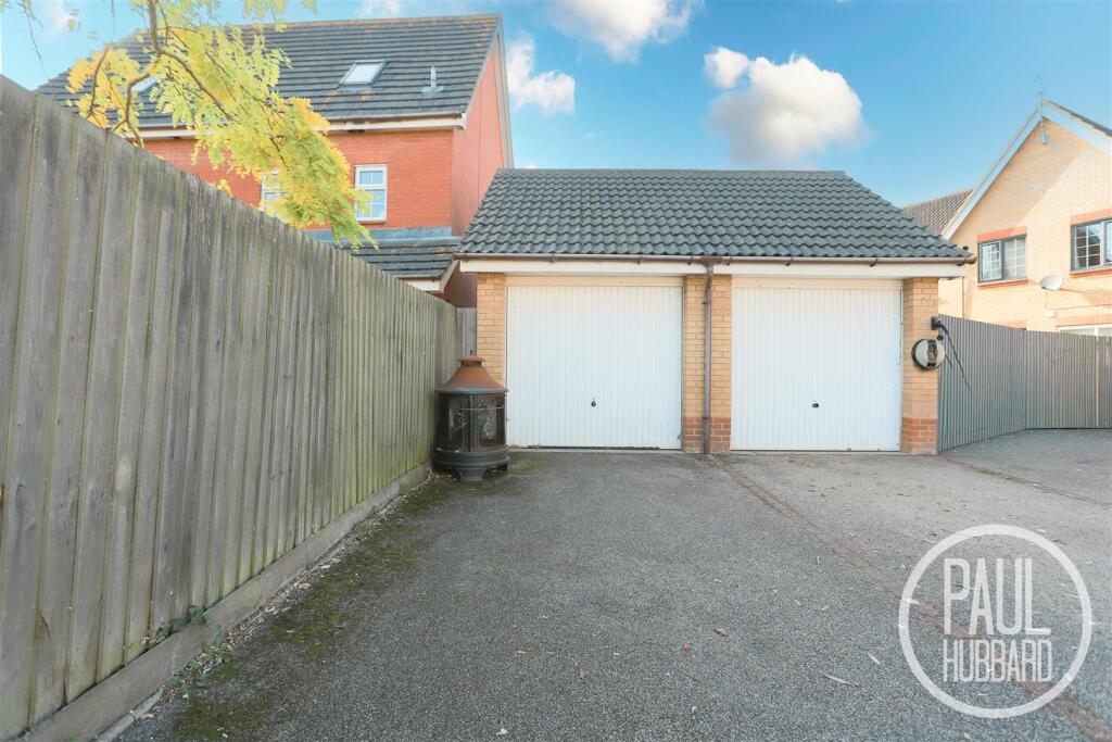
- GARAGE:
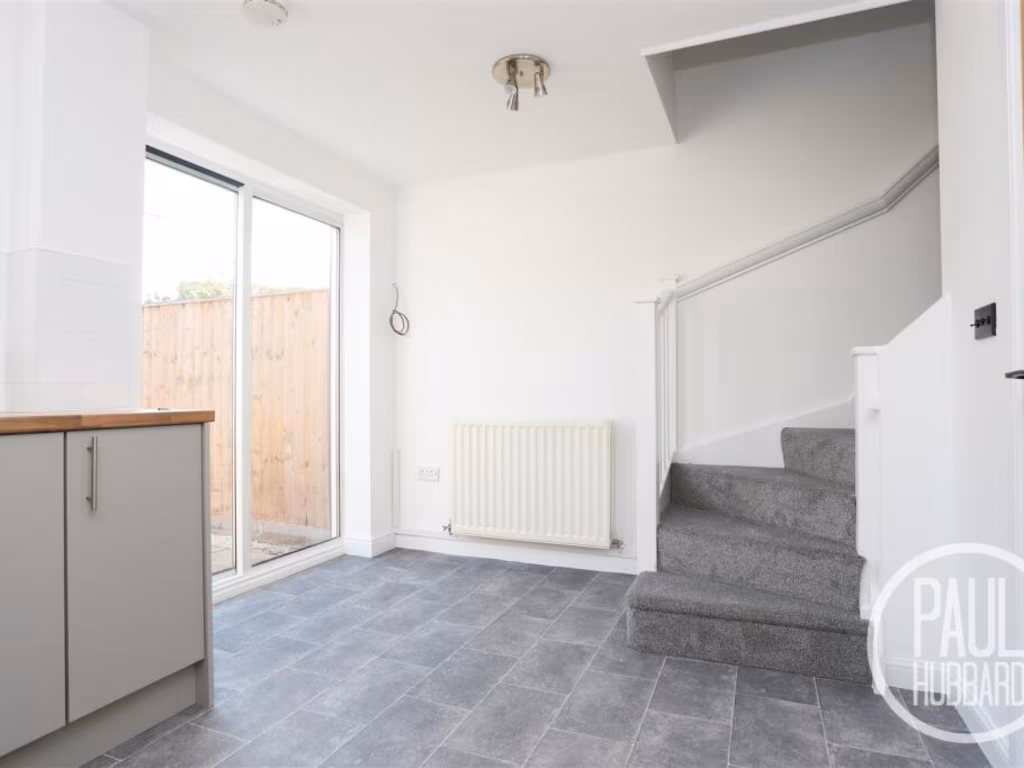
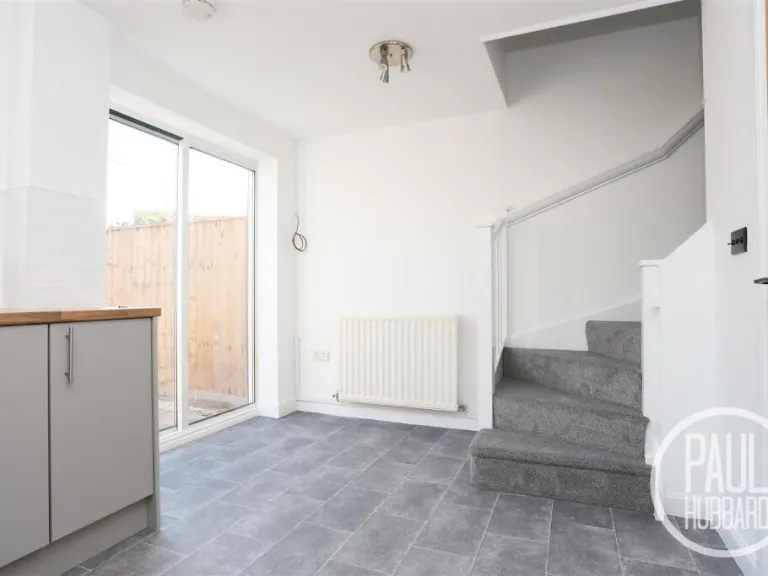
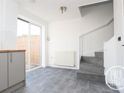
- KITCHEN/DINER:
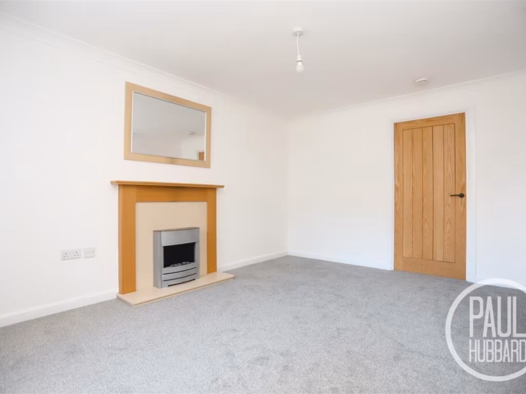
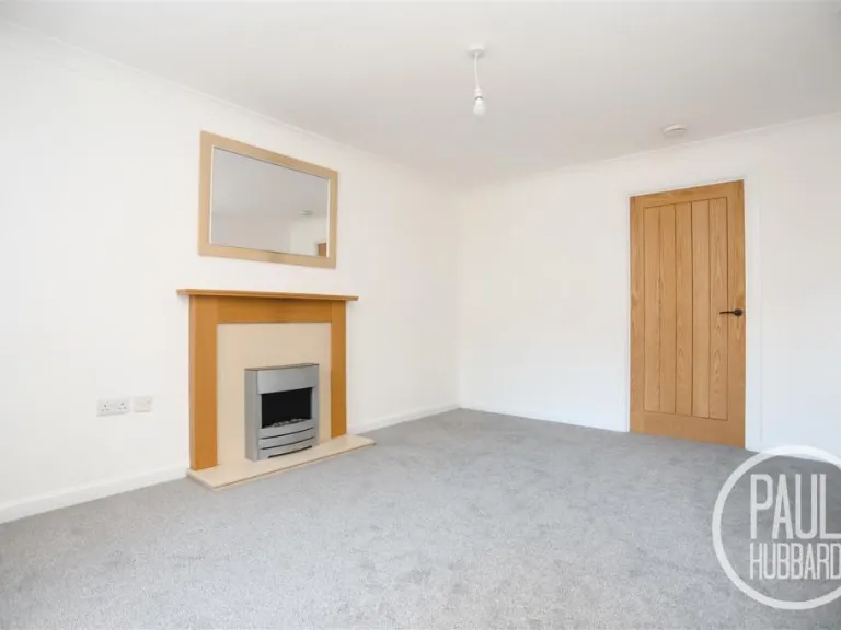
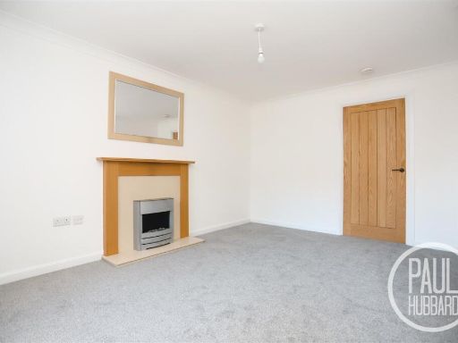
- SITTING ROOM:
- ENTRANCE HALL:
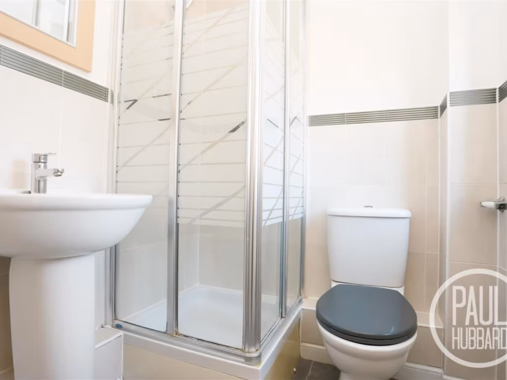
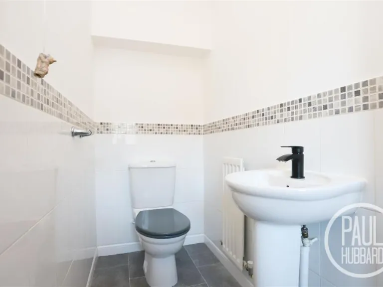
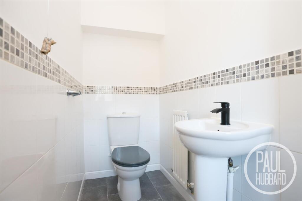
- CLOAKROOM:
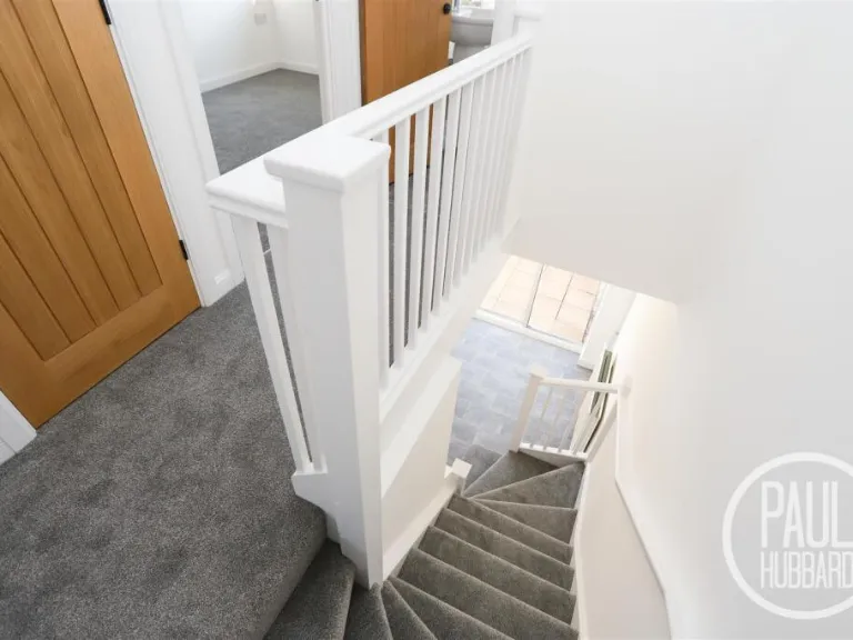
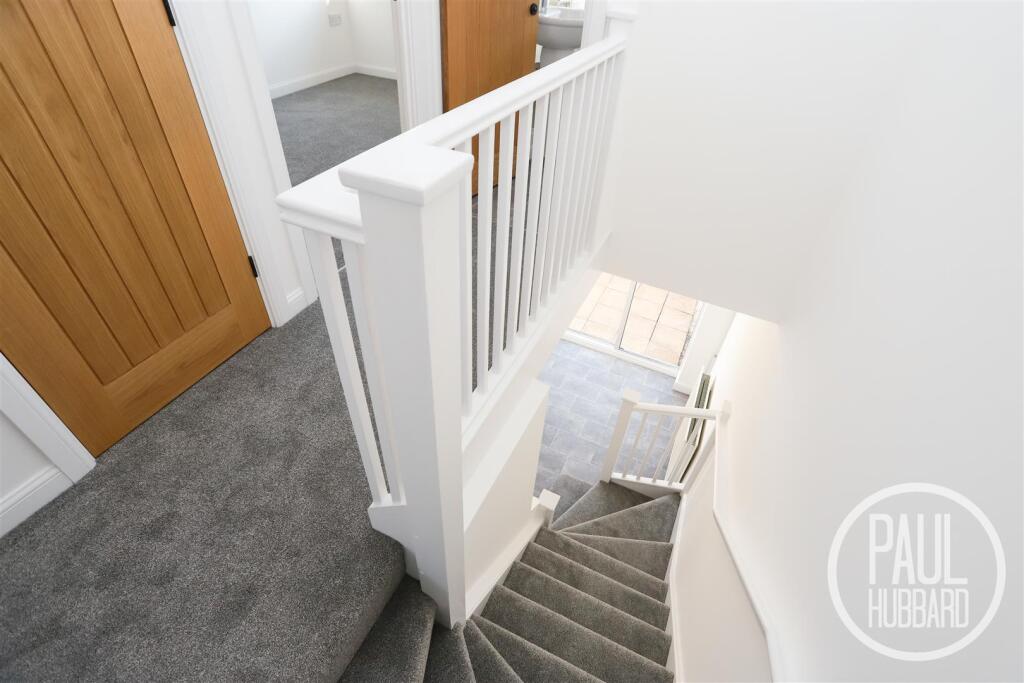
- LANDING:
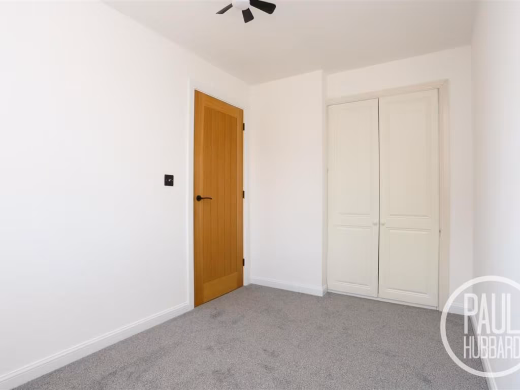
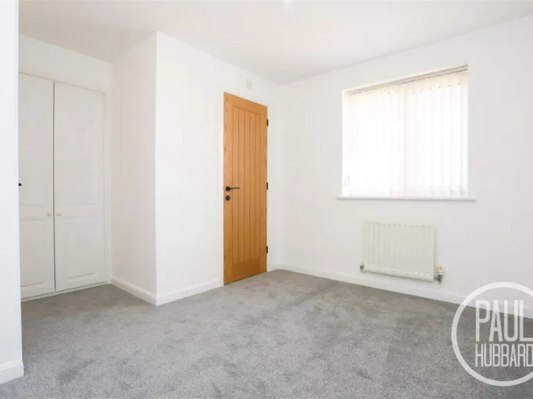
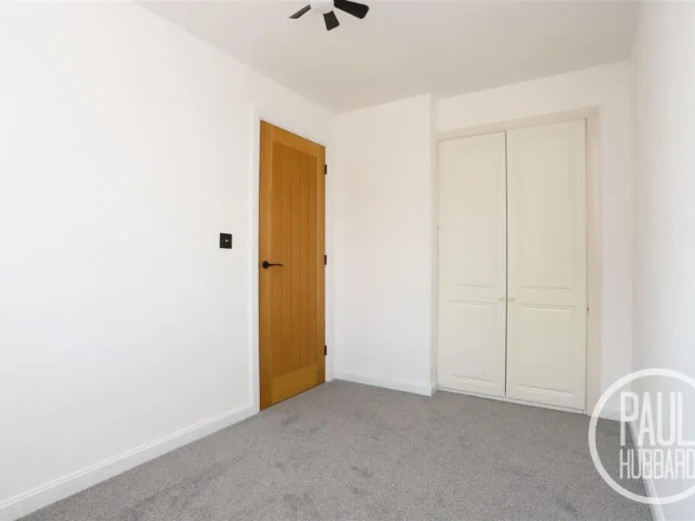
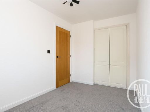
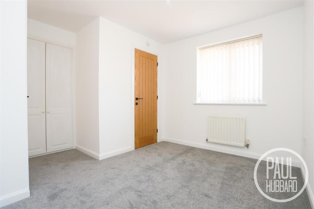
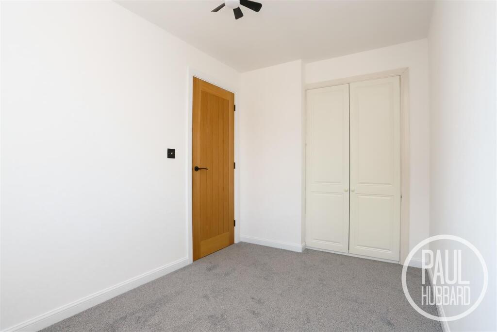
- BEDROOM 1:
- BEDROOM 2:
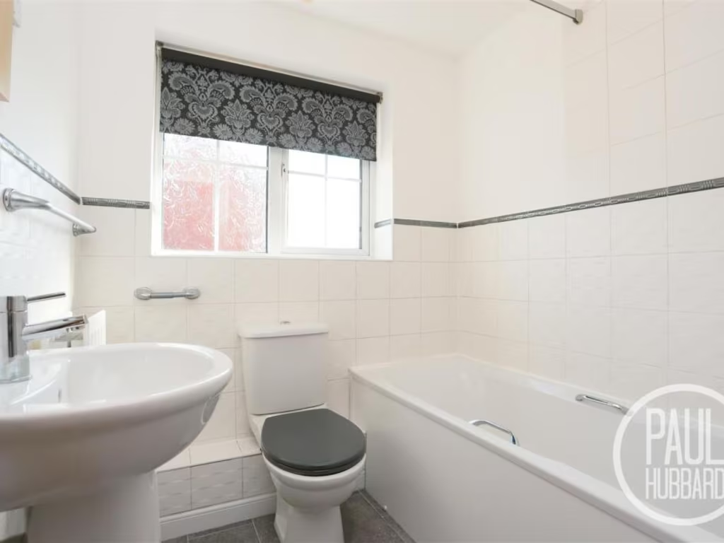
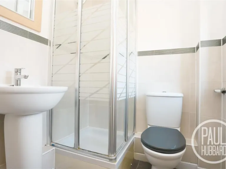
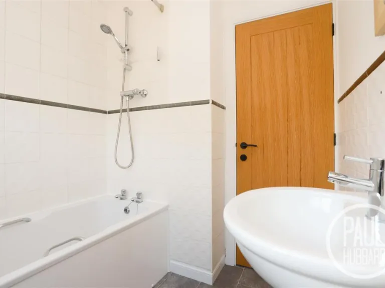
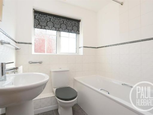
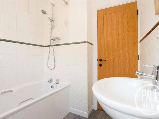
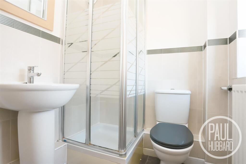
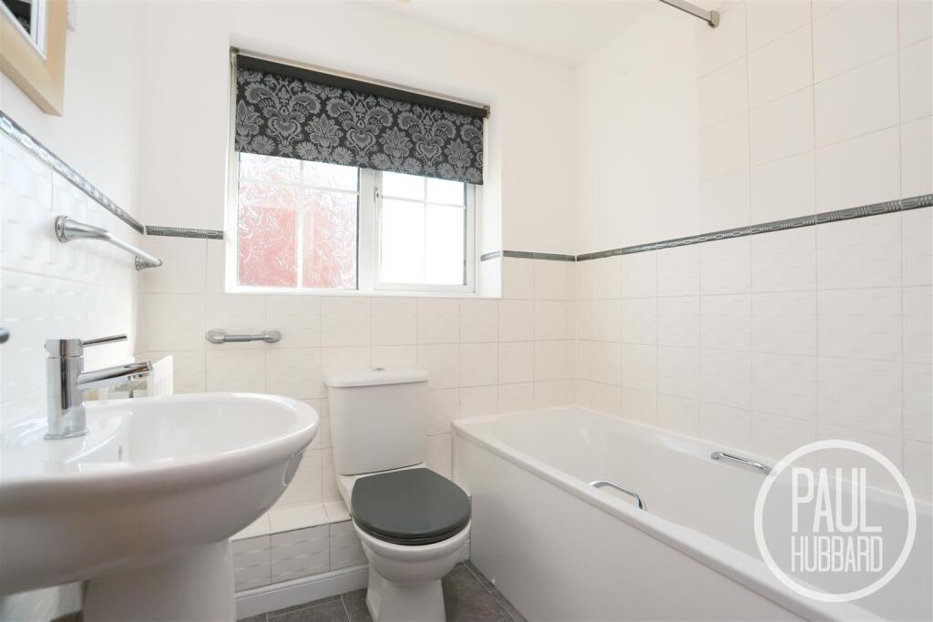
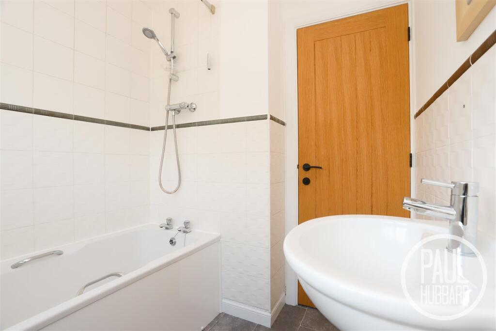
- BATHROOM:
- ENSUITE:
- WARDROBE:
Textual Property Features
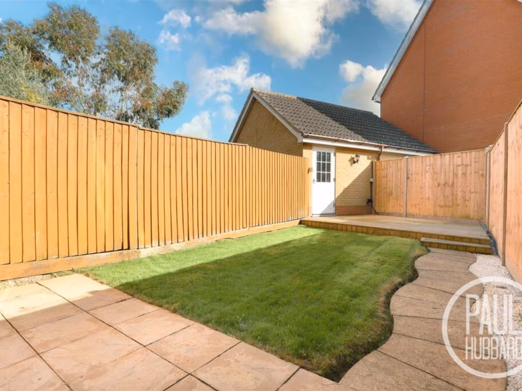
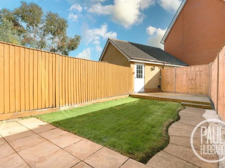
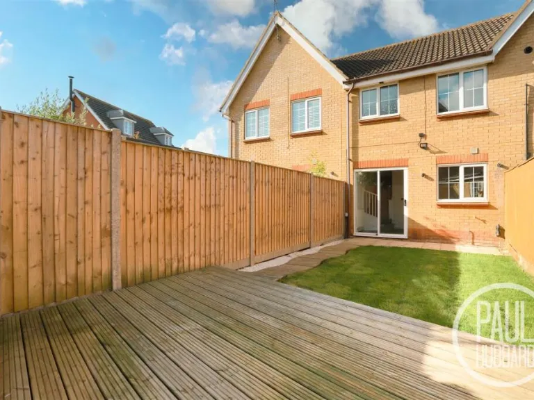
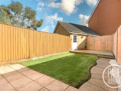
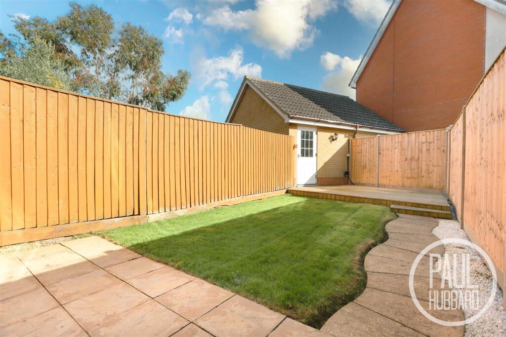
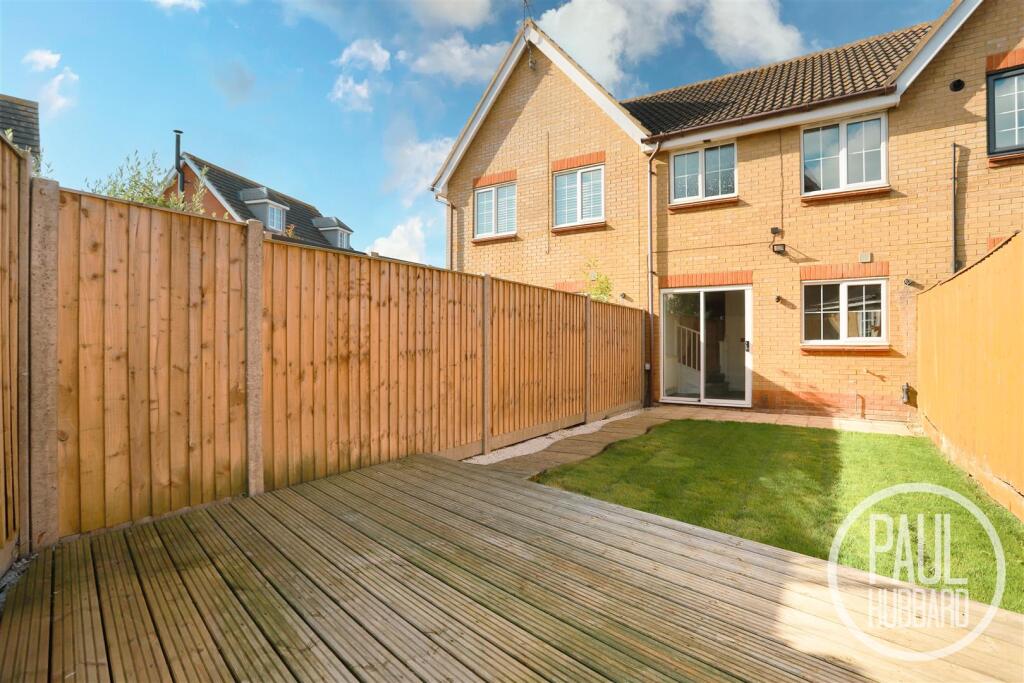
- Has Garden
- Chain Free
- Success
Detected Visual Features
- terraced house
- modern
- contemporary style
- two story
- brick exterior
- residential area
- cul-de-sac
- for sale
- investment potential
- modern kitchen
- grey cabinetry
- standard ceiling height
- small kitchen
- white tile backsplash
- window
- natural light
- chrome fixtures
EPC Details
- Fully double glazed
- Cavity wall, as built, insulated (assumed)
- Boiler and radiators, mains gas
- Low energy lighting in 30% of fixed outlets
- Solid, insulated (assumed)
Nearby Schools
- Grove Primary School
- Westwood Primary School
- St Mary's Roman Catholic Primary School
- East Point Academy
- Dell Primary School
- Roman Hill Primary School
- Northfield St Nicholas Primary Academy
- Kessingland Church of England Primary Academy
- Carlton Colville Primary School
- Pakefield High School
- Pakefield Primary School
- Phoenix St Peter Academy
- Red Oak Primary School
- Oulton Broad Primary School
- St Margaret's Primary Academy
- Woods Loke Primary School
- Poplars Community Primary School
- The Limes Primary Academy
- Gunton Primary Academy
- Ormiston Denes Academy
- The Old School
- Elm Tree Primary School
- Include Suffolk
- Benjamin Britten Academy of Music and Mathematics
Nearest General Shops
- Id: 793241019
- Tags:
- Brand: Seat
- Brand:wikidata: Q188217
- Brand:wikipedia: en:SEAT
- Building: yes
- Name: Robinsons Seat
- Shop: car
- TagsNormalized:
- Lat: 52.446582
- Lon: 1.7223879
- FullGeoHash: u134r5w5qx3x
- PartitionGeoHash: u134
- Images:
- FoodStandards: null
- Distance: 944.9
,- Id: 793241020
- Tags:
- Brand: Travis Perkins
- Brand:wikidata: Q2450664
- Brand:wikipedia: en:Travis Perkins
- Building: yes
- Name: Travis Perkins
- Shop: doityourself
- TagsNormalized:
- travis perkins
- doityourself
- shop
- Lat: 52.4460948
- Lon: 1.7218093
- FullGeoHash: u134r5tb9hdj
- PartitionGeoHash: u134
- Images:
- FoodStandards: null
- Distance: 920.1
,- Id: 736664077
- Tags:
- Brand: Howdens Joinery
- Brand:wikidata: Q5921438
- Brand:wikipedia: en:Howdens Joinery
- Building: yes
- Name: Howdens Joinery
- Shop: kitchen
- TagsNormalized:
- howdens joinery
- kitchen
- shop
- Lat: 52.4462068
- Lon: 1.7142962
- FullGeoHash: u134r5833cxc
- PartitionGeoHash: u134
- Images:
- FoodStandards: null
- Distance: 446.1
}
Nearest Grocery shops
- Id: 367206170
- Tags:
- Addr:
- City: Lowestoft
- Postcode: NR33 7AF
- Street: London Road Pakefield
- Brand: The Co-operative Food
- Brand:wikidata: Q107617274
- Building: yes
- Name: The Co-operative Food
- Opening_hours: Mo-Su 07:00-22:00
- Operator: Central England Co-operative
- Operator:wikidata: Q16986583
- Shop: supermarket
- TagsNormalized:
- the co-operative food
- food
- shop
- Lat: 52.453834
- Lon: 1.730113
- FullGeoHash: u134rkgvdx3g
- PartitionGeoHash: u134
- Images:
- FoodStandards: null
- Distance: 1569.2
,- Id: 316707280
- Tags:
- Addr:
- City: Norwich
- Country: GB
- Housenumber: 17-19
- Interpolation: odd
- Postcode: NR33 9EJ
- Street: Ashburnham Way
- Brand: The Co-operative Food
- Brand:wikidata: Q107617274
- Building: yes
- Name: The Co-operative Food
- Old_name: Rainbow
- Opening_hours: Mo-Fr 08:00-21:00; Sa 08:00-20:00; Su 10:00-16:00
- Operator: Central England Co-operative
- Operator:wikidata: Q16986583
- Phone: +44 1502 566535
- Shop: supermarket
- Website: https://www.co-operative.coop/store/food/NR33-9EJ/ashburnham-way/
- TagsNormalized:
- the co-operative food
- food
- shop
- Lat: 52.4572151
- Lon: 1.7040168
- FullGeoHash: u134qv8c6mxh
- PartitionGeoHash: u134
- Images:
- FoodStandards: null
- Distance: 1034.1
,- Id: 876109406
- Tags:
- Addr:
- City: Carlton Colville
- Housenumber: 1
- Postcode: NR33 8UY
- Street: Harrop Dale
- Building: yes
- Name: Bains Store
- Opening_hours: Mo-Sa 07:00-20:00; Su 08:00-20:00
- Opening_hours:covid19: same
- Payment:
- Cash: yes
- Credit_cards: yes
- Debit_cards: yes
- Phone: +441502 538018
- Shop: convenience
- Website: https://www.premier-stores.co.uk/index.php/our-stores/bains-store
- TagsNormalized:
- Lat: 52.4498085
- Lon: 1.7101675
- FullGeoHash: u134qujq3bcq
- PartitionGeoHash: u134
- Images:
- FoodStandards: null
- Distance: 185.8
}
Nearest Supermarkets
- Id: 143389781
- Tags:
- Addr:
- City: Lowestoft
- Country: GB
- Postcode: NR33 0PX
- Street: Belvedere Road
- Alt_name: ASDA Lowestoft Superstore
- Brand: Asda
- Brand:wikidata: Q297410
- Brand:wikipedia: en:Asda
- Building: retail
- Contact:
- Facebook: https://www.facebook.com/asda/
- Phone: +44 1502 534200
- Twitter: @asda
- Website: https://storelocator.asda.com/east-of-england/lowestoft/belvedere-road-off-horn-hill
- Name: Asda
- Opening_hours: Mo-We 06:00-24:00; Th-Sa 07:00-22:00; Su 10:00-16:00
- Opening_hours:covid19: same
- Operator: Asda Stores Ltd
- Phone: +44 1502 534200
- Shop: supermarket
- TagsNormalized:
- asda
- retail
- supermarket
- shop
- Lat: 52.4717749
- Lon: 1.7405971
- FullGeoHash: u134x85qnzg3
- PartitionGeoHash: u134
- Images:
- FoodStandards: null
- Distance: 3379.8
,- Id: 28511741
- Tags:
- Addr:
- City: Norwich
- Country: GB
- Housenumber: 18
- Postcode: NR33 7NG
- Street: Tower Road
- Brand: Morrisons
- Brand:wikidata: Q922344
- Brand:wikipedia: en:Morrisons
- Building: yes
- Contact:
- Website: https://my.morrisons.com/storefinder/286
- Name: Morrisons
- Shop: supermarket
- TagsNormalized:
- Lat: 52.4427285
- Lon: 1.7212179
- FullGeoHash: u134r4vm531h
- PartitionGeoHash: u134
- Images:
- FoodStandards: null
- Distance: 1052.3
,- Id: 793215064
- Tags:
- Addr:
- City: Lowestoft
- Country: GB
- Housename: Unit 1
- Place: Gateway Retail Park
- Postcode: NR33 7NR
- Brand: ALDI
- Brand:wikidata: Q41171672
- Brand:wikipedia: en:Aldi
- Building: retail
- Contact:
- Website: https://stores.aldi.co.uk/lowestoft/unit-1-gateway-retail-park
- Name: ALDI
- Opening_hours: Mo-Sa 08:00-22:00; Su 10:00-16:00
- Shop: supermarket
- TagsNormalized:
- aldi
- retail
- supermarket
- shop
- Lat: 52.445479
- Lon: 1.7228766
- FullGeoHash: u134r5qt1cvu
- PartitionGeoHash: u134
- Images:
- FoodStandards: null
- Distance: 1009.5
}
Nearest Religious buildings
- Id: 326957567
- Tags:
- Amenity: place_of_worship
- Building: church
- Denomination: anglican
- Name: Saint Peter's
- Religion: christian
- Wikidata: Q7591322
- TagsNormalized:
- place of worship
- church
- anglican
- christian
- Lat: 52.4515493
- Lon: 1.692754
- FullGeoHash: u134qs88kj2y
- PartitionGeoHash: u134
- Images:
- FoodStandards: null
- Distance: 1140.6
,- Id: 499888739
- Tags:
- Amenity: place_of_worship
- Building: yes
- Name: Lowestoft Community Church
- Religion: christian
- Source: OS OpenMap Local
- TagsNormalized:
- place of worship
- church
- christian
- Lat: 52.4451167
- Lon: 1.7204958
- FullGeoHash: u134r5kffqqe
- PartitionGeoHash: u134
- Images:
- FoodStandards: null
- Distance: 874.1
,- Id: 499888740
- Tags:
- Amenity: place_of_worship
- Building: yes
- Name: Lowestoft Community Church
- Source: OS OpenMap Local
- TagsNormalized:
- Lat: 52.445499
- Lon: 1.7204337
- FullGeoHash: u134r5kv1j87
- PartitionGeoHash: u134
- Images:
- FoodStandards: null
- Distance: 853.4
}
Nearest Leisure Facilities
- Id: 487198129
- Tags:
- Landuse: recreation_ground
- Leisure: park
- TagsNormalized:
- Lat: 52.4525522
- Lon: 1.7076082
- FullGeoHash: u134queqq0kv
- PartitionGeoHash: u134
- Images:
- FoodStandards: null
- Distance: 471
,- Id: 1082682577
- Tags:
- TagsNormalized:
- Lat: 52.4505524
- Lon: 1.7145451
- FullGeoHash: u134rh26xg9k
- PartitionGeoHash: u134
- Images:
- FoodStandards: null
- Distance: 460.8
,- Id: 1082682578
- Tags:
- TagsNormalized:
- Lat: 52.4507061
- Lon: 1.7137706
- FullGeoHash: u134qurgt8rc
- PartitionGeoHash: u134
- Images:
- FoodStandards: null
- Distance: 427.2
,- Id: 326957532
- Tags:
- TagsNormalized:
- Lat: 52.4488582
- Lon: 1.7134254
- FullGeoHash: u134qup8txy9
- PartitionGeoHash: u134
- Images:
- FoodStandards: null
- Distance: 320.8
,- Id: 326957530
- Tags:
- TagsNormalized:
- Lat: 52.4502147
- Lon: 1.7081291
- FullGeoHash: u134qu7bdk9m
- PartitionGeoHash: u134
- Images:
- FoodStandards: null
- Distance: 209
}
Nearest Tourist attractions
- Id: 800860776
- Tags:
- Addr:
- City: Lowestoft
- Postcode: NR33 7BQ
- Street: Arbor Lane
- Name: Pakefield Holiday Park
- Static_caravans: yes
- Tourism: caravan_site
- Website: https://www.parkholidays.com/our-parks/suffolk/pakefield/caravan-holidays
- TagsNormalized:
- Lat: 52.4472921
- Lon: 1.7313333
- FullGeoHash: u134r7sxwgze
- PartitionGeoHash: u134
- Images:
- FoodStandards: null
- Distance: 1534.6
,- Id: 873139560
- Tags:
- Name: Carlton Manor Holiday Park
- Tourism: caravan_site
- TagsNormalized:
- Lat: 52.4512024
- Lon: 1.6866413
- FullGeoHash: u134qkknmsfc
- PartitionGeoHash: u134
- Images:
- FoodStandards: null
- Distance: 1531.5
,- Id: 873139561
- Tags:
- Building: yes
- Tourism: guest_house
- TagsNormalized:
- Lat: 52.4517983
- Lon: 1.6869262
- FullGeoHash: u134qks3u5zk
- PartitionGeoHash: u134
- Images:
- FoodStandards: null
- Distance: 1527.7
}
Nearest Train stations
- Id: 252746160
- Tags:
- Name: Beccles
- Naptan:
- Network: National Rail
- Public_transport: station
- Railway: station
- Ref:
- Source: NPE
- Wikidata: Q2659206
- Wikipedia: en:Beccles railway station
- TagsNormalized:
- Lat: 52.4588262
- Lon: 1.5696314
- FullGeoHash: u1347tyfz1fp
- PartitionGeoHash: u134
- Images:
- FoodStandards: null
- Distance: 9499
,- Id: 263373156
- Tags:
- Name: Somerleyton
- Naptan:
- Network: National Rail
- Public_transport: station
- Railway: station
- Ref:
- Source: NPE
- Wikidata: Q1920909
- Wikipedia: en:Somerleyton railway station
- TagsNormalized:
- Lat: 52.5101587
- Lon: 1.6521998
- FullGeoHash: u134tx5jg513
- PartitionGeoHash: u134
- Images:
- FoodStandards: null
- Distance: 7865.7
,- Id: 252753813
- Tags:
- Name: Lowestoft
- Naptan:
- Network: National Rail
- Old_name: Lowestoft Central
- Public_transport: station
- Railway: station
- Ref:
- Wheelchair: yes
- Wikidata: Q2008297
- Wikipedia: en:Lowestoft railway station
- TagsNormalized:
- Lat: 52.47424
- Lon: 1.7499873
- FullGeoHash: u134xbdk9em4
- PartitionGeoHash: u134
- Images:
- FoodStandards: null
- Distance: 4009.2
,- Id: 252745593
- Tags:
- Name: Oulton Broad North
- Naptan:
- Network: National Rail
- Public_transport: station
- Railway: station
- Ref:
- Source: NPE
- Wikidata: Q2854239
- Wikipedia: en:Oulton Broad North railway station
- TagsNormalized:
- Lat: 52.4777293
- Lon: 1.7161761
- FullGeoHash: u134x138vvc8
- PartitionGeoHash: u134
- Images:
- FoodStandards: null
- Distance: 3302.5
,- Id: 263373872
- Tags:
- Name: Oulton Broad South
- Naptan:
- Network: National Rail
- Old_name: Carlton Colville
- Public_transport: station
- Railway: station
- Ref:
- Wikidata: Q1870239
- Wikipedia: en:Oulton Broad South railway station
- TagsNormalized:
- Lat: 52.4695869
- Lon: 1.7074886
- FullGeoHash: u134qzg37rgv
- PartitionGeoHash: u134
- Images:
- FoodStandards: null
- Distance: 2360.2
}
Nearest Hotels
- Id: 181821124
- Tags:
- Addr:
- City: Norwich
- Country: GB
- Postcode: NR32 3LN
- Building: hotel
- Fax: +44 1502 501350
- Name: Wherry Hotel
- Phone: +44 1502 516845
- Source:
- Tourism: hotel
- Website: http://www.wherryhotel.com/
- TagsNormalized:
- Lat: 52.4753356
- Lon: 1.7107228
- FullGeoHash: u134wbvdyxx3
- PartitionGeoHash: u134
- Images:
- FoodStandards: null
- Distance: 3000.8
,- Id: 1138683052
- Tags:
- Accommodation: yes
- Addr:
- City: Lowestoft
- Housenumber: 1
- Postcode: NR33 7AA
- Street: London Road Pakefield
- Amenity: pub
- Building: yes
- Food: yes
- Name: Tramway Hotel
- Opening_hours: Tu-Th 16:00-21:00; Fr-Sa 16:00-22:00
- Phone: +44 1502 518246
- Website: https://www.tramwayhotel.co.uk/
- TagsNormalized:
- Lat: 52.4538537
- Lon: 1.7309775
- FullGeoHash: u134rkumyen3
- PartitionGeoHash: u134
- Images:
- FoodStandards: null
- Distance: 1624.2
,- Id: 873139559
- Tags:
- Addr:
- Postcode: NR33 8BL
- Street: Chapel Road
- Description: formerly Carlton Manor Hotel
- Fhrs:
- Name: The Coachhouse Manor
- Tourism: hotel
- TagsNormalized:
- Lat: 52.4517596
- Lon: 1.6869413
- FullGeoHash: u134qks3ssdt
- PartitionGeoHash: u134
- Images:
- FoodStandards: null
- Distance: 1525.7
}
Tags
- terraced house
- modern
- contemporary style
- two story
- brick exterior
- residential area
- cul-de-sac
- for sale
- investment potential
- modern kitchen
- grey cabinetry
- standard ceiling height
- small kitchen
- white tile backsplash
- window
- natural light
- chrome fixtures
Local Market Stats
- Average Price/sqft: £252
- Avg Income: £35400
- Rental Yield: 4.4%
- Social Housing: 10%
- Planning Success Rate: 88%
Similar Properties
 2 bedroom terraced house for sale in Harebell Way, Carlton Colville, NR33 — £170,000 • 2 bed • 1 bath • 729 ft²
 3 bedroom terraced house for sale in Dorley Dale, Carlton Colville, NR33 — £220,000 • 3 bed • 2 bath • 919 ft²
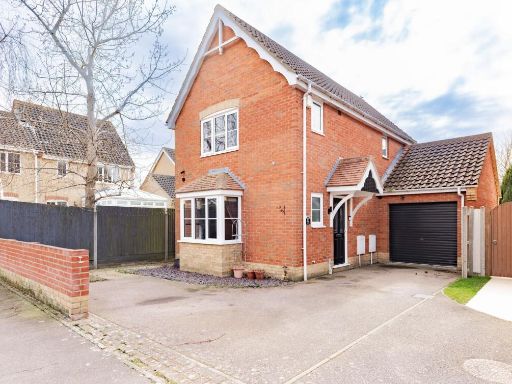 3 bedroom detached house for sale in Keel Close, Carlton Colville, NR33 — £269,950 • 3 bed • 2 bath • 866 ft²
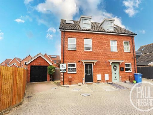 3 bedroom semi-detached house for sale in Buttermere Way, Carlton Colville, NR33 — £230,000 • 3 bed • 3 bath • 958 ft²
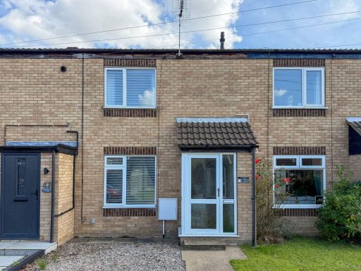 2 bedroom terraced house for sale in Buttercup Close, Carlton Colville, Lowestoft, NR33 8NW, NR33 — £200,000 • 2 bed • 1 bath • 602 ft²
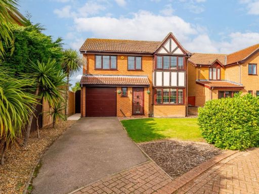 4 bedroom detached house for sale in Seavert Close, Carlton Colville, NR33 — £390,000 • 4 bed • 2 bath • 1399 ft²
Meta
- {
"@context": "https://schema.org",
"@type": "Residence",
"name": "2 bedroom house for sale in Abbeydale, Carlton Colville, NR…",
"description": "",
"url": "https://propertypiper.co.uk/property/b0d7b1bd-d94b-45f5-8a24-1c6a9ef3609e",
"image": "https://image-a.propertypiper.co.uk/4dea2d0b-05bc-4527-8ec1-38824c877b5f-1024.jpeg",
"address": {
"@type": "PostalAddress",
"streetAddress": "25 ABBEYDALE CARLTON COLVILLE LOWESTOFT",
"postalCode": "NR33 8WJ",
"addressLocality": "East Suffolk",
"addressRegion": "Waveney",
"addressCountry": "England"
},
"geo": {
"@type": "GeoCoordinates",
"latitude": 52.448375197348156,
"longitude": 1.7087590141796882
},
"numberOfRooms": 2,
"numberOfBathroomsTotal": 1,
"floorSize": {
"@type": "QuantitativeValue",
"value": 668,
"unitCode": "FTK"
},
"offers": {
"@type": "Offer",
"price": 220000,
"priceCurrency": "GBP",
"availability": "https://schema.org/InStock"
},
"additionalProperty": [
{
"@type": "PropertyValue",
"name": "Feature",
"value": "terraced house"
},
{
"@type": "PropertyValue",
"name": "Feature",
"value": "modern"
},
{
"@type": "PropertyValue",
"name": "Feature",
"value": "contemporary style"
},
{
"@type": "PropertyValue",
"name": "Feature",
"value": "two story"
},
{
"@type": "PropertyValue",
"name": "Feature",
"value": "brick exterior"
},
{
"@type": "PropertyValue",
"name": "Feature",
"value": "residential area"
},
{
"@type": "PropertyValue",
"name": "Feature",
"value": "cul-de-sac"
},
{
"@type": "PropertyValue",
"name": "Feature",
"value": "for sale"
},
{
"@type": "PropertyValue",
"name": "Feature",
"value": "investment potential"
},
{
"@type": "PropertyValue",
"name": "Feature",
"value": "modern kitchen"
},
{
"@type": "PropertyValue",
"name": "Feature",
"value": "grey cabinetry"
},
{
"@type": "PropertyValue",
"name": "Feature",
"value": "standard ceiling height"
},
{
"@type": "PropertyValue",
"name": "Feature",
"value": "small kitchen"
},
{
"@type": "PropertyValue",
"name": "Feature",
"value": "white tile backsplash"
},
{
"@type": "PropertyValue",
"name": "Feature",
"value": "window"
},
{
"@type": "PropertyValue",
"name": "Feature",
"value": "natural light"
},
{
"@type": "PropertyValue",
"name": "Feature",
"value": "chrome fixtures"
}
]
}
High Res Floorplan Images
Compatible Floorplan Images
FloorplanImages Thumbnail