SA3 1LU - Smallholding for sale in Oxwich, Swansea, SA3
View on Property Piper
Smallholding for sale in Oxwich, Swansea, SA3
Property Details
- Price: £1200000
- Bedrooms: 1
- Bathrooms: 1
- Property Type: undefined
- Property SubType: undefined
Brochure Descriptions
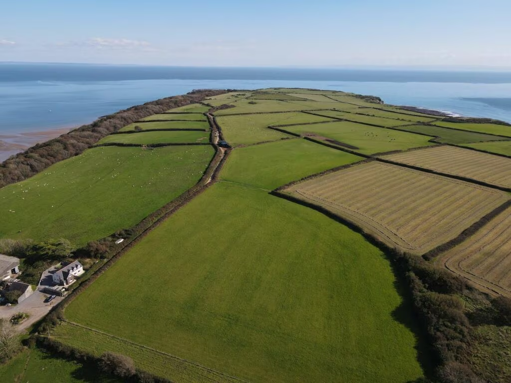
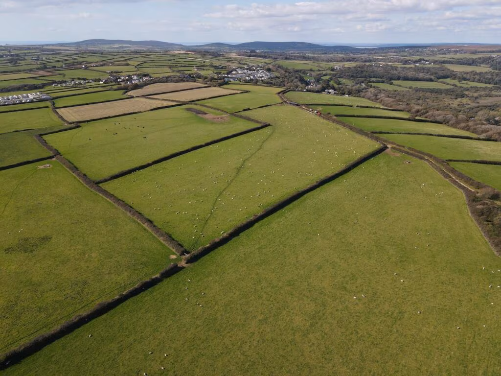
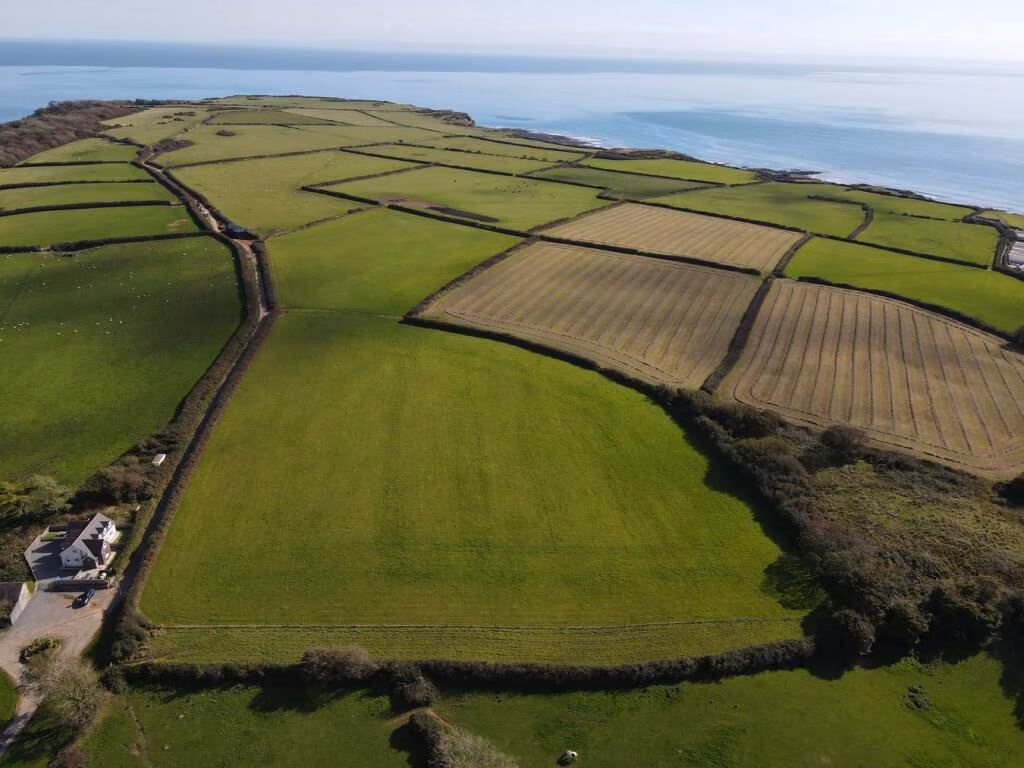
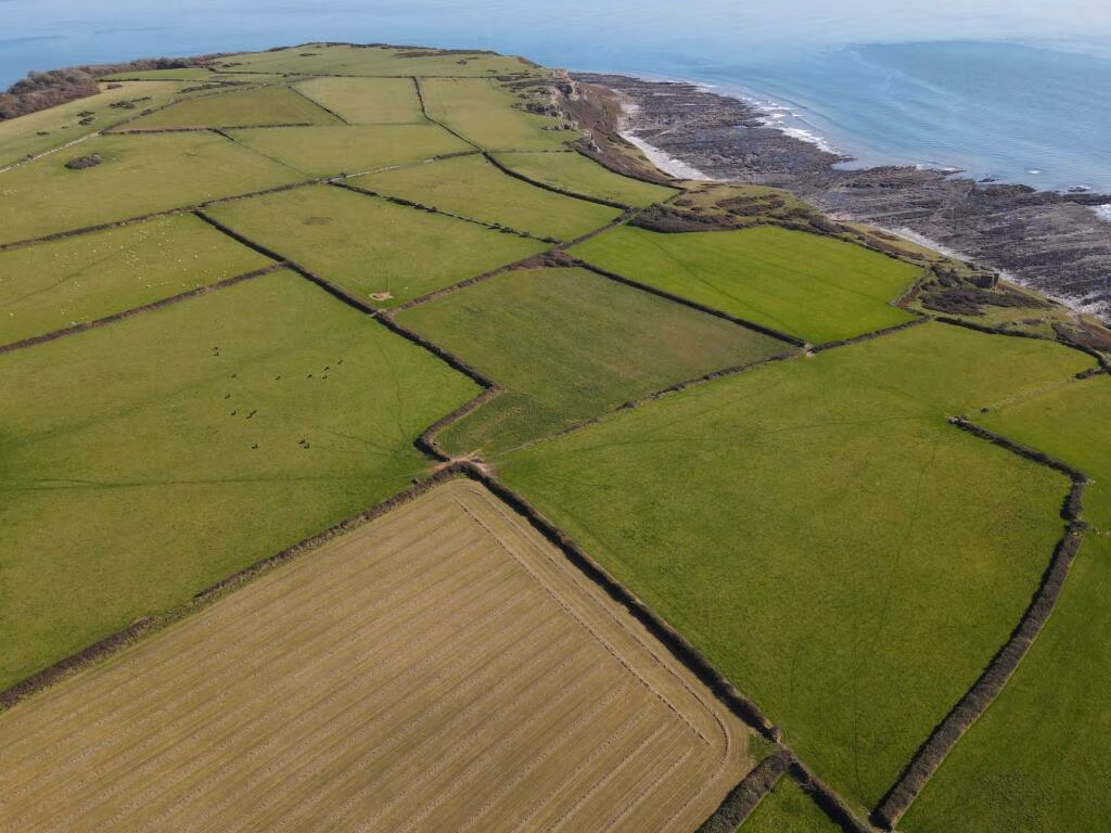
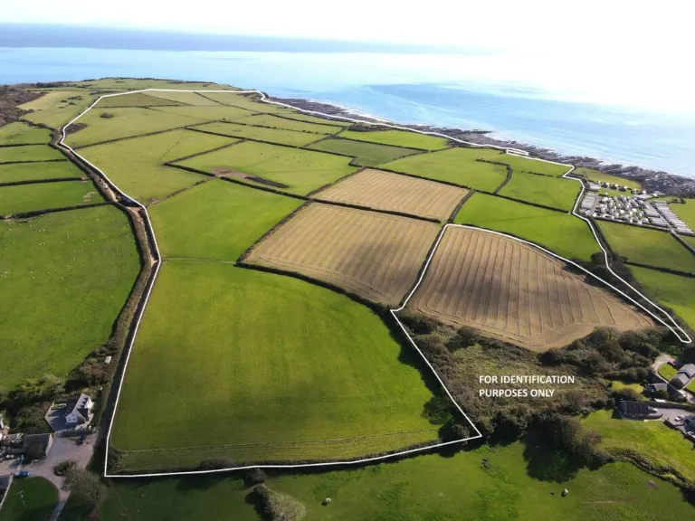
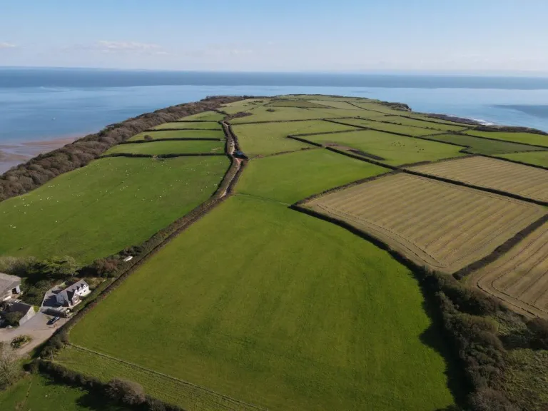
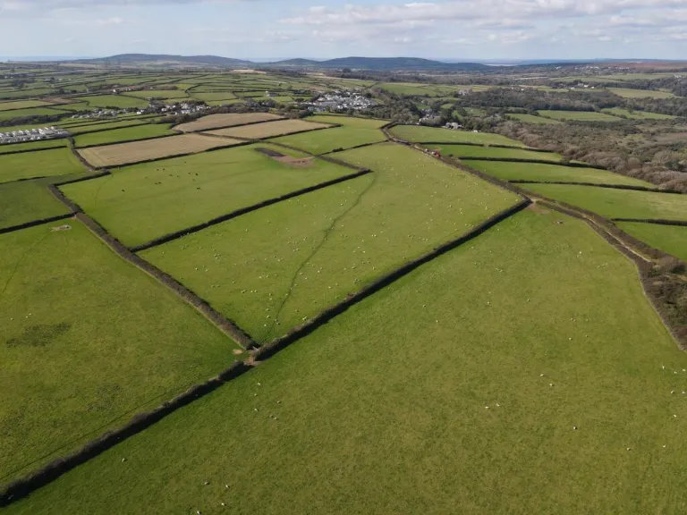
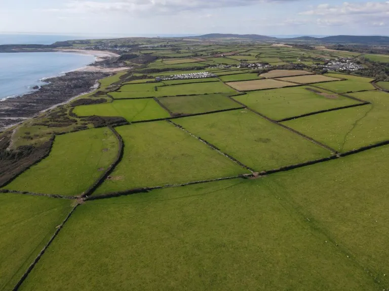
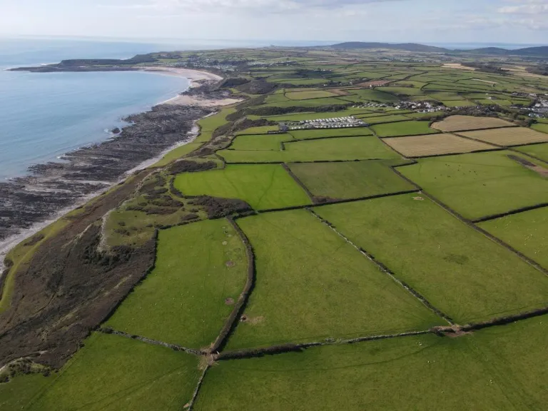
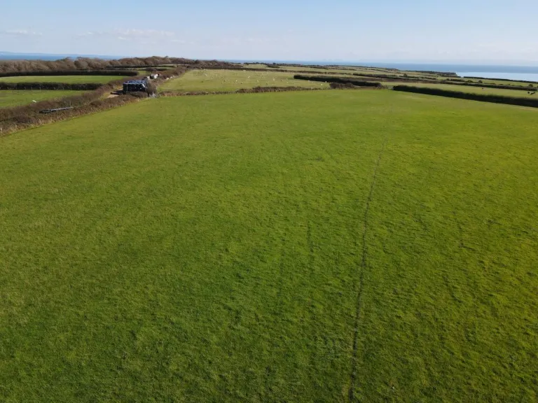
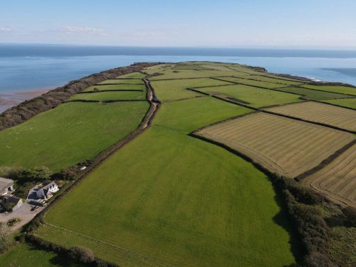
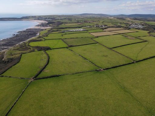
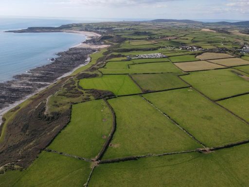
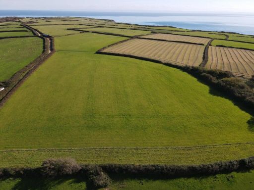
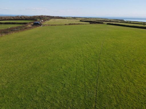
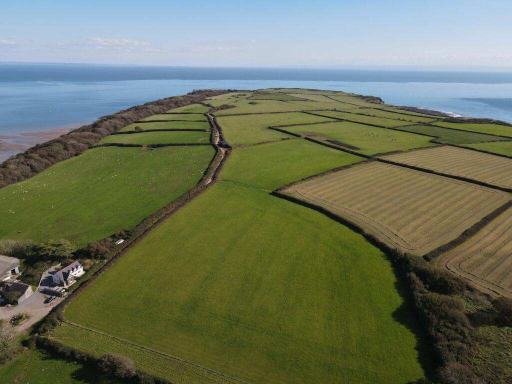
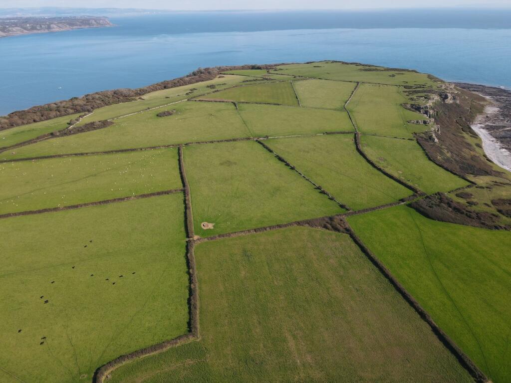
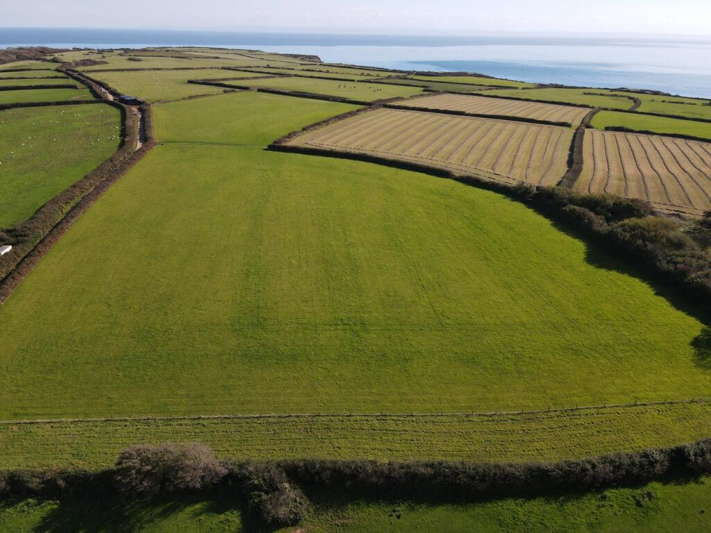
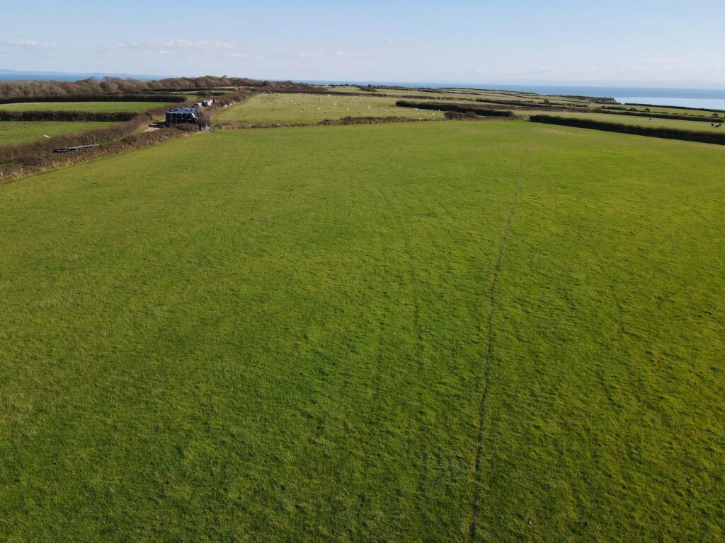
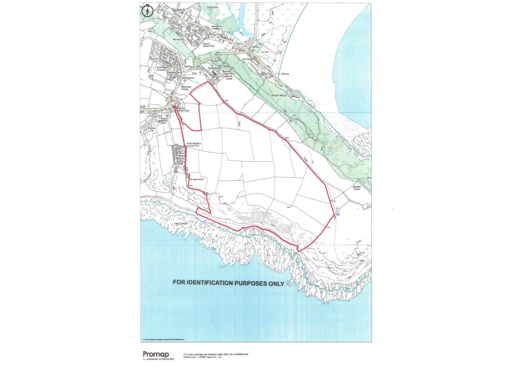
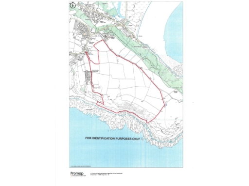
- Large rural agricultural holding comprising predominantly pasture and arable land forming part of Oxwich Castle Farm. The block is largely level/rolling with an area of cliffland to the western boundary and benefits from coastal/sea views in places. Property features include approximately 198.56 acres in total (with about 162.128 acres of pasture and arable currently laid to pasture and c.36.468 acres of cliffland), strategically placed water tanks and main access off a retained farm track. Overall land size: very large; individual fields vary from average to large. Suitable for grazing, arable cropping and rural investment/letting.
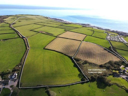
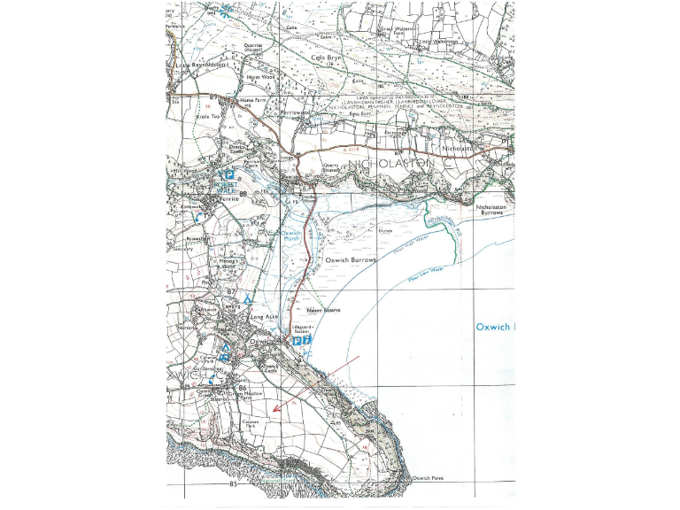
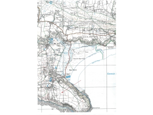
- Coastal property plotted on an Ordnance Survey extract covering the Oxwich / Nicholaston area (Oxwich Burrows and Oxwich Point are visible). The site appears to be coastal/edge-of-village land with direct proximity to dunes, beach and a nature reserve, offering exceptional sea and shoreline views. The map indicates a mix of open coastal fields and nearby settlement at Oxwich, so the holding is likely a large plot or small parcel of coastal farmland rather than a tightly built urban house. Garden/grounds would be large (extensive outdoor space), and the overall property footprint appears large/very large for a rural/coastal plot. No internal room details or exact residential address are shown on the image.
- Valuation-style description: A substantial, ring-fenced coastal agricultural holding on the Gower peninsula offered as a single lot. The land is principally level/gently undulating pasture and arable laid out in regular fields bounded by hedgerow/stone walls, with an area of cliffland to the western boundary. Main vehicular access is from Oxwich Castle Farm with a secondary access from Oxwich Green. The vendors indicate the land totals approximately 198.56 acres in all, of which about 162.128 acres are level pasture and arable suitable for grazing and arable cropping and approximately 36.468 acres comprise cliff/topography. The holding benefits from mains water supply and several sporadically placed tanks. Location and outlook are rural coastal with expansive countryside and coastal views across the bay; the parcel is large (very large agricultural holding) and well suited to continued agricultural enterprise or diversification subject to planning. Field sizes: medium to large; overall property size: very large (circa 198.6 acres).
Image Descriptions
- large land parcel
- large coastal farm land Agricultural or rural land
Floorplan Description
- Map showing an outlined land parcel/coastal area for identification purposes; not a building floorplan with rooms or floor dimensions.
Textual Property Features
Detected Visual Features
- land
- sea view
- coastal
- agricultural
- pasture
- fields
- farming
- investment property
- development opportunity
- farmland
- large acreage
- rural
- sheep grazing
Nearest General Shops
- Id: 3706301800
- Tags:
- Addr:
- Name: The Beach House Surf Shop
- Shop: clothes
- TagsNormalized:
- Lat: 51.5452676
- Lon: -4.2110376
- FullGeoHash: gcjj0pt8gwqf
- PartitionGeoHash: gcjj
- Images:
- FoodStandards: null
- Distance: 3162.9
,- Id: 7810522607
- Tags:
- Addr:
- City: Reynoldston
- Housename: Little Reynoldston Farm
- Postcode: SA3 1AD
- Email: sales@welshcoffee.com
- Name: Welsh Coffee Roasters
- Phone: +44 7900 011 244
- Shop: coffee
- Website: https://welshcoffee.com/
- TagsNormalized:
- Lat: 51.5820901
- Lon: -4.1837535
- FullGeoHash: gcjj2y1rrqx2
- PartitionGeoHash: gcjj
- Images:
- FoodStandards: null
- Distance: 3158.5
,- Id: 3706244252
- Tags:
- Amenity: ice_cream
- Name: Smugglers Gift Shop
- Shop: gift
- TagsNormalized:
- Lat: 51.5447816
- Lon: -4.2106197
- FullGeoHash: gcjj0pmyj7wq
- PartitionGeoHash: gcjj
- Images:
- FoodStandards: null
- Distance: 3155.7
}
Nearest Grocery shops
- Id: 3708235747
- Tags:
- Addr:
- Fhrs:
- Shop: convenience
- TagsNormalized:
- Lat: 51.5787397
- Lon: -4.2079743
- FullGeoHash: gcjj2jxggjfy
- PartitionGeoHash: gcjj
- Images:
- FoodStandards:
- Id: 96436
- FHRSID: 96436
- LocalAuthorityBusinessID: 2930
- BusinessName: Julians Supermarket Ltd
- BusinessType: Retailers - other
- BusinessTypeID: 4613
- AddressLine1: Knelston Garage
- AddressLine2: Knelston
- AddressLine3: null
- AddressLine4: Swansea
- PostCode: SA3 1AR
- RatingValue: 3
- RatingKey: fhrs_3_en-GB
- RatingDate: 2022-07-27
- LocalAuthorityCode: 568
- LocalAuthorityName: Swansea
- LocalAuthorityWebSite: http://www.swansea.gov.uk
- LocalAuthorityEmailAddress: FoodandSafety@swansea.gov.uk
- Scores:
- Hygiene: 10
- Structural: 10
- ConfidenceInManagement: 10
- NewRatingPending: false
- Geocode:
- Longitude: -4.21165500000000
- Latitude: 51.57895100000000
- Distance: 3779.6
,- Id: 165637242
- Tags:
- Addr:
- Postcode: SA3 2HL
- Street: Nicholaston Farm
- Amenity: cafe
- Building: yes
- Fhrs:
- Name: Farm and Coffee Shop
- Shop: convenience
- TagsNormalized:
- cafe
- coffee
- farm
- convenience
- shop
- Lat: 51.5743632
- Lon: -4.1330668
- FullGeoHash: gcjj3uy6kw4h
- PartitionGeoHash: gcjj
- Images:
- FoodStandards: null
- Distance: 3222.6
,- Id: 899048108
- Tags:
- Name: The Dunes
- Shop: convenience
- TagsNormalized:
- Lat: 51.5575552
- Lon: -4.1646942
- FullGeoHash: gcjj31z2e8fu
- PartitionGeoHash: gcjj
- Images:
- FoodStandards: null
- Distance: 347.2
}
Nearest Religious buildings
- Id: 893960087
- Tags:
- Amenity: place_of_worship
- Denomination: anglican
- Name: St. Nicholas's
- Religion: christian
- Wikidata: Q16857174
- TagsNormalized:
- place of worship
- anglican
- christian
- church
- Lat: 51.5750062
- Lon: -4.147919
- FullGeoHash: gcjj3sgw4mzr
- PartitionGeoHash: gcjj
- Images:
- FoodStandards: null
- Distance: 2598
,- Id: 264565030
- Tags:
- Amenity: place_of_worship
- Name: St. Andrew
- Religion: christian
- Wikidata: Q16744082
- TagsNormalized:
- place of worship
- christian
- church
- Lat: 51.57014
- Lon: -4.1757766
- FullGeoHash: gcjj2up3c6g7
- PartitionGeoHash: gcjj
- Images:
- FoodStandards: null
- Distance: 1722.9
,- Id: 240848420
- Tags:
- Amenity: place_of_worship
- Denomination: anglican
- Name: St. Illtyd's
- Religion: christian
- Wheelchair: yes
- Wikidata: Q16987334
- TagsNormalized:
- place of worship
- anglican
- christian
- church
- Lat: 51.5540512
- Lon: -4.1590039
- FullGeoHash: gcjj335s05ty
- PartitionGeoHash: gcjj
- Images:
- FoodStandards: null
- Distance: 657.3
}
Nearest Medical buildings
- Id: 4925236103
- Tags:
- Amenity: doctors
- Healthcare: doctor
- TagsNormalized:
- doctor
- doctors
- health
- healthcare
- Lat: 51.5753708
- Lon: -4.0881172
- FullGeoHash: gcjj6vp07cyy
- PartitionGeoHash: gcjj
- Images:
- FoodStandards: null
- Distance: 5970.4
,- Id: 4925231491
- Tags:
- Amenity: pharmacy
- Healthcare: pharmacy
- Operator: Well
- TagsNormalized:
- Lat: 51.5753456
- Lon: -4.0882749
- FullGeoHash: gcjj6vp00m32
- PartitionGeoHash: gcjj
- Images:
- FoodStandards: null
- Distance: 5959.2
,- Id: 1524588129
- Tags:
- Amenity: doctors
- Name: Gower Medical Practice
- TagsNormalized:
- Lat: 51.565779
- Lon: -4.2204698
- FullGeoHash: gchvrgq8rvvt
- PartitionGeoHash: gchv
- Images:
- FoodStandards: null
- Distance: 3789.5
,- Id: 1524588128
- Tags:
- Addr:
- City: Scurlage
- Postcode: SA3 1AY
- Street: Monksland Road
- Amenity: pharmacy
- Brand: Well Pharmacy
- Brand:wikidata: Q7726524
- Dispensing: yes
- Healthcare: pharmacy
- Name: Well Pharmacy
- TagsNormalized:
- pharmacy
- well pharmacy
- health
- healthcare
- Lat: 51.5655896
- Lon: -4.2204037
- FullGeoHash: gchvrgnz36wg
- PartitionGeoHash: gchv
- Images:
- FoodStandards: null
- Distance: 3778.8
}
Nearest Leisure Facilities
- Id: 101617186
- Tags:
- Leisure: pitch
- Sport: tennis
- TagsNormalized:
- Lat: 51.5520511
- Lon: -4.2071222
- FullGeoHash: gcjj22b2qyy7
- PartitionGeoHash: gcjj
- Images:
- FoodStandards: null
- Distance: 2711.1
,- Id: 1116429396
- Tags:
- Leisure: slipway
- Seamark:
- Small_craft_facility:
- Type: small_craft_facility
- TagsNormalized:
- Lat: 51.5475053
- Lon: -4.2011845
- FullGeoHash: gcjj0ruvcr3y
- PartitionGeoHash: gcjj
- Images:
- FoodStandards: null
- Distance: 2437.6
,- Id: 1948969930
- Tags:
- Leisure: Traditional Climbing
- Name: Oxwich Point
- Sport: climbing
- TagsNormalized:
- Lat: 51.543155
- Lon: -4.156052
- FullGeoHash: gcjj1rjssurp
- PartitionGeoHash: gcjj
- Images:
- FoodStandards: null
- Distance: 1599.2
,- Id: 2729893
- Tags:
- Name: Oxwich Leisure Park
- Tourism: chalet
- Type: multipolygon
- TagsNormalized:
- Lat: 51.557986
- Lon: -4.1712586
- FullGeoHash: gcjj31fe49hn
- PartitionGeoHash: gcjj
- Images:
- FoodStandards: null
- Distance: 357.1
,- Id: 1054377119
- Tags:
- TagsNormalized:
- Lat: 51.5548274
- Lon: -4.1730482
- FullGeoHash: gcjj31328ums
- PartitionGeoHash: gcjj
- Images:
- FoodStandards: null
- Distance: 335.5
}
Nearest Tourist attractions
- Id: 1783534
- Tags:
- Name: Sealands Farm
- Tourism: caravan_site
- Type: multipolygon
- TagsNormalized:
- Lat: 51.5515199
- Lon: -4.1749527
- FullGeoHash: gcjj2bxvkecd
- PartitionGeoHash: gcjj
- Images:
- FoodStandards: null
- Distance: 629.3
,- Id: 9823459617
- Tags:
- Name: Oxwich Camping Park
- Tourism: camp_site
- Website: http://oxwichcampingpark.co.uk/
- TagsNormalized:
- Lat: 51.5603552
- Lon: -4.1720083
- FullGeoHash: gcjj3460c4v5
- PartitionGeoHash: gcjj
- Images:
- FoodStandards: null
- Distance: 612
,- Id: 1783535
- Tags:
- Tourism: caravan_site
- Type: multipolygon
- TagsNormalized:
- Lat: 51.5558248
- Lon: -4.1741452
- FullGeoHash: gcjj312qrq7d
- PartitionGeoHash: gcjj
- Images:
- FoodStandards: null
- Distance: 409.2
}
Nearest Hotels
- Id: 42679715
- Tags:
- Addr:
- Amenity: pub
- Building: yes
- Fhrs:
- Name: The King Arthur Hotel
- Outdoor_seating: yes
- Tourism: hotel
- Wikidata: Q80859538
- TagsNormalized:
- Lat: 51.5875427
- Lon: -4.1922635
- FullGeoHash: gcjj2x5r1nvy
- PartitionGeoHash: gcjj
- Images:
- FoodStandards: null
- Distance: 3943.5
,- Id: 3706246847
- Tags:
- Addr:
- Name: Culver House Hotel
- Smoking: outside
- Tourism: hotel
- Website: https://culverhousehotel.co.uk/
- TagsNormalized:
- Lat: 51.5461186
- Lon: -4.209081
- FullGeoHash: gcjj0pxjckcw
- PartitionGeoHash: gcjj
- Images:
- FoodStandards: null
- Distance: 3003.1
,- Id: 240848422
- Tags:
- Addr:
- Amenity: restaurant
- Fhrs:
- Name: Oxwich Bay Hotel
- Tourism: hotel
- TagsNormalized:
- Lat: 51.5555272
- Lon: -4.1623448
- FullGeoHash: gcjj333hdqff
- PartitionGeoHash: gcjj
- Images:
- FoodStandards: null
- Distance: 410.3
}
Tags
- land
- sea view
- coastal
- agricultural
- pasture
- fields
- farming
- investment property
- development opportunity
- coastal
- farmland
- pasture
- sea view
- large acreage
- rural
- agricultural
- sheep grazing
Local Market Stats
- Average Price/sqft: £300
- Avg Income: £45800
- Rental Yield: 3.5%
- Social Housing: 6%
- Planning Success Rate: 75%
AirBnB Data
- 1km average: £81/night
- Listings in 1km: 3
Similar Properties
 Farm land for sale in Reynoldston, Swansea, SA3 — £770,000 • 1 bed • 1 bath
 Land for sale in Mynyddbach, Cwmtwrch, Swansea, Neath Port Talbot, SA9 — £1,250,000 • 1 bed • 1 bath
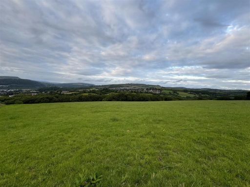 Land for sale in Eaglesbush, Cimla, SA11 — £375,000 • 1 bed • 1 bath
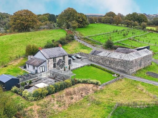 Farm land for sale in Cwmgiedd, Ystradgynlais, Swansea, City And County of Swansea., SA9 — £1,200,000 • 3 bed • 1 bath • 1878 ft²
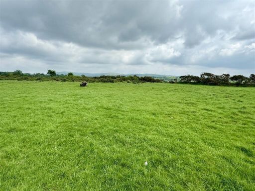 Land for sale in Talyclun, Llangennech, SA14 — £120,000 • 1 bed • 1 bath
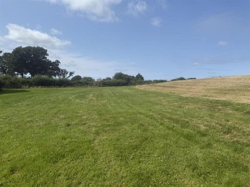 Land for sale in Llanboidy, Whitland, SA34 — £270,000 • 1 bed • 1 bath
Meta
- {
"@context": "https://schema.org",
"@type": "Residence",
"name": "Smallholding for sale in Oxwich, Swansea, SA3",
"description": "",
"url": "https://propertypiper.co.uk/property/b0a43374-6a8c-4634-a29f-7fd60d466b54",
"image": "https://image-a.propertypiper.co.uk/edb05692-6dc7-46b6-9cbf-c8e6e770aa02-1024.jpeg",
"address": {
"@type": "PostalAddress",
"streetAddress": "Oxwich, Swansea, SA3",
"postalCode": "SA3 1LU",
"addressLocality": "Swansea",
"addressRegion": "Gower",
"addressCountry": "Wales"
},
"geo": {
"@type": "GeoCoordinates",
"latitude": 51.55536479850941,
"longitude": -4.168273152640178
},
"numberOfRooms": 1,
"numberOfBathroomsTotal": 1,
"offers": {
"@type": "Offer",
"price": 1200000,
"priceCurrency": "GBP",
"availability": "https://schema.org/InStock"
},
"additionalProperty": [
{
"@type": "PropertyValue",
"name": "Feature",
"value": "land"
},
{
"@type": "PropertyValue",
"name": "Feature",
"value": "sea view"
},
{
"@type": "PropertyValue",
"name": "Feature",
"value": "coastal"
},
{
"@type": "PropertyValue",
"name": "Feature",
"value": "agricultural"
},
{
"@type": "PropertyValue",
"name": "Feature",
"value": "pasture"
},
{
"@type": "PropertyValue",
"name": "Feature",
"value": "fields"
},
{
"@type": "PropertyValue",
"name": "Feature",
"value": "farming"
},
{
"@type": "PropertyValue",
"name": "Feature",
"value": "investment property"
},
{
"@type": "PropertyValue",
"name": "Feature",
"value": "development opportunity"
},
{
"@type": "PropertyValue",
"name": "Feature",
"value": "coastal"
},
{
"@type": "PropertyValue",
"name": "Feature",
"value": "farmland"
},
{
"@type": "PropertyValue",
"name": "Feature",
"value": "pasture"
},
{
"@type": "PropertyValue",
"name": "Feature",
"value": "sea view"
},
{
"@type": "PropertyValue",
"name": "Feature",
"value": "large acreage"
},
{
"@type": "PropertyValue",
"name": "Feature",
"value": "rural"
},
{
"@type": "PropertyValue",
"name": "Feature",
"value": "agricultural"
},
{
"@type": "PropertyValue",
"name": "Feature",
"value": "sheep grazing"
}
]
}
High Res Floorplan Images
Compatible Floorplan Images
FloorplanImages Thumbnail