HD9 3UQ - 3 bedroom semidetached house for sale in Miry Lane, Nethert…
View on Property Piper
3 bedroom semi-detached house for sale in Miry Lane, Netherthong, HD9
Property Details
- Price: £350000
- Bedrooms: 3
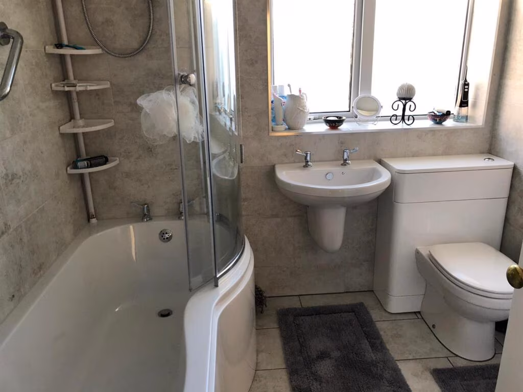
- Bathrooms: 2
- Property Type: undefined
- Property SubType: undefined
Brochure Descriptions
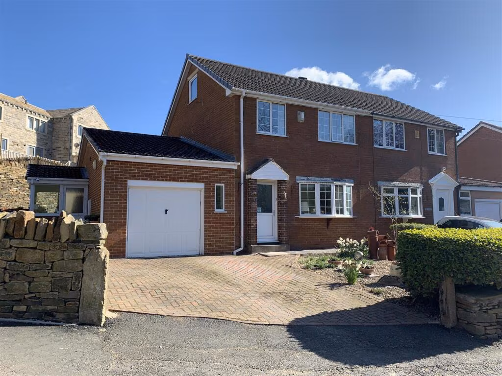
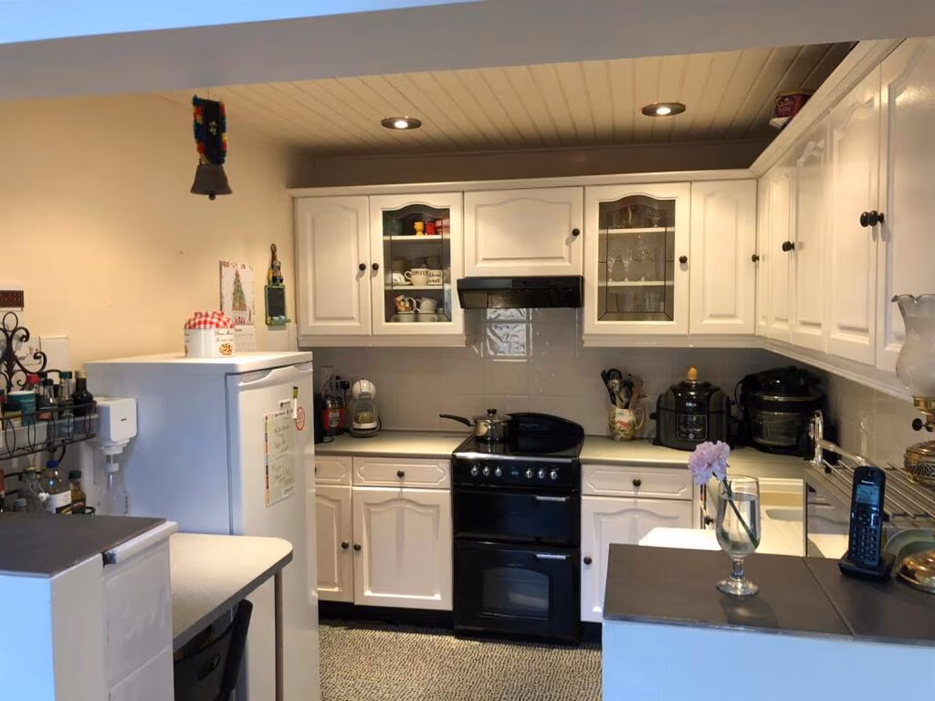
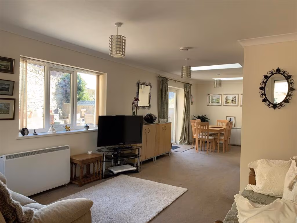
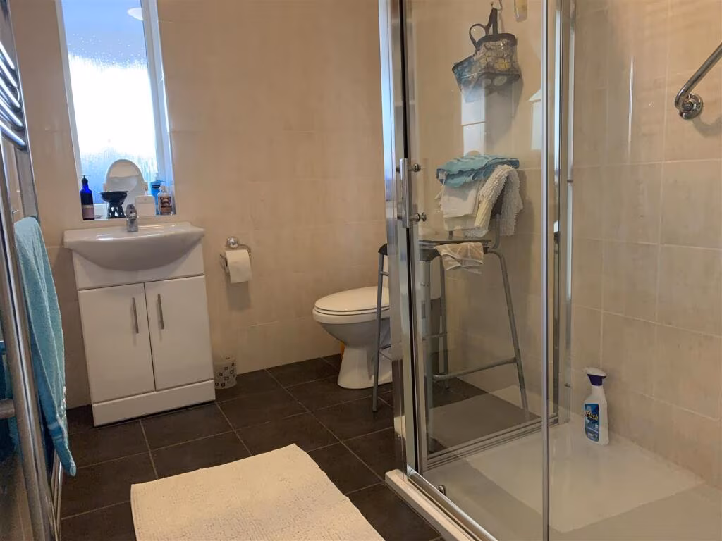
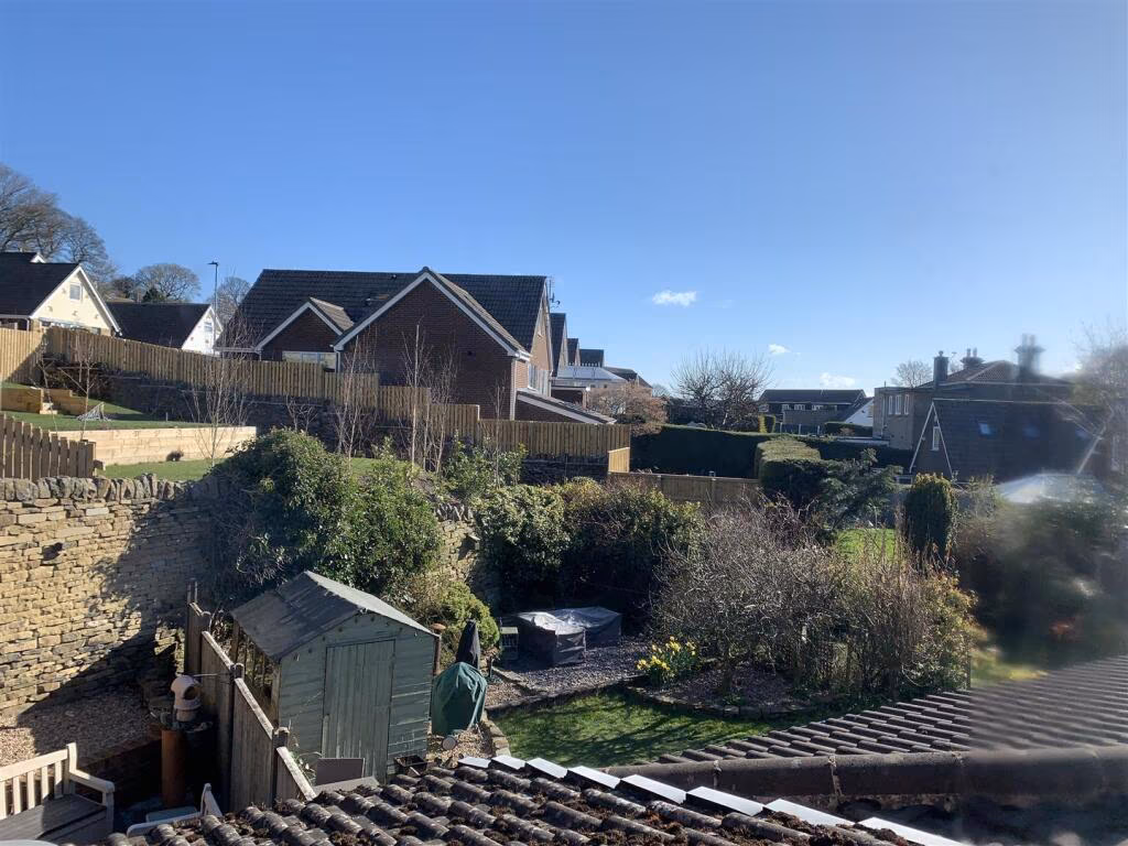
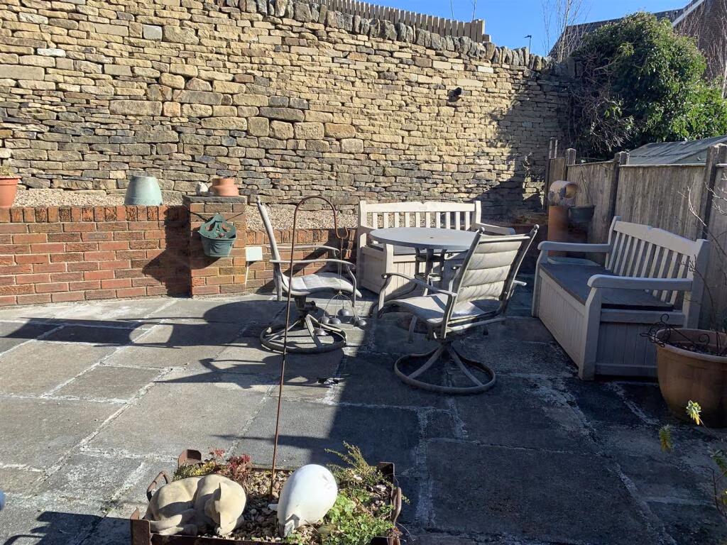
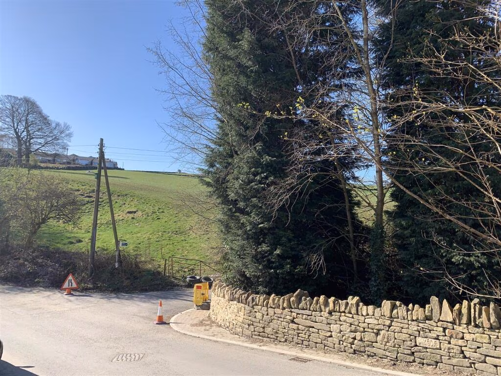
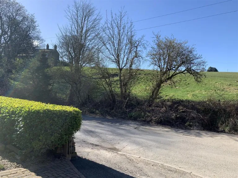
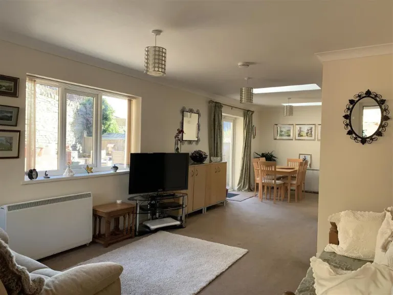
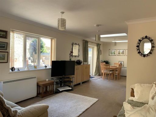
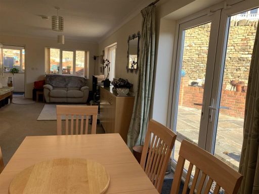
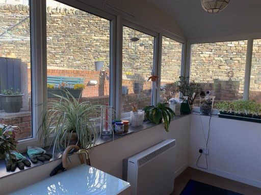
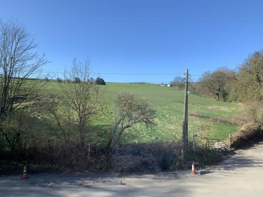
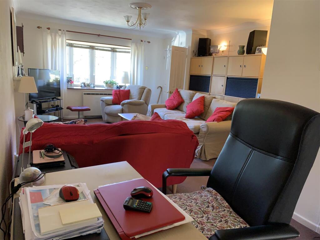
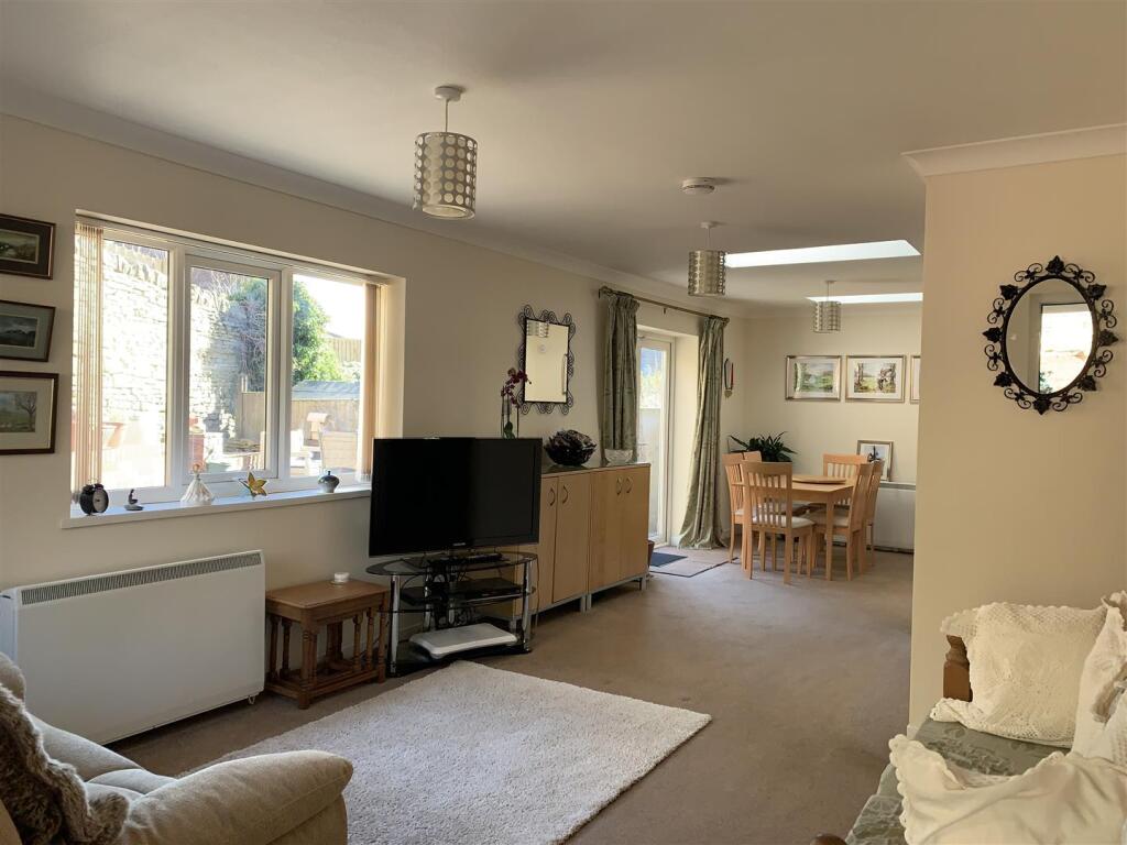
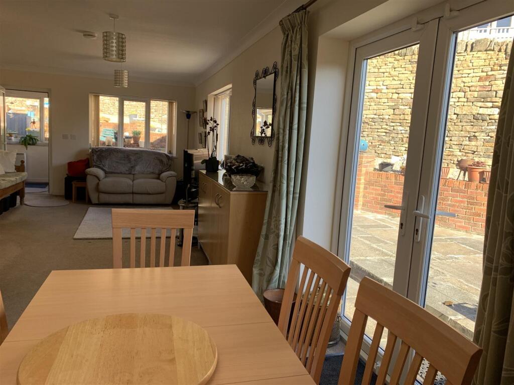
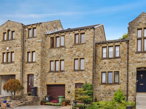
- Extended three-bedroom semi-detached family house occupying a larger-than-expected plot in Netherthong village with pleasant open/countryside views to the rear. Constructed in brick with tiled roof, the property features an integral single garage and a wide block-paved driveway providing off-road parking for multiple vehicles. Ground floor accommodation appears to include an entrance lobby, lounge, open-plan dining kitchen and family room with a downstairs shower room; first floor offers three bedrooms and a family bathroom. Externally there is a low-maintenance paved front garden and modest rear garden/plot with scope for a large outbuilding if required. Overall room sizes read as average to generous for a village family home; plot size is noticeably larger than adjoining homes and offers potential for extension subject to consent. Suitable for family occupation or as an investment in a sought-after, quiet residential location close to local school, pubs and amenities.
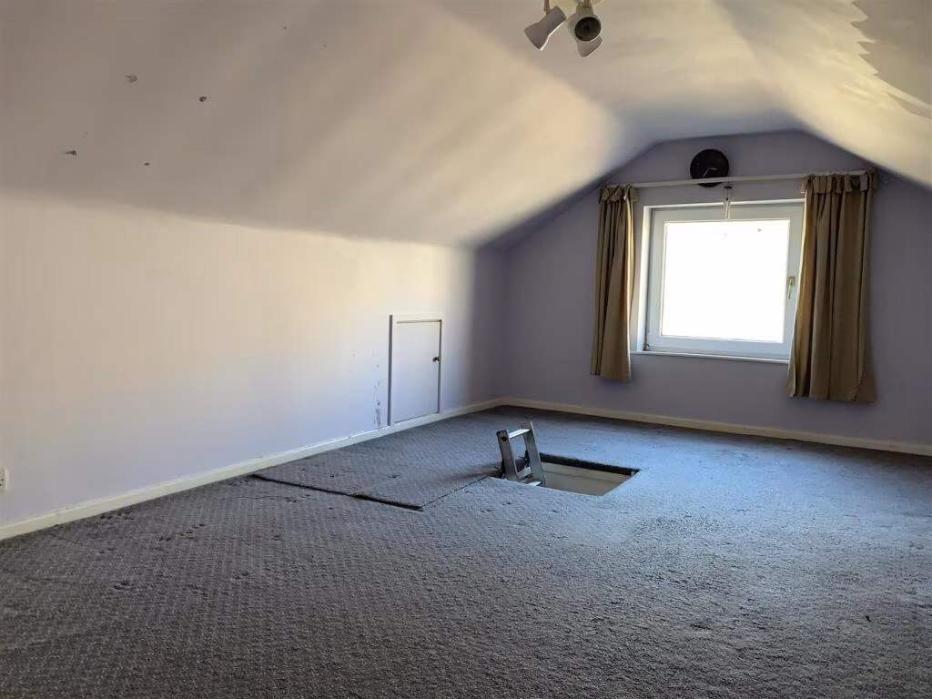
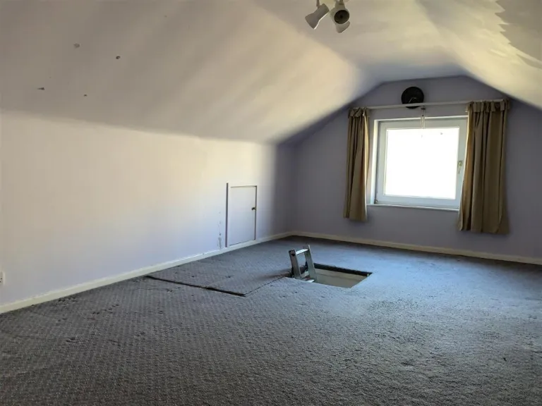
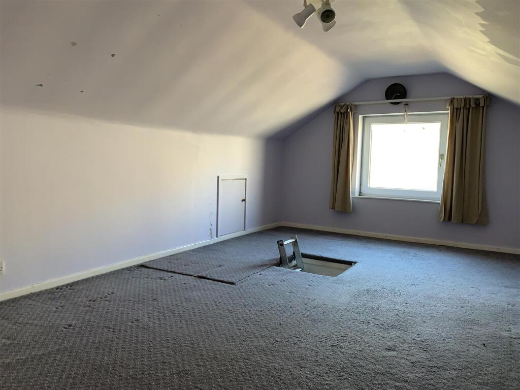
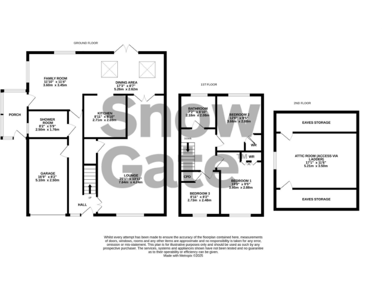
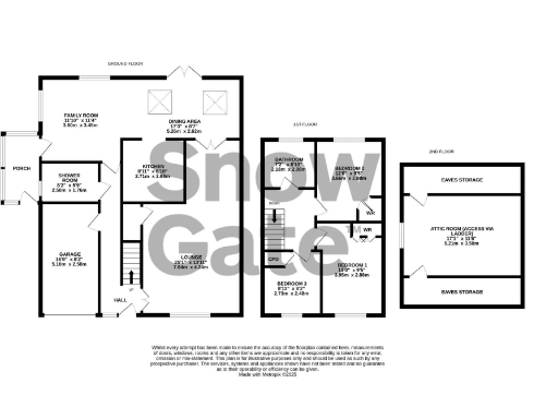
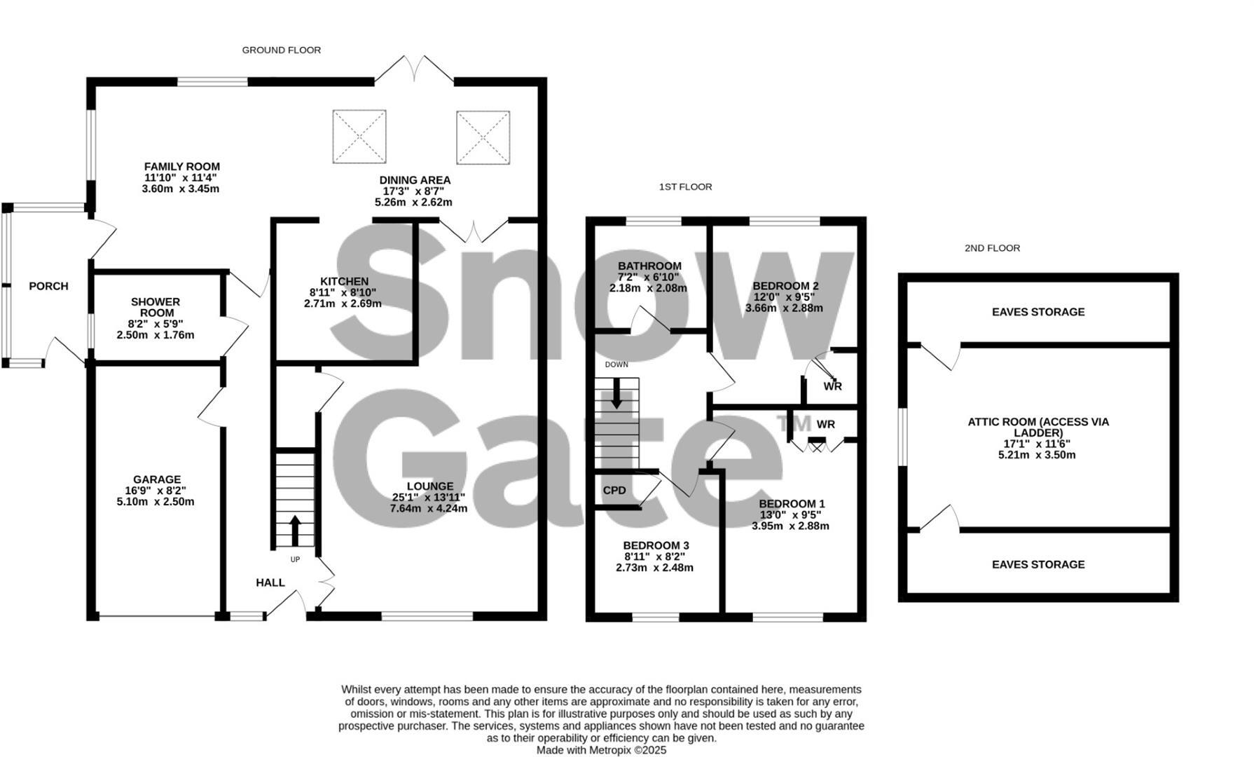
- Mid-sized, multi-level residential property shown on a three-storey floor plan. Ground floor configuration indicates an entrance hall leading to a lounge, an open family/dining area to the rear, a separate kitchen, a ground-floor shower room and an attached single garage with a porch/side entrance. First floor provides three bedrooms and a family bathroom. Second floor/loft has an attic room accessed via ladder/stairs with eaves storage either side. Overall the layout suggests flexible family accommodation with both formal and informal living spaces and useful ancillary storage (garage and eaves). No external grounds or garden are shown on the plan. Room proportions appear average for a typical family house — overall property size is likely medium (three to four bedroom equivalent including attic) and would suit a family needing extra storage or occasional additional bedroom space (loft). No precise floor area or address for the residential property is present on the image provided.
- Extended three-bedroom family home in Netherton, Holmfirth. The property offers flexible, spacious living accommodation with three reception rooms (including a very large lounge and an open plan dining/kitchen/family room), two bathrooms (including a downstairs shower room), loft space and an integral garage with off-road parking. Key features include modern uPVC double glazing, electric heating and scope for substantial outbuilding/extension. Room proportions are generous (e.g. lounge ~25'0" x 14'3", dining/family room ~28'4" x 11'7"), indicating overall internal space is above average for a three-bedroom house. Garden size is not specified on the sheet but the listing notes off-road parking and an integral garage; plot appears to be medium in size. Suitable as a family home with potential for improvement to increase value.
Image Descriptions
- semi-detached house modern late 20th-century
- kitchen Modern
Floorplan Description
- Floorplan showing ground, first and attic (second) floors with living, kitchen, bedrooms and bathroom.
Rooms
- FAMILY ROOM:
- DINING AREA:
- KITCHEN:
- SHOWER ROOM:
- LOUNGE:
- BATHROOM:
- BEDROOM 2:
- BEDROOM 1:
- BEDROOM 3:
- ATTIC ROOM (ACCESS VIA LADDER):
Textual Property Features
Detected Visual Features
- semi-detached
- modern
- late 20th-century
- garage
- garden
- brick exterior
- well-maintained
- paved driveway
- suburban
- modern kitchen
- white cabinets
- small space
- builtin appliances
- countertop
- overhead lighting
- tile backsplash
EPC Details
- Fully double glazed
- Cavity wall, as built, no insulation (assumed)
- Electric storage heaters
- Low energy lighting in all fixed outlets
- Suspended, no insulation (assumed)
Nearby Schools
- Upperthong Junior and Infant School
- New Mill Junior School
- Holmfirth High School
- Honley CofE (VC) Junior, Infant and Nursery School
- Netherton Infant and Nursery School
- Hillside Primary School
- Oak CofE Primary School
- Holme Junior and Infant School
- Honley High School
- Mount Pleasant Primary School
- Hepworth Junior and Infant School
- Scholes (Holmfirth) Junior & Infant School
- Holmfirth Junior Infant and Nursery School
- Meltham CofE (VC) Primary School
- Thurstonland Endowed Voluntary Controlled First School
- Brockholes Church of England Voluntary Controlled Junior and Infant School
- Helme Church of England Academy
- Farnley Tyas Church of England Voluntary Controlled First School
- Beaumont Primary Academy
- Spring Grove Junior Infant and Nursery School
- Hade Edge Junior, Infant and Nursery School
- Hinchliffe Mill Junior and Infant School
- New Mill Infant School
- Netherthong Primary School
- South Crosland Church of England Voluntary Aided Junior School
- Newsome Academy
- Moor End Academy
Nearest General Shops
- Id: 1717745661
- Tags:
- Name: Daihatsu Hepworth Motor Co
- Shop: car
- TagsNormalized:
- Lat: 53.578367
- Lon: -1.7827616
- FullGeoHash: gcw8z3tudes8
- PartitionGeoHash: gcw8
- Images:
- FoodStandards: null
- Distance: 1200.4
,- Id: 1710509801
- Tags:
- TagsNormalized:
- Lat: 53.5805945
- Lon: -1.7816925
- FullGeoHash: gcw8z6n9ed9z
- PartitionGeoHash: gcw8
- Images:
- FoodStandards: null
- Distance: 1121.4
,- Id: 1710510058
- Tags:
- TagsNormalized:
- Lat: 53.5807592
- Lon: -1.7815621
- FullGeoHash: gcw8z6ndw97n
- PartitionGeoHash: gcw8
- Images:
- FoodStandards: null
- Distance: 1120.7
}
Nearest Grocery shops
- Id: 4091070995
- Tags:
- Brand: Sainsbury's Local
- Brand:wikidata: Q13218434
- Brand:wikipedia: en:Sainsbury's Local
- Name: Sainsbury's Local
- Shop: convenience
- TagsNormalized:
- sainsburys
- sainsburys local
- convenience
- shop
- Lat: 53.5709792
- Lon: -1.7863199
- FullGeoHash: gcw8z271xdr6
- PartitionGeoHash: gcw8
- Images:
- FoodStandards: null
- Distance: 1731.5
,- Id: 184566677
- Tags:
- Addr:
- City: Holmfirth
- Postcode: HD9 7SN
- Street: Springwood Road
- Brand: The Co-operative Food
- Brand:wikidata: Q107617274
- Building: yes
- Name: The Co-operative Food
- Old_name: Wooldale Co-operative Society
- Operator: Central England Co-operative
- Operator:wikidata: Q16986583
- Shop: convenience
- TagsNormalized:
- the co-operative food
- food
- convenience
- shop
- Lat: 53.5846402
- Lon: -1.7713832
- FullGeoHash: gcw8zdy15ubv
- PartitionGeoHash: gcw8
- Images:
- FoodStandards: null
- Distance: 1675.6
,- Id: 2769465575
- Tags:
- Addr:
- City: Holmfirth
- Country: GB
- Housenumber: 130
- Postcode: HD9 3XZ
- Street: Town Gate
- Suburb: Netherthong
- Brand: Londis
- Brand:wikidata: Q21008564
- Brand:wikipedia: en:Londis (United Kingdom)
- Designation: Small Post Office Facilities
- Fhrs:
- Name: Londis
- Opening_hours: Mo-Sa 06:30-12:30,13:30-21:00; Su 09:00-12:00,17:00-20:00
- Shop: convenience
- Source:
- TagsNormalized:
- Lat: 53.5834014
- Lon: -1.7912175
- FullGeoHash: gcw8z4x9vtgr
- PartitionGeoHash: gcw8
- Images:
- FoodStandards: null
- Distance: 419.8
}
Nearest Religious buildings
- Id: 1717745698
- Tags:
- Addr:
- City: Holmfirth
- Housenumber: 40
- Postcode: HD9 7RY
- Street: Miry Lane
- Suburb: Thongsbridge
- Amenity: place_of_worship
- Name: The Parish Church of St Andrew Thongsbridge
- Religion: christian
- TagsNormalized:
- place of worship
- church
- parish
- christian
- Lat: 53.5831704
- Lon: -1.7773362
- FullGeoHash: gcw8zd9b94fj
- PartitionGeoHash: gcw8
- Images:
- FoodStandards: null
- Distance: 1302.3
,- Id: 1710509888
- Tags:
- Amenity: place_of_worship
- Name: Full Life Church
- Religion: christian
- TagsNormalized:
- place of worship
- church
- christian
- Lat: 53.5837077
- Lon: -1.7780945
- FullGeoHash: gcw8zd95xrhd
- PartitionGeoHash: gcw8
- Images:
- FoodStandards: null
- Distance: 1243.3
,- Id: 150736216
- Tags:
- Addr:
- City: Holmfirth
- Housename: All Saints Church
- Postcode: HD9 3XZ
- Street: Town Gate
- Suburb: Netherthong
- Amenity: place_of_worship
- Building: church
- Denomination: anglican
- Name: All Saints
- Religion: christian
- Wikidata: Q26522715
- TagsNormalized:
- place of worship
- church
- anglican
- christian
- Lat: 53.5830916
- Lon: -1.7908284
- FullGeoHash: gcw8z4xbnsjx
- PartitionGeoHash: gcw8
- Images:
- FoodStandards: null
- Distance: 459.5
}
Nearest Medical buildings
- Id: 3404796487
- Tags:
- Addr:
- City: Holmfirth
- Postcode: HD9 3TR
- Street: Huddersfield Road
- Amenity: doctors
- Cqc:
- Healthcare: doctor
- Name: Elmwood Family Doctors
- Website: https://elmwoodfamilydoctors.co.uk/
- TagsNormalized:
- doctor
- doctors
- health
- healthcare
- Lat: 53.5783131
- Lon: -1.7838265
- FullGeoHash: gcw8z3th3c6w
- PartitionGeoHash: gcw8
- Images:
- FoodStandards: null
- Distance: 1151.3
,- Id: 845735605
- Tags:
- Addr:
- Postcode: HD9 3TP
- Street: Huddersfield Road
- Amenity: doctors
- Building: health_centre
- Cqc:
- Healthcare: yes
- Name: Oaklands Health Centre
- Website: https://www.oaklandshealthcentre.co.uk/
- TagsNormalized:
- doctor
- doctors
- health
- health centre
- healthcare
- Lat: 53.5780905
- Lon: -1.784405
- FullGeoHash: gcw8z3sdurgn
- PartitionGeoHash: gcw8
- Images:
- FoodStandards: null
- Distance: 1140.4
,- Id: 301153857
- Tags:
- Addr:
- Postcode: HD9 3TS
- Street: Huddersfield Road
- Amenity: hospital
- Emergency: no
- Healthcare: hospital
- Name: Holme Valley Memorial Hospital
- Nhs: yes
- TagsNormalized:
- Lat: 53.5787123
- Lon: -1.7844971
- FullGeoHash: gcw8z3swd5ys
- PartitionGeoHash: gcw8
- Images:
- FoodStandards: null
- Distance: 1088.7
,- Id: 1710510118
- Tags:
- Amenity: dentist
- Fixme: presumably Elmwood Dental Surgery
- Healthcare: dentist
- TagsNormalized:
- Lat: 53.5791764
- Lon: -1.784196
- FullGeoHash: gcw8z3uc34rh
- PartitionGeoHash: gcw8
- Images:
- FoodStandards: null
- Distance: 1070.1
}
Nearest Airports
- Id: 1224469
- Tags:
- Addr:
- City: Manchester
- Country: GB
- Postcode: M90 1QX
- Aerodrome: international
- Aeroway: aerodrome
- Arp: yes
- Atis: 128.175
- Iata: MAN
- Icao: EGCC
- Name: Manchester Airport
- Note: rough sketched outline referring to Yahoo imagery - true boundary is where?
- Old_name: Ringway
- Operator: Manchester Airport PLC
- Size: 18720000
- Source:
- Tower_frequency: 118.625,119.400
- Type: multipolygon
- Website: https://www.manchesterairport.co.uk/
- Wikidata: Q8694
- Wikipedia: en:Manchester Airport
- TagsNormalized:
- airport
- international airport
- Lat: 53.3503197
- Lon: -2.2798822
- FullGeoHash: gcqrs05u4ukt
- PartitionGeoHash: gcqr
- Images:
- FoodStandards: null
- Distance: 41294.1
}
Nearest Leisure Facilities
- Id: 2770706595
- Tags:
- TagsNormalized:
- Lat: 53.5843542
- Lon: -1.7895807
- FullGeoHash: gcw8z68z7xxg
- PartitionGeoHash: gcw8
- Images:
- FoodStandards: null
- Distance: 483.7
,- Id: 406972939
- Tags:
- TagsNormalized:
- Lat: 53.5847768
- Lon: -1.7895391
- FullGeoHash: gcw8z6bcuwqu
- PartitionGeoHash: gcw8
- Images:
- FoodStandards: null
- Distance: 478.8
,- Id: 406972940
- Tags:
- TagsNormalized:
- Lat: 53.5849668
- Lon: -1.7896119
- FullGeoHash: gcw8z6bg51b9
- PartitionGeoHash: gcw8
- Images:
- FoodStandards: null
- Distance: 472.1
,- Id: 274082080
- Tags:
- Access: yes
- Leisure: playground
- TagsNormalized:
- Lat: 53.589487
- Lon: -1.7967392
- FullGeoHash: gcw8z5etkuqj
- PartitionGeoHash: gcw8
- Images:
- FoodStandards: null
- Distance: 469.1
,- Id: 301154341
- Tags:
- Landuse: recreation_ground
- Leisure: park
- TagsNormalized:
- Lat: 53.5894158
- Lon: -1.7967024
- FullGeoHash: gcw8z5esvz1t
- PartitionGeoHash: gcw8
- Images:
- FoodStandards: null
- Distance: 461.2
}
Nearest Tourist attractions
- Id: 3413675919
- Tags:
- Name: Nora Batty's house
- Note: Nora Batty's house in Last of the Summer Wine TV programme.
- Tourism: attraction
- TagsNormalized:
- Lat: 53.5693111
- Lon: -1.7892264
- FullGeoHash: gcw8xrcpu525
- PartitionGeoHash: gcw8
- Images:
- FoodStandards: null
- Distance: 1842.5
,- Id: 3413675918
- Tags:
- Name: Compo's house
- Note: Compo's house in Last of the Summer Wine TV programme
- Tourism: attraction
- TagsNormalized:
- Lat: 53.5693238
- Lon: -1.7891813
- FullGeoHash: gcw8xrcpvj9x
- PartitionGeoHash: gcw8
- Images:
- FoodStandards: null
- Distance: 1841.9
,- Id: 39361182
- Tags:
- Caravans: yes
- Name: Holme Valley Camping & Caravan Park
- Sanitary_dump_station: customers
- Tents: yes
- Tourism: camp_site
- TagsNormalized:
- Lat: 53.5894654
- Lon: -1.7709884
- FullGeoHash: gcw8zewmkbrk
- PartitionGeoHash: gcw8
- Images:
- FoodStandards: null
- Distance: 1763
}
Nearest Train stations
- Id: 248646520
- Tags:
- Name: Shelley
- Network: Whistlestop Valley
- Operator: Whistlestop Valley
- Public_transport: station
- Railway: station
- Train: yes
- Usage: tourism
- TagsNormalized:
- Lat: 53.5872189
- Lon: -1.6856984
- FullGeoHash: gcwbcek80msh
- PartitionGeoHash: gcwb
- Images:
- FoodStandards: null
- Distance: 7333
,- Id: 6012937553
- Tags:
- Name: Huddersfield
- Naptan:
- Network: National Rail
- Public_transport: station
- Railway: station
- Ref:
- Wheelchair: yes
- Wikipedia: en:Huddersfield railway station
- TagsNormalized:
- Lat: 53.64849
- Lon: -1.7847509
- FullGeoHash: gcw9pqkmh73k
- PartitionGeoHash: gcw9
- Images:
- FoodStandards: null
- Distance: 7074.3
,- Id: 6012937552
- Tags:
- Name: Slaithwaite
- Naptan:
- Network: National Rail
- Operator: Northern
- Public_transport: station
- Railway: station
- Ref:
- Source: NPE
- Train: yes
- Wikipedia: en:Slaithwaite railway station
- TagsNormalized:
- Lat: 53.6241585
- Lon: -1.8806027
- FullGeoHash: gcw9j1yx6g8v
- PartitionGeoHash: gcw9
- Images:
- FoodStandards: null
- Distance: 7022.2
,- Id: 3711588219
- Tags:
- Name: Shepley
- Naptan:
- Network: National Rail
- Public_transport: station
- Railway: station
- Ref:
- Source: NPE
- Wikipedia: en:Shepley railway station
- TagsNormalized:
- Lat: 53.5887533
- Lon: -1.7048254
- FullGeoHash: gcwbc5w94ewj
- PartitionGeoHash: gcwb
- Images:
- FoodStandards: null
- Distance: 6079.6
,- Id: 3711588220
- Tags:
- Name: Stocksmoor
- Naptan:
- Network: National Rail
- Public_transport: station
- Railway: station
- Ref:
- Source: NPE
- Wikipedia: en:Stocksmoor railway station
- TagsNormalized:
- Lat: 53.5941495
- Lon: -1.7232658
- FullGeoHash: gcwbbu90scxf
- PartitionGeoHash: gcwb
- Images:
- FoodStandards: null
- Distance: 4949.3
}
Nearest Hotels
- Id: 322031482
- Tags:
- Name: Lane Farm Holiday Cottages
- Tourism: hotel
- TagsNormalized:
- Lat: 53.5467049
- Lon: -1.8461806
- FullGeoHash: gcw8tgzshv7b
- PartitionGeoHash: gcw8
- Images:
- FoodStandards: null
- Distance: 5389.3
,- Id: 893419018
- Tags:
- Amenity: pub
- Name: Victoria Hotel
- TagsNormalized:
- Lat: 53.6283524
- Lon: -1.7763044
- FullGeoHash: gcw9pddxc17q
- PartitionGeoHash: gcw9
- Images:
- FoodStandards: null
- Distance: 4976.9
,- Id: 6337863817
- Tags:
- Name: Durker Roods Hotel
- Source: Bing; survey
- Tourism: hotel
- TagsNormalized:
- Lat: 53.5915464
- Lon: -1.8432596
- FullGeoHash: gcw8yh1c2uq4
- PartitionGeoHash: gcw8
- Images:
- FoodStandards: null
- Distance: 3148.5
}
Tags
- semi-detached
- modern
- late 20th-century
- garage
- garden
- brick exterior
- well-maintained
- paved driveway
- suburban
- modern kitchen
- white cabinets
- small space
- builtin appliances
- countertop
- overhead lighting
- tile backsplash
Local Market Stats
- Average Price/sqft: £255
- Avg Income: £45900
- Rental Yield: 3.4%
- Social Housing: 3%
- Planning Success Rate: 88%
AirBnB Data
- 1km average: £70/night
- Listings in 1km: 1
Similar Properties
 3 bedroom terraced house for sale in Dean Brook Road, Netherthong, Holmfirth, HD9 — £280,000 • 3 bed • 2 bath • 1023 ft²
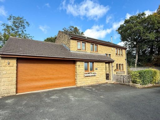 4 bedroom detached house for sale in New Road, Netherthong, Holmfirth, HD9 — £525,000 • 4 bed • 2 bath • 1061 ft²
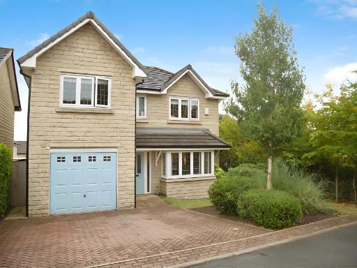 4 bedroom detached house for sale in St. Marys Avenue, Netherthong, Holmfirth, HD9 — £450,000 • 4 bed • 2 bath • 1200 ft²
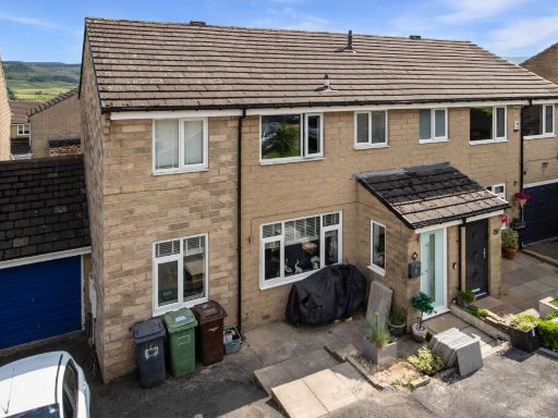 4 bedroom semi-detached house for sale in Greenlaws Close, Upperthong, Holmfirth, HD9 — £335,000 • 4 bed • 2 bath • 1149 ft²
 3 bedroom end of terrace house for sale in Dean Brook Road, Netherthong, Holmfirth, HD9 — £245,000 • 3 bed • 2 bath • 786 ft²
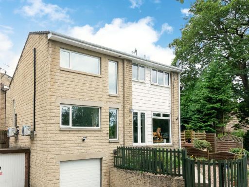 4 bedroom end of terrace house for sale in Luke Lane, Thongsbridge, HD9 — £325,000 • 4 bed • 2 bath • 1114 ft²
Meta
- {
"@context": "https://schema.org",
"@type": "Residence",
"name": "3 bedroom semidetached house for sale in Miry Lane, Nethert…",
"description": "",
"url": "https://propertypiper.co.uk/property/ae98f2f5-24a2-4cb6-a5e9-250cfadbbc78",
"image": "https://image-a.propertypiper.co.uk/8c475418-a8a1-4a39-a820-e051615ab676-1024.jpeg",
"address": {
"@type": "PostalAddress",
"streetAddress": "8 MIRY LANE, NETHERTHONG, HOLMFIRTH",
"postalCode": "HD9 3UQ",
"addressLocality": "Kirklees",
"addressRegion": "Colne Valley",
"addressCountry": "England"
},
"geo": {
"@type": "GeoCoordinates",
"latitude": 53.5852682,
"longitude": -1.7967453
},
"numberOfRooms": 3,
"numberOfBathroomsTotal": 2,
"floorSize": {
"@type": "QuantitativeValue",
"value": 1310,
"unitCode": "FTK"
},
"offers": {
"@type": "Offer",
"price": 350000,
"priceCurrency": "GBP",
"availability": "https://schema.org/InStock"
},
"additionalProperty": [
{
"@type": "PropertyValue",
"name": "Feature",
"value": "semi-detached"
},
{
"@type": "PropertyValue",
"name": "Feature",
"value": "modern"
},
{
"@type": "PropertyValue",
"name": "Feature",
"value": "late 20th-century"
},
{
"@type": "PropertyValue",
"name": "Feature",
"value": "garage"
},
{
"@type": "PropertyValue",
"name": "Feature",
"value": "garden"
},
{
"@type": "PropertyValue",
"name": "Feature",
"value": "brick exterior"
},
{
"@type": "PropertyValue",
"name": "Feature",
"value": "well-maintained"
},
{
"@type": "PropertyValue",
"name": "Feature",
"value": "paved driveway"
},
{
"@type": "PropertyValue",
"name": "Feature",
"value": "suburban"
},
{
"@type": "PropertyValue",
"name": "Feature",
"value": "modern kitchen"
},
{
"@type": "PropertyValue",
"name": "Feature",
"value": "white cabinets"
},
{
"@type": "PropertyValue",
"name": "Feature",
"value": "small space"
},
{
"@type": "PropertyValue",
"name": "Feature",
"value": "builtin appliances"
},
{
"@type": "PropertyValue",
"name": "Feature",
"value": "countertop"
},
{
"@type": "PropertyValue",
"name": "Feature",
"value": "overhead lighting"
},
{
"@type": "PropertyValue",
"name": "Feature",
"value": "tile backsplash"
}
]
}
High Res Floorplan Images
Compatible Floorplan Images
FloorplanImages Thumbnail