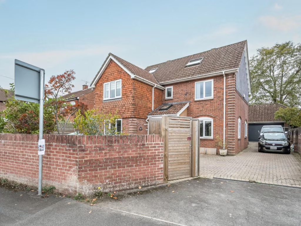
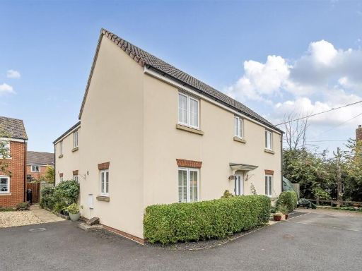
SN12 7AA - 5 bedroom detached house for sale in Forest Road, Melksham,…
View on Property Piper
5 bedroom detached house for sale in Forest Road, Melksham, SN12
Property Details
- Price: £525000
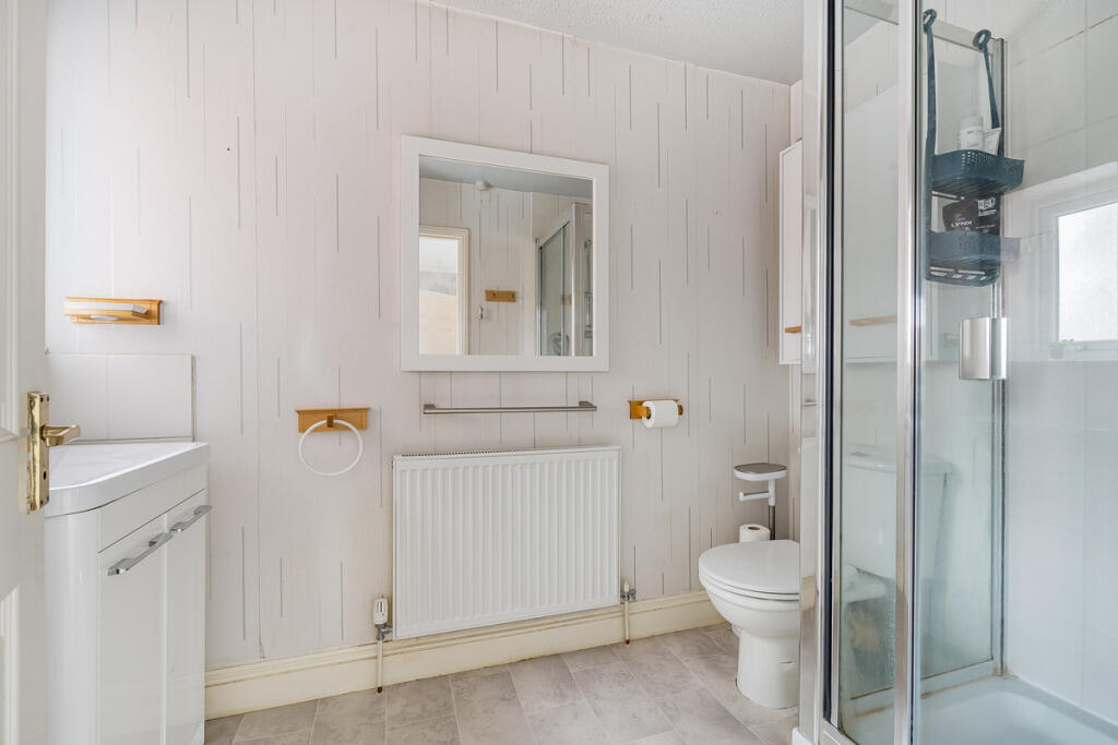
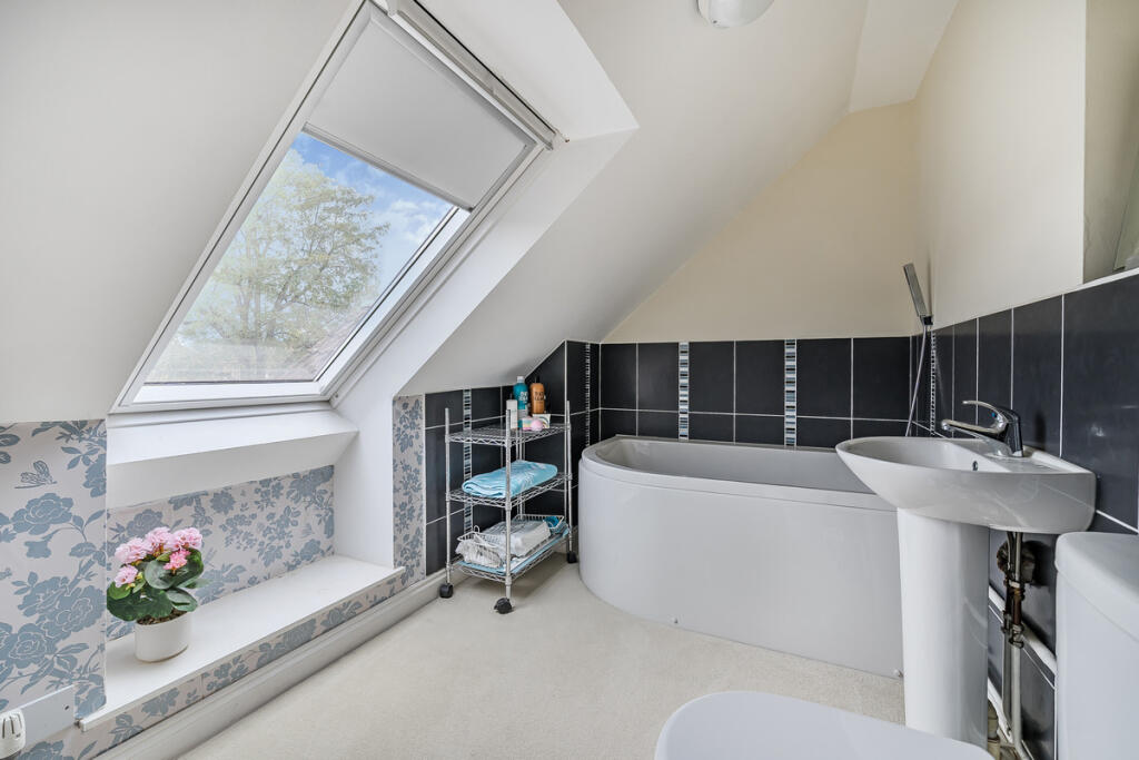
- Bedrooms: 5
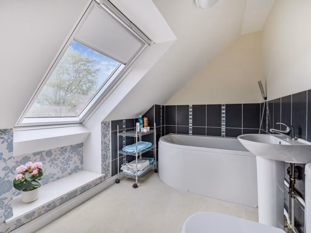
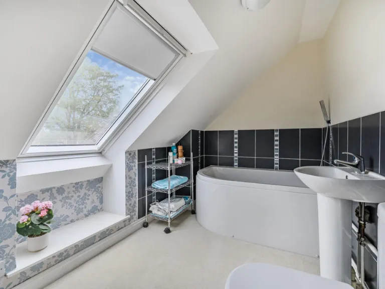
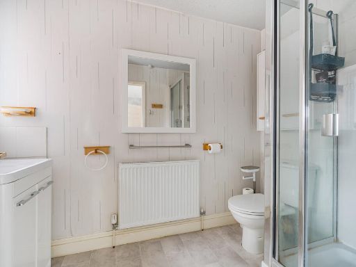
- Bathrooms: 3
- Property Type: undefined
- Property SubType: undefined
Image Descriptions
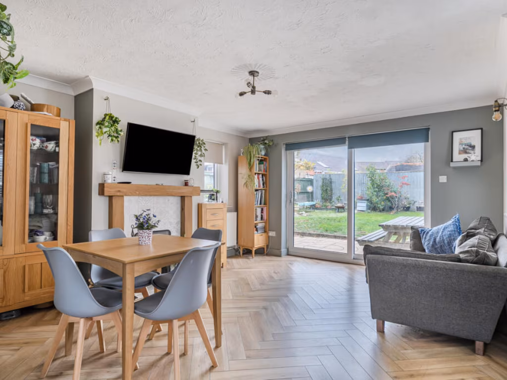
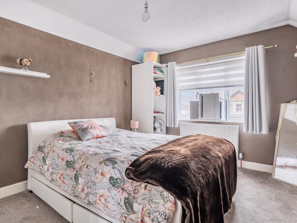
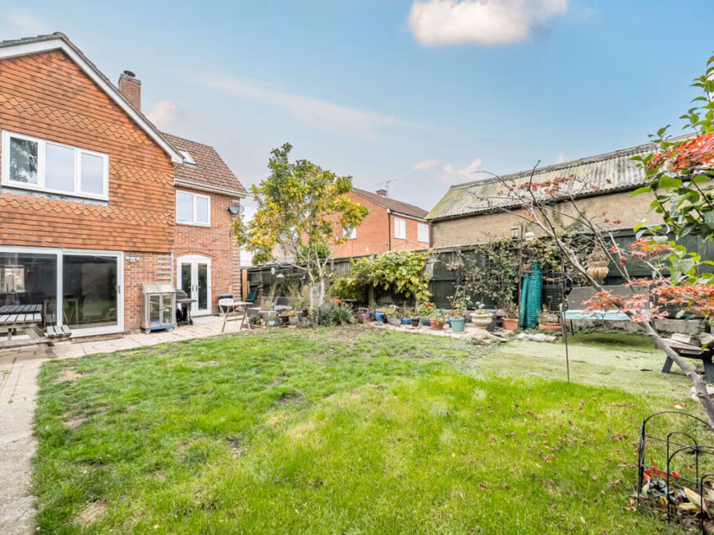
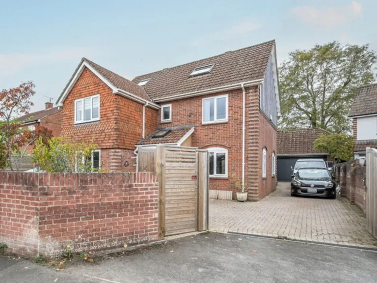
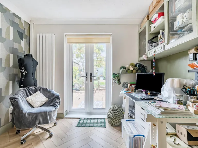
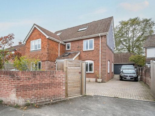
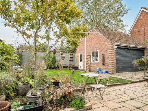
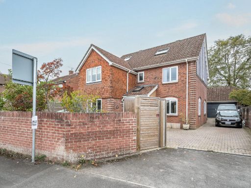
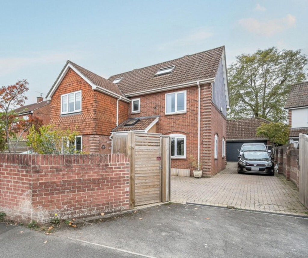
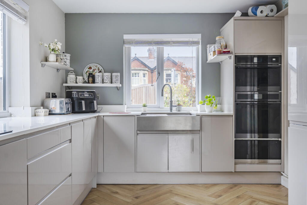
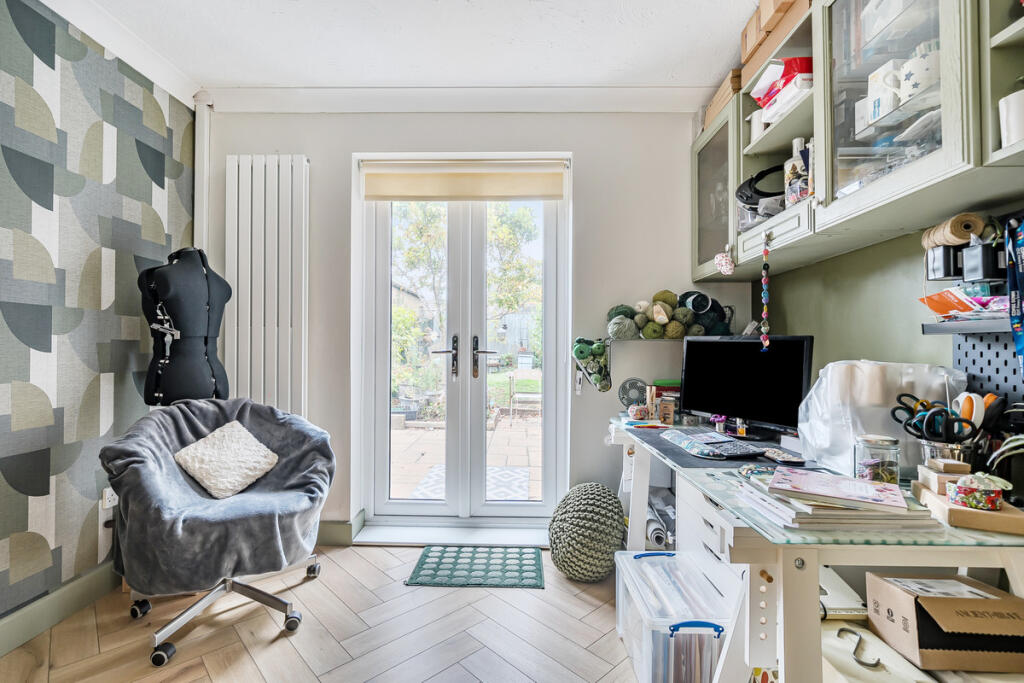
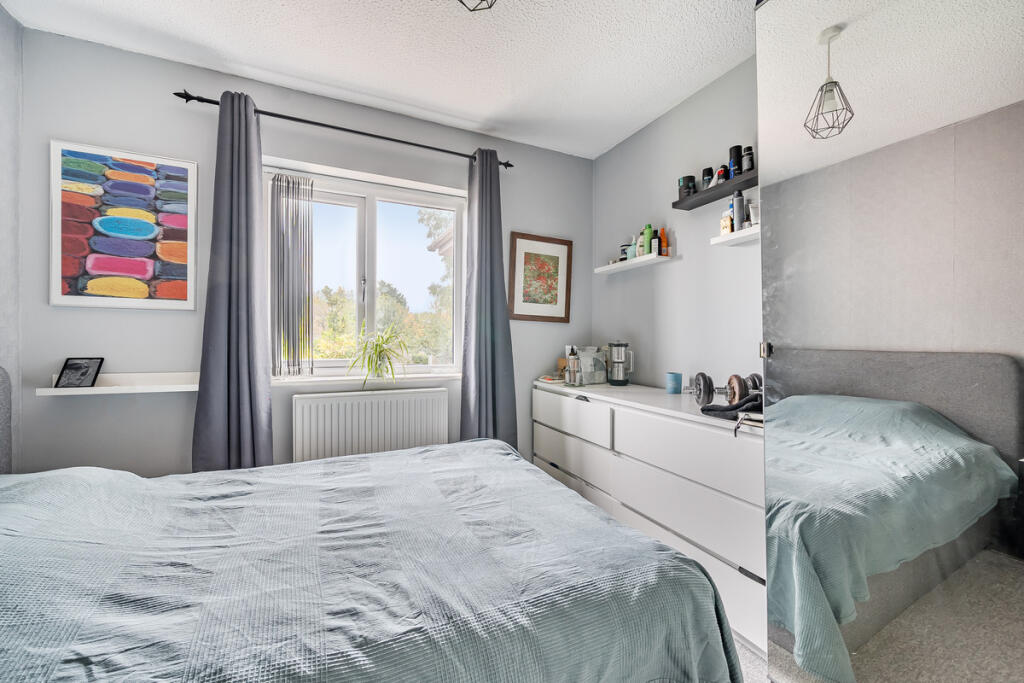
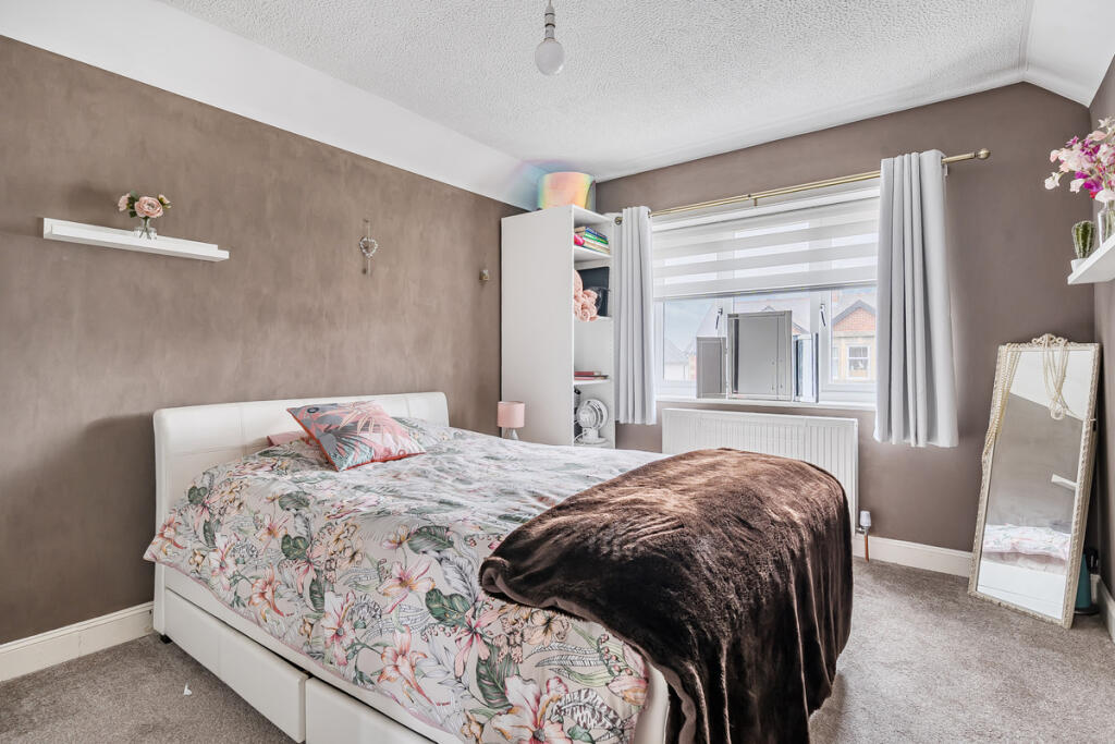
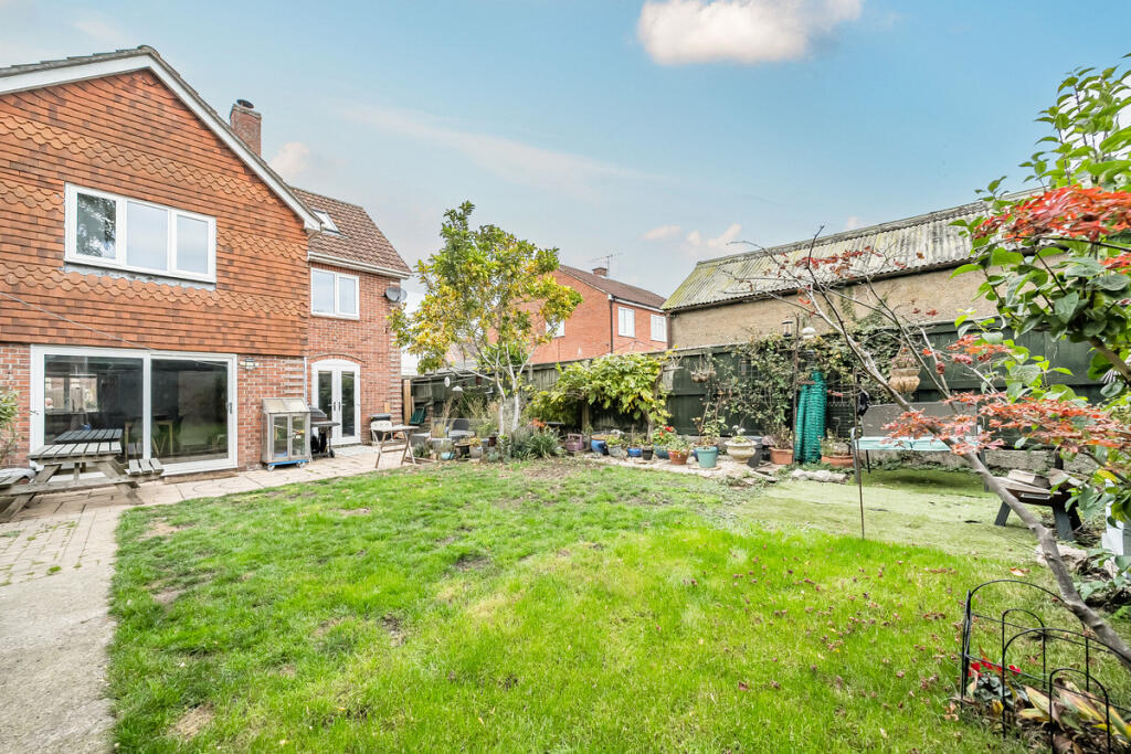
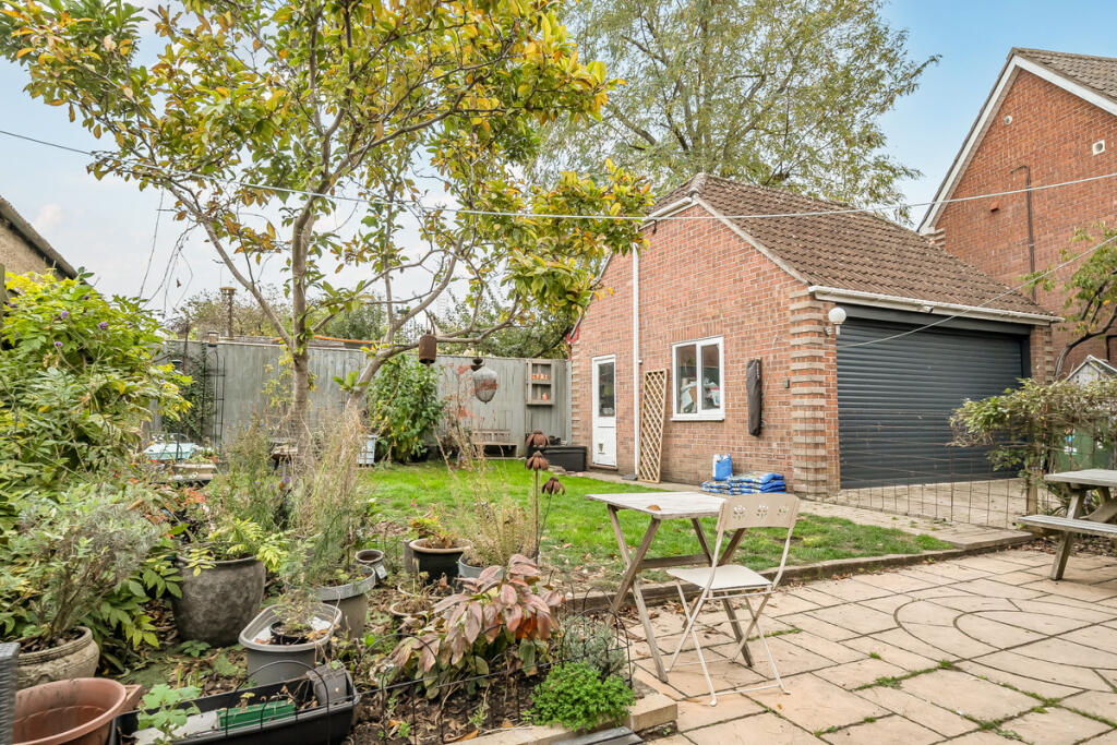
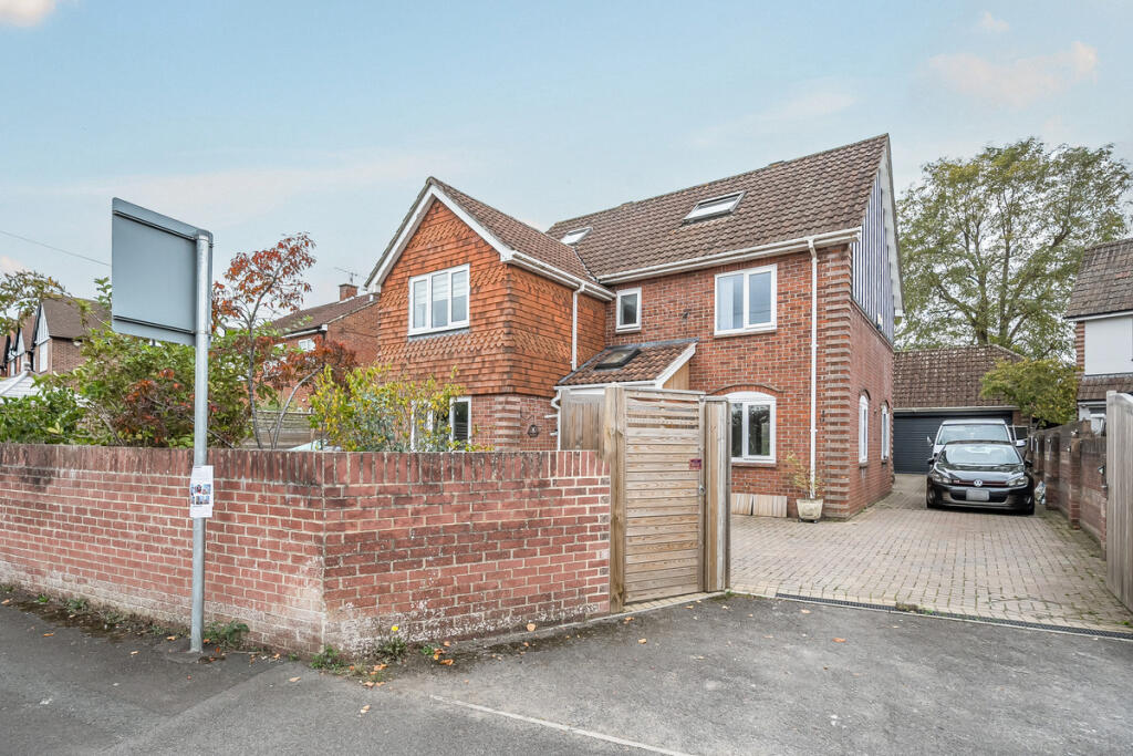
- external view modern semi-detached
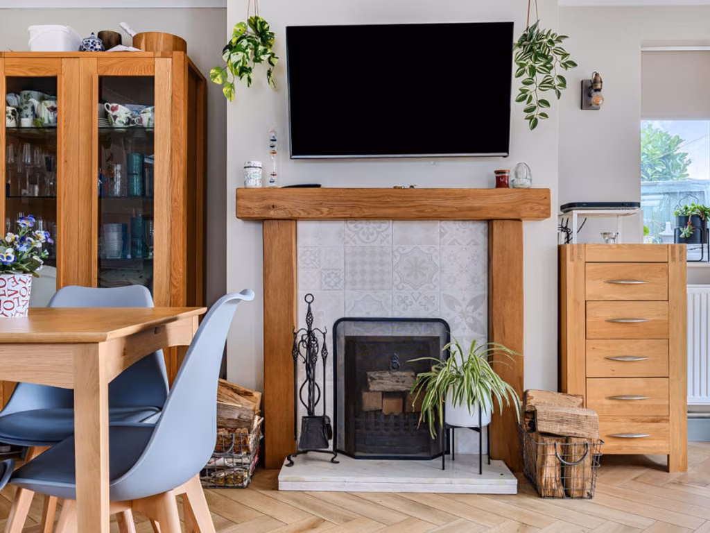
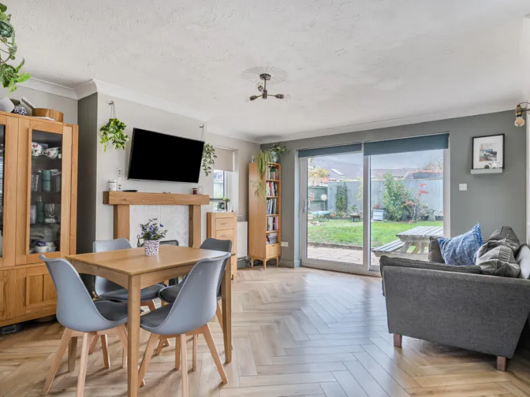
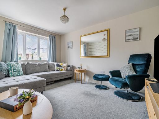
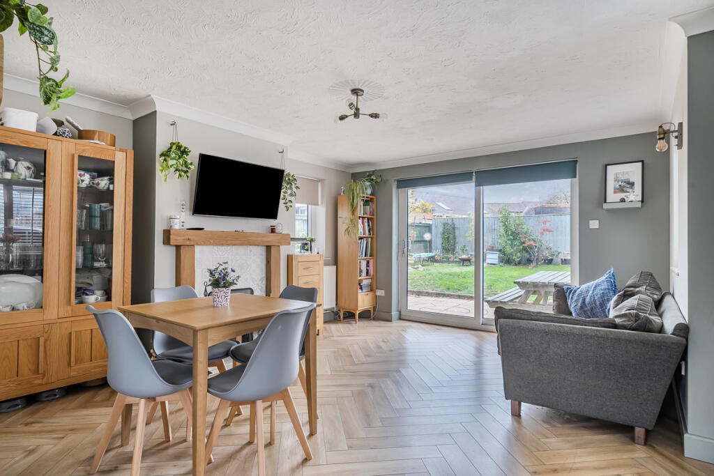
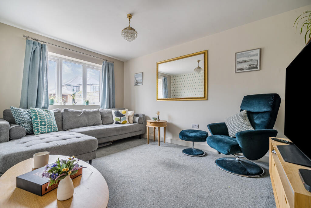
- living room modern
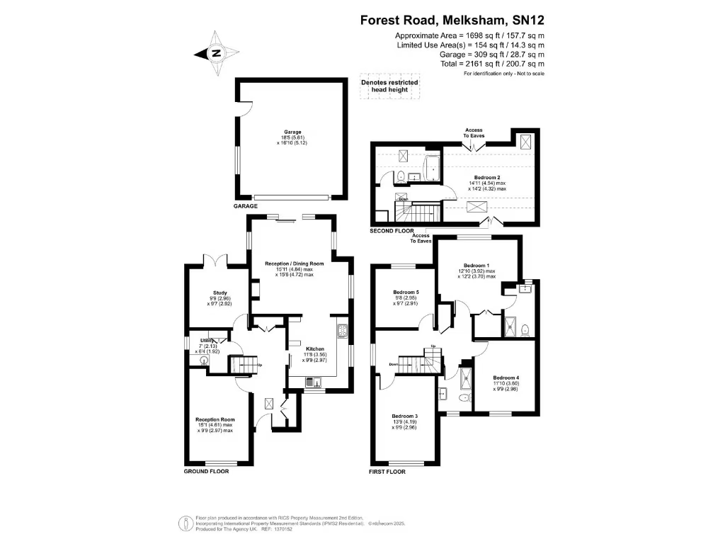
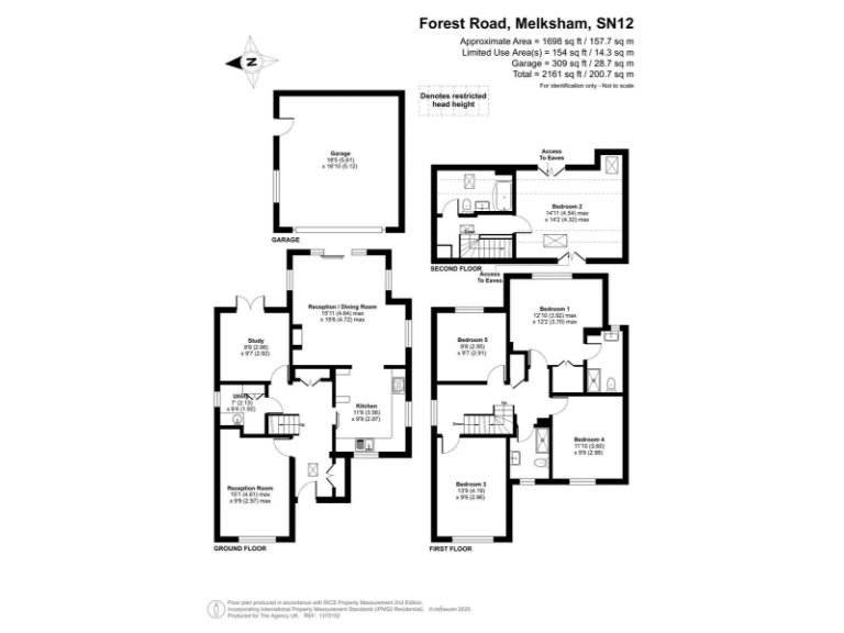
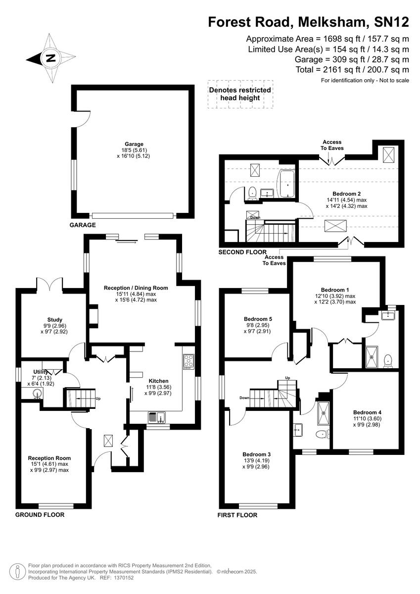
Floorplan Description
- Multi-storey house on Forest Road, Melksham
Rooms
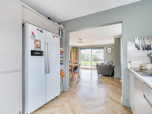
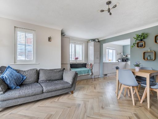
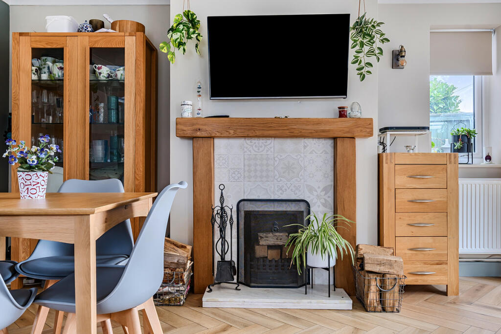
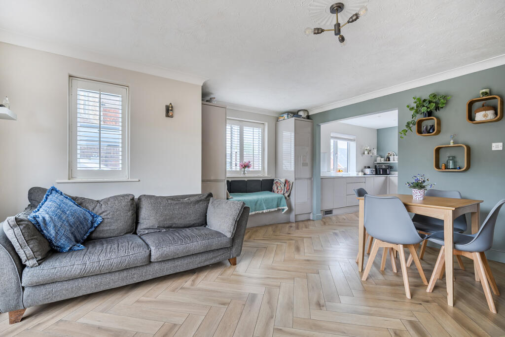
- Reception Room:
- Reception / Dining Room:
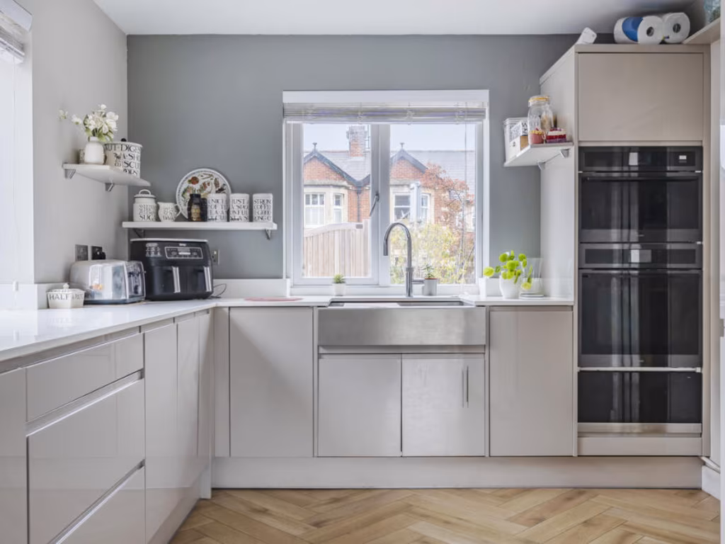
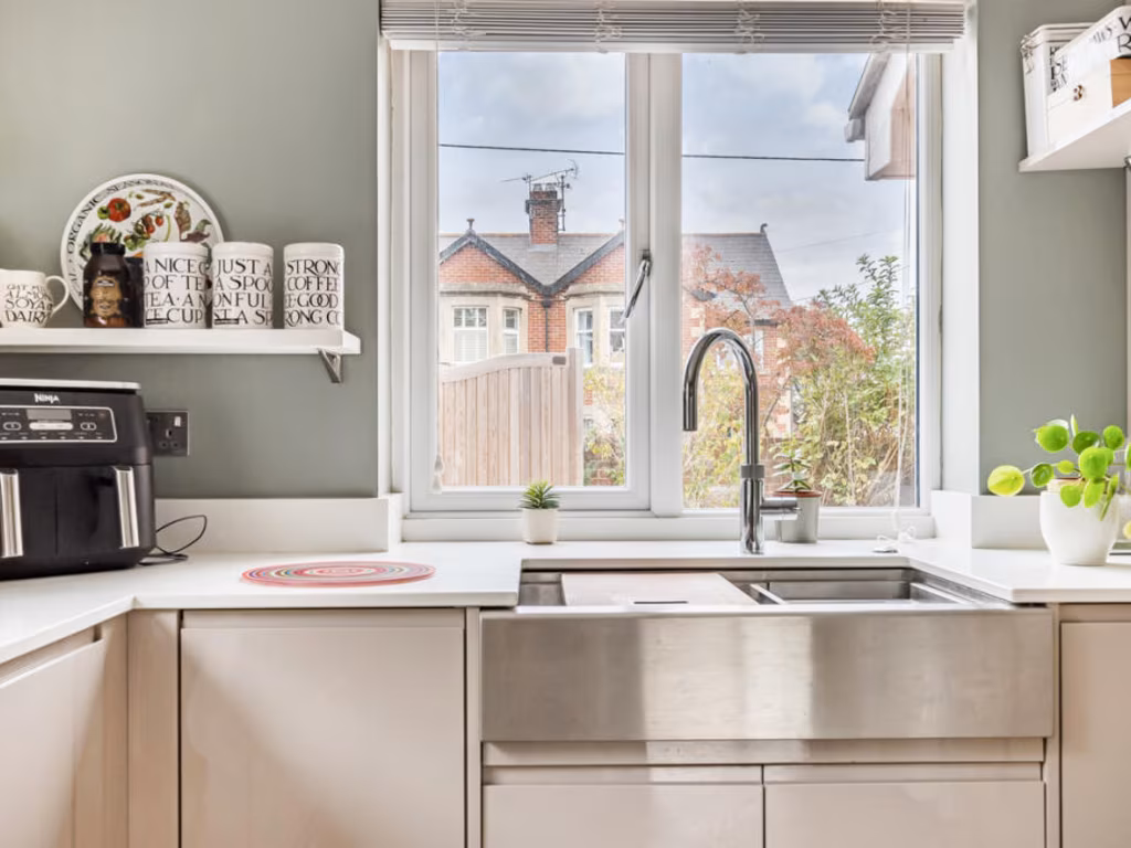
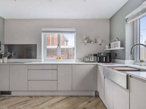
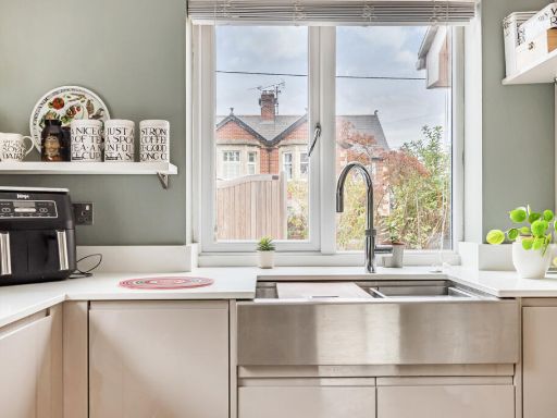
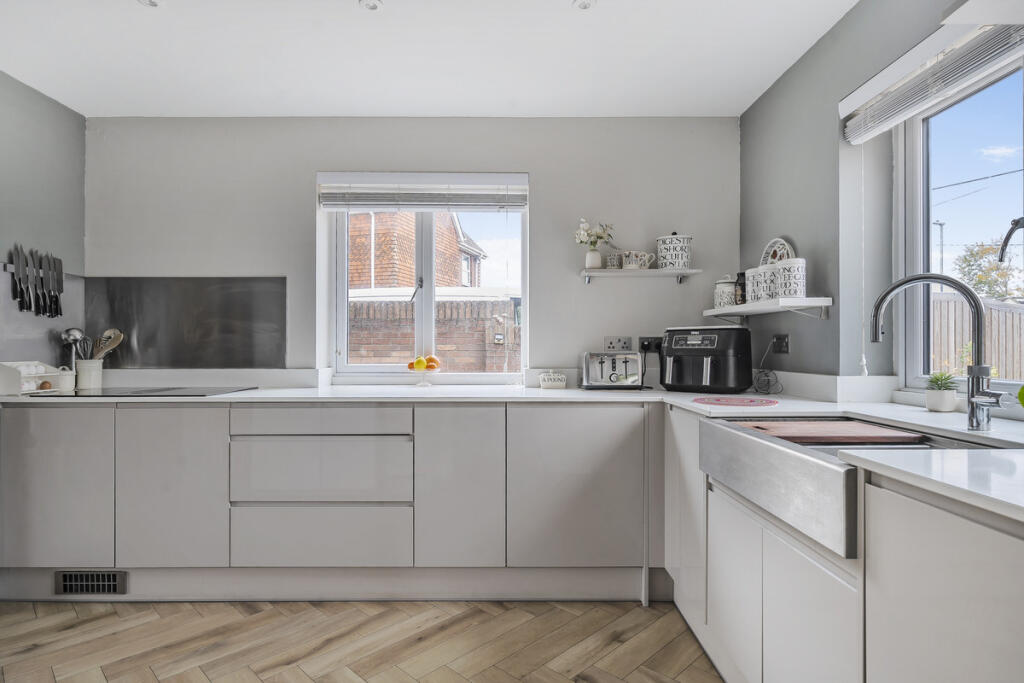
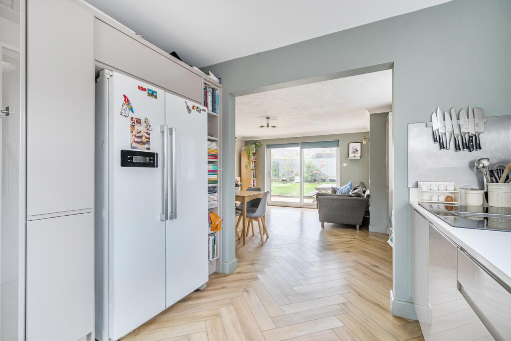
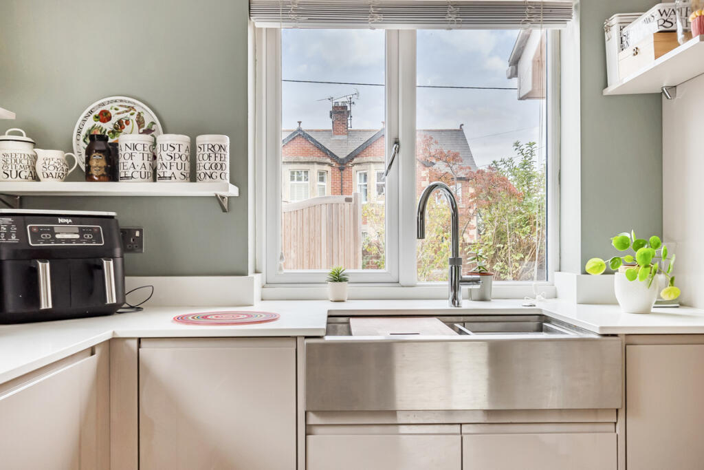
- Kitchen:
- Utility:
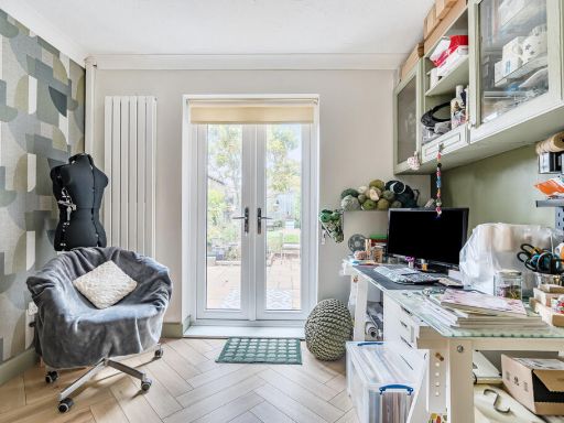
- Study:
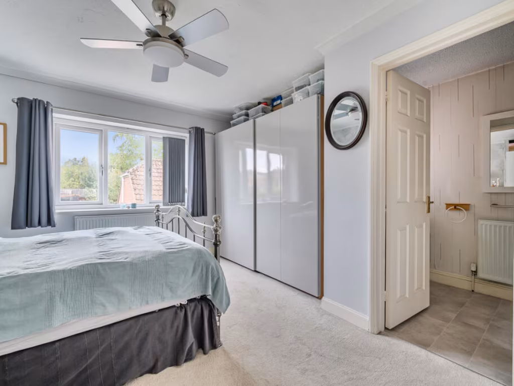
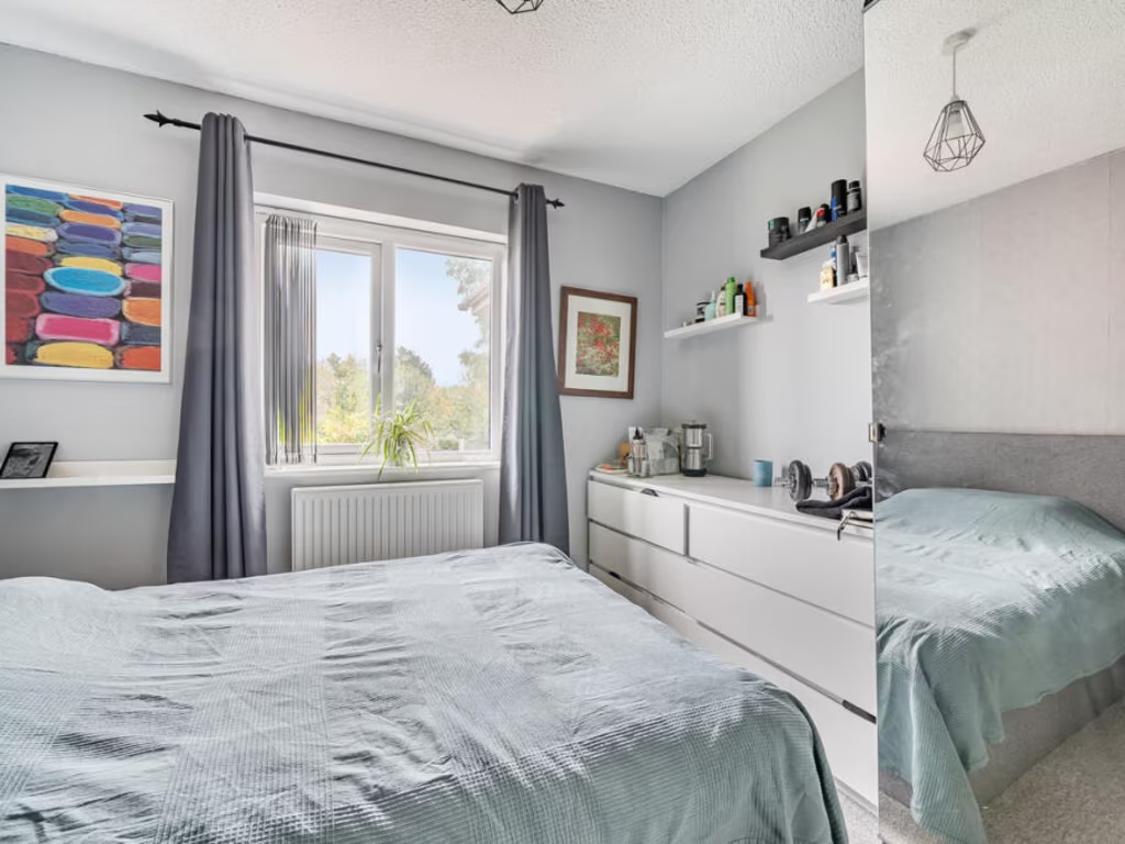
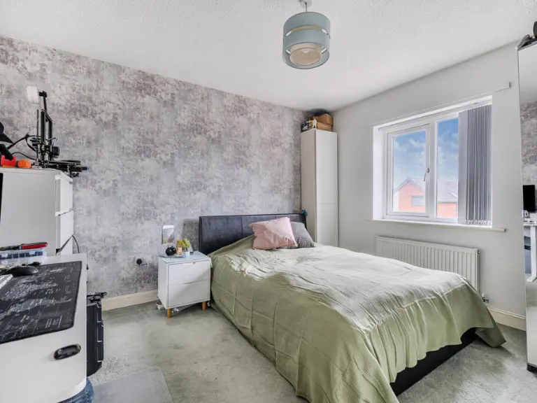
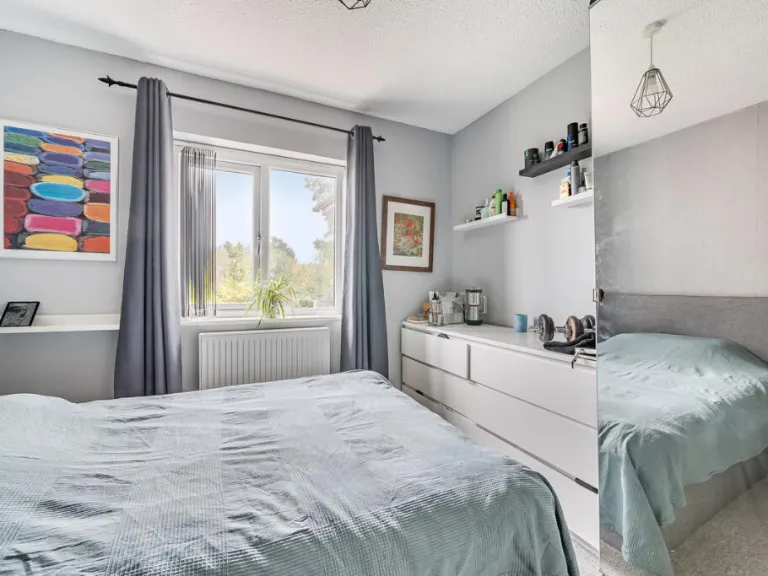
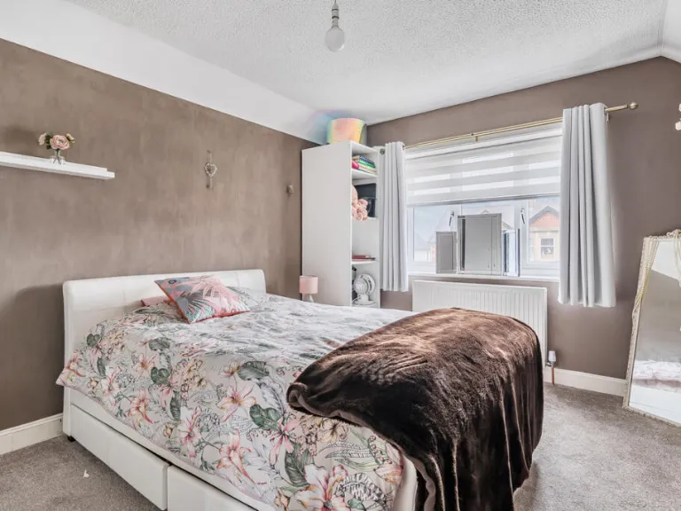
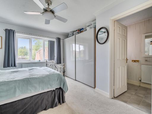
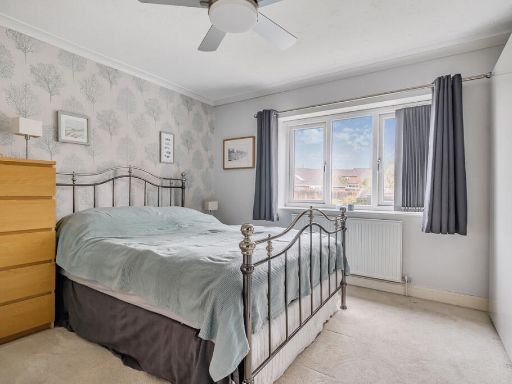
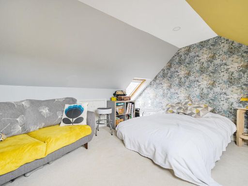
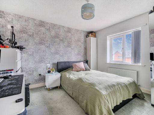
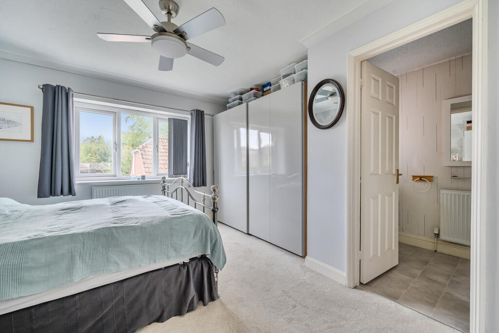
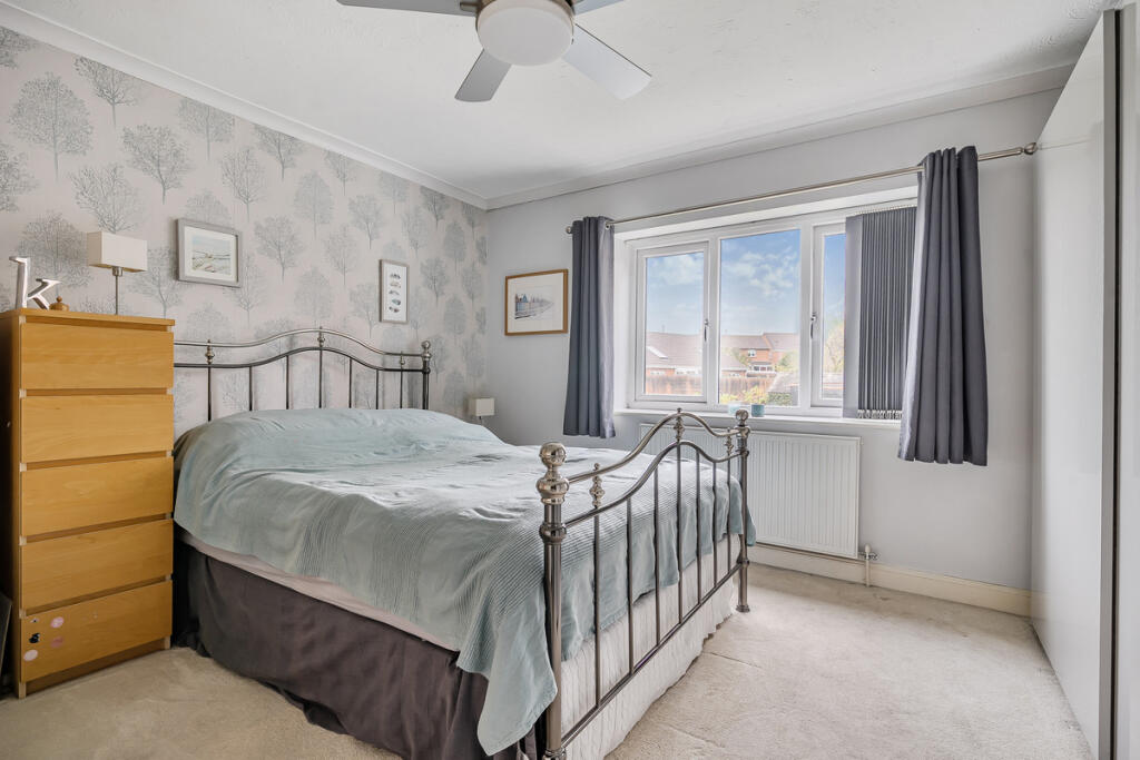
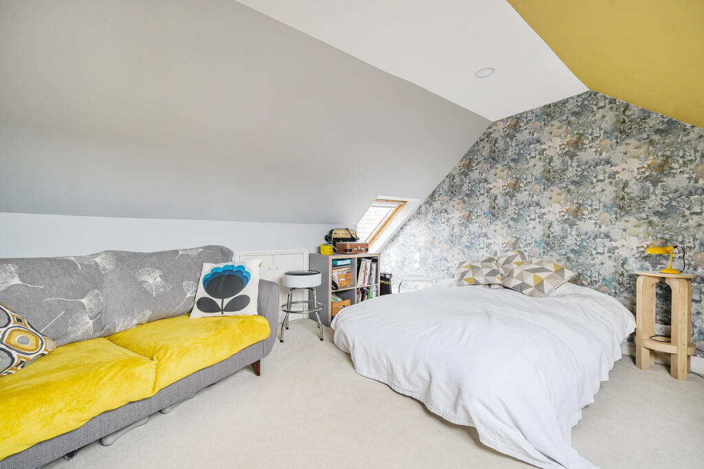
- Bedroom 1:
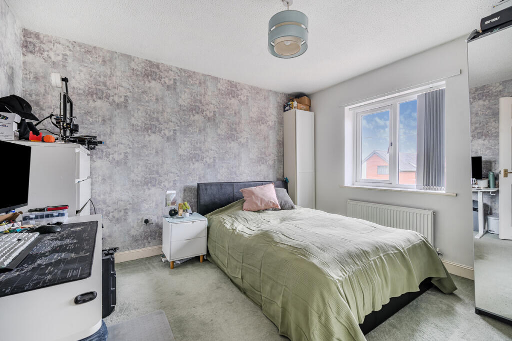
- Bedroom 3:
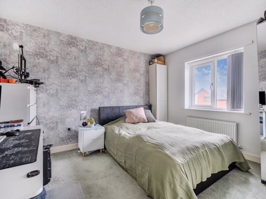
- Bedroom 4:
- Bedroom 5:
- Bedroom 2:
Textual Property Features
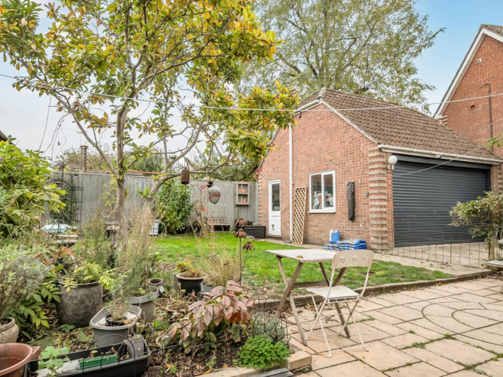
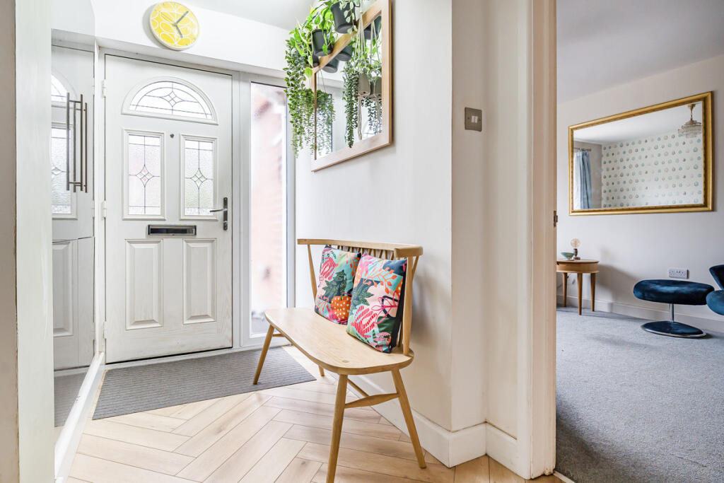
Detected Visual Features
- modern
- semi-detached
- brick
- garage
- driveway
- two-storey
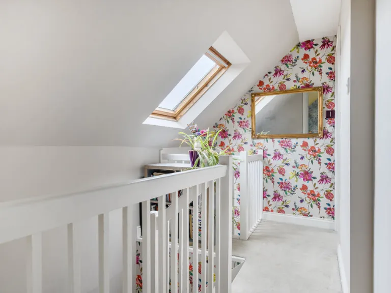
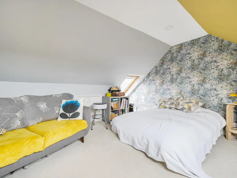
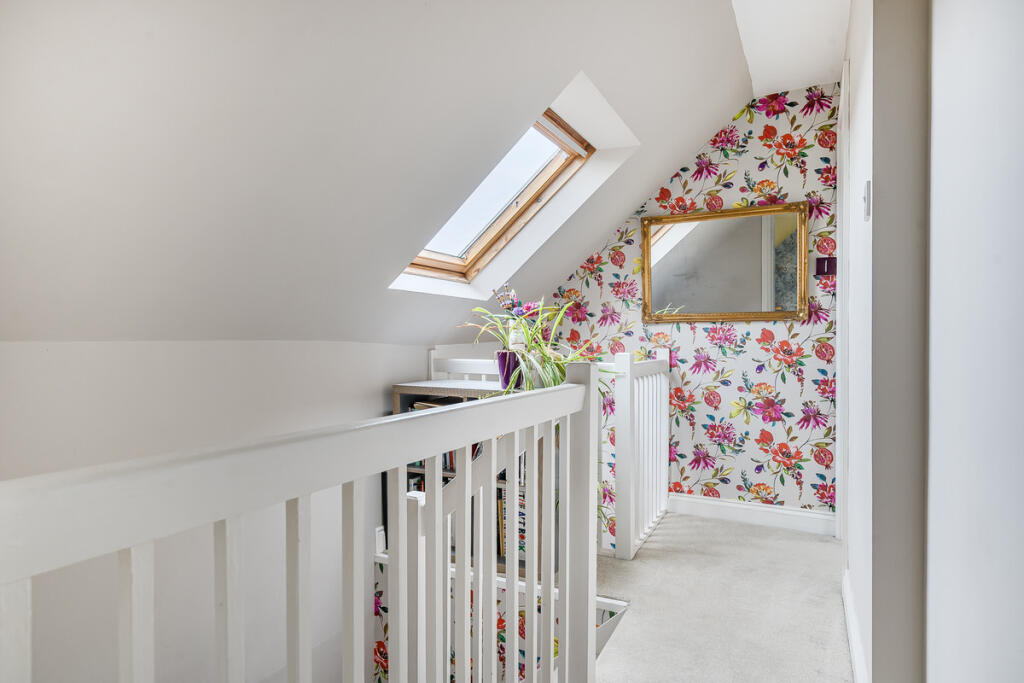
- loft conversion
- residential
- well-maintained
- family home
- open plan
- solid fireplace
- large window
- sliding doors
- wood flooring
- garden view
EPC Details
- Fully double glazed
- Cavity wall, as built, insulated (assumed)
- Boiler and radiators, mains gas
- Low energy lighting in 27% of fixed outlets
- Solid, no insulation (assumed)
Nearby Schools
- Keevil CofE Primary School
- Seend Church of England Primary School
- Bowerhill Primary School
- Melksham Oak Community School
- St Mary's Broughton Gifford Voluntary Controlled Church of England Primary School
- Shaw CE Primary School
- St Patrick's Catholic Primary School, Corsham
- Heywood Prep
- Castle Mead School
- Paxcroft Primary School
- Staverton Church of England Voluntary Controlled Primary School
- St George's Church of England Primary School, Semington
- Forest and Sandridge Church of England Primary School
- River Mead School
- Corsham Primary School
- The Mead Community Primary School
- Hilperton Church of England Voluntary Controlled Primary School
- Emmaus School
- Aloeric Primary School
- The Manor CofE VC Primary School
- Lacock Church of England Primary School
- The Corsham School
- The Corsham Regis Primary Academy
- Kings Lodge Primary School
- Holt Voluntary Controlled Primary School
- Churchfields, the Village School
Nearest Bars And Restaurants
- Id: 2150876272
- Tags:
- Amenity: pub
- Name: Grapes Inn
- TagsNormalized:
- Lat: 51.3746268
- Lon: -2.1384287
- FullGeoHash: gcnkr26yfuxf
- PartitionGeoHash: gcnk
- Images:
- FoodStandards: null
- Distance: 565.3
,- Id: 1776838960
- Tags:
- Addr:
- Housenumber: 3
- Postcode: SN12 6LL
- Street: Bath Road
- Amenity: pub
- Brand: Wetherspoon
- Internet_access: wlan
- Internet_access:fee: no
- Name: The Bear
- Source: local_knowledge
- Website: http://www.jdwetherspoon.co.uk/home/pubs/the-bear-melksham
- Wheelchair: yes
- TagsNormalized:
- Lat: 51.3749108
- Lon: -2.138618
- FullGeoHash: gcnkr2d8w9db
- PartitionGeoHash: gcnk
- Images:
- FoodStandards: null
- Distance: 556.2
,- Id: 276471384
- Tags:
- Amenity: pub
- Name: The Pig and Whistle
- Wheelchair: limited
- TagsNormalized:
- Lat: 51.3817257
- Lon: -2.1280003
- FullGeoHash: gcnkr9f2jzzu
- PartitionGeoHash: gcnk
- Images:
- FoodStandards: null
- Distance: 516.5
,- Id: 685786194
- Tags:
- Amenity: pub
- Name: The Foresters Arms
- TagsNormalized:
- Lat: 51.3771382
- Lon: -2.1249157
- FullGeoHash: gcnkr8uttbsp
- PartitionGeoHash: gcnk
- Images:
- FoodStandards: null
- Distance: 509.7
,- Id: 276502063
- Tags:
- Addr:
- City: Melksham
- Housename: Lowbourne ricket Club
- Postcode: SN12 7ED
- Street: Lowbourne
- Amenity: cafe
- Building: yes
- Building:levels: 1
- Name: Lowbourne Cricket Club
- Outdoor_seating: yes
- TagsNormalized:
- Lat: 51.3772198
- Lon: -2.1346164
- FullGeoHash: gcnkr2vtgzft
- PartitionGeoHash: gcnk
- Images:
- FoodStandards: null
- Distance: 185.2
}
Nearest General Shops
- Id: 6303599422
- Tags:
- Addr:
- City: Melksham
- Housenumber: 25-27
- Postcode: SN12 8BS
- Street: New Broughton Road
- Name: Autotech Melksham
- Shop: car_repair
- TagsNormalized:
- Lat: 51.376128
- Lon: -2.1426565
- FullGeoHash: gcnkr0xz8krt
- PartitionGeoHash: gcnk
- Images:
- FoodStandards: null
- Distance: 753.8
,- Id: 130789077
- Tags:
- Building: yes
- Name: Melksham Cycle Centre
- Shop: bicycle
- TagsNormalized:
- Lat: 51.3775721
- Lon: -2.1412936
- FullGeoHash: gcnkr30b01xg
- PartitionGeoHash: gcnk
- Images:
- FoodStandards: null
- Distance: 634.6
,- Id: 685786283
- Tags:
- TagsNormalized:
- Lat: 51.3805945
- Lon: -2.1286072
- FullGeoHash: gcnkr99cxv52
- PartitionGeoHash: gcnk
- Images:
- FoodStandards: null
- Distance: 390.3
}
Nearest Supermarkets
- Id: 277289888
- Tags:
- Brand: Sainsbury's
- Brand:wikidata: Q152096
- Brand:wikipedia: en:Sainsbury's
- Building: retail
- Name: Sainsbury's
- Shop: supermarket
- TagsNormalized:
- sainsburys
- retail
- supermarket
- shop
- Lat: 51.374622
- Lon: -2.1406989
- FullGeoHash: gcnkr23ny5ej
- PartitionGeoHash: gcnk
- Images:
- FoodStandards: null
- Distance: 694.2
,- Id: 168712029
- Tags:
- Addr:
- Country: GB
- Postcode: SN12 8AB
- Street: Bath Road
- Brand: Lidl
- Brand:wikidata: Q151954
- Brand:wikipedia: en:Lidl
- Building: yes
- Building:levels: 1
- Fhrs:
- Name: Lidl
- Opening_hours: Mo-Sa 08:00-22:00; Su 10:00-16:00
- Shop: supermarket
- Website: https://www.lidl.co.uk/
- Wheelchair: yes
- TagsNormalized:
- Lat: 51.3769693
- Lon: -2.141044
- FullGeoHash: gcnkr2buw11z
- PartitionGeoHash: gcnk
- Images:
- FoodStandards:
- Id: 630588
- FHRSID: 630588
- LocalAuthorityBusinessID: PI/000218181
- BusinessName: Lidl Great Britain Ltd
- BusinessType: Retailers - supermarkets/hypermarkets
- BusinessTypeID: 7840
- AddressLine1: Lidl
- AddressLine2: Bath Road
- AddressLine3: Melksham
- AddressLine4: Wiltshire
- PostCode: SN12 8AB
- RatingValue: 5
- RatingKey: fhrs_5_en-GB
- RatingDate: 2022-06-22
- LocalAuthorityCode: 709
- LocalAuthorityName: Wiltshire
- LocalAuthorityWebSite: http://www.wiltshire.gov.uk
- LocalAuthorityEmailAddress: publicprotectionwest@wiltshire.gov.uk
- Scores:
- Hygiene: 0
- Structural: 0
- ConfidenceInManagement: 0
- NewRatingPending: false
- Geocode:
- Longitude: -2.14126801490784
- Latitude: 51.37734222412110
- Distance: 624.6
,- Id: 1237890239
- Tags:
- Addr:
- Postcode: SN12 6LP
- Street: Bath Road
- Brand: Waitrose
- Brand:wikidata: Q771734
- Brand:wikipedia: en:Waitrose
- Name: Waitrose
- Official_name: Waitrose & Partners
- Opening_hours: Mo-Sa 08:00-20:00; Su 10:00-16:00
- Operator: Waitrose & Partners
- Phone: +44 1225 709294
- Shop: supermarket
- Website: https://www.waitrose.com/
- Wheelchair: yes
- TagsNormalized:
- Lat: 51.3753737
- Lon: -2.1382305
- FullGeoHash: gcnkr2dgpxgc
- PartitionGeoHash: gcnk
- Images:
- FoodStandards: null
- Distance: 504.7
}
Nearest Religious buildings
- Id: 685786362
- Tags:
- Amenity: community_centre
- Name: Saint Andrews Church Village Hall
- TagsNormalized:
- community centre
- church
- village hall
- Lat: 51.3794801
- Lon: -2.1255621
- FullGeoHash: gcnkr9k5nv61
- PartitionGeoHash: gcnk
- Images:
- FoodStandards: null
- Distance: 491.7
,- Id: 536409901
- Tags:
- Amenity: place_of_worship
- Building: church
- Denomination: anglican
- Name: St Andrew
- Religion: christian
- Wikidata: Q26574735
- TagsNormalized:
- place of worship
- church
- anglican
- christian
- Lat: 51.3790426
- Lon: -2.1256294
- FullGeoHash: gcnkr9k0t5xz
- PartitionGeoHash: gcnk
- Images:
- FoodStandards: null
- Distance: 471.7
,- Id: 902302750
- Tags:
- Amenity: place_of_worship
- Name: Ebenezer Baptist Church
- Religion: christian
- Source: OS OpenData StreetView
- Wikidata: Q2013904
- Wikipedia: en:Ebenezer Chapel, Melksham
- TagsNormalized:
- place of worship
- baptist
- church
- christian
- Lat: 51.3752825
- Lon: -2.1375385
- FullGeoHash: gcnkr2e6xwzc
- PartitionGeoHash: gcnk
- Images:
- FoodStandards: null
- Distance: 471.5
}
Nearest Medical buildings
- Id: 475846272
- Tags:
- Amenity: doctors
- Building: yes
- Healthcare: doctor
- Name: St Damian's Surgery
- TagsNormalized:
- doctor
- doctors
- health
- healthcare
- surgery
- Lat: 51.3673119
- Lon: -2.1323624
- FullGeoHash: gcnkprpk22gq
- PartitionGeoHash: gcnk
- Images:
- FoodStandards: null
- Distance: 1174.7
,- Id: 475846271
- Tags:
- Amenity: doctors
- Building: yes
- Healthcare: doctor
- Name: Giffords Surgery
- TagsNormalized:
- doctor
- doctors
- health
- healthcare
- surgery
- Lat: 51.3676713
- Lon: -2.1305555
- FullGeoHash: gcnkpx0w67yw
- PartitionGeoHash: gcnk
- Images:
- FoodStandards: null
- Distance: 1140.1
,- Id: 7494057756
- Tags:
- Amenity: pharmacy
- Brand: Asda
- Brand:wikidata: Q297410
- Brand:wikipedia: en:Asda
- Contact:
- Phone: +44 1225 491400
- Website: https://storelocator.asda.com/south-west/melksham/bradford-road/pharmacy
- Fixme: Location not accurate
- Opening_hours:
- Covid19: Mo-Th, Sa 08:00-22:00; Fr 09:00-18:00; Su 10:00-16:00
- Operator: Asda Stores Ltd
- TagsNormalized:
- Lat: 51.3759227
- Lon: -2.1457028
- FullGeoHash: gcnkr0tw3w0h
- PartitionGeoHash: gcnk
- Images:
- FoodStandards: null
- Distance: 964.5
,- Id: 1408478810
- Tags:
- Amenity: pharmacy
- Dispensing: yes
- Healthcare: pharmacy
- Name: Sainsbury's Pharmacy
- Opening_hours: Mo-Sa 07:00-23:00
- Wheelchair: yes
- TagsNormalized:
- pharmacy
- health
- healthcare
- sainsburys
- Lat: 51.3748563
- Lon: -2.1403794
- FullGeoHash: gcnkr292jx37
- PartitionGeoHash: gcnk
- Images:
- FoodStandards: null
- Distance: 661.8
}
Nearest Airports
- Id: 47483196
- Tags:
- Aerodrome: international
- Aeroway: aerodrome
- Iata: BRS
- Icao: EGGD
- Internet_access: wlan
- Internet_access:fee: no
- Name: Bristol Airport
- Type: public
- Website: https://www.bristolairport.co.uk/
- Wikidata: Q8725
- Wikipedia: en:Bristol Airport
- TagsNormalized:
- airport
- international airport
- Lat: 51.3830799
- Lon: -2.7186615
- FullGeoHash: gcnh64h24s74
- PartitionGeoHash: gcnh
- Images:
- FoodStandards: null
- Distance: 40708.1
}
Nearest Leisure Facilities
- Id: 396407336
- Tags:
- TagsNormalized:
- Lat: 51.3777633
- Lon: -2.134751
- FullGeoHash: gcnkr3j90tnr
- PartitionGeoHash: gcnk
- Images:
- FoodStandards: null
- Distance: 180
,- Id: 849306753
- Tags:
- Access: private
- Garden:
- Leisure: garden
- TagsNormalized:
- Lat: 51.3770792
- Lon: -2.1335387
- FullGeoHash: gcnkr2ymhvwp
- PartitionGeoHash: gcnk
- Images:
- FoodStandards: null
- Distance: 130.2
,- Id: 396407335
- Tags:
- TagsNormalized:
- Lat: 51.377515
- Lon: -2.133892
- FullGeoHash: gcnkr2ypswyy
- PartitionGeoHash: gcnk
- Images:
- FoodStandards: null
- Distance: 126.5
,- Id: 57736237
- Tags:
- Leisure: park
- Surface: grass
- TagsNormalized:
- Lat: 51.3776219
- Lon: -2.1305383
- FullGeoHash: gcnkr9086fgk
- PartitionGeoHash: gcnk
- Images:
- FoodStandards: null
- Distance: 116.3
,- Id: 849306756
- Tags:
- Access: private
- Garden:
- Leisure: garden
- TagsNormalized:
- Lat: 51.3772958
- Lon: -2.1333771
- FullGeoHash: gcnkr2yw2wne
- PartitionGeoHash: gcnk
- Images:
- FoodStandards: null
- Distance: 106.1
}
Nearest Tourist attractions
- Id: 342028519
- Tags:
- Name: Piccadilly Caravan Park
- Source: ACSI
- Tourism: camp_site
- Website: https://www.piccadillylacock.co.uk/
- TagsNormalized:
- Lat: 51.4130218
- Lon: -2.129748
- FullGeoHash: gcnkrx3nt3bv
- PartitionGeoHash: gcnk
- Images:
- FoodStandards: null
- Distance: 3911.7
,- Id: 474831191
- Tags:
- TagsNormalized:
- Lat: 51.346964
- Lon: -2.1486859
- FullGeoHash: gcnkp57mezze
- PartitionGeoHash: gcnk
- Images:
- FoodStandards: null
- Distance: 3623.6
,- Id: 168582498
- Tags:
- Access: yes
- Name: Bowerhill Community Picnic Area
- Tourism: picnic_site
- TagsNormalized:
- Lat: 51.3498699
- Lon: -2.116867
- FullGeoHash: gcnkpgfw9mt9
- PartitionGeoHash: gcnk
- Images:
- FoodStandards: null
- Distance: 3290.2
}
Nearest Bus stations and stops
- Id: 5549828485
- Tags:
- Bench: no
- Bin: no
- Bus: yes
- Highway: bus_stop
- Public_transport: platform
- Shelter: no
- TagsNormalized:
- Lat: 51.3601001
- Lon: -2.1190329
- FullGeoHash: gcnkpvbfqbwd
- PartitionGeoHash: gcnk
- Images:
- FoodStandards: null
- Distance: 2176.6
,- Id: 4840570127
- Tags:
- Bus: yes
- Highway: bus_stop
- Lit: yes
- Public_transport: platform
- Shelter: yes
- TagsNormalized:
- Lat: 51.3657685
- Lon: -2.140923
- FullGeoHash: gcnkpqc52ck0
- PartitionGeoHash: gcnk
- Images:
- FoodStandards: null
- Distance: 1477.2
,- Id: 7402516916
- Tags:
- Bus: yes
- Departures_board: timetable
- Highway: bus_stop
- Public_transport: platform
- Shelter: yes
- TagsNormalized:
- Lat: 51.3669817
- Lon: -2.1285052
- FullGeoHash: gcnkpx4465rm
- PartitionGeoHash: gcnk
- Images:
- FoodStandards: null
- Distance: 1237.7
,- Id: 5951393387
- Tags:
- Bench: yes
- Highway: bus_stop
- Name: Roundponds
- Public_transport: platform
- Shelter: yes
- Wheelchair: yes
- TagsNormalized:
- Lat: 51.3797054
- Lon: -2.1478799
- FullGeoHash: gcnkr17uqz29
- PartitionGeoHash: gcnk
- Images:
- FoodStandards: null
- Distance: 1109.6
,- Id: 3542549341
- Tags:
- Bus: yes
- Highway: bus_stop
- Name: Market Place
- Public_transport: platform
- Shelter: yes
- TagsNormalized:
- Lat: 51.3719167
- Lon: -2.1384924
- FullGeoHash: gcnkprfz1e27
- PartitionGeoHash: gcnk
- Images:
- FoodStandards: null
- Distance: 795
}
Nearest Hotels
- Id: 1386208020
- Tags:
- Addr:
- Housename: Beechfield House
- Postcode: SN12 7PU
- Street: Beanacre Road
- Fhrs:
- Name: Beechfield House Hotel
- Tourism: hotel
- TagsNormalized:
- Lat: 51.3899959
- Lon: -2.1401827
- FullGeoHash: gcnkr7386js4
- PartitionGeoHash: gcnk
- Images:
- FoodStandards: null
- Distance: 1458.1
,- Id: 348029836
- Tags:
- Name: Wellhouse Manor
- Tourism: hotel
- TagsNormalized:
- Lat: 51.3689502
- Lon: -2.1337332
- FullGeoHash: gcnkprqmb6m5
- PartitionGeoHash: gcnk
- Images:
- FoodStandards: null
- Distance: 998.4
,- Id: 1698026001
- Tags:
- Addr:
- Housenumber: 20
- Postcode: SN12 6EX
- Street: Market Place
- Amenity: pub
- Name: The kings Arms Hotel
- Source: local_knowledge
- Website: https://www.kingsarmsmelksham.co.uk/
- Wheelchair: limited
- TagsNormalized:
- Lat: 51.3716662
- Lon: -2.1379952
- FullGeoHash: gcnkprgjthej
- PartitionGeoHash: gcnk
- Images:
- FoodStandards: null
- Distance: 800.4
}
Tags
- modern
- semi-detached
- brick
- garage
- driveway
- two-storey
- loft conversion
- residential
- well-maintained
- garage
- family home
- modern
- open plan
- solid fireplace
- large window
- sliding doors
- wood flooring
- garden view
Local Market Stats
- Average Price/sqft: £297
- Avg Income: £47300
- Rental Yield: 3.8%
- Social Housing: 9%
- Planning Success Rate: 93%
Similar Properties
 4 bedroom detached house for sale in Skylark Road, Melksham, SN12 — £450,000 • 4 bed • 2 bath • 1575 ft²
 5 bedroom end of terrace house for sale in Ferris Grove, Melksham, SN12 — £325,000 • 5 bed • 2 bath • 1558 ft²
 4 bedroom detached house for sale in The Bramblings, Melksham, Wiltshire, SN12 — £490,000 • 4 bed • 2 bath • 1572 ft²
 5 bedroom detached house for sale in Teachers Way, Melksham, SN12 — £435,000 • 5 bed • 2 bath • 1486 ft²
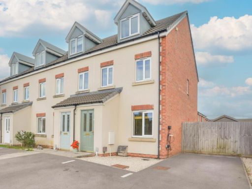 3 bedroom town house for sale in College Row, Melksham, Wiltshire, SN12 — £280,000 • 3 bed • 2 bath • 981 ft²
 4 bedroom detached house for sale in Cranesbill Road, Melksham, Wiltshire, SN12 7GG, SN12 — £500,000 • 4 bed • 2 bath • 1323 ft²
Meta
- {
"@context": "https://schema.org",
"@type": "Residence",
"name": "5 bedroom detached house for sale in Forest Road, Melksham,…",
"description": "",
"url": "https://propertypiper.co.uk/property/ad43ee71-cccf-4796-80fa-dace10da3bb1",
"image": "https://image-a.propertypiper.co.uk/31ac7c2d-dbac-4067-b7dc-4832fbafb800-1024.jpeg",
"address": {
"@type": "PostalAddress",
"streetAddress": "6 FOREST ROAD MELKSHAM",
"postalCode": "SN12 7AA",
"addressLocality": "Wiltshire",
"addressRegion": "Chippenham",
"addressCountry": "England"
},
"geo": {
"@type": "GeoCoordinates",
"latitude": 51.377875620362964,
"longitude": -2.1321632713448224
},
"numberOfRooms": 5,
"numberOfBathroomsTotal": 3,
"floorSize": {
"@type": "QuantitativeValue",
"value": 1698,
"unitCode": "FTK"
},
"offers": {
"@type": "Offer",
"price": 525000,
"priceCurrency": "GBP",
"availability": "https://schema.org/InStock"
},
"additionalProperty": [
{
"@type": "PropertyValue",
"name": "Feature",
"value": "modern"
},
{
"@type": "PropertyValue",
"name": "Feature",
"value": "semi-detached"
},
{
"@type": "PropertyValue",
"name": "Feature",
"value": "brick"
},
{
"@type": "PropertyValue",
"name": "Feature",
"value": "garage"
},
{
"@type": "PropertyValue",
"name": "Feature",
"value": "driveway"
},
{
"@type": "PropertyValue",
"name": "Feature",
"value": "two-storey"
},
{
"@type": "PropertyValue",
"name": "Feature",
"value": "loft conversion"
},
{
"@type": "PropertyValue",
"name": "Feature",
"value": "residential"
},
{
"@type": "PropertyValue",
"name": "Feature",
"value": "well-maintained"
},
{
"@type": "PropertyValue",
"name": "Feature",
"value": "garage"
},
{
"@type": "PropertyValue",
"name": "Feature",
"value": "family home"
},
{
"@type": "PropertyValue",
"name": "Feature",
"value": "modern"
},
{
"@type": "PropertyValue",
"name": "Feature",
"value": "open plan"
},
{
"@type": "PropertyValue",
"name": "Feature",
"value": "solid fireplace"
},
{
"@type": "PropertyValue",
"name": "Feature",
"value": "large window"
},
{
"@type": "PropertyValue",
"name": "Feature",
"value": "sliding doors"
},
{
"@type": "PropertyValue",
"name": "Feature",
"value": "wood flooring"
},
{
"@type": "PropertyValue",
"name": "Feature",
"value": "garden view"
}
]
}
High Res Floorplan Images
Compatible Floorplan Images
FloorplanImages Thumbnail