SM3 8DR - 2 bedroom apartment for sale in Whyte Mews, Anne Boleyn�…
View on Property Piper
2 bedroom apartment for sale in Whyte Mews, Anne Boleyn's Walk, Cheam, Sutton, SM3
Property Details
- Price: £500000
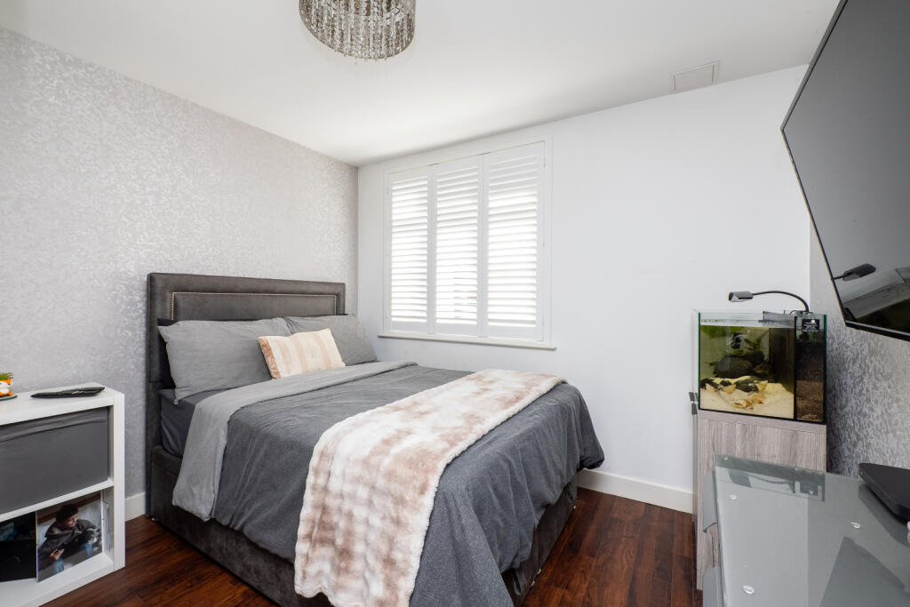
- Bedrooms: 2
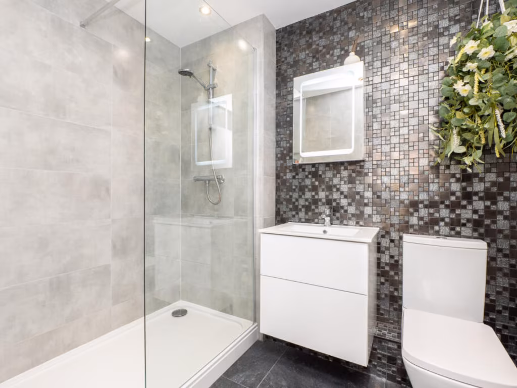
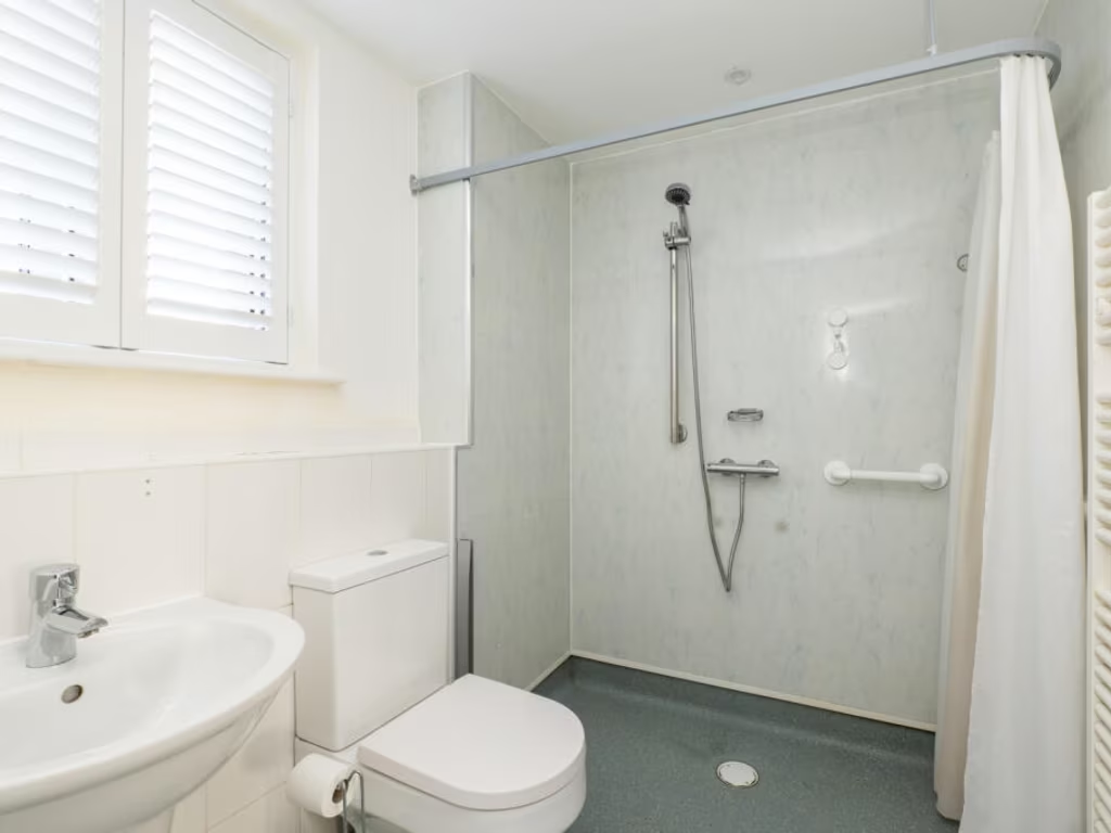
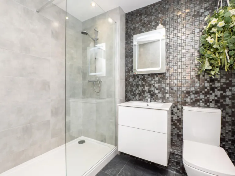
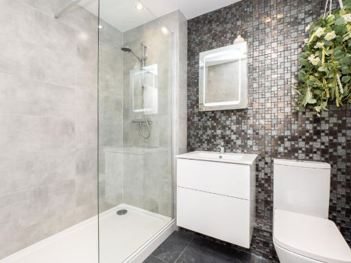
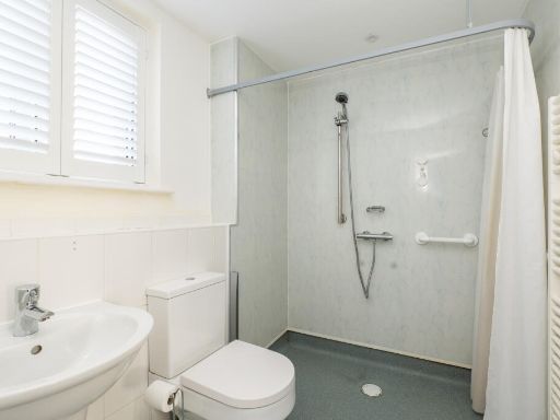
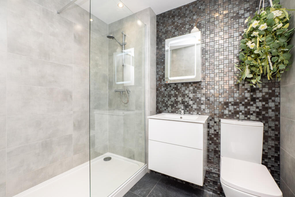
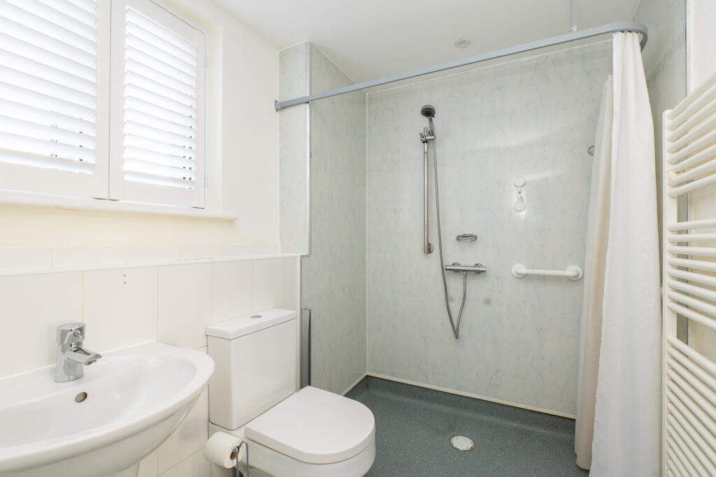
- Bathrooms: 2
- Property Type: undefined
- Property SubType: undefined
Brochure Descriptions
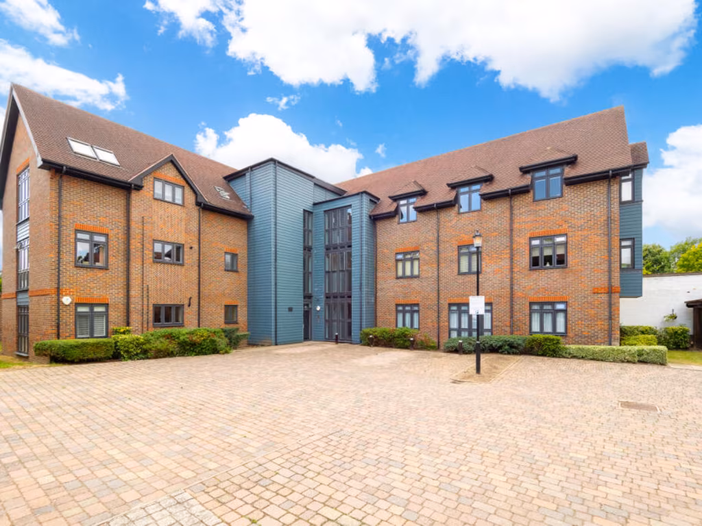
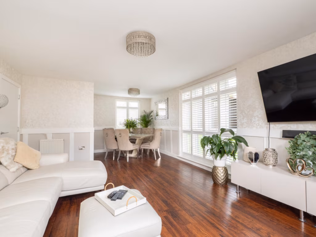
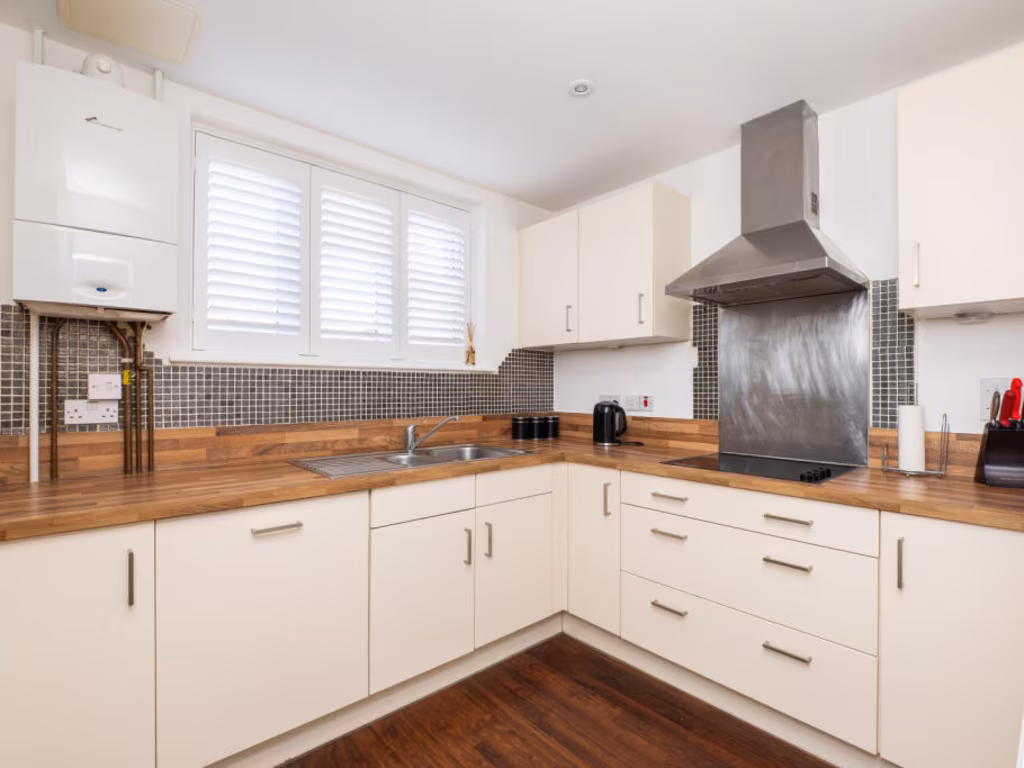
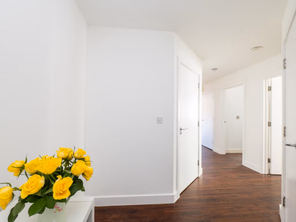
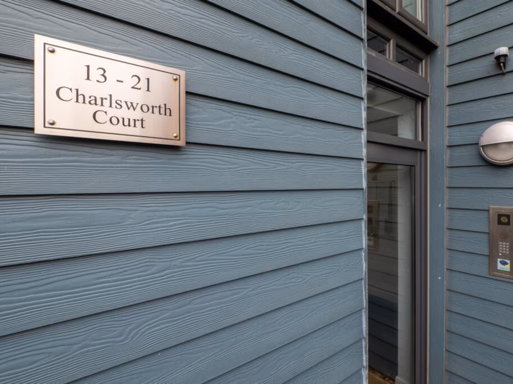
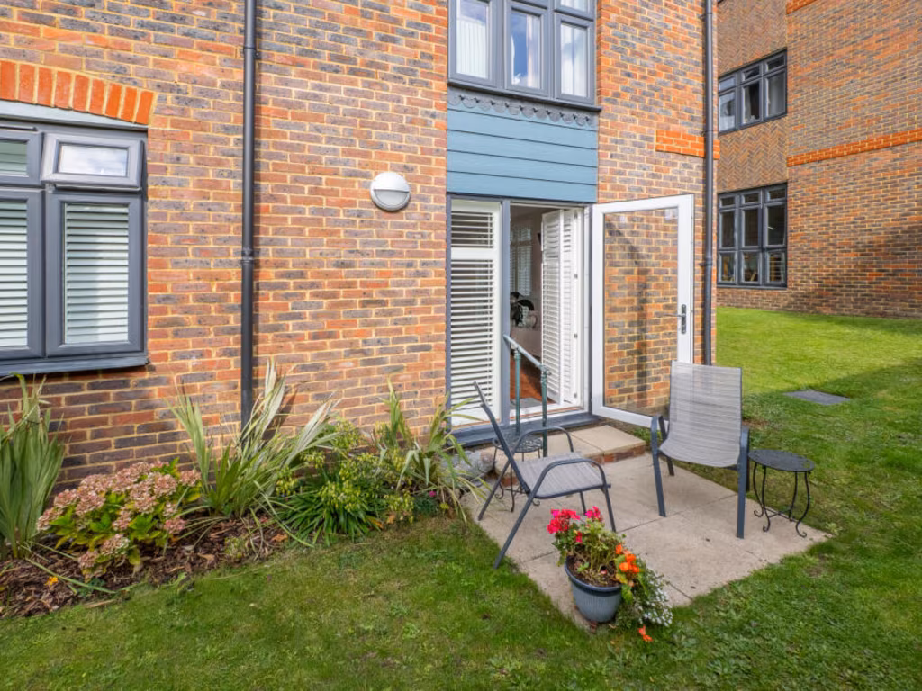
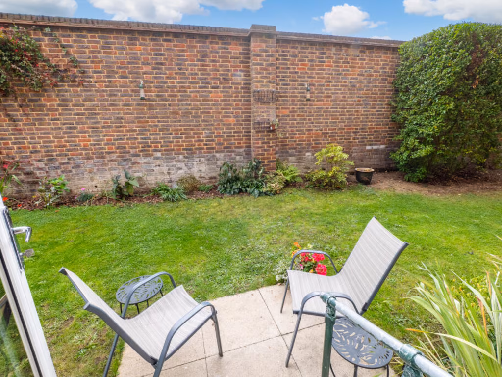
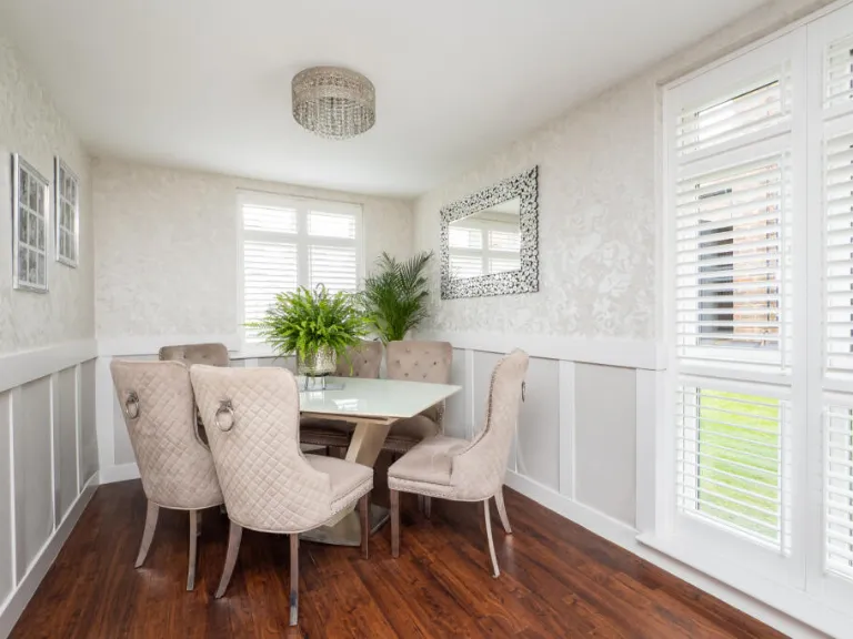
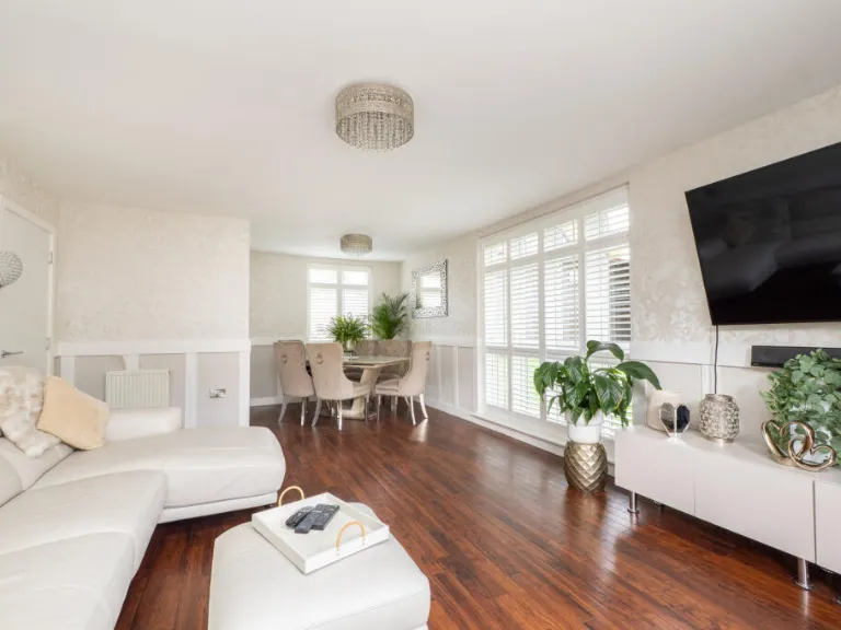
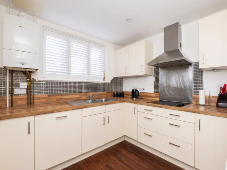
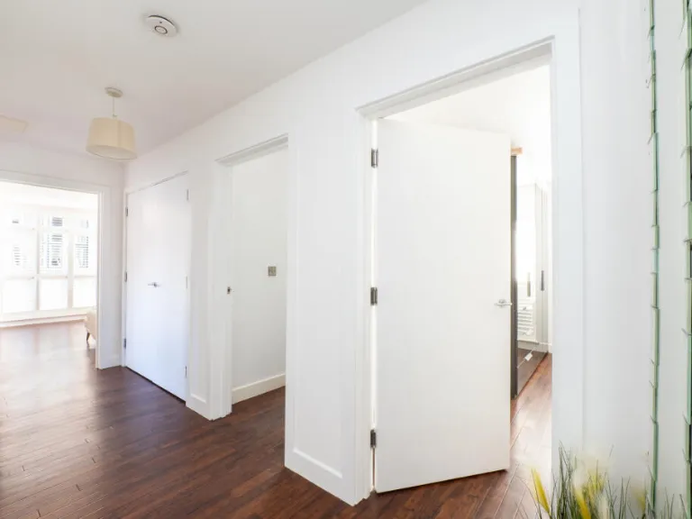
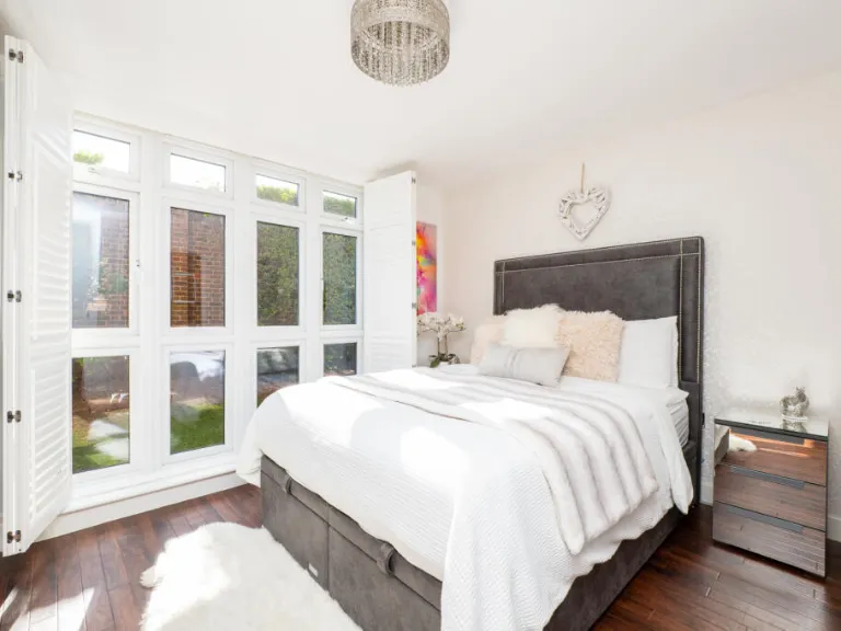
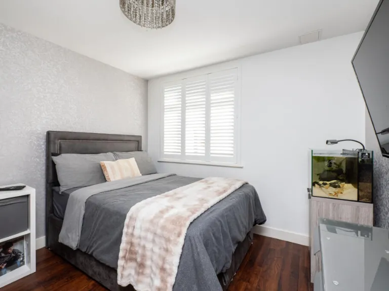
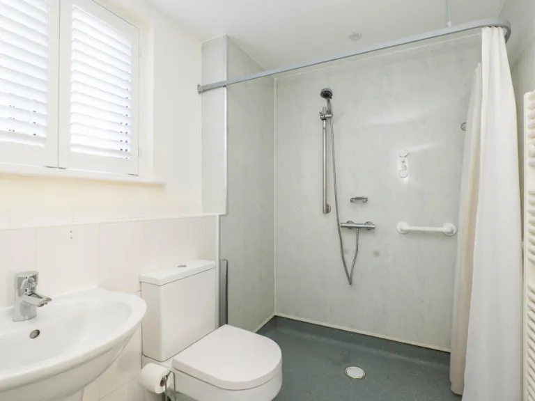
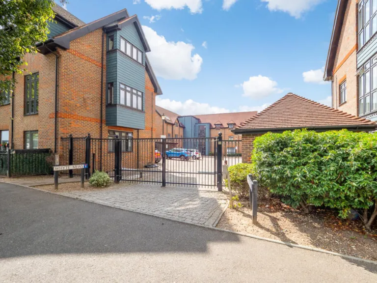
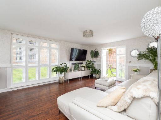
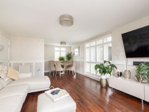
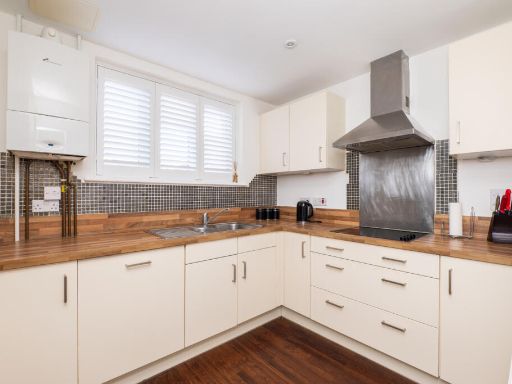
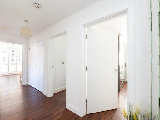
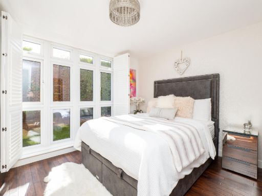
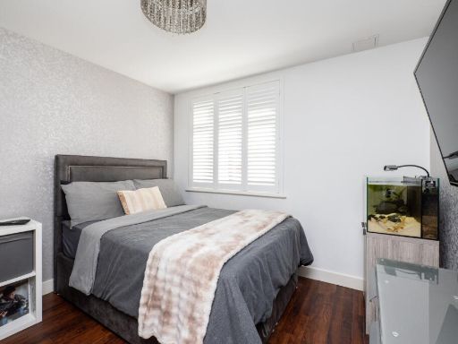
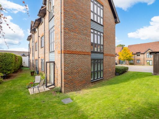
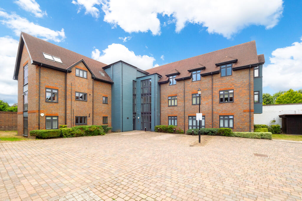
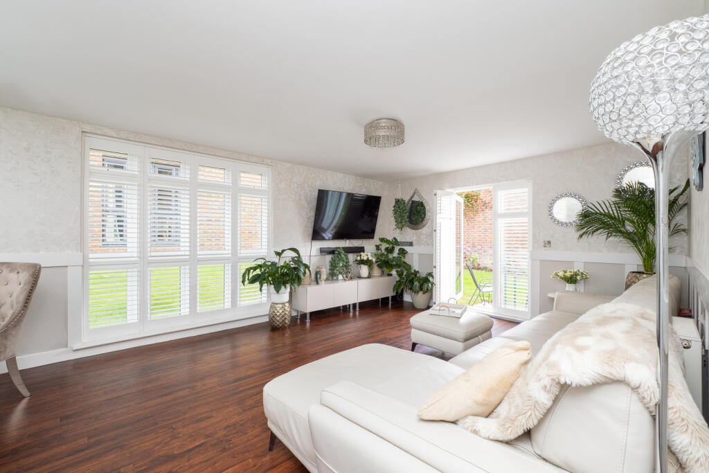
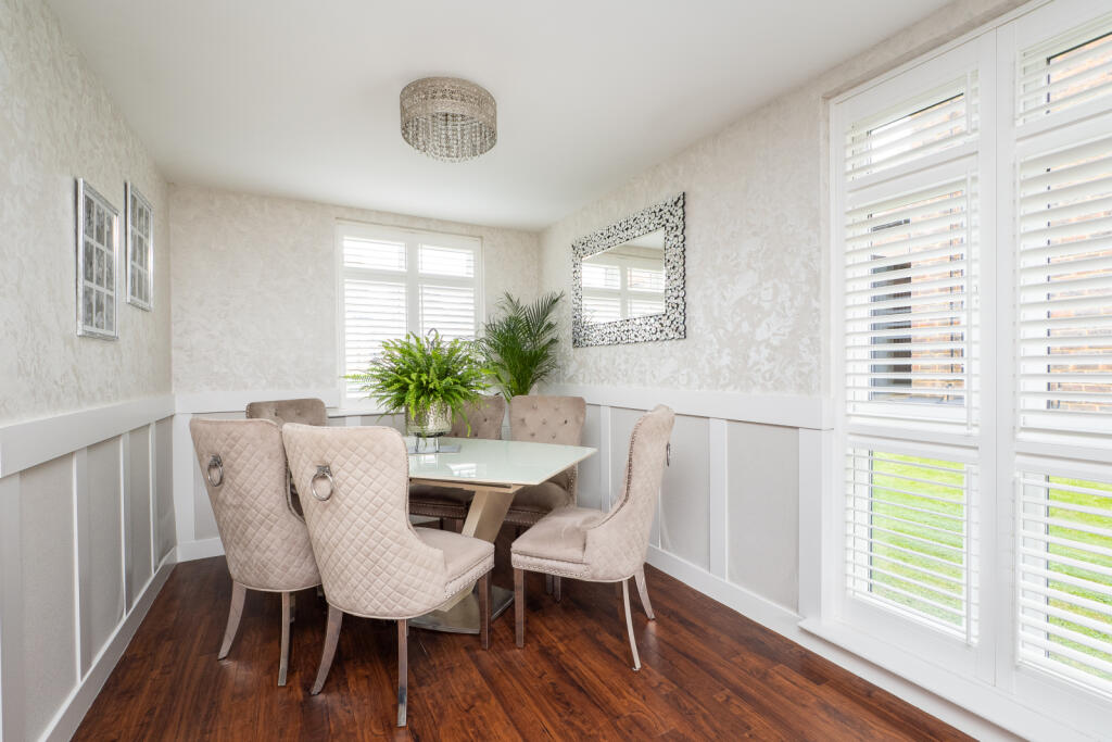
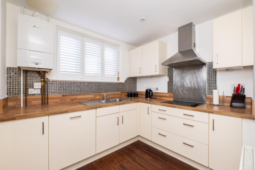
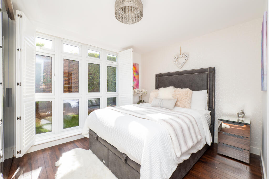
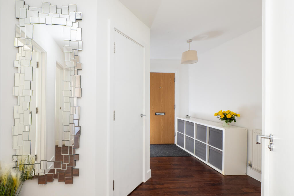
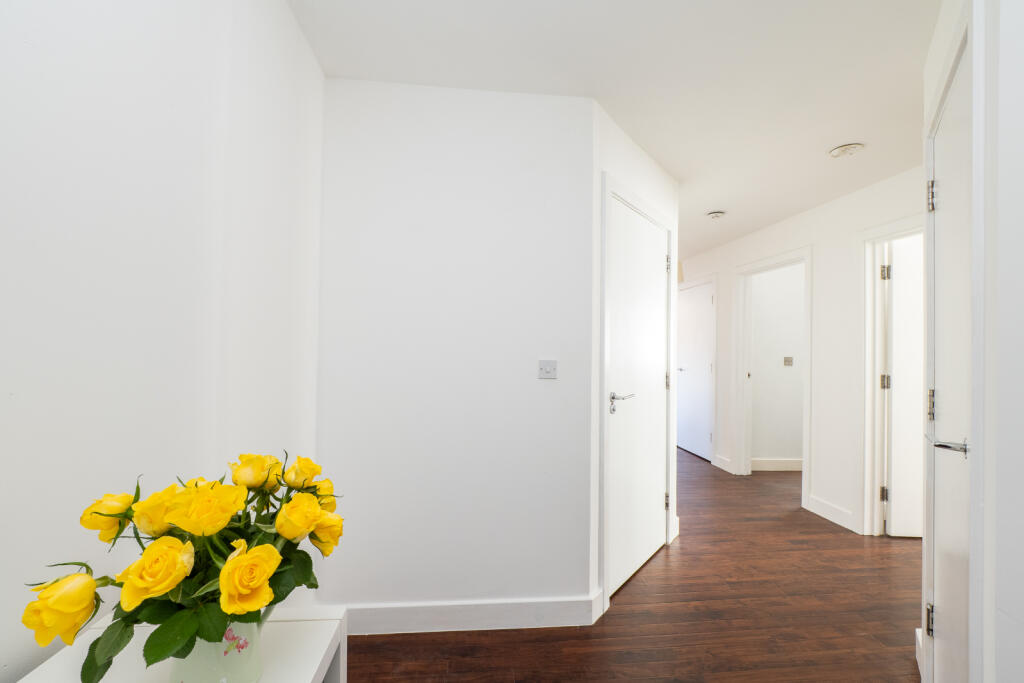
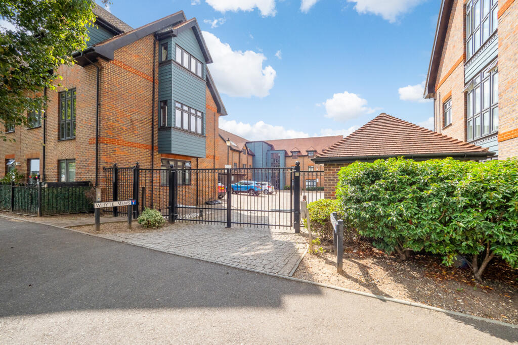
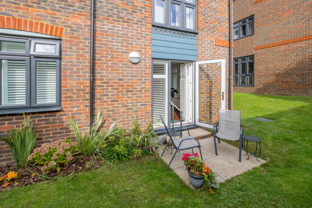
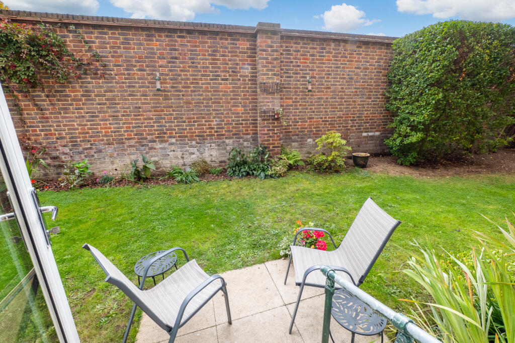
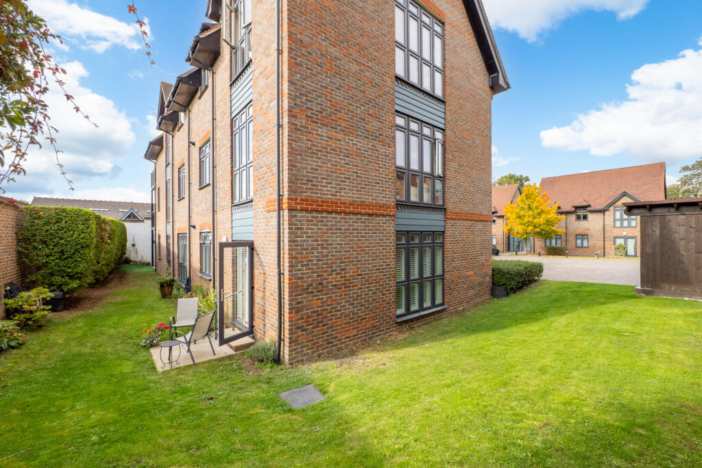
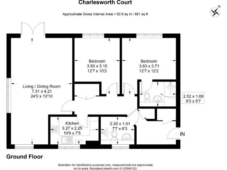
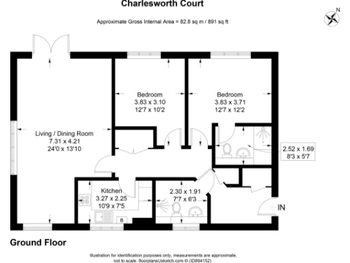
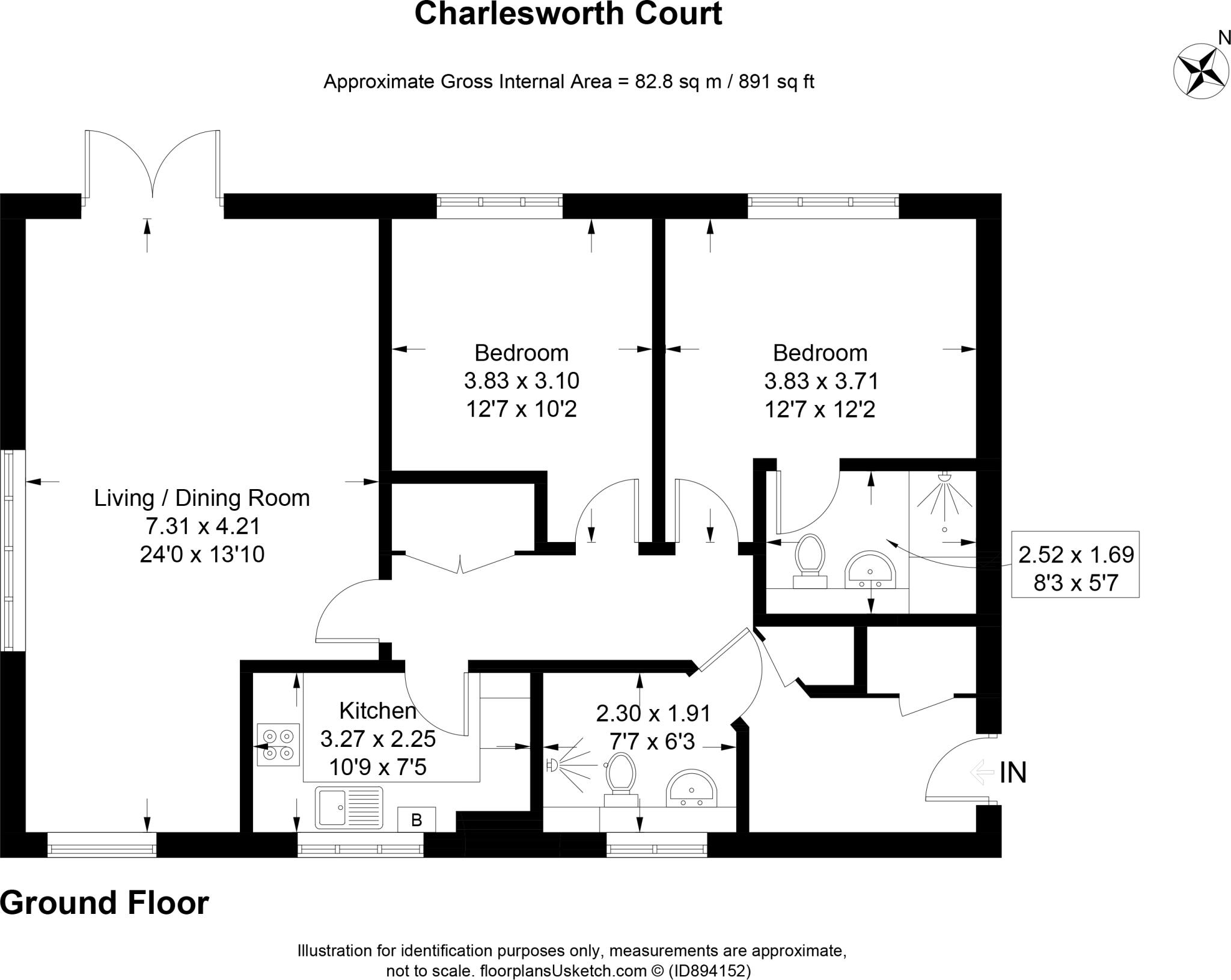
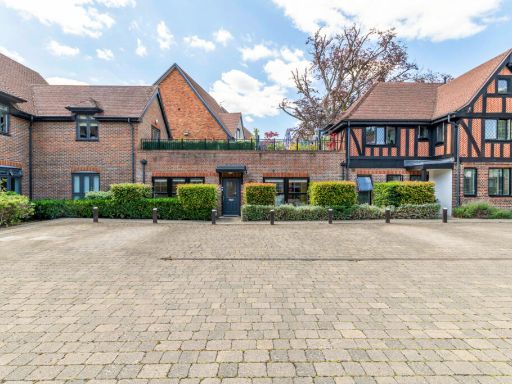
- Ground-floor two-bedroom, two-bathroom apartment in a secure modern development. The property offers a large, bright open-plan reception/dining room with French doors providing private rear access to the communal garden, a fully fitted kitchen, en-suite to the master bedroom and a family bathroom. The development is accessed via a private electronic gate and includes allocated residential parking and a paved communal courtyard. Presented to a good standard and well-suited to professionals, downsizers or investors seeking a well-located flat with convenient transport links (Cheam mainline station nearby) and close proximity to local amenities and Nonsuch Park. Property size: medium apartment; garden and courtyard: small/average communal grounds. EPC C, Council Tax Band D.
Image Descriptions
- apartment complex contemporary
- living room contemporary
Rooms
- Living / Dining Room:
- Bedroom:
- Bedroom:
- Kitchen:
- 2.30 x 1.91:
- 2.52 x 1.69:
Textual Property Features
Detected Visual Features
- contemporary
- red brick
- modern
- apartment complex
- communal area
- low maintenance
- spacious
- living room
- large windows
- garden access
- wood flooring
EPC Details
- Fully double glazed
- Cavity wall, as built, insulated (assumed)
- Boiler and radiators, mains gas
- Low energy lighting in all fixed outlets
- Suspended, insulated (assumed)
Nearby Schools
- Avenue Primary Academy
- Overton Grange School
- Devonshire Primary School
- Homefield Preparatory School
- Cheam Fields Primary Academy
- Sutton Grammar School
- Westbourne Primary School
- Cheam Common Infants' Academy
- St Cecilia's Catholic Primary School
- Sutton High School GDST
- Cheam Park Farm Primary Academy
- Ewell Castle School
- Cuddington Croft Primary School
- Nonsuch High School for Girls
- St Dunstan's Cheam CofE Primary School
- Robin Hood Infants' School
- Nonsuch Primary School
- Robin Hood Junior School
- Meadow Primary School
- Cheam High School
- All Saints Benhilton CofE Primary School
- Brookfield Primary Academy
- Harris Academy Sutton
- Cheam Common Junior Academy
- Dorchester Primary School
- Glenthorne High School
Nearest General Shops
- Id: 835909442
- Tags:
- Name: S M Pinegar
- Shop: butcher
- TagsNormalized:
- Lat: 51.3577815
- Lon: -0.2176347
- FullGeoHash: gcpu5j3sb8rg
- PartitionGeoHash: gcpu
- Images:
- FoodStandards: null
- Distance: 134.6
,- Id: 835909406
- Tags:
- Operator: Fine & Country
- Shop: estate_agent
- TagsNormalized:
- Lat: 51.3577849
- Lon: -0.21786
- FullGeoHash: gcpu5j3kg3pb
- PartitionGeoHash: gcpu
- Images:
- FoodStandards: null
- Distance: 126.3
,- Id: 835909417
- Tags:
- Operator: Christies
- Shop: estate_agent
- TagsNormalized:
- Lat: 51.3577815
- Lon: -0.2179941
- FullGeoHash: gcpu5j3kb27g
- PartitionGeoHash: gcpu
- Images:
- FoodStandards: null
- Distance: 121.5
}
Nearest Grocery shops
- Id: 835946922
- Tags:
- Name: Bon Bons
- Shop: convenience
- TagsNormalized:
- Lat: 51.3582756
- Lon: -0.2163714
- FullGeoHash: gcpu5j6rwhmz
- PartitionGeoHash: gcpu
- Images:
- FoodStandards: null
- Distance: 234
,- Id: 835911634
- Tags:
- Name: Michaels Greengrocers
- Shop: greengrocer
- TagsNormalized:
- Lat: 51.3581333
- Lon: -0.2166262
- FullGeoHash: gcpu5j6qb1zy
- PartitionGeoHash: gcpu
- Images:
- FoodStandards: null
- Distance: 210.3
,- Id: 835833813
- Tags:
- Name: Cheam Village News
- Shop: convenience
- TagsNormalized:
- Lat: 51.3568503
- Lon: -0.2160147
- FullGeoHash: gcpu5j4xq6zc
- PartitionGeoHash: gcpu
- Images:
- FoodStandards: null
- Distance: 192.3
}
Nearest Supermarkets
- Id: 24526305
- Tags:
- Brand: Sainsbury's
- Brand:wikidata: Q152096
- Building: yes
- Name: Sainsbury's
- Shop: supermarket
- TagsNormalized:
- sainsburys
- supermarket
- shop
- Lat: 51.3718314
- Lon: -0.2247921
- FullGeoHash: gcpu4zuq9gqy
- PartitionGeoHash: gcpu
- Images:
- FoodStandards: null
- Distance: 1722
,- Id: 9330485105
- Tags:
- Name: Little Waitrose
- Shop: supermarket
- TagsNormalized:
- little waitrose
- waitrose
- supermarket
- shop
- Lat: 51.3614684
- Lon: -0.200158
- FullGeoHash: gcpu5qn4pzxm
- PartitionGeoHash: gcpu
- Images:
- FoodStandards: null
- Distance: 1393.3
,- Id: 835785497
- Tags:
- Brand: Waitrose
- Brand:wikidata: Q771734
- Brand:wikipedia: en:Waitrose & Partners
- Name: Little Waitrose
- Official_name: Waitrose & Partners
- Operator: Waitrose & Partners
- Shop: supermarket
- TagsNormalized:
- waitrose
- little waitrose
- supermarket
- shop
- Lat: 51.3587154
- Lon: -0.2163434
- FullGeoHash: gcpu5jd6ny6w
- PartitionGeoHash: gcpu
- Images:
- FoodStandards: null
- Distance: 271.6
}
Nearest Religious buildings
- Id: 252783742
- Tags:
- Amenity: place_of_worship
- Denomination: catholic
- Name: St. Christopher's RC Church
- Religion: christian
- TagsNormalized:
- place of worship
- catholic
- church
- christian
- Lat: 51.3579022
- Lon: -0.2137822
- FullGeoHash: gcpu5jkm6wb7
- PartitionGeoHash: gcpu
- Images:
- FoodStandards: null
- Distance: 368
,- Id: 36969165
- Tags:
- Addr:
- City: Cheam Village, Sutton
- Housenumber: 4
- Postcode: SM3 8QB
- Street: Park Road
- Amenity: place_of_worship
- Denomination: baptist
- Email: churchoffice@cheambaptist.net
- Name: Cheam Baptist Church
- Phone: +44 20 8642 5070
- Religion: christian
- Service_times: 10:30, 18:30
- Website: https://cheambaptist.net/
- Wheelchair: yes
- TagsNormalized:
- place of worship
- baptist
- church
- christian
- Lat: 51.3597163
- Lon: -0.2168432
- FullGeoHash: gcpu5jf051jc
- PartitionGeoHash: gcpu
- Images:
- FoodStandards: null
- Distance: 350.5
,- Id: 36872838
- Tags:
- Amenity: school
- Name: Saint Dunstans Church of England Primary School
- TagsNormalized:
- Lat: 51.3566002
- Lon: -0.2201482
- FullGeoHash: gcpu4vptyhjt
- PartitionGeoHash: gcpu
- Images:
- FoodStandards: null
- Distance: 97.5
}
Nearest Medical buildings
- Id: 6294158522
- Tags:
- Addr:
- City: Sutton
- Housenumber: 125
- Postcode: SM1 2BH
- Street: Cheam Road
- Amenity: dentist
- Healthcare: dentist
- Name: Cheam Road Dental
- Source: survey;code-point open
- TagsNormalized:
- dentist
- health
- healthcare
- dental
- Lat: 51.3597726
- Lon: -0.205584
- FullGeoHash: gcpu5mf23e93
- PartitionGeoHash: gcpu
- Images:
- FoodStandards: null
- Distance: 974.1
,- Id: 268517393
- Tags:
- Addr:
- City: Sutton
- Housenumber: 11
- Postcode: SM2 7AY
- Street: Upper Mulgrave Road
- Village: Cheam
- Amenity: pharmacy
- Dispensing: yes
- Drive_through: no
- Healthcare: pharmacy
- Name: Mulgrave Road Pharmacy
- Opening_hours: Mo-Fr 09:00-17:00; Sa-Su off
- Source: survey
- Survey:
- TagsNormalized:
- Lat: 51.3547652
- Lon: -0.2150702
- FullGeoHash: gcpu5hg7hw04
- PartitionGeoHash: gcpu
- Images:
- FoodStandards: null
- Distance: 343.5
,- Id: 37552362
- Tags:
- Amenity: pharmacy
- Dispensing: yes
- Healthcare: pharmacy
- Name: Frith's Chemist
- TagsNormalized:
- pharmacy
- health
- healthcare
- chemist
- Lat: 51.3581048
- Lon: -0.2166155
- FullGeoHash: gcpu5j6q8kxu
- PartitionGeoHash: gcpu
- Images:
- FoodStandards: null
- Distance: 208.6
,- Id: 266940870
- Tags:
- Amenity: pharmacy
- Brand: Boots
- Brand:wikidata: Q6123139
- Brand:wikipedia: en:Boots UK
- Dispensing: yes
- Healthcare: pharmacy
- Name: Boots
- TagsNormalized:
- pharmacy
- boots
- health
- healthcare
- Lat: 51.3574432
- Lon: -0.2166262
- FullGeoHash: gcpu5j66b1rc
- PartitionGeoHash: gcpu
- Images:
- FoodStandards: null
- Distance: 165.7
}
Nearest Airports
- Id: 260720166
- Tags:
- Aerodrome: international
- Aeroway: aerodrome
- Alt_name: Gatwick Airport
- Ele: 62
- Iata: LGW
- Icao: EGKK
- Internet_access: wlan
- Internet_access:fee: no
- Internet_access:ssid: Gatwick FREE Wi-Fi
- Name: London Gatwick Airport
- Operator: Gatwick Airport Limited
- Ref: LGW
- Website: https://www.gatwickairport.com/
- Wikidata: Q8703
- Wikipedia: en:Gatwick Airport
- TagsNormalized:
- airport
- international airport
- Lat: 51.1540917
- Lon: -0.1883773
- FullGeoHash: gcpg58qf4mzd
- PartitionGeoHash: gcpg
- Images:
- FoodStandards: null
- Distance: 22640
,- Id: 121158889
- Tags:
- Aerodrome: continental
- Aeroway: aerodrome
- Fhrs:
- Authority: City of London Corporation
- Iata: LCY
- Icao: EGLC
- Name: London City Airport
- Operator: London City Airport Limited
- Ref: LCY
- Website: https://www.londoncityairport.com/
- Wikidata: Q8982
- Wikipedia: en:London City Airport
- TagsNormalized:
- airport
- continental airport
- Lat: 51.5042658
- Lon: 0.0539987
- FullGeoHash: u10j10p64702
- PartitionGeoHash: u10j
- Images:
- FoodStandards: null
- Distance: 25029.4
,- Id: 14001268
- Tags:
- Access: yes
- Aerodrome: international
- Aerodrome:type: public
- Aeroway: aerodrome
- Alt_name: London Heathrow
- Alt_name_2: London Heathrow Airport
- Ele: 25
- Iata: LHR
- Icao: EGLL
- Int_name: Heathrow Airport
- Name: London Heathrow Airport
- Note: area still approx
- Old_name: London Airport
- Operator: Heathrow Airport Limited
- Rank_aci:
- Ref: LHR
- Short_name: Heathrow
- Type: multipolygon
- Website: https://www.heathrow.com/
- Wikidata: Q8691
- Wikipedia: en:Heathrow Airport
- TagsNormalized:
- airport
- international airport
- Lat: 51.4677522
- Lon: -0.4547736
- FullGeoHash: gcpsv9kv7h2h
- PartitionGeoHash: gcps
- Images:
- FoodStandards: null
- Distance: 20495.4
}
Nearest Leisure Facilities
- Id: 22999242
- Tags:
- Created_by: Potlatch 0.7b
- Leisure: pitch
- Sport: tennis
- TagsNormalized:
- Lat: 51.3542992
- Lon: -0.2182042
- FullGeoHash: gcpu5hc07rpp
- PartitionGeoHash: gcpu
- Images:
- FoodStandards: null
- Distance: 281.7
,- Id: 22999244
- Tags:
- Created_by: Potlatch 0.7b
- Leisure: pitch
- Sport: bowls
- TagsNormalized:
- Lat: 51.3546396
- Lon: -0.2178008
- FullGeoHash: gcpu5hc6kyev
- PartitionGeoHash: gcpu
- Images:
- FoodStandards: null
- Distance: 250.4
,- Id: 22999238
- Tags:
- Created_by: Potlatch 0.7b
- Leisure: pitch
- Sport: tennis
- TagsNormalized:
- Lat: 51.3546075
- Lon: -0.2184317
- FullGeoHash: gcpu5hbfq0tw
- PartitionGeoHash: gcpu
- Images:
- FoodStandards: null
- Distance: 245.7
,- Id: 835904193
- Tags:
- Dance:
- Leisure: dance
- Name: Dance Options Cheam
- TagsNormalized:
- Lat: 51.3577715
- Lon: -0.2170339
- FullGeoHash: gcpu5j3uwwxb
- PartitionGeoHash: gcpu
- Images:
- FoodStandards: null
- Distance: 162.1
,- Id: 24550912
- Tags:
- Leisure: pitch
- Sport: soccer
- TagsNormalized:
- Lat: 51.3567314
- Lon: -0.2200745
- FullGeoHash: gcpu4vpwxuse
- PartitionGeoHash: gcpu
- Images:
- FoodStandards: null
- Distance: 90
}
Nearest Tourist attractions
- Id: 6266973817
- Tags:
- Fee: no
- Name: Bourne hall
- Tourism: museum
- Website: https://www.bournehall.org/
- TagsNormalized:
- Lat: 51.3503373
- Lon: -0.2524295
- FullGeoHash: gcpu4k01muwv
- PartitionGeoHash: gcpu
- Images:
- FoodStandards: null
- Distance: 2444.7
,- Id: 8954569413
- Tags:
- Name: Room Space
- Operator: Room Space
- Tourism: apartment
- TagsNormalized:
- Lat: 51.3609553
- Lon: -0.187139
- FullGeoHash: gcpu5tzxr250
- PartitionGeoHash: gcpu
- Images:
- FoodStandards: null
- Distance: 2245.1
,- Id: 425669383
- Tags:
- Description: A historic tudor home with later additions from the Stuart, Georgian and Victorian periods.
- Flickr: https://www.flickr.com/photos/25829192@N03/3960636881/
- Name: Whitehall
- Tourism: museum
- Website: http://www.friendsofwhitehallcheam.co.uk
- Wikidata: Q7995973
- Wikipedia: en:Whitehall (Sutton)
- TagsNormalized:
- Lat: 51.3594267
- Lon: -0.2171332
- FullGeoHash: gcpu5j9yk7jc
- PartitionGeoHash: gcpu
- Images:
- FoodStandards: null
- Distance: 313.1
}
Nearest Hotels
- Id: 261633241
- Tags:
- Name: Holiday Inn
- Tourism: hotel
- TagsNormalized:
- Lat: 51.3617505
- Lon: -0.1966293
- FullGeoHash: gcpu5w0gfhnx
- PartitionGeoHash: gcpu
- Images:
- FoodStandards: null
- Distance: 1633.6
,- Id: 24533285
- Tags:
- Addr:
- Housenumber: 355
- Postcode: KT17 2DE
- Street: London Road
- Building: yes
- Fhrs:
- Name: Nonsuch Park Hotel
- Postal_code: KT17 2DE
- Source: photo
- Source:addr:postcode: FHRS Open Data
- Tourism: hotel
- TagsNormalized:
- Lat: 51.3647876
- Lon: -0.235202
- FullGeoHash: gcpu4wstx6ks
- PartitionGeoHash: gcpu
- Images:
- FoodStandards: null
- Distance: 1444.7
,- Id: 345405759
- Tags:
- Created_by: Potlatch 0.10f
- Name: Thatched House Hotel
- Tourism: hotel
- TagsNormalized:
- Lat: 51.359454
- Lon: -0.2074197
- FullGeoHash: gcpu5m8ywb0s
- PartitionGeoHash: gcpu
- Images:
- FoodStandards: null
- Distance: 842.2
}
Tags
- contemporary
- red brick
- modern
- apartment complex
- communal area
- low maintenance
- contemporary
- spacious
- living room
- large windows
- garden access
- wood flooring
- modern
Local Market Stats
- Average Price/sqft: £529
- Avg Income: £60800
- Rental Yield: 4.1%
- Social Housing: 6%
- Planning Success Rate: 41%
AirBnB Data
- 1km average: £81/night
- Listings in 1km: 8
Similar Properties
 2 bedroom apartment for sale in Killick Mews, Ewell Road, Cheam, Sutton, SM3 — £525,000 • 2 bed • 1 bath • 688 ft²
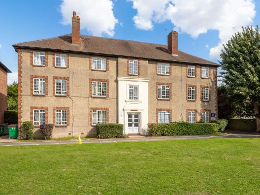 2 bedroom apartment for sale in Cheam Mansions, Station Way, Cheam, Sutton, SM3 — £375,000 • 2 bed • 1 bath • 921 ft²
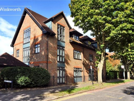 2 bedroom apartment for sale in Whyte Mews, Anne Boleyn's Walk, Cheam, Sutton, SM3 — £550,000 • 2 bed • 1 bath • 915 ft²
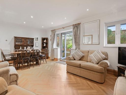 2 bedroom apartment for sale in The Broadway, Cheam, SM3 — £625,000 • 2 bed • 2 bath • 1182 ft²
 2 bedroom apartment for sale in Malden Road, Cheam, SM3 — £500,000 • 2 bed • 2 bath • 861 ft²
 2 bedroom apartment for sale in Malden Road, Cheam, SM3 — £525,000 • 2 bed • 2 bath • 1044 ft²
Meta
- {
"@context": "https://schema.org",
"@type": "Residence",
"name": "2 bedroom apartment for sale in Whyte Mews, Anne Boleyn…",
"description": "",
"url": "https://propertypiper.co.uk/property/acf96e25-f6d9-4a41-beaa-ce6d3ce36d28",
"image": "https://image-a.propertypiper.co.uk/447db529-992c-4d0b-8566-1cb88f957419-1024.jpeg",
"address": {
"@type": "PostalAddress",
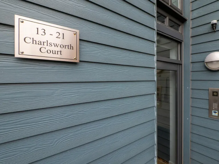
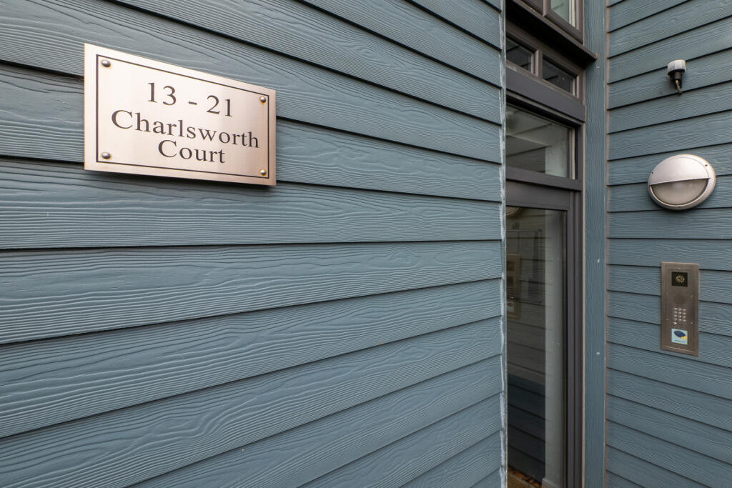
"streetAddress": "Flat 13, Charlesworth Court, Whyte Mews",
"postalCode": "SM3 8DR",
"addressLocality": "Sutton",
"addressRegion": "Sutton and Cheam",
"addressCountry": "England"
},
"geo": {
"@type": "GeoCoordinates",
"latitude": 51.356806463582906,
"longitude": -0.21878370917060264
},
"numberOfRooms": 2,
"numberOfBathroomsTotal": 2,
"floorSize": {
"@type": "QuantitativeValue",
"value": 891,
"unitCode": "FTK"
},
"offers": {
"@type": "Offer",
"price": 500000,
"priceCurrency": "GBP",
"availability": "https://schema.org/InStock"
},
"additionalProperty": [
{
"@type": "PropertyValue",
"name": "Feature",
"value": "contemporary"
},
{
"@type": "PropertyValue",
"name": "Feature",
"value": "red brick"
},
{
"@type": "PropertyValue",
"name": "Feature",
"value": "modern"
},
{
"@type": "PropertyValue",
"name": "Feature",
"value": "apartment complex"
},
{
"@type": "PropertyValue",
"name": "Feature",
"value": "communal area"
},
{
"@type": "PropertyValue",
"name": "Feature",
"value": "low maintenance"
},
{
"@type": "PropertyValue",
"name": "Feature",
"value": "contemporary"
},
{
"@type": "PropertyValue",
"name": "Feature",
"value": "spacious"
},
{
"@type": "PropertyValue",
"name": "Feature",
"value": "living room"
},
{
"@type": "PropertyValue",
"name": "Feature",
"value": "large windows"
},
{
"@type": "PropertyValue",
"name": "Feature",
"value": "garden access"
},
{
"@type": "PropertyValue",
"name": "Feature",
"value": "wood flooring"
},
{
"@type": "PropertyValue",
"name": "Feature",
"value": "modern"
}
]
}
High Res Floorplan Images
Compatible Floorplan Images
FloorplanImages Thumbnail