FY4 2DS - 2 bedroom flat for sale in St. Annes Court, St. Annes Road,…
View on Property Piper
2 bedroom flat for sale in St. Annes Court, St. Annes Road, Blackpool, Lancashire, FY4
Property Details
- Price: £65000
- Bedrooms: 2
- Bathrooms: 1
- Property Type: undefined
- Property SubType: undefined
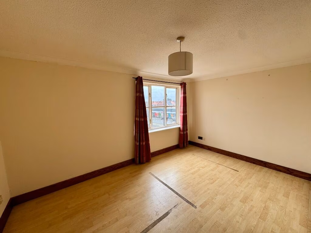
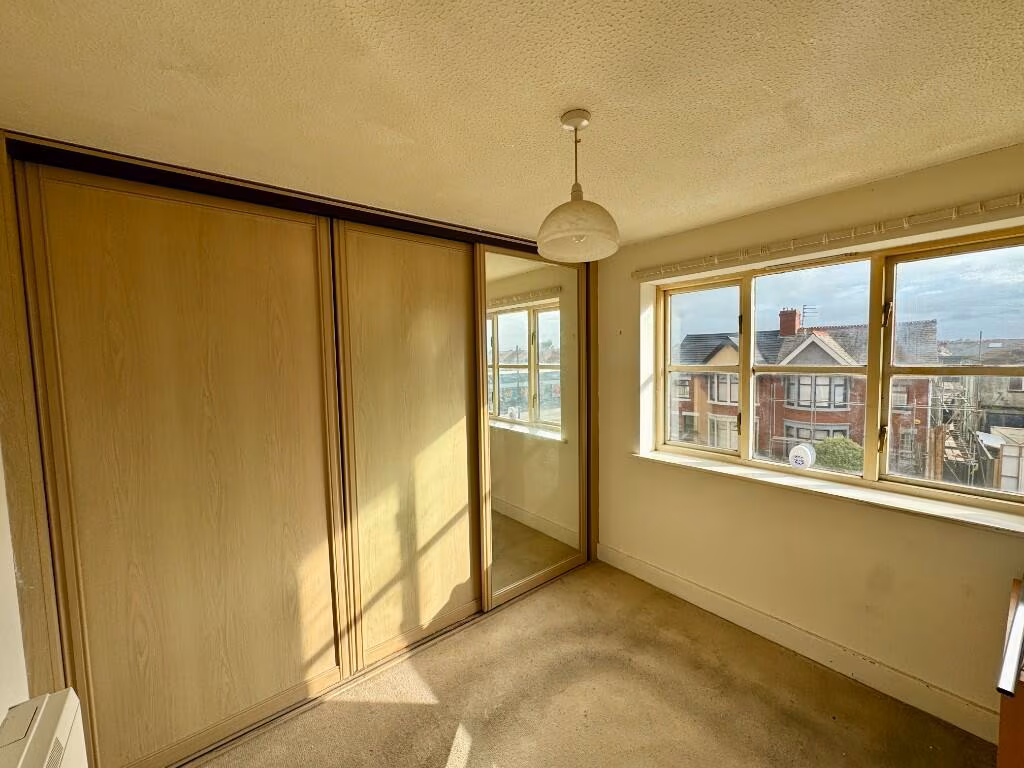
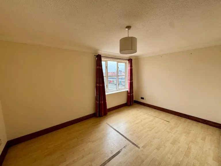
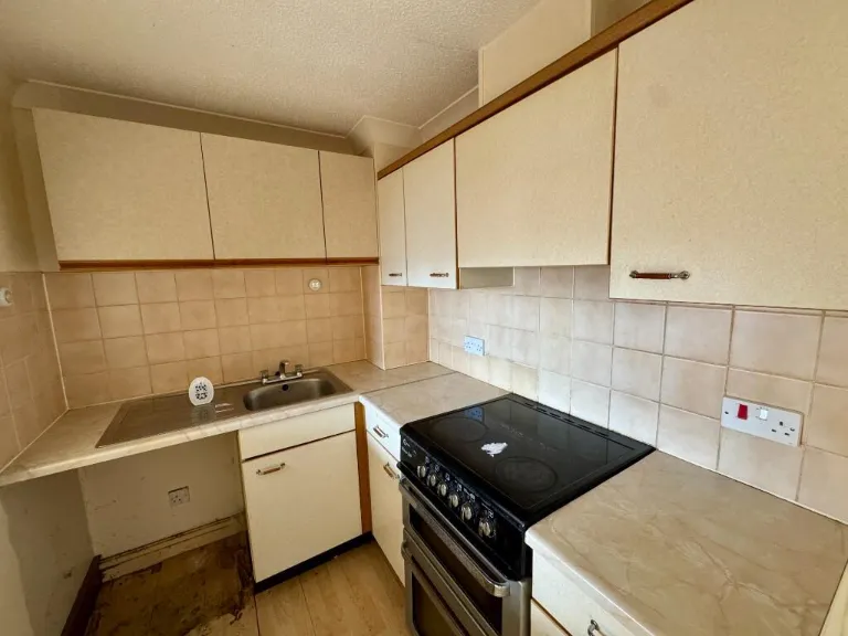
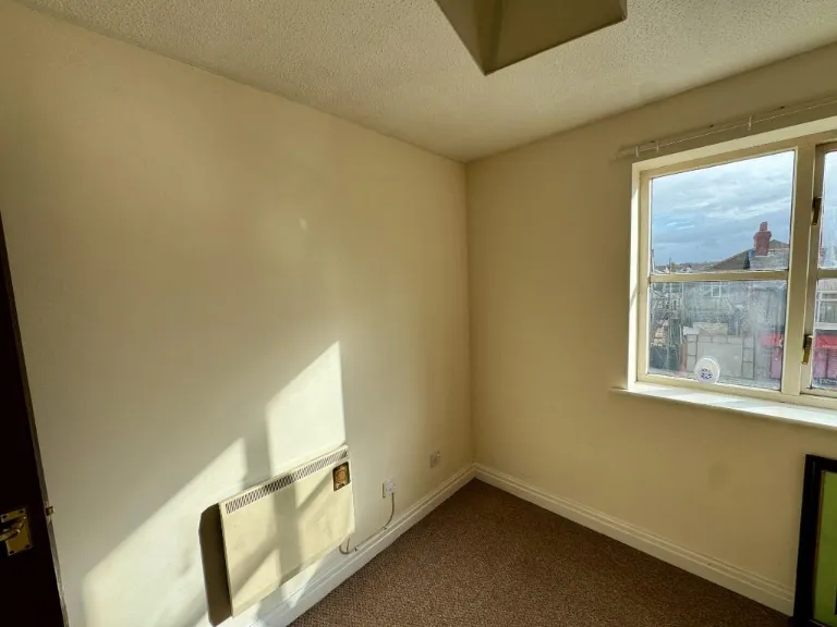
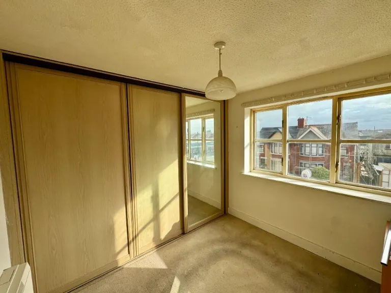
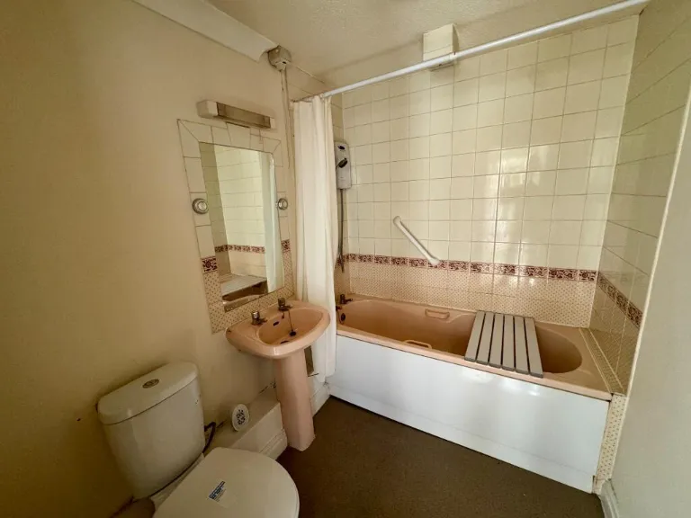
Image Descriptions
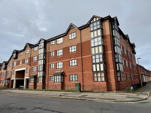
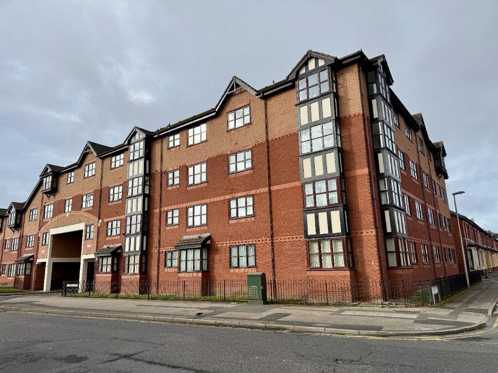
- multi-storey apartment building modern
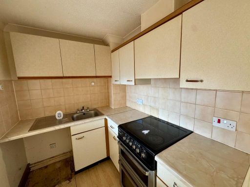
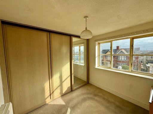
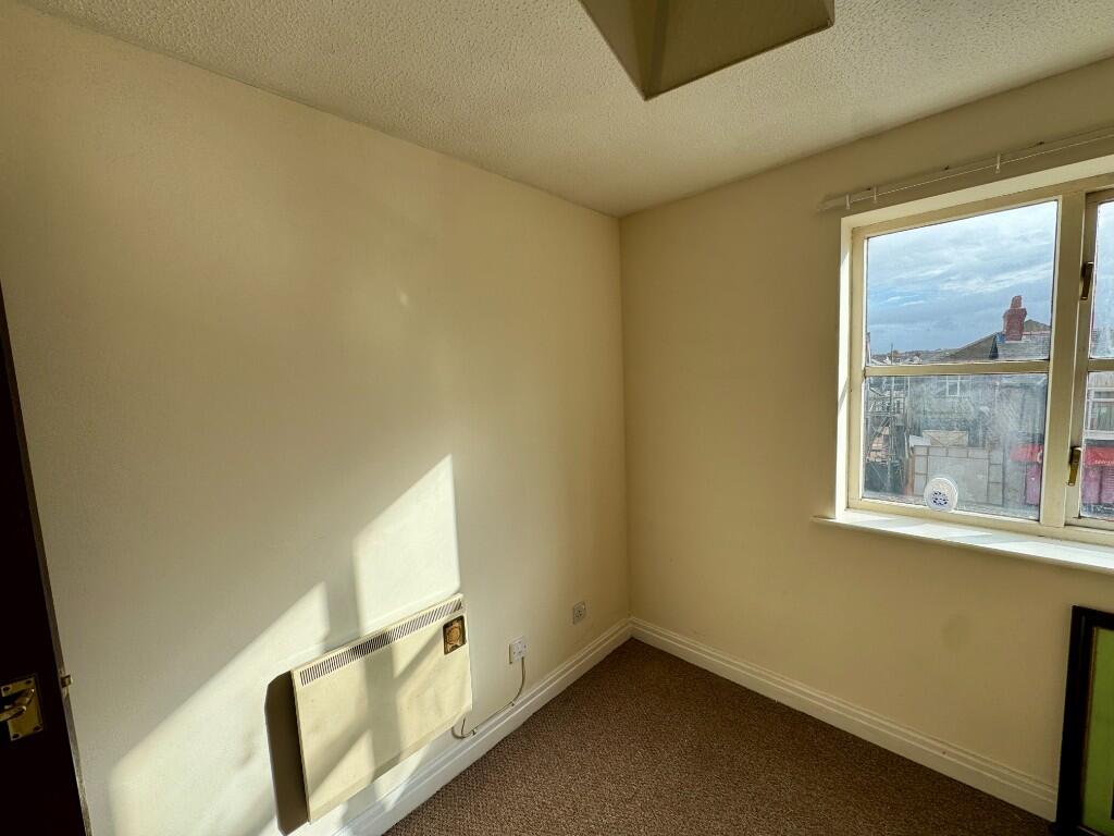
- room modern
Textual Property Features
- Is Public Notice
- Has Garden
- Chain Free
- Success
Detected Visual Features
- apartment
- building
- modern
- brick
- grey grid windows
- multi-storey
- residential
- urban
- neutral walls
- laminate flooring
- window
- ceiling light
EPC Details
- Fully double glazed
- Cavity wall, as built, insulated (assumed)
- Electric storage heaters
- Low energy lighting in 50% of fixed outlets
- (another dwelling below)
Nearby Schools
- Blackpool St Nicholas CofE Primary School
- Roseacre Primary Academy
- St Cuthbert's Catholic Academy
- Waterloo Primary Academy
- Revoe Learning Academy
- Tower Learning Centre Independent School
- Layton Primary School
- Armfield Academy
- Thames Primary Academy
- St George's School A Church of England Academy
- BFC School
- Blackpool St John's Church of England Primary School
- St Kentigern's Catholic Primary School
- Devonshire Primary Academy
- Westminster Primary Academy
- Highfield Leadership Academy
- Hawes Side Academy
- Marton Primary Academy and Nursery
- Baines' Endowed Church of England Primary Academy
- Blackpool Gateway Academy
Nearest General Shops
- Id: 4519258084
- Tags:
- Addr:
- Postcode: FY4 3AE
- Street: Waterloo Road
- Fhrs:
- Name: Molly's Pantry
- Shop: bakery
- TagsNormalized:
- Lat: 53.8000374
- Lon: -3.0381892
- FullGeoHash: gctf4cgxvjcg
- PartitionGeoHash: gctf
- Images:
- FoodStandards: null
- Distance: 367.5
,- Id: 211052057
- Tags:
- Addr:
- Brand: The Range
- Brand:wikidata: Q7759409
- Building: yes
- Name: The Range
- Shop: houseware
- TagsNormalized:
- Lat: 53.7977004
- Lon: -3.0456139
- FullGeoHash: gctf49w6241x
- PartitionGeoHash: gctf
- Images:
- FoodStandards: null
- Distance: 185.1
,- Id: 9873910296
- Tags:
- Name: Richard's
- Shop: hairdresser
- TagsNormalized:
- Lat: 53.7993737
- Lon: -3.0426777
- FullGeoHash: gctf4cbkh6ph
- PartitionGeoHash: gctf
- Images:
- FoodStandards: null
- Distance: 102.8
}
Nearest Grocery shops
- Id: 4519258079
- Tags:
- Addr:
- Fhrs:
- Name: Full Moon Stores
- Shop: convenience
- TagsNormalized:
- Lat: 53.7994291
- Lon: -3.0456953
- FullGeoHash: gctf49yhqhkz
- PartitionGeoHash: gctf
- Images:
- FoodStandards:
- Id: 745936
- FHRSID: 745936
- LocalAuthorityBusinessID: 768385
- BusinessName: Full Moon Stores
- BusinessType: Retailers - other
- BusinessTypeID: 4613
- AddressLine1: 142A Waterloo Road
- AddressLine2: Blackpool
- AddressLine3: null
- AddressLine4: null
- PostCode: FY4 2AF
- RatingValue: 3
- RatingKey: fhrs_3_en-GB
- RatingDate: 2022-11-10
- LocalAuthorityCode: 898
- LocalAuthorityName: Blackpool
- LocalAuthorityWebSite: http://www.blackpool.gov.uk/Services/A-F/FoodHygiene/
- LocalAuthorityEmailAddress: foodcontrol@blackpool.gov.uk
- Scores:
- Hygiene: 10
- Structural: 10
- ConfidenceInManagement: 5
- NewRatingPending: false
- Geocode:
- Longitude: -3.04538900000000
- Latitude: 53.79946600000000
- Distance: 198.1
,- Id: 10562110291
- Tags:
- Name: Carol's Corner Shop
- Shop: convenience
- TagsNormalized:
- Lat: 53.7993305
- Lon: -3.0428515
- FullGeoHash: gctf4cb7b6j7
- PartitionGeoHash: gctf
- Images:
- FoodStandards: null
- Distance: 95.4
,- Id: 4520373158
- Tags:
- Addr:
- Postcode: FY4 2AS
- Street: Saint Anne's Road
- Brand: Premier
- Brand:wikidata: Q7240340
- Fhrs:
- Name: St Anne's Convenience Store
- Shop: convenience
- TagsNormalized:
- Lat: 53.7981592
- Lon: -3.0423229
- FullGeoHash: gctf4c8suxxx
- PartitionGeoHash: gctf
- Images:
- FoodStandards:
- Id: 911713
- FHRSID: 911713
- LocalAuthorityBusinessID: 2144255
- BusinessName: Premier Convenience Store
- BusinessType: Retailers - other
- BusinessTypeID: 4613
- AddressLine1: 36-42 St Annes Road
- AddressLine2: Blackpool
- AddressLine3: null
- AddressLine4: null
- PostCode: FY4 2AS
- RatingValue: 5
- RatingKey: fhrs_5_en-GB
- RatingDate: 2019-11-26
- LocalAuthorityCode: 898
- LocalAuthorityName: Blackpool
- LocalAuthorityWebSite: http://www.blackpool.gov.uk/Services/A-F/FoodHygiene/
- LocalAuthorityEmailAddress: foodcontrol@blackpool.gov.uk
- Scores:
- Hygiene: 5
- Structural: 0
- ConfidenceInManagement: 5
- NewRatingPending: false
- Geocode:
- Longitude: -3.04222560000000
- Latitude: 53.79817890000000
- Distance: 64.6
}
Nearest Religious buildings
- Id: 556908081
- Tags:
- Addr:
- City: Blackpool
- Postcode: FY1 6LA
- Street: Central Drive
- Amenity: place_of_worship
- Building: yes
- Name: Holy Cross
- Religion: christian
- TagsNormalized:
- place of worship
- christian
- church
- Lat: 53.800184
- Lon: -3.0428165
- FullGeoHash: gctf4f02c1pw
- PartitionGeoHash: gctf
- Images:
- FoodStandards: null
- Distance: 189.6
,- Id: 556908078
- Tags:
- Addr:
- Postcode: FY4 3AD
- Street: Waterloo Road
- Amenity: place_of_worship
- Building: yes
- Denomination: anglican
- Name: Blackpool Christian Centre
- Religion: christian
- Wikidata: Q105091434
- TagsNormalized:
- place of worship
- anglican
- christian
- church
- Lat: 53.799762
- Lon: -3.0426225
- FullGeoHash: gctf4cbqmf81
- PartitionGeoHash: gctf
- Images:
- FoodStandards: null
- Distance: 145.4
,- Id: 581958194
- Tags:
- Addr:
- City: Blackpool
- Postcode: FY4 2AP
- Street: Saint Anne's Road
- Amenity: place_of_worship
- Denomination: baptist
- Name: Victory Baptist Church
- Religion: christian
- TagsNormalized:
- place of worship
- baptist
- church
- christian
- Lat: 53.7975066
- Lon: -3.0427497
- FullGeoHash: gctf4c834y17
- PartitionGeoHash: gctf
- Images:
- FoodStandards: null
- Distance: 112.1
}
Nearest Medical buildings
- Id: 4221390256
- Tags:
- Addr:
- Postcode: FY4 3AG
- Street: Waterloo Road
- Amenity: pharmacy
- Dispensing: yes
- Healthcare: pharmacy
- Name: Whitworth Chemists Ltd
- TagsNormalized:
- pharmacy
- health
- healthcare
- chemist
- Lat: 53.8002613
- Lon: -3.0361889
- FullGeoHash: gctf4fj15xt7
- PartitionGeoHash: gctf
- Images:
- FoodStandards: null
- Distance: 496.8
,- Id: 556908079
- Tags:
- Addr:
- City: Blackpool
- Housenumber: 178
- Postcode: FY4 3AD
- Street: Waterloo Road
- Amenity: clinic
- Building: yes
- Healthcare: clinic
- Name: Waterloo Medical Centre
- Opening_hours: Mo-Th 08:00-20:00, Fr 08:00-18:30, Sa 08:00-11:45, Su off
- TagsNormalized:
- Lat: 53.7998157
- Lon: -3.0423898
- FullGeoHash: gctf4cbweht9
- PartitionGeoHash: gctf
- Images:
- FoodStandards: null
- Distance: 155.4
,- Id: 4221390251
- Tags:
- Addr:
- City: Blackpool
- Housename: 182
- Postcode: FY4 3AD
- Street: Waterloo Road
- Amenity: pharmacy
- Brand: Lloyds Pharmacy
- Brand:wikidata: Q6662870
- Brand:wikipedia: en:LloydsPharmacy
- Dispensing: yes
- Healthcare: pharmacy
- Name: Lloyds Pharmacy
- TagsNormalized:
- pharmacy
- lloyds pharmacy
- health
- healthcare
- Lat: 53.7997209
- Lon: -3.0420523
- FullGeoHash: gctf4cby54c7
- PartitionGeoHash: gctf
- Images:
- FoodStandards: null
- Distance: 154.3
,- Id: 4796387655
- Tags:
- Addr:
- Postcode: FY4 2AE
- Street: Waterloo Road
- Amenity: pharmacy
- Healthcare: pharmacy
- Name: Trust Pharmacy
- Ref: 9010419
- TagsNormalized:
- Lat: 53.7992568
- Lon: -3.043508
- FullGeoHash: gctf49zg3h7g
- PartitionGeoHash: gctf
- Images:
- FoodStandards: null
- Distance: 88.8
}
Nearest Leisure Facilities
- Id: 187132939
- Tags:
- Leisure: track
- Sport: cycling
- TagsNormalized:
- track
- leisure
- cycling
- sports
- Lat: 53.7952477
- Lon: -3.0454803
- FullGeoHash: gctf49nk51j2
- PartitionGeoHash: gctf
- Images:
- FoodStandards: null
- Distance: 392
,- Id: 102427069
- Tags:
- TagsNormalized:
- Lat: 53.8004626
- Lon: -3.0477146
- FullGeoHash: gctf4dhdrj5k
- PartitionGeoHash: gctf
- Images:
- FoodStandards: null
- Distance: 372.4
,- Id: 211052055
- Tags:
- Leisure: pitch
- Sport: multi
- TagsNormalized:
- Lat: 53.7953436
- Lon: -3.043825
- FullGeoHash: gctf49ps9dzs
- PartitionGeoHash: gctf
- Images:
- FoodStandards: null
- Distance: 352.7
,- Id: 102427073
- Tags:
- Leisure: pitch
- Sport: multi
- TagsNormalized:
- Lat: 53.7999499
- Lon: -3.0473827
- FullGeoHash: gctf49uzqvdc
- PartitionGeoHash: gctf
- Images:
- FoodStandards: null
- Distance: 322.9
,- Id: 882390952
- Tags:
- Leisure: pitch
- Sport: multi
- TagsNormalized:
- Lat: 53.7973583
- Lon: -3.0436268
- FullGeoHash: gctf49x8q67q
- PartitionGeoHash: gctf
- Images:
- FoodStandards: null
- Distance: 129.9
}
Nearest Train stations
- Id: 29498456
- Tags:
- Name: Layton
- Naptan:
- Network: National Rail
- Public_transport: station
- Railway: station
- Ref:
- Source: npe
- Train: yes
- Wheelchair: limited
- Wikidata: Q2117163
- Wikipedia: en:Layton railway station (England)
- TagsNormalized:
- Lat: 53.8353586
- Lon: -3.029934
- FullGeoHash: gctf703ttqjq
- PartitionGeoHash: gctf
- Images:
- FoodStandards: null
- Distance: 4190.3
,- Id: 6089919907
- Tags:
- Name: Blackpool North
- Naptan:
- Network: National Rail
- Public_transport: station
- Railway: station
- Ref:
- Wikidata: Q2351722
- Wikipedia: en:Blackpool North railway station
- TagsNormalized:
- Lat: 53.8229372
- Lon: -3.048373
- FullGeoHash: gctf4whjrf8q
- PartitionGeoHash: gctf
- Images:
- FoodStandards: null
- Distance: 2740.2
,- Id: 50166239
- Tags:
- Name: Squires Gate
- Naptan:
- Network: National Rail
- Public_transport: station
- Railway: station
- Ref:
- Source: npe
- Wikipedia: en:Squires Gate railway station
- TagsNormalized:
- Lat: 53.7769901
- Lon: -3.0501715
- FullGeoHash: gctcftfctve3
- PartitionGeoHash: gctc
- Images:
- FoodStandards: null
- Distance: 2434.9
,- Id: 252717146
- Tags:
- Name: Blackpool Pleasure Beach
- Naptan:
- Network: National Rail
- Note: approximate, known to be at the SE corner of Pleasure Beach
- Public_transport: station
- Railway: station
- Ref:
- Wikidata: Q2149557
- Wikipedia: en:Blackpool Pleasure Beach railway station
- TagsNormalized:
- Lat: 53.787882
- Lon: -3.0538832
- FullGeoHash: gctcfxb1p7gw
- PartitionGeoHash: gctc
- Images:
- FoodStandards: null
- Distance: 1374.7
,- Id: 7298143086
- Tags:
- Name: Blackpool South
- Naptan:
- Network: National Rail
- Platforms: 1
- Public_transport: station
- Railway: station
- Ref:
- Source: npe
- Wheelchair: yes
- Wikidata: Q4923280
- Wikipedia: en:Blackpool South railway station
- TagsNormalized:
- Lat: 53.7983538
- Lon: -3.0488911
- FullGeoHash: gctf49ey5sn0
- PartitionGeoHash: gctf
- Images:
- FoodStandards: null
- Distance: 378.5
}
Nearest Bus stations and stops
- Id: 9627700049
- Tags:
- Bus: yes
- Highway: bus_stop
- Public_transport: platform
- TagsNormalized:
- Lat: 53.7960381
- Lon: -3.0497565
- FullGeoHash: gctf4970xs2e
- PartitionGeoHash: gctf
- Images:
- FoodStandards: null
- Distance: 513.3
,- Id: 9627700050
- Tags:
- Bus: yes
- Highway: bus_stop
- Public_transport: platform
- TagsNormalized:
- Lat: 53.7981668
- Lon: -3.0505717
- FullGeoHash: gctf49dth90v
- PartitionGeoHash: gctf
- Images:
- FoodStandards: null
- Distance: 489.9
,- Id: 9627700051
- Tags:
- Bus: yes
- Highway: bus_stop
- Public_transport: platform
- TagsNormalized:
- Lat: 53.7984318
- Lon: -3.0503237
- FullGeoHash: gctf49dyd69f
- PartitionGeoHash: gctf
- Images:
- FoodStandards: null
- Distance: 472.3
,- Id: 5649918978
- Tags:
- Bus: yes
- Highway: bus_stop
- Public_transport: platform
- Shelter: no
- TagsNormalized:
- Lat: 53.7990327
- Lon: -3.049305
- FullGeoHash: gctf49gd4496
- PartitionGeoHash: gctf
- Images:
- FoodStandards: null
- Distance: 409.8
,- Id: 10080426349
- Tags:
- Bus: yes
- Highway: bus_stop
- Public_transport: platform
- Shelter: yes
- TagsNormalized:
- Lat: 53.7988302
- Lon: -3.042876
- FullGeoHash: gctf4cb0zug4
- PartitionGeoHash: gctf
- Images:
- FoodStandards: null
- Distance: 41.5
}
Nearest Hotels
- Id: 463534286
- Tags:
- Addr:
- City: Blackpool
- Postcode: FY1 6BF
- Street: Yeadon Way
- Brand: Premier Inn
- Brand:wikidata: Q2108626
- Building: yes
- Description: Hotel
- Internet_access: yes
- Internet_access:fee: customers
- Internet_access:operator: Virgin Media
- Internet_access:ssid: Premier Inn Free Wi-Fi
- Name: Premier Inn Blackpool (Beach)
- Operator: Premier Inn
- Phone: +44 871 527 8108
- Tourism: hotel
- TagsNormalized:
- Lat: 53.7952055
- Lon: -3.0468129
- FullGeoHash: gctf49j7u15s
- PartitionGeoHash: gctf
- Images:
- FoodStandards: null
- Distance: 437.9
,- Id: 556908075
- Tags:
- Addr:
- Postcode: FY4 2AF
- Street: Waterloo Road
- Leisure: pitch
- Lit: no
- Name: Waterloo Hotel Crown Green Bowls Club
- Sport: bowls
- Surface: grass
- TagsNormalized:
- pitch
- leisure
- bowls
- hotel
- club
- sports
- Lat: 53.7999942
- Lon: -3.0440502
- FullGeoHash: gctf49zrsmzd
- PartitionGeoHash: gctf
- Images:
- FoodStandards: null
- Distance: 177.9
,- Id: 4519258078
- Tags:
- Addr:
- City: Blackpool
- Housename: The Gurkha
- Housenumber: 148-154
- Postcode: FY4 2AF
- Street: Waterloo Road
- Fhrs:
- Name: The Gurkha - Buffet Restaurant, Hotel & Bar
- Tourism: hotel
- TagsNormalized:
- Lat: 53.7994624
- Lon: -3.0451589
- FullGeoHash: gctf49ysddsv
- PartitionGeoHash: gctf
- Images:
- FoodStandards: null
- Distance: 171.5
}
Tags
- apartment
- building
- modern
- brick
- grey grid windows
- multi-storey
- residential
- urban
- modern
- neutral walls
- laminate flooring
- window
- ceiling light
Local Market Stats
- Average Price/sqft: £149
- Avg Income: £34500
- Rental Yield: 5%
- Social Housing: 6%
- Planning Success Rate: 79%
AirBnB Data
- 1km average: £85/night
- Listings in 1km: 45
Similar Properties
 2 bedroom flat for sale in St. Davids Road North, Lytham St. Annes, Lancashire, FY8 — £54,950 • 2 bed • 1 bath • 500 ft²
 3 bedroom flat for sale in 136a St. Albans Road, St. Annes, FY8 1UZ, FY8 — £135,000 • 3 bed • 2 bath
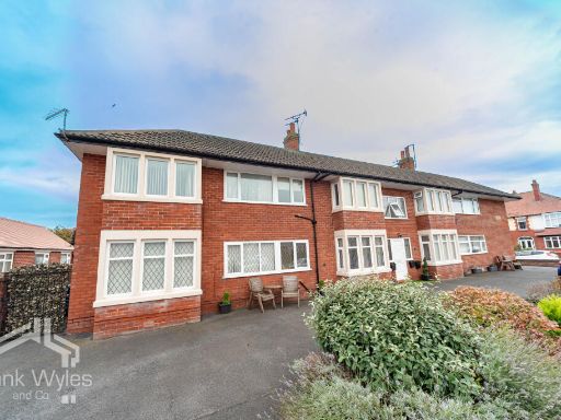 2 bedroom flat for sale in Flat 4, Eccleston Court, Mayfield Road, Lytham St. Annes, Lancashire, FY8 — £115,000 • 2 bed • 1 bath • 535 ft²
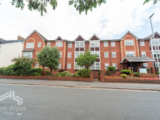 2 bedroom flat for sale in Flat 210, Ashton Garden Court, St. Andrews Road North, Lytham St. Annes, Lancashire, FY8 — £124,400 • 2 bed • 1 bath • 571 ft²
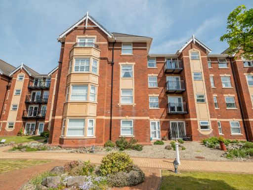 2 bedroom apartment for sale in Clifton Drive South, Lytham St. Annes, FY8 — £190,000 • 2 bed • 1 bath • 622 ft²
 2 bedroom apartment for sale in 96 St. Andrews Road South, Lytham St. Annes, FY8 — £85,000 • 2 bed • 1 bath • 600 ft²
Meta
- {
"@context": "https://schema.org",
"@type": "Residence",
"name": "2 bedroom flat for sale in St. Annes Court, St. Annes Road,…",
"description": "",
"url": "https://propertypiper.co.uk/property/ac46615b-4b76-4a80-a18c-c23b39d73826",
"image": "https://image-a.propertypiper.co.uk/36b2068f-8a93-4b22-90ec-1068a2fbf3ee-1024.jpeg",
"address": {
"@type": "PostalAddress",
"streetAddress": "29 ST ANNES COURT BLACKPOOL ",
"postalCode": "FY4 2DS",
"addressLocality": "Blackpool",
"addressRegion": "Blackpool South",
"addressCountry": "England"
},
"geo": {
"@type": "GeoCoordinates",
"latitude": 53.79848913593292,
"longitude": -3.0431327364515712
},
"numberOfRooms": 2,
"numberOfBathroomsTotal": 1,
"floorSize": {
"@type": "QuantitativeValue",
"value": 596,
"unitCode": "FTK"
},
"offers": {
"@type": "Offer",
"price": 65000,
"priceCurrency": "GBP",
"availability": "https://schema.org/InStock"
},
"additionalProperty": [
{
"@type": "PropertyValue",
"name": "Feature",
"value": "apartment"
},
{
"@type": "PropertyValue",
"name": "Feature",
"value": "building"
},
{
"@type": "PropertyValue",
"name": "Feature",
"value": "modern"
},
{
"@type": "PropertyValue",
"name": "Feature",
"value": "brick"
},
{
"@type": "PropertyValue",
"name": "Feature",
"value": "grey grid windows"
},
{
"@type": "PropertyValue",
"name": "Feature",
"value": "multi-storey"
},
{
"@type": "PropertyValue",
"name": "Feature",
"value": "residential"
},
{
"@type": "PropertyValue",
"name": "Feature",
"value": "urban"
},
{
"@type": "PropertyValue",
"name": "Feature",
"value": "modern"
},
{
"@type": "PropertyValue",
"name": "Feature",
"value": "neutral walls"
},
{
"@type": "PropertyValue",
"name": "Feature",
"value": "laminate flooring"
},
{
"@type": "PropertyValue",
"name": "Feature",
"value": "window"
},
{
"@type": "PropertyValue",
"name": "Feature",
"value": "ceiling light"
}
]
}