G61 1LT - 5 bedroom semidetached house for sale in 21 Allander Road,…
View on Property Piper
5 bedroom semi-detached house for sale in 21 Allander Road, Bearsden, G61 1LT, G61
Property Details
- Price: £385000
- Bedrooms: 5
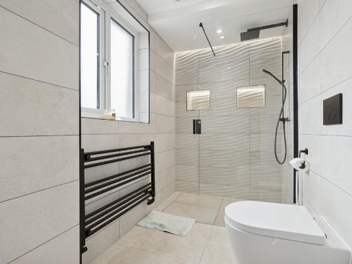
- Bathrooms: 3
- Property Type: undefined
- Property SubType: undefined
Brochure Descriptions
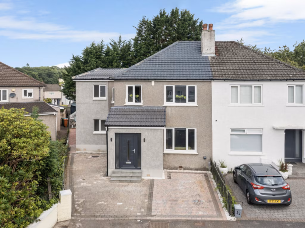
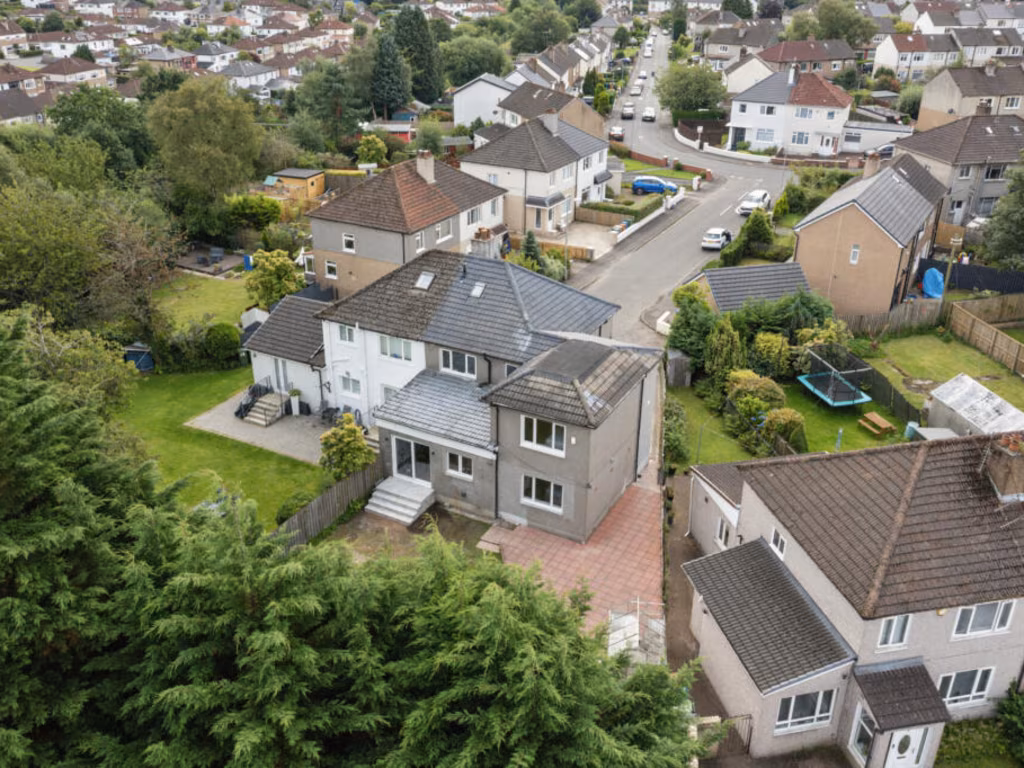
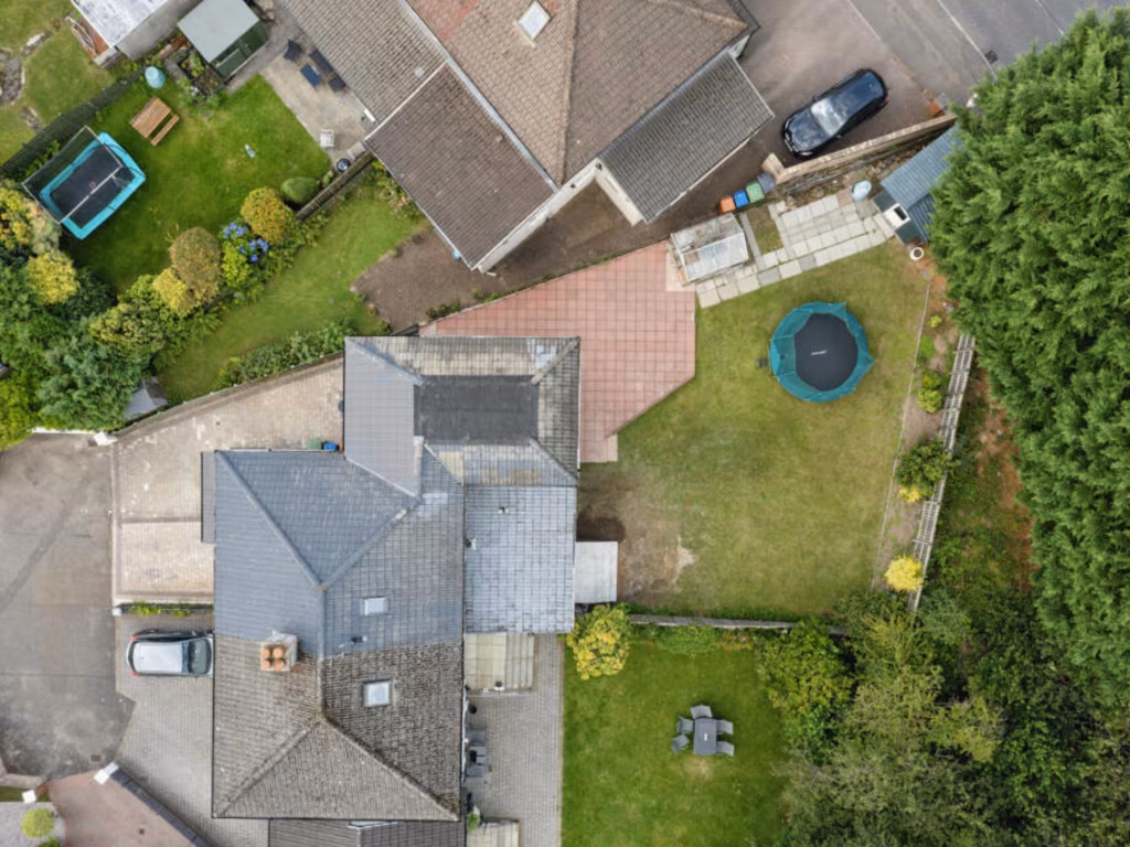
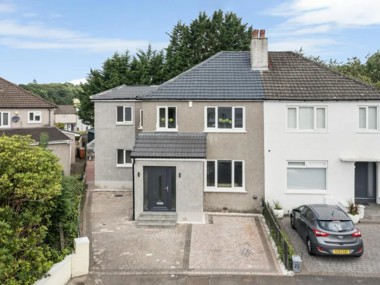
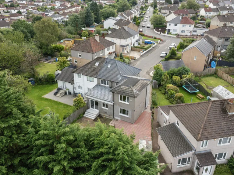
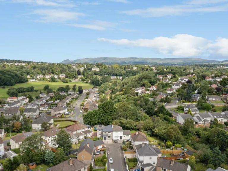
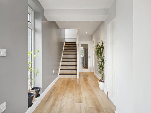
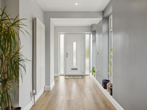
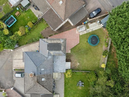
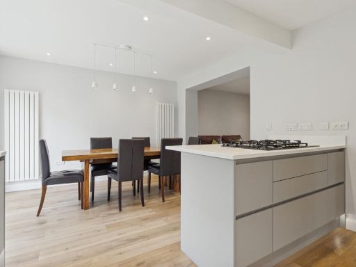
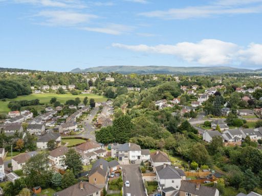
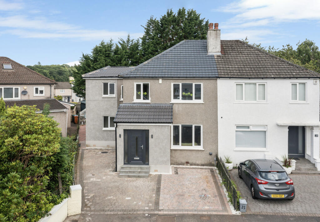
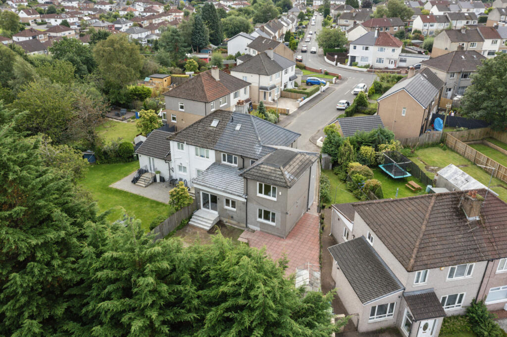
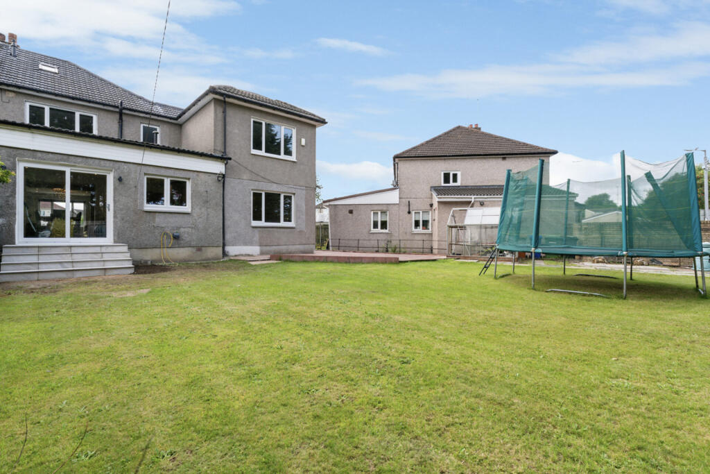
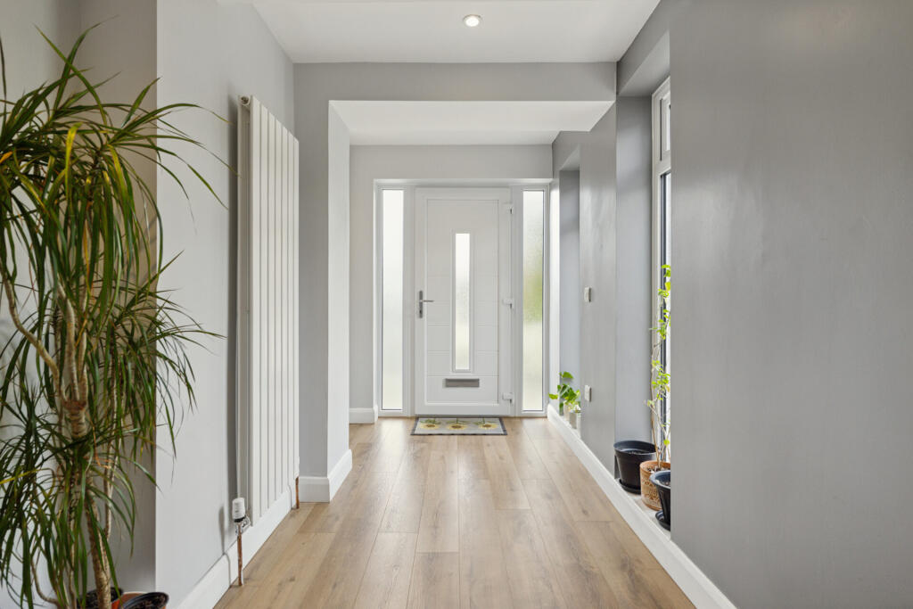
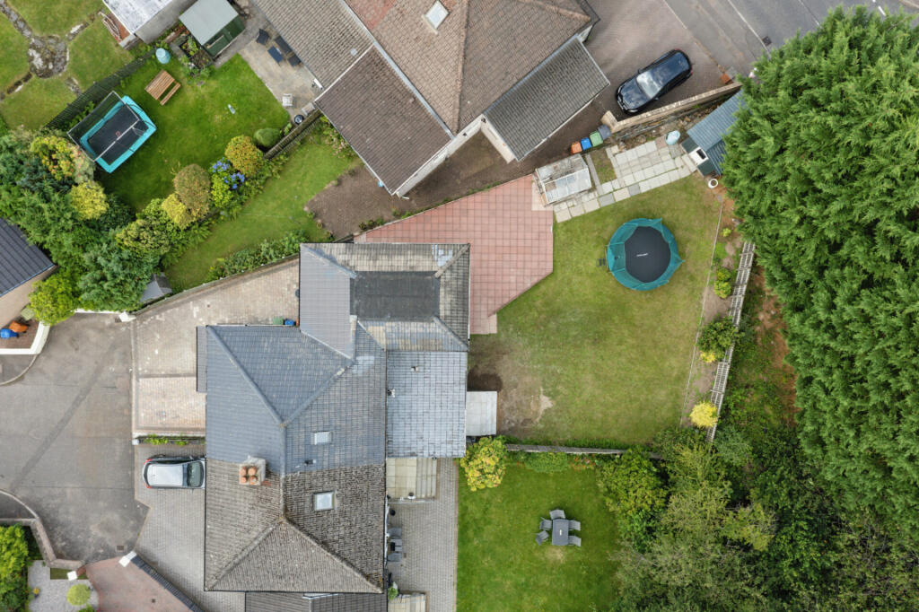
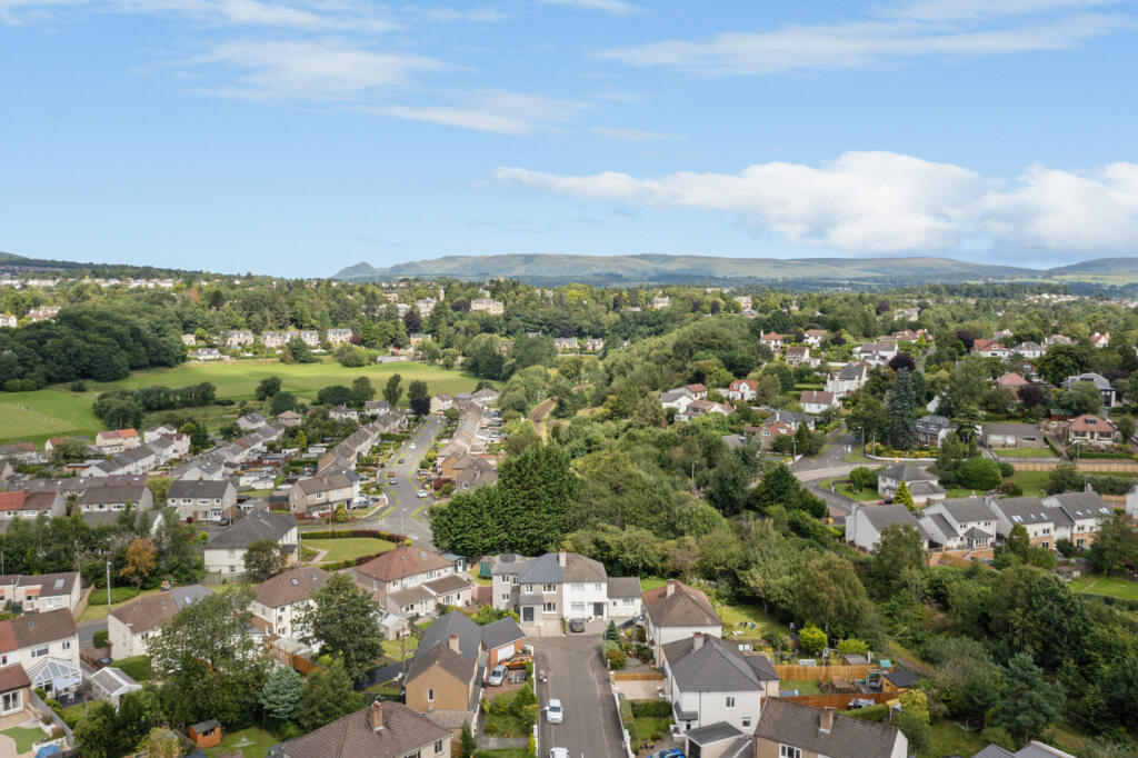
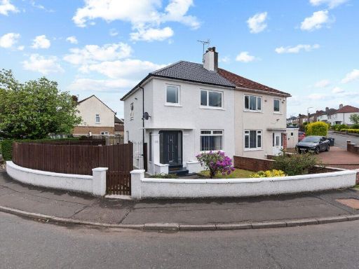
- This is a semi-detached two-storey residential house with a rendered exterior, located on Allander Road in Bearsden. The house appears to offer a sizeable, paved driveway with room for multiple vehicles. The property is situated in a residential area with similar style homes and mature trees visible in the background, offering some greenery and likely privacy. The overall plot and garden size appear average for the area. The house is likely to include three or four bedrooms based on its size and typical local layouts. No exceptional views are visible from this image. The property looks well-maintained and up-to-date.
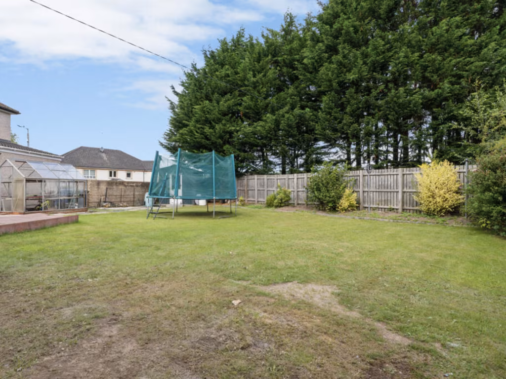
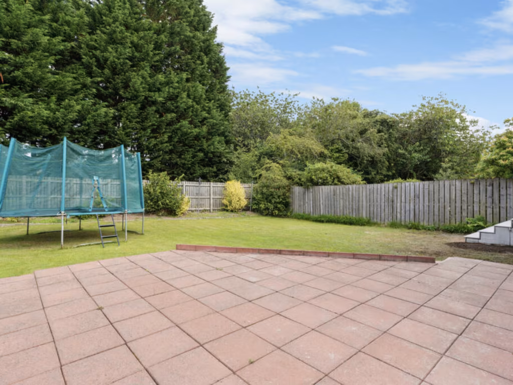
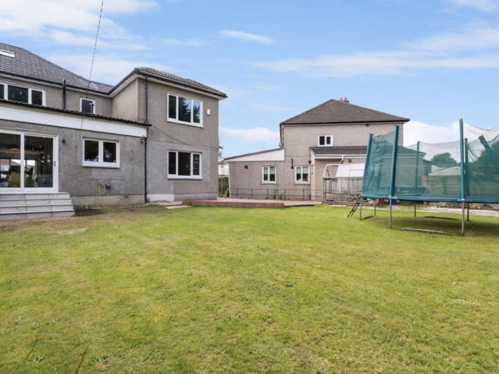
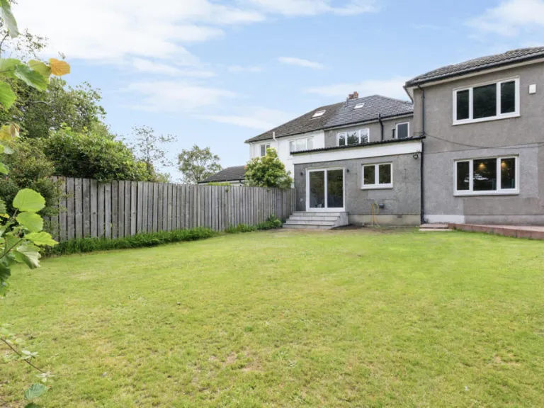
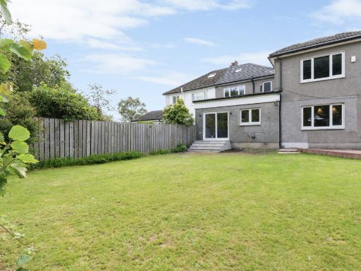
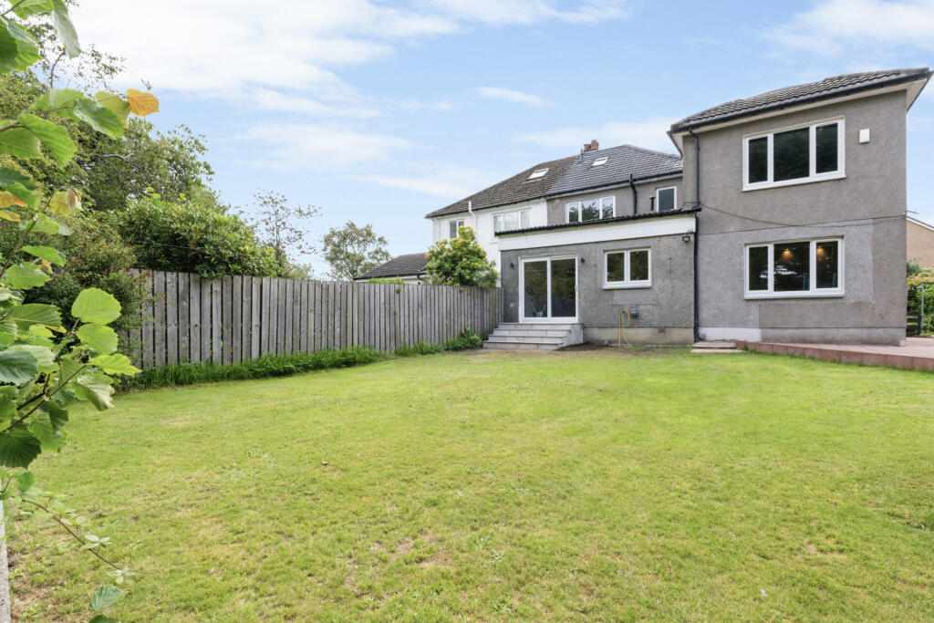
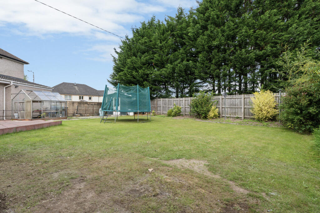
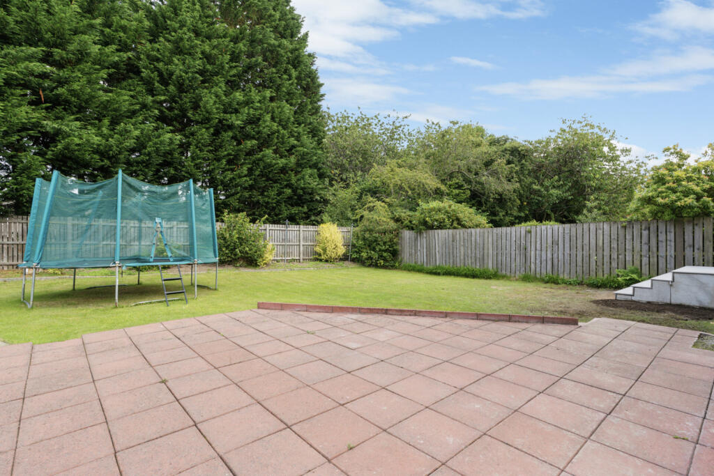
- The property is a large detached or semi-detached two-story house with a substantial, well-maintained garden. The exterior suggests a modern or updated structure with grey render and large windows providing good natural light. The garden is sizable, mostly lawn with flowerbeds and mature hedges/fence for privacy, suitable for a family. There are no specific landscape views shown, and the neighborhood setting appears to be suburban.
Image Descriptions
- house exterior 20th-century semi-detached
- two-story residential house Post-war suburban
Floorplan Description
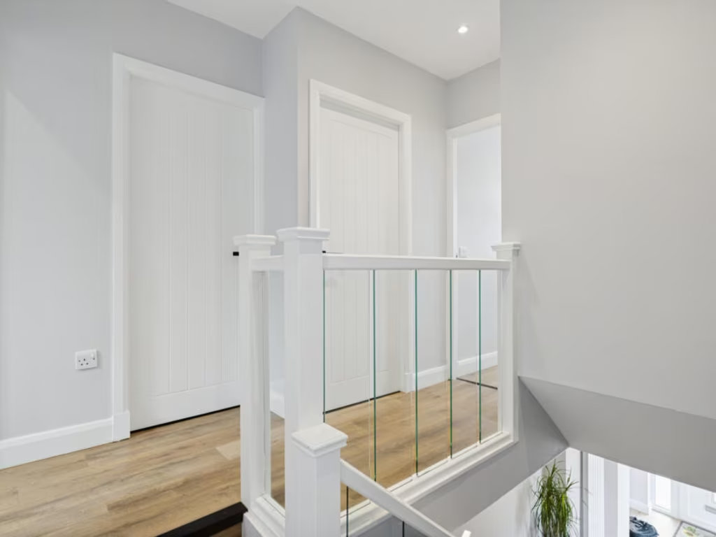
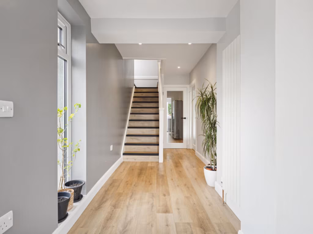
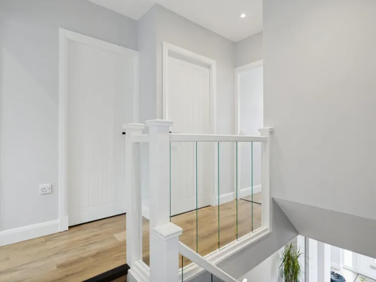
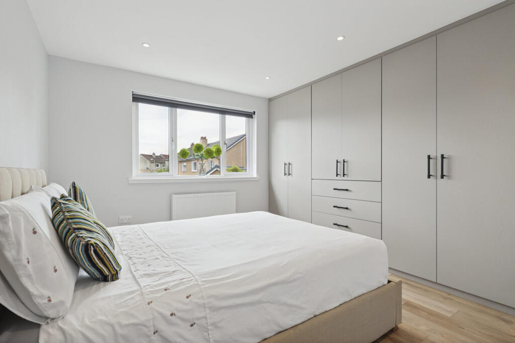
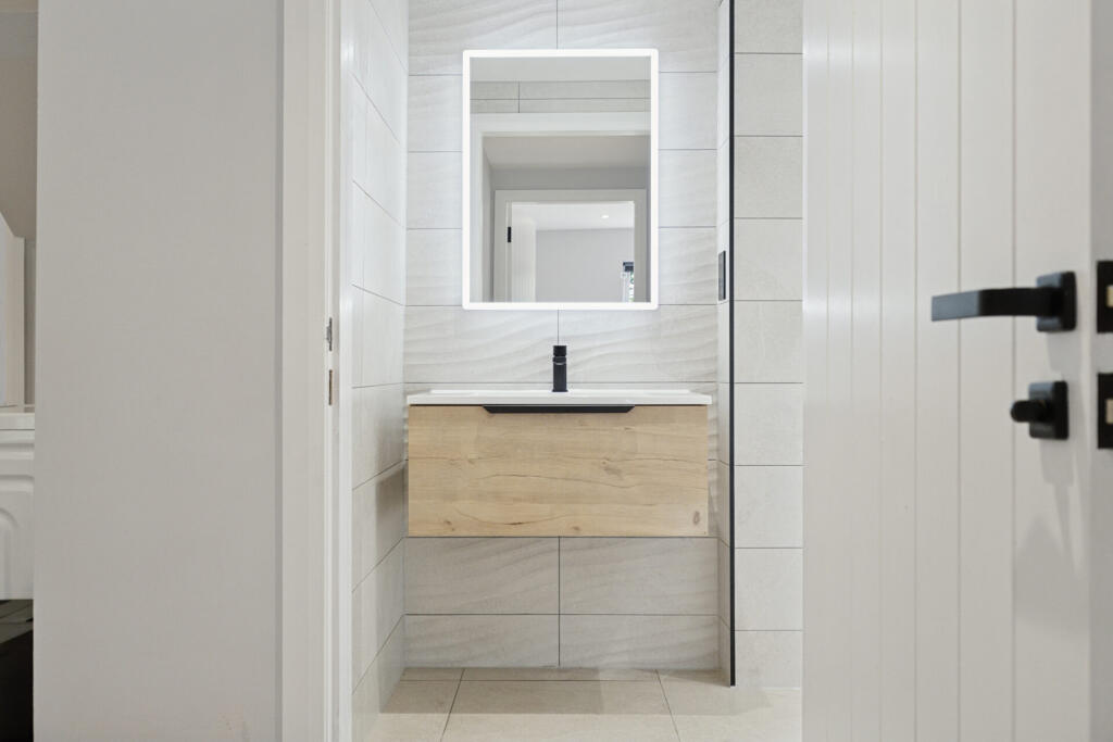
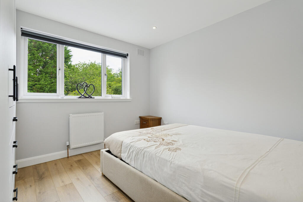
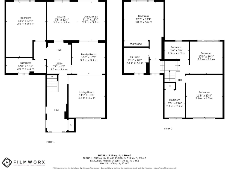
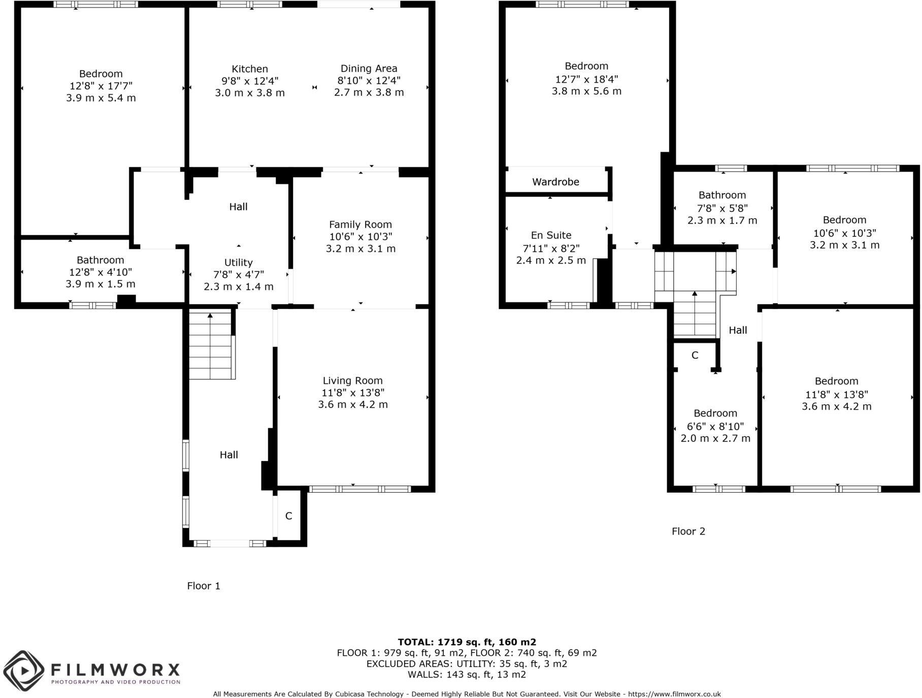
- A two-story house with a variety of room sizes including multiple bedrooms and living areas.
- A spacious multi-story property featuring large bedrooms and well-appointed living areas.
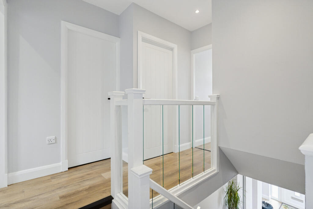
- Two-floor residential property with multiple bedrooms, living and family areas
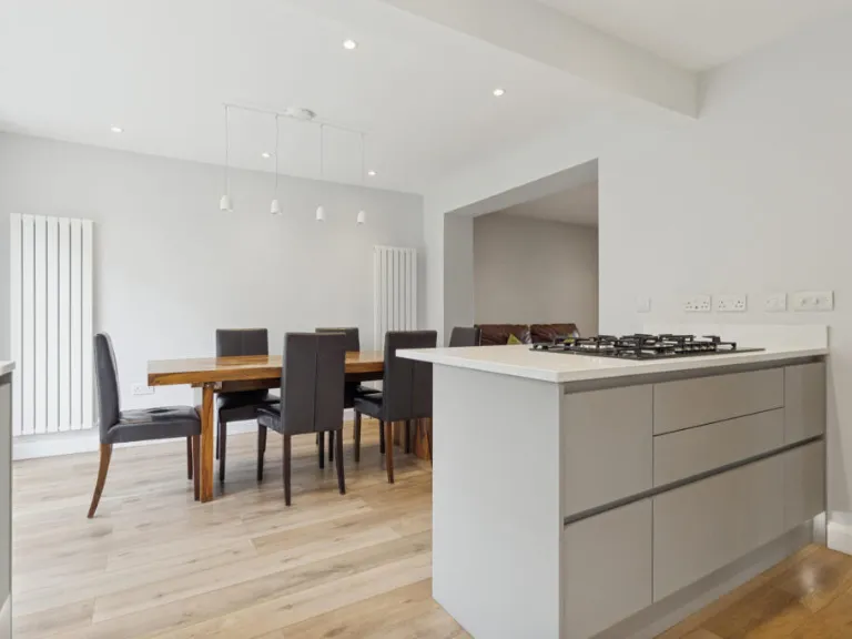
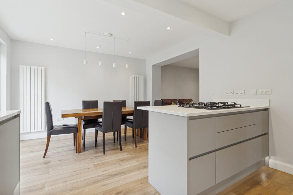
- Two-floor property with multiple bedrooms, living, dining, kitchen and utility spaces.
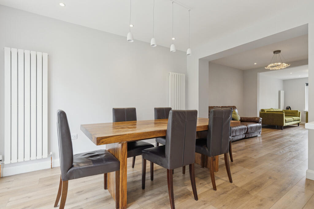
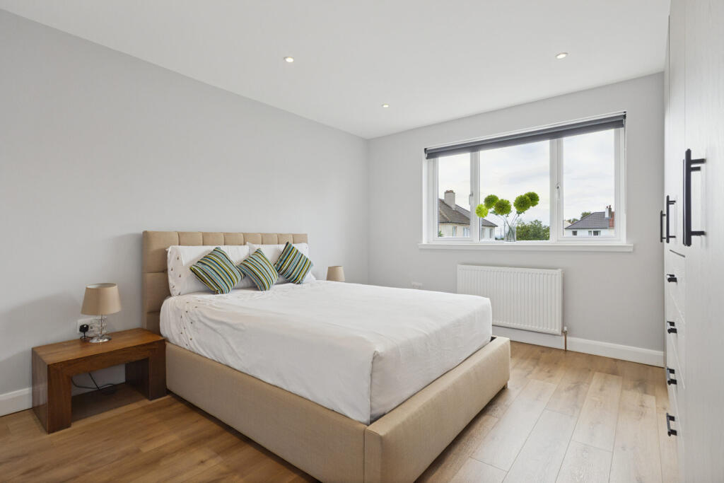
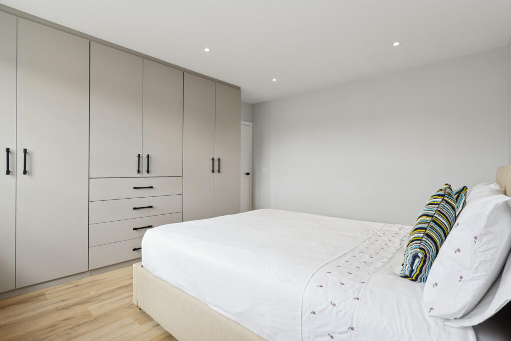
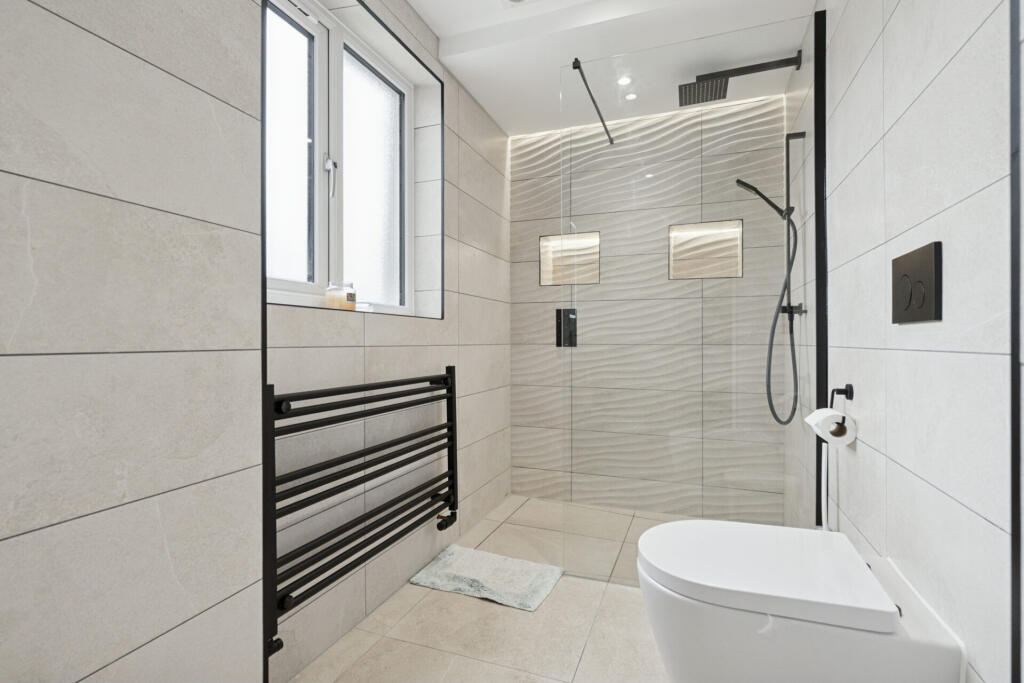
Rooms
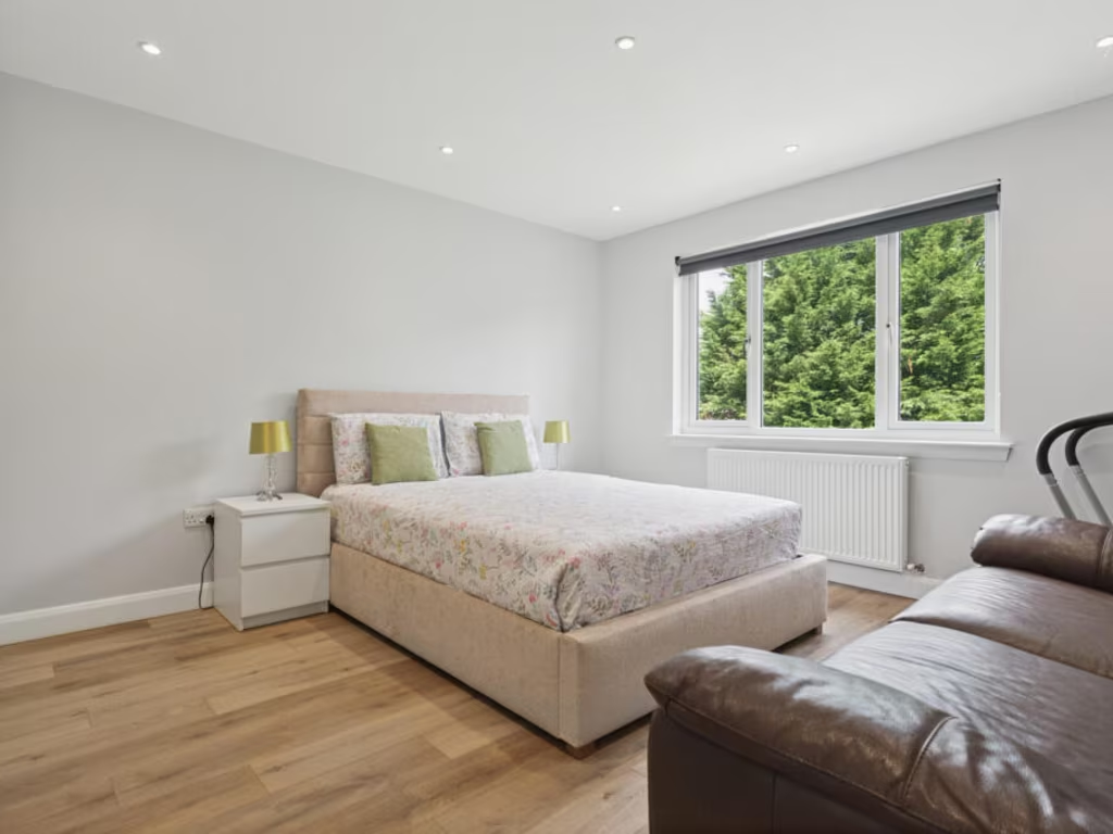
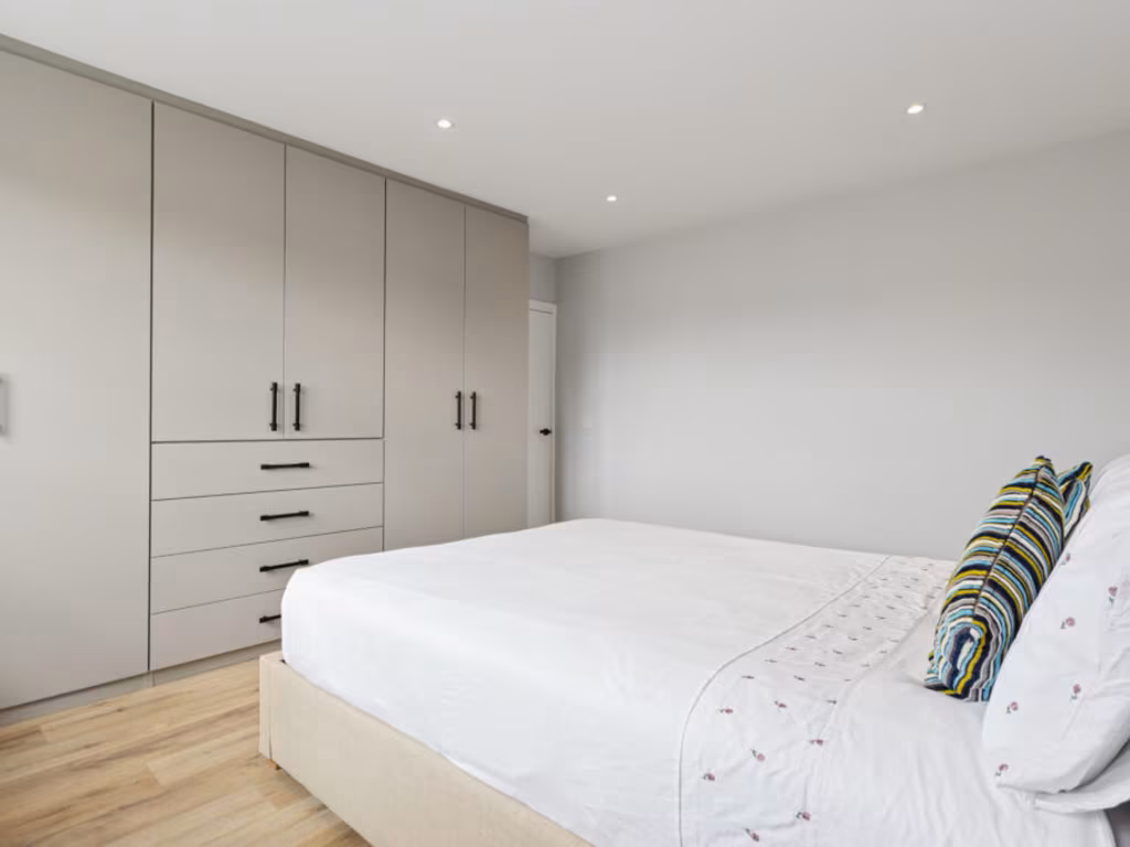
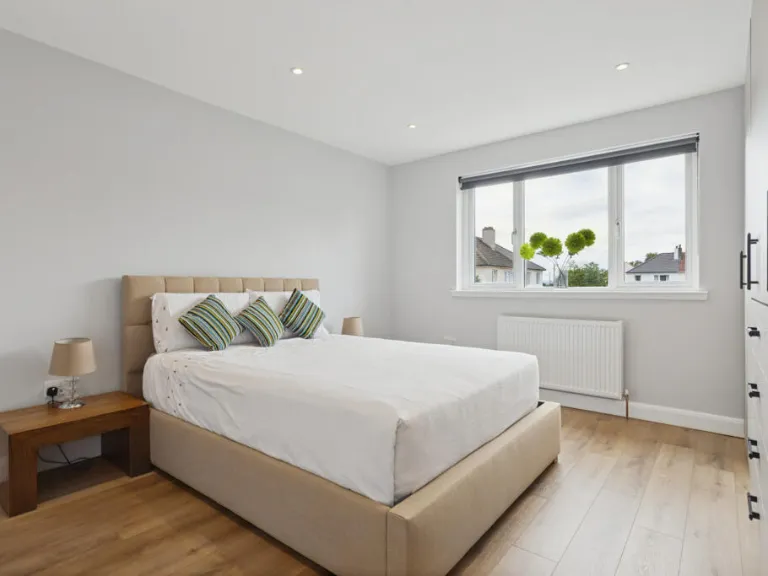
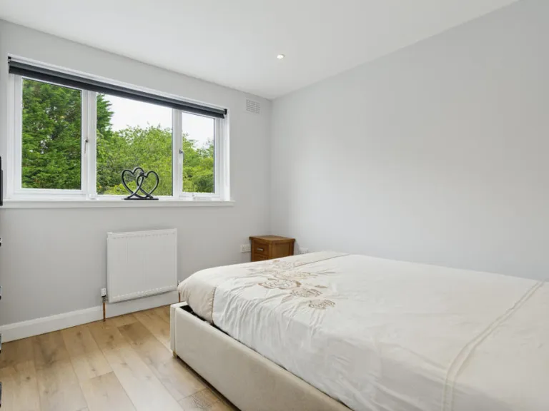
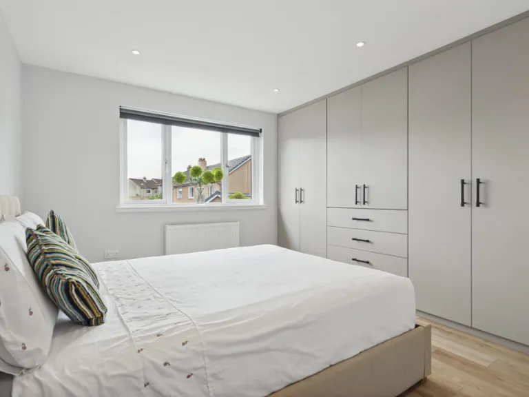
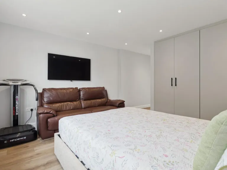
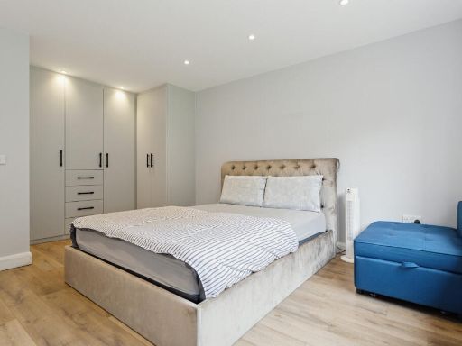
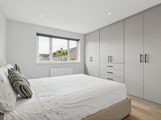
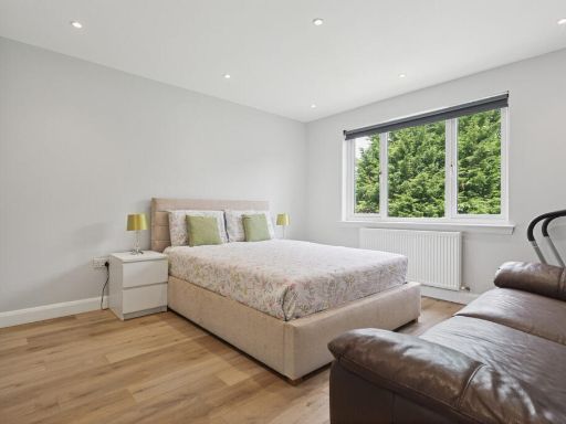
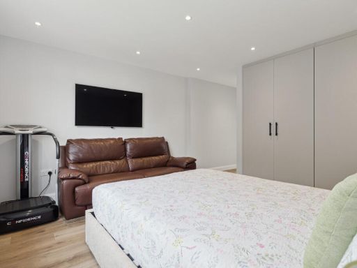
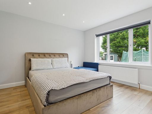
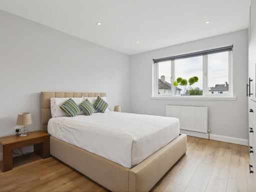
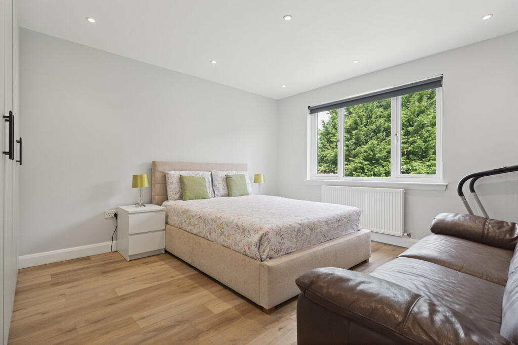
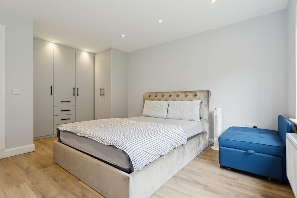
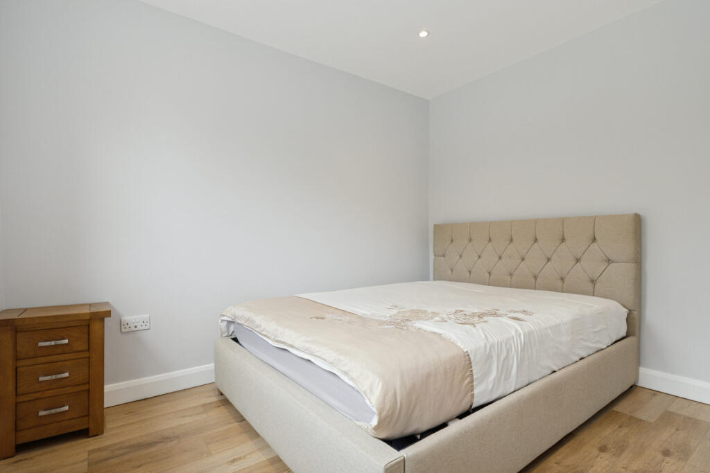
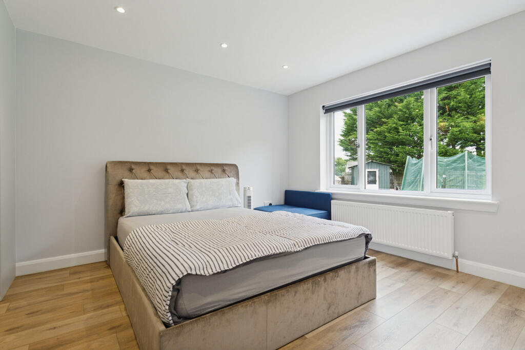
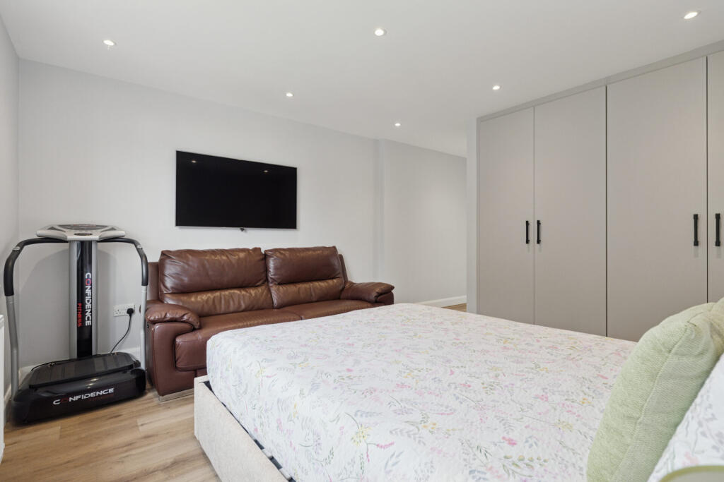
- Bedroom: large
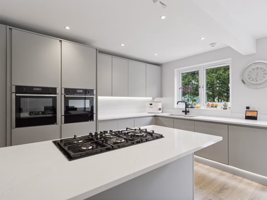
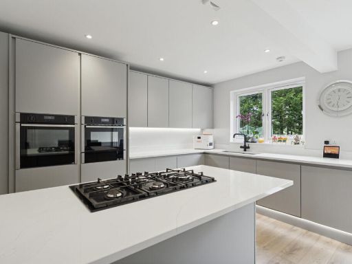
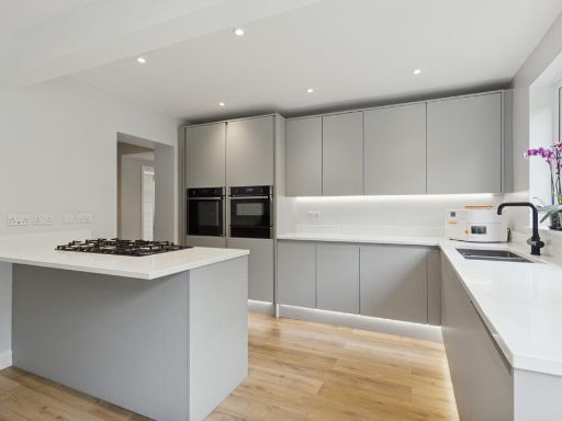
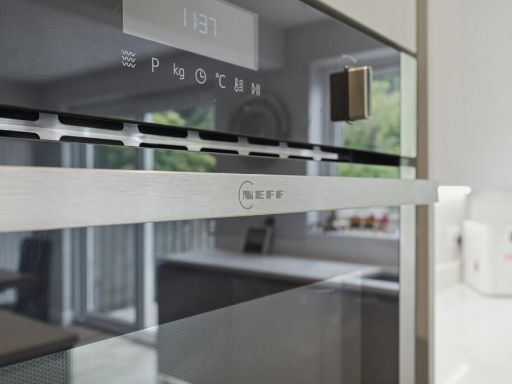
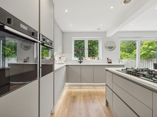
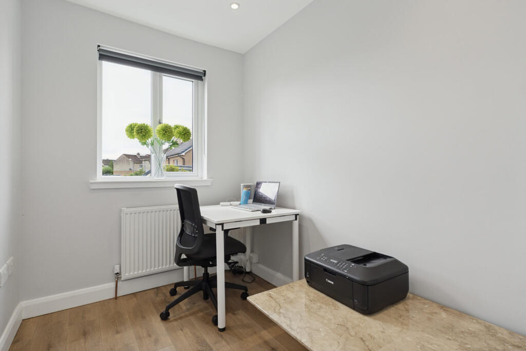
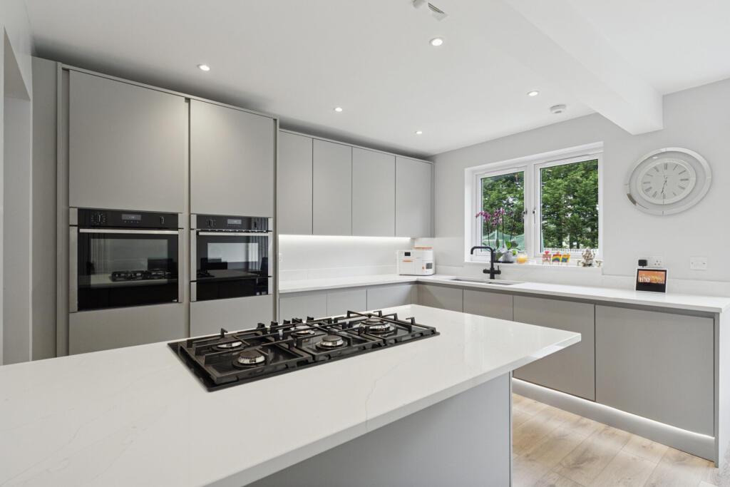
- Kitchen: average
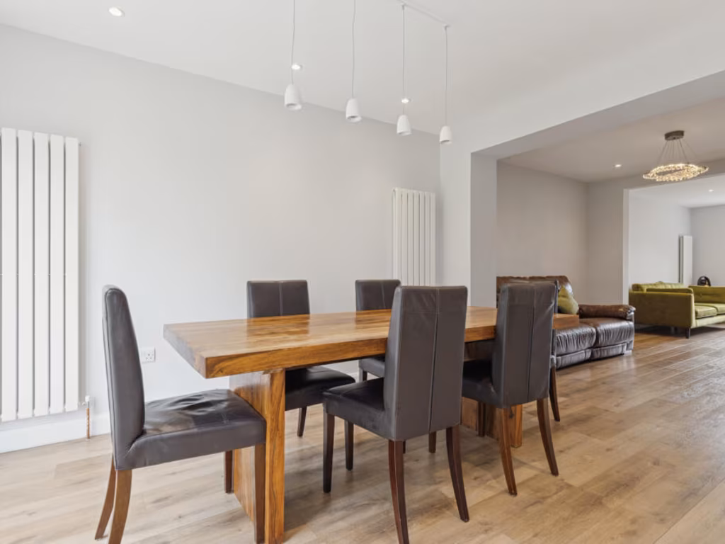
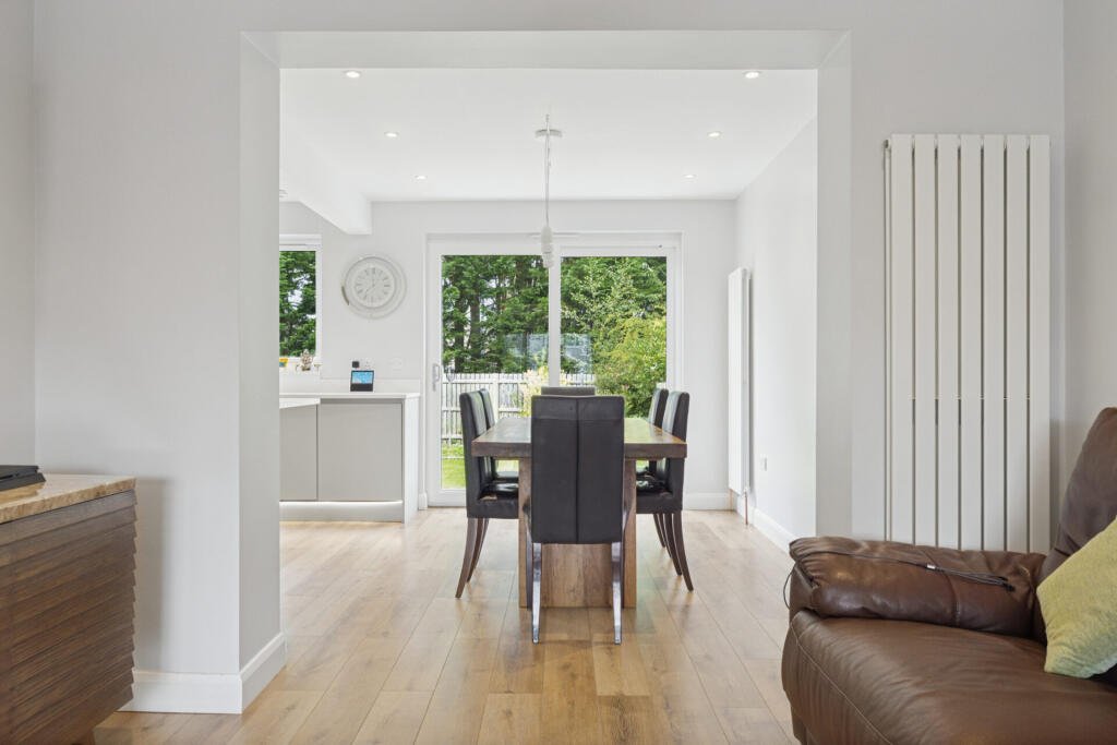
- Dining Area: average
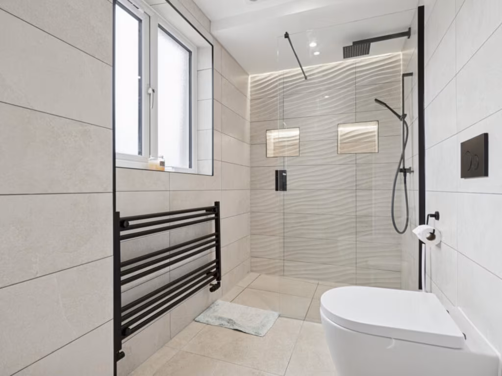
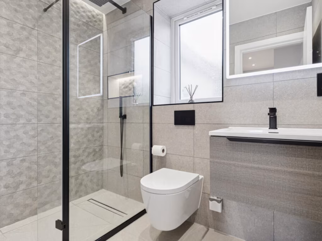
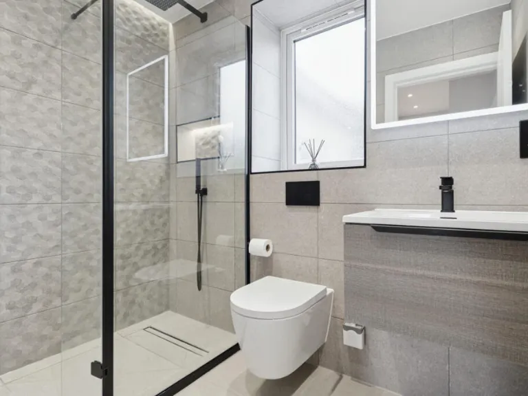
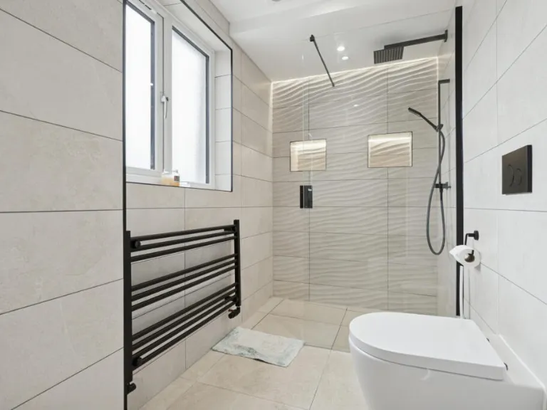
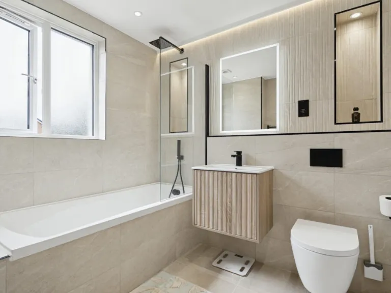
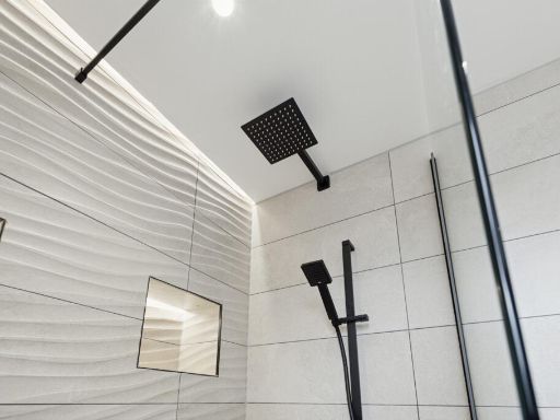
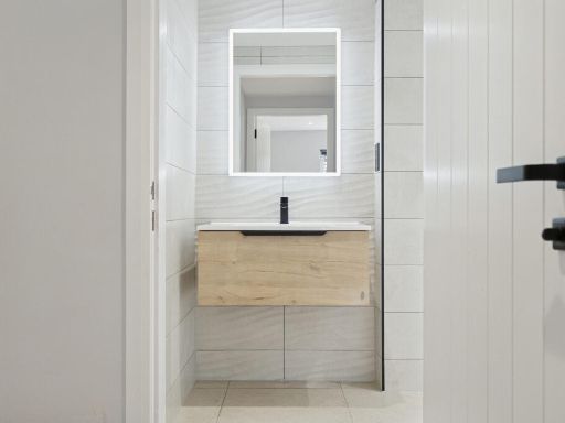
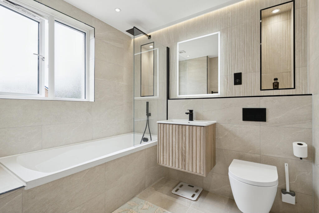
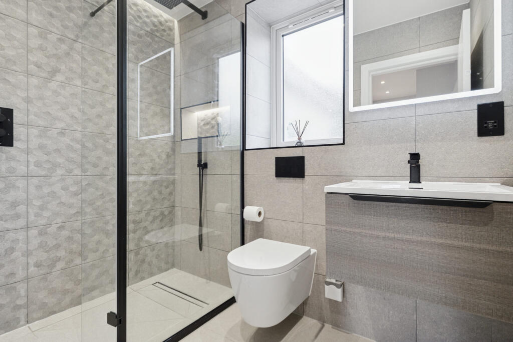
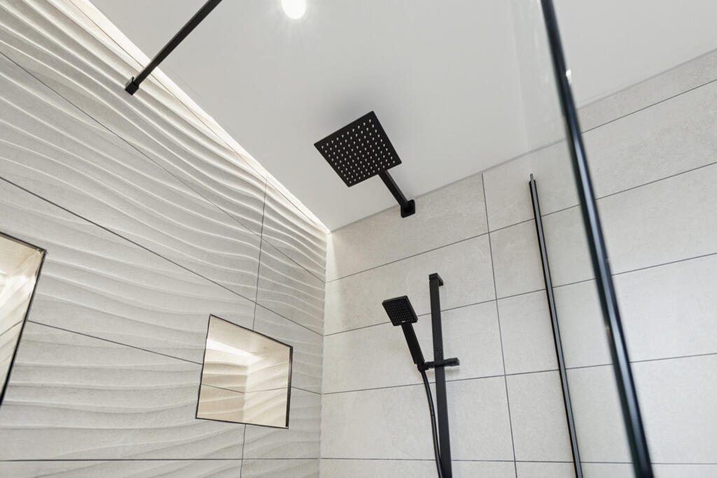
- Bathroom: average
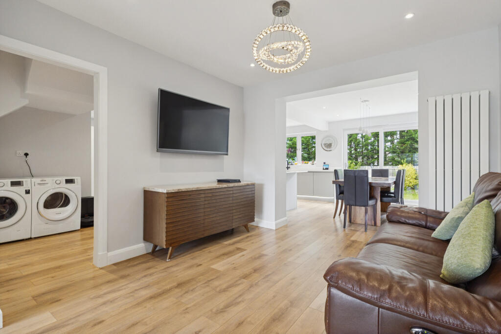
- Utility: small
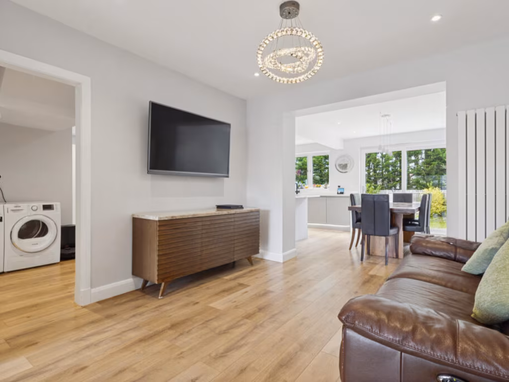
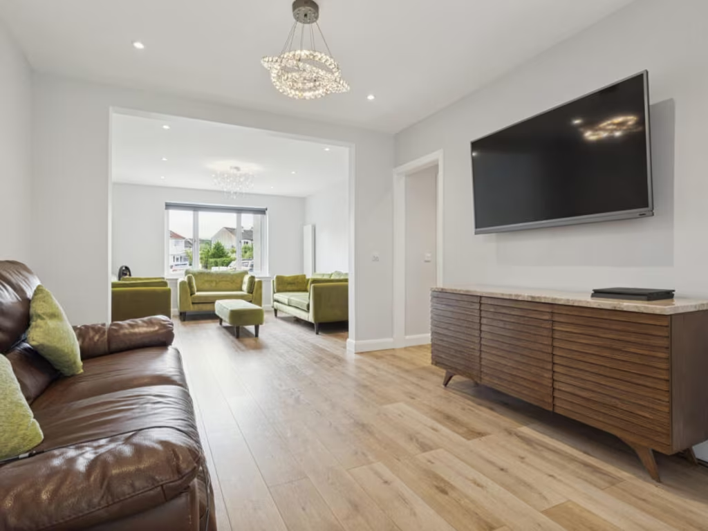
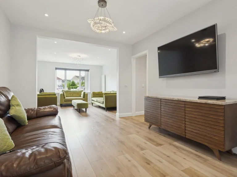
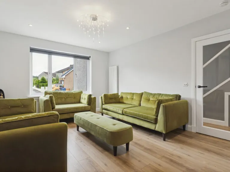
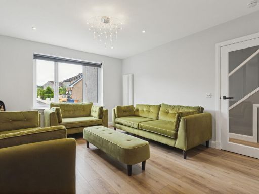
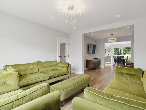
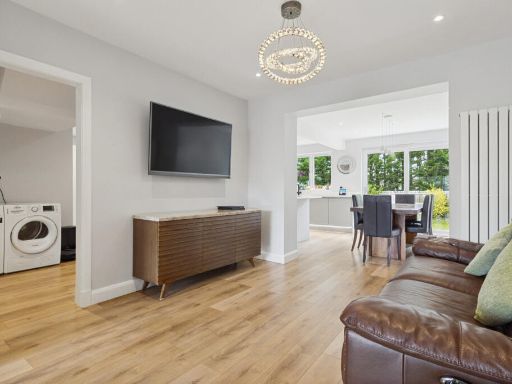
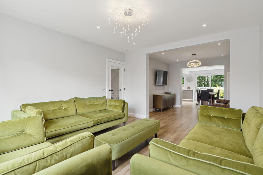
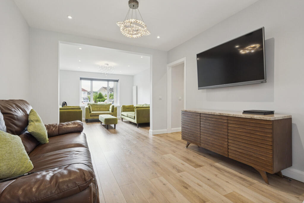
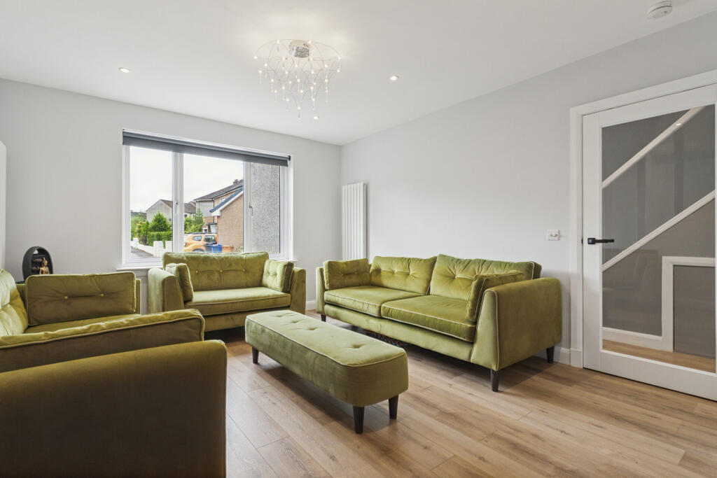
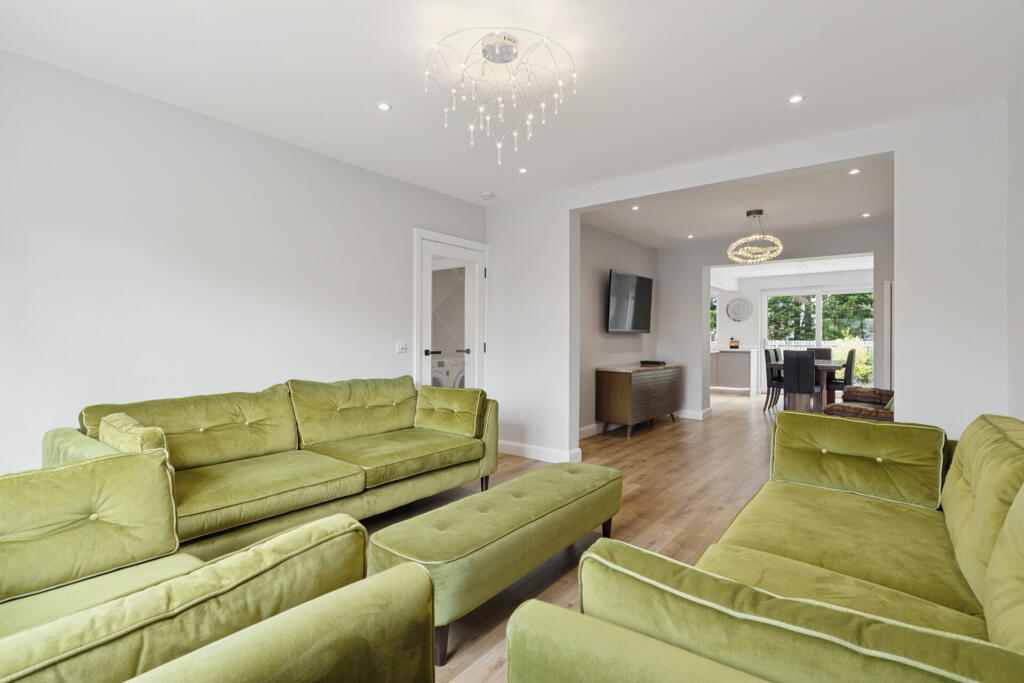
- Living Room: large
- Family Room: average
- Bedroom: large
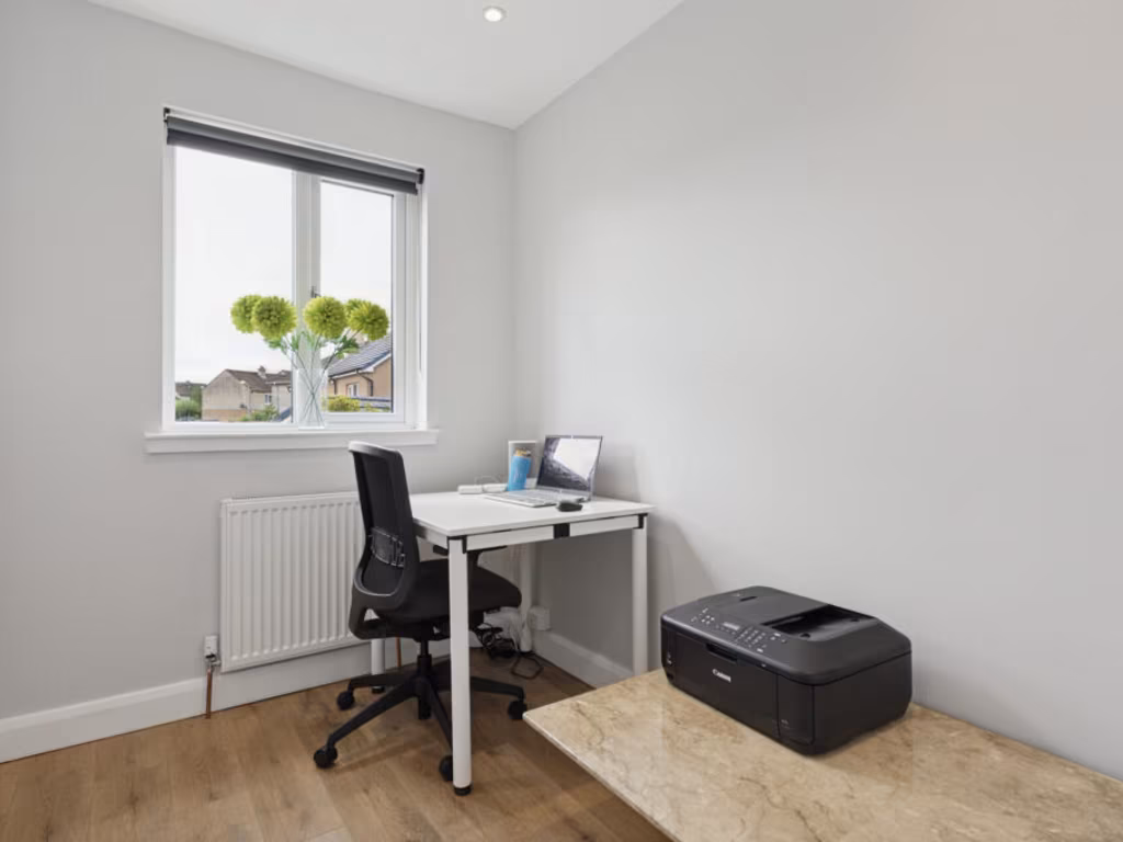
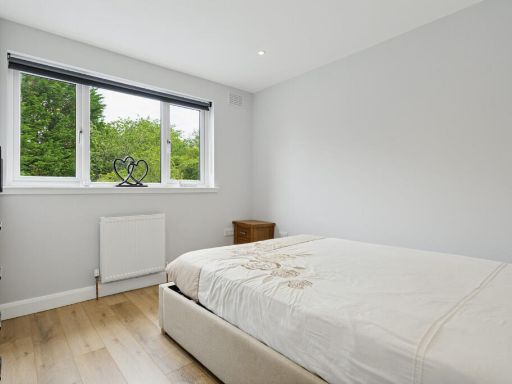
- Bedroom: average
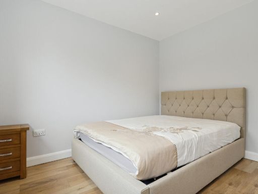
- Bedroom: small
- Bedroom: large
- En Suite: small
- Bathroom: small
- Bedroom: Large
- Kitchen: Average
- Dining Area: Average
- Family Room: Average
- Living Room: Average
- Bathroom: Large
- Utility: Small
- Wardrobe:
- En Suite: Small
- Bathroom: Small
- Bedroom: Small
- Bedroom: Large
- Bedroom: Small
- Bedroom:
- Kitchen:
- Dining Area:
- Bathroom:
- Utility:
- Family Room:
- Living Room:
- Bedroom:
- Wardrobe:
- En Suite:
- Bathroom:
- Bedroom:
- Bedroom:
- Bedroom:
- Bedroom:
- Kitchen:
- Dining Area:
- Bathroom:
- Utility:
- Family Room:
- Living Room:
- Bedroom:
- En Suite:
- Bathroom:
- Bedroom:
- Bedroom:
- Bedroom:
Textual Property Features
Detected Visual Features
- semi-detached
- 20th-century
- two-storey
- gable roof
- rendered exterior
- driveway
- residential area
- Post-war
- suburban
- two-story
- extension
- garage
- garden
- detached
- residential
- brickwork
- modernized
Nearest Bars And Restaurants
- Id: 8541028136
- Tags:
- Amenity: cafe
- Check_date: 2023-01-11
- Name: Vivi & Co
- TagsNormalized:
- Lat: 55.9196756
- Lon: -4.3337216
- FullGeoHash: gcuyj7u78znf
- PartitionGeoHash: gcuy
- Images:
- FoodStandards: null
- Distance: 1123.5
,- Id: 10621559414
- Tags:
- Amenity: fast_food
- Brand: Pizza Hut Delivery
- Brand:wikidata: Q107293079
- Check_date: 2023-02-08
- Cuisine: pizza
- Delivery: yes
- Name: Pizza Hut Delivery
- Takeaway: only
- TagsNormalized:
- fast food
- food
- hut
- pizza
- pizza hut
- pizza hut delivery
- takeaway
- Lat: 55.917228
- Lon: -4.3310222
- FullGeoHash: gcuyj7qjrygc
- PartitionGeoHash: gcuy
- Images:
- FoodStandards: null
- Distance: 993.1
,- Id: 10621559413
- Tags:
- Amenity: restaurant
- Check_date: 2023-02-08
- Cuisine: chinese
- Name: The Lantern
- Takeaway: only
- TagsNormalized:
- restaurant
- chinese
- takeaway
- Lat: 55.9171828
- Lon: -4.3309926
- FullGeoHash: gcuyj7qm0w3u
- PartitionGeoHash: gcuy
- Images:
- FoodStandards: null
- Distance: 990.7
,- Id: 10621559412
- Tags:
- Addr:
- Housenumber: 78
- Street: Drymen Road
- Amenity: restaurant
- Check_date: 2023-02-08
- Name: No 78
- TagsNormalized:
- Lat: 55.9171272
- Lon: -4.3309593
- FullGeoHash: gcuyj7qkck48
- PartitionGeoHash: gcuy
- Images:
- FoodStandards: null
- Distance: 987.6
,- Id: 4907300325
- Tags:
- Amenity: restaurant
- Check_date: 2023-02-03
- Name: The Station
- TagsNormalized:
- Lat: 55.9168835
- Lon: -4.3322422
- FullGeoHash: gcuyj7m77qw4
- PartitionGeoHash: gcuy
- Images:
- FoodStandards: null
- Distance: 914.1
}
Nearest General Shops
- Id: 8518290266
- Tags:
- Addr:
- City: Glasgow
- Housenumber: 135A
- Street: Spey Road
- Beauty: tanning
- Name: Tantastic
- Shop: beauty
- TagsNormalized:
- Lat: 55.9081839
- Lon: -4.3484173
- FullGeoHash: gcuyj1c8f8c5
- PartitionGeoHash: gcuy
- Images:
- FoodStandards: null
- Distance: 495.7
,- Id: 8497671346
- Tags:
- Addr:
- City: Glasgow
- Housenumber: 2B
- Street: Monreith Avenue
- Name: Gillian Copeland
- Shop: hairdresser
- TagsNormalized:
- Lat: 55.9085245
- Lon: -4.3362061
- FullGeoHash: gcuyj3f6z067
- PartitionGeoHash: gcuy
- Images:
- FoodStandards: null
- Distance: 419.1
,- Id: 8497671345
- Tags:
- Addr:
- City: Glasgow
- Housenumber: 3A
- Street: Monreith Avenue
- Name: Mellow Moods
- Shop: hairdresser
- TagsNormalized:
- Lat: 55.9085147
- Lon: -4.3364408
- FullGeoHash: gcuyj3f69we2
- PartitionGeoHash: gcuy
- Images:
- FoodStandards: null
- Distance: 407.7
}
Nearest Grocery shops
- Id: 4908903829
- Tags:
- Brand: Day-Today
- Name: Day-Today
- Opening_hours: Mo-Sa 08:30-20:00, Su 08:00-21:00
- Shop: convenience
- TagsNormalized:
- Lat: 55.9038928
- Lon: -4.3409085
- FullGeoHash: gcuyj0zpc8bn
- PartitionGeoHash: gcuy
- Images:
- FoodStandards: null
- Distance: 751.8
,- Id: 1376259796
- Tags:
- Addr:
- City: Glasgow
- Housenumber: 151-153
- Postcode: G61 1LF
- Street: Spey Road
- Brand: Scotmid
- Brand:wikidata: Q7435719
- Brand:wikipedia: en:Scotmid
- Name: Scotmid
- Opening_hours: Mo-Su 07:00-22:00
- Operator: Scottish Midland Co-operative Society
- Payment:
- Cash: yes
- Credit_cards: yes
- Debit_cards: yes
- Phone: +44 141 942 9635
- Shop: convenience
- Website: https://scotmid.coop/
- TagsNormalized:
- Lat: 55.9086034
- Lon: -4.3484008
- FullGeoHash: gcuyj1ce4zj3
- PartitionGeoHash: gcuy
- Images:
- FoodStandards: null
- Distance: 470.7
,- Id: 8494429012
- Tags:
- Addr:
- City: Glasgow
- Housenumber: 2A
- Postcode: G61 1NL
- Street: Monreith Avenue
- Name: KeyStore
- Opening_hours: Mo-Fr 07:00-20:00; Sa 07:00-21:00; Su 08:00-18:00
- Payment:
- Cash: yes
- Credit_cards: yes
- Debit_cards: yes
- Phone: +44 141 570 0034
- Shop: convenience
- Website: https://www.keystore.co.uk/store/keystore-bearsden/
- TagsNormalized:
- Lat: 55.9085169
- Lon: -4.3362935
- FullGeoHash: gcuyj3f6tncj
- PartitionGeoHash: gcuy
- Images:
- FoodStandards: null
- Distance: 415.1
}
Nearest Supermarkets
- Id: 146426690
- Tags:
- Addr:
- Country: GB
- Housenumber: 80
- Postcode: G61 2TX
- Street: Milngavie Road
- Brand: Asda
- Brand:wikidata: Q297410
- Brand:wikipedia: en:Asda
- Building: retail
- Contact:
- Facebook: https://www.facebook.com/asda/
- Twitter: @asda
- Website: https://storelocator.asda.com/scotland/glasgow/80-milngavie-road
- Name: Asda
- Operator: Asda Stores Ltd
- Shop: supermarket
- Source: Bing
- TagsNormalized:
- asda
- retail
- supermarket
- shop
- Lat: 55.917193
- Lon: -4.3185086
- FullGeoHash: gcuyjerm72q8
- PartitionGeoHash: gcuy
- Images:
- FoodStandards: null
- Distance: 1623
,- Id: 1607886119
- Tags:
- Addr:
- City: Bearsden
- Housenumber: 134-138
- Postcode: G61 3RB
- Street: Drymen Road
- Brand: Marks & Spencer
- Brand:wikidata: Q714491
- Check_date: 2022-09-03
- Contact:
- Website: https://www.marksandspencer.com/stores/bearsden-simply-food-8866
- Entrance: main
- Name: Marks & Spencer
- Opening_hours: Mo-Sa 08:00-19:00; Su 09:00-18:00
- Operator: Marks & Spencer
- Shop: supermarket
- TagsNormalized:
- marks & spencer
- supermarket
- shop
- Lat: 55.9204979
- Lon: -4.3342965
- FullGeoHash: gcuyjk5be867
- PartitionGeoHash: gcuy
- Images:
- FoodStandards: null
- Distance: 1191.5
,- Id: 158451101
- Tags:
- Addr:
- Housenumber: 3
- Postcode: G61 4AN
- Street: Station Road
- Brand: Co-op Food
- Brand:wikidata: Q3277439
- Brand:wikipedia: en:Co-op Food
- Building: retail
- Building:levels: 1
- Check_date: 2023-01-31
- Name: Co-op Food
- Opening_hours: Mo-Su 07:00-22:00
- Payment:
- Cash: yes
- Contactless: yes
- Credit_cards: yes
- Debit_cards: yes
- Phone: +44 141 931 5493
- Roof:
- Shop: supermarket
- Website: https://www.coop.co.uk/
- TagsNormalized:
- co-op
- co-op food
- food
- retail
- supermarket
- shop
- Lat: 55.9168315
- Lon: -4.3314058
- FullGeoHash: gcuyj7mgnuvs
- PartitionGeoHash: gcuy
- Images:
- FoodStandards: null
- Distance: 944.6
}
Nearest Religious buildings
- Id: 85255127
- Tags:
- Amenity: place_of_worship
- Building: church
- Denomination: church_of_scotland
- Name: Bearsden Cross
- Religion: christian
- Source: OS_OpenData_StreetView
- TagsNormalized:
- place of worship
- church
- church of scotland
- christian
- Lat: 55.9180889
- Lon: -4.333082
- FullGeoHash: gcuyj7sdrz7c
- PartitionGeoHash: gcuy
- Images:
- FoodStandards: null
- Distance: 990.1
,- Id: 2953937033
- Tags:
- Addr:
- City: Glasgow
- Housenumber: 248
- Postcode: G15 6EG
- Street: Drumchapel Road
- Amenity: dentist
- Fax: +44 141 9444449
- Name: Drumchapel Road Dental Surgery
- Opening_hours: Mo-Fr 09:00-17:45; Sa 09:00-13:00
- Phone: +44 141 9444449
- TagsNormalized:
- dentist
- chapel
- dental
- surgery
- Lat: 55.9064554
- Lon: -4.3547134
- FullGeoHash: gcuyhckyxydk
- PartitionGeoHash: gcuy
- Images:
- FoodStandards: null
- Distance: 930.8
,- Id: 82389431
- Tags:
- Amenity: place_of_worship
- Building: yes
- Denomination: church_of_scotland
- Name: Westerton Parish Church
- Religion: christian
- Source: OS_OpenData_StreetView
- TagsNormalized:
- place of worship
- church
- church of scotland
- parish
- christian
- Lat: 55.9058313
- Lon: -4.3330605
- FullGeoHash: gcuyj3kg067c
- PartitionGeoHash: gcuy
- Images:
- FoodStandards: null
- Distance: 762
}
Nearest Medical buildings
- Id: 8693472465
- Tags:
- Addr:
- Housenumber: 8
- Postcode: G61 3SL
- Street: New Kirk Road
- Amenity: pharmacy
- Brand: Lloyds Pharmacy
- Brand:wikidata: Q6662870
- Brand:wikipedia: en:LloydsPharmacy
- Check_date: 2022-09-03
- Dispensing: yes
- Drive_through: no
- Healthcare: pharmacy
- Name: Lloyds Pharmacy
- Opening_hours: Mo-Fr 09:00-18:00; Sa 09:00-17:00
- Phone: +44 141 942 9248
- Website: https://lloydspharmacy.com/
- TagsNormalized:
- pharmacy
- lloyds pharmacy
- health
- healthcare
- Lat: 55.9198909
- Lon: -4.333652
- FullGeoHash: gcuyj7ukfx4y
- PartitionGeoHash: gcuy
- Images:
- FoodStandards: null
- Distance: 1146.8
,- Id: 8693472464
- Tags:
- Addr:
- Housenumber: 104
- Postcode: G61 3RA
- Street: Drymen Road
- Amenity: pharmacy
- Dispensing: yes
- Drive_through: no
- Healthcare: pharmacy
- Name: J H C Suttie & Co
- Opening_hours: Mo-Fr 09:00-18:00; Sa 09:00-13:00
- Phone: +44 141 942 0274
- TagsNormalized:
- Lat: 55.9196351
- Lon: -4.3336929
- FullGeoHash: gcuyj7u73xs2
- PartitionGeoHash: gcuy
- Images:
- FoodStandards: null
- Distance: 1120.2
,- Id: 8693472463
- Tags:
- Addr:
- Housenumber: 96
- Street: Drymen Road
- Amenity: doctors
- Healthcare: doctor
- Healthcare:speciality: general
- Name: Denbridge Surgery
- Phone: +44 141 942 9494
- Website: https://www.denbridge-surgery.org.uk/
- TagsNormalized:
- doctor
- doctors
- health
- healthcare
- general
- surgery
- Lat: 55.9182395
- Lon: -4.3320453
- FullGeoHash: gcuyj7te252g
- PartitionGeoHash: gcuy
- Images:
- FoodStandards: null
- Distance: 1040.4
,- Id: 1376259799
- Tags:
- Addr:
- City: Glasgow
- Housenumber: 145
- Street: Spey Road
- Amenity: pharmacy
- Dispensing: yes
- Healthcare: pharmacy
- Name: Mackie Pharmacy
- Opening_hours: Mo-Fr 08:00-19:00; Sa 09:00-18:00
- Operator: JP Mackie & Co Ltd
- Phone: +44 141 942 6626
- TagsNormalized:
- Lat: 55.9083644
- Lon: -4.3484062
- FullGeoHash: gcuyj1c9ff92
- PartitionGeoHash: gcuy
- Images:
- FoodStandards: null
- Distance: 484.3
}
Nearest Airports
- Id: 1100796130
- Tags:
- Addr:
- City: Paisley
- Postcode: PA3 2SW
- Aerodrome: international
- Aerodrome:type: public
- Aeroway: aerodrome
- Iata: GLA
- Icao: EGPF
- Ifr: yes
- Is_in: Paisley, Scotland, UK
- Name: Glasgow Airport
- Operator: Glasgow Airport Limited
- Phone: +44 141 887 1111
- Ref: GLA
- Source: CAA AIP
- Wikidata: Q8721
- Wikipedia: en:Glasgow Airport
- TagsNormalized:
- airport
- international airport
- Lat: 55.8705835
- Lon: -4.4351667
- FullGeoHash: gcuvg4fmtpsh
- PartitionGeoHash: gcuv
- Images:
- FoodStandards: null
- Distance: 7331.2
,- Id: 4519551
- Tags:
- Aerodrome: international
- Name: Glasgow International Airport
- Type: site
- Wikidata: Q8721
- TagsNormalized:
- airport
- international airport
- Lat: 55.8705829
- Lon: -4.4355768
- FullGeoHash: gcuvg4fjexd0
- PartitionGeoHash: gcuv
- Images:
- FoodStandards: null
- Distance: 7351.6
}
Nearest Leisure Facilities
- Id: 266856138
- Tags:
- Leisure: pitch
- Sport: rugby_union
- TagsNormalized:
- pitch
- leisure
- rugby
- rugby union
- sports
- Lat: 55.9144759
- Lon: -4.3418786
- FullGeoHash: gcuyj4ym6vu8
- PartitionGeoHash: gcuy
- Images:
- FoodStandards: null
- Distance: 427
,- Id: 266856137
- Tags:
- Leisure: pitch
- Sport: soccer
- TagsNormalized:
- Lat: 55.9137703
- Lon: -4.3454768
- FullGeoHash: gcuyj4g9r41x
- PartitionGeoHash: gcuy
- Images:
- FoodStandards: null
- Distance: 417.9
,- Id: 266856132
- Tags:
- Leisure: pitch
- Sport: soccer
- TagsNormalized:
- Lat: 55.912702
- Lon: -4.3467542
- FullGeoHash: gcuyj4dg1715
- PartitionGeoHash: gcuy
- Images:
- FoodStandards: null
- Distance: 386
,- Id: 266856136
- Tags:
- Leisure: pitch
- Sport: soccer
- TagsNormalized:
- Lat: 55.9132534
- Lon: -4.3451191
- FullGeoHash: gcuyj4eyr3uk
- PartitionGeoHash: gcuy
- Images:
- FoodStandards: null
- Distance: 357.9
,- Id: 586653434
- Tags:
- TagsNormalized:
- Lat: 55.9101783
- Lon: -4.3462129
- FullGeoHash: gcuyj45hmusu
- PartitionGeoHash: gcuy
- Images:
- FoodStandards: null
- Distance: 281.2
}
Nearest Tourist attractions
- Id: 236092318
- Tags:
- Building: yes
- Height: 46
- Name: Titan Crane
- Tourism: attraction
- Website: https://www.titanclydebank.com/
- Wikidata: Q7809742
- Wikipedia: en:Titan Clydebank
- TagsNormalized:
- Lat: 55.8973335
- Lon: -4.4086937
- FullGeoHash: gcuvgxv9tfpw
- PartitionGeoHash: gcuv
- Images:
- FoodStandards: null
- Distance: 4425.7
,- Id: 6502359003
- Tags:
- Addr:
- Postcode: G12 0PR
- Street: Bellshaugh Court
- Name: Queen Margaret Residence
- Name:en: Queen Margaret Residences
- Tourism: apartment
- Website: http://sanctuary-housing.co.uk
- TagsNormalized:
- Lat: 55.8844396
- Lon: -4.2971478
- FullGeoHash: gcuvyjqymnw7
- PartitionGeoHash: gcuv
- Images:
- FoodStandards: null
- Distance: 4028.2
,- Id: 443593726
- Tags:
- Building: yes
- Name: Best Foot Forward
- Tourism: guest_house
- TagsNormalized:
- Lat: 55.9385625
- Lon: -4.3099706
- FullGeoHash: gcuyjzm9druf
- PartitionGeoHash: gcuy
- Images:
- FoodStandards: null
- Distance: 3683.6
}
Nearest Bus stations and stops
- Id: 8518248847
- Tags:
- Bench: yes
- Bin: no
- Bus: yes
- Departures_board: timetable
- Highway: bus_stop
- Name: Westerton, Before Maxwell Avenue on Canniesburn Road
- Public_transport: platform
- Shelter: yes
- TagsNormalized:
- Lat: 55.9109102
- Lon: -4.3367173
- FullGeoHash: gcuyj660ejj4
- PartitionGeoHash: gcuy
- Images:
- FoodStandards: null
- Distance: 316.8
,- Id: 8518248849
- Tags:
- Bench: yes
- Bus: yes
- Departures_board: timetable
- Highway: bus_stop
- Name: Westerton, Opp Carron Crescent on Canniesburn Road
- Public_transport: platform
- Shelter: yes
- TagsNormalized:
- Lat: 55.9095116
- Lon: -4.3459843
- FullGeoHash: gcuyj452e0r5
- PartitionGeoHash: gcuy
- Images:
- FoodStandards: null
- Distance: 290.6
,- Id: 8518248850
- Tags:
- Bus: yes
- Departures_board: timetable
- Highway: bus_stop
- Name: Westerton, At Colquhoun Park Primary School on Canniesburn Road
- Public_transport: platform
- Shelter: yes
- TagsNormalized:
- Lat: 55.9101222
- Lon: -4.3448622
- FullGeoHash: gcuyj4hhj65v
- PartitionGeoHash: gcuy
- Images:
- FoodStandards: null
- Distance: 200.6
,- Id: 8518248851
- Tags:
- Bus: yes
- Departures_board: timetable
- Highway: bus_stop
- Name: Westerton, Before Pendicle Road on Canniesburn Road
- Public_transport: platform
- Shelter: yes
- TagsNormalized:
- Lat: 55.9116038
- Lon: -4.3408984
- FullGeoHash: gcuyj4rh9wrs
- PartitionGeoHash: gcuy
- Images:
- FoodStandards: null
- Distance: 120.7
,- Id: 8518248848
- Tags:
- Bus: yes
- Departures_board: timetable
- Highway: bus_stop
- Name: Westerton, Opp Tweed Drive on Canniesburn Road
- Public_transport: platform
- TagsNormalized:
- Lat: 55.9110988
- Lon: -4.3419838
- FullGeoHash: gcuyj4q3b2np
- PartitionGeoHash: gcuy
- Images:
- FoodStandards: null
- Distance: 53
}
Nearest Hotels
- Id: 146223215
- Tags:
- Brand: Premier Inn
- Brand:wikidata: Q2108626
- Brand:wikipedia: en:Premier Inn
- Building: hotel
- Name: Premier Inn Milngavie
- Operator: Premier Inn
- Source: Bing
- Tourism: hotel
- TagsNormalized:
- Lat: 55.934955
- Lon: -4.3153745
- FullGeoHash: gcuyjy9ssrre
- PartitionGeoHash: gcuy
- Images:
- FoodStandards: null
- Distance: 3165.1
,- Id: 146223214
- Tags:
- Addr:
- Housenumber: 279
- Street: Milngavie Road
- Brand: Premier Inn
- Brand:wikidata: Q2108626
- Brand:wikipedia: en:Premier Inn
- Building: hotel
- Name: Premier Inn Bearsden
- Operator: Premier Inn
- Source: Bing
- Tourism: hotel
- Wheelchair: yes
- TagsNormalized:
- Lat: 55.9310991
- Lon: -4.3178036
- FullGeoHash: gcuyjtzy7bs6
- PartitionGeoHash: gcuy
- Images:
- FoodStandards: null
- Distance: 2721.8
,- Id: 442131076
- Tags:
- Addr:
- City: Bearsden
- Housenumber: 100
- Postcode: G61 2TQ
- Street: Milngavie Road
- Building: yes
- Name: Boclair House Hotel
- Operator: Manorview
- Phone: +44 141 942 4278
- Tourism: hotel
- TagsNormalized:
- Lat: 55.9181521
- Lon: -4.3204739
- FullGeoHash: gcuyjetfvej4
- PartitionGeoHash: gcuy
- Images:
- FoodStandards: null
- Distance: 1568.6
}
Tags
- semi-detached
- 20th-century
- two-storey
- gable roof
- rendered exterior
- driveway
- residential area
- Post-war
- suburban
- two-story
- extension
- garage
- garden
- detached
- residential
- brickwork
- modernized
Local Market Stats
- Average Price/sqft: £308
- Planning Success Rate: 88%
AirBnB Data
- 1km average: £95/night
- Listings in 1km: 1
Similar Properties
 3 bedroom semi-detached house for sale in 16 Allander Road, Bearsden, G61 1LT, G61 — £265,000 • 3 bed • 1 bath • 904 ft²
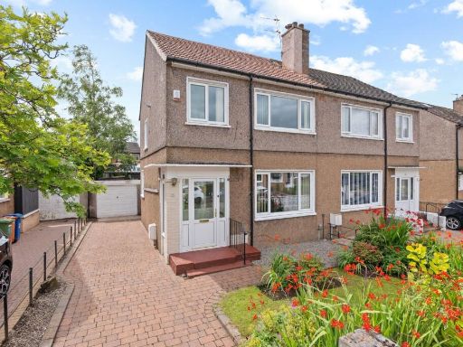 3 bedroom semi-detached house for sale in 10 Falloch Road, Bearsden, G61 1LH, G61 — £235,000 • 3 bed • 1 bath • 926 ft²
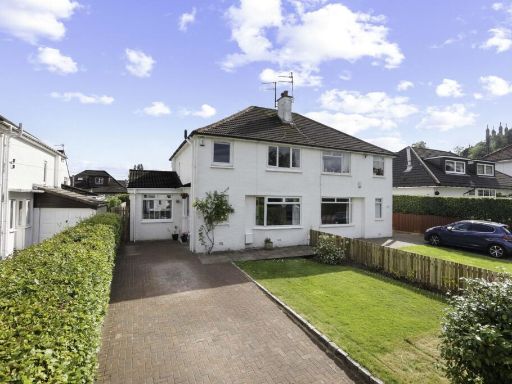 3 bedroom semi-detached house for sale in 14 North Grange Road, Bearsden, G61 3AE, G61 — £395,000 • 3 bed • 2 bath • 1141 ft²
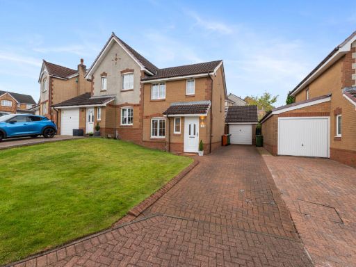 3 bedroom semi-detached house for sale in 32 St. Andrews Drive, Bearsden, G61 4NW, G61 — £275,000 • 3 bed • 2 bath • 721 ft²
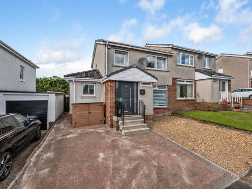 3 bedroom semi-detached house for sale in 3 Lochnagar Drive, Bearsden, G61 4RP, G61 — £360,000 • 3 bed • 2 bath • 1324 ft²
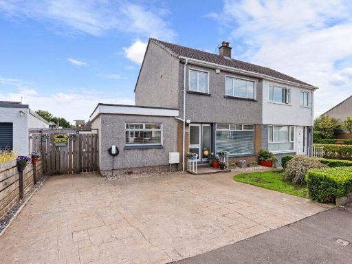 4 bedroom semi-detached house for sale in 172 Rannoch Drive, Bearsden, G61 2BG, G61 — £345,000 • 4 bed • 1 bath • 1184 ft²
Meta
- {
"@context": "https://schema.org",
"@type": "Residence",
"name": "5 bedroom semidetached house for sale in 21 Allander Road,…",
"description": "",
"url": "https://propertypiper.co.uk/property/a9283f9e-03bf-4890-ba72-9ce7c14883c8",
"image": "https://image-a.propertypiper.co.uk/13d7bcce-5292-4af1-95f8-3de3a7a428b3-1024.jpeg",
"address": {
"@type": "PostalAddress",
"streetAddress": "25, ALLANDER ROAD, GLASGOW, BEARSDEN",
"postalCode": "G61 1LT",
"addressLocality": "East Dunbartonshire",
"addressRegion": "East Dunbartonshire",
"addressCountry": "Scotland"
},
"geo": {
"@type": "GeoCoordinates",
"latitude": 55.9106364,
"longitude": -4.3417762
},
"numberOfRooms": 5,
"numberOfBathroomsTotal": 3,
"floorSize": {
"@type": "QuantitativeValue",
"value": 1679,
"unitCode": "FTK"
},
"offers": {
"@type": "Offer",
"price": 385000,
"priceCurrency": "GBP",
"availability": "https://schema.org/InStock"
},
"additionalProperty": [
{
"@type": "PropertyValue",
"name": "Feature",
"value": "semi-detached"
},
{
"@type": "PropertyValue",
"name": "Feature",
"value": "20th-century"
},
{
"@type": "PropertyValue",
"name": "Feature",
"value": "two-storey"
},
{
"@type": "PropertyValue",
"name": "Feature",
"value": "gable roof"
},
{
"@type": "PropertyValue",
"name": "Feature",
"value": "rendered exterior"
},
{
"@type": "PropertyValue",
"name": "Feature",
"value": "driveway"
},
{
"@type": "PropertyValue",
"name": "Feature",
"value": "residential area"
},
{
"@type": "PropertyValue",
"name": "Feature",
"value": "Post-war"
},
{
"@type": "PropertyValue",
"name": "Feature",
"value": "suburban"
},
{
"@type": "PropertyValue",
"name": "Feature",
"value": "two-story"
},
{
"@type": "PropertyValue",
"name": "Feature",
"value": "extension"
},
{
"@type": "PropertyValue",
"name": "Feature",
"value": "garage"
},
{
"@type": "PropertyValue",
"name": "Feature",
"value": "garden"
},
{
"@type": "PropertyValue",
"name": "Feature",
"value": "detached"
},
{
"@type": "PropertyValue",
"name": "Feature",
"value": "residential"
},
{
"@type": "PropertyValue",
"name": "Feature",
"value": "brickwork"
},
{
"@type": "PropertyValue",
"name": "Feature",
"value": "modernized"
}
]
}
High Res Floorplan Images
Compatible Floorplan Images
FloorplanImages Thumbnail