BN2 7FP - 5 bedroom detached house for sale in Rowan Way, Rottingdean…
View on Property Piper
5 bedroom detached house for sale in Rowan Way, Rottingdean, Brighton, East Sussex, BN2
Property Details
- Price: £725000
- Bedrooms: 5
- Bathrooms: 3
- Property Type: undefined
- Property SubType: undefined
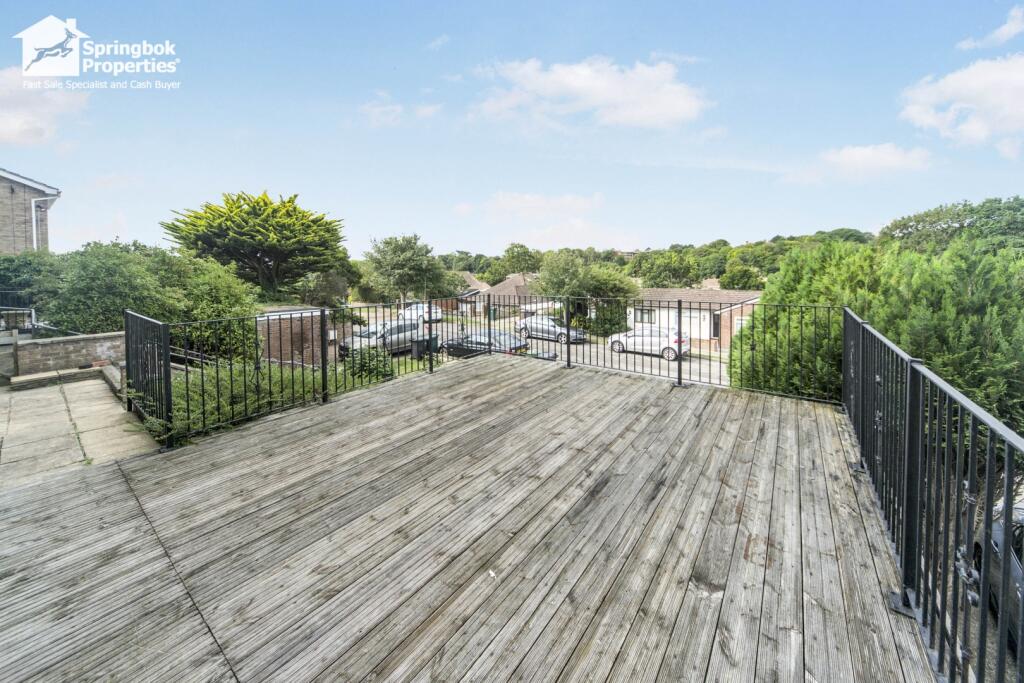
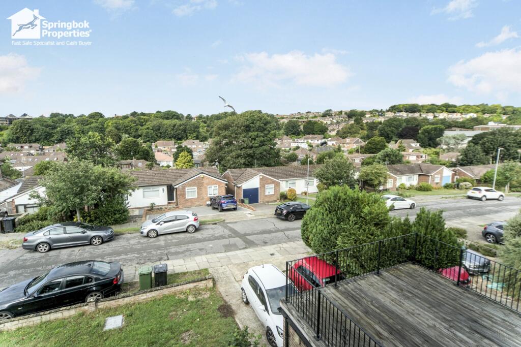
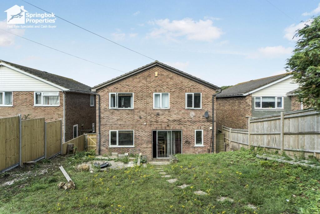
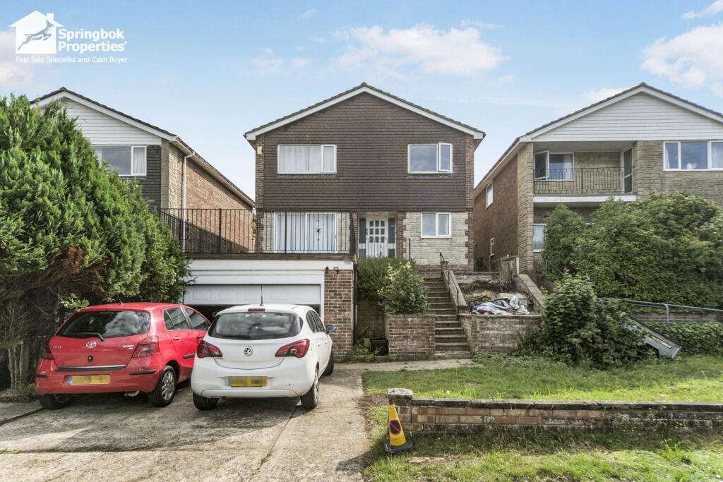
Image Descriptions
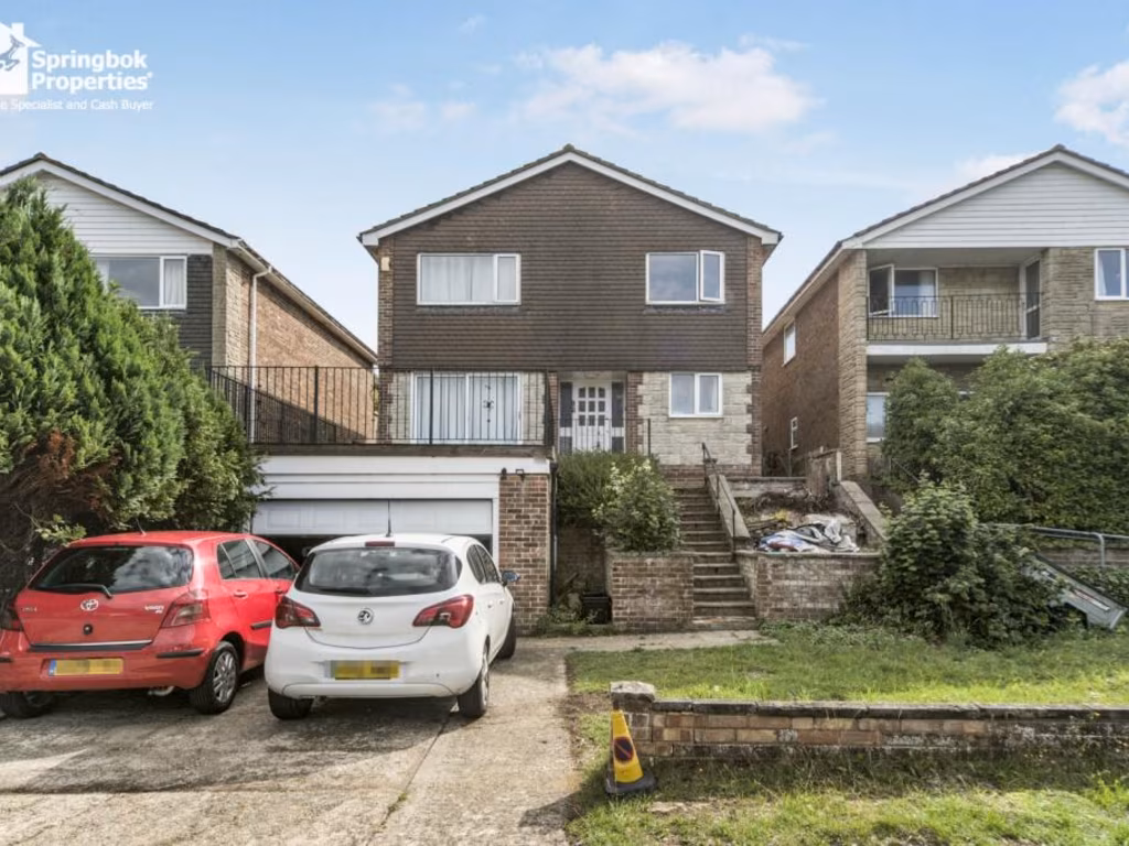
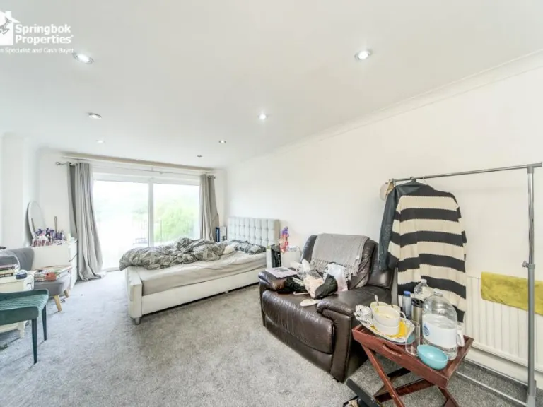
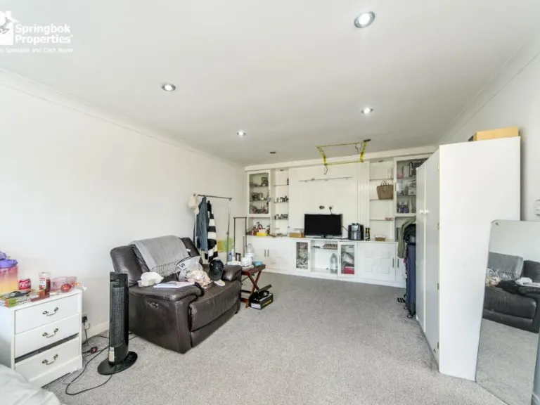
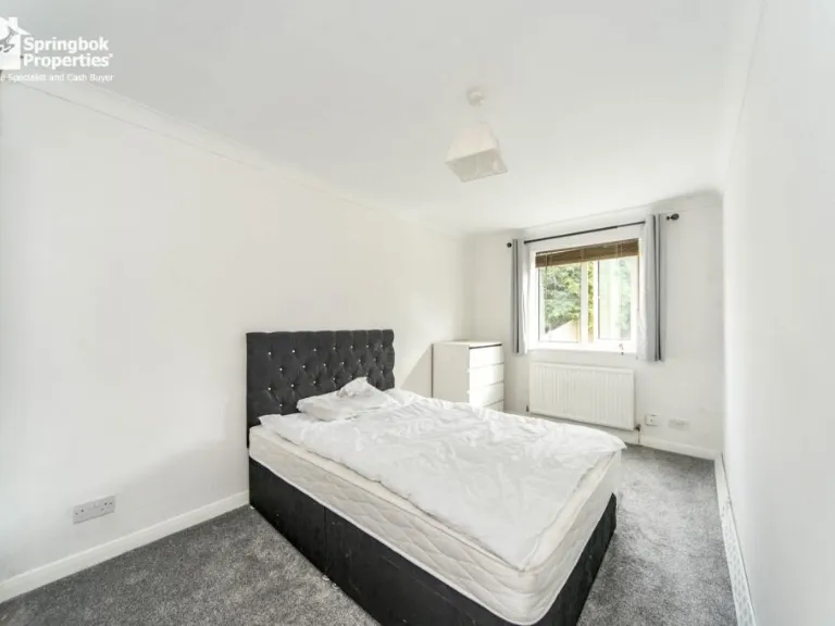
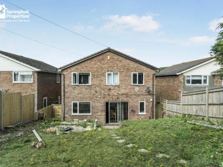
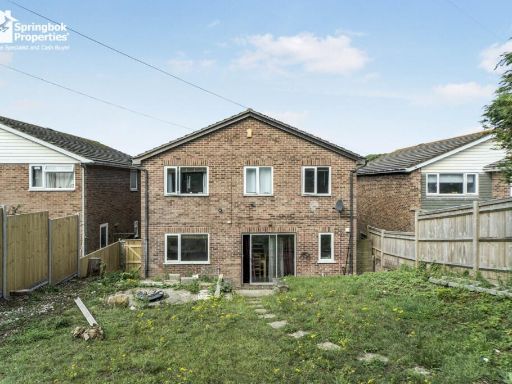
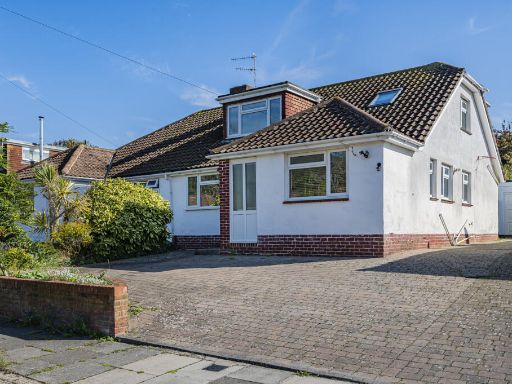
- detached house 1970s
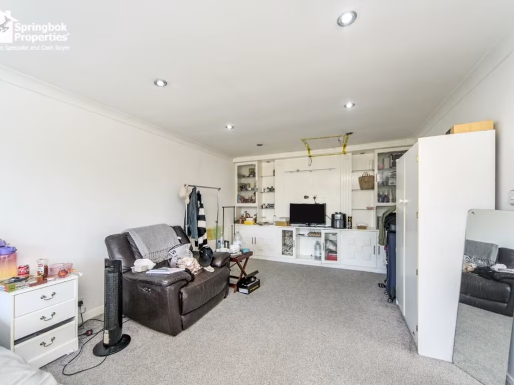
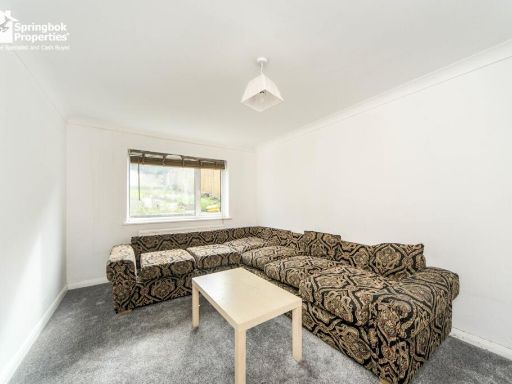
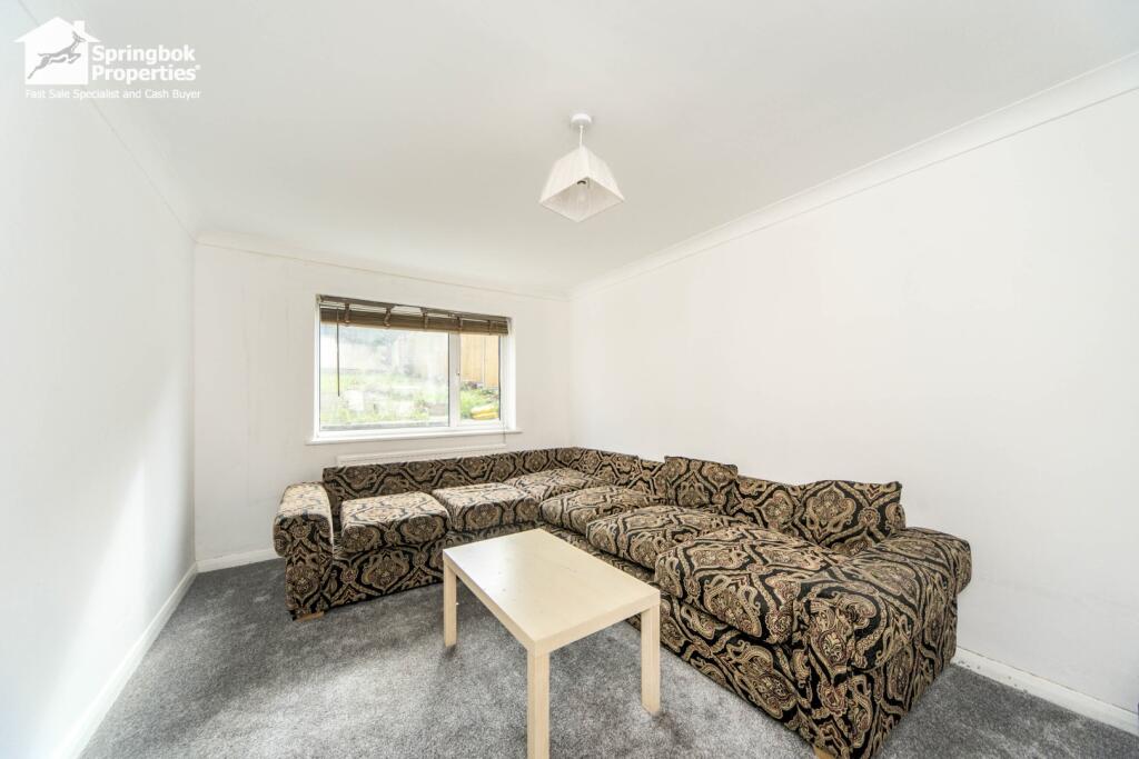
- living room contemporary
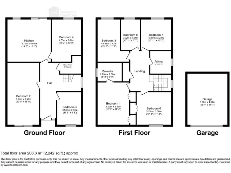
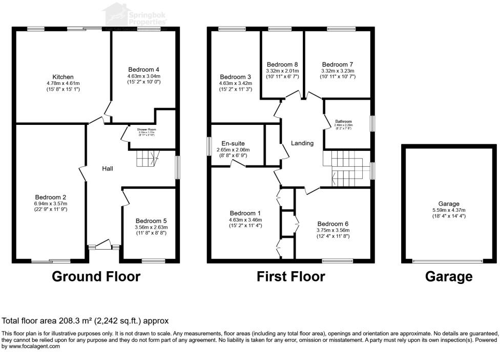
Floorplan Description
- A spacious multi-story home with a garage and multiple bedrooms.
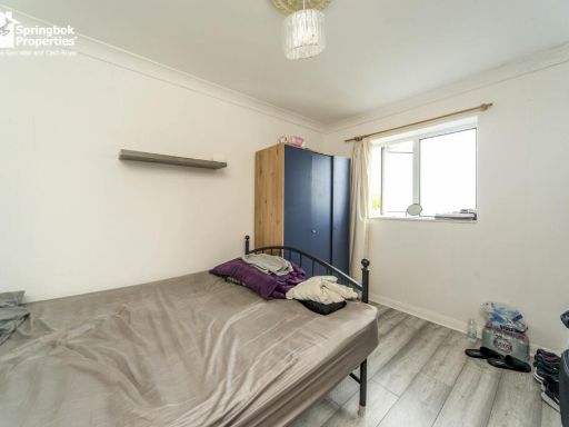
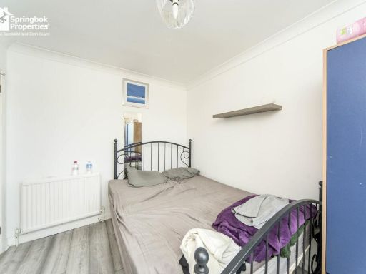
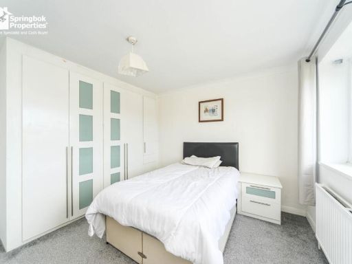
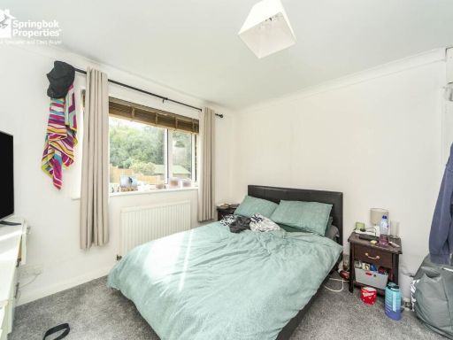
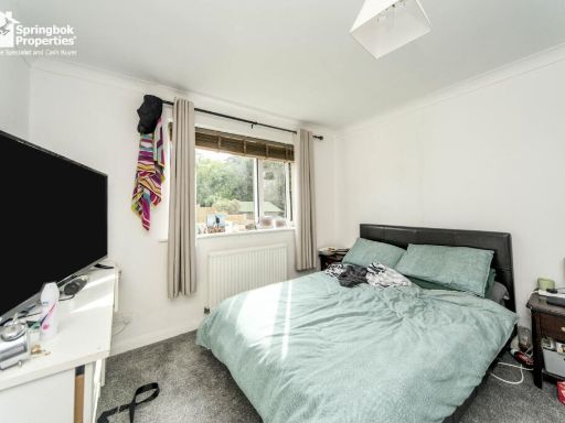
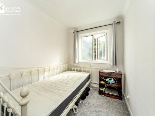
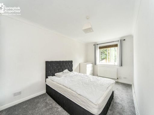
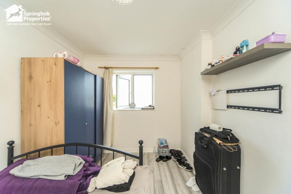
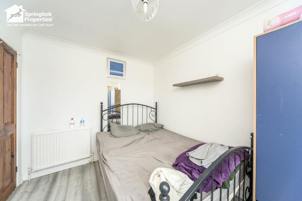
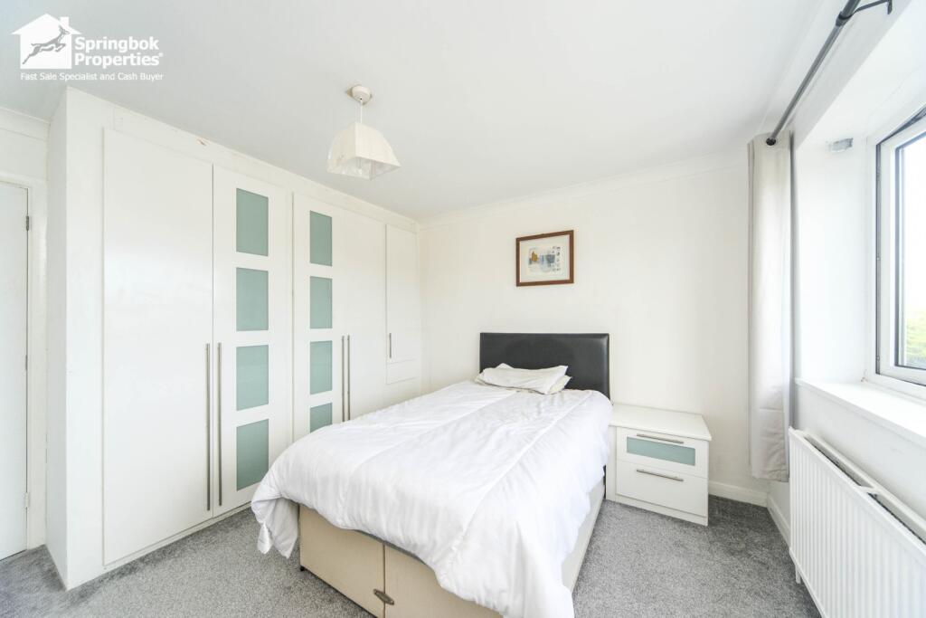
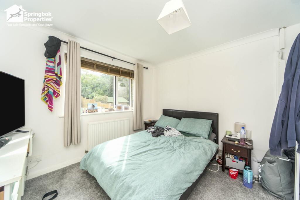
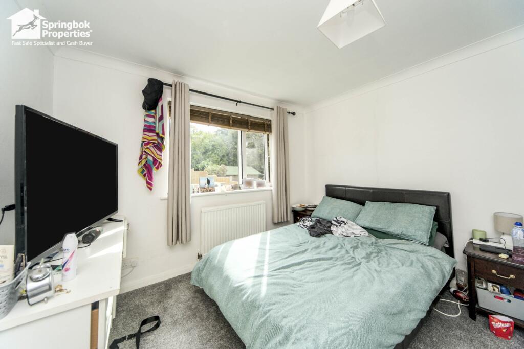
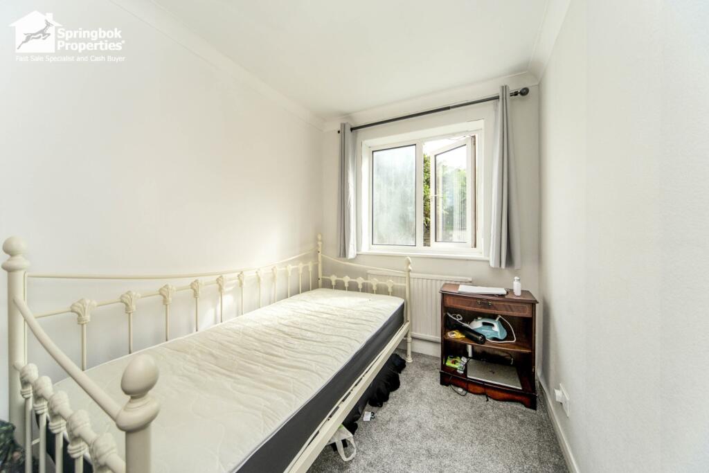
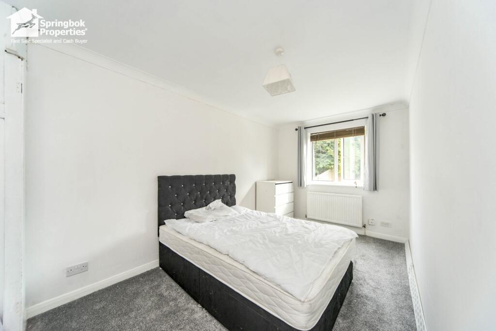
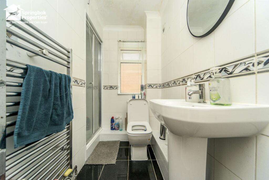
Rooms
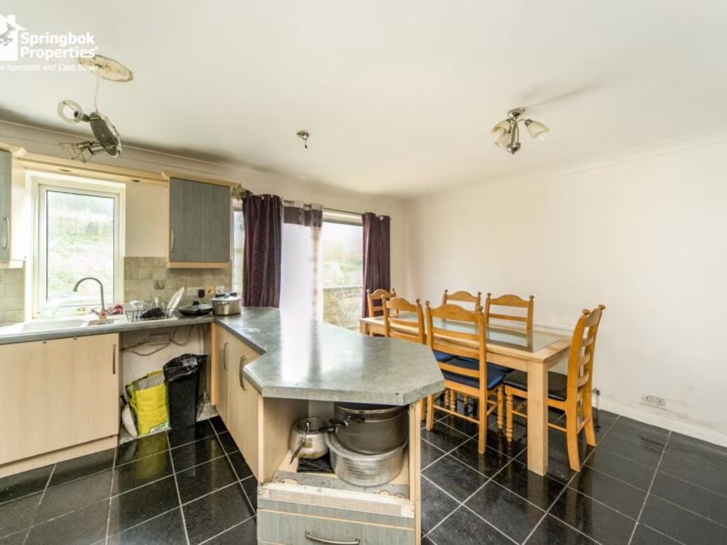
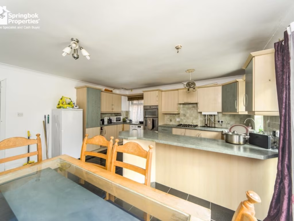
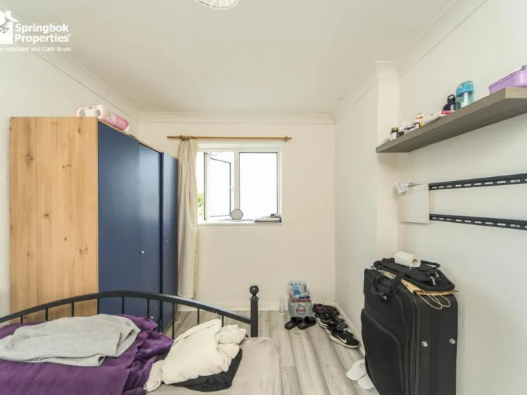
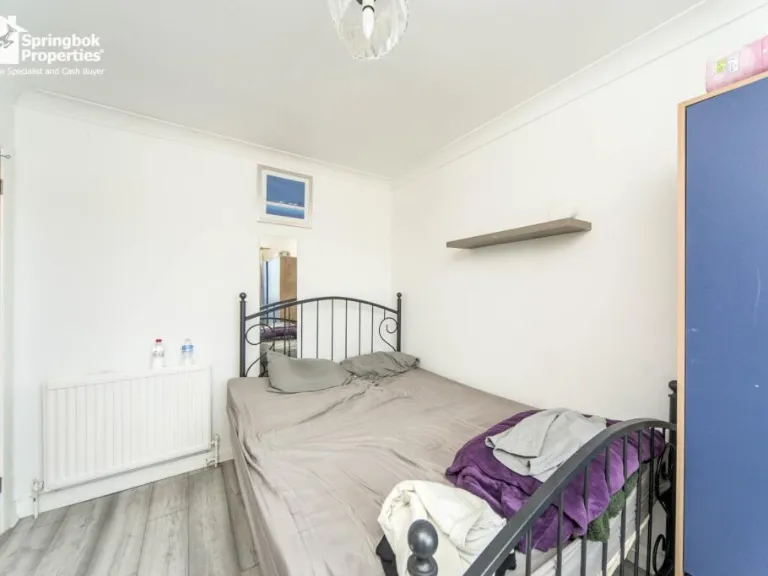
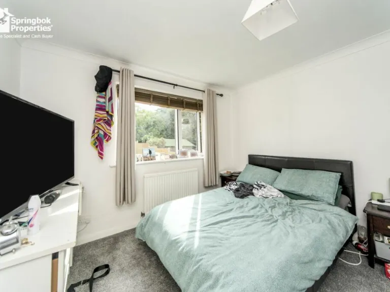
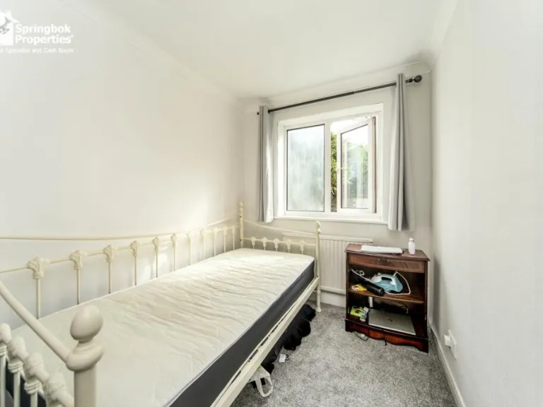
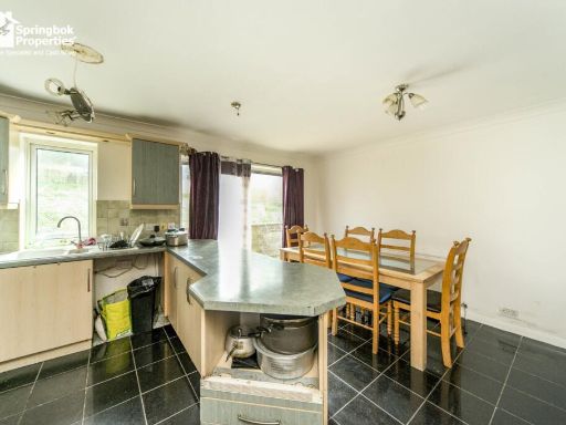
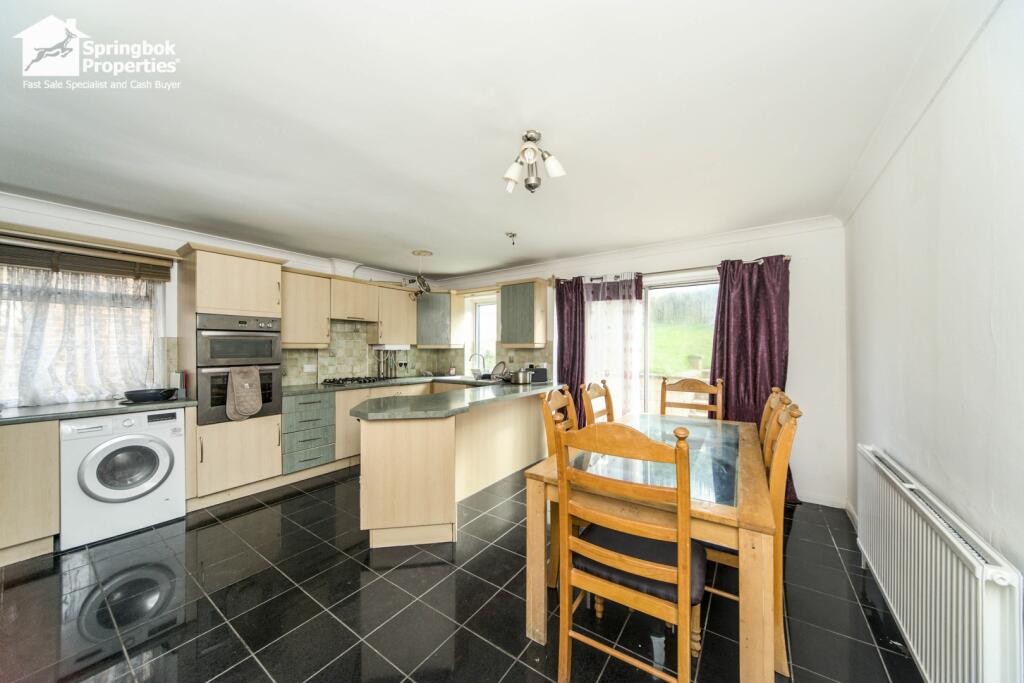
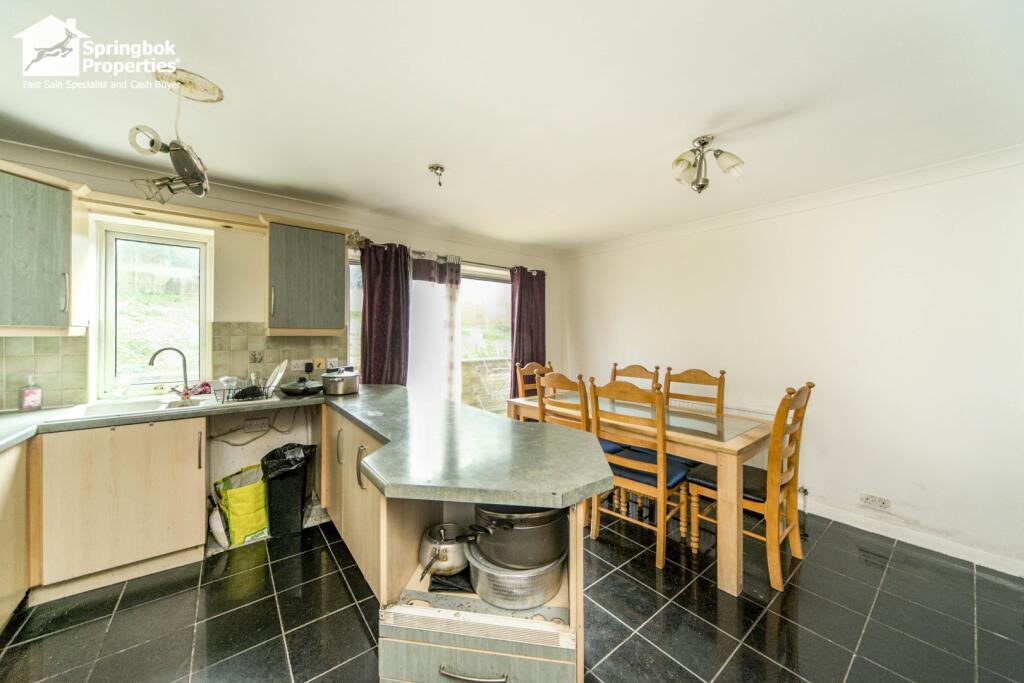
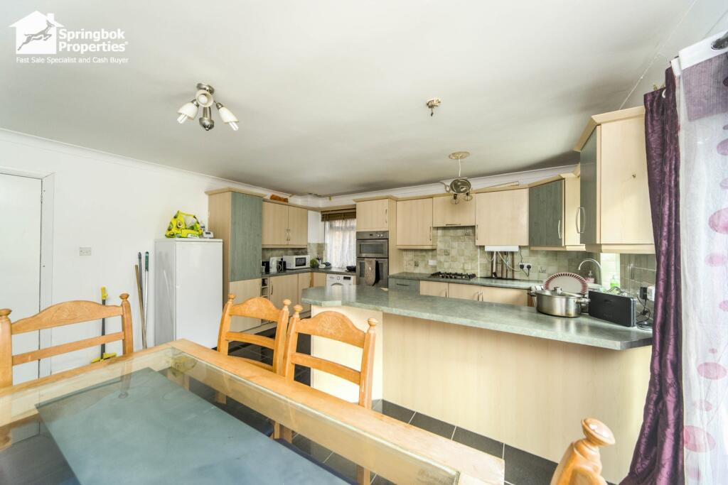
- Kitchen: large
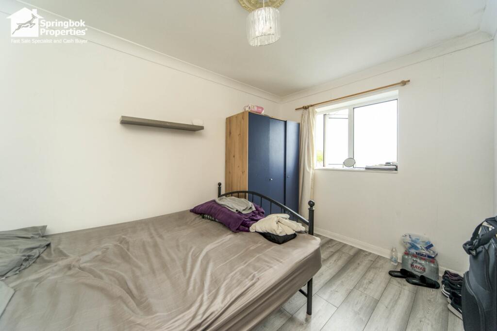
- Bedroom 4: average
- Bedroom 2: large
- Bedroom 5: average
- Bedroom 3: average
- Bedroom 8: small
- Bedroom 7: small
- En-suite: small
- Bedroom 1: average
- Bedroom 6: average
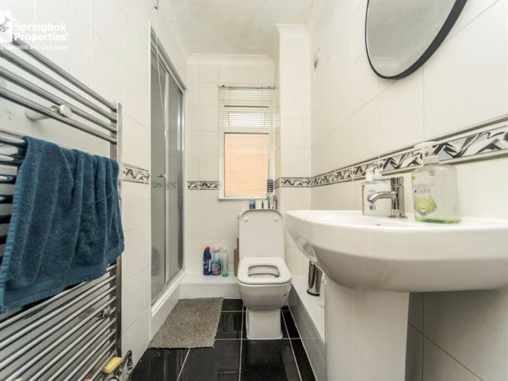
- Bathroom: small
- Garage: average
Textual Property Features
Detected Visual Features
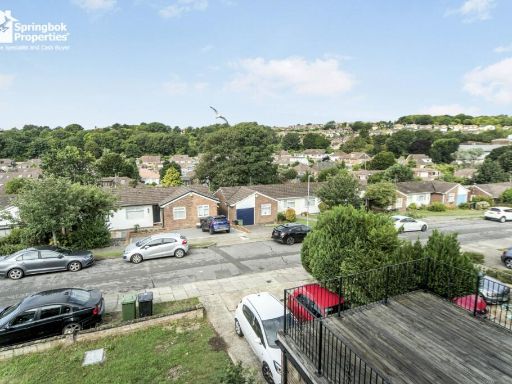
- detached house
- 1970s
- brick
- garage
- driveway
- garden
- needs modernization
- dated exterior
- stone facade
- sloped roof
- contemporary
- living room
- standard ceiling
- medium size
- large window
- built-in blind
- natural light
- white walls
EPC Details
- Fully double glazed
- Cavity wall, filled cavity
- Boiler and radiators, mains gas
- Low energy lighting in all fixed outlets
- Solid, no insulation (assumed)
Nearby Schools
- Peacehaven Heights Academy
- Our Lady of Lourdes RC School
- St Margaret's CofE Primary School, Rottingdean
- St John the Baptist Catholic Primary School
- City Academy Whitehawk
- Rudyard Kipling Primary School & Nursery
- St Martin's CofE Primary School
- Coombe Road Primary School
- Roedean School
- Longhill High School
- Brighton College
- Queen's Park Primary School
- Elm Grove Primary School
- Moulsecoomb Primary School
- Brighton Aldridge Community Academy
- Saltdean Primary School
- Oxford International College, Brighton
- Brighton College Nursery, Pre-Prep and Prep School
- St Mark's CofE Primary School
- St Luke's Primary School
- Woodingdean Primary School
- Bevendean Primary School and Nursery
- Hertford Infant School
- Telscombe Cliffs Academy
- Fairlight Primary School
- St Joseph's Catholic Primary School
- Iford and Kingston Church of England Primary School
Nearest General Shops
- Id: 393099800
- Tags:
- TagsNormalized:
- Lat: 50.827792
- Lon: -0.0634009
- FullGeoHash: gcpcnscv6ehv
- PartitionGeoHash: gcpc
- Images:
- FoodStandards: null
- Distance: 1274.1
,- Id: 393099750
- Tags:
- Addr:
- Housenumber: 116
- Postcode: BN2 6TD
- Street: Cowley Drive
- Fhrs:
- Name: Bridgman Pharmacy
- Shop: chemist
- TagsNormalized:
- Lat: 50.8276563
- Lon: -0.0635812
- FullGeoHash: gcpcnscsw3y7
- PartitionGeoHash: gcpc
- Images:
- FoodStandards:
- Id: 207060
- FHRSID: 207060
- LocalAuthorityBusinessID: 1992/00420/COMM
- BusinessName: Bridgeman Pharmacy
- BusinessType: Retailers - other
- BusinessTypeID: 4613
- AddressLine1: 116 Cowley Drive
- AddressLine2: Brighton
- AddressLine3: null
- AddressLine4: null
- PostCode: BN2 6TD
- RatingValue: Exempt
- RatingKey: fhrs_exempt_en-GB
- RatingDate: 2020-02-27
- LocalAuthorityCode: 875
- LocalAuthorityName: Brighton and Hove
- LocalAuthorityWebSite: http://www.brighton-hove.gov.uk/foodsafety
- LocalAuthorityEmailAddress: ehl.food@brighton-hove.gov.uk
- Scores:
- Hygiene: null
- Structural: null
- ConfidenceInManagement: null
- NewRatingPending: false
- Geocode:
- Longitude: -0.06278900000000
- Latitude: 50.82807800000000
- Distance: 1258.2
,- Id: 1404516427
- Tags:
- Name: St Margarets Church
- Shop: jewelry
- TagsNormalized:
- Lat: 50.8068152
- Lon: -0.0575792
- FullGeoHash: gcpcn9n54kcc
- PartitionGeoHash: gcpc
- Images:
- FoodStandards: null
- Distance: 1173.5
}
Nearest Religious buildings
- Id: 82757751
- Tags:
- Amenity: place_of_worship
- Denomination: catholic
- Name: St Martha's Convent
- Religion: christian
- TagsNormalized:
- place of worship
- catholic
- christian
- church
- Lat: 50.8062956
- Lon: -0.0592278
- FullGeoHash: gcpcn9hb5guw
- PartitionGeoHash: gcpc
- Images:
- FoodStandards: null
- Distance: 1183.5
,- Id: 860372845
- Tags:
- Amenity: place_of_worship
- Building: church
- Denomination: anglican
- Name: St Margaret's
- Religion: christian
- Wikidata: Q7594110
- TagsNormalized:
- place of worship
- church
- anglican
- christian
- Lat: 50.8068424
- Lon: -0.0574027
- FullGeoHash: gcpcn9n5q3vk
- PartitionGeoHash: gcpc
- Images:
- Q7594110-1
- Q7594110-2
- Q7594110-3
- FoodStandards: null
- Distance: 1176.1
,- Id: 860329552
- Tags:
- Amenity: place_of_worship
- Building: church
- Denomination: anglican
- Name: St Wulfran's
- Religion: christian
- Wikidata: Q7595666
- TagsNormalized:
- place of worship
- church
- anglican
- christian
- Lat: 50.8157384
- Lon: -0.0773449
- FullGeoHash: gcpcn4xxjspq
- PartitionGeoHash: gcpc
- Images:
- FoodStandards: null
- Distance: 891.4
}
Nearest Leisure Facilities
- Id: 1056651230
- Tags:
- Access: private
- Leisure: swimming_pool
- Location: outdoor
- Swimming_pool: outdoor
- TagsNormalized:
- swimming
- swimming pool
- pool
- leisure
- Lat: 50.814149
- Lon: -0.0693884
- FullGeoHash: gcpcn6mmz5um
- PartitionGeoHash: gcpc
- Images:
- FoodStandards: null
- Distance: 411.4
,- Id: 1056651232
- Tags:
- Leisure: pitch
- Sport: tennis
- TagsNormalized:
- Lat: 50.8147963
- Lon: -0.0683419
- FullGeoHash: gcpcn6w1xs8e
- PartitionGeoHash: gcpc
- Images:
- FoodStandards: null
- Distance: 309.8
,- Id: 304443203
- Tags:
- TagsNormalized:
- Lat: 50.8182728
- Lon: -0.0652689
- FullGeoHash: gcpcne0mzhev
- PartitionGeoHash: gcpc
- Images:
- FoodStandards: null
- Distance: 216.1
,- Id: 25772618
- Tags:
- Building: yes
- Leisure: sports_centre
- Name: Deans Leisure Centre
- TagsNormalized:
- sports
- sports centre
- leisure
- Lat: 50.817366
- Lon: -0.067112
- FullGeoHash: gcpcn7p0s5te
- PartitionGeoHash: gcpc
- Images:
- FoodStandards: null
- Distance: 203.1
,- Id: 234185304
- Tags:
- TagsNormalized:
- Lat: 50.8159131
- Lon: -0.0623899
- FullGeoHash: gcpcndf84hy9
- PartitionGeoHash: gcpc
- Images:
- FoodStandards: null
- Distance: 169.6
}
Nearest Tourist attractions
- Id: 609526774
- Tags:
- TagsNormalized:
- Lat: 50.8419988
- Lon: -0.0816765
- FullGeoHash: gcpcnps80g98
- PartitionGeoHash: gcpc
- Images:
- FoodStandards: null
- Distance: 3090
,- Id: 607374756
- Tags:
- Landuse: recreation_ground
- Man_made: water_well
- Name: Woodingdean Water Well
- Operator: Woodingdean Water Well
- Tourism: attraction
- Wikidata: Q42851541
- TagsNormalized:
- recreation ground
- water
- attraction
- tourism
- Lat: 50.8346542
- Lon: -0.0818215
- FullGeoHash: gcpcnnhmm6mk
- PartitionGeoHash: gcpc
- Images:
- FoodStandards: null
- Distance: 2363
,- Id: 119015000
- Tags:
- Access: permit
- Name: Sheepcote Valley
- Name:en: Sheepcote Valley Brighton C.C. Site The Caravan Club Limited and Motorhome Club
- Name:nl: Sheepcote Valley Brighton C.C. Site The Caravan Club Limited and Motorhome Club
- Tourism: camp_site
- TagsNormalized:
- Lat: 50.8224236
- Lon: -0.0966809
- FullGeoHash: gcpcjgcw54mm
- PartitionGeoHash: gcpc
- Images:
- FoodStandards: null
- Distance: 2345.8
}
Nearest Train stations
- Id: 6745675391
- Tags:
- Name: Falmer
- Naptan:
- Network: National Rail
- Public_transport: station
- Railway: station
- Ref:
- Train: yes
- Wheelchair: yes
- Wikidata: Q2435208
- Wikipedia: en:Falmer railway station
- TagsNormalized:
- Lat: 50.8619409
- Lon: -0.0872899
- FullGeoHash: gcpcq50kmbzz
- PartitionGeoHash: gcpc
- Images:
- FoodStandards: null
- Distance: 5310.6
,- Id: 6745675390
- Tags:
- Name: Moulsecoomb
- Naptan:
- Network: National Rail
- Public_transport: station
- Railway: station
- Ref:
- Toilets:
- Train: yes
- Wheelchair: no
- Wikidata: Q2437531
- Wikipedia: en:Moulsecoomb railway station
- TagsNormalized:
- Lat: 50.8465383
- Lon: -0.1190654
- FullGeoHash: gcpcm23699dr
- PartitionGeoHash: gcpc
- Images:
- FoodStandards: null
- Distance: 5083.2
,- Id: 87341809
- Tags:
- Name: Aquarium
- Public_transport: station
- Railway: station
- Train: yes
- Usage: tourism
- TagsNormalized:
- Lat: 50.8189252
- Lon: -0.1327187
- FullGeoHash: gcpchgr3eqmb
- PartitionGeoHash: gcpc
- Images:
- FoodStandards: null
- Distance: 4787.2
,- Id: 3770290449
- Tags:
- Name: Halfway Station
- Old_name: Paston Place
- Public_transport: station
- Railway: station
- Toilets:
- Train: yes
- Usage: tourism
- Wheelchair: yes
- TagsNormalized:
- Lat: 50.8165473
- Lon: -0.1210879
- FullGeoHash: gcpcj4zgf7n2
- PartitionGeoHash: gcpc
- Images:
- FoodStandards: null
- Distance: 3961.8
,- Id: 87341817
- Tags:
- Name: Black Rock
- Public_transport: station
- Railway: station
- Train: yes
- Usage: tourism
- Wheelchair: yes
- TagsNormalized:
- Lat: 50.8145348
- Lon: -0.1111525
- FullGeoHash: gcpcj6x01gye
- PartitionGeoHash: gcpc
- Images:
- FoodStandards: null
- Distance: 3270.1
}
Nearest Bus stations and stops
- Id: 2479317662
- Tags:
- Bus: yes
- Highway: bus_stop
- Name: Longhill School
- Public_transport: platform
- TagsNormalized:
- Lat: 50.8196835
- Lon: -0.0653858
- FullGeoHash: gcpcne2qh7su
- PartitionGeoHash: gcpc
- Images:
- FoodStandards: null
- Distance: 372.4
,- Id: 8818182233
- Tags:
- Highway: bus_stop
- Name: Longhill School
- Public_transport: platform
- TagsNormalized:
- Lat: 50.8195946
- Lon: -0.0650983
- FullGeoHash: gcpcne2te554
- PartitionGeoHash: gcpc
- Images:
- FoodStandards: null
- Distance: 360.5
,- Id: 10301286628
- Tags:
- Highway: bus_stop
- Name: Longhill School
- Public_transport: platform
- TagsNormalized:
- Lat: 50.8186615
- Lon: -0.0675385
- FullGeoHash: gcpcn7qb4jpe
- PartitionGeoHash: gcpc
- Images:
- FoodStandards: null
- Distance: 324.4
,- Id: 2479317657
- Tags:
- Bus: yes
- Highway: bus_stop
- Name: Rottingdean Place
- Public_transport: platform
- TagsNormalized:
- Lat: 50.8155092
- Lon: -0.0637478
- FullGeoHash: gcpcnd9tf96p
- PartitionGeoHash: gcpc
- Images:
- FoodStandards: null
- Distance: 116
,- Id: 4868030136
- Tags:
- Bus: yes
- Highway: bus_stop
- Name: Rottingdean Place
- Public_transport: platform
- Ref: bridtjd
- TagsNormalized:
- Lat: 50.8160014
- Lon: -0.0638719
- FullGeoHash: gcpcndc2xtjx
- PartitionGeoHash: gcpc
- Images:
- FoodStandards: null
- Distance: 70.5
}
Nearest Hotels
- Id: 6316610385
- Tags:
- Addr:
- City: Brighton
- Postcode: BN2 5WA
- Street: Waterfront
- Suburb: Brighton Marina
- Brand: Malmaison
- Brand:wikidata: Q6744343
- Fhrs:
- Name: Malmaison
- Old_name: The Seattle
- Source:
- Tourism: hotel
- Website: https://www.malmaison.com/locations/brighton/
- TagsNormalized:
- Lat: 50.812485
- Lon: -0.1021162
- FullGeoHash: gcpcjdjsht8x
- PartitionGeoHash: gcpc
- Images:
- FoodStandards: null
- Distance: 2664.2
,- Id: 240239813
- Tags:
- Addr:
- City: Brighton
- Postcode: BN2 6BB
- Street: Warren Road
- Building: yes
- Fhrs:
- Name: Downs Hotel
- Tourism: hotel
- Website: http://downs-hotel.co.uk/
- TagsNormalized:
- Lat: 50.8369709
- Lon: -0.0756638
- FullGeoHash: gcpcnq8fufhz
- PartitionGeoHash: gcpc
- Images:
- FoodStandards: null
- Distance: 2417.5
,- Id: 82742522
- Tags:
- Addr:
- Fhrs:
- Name: The White Horse
- Tourism: hotel
- TagsNormalized:
- Lat: 50.8030082
- Lon: -0.0575133
- FullGeoHash: gcpcn8qhgz4u
- PartitionGeoHash: gcpc
- Images:
- FoodStandards: null
- Distance: 1568.4
}
Tags
- detached house
- 1970s
- brick
- garage
- driveway
- garden
- needs modernization
- dated exterior
- stone facade
- sloped roof
- contemporary
- living room
- standard ceiling
- medium size
- large window
- built-in blind
- natural light
- white walls
Local Market Stats
- Average Price/sqft: £470
- Avg Income: £46300
- Rental Yield: 4.4%
- Social Housing: 15%
- Planning Success Rate: 84%
AirBnB Data
- 1km average: £82/night
- Listings in 1km: 3
Similar Properties
 5 bedroom semi-detached house for sale in Eley Drive, Rottingdean, Brighton, East Sussex, BN2 — £625,000 • 5 bed • 2 bath • 1472 ft²
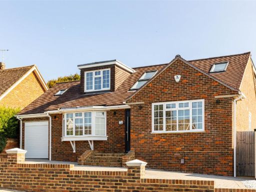 4 bedroom detached house for sale in Royles Close, Rottingdean, BN2 — £825,000 • 4 bed • 4 bath • 1690 ft²
 4 bedroom detached house for sale in Wilkinson Close, Rottingdean, Brighton, BN2 — £750,000 • 4 bed • 2 bath • 1273 ft²
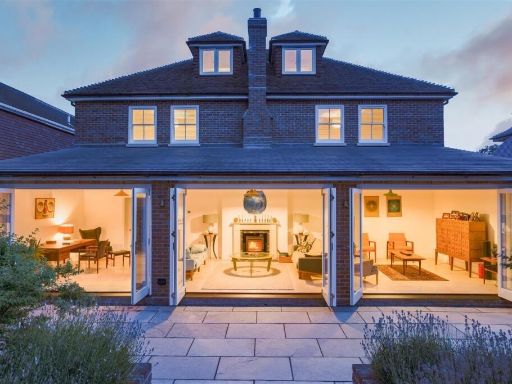 5 bedroom detached house for sale in Falmer Road, Rottingdean, BN2 — £2,000,000 • 5 bed • 4 bath • 3396 ft²
 3 bedroom detached house for sale in Royles Close, Rottingdean, BN2 — £1,099,000 • 3 bed • 2 bath • 1902 ft²
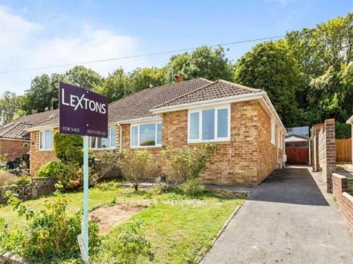 3 bedroom semi-detached house for sale in Elvin Crescent, Rottingdean, Brighton, BN2 — £500,000 • 3 bed • 1 bath • 1001 ft²
Meta
- {
"@context": "https://schema.org",
"@type": "Residence",
"name": "5 bedroom detached house for sale in Rowan Way, Rottingdean…",
"description": "",
"url": "https://propertypiper.co.uk/property/a2a88ca5-d918-4e1a-a237-984a98960f49",
"image": "https://image-a.propertypiper.co.uk/df9a35ea-e054-4266-96d6-694059fef105-1024.jpeg",
"address": {
"@type": "PostalAddress",
"streetAddress": "38 ROWAN WAY ROTTINGDEAN BRIGHTON",
"postalCode": "BN2 7FP",
"addressLocality": "Brighton and Hove",
"addressRegion": "Brighton, Kemptown",
"addressCountry": "England"
},
"geo": {
"@type": "GeoCoordinates",
"latitude": 50.81636294119173,
"longitude": -0.06469592340701424
},
"numberOfRooms": 5,
"numberOfBathroomsTotal": 3,
"floorSize": {
"@type": "QuantitativeValue",
"value": 2242,
"unitCode": "FTK"
},
"offers": {
"@type": "Offer",
"price": 725000,
"priceCurrency": "GBP",
"availability": "https://schema.org/InStock"
},
"additionalProperty": [
{
"@type": "PropertyValue",
"name": "Feature",
"value": "detached house"
},
{
"@type": "PropertyValue",
"name": "Feature",
"value": "1970s"
},
{
"@type": "PropertyValue",
"name": "Feature",
"value": "brick"
},
{
"@type": "PropertyValue",
"name": "Feature",
"value": "garage"
},
{
"@type": "PropertyValue",
"name": "Feature",
"value": "driveway"
},
{
"@type": "PropertyValue",
"name": "Feature",
"value": "garden"
},
{
"@type": "PropertyValue",
"name": "Feature",
"value": "needs modernization"
},
{
"@type": "PropertyValue",
"name": "Feature",
"value": "dated exterior"
},
{
"@type": "PropertyValue",
"name": "Feature",
"value": "stone facade"
},
{
"@type": "PropertyValue",
"name": "Feature",
"value": "sloped roof"
},
{
"@type": "PropertyValue",
"name": "Feature",
"value": "contemporary"
},
{
"@type": "PropertyValue",
"name": "Feature",
"value": "living room"
},
{
"@type": "PropertyValue",
"name": "Feature",
"value": "standard ceiling"
},
{
"@type": "PropertyValue",
"name": "Feature",
"value": "medium size"
},
{
"@type": "PropertyValue",
"name": "Feature",
"value": "large window"
},
{
"@type": "PropertyValue",
"name": "Feature",
"value": "built-in blind"
},
{
"@type": "PropertyValue",
"name": "Feature",
"value": "natural light"
},
{
"@type": "PropertyValue",
"name": "Feature",
"value": "white walls"
}
]
}
High Res Floorplan Images
Compatible Floorplan Images
FloorplanImages Thumbnail