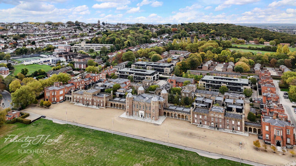
SE18 4BY - 1 bedroom apartment for sale in Ashmore Road, London, SE18
View on Property Piper
1 bedroom apartment for sale in Ashmore Road, London, SE18
Property Details
- Price: £500000
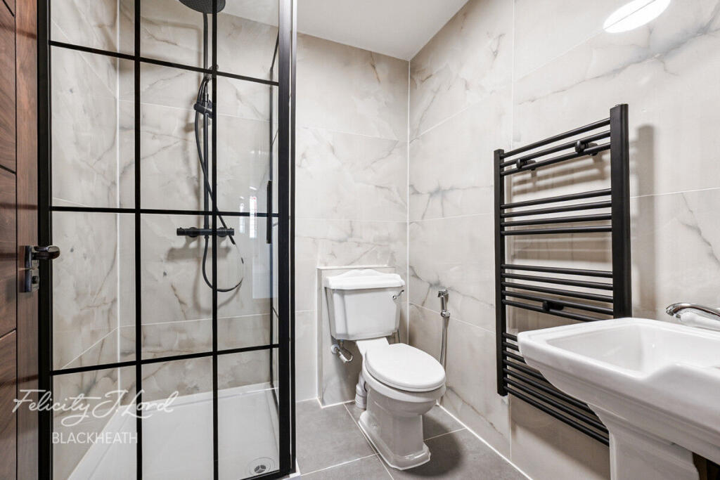
- Bedrooms: 1
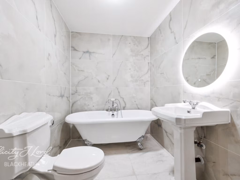
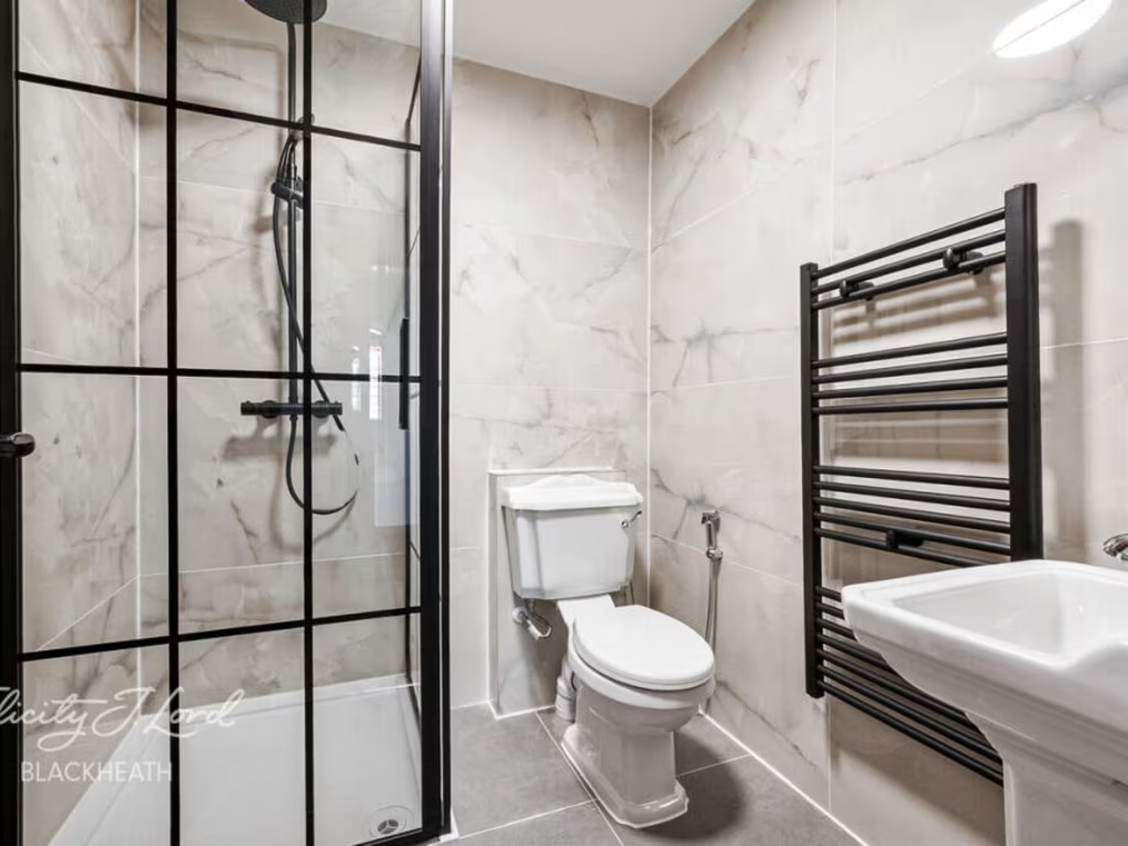
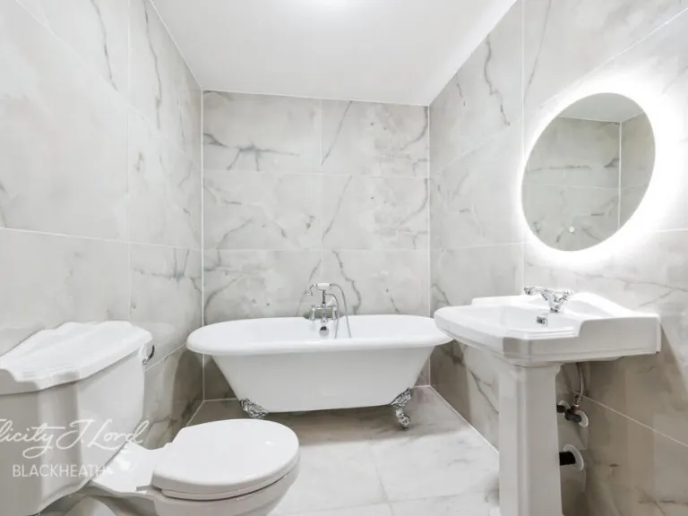
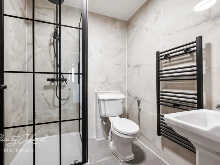
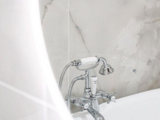
- Bathrooms: 1
- Property Type: undefined
- Property SubType: undefined
Image Descriptions
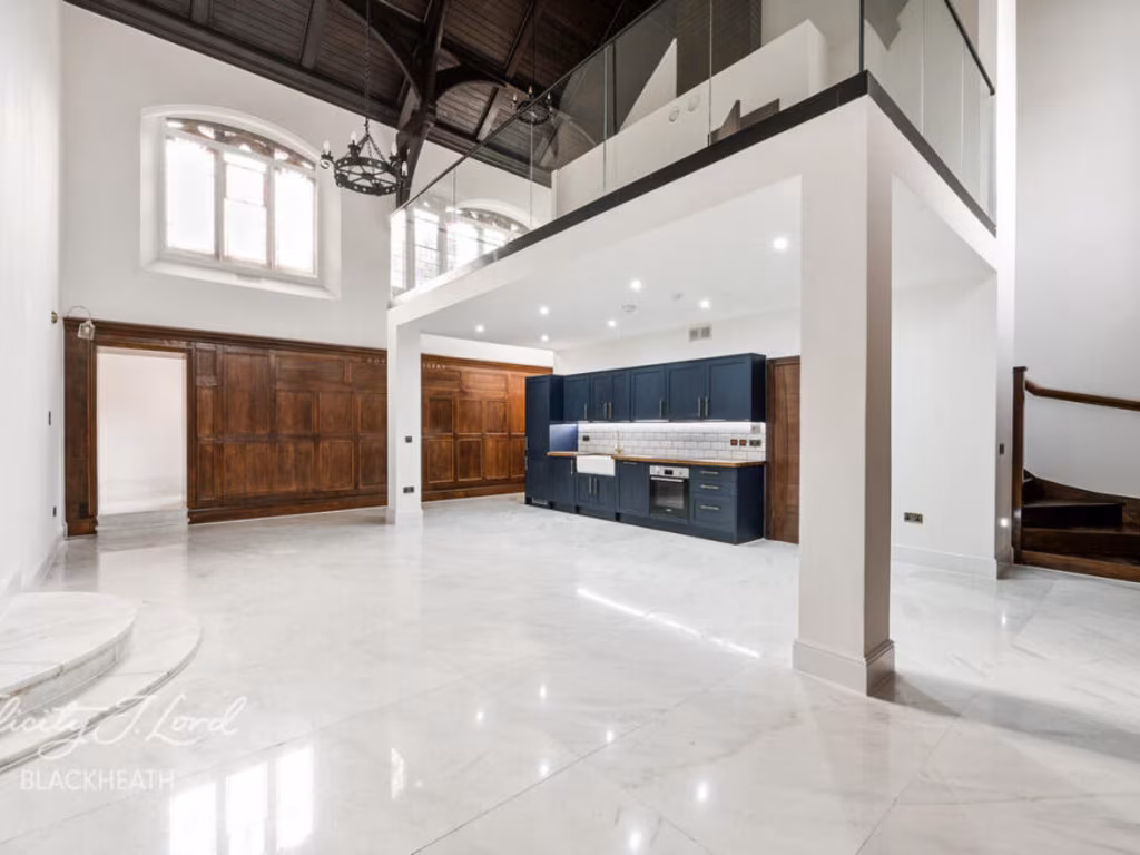
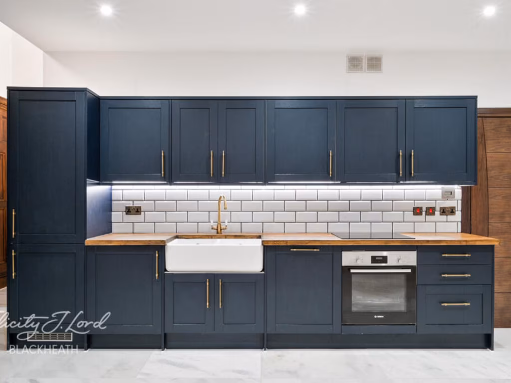
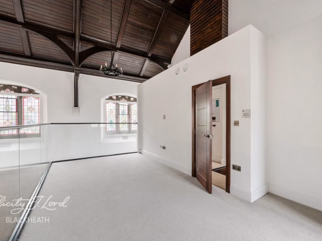
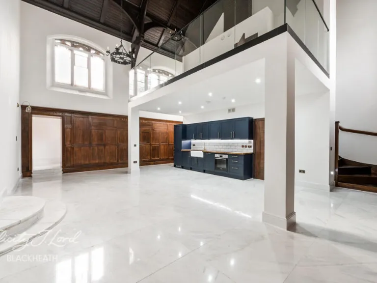
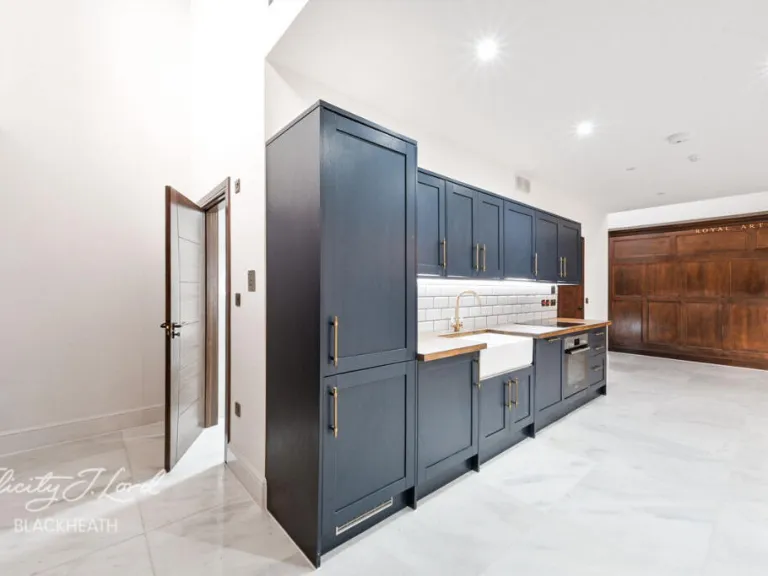
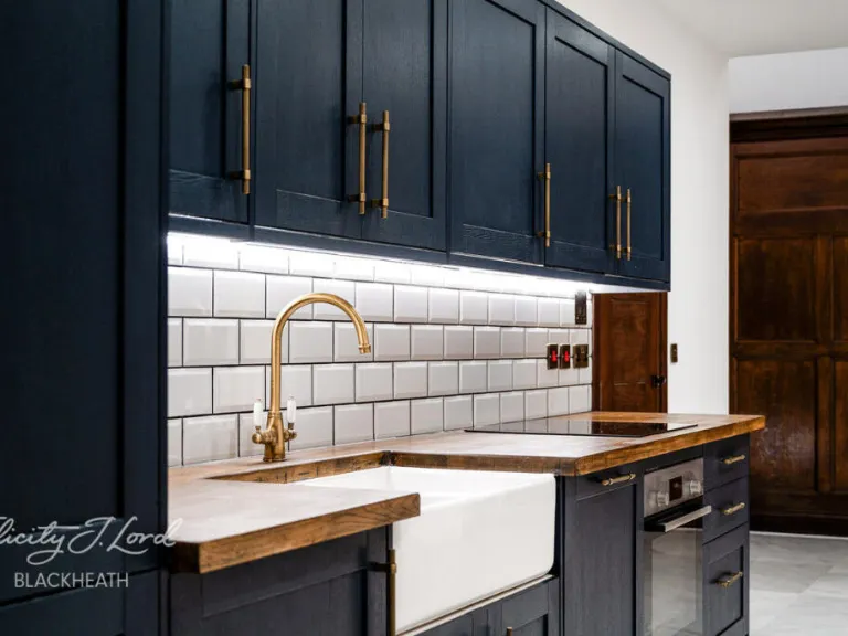
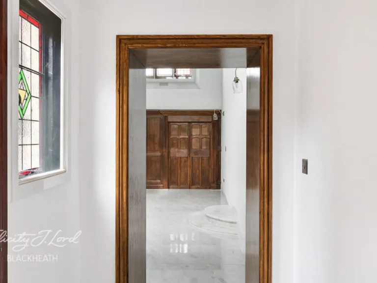
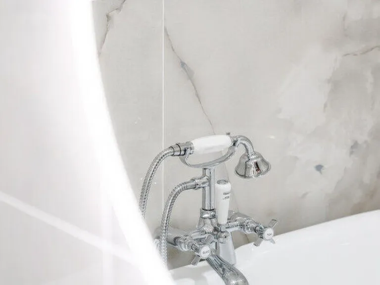
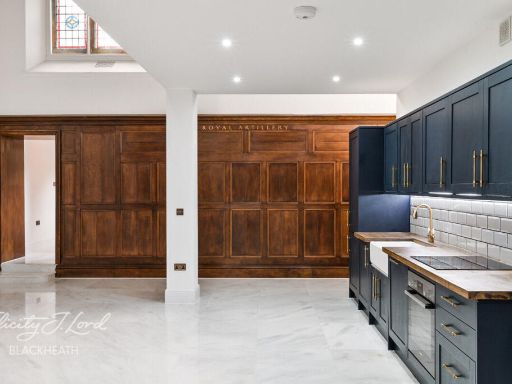
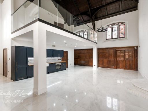
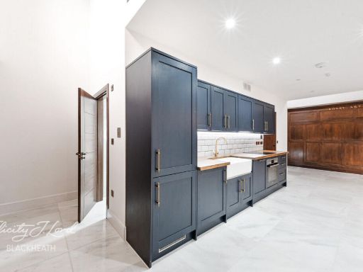
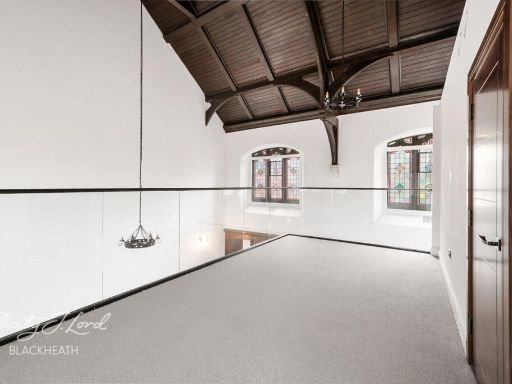
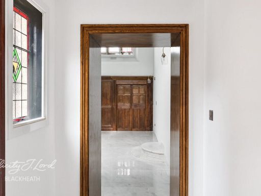
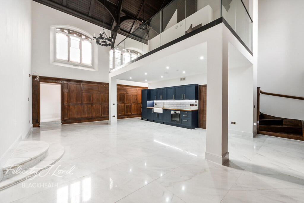
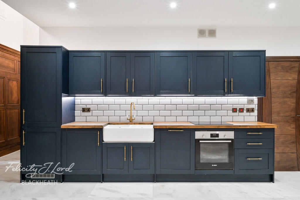
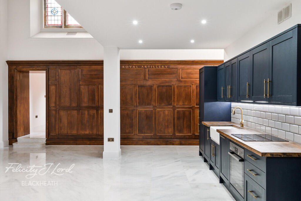
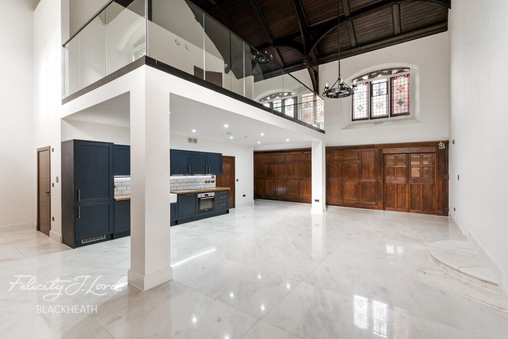
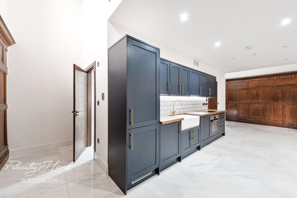
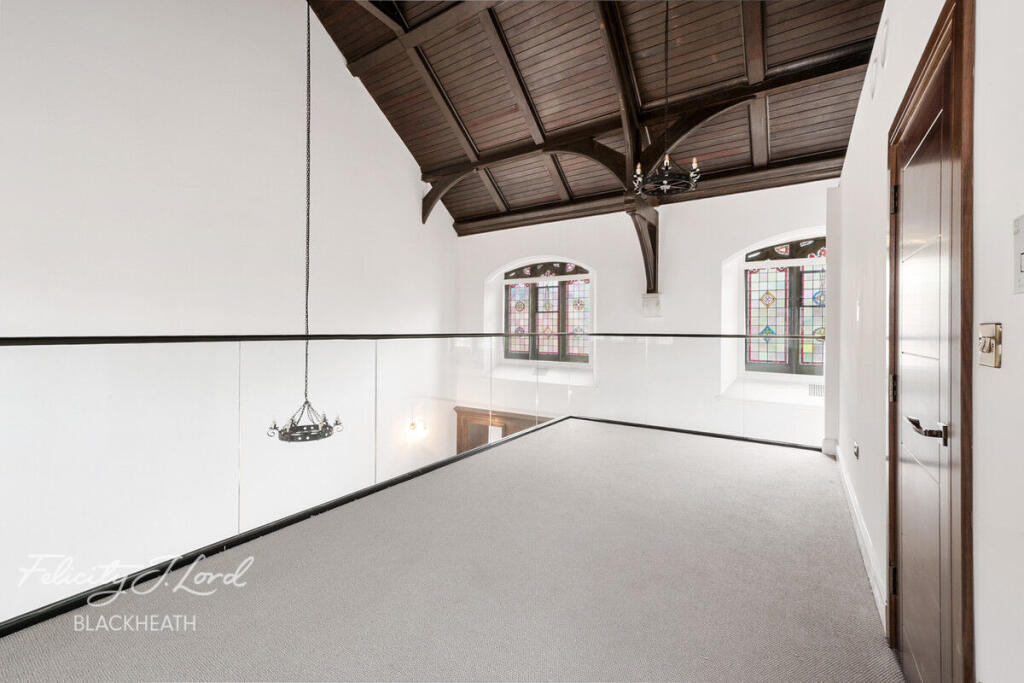
- kitchen and living space modern converted
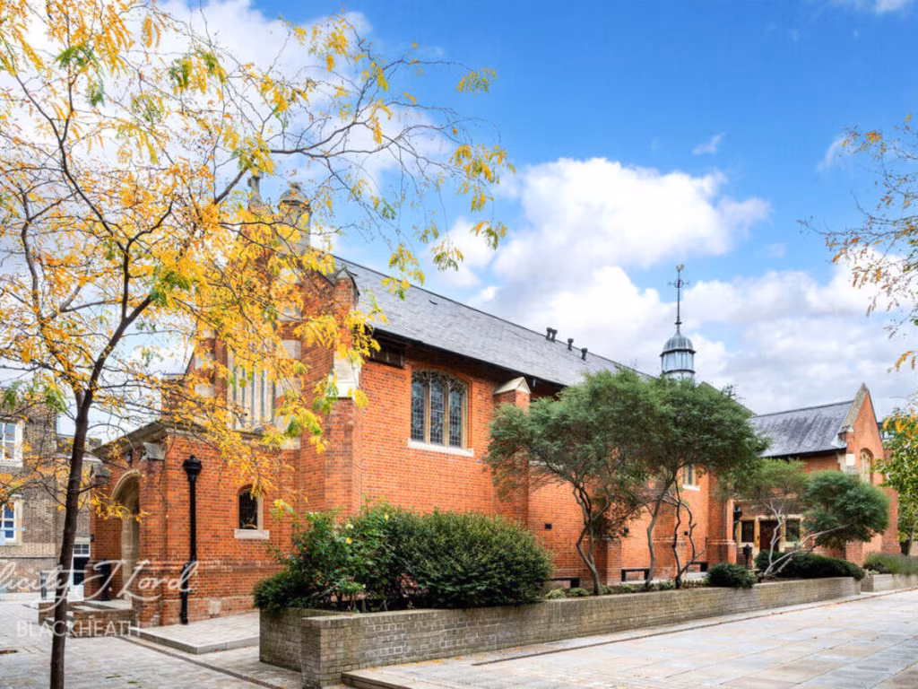
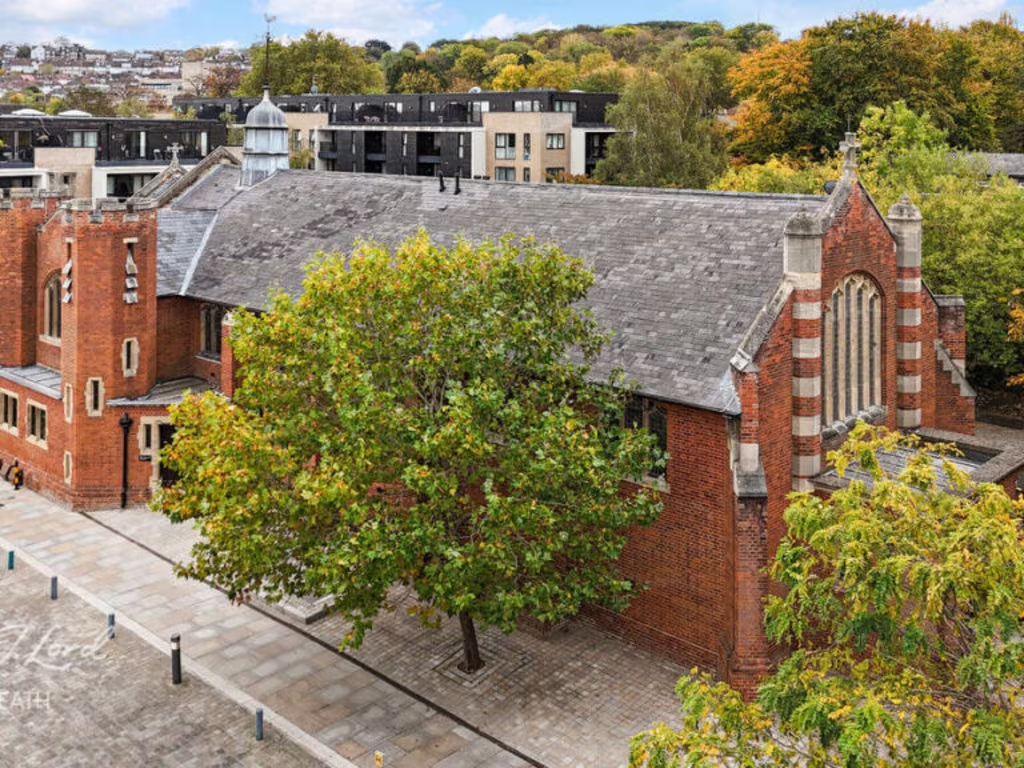
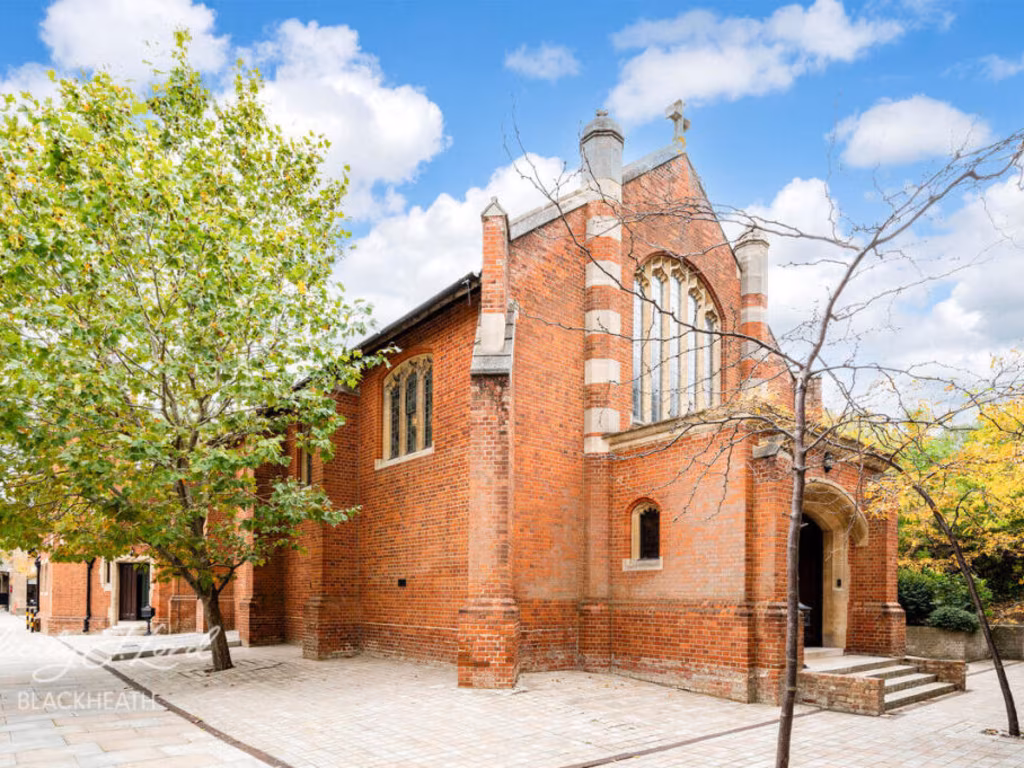
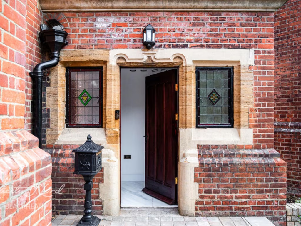
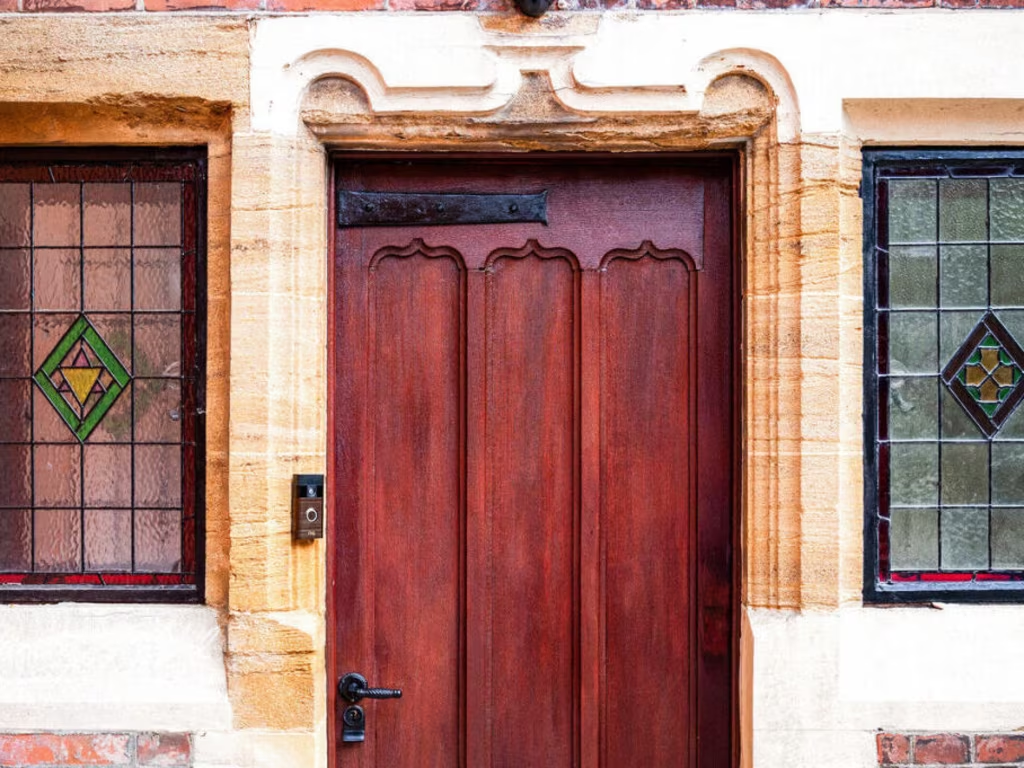
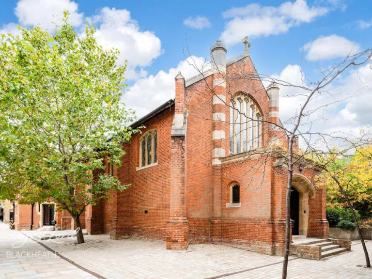
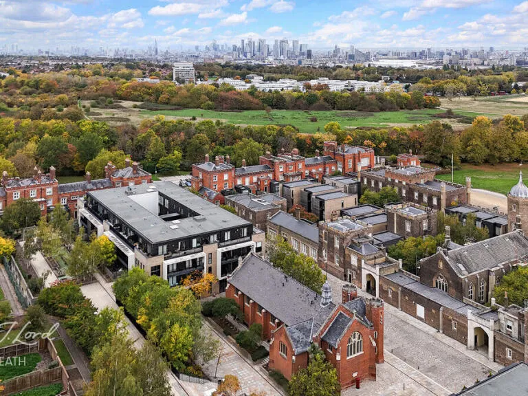
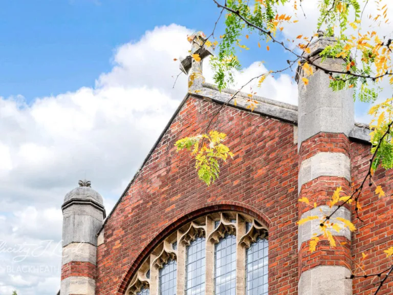
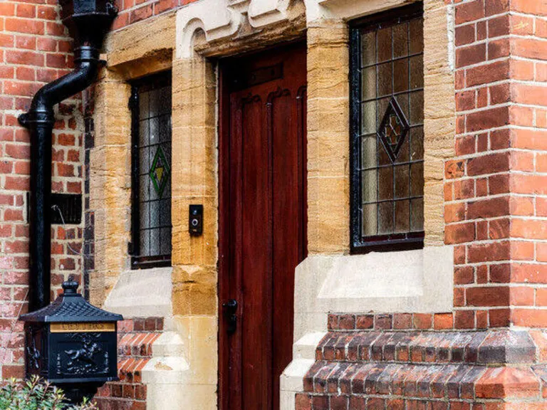
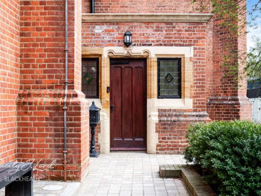
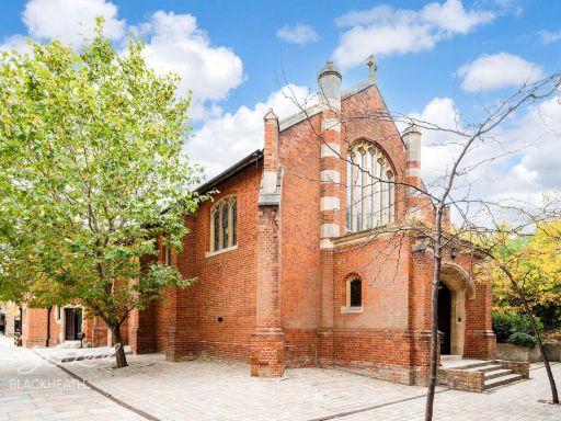
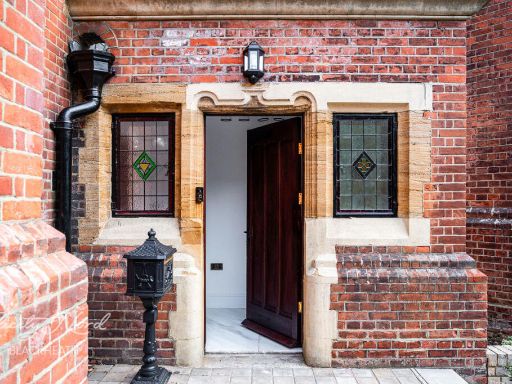
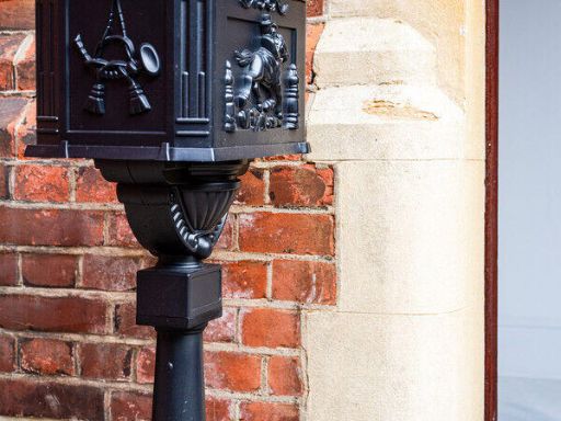
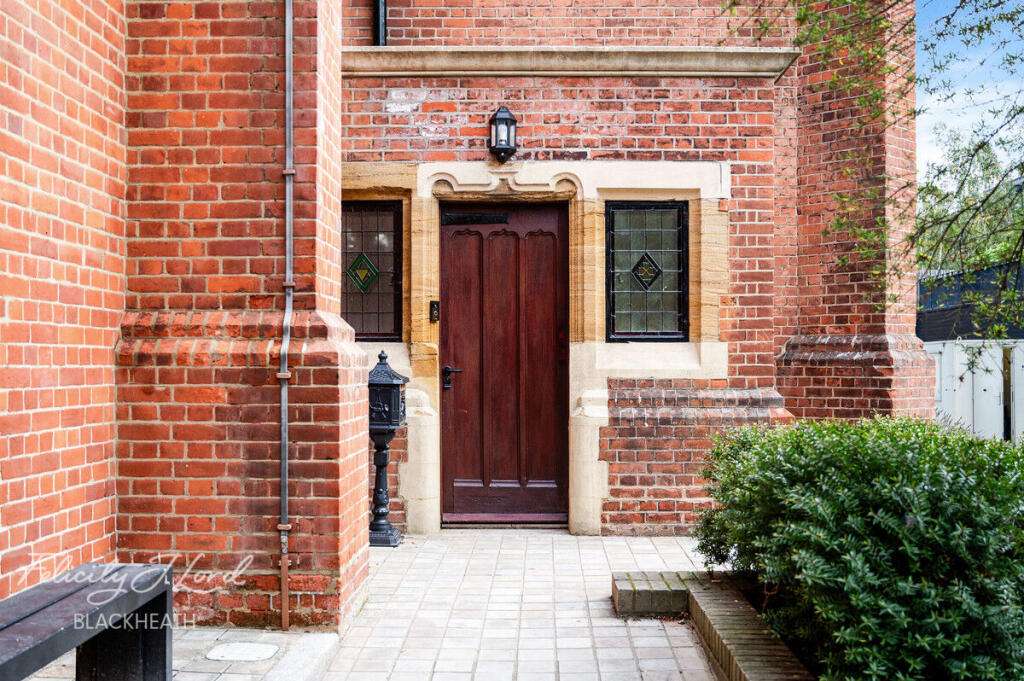
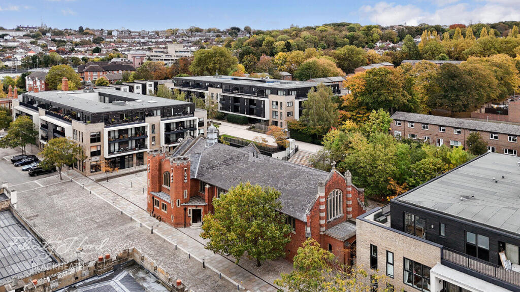
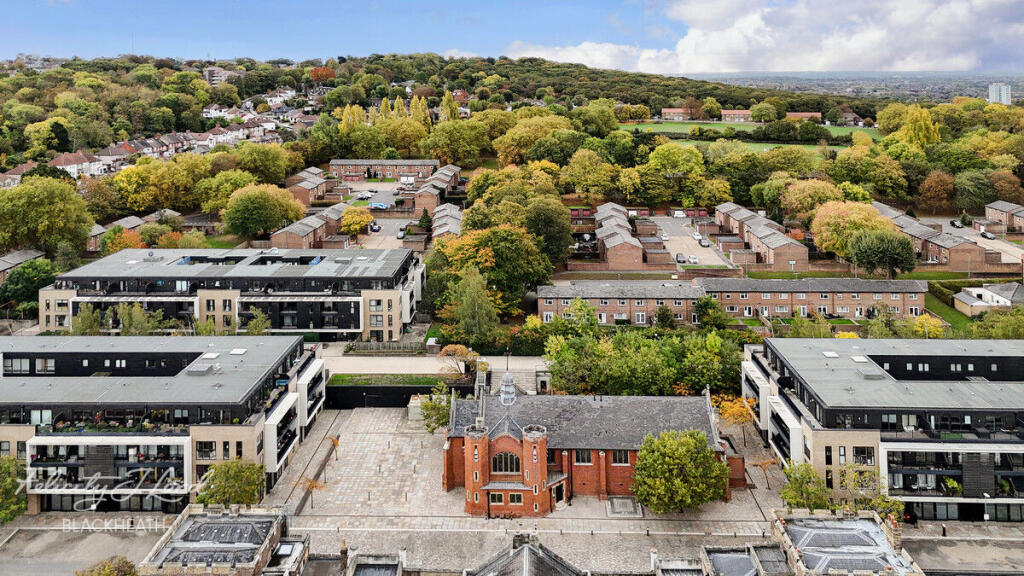
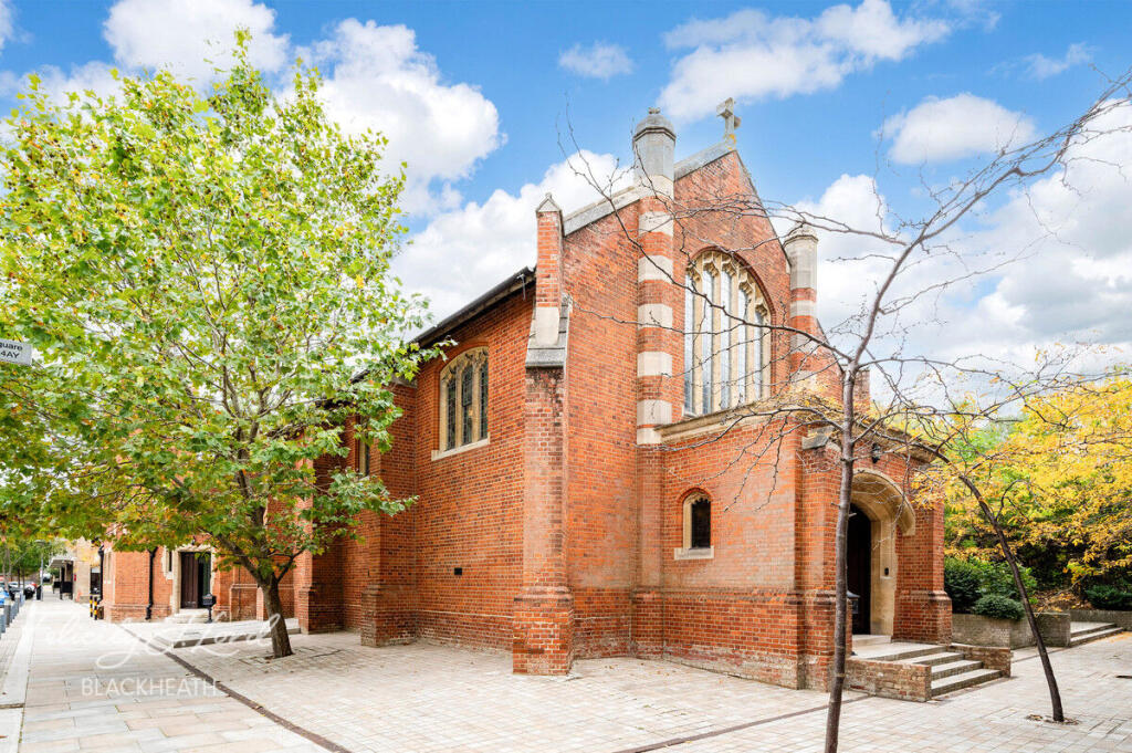
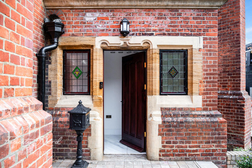
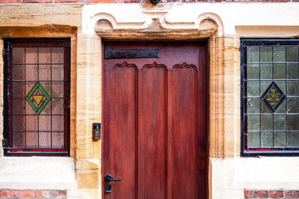
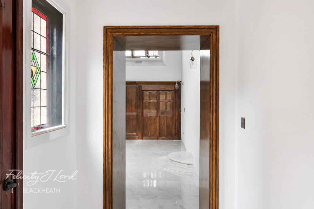
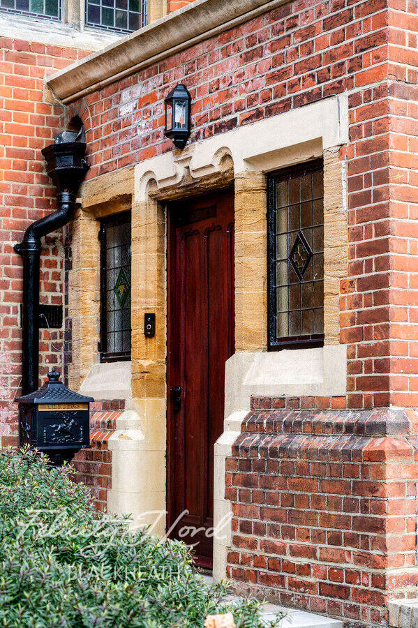
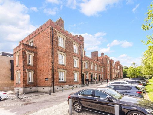
- front entrance Victorian
Floorplan Description
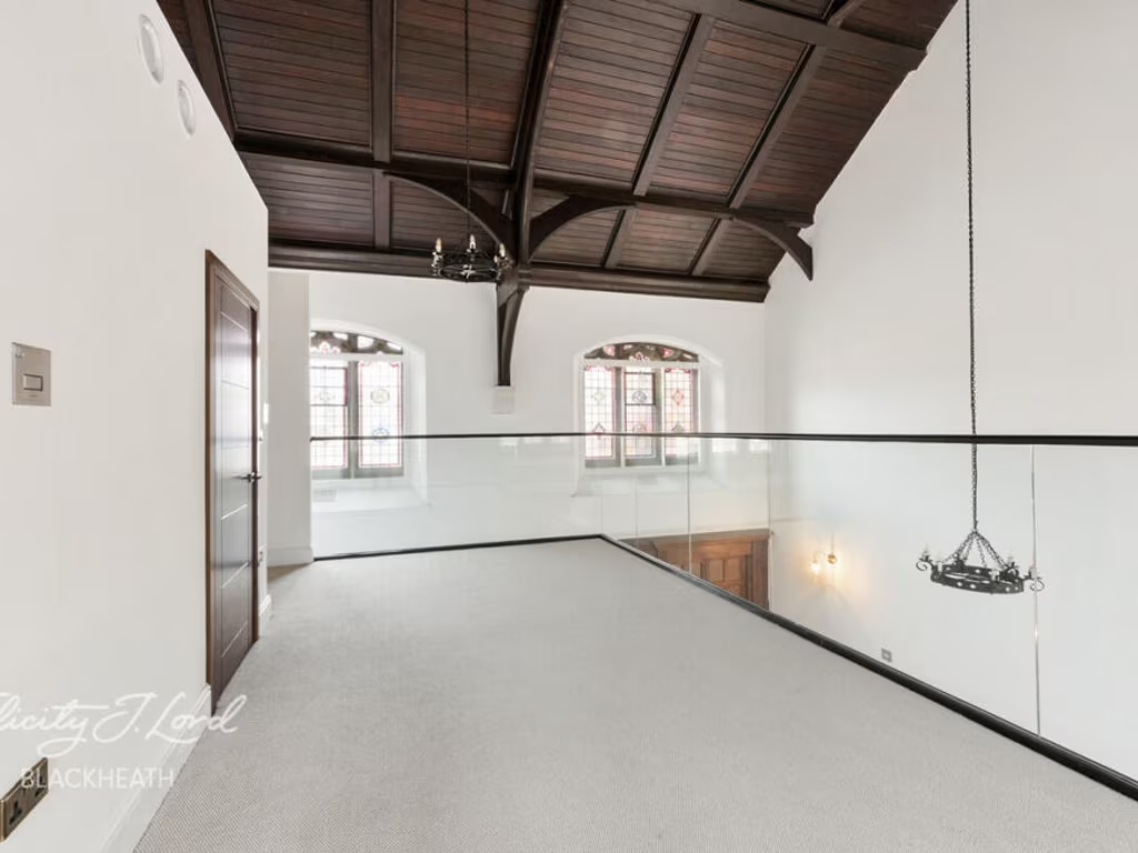
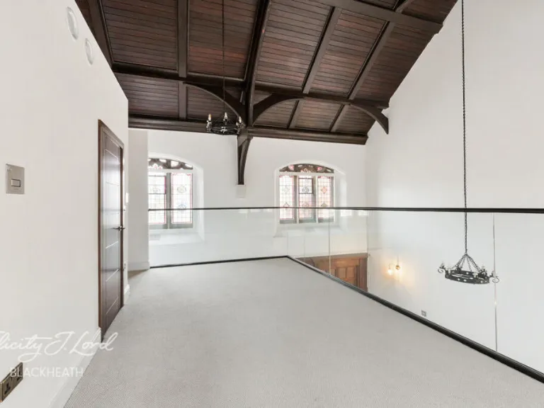
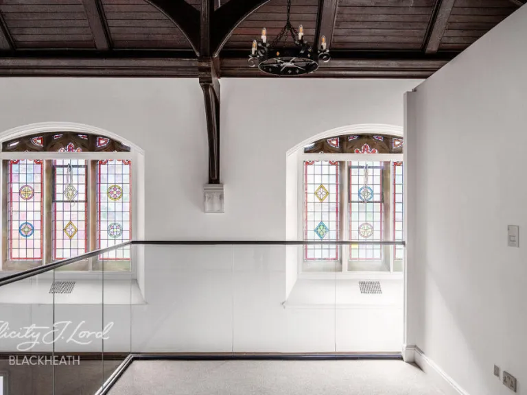
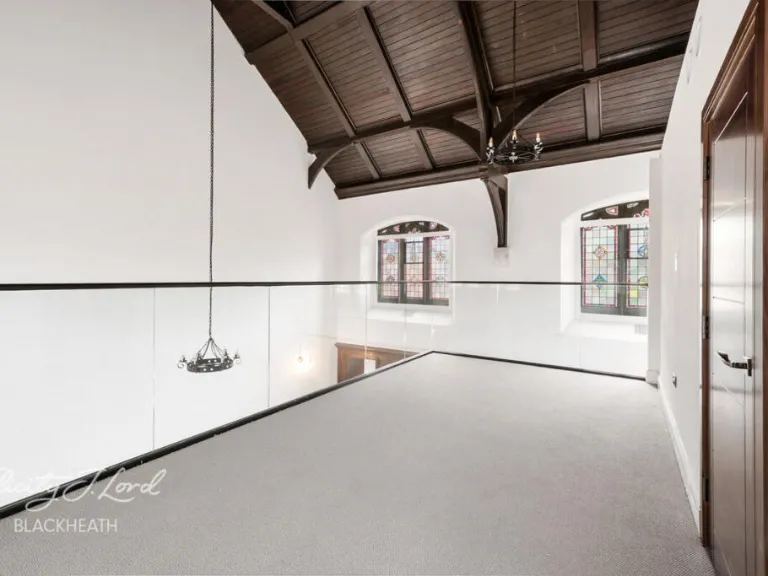
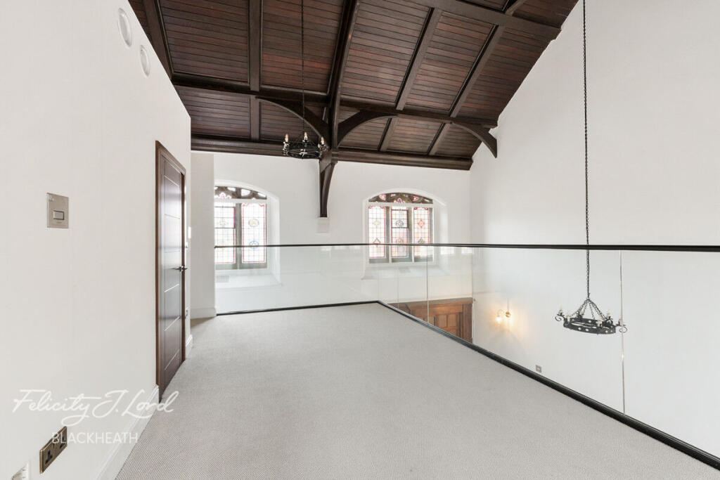
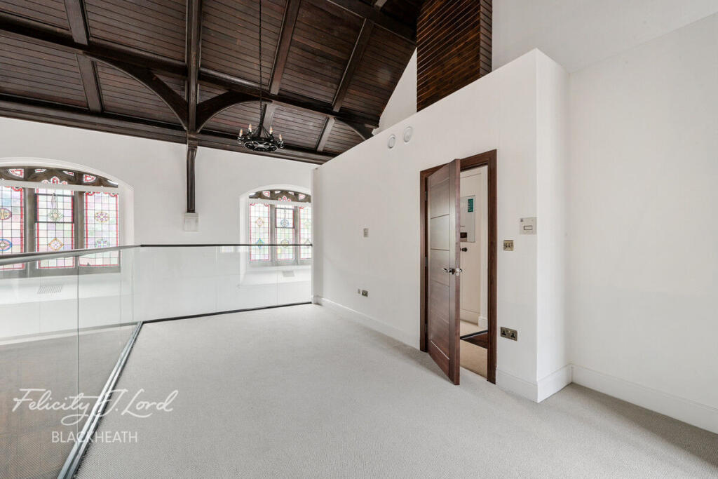
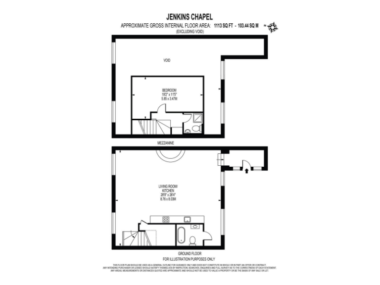
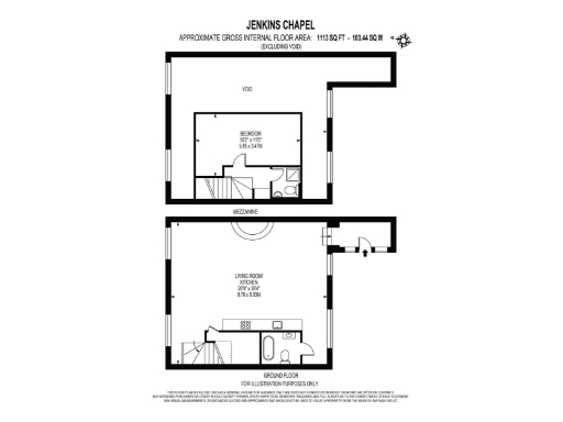
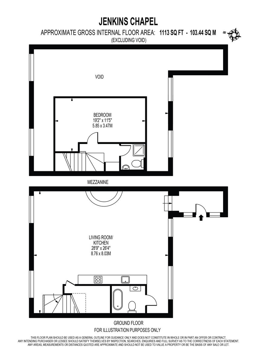
- Mezzanine and Ground Floor plan showing a bedroom and a large living room/kitchen.
Rooms
- BEDROOM:
- LIVING ROOM/ KITCHEN:
Textual Property Features
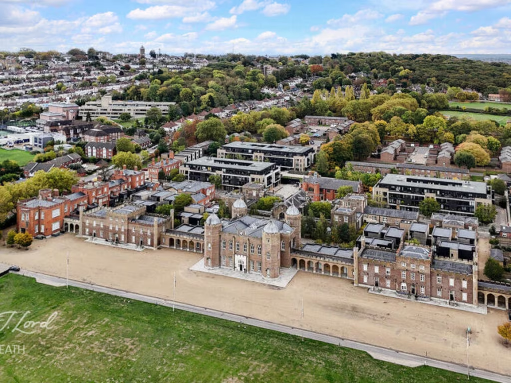
- Is Listed Building
- Success
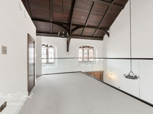
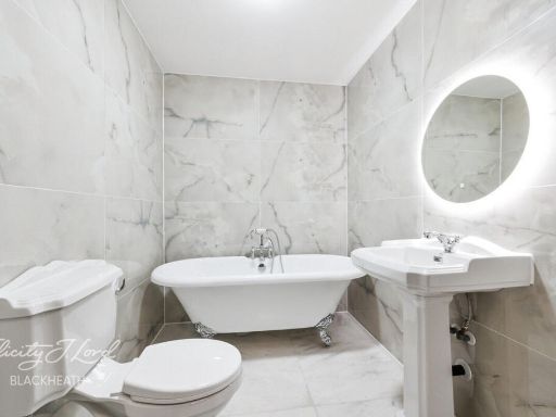
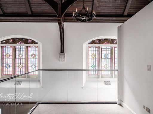
Detected Visual Features
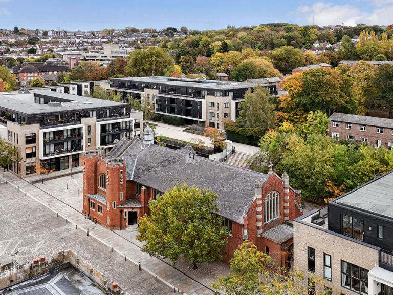
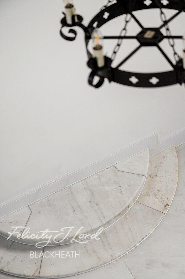
- modern conversion
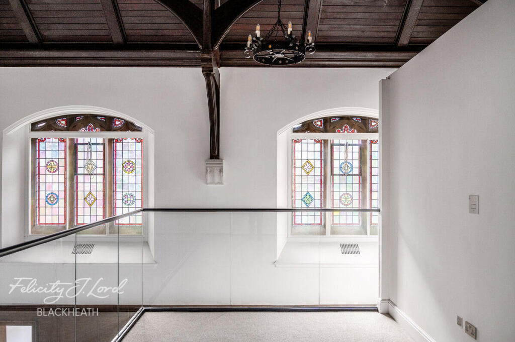
- double height ceiling
- open concept
- integrated kitchen
- large room
- historic elements
- balcony
- mixed materials
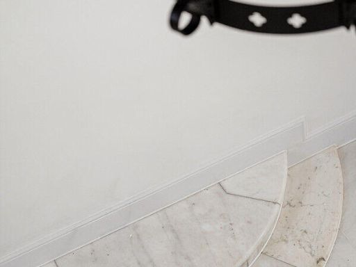
- natural light
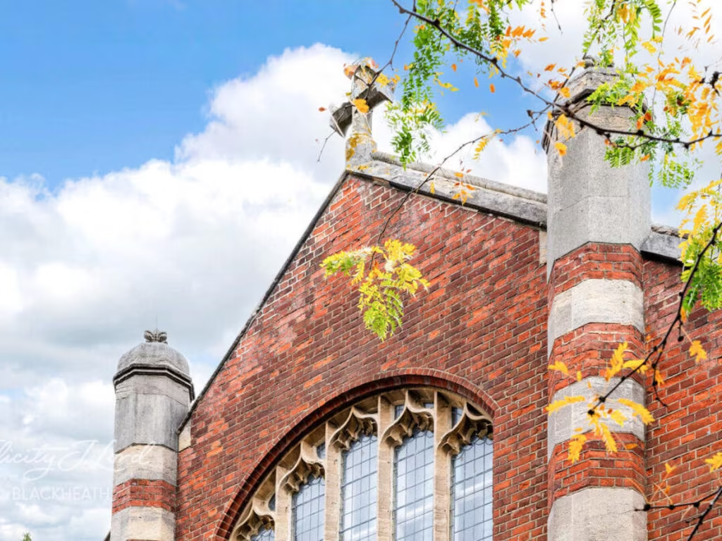
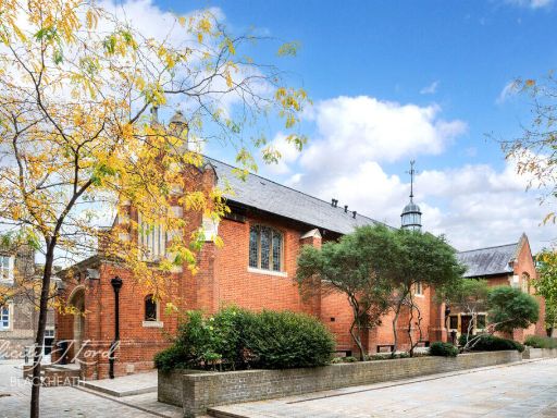
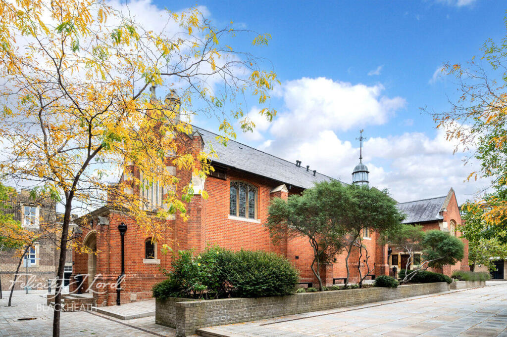
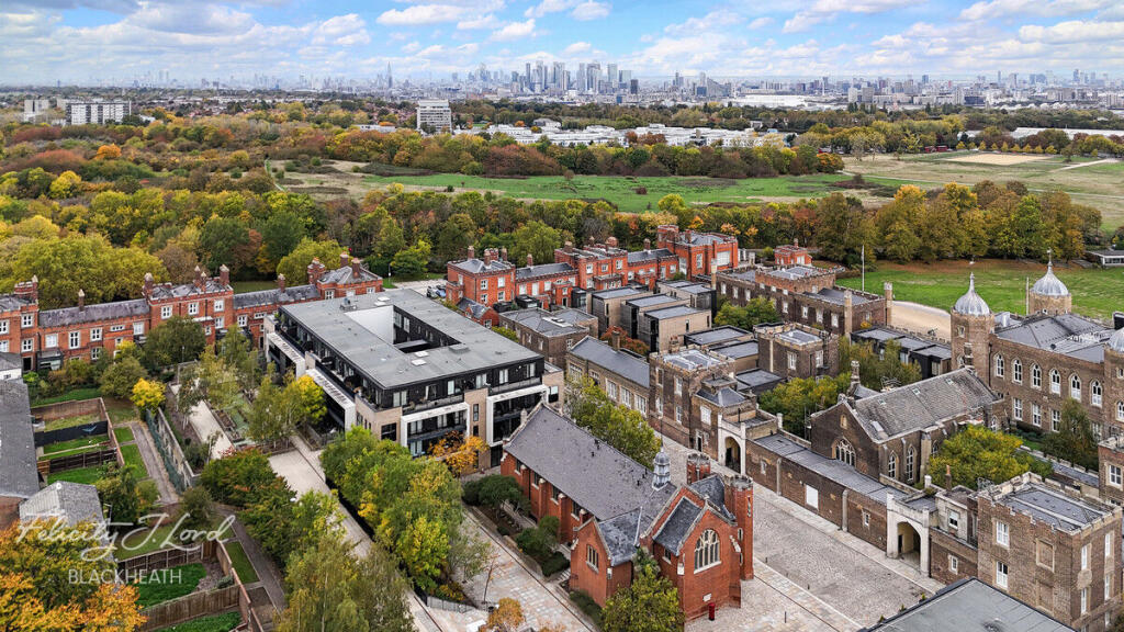
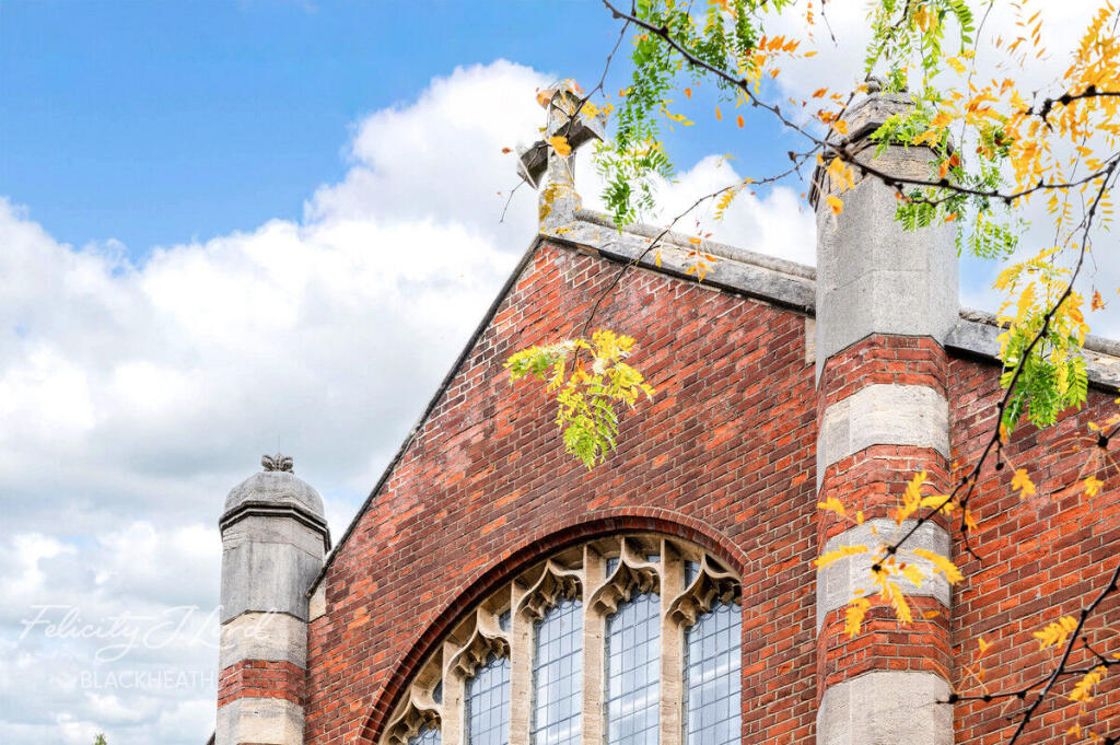
- Victorian architecture
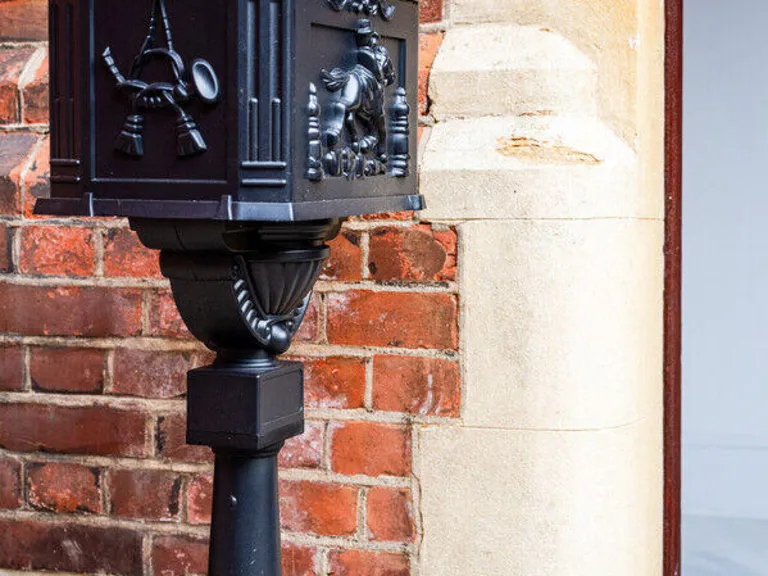
- red brick
- period features
- leadlight windows
- wooden door
- stone trim
- historic look
Nearby Schools
- Eltham Church of England Primary School
- Eglinton Primary School
- Notre Dame Catholic Primary School
- Nightingale Primary School
- Royal Greenwich Trust School
- St Mary's Catholic Primary School
- Christ Church Church of England Primary School, Shooters Hill
- Kidbrooke Park Primary School
- Ark Greenwich Free School
- Plumcroft Primary School
- St Peter's Catholic Primary School
- Mulgrave Primary School
- The Halley Academy
- Saint Mary Magdalene Church of England All Through School
- StreetVibes Media Academy
- Gordon Primary School
- St Thomas More Catholic Primary School
- Deansfield Primary School
- Henwick Primary School
- Charlton Manor Primary School
- St Margaret's Church of England Primary School
- Thorntree Primary School
- Foxfield Primary School
- Woodhill Primary School
- Cardwell Primary School
Nearest General Shops
- Id: 6326076766
- Tags:
- Addr:
- City: London
- Housenumber: Fountain House, 83
- Postcode: SE18 6TT
- Street: Brookhill Rd, Woolwich,
- Name: VBeauty & Hair Salon
- Shop: hairdresser
- TagsNormalized:
- Lat: 51.4870171
- Lon: 0.0672112
- FullGeoHash: u10hcsbvw5sk
- PartitionGeoHash: u10h
- Images:
- FoodStandards: null
- Distance: 1438.4
,- Id: 879726625
- Tags:
- Addr:
- City: London
- Housenumber: 40
- Postcode: SE18 4AB
- Street: Artillery Place
- Brand: Vauxhall
- Brand:wikidata: Q59187
- Building: yes
- Name: WJ King
- Opening_hours: Mo-Sa 09:00-18:00
- Phone: +44 20 8194 8845
- Shop: car
- Website: https://www.wjking.co.uk/
- TagsNormalized:
- Lat: 51.4879464
- Lon: 0.0599198
- FullGeoHash: u10hcm5eh0z7
- PartitionGeoHash: u10h
- Images:
- FoodStandards: null
- Distance: 1420.7
,- Id: 1893982006
- Tags:
- Addr:
- Housenumber: 428-430
- Postcode: SE9 6UD
- Street: Well Hall Road
- Brand: Costcutter
- Brand:wikidata: Q5175072
- Fhrs:
- Name: Costcutter
- Shop: supermarket
- TagsNormalized:
- Lat: 51.4669518
- Lon: 0.0530169
- FullGeoHash: u10hc1q8erhq
- PartitionGeoHash: u10h
- Images:
- FoodStandards:
- Id: 695199
- FHRSID: 695199
- LocalAuthorityBusinessID: PI/000177891
- BusinessName: CostCutter
- BusinessType: Retailers - other
- BusinessTypeID: 4613
- AddressLine1: 428 - 430 Well Hall Road
- AddressLine2: null
- AddressLine3: Eltham
- AddressLine4: Greenwich
- PostCode: SE9 6UD
- RatingValue: 3
- RatingKey: fhrs_3_en-GB
- RatingDate: 2021-09-03
- LocalAuthorityCode: 511
- LocalAuthorityName: Greenwich
- LocalAuthorityWebSite: http://www.royalgreenwich.gov.uk
- LocalAuthorityEmailAddress: Food.Concerns@royalgreenwich.gov.uk
- Scores:
- Hygiene: 10
- Structural: 10
- ConfidenceInManagement: 10
- NewRatingPending: false
- Geocode:
- Longitude: 0.05299560000000
- Latitude: 51.46700040000000
- Distance: 999.7
}
Nearest Grocery shops
- Id: 266638591
- Tags:
- Addr:
- Housenumber: 72-74
- Postcode: SE18 3SH
- Street: Herbert Road
- Alt_name: Louroy Supermarket
- Brand: Premier
- Brand:wikidata: Q7240340
- Building: yes
- Name: Premier
- Shop: convenience
- TagsNormalized:
- Lat: 51.4798359
- Lon: 0.0689976
- FullGeoHash: u10hced5zbbq
- PartitionGeoHash: u10h
- Images:
- FoodStandards: null
- Distance: 874.9
,- Id: 2721709730
- Tags:
- Addr:
- Housenumber: 53
- Street: Shooters Hill
- Name: Vishnu Store
- Shop: convenience
- TagsNormalized:
- Lat: 51.470513
- Lon: 0.0604896
- FullGeoHash: u10hc3uj3x03
- PartitionGeoHash: u10h
- Images:
- FoodStandards: null
- Distance: 532.9
,- Id: 2721709726
- Tags:
- Name: Vishnu Store
- Shop: convenience
- TagsNormalized:
- Lat: 51.4769418
- Lon: 0.0636627
- FullGeoHash: u10hc7n6gmqq
- PartitionGeoHash: u10h
- Images:
- FoodStandards: null
- Distance: 388.9
}
Nearest Supermarkets
- Id: 232841491
- Tags:
- Addr:
- Housenumber: 196-212
- Postcode: SE18 2RS
- Street: Plumstead Common Road
- Building: yes
- Designation: The Co-operative Food
- Name: Co-op
- Shop: supermarket
- TagsNormalized:
- Lat: 51.4804474
- Lon: 0.0807781
- FullGeoHash: u10hcgdz66bw
- PartitionGeoHash: u10h
- Images:
- FoodStandards: null
- Distance: 1630.3
,- Id: 266638590
- Tags:
- Addr:
- Housenumber: 9-15
- Postcode: SE18 3TB
- Street: Herbert Road
- Alt_name: The Co-operative Food
- Building: yes
- Name: Co-op
- Shop: supermarket
- TagsNormalized:
- Lat: 51.4813611
- Lon: 0.0698559
- FullGeoHash: u10hcefuev22
- PartitionGeoHash: u10h
- Images:
- FoodStandards: null
- Distance: 1028.1
,- Id: 179062691
- Tags:
- Addr:
- Housename: Brook House
- Housenumber: 386
- Postcode: SE18 4LP
- Street: Shooters Hill Road
- Alt_name: The Co-operative Food
- Brand: Co-op Food
- Brand:wikidata: Q3277439
- Building: retail
- Building:levels: 2
- Name: Co-op Food
- Opening_hours: Mo-Su 07:00-22:00
- Operator: The Co-operative Group
- Operator:wikidata: Q117202
- Roof:
- Shop: supermarket
- Website: https://finder.coop.co.uk/food/store/SE18-4LP/386-shooters-hill-road
- TagsNormalized:
- co-op
- co-op food
- food
- retail
- supermarket
- shop
- Lat: 51.4726418
- Lon: 0.0459039
- FullGeoHash: u10hc433veuk
- PartitionGeoHash: u10h
- Images:
- FoodStandards: null
- Distance: 937.2
}
Nearest Religious buildings
- Id: 455568496
- Tags:
- Addr:
- City: London
- Country: GB
- Postcode: SE18 3RS
- Street: Shooters Hill
- Amenity: school
- Capacity: 210
- Denomination: anglican
- Diocese: Diocese of Southwark
- Isced:
- Max_age: 11
- Min_age: 5
- Name: Christ Church CofE Primary School
- Phone: +44 20 8856 4513
- Ref:
- Religion: christian
- School:
- Boarding: no
- Gender: mixed
- Selective: no
- Trust: no
- Type: voluntary_aided
- Source:
- Addr: edubase
- Name: edubase
- Website: https://www.ccshprimary.org.uk/
- Wikidata: Q66220286
- TagsNormalized:
- school
- anglican
- church
- christian
- Lat: 51.4695486
- Lon: 0.0608044
- FullGeoHash: u10hc3srbg70
- PartitionGeoHash: u10h
- Images:
- FoodStandards: null
- Distance: 642.3
,- Id: 371261382
- Tags:
- Addr:
- Postcode: SE18 3RR
- Street: Shooters Hill
- Amenity: place_of_worship
- Building: yes
- Denomination: anglican
- Name: Christ Church
- Religion: christian
- Wikidata: Q105076478
- TagsNormalized:
- place of worship
- anglican
- church
- christian
- Lat: 51.4698786
- Lon: 0.0604059
- FullGeoHash: u10hc3gcz8cc
- PartitionGeoHash: u10h
- Images:
- FoodStandards: null
- Distance: 600.8
,- Id: 1199260416
- Tags:
- Amenity: place_of_worship
- Name: St Joseph's
- Religion: christian
- TagsNormalized:
- place of worship
- christian
- church
- Lat: 51.477123
- Lon: 0.0647055
- FullGeoHash: u10hc7p5gxpz
- PartitionGeoHash: u10h
- Images:
- FoodStandards: null
- Distance: 461.9
}
Nearest Medical buildings
- Id: 906820479
- Tags:
- Addr:
- Country: GB
- Housenumber: 36-38
- Postcode: SE18 3SH
- Street: Herbert Road
- Amenity: pharmacy
- Building: yes
- Dispensing: yes
- Healthcare: pharmacy
- Name: Herbert Pharmacy
- Website: https://www.herbertpharmacyltd.co.uk/
- TagsNormalized:
- Lat: 51.480612
- Lon: 0.0694672
- FullGeoHash: u10hcef869wk
- PartitionGeoHash: u10h
- Images:
- FoodStandards: null
- Distance: 953.5
,- Id: 713671496
- Tags:
- Addr:
- City: Woolwich
- Postcode: SE18 3RG
- Street: Shooters Hill
- Amenity: hospital
- Healthcare: hospital
- Name: Memorial Hospital
- Phone: +44 20 8836 8500
- Website: https://www.nhs.uk/Services/hospitals/Overview/DefaultView.aspx?id=2324
- Wikidata: Q23891198
- Wikipedia: en:Memorial Hospital, Woolwich
- TagsNormalized:
- Lat: 51.4687321
- Lon: 0.0641413
- FullGeoHash: u10hc3wene54
- PartitionGeoHash: u10h
- Images:
- FoodStandards: null
- Distance: 807.5
,- Id: 1199260332
- Tags:
- Amenity: medical_centre
- Healthcare: centre
- Name: All Saints Medical Centre
- TagsNormalized:
- Lat: 51.4796622
- Lon: 0.0665399
- FullGeoHash: u10hce86y2xd
- PartitionGeoHash: u10h
- Images:
- FoodStandards: null
- Distance: 731.1
,- Id: 255439869
- Tags:
- Addr:
- City: London
- Postcode: SE18 4QH
- Street: Stadium Road
- Amenity: hospital
- Healthcare: hospital
- Name: Queen Elizabeth Hospital
- Toilets:
- Wheelchair: yes
- Wikidata: Q7270343
- Wikipedia: en:Queen Elizabeth Hospital, London
- TagsNormalized:
- Lat: 51.4778741
- Lon: 0.0502258
- FullGeoHash: u10hc5k86770
- PartitionGeoHash: u10h
- Images:
- FoodStandards: null
- Distance: 664.9
}
Nearest Airports
- Id: 103894219
- Tags:
- Aerodrome: international
- Aeroway: aerodrome
- Iata: SEN
- Icao: EGMC
- Name: London Southend Airport
- Old_name: Southend Municipal Airport
- Ref: SEN
- Wikidata: Q1415441
- TagsNormalized:
- airport
- international airport
- Lat: 51.5701749
- Lon: 0.6924624
- FullGeoHash: u10mru04p937
- PartitionGeoHash: u10m
- Images:
- FoodStandards: null
- Distance: 45094.6
,- Id: 121158889
- Tags:
- Aerodrome: continental
- Aeroway: aerodrome
- Fhrs:
- Authority: City of London Corporation
- Iata: LCY
- Icao: EGLC
- Name: London City Airport
- Operator: London City Airport Limited
- Ref: LCY
- Website: https://www.londoncityairport.com/
- Wikidata: Q8982
- Wikipedia: en:London City Airport
- TagsNormalized:
- airport
- continental airport
- Lat: 51.5042658
- Lon: 0.0539987
- FullGeoHash: u10j10p64702
- PartitionGeoHash: u10j
- Images:
- FoodStandards: null
- Distance: 3250.3
,- Id: 260720166
- Tags:
- Aerodrome: international
- Aeroway: aerodrome
- Alt_name: Gatwick Airport
- Ele: 62
- Iata: LGW
- Icao: EGKK
- Internet_access: wlan
- Internet_access:fee: no
- Internet_access:ssid: Gatwick FREE Wi-Fi
- Name: London Gatwick Airport
- Operator: Gatwick Airport Limited
- Ref: LGW
- Website: https://www.gatwickairport.com/
- Wikidata: Q8703
- Wikipedia: en:Gatwick Airport
- TagsNormalized:
- airport
- international airport
- Lat: 51.1540917
- Lon: -0.1883773
- FullGeoHash: gcpg58qf4mzd
- PartitionGeoHash: gcpg
- Images:
- FoodStandards: null
- Distance: 39622.3
}
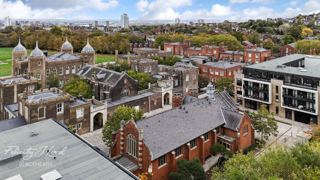
Nearest Leisure Facilities
- Id: 49865206
- Tags:
- Description: South of Ha Ha Road is public open space parkland
- Leisure: park
- Name: Woolwich Common
- Surface: grass
- Wikidata: Q8033973
- TagsNormalized:
- Lat: 51.4770727
- Lon: 0.0545192
- FullGeoHash: u10hc5pewmu7
- PartitionGeoHash: u10h
- Images:
- FoodStandards: null
- Distance: 363.2
,- Id: 1138674346
- Tags:
- TagsNormalized:
- Lat: 51.476475
- Lon: 0.0615735
- FullGeoHash: u10hc7hb4y2w
- PartitionGeoHash: u10h
- Images:
- FoodStandards: null
- Distance: 239.3
,- Id: 103888292
- Tags:
- TagsNormalized:
- Lat: 51.4771976
- Lon: 0.0587219
- FullGeoHash: u10hc74u2m4h
- PartitionGeoHash: u10h
- Images:
- FoodStandards: null
- Distance: 223.5
,- Id: 694509153
- Tags:
- Access: private
- Leisure: pitch
- Sport: cricket
- TagsNormalized:
- pitch
- leisure
- cricket
- sports
- Lat: 51.476888
- Lon: 0.0588404
- FullGeoHash: u10hc74fe56t
- PartitionGeoHash: u10h
- Images:
- FoodStandards: null
- Distance: 189
,- Id: 993151428
- Tags:
- TagsNormalized:
- Lat: 51.474312
- Lon: 0.0591302
- FullGeoHash: u10hc6e59g4x
- PartitionGeoHash: u10h
- Images:
- FoodStandards: null
- Distance: 100.1
}
Nearest Tourist attractions
- Id: 7999204585
- Tags:
- Addr:
- Name: Minotaur house
- Tourism: apartment
- TagsNormalized:
- Lat: 51.4929246
- Lon: 0.06886
- FullGeoHash: u10hcw40h8ce
- PartitionGeoHash: u10h
- Images:
- FoodStandards: null
- Distance: 2091.5
,- Id: 7999204685
- Tags:
- Name: Thalía
- Tourism: apartment
- TagsNormalized:
- Lat: 51.4926366
- Lon: 0.0688189
- FullGeoHash: u10hctfn7e5j
- PartitionGeoHash: u10h
- Images:
- FoodStandards: null
- Distance: 2060.4
,- Id: 1052225133
- Tags:
- Barrier: fence
- Description: Various domestic animals (pigs, goats, sheep, ducks, ponies)
- Landuse: meadow
- Tourism: zoo
- Zoo: petting_zoo
- TagsNormalized:
- Lat: 51.4859216
- Lon: 0.0446624
- FullGeoHash: u10hch8x0xqt
- PartitionGeoHash: u10h
- Images:
- FoodStandards: null
- Distance: 1543.8
}
Nearest Hotels
- Id: 748824064
- Tags:
- Addr:
- City: London
- Housenumber: 91
- Postcode: SE18 6BF
- Street: Beresford Street
- Suburb: Woolwich
- Branch: London Woolwich
- Brand: Premier Inn
- Brand:wikidata: Q2108626
- Building: yes
- Building:levels: 6
- Internet_access: wlan
- Internet_access:fee: customers
- Internet_access:operator: Virgin Media
- Internet_access:ssid: Premier Inn Free Wi-Fi
- Name: Premier Inn London Woolwich
- Tourism: hotel
- TagsNormalized:
- Lat: 51.4926863
- Lon: 0.0675913
- FullGeoHash: u10hctcnwurw
- PartitionGeoHash: u10h
- Images:
- FoodStandards: null
- Distance: 2038.6
,- Id: 2959234563
- Tags:
- Brand: Travelodge
- Brand:wikidata: Q9361374
- Internet_access: wlan
- Internet_access:fee: customers
- Internet_access:ssid: Travelodge WiFi
- Name: Travelodge Hotel
- Tourism: hotel
- TagsNormalized:
- Lat: 51.4927255
- Lon: 0.0617961
- FullGeoHash: u10hcmuyzgy8
- PartitionGeoHash: u10h
- Images:
- FoodStandards: null
- Distance: 1961
,- Id: 10095832951
- Tags:
- Brand: Travelodge
- Brand:wikidata: Q9361374
- Internet_access: wlan
- Internet_access:fee: customers
- Internet_access:ssid: Travelodge WiFi
- Name: Travelodge
- Tourism: hotel
- TagsNormalized:
- Lat: 51.4923324
- Lon: 0.0630677
- FullGeoHash: u10hcmvutd6x
- PartitionGeoHash: u10h
- Images:
- FoodStandards: null
- Distance: 1929
}
Tags
- modern conversion
- double height ceiling
- open concept
- integrated kitchen
- large room
- historic elements
- balcony
- mixed materials
- natural light
- Victorian architecture
- red brick
- period features
- leadlight windows
- wooden door
- stone trim
- historic look
Local Market Stats
- Average Price/sqft: £465
- Avg Income: £50400
- Rental Yield: 5.6%
- Social Housing: 30%
- Planning Success Rate: 62%
AirBnB Data
- 1km average: £88/night
- Listings in 1km: 8
Similar Properties
 1 bedroom apartment for sale in Langhorne Street, LONDON, SE18 — £310,000 • 1 bed • 1 bath • 552 ft²
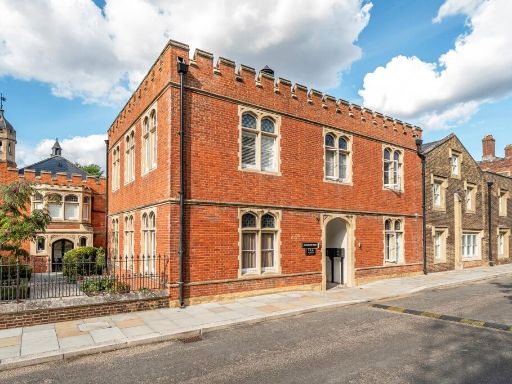 2 bedroom flat for sale in Ashmore Road, Shooters Hill, London, SE18 — £435,000 • 2 bed • 2 bath • 920 ft²
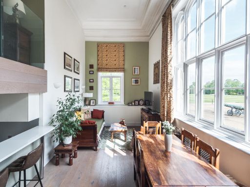 2 bedroom flat for sale in Royal Military Academy, Woolwich Common, SE18 — £625,000 • 2 bed • 3 bath • 1367 ft²
 2 bedroom terraced house for sale in Wellesley Road, Royal Military Academy, Woolwich, London, SE18 — £740,000 • 2 bed • 2 bath • 1312 ft²
 1 bedroom detached bungalow for sale in Napoleon Lane, Plumstead, SE18 — £300,000 • 1 bed • 1 bath • 457 ft²
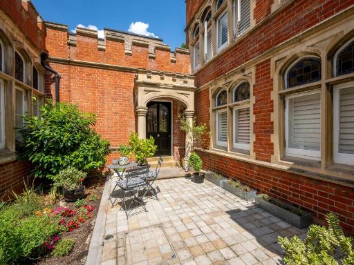 2 bedroom semi-detached house for sale in Napoleon Lane, Royal Military Academy, Woolwich, London, SE18 — £500,000 • 2 bed • 2 bath • 1098 ft²
Meta
- {
"@context": "https://schema.org",
"@type": "Residence",
"name": "1 bedroom apartment for sale in Ashmore Road, London, SE18",
"description": "",
"url": "https://propertypiper.co.uk/property/9f644ae3-5dbd-440e-96a0-10ee1af8a170",
"image": "https://image-a.propertypiper.co.uk/f2bd265e-ffff-4c66-ad13-87d439670ef9-1024.jpeg",
"address": {
"@type": "PostalAddress",
"streetAddress": "Ashmore Road, London",
"postalCode": "SE18 4BY",
"addressLocality": "Greenwich",
"addressRegion": "Greenwich and Woolwich",
"addressCountry": "England"
},
"geo": {
"@type": "GeoCoordinates",
"latitude": 51.4751886,
"longitude": 0.0588031
},
"numberOfRooms": 1,
"numberOfBathroomsTotal": 1,
"floorSize": {
"@type": "QuantitativeValue",
"value": 1046,
"unitCode": "FTK"
},
"offers": {
"@type": "Offer",
"price": 500000,
"priceCurrency": "GBP",
"availability": "https://schema.org/InStock"
},
"additionalProperty": [
{
"@type": "PropertyValue",
"name": "Feature",
"value": "modern conversion"
},
{
"@type": "PropertyValue",
"name": "Feature",
"value": "double height ceiling"
},
{
"@type": "PropertyValue",
"name": "Feature",
"value": "open concept"
},
{
"@type": "PropertyValue",
"name": "Feature",
"value": "integrated kitchen"
},
{
"@type": "PropertyValue",
"name": "Feature",
"value": "large room"
},
{
"@type": "PropertyValue",
"name": "Feature",
"value": "historic elements"
},
{
"@type": "PropertyValue",
"name": "Feature",
"value": "balcony"
},
{
"@type": "PropertyValue",
"name": "Feature",
"value": "mixed materials"
},
{
"@type": "PropertyValue",
"name": "Feature",
"value": "natural light"
},
{
"@type": "PropertyValue",
"name": "Feature",
"value": "Victorian architecture"
},
{
"@type": "PropertyValue",
"name": "Feature",
"value": "red brick"
},
{
"@type": "PropertyValue",
"name": "Feature",
"value": "period features"
},
{
"@type": "PropertyValue",
"name": "Feature",
"value": "leadlight windows"
},
{
"@type": "PropertyValue",
"name": "Feature",
"value": "wooden door"
},
{
"@type": "PropertyValue",
"name": "Feature",
"value": "stone trim"
},
{
"@type": "PropertyValue",
"name": "Feature",
"value": "historic look"
}
]
}
High Res Floorplan Images
Compatible Floorplan Images
FloorplanImages Thumbnail