FK3 0LG - 4 bedroom semidetached house for sale in Hamilton Road, Gra…
View on Property Piper
4 bedroom semi-detached house for sale in Hamilton Road, Grangemouth, FK3
Property Details
- Price: £175000
- Bedrooms: 4
- Bathrooms: 2
- Property Type: undefined
- Property SubType: undefined
Brochure Descriptions
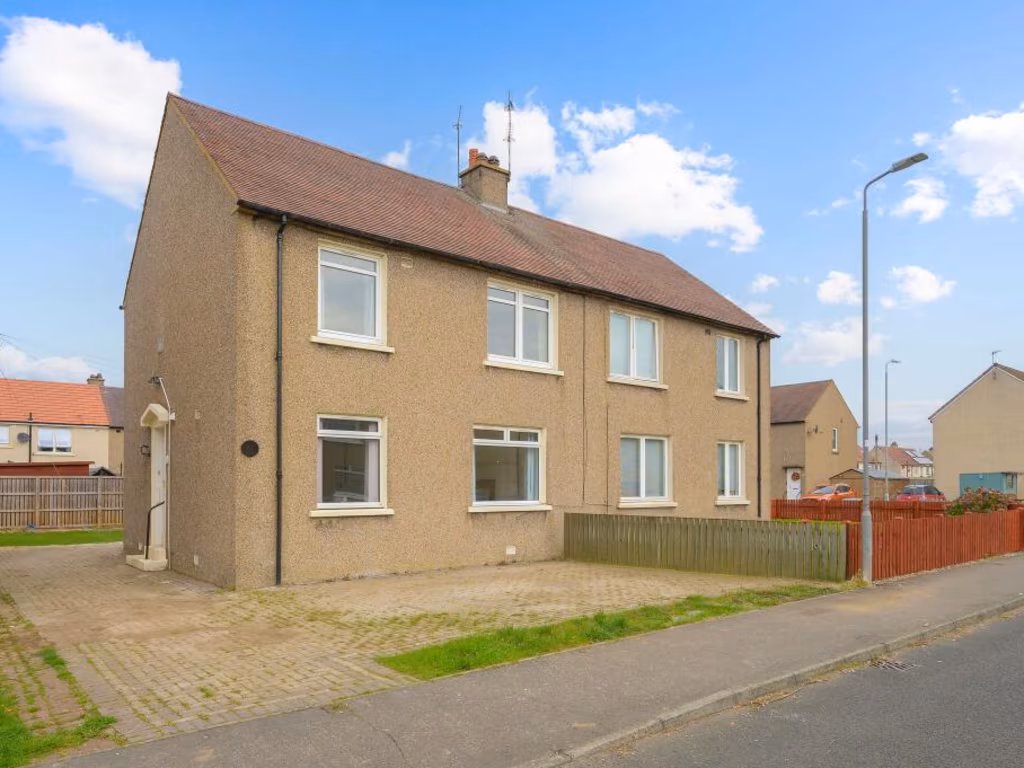
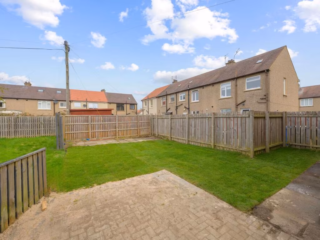
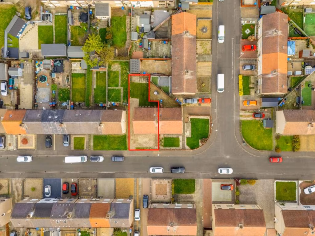
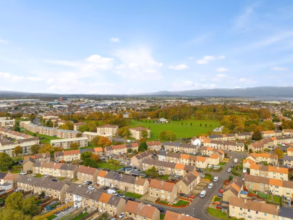
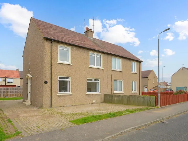
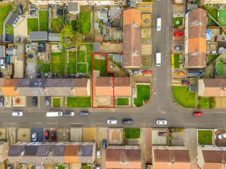
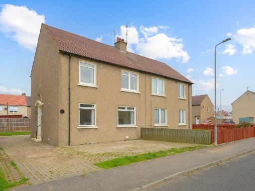
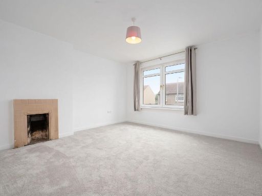
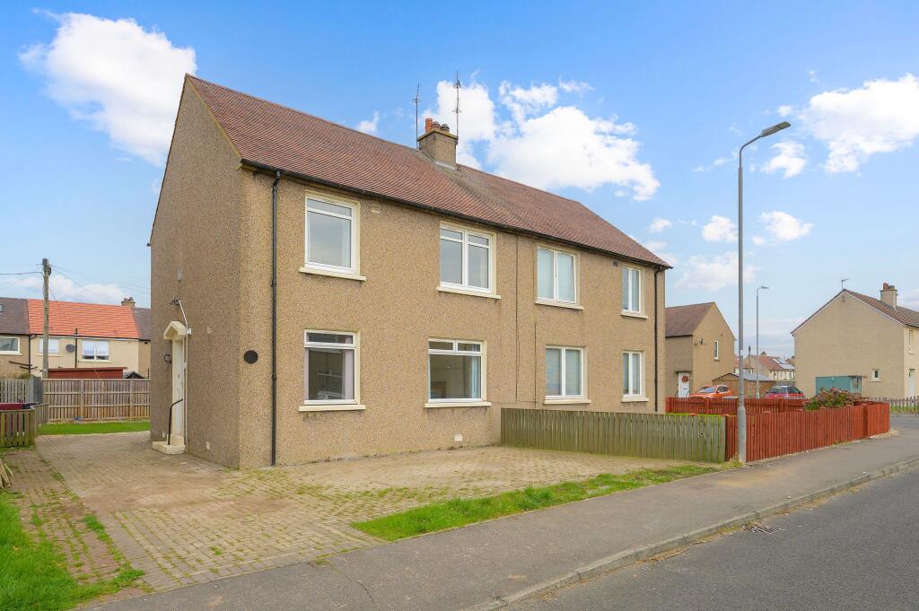
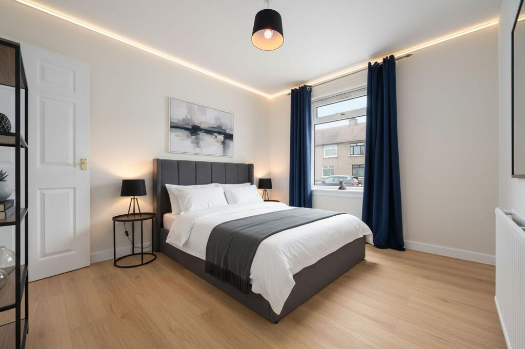
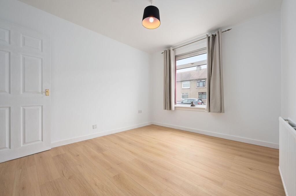
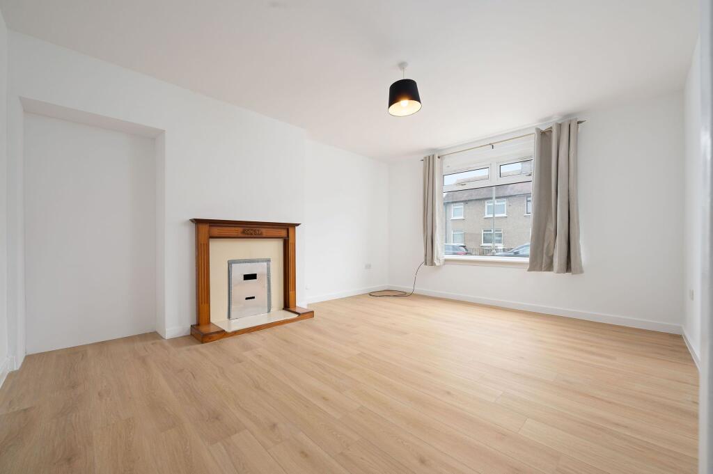
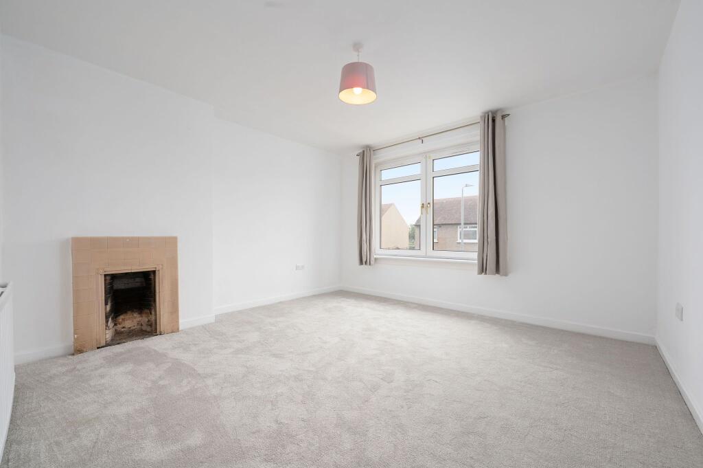
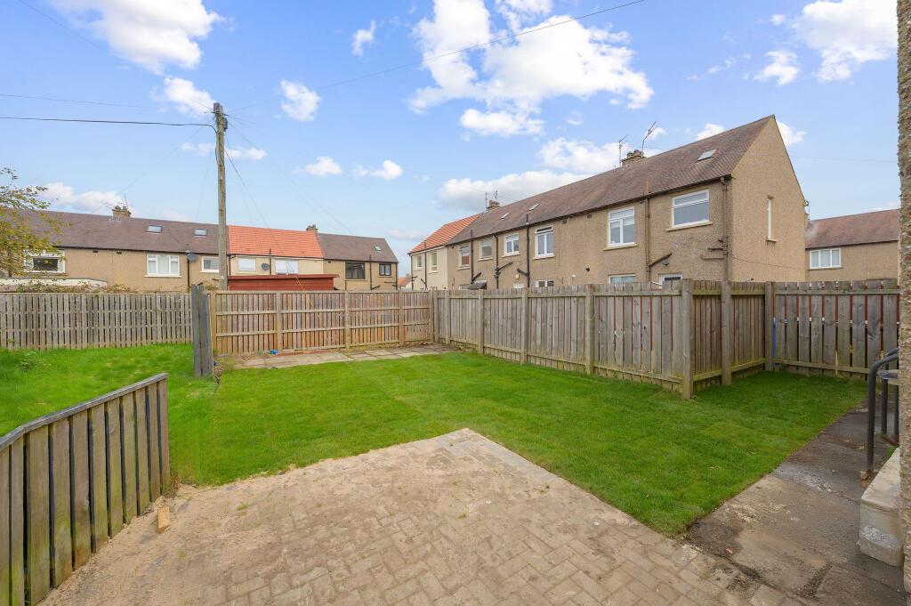
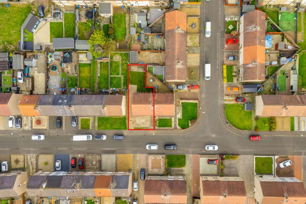
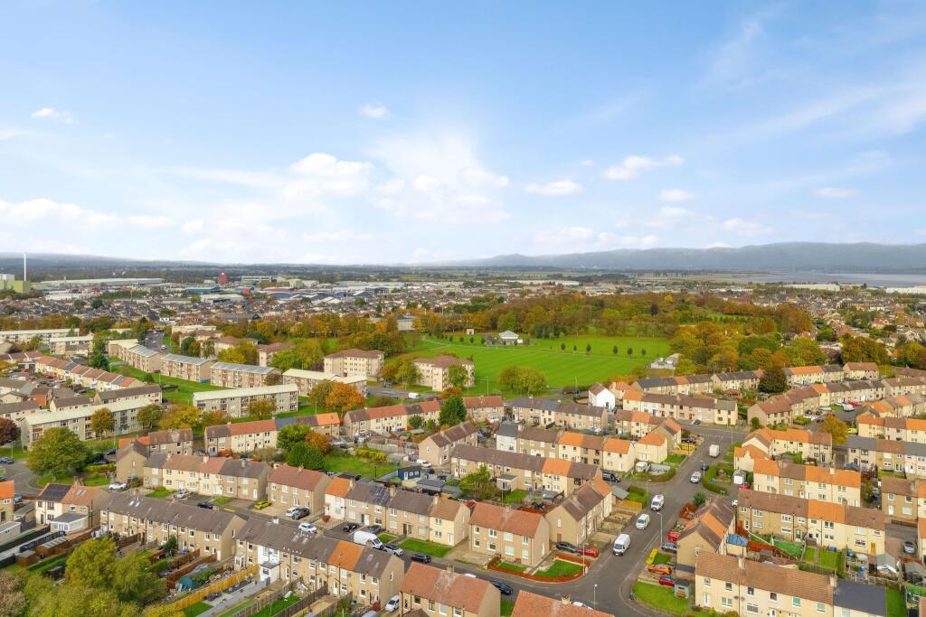
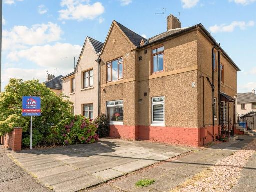
- Two-storey semi-detached residential building finished in pebble-dash render. The property presents as a mid-20th century style semi with a symmetrical window arrangement and separate entrance at the gable end — likely arranged as two flats or a family house with multiple reception rooms. External features include a paved driveway providing off-street parking for two vehicles, a small fenced front garden and a modest private yard area to the side. The plot sits on a residential suburban street with similar neighbouring houses; no notable long-range views are visible (typical suburban outlook). Overall impression: a medium-sized suburban property with average-sized front garden/parking and modest rear/outdoor space. Suitable for owner-occupation or buy-to-let; likely to appeal to buyers seeking a low-maintenance brick/pebble-dash home in a residential neighbourhood.
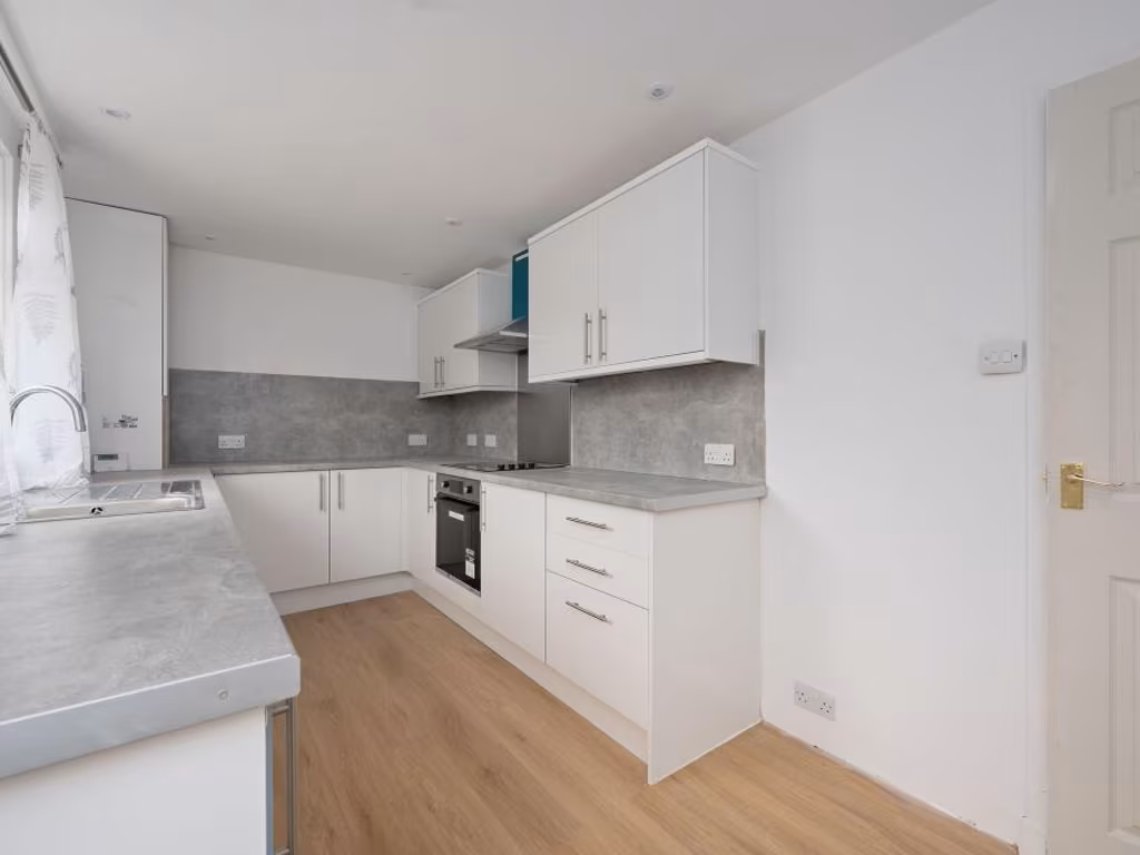
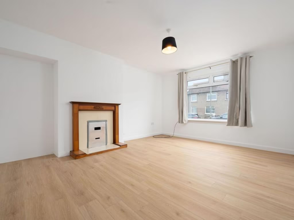
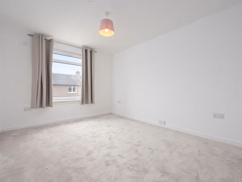
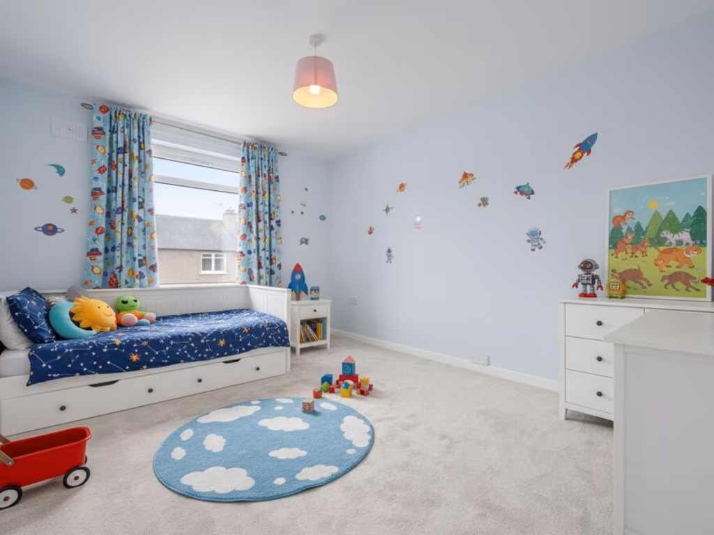
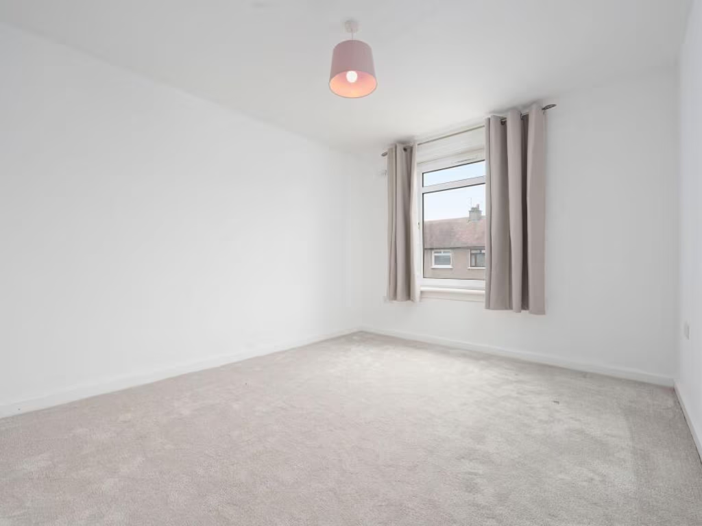
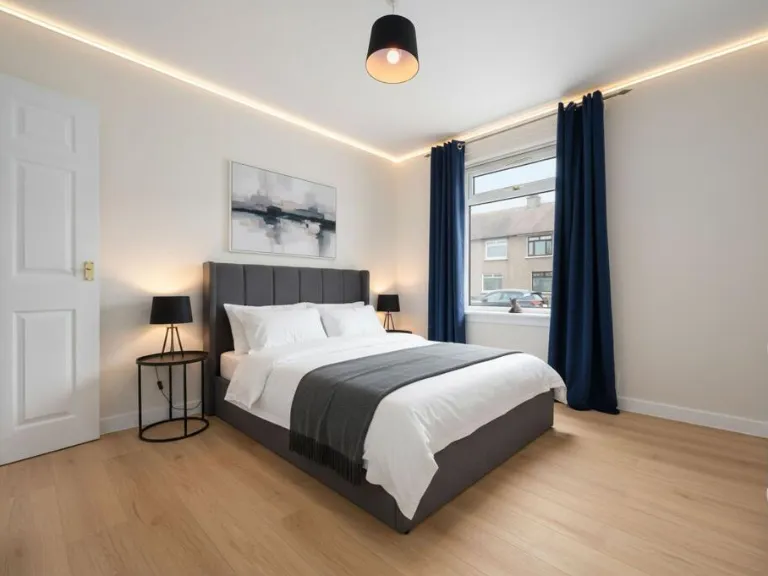
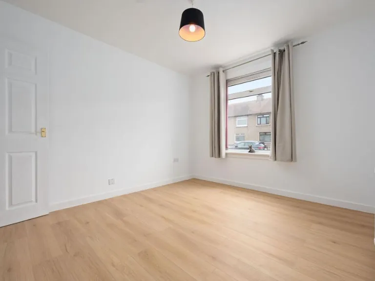
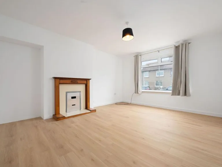
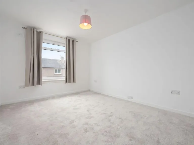
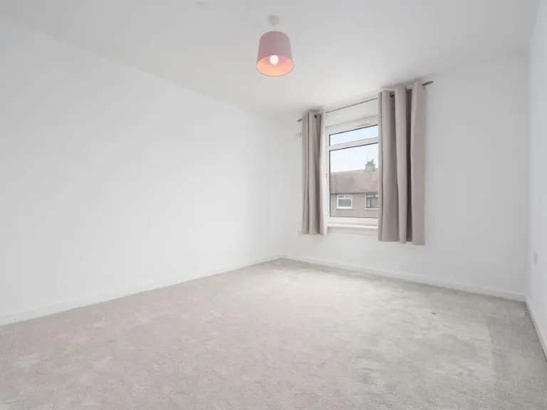
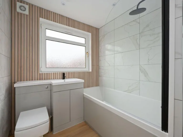
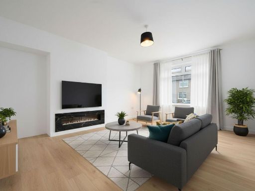
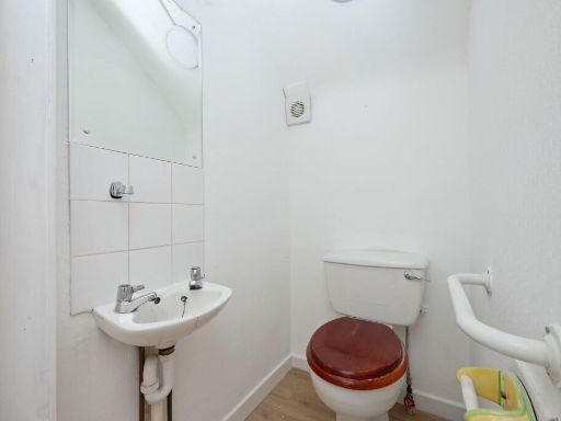
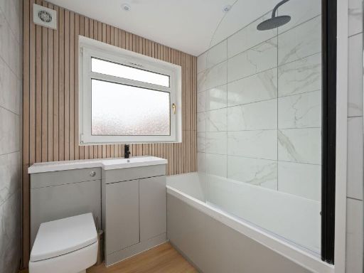
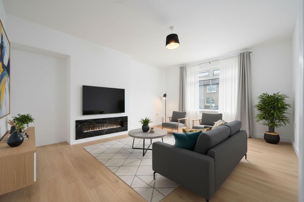
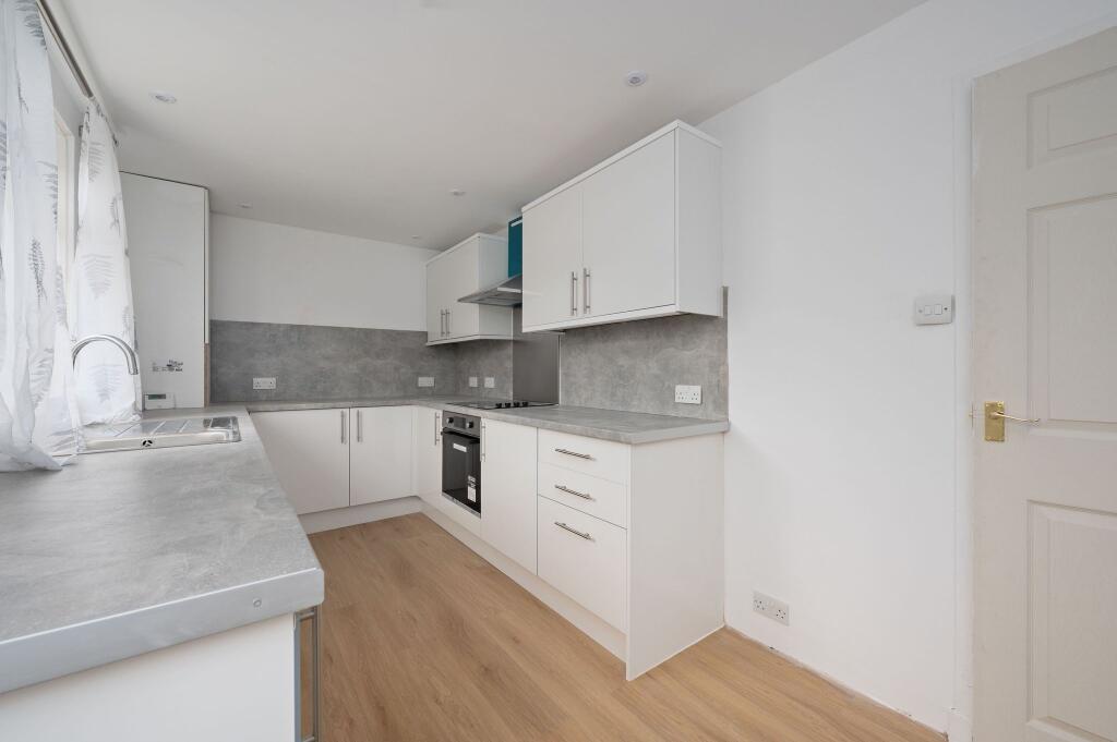
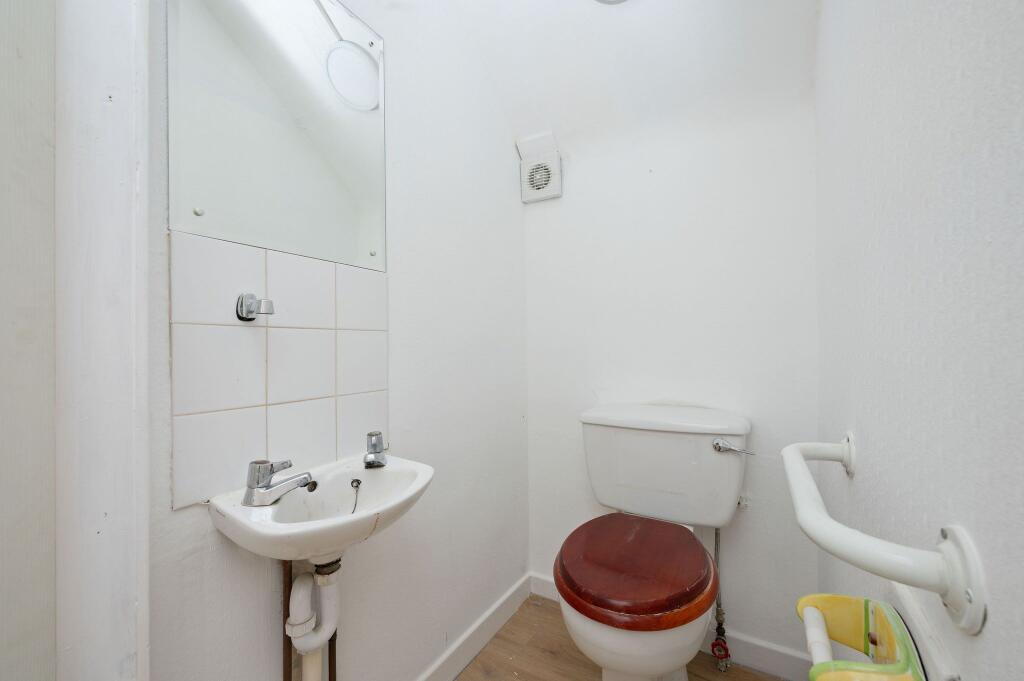
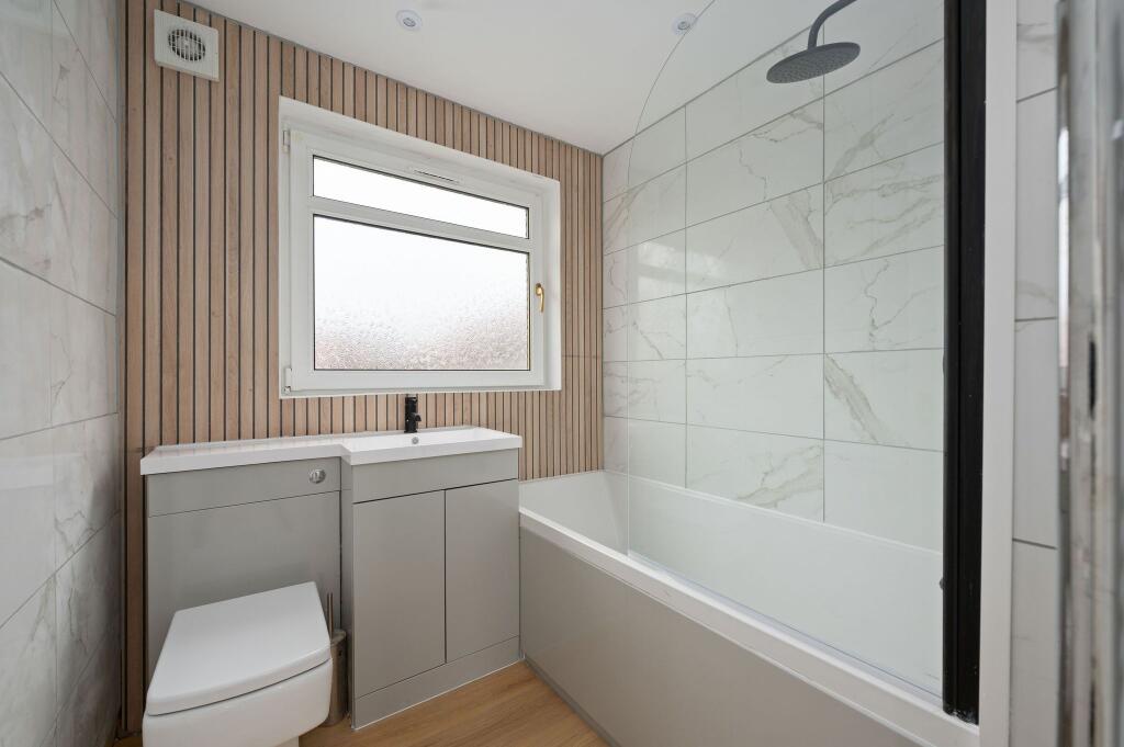
- Purpose: small residential flat/ground-floor apartment. Accommodation shown: fitted galley kitchen with modern white units and integrated oven; small bathroom/WC with pedestal basin and close-coupled toilet; one double bedroom and a separate living room featuring a central fireplace. Decor and condition: recently refreshed neutral decor throughout with light-coloured laminate flooring and contemporary lighting. Windows face the street (urban view), providing reasonable daylight. Size and layout: room sizes appear average-to-small consistent with a one-bedroom flat; overall property footprint is compact. Energy and running costs: EPC indicated current rating 66 (band D). Overall valuation impression: a modest, well-presented, low-maintenance city/suburban flat suitable for a first-time buyer or investor; limited internal space but in good decorative order and ready to occupy.
Image Descriptions
- semi-detached house post-war
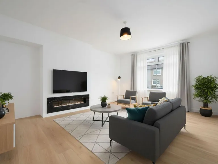
- living room contemporary
Floorplan Description
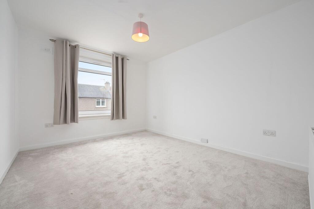
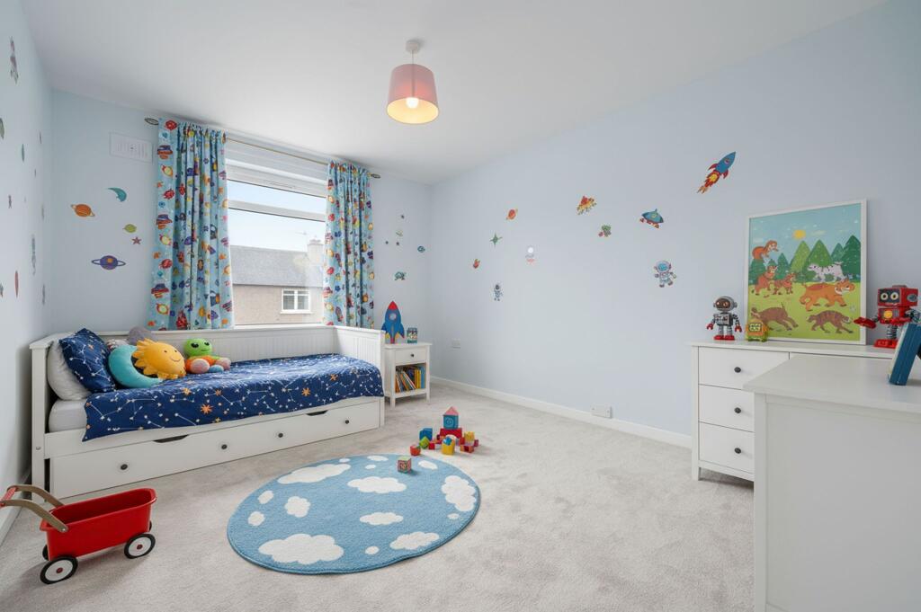
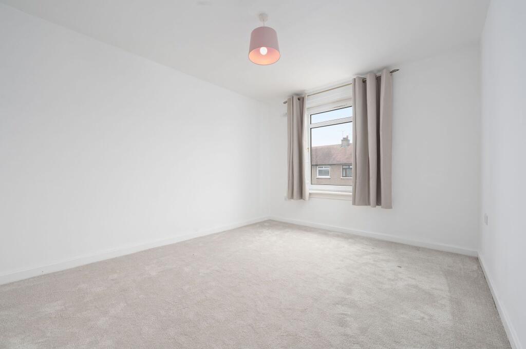
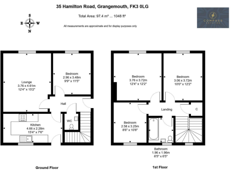
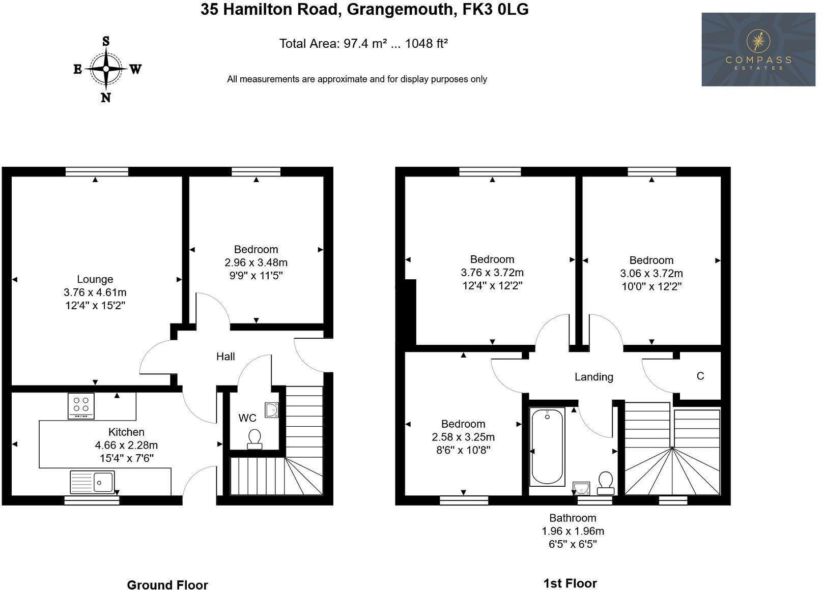
- Two-storey house floorplan with living room, kitchen, and multiple bedrooms
Rooms
- Lounge:
- Bedroom:
- Kitchen:
- Bedroom:
- Bedroom:
- Bedroom:
- Bathroom:
Textual Property Features
Detected Visual Features
- semi-detached
- post-war
- two-storey
- flat roof
- brownish facade
- retro look
- potential for renovation
- driveway
- suburban
- fenced area
- contemporary
- minimalist
- living room
- modern fireplace
- neutral decor
- large window
- natural light
- bright
- airy
- hardwood floor
Nearest Bars And Restaurants
- Id: 464905892
- Tags:
- Amenity: fast_food
- Name: Four-in-One
- TagsNormalized:
- Lat: 56.006255
- Lon: -3.7300627
- FullGeoHash: gcvqe5eu54xs
- PartitionGeoHash: gcvq
- Images:
- FoodStandards: null
- Distance: 947.2
,- Id: 36984200
- Tags:
- Amenity: pub
- Name: The Ellwyn
- TagsNormalized:
- Lat: 56.0065455
- Lon: -3.729562
- FullGeoHash: gcvqe5sjybv1
- PartitionGeoHash: gcvq
- Images:
- FoodStandards: null
- Distance: 910.8
,- Id: 1783972416
- Tags:
- Amenity: fast_food
- Cuisine: burger
- Name: Dhillon's
- Source: survey
- TagsNormalized:
- Lat: 56.0097374
- Lon: -3.7107327
- FullGeoHash: gcvqes3bmev1
- PartitionGeoHash: gcvq
- Images:
- FoodStandards: null
- Distance: 341.1
,- Id: 1783972385
- Tags:
- Amenity: fast_food
- Cuisine: chinese
- Name: ABC Chinese Chippy
- Source: survey
- TagsNormalized:
- Lat: 56.0092694
- Lon: -3.7105236
- FullGeoHash: gcvqes4jds94
- PartitionGeoHash: gcvq
- Images:
- FoodStandards: null
- Distance: 323.9
,- Id: 1783972452
- Tags:
- Amenity: restaurant
- Cuisine: chinese
- Name: Wongs Restaurant
- Source: survey
- TagsNormalized:
- Lat: 56.0093617
- Lon: -3.710644
- FullGeoHash: gcvqes1yptz2
- PartitionGeoHash: gcvq
- Images:
- FoodStandards: null
- Distance: 322.4
}
Nearest General Shops
- Id: 1783972463
- Tags:
- Shop: vacant
- Source: survey
- TagsNormalized:
- Lat: 56.0092653
- Lon: -3.7106098
- FullGeoHash: gcvqes4j8ebc
- PartitionGeoHash: gcvq
- Images:
- FoodStandards: null
- Distance: 319
,- Id: 1783972460
- Tags:
- Name: Fone Unlocker
- Shop: mobile_phone
- TagsNormalized:
- Lat: 56.0092476
- Lon: -3.7106962
- FullGeoHash: gcvqes1vw82r
- PartitionGeoHash: gcvq
- Images:
- FoodStandards: null
- Distance: 313.3
,- Id: 1783972423
- Tags:
- Brand: Spar
- Brand:wikidata: Q610492
- Name: Spar
- Shop: supermarket
- Source: survey
- TagsNormalized:
- Lat: 56.0092394
- Lon: -3.7108741
- FullGeoHash: gcvqes1v6qgx
- PartitionGeoHash: gcvq
- Images:
- FoodStandards: null
- Distance: 303.2
}
Nearest Grocery shops
- Id: 530878677
- Tags:
- Brand: Spar
- Brand:wikidata: Q610492
- Building: yes
- Name: Spar
- Shop: convenience
- TagsNormalized:
- Lat: 56.0100511
- Lon: -3.7234244
- FullGeoHash: gcvqek2djym9
- PartitionGeoHash: gcvq
- Images:
- FoodStandards: null
- Distance: 570.2
,- Id: 1783972453
- Tags:
- Name: gkr
- Shop: convenience
- Source: survey
- TagsNormalized:
- Lat: 56.0097933
- Lon: -3.7105452
- FullGeoHash: gcvqes60dn0z
- PartitionGeoHash: gcvq
- Images:
- FoodStandards: null
- Distance: 354.2
,- Id: 1783972426
- Tags:
- Name: W & S Frew
- Shop: convenience
- Source: survey
- TagsNormalized:
- Lat: 56.0097714
- Lon: -3.7109339
- FullGeoHash: gcvqes3b8fph
- PartitionGeoHash: gcvq
- Images:
- FoodStandards: null
- Distance: 333.6
}
Nearest Religious buildings
- Id: 507041193
- Tags:
- Amenity: place_of_worship
- Building: yes
- Denomination: roman_catholic
- Name: Sacred Heart Roman Catholic Church
- Religion: christian
- Source: OS OpenMap Local
- Wikidata: Q15126790
- TagsNormalized:
- place of worship
- catholic
- roman catholic
- church
- christian
- Lat: 56.016009
- Lon: -3.7178145
- FullGeoHash: gcvqemkubsut
- PartitionGeoHash: gcvq
- Images:
- FoodStandards: null
- Distance: 918.7
,- Id: 507041196
- Tags:
- Amenity: place_of_worship
- Building: church
- Denomination: roman_catholic
- Name: Christ The King Roman Catholic Church
- Religion: christian
- TagsNormalized:
- place of worship
- church
- catholic
- roman catholic
- christian
- Lat: 56.0028892
- Lon: -3.7200616
- FullGeoHash: gcvqe750kr1n
- PartitionGeoHash: gcvq
- Images:
- FoodStandards: null
- Distance: 635.3
,- Id: 7422987
- Tags:
- Amenity: place_of_worship
- Building: church
- Name: Kirk Of The Holy Rood
- Religion: christian
- Source: OS OpenMap Local
- Type: multipolygon
- TagsNormalized:
- place of worship
- church
- christian
- Lat: 56.0057036
- Lon: -3.7169774
- FullGeoHash: gcvqe7t2u5ug
- PartitionGeoHash: gcvq
- Images:
- FoodStandards: null
- Distance: 269.1
}
Nearest Medical buildings
- Id: 827503885
- Tags:
- Amenity: veterinary
- Building: yes
- Name: Polmont Veterinary Clinic
- TagsNormalized:
- Lat: 55.9925048
- Lon: -3.7053915
- FullGeoHash: gcvqe9jgfp7v
- PartitionGeoHash: gcvq
- Images:
- FoodStandards: null
- Distance: 1814
,- Id: 43834780
- Tags:
- Addr:
- City: Grangemouth
- Housenumber: 72
- Postcode: FK3 9BL
- Street: Bo'ness Road
- Amenity: dentist
- Healthcare: dentist
- Name: The Practice Dental Surgery
- Source: survey
- Website: https://thepracticegrangemouth.co.uk/
- TagsNormalized:
- dentist
- health
- healthcare
- dental
- surgery
- Lat: 56.0184723
- Lon: -3.7178904
- FullGeoHash: gcvqemueqb5g
- PartitionGeoHash: gcvq
- Images:
- FoodStandards: null
- Distance: 1189.7
,- Id: 464905884
- Tags:
- Amenity: pharmacy
- Dispensing: yes
- Name: Lindsay Gilmour
- TagsNormalized:
- Lat: 56.006314
- Lon: -3.730135
- FullGeoHash: gcvqe5eu3t9u
- PartitionGeoHash: gcvq
- Images:
- FoodStandards: null
- Distance: 950.4
,- Id: 1783972421
- Tags:
- Amenity: pharmacy
- Dispensing: yes
- Name: Numark Rowlands Pharmacy
- Source: survey
- TagsNormalized:
- pharmacy
- rowlands pharmacy
- Lat: 56.009234
- Lon: -3.7110017
- FullGeoHash: gcvqes1trmuw
- PartitionGeoHash: gcvq
- Images:
- FoodStandards: null
- Distance: 296
}
Nearest Airports
- Id: 403150963
- Tags:
- Aerodrome: international
- Aerodrome:type: public
- Aeroway: aerodrome
- Iata: EDI
- Icao: EGPH
- Is_in: Edinburgh,Scotland,UK
- Name: Edinburgh Airport
- Old_name: Turnhouse
- Source: Gagravarr_Airports
- Wikidata: Q8716
- Wikipedia: en:Edinburgh Airport
- TagsNormalized:
- airport
- international airport
- Lat: 55.9500825
- Lon: -3.3614651
- FullGeoHash: gcvw792kb5mf
- PartitionGeoHash: gcvw
- Images:
- FoodStandards: null
- Distance: 22921
}
Nearest Leisure Facilities
- Id: 209876921
- Tags:
- Leisure: pitch
- Source: Bing
- Sport: soccer
- TagsNormalized:
- Lat: 56.0048147
- Lon: -3.7138512
- FullGeoHash: gcvqe7resypu
- PartitionGeoHash: gcvq
- Images:
- FoodStandards: null
- Distance: 350.4
,- Id: 119661051
- Tags:
- Leisure: park
- Source: Bing;survey
- TagsNormalized:
- Lat: 56.0050088
- Lon: -3.7148453
- FullGeoHash: gcvqe7quvf6d
- PartitionGeoHash: gcvq
- Images:
- FoodStandards: null
- Distance: 320.4
,- Id: 54071793
- Tags:
- Leisure: pitch
- Source: survey
- Sport: soccer
- TagsNormalized:
- Lat: 56.0099661
- Lon: -3.7179844
- FullGeoHash: gcvqekk9swmy
- PartitionGeoHash: gcvq
- Images:
- FoodStandards: null
- Distance: 292.2
,- Id: 39268138
- Tags:
- Leisure: park
- Name: Zetland Park
- Source: survey
- TagsNormalized:
- Lat: 56.0103779
- Lon: -3.7156918
- FullGeoHash: gcvqekqk455q
- PartitionGeoHash: gcvq
- Images:
- FoodStandards: null
- Distance: 279.4
,- Id: 54071789
- Tags:
- Leisure: pitch
- Source: survey
- Sport: soccer
- TagsNormalized:
- Lat: 56.0100129
- Lon: -3.7169478
- FullGeoHash: gcvqekm3uz4v
- PartitionGeoHash: gcvq
- Images:
- FoodStandards: null
- Distance: 262.6
}
Nearest Tourist attractions
- Id: 755115432
- Tags:
- Addr:
- City: Falkirk
- Postcode: FK2 0XS
- Street: Bean Cross Farm
- Internet_access: wlan
- Internet_access:fee: no
- Landuse: commercial
- Name: Metro Inns
- Operator: Metro Inns
- Source: Bing
- Tourism: motel
- Website: http://metroinns.co.uk/hotels/falkirk/
- TagsNormalized:
- Lat: 55.9987085
- Lon: -3.7261065
- FullGeoHash: gcvqe4q8p7ve
- PartitionGeoHash: gcvq
- Images:
- FoodStandards: null
- Distance: 1228.5
,- Id: 755115433
- Tags:
- Addr:
- City: Falkirk
- Street: Bean Cross Farm
- Landuse: commercial
- Name: Travelodge
- Name:en: Travelodge
- Operator: Travelodge
- Source: Bing
- Tourism: motel
- TagsNormalized:
- Lat: 55.9992046
- Lon: -3.7265278
- FullGeoHash: gcvqe4q7j877
- PartitionGeoHash: gcvq
- Images:
- FoodStandards: null
- Distance: 1198.3
,- Id: 103085506
- Tags:
- Building: yes
- Name: Falkirk Museums Workshop and Store
- Opening_hours: "by appointment"
- Source: Bing
- Tourism: museum
- TagsNormalized:
- Lat: 56.0134848
- Lon: -3.7084358
- FullGeoHash: gcvqesgw5nmg
- PartitionGeoHash: gcvq
- Images:
- FoodStandards: null
- Distance: 748
}
Nearest Train stations
- Id: 582823081
- Tags:
- Name: Bo'ness
- Naptan:
- Public_transport: station
- Railway: station
- Train: yes
- Usage: tourism
- Wikidata: Q4931027
- Wikipedia: en:Bo'ness railway station
- TagsNormalized:
- Lat: 56.0179562
- Lon: -3.6004981
- FullGeoHash: gcvqwjf0nrfh
- PartitionGeoHash: gcvq
- Images:
- FoodStandards: null
- Distance: 7211.5
,- Id: 582823036
- Tags:
- Name: Kinneil Halt
- Naptan:
- Public_transport: station
- Railway: station
- Request_stop: yes
- Usage: tourism
- Wikidata: Q6414054
- Wikipedia: en:Kinneil railway station
- TagsNormalized:
- Lat: 56.0148224
- Lon: -3.6256241
- FullGeoHash: gcvqtmpvuzdw
- PartitionGeoHash: gcvq
- Images:
- FoodStandards: null
- Distance: 5615.7
,- Id: 3196683945
- Tags:
- Name: Falkirk High
- Name:gd: Bràighe na h-Eaglaise Brice
- Naptan:
- Network: National Rail
- Operator: ScotRail
- Public_transport: station
- Railway: station
- Ref:
- Source: NPE
- Train: yes
- Wikidata: Q2189322
- Wikipedia: en:Falkirk High railway station
- TagsNormalized:
- Lat: 55.9917417
- Lon: -3.7925193
- FullGeoHash: gcvq98yrecht
- PartitionGeoHash: gcvq
- Images:
- FoodStandards: null
- Distance: 5137.2
,- Id: 2614963382
- Tags:
- Name: Manuel
- Network: Bo'ness and Kinneil Railway
- Operator: Scottish Railway Preservation Society
- Public_transport: station
- Railway: station
- Train: yes
- Usage: tourism
- Wikidata: Q6752658
- Wikipedia: en:Manuel Junction
- TagsNormalized:
- Lat: 55.9776784
- Lon: -3.6575248
- FullGeoHash: gcvqky2tt7xf
- PartitionGeoHash: gcvq
- Images:
- FoodStandards: null
- Distance: 4910
,- Id: 125759824
- Tags:
- Name: Birkhill
- Naptan:
- Network: Bo'ness and Kinneil Railway
- Operator: Scottish Railway Preservation Society
- Public_transport: station
- Railway: station
- Train: yes
- Usage: tourism
- Wikidata: Q4916478
- Wikipedia: en:Birkhill railway station
- TagsNormalized:
- Lat: 55.9932981
- Lon: -3.6606053
- FullGeoHash: gcvqs9q2teqc
- PartitionGeoHash: gcvq
- Images:
- FoodStandards: null
- Distance: 3757.2
}
Nearest Bus stations and stops
- Id: 8013462847
- Tags:
- Bus: yes
- Highway: bus_stop
- Public_transport: platform
- TagsNormalized:
- Lat: 56.0137158
- Lon: -3.7448066
- FullGeoHash: gcvqducpe9mv
- PartitionGeoHash: gcvq
- Images:
- FoodStandards: null
- Distance: 1956.5
,- Id: 9725622099
- Tags:
- Bus: yes
- Highway: bus_stop
- Public_transport: platform
- TagsNormalized:
- Lat: 56.020438
- Lon: -3.7258454
- FullGeoHash: gcvqennytw83
- PartitionGeoHash: gcvq
- Images:
- FoodStandards: null
- Distance: 1547
,- Id: 9725622098
- Tags:
- Bus: yes
- Highway: bus_stop
- Public_transport: platform
- TagsNormalized:
- Lat: 56.0202848
- Lon: -3.725964
- FullGeoHash: gcvqennvf9zz
- PartitionGeoHash: gcvq
- Images:
- FoodStandards: null
- Distance: 1534.8
,- Id: 9725622100
- Tags:
- Bus: yes
- Highway: bus_stop
- Public_transport: platform
- TagsNormalized:
- Lat: 56.0182994
- Lon: -3.7293811
- FullGeoHash: gcvqeju65pgu
- PartitionGeoHash: gcvq
- Images:
- FoodStandards: null
- Distance: 1458.6
,- Id: 10062666810
- Tags:
- Bus: yes
- Highway: bus_stop
- Public_transport: platform
- TagsNormalized:
- Lat: 56.0069273
- Lon: -3.7300065
- FullGeoHash: gcvqe5ezuxcw
- PartitionGeoHash: gcvq
- Images:
- FoodStandards: null
- Distance: 932.3
}
Nearest Hotels
- Id: 97772543
- Tags:
- Name: Oxgang Hotel
- Source: Bong; survey
- Tourism: hotel
- TagsNormalized:
- Lat: 56.0156781
- Lon: -3.7086875
- FullGeoHash: gcvqet76vr4p
- PartitionGeoHash: gcvq
- Images:
- FoodStandards: null
- Distance: 953.9
,- Id: 943534674
- Tags:
- Building: yes
- Name: Bowhouse Hotel
- Tourism: hotel
- TagsNormalized:
- Lat: 56.0023437
- Lon: -3.7199508
- FullGeoHash: gcvqe6gjqce8
- PartitionGeoHash: gcvq
- Images:
- FoodStandards: null
- Distance: 685.9
,- Id: 1783972393
- Tags:
- Name: Avongrange Hotel
- Source: survey
- Tourism: hotel
- TagsNormalized:
- Lat: 56.0095925
- Lon: -3.7114638
- FullGeoHash: gcvqes1rs8u1
- PartitionGeoHash: gcvq
- Images:
- FoodStandards: null
- Distance: 295.5
}
Tags
- semi-detached
- post-war
- two-storey
- flat roof
- brownish facade
- retro look
- potential for renovation
- driveway
- suburban
- fenced area
- contemporary
- minimalist
- living room
- modern fireplace
- neutral decor
- large window
- natural light
- bright
- airy
- hardwood floor
Local Market Stats
- Average Price/sqft: £132
- Planning Success Rate: 93%
AirBnB Data
- 1km average: £65/night
- Listings in 1km: 1
Similar Properties
 2 bedroom ground floor flat for sale in 26 Newlands Road, Grangemouth, Stirlingshire, FK3 8NX, FK3 — £89,000 • 2 bed • 1 bath • 576 ft²
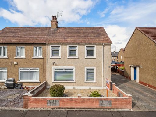 4 bedroom semi-detached house for sale in 34 Wilson Street, Grangemouth, FK3 — £180,000 • 4 bed • 1 bath • 1077 ft²
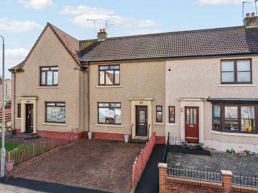 3 bedroom terraced house for sale in 79 Hawthorn Street, Grangemouth, FK3 — £145,000 • 3 bed • 1 bath • 976 ft²
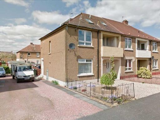 5 bedroom apartment for sale in 16 Haig Street, FK3 8QF, FK3 — £145,000 • 5 bed • 2 bath • 1381 ft²
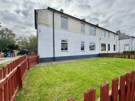 3 bedroom ground floor flat for sale in Kelvin Street,Grangemouth,FK3 8EX, FK3 — £124,995 • 3 bed • 1 bath • 648 ft²
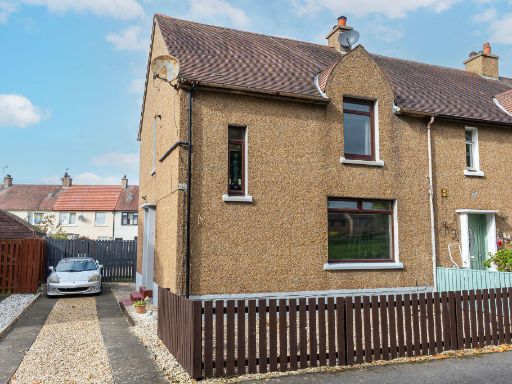 3 bedroom end of terrace house for sale in Burnbank Road, Grangemouth FK3 — £155,000 • 3 bed • 1 bath • 990 ft²
Meta
- {
"@context": "https://schema.org",
"@type": "Residence",
"name": "4 bedroom semidetached house for sale in Hamilton Road, Gra…",
"description": "",
"url": "https://propertypiper.co.uk/property/9b5187c6-1685-4f52-8d0d-6ef6f79ff3f4",
"image": "https://image-a.propertypiper.co.uk/0cc0759a-2938-4aa9-96e5-e04717e1be5e-1024.jpeg",
"address": {
"@type": "PostalAddress",
"streetAddress": "35, HAMILTON ROAD, GRANGEMOUTH",
"postalCode": "FK3 0LG",
"addressLocality": "Falkirk",
"addressRegion": "Linlithgow and East Falkirk",
"addressCountry": "Scotland"
},
"geo": {
"@type": "GeoCoordinates",
"latitude": 56.0078868,
"longitude": -3.7151092
},
"numberOfRooms": 4,
"numberOfBathroomsTotal": 2,
"floorSize": {
"@type": "QuantitativeValue",
"value": 1033,
"unitCode": "FTK"
},
"offers": {
"@type": "Offer",
"price": 175000,
"priceCurrency": "GBP",
"availability": "https://schema.org/InStock"
},
"additionalProperty": [
{
"@type": "PropertyValue",
"name": "Feature",
"value": "semi-detached"
},
{
"@type": "PropertyValue",
"name": "Feature",
"value": "post-war"
},
{
"@type": "PropertyValue",
"name": "Feature",
"value": "two-storey"
},
{
"@type": "PropertyValue",
"name": "Feature",
"value": "flat roof"
},
{
"@type": "PropertyValue",
"name": "Feature",
"value": "brownish facade"
},
{
"@type": "PropertyValue",
"name": "Feature",
"value": "retro look"
},
{
"@type": "PropertyValue",
"name": "Feature",
"value": "potential for renovation"
},
{
"@type": "PropertyValue",
"name": "Feature",
"value": "driveway"
},
{
"@type": "PropertyValue",
"name": "Feature",
"value": "suburban"
},
{
"@type": "PropertyValue",
"name": "Feature",
"value": "fenced area"
},
{
"@type": "PropertyValue",
"name": "Feature",
"value": "contemporary"
},
{
"@type": "PropertyValue",
"name": "Feature",
"value": "minimalist"
},
{
"@type": "PropertyValue",
"name": "Feature",
"value": "living room"
},
{
"@type": "PropertyValue",
"name": "Feature",
"value": "modern fireplace"
},
{
"@type": "PropertyValue",
"name": "Feature",
"value": "neutral decor"
},
{
"@type": "PropertyValue",
"name": "Feature",
"value": "large window"
},
{
"@type": "PropertyValue",
"name": "Feature",
"value": "natural light"
},
{
"@type": "PropertyValue",
"name": "Feature",
"value": "bright"
},
{
"@type": "PropertyValue",
"name": "Feature",
"value": "airy"
},
{
"@type": "PropertyValue",
"name": "Feature",
"value": "hardwood floor"
}
]
}
High Res Floorplan Images
Compatible Floorplan Images
FloorplanImages Thumbnail