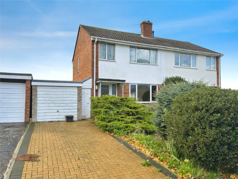
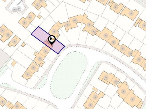
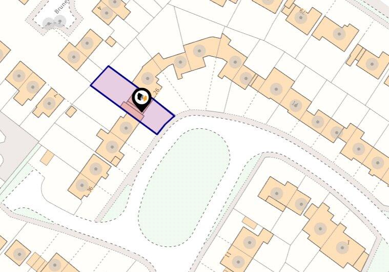
BA13 3AN - 3 bedroom semidetached house for sale in Chichester Park, W…
View on Property Piper
3 bedroom semi-detached house for sale in Chichester Park, Westbury, BA13
Property Details
- Price: £240000
- Bedrooms: 3
- Bathrooms: 1
- Property Type: undefined
- Property SubType: undefined
Image Descriptions
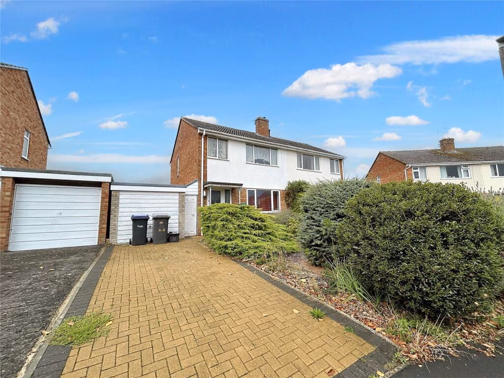
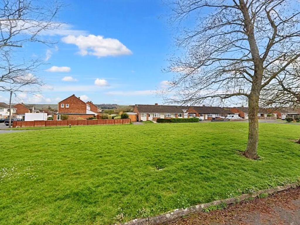
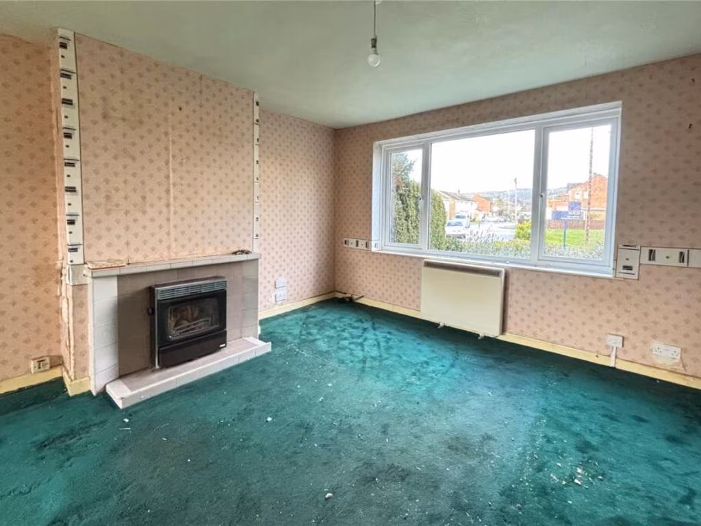
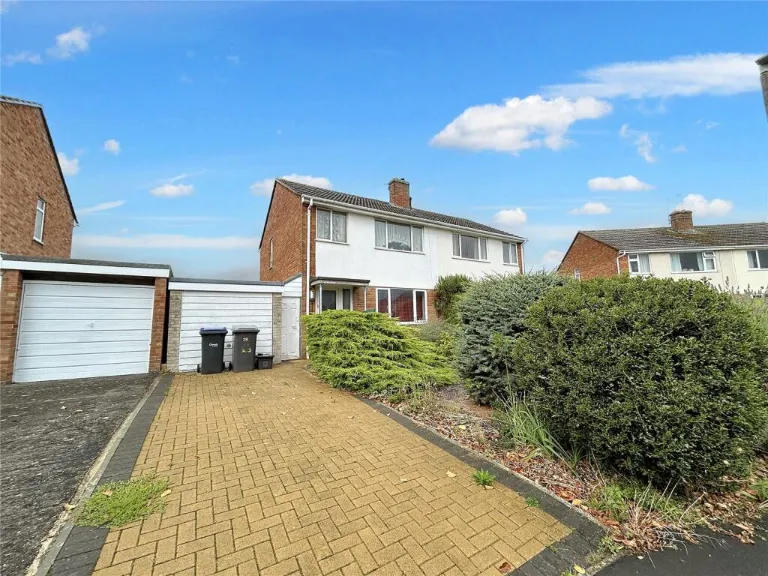
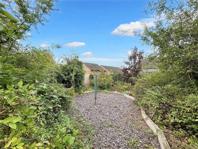
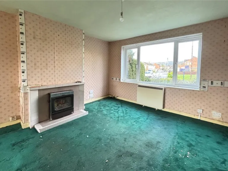
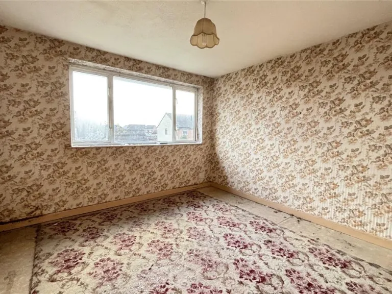
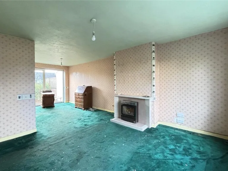
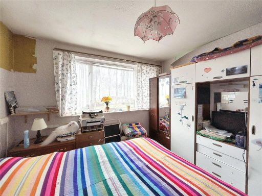
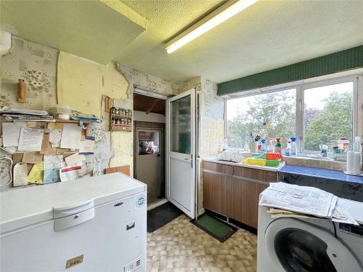
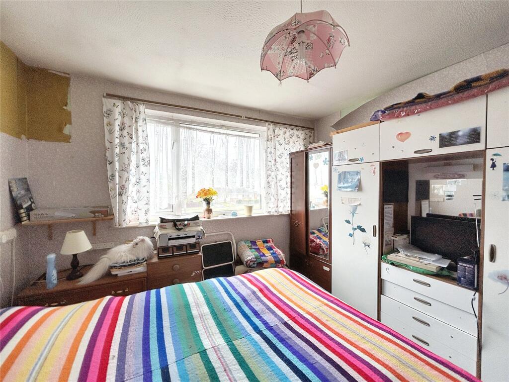
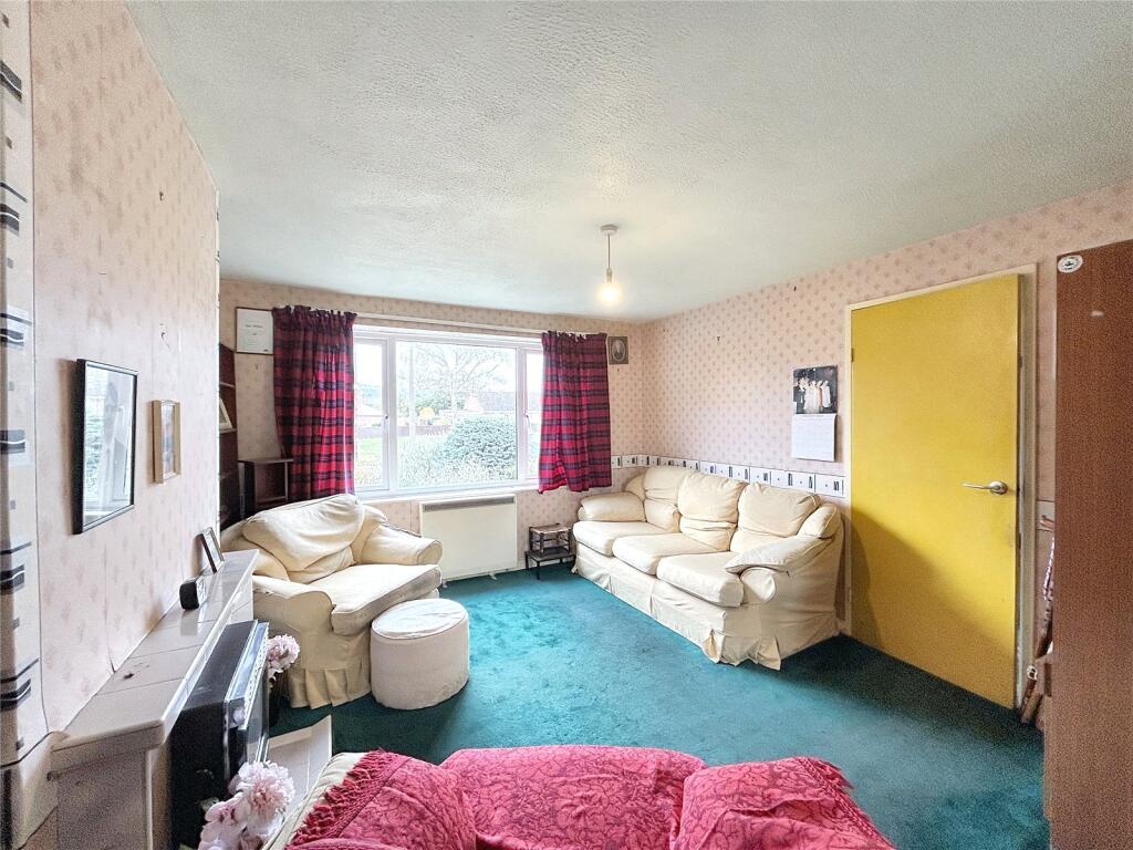
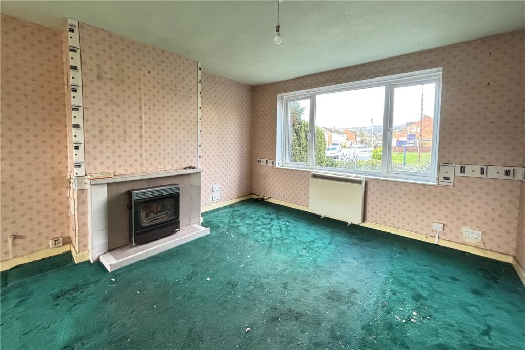
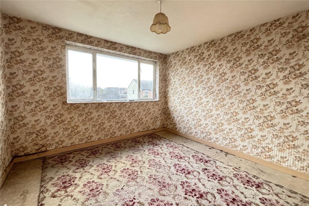
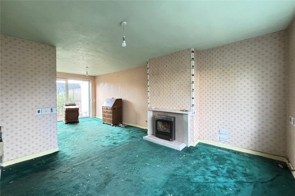
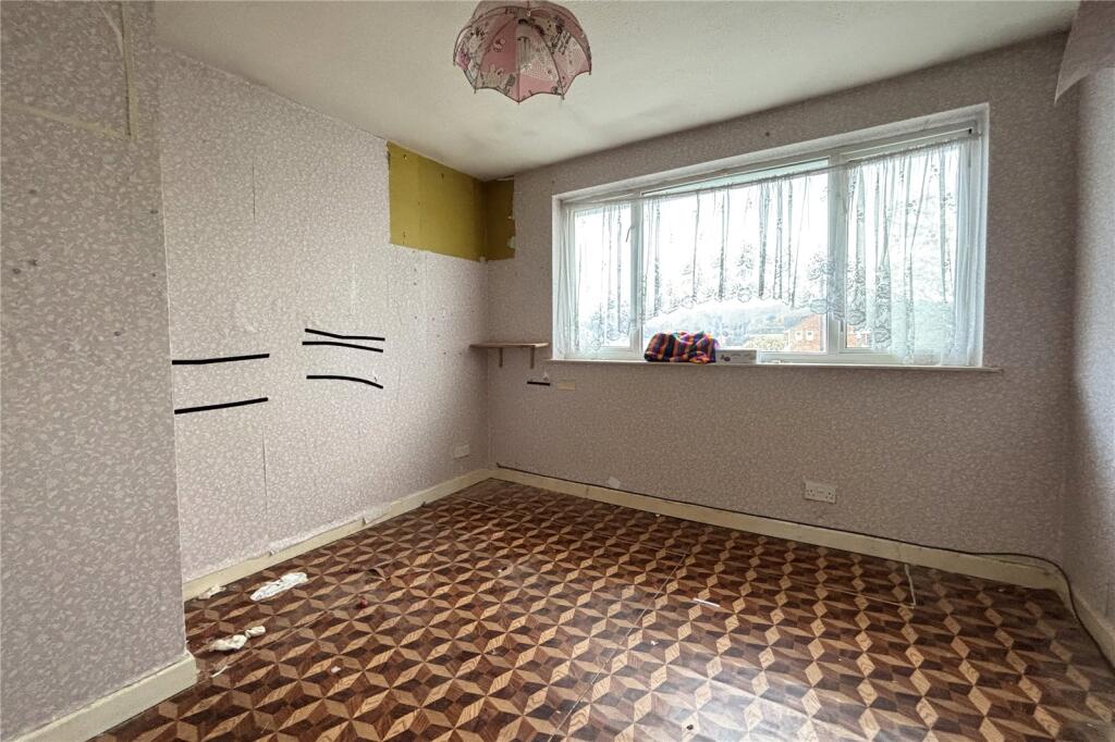
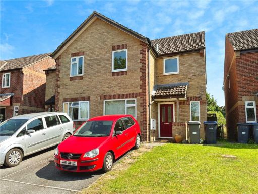
- semi-detached house 1960s-1970s suburban
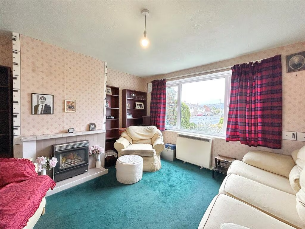
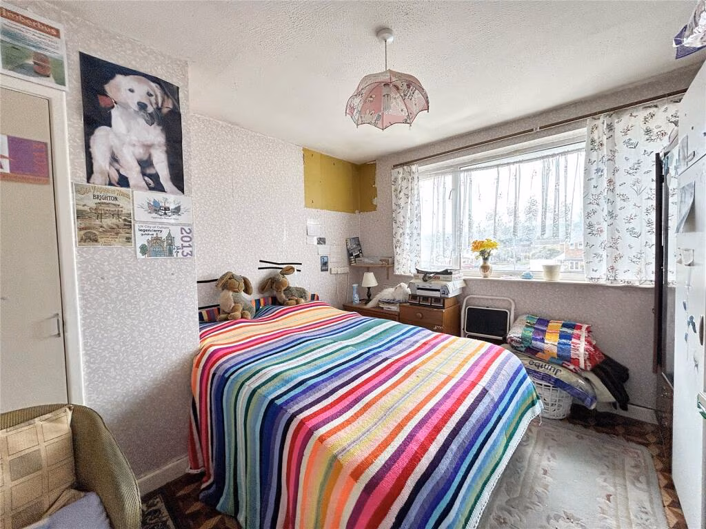
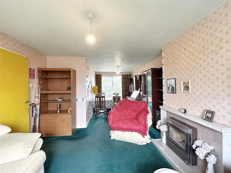
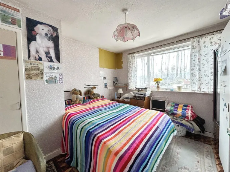
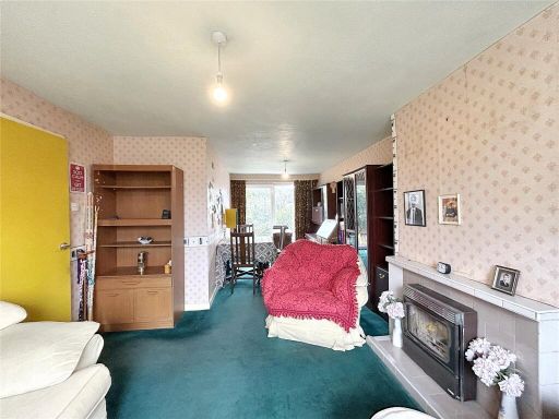
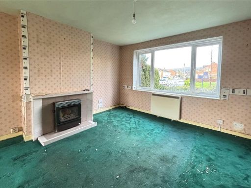
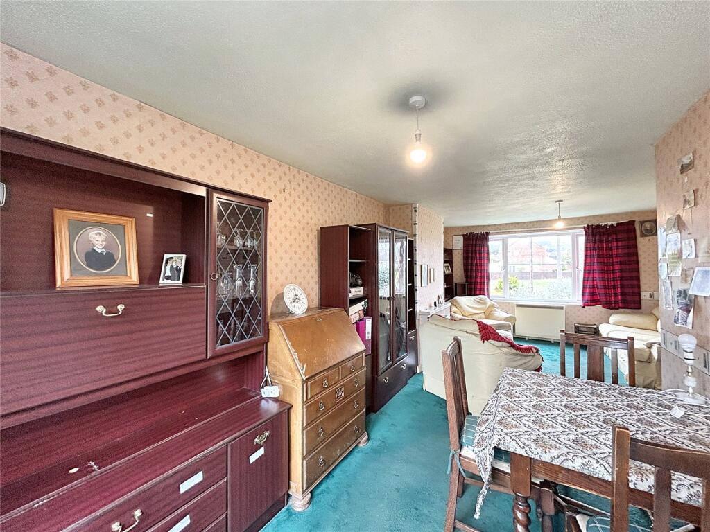
- living room Mid-20th Century
Floorplan Description
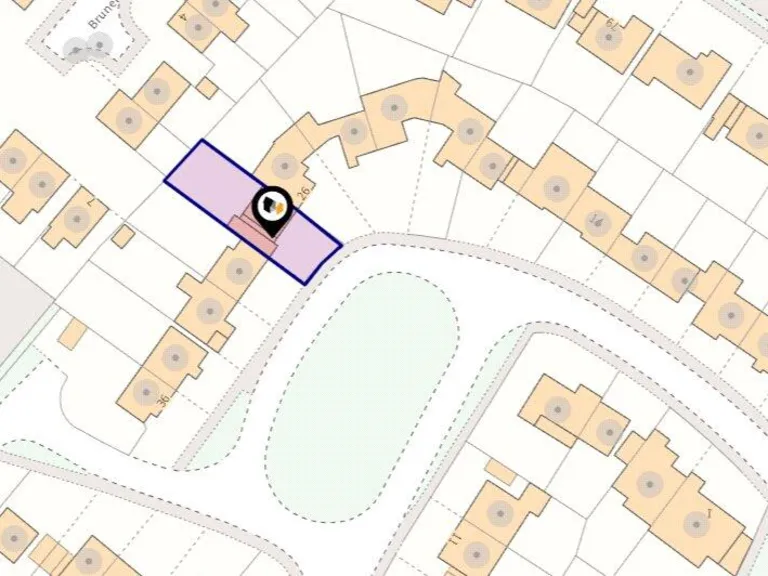
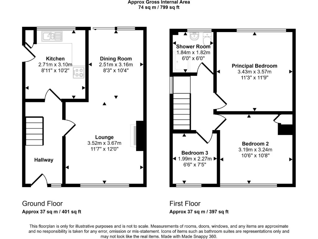
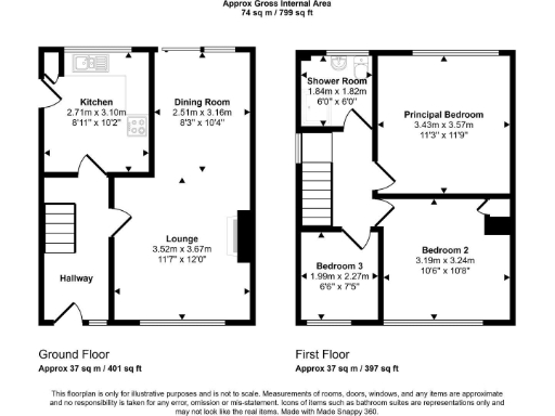
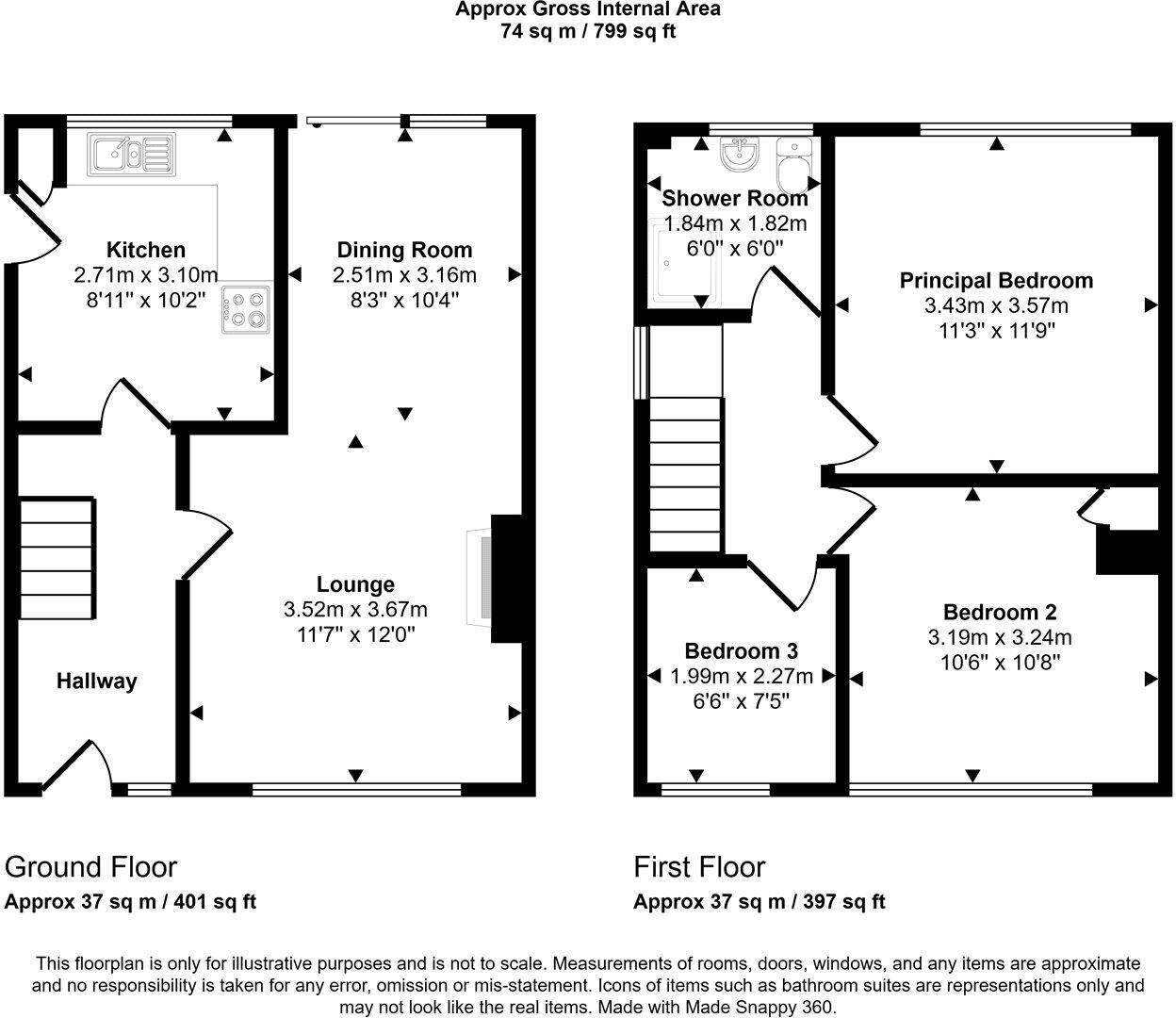
- Two-storey residential property floorplan.
Rooms
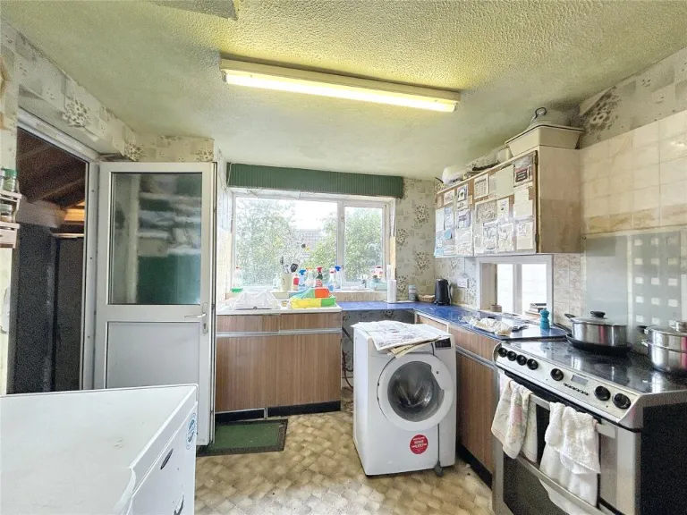
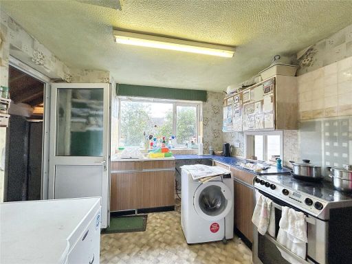
- Kitchen:
- Dining Room:
- Lounge:
- Hallway:
- Shower Room:
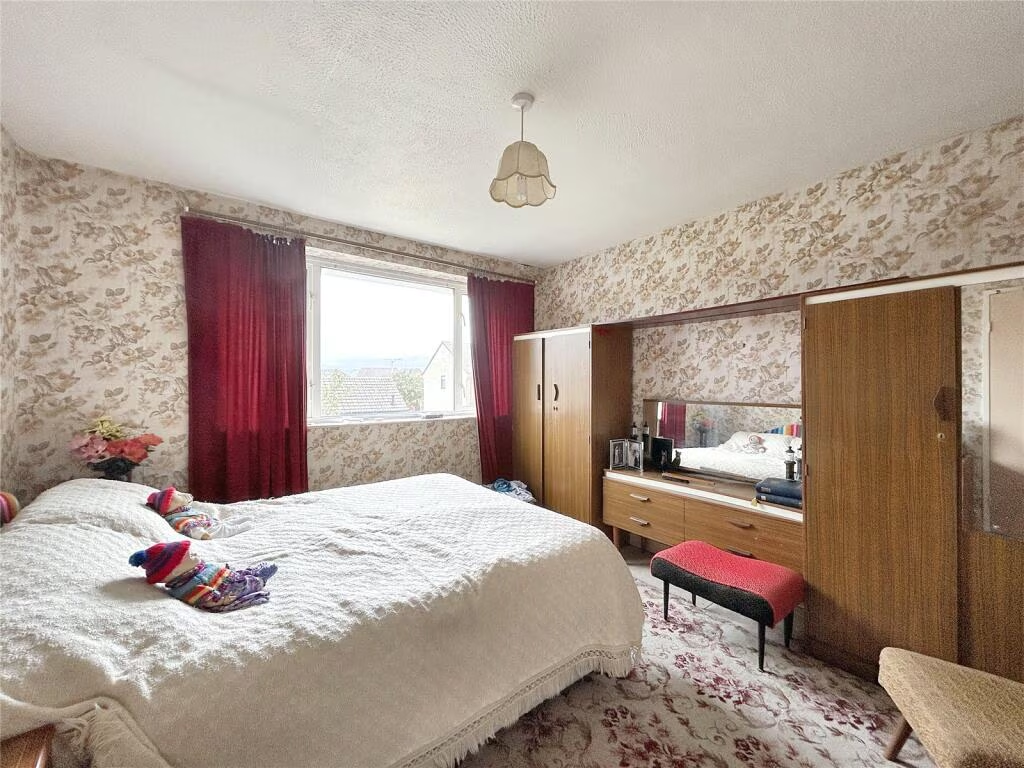
- Principal Bedroom:
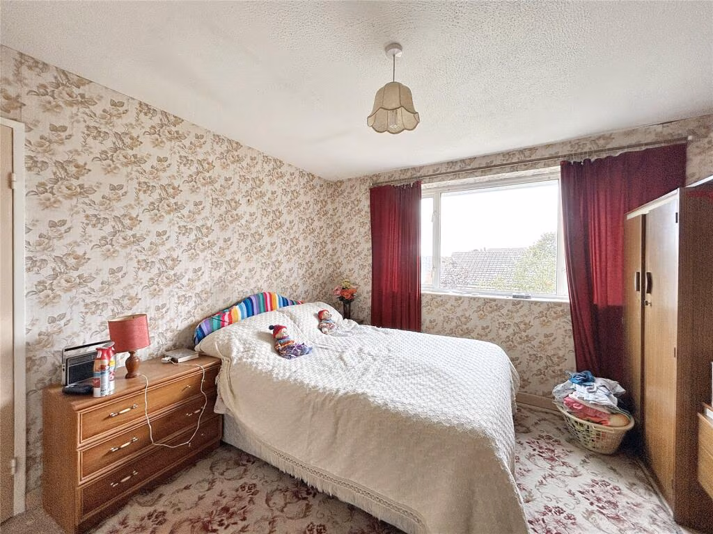
- Bedroom 2:
- Bedroom 3:
Textual Property Features
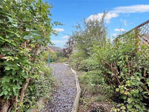
Detected Visual Features
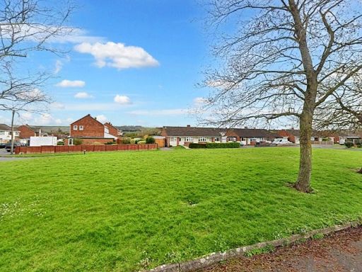
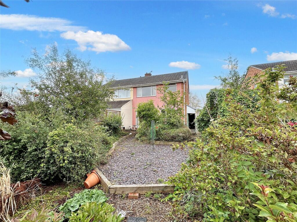
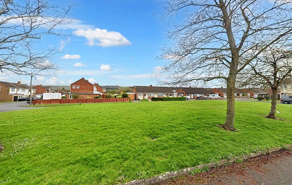
- semi-detached
- suburban
- driveway
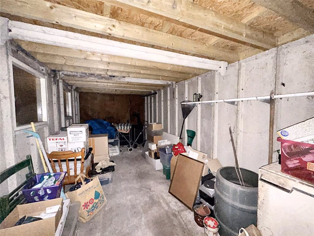
- garage
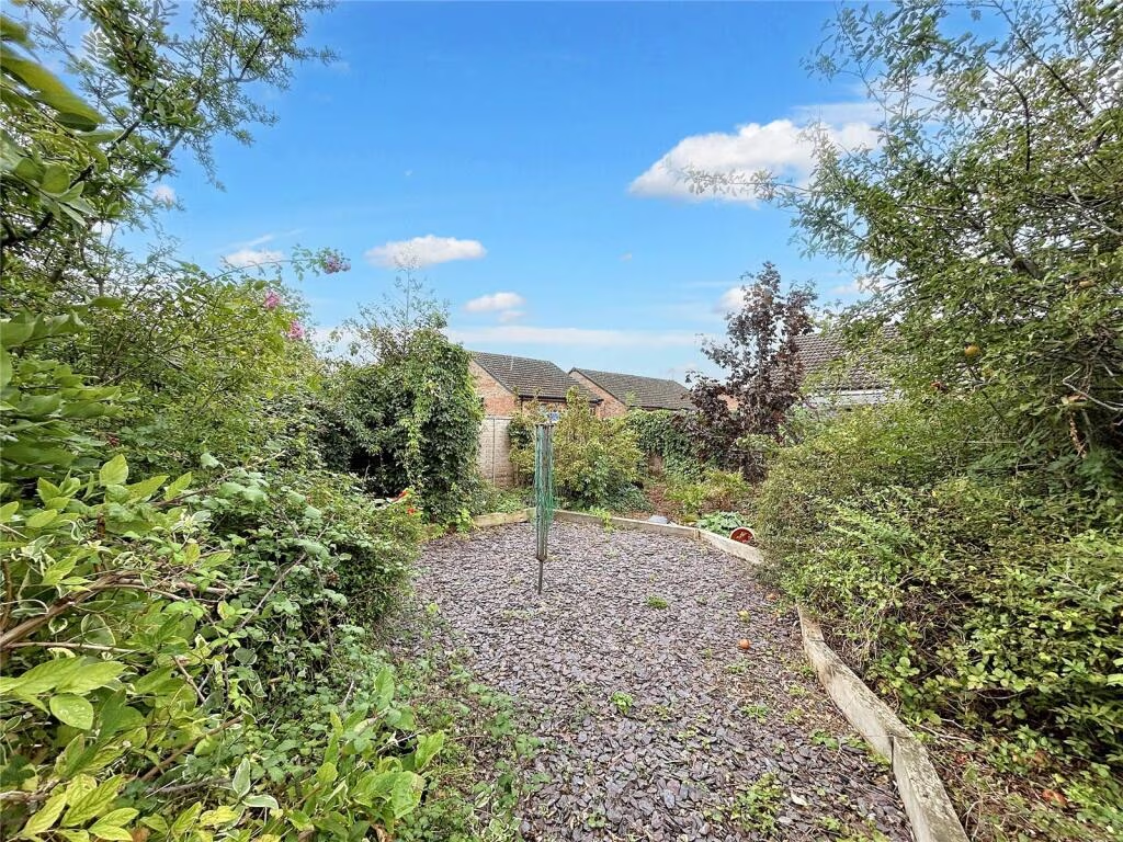
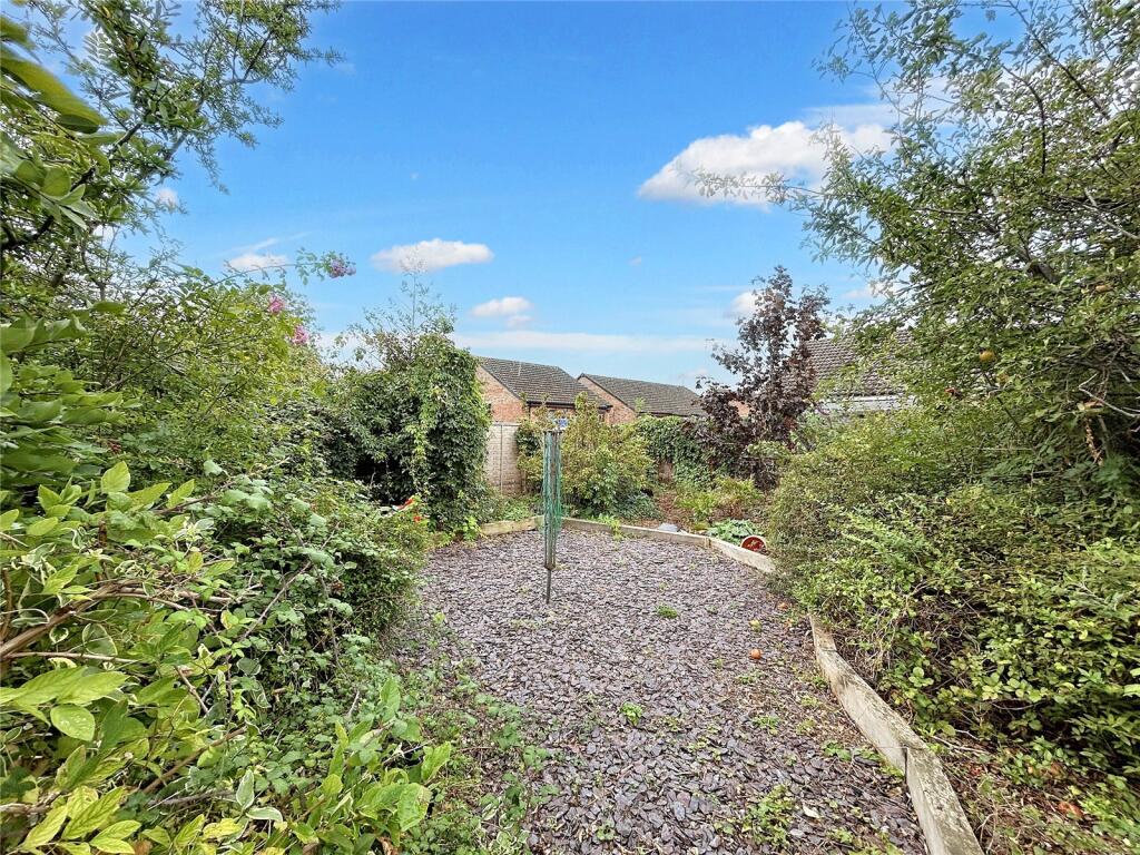
- garden
- 1960s
- 1970s
- brick
- family home
- living room
- mid-20th century
- gas fireplace
- built-in shelves
- large window
- dated decor
- needs modernization
Nearby Schools
- New Close Primary School
- Westbury Church of England Junior School
- Bratton Primary School
- The Clarendon Academy
- Oasis Academy Longmeadow
- Newtown Community Primary School
- Castle Mead School
- The John of Gaunt School
- St John's Catholic Primary School, Trowbridge
- Paxcroft Primary School
- The Minster CofE Primary School
- The Avenue Primary School and Children's Centre
- Warminster School
- Dilton Marsh CofE Primary School
- Bitham Brook Primary School
- Holbrook Primary School
- St Augustine's Catholic College
- The Mead Community Primary School
- Matravers School
- Westbury Infant School
- West Ashton Church of England Primary School
Nearest Bars And Restaurants
- Id: 474526801
- Tags:
- Amenity: pub
- Food: yes
- Image: http://www.flickr.com/photos/44470358@N08/4113136508/
- Name: The Crown
- Operator: Wadworth
- Website: http://www.thecrowninnwestbury.co.uk/
- Wikidata: Q26476535
- TagsNormalized:
- Lat: 51.2626559
- Lon: -2.1826148
- FullGeoHash: gcn7wk4dt7sm
- PartitionGeoHash: gcn7
- Images:
- FoodStandards: null
- Distance: 530.5
,- Id: 500885974
- Tags:
- Addr:
- Housenumber: 23
- Street: Market Place
- Amenity: restaurant
- Cuisine: chinese
- Name: New China Cottage
- Opening_hours: Mo off; Tu-Th 17:30-23:30; Fr-Sa 17:30-24:00; Su 17:30-23:30
- Wikidata: Q26573833
- TagsNormalized:
- Lat: 51.262941
- Lon: -2.1822327
- FullGeoHash: gcn7wk4uq2c6
- PartitionGeoHash: gcn7
- Images:
- FoodStandards: null
- Distance: 520.1
,- Id: 474526781
- Tags:
- Accommodation: yes
- Amenity: pub
- Food: yes
- Image: http://www.flickr.com/photos/44470358@N08/4112869740/
- Name: The White Lion
- Wikidata: Q26476538
- TagsNormalized:
- Lat: 51.2627742
- Lon: -2.1827435
- FullGeoHash: gcn7wk4e63sr
- PartitionGeoHash: gcn7
- Images:
- FoodStandards: null
- Distance: 514.6
,- Id: 500885978
- Tags:
- Addr:
- Housenumber: 24
- Street: Market Place
- Amenity: fast_food
- Cuisine: fish_and_chips
- Name: Magic Wok
- Opening_hours: Mo-Sa 11:45-14:00,17:00-23:00; Su off
- TagsNormalized:
- Lat: 51.2630485
- Lon: -2.1822861
- FullGeoHash: gcn7wk4uvhce
- PartitionGeoHash: gcn7
- Images:
- FoodStandards: null
- Distance: 508.4
,- Id: 474526771
- Tags:
- Amenity: pub
- Image: http://www.flickr.com/photos/44470358@N08/4112353617/
- Name: The Ludlow Arms
- Operator: Free House
- Website: http://www.ludlowarms.co.uk/
- Wikidata: Q26646172
- TagsNormalized:
- Lat: 51.2629749
- Lon: -2.1824511
- FullGeoHash: gcn7wk4u3pns
- PartitionGeoHash: gcn7
- Images:
- FoodStandards: null
- Distance: 507.9
}
Nearest General Shops
- Id: 534767112
- Tags:
- Name: Phil Stokes Motorcycles
- Shop: motorcycle_repair
- TagsNormalized:
- motorcycle
- motorcycle repair
- repair
- shop
- Lat: 51.2626894
- Lon: -2.1842451
- FullGeoHash: gcn7wk16z3uv
- PartitionGeoHash: gcn7
- Images:
- FoodStandards: null
- Distance: 474.2
,- Id: 404409264
- Tags:
- Name: Alan Petrie Motors
- Shop: car_repair
- TagsNormalized:
- Lat: 51.2651014
- Lon: -2.1810168
- FullGeoHash: gcn7wkebfes1
- PartitionGeoHash: gcn7
- Images:
- FoodStandards: null
- Distance: 437.7
,- Id: 530750727
- Tags:
- Brand: Volvo
- Brand:wikidata: Q215293
- Brand:wikipedia: en:Volvo Cars
- Name: Kings Motor Services
- Shop: car
- Website: http://www.kingsmotorservices.co.uk
- TagsNormalized:
- Lat: 51.2631431
- Lon: -2.1881161
- FullGeoHash: gcn7whntmnqr
- PartitionGeoHash: gcn7
- Images:
- FoodStandards: null
- Distance: 399.5
}
Nearest Grocery shops
- Id: 520595953
- Tags:
- Amenity: fast_food
- Cuisine: sandwich
- Name: Checkers Baguette Shop
- Opening_hours: Mo-Sa 08:00-15:00; Su off
- TagsNormalized:
- fast food
- food
- sandwich
- shop
- Lat: 51.2605994
- Lon: -2.1834619
- FullGeoHash: gcn7w7dn9skf
- PartitionGeoHash: gcn7
- Images:
- FoodStandards: null
- Distance: 711
,- Id: 503672102
- Tags:
- Addr:
- Housenumber: 30
- Street: High Street
- Brand: McColl's
- Brand:wikidata: Q16997477
- Brand:wikipedia: en:McColl's
- Contact:
- Website: https://www.mccolls.co.uk/storelocator/westbury-high-street/
- Level: 0
- Name: McColl's
- Opening_hours: Mo-Su 06:00-20:00
- Shop: convenience
- TagsNormalized:
- Lat: 51.2607898
- Lon: -2.1848282
- FullGeoHash: gcn7w79p9zf1
- PartitionGeoHash: gcn7
- Images:
- FoodStandards: null
- Distance: 665
,- Id: 474526792
- Tags:
- Brand: One Stop
- Brand:wikidata: Q65954217
- Name: One Stop
- Shop: convenience
- TagsNormalized:
- Lat: 51.2627204
- Lon: -2.182668
- FullGeoHash: gcn7wk4dupsy
- PartitionGeoHash: gcn7
- Images:
- FoodStandards: null
- Distance: 522.5
}
Nearest Supermarkets
- Id: 41215561
- Tags:
- Addr:
- City: Westbury
- Housenumber: 42
- Postcode: BA13 3BG
- Street: Edward Street
- Alt_name: Morrisons Westbury
- Brand: Morrisons
- Brand:wikidata: Q922344
- Brand:wikipedia: en:Morrisons
- Building: yes
- Contact:
- Website: https://my.morrisons.com/storefinder/678
- Name: Morrisons
- Opening_hours: Mo-We 08:00-20:00; Th-Fr 08:00-21:00; Sa 08:00-20:00; Su 10:00-16:00
- Operator: Morrisons
- Shop: supermarket
- TagsNormalized:
- Lat: 51.2601408
- Lon: -2.1837756
- FullGeoHash: gcn7w79gfqff
- PartitionGeoHash: gcn7
- Images:
- FoodStandards: null
- Distance: 752.9
,- Id: 148948352
- Tags:
- Addr:
- Country: GB
- Postcode: BA13 3XW
- Street: Kingfisher Drive
- Brand: Lidl
- Brand:wikidata: Q151954
- Brand:wikipedia: en:Lidl
- Building: supermarket
- Fhrs:
- Name: Lidl
- Opening_hours: Mo-Sa 08:00-22:00; Su 10:00-16:00
- Operator: Lidl
- Shop: supermarket
- Source: Bing
- TagsNormalized:
- Lat: 51.2661954
- Lon: -2.1798056
- FullGeoHash: gcn7wksxnz7p
- PartitionGeoHash: gcn7
- Images:
- FoodStandards:
- Id: 630867
- FHRSID: 630867
- LocalAuthorityBusinessID: PI/000265012
- BusinessName: Lidl 1684
- BusinessType: Retailers - supermarkets/hypermarkets
- BusinessTypeID: 7840
- AddressLine1: Lidl
- AddressLine2: Kingfisher Drive
- AddressLine3: Westbury
- AddressLine4: Wiltshire
- PostCode: BA13 3XW
- RatingValue: 5
- RatingKey: fhrs_5_en-GB
- RatingDate: 2022-10-31
- LocalAuthorityCode: 709
- LocalAuthorityName: Wiltshire
- LocalAuthorityWebSite: http://www.wiltshire.gov.uk
- LocalAuthorityEmailAddress: publicprotectionwest@wiltshire.gov.uk
- Scores:
- Hygiene: 0
- Structural: 0
- ConfidenceInManagement: 0
- NewRatingPending: false
- Geocode:
- Longitude: -2.18006396293640
- Latitude: 51.26472091674800
- Distance: 489.6
,- Id: 41989283
- Tags:
- Brand: Tesco Express
- Brand:wikidata: Q98456772
- Building: supermarket
- Contact:
- Website: https://www.tesco.com/store-locator/wiltshire/fore-st
- Name: Tesco Express
- Operator: Tesco
- Shop: convenience
- TagsNormalized:
- tesco
- tesco express
- supermarket
- convenience
- shop
- Lat: 51.2645294
- Lon: -2.1823204
- FullGeoHash: gcn7wk6vs0zv
- PartitionGeoHash: gcn7
- Images:
- FoodStandards: null
- Distance: 390.6
}
Nearest Religious buildings
- Id: 328356227
- Tags:
- Amenity: place_of_worship
- Building: church
- Denomination: anglican
- Description: Access details: http://www.english-heritage.org.uk/server/show/conGap.2939
- Image: http://www.flickr.com/photos/44470358@N08/4112049235/
- Name: All Saints
- Religion: christian
- Source: http://www.sdgr.org.uk/
- Url: http://www.wiltshire.gov.uk/community/getchurch.php?id=369
- Wikidata: Q17529516
- TagsNormalized:
- place of worship
- church
- anglican
- christian
- Lat: 51.2618908
- Lon: -2.1823231
- FullGeoHash: gcn7w7fyhjjc
- PartitionGeoHash: gcn7
- Images:
- FoodStandards: null
- Distance: 613.4
,- Id: 41081230
- Tags:
- Amenity: place_of_worship
- Building: yes
- Denomination: catholic
- Image: http://www.flickr.com/photos/44470358@N08/4112404477/
- Name: Saint Bernadette of Lourdes
- Religion: christian
- Url: http://www.wiltshire.gov.uk/community/getchurch.php?id=367
- TagsNormalized:
- place of worship
- catholic
- christian
- church
- Lat: 51.2613672
- Lon: -2.1866542
- FullGeoHash: gcn7w5zep72q
- PartitionGeoHash: gcn7
- Images:
- FoodStandards: null
- Distance: 586.5
,- Id: 500885968
- Tags:
- Amenity: place_of_worship
- Denomination: baptist
- Image: http://www.flickr.com/photos/44470358@N08/4113155116/
- Name: West End Baptist Church
- Religion: christian
- Url: http://www.wiltshire.gov.uk/community/getchurch.php?id=373
- TagsNormalized:
- place of worship
- baptist
- church
- christian
- Lat: 51.2622028
- Lon: -2.1850042
- FullGeoHash: gcn7w7bzvxny
- PartitionGeoHash: gcn7
- Images:
- FoodStandards: null
- Distance: 509.2
}
Nearest Medical buildings
- Id: 503606905
- Tags:
- Addr:
- Housenumber: 9-11
- Street: High Street
- Amenity: pharmacy
- Branch: Chemist
- Brand: Boots
- Brand:wikidata: Q6123139
- Brand:wikipedia: en:Boots (company)
- Healthcare: pharmacy
- Level: 0
- Name: Boots
- Opening_hours: Mo-Fr 09:00-18:00; Sa 09:00-17:30; Su off
- Operator: Boots
- TagsNormalized:
- pharmacy
- boots
- health
- healthcare
- Lat: 51.2608842
- Lon: -2.1841336
- FullGeoHash: gcn7w7c83crv
- PartitionGeoHash: gcn7
- Images:
- FoodStandards: null
- Distance: 666.6
,- Id: 503672065
- Tags:
- Addr:
- Housenumber: 22-24
- Street: High Street
- Amenity: dentist
- Healthcare: dentist
- Level: 0
- Name: Westbury Downs Dental Practice
- TagsNormalized:
- dentist
- health
- healthcare
- dental
- Lat: 51.260908
- Lon: -2.1846323
- FullGeoHash: gcn7w7c0qmu4
- PartitionGeoHash: gcn7
- Images:
- FoodStandards: null
- Distance: 655.2
,- Id: 41081167
- Tags:
- Amenity: doctors
- Building: yes
- Healthcare: doctor
- Name: Eastleigh Surgery
- TagsNormalized:
- doctor
- doctors
- health
- healthcare
- surgery
- Lat: 51.261242
- Lon: -2.1868804
- FullGeoHash: gcn7w5zd3upg
- PartitionGeoHash: gcn7
- Images:
- FoodStandards: null
- Distance: 600.4
,- Id: 42764594
- Tags:
- Amenity: doctors
- Healthcare: doctor
- Name: Eastleigh Surgery
- TagsNormalized:
- doctor
- doctors
- health
- healthcare
- surgery
- Lat: 51.2612929
- Lon: -2.1869638
- FullGeoHash: gcn7w5zd8j9d
- PartitionGeoHash: gcn7
- Images:
- FoodStandards: null
- Distance: 594.8
}
Nearest Airports
- Id: 47483196
- Tags:
- Aerodrome: international
- Aeroway: aerodrome
- Iata: BRS
- Icao: EGGD
- Internet_access: wlan
- Internet_access:fee: no
- Name: Bristol Airport
- Type: public
- Website: https://www.bristolairport.co.uk/
- Wikidata: Q8725
- Wikipedia: en:Bristol Airport
- TagsNormalized:
- airport
- international airport
- Lat: 51.3830799
- Lon: -2.7186615
- FullGeoHash: gcnh64h24s74
- PartitionGeoHash: gcnh
- Images:
- FoodStandards: null
- Distance: 39158.8
}
Nearest Leisure Facilities
- Id: 5364860001
- Tags:
- Leisure: playground
- Name: Kingfisher Road Play Area
- TagsNormalized:
- Lat: 51.2645829
- Lon: -2.1810346
- FullGeoHash: gcn7wk7vf4ys
- PartitionGeoHash: gcn7
- Images:
- FoodStandards: null
- Distance: 462.2
,- Id: 556138285
- Tags:
- TagsNormalized:
- Lat: 51.264616
- Lon: -2.1810051
- FullGeoHash: gcn7wk7y4chd
- PartitionGeoHash: gcn7
- Images:
- FoodStandards: null
- Distance: 462.2
,- Id: 613056148
- Tags:
- Leisure: playground
- Name: Play Park
- TagsNormalized:
- Lat: 51.2693985
- Lon: -2.1821472
- FullGeoHash: gcn7wm71bk94
- PartitionGeoHash: gcn7
- Images:
- FoodStandards: null
- Distance: 446.2
,- Id: 42455804
- Tags:
- Leisure: playground
- Name: Campion Close Play Area
- TagsNormalized:
- Lat: 51.2691514
- Lon: -2.1852408
- FullGeoHash: gcn7wm2b2nw2
- PartitionGeoHash: gcn7
- Images:
- FoodStandards: null
- Distance: 299.6
,- Id: 148999739
- Tags:
- Leisure: pitch
- Name: Westbury United Football Pitch
- Sport: soccer
- TagsNormalized:
- pitch
- leisure
- football
- soccer
- sports
- Lat: 51.2644204
- Lon: -2.1886003
- FullGeoHash: gcn7whqkcut7
- PartitionGeoHash: gcn7
- Images:
- FoodStandards: null
- Distance: 276.7
}
Nearest Tourist attractions
- Id: 971417886
- Tags:
- Building: yes
- Tourism: chalet
- TagsNormalized:
- Lat: 51.2614743
- Lon: -2.2222057
- FullGeoHash: gcn7t7vgdz7m
- PartitionGeoHash: gcn7
- Images:
- FoodStandards: null
- Distance: 2529.1
,- Id: 43653058
- Tags:
- Building: yes
- Name: Redwood Lodge B&B
- Tourism: guest_house
- TagsNormalized:
- Lat: 51.2708111
- Lon: -2.1974972
- FullGeoHash: gcn7tvxf4egm
- PartitionGeoHash: gcn7
- Images:
- FoodStandards: null
- Distance: 876.5
,- Id: 552664297
- Tags:
- Building: yes
- Tourism: guest_house
- TagsNormalized:
- Lat: 51.2618747
- Lon: -2.1889731
- FullGeoHash: gcn7w5yn14p3
- PartitionGeoHash: gcn7
- Images:
- FoodStandards: null
- Distance: 551
}
Nearest Train stations
- Id: 6605809089
- Tags:
- Name: Frome
- Naptan:
- Network: National Rail
- Public_transport: station
- Railway: station
- Ref:
- Source: NPE
- Wikidata: Q1982991
- Wikipedia: en:Frome railway station
- TagsNormalized:
- Lat: 51.2274459
- Lon: -2.3099995
- FullGeoHash: gcn77mtvt059
- PartitionGeoHash: gcn7
- Images:
- FoodStandards: null
- Distance: 9618.8
,- Id: 7154293857
- Tags:
- Name: Warminster
- Naptan:
- Network: National Rail
- Operator: Great Western Railway
- Public_transport: station
- Railway: station
- Ref:
- Source: Bing
- Wikidata: Q2383286
- Wikipedia: en:Warminster railway station
- TagsNormalized:
- Lat: 51.2069721
- Lon: -2.1769016
- FullGeoHash: gcn7q3yy4x2w
- PartitionGeoHash: gcn7
- Images:
- FoodStandards: null
- Distance: 6670.6
,- Id: 17773687
- Tags:
- Name: Trowbridge
- Naptan:
- Network: National Rail
- Public_transport: station
- Railway: station
- Ref:
- Source: NPE
- Wikidata: Q2974092
- Wikipedia: en:Trowbridge railway station
- TagsNormalized:
- Lat: 51.3200055
- Lon: -2.2143313
- FullGeoHash: gcn7vwe8dq6v
- PartitionGeoHash: gcn7
- Images:
- FoodStandards: null
- Distance: 6234.9
,- Id: 5232609898
- Tags:
- Name: Dilton Marsh
- Naptan:
- Network: National Rail
- Public_transport: station
- Railway: station
- Ref:
- Request_stop: yes
- Train: yes
- Wikidata: Q2303611
- Wikipedia: en:Dilton Marsh railway station
- TagsNormalized:
- Lat: 51.2489573
- Lon: -2.2078698
- FullGeoHash: gcn7tc86bfhf
- PartitionGeoHash: gcn7
- Images:
- FoodStandards: null
- Distance: 2452.5
,- Id: 6606028831
- Tags:
- Name: Westbury
- Naptan:
- Network: National Rail
- Public_transport: station
- Railway: station
- Ref:
- Wheelchair: yes
- Wikidata: Q1980683
- Wikipedia: en:Westbury railway station
- TagsNormalized:
- Lat: 51.2663283
- Lon: -2.1997296
- FullGeoHash: gcn7tuy0n868
- PartitionGeoHash: gcn7
- Images:
- FoodStandards: null
- Distance: 899.8
}
Nearest Hotels
- Id: 2448606510
- Tags:
- Brand: Travelodge
- Brand:wikidata: Q9361374
- Brand:wikipedia: en:Travelodge UK
- Name: Travelodge
- Tourism: hotel
- TagsNormalized:
- Lat: 51.2177962
- Lon: -2.1996473
- FullGeoHash: gcn7mgym290p
- PartitionGeoHash: gcn7
- Images:
- FoodStandards: null
- Distance: 5504.4
,- Id: 41989322
- Tags:
- Building: yes
- Description: AA ***
- Image: http://www.flickr.com/photos/44470358@N08/4112487668/
- Name: The Cedar Hotel & Restaurant
- Tourism: hotel
- TagsNormalized:
- Lat: 51.2547978
- Lon: -2.1873128
- FullGeoHash: gcn7w4xhzfv6
- PartitionGeoHash: gcn7
- Images:
- FoodStandards: null
- Distance: 1317.4
,- Id: 487788045
- Tags:
- Image: http://www.flickr.com/photos/44470358@N08/4112833886/
- Name: The Lopes Arms
- Tourism: hotel
- Website: http://www.lopesarmshotel.co.uk/
- Wikidata: Q26287941
- TagsNormalized:
- Lat: 51.2624512
- Lon: -2.1819121
- FullGeoHash: gcn7wk51mv82
- PartitionGeoHash: gcn7
- Images:
- FoodStandards: null
- Distance: 577.1
}
Tags
- semi-detached
- suburban
- driveway
- garage
- garden
- 1960s
- 1970s
- brick
- family home
- living room
- mid-20th century
- gas fireplace
- built-in shelves
- large window
- dated decor
- needs modernization
Local Market Stats
- Average Price/sqft: £288
- Avg Income: £46300
- Rental Yield: 4.2%
- Social Housing: 6%
- Planning Success Rate: 92%
Similar Properties
 3 bedroom semi-detached house for sale in Kendrick Close, Westbury, BA13 — £265,000 • 3 bed • 1 bath • 948 ft²
 4 bedroom semi-detached house for sale in Eden Vale Road, Westbury, BA13 — £375,000 • 4 bed • 1 bath • 1447 ft²
 3 bedroom semi-detached house for sale in Gilhespy Way, Westbury, BA13 — £295,000 • 3 bed • 2 bath • 815 ft²
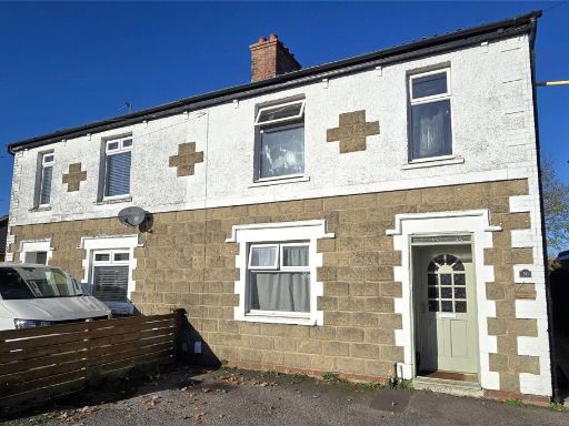 3 bedroom semi-detached house for sale in Oldfield Road, Westbury, BA13 — £275,000 • 3 bed • 1 bath • 1025 ft²
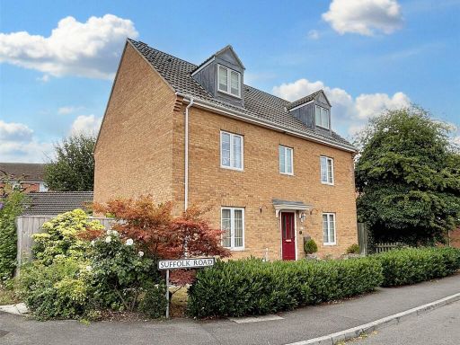 5 bedroom detached house for sale in Suffolk Road, Westbury, BA13 — £450,000 • 5 bed • 3 bath • 2064 ft²
 4 bedroom detached house for sale in Sunnybank Road, Westbury, BA13 — £375,000 • 4 bed • 2 bath • 1380 ft²
Meta
- {
"@context": "https://schema.org",
"@type": "Residence",
"name": "3 bedroom semidetached house for sale in Chichester Park, W…",
"description": "",
"url": "https://propertypiper.co.uk/property/98287530-5958-4f5e-9bb1-aa68a594626a",
"image": "https://image-a.propertypiper.co.uk/4b088823-2491-476a-86b4-5706317e5410-1024.jpeg",
"address": {
"@type": "PostalAddress",
"streetAddress": "Chichester Park, Westbury",
"postalCode": "BA13 3AN",
"addressLocality": "Wiltshire",
"addressRegion": "South West Wiltshire",
"addressCountry": "England"
},
"geo": {
"@type": "GeoCoordinates",
"latitude": 51.266641,
"longitude": -2.1868064
},
"numberOfRooms": 3,
"numberOfBathroomsTotal": 1,
"floorSize": {
"@type": "QuantitativeValue",
"value": 799,
"unitCode": "FTK"
},
"offers": {
"@type": "Offer",
"price": 240000,
"priceCurrency": "GBP",
"availability": "https://schema.org/InStock"
},
"additionalProperty": [
{
"@type": "PropertyValue",
"name": "Feature",
"value": "semi-detached"
},
{
"@type": "PropertyValue",
"name": "Feature",
"value": "suburban"
},
{
"@type": "PropertyValue",
"name": "Feature",
"value": "driveway"
},
{
"@type": "PropertyValue",
"name": "Feature",
"value": "garage"
},
{
"@type": "PropertyValue",
"name": "Feature",
"value": "garden"
},
{
"@type": "PropertyValue",
"name": "Feature",
"value": "1960s"
},
{
"@type": "PropertyValue",
"name": "Feature",
"value": "1970s"
},
{
"@type": "PropertyValue",
"name": "Feature",
"value": "brick"
},
{
"@type": "PropertyValue",
"name": "Feature",
"value": "family home"
},
{
"@type": "PropertyValue",
"name": "Feature",
"value": "living room"
},
{
"@type": "PropertyValue",
"name": "Feature",
"value": "mid-20th century"
},
{
"@type": "PropertyValue",
"name": "Feature",
"value": "gas fireplace"
},
{
"@type": "PropertyValue",
"name": "Feature",
"value": "built-in shelves"
},
{
"@type": "PropertyValue",
"name": "Feature",
"value": "large window"
},
{
"@type": "PropertyValue",
"name": "Feature",
"value": "dated decor"
},
{
"@type": "PropertyValue",
"name": "Feature",
"value": "needs modernization"
}
]
}
High Res Floorplan Images
Compatible Floorplan Images
FloorplanImages Thumbnail