BA13 3EA - 4 bedroom detached house for sale in Sunnybank Road, Westbu…
View on Property Piper
4 bedroom detached house for sale in Sunnybank Road, Westbury, BA13
Property Details
- Price: £375000
- Bedrooms: 4
- Bathrooms: 2
- Property Type: undefined
- Property SubType: undefined
Brochure Descriptions
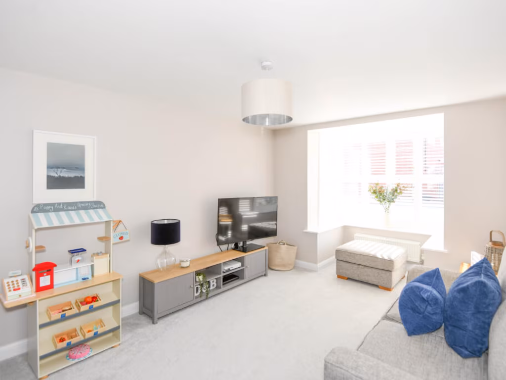
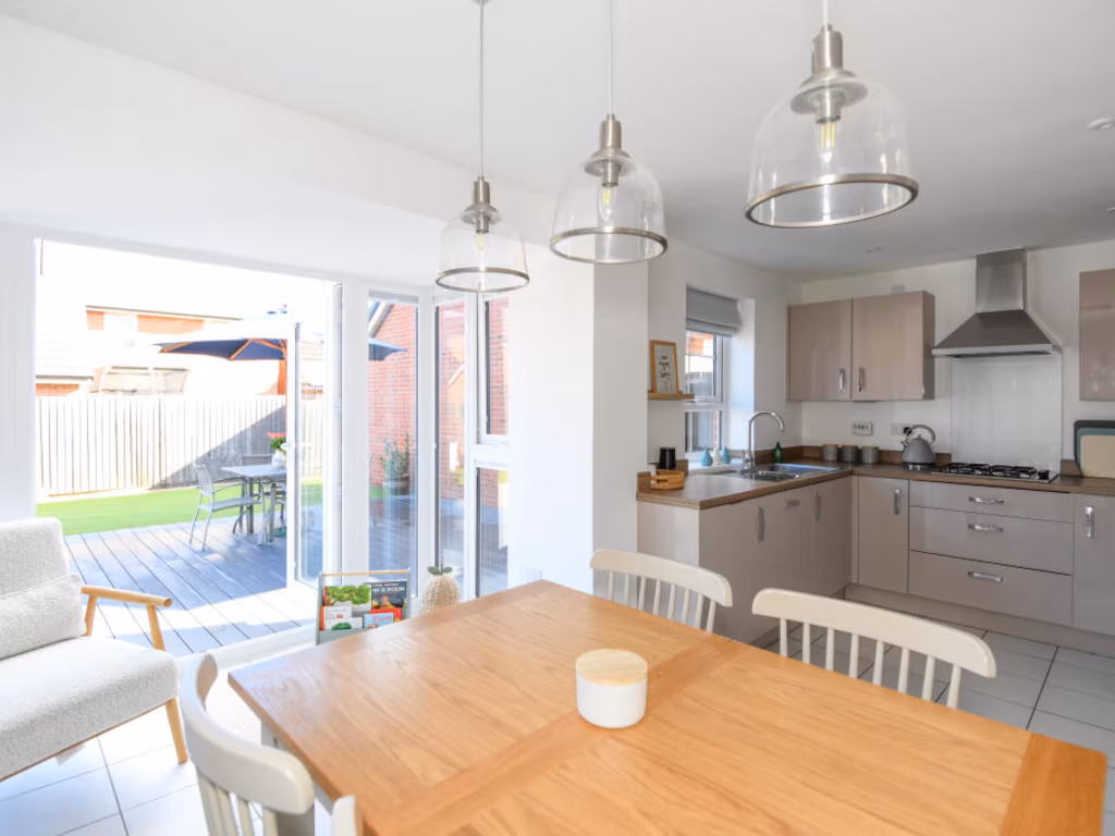
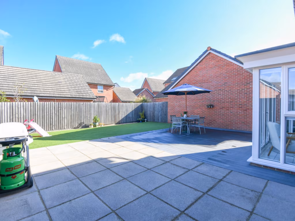
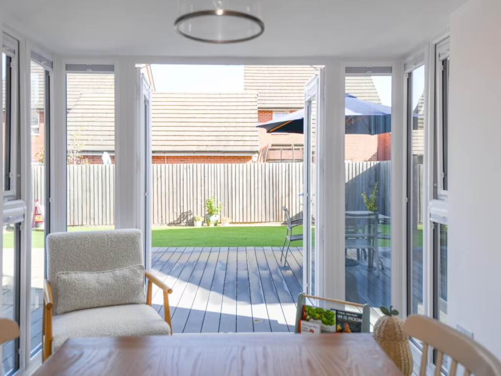
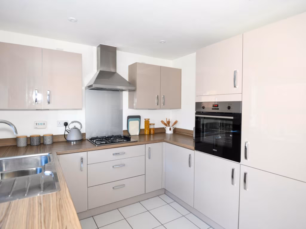
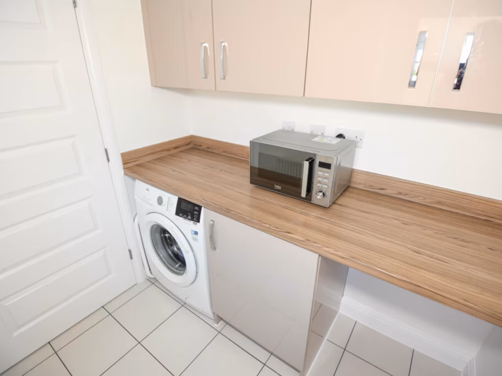
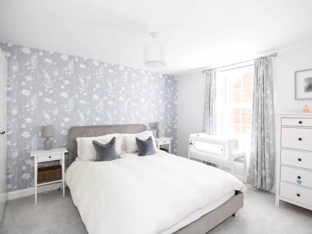
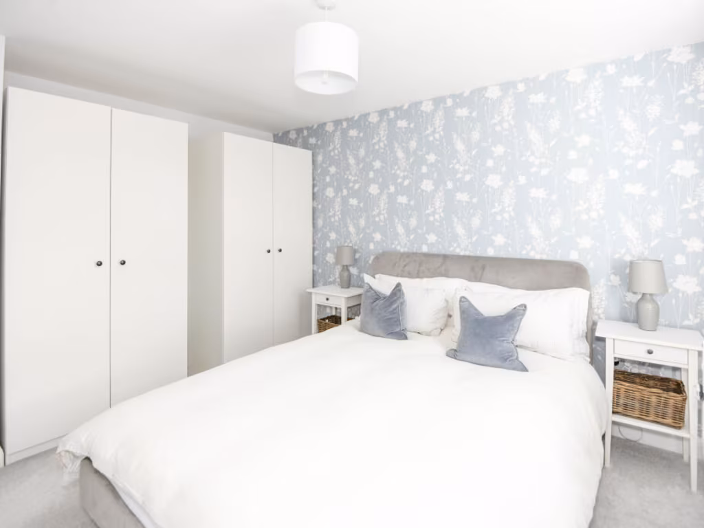
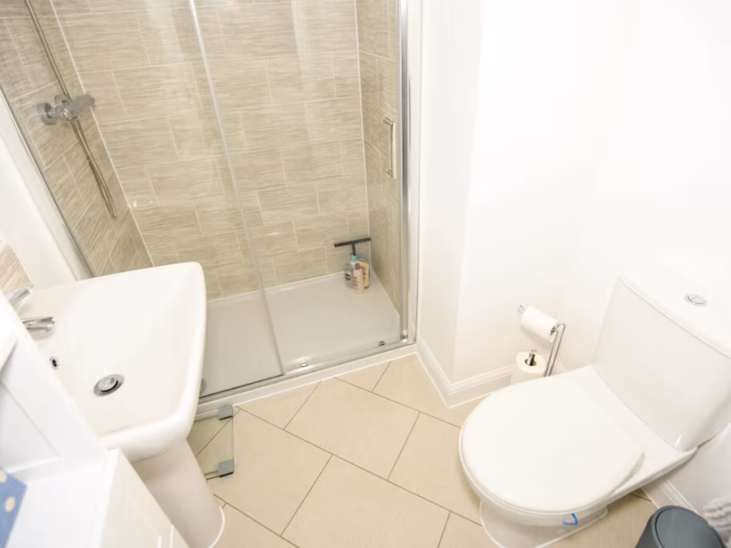
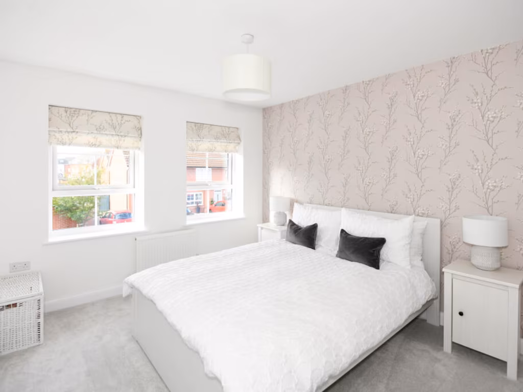
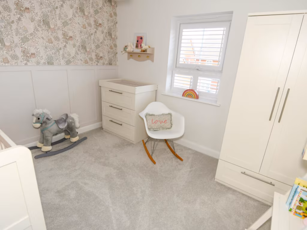
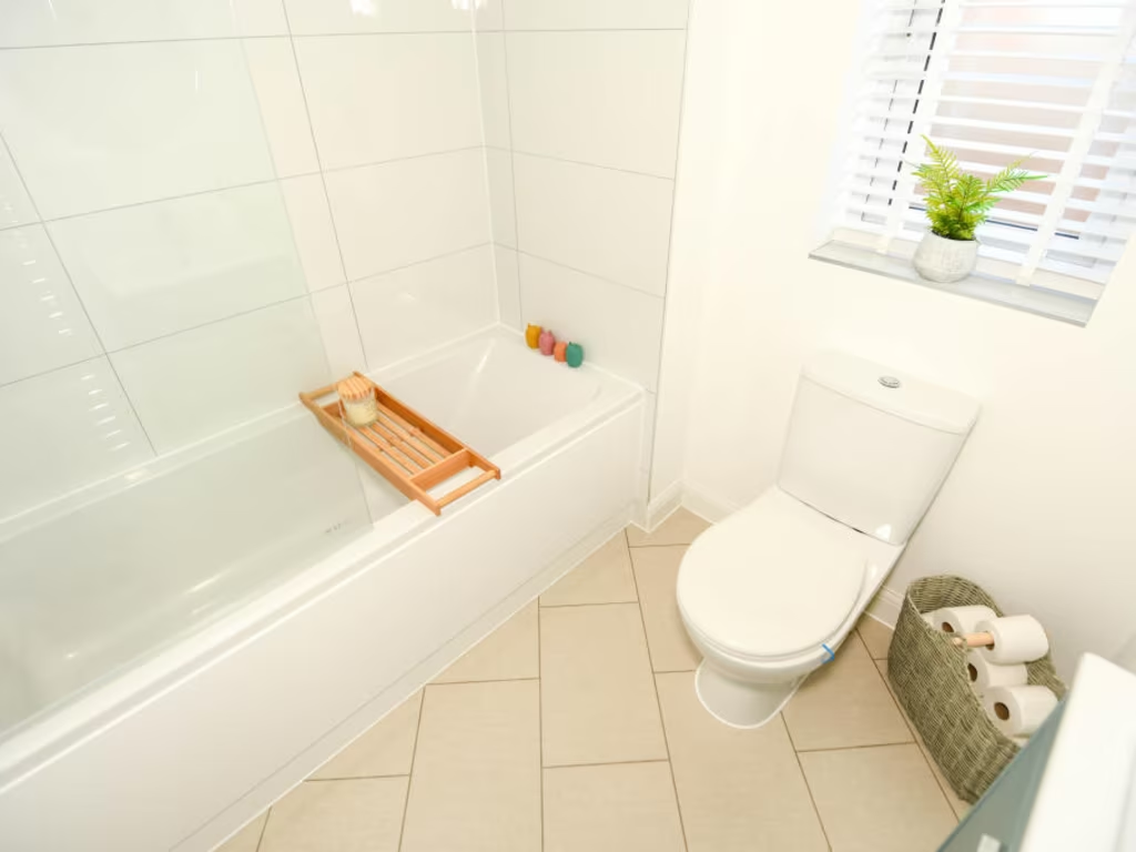
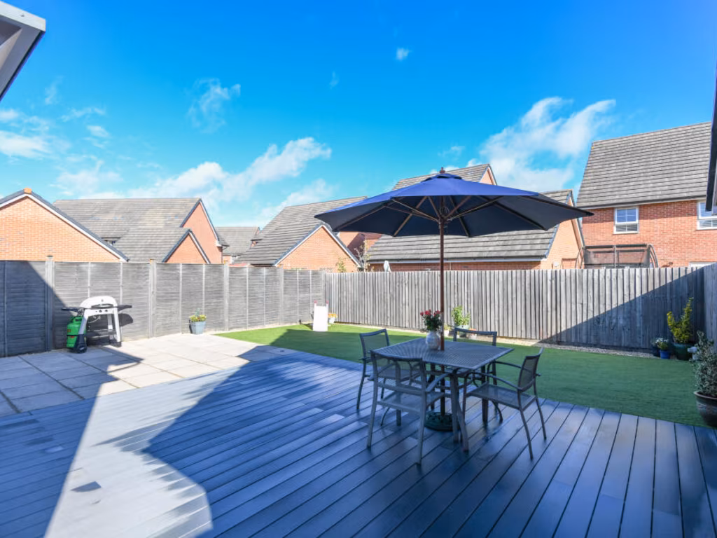
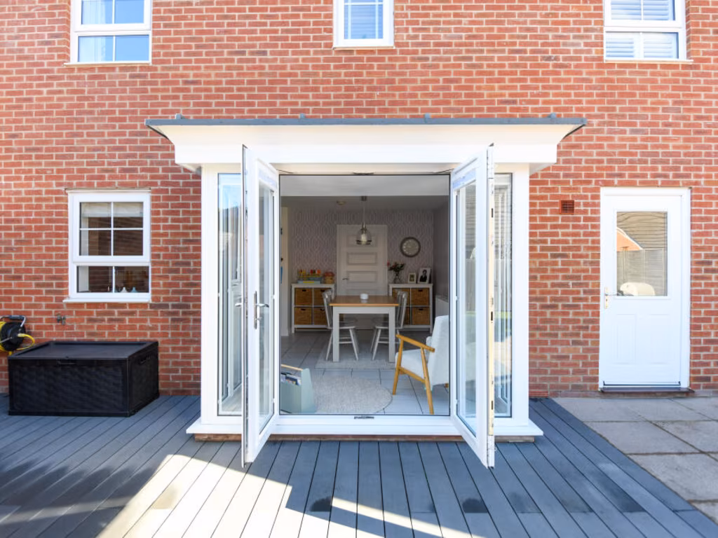
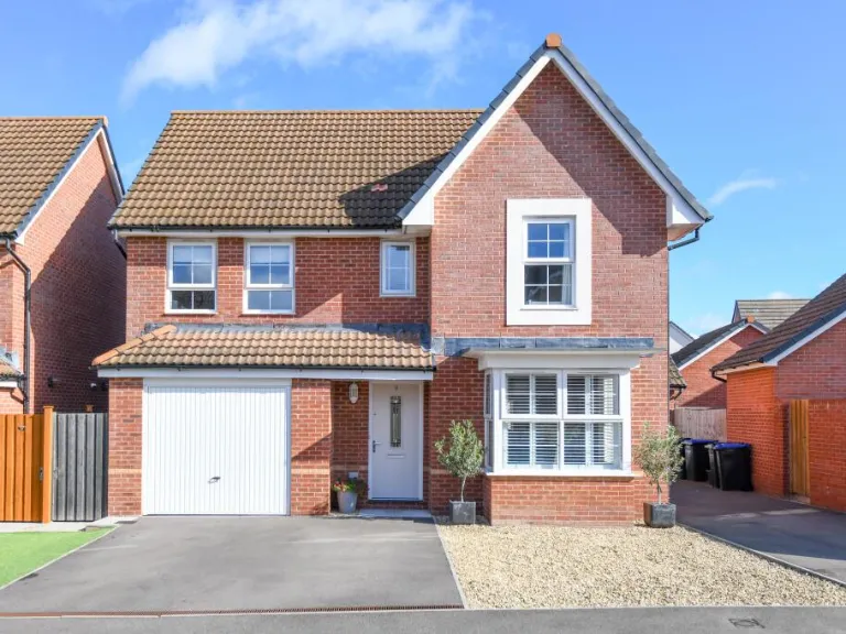
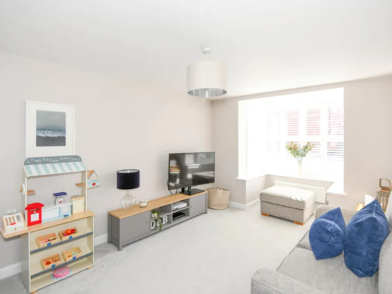
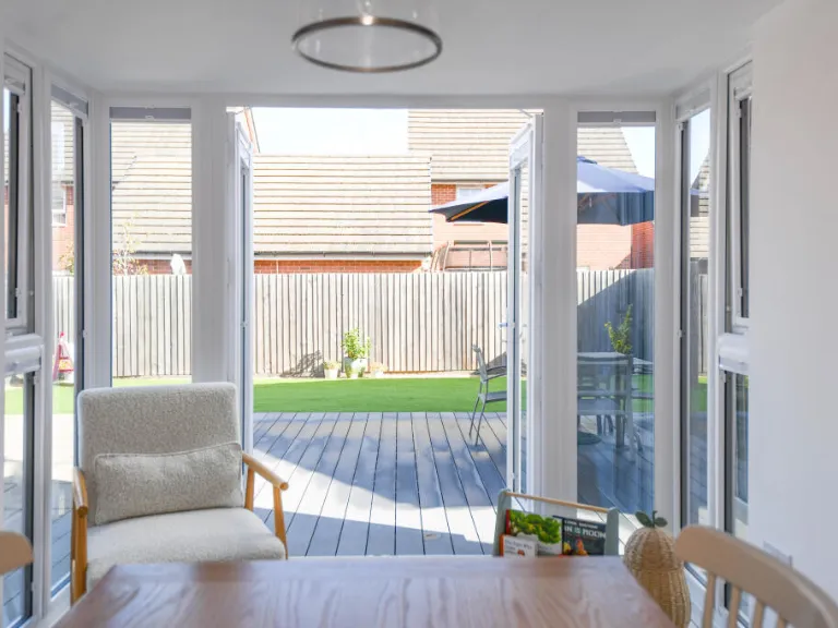
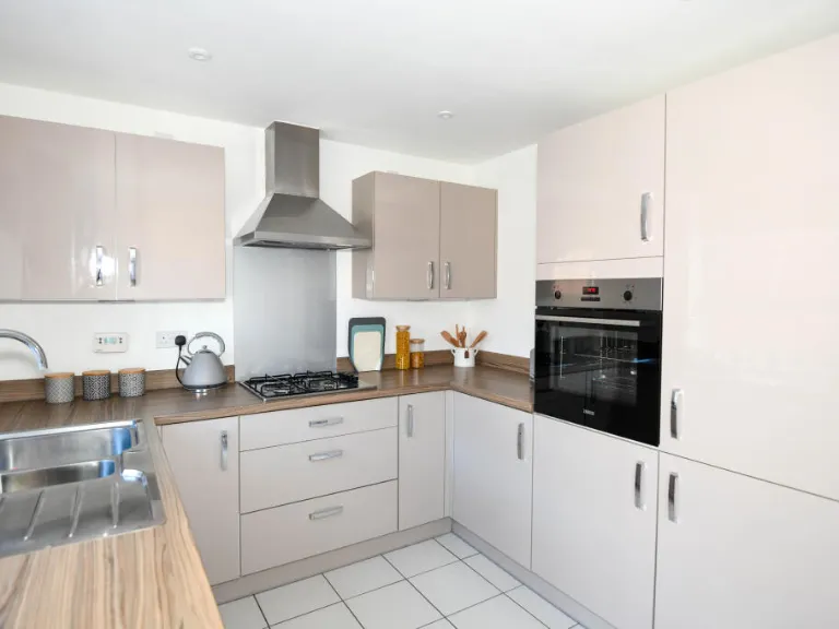
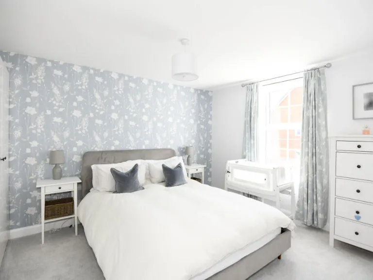
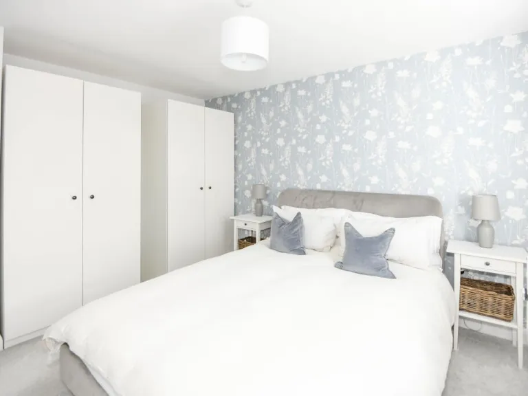
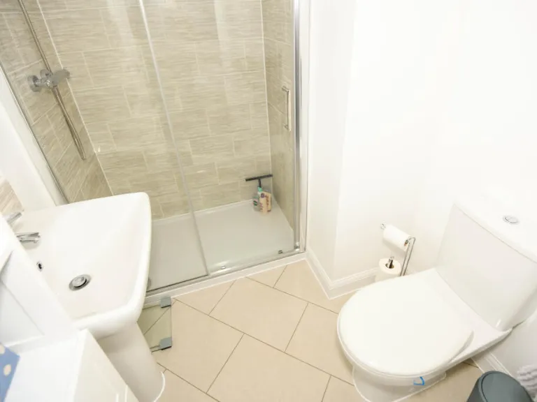
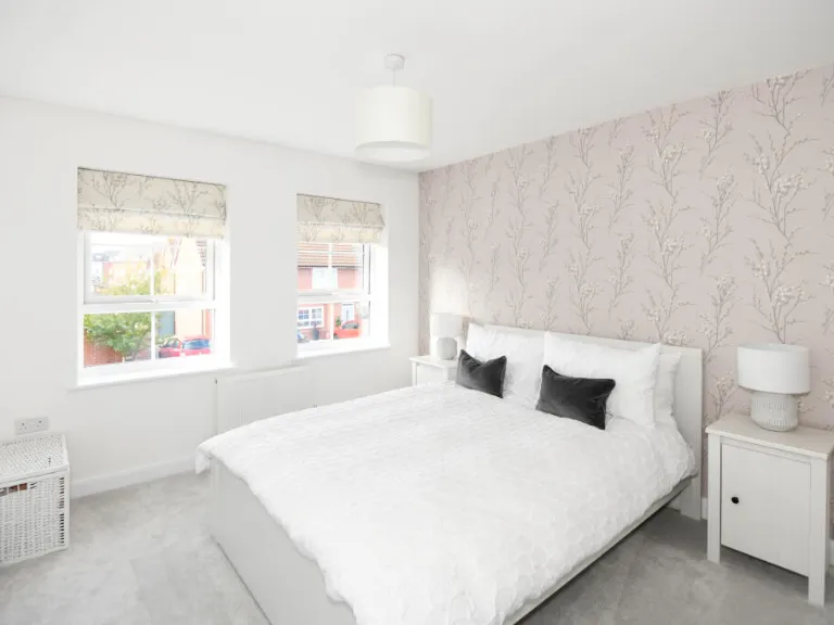
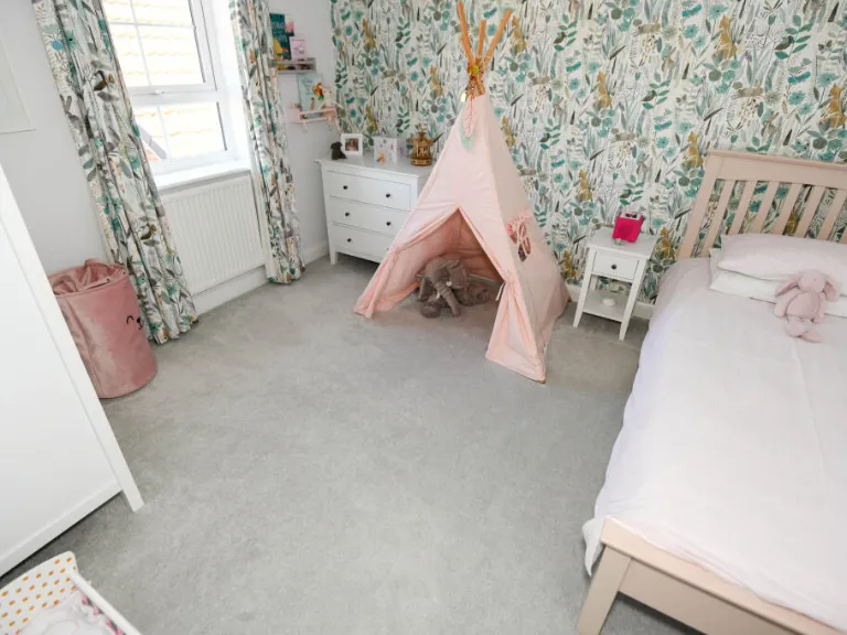
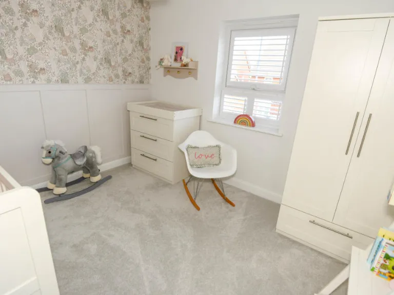
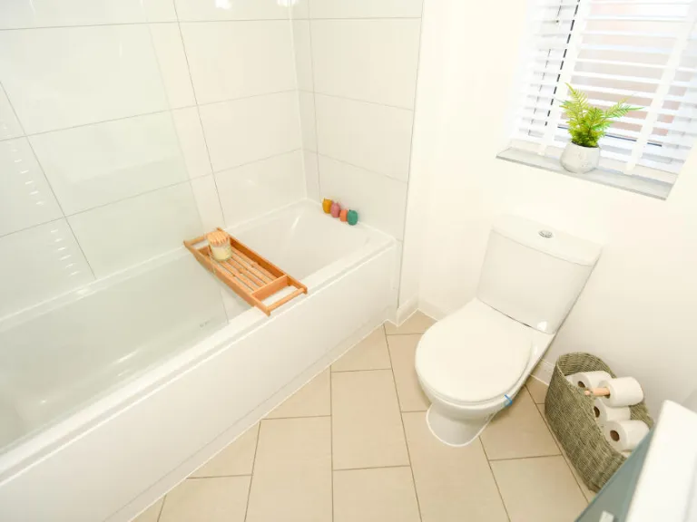
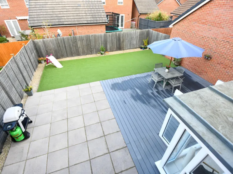
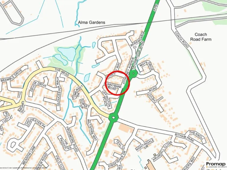
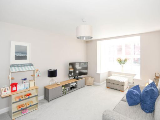
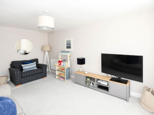
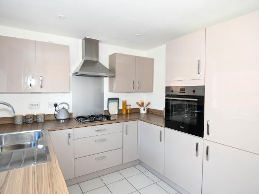
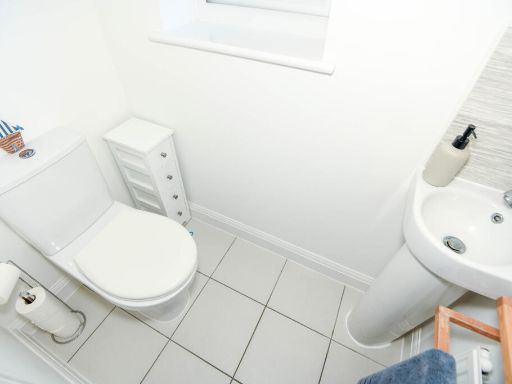
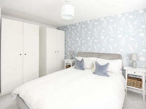
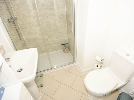
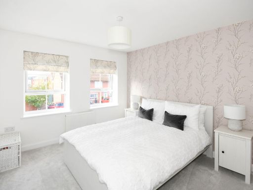
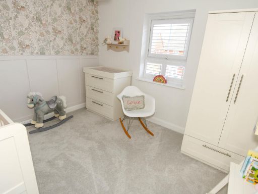
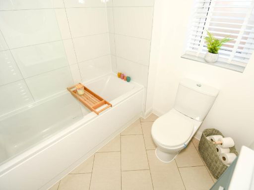
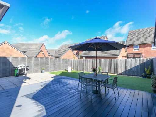
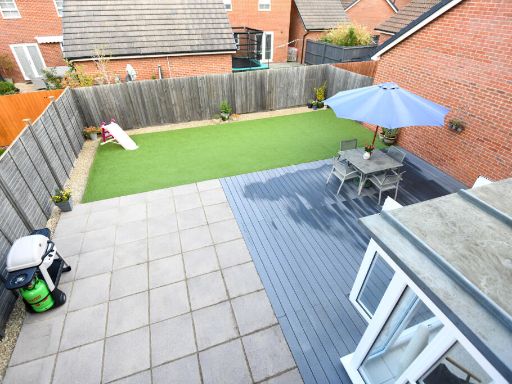
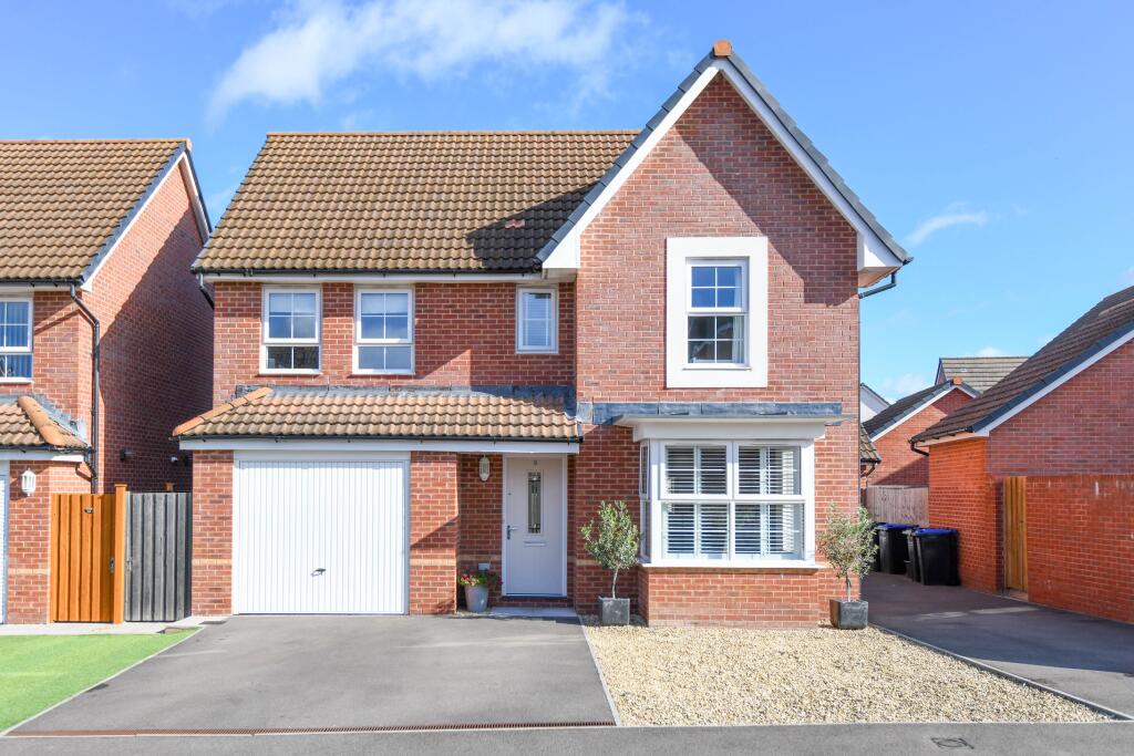
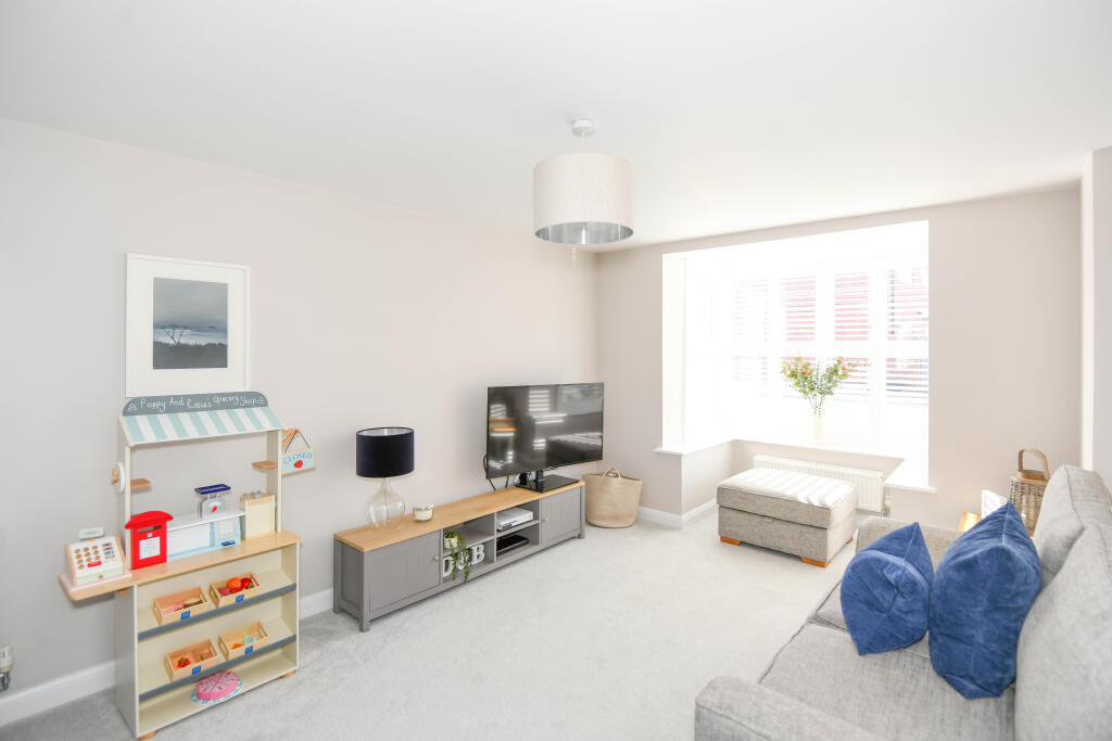
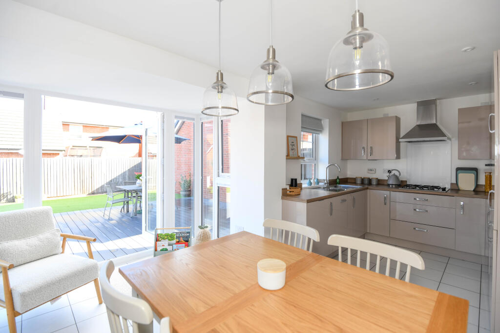
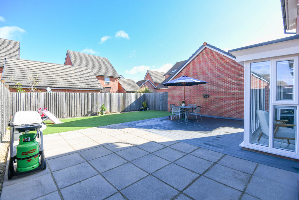
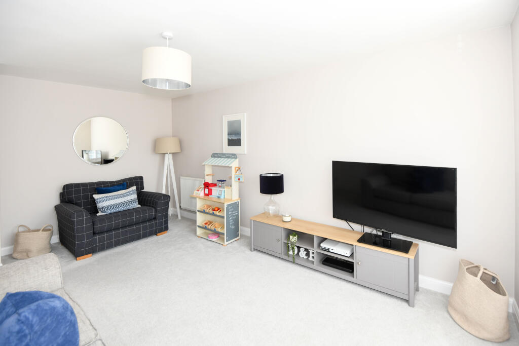
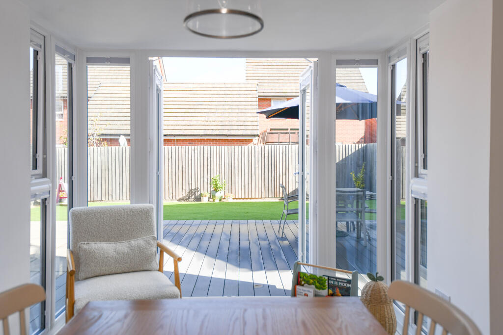
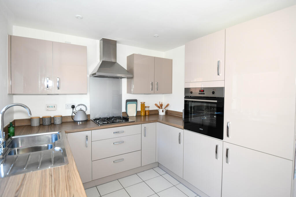
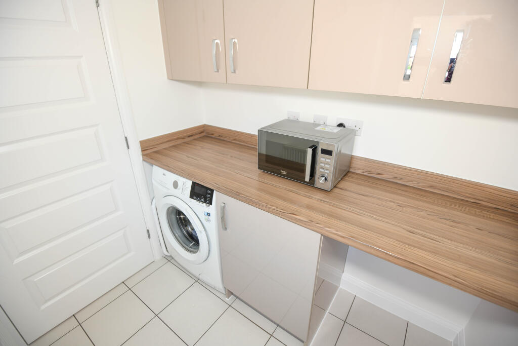
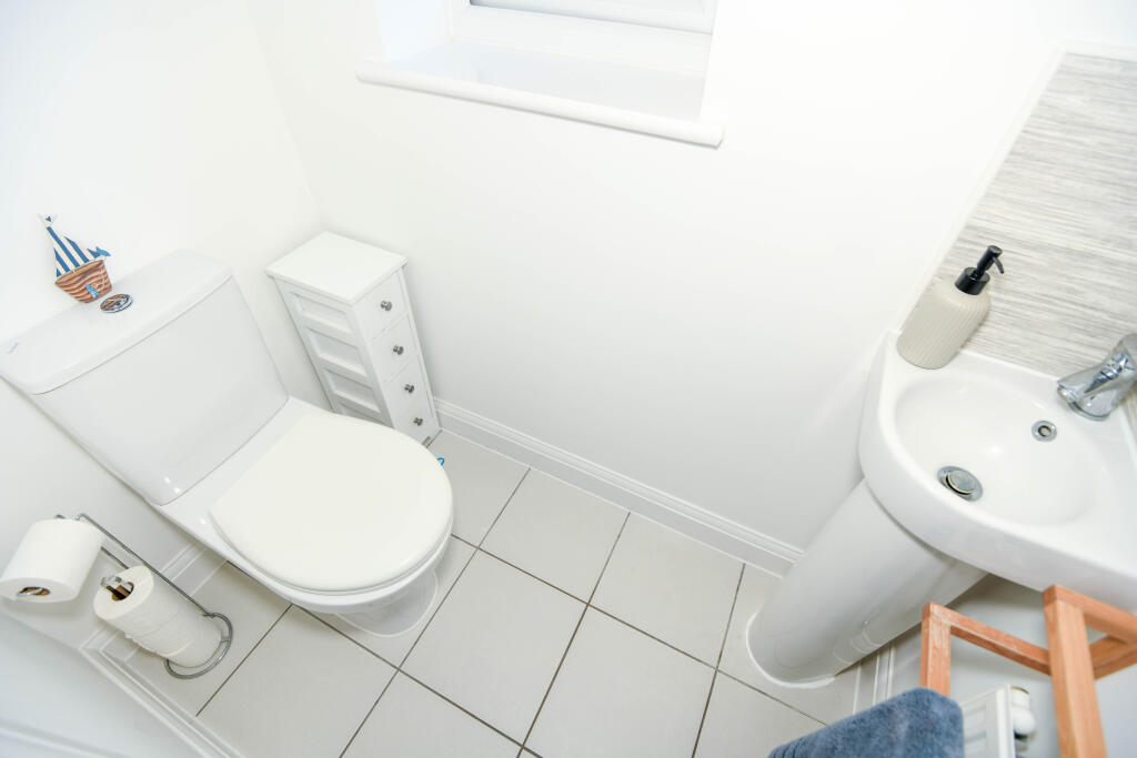
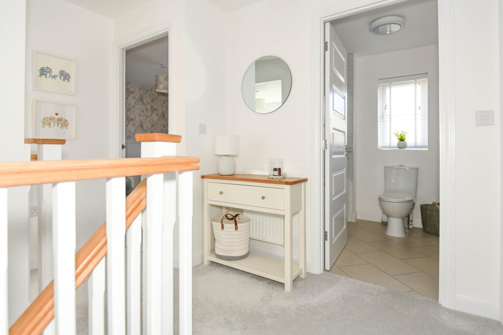
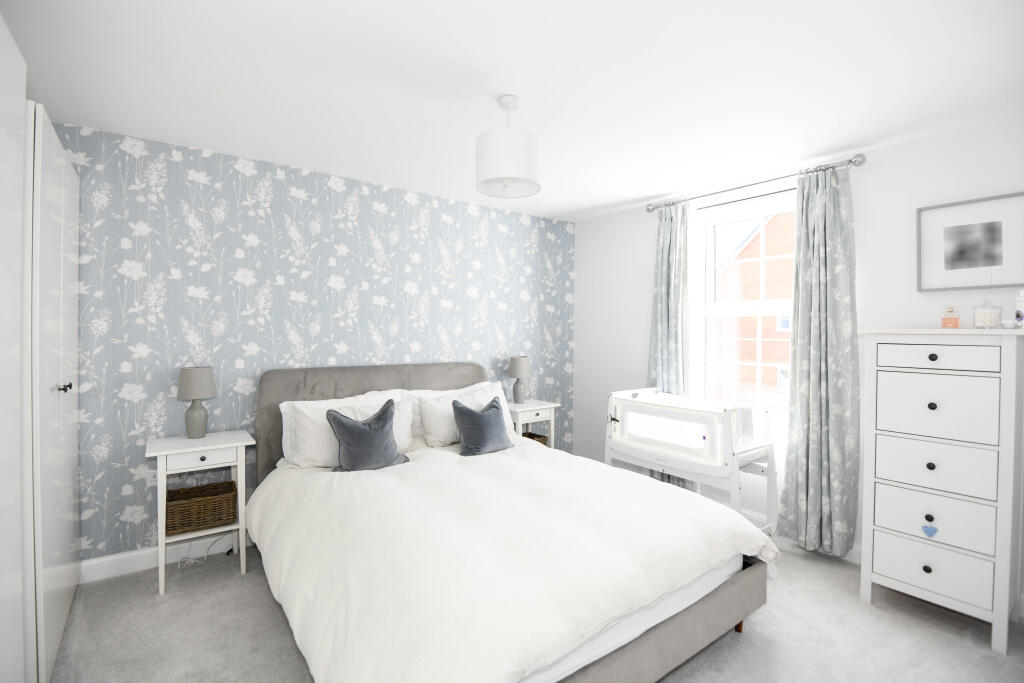
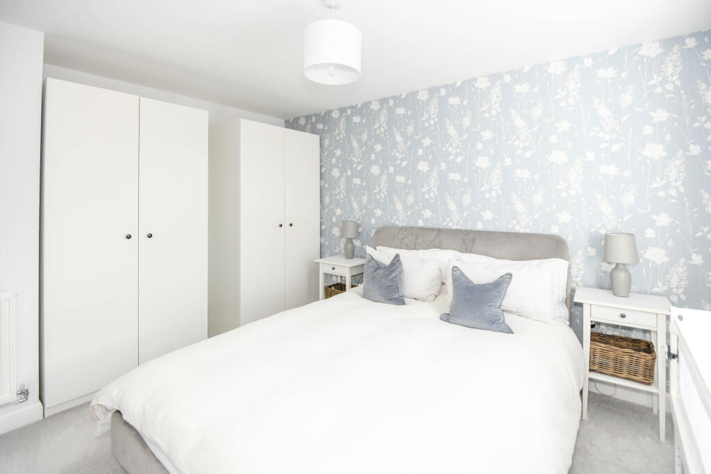
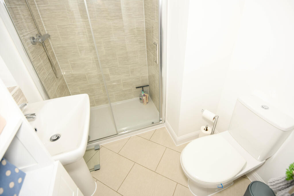
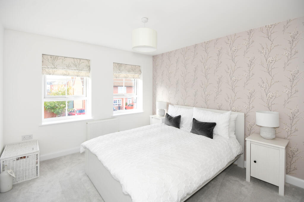
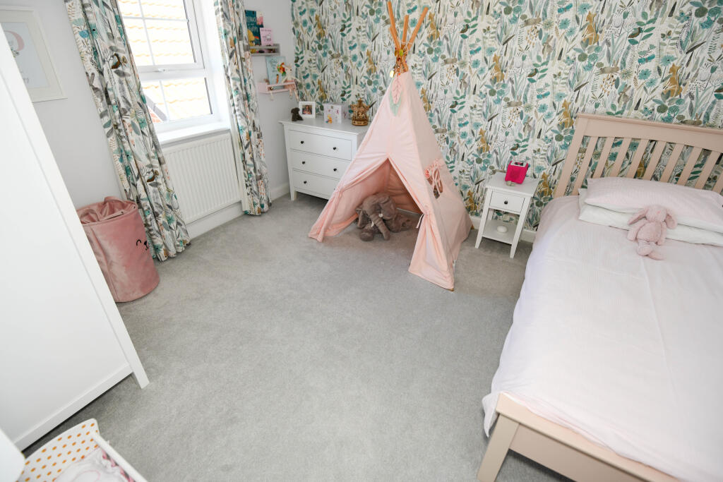
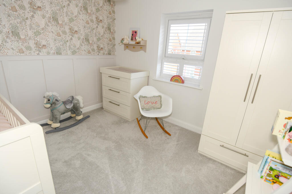
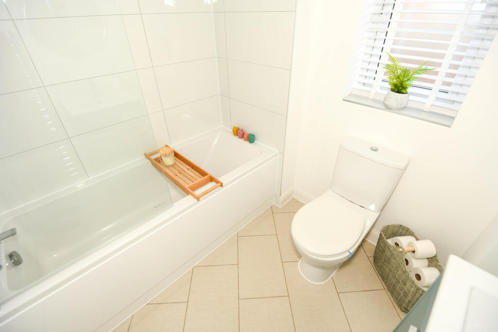
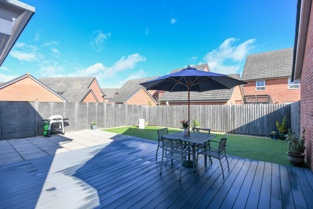
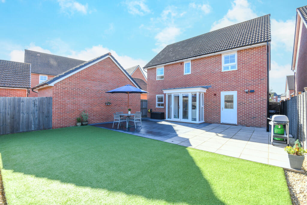
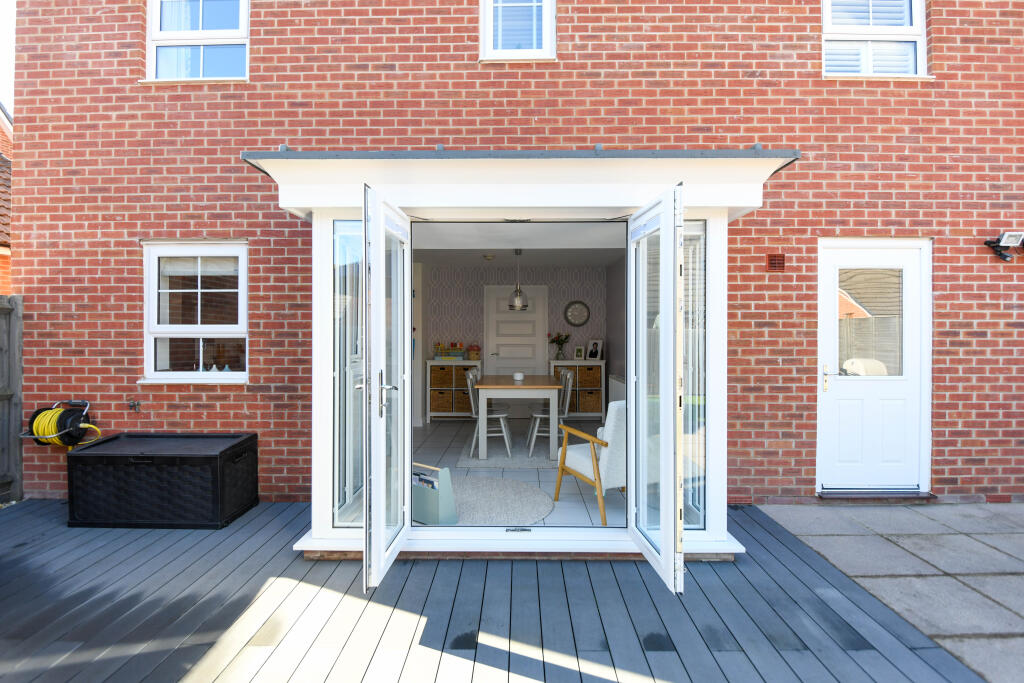
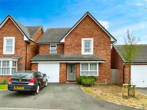
- A modern, well presented four-bedroom detached family home finished to a high specification and situated on the edge of Westbury. The property offers a tiled entrance hall, a bay-fronted living room, a large open-plan modern kitchen/dining room with integrated appliances and French doors opening to the rear garden, plus a utility room and ground-floor cloakroom. On the first floor are four double bedrooms (one with en-suite shower) and a newly refitted family bathroom. The house benefits from UPVC double glazing, gas central heating, newly fitted carpets to the first floor, an integral garage and a double driveway providing off-street parking for two vehicles. Gardens are enclosed and landscaped; the front garden is modest with a paved/gravel forecourt and the rear garden appears to be average in size for a suburban family home. Overall the property represents a mid-to-large sized family dwelling in a residential edge-of-town location, suitable for purchasers prioritising well-specified accommodation and easy access to local schools and amenities.
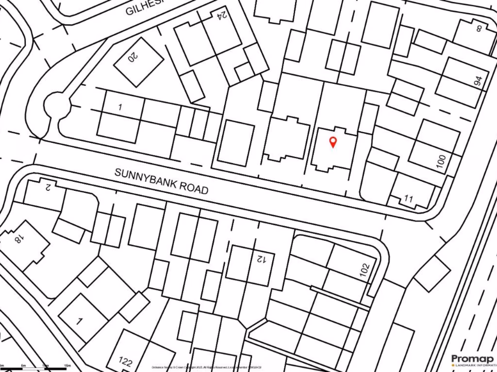
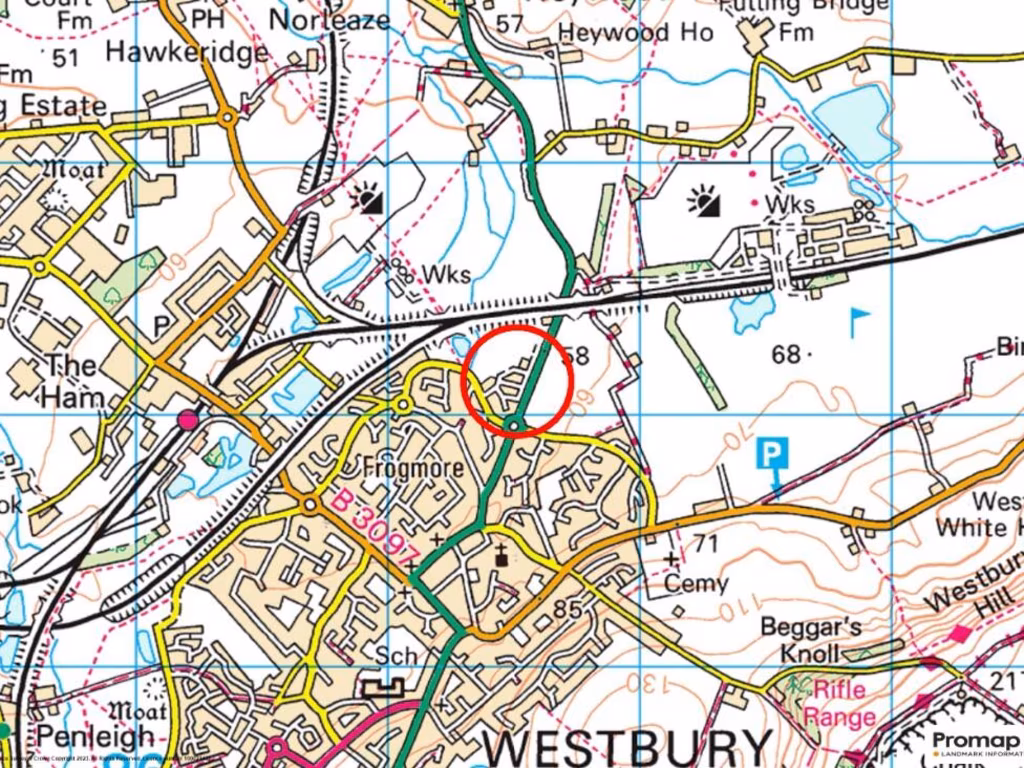
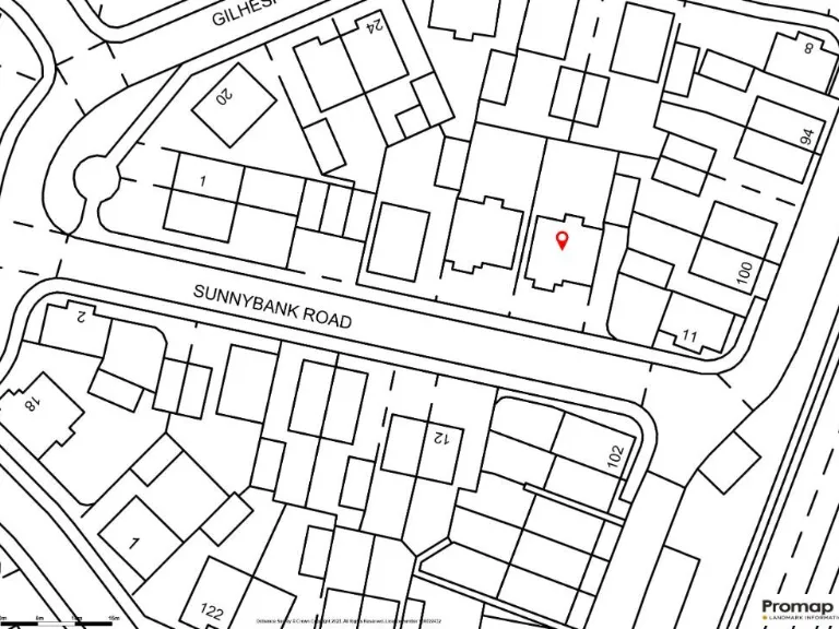
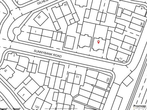
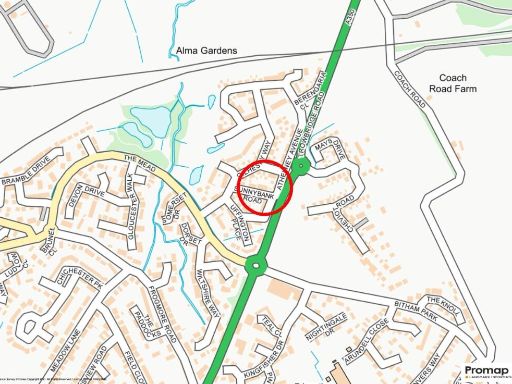
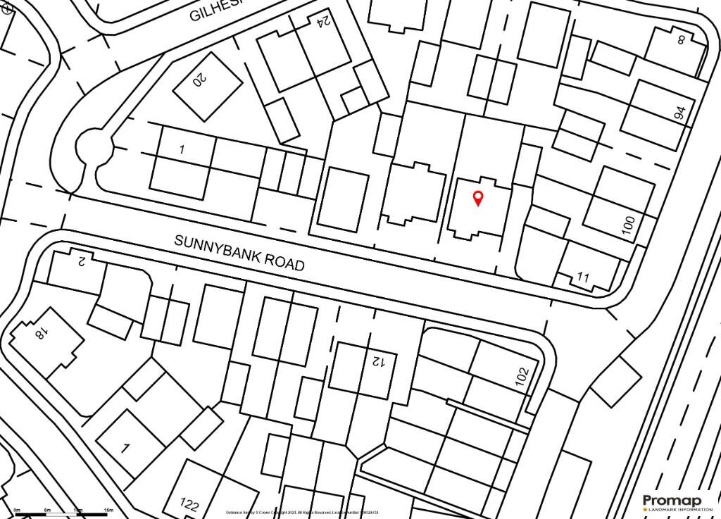
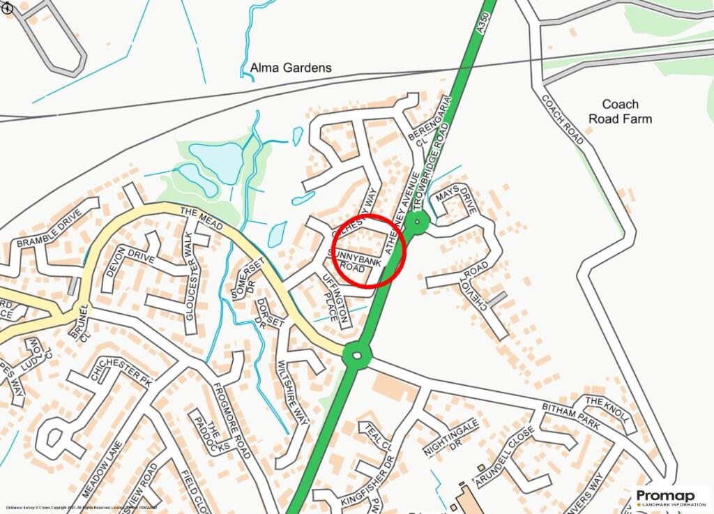
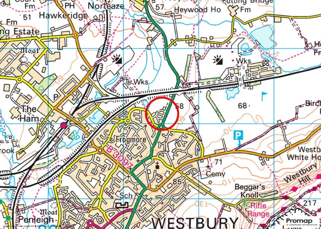
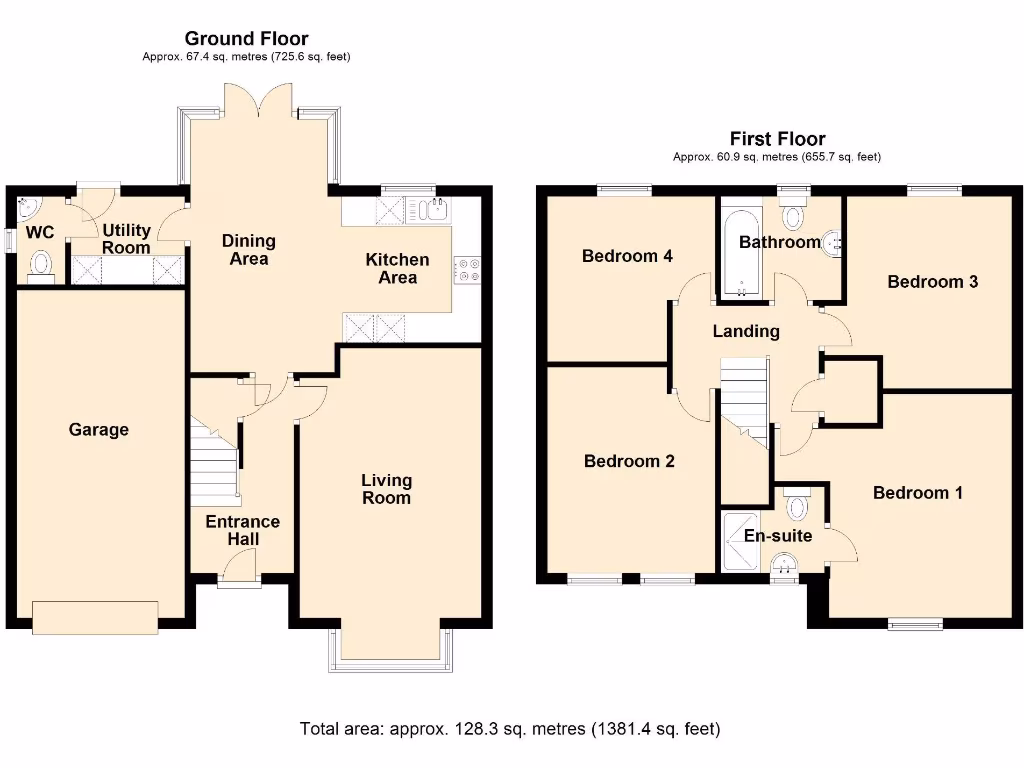
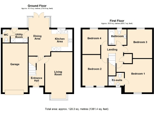
- Semi-detached / detached family house (four-bedroom layout) shown on provided floorplan. Ground floor comprises entrance hall, living room, open dining area leading to kitchen, utility room and ground-floor WC, plus integral garage. First floor shows four bedrooms including an en-suite to the principal bedroom and a separate family bathroom. Accommodation footprint and layout indicate a mid-to-large sized family home with internal living space arranged over two storeys. No explicit residential street address is shown on the sheet — maps are included but do not provide a clear postal property address. The property likely sits in a suburban setting (map excerpts visible) and would typically include a modest rear garden (appears average in size for this house type). Overall condition and finishes cannot be determined from the floorplan alone.
Image Descriptions
- modern detached house contemporary
- living room modern
Rooms
- WC:
- Utility Room:
- Dining Area:
- Kitchen Area:
- Garage:
- Entrance Hall:
- Living Room:
- Bedroom 4:
- Bathroom:
- Bedroom 3:
- Landing:
- Bedroom 2:
- En-suite:
- Bedroom 1:
Textual Property Features
Detected Visual Features
- modern
- detached
- family home
- garage
- driveway
- low maintenance
- two-story
- brick exterior
- contemporary style
- living room
- bay window
- neutral decor
- white shutters
- light room
EPC Details
- High performance glazing
- Average thermal transmittance 0.27 W/m-¦K
- Boiler and radiators, mains gas
- Low energy lighting in all fixed outlets
- Average thermal transmittance 0.15 W/m-¦K
Nearby Schools
- New Close Primary School
- Westbury Church of England Junior School
- Bratton Primary School
- The Clarendon Academy
- Oasis Academy Longmeadow
- Newtown Community Primary School
- Castle Mead School
- The John of Gaunt School
- St John's Catholic Primary School, Trowbridge
- Paxcroft Primary School
- The Minster CofE Primary School
- The Avenue Primary School and Children's Centre
- Warminster School
- Dilton Marsh CofE Primary School
- Bitham Brook Primary School
- Holbrook Primary School
- St Augustine's Catholic College
- The Mead Community Primary School
- Matravers School
- Westbury Infant School
- West Ashton Church of England Primary School
Nearest Bars And Restaurants
- Id: 474526781
- Tags:
- Accommodation: yes
- Amenity: pub
- Food: yes
- Image: http://www.flickr.com/photos/44470358@N08/4112869740/
- Name: The White Lion
- Wikidata: Q26476538
- TagsNormalized:
- Lat: 51.2627742
- Lon: -2.1827435
- FullGeoHash: gcn7wk4e63sr
- PartitionGeoHash: gcn7
- Images:
- FoodStandards: null
- Distance: 625.3
,- Id: 490176356
- Tags:
- Amenity: fast_food
- Cuisine: pizza
- Name: Olympia Takeaway
- TagsNormalized:
- fast food
- food
- pizza
- takeaway
- Lat: 51.2627062
- Lon: -2.1821274
- FullGeoHash: gcn7wk54btpc
- PartitionGeoHash: gcn7
- Images:
- FoodStandards: null
- Distance: 622.7
,- Id: 500885974
- Tags:
- Addr:
- Housenumber: 23
- Street: Market Place
- Amenity: restaurant
- Cuisine: chinese
- Name: New China Cottage
- Opening_hours: Mo off; Tu-Th 17:30-23:30; Fr-Sa 17:30-24:00; Su 17:30-23:30
- Wikidata: Q26573833
- TagsNormalized:
- Lat: 51.262941
- Lon: -2.1822327
- FullGeoHash: gcn7wk4uq2c6
- PartitionGeoHash: gcn7
- Images:
- FoodStandards: null
- Distance: 598.7
,- Id: 474526771
- Tags:
- Amenity: pub
- Image: http://www.flickr.com/photos/44470358@N08/4112353617/
- Name: The Ludlow Arms
- Operator: Free House
- Website: http://www.ludlowarms.co.uk/
- Wikidata: Q26646172
- TagsNormalized:
- Lat: 51.2629749
- Lon: -2.1824511
- FullGeoHash: gcn7wk4u3pns
- PartitionGeoHash: gcn7
- Images:
- FoodStandards: null
- Distance: 598.5
,- Id: 500885978
- Tags:
- Addr:
- Housenumber: 24
- Street: Market Place
- Amenity: fast_food
- Cuisine: fish_and_chips
- Name: Magic Wok
- Opening_hours: Mo-Sa 11:45-14:00,17:00-23:00; Su off
- TagsNormalized:
- Lat: 51.2630485
- Lon: -2.1822861
- FullGeoHash: gcn7wk4uvhce
- PartitionGeoHash: gcn7
- Images:
- FoodStandards: null
- Distance: 587.9
}
Nearest General Shops
- Id: 520595826
- Tags:
- Name: The Space
- Shop: space
- Website: http://www.thespacewestbury.co.uk
- TagsNormalized:
- Lat: 51.2630752
- Lon: -2.1827427
- FullGeoHash: gcn7wk4t43v4
- PartitionGeoHash: gcn7
- Images:
- FoodStandards: null
- Distance: 593.1
,- Id: 520595835
- Tags:
- Addr:
- Housenumber: 3
- Street: Fore Street
- Name: Fore Hair & Beauty
- Shop: hairdresser
- TagsNormalized:
- Lat: 51.263161
- Lon: -2.1827171
- FullGeoHash: gcn7wk4te1b4
- PartitionGeoHash: gcn7
- Images:
- FoodStandards: null
- Distance: 583.5
,- Id: 404409264
- Tags:
- Name: Alan Petrie Motors
- Shop: car_repair
- TagsNormalized:
- Lat: 51.2651014
- Lon: -2.1810168
- FullGeoHash: gcn7wkebfes1
- PartitionGeoHash: gcn7
- Images:
- FoodStandards: null
- Distance: 347
}
Nearest Grocery shops
- Id: 503672102
- Tags:
- Addr:
- Housenumber: 30
- Street: High Street
- Brand: McColl's
- Brand:wikidata: Q16997477
- Brand:wikipedia: en:McColl's
- Contact:
- Website: https://www.mccolls.co.uk/storelocator/westbury-high-street/
- Level: 0
- Name: McColl's
- Opening_hours: Mo-Su 06:00-20:00
- Shop: convenience
- TagsNormalized:
- Lat: 51.2607898
- Lon: -2.1848282
- FullGeoHash: gcn7w79p9zf1
- PartitionGeoHash: gcn7
- Images:
- FoodStandards: null
- Distance: 880.5
,- Id: 520595953
- Tags:
- Amenity: fast_food
- Cuisine: sandwich
- Name: Checkers Baguette Shop
- Opening_hours: Mo-Sa 08:00-15:00; Su off
- TagsNormalized:
- fast food
- food
- sandwich
- shop
- Lat: 51.2605994
- Lon: -2.1834619
- FullGeoHash: gcn7w7dn9skf
- PartitionGeoHash: gcn7
- Images:
- FoodStandards: null
- Distance: 871.9
,- Id: 474526792
- Tags:
- Brand: One Stop
- Brand:wikidata: Q65954217
- Name: One Stop
- Shop: convenience
- TagsNormalized:
- Lat: 51.2627204
- Lon: -2.182668
- FullGeoHash: gcn7wk4dupsy
- PartitionGeoHash: gcn7
- Images:
- FoodStandards: null
- Distance: 629.7
}
Nearest Supermarkets
- Id: 41215561
- Tags:
- Addr:
- City: Westbury
- Housenumber: 42
- Postcode: BA13 3BG
- Street: Edward Street
- Alt_name: Morrisons Westbury
- Brand: Morrisons
- Brand:wikidata: Q922344
- Brand:wikipedia: en:Morrisons
- Building: yes
- Contact:
- Website: https://my.morrisons.com/storefinder/678
- Name: Morrisons
- Opening_hours: Mo-We 08:00-20:00; Th-Fr 08:00-21:00; Sa 08:00-20:00; Su 10:00-16:00
- Operator: Morrisons
- Shop: supermarket
- TagsNormalized:
- Lat: 51.2601408
- Lon: -2.1837756
- FullGeoHash: gcn7w79gfqff
- PartitionGeoHash: gcn7
- Images:
- FoodStandards: null
- Distance: 926.7
,- Id: 41989283
- Tags:
- Brand: Tesco Express
- Brand:wikidata: Q98456772
- Building: supermarket
- Contact:
- Website: https://www.tesco.com/store-locator/wiltshire/fore-st
- Name: Tesco Express
- Operator: Tesco
- Shop: convenience
- TagsNormalized:
- tesco
- tesco express
- supermarket
- convenience
- shop
- Lat: 51.2645294
- Lon: -2.1823204
- FullGeoHash: gcn7wk6vs0zv
- PartitionGeoHash: gcn7
- Images:
- FoodStandards: null
- Distance: 430.1
,- Id: 148948352
- Tags:
- Addr:
- Country: GB
- Postcode: BA13 3XW
- Street: Kingfisher Drive
- Brand: Lidl
- Brand:wikidata: Q151954
- Brand:wikipedia: en:Lidl
- Building: supermarket
- Fhrs:
- Name: Lidl
- Opening_hours: Mo-Sa 08:00-22:00; Su 10:00-16:00
- Operator: Lidl
- Shop: supermarket
- Source: Bing
- TagsNormalized:
- Lat: 51.2661954
- Lon: -2.1798056
- FullGeoHash: gcn7wksxnz7p
- PartitionGeoHash: gcn7
- Images:
- FoodStandards:
- Id: 630867
- FHRSID: 630867
- LocalAuthorityBusinessID: PI/000265012
- BusinessName: Lidl 1684
- BusinessType: Retailers - supermarkets/hypermarkets
- BusinessTypeID: 7840
- AddressLine1: Lidl
- AddressLine2: Kingfisher Drive
- AddressLine3: Westbury
- AddressLine4: Wiltshire
- PostCode: BA13 3XW
- RatingValue: 5
- RatingKey: fhrs_5_en-GB
- RatingDate: 2022-10-31
- LocalAuthorityCode: 709
- LocalAuthorityName: Wiltshire
- LocalAuthorityWebSite: http://www.wiltshire.gov.uk
- LocalAuthorityEmailAddress: publicprotectionwest@wiltshire.gov.uk
- Scores:
- Hygiene: 0
- Structural: 0
- ConfidenceInManagement: 0
- NewRatingPending: false
- Geocode:
- Longitude: -2.18006396293640
- Latitude: 51.26472091674800
- Distance: 225.2
}
Nearest Religious buildings
- Id: 41081230
- Tags:
- Amenity: place_of_worship
- Building: yes
- Denomination: catholic
- Image: http://www.flickr.com/photos/44470358@N08/4112404477/
- Name: Saint Bernadette of Lourdes
- Religion: christian
- Url: http://www.wiltshire.gov.uk/community/getchurch.php?id=367
- TagsNormalized:
- place of worship
- catholic
- christian
- church
- Lat: 51.2613672
- Lon: -2.1866542
- FullGeoHash: gcn7w5zep72q
- PartitionGeoHash: gcn7
- Images:
- FoodStandards: null
- Distance: 877
,- Id: 500885968
- Tags:
- Amenity: place_of_worship
- Denomination: baptist
- Image: http://www.flickr.com/photos/44470358@N08/4113155116/
- Name: West End Baptist Church
- Religion: christian
- Url: http://www.wiltshire.gov.uk/community/getchurch.php?id=373
- TagsNormalized:
- place of worship
- baptist
- church
- christian
- Lat: 51.2622028
- Lon: -2.1850042
- FullGeoHash: gcn7w7bzvxny
- PartitionGeoHash: gcn7
- Images:
- FoodStandards: null
- Distance: 741
,- Id: 328356227
- Tags:
- Amenity: place_of_worship
- Building: church
- Denomination: anglican
- Description: Access details: http://www.english-heritage.org.uk/server/show/conGap.2939
- Image: http://www.flickr.com/photos/44470358@N08/4112049235/
- Name: All Saints
- Religion: christian
- Source: http://www.sdgr.org.uk/
- Url: http://www.wiltshire.gov.uk/community/getchurch.php?id=369
- Wikidata: Q17529516
- TagsNormalized:
- place of worship
- church
- anglican
- christian
- Lat: 51.2618908
- Lon: -2.1823231
- FullGeoHash: gcn7w7fyhjjc
- PartitionGeoHash: gcn7
- Images:
- FoodStandards: null
- Distance: 714.2
}
Nearest Medical buildings
- Id: 41081167
- Tags:
- Amenity: doctors
- Building: yes
- Healthcare: doctor
- Name: Eastleigh Surgery
- TagsNormalized:
- doctor
- doctors
- health
- healthcare
- surgery
- Lat: 51.261242
- Lon: -2.1868804
- FullGeoHash: gcn7w5zd3upg
- PartitionGeoHash: gcn7
- Images:
- FoodStandards: null
- Distance: 897
,- Id: 42764594
- Tags:
- Amenity: doctors
- Healthcare: doctor
- Name: Eastleigh Surgery
- TagsNormalized:
- doctor
- doctors
- health
- healthcare
- surgery
- Lat: 51.2612929
- Lon: -2.1869638
- FullGeoHash: gcn7w5zd8j9d
- PartitionGeoHash: gcn7
- Images:
- FoodStandards: null
- Distance: 895.1
,- Id: 503672065
- Tags:
- Addr:
- Housenumber: 22-24
- Street: High Street
- Amenity: dentist
- Healthcare: dentist
- Level: 0
- Name: Westbury Downs Dental Practice
- TagsNormalized:
- dentist
- health
- healthcare
- dental
- Lat: 51.260908
- Lon: -2.1846323
- FullGeoHash: gcn7w7c0qmu4
- PartitionGeoHash: gcn7
- Images:
- FoodStandards: null
- Distance: 863.4
,- Id: 503606905
- Tags:
- Addr:
- Housenumber: 9-11
- Street: High Street
- Amenity: pharmacy
- Branch: Chemist
- Brand: Boots
- Brand:wikidata: Q6123139
- Brand:wikipedia: en:Boots (company)
- Healthcare: pharmacy
- Level: 0
- Name: Boots
- Opening_hours: Mo-Fr 09:00-18:00; Sa 09:00-17:30; Su off
- Operator: Boots
- TagsNormalized:
- pharmacy
- boots
- health
- healthcare
- Lat: 51.2608842
- Lon: -2.1841336
- FullGeoHash: gcn7w7c83crv
- PartitionGeoHash: gcn7
- Images:
- FoodStandards: null
- Distance: 854.5
}
Nearest Airports
- Id: 47483196
- Tags:
- Aerodrome: international
- Aeroway: aerodrome
- Iata: BRS
- Icao: EGGD
- Internet_access: wlan
- Internet_access:fee: no
- Name: Bristol Airport
- Type: public
- Website: https://www.bristolairport.co.uk/
- Wikidata: Q8725
- Wikipedia: en:Bristol Airport
- TagsNormalized:
- airport
- international airport
- Lat: 51.3830799
- Lon: -2.7186615
- FullGeoHash: gcnh64h24s74
- PartitionGeoHash: gcnh
- Images:
- FoodStandards: null
- Distance: 39526.6
}
Nearest Leisure Facilities
- Id: 870569171
- Tags:
- Leisure: pitch
- Sport: tennis
- TagsNormalized:
- Lat: 51.2645353
- Lon: -2.1784538
- FullGeoHash: gcn7wkmtw650
- PartitionGeoHash: gcn7
- Images:
- FoodStandards: null
- Distance: 427.3
,- Id: 5364860001
- Tags:
- Leisure: playground
- Name: Kingfisher Road Play Area
- TagsNormalized:
- Lat: 51.2645829
- Lon: -2.1810346
- FullGeoHash: gcn7wk7vf4ys
- PartitionGeoHash: gcn7
- Images:
- FoodStandards: null
- Distance: 404.3
,- Id: 556138285
- Tags:
- TagsNormalized:
- Lat: 51.264616
- Lon: -2.1810051
- FullGeoHash: gcn7wk7y4chd
- PartitionGeoHash: gcn7
- Images:
- FoodStandards: null
- Distance: 400.4
,- Id: 42455804
- Tags:
- Leisure: playground
- Name: Campion Close Play Area
- TagsNormalized:
- Lat: 51.2691514
- Lon: -2.1852408
- FullGeoHash: gcn7wm2b2nw2
- PartitionGeoHash: gcn7
- Images:
- FoodStandards: null
- Distance: 357.3
,- Id: 613056148
- Tags:
- Leisure: playground
- Name: Play Park
- TagsNormalized:
- Lat: 51.2693985
- Lon: -2.1821472
- FullGeoHash: gcn7wm71bk94
- PartitionGeoHash: gcn7
- Images:
- FoodStandards: null
- Distance: 183.9
}
Nearest Tourist attractions
- Id: 162258889
- Tags:
- Area: yes
- Man_made: geoglyph
- Material: concrete
- Name: Westbury White Horse
- Tourism: attraction
- Wikidata: Q523097
- Wikimedia_commons: Category:Westbury White Horse
- Wikipedia: en:Westbury White Horse
- TagsNormalized:
- Lat: 51.2636062
- Lon: -2.1470391
- FullGeoHash: gcn7xhk84kgd
- PartitionGeoHash: gcn7
- Images:
- FoodStandards: null
- Distance: 2372.3
,- Id: 43653058
- Tags:
- Building: yes
- Name: Redwood Lodge B&B
- Tourism: guest_house
- TagsNormalized:
- Lat: 51.2708111
- Lon: -2.1974972
- FullGeoHash: gcn7tvxf4egm
- PartitionGeoHash: gcn7
- Images:
- FoodStandards: null
- Distance: 1228.7
,- Id: 552664297
- Tags:
- Building: yes
- Tourism: guest_house
- TagsNormalized:
- Lat: 51.2618747
- Lon: -2.1889731
- FullGeoHash: gcn7w5yn14p3
- PartitionGeoHash: gcn7
- Images:
- FoodStandards: null
- Distance: 924.4
}
Nearest Train stations
- Id: 3195751158
- Tags:
- Name: Bradford-on-Avon
- Naptan:
- Network: National Rail
- Public_transport: station
- Railway: station
- Ref:
- Source: NPE
- Toilets:
- Wheelchair: limited
- Wikidata: Q4954566
- Wikipedia: en:Bradford-on-Avon railway station
- TagsNormalized:
- Lat: 51.344789
- Lon: -2.2527549
- FullGeoHash: gcnkhep9542h
- PartitionGeoHash: gcnk
- Images:
- FoodStandards: null
- Distance: 9893.5
,- Id: 7154293857
- Tags:
- Name: Warminster
- Naptan:
- Network: National Rail
- Operator: Great Western Railway
- Public_transport: station
- Railway: station
- Ref:
- Source: Bing
- Wikidata: Q2383286
- Wikipedia: en:Warminster railway station
- TagsNormalized:
- Lat: 51.2069721
- Lon: -2.1769016
- FullGeoHash: gcn7q3yy4x2w
- PartitionGeoHash: gcn7
- Images:
- FoodStandards: null
- Distance: 6811.6
,- Id: 17773687
- Tags:
- Name: Trowbridge
- Naptan:
- Network: National Rail
- Public_transport: station
- Railway: station
- Ref:
- Source: NPE
- Wikidata: Q2974092
- Wikipedia: en:Trowbridge railway station
- TagsNormalized:
- Lat: 51.3200055
- Lon: -2.2143313
- FullGeoHash: gcn7vwe8dq6v
- PartitionGeoHash: gcn7
- Images:
- FoodStandards: null
- Distance: 6227.3
,- Id: 5232609898
- Tags:
- Name: Dilton Marsh
- Naptan:
- Network: National Rail
- Public_transport: station
- Railway: station
- Ref:
- Request_stop: yes
- Train: yes
- Wikidata: Q2303611
- Wikipedia: en:Dilton Marsh railway station
- TagsNormalized:
- Lat: 51.2489573
- Lon: -2.2078698
- FullGeoHash: gcn7tc86bfhf
- PartitionGeoHash: gcn7
- Images:
- FoodStandards: null
- Distance: 2871.5
,- Id: 6606028831
- Tags:
- Name: Westbury
- Naptan:
- Network: National Rail
- Public_transport: station
- Railway: station
- Ref:
- Wheelchair: yes
- Wikidata: Q1980683
- Wikipedia: en:Westbury railway station
- TagsNormalized:
- Lat: 51.2663283
- Lon: -2.1997296
- FullGeoHash: gcn7tuy0n868
- PartitionGeoHash: gcn7
- Images:
- FoodStandards: null
- Distance: 1365
}
Nearest Hotels
- Id: 2448606510
- Tags:
- Brand: Travelodge
- Brand:wikidata: Q9361374
- Brand:wikipedia: en:Travelodge UK
- Name: Travelodge
- Tourism: hotel
- TagsNormalized:
- Lat: 51.2177962
- Lon: -2.1996473
- FullGeoHash: gcn7mgym290p
- PartitionGeoHash: gcn7
- Images:
- FoodStandards: null
- Distance: 5762.8
,- Id: 41989322
- Tags:
- Building: yes
- Description: AA ***
- Image: http://www.flickr.com/photos/44470358@N08/4112487668/
- Name: The Cedar Hotel & Restaurant
- Tourism: hotel
- TagsNormalized:
- Lat: 51.2547978
- Lon: -2.1873128
- FullGeoHash: gcn7w4xhzfv6
- PartitionGeoHash: gcn7
- Images:
- FoodStandards: null
- Distance: 1566.5
,- Id: 487788045
- Tags:
- Image: http://www.flickr.com/photos/44470358@N08/4112833886/
- Name: The Lopes Arms
- Tourism: hotel
- Website: http://www.lopesarmshotel.co.uk/
- Wikidata: Q26287941
- TagsNormalized:
- Lat: 51.2624512
- Lon: -2.1819121
- FullGeoHash: gcn7wk51mv82
- PartitionGeoHash: gcn7
- Images:
- FoodStandards: null
- Distance: 647.8
}
Tags
- modern
- detached
- family home
- garage
- driveway
- low maintenance
- two-story
- brick exterior
- contemporary style
- modern
- living room
- bay window
- neutral decor
- white shutters
- light room
Local Market Stats
- Average Price/sqft: £288
- Avg Income: £46300
- Rental Yield: 4.2%
- Social Housing: 6%
- Planning Success Rate: 92%
Similar Properties
 4 bedroom detached house for sale in Wedmore Drive, Westbury, BA13 — £360,000 • 4 bed • 2 bath • 1610 ft²
 4 bedroom detached house for sale in Neptune Road, Westbury, BA13 — £375,000 • 4 bed • 3 bath • 1392 ft²
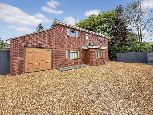 4 bedroom detached house for sale in Acacia Drive, Westbury, BA13 — £475,000 • 4 bed • 2 bath • 1719 ft²
 4 bedroom detached house for sale in Whitehorse Way, Westbury, BA13 — £385,000 • 4 bed • 2 bath • 1500 ft²
 5 bedroom detached house for sale in Wedmore Drive, Westbury, BA13 — £525,000 • 5 bed • 4 bath • 2000 ft²
 4 bedroom town house for sale in Uffington Place, Westbury, BA13 — £325,000 • 4 bed • 2 bath • 1123 ft²
Meta
- {
"@context": "https://schema.org",
"@type": "Residence",
"name": "4 bedroom detached house for sale in Sunnybank Road, Westbu…",
"description": "",
"url": "https://propertypiper.co.uk/property/551af1d0-232c-4458-99fd-fdae8587f06d",
"image": "https://image-a.propertypiper.co.uk/84ca16ef-e53a-4114-9beb-955714f21db4-1024.jpeg",
"address": {
"@type": "PostalAddress",
"streetAddress": "9, Sunnybank Road, WESTBURY",
"postalCode": "BA13 3EA",
"addressLocality": "Wiltshire",
"addressRegion": "South West Wiltshire",
"addressCountry": "England"
},
"geo": {
"@type": "GeoCoordinates",
"latitude": 51.268192889635884,
"longitude": -2.180338256087606
},
"numberOfRooms": 4,
"numberOfBathroomsTotal": 2,
"floorSize": {
"@type": "QuantitativeValue",
"value": 1380,
"unitCode": "FTK"
},
"offers": {
"@type": "Offer",
"price": 375000,
"priceCurrency": "GBP",
"availability": "https://schema.org/InStock"
},
"additionalProperty": [
{
"@type": "PropertyValue",
"name": "Feature",
"value": "modern"
},
{
"@type": "PropertyValue",
"name": "Feature",
"value": "detached"
},
{
"@type": "PropertyValue",
"name": "Feature",
"value": "family home"
},
{
"@type": "PropertyValue",
"name": "Feature",
"value": "garage"
},
{
"@type": "PropertyValue",
"name": "Feature",
"value": "driveway"
},
{
"@type": "PropertyValue",
"name": "Feature",
"value": "low maintenance"
},
{
"@type": "PropertyValue",
"name": "Feature",
"value": "two-story"
},
{
"@type": "PropertyValue",
"name": "Feature",
"value": "brick exterior"
},
{
"@type": "PropertyValue",
"name": "Feature",
"value": "contemporary style"
},
{
"@type": "PropertyValue",
"name": "Feature",
"value": "modern"
},
{
"@type": "PropertyValue",
"name": "Feature",
"value": "living room"
},
{
"@type": "PropertyValue",
"name": "Feature",
"value": "bay window"
},
{
"@type": "PropertyValue",
"name": "Feature",
"value": "neutral decor"
},
{
"@type": "PropertyValue",
"name": "Feature",
"value": "white shutters"
},
{
"@type": "PropertyValue",
"name": "Feature",
"value": "light room"
}
]
}
High Res Floorplan Images
Compatible Floorplan Images
FloorplanImages Thumbnail