PO30 2EP - 3 bedroom detached bungalow for sale in Fairlee Road, Newpo…
View on Property Piper
3 bedroom detached bungalow for sale in Fairlee Road, Newport, PO30
Property Details
- Price: £425000
- Bedrooms: 3
- Bathrooms: 1
- Property Type: undefined
- Property SubType: undefined
Brochure Descriptions
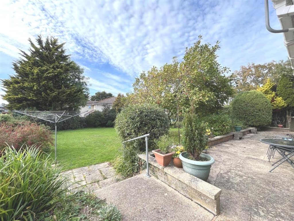
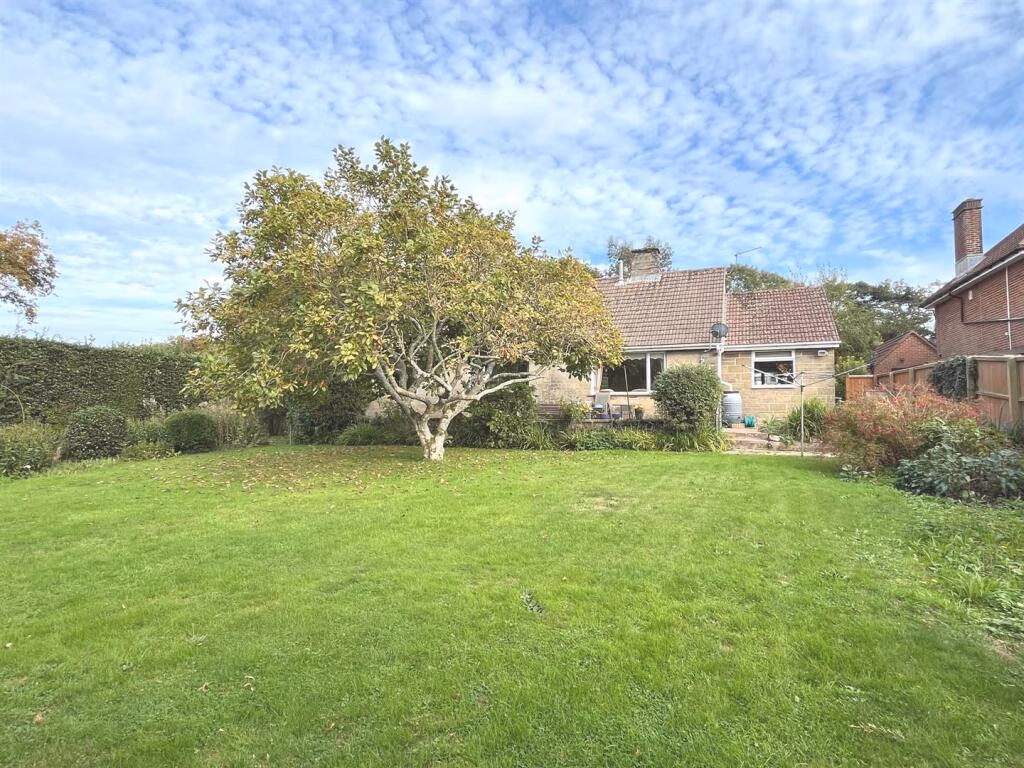
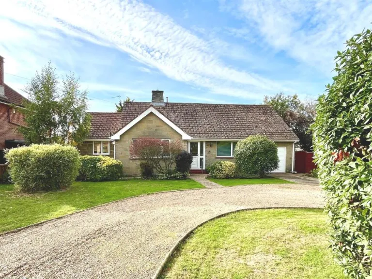
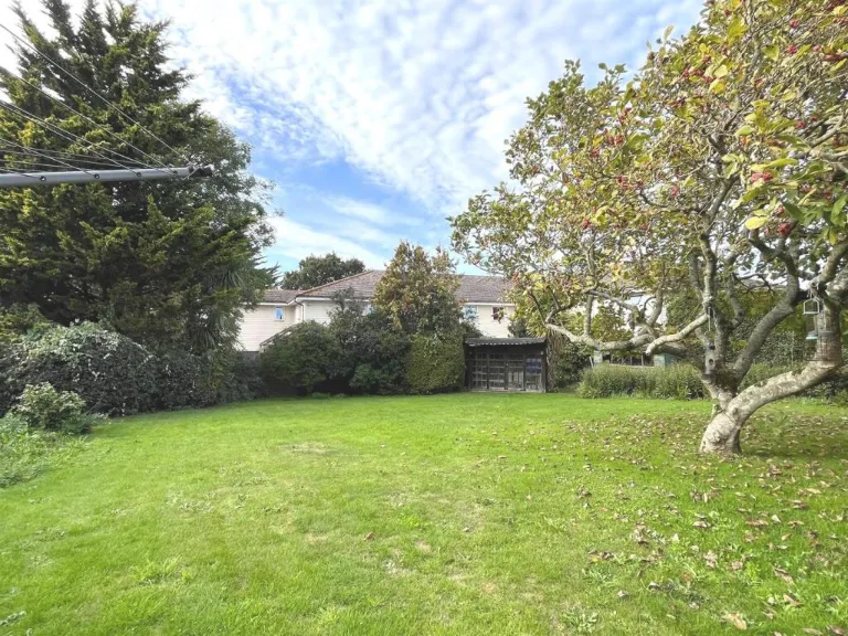
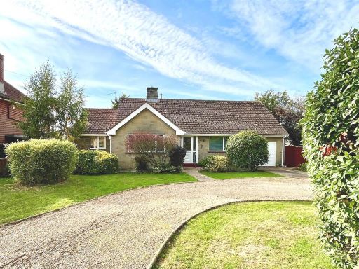
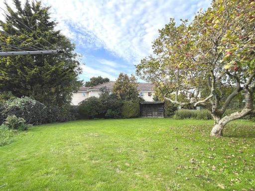
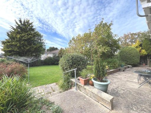
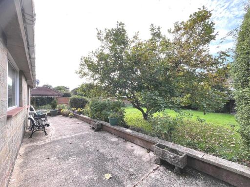
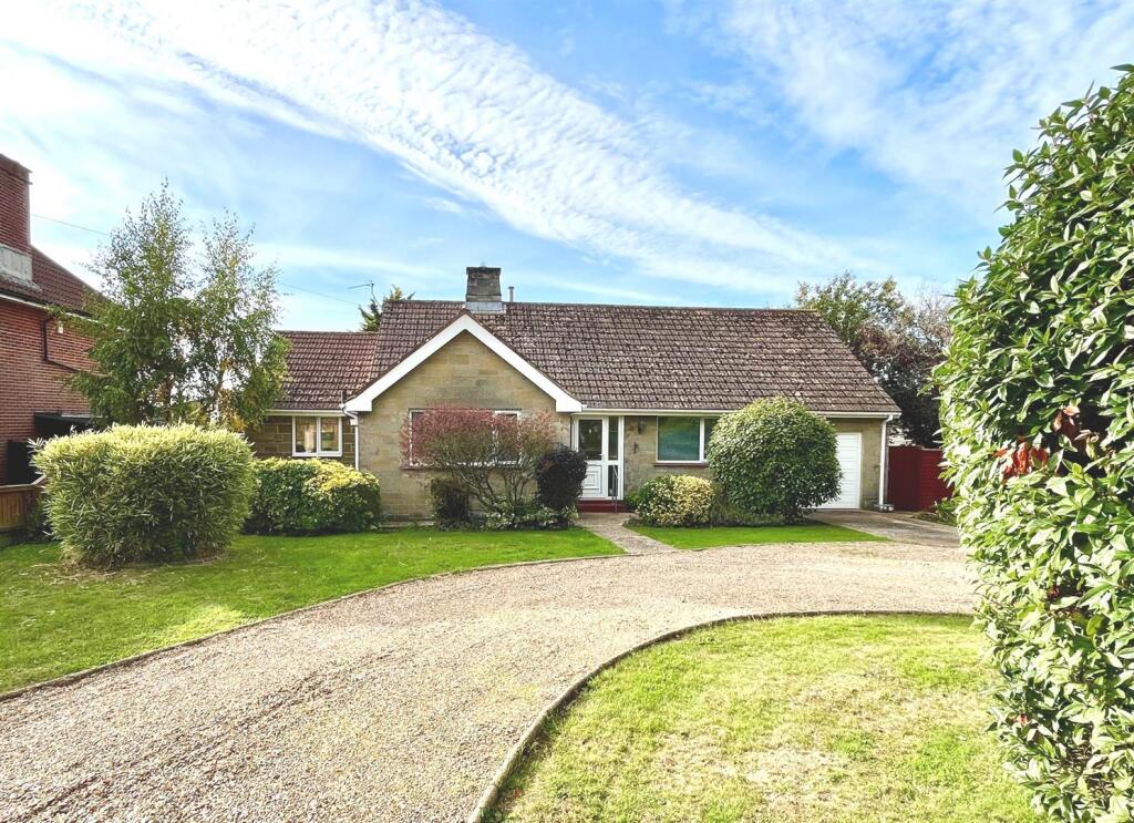
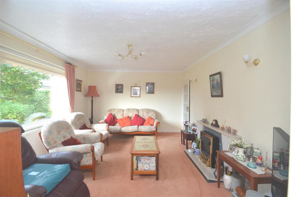
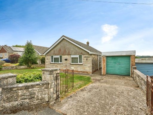
- Detached single-storey bungalow set back from the road with a large curved gravel driveway and integral single garage. The property benefits from a broad frontage with mature shrubs, hedging and lawned gardens providing good privacy and kerb appeal. Exterior appears to be stone/brick with a pitched tiled roof. The plot offers generous off-street parking for multiple vehicles and a medium-to-large private garden area (front garden pictured). The property is presented in a traditional style and would likely benefit from some modernisation internally — offering scope to add value. Overall impression: a well-situated, spacious bungalow on a sizable plot in Newport, Isle of Wight, suitable for buyers seeking single-level accommodation with ample outside space.
Image Descriptions
- single-family home Mid-20th Century
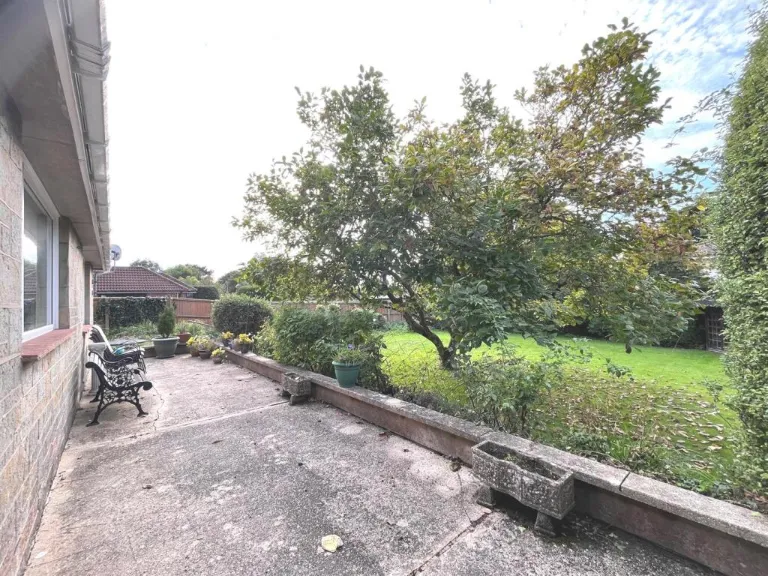
- backyard
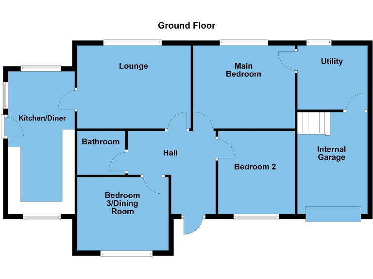
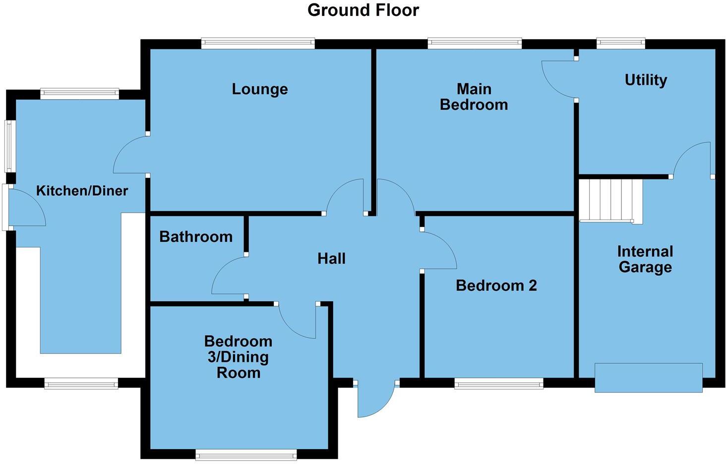
Rooms
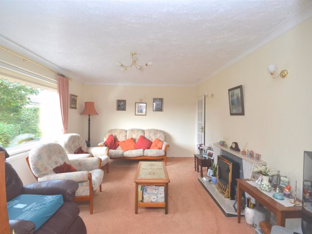
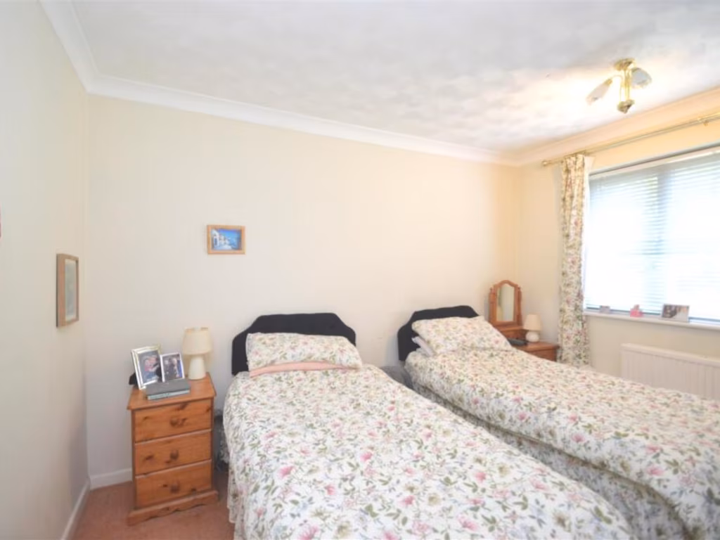
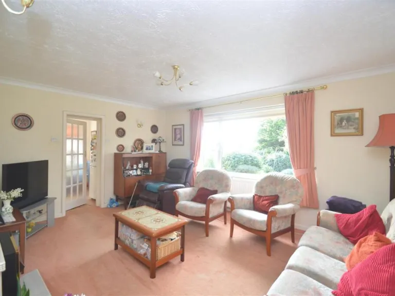
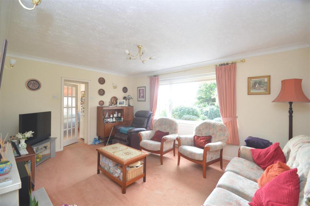
- Lounge:
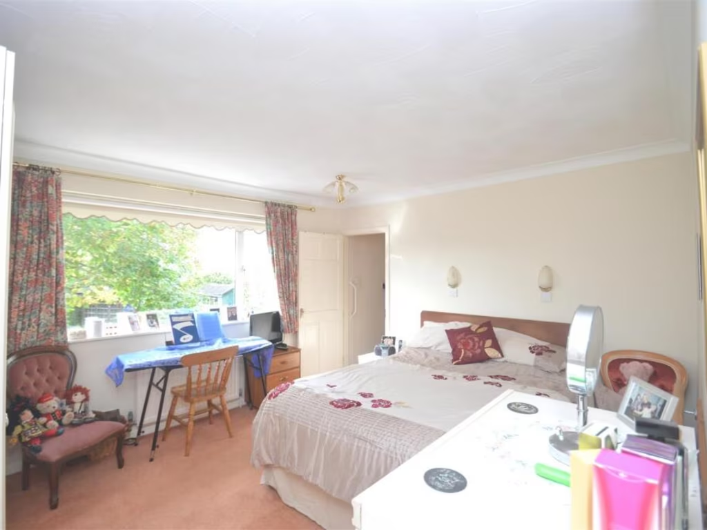
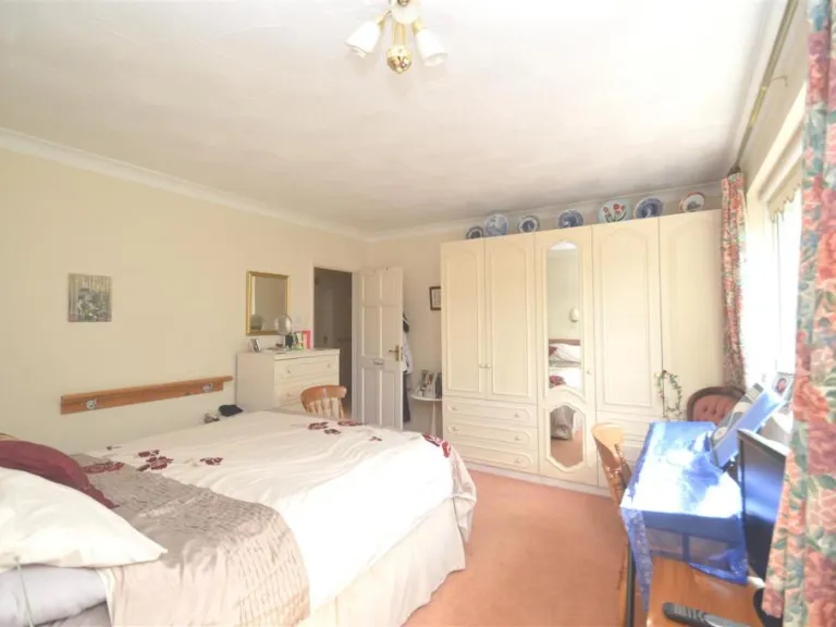
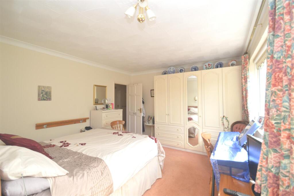
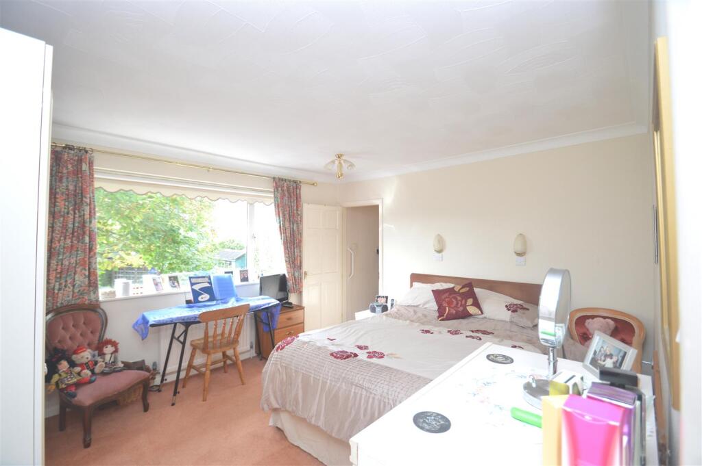
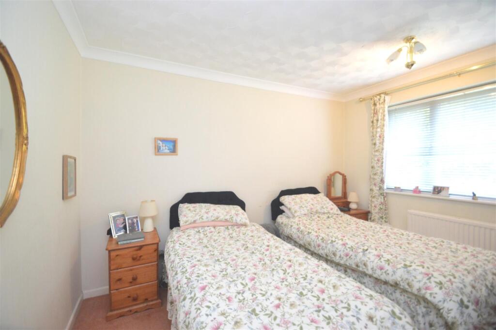
- Main Bedroom:
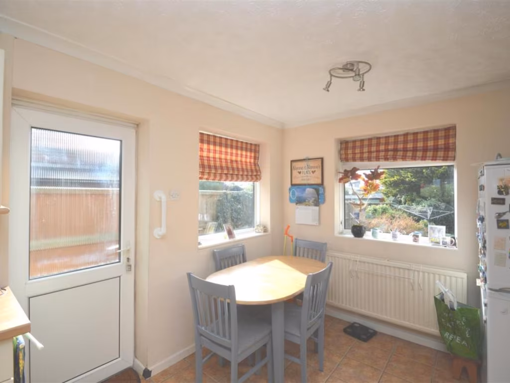
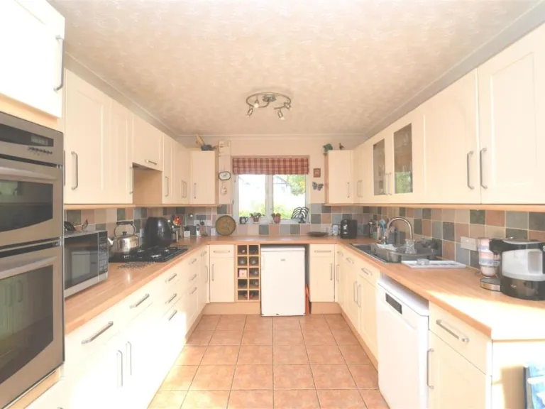
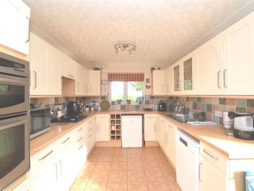
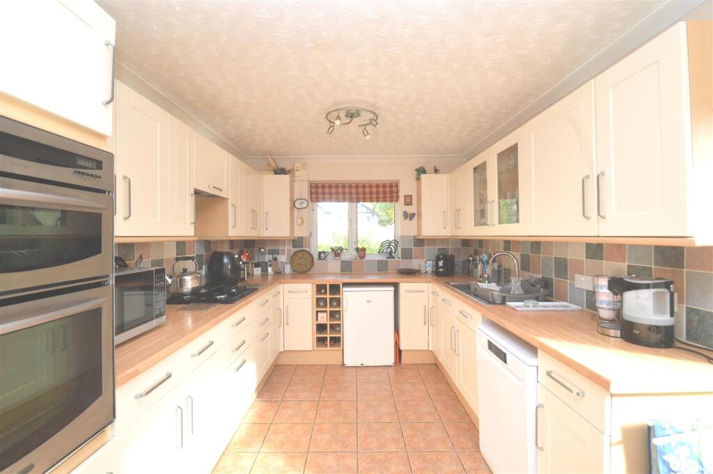
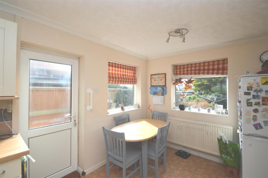
- Kitchen/Diner:
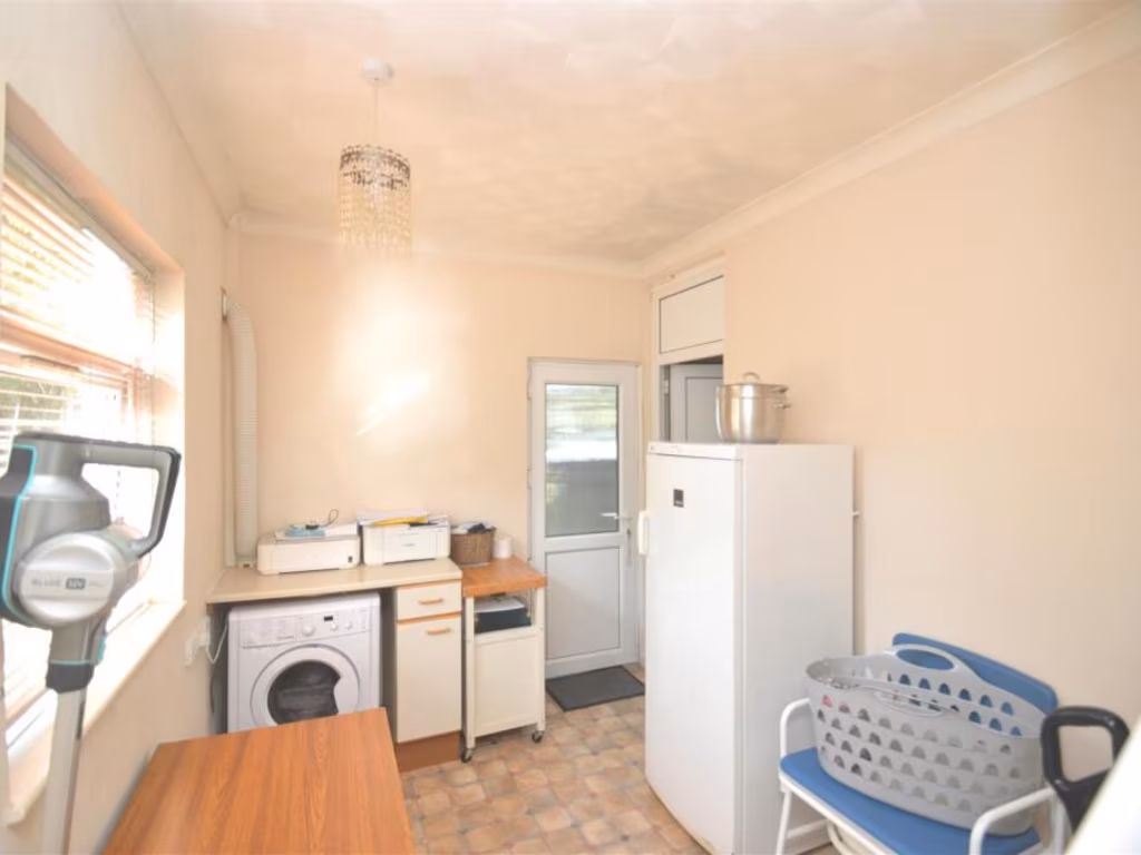
- Utility:
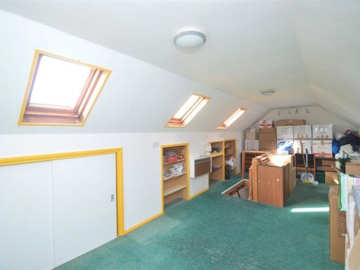
- Internal Garage:
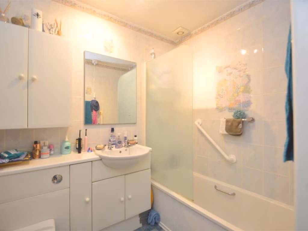
- Bathroom:
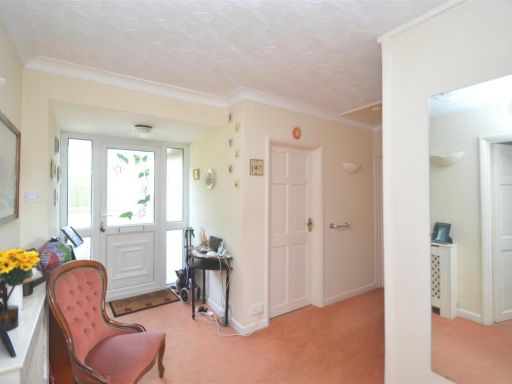
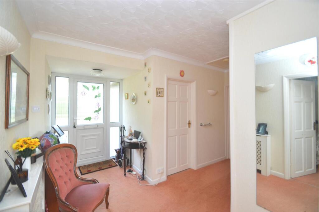
- Hall:
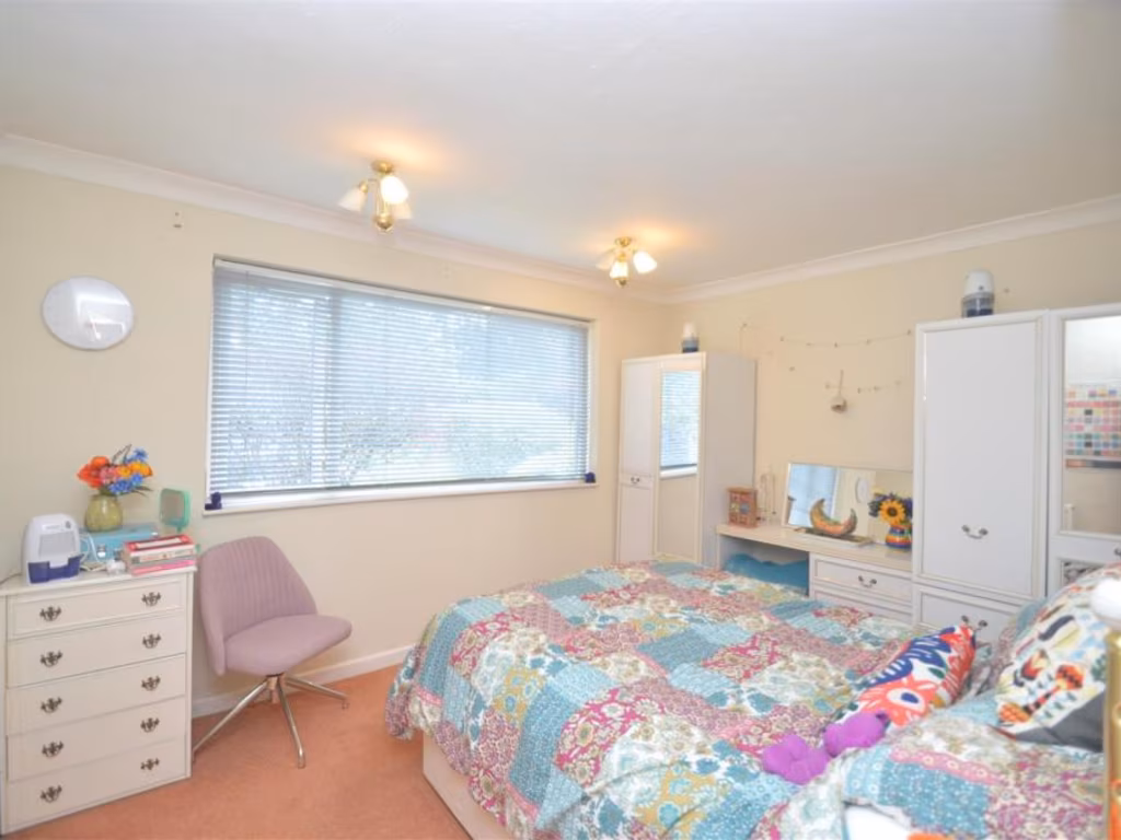
- Bedroom 2:
- Bedroom 3/Dining Room:
Textual Property Features
- Has Garden
- Chain Free
- Success
Detected Visual Features
- detached house
- bungalow
- single-story
- front garden
- sloped roof
- suburban
- driveway
- chimney
- garage potential
- garden
- spacious
- tree
- grass
- fence
- outdoor space
EPC Details
- Fully double glazed
- Cavity wall, filled cavity
- Boiler and radiators, mains gas
- Low energy lighting in 50% of fixed outlets
- Suspended, no insulation (assumed)
Nearby Schools
- Christ The King College
- Barton Primary School
- Queensgate Foundation Primary
- Cowes Primary School
- Cowes Enterprise College, An Ormiston Academy
- Arreton St George's Church of England (Aided) Primary School
- St Thomas of Canterbury Catholic Primary School
- Carisbrooke Church of England Controlled Primary School
- Hunnyhill Primary School
- Ryde School with Upper Chine
- Northwood Primary School
- Priory School
- Lanesend Primary School
- Gurnard Primary School
- Holy Cross Catholic Primary School
- Summerfields Primary School
- Haylands Primary School
- Ryde Academy
- Binstead Primary School
- Newchurch Primary School
- Nine Acres Primary School
- Newport Church of England Aided Primary School
- Wootton Community Primary School
- Greenmount Primary School
Nearest General Shops
- Id: 6121838572
- Tags:
- Addr:
- City: Newport
- Country: GB
- Housename: Newport Business Park
- Postcode: PO30 5GY
- Street: Barry Way
- Unit: 9,10
- Contact:
- Email: newport@woodsiw.co.uk
- Facebook: https://www.facebook.com/woodstradesupplies
- Fax: +44 1983 526322
- Phone: +44 1983 526314
- Twitter: woodsiw
- Website: http://www.woodstradesupplies.co.uk/
- Name: Woods Trade Supplies
- Opening_hours: Mo-Fr 07:30-17:00; Sa 08:00-12:00
- Shop: trade
- Trade: plumbing
- TagsNormalized:
- Lat: 50.7116781
- Lon: -1.2932228
- FullGeoHash: gcp06xf2ctzp
- PartitionGeoHash: gcp0
- Images:
- FoodStandards: null
- Distance: 890.2
,- Id: 9677031467
- Tags:
- Addr:
- City: Newport
- Country: GB
- Housenumber: 8
- Postcode: PO30 5GY
- Street: Barry Way
- Fhrs:
- Name: Starlight Academy
- Shop: yes
- TagsNormalized:
- Lat: 50.7118276
- Lon: -1.2931573
- FullGeoHash: gcp06xf3g3b4
- PartitionGeoHash: gcp0
- Images:
- FoodStandards:
- Id: 1419812
- FHRSID: 1419812
- LocalAuthorityBusinessID: 21/00261/CP
- BusinessName: Starlight Academy
- BusinessType: Retailers - other
- BusinessTypeID: 4613
- AddressLine1: 8 Barry Way
- AddressLine2: Newport
- AddressLine3: Isle Of Wight
- AddressLine4: null
- PostCode: PO30 5GY
- RatingValue: AwaitingInspection
- RatingKey: fhrs_awaitinginspection_en-GB
- RatingDate: null
- LocalAuthorityCode: 867
- LocalAuthorityName: Isle of Wight
- LocalAuthorityWebSite: http://www.iwight.com/eh
- LocalAuthorityEmailAddress: eh@iow.gov.uk
- Scores:
- Hygiene: null
- Structural: null
- ConfidenceInManagement: null
- NewRatingPending: false
- Geocode:
- Longitude: null
- Latitude: null
- Distance: 885.5
,- Id: 82461292
- Tags:
- Addr:
- City: Newport
- Country: GB
- Postcode: PO30 2EJ
- Street: Fairlee Road
- Building: yes
- Car:
- Fhrs:
- Name: Fairlee Service Station
- Second_hand: only
- Shop: car_repair
- Source:
- TagsNormalized:
- Lat: 50.7054414
- Lon: -1.2869883
- FullGeoHash: gcp06wwudgrg
- PartitionGeoHash: gcp0
- Images:
- FoodStandards: null
- Distance: 835.8
}
Nearest Grocery shops
- Id: 2388468336
- Tags:
- TagsNormalized:
- Lat: 50.7242162
- Lon: -1.2777506
- FullGeoHash: gcp0dfj9fr0p
- PartitionGeoHash: gcp0
- Images:
- FoodStandards: null
- Distance: 1398.3
,- Id: 281305750
- Tags:
- Addr:
- City: Newport
- Country: GB
- Housename: Wakes Retail Park
- Postcode: PO30 5UZ
- Street: River Way
- Unit: B
- Brand: The Food Warehouse
- Brand:wikidata: Q87263899
- Building: retail
- Check_date:
- Opening_hours: 2022-08-24
- Fhrs:
- Name: The Food Warehouse
- Opening_hours: Mo-Sa 08:00-20:00; Su 10:00-16:00
- Shop: supermarket
- Survey:
- Website: https://www.thefoodwarehouse.com/store-locator/newport-isle-of-wight
- TagsNormalized:
- food
- the food warehouse
- warehouse
- retail
- shop
- Lat: 50.7040021
- Lon: -1.2930217
- FullGeoHash: gcp06w6knrj1
- PartitionGeoHash: gcp0
- Images:
- FoodStandards:
- Id: 1320046
- FHRSID: 1320046
- LocalAuthorityBusinessID: 20/00251/CP
- BusinessName: Food Warehouse
- BusinessType: Retailers - other
- BusinessTypeID: 4613
- AddressLine1: Unit B
- AddressLine2: Riverway
- AddressLine3: Newport
- AddressLine4: Isle Of Wight
- PostCode: PO30 5UZ
- RatingValue: 4
- RatingKey: fhrs_4_en-GB
- RatingDate: 2021-06-23
- LocalAuthorityCode: 867
- LocalAuthorityName: Isle of Wight
- LocalAuthorityWebSite: http://www.iwight.com/eh
- LocalAuthorityEmailAddress: eh@iow.gov.uk
- Scores:
- Hygiene: 10
- Structural: 0
- ConfidenceInManagement: 0
- NewRatingPending: false
- Geocode:
- Longitude: -1.29310595989227
- Latitude: 50.70394134521480
- Distance: 1230.2
,- Id: 9133259103
- Tags:
- Addr:
- City: Newport
- Country: GB
- Postcode: PO30 2EJ
- Street: Fairlee Road
- Brand: Mace
- Brand:wikidata: Q75240338
- Name: Mace
- Operator: Fairlee Service Station
- Shop: convenience
- TagsNormalized:
- Lat: 50.7052436
- Lon: -1.2870701
- FullGeoHash: gcp06wwg3n6z
- PartitionGeoHash: gcp0
- Images:
- FoodStandards: null
- Distance: 857.5
}
Nearest Airports
- Id: 100647893
- Tags:
- Aerodrome: international
- Aerodrome:type: public
- Aeroway: aerodrome
- Contact:
- Vhf:
- Approach: 120.225 MHz
- Tower: 118.2 MHz
- Ele: 44ft
- Iata: SOU
- Icao: EGHI
- Is_in: Hampshire, England,UK
- Name: Southampton Airport
- Operator: Southampton International Airport Limited
- Source: Bing;Gagravarr_Airports
- Wikidata: Q8988
- Wikipedia: en:Southampton Airport
- TagsNormalized:
- airport
- international airport
- Lat: 50.9513872
- Lon: -1.3516684
- FullGeoHash: gcp1c5rtrffz
- PartitionGeoHash: gcp1
- Images:
- FoodStandards: null
- Distance: 27108
}
Nearest Leisure Facilities
- Id: 503740403
- Tags:
- TagsNormalized:
- Lat: 50.7144191
- Lon: -1.2787937
- FullGeoHash: gcp0dbkbcuym
- PartitionGeoHash: gcp0
- Images:
- FoodStandards: null
- Distance: 320.4
,- Id: 317742130
- Tags:
- Leisure: pitch
- Sport: tennis
- TagsNormalized:
- Lat: 50.7122427
- Lon: -1.2848366
- FullGeoHash: gcp06zbkjphq
- PartitionGeoHash: gcp0
- Images:
- FoodStandards: null
- Distance: 304.2
,- Id: 1311897058
- Tags:
- Addr:
- City: Newport
- Country: GB
- Postcode: PO30 2DX
- Street: Fairlee Road
- Fhrs:
- Leisure: sports_centre
- Name: Medina Leisure Centre
- TagsNormalized:
- sports
- sports centre
- leisure
- Lat: 50.7111073
- Lon: -1.2843208
- FullGeoHash: gcp06z8v95t4
- PartitionGeoHash: gcp0
- Images:
- FoodStandards:
- Id: 542191
- FHRSID: 542191
- LocalAuthorityBusinessID: 890
- BusinessName: Medina Leisure Centre
- BusinessType: Restaurant/Cafe/Canteen
- BusinessTypeID: 1
- AddressLine1: Medina College
- AddressLine2: Fairlee Road
- AddressLine3: Newport
- AddressLine4: Isle Of Wight
- PostCode: PO30 2DX
- RatingValue: 5
- RatingKey: fhrs_5_en-GB
- RatingDate: 2018-11-21
- LocalAuthorityCode: 867
- LocalAuthorityName: Isle of Wight
- LocalAuthorityWebSite: http://www.iwight.com/eh
- LocalAuthorityEmailAddress: eh@iow.gov.uk
- Scores:
- Hygiene: 0
- Structural: 0
- ConfidenceInManagement: 0
- NewRatingPending: false
- Geocode:
- Longitude: -1.28256297111511
- Latitude: 50.71158218383790
- Distance: 273.4
,- Id: 510020788
- Tags:
- TagsNormalized:
- Lat: 50.7115851
- Lon: -1.2780504
- FullGeoHash: gcp06zv27k8s
- PartitionGeoHash: gcp0
- Images:
- FoodStandards: null
- Distance: 179.4
,- Id: 317742141
- Tags:
- Leisure: pitch
- Sport: basketball
- TagsNormalized:
- pitch
- leisure
- basketball
- sports
- Lat: 50.712105
- Lon: -1.2822726
- FullGeoHash: gcp06zf72vs1
- PartitionGeoHash: gcp0
- Images:
- FoodStandards: null
- Distance: 124.8
}
Nearest Tourist attractions
- Id: 475137518
- Tags:
- Addr:
- City: Newport
- Country: GB
- Housename: Bank Cottage
- Postcode: PO30 5TD
- Street: Dodnor Lane
- Building: detached
- Fhrs:
- Guest_house: bed_and_breakfast
- Name: Bank Cottage B&B
- Tourism: guest_house
- TagsNormalized:
- detached
- bank
- guest house
- tourism
- Lat: 50.7153632
- Lon: -1.2954234
- FullGeoHash: gcp0d82wqkym
- PartitionGeoHash: gcp0
- Images:
- FoodStandards:
- Id: 758590
- FHRSID: 758590
- LocalAuthorityBusinessID: 79530
- BusinessName: Bank Cottage B&B
- BusinessType: Hotel/bed & breakfast/guest house
- BusinessTypeID: 7842
- AddressLine1: Bank Cottage
- AddressLine2: Dodnor Lane
- AddressLine3: Newport
- AddressLine4: Isle Of Wight
- PostCode: PO30 5TD
- RatingValue: 5
- RatingKey: fhrs_5_en-GB
- RatingDate: 2018-11-30
- LocalAuthorityCode: 867
- LocalAuthorityName: Isle of Wight
- LocalAuthorityWebSite: http://www.iwight.com/eh
- LocalAuthorityEmailAddress: eh@iow.gov.uk
- Scores:
- Hygiene: 0
- Structural: 0
- ConfidenceInManagement: 5
- NewRatingPending: false
- Geocode:
- Longitude: -1.29543197154999
- Latitude: 50.71484756469730
- Distance: 1118.8
,- Id: 425314481
- Tags:
- Name: Riverside Paddock
- Tourism: caravan_site
- TagsNormalized:
- Lat: 50.7170538
- Lon: -1.2891989
- FullGeoHash: gcp0d8v0r2pd
- PartitionGeoHash: gcp0
- Images:
- FoodStandards: null
- Distance: 844.7
,- Id: 4899783317
- Tags:
- Name: Isle of Wight Festival Site (June)
- Tourism: attraction
- Website: https://isleofwightfestival.com/
- TagsNormalized:
- Lat: 50.7112618
- Lon: -1.2861877
- FullGeoHash: gcp06xxqt8kg
- PartitionGeoHash: gcp0
- Images:
- FoodStandards: null
- Distance: 398.8
}
Nearest Train stations
- Id: 2513777384
- Tags:
- Name: Ryde Esplanade
- Naptan:
- Network: National Rail
- Operator: Island Line
- Public_transport: station
- Railway: station
- Ref:
- Wheelchair: yes
- Wikidata: Q2174613
- Wikipedia: en:Ryde Esplanade railway station
- TagsNormalized:
- Lat: 50.7330485
- Lon: -1.1596319
- FullGeoHash: gcp0teet6tey
- PartitionGeoHash: gcp0
- Images:
- FoodStandards: null
- Distance: 8836.9
,- Id: 7138878
- Tags:
- Image: File:Ryde St. John's Road Railway station 1971.jpg
- Name: Ryde St John's Road
- Naptan:
- Network: National Rail
- Operator: Island Line Trains
- Public_transport: station
- Railway: station
- Ref:
- Wikidata: Q4567463
- Wikipedia: en:Ryde St John's Road railway station
- TagsNormalized:
- Lat: 50.7241835
- Lon: -1.1566159
- FullGeoHash: gcp0tdjcbchs
- PartitionGeoHash: gcp0
- Images:
- FoodStandards: null
- Distance: 8835.9
,- Id: 252733074
- Tags:
- Name: Ashey
- Naptan:
- Public_transport: station
- Railway: station
- Request_stop: yes
- Usage: tourism
- Wikidata: Q4804934
- TagsNormalized:
- Lat: 50.6964692
- Lon: -1.183063
- FullGeoHash: gcp0mj482du6
- PartitionGeoHash: gcp0
- Images:
- FoodStandards: null
- Distance: 7075.1
,- Id: 7227760
- Tags:
- Addr:
- City: Havenstreet, near Ryde
- Street: Main Road
- Name: Havenstreet
- Naptan:
- Public_transport: station
- Railway: station
- Usage: tourism
- Wikidata: Q5683726
- TagsNormalized:
- Lat: 50.7054566
- Lon: -1.2146336
- FullGeoHash: gcp0kqes8ypw
- PartitionGeoHash: gcp0
- Images:
- FoodStandards: null
- Distance: 4696.5
,- Id: 2518544702
- Tags:
- Image: File:Wootton station, Isle of Wight, UK.jpg
- Name: Wootton
- Platforms: 1
- Public_transport: station
- Railway: station
- Usage: tourism
- Wikidata: Q8034101
- TagsNormalized:
- Lat: 50.718146
- Lon: -1.2405289
- FullGeoHash: gcp0ebbwtedt
- PartitionGeoHash: gcp0
- Images:
- FoodStandards: null
- Distance: 2907.7
}
Nearest Hotels
- Id: 5117835936
- Tags:
- Addr:
- City: Newport
- Country: GB
- Housenumber: 27
- Postcode: PO30 5BA
- Street: Quay Street
- Fhrs:
- Name: Calverts Hotel
- Source:
- Survey:
- Tourism: hotel
- Wikidata: Q26286055
- TagsNormalized:
- Lat: 50.7005575
- Lon: -1.2933565
- FullGeoHash: gcp06tf0nsgq
- PartitionGeoHash: gcp0
- Images:
- FoodStandards: null
- Distance: 1537.4
,- Id: 7146505922
- Tags:
- Addr:
- City: Newport
- Country: GB
- Housenumber: 41
- Postcode: PO30 5BA
- Street: Quay Street
- Contact:
- Fhrs:
- Guest_house: bed_and_breakfast
- Name: Newport Quary Hotel
- Source:
- Survey:
- Tourism: guest_house
- TagsNormalized:
- Lat: 50.7010685
- Lon: -1.2925291
- FullGeoHash: gcp06tfg1uhq
- PartitionGeoHash: gcp0
- Images:
- FoodStandards: null
- Distance: 1457.3
,- Id: 82461324
- Tags:
- Brand: Premier Inn
- Brand:wikidata: Q2108626
- Brand:wikipedia: en:Premier Inn
- Building: hotel
- Contact:
- Website: https://www.premierinn.com/gb/en/hotels/england/isle-of-wight/newport/isle-of-wight-newport.html
- Internet_access: wlan
- Internet_access:fee: customers
- Internet_access:operator: Virgin Media
- Internet_access:ssid: Premier Inn Free Wi-Fi
- Name: Premier Inn
- Source: Bing Imagery
- Swimming_pool: no
- Tourism: hotel
- TagsNormalized:
- Lat: 50.7065025
- Lon: -1.2909286
- FullGeoHash: gcp06wgfz1jv
- PartitionGeoHash: gcp0
- Images:
- FoodStandards: null
- Distance: 934.8
}
Tags
- detached house
- bungalow
- single-story
- front garden
- sloped roof
- suburban
- driveway
- chimney
- garage potential
- garden
- spacious
- tree
- grass
- fence
- outdoor space
Local Market Stats
- Average Price/sqft: £260
- Avg Income: £37500
- Rental Yield: 4.8%
- Social Housing: 5%
- Planning Success Rate: 79%
Similar Properties
 3 bedroom bungalow for sale in Long Lane, Newport, Isle of Wight, PO30 — £335,000 • 3 bed • 1 bath • 1017 ft²
 3 bedroom bungalow for sale in Staplers Road, Newport, Isle Of Wight, PO30 — £475,000 • 3 bed • 1 bath • 1785 ft²
 2 bedroom bungalow for sale in Fieldfare Road, Newport, Isle of Wight, PO30 — £310,000 • 2 bed • 1 bath • 949 ft²
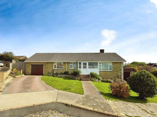 3 bedroom detached house for sale in Buckbury Close, Newport, PO30 2NN, PO30 — £370,000 • 3 bed • 1 bath • 1690 ft²
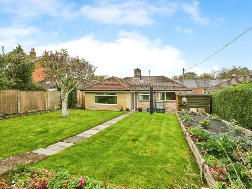 2 bedroom bungalow for sale in Carisbrooke Road, Newport, Isle of Wight, PO30 — £280,000 • 2 bed • 1 bath • 1202 ft²
 2 bedroom semi-detached bungalow for sale in Mountbatten Drive, Newport, Isle of Wight, PO30 — £290,000 • 2 bed • 1 bath • 664 ft²
Meta
- {
"@context": "https://schema.org",
"@type": "Residence",
"name": "3 bedroom detached bungalow for sale in Fairlee Road, Newpo…",
"description": "",
"url": "https://propertypiper.co.uk/property/944fc377-a1c4-4f7c-9435-7720ab0c4ae2",
"image": "https://image-a.propertypiper.co.uk/3522489b-67a1-43ac-94b7-d4f34ac52994-1024.jpeg",
"address": {
"@type": "PostalAddress",
"streetAddress": "187 FAIRLEE ROAD NEWPORT",
"postalCode": "PO30 2EP",
"addressLocality": "Isle of Wight",
"addressRegion": "Isle of Wight",
"addressCountry": "England"
},
"geo": {
"@type": "GeoCoordinates",
"latitude": 50.71176897659152,
"longitude": -1.2805809760586355
},
"numberOfRooms": 3,
"numberOfBathroomsTotal": 1,
"floorSize": {
"@type": "QuantitativeValue",
"value": 1066,
"unitCode": "FTK"
},
"offers": {
"@type": "Offer",
"price": 425000,
"priceCurrency": "GBP",
"availability": "https://schema.org/InStock"
},
"additionalProperty": [
{
"@type": "PropertyValue",
"name": "Feature",
"value": "detached house"
},
{
"@type": "PropertyValue",
"name": "Feature",
"value": "bungalow"
},
{
"@type": "PropertyValue",
"name": "Feature",
"value": "single-story"
},
{
"@type": "PropertyValue",
"name": "Feature",
"value": "front garden"
},
{
"@type": "PropertyValue",
"name": "Feature",
"value": "sloped roof"
},
{
"@type": "PropertyValue",
"name": "Feature",
"value": "suburban"
},
{
"@type": "PropertyValue",
"name": "Feature",
"value": "driveway"
},
{
"@type": "PropertyValue",
"name": "Feature",
"value": "chimney"
},
{
"@type": "PropertyValue",
"name": "Feature",
"value": "garage potential"
},
{
"@type": "PropertyValue",
"name": "Feature",
"value": "garden"
},
{
"@type": "PropertyValue",
"name": "Feature",
"value": "spacious"
},
{
"@type": "PropertyValue",
"name": "Feature",
"value": "tree"
},
{
"@type": "PropertyValue",
"name": "Feature",
"value": "grass"
},
{
"@type": "PropertyValue",
"name": "Feature",
"value": "fence"
},
{
"@type": "PropertyValue",
"name": "Feature",
"value": "outdoor space"
}
]
}
High Res Floorplan Images
Compatible Floorplan Images
FloorplanImages Thumbnail