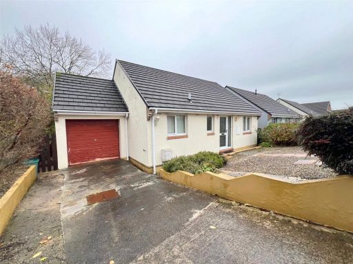
SA61 2SP - 2 bedroom bungalow for sale in Castle High, HAVERFORDWEST,…
View on Property Piper
2 bedroom bungalow for sale in Castle High, HAVERFORDWEST, Dyfed, SA61
Property Details
- Price: £190000
- Bedrooms: 2
- Bathrooms: 1
- Property Type: undefined
- Property SubType: undefined
Image Descriptions
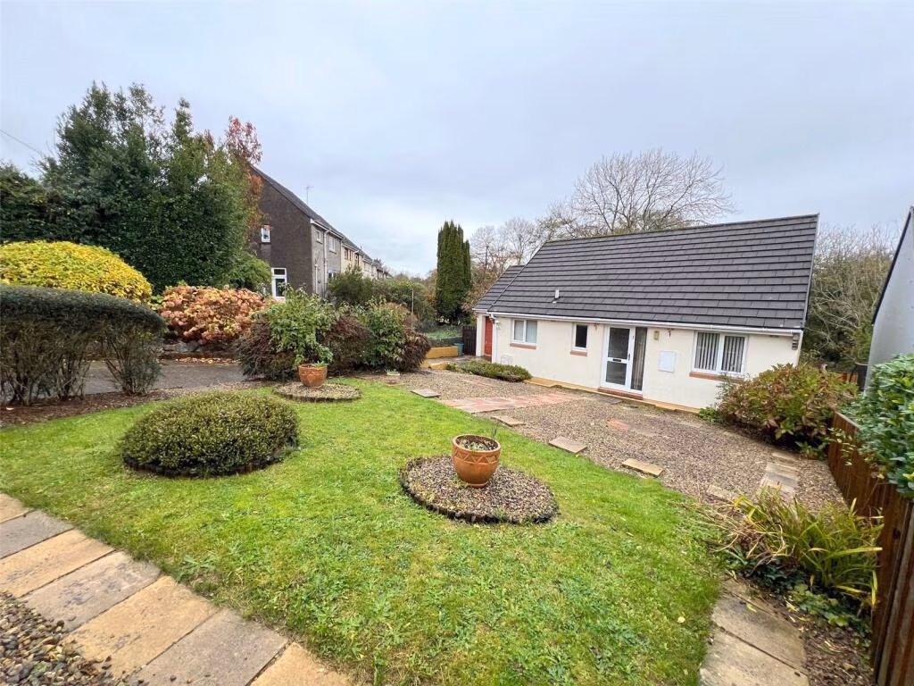
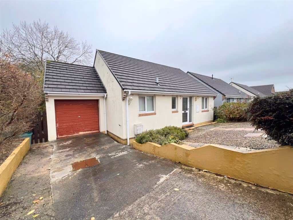
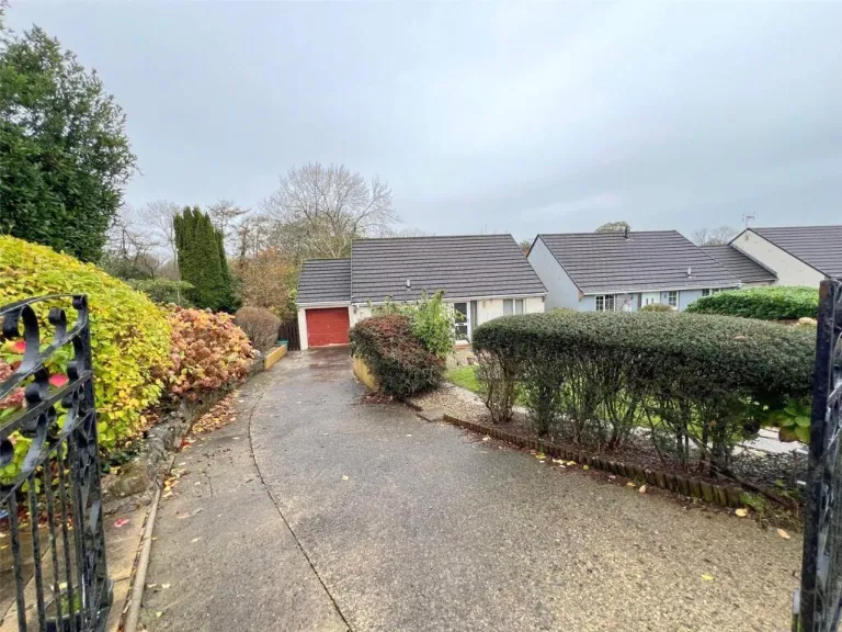
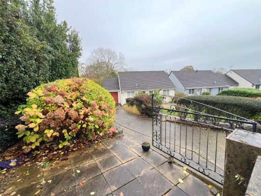
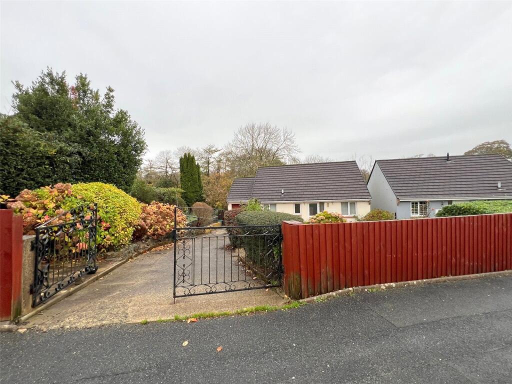
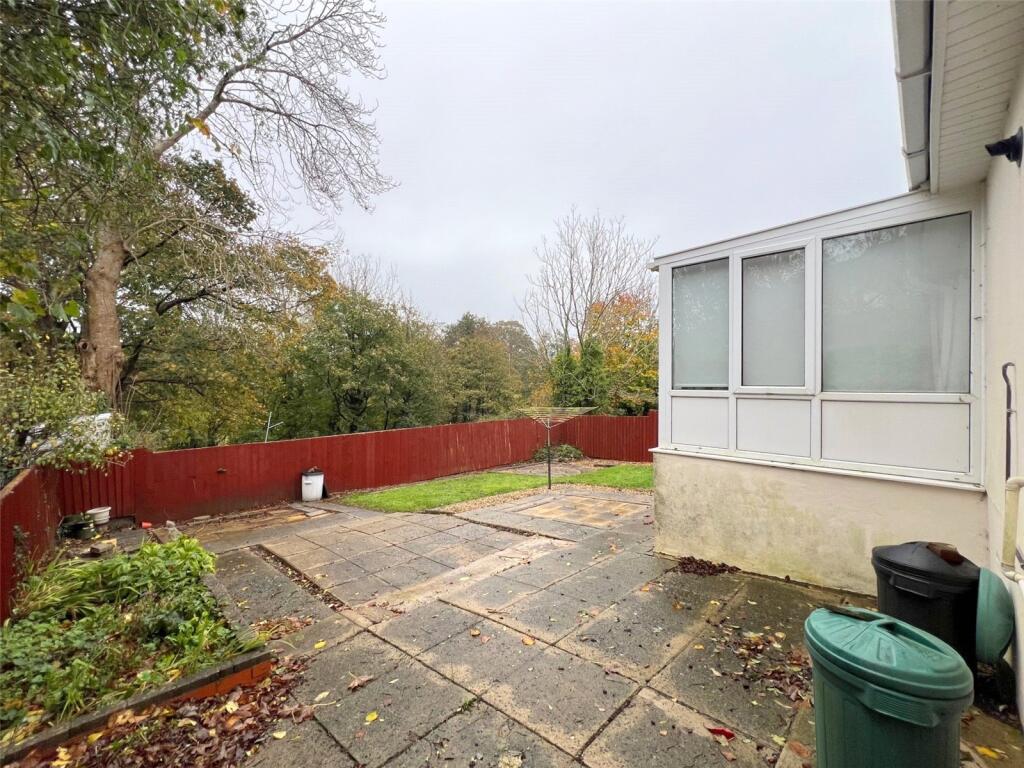
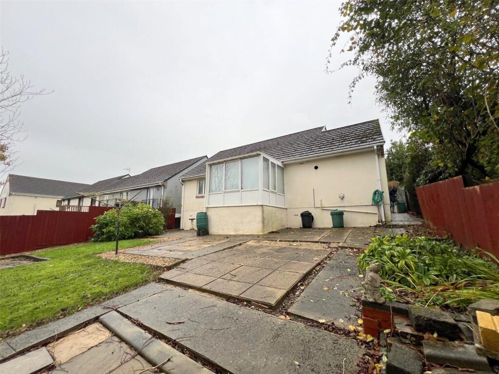
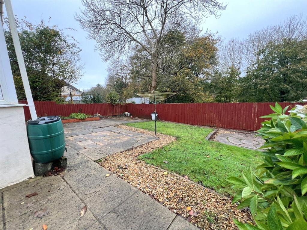
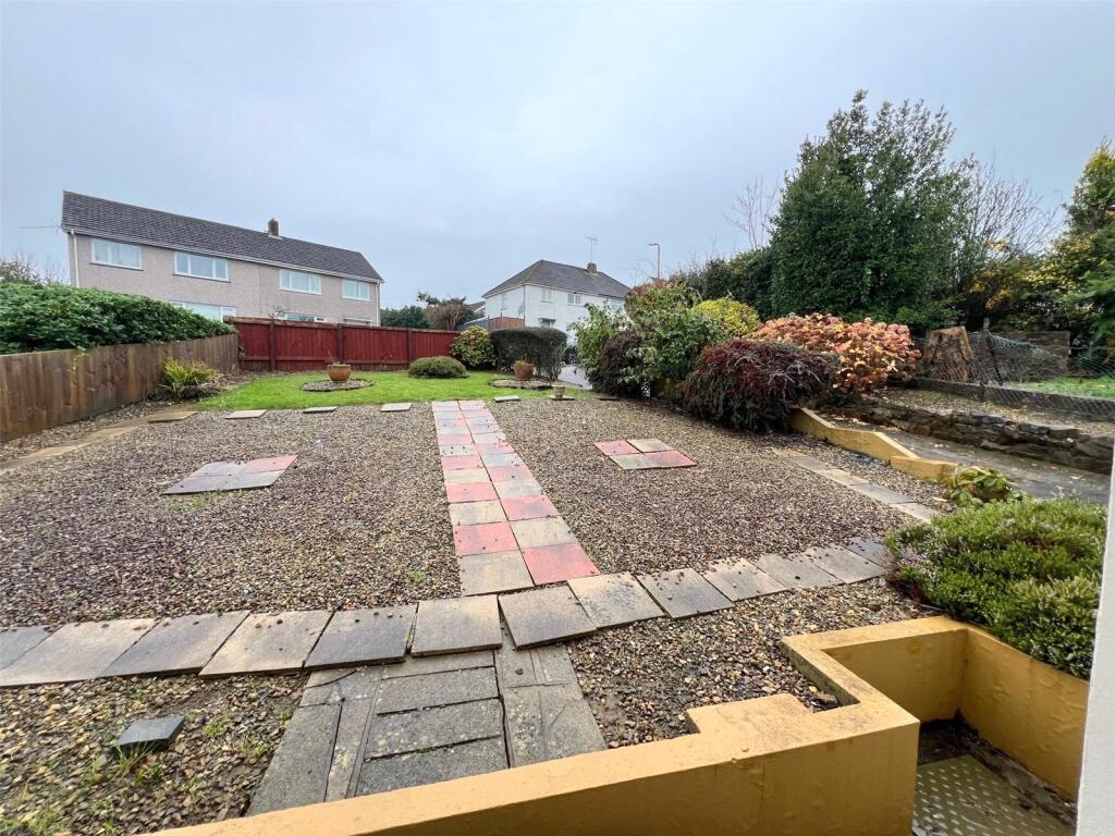
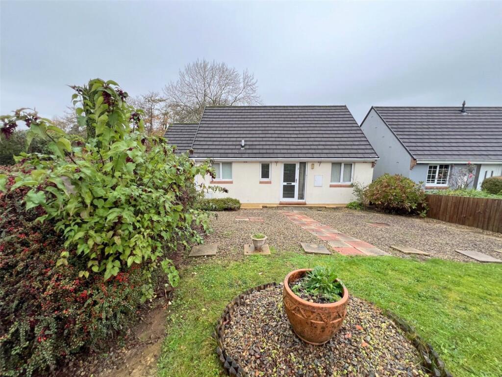
- bungalow modern
- bungalow Contemporary Bungalow
Floorplan Description
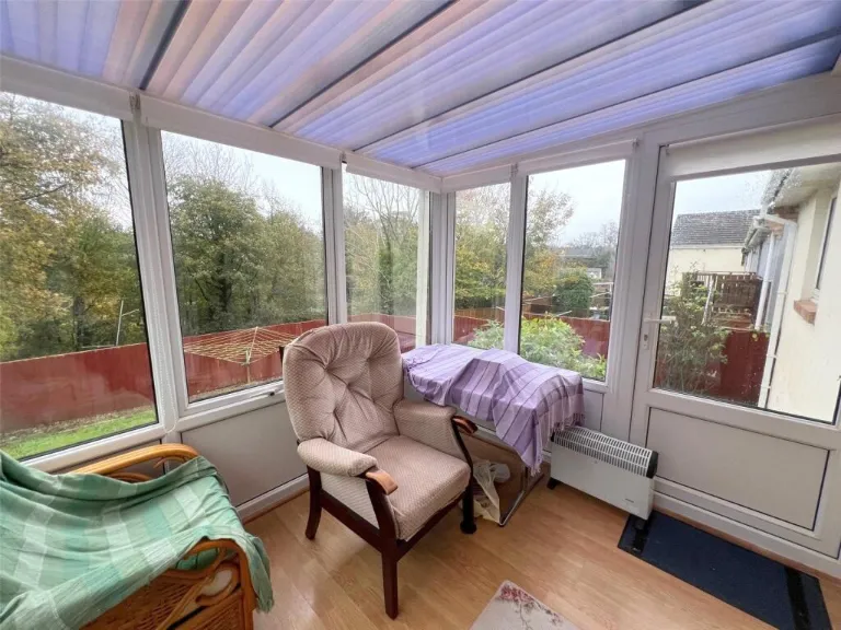
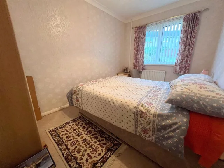
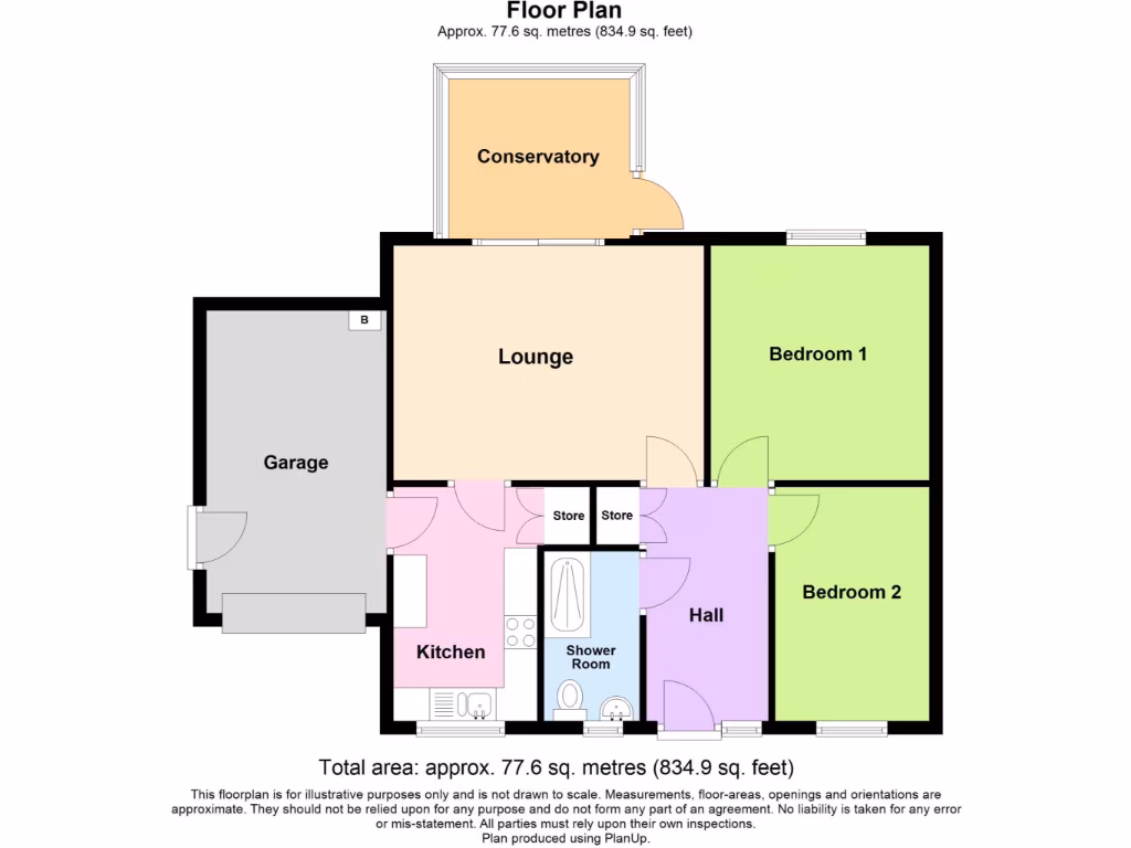
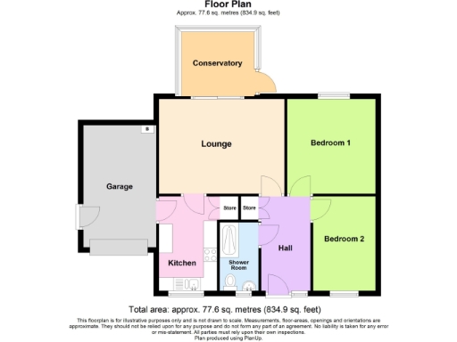
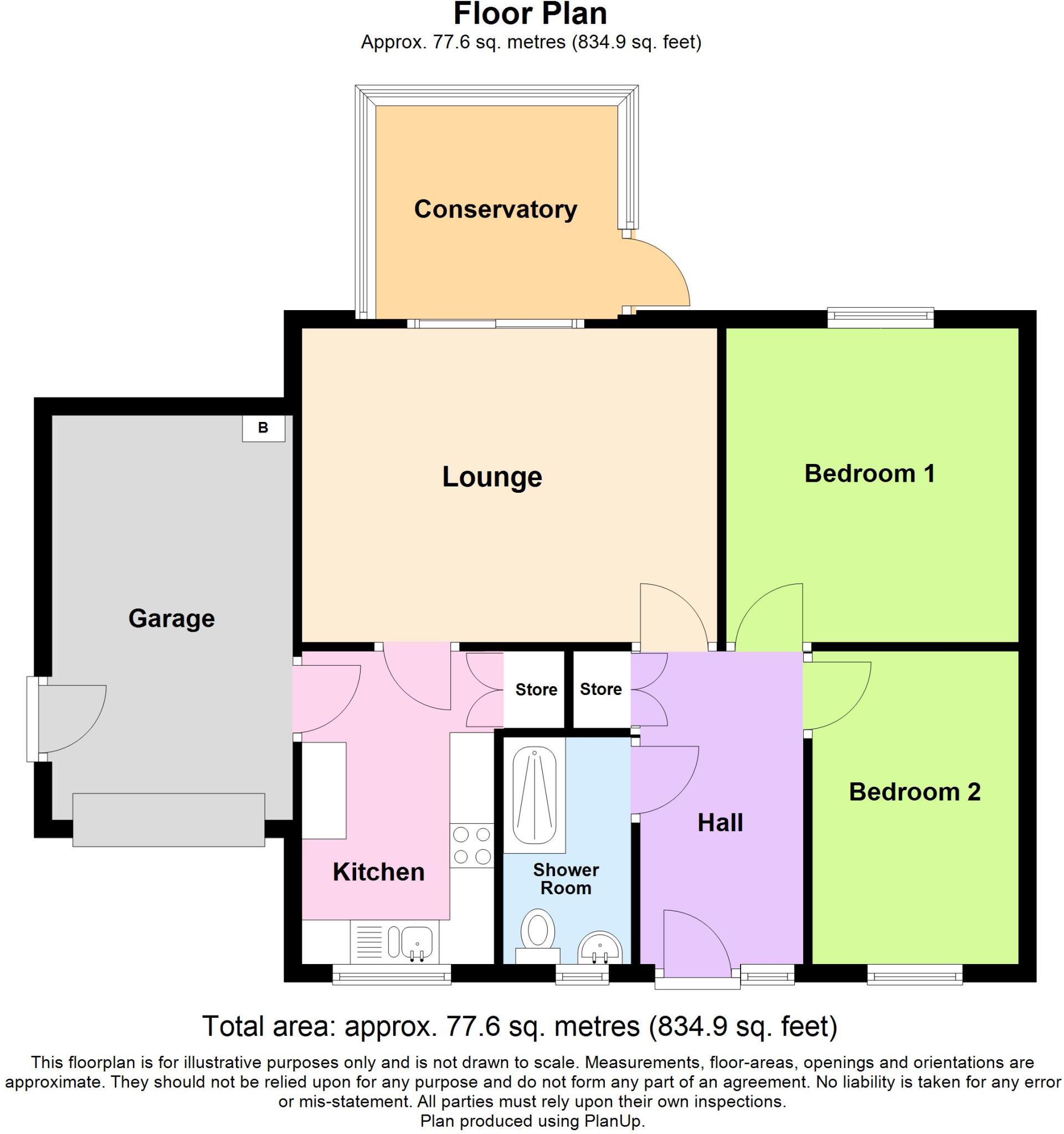
- Single-storey property with conservatory and two bedrooms (as labelled on plan).
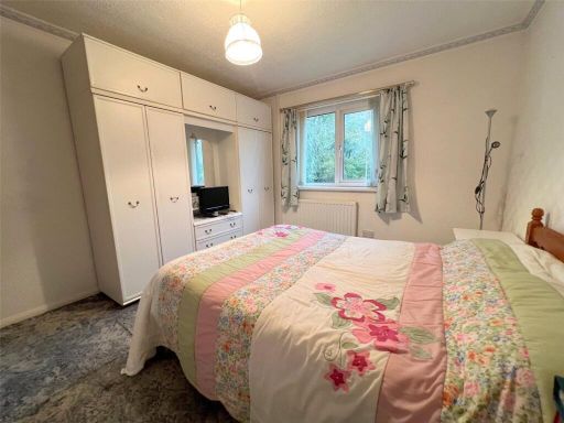
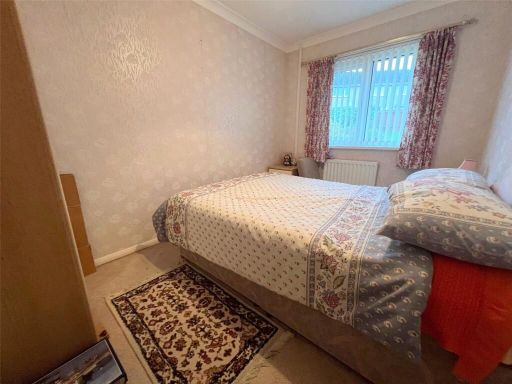
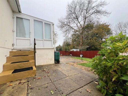
Rooms
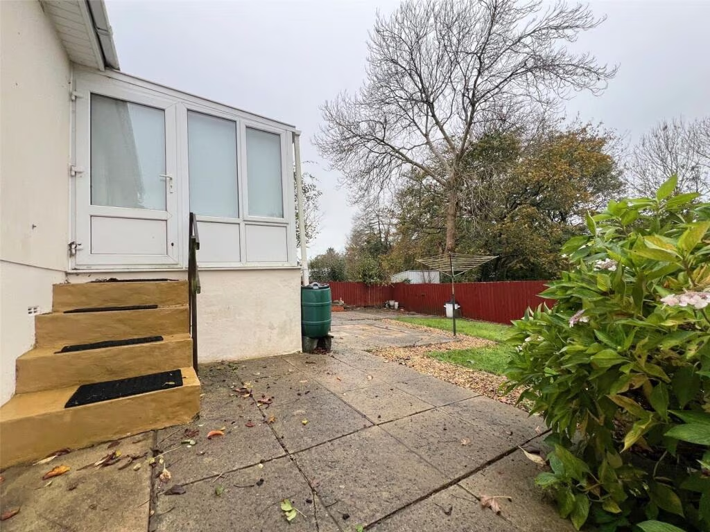
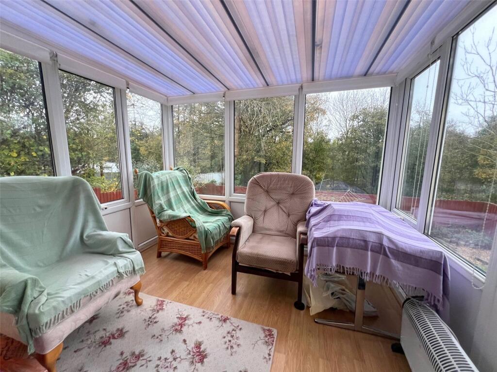
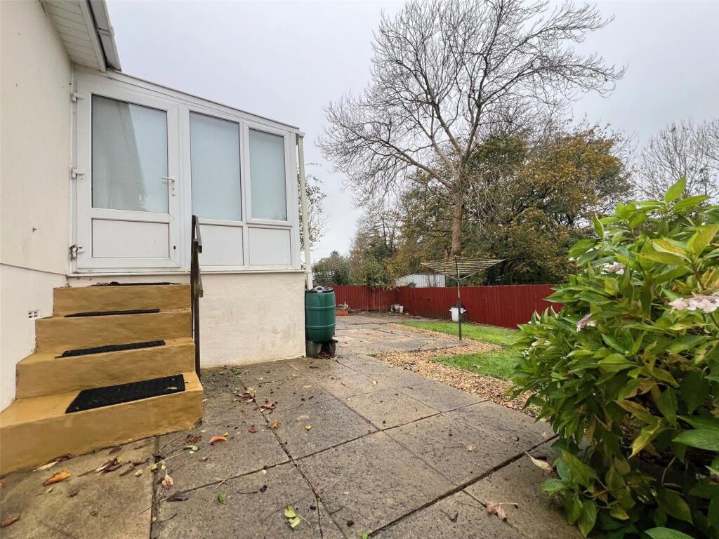
- Conservatory:
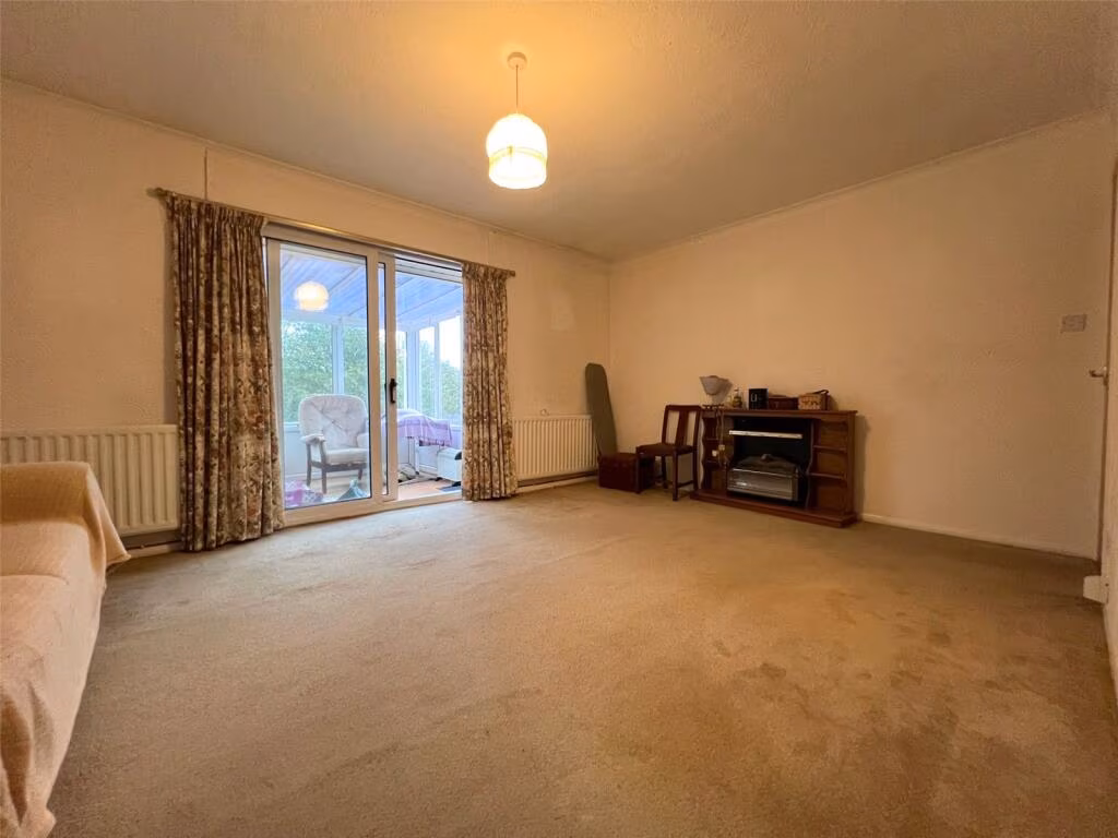
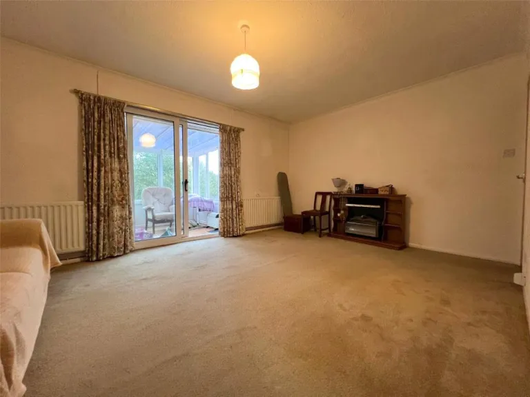
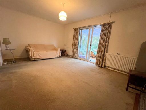
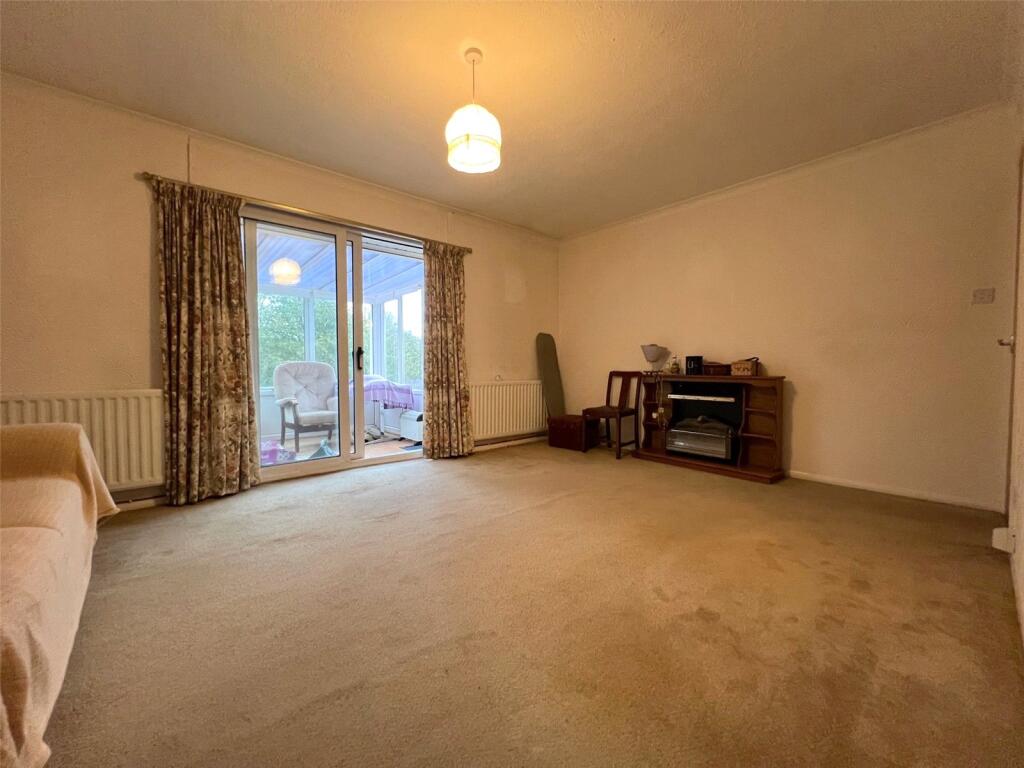
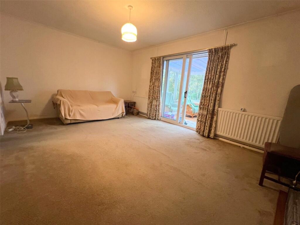
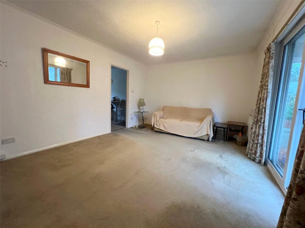
- Lounge:
- Garage:
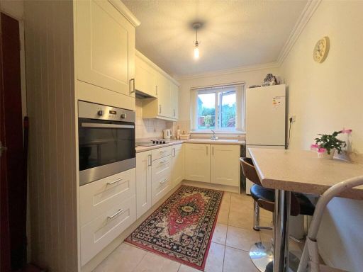
- Kitchen:
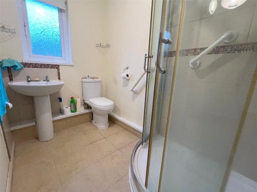
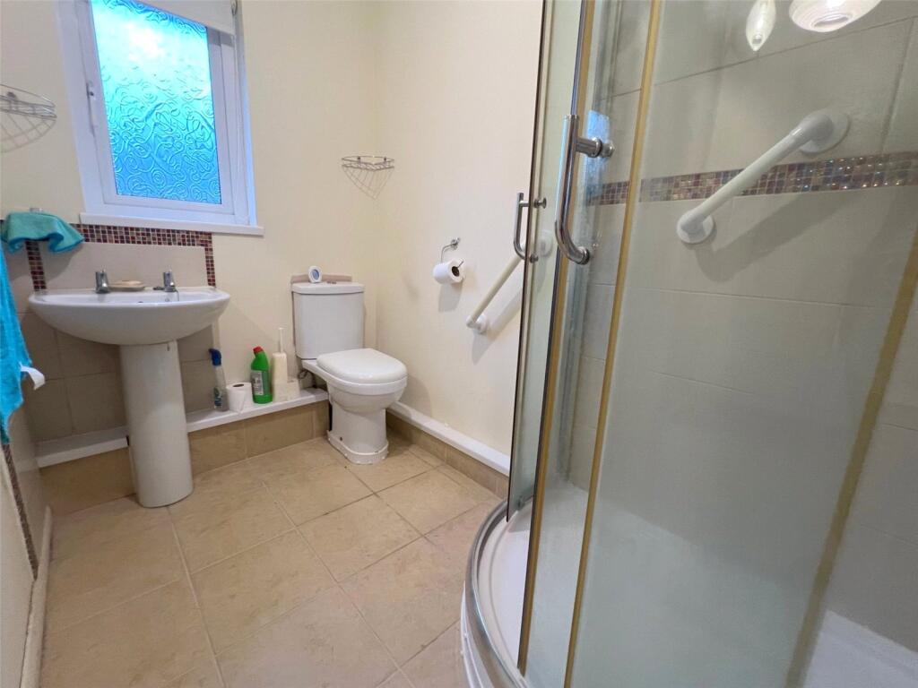
- Shower Room:
- Store:
- Store:
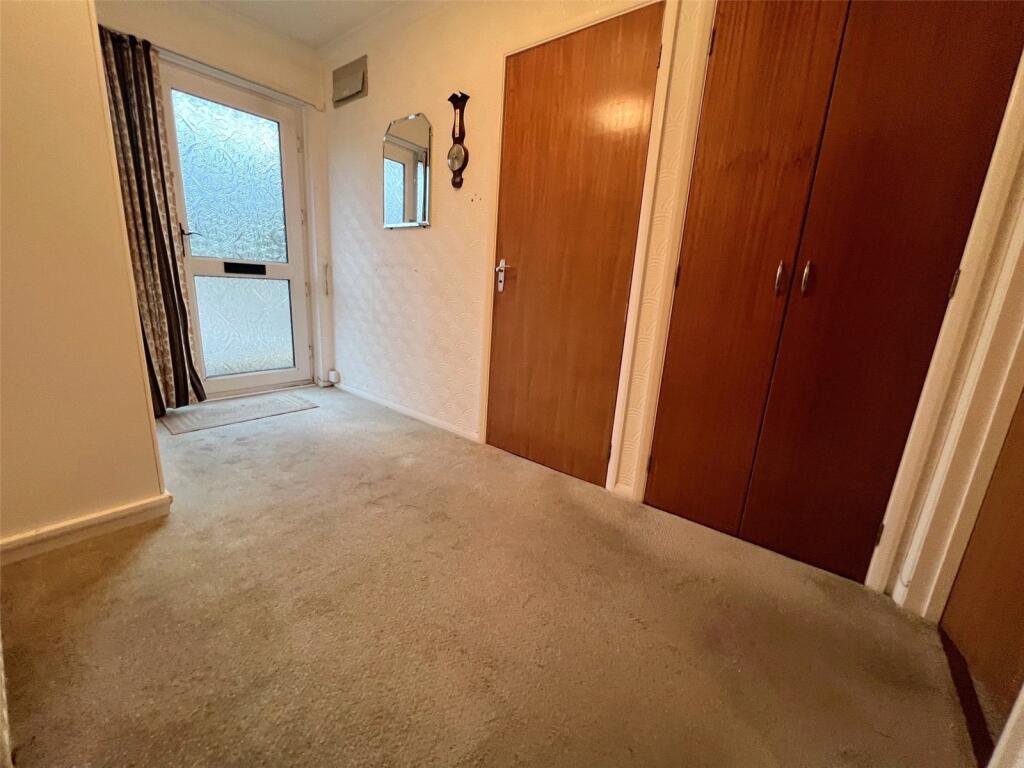
- Hall:
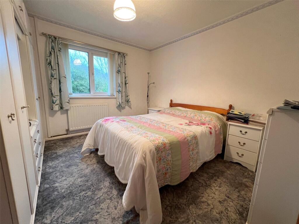
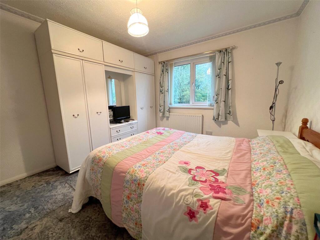
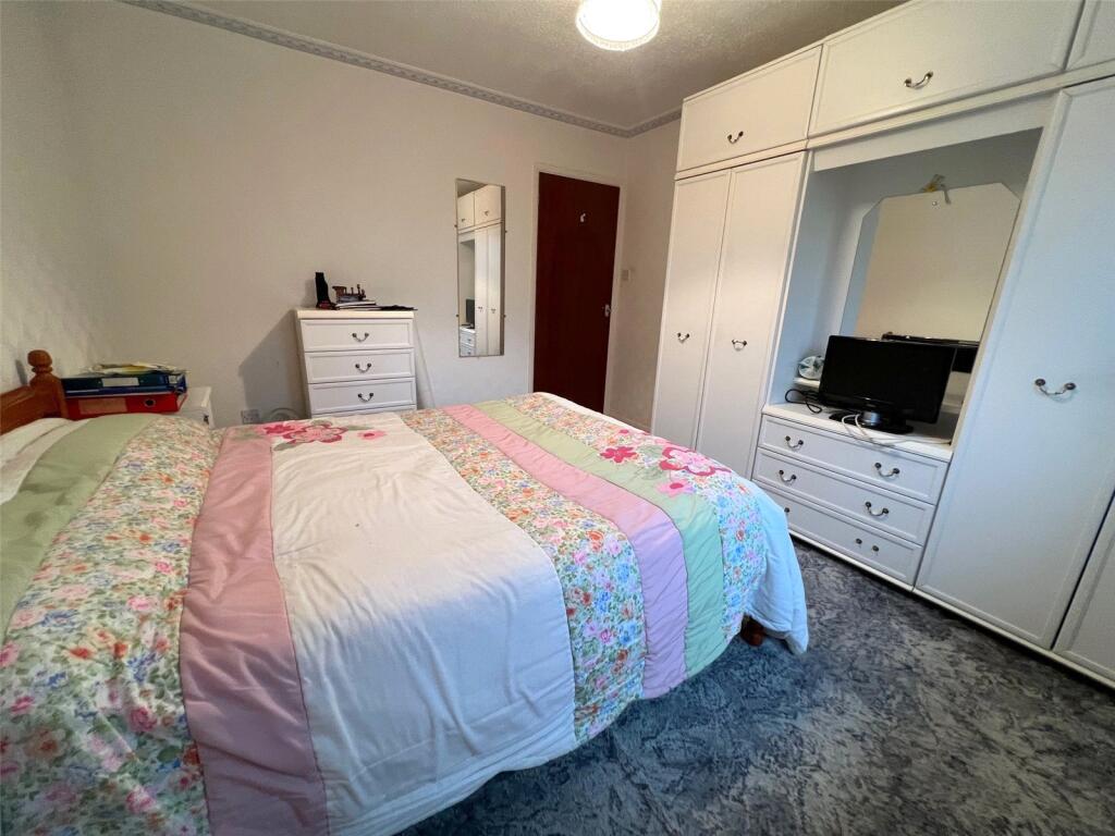
- Bedroom 1:
- Bedroom 2:
Textual Property Features
Detected Visual Features
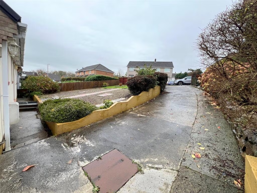
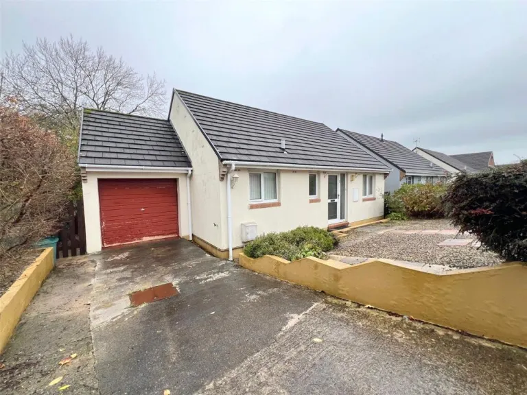
- bungalow
- modern
- single-story
- gabled roof
- detached
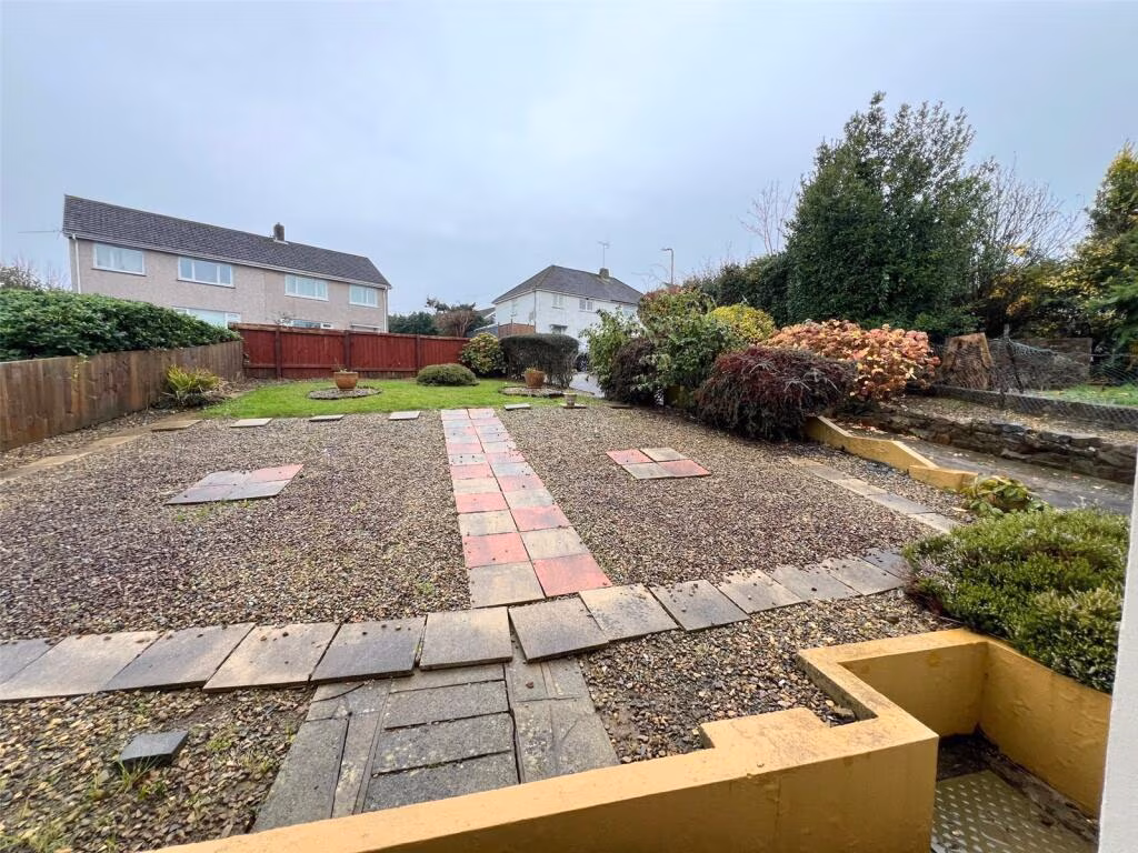
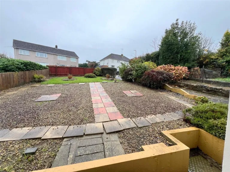
- garden
- garage potential
- quiet neighborhood
- privacy
- driveway
- needs cosmetic work
- contemporary
- low-maintenance
- compact garden
- efficient layout
- accessible
- easy access
EPC Details
- Fully double glazed
- Timber frame, as built, insulated (assumed)
- Boiler and radiators, mains gas
- Low energy lighting in 55% of fixed outlets
- To unheated space, insulated
Nearest General Shops
- Id: 9934209933
- Tags:
- Addr:
- City: Haverfordwest
- Street: High Street
- Shop: yes
- TagsNormalized:
- Lat: 51.8012194
- Lon: -4.9710909
- FullGeoHash: gchqwyh5vpjy
- PartitionGeoHash: gchq
- Images:
- FoodStandards: null
- Distance: 421.9
,- Id: 308702513
- Tags:
- Addr:
- City: HAVERFORDWEST
- Housenumber: 1
- Street: Old Bridge
- Building: yes
- Name: Seconds Ahead Ladies Wear
- Shop: clothes
- TagsNormalized:
- Lat: 51.8039529
- Lon: -4.9685135
- FullGeoHash: gchqwyw5chxz
- PartitionGeoHash: gchq
- Images:
- FoodStandards: null
- Distance: 420
,- Id: 281550931
- Tags:
- Addr:
- City: HAVERFORDWEST
- Postcode: SA61 2HD
- Street: Perrots Road
- Building: commercial
- Name: Fred Rees Garages Ltd
- Shop: car
- TagsNormalized:
- Lat: 51.8044502
- Lon: -4.9704793
- FullGeoHash: gchqwyswg3qn
- PartitionGeoHash: gchq
- Images:
- FoodStandards: null
- Distance: 282.9
}
Nearest Religious buildings
- Id: 560494568
- Tags:
- Amenity: place_of_worship
- Building: church
- Denomination: anglican
- Name: St Mary's Church
- Religion: christian
- Wikidata: Q17742388
- TagsNormalized:
- place of worship
- church
- anglican
- christian
- Lat: 51.801164
- Lon: -4.9717981
- FullGeoHash: gchqwy5essye
- PartitionGeoHash: gchq
- Images:
- FoodStandards: null
- Distance: 401.5
,- Id: 320995824
- Tags:
- Amenity: place_of_worship
- Denomination: baptist
- Name: Bethesda Baptist
- Religion: christian
- TagsNormalized:
- place of worship
- baptist
- christian
- church
- Lat: 51.8020787
- Lon: -4.9729033
- FullGeoHash: gchqwy6bfzqe
- PartitionGeoHash: gchq
- Images:
- FoodStandards: null
- Distance: 276.5
,- Id: 321816353
- Tags:
- Amenity: place_of_worship
- Denomination: anglican
- Name: St. Martin of Tours
- Religion: christian
- Wikidata: Q17741884
- TagsNormalized:
- place of worship
- anglican
- christian
- church
- Lat: 51.8026641
- Lon: -4.9723055
- FullGeoHash: gchqwy7k2ukr
- PartitionGeoHash: gchq
- Images:
- FoodStandards: null
- Distance: 243.4
}
Nearest Medical buildings
- Id: 1139349736
- Tags:
- Amenity: doctors
- Name: St Thomas Surgery
- TagsNormalized:
- Lat: 51.7977311
- Lon: -4.9707236
- FullGeoHash: gchqwvkrtszv
- PartitionGeoHash: gchq
- Images:
- FoodStandards: null
- Distance: 781
,- Id: 561541539
- Tags:
- Amenity: pharmacy
- Building: yes
- Drive_through: no
- Healthcare: pharmacy
- Name: Noots Pharmacy
- TagsNormalized:
- Lat: 51.7981946
- Lon: -4.9705706
- FullGeoHash: gchqwvsd373f
- PartitionGeoHash: gchq
- Images:
- FoodStandards: null
- Distance: 736.7
,- Id: 1139349724
- Tags:
- Amenity: pharmacy
- Brand: Lloyds Pharmacy
- Brand:wikidata: Q6662870
- Healthcare: pharmacy
- Name: Lloyds Pharmacy
- Operator: Lloyd's Pharmacy
- TagsNormalized:
- pharmacy
- lloyds pharmacy
- health
- healthcare
- Lat: 51.7987098
- Lon: -4.9696776
- FullGeoHash: gchqwvtjq57g
- PartitionGeoHash: gchq
- Images:
- FoodStandards: null
- Distance: 710.9
,- Id: 1150536095
- Tags:
- Amenity: dentist
- Building: yes
- Healthcare: dentist
- TagsNormalized:
- Lat: 51.7985977
- Lon: -4.9781574
- FullGeoHash: gchqwtxh8w2y
- PartitionGeoHash: gchq
- Images:
- FoodStandards: null
- Distance: 683.5
}
Nearest Leisure Facilities
- Id: 98473509
- Tags:
- Building: public
- Leisure: sports_centre
- Name: Haverfordwest Leisure Centre
- Name:cy: Canolfan Hamdden Hwlffordd
- Wheelchair: yes
- TagsNormalized:
- sports
- sports centre
- leisure
- Lat: 51.7983605
- Lon: -4.9700029
- FullGeoHash: gchqwvsgqd30
- PartitionGeoHash: gchq
- Images:
- FoodStandards: null
- Distance: 735.5
,- Id: 95320247
- Tags:
- Leisure: pitch
- Sport: soccer
- TagsNormalized:
- Lat: 51.8091967
- Lon: -4.967454
- FullGeoHash: gchqwzwf3ymb
- PartitionGeoHash: gchq
- Images:
- FoodStandards: null
- Distance: 730
,- Id: 103508030
- Tags:
- Leisure: pitch
- Sport: tennis
- TagsNormalized:
- Lat: 51.7997371
- Lon: -4.9676254
- FullGeoHash: gchqwvyemfy5
- PartitionGeoHash: gchq
- Images:
- FoodStandards: null
- Distance: 700.6
,- Id: 1104455396
- Tags:
- Leisure: pitch
- Sport: soccer
- TagsNormalized:
- Lat: 51.8096287
- Lon: -4.9691612
- FullGeoHash: gchqwztsfnuc
- PartitionGeoHash: gchq
- Images:
- FoodStandards: null
- Distance: 697
,- Id: 967872810
- Tags:
- TagsNormalized:
- Lat: 51.8064708
- Lon: -4.9700279
- FullGeoHash: gchqwzhftfne
- PartitionGeoHash: gchq
- Images:
- FoodStandards: null
- Distance: 393.4
}
Nearest Tourist attractions
- Id: 205182048
- Tags:
- Alt_name: The Dingle
- Name: Crundale House
- Tourism: guest_house
- TagsNormalized:
- Lat: 51.8203418
- Lon: -4.9424228
- FullGeoHash: gchqz99535y7
- PartitionGeoHash: gchq
- Images:
- FoodStandards: null
- Distance: 2838.6
,- Id: 684566290
- Tags:
- TagsNormalized:
- Lat: 51.8146843
- Lon: -5.0010352
- FullGeoHash: gchqy0w67mjz
- PartitionGeoHash: gchq
- Images:
- FoodStandards: null
- Distance: 2151.6
,- Id: 321816434
- Tags:
- Name: Haverfordwest Museum
- Tourism: museum
- Wikidata: Q15223341
- TagsNormalized:
- Lat: 51.8025877
- Lon: -4.9699911
- FullGeoHash: gchqwykgyy60
- PartitionGeoHash: gchq
- Images:
- FoodStandards: null
- Distance: 371.2
}
Nearest Train stations
- Id: 1590432668
- Tags:
- Name: Main Entrance Station
- Public_transport: station
- Railway: station
- Usage: tourism
- TagsNormalized:
- Lat: 51.7775924
- Lon: -4.8001387
- FullGeoHash: gchwdcbdkdv1
- PartitionGeoHash: gchw
- Images:
- FoodStandards: null
- Distance: 12361.4
,- Id: 858361120
- Tags:
- Name: Oakwood Park Station
- Public_transport: station
- Railway: station
- Usage: tourism
- TagsNormalized:
- Lat: 51.7789542
- Lon: -4.8028585
- FullGeoHash: gchwddndm29h
- PartitionGeoHash: gchw
- Images:
- FoodStandards: null
- Distance: 12143.6
,- Id: 19840190
- Tags:
- Name: Milford Haven
- Name:cy: Aberdaugleddau
- Name:en: Milford Haven
- Naptan:
- Network: National Rail
- Operator: Trafnidiaeth Cymru
- Operator:cy: Trafnidiaeth Cymru
- Operator:en: Transport for Wales
- Public_transport: station
- Railway: station
- Ref:
- Wikidata: Q3400252
- Wikipedia: en:Milford Haven railway station
- TagsNormalized:
- Lat: 51.7157559
- Lon: -5.0414117
- FullGeoHash: gchqjq8fnedu
- PartitionGeoHash: gchq
- Images:
- FoodStandards: null
- Distance: 10870.4
,- Id: 19840233
- Tags:
- Name: Johnston
- Naptan:
- Network: National Rail
- Public_transport: station
- Railway: station
- Ref:
- Request_stop: yes
- Train: yes
- Wikidata: Q1812881
- Wikipedia: en:Johnston railway station
- TagsNormalized:
- Lat: 51.7564283
- Lon: -4.9968493
- FullGeoHash: gchqqmcrhcx0
- PartitionGeoHash: gchq
- Images:
- FoodStandards: null
- Distance: 5542.8
,- Id: 19840285
- Tags:
- Name: Haverfordwest
- Name:cy: Hwlffordd
- Naptan:
- Network: National Rail
- Operator: Trafnidiaeth Cymru
- Operator:cy: Trafnidiaeth Cymru
- Operator:en: Transport for Wales
- Public_transport: station
- Railway: station
- Ref:
- Wikidata: Q1931357
- Wikipedia: en:Haverfordwest railway station
- TagsNormalized:
- Lat: 51.8026795
- Lon: -4.960232
- FullGeoHash: gchqxnkh6pqg
- PartitionGeoHash: gchq
- Images:
- FoodStandards: null
- Distance: 1004.3
}
Nearest Bus stations and stops
- Id: 9769129625
- Tags:
- Bus: yes
- Highway: bus_stop
- Public_transport: platform
- TagsNormalized:
- Lat: 51.8690517
- Lon: -4.9652943
- FullGeoHash: gchrp42rhk01
- PartitionGeoHash: gchr
- Images:
- FoodStandards: null
- Distance: 7224.4
,- Id: 5997795331
- Tags:
- Bus: yes
- Highway: bus_stop
- Public_transport: platform
- TagsNormalized:
- Lat: 51.8124924
- Lon: -4.9628089
- FullGeoHash: gchqz04jwhtk
- PartitionGeoHash: gchq
- Images:
- FoodStandards: null
- Distance: 1216
,- Id: 5997795332
- Tags:
- Bus: yes
- Highway: bus_stop
- Public_transport: platform
- TagsNormalized:
- Lat: 51.8127471
- Lon: -4.9635819
- FullGeoHash: gchqz01xhhj5
- PartitionGeoHash: gchq
- Images:
- FoodStandards: null
- Distance: 1203.2
,- Id: 5997795334
- Tags:
- Bus: yes
- Highway: bus_stop
- Public_transport: platform
- TagsNormalized:
- Lat: 51.8107513
- Lon: -4.9639769
- FullGeoHash: gchqxpc7dbnd
- PartitionGeoHash: gchq
- Images:
- FoodStandards: null
- Distance: 1020.5
,- Id: 5997795333
- Tags:
- Bus: yes
- Highway: bus_stop
- Public_transport: platform
- TagsNormalized:
- Lat: 51.8106831
- Lon: -4.9642445
- FullGeoHash: gchqxpc5her5
- PartitionGeoHash: gchq
- Images:
- FoodStandards: null
- Distance: 1002.1
}
Nearest Hotels
- Id: 123021216
- Tags:
- Addr:
- Postcode: SA61 2NB
- Street: Salutation Square
- Building: hotel
- Fax: +44 (0)1437 762504
- Fhrs:
- Internet_access: wlan
- Internet_access:fee: no
- Name: County Hotel
- Phone: +44 1437 762144
- Source:
- Tourism: hotel
- Website: https://countyhotelhaverfordwest.co.uk/
- Wikidata: Q29490505
- TagsNormalized:
- Lat: 51.8028393
- Lon: -4.9661368
- FullGeoHash: gchqwyrv2thj
- PartitionGeoHash: gchq
- Images:
- FoodStandards: null
- Distance: 604.6
,- Id: 321817681
- Tags:
- Addr:
- Postcode: SA61 2DU
- Street: Mariners Square
- Fhrs:
- Internet_access: wlan
- Internet_access:fee: no
- Name: Hotel Mariners
- Phone: +44 1437763353
- Smoking: outside
- Source:
- Tourism: hotel
- Website: https://www.hotelmariners.co.uk/
- Wheelchair: limited
- Wikidata: Q29490447
- TagsNormalized:
- Lat: 51.8015323
- Lon: -4.9727813
- FullGeoHash: gchqwy4vvc98
- PartitionGeoHash: gchq
- Images:
- FoodStandards: null
- Distance: 335.6
,- Id: 321817678
- Tags:
- TagsNormalized:
- Lat: 51.8015206
- Lon: -4.973843
- FullGeoHash: gchqwy4jtp3f
- PartitionGeoHash: gchq
- Images:
- FoodStandards: null
- Distance: 317.2
}
Tags
- bungalow
- modern
- single-story
- gabled roof
- detached
- garden
- garage potential
- quiet neighborhood
- privacy
- driveway
- needs cosmetic work
- bungalow
- single-story
- contemporary
- low-maintenance
- compact garden
- driveway
- efficient layout
- accessible
- easy access
- quiet neighborhood
Local Market Stats
- Average Price/sqft: £188
- Avg Income: £34700
- Rental Yield: 3.5%
- Social Housing: 10%
- Planning Success Rate: 94%
AirBnB Data
- 1km average: £75/night
- Listings in 1km: 2
Similar Properties
 2 bedroom bungalow for sale in Fleming Crescent, Haverfordwest, SA61 — £175,000 • 2 bed • 1 bath • 539 ft²
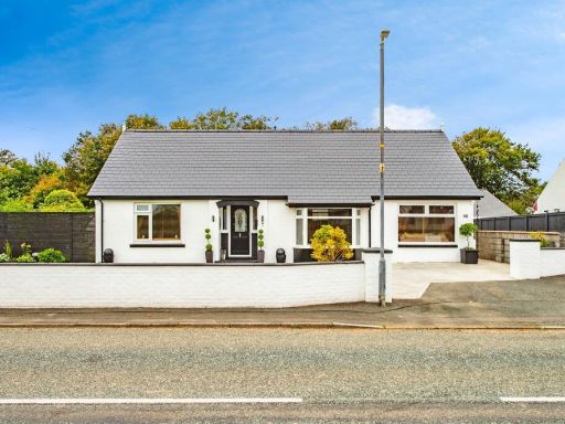 3 bedroom bungalow for sale in Cardigan Road, Haverfordwest, Pembrokeshire, SA61 — £310,000 • 3 bed • 1 bath • 968 ft²
 2 bedroom bungalow for sale in Crowhill, Haverfordwest, SA61 — £230,000 • 2 bed • 1 bath • 815 ft²
 3 bedroom detached bungalow for sale in Trevaughan Close, Haverfordwest, SA61 — £240,000 • 3 bed • 1 bath • 985 ft²
 3 bedroom bungalow for sale in Shakespeare Close, Priory Park, Haverfordwest, SA61 — £199,950 • 3 bed • 1 bath • 493 ft²
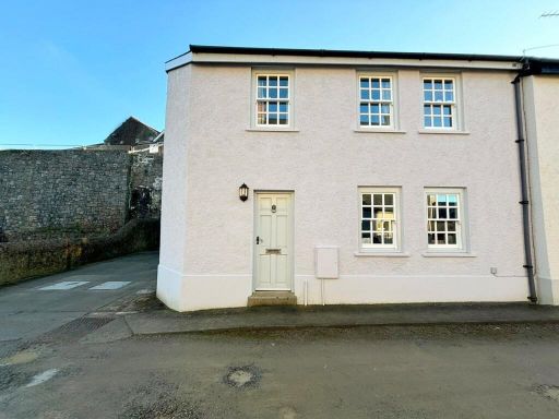 2 bedroom detached house for sale in Hayguard Lane, Haverfordwest, Pembrokeshire, SA61 — £160,000 • 2 bed • 1 bath • 827 ft²
Meta
- {
"@context": "https://schema.org",
"@type": "Residence",
"name": "2 bedroom bungalow for sale in Castle High, HAVERFORDWEST,…",
"description": "",
"url": "https://propertypiper.co.uk/property/900c69ab-b65c-4cdd-8583-9a14605f127b",
"image": "https://image-a.propertypiper.co.uk/a18ddf12-ca37-4fd3-be36-aff99104f80c-1024.jpeg",
"address": {
"@type": "PostalAddress",
"streetAddress": "Castle High, HAVERFORDWEST, Dyfed, SA61",
"postalCode": "SA61 2SP",
"addressLocality": "Pembrokeshire",
"addressRegion": "Preseli Pembrokeshire",
"addressCountry": "Wales"
},
"geo": {
"@type": "GeoCoordinates",
"latitude": 51.80433553539636,
"longitude": -4.974590295468894
},
"numberOfRooms": 2,
"numberOfBathroomsTotal": 1,
"floorSize": {
"@type": "QuantitativeValue",
"value": 834,
"unitCode": "FTK"
},
"offers": {
"@type": "Offer",
"price": 190000,
"priceCurrency": "GBP",
"availability": "https://schema.org/InStock"
},
"additionalProperty": [
{
"@type": "PropertyValue",
"name": "Feature",
"value": "bungalow"
},
{
"@type": "PropertyValue",
"name": "Feature",
"value": "modern"
},
{
"@type": "PropertyValue",
"name": "Feature",
"value": "single-story"
},
{
"@type": "PropertyValue",
"name": "Feature",
"value": "gabled roof"
},
{
"@type": "PropertyValue",
"name": "Feature",
"value": "detached"
},
{
"@type": "PropertyValue",
"name": "Feature",
"value": "garden"
},
{
"@type": "PropertyValue",
"name": "Feature",
"value": "garage potential"
},
{
"@type": "PropertyValue",
"name": "Feature",
"value": "quiet neighborhood"
},
{
"@type": "PropertyValue",
"name": "Feature",
"value": "privacy"
},
{
"@type": "PropertyValue",
"name": "Feature",
"value": "driveway"
},
{
"@type": "PropertyValue",
"name": "Feature",
"value": "needs cosmetic work"
},
{
"@type": "PropertyValue",
"name": "Feature",
"value": "bungalow"
},
{
"@type": "PropertyValue",
"name": "Feature",
"value": "single-story"
},
{
"@type": "PropertyValue",
"name": "Feature",
"value": "contemporary"
},
{
"@type": "PropertyValue",
"name": "Feature",
"value": "low-maintenance"
},
{
"@type": "PropertyValue",
"name": "Feature",
"value": "compact garden"
},
{
"@type": "PropertyValue",
"name": "Feature",
"value": "driveway"
},
{
"@type": "PropertyValue",
"name": "Feature",
"value": "efficient layout"
},
{
"@type": "PropertyValue",
"name": "Feature",
"value": "accessible"
},
{
"@type": "PropertyValue",
"name": "Feature",
"value": "easy access"
},
{
"@type": "PropertyValue",
"name": "Feature",
"value": "quiet neighborhood"
}
]
}
High Res Floorplan Images
Compatible Floorplan Images
FloorplanImages Thumbnail