Summary - Land to the East of Leigh Road, Havant, PO9 2AW PO9 2AW
1 bed 1 bath Commercial Development
Brownfield corner plot with planning potential near mainline station.
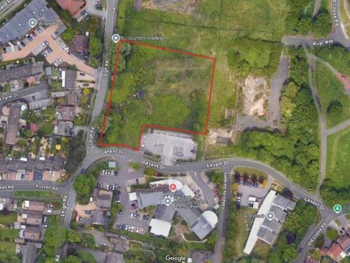
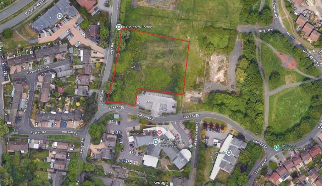
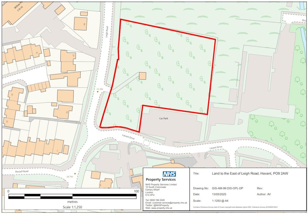
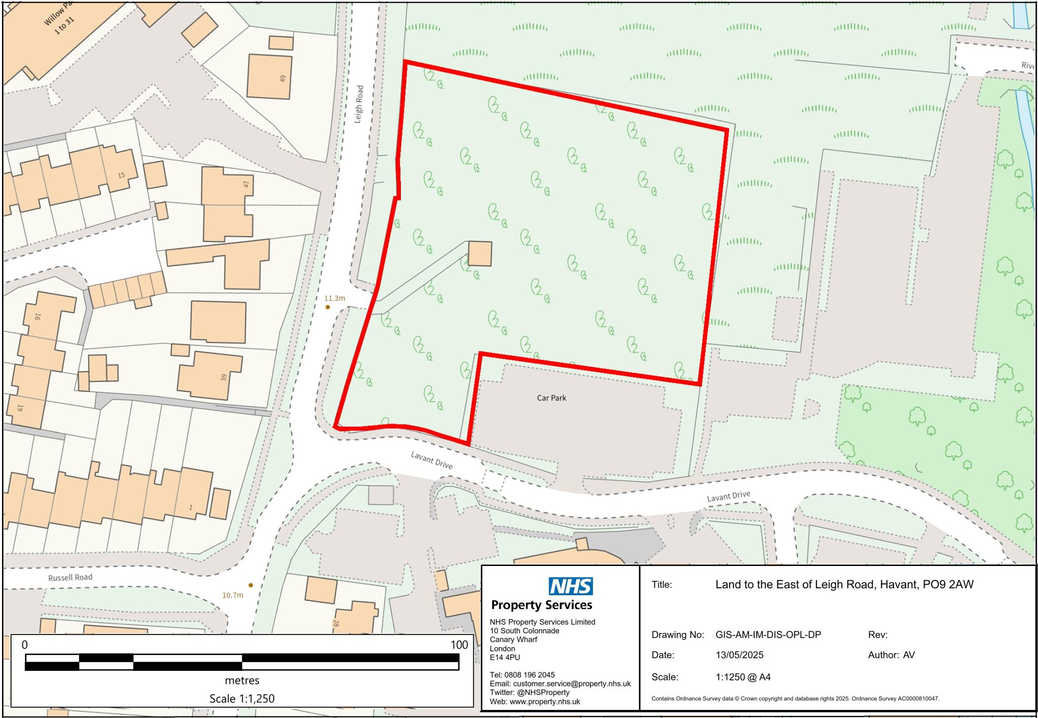
Site area 1.38 acres (0.59 ha) freehold brownfield parcel
Pre-application lodged suggesting potential for c.21 dwellings
Part of mixed-use allocation H69 (housing, care home, community health)
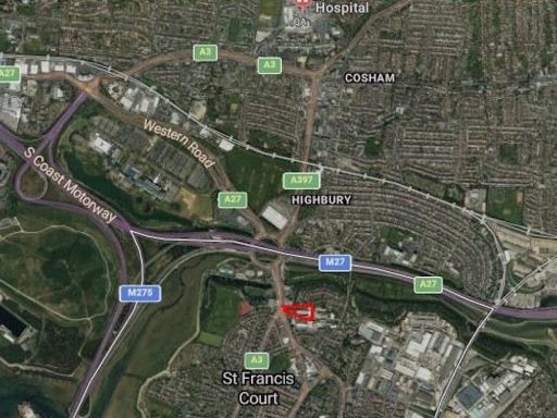
0.3 miles to Havant railway station; good public transport access
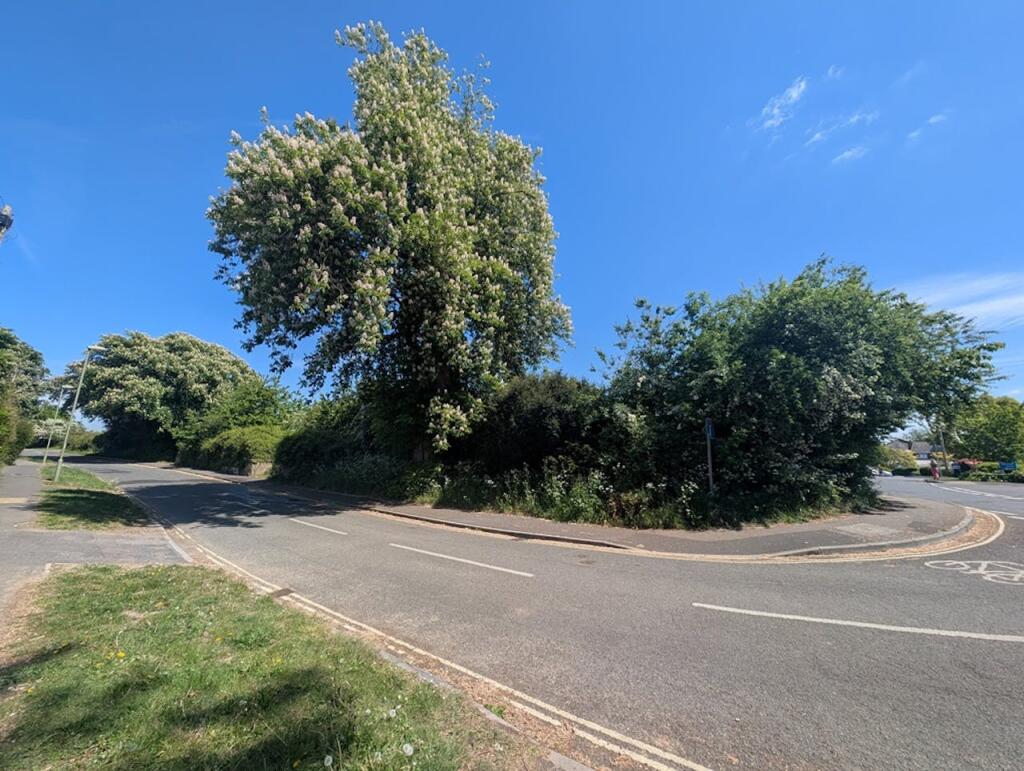
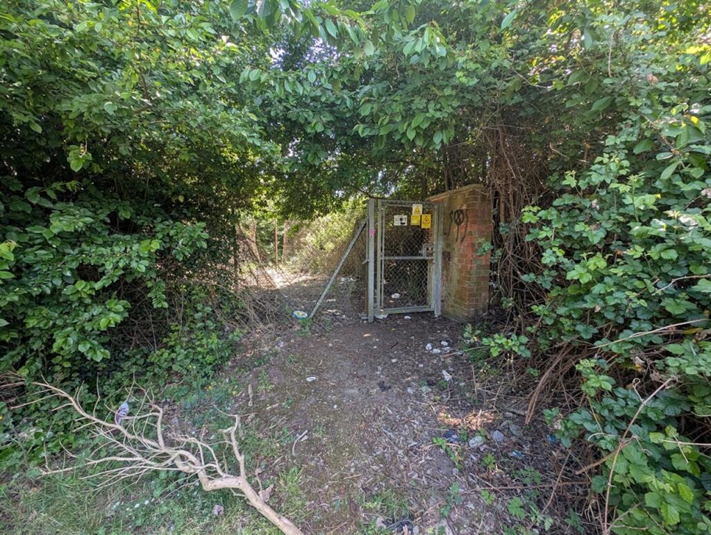
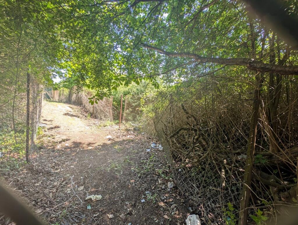
Flood risk: none; previously occupied by Oak Park school (demolition likely)
Council housing supply short (1.8 years) — NPPF tilted balance relevant
Net developable area may be reduced by infrastructure, buffers or covenants
Local crime levels recorded as high — factor in scheme design and use
This 1.38-acre freehold parcel sits on the corner of Lavant Drive and Leigh Road, 0.3 miles north of Havant railway station. The site is designated brownfield and forms part of the mixed-use allocation H69, making it a clear candidate for residential-led redevelopment, care-home or community health uses. A pre-application (site ref HA09) in the Council’s SHELAA suggests a potential yield of 21 dwellings (c.40 dph) although the net developable area may be smaller than the gross figure used.
For developers and specialist investors the site offers immediate policy relevance: Havant’s current five-year housing land supply is short (1.8 years with a 20% buffer), which invokes the NPPF tilted balance in favour of sustainable development. Good transport links — Havant station and central amenities are within easy walking distance — support higher density proposals and reduce the need for major highway works. The land is vacant and previously used for Oak Park school, simplifying demolition considerations.
Key risks and constraints are straightforward. Pre-application advice has been lodged but planning permission is not granted — interested parties must allow for the full planning process and possible S106 / affordable housing contributions. The site sits in an area described as ageing urban communities and recorded local crime rates are high, which could affect some end-users’ perceptions and certain sensitive uses. The council’s SHELAA indicates the gross site area was used for yield; service runs, buffer zones and design requirements may reduce net capacity. Flood risk is nil.
This opportunity suits investors or housebuilders able to manage a modest planning route, absorb potential policy obligations and deliver a medium-density residential or mixed-use scheme. The data room contains the pre-app, council response and associated plans — early due diligence on ground conditions, infrastructure capacity and local consultation is recommended.
 Commercial development for sale in North Plot, London Road, Hilsea, PO2 9DG, PO2 — POA • 1 bed • 1 bath
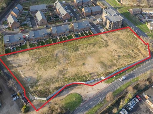 Commercial development for sale in Former Colt International Site, New Lane, Havant, Hampshire, PO9 — POA • 1 bed • 1 bath
 Warehouse for sale in South Plot, Land to the East of Darnel Road, Hambledon Road, Waterlooville, PO7 7FZ, PO7 — £975,000 • 1 bed • 1 bath
 Commercial development for sale in Land adjacent to 135 Southampton Road, Portsmouth, PO6 4SB, PO6 — POA • 1 bed • 1 bath • 5532 ft²
 Land for sale in South Plot, Land to the East of Darnel Road, Hambledon Road, Waterlooville, PO7 7FQ, PO7 — POA • 1 bed • 1 bath
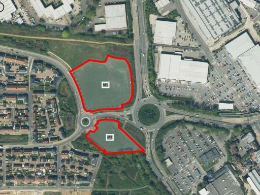 Land for sale in Berewood - Commercial Development, Parcels M1 and M3, PO7 — POA • 1 bed • 1 bath • 1076 ft²