OX26 3YU - 4 bedroom detached house for sale in Heather Road, Bicester…
View on Property Piper
4 bedroom detached house for sale in Heather Road, Bicester, Oxfordshire, OX26
Property Details
- Price: £550000
- Bedrooms: 4
- Bathrooms: 2
- Property Type: undefined
- Property SubType: undefined
Image Descriptions
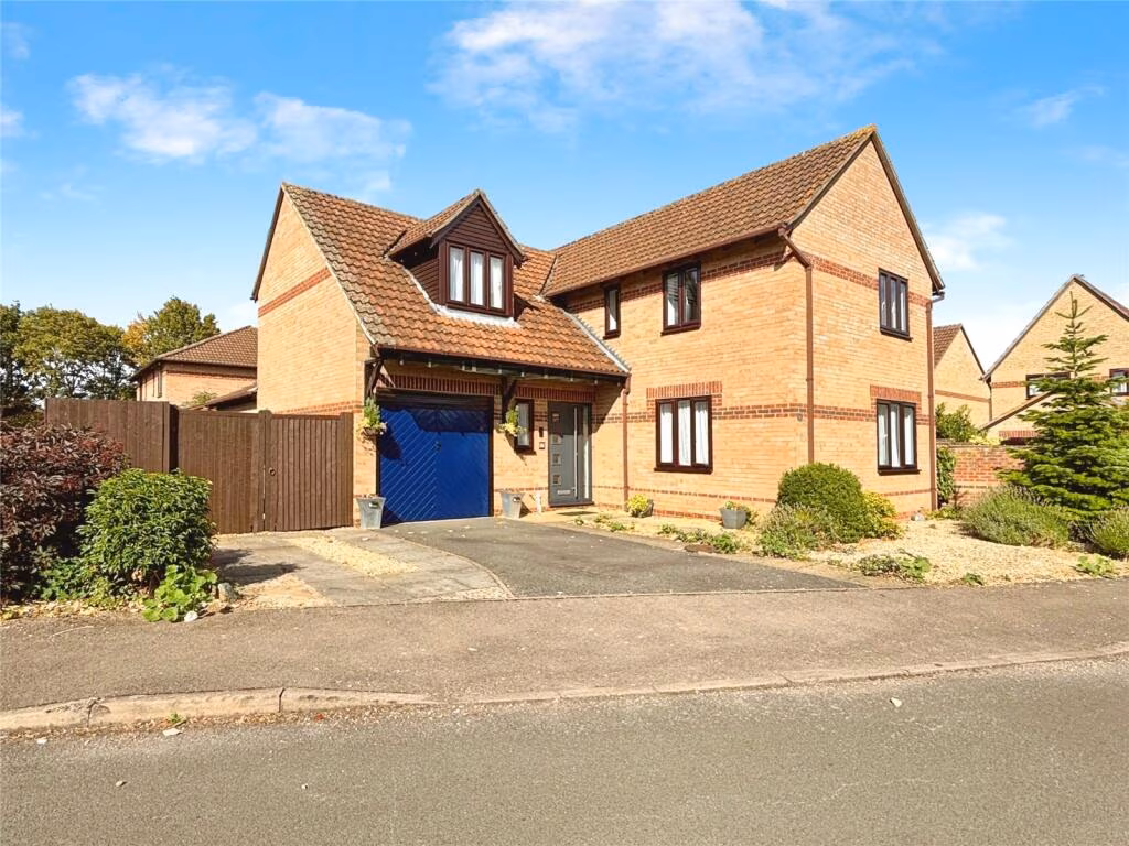
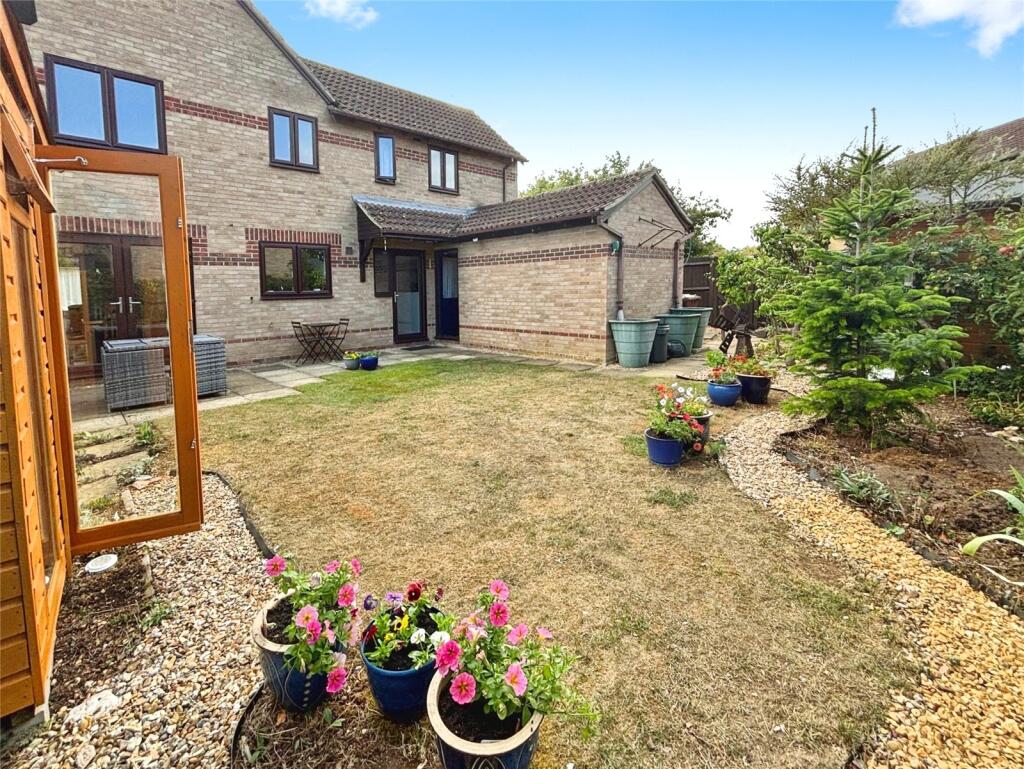
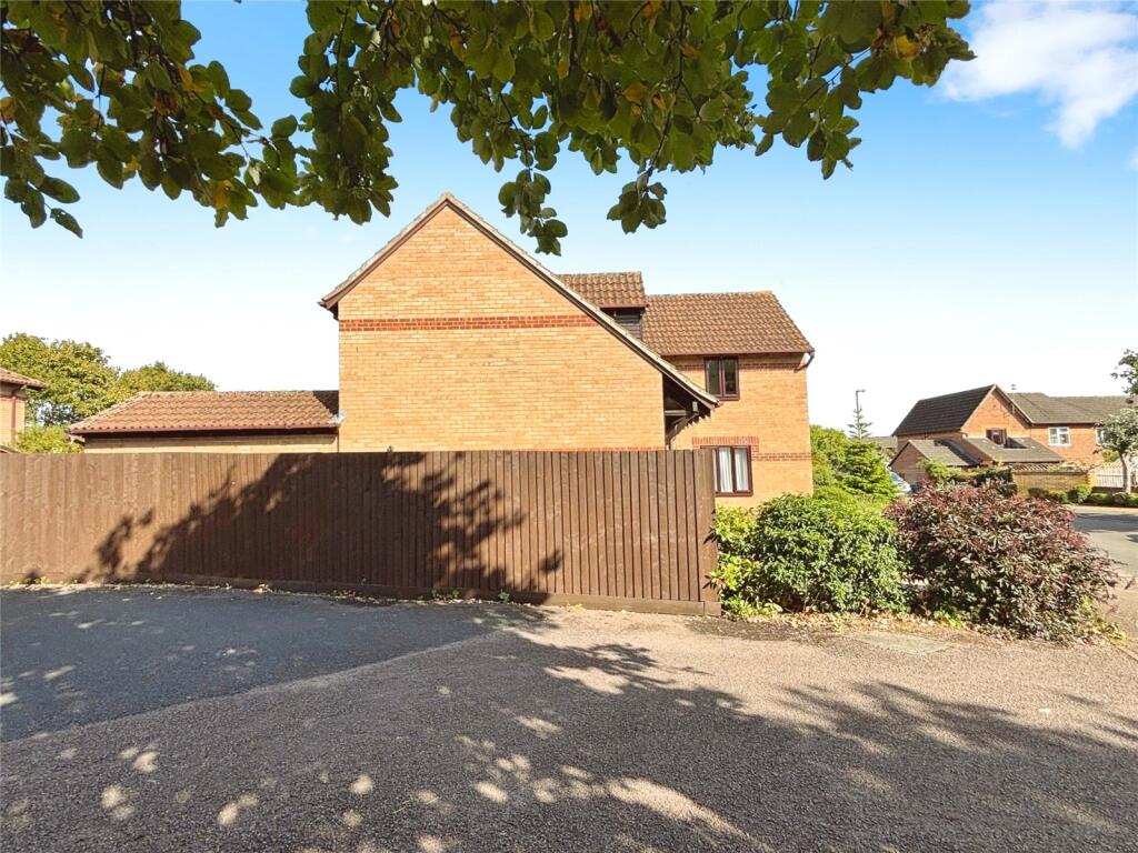
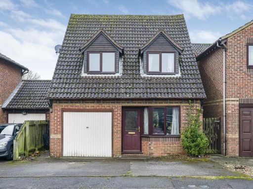
- modern detached house Modern
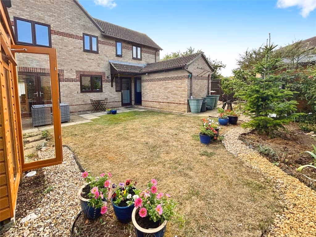
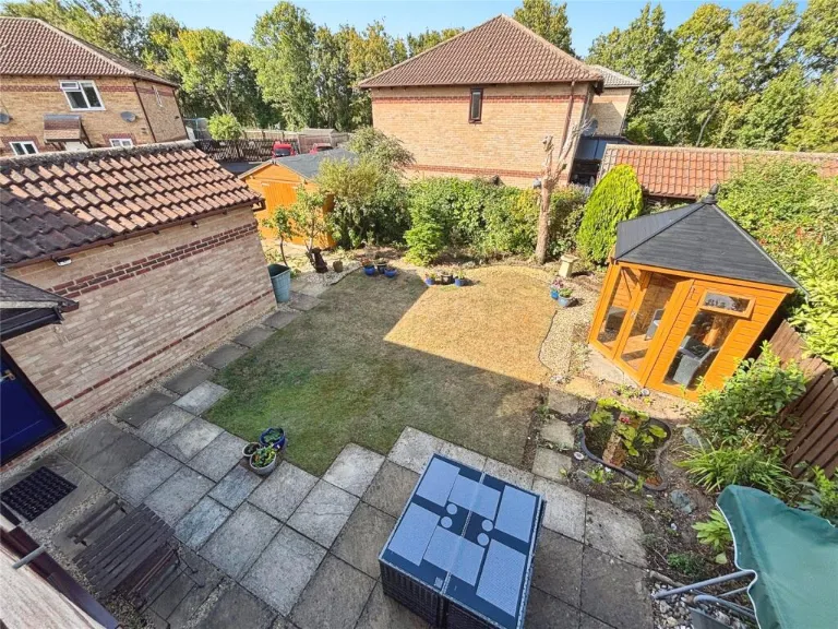
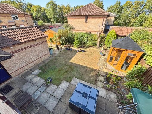
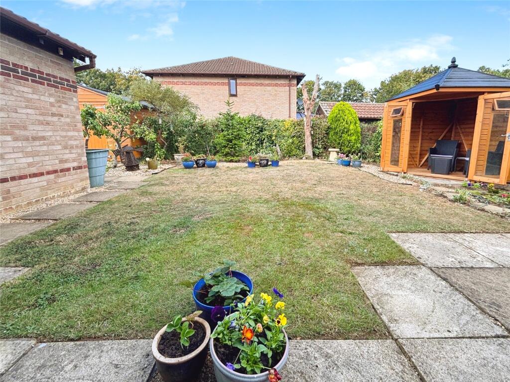
- rear of residential property modern suburban
Rooms
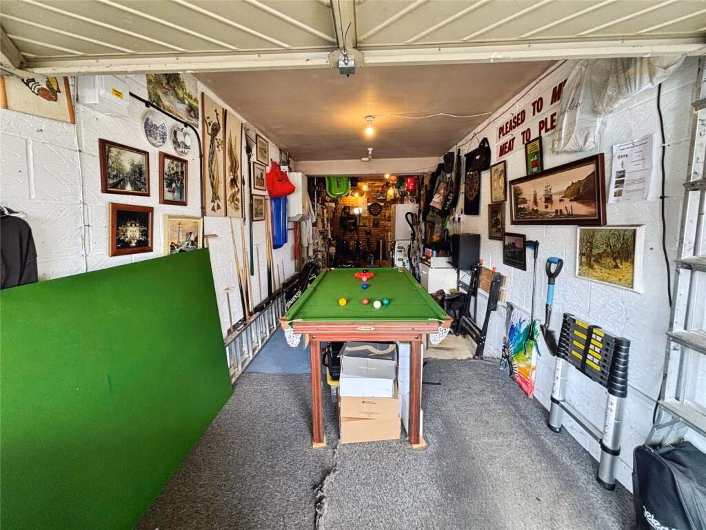
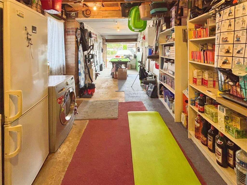
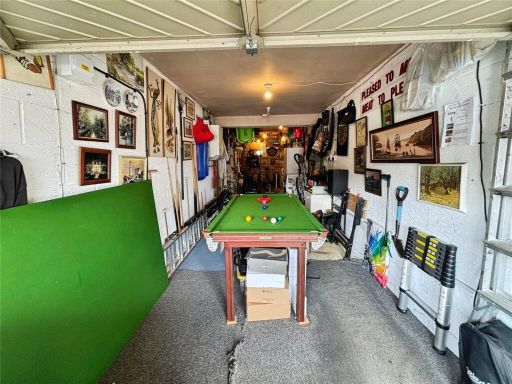
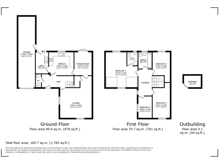
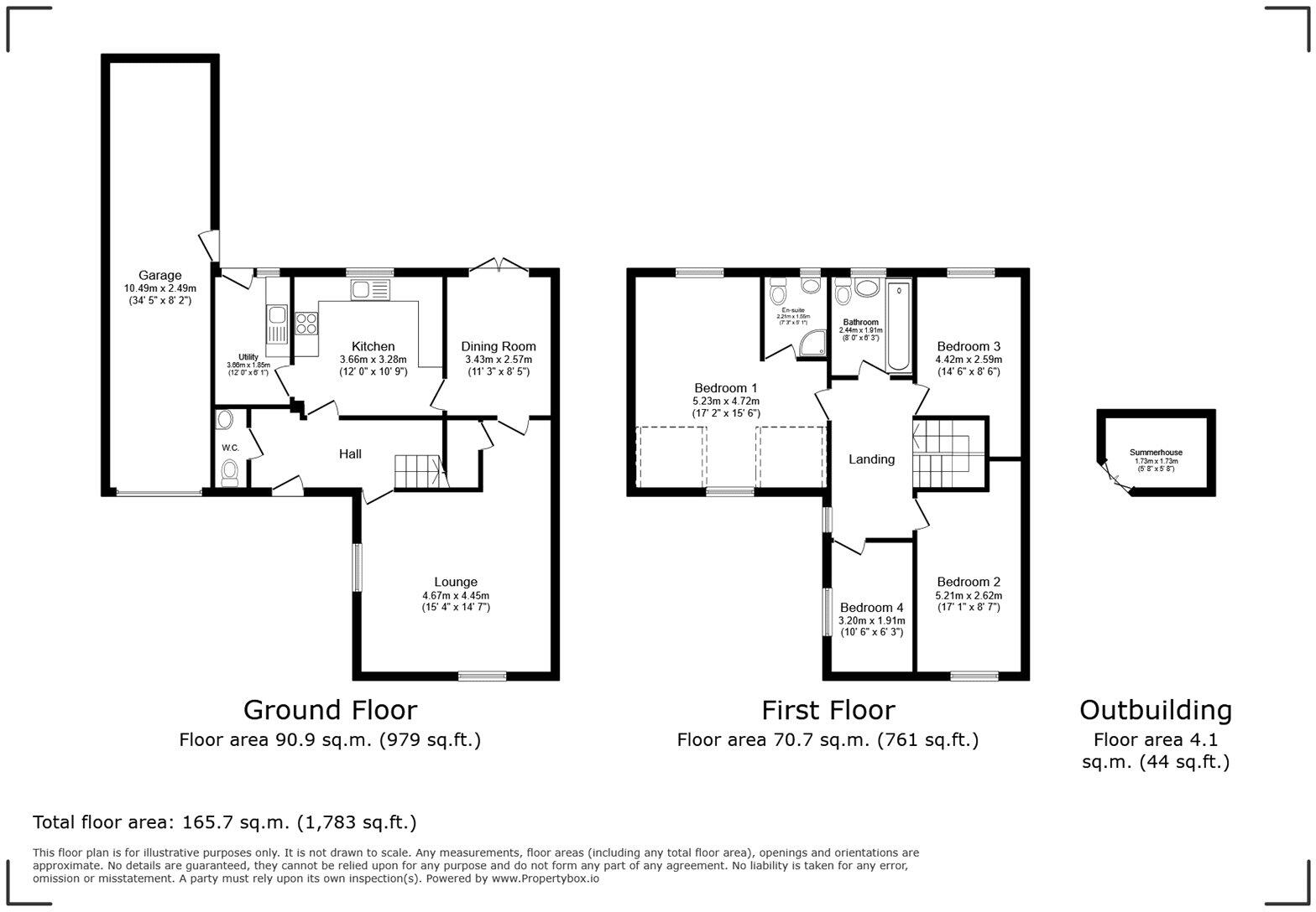
- Garage:
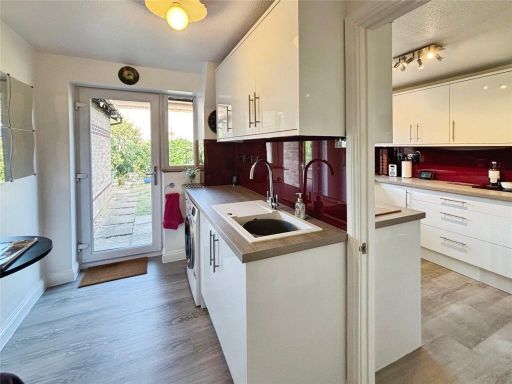
- Utility:
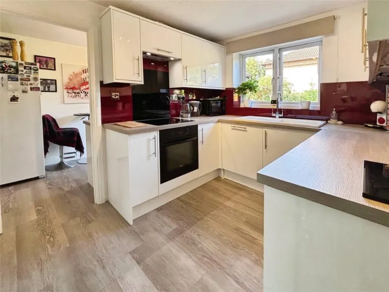
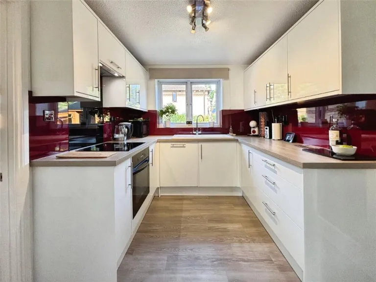
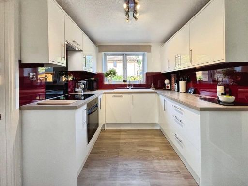
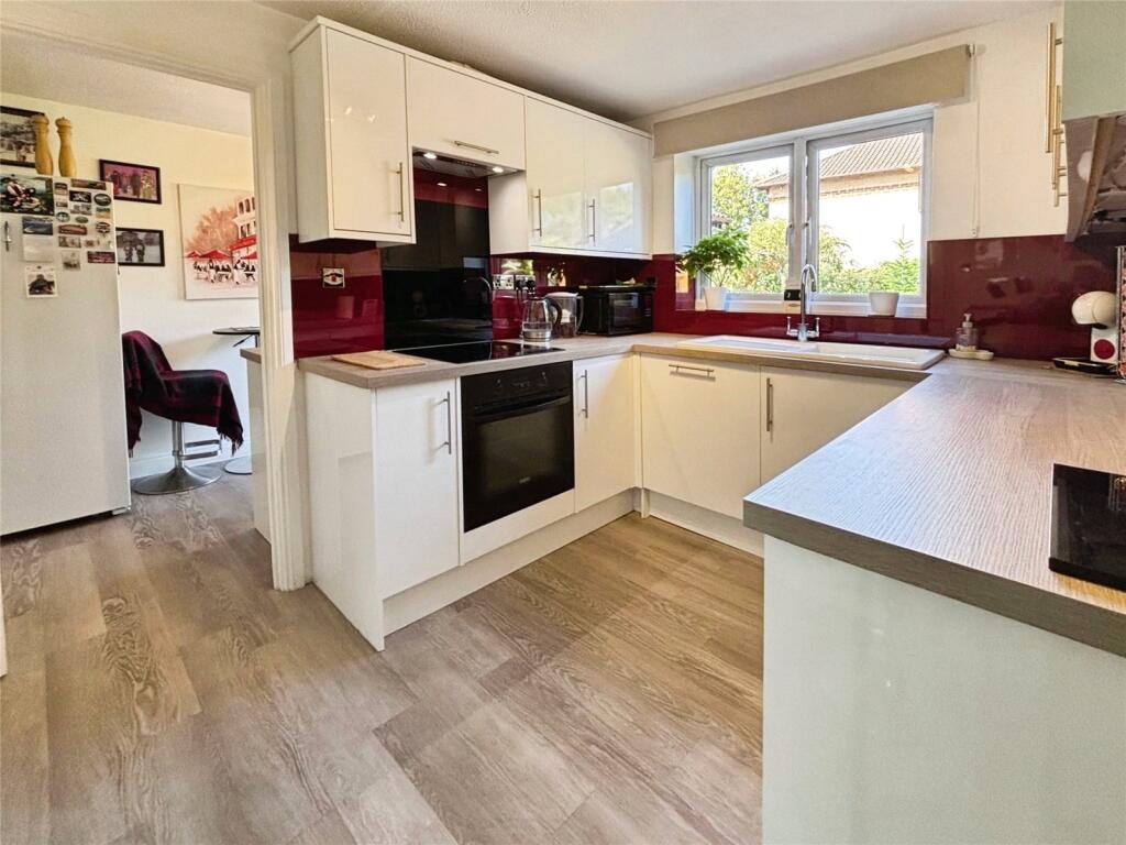
- Kitchen:
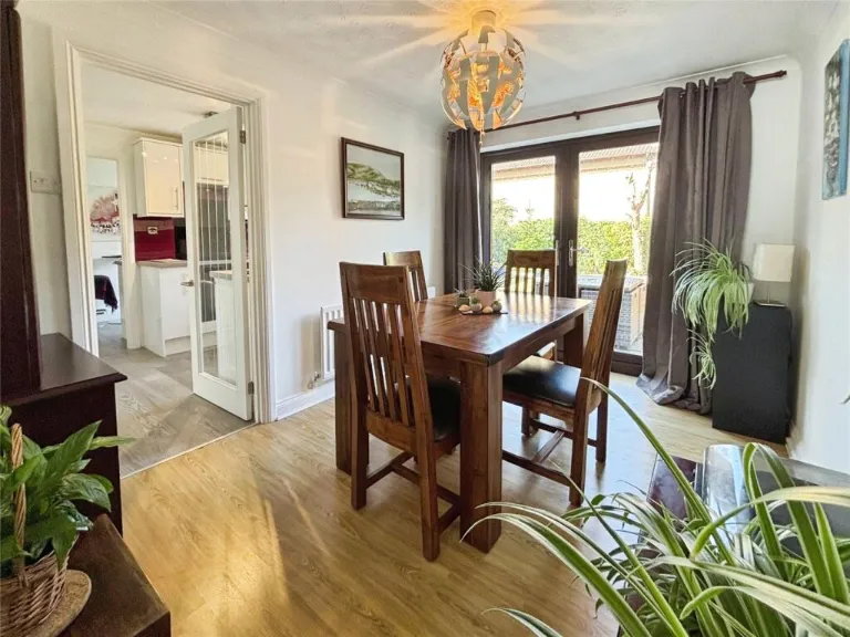
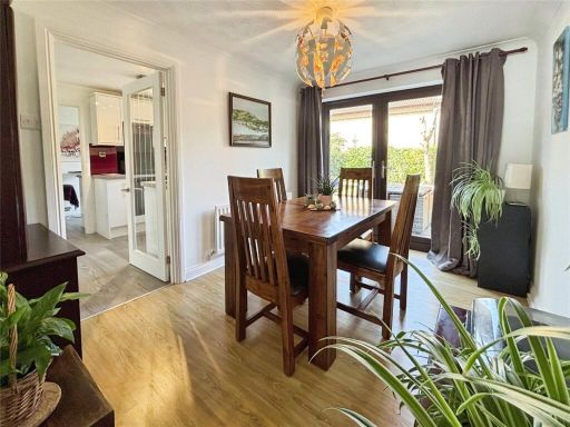
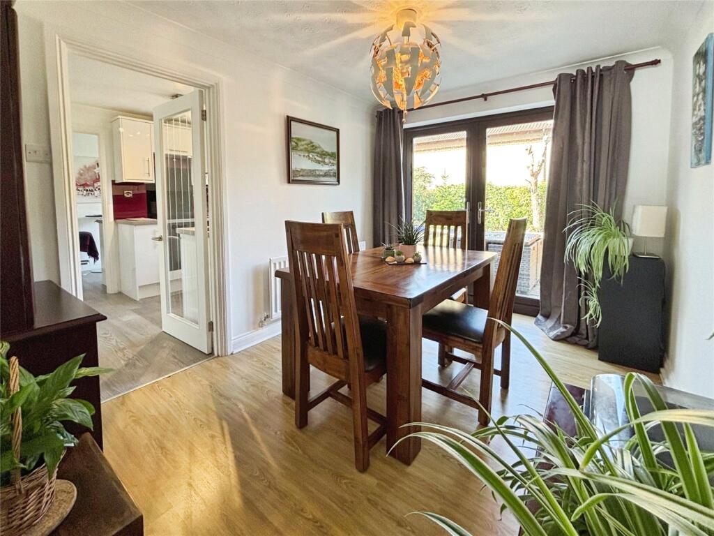
- Dining Room:
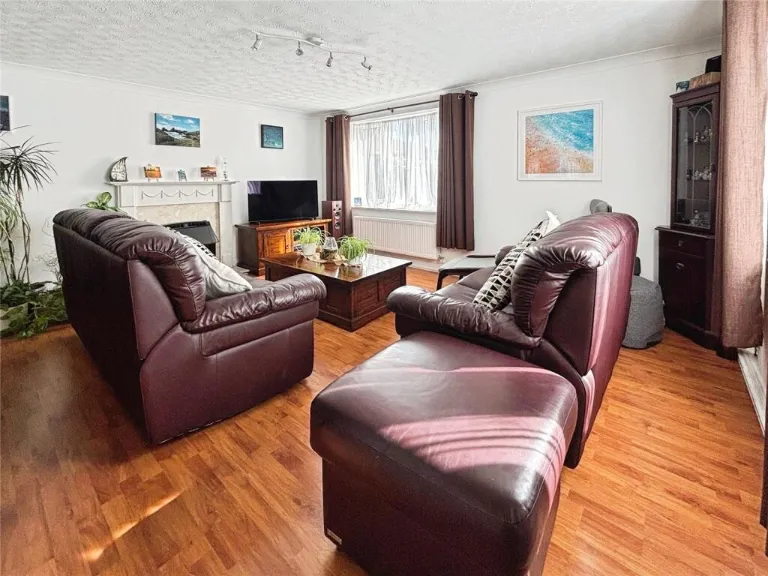
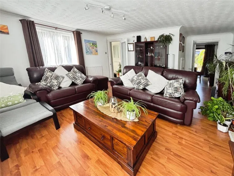
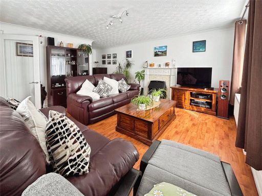
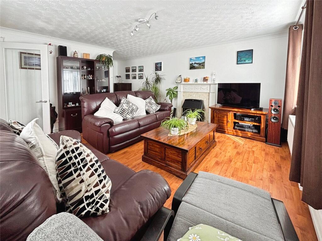
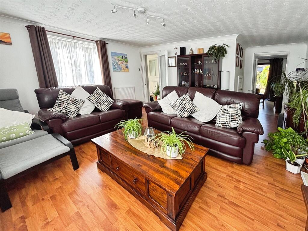
- Lounge:
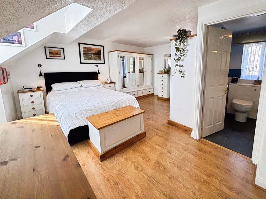
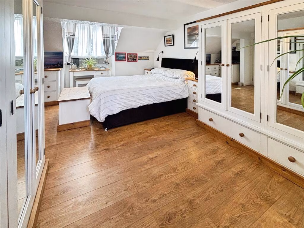
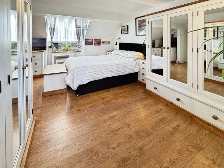
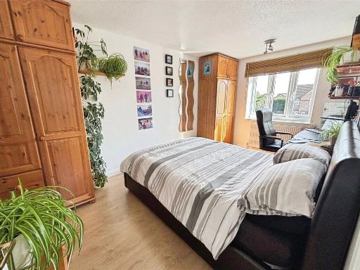
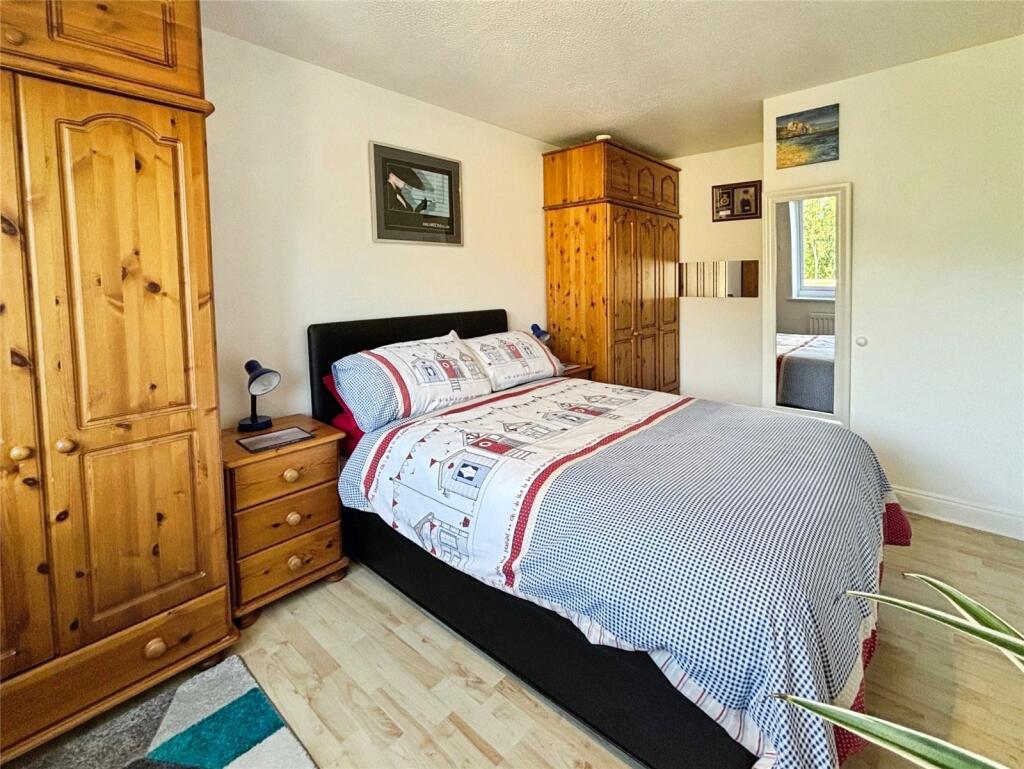
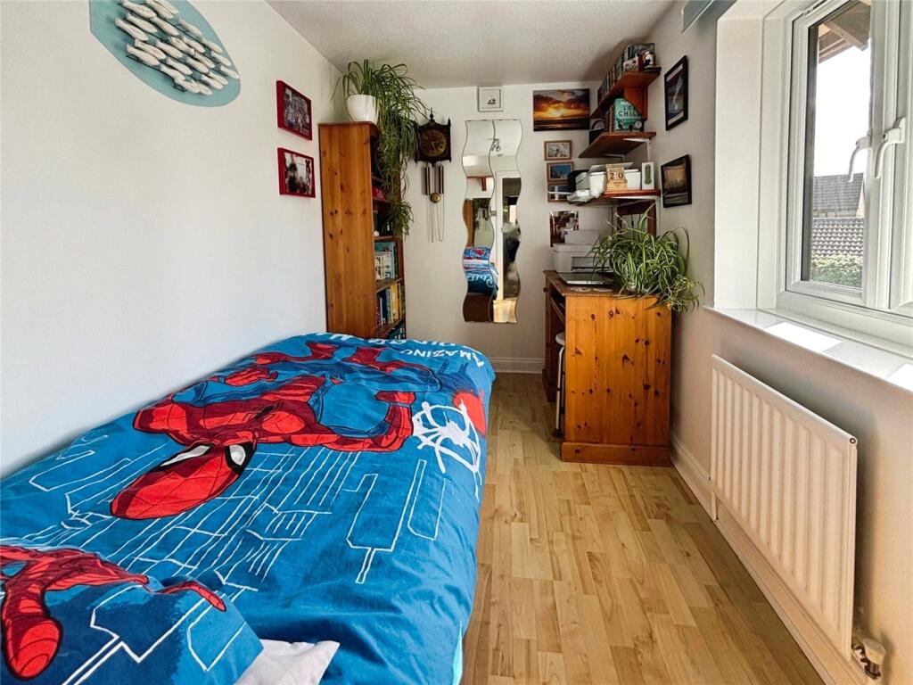
- Bedroom 1:
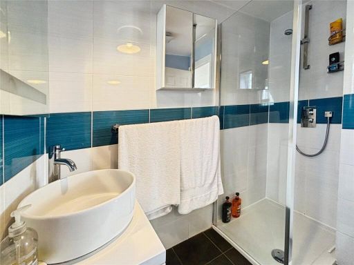
- Ensuite:
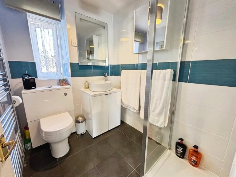
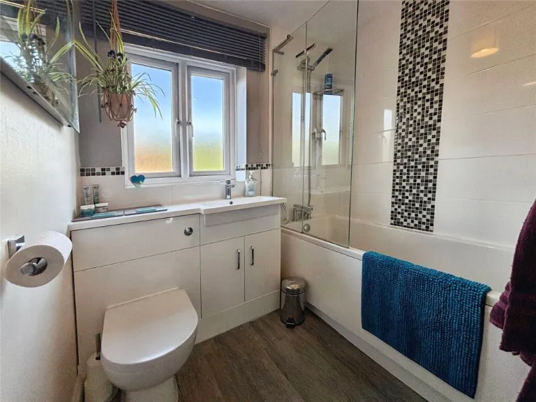
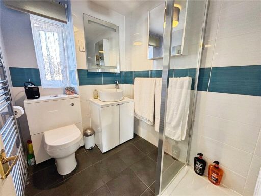
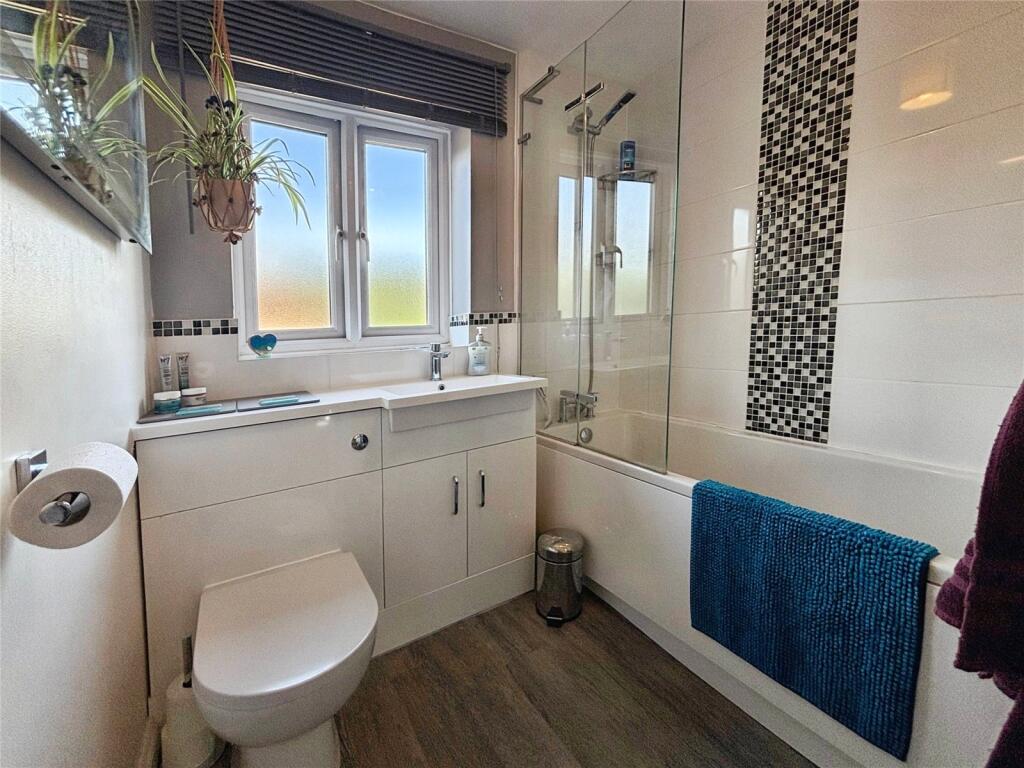
- Bathroom:
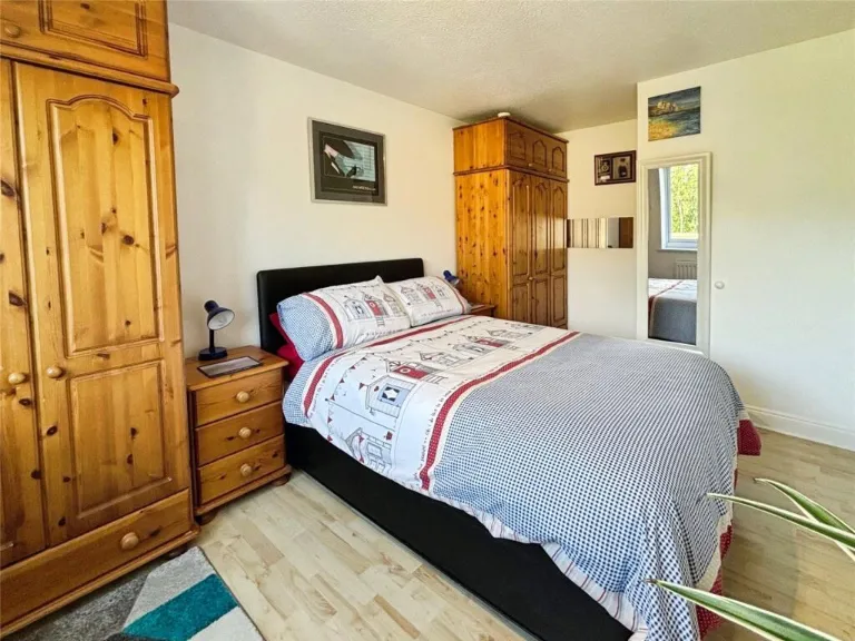
- Bedroom 3:
- Bedroom 4:
- Bedroom 2:
- Summerhouse:
Textual Property Features
Detected Visual Features
- modern
- detached
- brick exterior
- pitched roof
- driveway
- suburban
- garage
- residential
- family home
- double glazing
- brick
- semi-detached
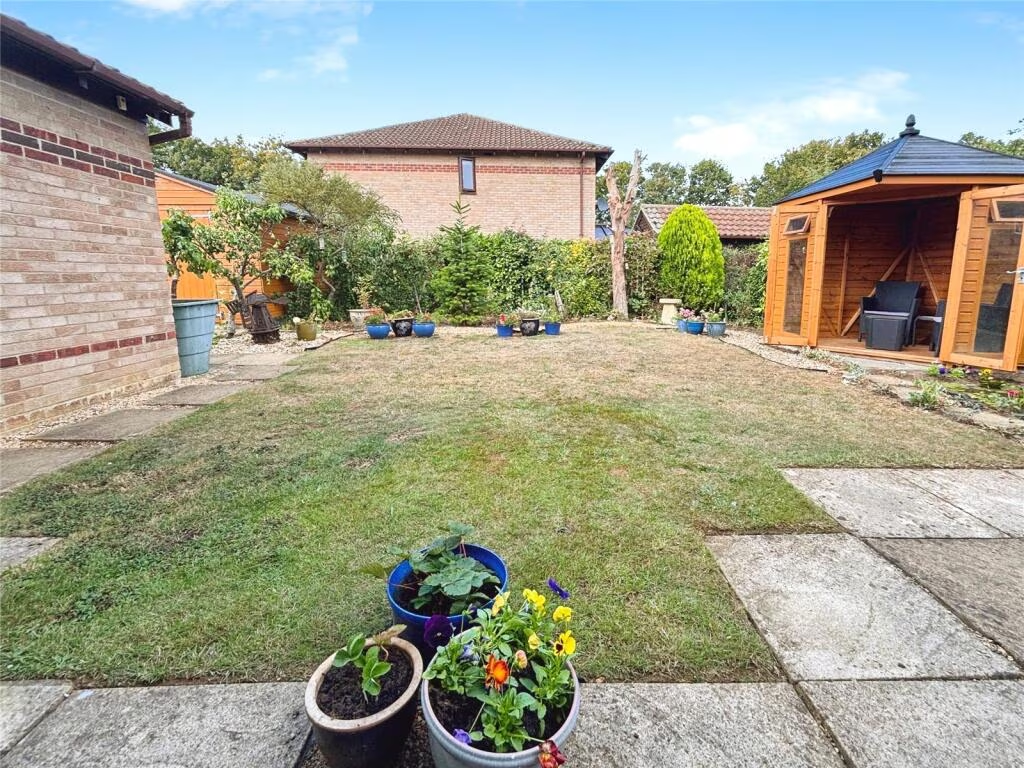
- garden
- patio
- lawn
EPC Details
- Fully double glazed
- Cavity wall, as built, insulated (assumed)
- Boiler and radiators, mains gas
- Low energy lighting in 80% of fixed outlets
- Solid, limited insulation (assumed)
Nearby Schools
- St Edburg's Church of England (VA) School
- St Mary's Catholic Primary School, Bicester
- King's Meadow Primary School
- The Cooper School
- Gagle Brook Primary School
- Five Acres Primary School
- Chesterton Church of England Voluntary Aided Primary School
- Launton Church of England Primary School
- The Bicester School
- Longfields Primary and Nursery School
- Bure Park Primary School
- Glory Farm Primary School
- Graven Hill Primary School
- Langford Village Community Primary School
- Marsh Gibbon CofE Primary School
- Fritwell Church of England Primary School
- Bruern Abbey School
- Whitelands Academy
- Brookside Primary School
- Southwold Primary School
- Heyford Park School
- Fringford Church of England Primary School
Nearest General Shops
- Id: 8495414599
- Tags:
- TagsNormalized:
- Lat: 51.9062645
- Lon: -1.1469198
- FullGeoHash: gcppmchzfv48
- PartitionGeoHash: gcpp
- Images:
- FoodStandards: null
- Distance: 1049.3
,- Id: 2606259100
- Tags:
- Brand: Ladbrokes
- Brand:wikidata: Q1799875
- Brand:wikipedia: en:Ladbrokes Coral
- Name: Ladbrokes
- Shop: bookmaker
- TagsNormalized:
- Lat: 51.9074433
- Lon: -1.1506188
- FullGeoHash: gcppmc6nu8u2
- PartitionGeoHash: gcpp
- Images:
- FoodStandards: null
- Distance: 864.3
,- Id: 90122289
- Tags:
- Building: yes
- Name: Eden Approved
- Shop: car
- Source: bing
- TagsNormalized:
- Lat: 51.9090614
- Lon: -1.148468
- FullGeoHash: gcppmcg8ny2h
- PartitionGeoHash: gcpp
- Images:
- FoodStandards: null
- Distance: 720.7
}
Nearest Grocery shops
- Id: 26632769
- Tags:
- Name: The Co-operative Food
- Operator: Midcounties Co-operative
- Shop: supermarket
- TagsNormalized:
- the co-operative food
- food
- shop
- Lat: 51.910183
- Lon: -1.1563588
- FullGeoHash: gcppm9vywzkr
- PartitionGeoHash: gcpp
- Images:
- FoodStandards: null
- Distance: 630.9
,- Id: 90123788
- Tags:
- Building: yes
- Shop: convenience
- Source: bing
- TagsNormalized:
- Lat: 51.9177078
- Lon: -1.1463214
- FullGeoHash: gcppmgm68f0y
- PartitionGeoHash: gcpp
- Images:
- FoodStandards: null
- Distance: 479.5
,- Id: 330805288
- Tags:
- Addr:
- City: Bicester
- Housenumber: 1
- Postcode: OX26 3YQ
- Street: Holm Square
- Alt_name: Tesco Southwold Express
- Brand: Tesco Express
- Brand:wikidata: Q98456772
- Brand:wikipedia: en:Tesco
- Building: yes
- Contact:
- Website: https://www.tesco.com/store-locator/bicester/1-holm-square
- Fhrs:
- Layer: -1
- Name: Tesco Express
- Operator: Tesco
- Shop: convenience
- Source:
- Addr:
- Postcode: FSA Food Hygiene Ratings Database
- TagsNormalized:
- tesco
- tesco express
- convenience
- shop
- Lat: 51.9124221
- Lon: -1.1505312
- FullGeoHash: gcppmf65y8vg
- PartitionGeoHash: gcpp
- Images:
- FoodStandards:
- Id: 222725
- FHRSID: 222725
- LocalAuthorityBusinessID: 999000020814
- BusinessName: Tesco Express
- BusinessType: Retailers - other
- BusinessTypeID: 4613
- AddressLine1: 1 Holm Square
- AddressLine2: null
- AddressLine3: Bicester
- AddressLine4: Oxfordshire
- PostCode: OX26 3YQ
- RatingValue: 5
- RatingKey: fhrs_5_en-GB
- RatingDate: 2015-05-12
- LocalAuthorityCode: 268
- LocalAuthorityName: Cherwell
- LocalAuthorityWebSite: http://www.cherwell.gov.uk
- LocalAuthorityEmailAddress: HPandCompliance@cherwell-dc.gov.uk
- Scores:
- Hygiene: 5
- Structural: 0
- ConfidenceInManagement: 0
- NewRatingPending: false
- Geocode:
- Longitude: null
- Latitude: null
- Distance: 321.3
}
Nearest Supermarkets
- Id: 254038337
- Tags:
- Addr:
- City: Bicester
- Postcode: OX26 4LB
- Street: Launton Road
- Alt_name: LIDL Bicester
- Brand: Lidl
- Brand:wikidata: Q151954
- Building: commercial
- Fhrs:
- Name: LIDL
- Shop: supermarket
- Source:
- Addr:
- Postcode: FSA Food Hygiene Ratings Database
- TagsNormalized:
- Lat: 51.9039565
- Lon: -1.1332505
- FullGeoHash: gcppq0yf3qg0
- PartitionGeoHash: gcpp
- Images:
- FoodStandards:
- Id: 222819
- FHRSID: 222819
- LocalAuthorityBusinessID: 10/00169/C
- BusinessName: Lidl UK GMBH
- BusinessType: Retailers - supermarkets/hypermarkets
- BusinessTypeID: 7840
- AddressLine1: Lidl Launton Road
- AddressLine2: null
- AddressLine3: Bicester
- AddressLine4: Oxfordshire
- PostCode: OX26 4LB
- RatingValue: 5
- RatingKey: fhrs_5_en-GB
- RatingDate: 2017-07-10
- LocalAuthorityCode: 268
- LocalAuthorityName: Cherwell
- LocalAuthorityWebSite: http://www.cherwell.gov.uk
- LocalAuthorityEmailAddress: HPandCompliance@cherwell-dc.gov.uk
- Scores:
- Hygiene: 5
- Structural: 5
- ConfidenceInManagement: 5
- NewRatingPending: false
- Geocode:
- Longitude: null
- Latitude: null
- Distance: 1790.2
,- Id: 26885220
- Tags:
- Brand: Co-op Food
- Brand:wikidata: Q3277439
- Brand:wikipedia: en:Co-op Food
- Name: Co-op Food
- Operator: Midcounties Co-operative
- Shop: supermarket
- TagsNormalized:
- co-op
- co-op food
- food
- supermarket
- shop
- Lat: 51.9061492
- Lon: -1.1470548
- FullGeoHash: gcppmchxpxtb
- PartitionGeoHash: gcpp
- Images:
- FoodStandards: null
- Distance: 1058.5
,- Id: 330732593
- Tags:
- Addr:
- City: Bicester
- Housename: Audley House
- Housenumber: Unit 1
- Postcode: OX26 3AH
- Street: Buckingham Road
- Brand: Co-op Food
- Brand:wikidata: Q3277439
- Brand:wikipedia: en:Co-op Food
- Building: retail
- Name: Co-op Food
- Operator: Midcounties Co-operative
- Shop: supermarket
- TagsNormalized:
- co-op
- co-op food
- food
- retail
- supermarket
- shop
- Lat: 51.9076066
- Lon: -1.1505738
- FullGeoHash: gcppmc6ptxjy
- PartitionGeoHash: gcpp
- Images:
- FoodStandards: null
- Distance: 846.6
}
Nearest Religious buildings
- Id: 6509850776
- Tags:
- Addr:
- City: Bicester
- Country: GB
- Postcode: OX26 4FR
- Street: Hart Place
- Amenity: place_of_worship
- Name: Bicester Salvation Army
- Religion: christian
- TagsNormalized:
- place of worship
- salvation army
- christian
- church
- Lat: 51.908449
- Lon: -1.1377354
- FullGeoHash: gcppq1es8u4z
- PartitionGeoHash: gcpp
- Images:
- FoodStandards: null
- Distance: 1230
,- Id: 195154640
- Tags:
- Amenity: place_of_worship
- Building: church
- Denomination: anglican
- Name: Saint Lawrence
- Religion: christian
- Wikidata: Q17548020
- TagsNormalized:
- place of worship
- church
- anglican
- christian
- Lat: 51.9223209
- Lon: -1.1571155
- FullGeoHash: gcppmsjmmq0h
- PartitionGeoHash: gcpp
- Images:
- FoodStandards: null
- Distance: 869.7
,- Id: 245719248
- Tags:
- Addr:
- City: BICESTER
- Postcode: OX26 3HA
- Street: Barberry Place
- Amenity: place_of_worship
- Building: church
- Denomination: anglican
- Name: Emmanuel Church Bicester
- Religion: christian
- Website: http://www.emmanuelbicester.org.uk/
- Wikidata: Q105073329
- TagsNormalized:
- place of worship
- church
- anglican
- christian
- Lat: 51.9099317
- Lon: -1.1571844
- FullGeoHash: gcppm9vm78su
- PartitionGeoHash: gcpp
- Images:
- FoodStandards: null
- Distance: 683.5
}
Nearest Medical buildings
- Id: 975203342
- Tags:
- Amenity: doctors
- Healthcare: doctor
- TagsNormalized:
- doctor
- doctors
- health
- healthcare
- Lat: 51.9078695
- Lon: -1.1504697
- FullGeoHash: gcppmcd3205w
- PartitionGeoHash: gcpp
- Images:
- FoodStandards: null
- Distance: 818.5
,- Id: 674625943
- Tags:
- Addr:
- City: Bicester
- Housenumber: 119
- Postcode: OX26 3EU
- Street: Buckingham Rd
- Amenity: doctors
- Building: yes
- Healthcare: doctor
- Name: Victoria House Surgery
- Operator: Alchester Medical Group
- TagsNormalized:
- doctor
- doctors
- health
- healthcare
- surgery
- Lat: 51.9078746
- Lon: -1.1505582
- FullGeoHash: gcppmcd1q11t
- PartitionGeoHash: gcpp
- Images:
- FoodStandards: null
- Distance: 817.2
,- Id: 26487645
- Tags:
- Amenity: doctors
- Healthcare: doctor
- Name: North Bicester Surgery
- TagsNormalized:
- doctor
- doctors
- health
- healthcare
- surgery
- Lat: 51.9100957
- Lon: -1.1567595
- FullGeoHash: gcppm9vwjx1w
- PartitionGeoHash: gcpp
- Images:
- FoodStandards: null
- Distance: 652.9
,- Id: 2606250902
- Tags:
- Amenity: pharmacy
- Brand: NHS
- Dispensing: yes
- Drive_through: no
- Healthcare: pharmacy
- Name: Co-operative Pharmacy
- Opening_hours: Mo-Sa 08:00-18:00
- Opening_hours:covid19: open
- Operator: The Midcounties Co-operative
- TagsNormalized:
- pharmacy
- nhs
- health
- healthcare
- Lat: 51.9102326
- Lon: -1.156192
- FullGeoHash: gcppm9yp4b8z
- PartitionGeoHash: gcpp
- Images:
- FoodStandards: null
- Distance: 620.7
}
Nearest Leisure Facilities
- Id: 330805283
- Tags:
- TagsNormalized:
- Lat: 51.9116855
- Lon: -1.1511821
- FullGeoHash: gcppmf1xrx83
- PartitionGeoHash: gcpp
- Images:
- FoodStandards: null
- Distance: 391.4
,- Id: 4491919
- Tags:
- Leisure: park
- Source: Bing
- TagsNormalized:
- Lat: 51.9181581
- Lon: -1.1490747
- FullGeoHash: gcppmg7m0w5u
- PartitionGeoHash: gcpp
- Images:
- FoodStandards: null
- Distance: 387.1
,- Id: 4339693
- Tags:
- Created_by: JOSM
- Leisure: playground
- TagsNormalized:
- Lat: 51.9138818
- Lon: -1.1568848
- FullGeoHash: gcppmdts68up
- PartitionGeoHash: gcpp
- Images:
- FoodStandards: null
- Distance: 366
,- Id: 4401077
- Tags:
- Leisure: park
- Name: Southwold Park
- TagsNormalized:
- Lat: 51.9127766
- Lon: -1.1526498
- FullGeoHash: gcppmf2tv6fn
- PartitionGeoHash: gcpp
- Images:
- FoodStandards: null
- Distance: 270.3
,- Id: 4351813
- Tags:
- Leisure: playground
- Name: Southwold Play Area
- TagsNormalized:
- Lat: 51.9127972
- Lon: -1.1517365
- FullGeoHash: gcppmf3mfwg1
- PartitionGeoHash: gcpp
- Images:
- FoodStandards: null
- Distance: 264.5
}
Nearest Tourist attractions
- Id: 4880845822
- Tags:
- Addr:
- Housenumber: 46
- Postcode: OX26 2LB
- Street: Ashby Road
- Email: adrian29marius@icloud.com
- Internet_access: wlan
- Name: Citywide Bucharest
- Opening_hours: Mo-Su 10:00-16:00
- Operator: Ady English
- Phone: +44 7738223497
- Tourism: guest_house
- Website: http://www.adyenglish.co.uk
- TagsNormalized:
- Lat: 51.9012851
- Lon: -1.1642056
- FullGeoHash: gcppm826bhc3
- PartitionGeoHash: gcpp
- Images:
- FoodStandards: null
- Distance: 1757.3
,- Id: 352553128
- Tags:
- Addr:
- Housenumber: 25
- Postcode: OX26 4TR
- Street: Churchill Road
- Building: yes
- Name: The Winston Guesthouse
- Source: Bing
- Tourism: guest_house
- Website: http://www.winstonsouth.com/
- TagsNormalized:
- Lat: 51.9067244
- Lon: -1.1455376
- FullGeoHash: gcppmcmfe49r
- PartitionGeoHash: gcpp
- Images:
- FoodStandards: null
- Distance: 1037.9
,- Id: 352552621
- Tags:
- Addr:
- Housenumber: 23
- Postcode: OX26 4TR
- Street: Churchill Road
- Building: yes
- Name: Ava House
- Source: Bing
- Tourism: guest_house
- Website: http://www.ava-house.com/
- TagsNormalized:
- Lat: 51.9068444
- Lon: -1.1459415
- FullGeoHash: gcppmcme39h5
- PartitionGeoHash: gcpp
- Images:
- FoodStandards: null
- Distance: 1014.2
}
Nearest Train stations
- Id: 14724359
- Tags:
- Name: Islip
- Naptan:
- Network: National Rail
- Public_transport: station
- Railway: station
- Ref:
- Wikidata: Q1847555
- Wikipedia: en:Islip railway station
- TagsNormalized:
- Lat: 51.826163
- Lon: -1.2376466
- FullGeoHash: gcpngfdv29pb
- PartitionGeoHash: gcpn
- Images:
- FoodStandards: null
- Distance: 11513.1
,- Id: 4490148480
- Tags:
- Name: Tackley
- Naptan:
- Network: National Rail
- Public_transport: station
- Railway: station
- Ref:
- Wikidata: Q2457327
- Wikipedia: en:Tackley railway station
- TagsNormalized:
- Lat: 51.8814551
- Lon: -1.297508
- FullGeoHash: gcpp4kxpmu5y
- PartitionGeoHash: gcpp
- Images:
- FoodStandards: null
- Distance: 10666.2
,- Id: 1494376631
- Tags:
- Name: Heyford
- Naptan:
- Network: National Rail
- Public_transport: station
- Railway: station
- Ref:
- Wikidata: Q2075758
- Wikipedia: en:Heyford railway station
- TagsNormalized:
- Lat: 51.9185846
- Lon: -1.2994468
- FullGeoHash: gcpp67mz8twh
- PartitionGeoHash: gcpp
- Images:
- FoodStandards: null
- Distance: 10121.5
,- Id: 14731037
- Tags:
- Name: Bicester Village
- Naptan:
- Network: National Rail
- Note:
- Name: used to be Bicester Town, don't ask
- Operator: Chiltern Rail
- Postal_code: OX26 6HU
- Public_transport: station
- Railway: station
- Ref:
- Train: yes
- Wikidata: Q1873632
- Wikipedia: en:Bicester Village railway station
- TagsNormalized:
- Lat: 51.8924126
- Lon: -1.1493759
- FullGeoHash: gcppjyep1wg4
- PartitionGeoHash: gcpp
- Images:
- FoodStandards: null
- Distance: 2536.9
,- Id: 17577157
- Tags:
- Name: Bicester North
- Naptan:
- Network: National Rail
- Postal_code: OX26 6EF
- Public_transport: station
- Railway: station
- Ref:
- Wheelchair: yes
- Wikidata: Q2184930
- Wikipedia: en:Bicester North railway station
- TagsNormalized:
- Lat: 51.9034655
- Lon: -1.1499566
- FullGeoHash: gcppmbdxs54p
- PartitionGeoHash: gcpp
- Images:
- FoodStandards: null
- Distance: 1309
}
Nearest Hotels
- Id: 4230034816
- Tags:
- Name: Littlebury Hotel
- Tourism: hotel
- Website: www.littleburyhotel.com
- TagsNormalized:
- Lat: 51.8970847
- Lon: -1.1560198
- FullGeoHash: gcppjxw4qvc0
- PartitionGeoHash: gcpp
- Images:
- FoodStandards: null
- Distance: 2030.2
,- Id: 1020496015
- Tags:
- Name: Almond Tree Hotel
- Phone: +44 1869 360629
- Postal_code: OX26 4PP
- Tourism: hotel
- TagsNormalized:
- Lat: 51.9008976
- Lon: -1.1403921
- FullGeoHash: gcppq038duw1
- PartitionGeoHash: gcpp
- Images:
- FoodStandards: null
- Distance: 1775
,- Id: 5003535974
- Tags:
- Brand: Travelodge
- Brand:wikidata: Q9361374
- Brand:wikipedia: en:Travelodge_UK
- Internet_access: wlan
- Internet_access:fee: customers
- Internet_access:ssid: Travelodge WiFi
- Name: Travelodge
- Tourism: hotel
- TagsNormalized:
- Lat: 51.899382
- Lon: -1.1537224
- FullGeoHash: gcppjxzzu640
- PartitionGeoHash: gcpp
- Images:
- FoodStandards: null
- Distance: 1759.8
}
Tags
- modern
- detached
- brick exterior
- pitched roof
- driveway
- suburban
- garage
- residential
- family home
- double glazing
- modern
- suburban
- brick
- semi-detached
- garage
- garden
- patio
- lawn
Local Market Stats
- Average Price/sqft: £371
- Avg Income: £65300
- Rental Yield: 4.6%
- Social Housing: 7%
- Planning Success Rate: 86%
AirBnB Data
- 1km average: £111/night
- Listings in 1km: 2
Similar Properties
 3 bedroom detached house for sale in Willow Drive, Bicester, OX26 — £400,000 • 3 bed • 1 bath • 1130 ft²
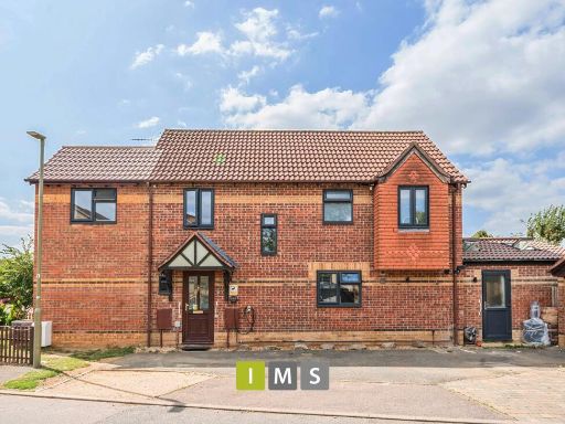 4 bedroom detached house for sale in Aspen Close, Bicester, OX26 — £500,000 • 4 bed • 2 bath • 850 ft²
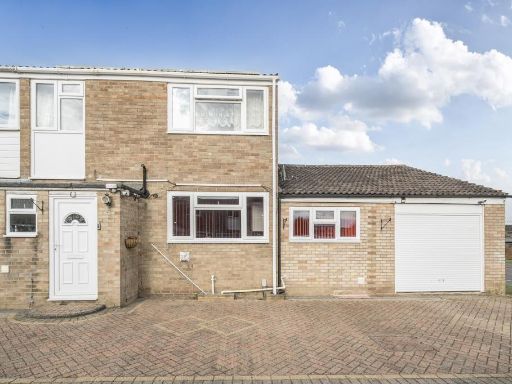 4 bedroom semi-detached house for sale in Hampden Close, Bicester, Oxfordshire, OX26 — £425,000 • 4 bed • 1 bath • 1803 ft²
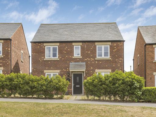 4 bedroom detached house for sale in Izzard Road, Heyford Park, OX25 — £540,000 • 4 bed • 2 bath • 1270 ft²
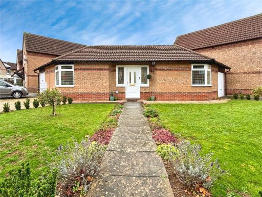 1 bedroom bungalow for sale in Spruce Drive, Bicester, Oxfordshire, OX26 — £310,000 • 1 bed • 1 bath • 538 ft²
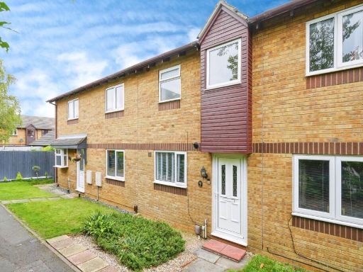 2 bedroom terraced house for sale in Hawthorn Walk, BICESTER, Oxfordshire, OX26 — £280,000 • 2 bed • 1 bath • 698 ft²
Meta
- {
"@context": "https://schema.org",
"@type": "Residence",
"name": "4 bedroom detached house for sale in Heather Road, Bicester…",
"description": "",
"url": "https://propertypiper.co.uk/property/860be71b-216f-4041-a2c3-4d748d6f198c",
"image": "https://image-a.propertypiper.co.uk/604c095e-ec99-4103-ae74-6963f0715f83-1024.jpeg",
"address": {
"@type": "PostalAddress",
"streetAddress": "26 HEATHER ROAD BICESTER ",
"postalCode": "OX26 3YU",
"addressLocality": "Cherwell",
"addressRegion": "Banbury",
"addressCountry": "England"
},
"geo": {
"@type": "GeoCoordinates",
"latitude": 51.9151713,
"longitude": -1.1519753
},
"numberOfRooms": 4,
"numberOfBathroomsTotal": 2,
"floorSize": {
"@type": "QuantitativeValue",
"value": 1740,
"unitCode": "FTK"
},
"offers": {
"@type": "Offer",
"price": 550000,
"priceCurrency": "GBP",
"availability": "https://schema.org/InStock"
},
"additionalProperty": [
{
"@type": "PropertyValue",
"name": "Feature",
"value": "modern"
},
{
"@type": "PropertyValue",
"name": "Feature",
"value": "detached"
},
{
"@type": "PropertyValue",
"name": "Feature",
"value": "brick exterior"
},
{
"@type": "PropertyValue",
"name": "Feature",
"value": "pitched roof"
},
{
"@type": "PropertyValue",
"name": "Feature",
"value": "driveway"
},
{
"@type": "PropertyValue",
"name": "Feature",
"value": "suburban"
},
{
"@type": "PropertyValue",
"name": "Feature",
"value": "garage"
},
{
"@type": "PropertyValue",
"name": "Feature",
"value": "residential"
},
{
"@type": "PropertyValue",
"name": "Feature",
"value": "family home"
},
{
"@type": "PropertyValue",
"name": "Feature",
"value": "double glazing"
},
{
"@type": "PropertyValue",
"name": "Feature",
"value": "modern"
},
{
"@type": "PropertyValue",
"name": "Feature",
"value": "suburban"
},
{
"@type": "PropertyValue",
"name": "Feature",
"value": "brick"
},
{
"@type": "PropertyValue",
"name": "Feature",
"value": "semi-detached"
},
{
"@type": "PropertyValue",
"name": "Feature",
"value": "garage"
},
{
"@type": "PropertyValue",
"name": "Feature",
"value": "garden"
},
{
"@type": "PropertyValue",
"name": "Feature",
"value": "patio"
},
{
"@type": "PropertyValue",
"name": "Feature",
"value": "lawn"
}
]
}
High Res Floorplan Images
Compatible Floorplan Images
FloorplanImages Thumbnail