SL7 1TW - 4 bedroom house for sale in Churchill Drive, Marlow, Buckin…
View on Property Piper
4 bedroom house for sale in Churchill Drive, Marlow, Buckinghamshire, SL7
Property Details
- Price: £525000
- Bedrooms: 4
- Bathrooms: 2
- Property Type: undefined
- Property SubType: undefined
Brochure Descriptions
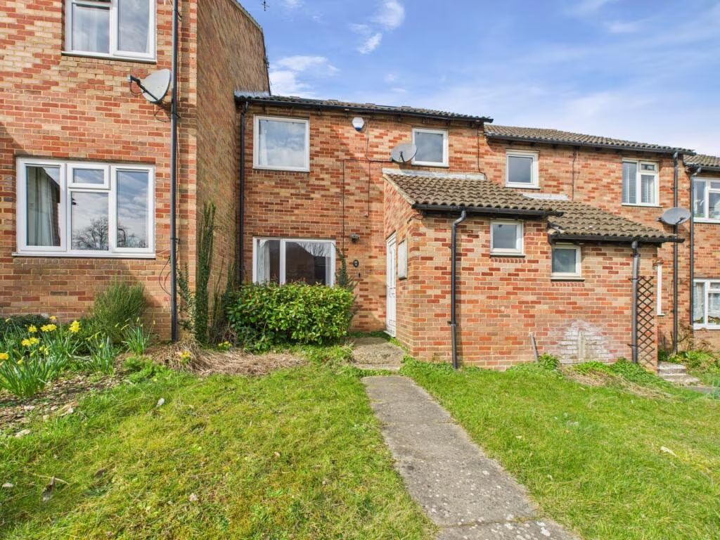
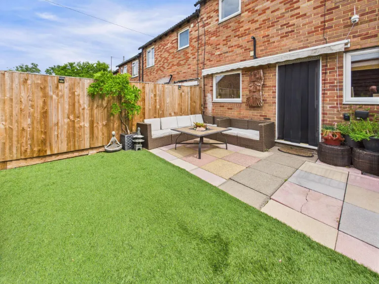
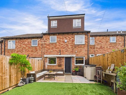
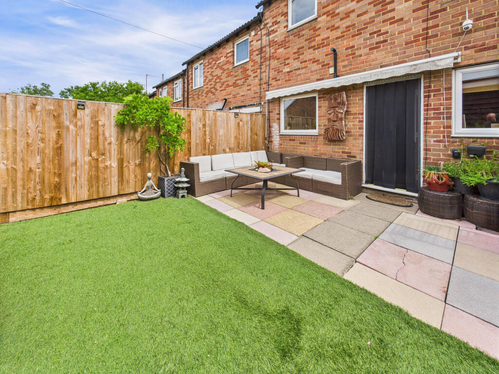
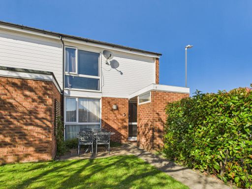
- Mid-terraced three-storey family house with a loft conversion. Brick-built façade with two-storey extension/roof dormer to the rear. The rear garden is modest in size with a paved patio area and artificial turf — low-maintenance landscaping suited to family or commuter buyers. External condition appears good with recently installed timber fencing and garden storage. Accommodation likely provides through-living space at ground floor, bedrooms to first and second floors (including dormer), and typical suburban layout. No notable views (urban/residential setting). Overall plot and garden size: small/average for a terraced property; overall property footprint: small to medium for a suburban townhouse.
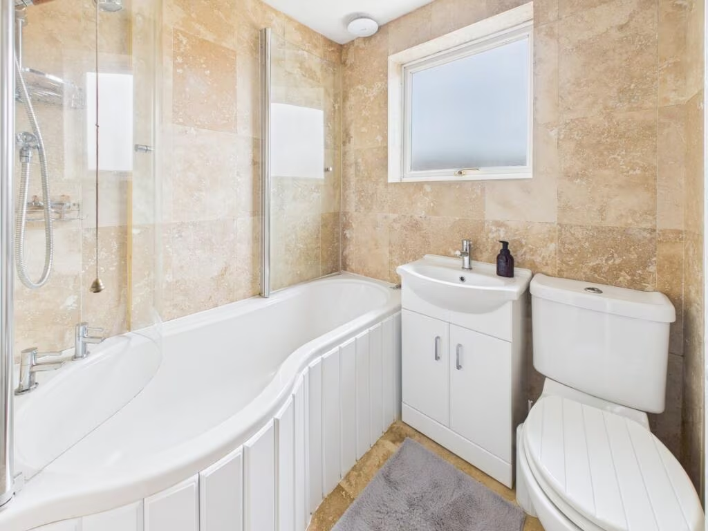
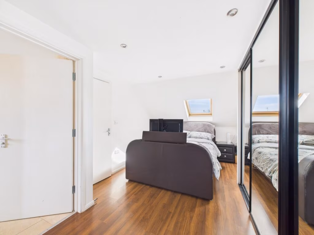
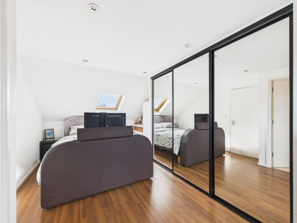
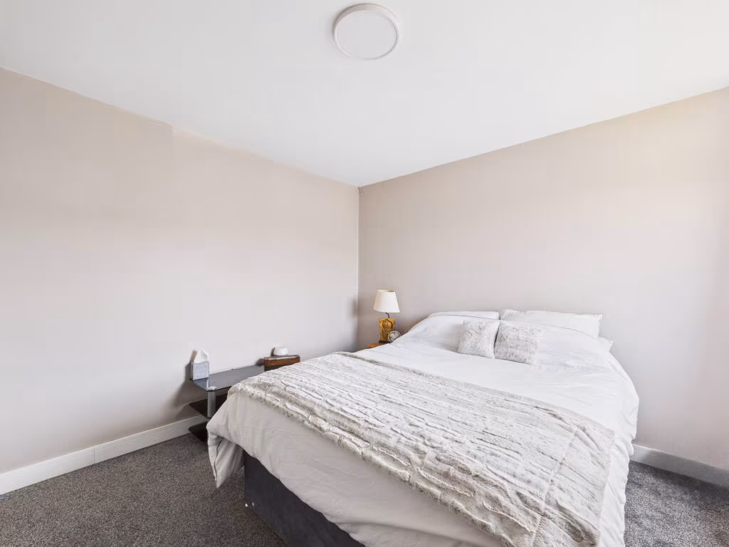
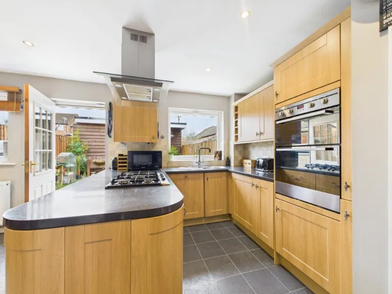
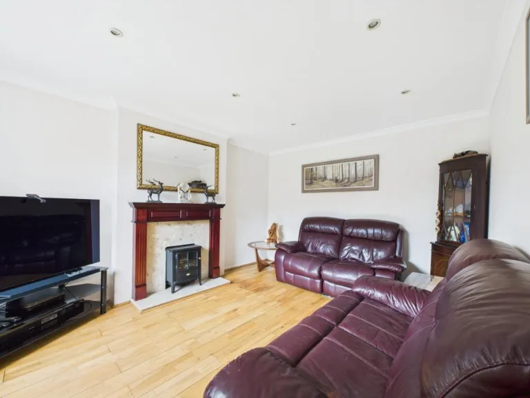
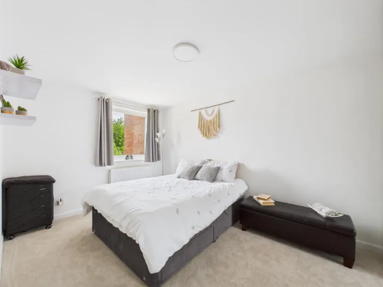
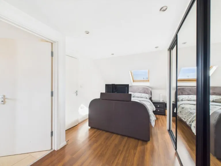
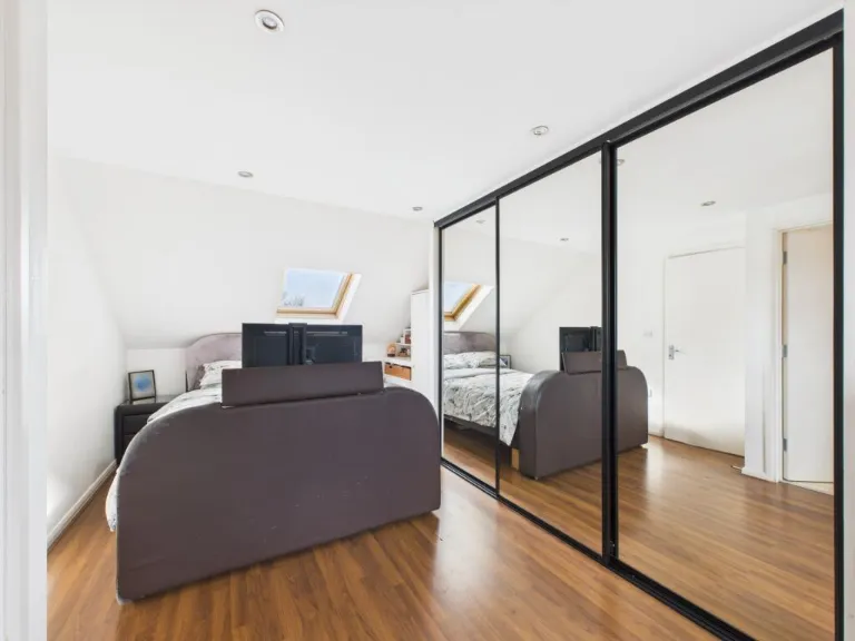
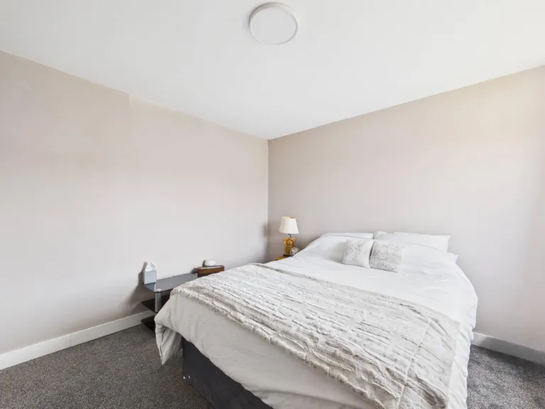
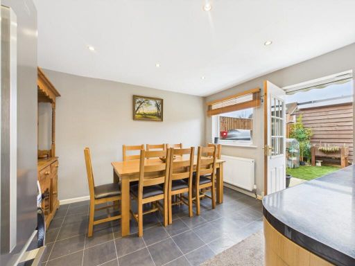
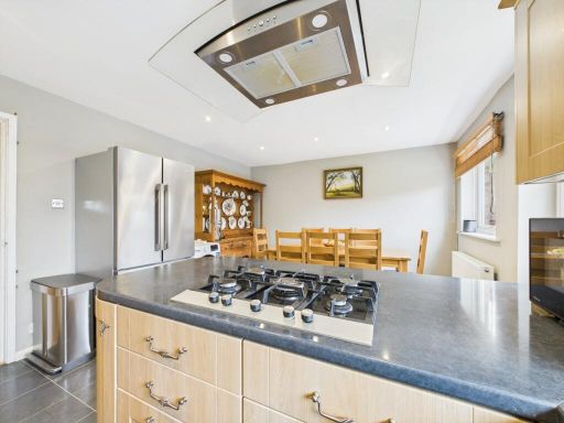
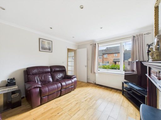
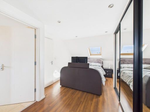
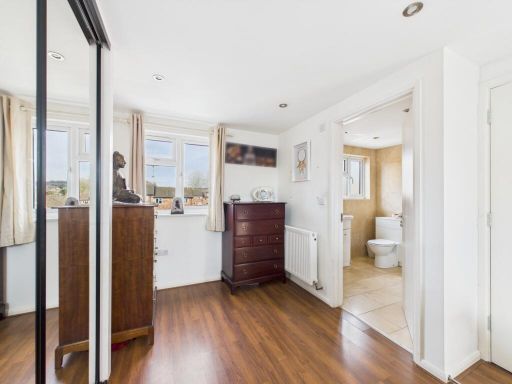
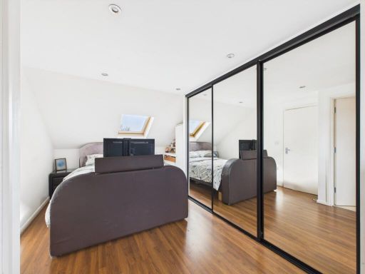
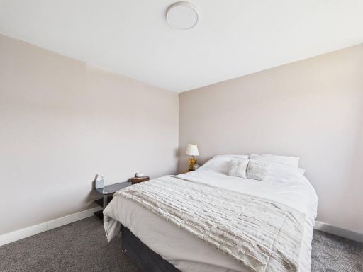
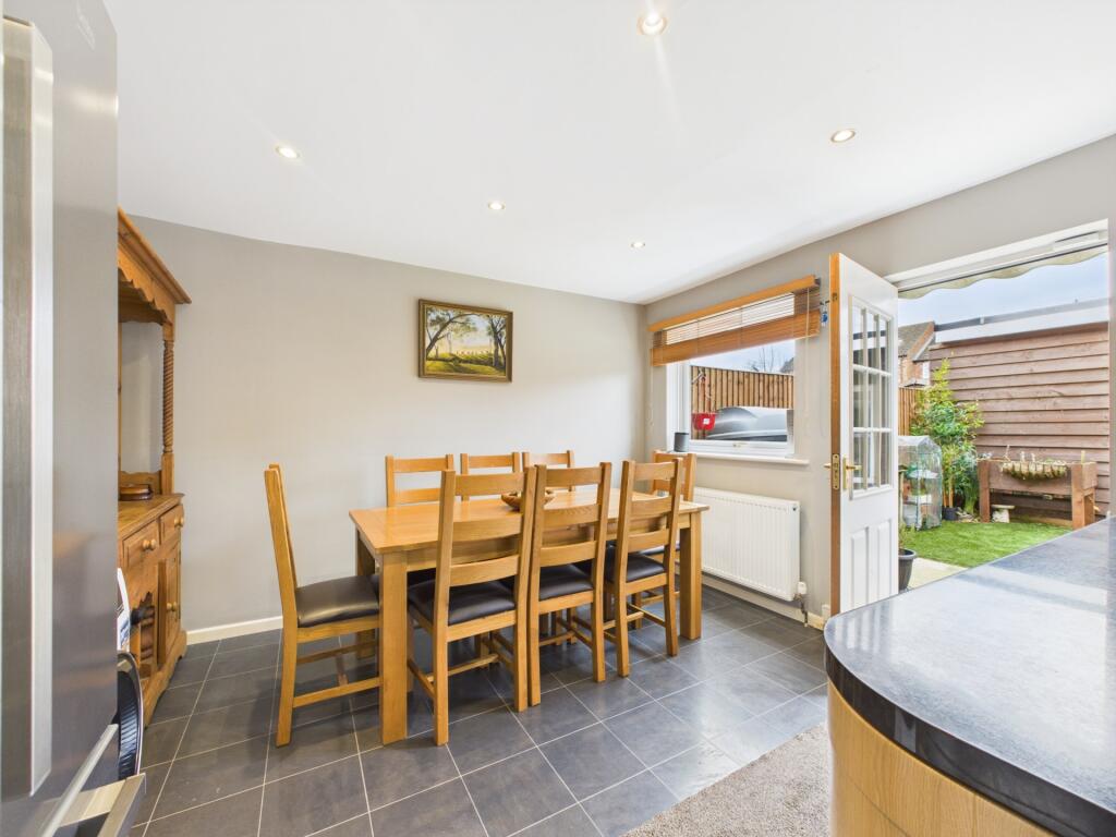
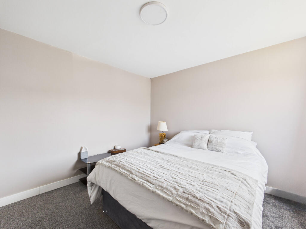
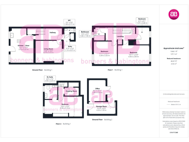
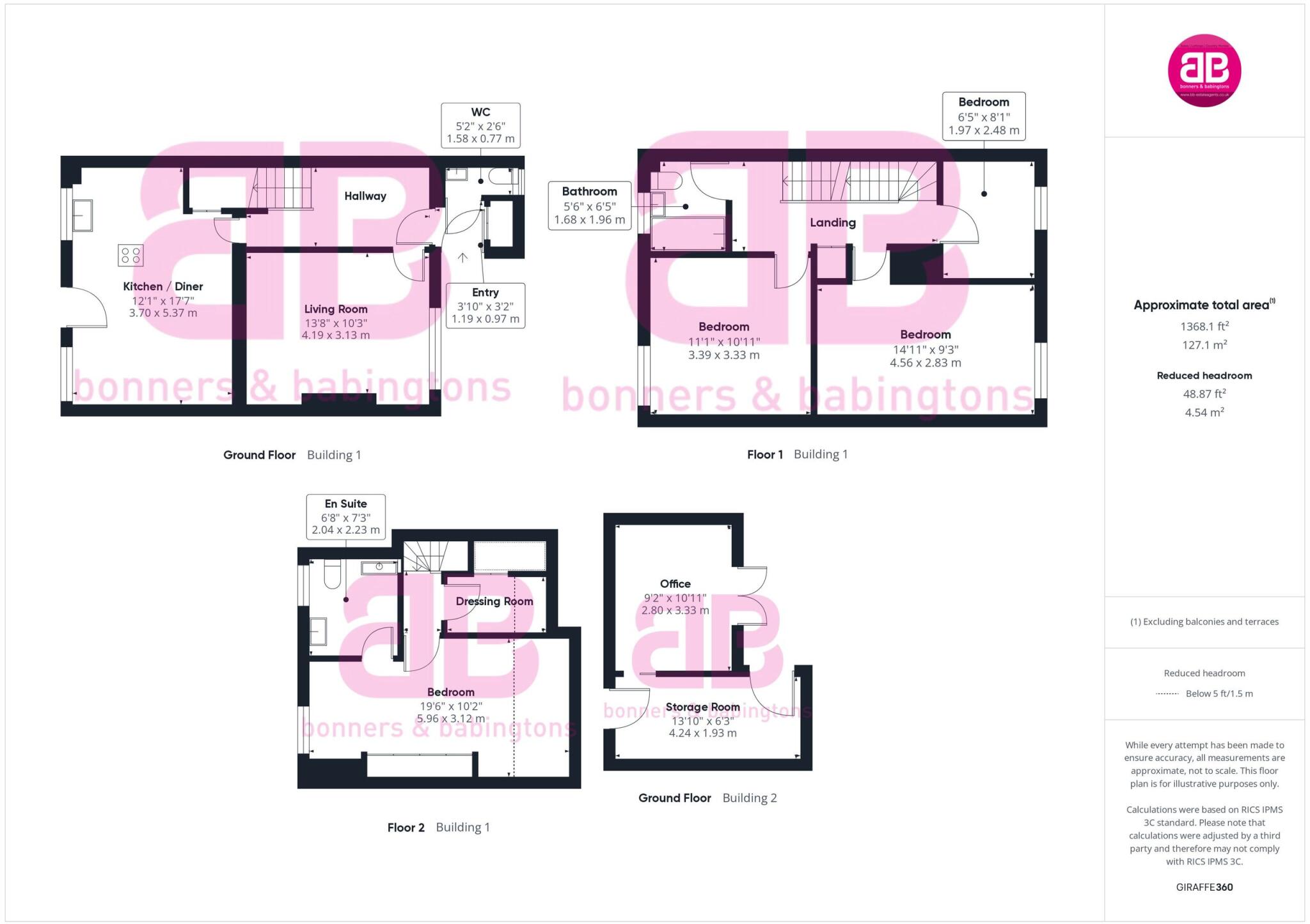
- Substantial mid-terrace/mews townhouse arranged over multiple floors, presented with clear floorplans. The accommodation extends to approximately 1368 sq ft (127.1 m²) and offers a flexible layout including an open-plan kitchen/diner, separate living room, multiple bedrooms (including at least one en-suite) and an additional office/storage room at lower ground/ground level. The property benefits from a private rear garden of small-to-average size with paved patio and artificial lawn area, and built-in wardrobes/wardrobes indicated in bedroom photography. Overall this is a well-proportioned family home offering versatile living and study space, suitable for buyers seeking a town-centre location in Marlow with low-maintenance outdoor space. Internal finishes appear modern with good natural light to principal rooms.
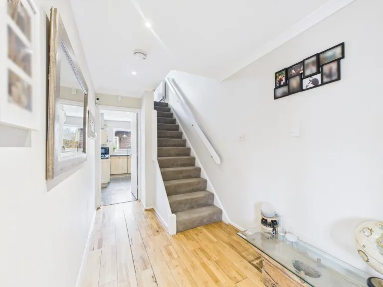
- Mid-terrace or semi-detached residential property located on Churchill Drive, Marlow (SL7 1TW). Internal images show a modern fitted kitchen with integrated appliances, stone-style worktops, breakfast bar peninsula and tiled flooring — suggesting a practical family kitchen of average size. Additional photos show a small to average rear garden with lawn, paved patio area and timber boundary fencing, and a light, narrow entrance hall/staircase with wooden flooring. Overall the property appears to be a modest family home (small to average overall plot), likely arranged over two storeys with functional living spaces suitable for a 2–3 bedroom dwelling. No exceptional views visible; enclosed suburban rear garden.
Image Descriptions
- backyard and rear view of a terraced house modern terraced
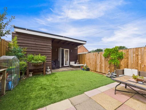
- backyard of a modern bungalow Contemporary
Floorplan Description
- Multi-building residential property (floorplans for Building 1 and Building 2)
Rooms
- Kitchen / Diner:
- Living Room:
- Entry:
- WC:
- Bathroom:
- Bedroom:
- Bedroom:
- Bedroom:
- En Suite:
- Bedroom:
- Office:
- Storage Room:
Textual Property Features
Detected Visual Features
- modern
- terraced
- backyard
- garden
- astroturf
- patio
- three-story
- brickwork
- extension
- contemporary bungalow
- modern design
- well-maintained
- artificial grass
- outdoor space
- private garden
- fenced
- relaxation area
Nearby Schools
- Spinfield School
- Great Marlow School
- St Michael's Catholic School
- Cookham Rise Primary School
- Cookham Dean CofE Primary School
- Herries Preparatory School
- Little Marlow CofE School
- Burford School
- Booker Hill School
- Bisham Church of England Academy
- Sir William Borlase's Grammar School
- Holy Trinity Church of England (Aided) School
- Claytons Primary School
- Chepping View Primary Academy
- Abbey View Primary Academy
- Crown House School
- High Wycombe Church of England Combined School
- St Peter's Catholic Primary School
- Foxes Piece School
- Marlow Church of England Infant School
- Cressex Community School
- John Hampden Grammar School
- Wycombe High School
- Wycombe Abbey
- Castlefield School
- The Chalfonts Independent Grammar School
- Oakridge School
Nearest Bars And Restaurants
- Id: 4323936490
- Tags:
- Addr:
- Amenity: restaurant
- Cuisine: italian
- Name: Da Luca
- Phone: +44 1628 478150
- Website: http://www.dalucarestaurant.com
- TagsNormalized:
- Lat: 51.5868274
- Lon: -0.7753886
- FullGeoHash: gcpmqr57h1s7
- PartitionGeoHash: gcpm
- Images:
- FoodStandards: null
- Distance: 929.2
,- Id: 7745551555
- Tags:
- Amenity: cafe
- Name: Tin Town Coffee
- TagsNormalized:
- Lat: 51.5869024
- Lon: -0.7744564
- FullGeoHash: gcpmqrh53ze7
- PartitionGeoHash: gcpm
- Images:
- FoodStandards: null
- Distance: 874.3
,- Id: 808452854
- Tags:
- Amenity: fast_food
- Name: Marlow Bottom Fish Bar
- TagsNormalized:
- Lat: 51.5869866
- Lon: -0.7741906
- FullGeoHash: gcpmqrh7bp39
- PartitionGeoHash: gcpm
- Images:
- FoodStandards: null
- Distance: 862.1
,- Id: 15917654
- Tags:
- Amenity: pub
- Fhrs:
- Name: The Britannia
- Website: https://www.chickenandgrillpubs.co.uk/britannia/
- TagsNormalized:
- Lat: 51.5789037
- Lon: -0.7670415
- FullGeoHash: gcpmqt9kyss3
- PartitionGeoHash: gcpm
- Images:
- FoodStandards:
- Id: 479412
- FHRSID: 479412
- LocalAuthorityBusinessID: 12/00685/MIXED
- BusinessName: Britannia Arms
- BusinessType: Pub/bar/nightclub
- BusinessTypeID: 7843
- AddressLine1: The Britannia
- AddressLine2: Little Marlow Road
- AddressLine3: Marlow
- AddressLine4: Buckinghamshire
- PostCode: SL7 1HL
- RatingValue: 5
- RatingKey: fhrs_5_en-GB
- RatingDate: 2018-10-11
- LocalAuthorityCode: 021
- LocalAuthorityName: Buckinghamshire
- LocalAuthorityWebSite: http://www.buckinghamshire.gov.uk
- LocalAuthorityEmailAddress: environmentalhealth@buckinghamshire.gov.uk
- Scores:
- Hygiene: 5
- Structural: 0
- ConfidenceInManagement: 0
- NewRatingPending: false
- Geocode:
- Longitude: -0.76712400000000
- Latitude: 51.57889400000000
- Distance: 574.6
,- Id: 5700726710
- Tags:
- TagsNormalized:
- Lat: 51.5836083
- Lon: -0.7551196
- FullGeoHash: gcpmqyd0k3w1
- PartitionGeoHash: gcpm
- Images:
- FoodStandards: null
- Distance: 550.8
}
Nearest General Shops
- Id: 2702531050
- Tags:
- TagsNormalized:
- Lat: 51.5869727
- Lon: -0.7742199
- FullGeoHash: gcpmqrh5zkey
- PartitionGeoHash: gcpm
- Images:
- FoodStandards: null
- Distance: 863.2
,- Id: 130656746
- Tags:
- Fhrs:
- Landuse: retail
- Name: Marlow Garden Centre
- Old_name: Wyevale
- Shop: garden_centre
- Website: https://www.hillier.co.uk/garden-centres/marlow/
- TagsNormalized:
- Lat: 51.5840889
- Lon: -0.7547913
- FullGeoHash: gcpmqyd7h54u
- PartitionGeoHash: gcpm
- Images:
- FoodStandards:
- Id: 479414
- FHRSID: 479414
- LocalAuthorityBusinessID: 12/00689/MIXED
- BusinessName: Hillier Garden Centres
- BusinessType: Restaurant/Cafe/Canteen
- BusinessTypeID: 1
- AddressLine1: Hillier's Garden Centre
- AddressLine2: Pump Lane South
- AddressLine3: Little Marlow
- AddressLine4: Buckinghamshire
- PostCode: SL7 3RB
- RatingValue: 5
- RatingKey: fhrs_5_en-GB
- RatingDate: 2019-05-07
- LocalAuthorityCode: 021
- LocalAuthorityName: Buckinghamshire
- LocalAuthorityWebSite: http://www.buckinghamshire.gov.uk
- LocalAuthorityEmailAddress: environmentalhealth@buckinghamshire.gov.uk
- Scores:
- Hygiene: 0
- Structural: 0
- ConfidenceInManagement: 0
- NewRatingPending: false
- Geocode:
- Longitude: -0.75587201118469
- Latitude: 51.58454132080080
- Distance: 577.6
,- Id: 588729742
- Tags:
- Building: yes
- Drive_through: yes
- Name: Rebellion Brewery Drive-Through
- Shop: alcohol
- TagsNormalized:
- drive through
- brewery
- alcohol
- shop
- Lat: 51.5864436
- Lon: -0.7686691
- FullGeoHash: gcpmqx02bdnf
- PartitionGeoHash: gcpm
- Images:
- FoodStandards: null
- Distance: 509.5
}
Nearest Grocery shops
- Id: 9063255774
- Tags:
- Brand: Londis
- Brand:wikidata: Q21008564
- Brand:wikipedia: en:Londis (United Kingdom)
- Name: Londis
- Shop: convenience
- TagsNormalized:
- Lat: 51.5797223
- Lon: -0.7738002
- FullGeoHash: gcpmqmu99jhu
- PartitionGeoHash: gcpm
- Images:
- FoodStandards: null
- Distance: 848.4
,- Id: 1439753583
- Tags:
- Fhrs:
- Name: Marlow News
- Shop: convenience
- TagsNormalized:
- Lat: 51.5780749
- Lon: -0.7653489
- FullGeoHash: gcpmqtd8n443
- PartitionGeoHash: gcpm
- Images:
- FoodStandards:
- Id: 492314
- FHRSID: 492314
- LocalAuthorityBusinessID: 13/00030/MIXED
- BusinessName: Marlow News
- BusinessType: Retailers - other
- BusinessTypeID: 4613
- AddressLine1: 3 Newtown Road
- AddressLine2: Marlow
- AddressLine3: Buckinghamshire
- AddressLine4: null
- PostCode: SL7 1JX
- RatingValue: 5
- RatingKey: fhrs_5_en-GB
- RatingDate: 2019-07-19
- LocalAuthorityCode: 021
- LocalAuthorityName: Buckinghamshire
- LocalAuthorityWebSite: http://www.buckinghamshire.gov.uk
- LocalAuthorityEmailAddress: environmentalhealth@buckinghamshire.gov.uk
- Scores:
- Hygiene: 5
- Structural: 0
- ConfidenceInManagement: 5
- NewRatingPending: false
- Geocode:
- Longitude: -0.76497900485992
- Latitude: 51.57764053344730
- Distance: 617.8
,- Id: 5700726688
- Tags:
- Fhrs:
- Name: Hursts
- Shop: convenience
- Website: https://www.mrhgb.co.uk/little-marlow
- TagsNormalized:
- Lat: 51.5792081
- Lon: -0.7635753
- FullGeoHash: gcpmqteyxmkc
- PartitionGeoHash: gcpm
- Images:
- FoodStandards:
- Id: 605472
- FHRSID: 605472
- LocalAuthorityBusinessID: 13/00682/MIXED
- BusinessName: MFG Little Marlow Marlow Service Station
- BusinessType: Retailers - other
- BusinessTypeID: 4613
- AddressLine1: Little Marlow Service Station
- AddressLine2: 170 - 174 Little Marlow Road
- AddressLine3: Marlow
- AddressLine4: Buckinghamshire
- PostCode: SL7 1HX
- RatingValue: 3
- RatingKey: fhrs_3_en-GB
- RatingDate: 2022-07-08
- LocalAuthorityCode: 021
- LocalAuthorityName: Buckinghamshire
- LocalAuthorityWebSite: http://www.buckinghamshire.gov.uk
- LocalAuthorityEmailAddress: environmentalhealth@buckinghamshire.gov.uk
- Scores:
- Hygiene: 10
- Structural: 10
- ConfidenceInManagement: 10
- NewRatingPending: false
- Geocode:
- Longitude: -0.76114797592163
- Latitude: 51.58000183105470
- Distance: 472.9
}
Nearest Religious buildings
- Id: 440989312
- Tags:
- Addr:
- City: Marlow
- Country: GB
- Postcode: SL7 3AG
- Street: Wethered Road
- Amenity: school
- Name: Holy Trinity Church of England (Aided) School
- Phone: +441628482831
- Ref:
- Source:
- Addr: edubase
- Geometry: OS_Open_Map_Local_FunctionalSite
- Name: edubase
- Website: www.holytrinity.bucks.sch.uk
- Wikidata: Q67148297
- TagsNormalized:
- Lat: 51.5761741
- Lon: -0.7780668
- FullGeoHash: gcpmqm1kvxxq
- PartitionGeoHash: gcpm
- Images:
- FoodStandards: null
- Distance: 1313.7
,- Id: 588482691
- Tags:
- Amenity: place_of_worship
- Building: chapel
- Name: Marlow Cemetery Chapel
- Religion: christian
- TagsNormalized:
- place of worship
- chapel
- cemetery
- christian
- church
- Lat: 51.5761657
- Lon: -0.7758478
- FullGeoHash: gcpmqm5hcqju
- PartitionGeoHash: gcpm
- Images:
- FoodStandards: null
- Distance: 1197.3
,- Id: 440989336
- Tags:
- Addr:
- City: Marlow
- Country: GB
- Postcode: SL7 3AZ
- Street: Sandygate Road
- Amenity: school
- Capacity: 180
- Denomination: anglican
- Diocese: Diocese of Oxford
- Isced:
- Max_age: 7
- Min_age: 5
- Name: Marlow Church of England Infant School
- Phone: +44 1628 483983
- Ref:
- Religion: christian
- School:
- Boarding: no
- Gender: mixed
- Selective: no
- Trust: no
- Type: voluntary_aided
- Source:
- Addr: edubase
- Geometry: OS_Open_Map_Local_FunctionalSite
- Name: edubase
- Website: https://www.marlow-infant.bucks.sch.uk/
- Wikidata: Q66223366
- TagsNormalized:
- school
- anglican
- church
- christian
- Lat: 51.578373
- Lon: -0.7770449
- FullGeoHash: gcpmqmd1v997
- PartitionGeoHash: gcpm
- Images:
- FoodStandards: null
- Distance: 1117.5
}
Nearest Medical buildings
- Id: 797652531
- Tags:
- Amenity: hospital
- Healthcare: hospital
- TagsNormalized:
- Lat: 51.5735827
- Lon: -0.7704981
- FullGeoHash: gcpmqkwvyhdu
- PartitionGeoHash: gcpm
- Images:
- FoodStandards: null
- Distance: 1210.8
,- Id: 808452846
- Tags:
- Amenity: pharmacy
- Healthcare: pharmacy
- Name: Doctors House and Pharmacy
- TagsNormalized:
- pharmacy
- health
- healthcare
- doctor
- doctors
- Lat: 51.573816
- Lon: -0.7697709
- FullGeoHash: gcpmqkxrr015
- PartitionGeoHash: gcpm
- Images:
- FoodStandards: null
- Distance: 1166.5
,- Id: 5513787024
- Tags:
- Addr:
- City: Marlow Bottom
- Postcode: SL7 3NB
- Street: 44 Marlow Bottom Road
- Amenity: dentist
- Name: La Perla Clinic
- Phone: +44 1628 488499
- Website: http://www.laperlaclinic.co.uk
- Wheelchair: yes
- TagsNormalized:
- Lat: 51.5868565
- Lon: -0.7757378
- FullGeoHash: gcpmqr555zpc
- PartitionGeoHash: gcpm
- Images:
- FoodStandards: null
- Distance: 952.6
,- Id: 2702529638
- Tags:
- Amenity: pharmacy
- Dispensing: yes
- Healthcare: pharmacy
- TagsNormalized:
- Lat: 51.5869555
- Lon: -0.7742509
- FullGeoHash: gcpmqrh5y9s8
- PartitionGeoHash: gcpm
- Images:
- FoodStandards: null
- Distance: 864.2
}
Nearest Airports
- Id: 14001268
- Tags:
- Access: yes
- Aerodrome: international
- Aerodrome:type: public
- Aeroway: aerodrome
- Alt_name: London Heathrow
- Alt_name_2: London Heathrow Airport
- Ele: 25
- Iata: LHR
- Icao: EGLL
- Int_name: Heathrow Airport
- Name: London Heathrow Airport
- Note: area still approx
- Old_name: London Airport
- Operator: Heathrow Airport Limited
- Rank_aci:
- Ref: LHR
- Short_name: Heathrow
- Type: multipolygon
- Website: https://www.heathrow.com/
- Wikidata: Q8691
- Wikipedia: en:Heathrow Airport
- TagsNormalized:
- airport
- international airport
- Lat: 51.4677522
- Lon: -0.4547736
- FullGeoHash: gcpsv9kv7h2h
- PartitionGeoHash: gcps
- Images:
- FoodStandards: null
- Distance: 24909
}
Nearest Leisure Facilities
- Id: 794453730
- Tags:
- TagsNormalized:
- Lat: 51.5826447
- Lon: -0.764634
- FullGeoHash: gcpmqw74wtzt
- PartitionGeoHash: gcpm
- Images:
- FoodStandards: null
- Distance: 139.4
,- Id: 794453693
- Tags:
- TagsNormalized:
- Lat: 51.5825049
- Lon: -0.7623093
- FullGeoHash: gcpmqwkcugug
- PartitionGeoHash: gcpm
- Images:
- FoodStandards: null
- Distance: 118
,- Id: 794453694
- Tags:
- TagsNormalized:
- Lat: 51.582512
- Lon: -0.7623496
- FullGeoHash: gcpmqwkcgvnv
- PartitionGeoHash: gcpm
- Images:
- FoodStandards: null
- Distance: 116.1
,- Id: 794453382
- Tags:
- TagsNormalized:
- Lat: 51.5828905
- Lon: -0.7640322
- FullGeoHash: gcpmqw7shg8r
- PartitionGeoHash: gcpm
- Images:
- FoodStandards: null
- Distance: 90.2
,- Id: 794453384
- Tags:
- TagsNormalized:
- Lat: 51.5831877
- Lon: -0.762281
- FullGeoHash: gcpmqwkvve4h
- PartitionGeoHash: gcpm
- Images:
- FoodStandards: null
- Distance: 62.9
}
Nearest Bus stations and stops
- Id: 2702547404
- Tags:
- Bench: yes
- Bin: yes
- Highway: bus_stop
- Public_transport: platform
- Shelter: yes
- Tactile_paving: no
- TagsNormalized:
- Lat: 51.5785499
- Lon: -0.7670173
- FullGeoHash: gcpmqt96z4w6
- PartitionGeoHash: gcpm
- Images:
- FoodStandards: null
- Distance: 608.8
,- Id: 2702546836
- Tags:
- Bench: yes
- Highway: bus_stop
- Public_transport: platform
- Shelter: yes
- TagsNormalized:
- Lat: 51.5786766
- Lon: -0.7657781
- FullGeoHash: gcpmqtd7s44q
- PartitionGeoHash: gcpm
- Images:
- FoodStandards: null
- Distance: 562.4
,- Id: 2702558661
- Tags:
- Highway: bus_stop
- Public_transport: platform
- TagsNormalized:
- Lat: 51.5807034
- Lon: -0.768471
- FullGeoHash: gcpmqtbrmk42
- PartitionGeoHash: gcpm
- Images:
- FoodStandards: null
- Distance: 481.3
,- Id: 2702560043
- Tags:
- Highway: bus_stop
- Public_transport: platform
- TagsNormalized:
- Lat: 51.5853668
- Lon: -0.7666471
- FullGeoHash: gcpmqwcdxc67
- PartitionGeoHash: gcpm
- Images:
- FoodStandards: null
- Distance: 325.5
,- Id: 2702560041
- Tags:
- Highway: bus_stop
- Public_transport: platform
- TagsNormalized:
- Lat: 51.5853001
- Lon: -0.7662501
- FullGeoHash: gcpmqwf41hft
- PartitionGeoHash: gcpm
- Images:
- FoodStandards: null
- Distance: 300.1
}
Nearest Hotels
- Id: 5620566221
- Tags:
- Brand: Premier Inn
- Brand:wikidata: Q2108626
- Brand:wikipedia: en:Premier Inn
- Internet_access: wlan
- Internet_access:fee: customers
- Internet_access:operator: Virgin Media
- Internet_access:ssid: Premier Inn Free Wi-Fi
- Name: Premier Inn
- Tourism: hotel
- Website: https://www.premierinn.com/gb/en/hotels/england/buckinghamshire/marlow/marlow.html
- TagsNormalized:
- Lat: 51.568806
- Lon: -0.7735169
- FullGeoHash: gcpmq7udpdpy
- PartitionGeoHash: gcpm
- Images:
- FoodStandards: null
- Distance: 1780.7
,- Id: 423224228
- Tags:
- Building: yes
- Fhrs:
- Name: Crowne Plaza
- Tourism: hotel
- Website: https://www.cpmarlow.co.uk/
- TagsNormalized:
- Lat: 51.5708395
- Lon: -0.7522159
- FullGeoHash: gcpmquhmbj70
- PartitionGeoHash: gcpm
- Images:
- FoodStandards: null
- Distance: 1590.8
,- Id: 848305674
- Tags:
- Addr:
- Housename: Travelodge
- Postcode: SL7 1BU
- Street: FieldhouseLane
- Brand: Travelodge
- Brand:wikidata: Q9361374
- Brand:wikipedia: en:Travelodge UK
- Building: yes
- Fhrs:
- Authority: Buckinghamshire
- Id: 1151162
- Local_authority_id: 19/00085/MIXED
- Name: Travelodge
- Tourism: hotel
- TagsNormalized:
- Lat: 51.5710308
- Lon: -0.7603144
- FullGeoHash: gcpmqsnr52um
- PartitionGeoHash: gcpm
- Images:
- FoodStandards: null
- Distance: 1394.2
}
Tags
- modern
- terraced
- backyard
- garden
- astroturf
- patio
- three-story
- brickwork
- extension
- backyard
- contemporary bungalow
- modern design
- well-maintained
- patio
- artificial grass
- outdoor space
- private garden
- fenced
- relaxation area
Local Market Stats
- Average Price/sqft: £571
- Avg Income: £64400
- Rental Yield: 3.1%
- Social Housing: 7%
- Planning Success Rate: 90%
AirBnB Data
- 1km average: £74/night
- Listings in 1km: 2
Similar Properties
 2 bedroom end of terrace house for sale in Shelley Road, Marlow, Buckinghamshire, SL7 — £400,000 • 2 bed • 1 bath • 840 ft²
 3 bedroom terraced house for sale in Marlow, SL7 — £485,000 • 3 bed • 1 bath • 983 ft²
 3 bedroom terraced house for sale in The Croft, Marlow, Buckinghamshire, SL7 — £400,000 • 3 bed • 1 bath • 850 ft²
 3 bedroom terraced house for sale in Bristow Court, Byron Close, Marlow, Buckinghamshire, SL7 — £410,000 • 3 bed • 1 bath • 789 ft²
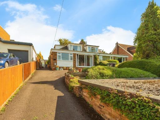 3 bedroom semi-detached house for sale in New Road, Marlow, SL7 — £900,000 • 3 bed • 2 bath • 669 ft²
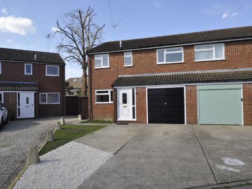 3 bedroom semi-detached house for sale in The Acre, Marlow, Buckinghamshire, SL7 — £500,000 • 3 bed • 1 bath • 775 ft²
Meta
- {
"@context": "https://schema.org",
"@type": "Residence",
"name": "4 bedroom house for sale in Churchill Drive, Marlow, Buckin…",
"description": "",
"url": "https://propertypiper.co.uk/property/815b6fd4-d95e-4a34-bebd-53ef6ec27592",
"image": "https://image-a.propertypiper.co.uk/bf1c24e6-83cc-4149-b9a0-3a6bf9950594-1024.jpeg",
"address": {
"@type": "PostalAddress",
"streetAddress": "16 CHURCHILL DRIVE MARLOW",
"postalCode": "SL7 1TW",
"addressLocality": "Buckinghamshire",
"addressRegion": "Beaconsfield",
"addressCountry": "England"
},
"geo": {
"@type": "GeoCoordinates",
"latitude": 51.5834498,
"longitude": -0.7630872
},
"numberOfRooms": 4,
"numberOfBathroomsTotal": 2,
"floorSize": {
"@type": "QuantitativeValue",
"value": 1270,
"unitCode": "FTK"
},
"offers": {
"@type": "Offer",
"price": 525000,
"priceCurrency": "GBP",
"availability": "https://schema.org/InStock"
},
"additionalProperty": [
{
"@type": "PropertyValue",
"name": "Feature",
"value": "modern"
},
{
"@type": "PropertyValue",
"name": "Feature",
"value": "terraced"
},
{
"@type": "PropertyValue",
"name": "Feature",
"value": "backyard"
},
{
"@type": "PropertyValue",
"name": "Feature",
"value": "garden"
},
{
"@type": "PropertyValue",
"name": "Feature",
"value": "astroturf"
},
{
"@type": "PropertyValue",
"name": "Feature",
"value": "patio"
},
{
"@type": "PropertyValue",
"name": "Feature",
"value": "three-story"
},
{
"@type": "PropertyValue",
"name": "Feature",
"value": "brickwork"
},
{
"@type": "PropertyValue",
"name": "Feature",
"value": "extension"
},
{
"@type": "PropertyValue",
"name": "Feature",
"value": "backyard"
},
{
"@type": "PropertyValue",
"name": "Feature",
"value": "contemporary bungalow"
},
{
"@type": "PropertyValue",
"name": "Feature",
"value": "modern design"
},
{
"@type": "PropertyValue",
"name": "Feature",
"value": "well-maintained"
},
{
"@type": "PropertyValue",
"name": "Feature",
"value": "patio"
},
{
"@type": "PropertyValue",
"name": "Feature",
"value": "artificial grass"
},
{
"@type": "PropertyValue",
"name": "Feature",
"value": "outdoor space"
},
{
"@type": "PropertyValue",
"name": "Feature",
"value": "private garden"
},
{
"@type": "PropertyValue",
"name": "Feature",
"value": "fenced"
},
{
"@type": "PropertyValue",
"name": "Feature",
"value": "relaxation area"
}
]
}
High Res Floorplan Images
Compatible Floorplan Images
FloorplanImages Thumbnail