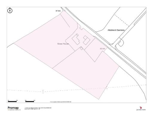
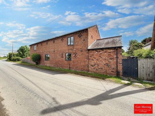
SY14 7JJ - Equestrian facility for sale in Old Hall Street, Malpas, Ch…
View on Property Piper
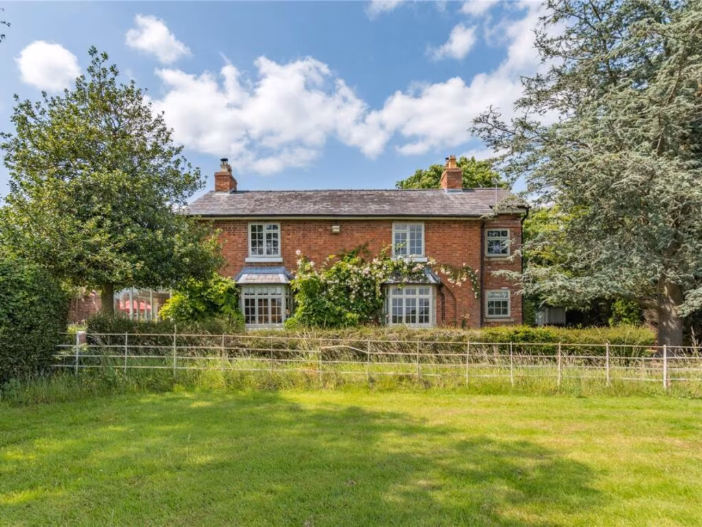
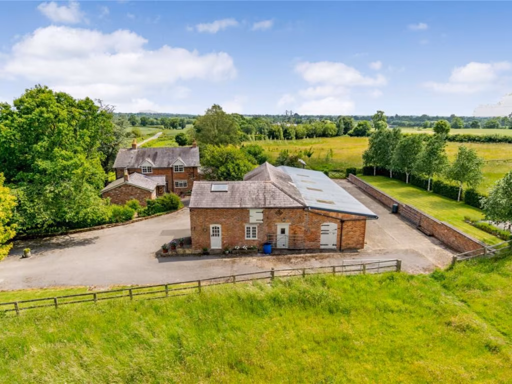
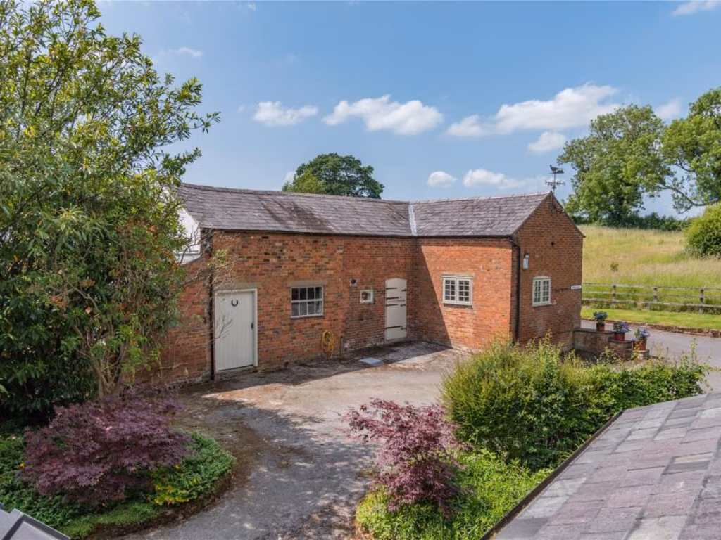
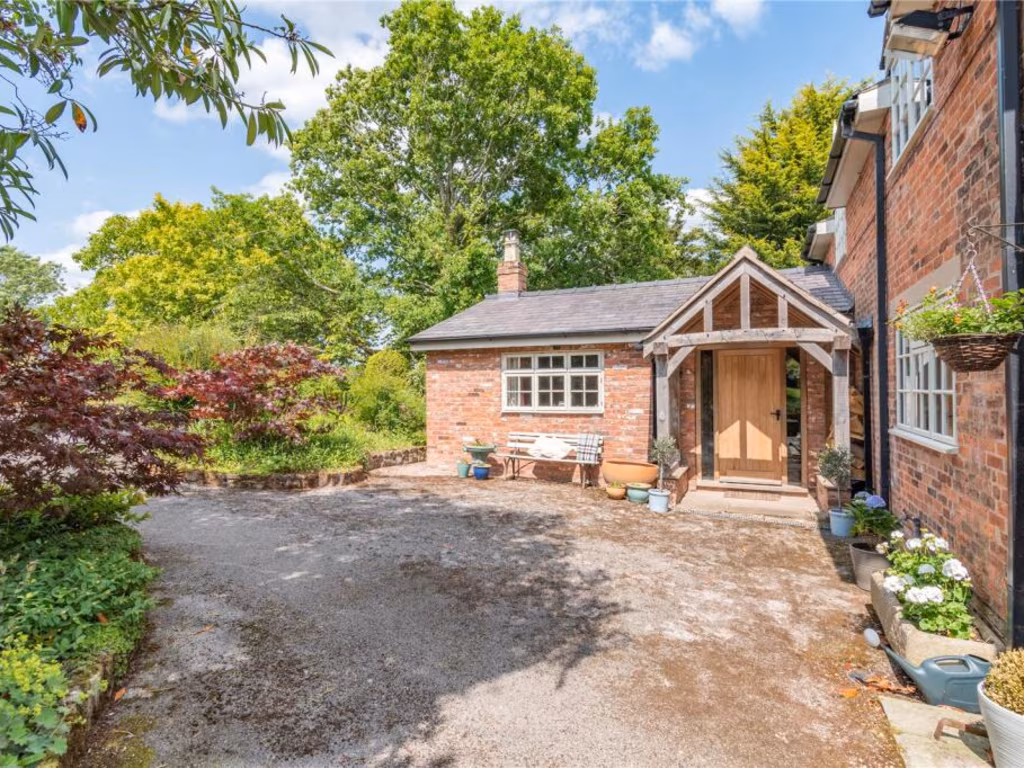
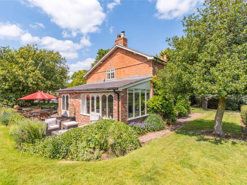
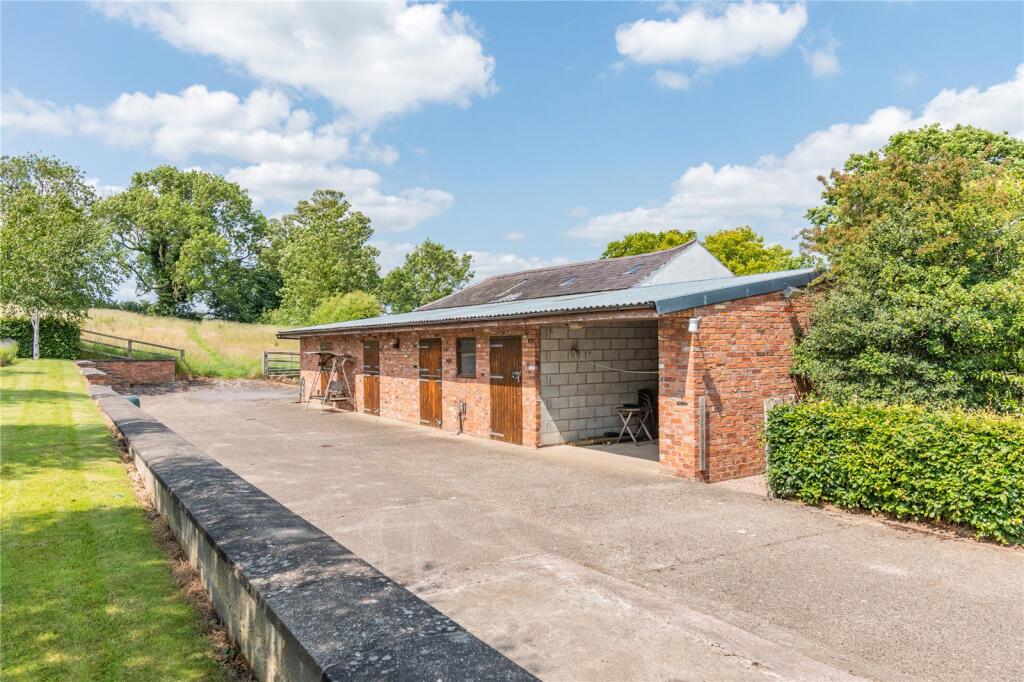
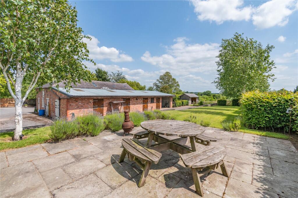
Equestrian facility for sale in Old Hall Street, Malpas, Cheshire, SY14
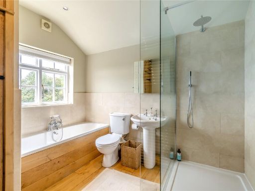
Property Details
- Price: £1150000
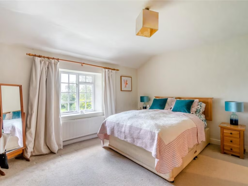
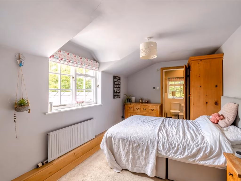
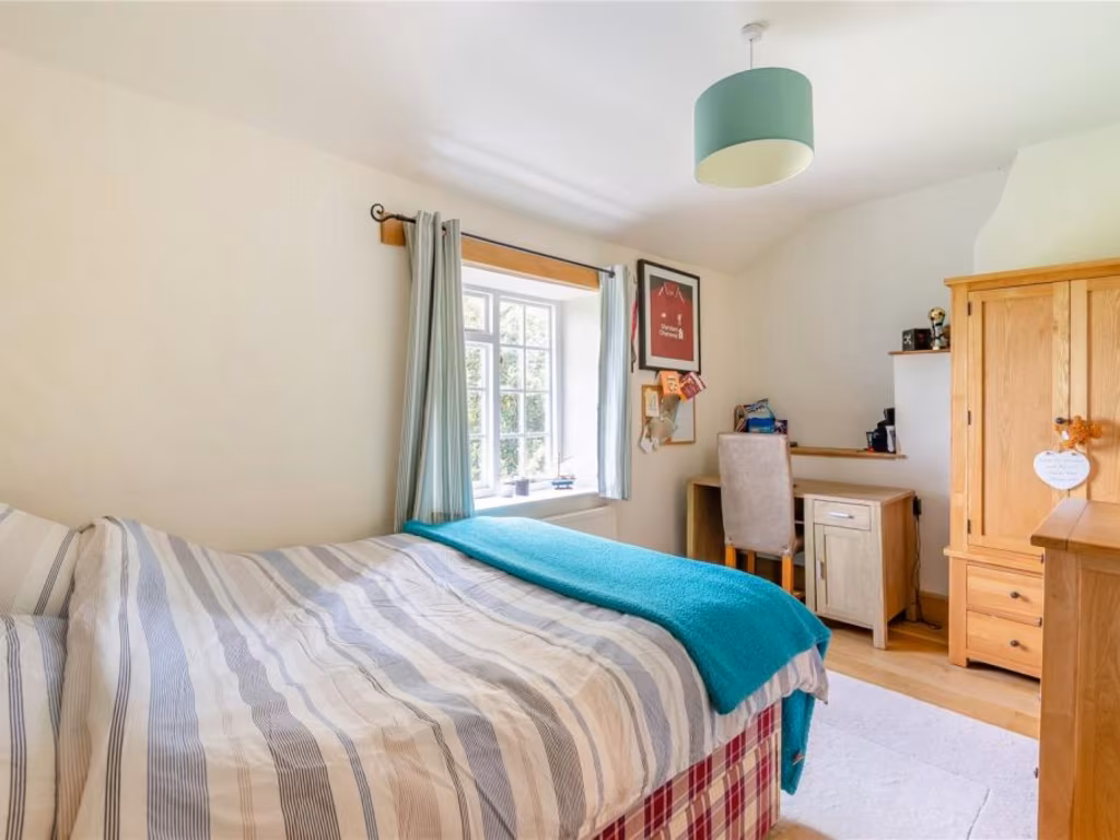
- Bedrooms: 4
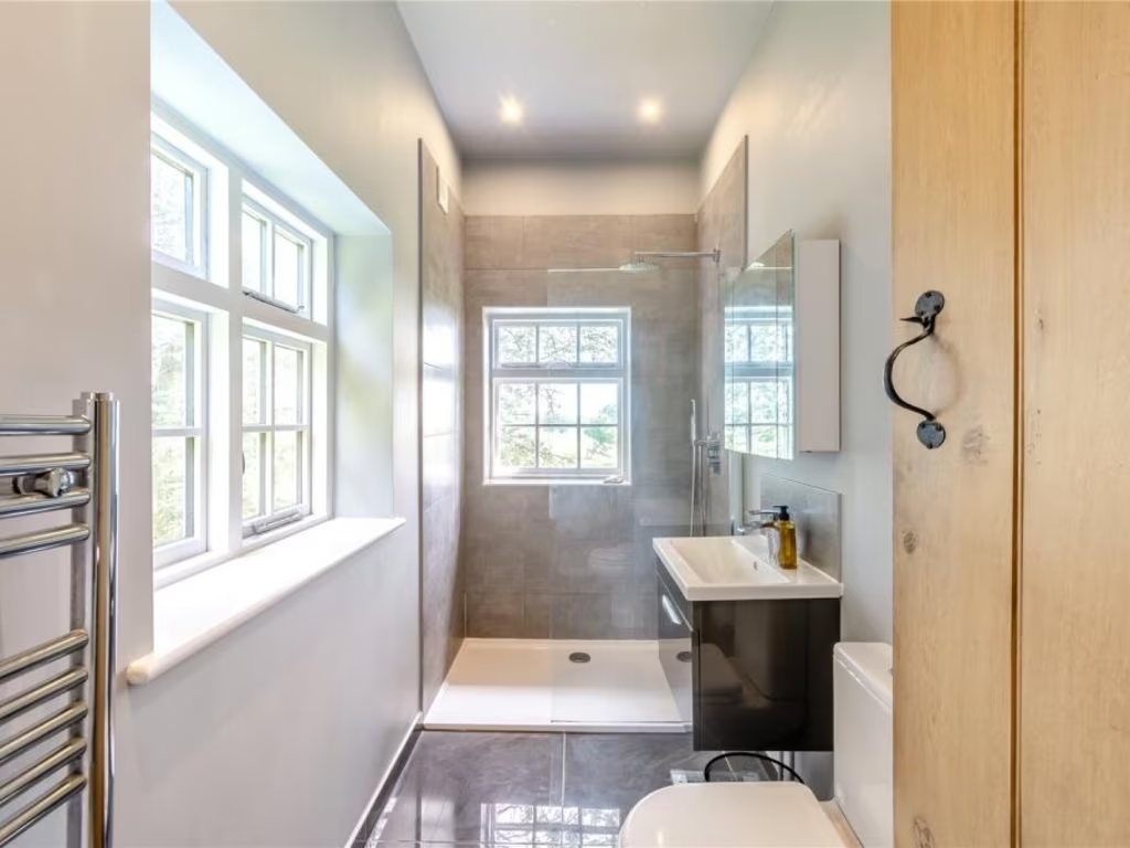
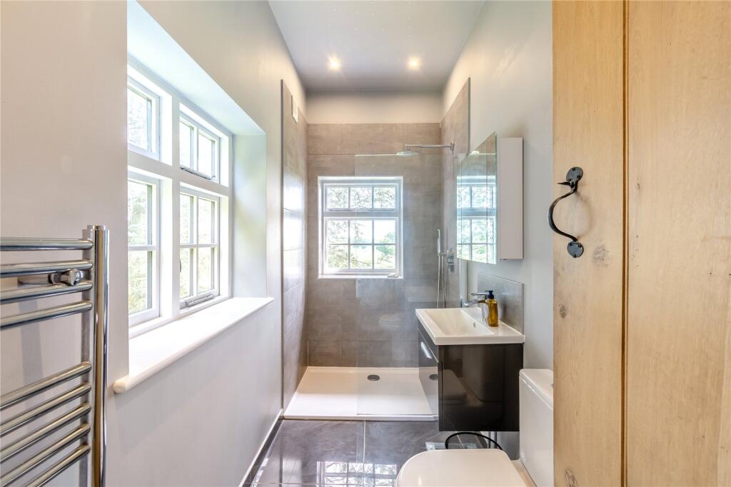
- Bathrooms: 3
- Property Type: undefined
- Property SubType: undefined
Image Descriptions
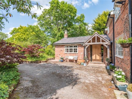
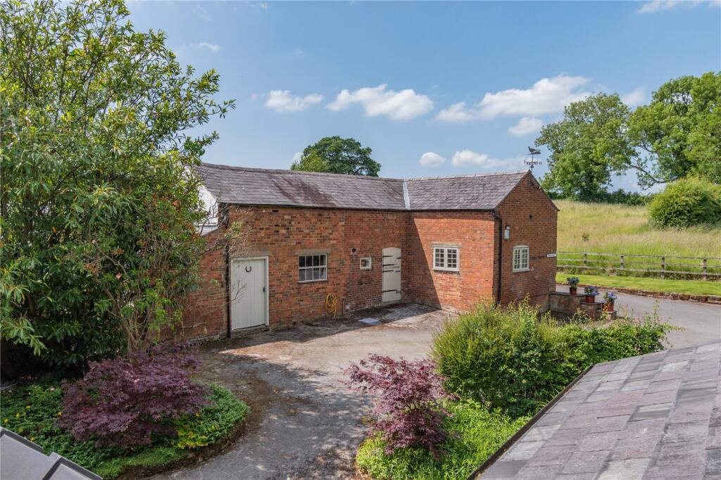
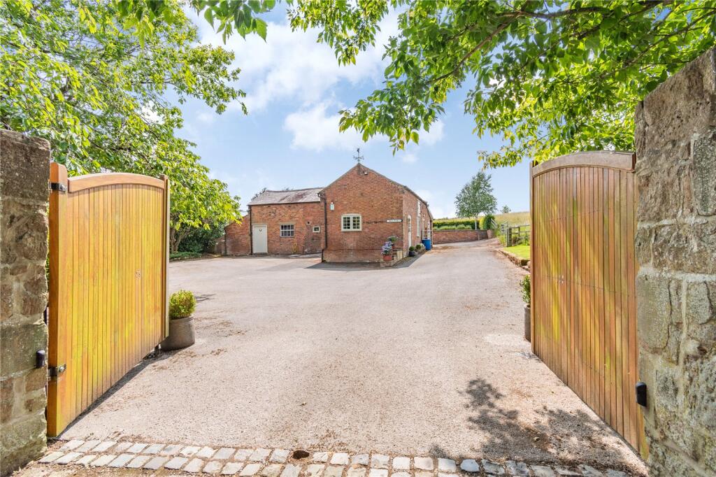
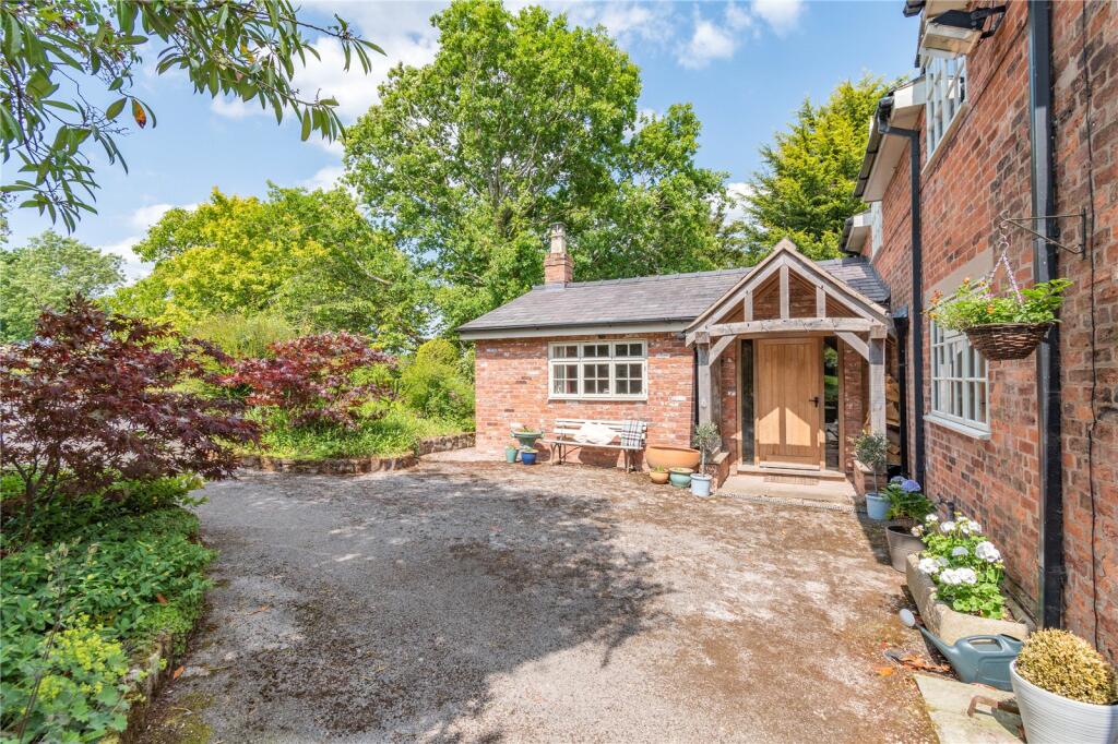
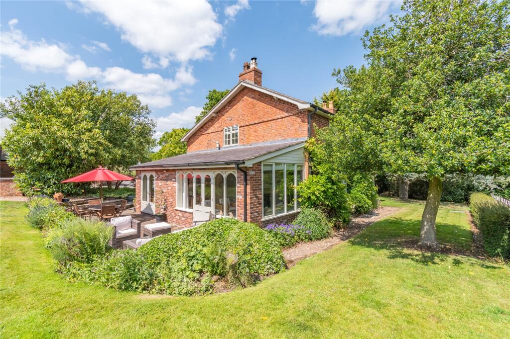
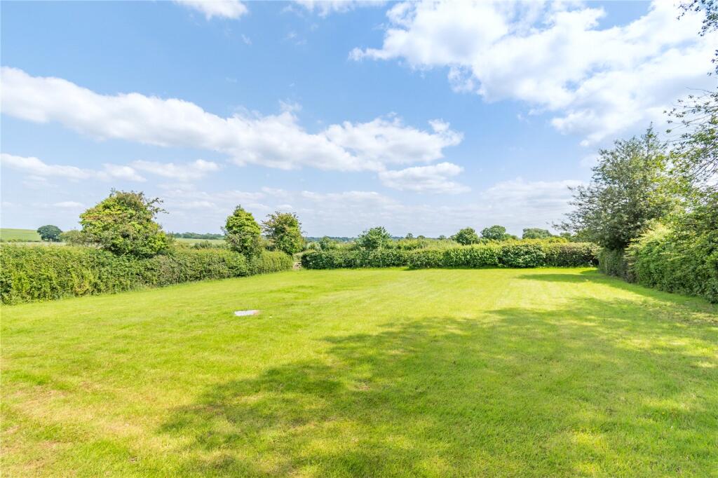
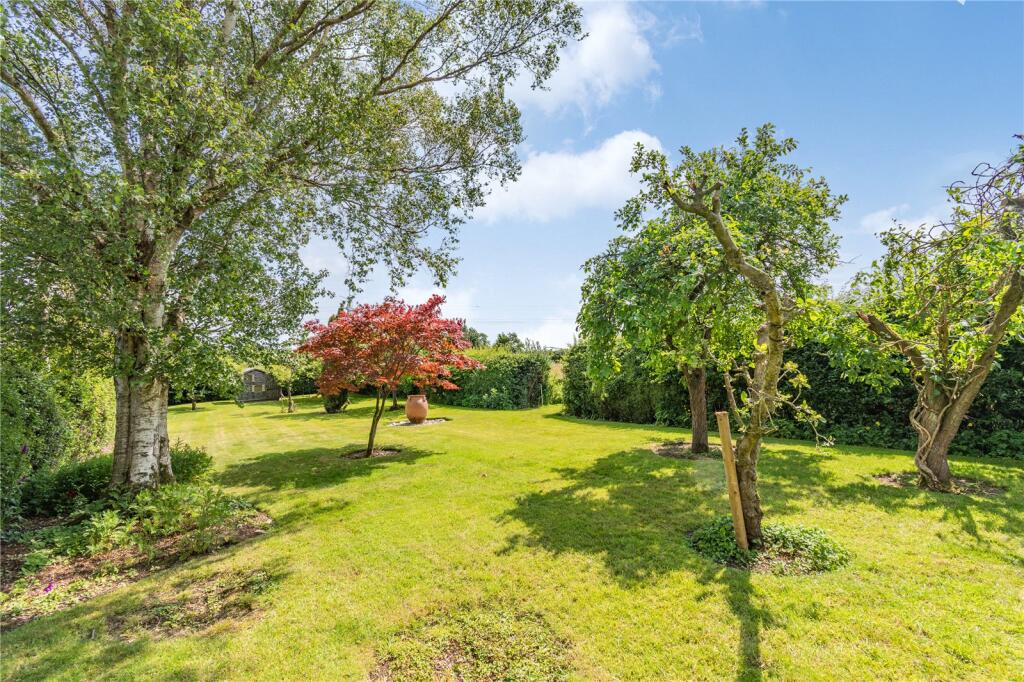
- rural house Victorian
- barn conversion converted barn
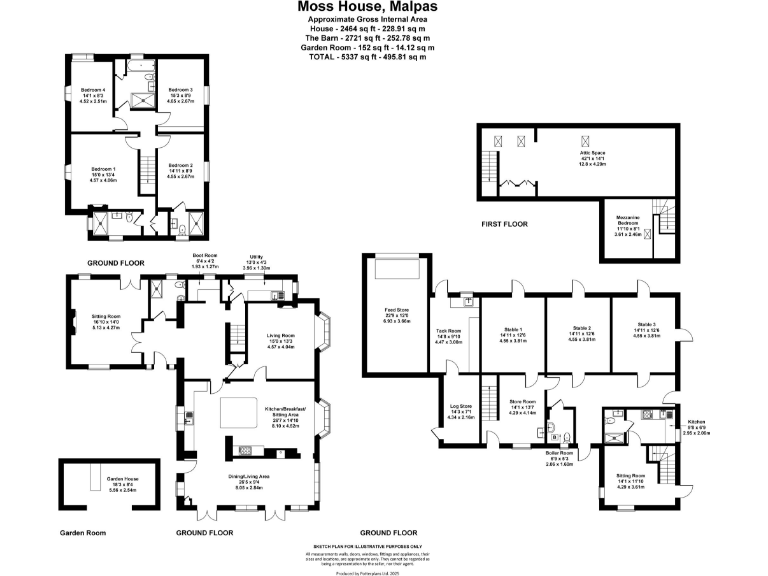
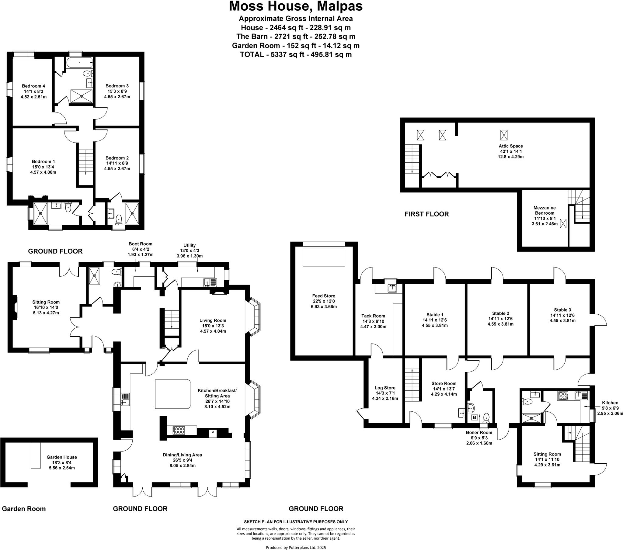
Floorplan Description
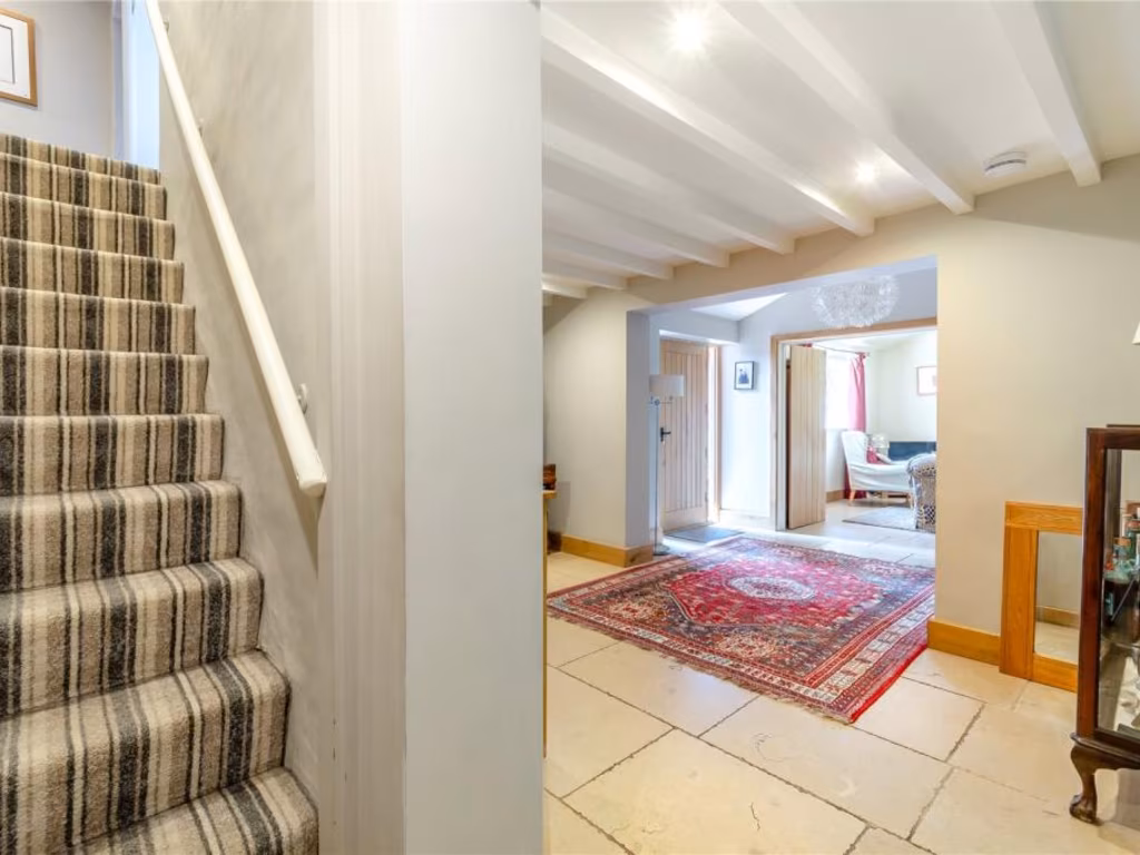
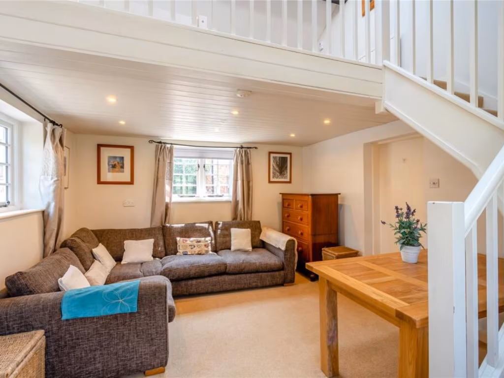
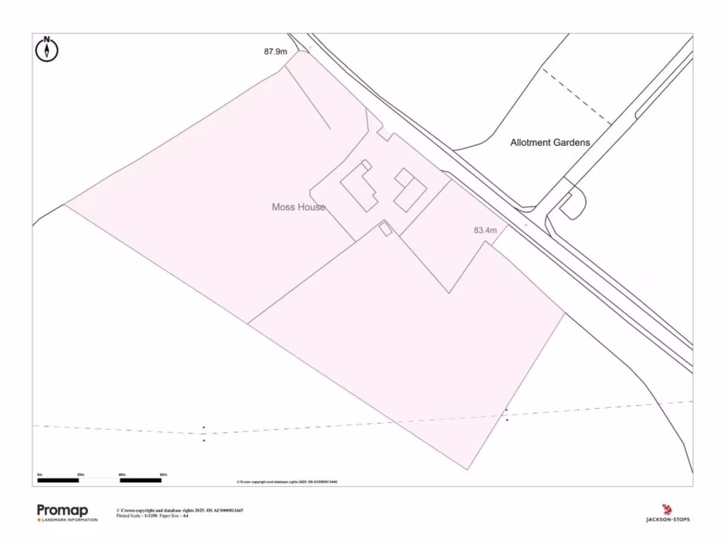
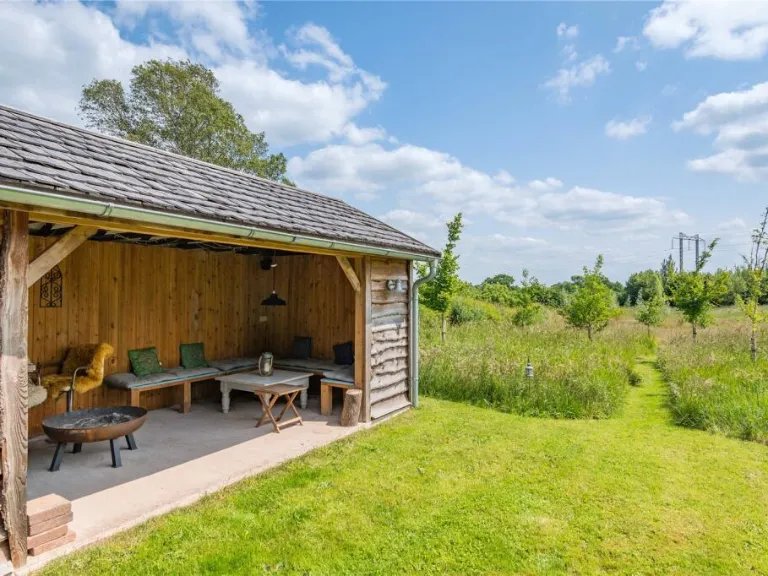
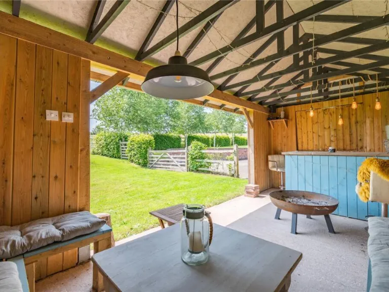
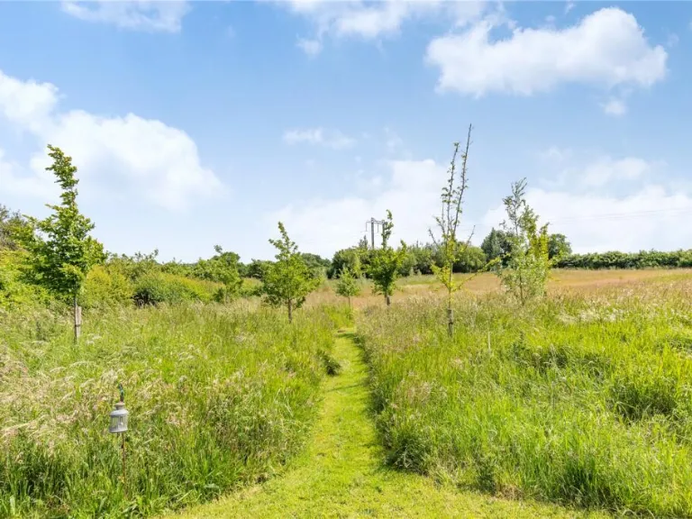
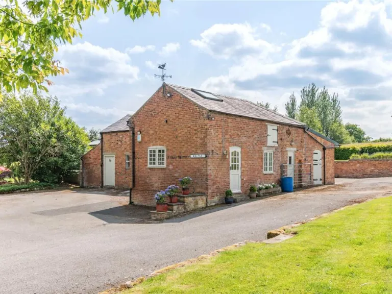
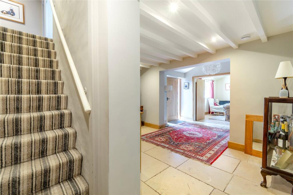
- Moss House in Malpas offering extensive living space across multiple floors.
Rooms
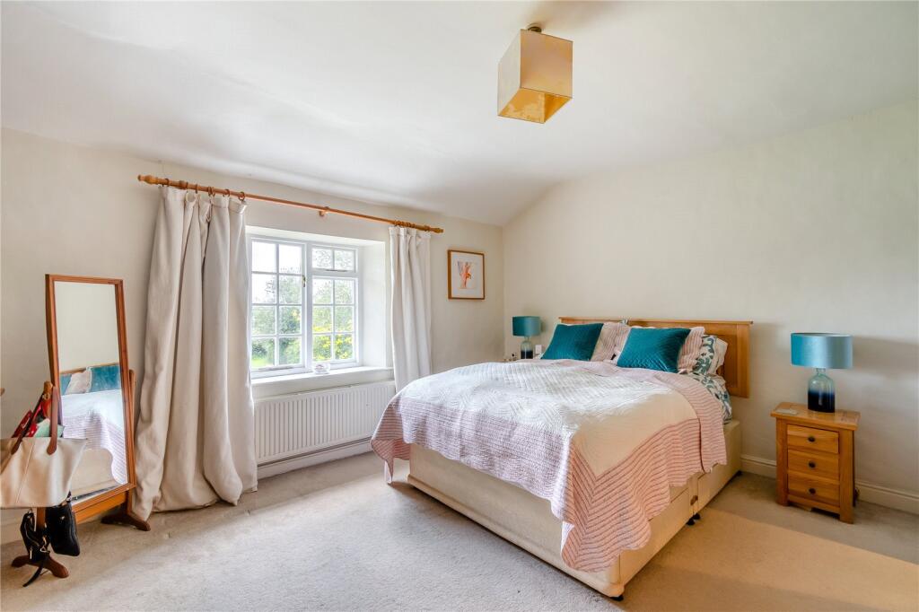
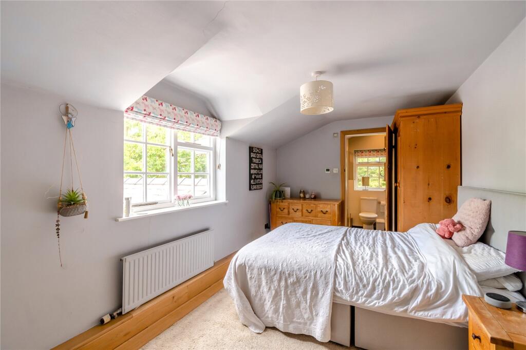
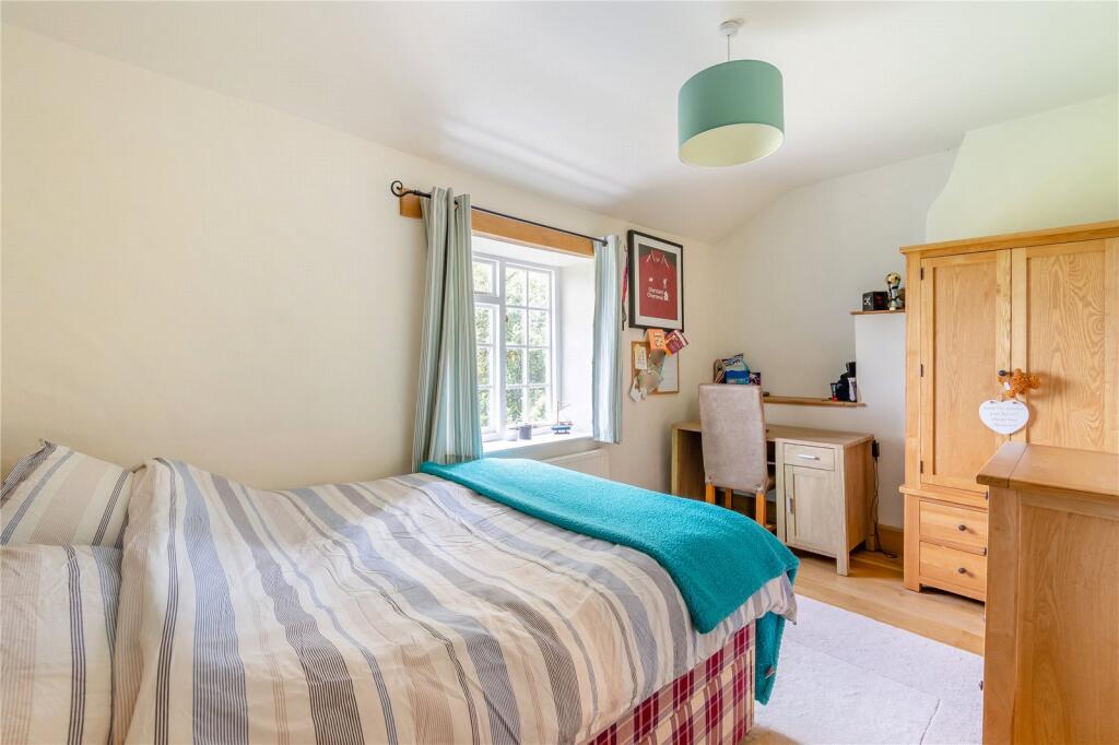
- Bedroom 4: Small
- Bedroom 3: Average
- Bedroom 2: Average
- Bedroom 1: Average
- Boot Room: Small
- Utility: Small
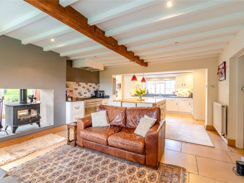
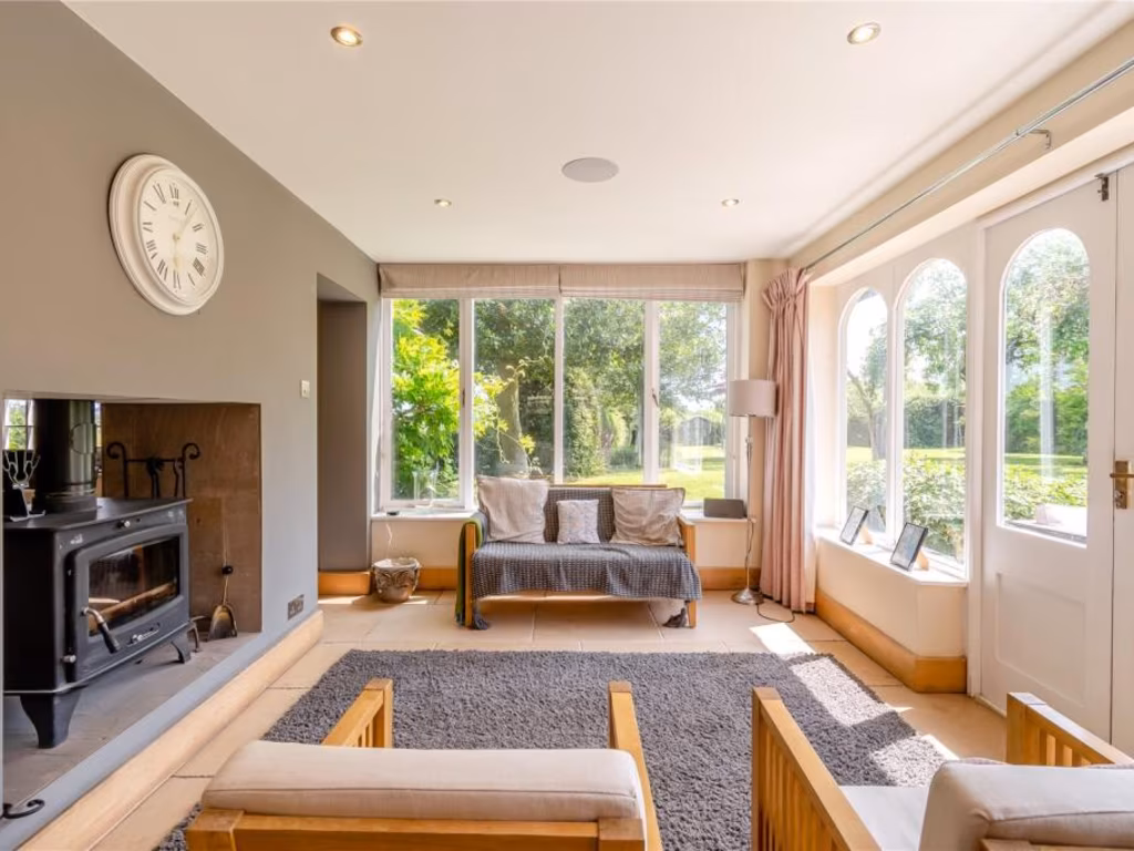
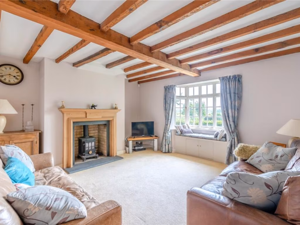
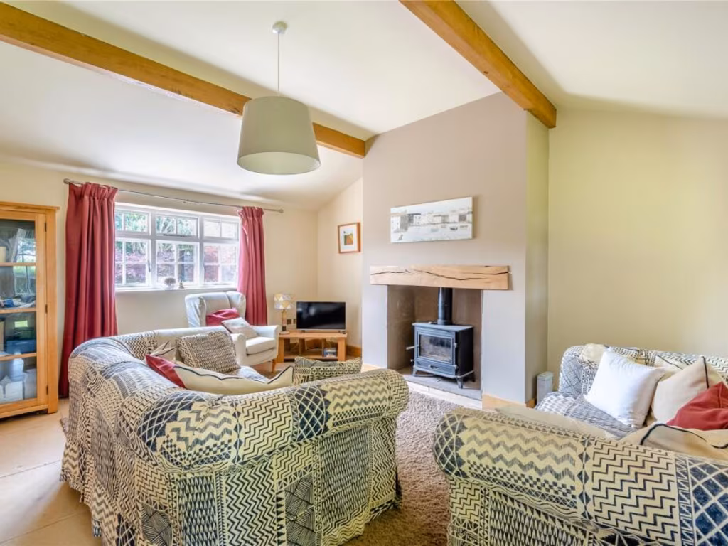
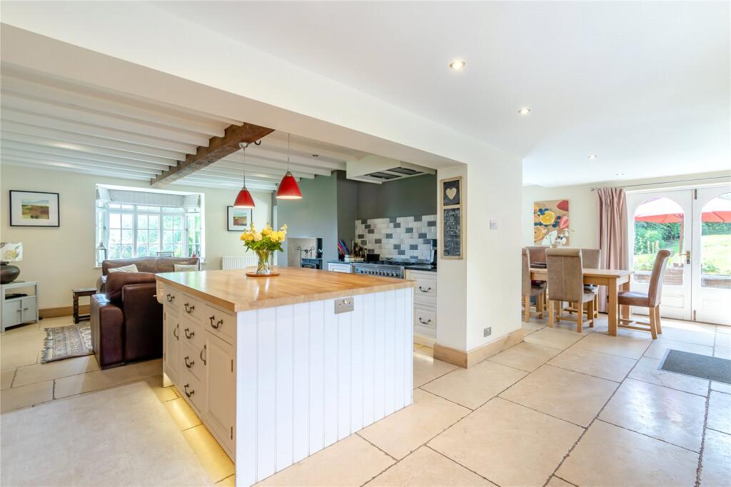
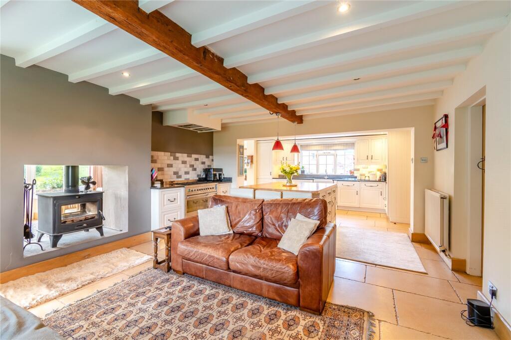
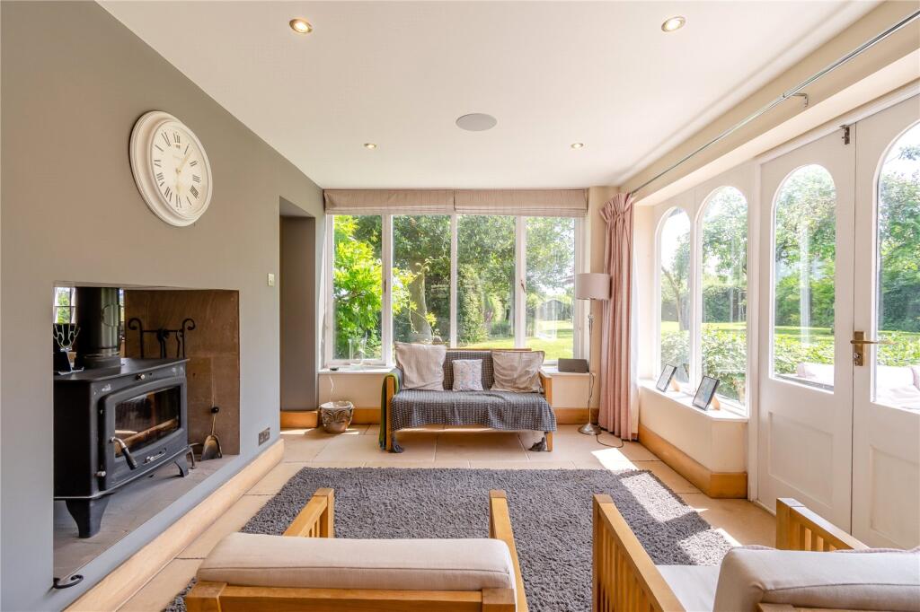
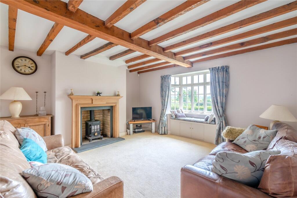
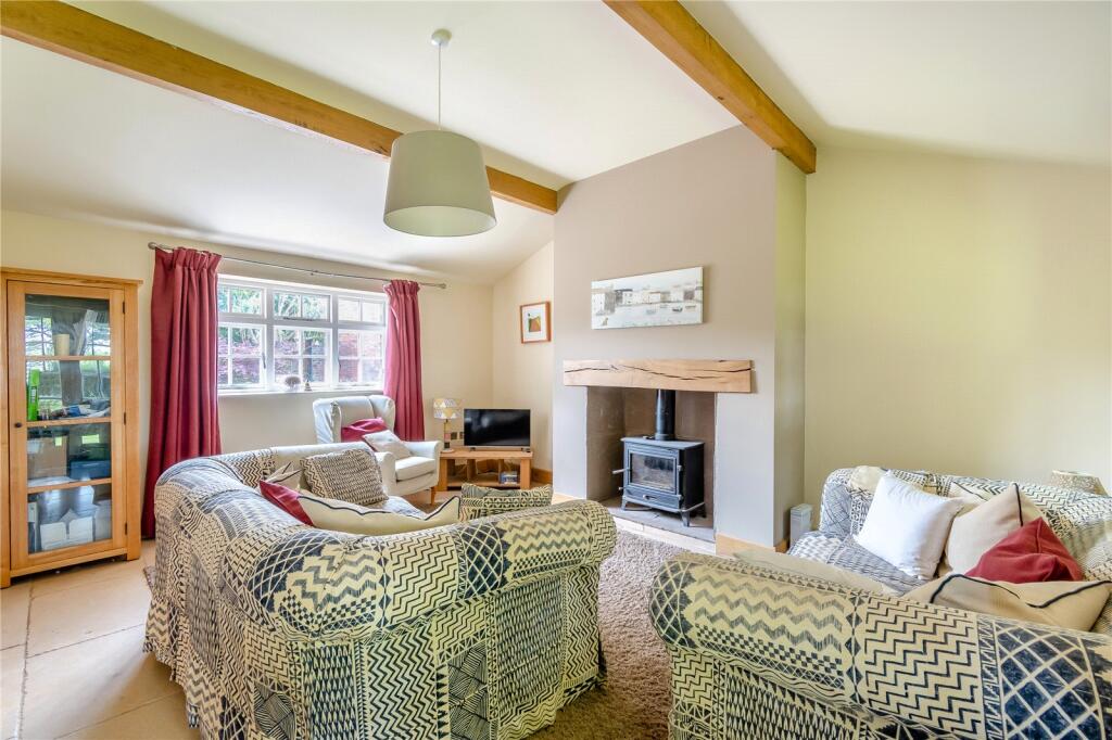
- Living Room: Average
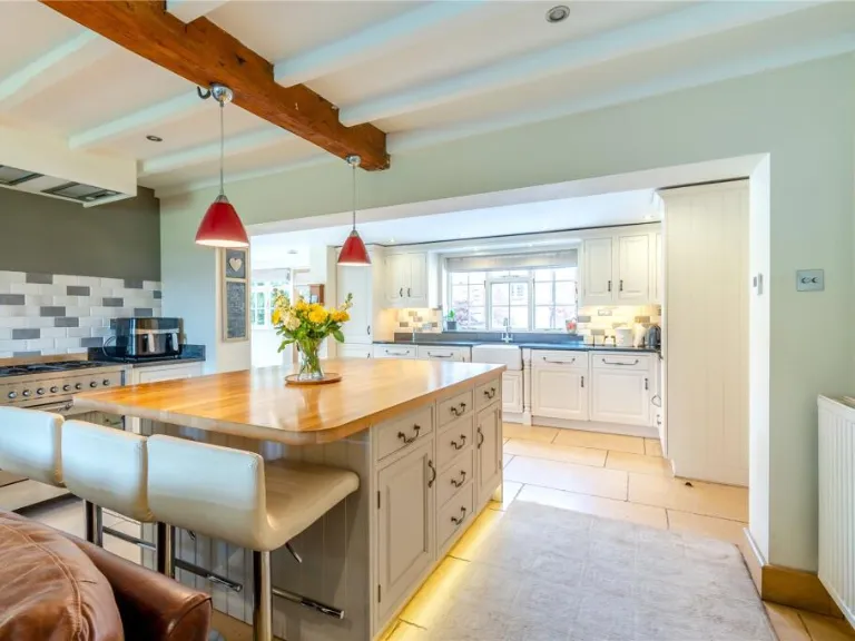
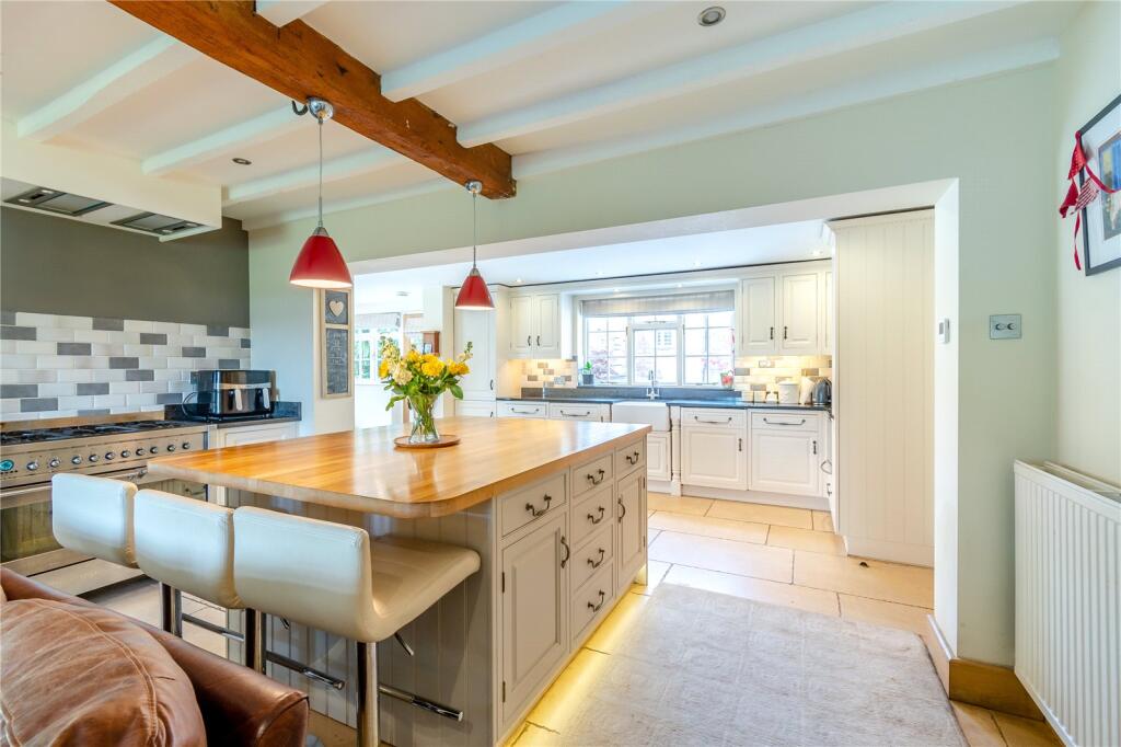
- Kitchen/Breakfast/Sitting Area: Large
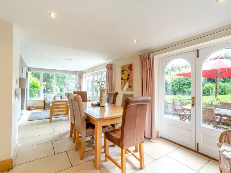
- Dining/Living Area: Large
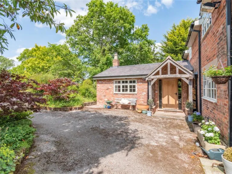
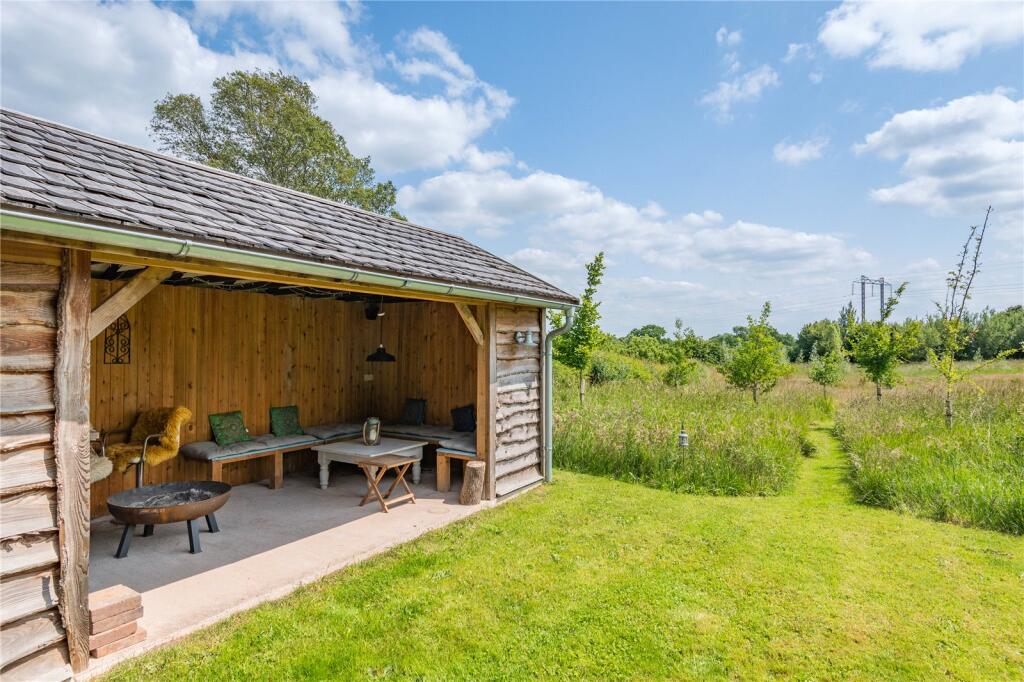
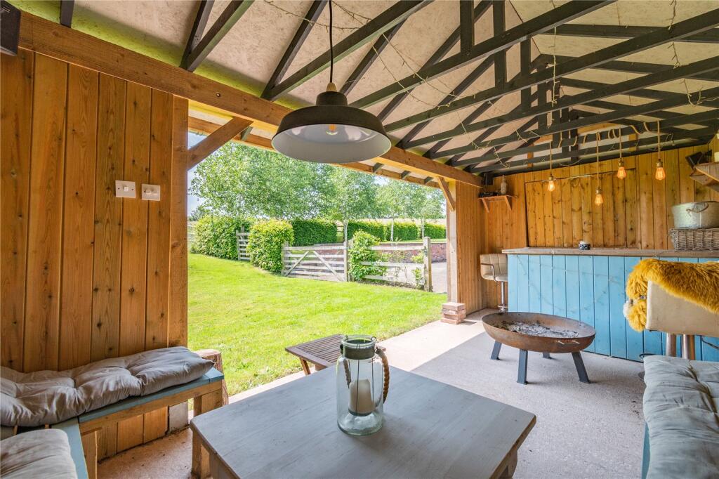
- Garden House: Small
- Affix Space: Small
- Mezzanine Bedroom: Small
- Feed Store: Small
- Tak Room: Small
- Stable 1: Average
- Stable 2: Average
- Stable 3: Average
- Log Store: Small
- Store Room: Small
- Boiler Room: Small
- Kitchen: Small
- Sitting Room: Small
Textual Property Features
Detected Visual Features
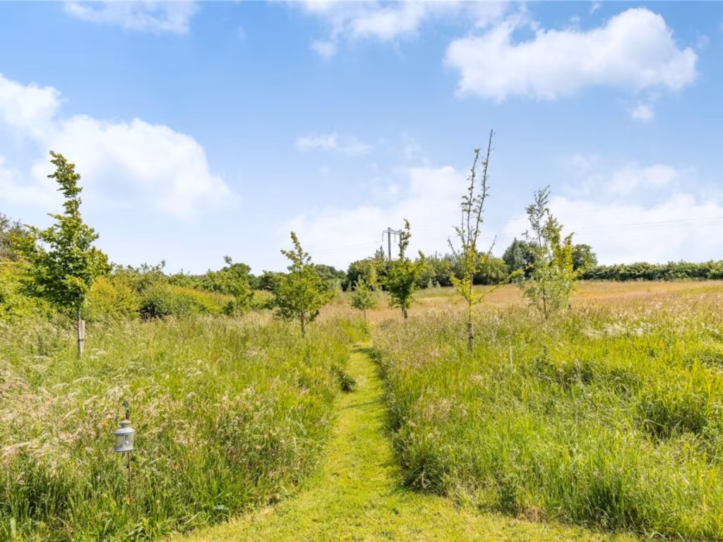
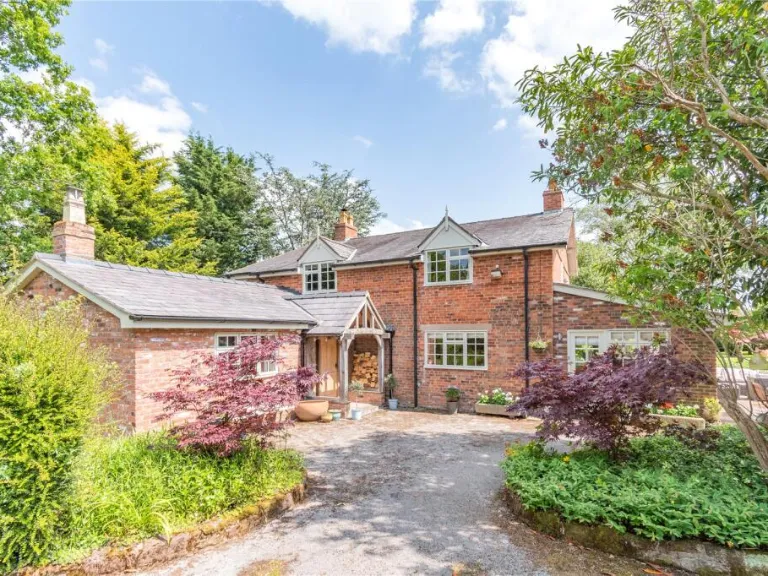
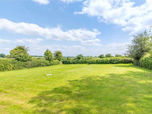
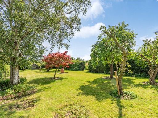
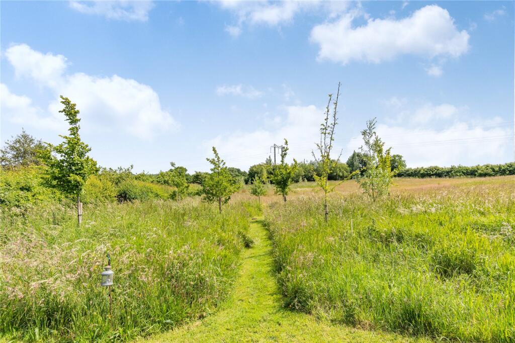
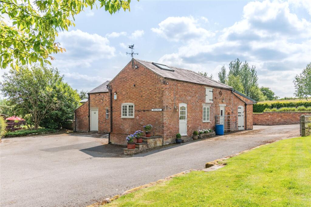
- Victorian
- rural
- red brick
- country house
- period property
- detached
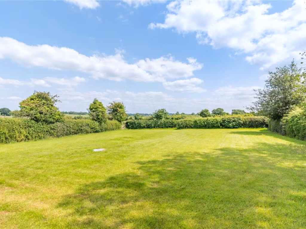
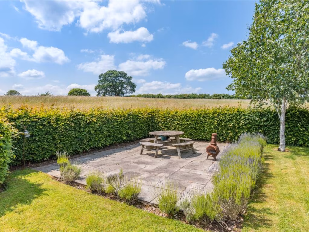
- garden
- nature
- ivy
- converted barn
- rural property
- brick construction
- large plot
- countryside
- potential
Nearby Schools
- Bickerton Holy Trinity CofE Primary School
- Clutton Church of England Primary School
- Tushingham With Grindley CofE Primary School
- Tilston Parochial CofE Primary School
- Whitchurch CofE Junior Academy
- Malpas Alport Endowed Primary School
- Shocklach Oviatt CofE Primary School
- Sir John Talbot's School
- Whitchurch CofE Infant and Nursery Academy
- Bishop Heber High School
Nearest General Shops
- Id: 1357852173
- Tags:
- Name: Launderette
- Shop: laundry
- TagsNormalized:
- Lat: 53.0209405
- Lon: -2.7660576
- FullGeoHash: gcqj9h1v65tv
- PartitionGeoHash: gcqj
- Images:
- FoodStandards: null
- Distance: 1104.8
,- Id: 432610258
- Tags:
- TagsNormalized:
- Lat: 53.0208908
- Lon: -2.7657167
- FullGeoHash: gcqj9h4j44kj
- PartitionGeoHash: gcqj
- Images:
- FoodStandards: null
- Distance: 1087.5
,- Id: 947191989
- Tags:
- HE_ref: 1136184
- Addr:
- Housenumber: 13
- Postcode: SY14 8NN
- Street: High Street
- Alt_name: Spar
- Building: retail
- Fhrs:
- Listed_status: Grade II
- Name: Huxley's Bakery
- Shop: bakery
- Source:
- Wikidata: Q26429491
- TagsNormalized:
- Lat: 53.0207243
- Lon: -2.7657763
- FullGeoHash: gcqj9h4h0ers
- PartitionGeoHash: gcqj
- Images:
- FoodStandards:
- Id: 290602
- FHRSID: 290602
- LocalAuthorityBusinessID: X/04/00529/MIXED
- BusinessName: J Huxley
- BusinessType: Retailers - other
- BusinessTypeID: 4613
- AddressLine1: 13 High Street
- AddressLine2: null
- AddressLine3: Malpas
- AddressLine4: Cheshire
- PostCode: SY14 8NN
- RatingValue: 5
- RatingKey: fhrs_5_en-GB
- RatingDate: 2022-05-17
- LocalAuthorityCode: 704
- LocalAuthorityName: Cheshire West and Chester
- LocalAuthorityWebSite: http://www.cheshirewestandchester.gov.uk
- LocalAuthorityEmailAddress: foodsafety@cheshirewestandchester.gov.uk
- Scores:
- Hygiene: 5
- Structural: 5
- ConfidenceInManagement: 5
- NewRatingPending: false
- Geocode:
- Longitude: -2.76559710502625
- Latitude: 53.02052688598630
- Distance: 1074.3
}
Nearest Grocery shops
- Id: 9123064359
- Tags:
- TagsNormalized:
- Lat: 52.9840815
- Lon: -2.7130412
- FullGeoHash: gcqj6m2qts9v
- PartitionGeoHash: gcqj
- Images:
- FoodStandards: null
- Distance: 4325.2
,- Id: 7899020628
- Tags:
- Brand: Nisa
- Brand:wikidata: Q16999069
- Brand:wikipedia: en:Nisa (retailer)
- Name: Nisa
- Old_name: Neils; Owens; Londis;
- Shop: convenience
- TagsNormalized:
- Lat: 53.0210736
- Lon: -2.7661084
- FullGeoHash: gcqj9h1y1h2p
- PartitionGeoHash: gcqj
- Images:
- FoodStandards: null
- Distance: 1118.9
,- Id: 922460468
- Tags:
- Addr:
- Postcode: SY14 8NQ
- Street: Well Street
- Alt_name:
- 1: Shepherds
- 2: Co-op Food
- Brand: Co-op Food
- Brand:wikidata: Q3277439
- Fhrs:
- Name: The Co-operative Food
- Opening_date: 2021-03-26
- Operator: Co-operative
- Shop: convenience
- Source:
- TagsNormalized:
- co-op
- co-op food
- food
- the co-operative food
- convenience
- shop
- Lat: 53.0193232
- Lon: -2.7641194
- FullGeoHash: gcqj95g5zq5n
- PartitionGeoHash: gcqj
- Images:
- FoodStandards:
- Id: 290878
- FHRSID: 290878
- LocalAuthorityBusinessID: X/06/00069/MIXED
- BusinessName: Co-Op
- BusinessType: Retailers - other
- BusinessTypeID: 4613
- AddressLine1: Shepherds Supermarket Old Hall Street
- AddressLine2: null
- AddressLine3: Malpas
- AddressLine4: Cheshire
- PostCode: SY14 8NQ
- RatingValue: 5
- RatingKey: fhrs_5_en-GB
- RatingDate: 2011-08-01
- LocalAuthorityCode: 704
- LocalAuthorityName: Cheshire West and Chester
- LocalAuthorityWebSite: http://www.cheshirewestandchester.gov.uk
- LocalAuthorityEmailAddress: foodsafety@cheshirewestandchester.gov.uk
- Scores:
- Hygiene: 0
- Structural: 5
- ConfidenceInManagement: 5
- NewRatingPending: false
- Geocode:
- Longitude: -2.76529192924500
- Latitude: 53.02011489868160
- Distance: 883.2
}
Nearest Supermarkets
- Id: 403063733
- Tags:
- Brand: Tesco
- Brand:wikidata: Q487494
- Brand:wikipedia: en:Tesco
- Building: yes
- Contact:
- Website: https://www.tesco.com/store-locator/whitchurch/white-lion-meadow
- Layer: 1
- Name: Tesco
- Shop: supermarket
- Wheelchair: yes
- TagsNormalized:
- Lat: 52.9682122
- Lon: -2.6815926
- FullGeoHash: gcqj6fx64q7t
- PartitionGeoHash: gcqj
- Images:
- FoodStandards: null
- Distance: 7058.2
,- Id: 200353909
- Tags:
- Brand: Sainsbury's
- Brand:wikidata: Q152096
- Brand:wikipedia: en:Sainsbury's
- Building: yes
- Name: Sainsbury's
- Shop: supermarket
- TagsNormalized:
- sainsburys
- supermarket
- shop
- Lat: 52.9731574
- Lon: -2.6855243
- FullGeoHash: gcqj6gkrn8rb
- PartitionGeoHash: gcqj
- Images:
- FoodStandards: null
- Distance: 6488.1
,- Id: 801793682
- Tags:
- Addr:
- City: Whitchurch
- Housename: ALDI
- Postcode: SY13 1JG
- Street: Wrexham Road
- Brand: ALDI
- Brand:wikidata: Q41171672
- Brand:wikipedia: en:Aldi
- Building: retail
- Contact:
- Website: https://stores.aldi.co.uk/whitchurch/wrexham-road
- Name: ALDI
- Opening_hours: Mo-Sa 08:00-22:00; Su 10:00-16:00
- Opening_hours:url: https://www.aldi.co.uk/store/s-uk-E1254
- Shop: supermarket
- Start_date: 2020-06-04
- TagsNormalized:
- aldi
- retail
- supermarket
- shop
- Lat: 52.9680305
- Lon: -2.7052839
- FullGeoHash: gcqj66w14kd1
- PartitionGeoHash: gcqj
- Images:
- FoodStandards: null
- Distance: 6047.7
}
Nearest Religious buildings
- Id: 7925793541
- Tags:
- Amenity: place_of_worship
- Building: yes
- Name: Bradley Chapel
- Religion: christian
- TagsNormalized:
- place of worship
- chapel
- christian
- church
- Lat: 53.0066587
- Lon: -2.7321114
- FullGeoHash: gcqj9cdd1jq5
- PartitionGeoHash: gcqj
- Images:
- FoodStandards: null
- Distance: 1782.3
,- Id: 610537033
- Tags:
- Addr:
- Postcode: SY14 8PR
- Street: High Street
- Amenity: place_of_worship
- Building: church
- Denomination: methodist
- Fhrs:
- Name: High Street Church
- Religion: christian
- Source:
- TagsNormalized:
- place of worship
- church
- methodist
- christian
- Lat: 53.0209319
- Lon: -2.7671913
- FullGeoHash: gcqj9h0vrf0d
- PartitionGeoHash: gcqj
- Images:
- FoodStandards: null
- Distance: 1148.4
,- Id: 610537024
- Tags:
- HE_ref: 1135959
- Amenity: place_of_worship
- Building: church
- Denomination: anglican
- Listed_status: Grade I
- Name: St Oswald's Church
- Religion: christian
- Wikidata: Q7595016
- Wikipedia: en:St Oswald's Church, Malpas
- TagsNormalized:
- place of worship
- church
- anglican
- christian
- Lat: 53.0195407
- Lon: -2.7671035
- FullGeoHash: gcqj95cj1ydp
- PartitionGeoHash: gcqj
- Images:
- FoodStandards: null
- Distance: 1025.8
}
Nearest Leisure Facilities
- Id: 121260613
- Tags:
- Leisure: pitch
- Sport: bowls
- TagsNormalized:
- Lat: 53.0211884
- Lon: -2.7680203
- FullGeoHash: gcqj9h0qu3yk
- PartitionGeoHash: gcqj
- Images:
- FoodStandards: null
- Distance: 1205
,- Id: 121260620
- Tags:
- Leisure: pitch
- Sport: bowls
- TagsNormalized:
- Lat: 53.0188842
- Lon: -2.7712815
- FullGeoHash: gcqj8gy12kqe
- PartitionGeoHash: gcqj
- Images:
- FoodStandards: null
- Distance: 1188.1
,- Id: 1357894390
- Tags:
- Leisure: sports_centre
- Name: Malpas and District Sports and Social Club
- TagsNormalized:
- sports
- sports centre
- leisure
- social club
- club
- Lat: 53.0183427
- Lon: -2.771504
- FullGeoHash: gcqj8gty5r2v
- PartitionGeoHash: gcqj
- Images:
- FoodStandards: null
- Distance: 1167
,- Id: 121260617
- Tags:
- Leisure: pitch
- Sport: tennis
- TagsNormalized:
- Lat: 53.0186033
- Lon: -2.7709716
- FullGeoHash: gcqj8gwpxxvz
- PartitionGeoHash: gcqj
- Images:
- FoodStandards: null
- Distance: 1153.2
,- Id: 121260616
- Tags:
- Leisure: pitch
- Name: Malpas Bowls Club & Social Institute Crown Green Bowls Club
- Sport: bowls
- TagsNormalized:
- pitch
- leisure
- bowls
- club
- sports
- Lat: 53.0203703
- Lon: -2.7676429
- FullGeoHash: gcqj9h0dj1ru
- PartitionGeoHash: gcqj
- Images:
- FoodStandards: null
- Distance: 1118.8
}
Nearest Tourist attractions
- Id: 8119326226
- Tags:
- TagsNormalized:
- Lat: 52.9804823
- Lon: -2.7107757
- FullGeoHash: gcqj6kf1dmep
- PartitionGeoHash: gcqj
- Images:
- FoodStandards: null
- Distance: 4725.3
,- Id: 998218812
- Tags:
- Name: Canalside Caravan Park
- Tourism: caravan_site
- Website: http://www.canalsidecaravansite.20m.com/
- TagsNormalized:
- Lat: 52.9859268
- Lon: -2.7135596
- FullGeoHash: gcqj6mb13kxk
- PartitionGeoHash: gcqj
- Images:
- FoodStandards: null
- Distance: 4152.2
,- Id: 505991100
- Tags:
- TagsNormalized:
- Lat: 53.0307771
- Lon: -2.7801955
- FullGeoHash: gcqj8tzw8trg
- PartitionGeoHash: gcqj
- Images:
- FoodStandards: null
- Distance: 2546.4
}
Nearest Bus stations and stops
- Id: 432610143
- Tags:
- Bus: yes
- Highway: bus_stop
- Public_transport: platform
- TagsNormalized:
- Lat: 53.0205175
- Lon: -2.7657451
- FullGeoHash: gcqj9h44ckyf
- PartitionGeoHash: gcqj
- Images:
- FoodStandards: null
- Distance: 1054.2
,- Id: 432610145
- Tags:
- Bus: yes
- Highway: bus_stop
- Public_transport: platform
- TagsNormalized:
- Lat: 53.0198407
- Lon: -2.7652697
- FullGeoHash: gcqj95fquw9m
- PartitionGeoHash: gcqj
- Images:
- FoodStandards: null
- Distance: 974.4
,- Id: 7107547594
- Tags:
- Bus: yes
- Highway: bus_stop
- Public_transport: platform
- TagsNormalized:
- Lat: 53.0198847
- Lon: -2.7651416
- FullGeoHash: gcqj95frpwbg
- PartitionGeoHash: gcqj
- Images:
- FoodStandards: null
- Distance: 973.4
,- Id: 502505990
- Tags:
- Bus: yes
- Highway: bus_stop
- Name: Oldhall Street
- Naptan:
- AtcoCode: 0610CH631
- Bearing: NE
- CommonName: Oldhall Street
- Crossing: Oldhall Street
- Indicator: crn
- Landmark: House number 23
- NaptanCode: chwpgtm
- ShortCommonName: Oldhall Street
- Street: Springfield Road
- Verified: no
- Public_transport: platform
- Source: naptan_import
- TagsNormalized:
- Lat: 53.018915
- Lon: -2.7635295
- FullGeoHash: gcqj95g9t455
- PartitionGeoHash: gcqj
- Images:
- FoodStandards: null
- Distance: 823.6
,- Id: 502505991
- Tags:
- Bus: yes
- Highway: bus_stop
- Local_ref: NR
- Name: Oldhall Street
- Naptan:
- AtcoCode: 0610CH632
- Bearing: SW
- BusStopType: CUS
- CommonName: Oldhall Street
- Crossing: Oldhall Street
- Indicator: nr
- Landmark: House number 23
- NaptanCode: chwpgtj
- ShortCommonName: Oldhall Street
- Street: Springfield Road
- Verified: no
- Public_transport: platform
- Source: naptan_import
- TagsNormalized:
- Lat: 53.0188099
- Lon: -2.7634192
- FullGeoHash: gcqj95g8zwt2
- PartitionGeoHash: gcqj
- Images:
- FoodStandards: null
- Distance: 809.7
}
Nearest Hotels
- Id: 32341032
- Tags:
- Amenity: pub
- Created_by: JOSM
- Name: Queens Head Hotel PH
- TagsNormalized:
- Lat: 52.9971569
- Lon: -2.8352788
- FullGeoHash: gcmvrrz6v4ng
- PartitionGeoHash: gcmv
- Images:
- FoodStandards: null
- Distance: 5531.1
,- Id: 5116301409
- Tags:
- Name: Iscoyd Mansion
- Tourism: hotel
- TagsNormalized:
- Lat: 52.9727487
- Lon: -2.739329
- FullGeoHash: gcqj3emk9h06
- PartitionGeoHash: gcqj
- Images:
- FoodStandards: null
- Distance: 4595.9
,- Id: 971249870
- Tags:
- Name: The Lion
- Old_name: The Red Lion Hotel
- Tourism: hotel
- TagsNormalized:
- Lat: 53.0198813
- Lon: -2.7647682
- FullGeoHash: gcqj95fz0npr
- PartitionGeoHash: gcqj
- Images:
- FoodStandards: null
- Distance: 958.9
}
Tags
- Victorian
- rural
- red brick
- country house
- period property
- detached
- garden
- nature
- ivy
- converted barn
- rural property
- brick construction
- large plot
- countryside
- potential
Local Market Stats
- Average Price/sqft: £272
- Avg Income: £44100
- Rental Yield: 4.2%
- Social Housing: 7%
- Planning Success Rate: 88%
Similar Properties
 4 bedroom barn conversion for sale in Chorlton Lane, Chorlton, SY14 — £535,000 • 4 bed • 2 bath • 1878 ft²
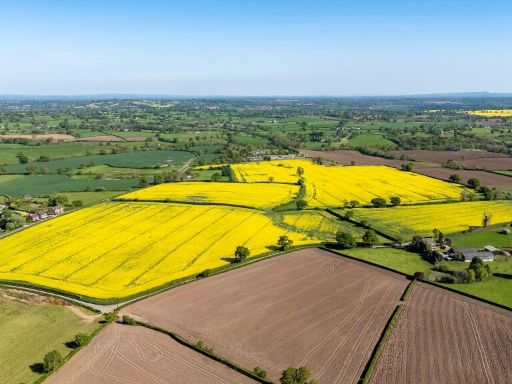 4 bedroom farm house for sale in Malpas, Cheshire, SY14 — £4,000,000 • 4 bed • 2 bath • 2768 ft²
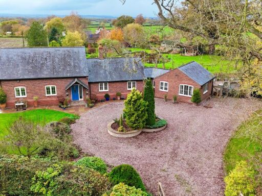 4 bedroom detached house for sale in Oldcastle, Malpas, SY14 — £825,000 • 4 bed • 3 bath • 2573 ft²
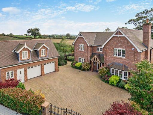 5 bedroom detached house for sale in Berwyn View, Malpas, SY14 — £1,195,000 • 5 bed • 4 bath • 3000 ft²
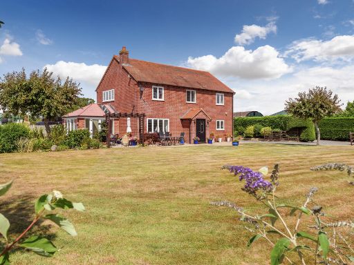 3 bedroom house for sale in Muckleton Lane, Shawbury, SY4 4HF, SY4 — £750,000 • 3 bed • 2 bath • 1788 ft²
 6 bedroom detached house for sale in Tilston Road, Malpas, Cheshire SY14 7DF, SY14 — £1,400,000 • 6 bed • 4 bath • 4500 ft²
Meta
- {
"@context": "https://schema.org",
"@type": "Residence",
"name": "Equestrian facility for sale in Old Hall Street, Malpas, Ch…",
"description": "",
"url": "https://propertypiper.co.uk/property/80af6966-900f-4ebe-a2cc-c3049d88aa11",
"image": "https://image-a.propertypiper.co.uk/dc3edabf-d2a3-4dfd-85b5-95c4becc4246-1024.jpeg",
"address": {
"@type": "PostalAddress",
"streetAddress": "MOSS HOUSE MALPAS ",
"postalCode": "SY14 7JJ",
"addressLocality": "Cheshire West and Chester",
"addressRegion": "Eddisbury",
"addressCountry": "England"
},
"geo": {
"@type": "GeoCoordinates",
"latitude": 53.0127254,
"longitude": -2.7567685
},
"numberOfRooms": 4,
"numberOfBathroomsTotal": 3,
"floorSize": {
"@type": "QuantitativeValue",
"value": 2464,
"unitCode": "FTK"
},
"offers": {
"@type": "Offer",
"price": 1150000,
"priceCurrency": "GBP",
"availability": "https://schema.org/InStock"
},
"additionalProperty": [
{
"@type": "PropertyValue",
"name": "Feature",
"value": "Victorian"
},
{
"@type": "PropertyValue",
"name": "Feature",
"value": "rural"
},
{
"@type": "PropertyValue",
"name": "Feature",
"value": "red brick"
},
{
"@type": "PropertyValue",
"name": "Feature",
"value": "country house"
},
{
"@type": "PropertyValue",
"name": "Feature",
"value": "period property"
},
{
"@type": "PropertyValue",
"name": "Feature",
"value": "detached"
},
{
"@type": "PropertyValue",
"name": "Feature",
"value": "garden"
},
{
"@type": "PropertyValue",
"name": "Feature",
"value": "nature"
},
{
"@type": "PropertyValue",
"name": "Feature",
"value": "ivy"
},
{
"@type": "PropertyValue",
"name": "Feature",
"value": "converted barn"
},
{
"@type": "PropertyValue",
"name": "Feature",
"value": "rural property"
},
{
"@type": "PropertyValue",
"name": "Feature",
"value": "brick construction"
},
{
"@type": "PropertyValue",
"name": "Feature",
"value": "large plot"
},
{
"@type": "PropertyValue",
"name": "Feature",
"value": "countryside"
},
{
"@type": "PropertyValue",
"name": "Feature",
"value": "potential"
}
]
}
High Res Floorplan Images
Compatible Floorplan Images
FloorplanImages Thumbnail