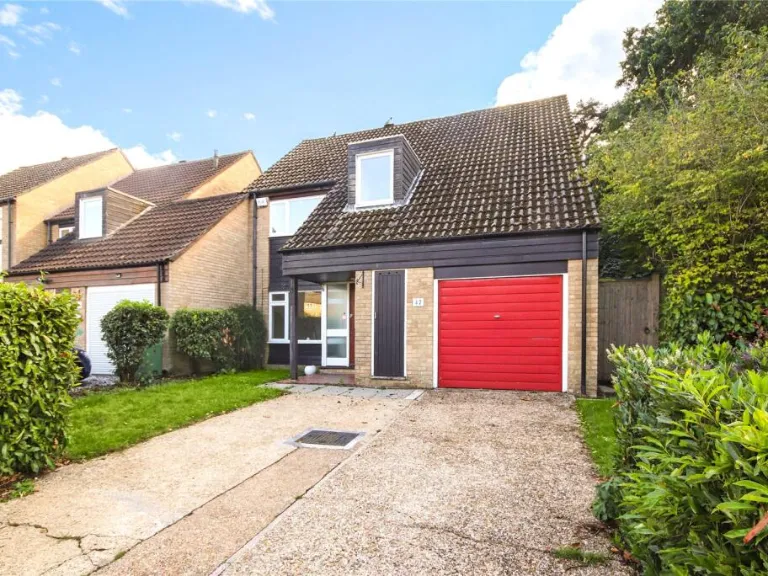
RG12 7WQ - 4 bedroom link detached house for sale in Frobisher, Brackn…
View on Property Piper
4 bedroom link detached house for sale in Frobisher, Bracknell, Berkshire, RG12
Property Details
- Price: £500000
- Bedrooms: 4
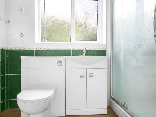
- Bathrooms: 2
- Property Type: undefined
- Property SubType: undefined
Brochure Descriptions
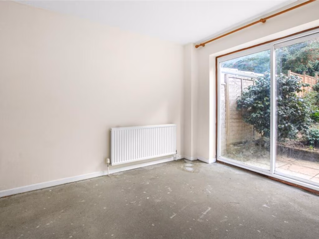
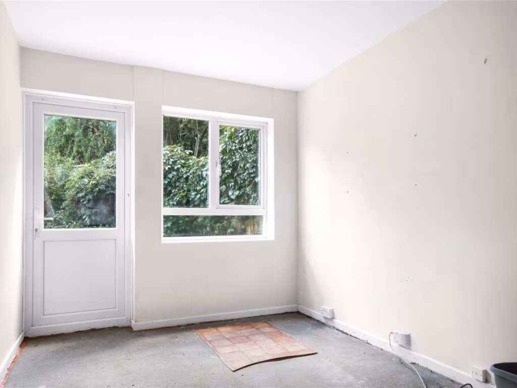
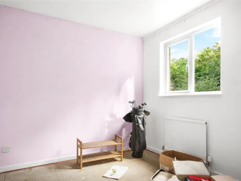
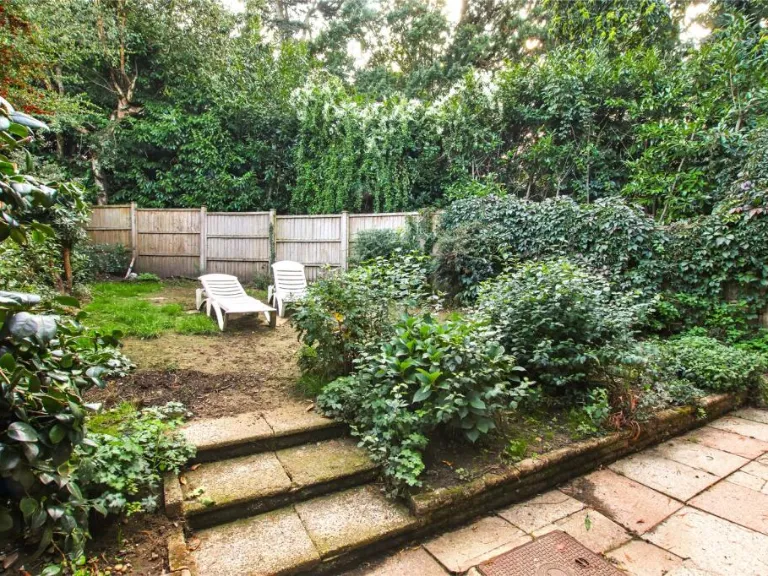
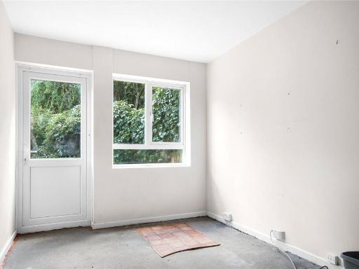
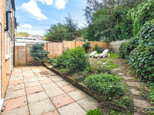
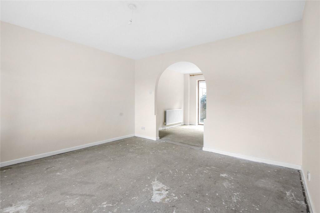
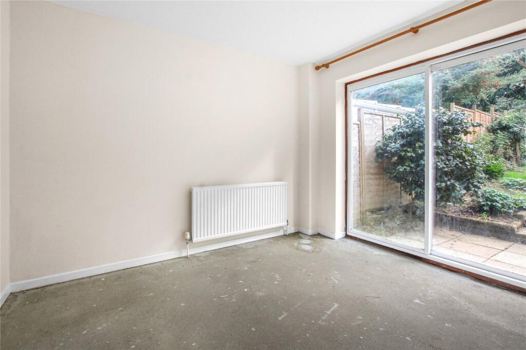
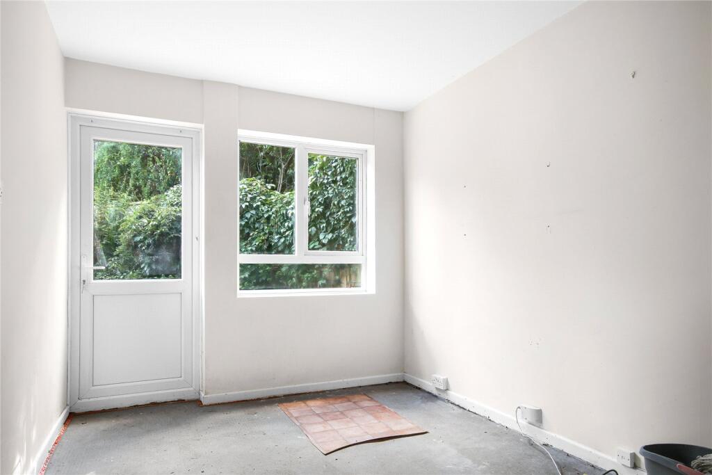
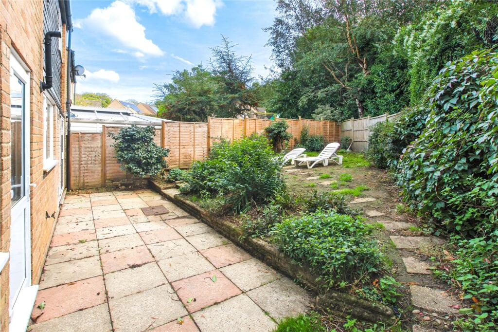
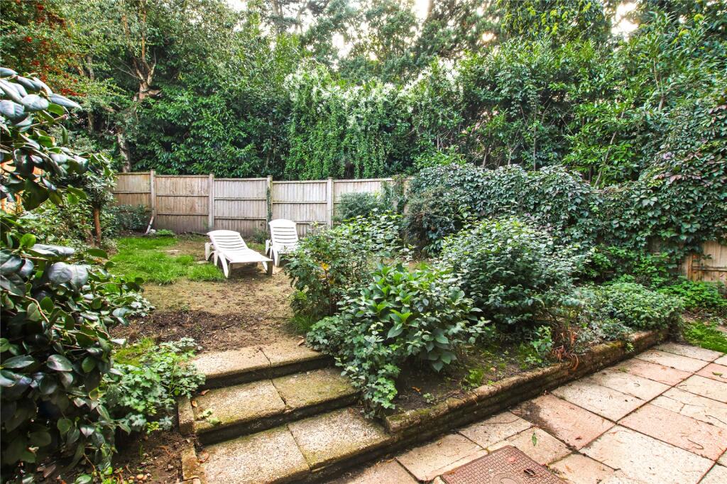
- A residential plot highlighted on an aerial plan adjacent to a substantial area of mature trees/green space. The property appears to be a modest mid-terrace or semi-detached house set on a uniquely shaped, triangular/sector-shaped plot with a long rear garden backing onto woodland. The site benefits from an elevated tree-lined outlook and immediate access to open green amenity land, providing a degree of privacy and outlook. Garden size: large. House footprint and living accommodation: small-to-average (typical suburban two- to three-bedroom dwelling inferred from neighbouring properties). Overall property size: small-to-moderate residential plot with exceptionally generous rear garden and attractive green views.
Image Descriptions
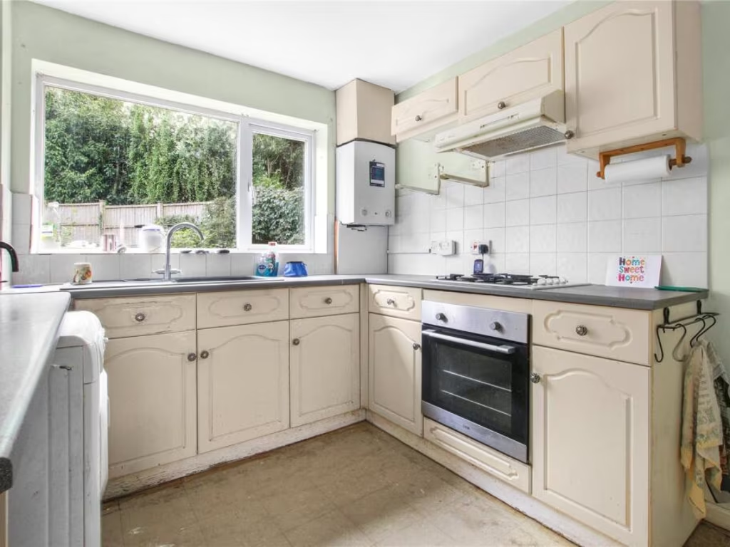
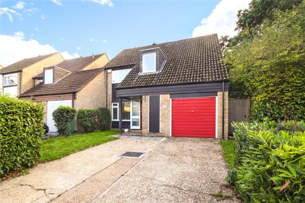
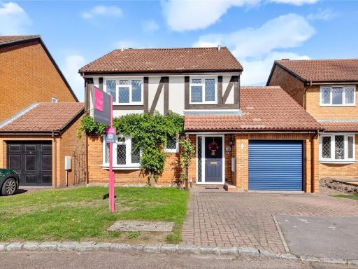
- detached house Modern 1980s
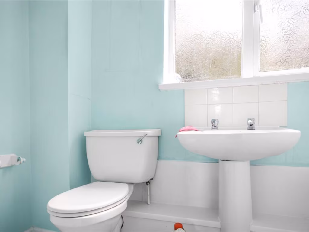
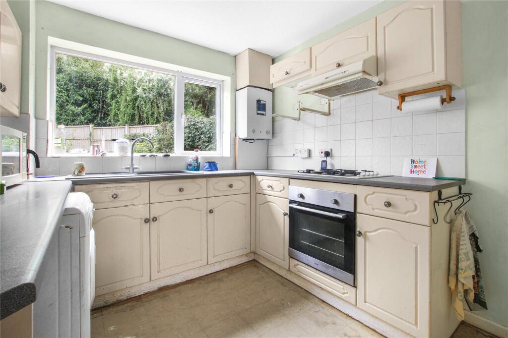
- kitchen 1980s
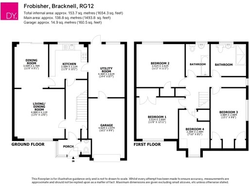
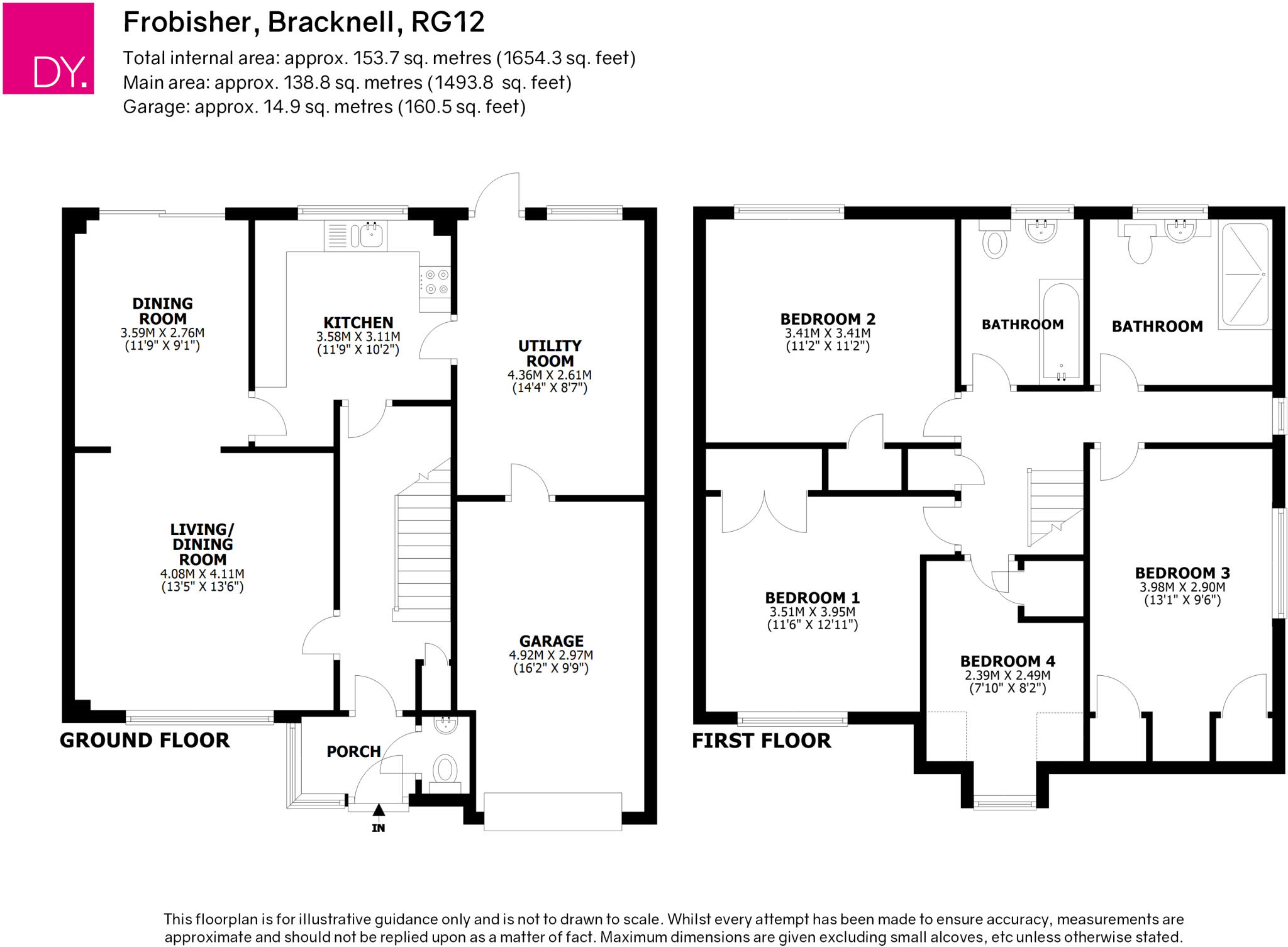
Floorplan Description
- Two-storey residential property with garage
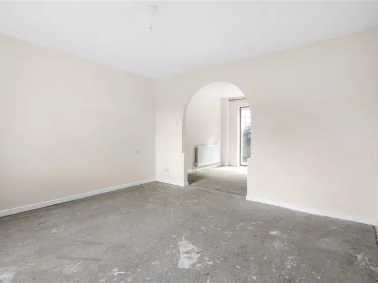
Rooms
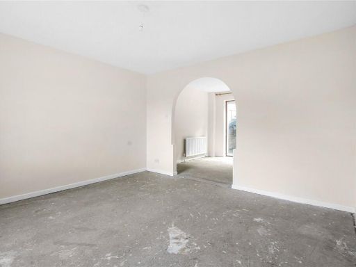
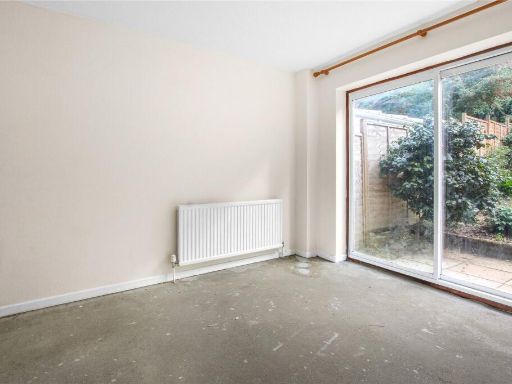
- DINING ROOM:
- KITCHEN:
- UTILITY ROOM:
- LIVING/ DINING ROOM:
- GARAGE:
- PORCH:
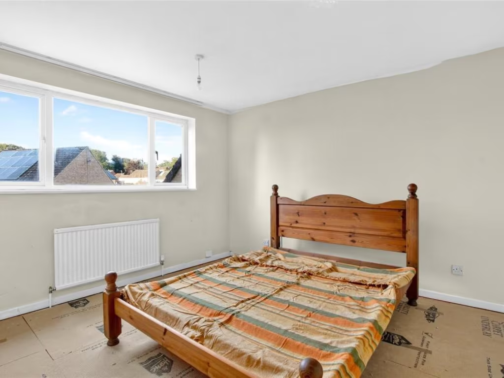
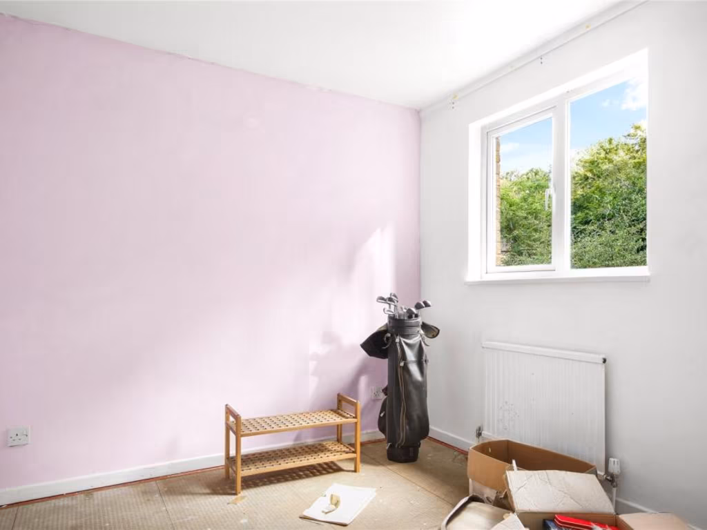
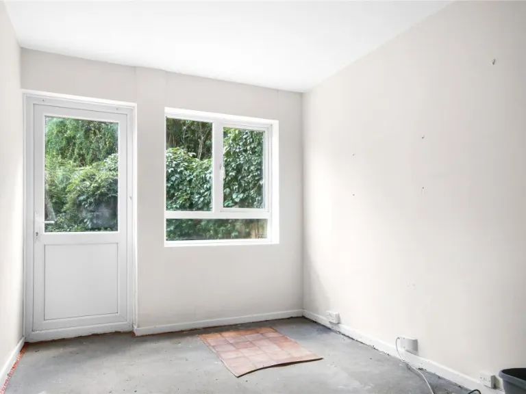
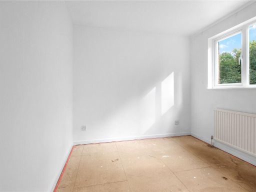
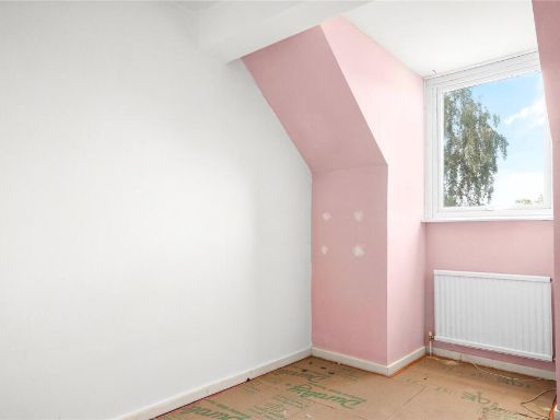
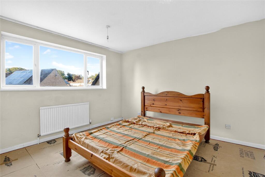
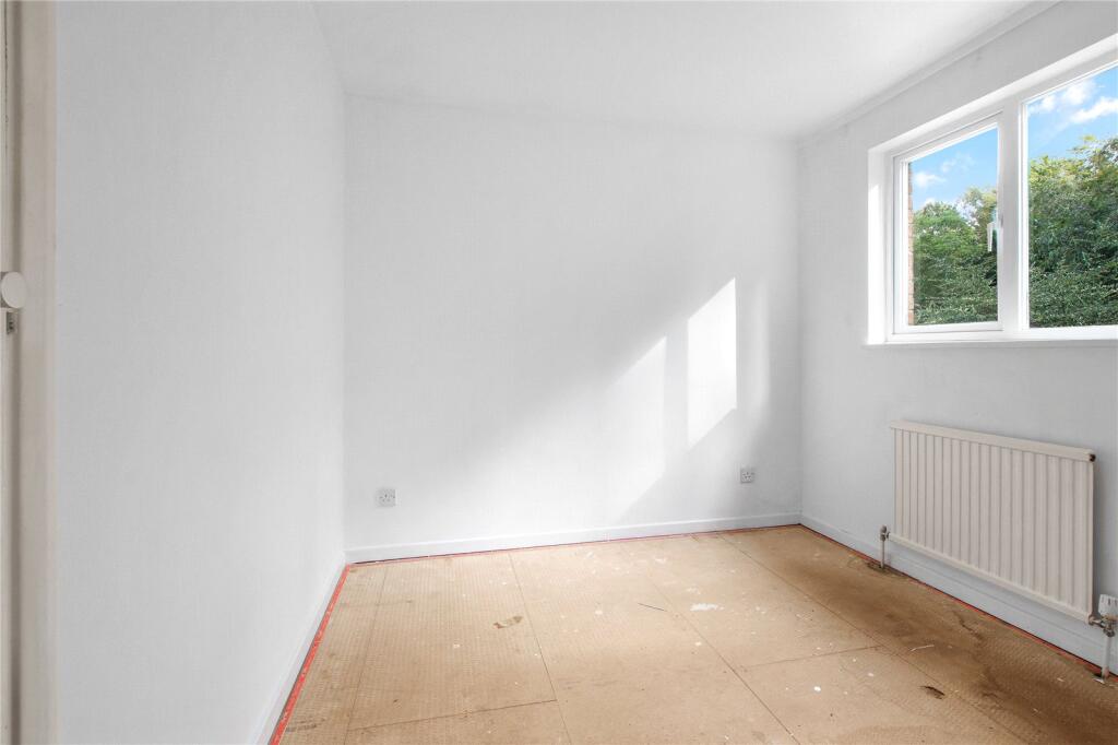
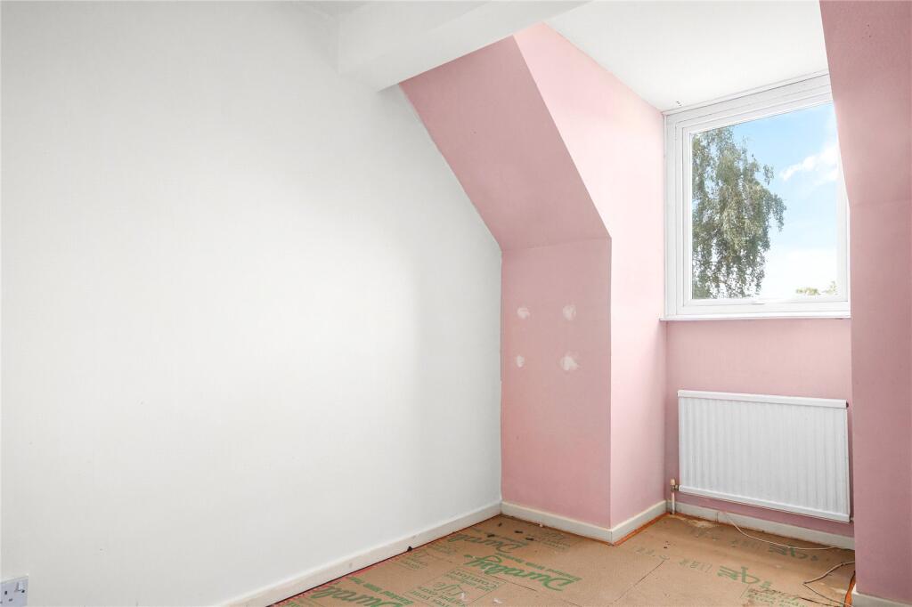
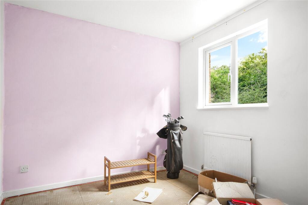
- BEDROOM 1:
- BEDROOM 2:
- BEDROOM 3:
- BEDROOM 4:
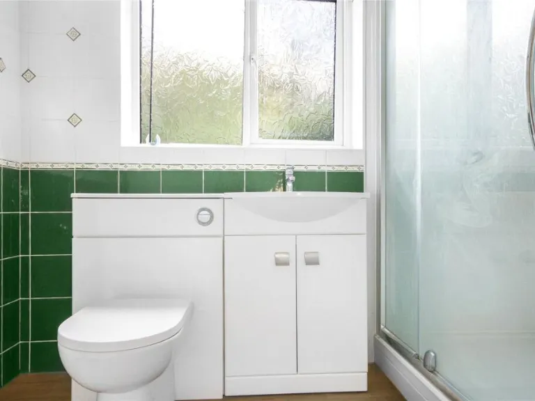
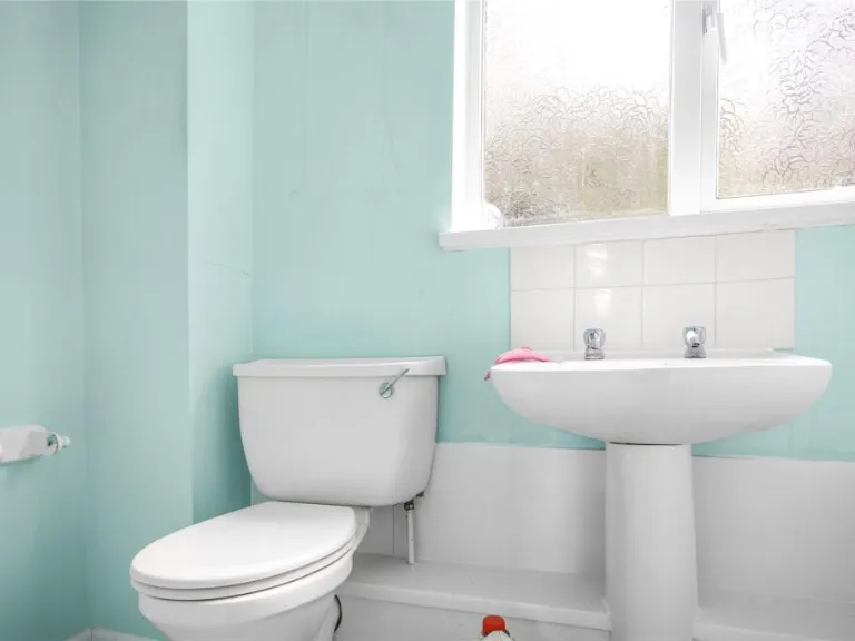
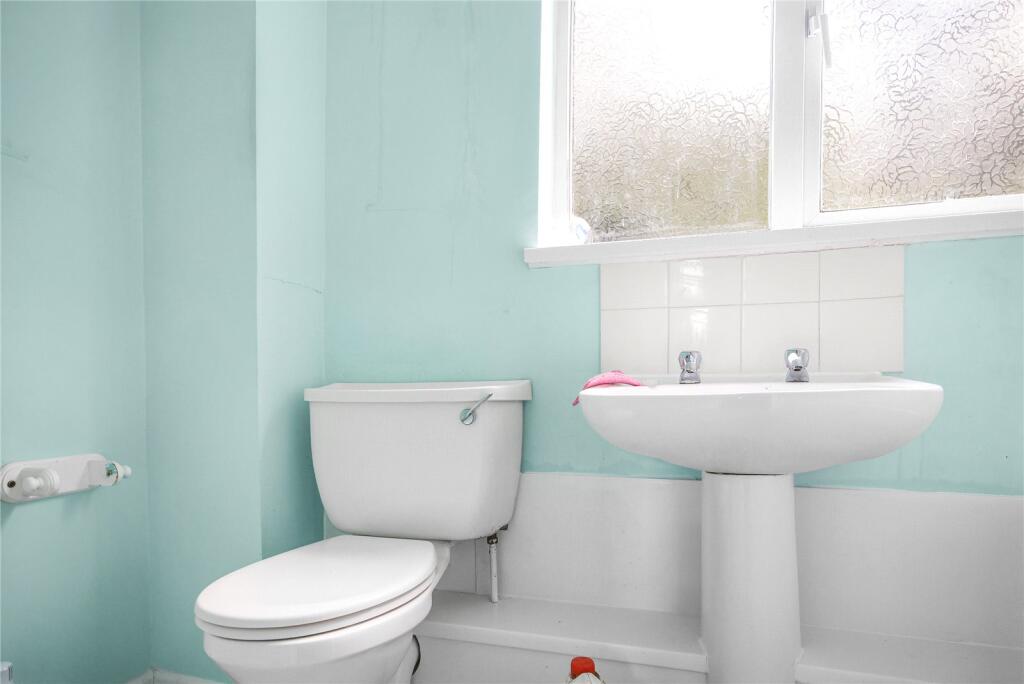
- BATHROOM:
- BATHROOM:
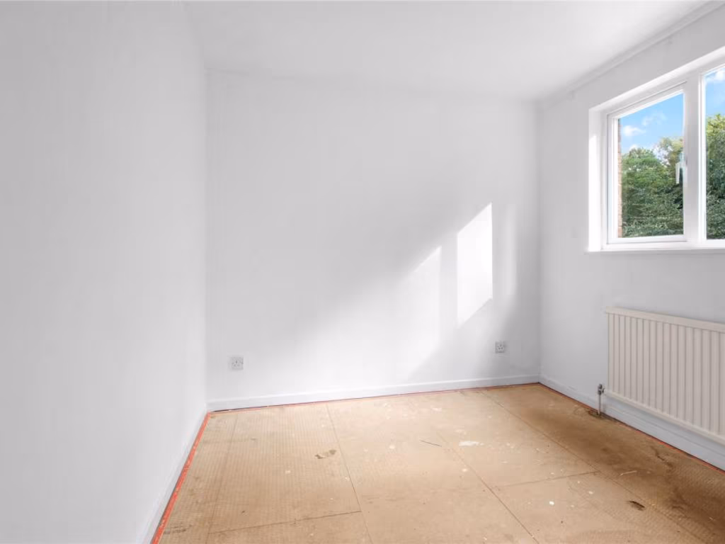
Textual Property Features
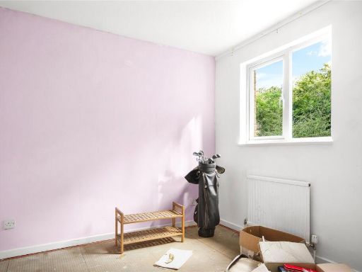
- Has Garden
- Chain Free
- Success
Detected Visual Features
- detached house
- modern
- 1980s
- garage
- garden
- driveway
- residential
- family home
- 1980s kitchen
- dated cabinetry
- standard ceiling
- medium room
- gas stovetop
- needs modernization
- potential mold risk
- worn floor
- replacement boiler
EPC Details
- Fully double glazed
- Cavity wall, as built, insulated (assumed)
- Boiler and radiators, mains gas
- Low energy lighting in all fixed outlets
- Solid, no insulation (assumed)
Nearby Schools
- Pine Ridge Infant School
- St Margaret Clitherow Catholic Primary School, Bracknell
- Wildridings Primary School
- LVS Ascot
- Heathfield School
- Garth Hill College
- Sandy Lane Primary School
- Wildmoor Heath School
- Birch Hill Primary School and Nursery
- Jennett's Park CofE Primary School
- The Brakenhale School
- St Joseph's Catholic Primary School, Bracknell
- Newbold School
- Lorraine Infant School
- Cordwalles Junior School
- Crown Wood Primary School
- Great Hollands Primary School
- Whitegrove Primary School
- Wooden Hill Primary and Nursery School
- The Pines School
- King's Academy Easthampstead Park
- St Michael's Easthampstead Church of England Voluntary Aided Primary School
- Fox Hill Primary School
- Harmans Water Primary School
- Ranelagh School
- Holly Spring Primary School
- King's Academy Binfield
- Warfield Church of England Primary School
Nearest General Shops
- Id: 6285145092
- Tags:
- Addr:
- City: Bracknell
- Housenumber: 98
- Postcode: RG12 7DE
- Street: Liscombe
- Brand: Coral
- Brand:wikidata: Q54621344
- Brand:wikipedia: en:Coral (bookmaker)
- Name: Coral
- Shop: bookmaker
- TagsNormalized:
- Lat: 51.391954
- Lon: -0.7521162
- FullGeoHash: gcpkqgs7f6td
- PartitionGeoHash: gcpk
- Images:
- FoodStandards: null
- Distance: 399.6
,- Id: 6285150101
- Tags:
- TagsNormalized:
- Lat: 51.3924157
- Lon: -0.7521794
- FullGeoHash: gcpkqgsq8bwk
- PartitionGeoHash: gcpk
- Images:
- FoodStandards: null
- Distance: 383.4
,- Id: 6285150102
- Tags:
- TagsNormalized:
- Lat: 51.3920615
- Lon: -0.7516226
- FullGeoHash: gcpkqgssmyts
- PartitionGeoHash: gcpk
- Images:
- FoodStandards: null
- Distance: 363.6
}
Nearest Grocery shops
- Id: 4357467799
- Tags:
- Brand: Little Waitrose
- Brand:wikidata: Q771734
- Brand:wikipedia: en:Waitrose
- Name: Little Waitrose
- Shop: convenience
- Wheelchair: yes
- TagsNormalized:
- little waitrose
- waitrose
- convenience
- shop
- Lat: 51.4052193
- Lon: -0.7479173
- FullGeoHash: gcpkqyp3h72m
- PartitionGeoHash: gcpk
- Images:
- FoodStandards: null
- Distance: 1296.8
,- Id: 8477361297
- Tags:
- Brand: M&S Simply Food
- Brand:wikidata: Q714491
- Brand:wikipedia: en:Marks & Spencer
- Contact:
- Website: https://www.marksandspencer.com/stores/hornbill-bp-1867
- Name: M&S Simply Food
- Shop: convenience
- TagsNormalized:
- m&s simply food
- food
- convenience
- shop
- Lat: 51.3982356
- Lon: -0.7447224
- FullGeoHash: gcpkrhc8qtwd
- PartitionGeoHash: gcpk
- Images:
- FoodStandards: null
- Distance: 541.6
,- Id: 3132295455
- Tags:
- Addr:
- City: Bracknell
- Country: GB
- Housename: Birch Hill Post Office
- Housenumber: 94-95
- Postcode: RG12 7DE
- Street: Liscombe
- Brand: Morrisons Daily
- Brand:wikidata: Q99752411
- Contact:
- Website: https://my.morrisons.com/storefinder/36506
- Fhrs:
- Name: Morrisons Daily
- Operator: McColl's
- Operator:website: https://www.mccolls.co.uk/storelocator/bracknell-birch-hill/
- Operator:wikidata: Q16997477
- Shop: convenience
- TagsNormalized:
- morrisons
- morrisons daily
- convenience
- shop
- Lat: 51.391776
- Lon: -0.7520458
- FullGeoHash: gcpkqgs6u16j
- PartitionGeoHash: gcpk
- Images:
- FoodStandards: null
- Distance: 404.6
}
Nearest Supermarkets
- Id: 49713284
- Tags:
- Brand: Tesco
- Brand:wikidata: Q487494
- Brand:wikipedia: en:Tesco
- Building: yes
- Contact:
- Website: https://www.tesco.com/store-locator/bracknell/whitton-rd
- Layer: -1
- Location: surface
- Name: Tesco
- Shop: supermarket
- Wheelchair: yes
- TagsNormalized:
- Lat: 51.4080365
- Lon: -0.7249223
- FullGeoHash: gcpkrw81s0df
- PartitionGeoHash: gcpk
- Images:
- FoodStandards: null
- Distance: 2219.7
,- Id: 53568972
- Tags:
- Brand: Sainsbury's
- Brand:wikidata: Q152096
- Brand:wikipedia: en:Sainsbury's
- Building: yes
- Name: Sainsbury's
- Shop: supermarket
- Source:
- Building: OS_OpenData_StreetView
- Toilets:
- Wheelchair: yes
- TagsNormalized:
- sainsburys
- supermarket
- shop
- Lat: 51.3927126
- Lon: -0.7404745
- FullGeoHash: gcpkr5ub38n0
- PartitionGeoHash: gcpk
- Images:
- FoodStandards: null
- Distance: 461
,- Id: 3132281283
- Tags:
- Addr:
- City: Bracknell
- Housenumber: 136
- Postcode: RG12 7DE
- Street: Liscombe
- Brand: ALDI
- Brand:wikidata: Q41171672
- Brand:wikipedia: en:Aldi
- Contact:
- Website: https://stores.aldi.co.uk/bracknell/birch-hill
- Fhrs:
- Name: Aldi
- Shop: supermarket
- TagsNormalized:
- Lat: 51.391999
- Lon: -0.7524572
- FullGeoHash: gcpkqgsh46zp
- PartitionGeoHash: gcpk
- Images:
- FoodStandards:
- Id: 985705
- FHRSID: 985705
- LocalAuthorityBusinessID: 08/60098/CP
- BusinessName: Aldi
- BusinessType: Retailers - supermarkets/hypermarkets
- BusinessTypeID: 7840
- AddressLine1: 136 Liscombe
- AddressLine2: Bracknell
- AddressLine3: null
- AddressLine4: null
- PostCode: RG12 7DE
- RatingValue: 5
- RatingKey: fhrs_5_en-GB
- RatingDate: 2022-01-12
- LocalAuthorityCode: 882
- LocalAuthorityName: Bracknell Forest
- LocalAuthorityWebSite: http://www.bracknell-forest.gov.uk
- LocalAuthorityEmailAddress: environmental.health@bracknell-forest.gov.uk
- Scores:
- Hygiene: 0
- Structural: 0
- ConfidenceInManagement: 5
- NewRatingPending: false
- Geocode:
- Longitude: -0.75215601921081
- Latitude: 51.39215469360350
- Distance: 418.7
}
Nearest Religious buildings
- Id: 290844962
- Tags:
- Addr:
- Street: Off Ringmead Road
- Alt_name: Bracknell Ward
- Amenity: place_of_worship
- Denomination: mormon
- Name: The Church of Jesus Christ of Latter-day Saints
- TagsNormalized:
- place of worship
- mormon
- church
- Lat: 51.3958856
- Lon: -0.7591786
- FullGeoHash: gcpkqsr4tz7r
- PartitionGeoHash: gcpk
- Images:
- FoodStandards: null
- Distance: 885
,- Id: 1018556367
- Tags:
- Amenity: place_of_worship
- Building: yes
- Denomination: baptist
- Name: Easthampstead Baptist Church
- Religion: christian
- TagsNormalized:
- place of worship
- baptist
- church
- christian
- Lat: 51.3988077
- Lon: -0.751541
- FullGeoHash: gcpkquuezb4q
- PartitionGeoHash: gcpk
- Images:
- FoodStandards: null
- Distance: 662.8
,- Id: 307966363
- Tags:
- Amenity: place_of_worship
- Building: yes
- Denomination: baptist
- Name: Lepington Baptist Church
- Religion: christian
- TagsNormalized:
- place of worship
- baptist
- church
- christian
- Lat: 51.3914489
- Lon: -0.7521639
- FullGeoHash: gcpkqgs2ck3v
- PartitionGeoHash: gcpk
- Images:
- FoodStandards: null
- Distance: 430.6
}
Nearest Medical buildings
- Id: 2635860985
- Tags:
- Amenity: pharmacy
- Healthcare: pharmacy
- Name: Sainsburys Pharmacy
- TagsNormalized:
- pharmacy
- health
- healthcare
- sainsburys
- Lat: 51.3924789
- Lon: -0.7404512
- FullGeoHash: gcpkr5syfhrt
- PartitionGeoHash: gcpk
- Images:
- FoodStandards: null
- Distance: 468.6
,- Id: 307966364
- Tags:
- Addr:
- City: South East England
- Postcode: RG12 7WW
- Street: Leppington
- Amenity: doctors
- Building: public
- Contact:
- Electricity: grid
- Healthcare: doctor
- Name: Ringmead Medical Practice - Birch Hill
- Opening_hours: Mo-Fr 08:00-18:30
- Operational_status: operational
- Wheelchair: yes
- TagsNormalized:
- doctor
- doctors
- health
- healthcare
- Lat: 51.3911873
- Lon: -0.7520978
- FullGeoHash: gcpkqgkr6gej
- PartitionGeoHash: gcpk
- Images:
- FoodStandards: null
- Distance: 443.5
,- Id: 3132295454
- Tags:
- Addr:
- City: Bracknell
- Housenumber: 97
- Postcode: RG12 7DE
- Street: Liscombe
- Amenity: pharmacy
- Brand: Kamsons Pharmacy
- Dispensing: yes
- Electricity: grid
- Fhrs:
- Id: 986353
- Local_authority_id: 90/25788/CP
- Healthcare: pharmacy
- Name: Kamsons Pharmacy
- Opening_hours: Mo-Th 09:00-18:00; Fr 09:00-18:30; Sa 09:00-13:00
- Operational_status: operational
- Wheelchair: yes
- TagsNormalized:
- Lat: 51.3918935
- Lon: -0.7520899
- FullGeoHash: gcpkqgs77p31
- PartitionGeoHash: gcpk
- Images:
- FoodStandards: null
- Distance: 401
,- Id: 258193064
- Tags:
- Amenity: doctors
- Building: yes
- Healthcare: doctor
- Name: Forest End Medical Center
- Opening_hours: Mo-Fr 08:00-18:30
- TagsNormalized:
- doctor
- doctors
- health
- healthcare
- forest
- Lat: 51.3935316
- Lon: -0.7420376
- FullGeoHash: gcpkr5gtj28t
- PartitionGeoHash: gcpk
- Images:
- FoodStandards: null
- Distance: 342.5
}
Nearest Airports
- Id: 14001268
- Tags:
- Access: yes
- Aerodrome: international
- Aerodrome:type: public
- Aeroway: aerodrome
- Alt_name: London Heathrow
- Alt_name_2: London Heathrow Airport
- Ele: 25
- Iata: LHR
- Icao: EGLL
- Int_name: Heathrow Airport
- Name: London Heathrow Airport
- Note: area still approx
- Old_name: London Airport
- Operator: Heathrow Airport Limited
- Rank_aci:
- Ref: LHR
- Short_name: Heathrow
- Type: multipolygon
- Website: https://www.heathrow.com/
- Wikidata: Q8691
- Wikipedia: en:Heathrow Airport
- TagsNormalized:
- airport
- international airport
- Lat: 51.4677522
- Lon: -0.4547736
- FullGeoHash: gcpsv9kv7h2h
- PartitionGeoHash: gcps
- Images:
- FoodStandards: null
- Distance: 21872
}
Nearest Leisure Facilities
- Id: 53568954
- Tags:
- Leisure: playground
- Name: Barry Square Play Area
- Operator: Bracknell Forest Council
- Source: Bing
- TagsNormalized:
- Lat: 51.3913786
- Lon: -0.7412455
- FullGeoHash: gcpkr5s0rxr6
- PartitionGeoHash: gcpk
- Images:
- FoodStandards: null
- Distance: 466.3
,- Id: 934261479
- Tags:
- TagsNormalized:
- Lat: 51.3914093
- Lon: -0.7414011
- FullGeoHash: gcpkr5s0sj53
- PartitionGeoHash: gcpk
- Images:
- FoodStandards: null
- Distance: 455.3
,- Id: 53021885
- Tags:
- TagsNormalized:
- Lat: 51.3916843
- Lon: -0.7508035
- FullGeoHash: gcpkqgt63023
- PartitionGeoHash: gcpk
- Images:
- FoodStandards: null
- Distance: 338.6
,- Id: 944313432
- Tags:
- TagsNormalized:
- Lat: 51.3915851
- Lon: -0.7504363
- FullGeoHash: gcpkqgt99tf4
- PartitionGeoHash: gcpk
- Images:
- FoodStandards: null
- Distance: 326.4
,- Id: 395411665
- Tags:
- Leisure: park
- Name: South Hill Park
- Wikidata: Q7567474
- Wikipedia: en:South Hill Park
- TagsNormalized:
- Lat: 51.3942347
- Lon: -0.7508286
- FullGeoHash: gcpkquj307tx
- PartitionGeoHash: gcpk
- Images:
- FoodStandards: null
- Distance: 277.4
}
Nearest Tourist attractions
- Id: 404180433
- Tags:
- Brand: Go Ape
- Brand:website: https://goape.co.uk/
- Brand:wikidata: Q5574692
- Brand:wikipedia: en:Go Ape
- Name: Go Ape!
- Tourism: attraction
- Website: https://goape.co.uk/locations/bracknell
- TagsNormalized:
- Lat: 51.3873621
- Lon: -0.7394763
- FullGeoHash: gcpkr4v90fwe
- PartitionGeoHash: gcpk
- Images:
- FoodStandards: null
- Distance: 864.5
,- Id: 132712773
- Tags:
- TagsNormalized:
- Lat: 51.3868841
- Lon: -0.7408811
- FullGeoHash: gcpkr4sw21rp
- PartitionGeoHash: gcpk
- Images:
- FoodStandards: null
- Distance: 855.4
,- Id: 1782199
- Tags:
- Building: yes
- Name: The Look Out
- Source:
- Building: OS OpenData StreetView
- Tourism: attraction
- Type: multipolygon
- TagsNormalized:
- Lat: 51.3871056
- Lon: -0.7411825
- FullGeoHash: gcpkr4sr94y2
- PartitionGeoHash: gcpk
- Images:
- FoodStandards: null
- Distance: 823.7
}
Nearest Train stations
- Id: 15721189
- Tags:
- Name: Wokingham
- Naptan:
- Network: National Rail
- Operator: South West Trains
- Public_transport: station
- Railway: station
- Ref:
- Wheelchair: yes
- Wikidata: Q2588372
- Wikipedia: en:Wokingham railway station
- TagsNormalized:
- Lat: 51.4119036
- Lon: -0.8429813
- FullGeoHash: gcpkkz60j17w
- PartitionGeoHash: gcpk
- Images:
- FoodStandards: null
- Distance: 6964.8
,- Id: 1622191508
- Tags:
- Name: Sandhurst
- Naptan:
- Network: National Rail
- Operator: Great Western Railway
- Public_transport: station
- Railway: station
- Ref:
- Source: bing
- Source:operator: Local Knowledge
- Wheelchair: no
- Wikidata: Q2848846
- Wikipedia: en:Sandhurst railway station
- TagsNormalized:
- Lat: 51.3465435
- Lon: -0.8038071
- FullGeoHash: gcpkjeqemcmy
- PartitionGeoHash: gcpk
- Images:
- FoodStandards: null
- Distance: 6550.6
,- Id: 5967525976
- Tags:
- Name: Camberley
- Naptan:
- Network: National Rail
- Operator: South Western Railway
- Public_transport: station
- Railway: station
- Ref:
- Wikidata: Q5025046
- Wikipedia: en:Camberley railway station
- TagsNormalized:
- Lat: 51.3363364
- Lon: -0.7438865
- FullGeoHash: gcpkp16rf4wn
- PartitionGeoHash: gcpk
- Images:
- FoodStandards: null
- Distance: 6367.9
,- Id: 1622191469
- Tags:
- Name: Crowthorne
- Naptan:
- Network: National Rail
- Public_transport: station
- Railway: station
- Ref:
- Source: bing
- Wheelchair: yes
- Wikidata: Q4371483
- Wikipedia: en:Crowthorne railway station
- TagsNormalized:
- Lat: 51.3664877
- Lon: -0.8192585
- FullGeoHash: gcpkjqgrmzkd
- PartitionGeoHash: gcpk
- Images:
- FoodStandards: null
- Distance: 5851.3
,- Id: 5967525977
- Tags:
- Name: Bagshot
- Naptan:
- Network: National Rail
- Operator: South Western Railway
- Public_transport: station
- Railway: station
- Ref:
- Wikidata: Q2480873
- Wikipedia: en:Bagshot railway station
- TagsNormalized:
- Lat: 51.3643336
- Lon: -0.6885039
- FullGeoHash: gcps0qdduty2
- PartitionGeoHash: gcps
- Images:
- FoodStandards: null
- Distance: 5199.8
}
Nearest Bus stations and stops
- Id: 8658922460
- Tags:
- Bus: yes
- Highway: bus_stop
- Public_transport: platform
- Shelter: yes
- TagsNormalized:
- Lat: 51.3897421
- Lon: -0.7477827
- FullGeoHash: gcpkqgpqzqkb
- PartitionGeoHash: gcpk
- Images:
- FoodStandards: null
- Distance: 429.5
,- Id: 4622631426
- Tags:
- Bus: yes
- Highway: bus_stop
- Public_transport: platform
- Source: Bing
- TagsNormalized:
- Lat: 51.3906337
- Lon: -0.743748
- FullGeoHash: gcpkr56kjkmq
- PartitionGeoHash: gcpk
- Images:
- FoodStandards: null
- Distance: 396
,- Id: 8658875315
- Tags:
- Bus: yes
- Highway: bus_stop
- Public_transport: platform
- Shelter: yes
- TagsNormalized:
- Lat: 51.3909598
- Lon: -0.7438968
- FullGeoHash: gcpkr56q1cq2
- PartitionGeoHash: gcpk
- Images:
- FoodStandards: null
- Distance: 360.5
,- Id: 4622631441
- Tags:
- Highway: bus_stop
- Public_transport: platform
- Shelter: yes
- Source: Bing
- TagsNormalized:
- Lat: 51.3929928
- Lon: -0.7435567
- FullGeoHash: gcpkr5f9cu5z
- PartitionGeoHash: gcpk
- Images:
- FoodStandards: null
- Distance: 245.7
,- Id: 6285153151
- Tags:
- Bus: yes
- Highway: bus_stop
- Public_transport: platform
- Shelter: yes
- TagsNormalized:
- Lat: 51.3930052
- Lon: -0.7438277
- FullGeoHash: gcpkr5f3gw9c
- PartitionGeoHash: gcpk
- Images:
- FoodStandards: null
- Distance: 227.2
}
Nearest Hotels
- Id: 6297841613
- Tags:
- Addr:
- City: Bracknell
- Postcode: RG12 1ED
- Street: The Ring
- Internet_access: yes
- Name: Grange Bracknell Hotel
- Operator: GlobalGrange Limited
- Tourism: hotel
- Wheelchair: yes
- TagsNormalized:
- Lat: 51.4158848
- Lon: -0.7489586
- FullGeoHash: gcpkqzyx5zxg
- PartitionGeoHash: gcpk
- Images:
- FoodStandards: null
- Distance: 2484.9
,- Id: 584757290
- Tags:
- Addr:
- City: Bracknell
- Country: GB
- Postcode: RG12 7AA
- Street: Downshire Way
- Brand: Premier Inn
- Brand:wikidata: Q2108626
- Brand:wikipedia: en:Premier Inn
- Building: yes
- Fhrs:
- Internet_access: wlan
- Internet_access:fee: no
- Name: Premier Inn
- Smoking: no
- Tourism: hotel
- TagsNormalized:
- Lat: 51.4118826
- Lon: -0.7587974
- FullGeoHash: gcpkqxprytx9
- PartitionGeoHash: gcpk
- Images:
- FoodStandards: null
- Distance: 2195
,- Id: 9060388032
- Tags:
- Addr:
- City: Bracknell
- Country: GB
- Postcode: RG12 0QJ
- Street: Bagshot Road
- Fhrs:
- Name: Village Hotel Bracknell
- Tourism: hotel
- TagsNormalized:
- Lat: 51.3944193
- Lon: -0.7426636
- FullGeoHash: gcpkrh54nwju
- PartitionGeoHash: gcpk
- Images:
- FoodStandards: null
- Distance: 313.6
}
Tags
- detached house
- modern
- 1980s
- garage
- garden
- driveway
- residential
- family home
- 1980s kitchen
- dated cabinetry
- standard ceiling
- medium room
- gas stovetop
- needs modernization
- potential mold risk
- worn floor
- replacement boiler
Local Market Stats
- Average Price/sqft: £391
- Avg Income: £61400
- Rental Yield: 4.4%
- Social Housing: 19%
- Planning Success Rate: 95%
Similar Properties
 4 bedroom detached house for sale in Leafield Copse, The Warren, Bracknell, Berkshire, RG12 — £600,000 • 4 bed • 2 bath • 1195 ft²
 3 bedroom terraced house for sale in Hillberry, Bracknell, Berkshire, RG12 — £375,000 • 3 bed • 1 bath • 952 ft²
 4 bedroom detached house for sale in Arden Close, Bracknell, RG12 — £690,000 • 4 bed • 2 bath • 1671 ft²
 4 bedroom detached house for sale in Shaftesbury Close, Bracknell, RG12 — £500,000 • 4 bed • 1 bath • 1096 ft²
 3 bedroom terraced house for sale in Evedon, Bracknell, Berkshire, RG12 — £375,000 • 3 bed • 1 bath • 961 ft²
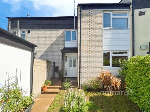 4 bedroom terraced house for sale in Overlord Close, Camberley, Surrey, GU15 — £475,000 • 4 bed • 2 bath • 1589 ft²
Meta
- {
"@context": "https://schema.org",
"@type": "Residence",
"name": "4 bedroom link detached house for sale in Frobisher, Brackn…",
"description": "",
"url": "https://propertypiper.co.uk/property/7678fe46-125d-4cbd-a74c-9b756164a403",
"image": "https://image-a.propertypiper.co.uk/704d563b-99e7-4c79-8659-db3d59166cd9-1024.jpeg",
"address": {
"@type": "PostalAddress",
"streetAddress": "47 FROBISHER BRACKNELL",
"postalCode": "RG12 7WQ",
"addressLocality": "Bracknell Forest",
"addressRegion": "Bracknell",
"addressCountry": "England"
},
"geo": {
"@type": "GeoCoordinates",
"latitude": 51.39357185606541,
"longitude": -0.7469741453051073
},
"numberOfRooms": 4,
"numberOfBathroomsTotal": 2,
"floorSize": {
"@type": "QuantitativeValue",
"value": 1654,
"unitCode": "FTK"
},
"offers": {
"@type": "Offer",
"price": 500000,
"priceCurrency": "GBP",
"availability": "https://schema.org/InStock"
},
"additionalProperty": [
{
"@type": "PropertyValue",
"name": "Feature",
"value": "detached house"
},
{
"@type": "PropertyValue",
"name": "Feature",
"value": "modern"
},
{
"@type": "PropertyValue",
"name": "Feature",
"value": "1980s"
},
{
"@type": "PropertyValue",
"name": "Feature",
"value": "garage"
},
{
"@type": "PropertyValue",
"name": "Feature",
"value": "garden"
},
{
"@type": "PropertyValue",
"name": "Feature",
"value": "driveway"
},
{
"@type": "PropertyValue",
"name": "Feature",
"value": "residential"
},
{
"@type": "PropertyValue",
"name": "Feature",
"value": "family home"
},
{
"@type": "PropertyValue",
"name": "Feature",
"value": "1980s kitchen"
},
{
"@type": "PropertyValue",
"name": "Feature",
"value": "dated cabinetry"
},
{
"@type": "PropertyValue",
"name": "Feature",
"value": "standard ceiling"
},
{
"@type": "PropertyValue",
"name": "Feature",
"value": "medium room"
},
{
"@type": "PropertyValue",
"name": "Feature",
"value": "gas stovetop"
},
{
"@type": "PropertyValue",
"name": "Feature",
"value": "needs modernization"
},
{
"@type": "PropertyValue",
"name": "Feature",
"value": "potential mold risk"
},
{
"@type": "PropertyValue",
"name": "Feature",
"value": "worn floor"
},
{
"@type": "PropertyValue",
"name": "Feature",
"value": "replacement boiler"
}
]
}
High Res Floorplan Images
Compatible Floorplan Images
FloorplanImages Thumbnail