GU24 9QE - 3 bedroom semidetached house for sale in Holly Ridge, Fenns…
View on Property Piper
3 bedroom semi-detached house for sale in Holly Ridge, Fenns Lane, West End, Woking, GU24
Property Details
- Price: £1250000
- Bedrooms: 3
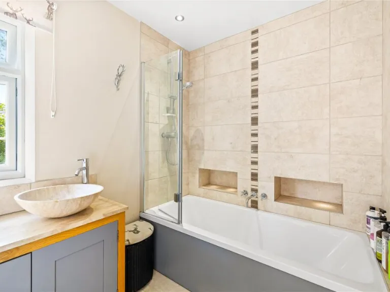
- Bathrooms: 2
- Property Type: undefined
- Property SubType: undefined
Brochure Descriptions
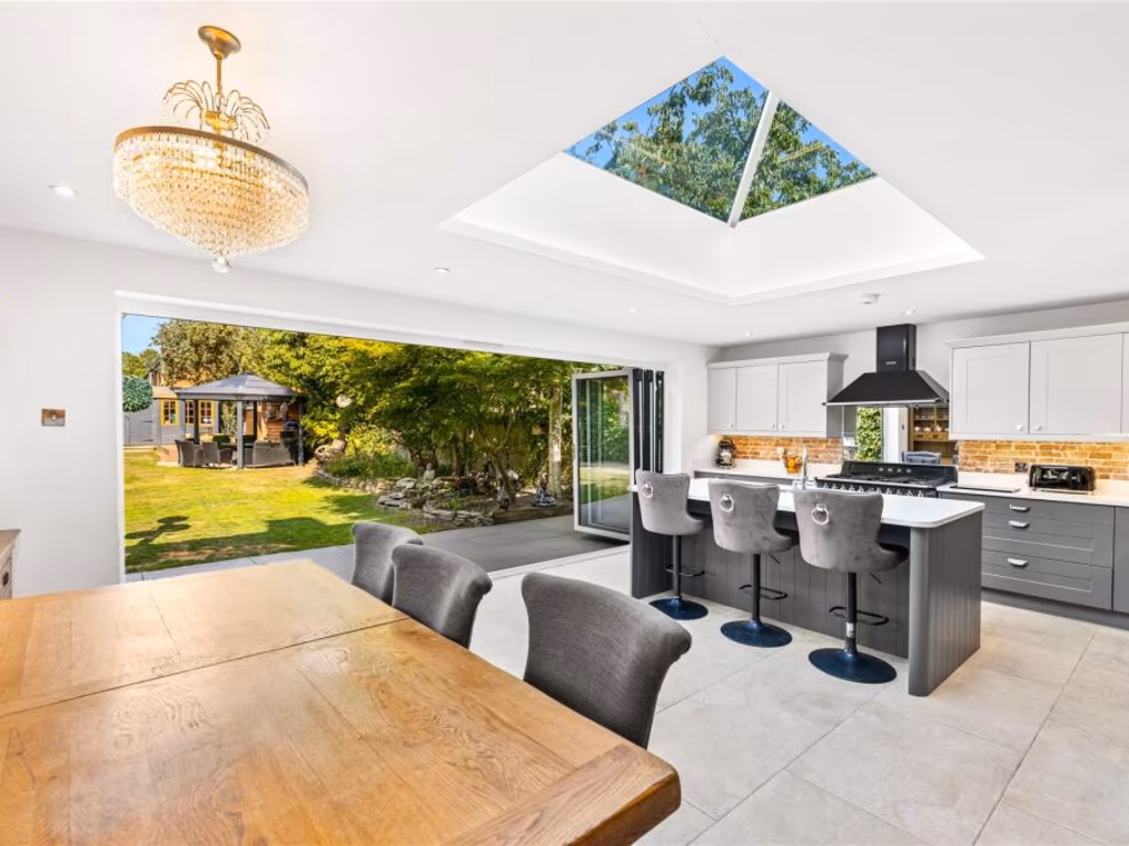
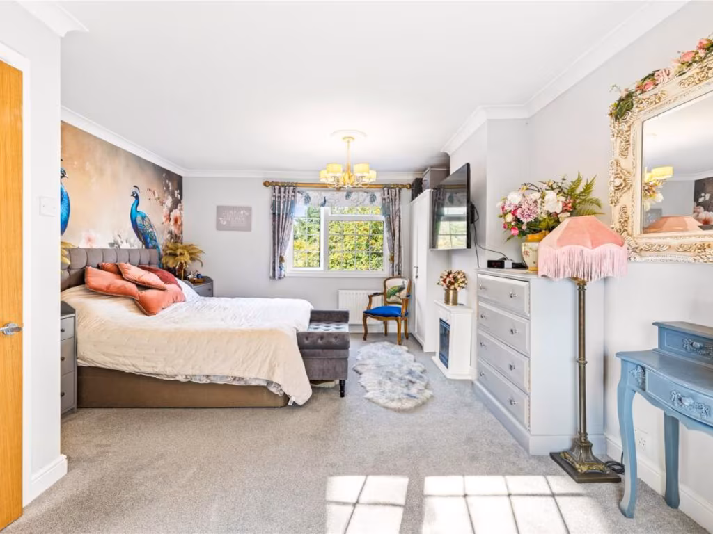
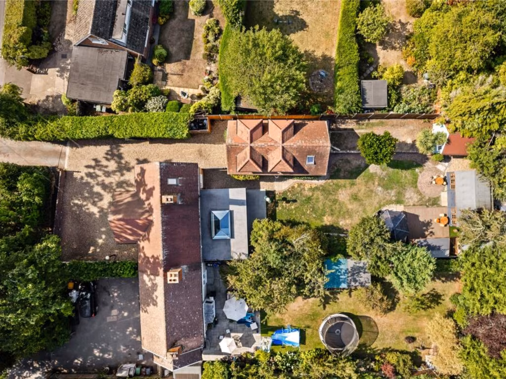
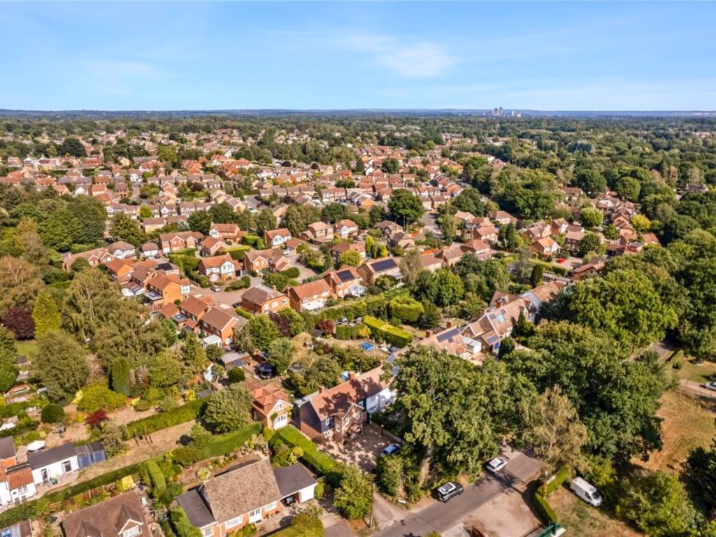
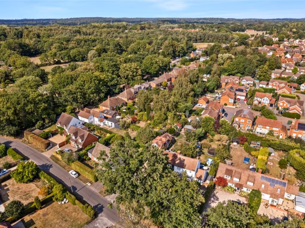
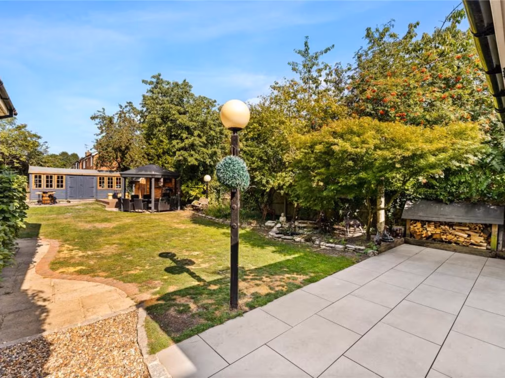
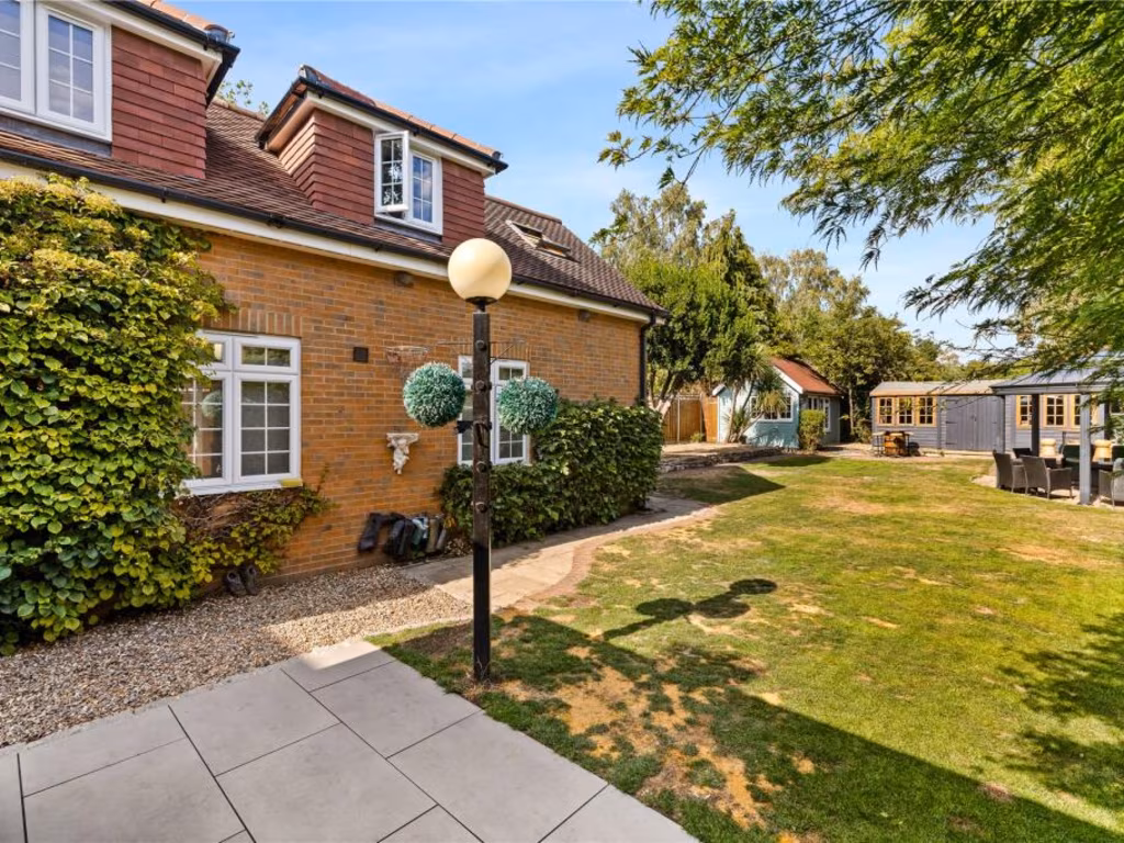
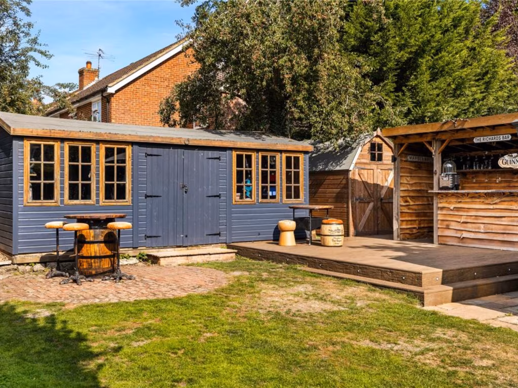
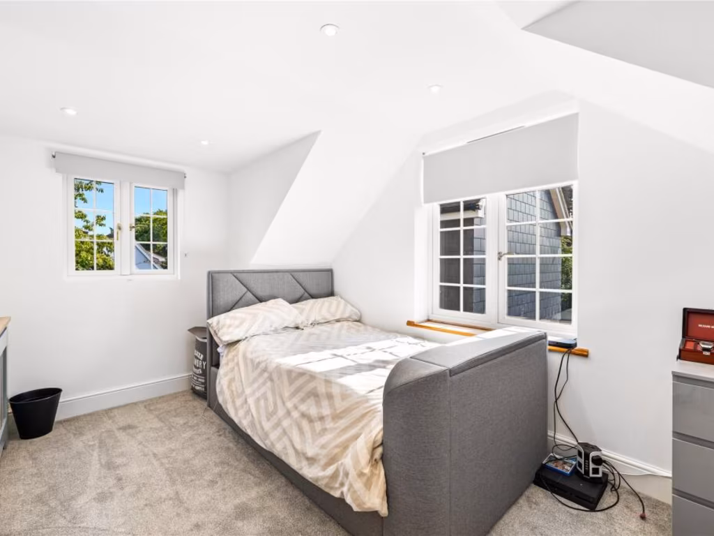
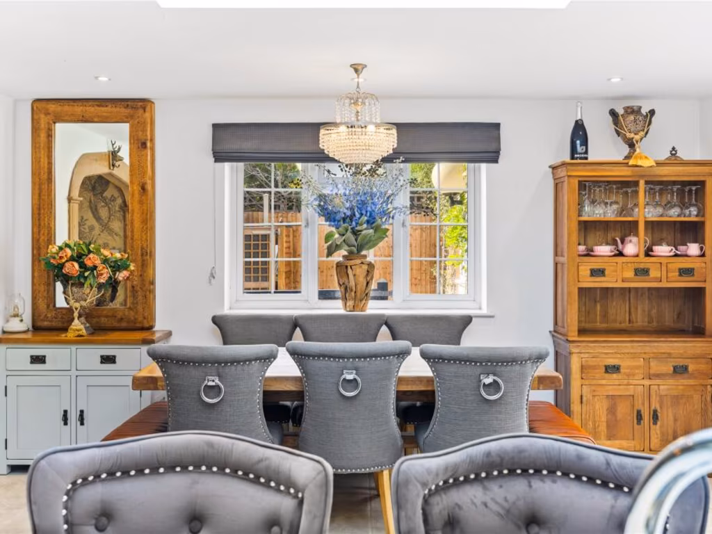
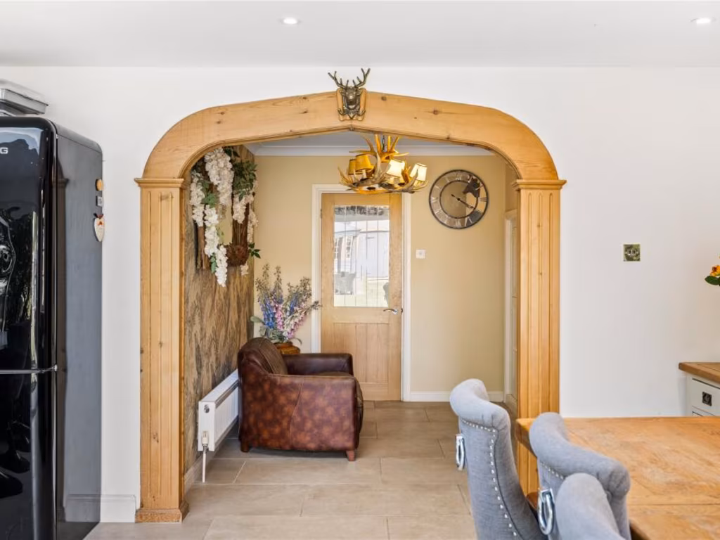
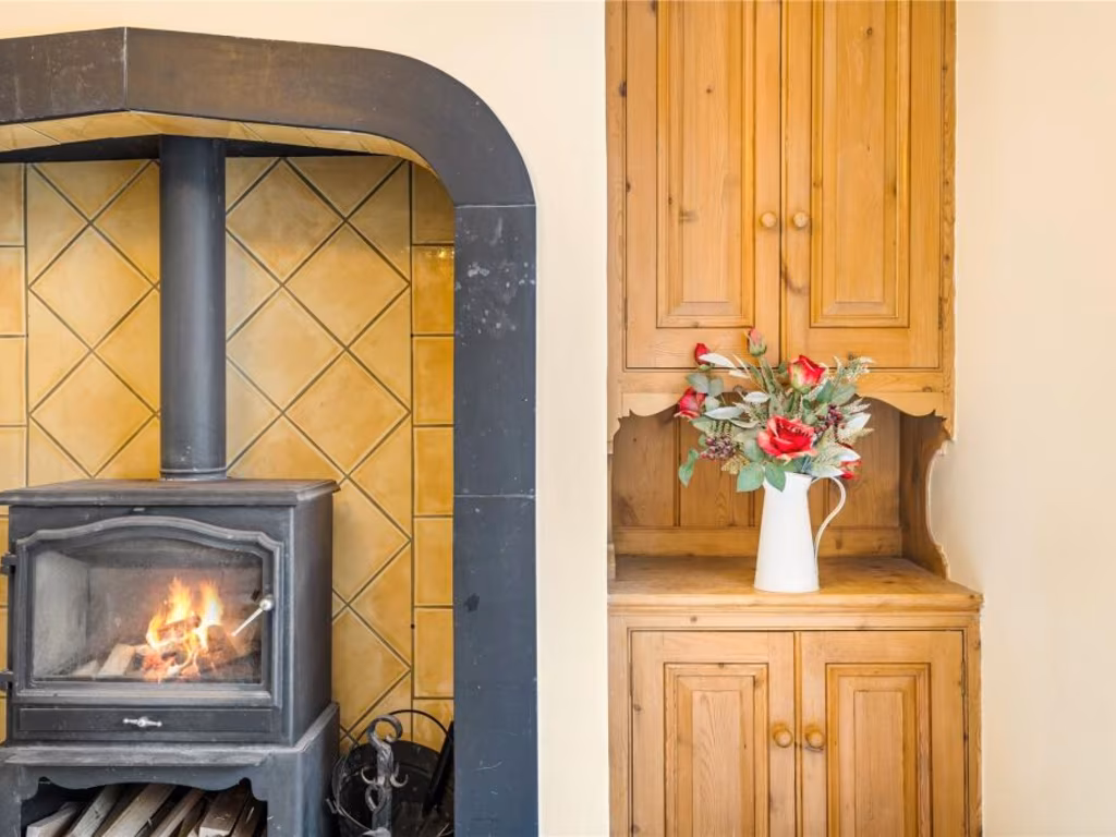
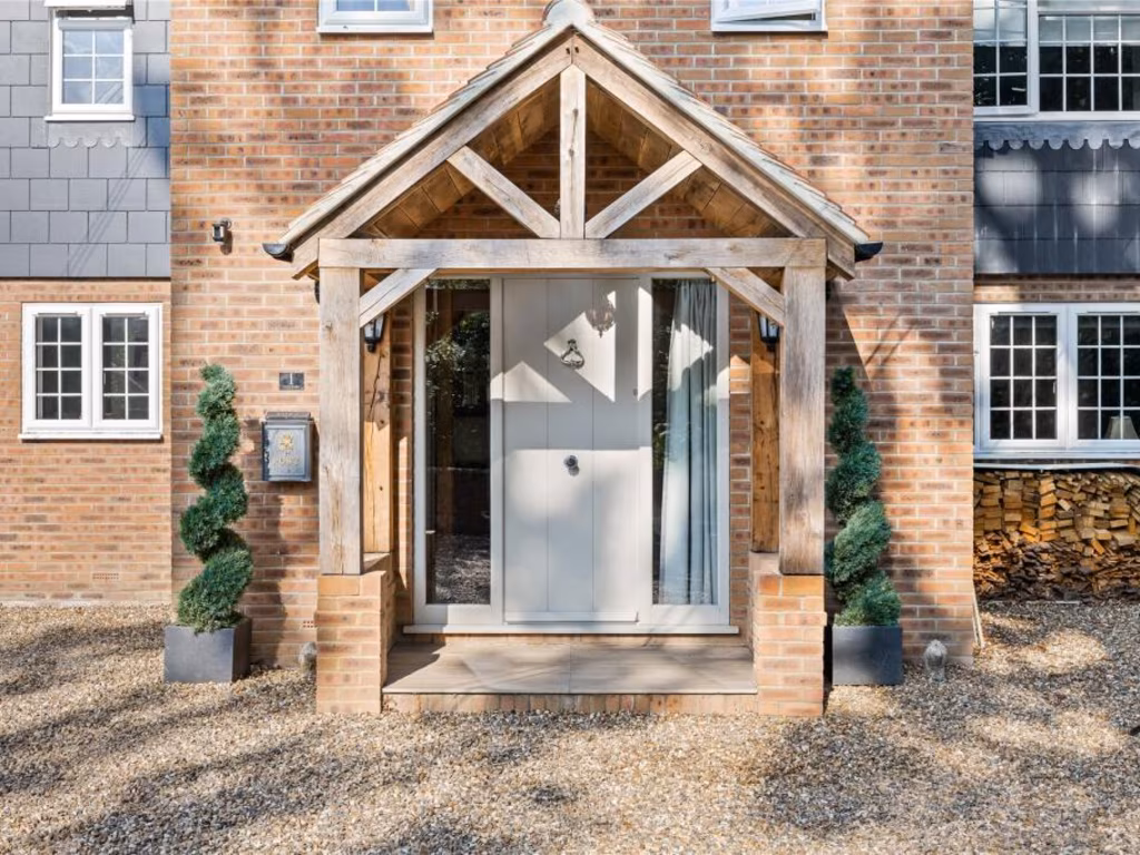
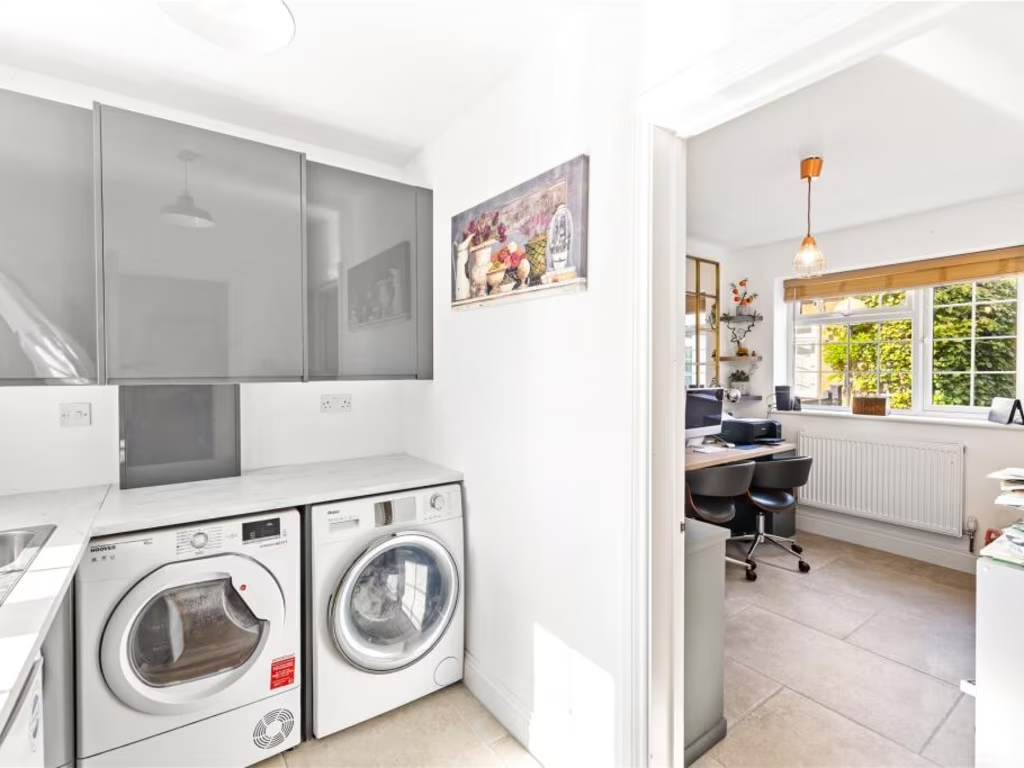
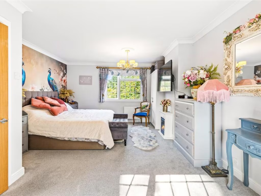
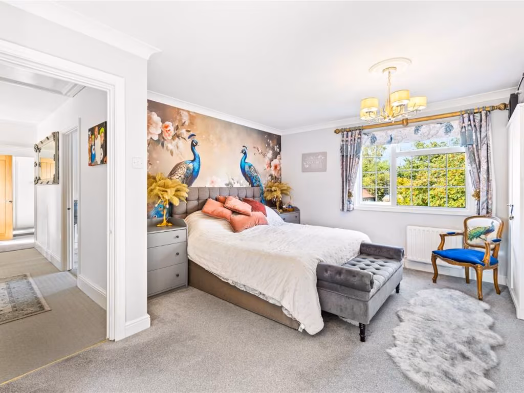
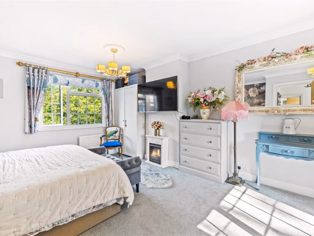
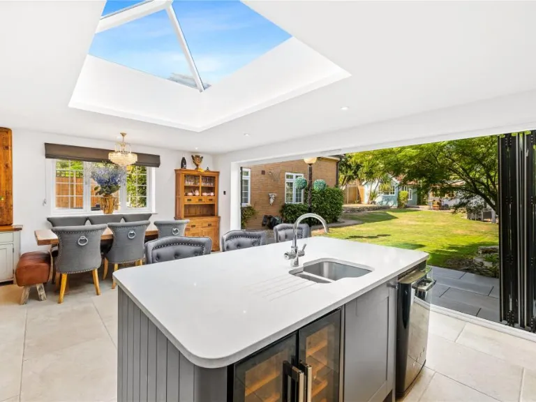
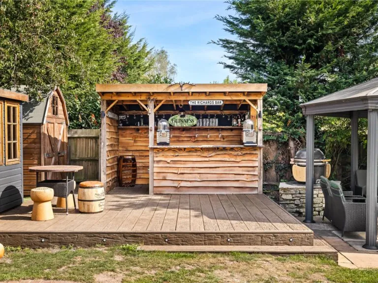
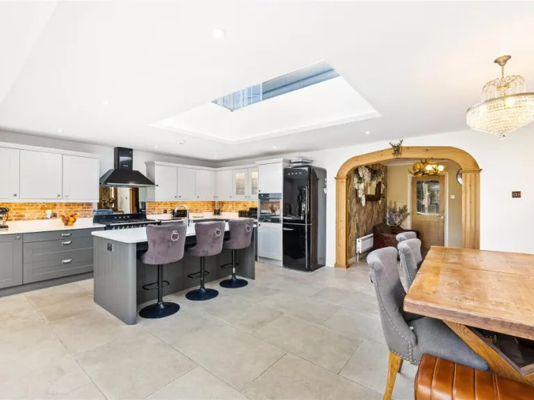
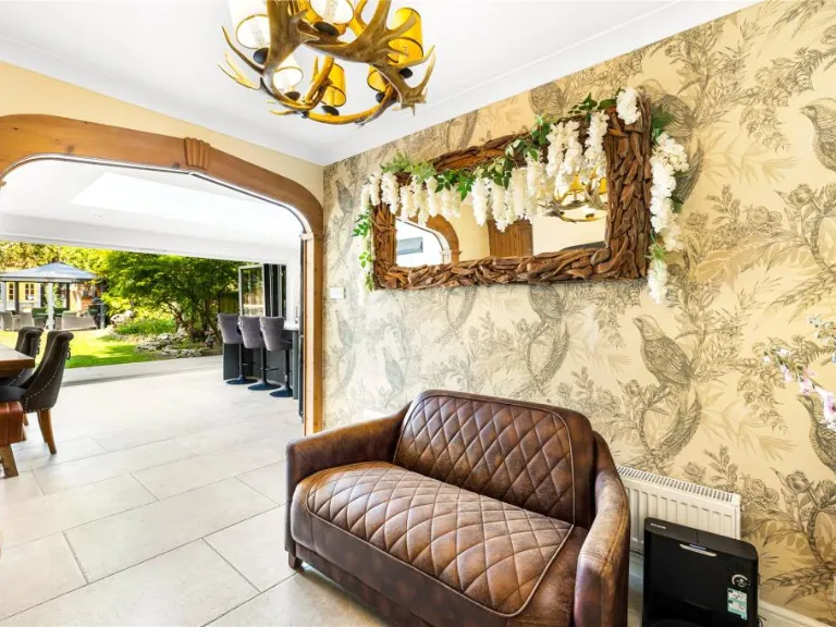
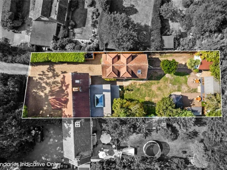
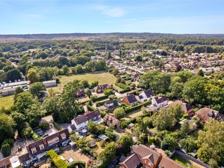
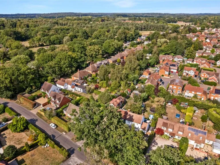
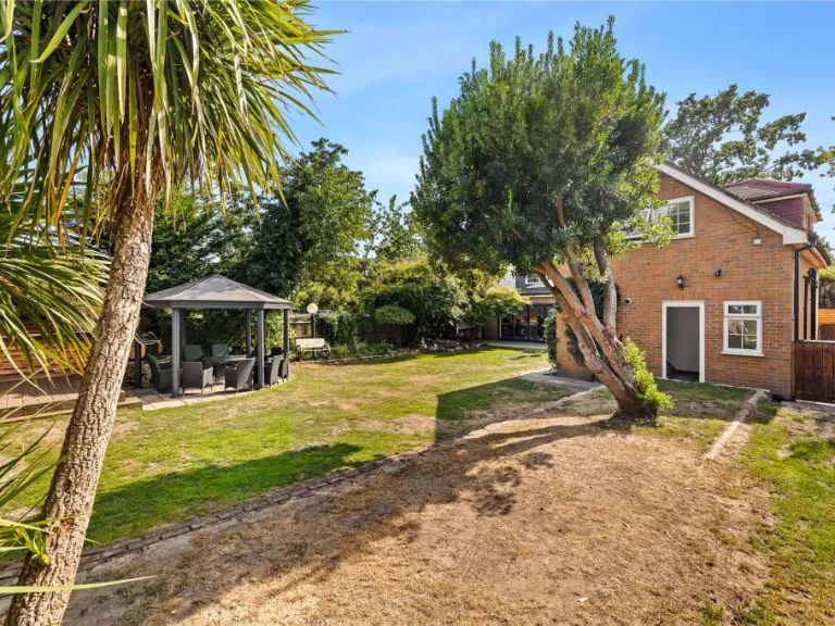
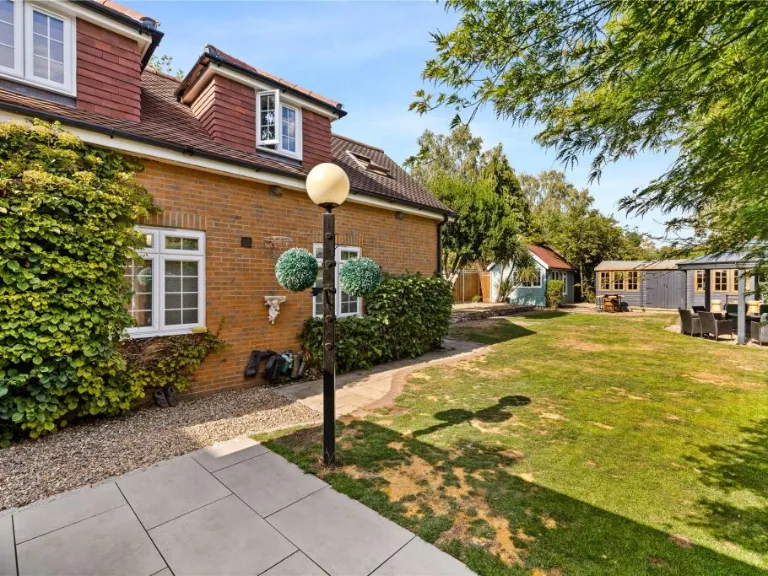
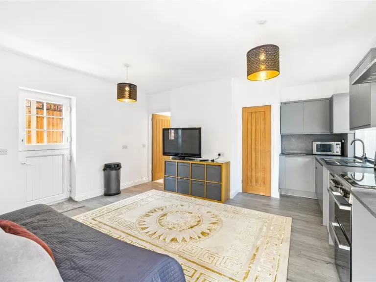
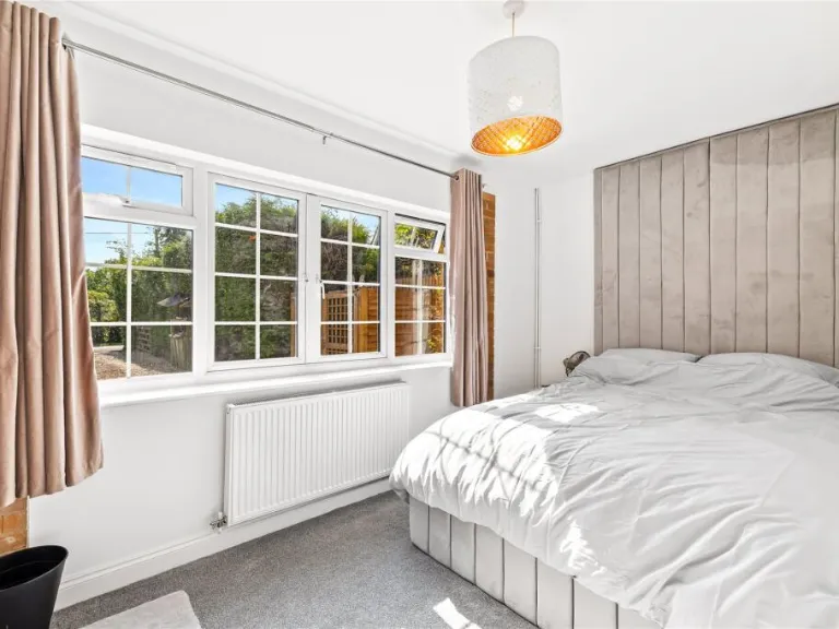
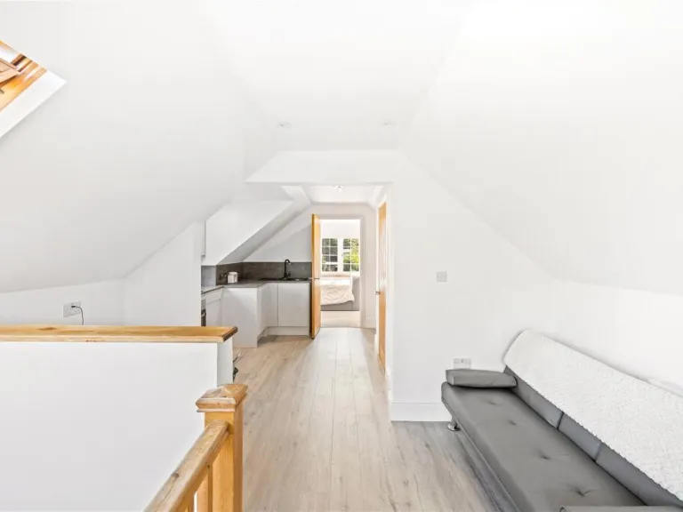
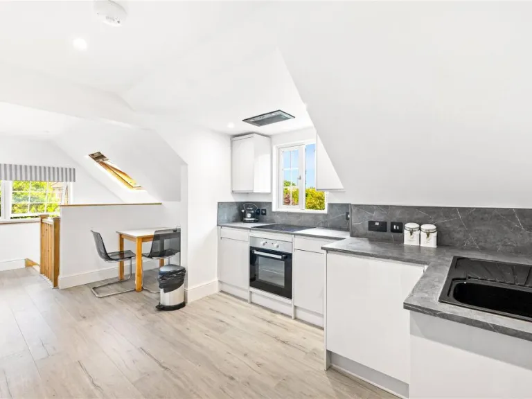
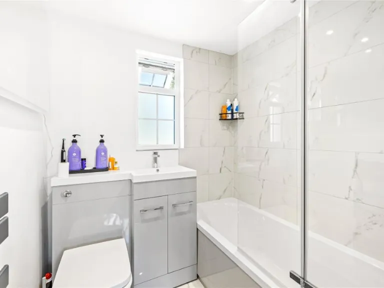
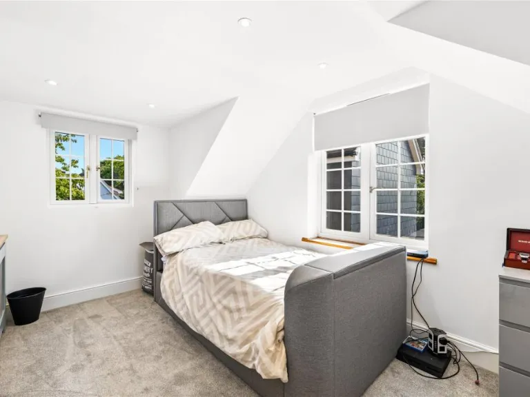
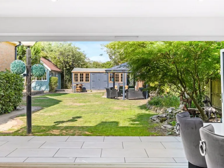
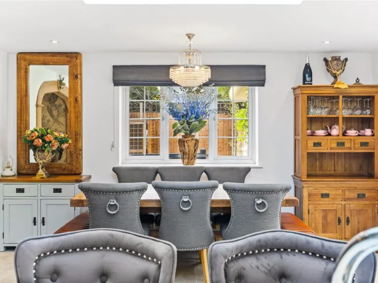
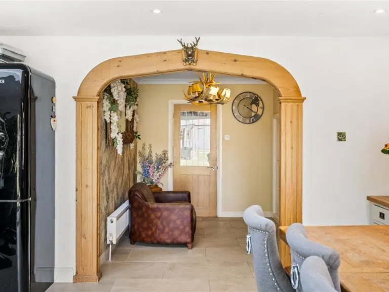
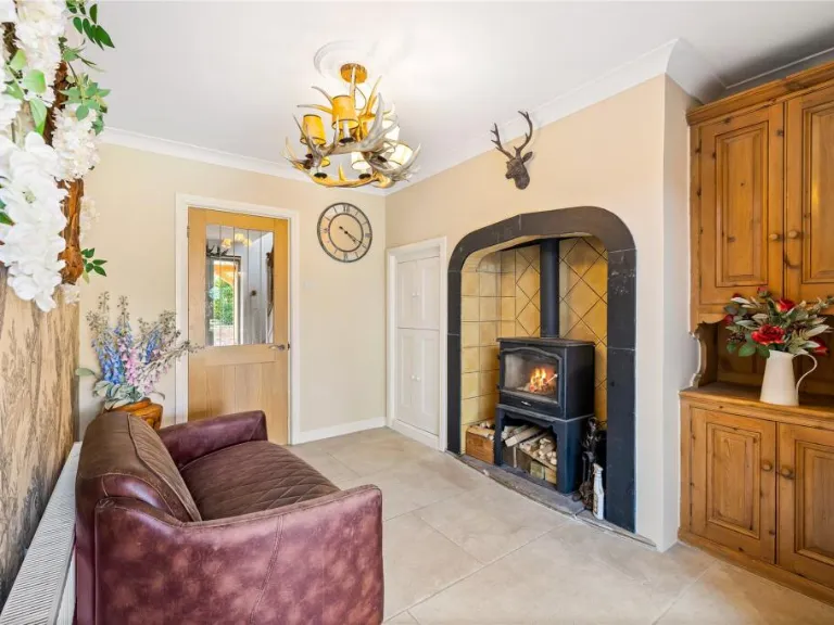
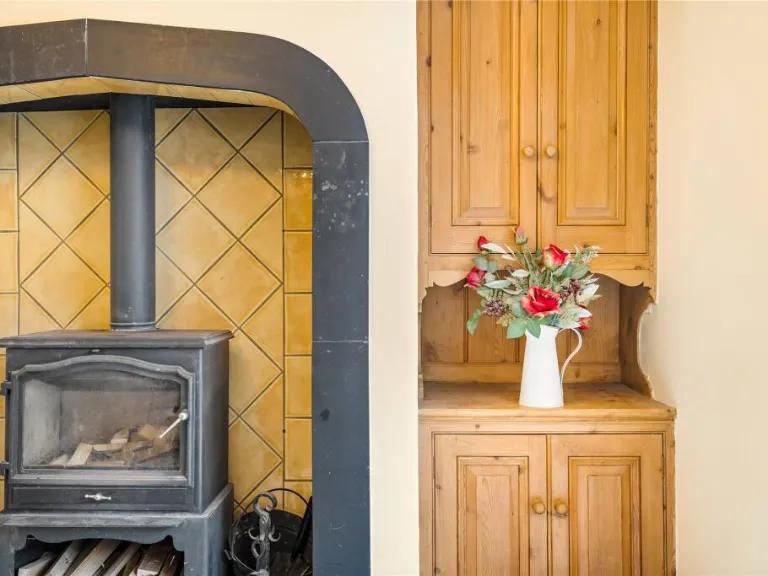
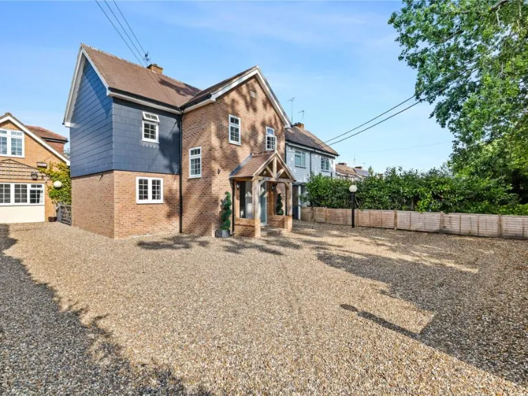
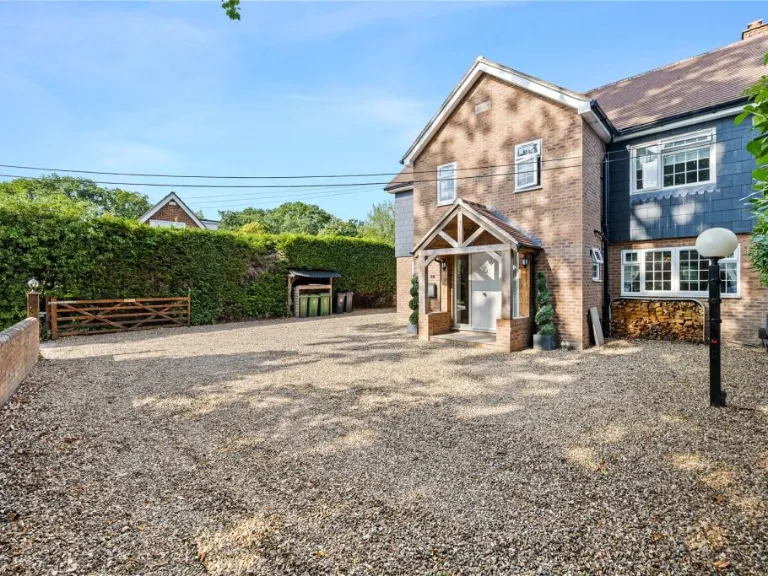
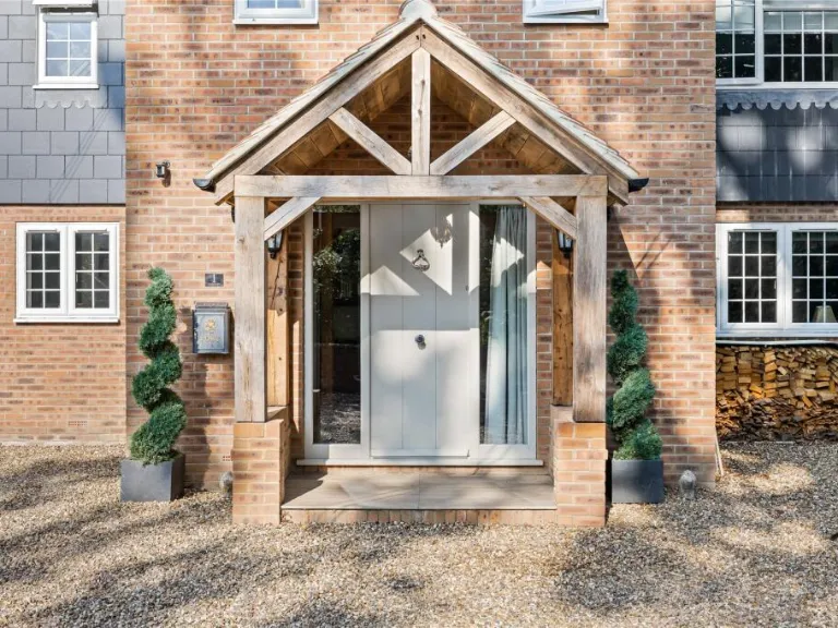
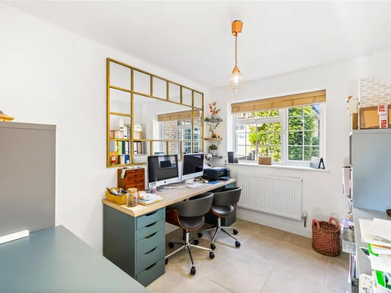
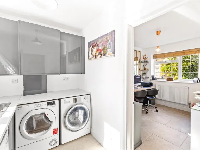
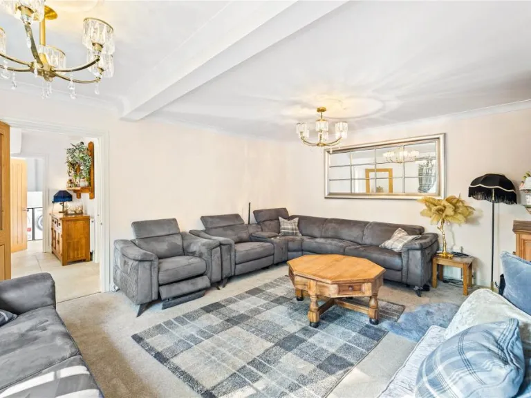
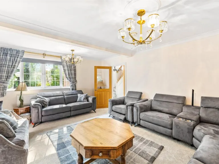
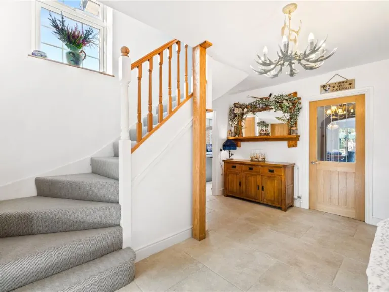
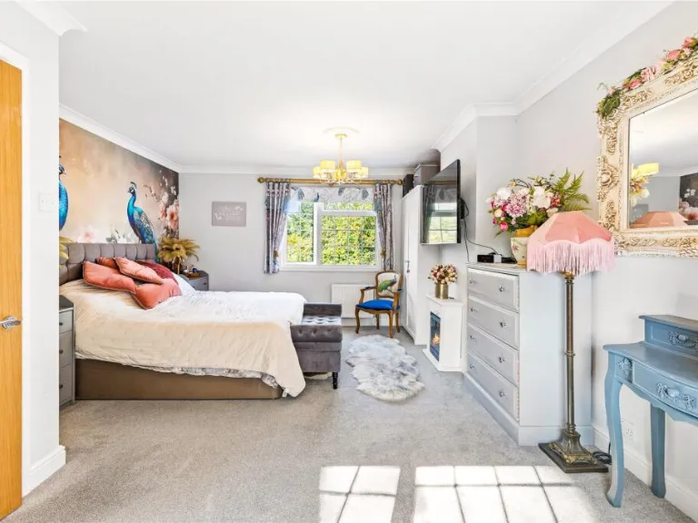
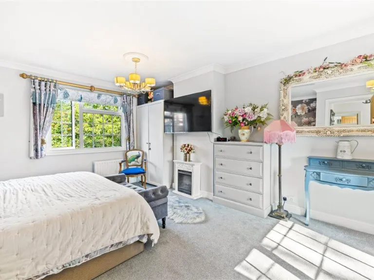
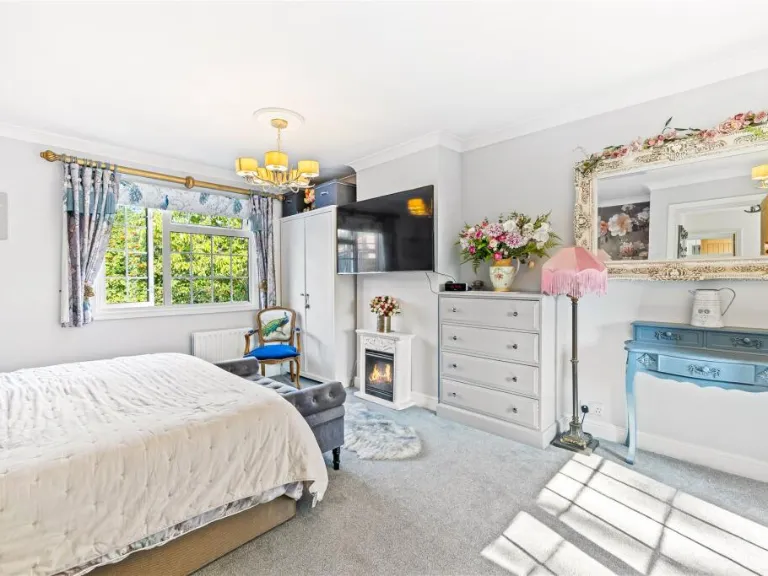
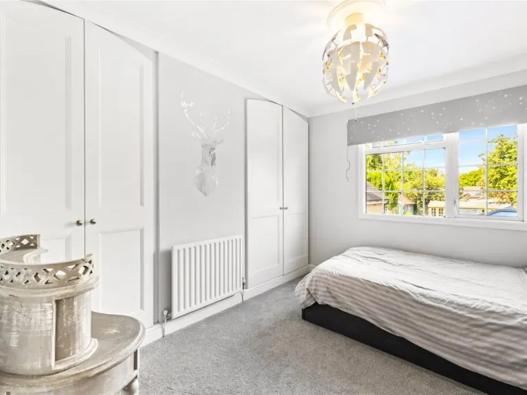
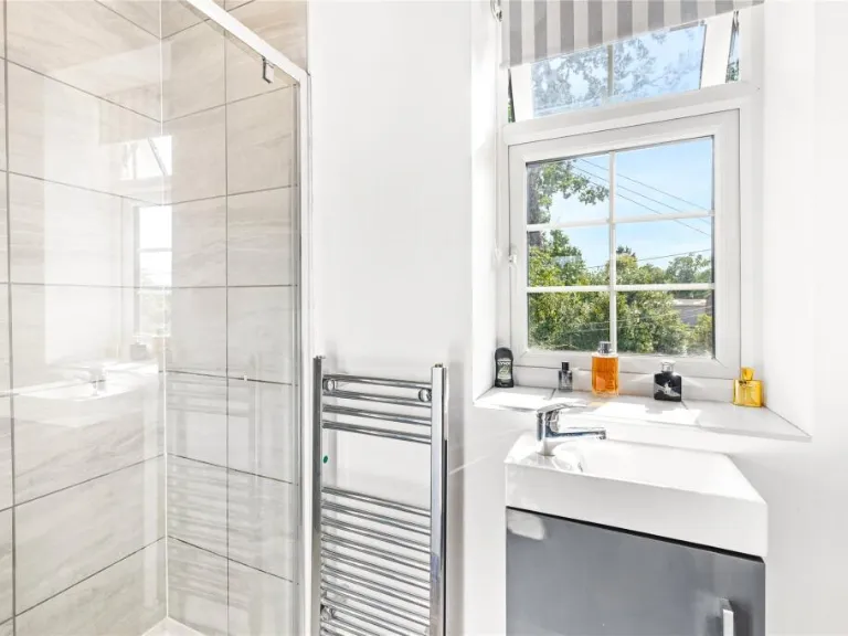
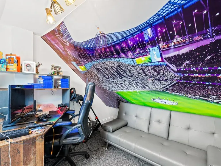
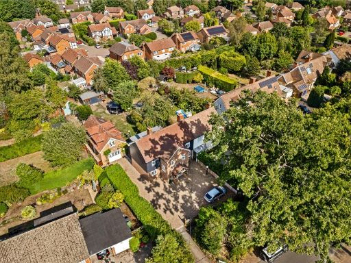
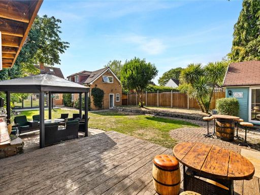
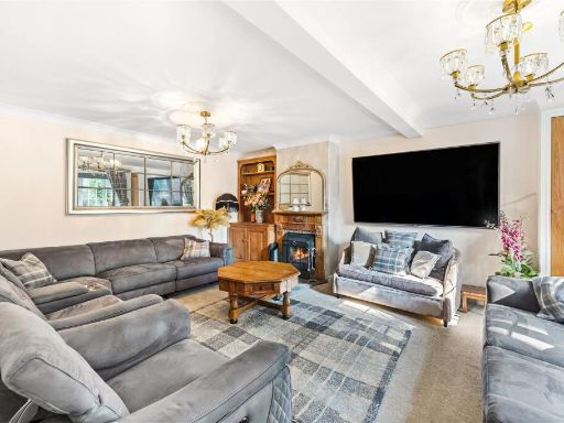
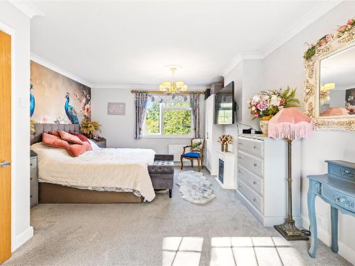
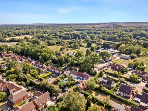
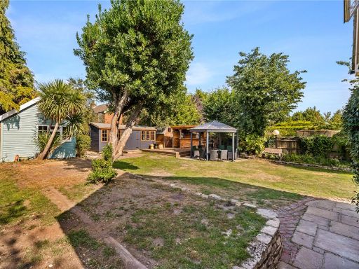
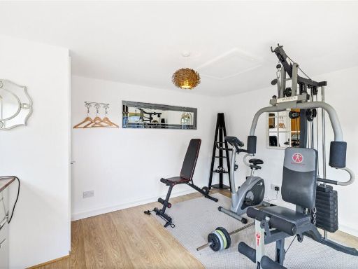
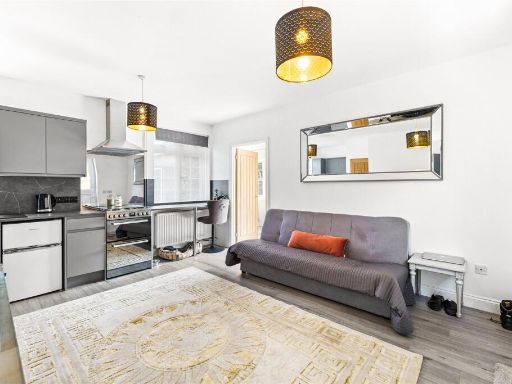
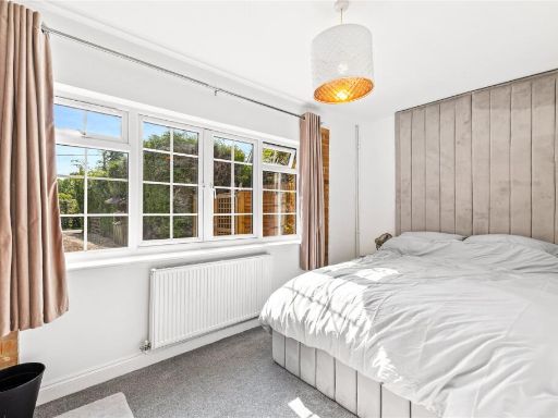
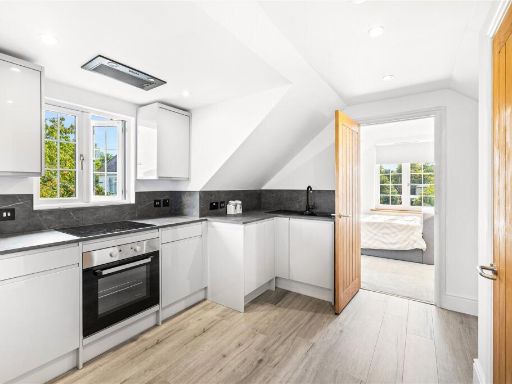
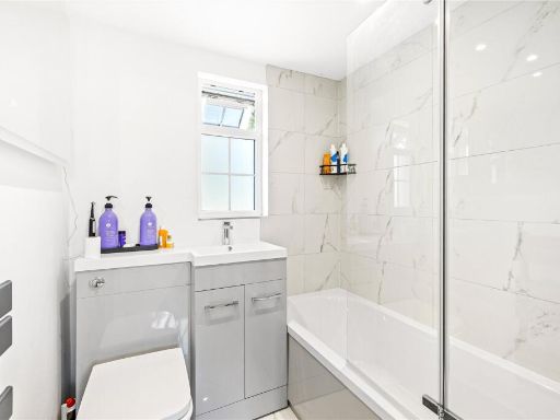
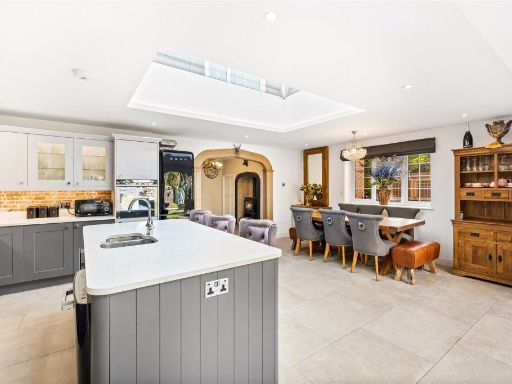
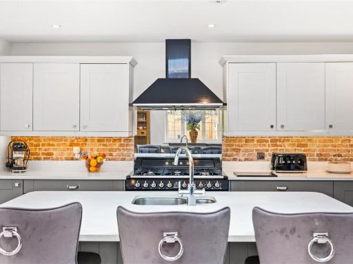
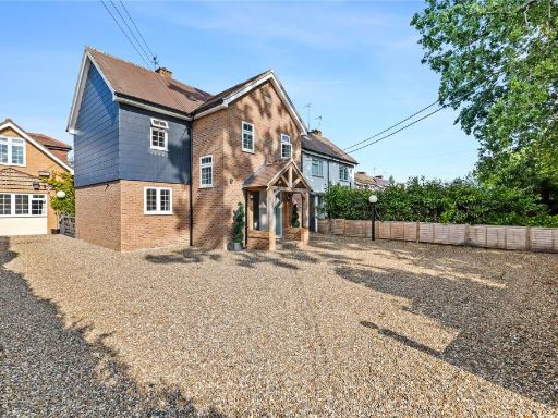
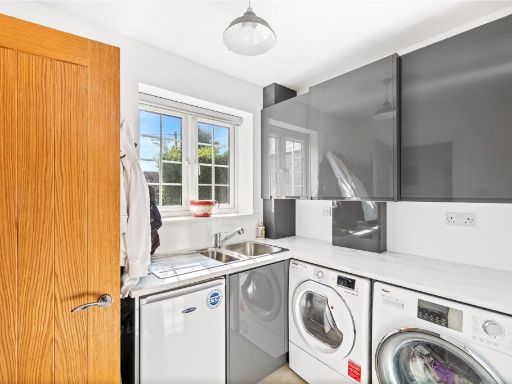
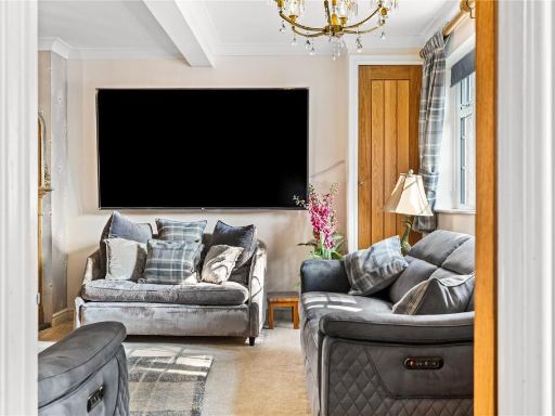
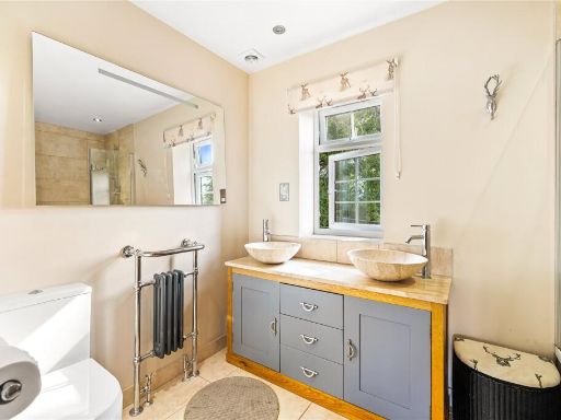
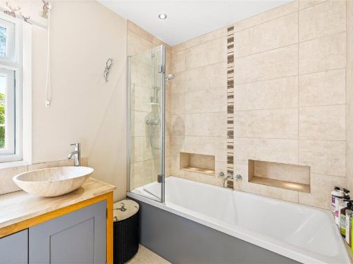
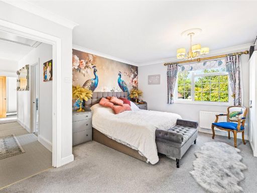
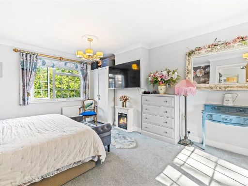
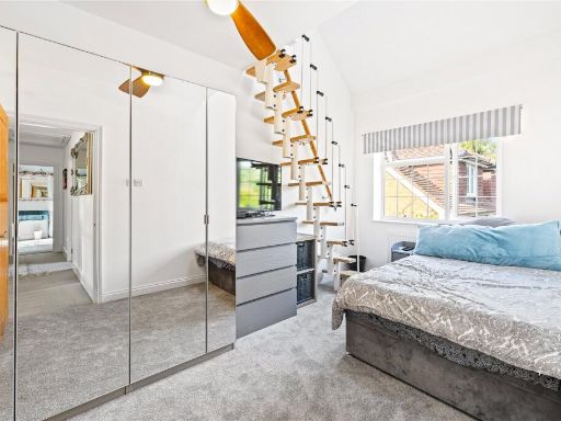
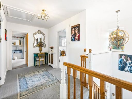
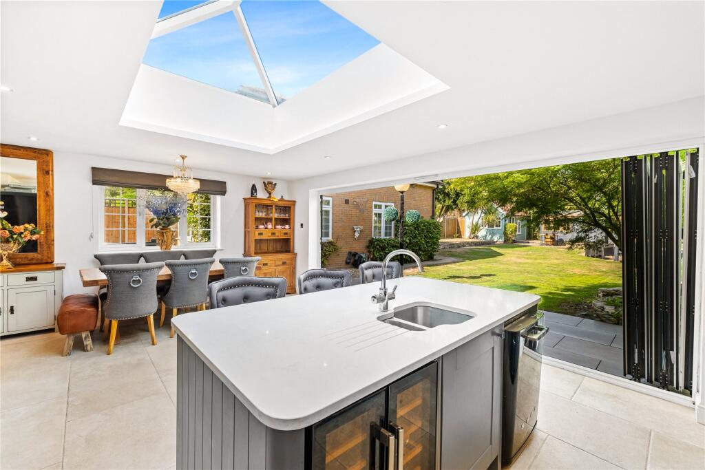
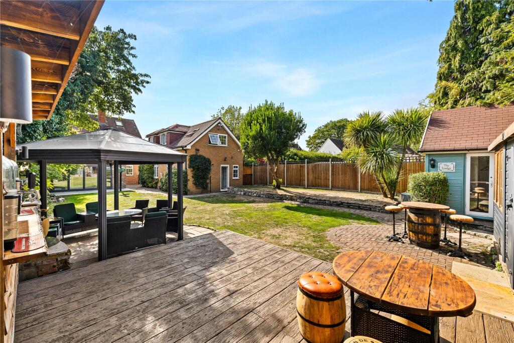
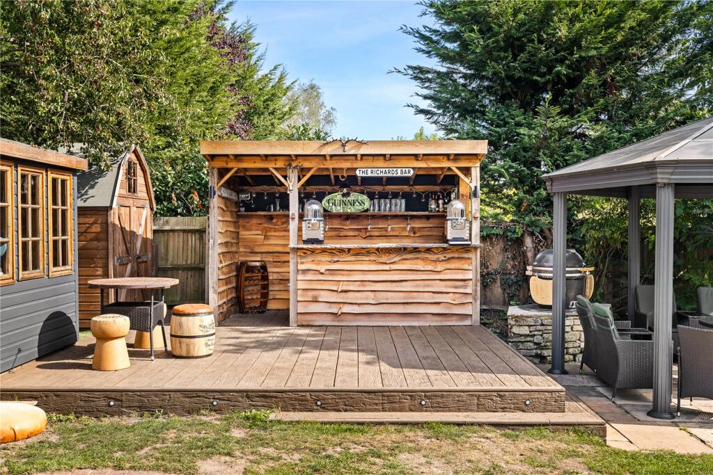
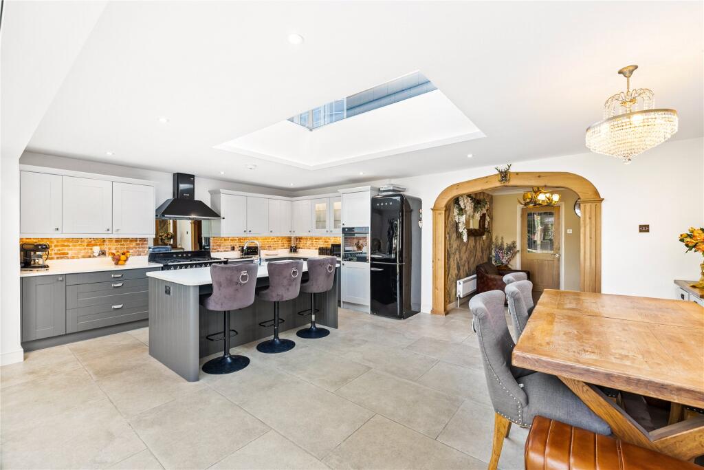
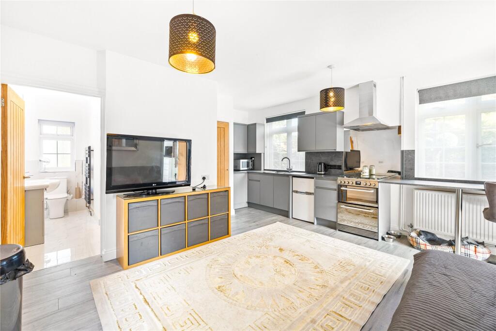
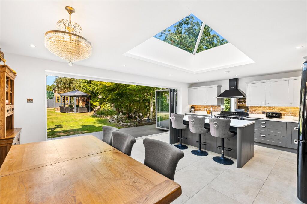
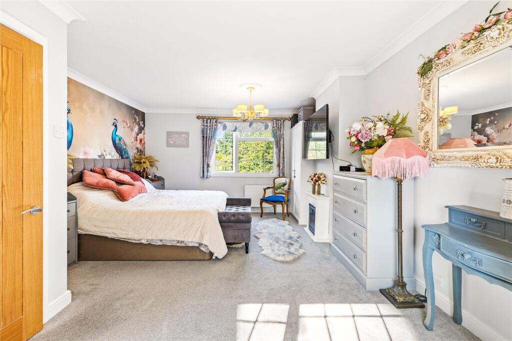
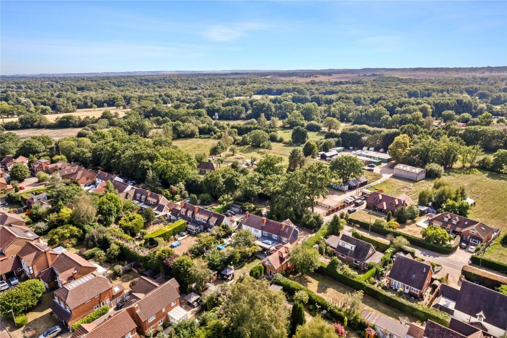
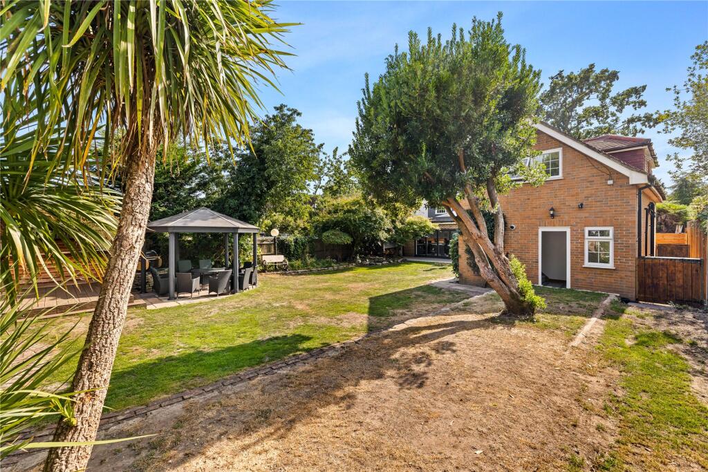
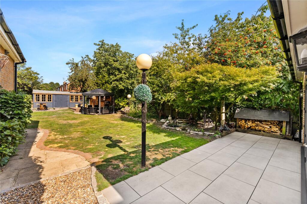
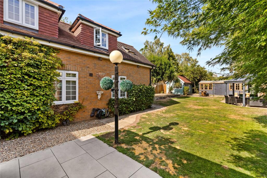
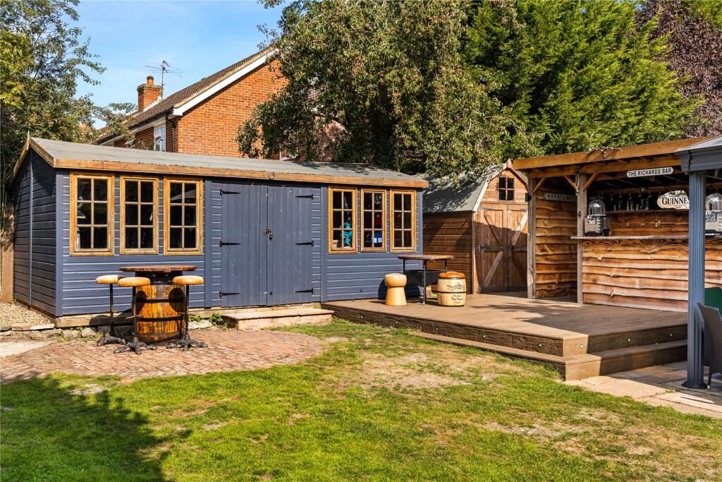
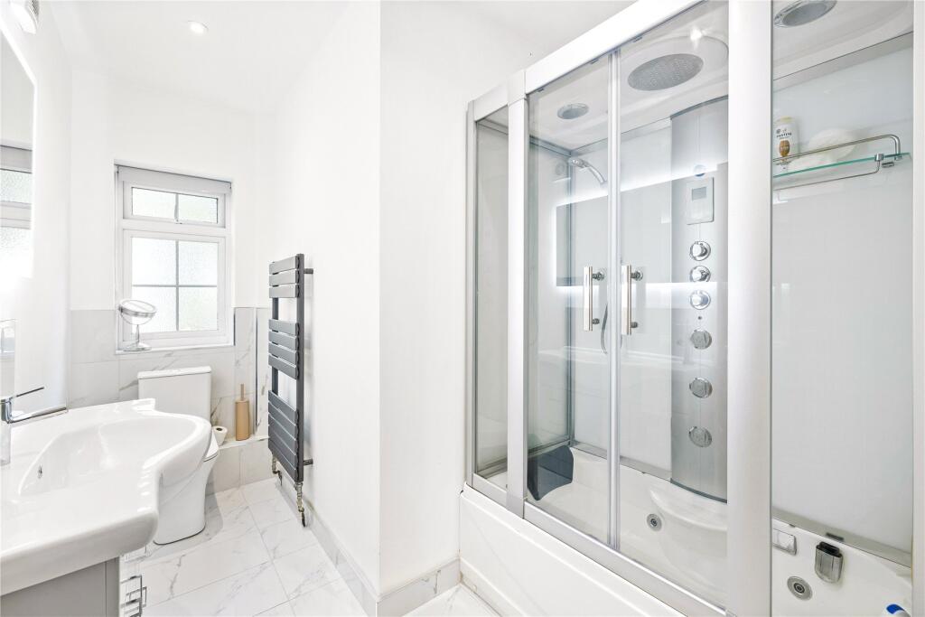
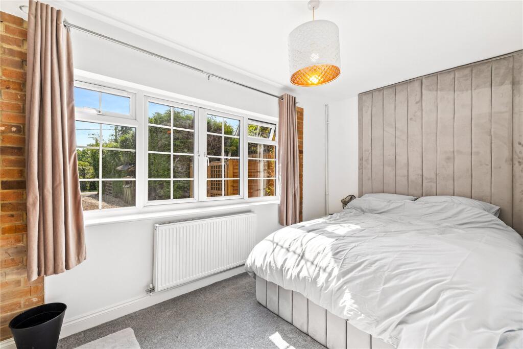
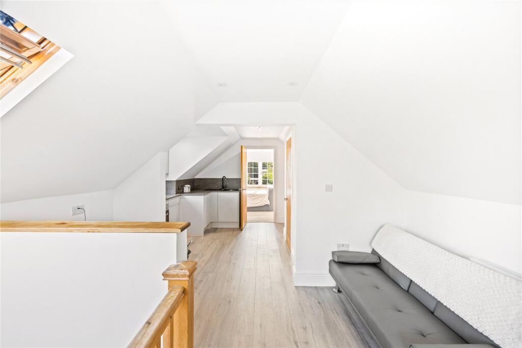
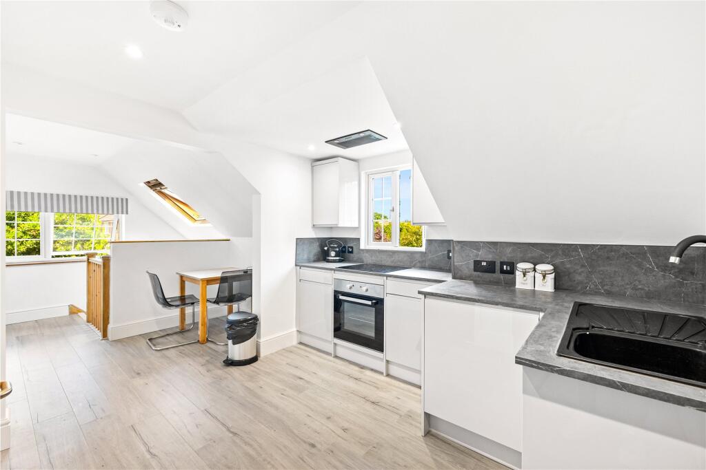
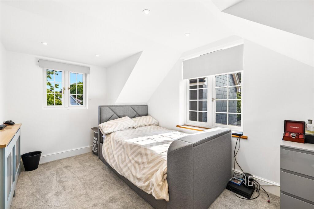
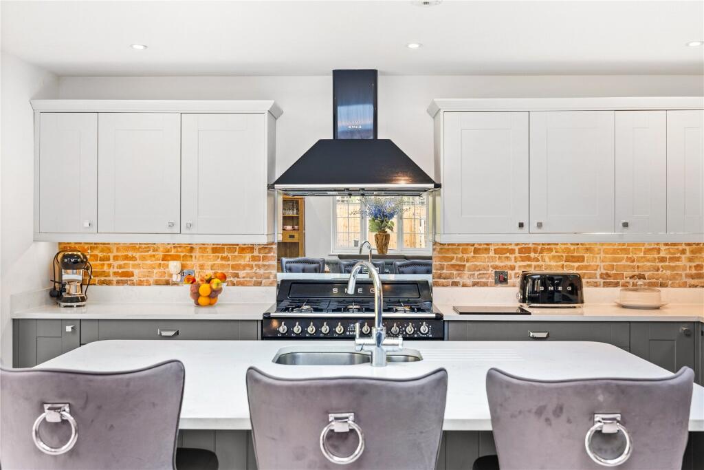
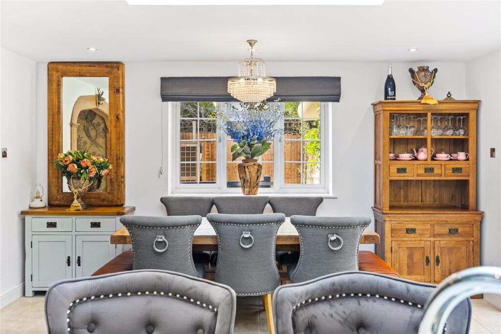
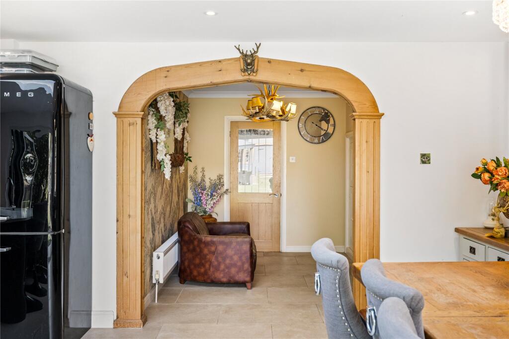
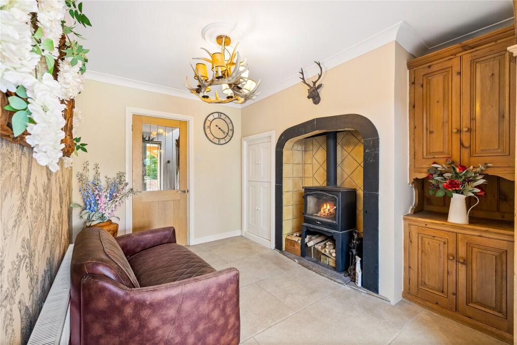
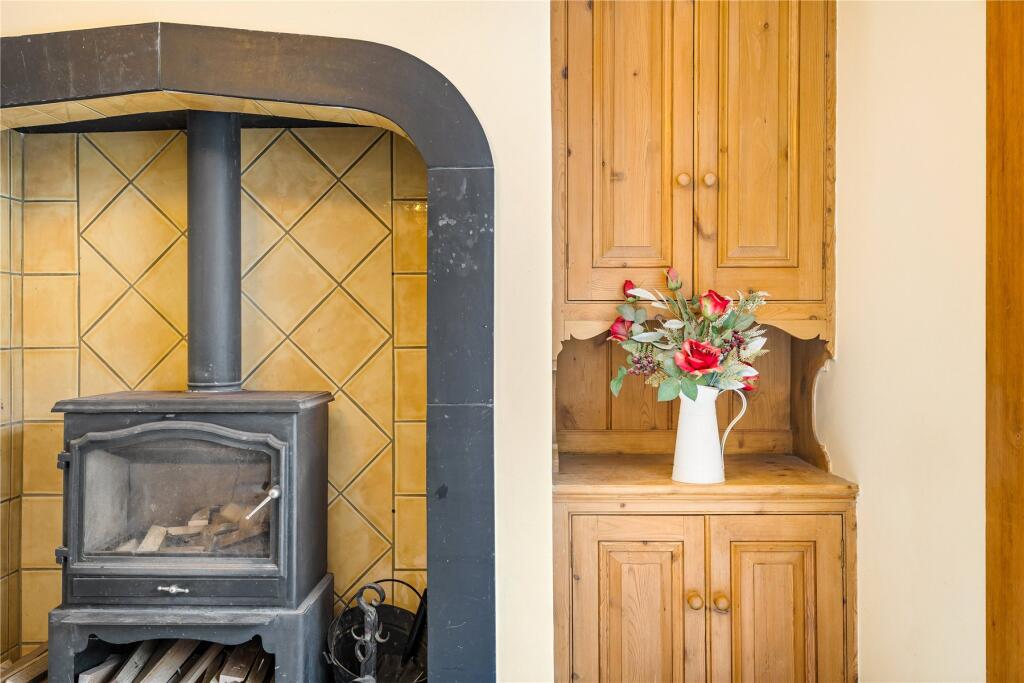
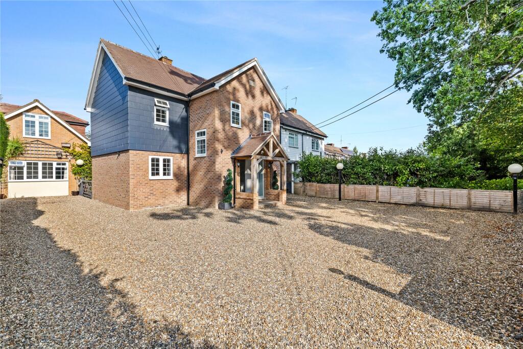
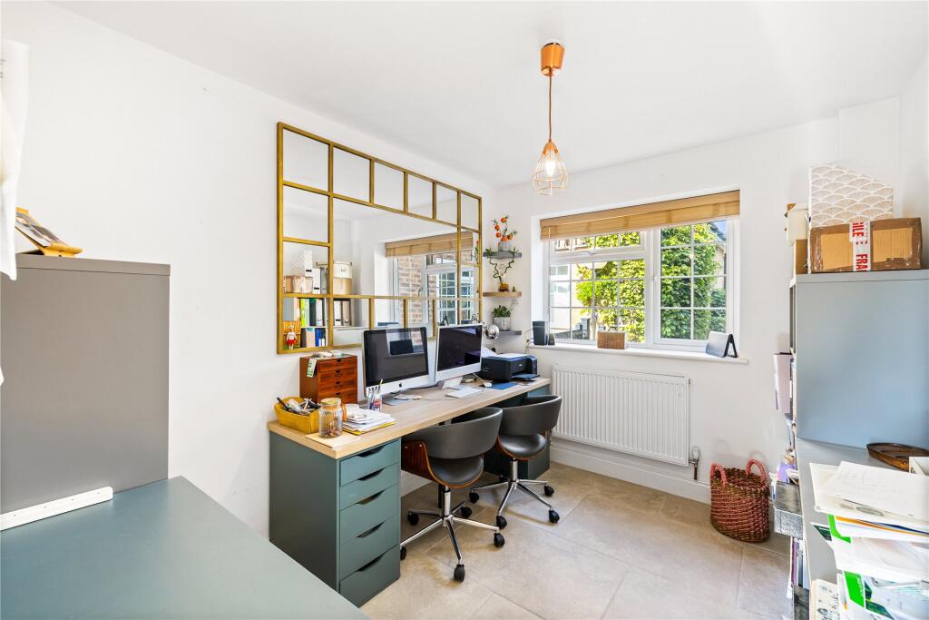
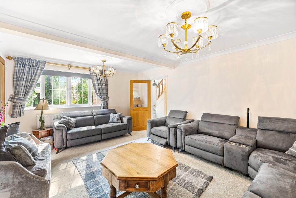
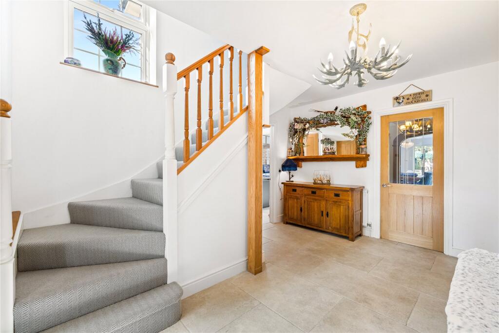
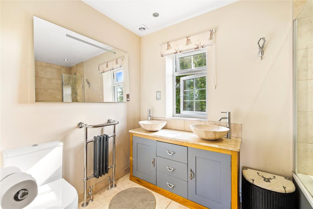
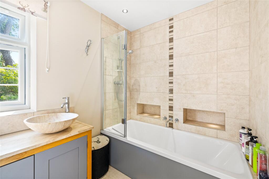
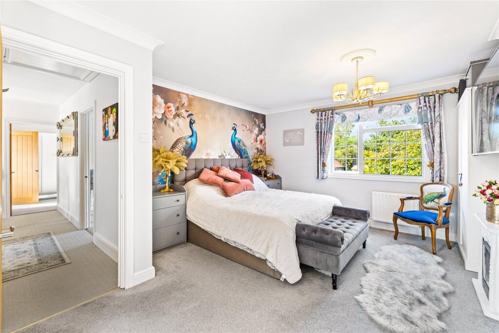
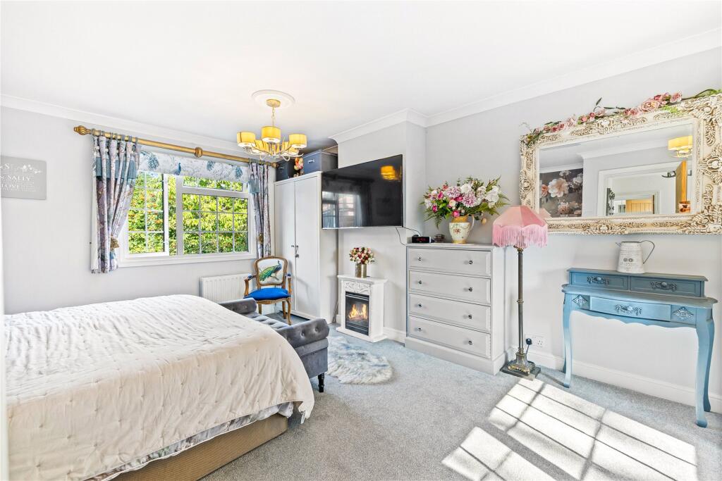
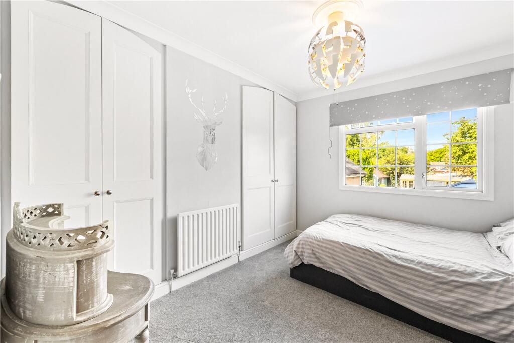
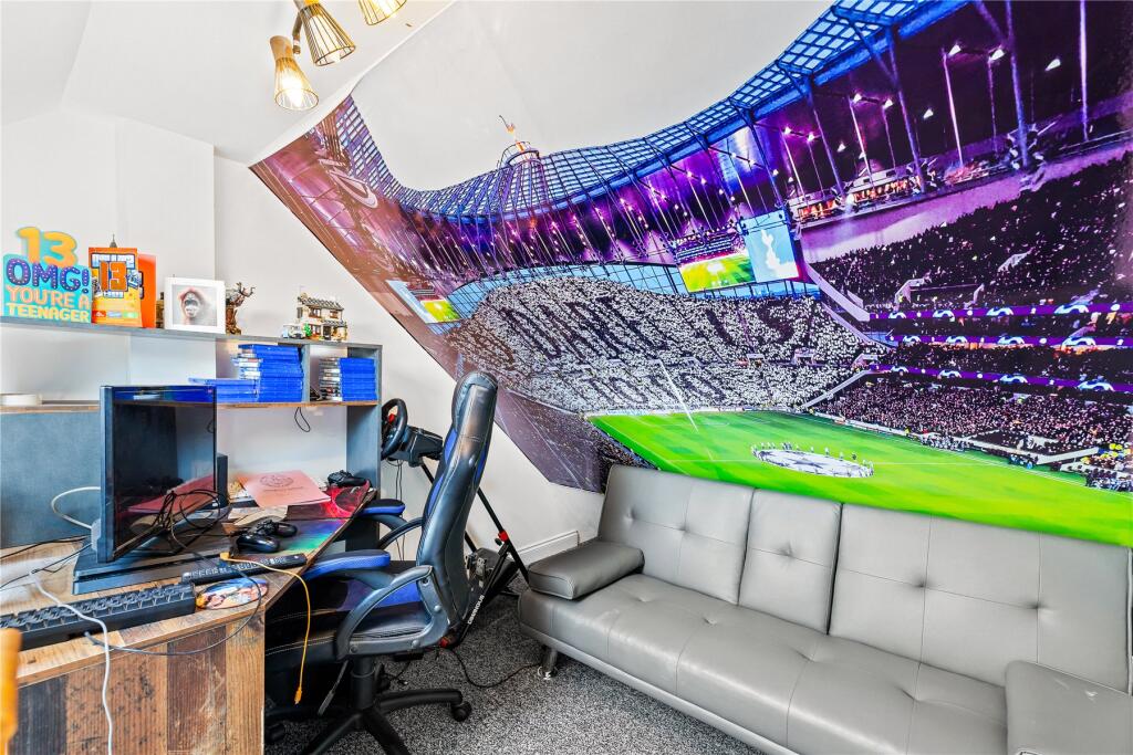
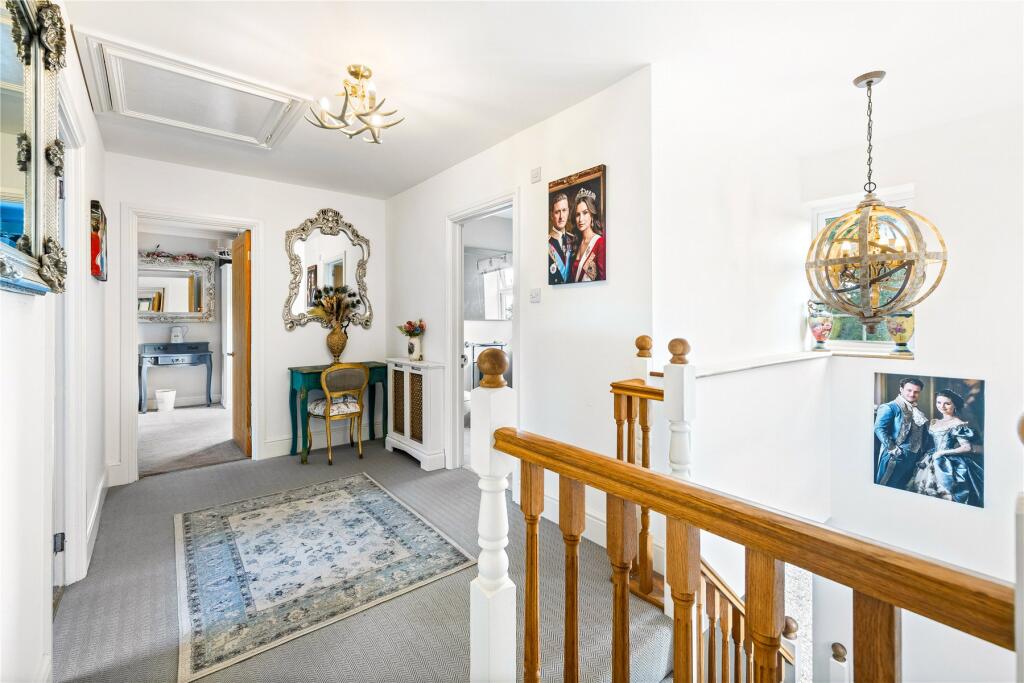
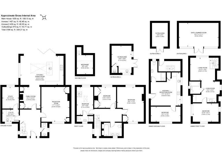
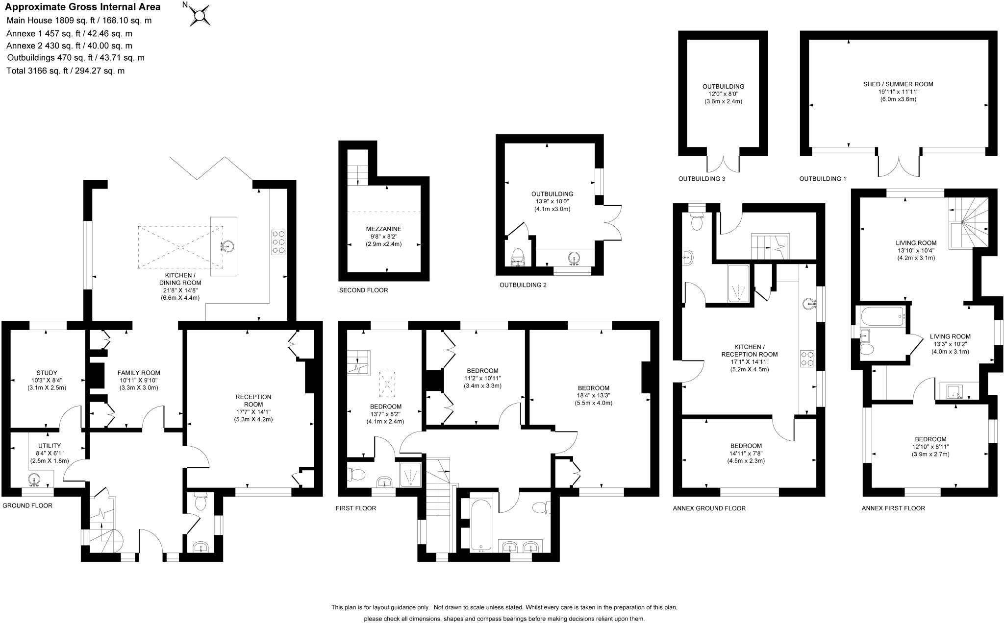
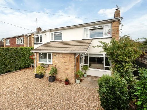
- Substantial detached residential property occupying a generous plot in a mature suburban setting. The marketing images and floorplan indicate a large, multi-room dwelling with extensive accommodation laid out across a ground-floor footprint and several additional wings/rooms — likely providing 4–6 reception/bedroom spaces plus utility and ancillary rooms. The principal living space includes a large open-plan kitchen/dining/family area with a central island, skylight/lantern and bi-fold doors opening directly onto a sizeable private rear garden — creating strong indoor/outdoor flow. External photographs show a long driveway, parking/turning area, detached/outbuilding(s) and mature landscaped gardens with tree screening, offering a high degree of privacy. Overall room sizes appear generous and the plot is large for the street; the property presents as a high-value family home in a desirable West End / Woking suburb.
Image Descriptions
- a suburban neighborhood aerial view contemporary suburban
- kitchen and garden contemporary
Textual Property Features
Detected Visual Features
- suburban
- detached houses
- pitched roofs
- driveway
- gardens
- green spaces
- family-friendly neighborhood
- contemporary
- kitchen
- island
- skylight
- garden
- patio
- modern
- open-plan
- bright
EPC Details
- Fully double glazed
- Timber frame, as built, no insulation (assumed)
- Boiler and radiators, mains gas
- Low energy lighting in all fixed outlets
- Suspended, no insulation (assumed)
Nearby Schools
- The Oaktree School
- St Hugh of Lincoln Catholic Primary School
- Beaufort Primary School
- Charters School
- Pirbright Village Primary School
- The Winston Churchill School A Specialist Sports College
- Gordon's School
- Bagshot Infant School
- Woodcote House School
- The Hermitage School
- The Knaphill Lower School
- St John's Primary School
- Knaphill School
- Heather Ridge Infant School
- Holy Trinity CofE Primary School
- St Lawrence CofE (Aided) Primary School
- Connaught Junior School
- Windlesham Village Infant School
- Brookwood Primary School
- Bisley CofE Primary School
- Hammond School
- Lightwater Village School
- Valley End CofE Infant School
- Hall Grove School
- Coworth-Flexlands School
Nearest Bars And Restaurants
- Id: 1607477332
- Tags:
- Amenity: fast_food
- Wheelchair: limited
- TagsNormalized:
- Lat: 51.3505914
- Lon: -0.6637654
- FullGeoHash: gcps0uhdvhh9
- PartitionGeoHash: gcps
- Images:
- FoodStandards: null
- Distance: 1715.9
,- Id: 41052832
- Tags:
- Amenity: pub
- Name: The Hen and Chickens
- TagsNormalized:
- Lat: 51.3268198
- Lon: -0.6392164
- FullGeoHash: gcpecry83htw
- PartitionGeoHash: gcpe
- Images:
- FoodStandards: null
- Distance: 1429.7
,- Id: 2954339134
- Tags:
- TagsNormalized:
- Lat: 51.3378288
- Lon: -0.6401259
- FullGeoHash: gcps13vbebzt
- PartitionGeoHash: gcps
- Images:
- FoodStandards: null
- Distance: 711.4
,- Id: 49267922
- Tags:
- Amenity: pub
- Name: The Inn @ West End
- TagsNormalized:
- Lat: 51.3400283
- Lon: -0.6445272
- FullGeoHash: gcps164tm6vt
- PartitionGeoHash: gcps
- Images:
- FoodStandards: null
- Distance: 485.3
,- Id: 2954339133
- Tags:
- Addr:
- Amenity: pub
- Brand: Hall & Woodhouse
- Brand:wikidata: Q5642555
- Brand:wikipedia: en:Hall & Woodhouse
- Name: Hare & Hounds
- TagsNormalized:
- Lat: 51.339959
- Lon: -0.6473003
- FullGeoHash: gcps160suy1b
- PartitionGeoHash: gcps
- Images:
- FoodStandards: null
- Distance: 335.2
}
Nearest General Shops
- Id: 2954339135
- Tags:
- TagsNormalized:
- Lat: 51.3378757
- Lon: -0.6400508
- FullGeoHash: gcps13vbv9xt
- PartitionGeoHash: gcps
- Images:
- FoodStandards: null
- Distance: 716.8
,- Id: 4128493013
- Tags:
- TagsNormalized:
- Lat: 51.3401979
- Lon: -0.6448067
- FullGeoHash: gcps164qqft3
- PartitionGeoHash: gcps
- Images:
- FoodStandards: null
- Distance: 480.1
,- Id: 9956639293
- Tags:
- Name: Martins Tyres
- Opening_hours: Mo-Th 09:00-17:00; Fr 09:00-16:30; Sa 09:00-12:30
- Service:
- Vehicle:
- Tpms: yes
- Tyre_fitting: yes
- Tyres: yes
- Tyres_repair: yes
- Wheel_balancing: yes
- Shop: car_repair
- TagsNormalized:
- martins
- tyres
- car repair
- repair
- shop
- Lat: 51.3394885
- Lon: -0.6483856
- FullGeoHash: gcps14pf5w29
- PartitionGeoHash: gcps
- Images:
- FoodStandards: null
- Distance: 248.2
}
Nearest Grocery shops
- Id: 10591596968
- Tags:
- Addr:
- City: Woking
- Housenumber: 199
- Postcode: GU24 9DL
- Street: Guildford Road
- Suburb: Bisley
- Brand: Sainsbury's Local
- Brand:wikidata: Q13218434
- Fhrs:
- Name: Sainsbury's Local
- Shop: convenience
- Source:
- Website: https://stores.sainsburys.co.uk/4898/bisley-local
- TagsNormalized:
- sainsburys
- sainsburys local
- convenience
- shop
- Lat: 51.3268457
- Lon: -0.6385696
- FullGeoHash: gcpecrz081xb
- PartitionGeoHash: gcpe
- Images:
- FoodStandards:
- Id: 701097
- FHRSID: 701097
- LocalAuthorityBusinessID: 16728
- BusinessName: Sainsbury's
- BusinessType: Retailers - supermarkets/hypermarkets
- BusinessTypeID: 7840
- AddressLine1: 199 Guildford Road
- AddressLine2: Bisley
- AddressLine3: Woking
- AddressLine4: Surrey
- PostCode: GU24 9DL
- RatingValue: 5
- RatingKey: fhrs_5_en-GB
- RatingDate: 2022-10-24
- LocalAuthorityCode: 312
- LocalAuthorityName: Surrey Heath
- LocalAuthorityWebSite: http://www.surreyheath.gov.uk
- LocalAuthorityEmailAddress: environmental.health@surreyheath.gov.uk
- Scores:
- Hygiene: 0
- Structural: 5
- ConfidenceInManagement: 0
- NewRatingPending: false
- Geocode:
- Longitude: -0.63870590000000
- Latitude: 51.32684820000000
- Distance: 1452.2
,- Id: 577558351
- Tags:
- TagsNormalized:
- Lat: 51.3380623
- Lon: -0.6408939
- FullGeoHash: gcps13v3fh6y
- PartitionGeoHash: gcps
- Images:
- FoodStandards: null
- Distance: 659.5
,- Id: 583220481
- Tags:
- TagsNormalized:
- Lat: 51.3410951
- Lon: -0.6438448
- FullGeoHash: gcps1675t3f9
- PartitionGeoHash: gcps
- Images:
- FoodStandards: null
- Distance: 594.6
}
Nearest Supermarkets
- Id: 667484336
- Tags:
- Brand: Waitrose
- Brand:wikidata: Q771734
- Brand:wikipedia: en:Waitrose & Partners
- Building: retail
- Name: Waitrose
- Official_name: Waitrose & Partners
- Opening_hours: Mo-Fr 07:30-21:00; Sa 07:30-20:00; Su 10:00-16:00
- Operator: Waitrose & Partners
- Shop: supermarket
- TagsNormalized:
- waitrose
- retail
- supermarket
- shop
- Lat: 51.3546977
- Lon: -0.6989347
- FullGeoHash: gcps0hg4c9s8
- PartitionGeoHash: gcps
- Images:
- FoodStandards: null
- Distance: 3870.8
,- Id: 2658130382
- Tags:
- Addr:
- Housenumber: 7
- Postcode: GU15 1AX
- Street: Heather Ridge Arcade
- Brand:
- Name: Sainsbury's Local
- Opening_hours: Mo-Sa 07:00-22:00; Su 10:00-16:00
- Phone: +44 1276 65928
- Shop: supermarket
- Website: https://stores.sainsburys.co.uk/4115/frimley-local
- TagsNormalized:
- sainsburys
- sainsburys local
- supermarket
- shop
- Lat: 51.3294973
- Lon: -0.7021078
- FullGeoHash: gcps000xzxy6
- PartitionGeoHash: gcps
- Images:
- FoodStandards: null
- Distance: 3706.9
,- Id: 34214538
- Tags:
- Addr:
- City: Woking
- Postcode: GU21 2QT
- Street: Redding Way
- Brand: Sainsbury's
- Brand:wikidata: Q152096
- Brand:wikipedia: en:Sainsbury's
- Building: yes
- Check_date: 2017-06-21
- Contact:
- Phone: +44 1483 799601
- Website: https://stores.sainsburys.co.uk/0686/brookwood
- Name: Sainsbury's
- Opening_hours: Mo-Sa 07:00-22:00; Su 10:00-16:00
- Operator: Sainsbury's Supermarkets Ltd
- Shop: supermarket
- Source: hcps
- Toilets: yes
- Toilets:wheelchair: yes
- Wheelchair: yes
- TagsNormalized:
- sainsburys
- supermarket
- shop
- Lat: 51.3118669
- Lon: -0.6254333
- FullGeoHash: gcpecv096370
- PartitionGeoHash: gcpe
- Images:
- FoodStandards: null
- Distance: 3347.6
}
Nearest Religious buildings
- Id: 45059016
- Tags:
- Amenity: place_of_worship
- Building: church
- Denomination: anglican
- Name: St John the Baptist, Bisley
- Religion: christian
- Wikidata: Q17548060
- TagsNormalized:
- place of worship
- church
- anglican
- baptist
- christian
- Lat: 51.3273336
- Lon: -0.6266108
- FullGeoHash: gcpecxzeqump
- PartitionGeoHash: gcpe
- Images:
- FoodStandards: null
- Distance: 2008.3
,- Id: 147537172
- Tags:
- Amenity: place_of_worship
- Building: church
- Denomination: anglican
- Name: All Saints
- Religion: christian
- Wikidata: Q105086097
- TagsNormalized:
- place of worship
- church
- anglican
- christian
- Lat: 51.3516115
- Lon: -0.6619847
- FullGeoHash: gcps0umbydhq
- PartitionGeoHash: gcps
- Images:
- FoodStandards: null
- Distance: 1751.9
,- Id: 145931919
- Tags:
- Amenity: place_of_worship
- Building: church
- Denomination: anglican
- Name: Holy Trinity
- Religion: christian
- Wikidata: Q105085659
- TagsNormalized:
- place of worship
- church
- anglican
- christian
- Lat: 51.3435303
- Lon: -0.6421227
- FullGeoHash: gcps16u3try8
- PartitionGeoHash: gcps
- Images:
- FoodStandards: null
- Distance: 870.8
}
Nearest Medical buildings
- Id: 2954325754
- Tags:
- Amenity: pharmacy
- Wheelchair: yes
- TagsNormalized:
- Lat: 51.3504221
- Lon: -0.6643186
- FullGeoHash: gcps0uh3bk2p
- PartitionGeoHash: gcps
- Images:
- FoodStandards: null
- Distance: 1721.5
,- Id: 1607477294
- Tags:
- Amenity: pharmacy
- Wheelchair: no
- TagsNormalized:
- Lat: 51.3504607
- Lon: -0.6636474
- FullGeoHash: gcps0uhdpgst
- PartitionGeoHash: gcps
- Images:
- FoodStandards: null
- Distance: 1699.2
,- Id: 577558230
- Tags:
- TagsNormalized:
- Lat: 51.3377869
- Lon: -0.6401983
- FullGeoHash: gcps13vb631e
- PartitionGeoHash: gcps
- Images:
- FoodStandards: null
- Distance: 706.3
,- Id: 4136640810
- Tags:
- Addr:
- Housename: West End Surgery
- Postcode: GU24 9LU
- Street: Lucas Green Road
- Amenity: doctors
- Name: Chobham & West End Surgery
- TagsNormalized:
- Lat: 51.3361473
- Lon: -0.6407161
- FullGeoHash: gcps13mqwprq
- PartitionGeoHash: gcps
- Images:
- FoodStandards: null
- Distance: 690
}
Nearest Airports
- Id: 260720166
- Tags:
- Aerodrome: international
- Aeroway: aerodrome
- Alt_name: Gatwick Airport
- Ele: 62
- Iata: LGW
- Icao: EGKK
- Internet_access: wlan
- Internet_access:fee: no
- Internet_access:ssid: Gatwick FREE Wi-Fi
- Name: London Gatwick Airport
- Operator: Gatwick Airport Limited
- Ref: LGW
- Website: https://www.gatwickairport.com/
- Wikidata: Q8703
- Wikipedia: en:Gatwick Airport
- TagsNormalized:
- airport
- international airport
- Lat: 51.1540917
- Lon: -0.1883773
- FullGeoHash: gcpg58qf4mzd
- PartitionGeoHash: gcpg
- Images:
- FoodStandards: null
- Distance: 38086.1
,- Id: 14001268
- Tags:
- Access: yes
- Aerodrome: international
- Aerodrome:type: public
- Aeroway: aerodrome
- Alt_name: London Heathrow
- Alt_name_2: London Heathrow Airport
- Ele: 25
- Iata: LHR
- Icao: EGLL
- Int_name: Heathrow Airport
- Name: London Heathrow Airport
- Note: area still approx
- Old_name: London Airport
- Operator: Heathrow Airport Limited
- Rank_aci:
- Ref: LHR
- Short_name: Heathrow
- Type: multipolygon
- Website: https://www.heathrow.com/
- Wikidata: Q8691
- Wikipedia: en:Heathrow Airport
- TagsNormalized:
- airport
- international airport
- Lat: 51.4677522
- Lon: -0.4547736
- FullGeoHash: gcpsv9kv7h2h
- PartitionGeoHash: gcps
- Images:
- FoodStandards: null
- Distance: 19835.2
}
Nearest Leisure Facilities
- Id: 1142012498
- Tags:
- TagsNormalized:
- Lat: 51.33536
- Lon: -0.6472484
- FullGeoHash: gcps132dnh8w
- PartitionGeoHash: gcps
- Images:
- FoodStandards: null
- Distance: 332.3
,- Id: 1135397949
- Tags:
- TagsNormalized:
- Lat: 51.3399897
- Lon: -0.6486501
- FullGeoHash: gcps14ptj7er
- PartitionGeoHash: gcps
- Images:
- FoodStandards: null
- Distance: 288.2
,- Id: 1135397945
- Tags:
- Leisure: pitch
- Sport: equestrian
- TagsNormalized:
- pitch
- leisure
- equestrian
- sports
- Lat: 51.3396191
- Lon: -0.6505454
- FullGeoHash: gcps14n6cnwh
- PartitionGeoHash: gcps
- Images:
- FoodStandards: null
- Distance: 221.7
,- Id: 1135397946
- Tags:
- TagsNormalized:
- Lat: 51.3395859
- Lon: -0.6504417
- FullGeoHash: gcps14n6g87w
- PartitionGeoHash: gcps
- Images:
- FoodStandards: null
- Distance: 217.7
,- Id: 15395028
- Tags:
- Leisure: garden
- Type: multipolygon
- TagsNormalized:
- Lat: 51.3391807
- Lon: -0.6501079
- FullGeoHash: gcps14n87kum
- PartitionGeoHash: gcps
- Images:
- FoodStandards: null
- Distance: 173.5
}
Nearest Tourist attractions
- Id: 3655698429
- Tags:
- Name: NRA Museum
- Opening_hours: By Appointment Only
- Tourism: museum
- Website: http://www.nra.org.uk/
- TagsNormalized:
- Lat: 51.3116542
- Lon: -0.6555987
- FullGeoHash: gcpecj4853w5
- PartitionGeoHash: gcpe
- Images:
- FoodStandards: null
- Distance: 2911.1
,- Id: 1594735986
- Tags:
- Name: Mizen's Railway
- Opening_hours: summer: Su 14:00-17:00 || "special events"
- Operator: Woking Miniature Railway Society
- Tourism: theme_park
- Website: www.wmrs.co.uk
- TagsNormalized:
- Lat: 51.3266882
- Lon: -0.6127668
- FullGeoHash: gcpefp9z9kpv
- PartitionGeoHash: gcpe
- Images:
- FoodStandards: null
- Distance: 2881.3
,- Id: 42053745
- Tags:
- Name: St John the Baptist's Well
- Tourism: attraction
- TagsNormalized:
- Lat: 51.3263487
- Lon: -0.6298107
- FullGeoHash: gcpecxtmskg5
- PartitionGeoHash: gcpe
- Images:
- FoodStandards: null
- Distance: 1900.5
}
Nearest Train stations
- Id: 3711871943
- Tags:
- Name: Longcross
- Naptan:
- Network: National Rail
- Old_name: Longcross Halt
- Public_transport: station
- Railway: station
- Ref:
- Wikidata: Q1925371
- Wikipedia: en:Longcross railway station
- TagsNormalized:
- Lat: 51.385277
- Lon: -0.5950836
- FullGeoHash: gcps66qsvtcs
- PartitionGeoHash: gcps
- Images:
- FoodStandards: null
- Distance: 6542.3
,- Id: 5967525976
- Tags:
- Name: Camberley
- Naptan:
- Network: National Rail
- Operator: South Western Railway
- Public_transport: station
- Railway: station
- Ref:
- Wikidata: Q5025046
- Wikipedia: en:Camberley railway station
- TagsNormalized:
- Lat: 51.3363364
- Lon: -0.7438865
- FullGeoHash: gcpkp16rf4wn
- PartitionGeoHash: gcpk
- Images:
- FoodStandards: null
- Distance: 6498.5
,- Id: 6022636079
- Tags:
- Name: Sunningdale
- Naptan:
- Network: National Rail
- Note: On this railway station customers have to show their rail ticket at the ticket office to get the code for using the toilets.
- Public_transport: station
- Railway: station
- Ref:
- Wikidata: Q2537626
- Wikipedia: en:Sunningdale railway station
- TagsNormalized:
- Lat: 51.3921459
- Lon: -0.6332427
- FullGeoHash: gcps3eduuqk5
- PartitionGeoHash: gcps
- Images:
- FoodStandards: null
- Distance: 6177.5
,- Id: 5967525977
- Tags:
- Name: Bagshot
- Naptan:
- Network: National Rail
- Operator: South Western Railway
- Public_transport: station
- Railway: station
- Ref:
- Wikidata: Q2480873
- Wikipedia: en:Bagshot railway station
- TagsNormalized:
- Lat: 51.3643336
- Lon: -0.6885039
- FullGeoHash: gcps0qdduty2
- PartitionGeoHash: gcps
- Images:
- FoodStandards: null
- Distance: 3979.2
,- Id: 5863634787
- Tags:
- Name: Brookwood
- Naptan:
- Network: National Rail
- Public_transport: station
- Railway: station
- Ref:
- Wheelchair: limited
- Wikidata: Q2184630
- Wikipedia: en:Brookwood railway station
- TagsNormalized:
- Lat: 51.3035819
- Lon: -0.6359925
- FullGeoHash: gcpece8ch2cd
- PartitionGeoHash: gcpe
- Images:
- FoodStandards: null
- Distance: 3915.3
}
Nearest Hotels
- Id: 28917539
- Tags:
- Brand: Premier Inn
- Brand:wikidata: Q2108626
- Brand:wikipedia: en:Premier Inn
- Name: Premier Inn
- Tourism: hotel
- Wheelchair: yes
- TagsNormalized:
- Lat: 51.3690176
- Lon: -0.6887071
- FullGeoHash: gcps0r6qpyyv
- PartitionGeoHash: gcps
- Images:
- FoodStandards: null
- Distance: 4390.1
,- Id: 170230307
- Tags:
- Landuse: commercial
- Name: Pennyhill Park
- Source: SAS
- Stars: 5
- Tourism: hotel
- TagsNormalized:
- Lat: 51.3546104
- Lon: -0.7073684
- FullGeoHash: gcpkpuufm15z
- PartitionGeoHash: gcpk
- Images:
- FoodStandards: null
- Distance: 4386.5
,- Id: 165284024
- Tags:
- Addr:
- City: Bisley Camp
- Housename: Bisley Pavilion
- Postcode: GU24 0NY
- Street: Queen's Way
- Building: yes
- Name: Bisley Pavilion
- Reservation: required
- Rooms: 20
- Tourism: hotel
- Website: http://www.bisleypavilion.com
- TagsNormalized:
- Lat: 51.3112378
- Lon: -0.6565033
- FullGeoHash: gcpechcvw7gx
- PartitionGeoHash: gcpe
- Images:
- FoodStandards: null
- Distance: 2965.4
}
Tags
- suburban
- detached houses
- pitched roofs
- driveway
- gardens
- green spaces
- family-friendly neighborhood
- contemporary
- kitchen
- island
- skylight
- garden
- patio
- modern
- open-plan
- bright
Local Market Stats
- Average Price/sqft: £513
- Avg Income: £70000
- Rental Yield: 3.8%
- Social Housing: 4%
- Planning Success Rate: 78%
AirBnB Data
- 1km average: £111/night
- Listings in 1km: 3
Similar Properties
 5 bedroom detached house for sale in Commonfields, West End, Woking, Surrey, GU24 — £980,000 • 5 bed • 2 bath • 2060 ft²
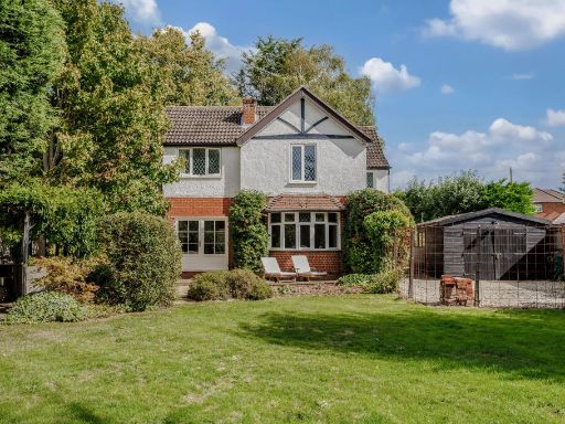 4 bedroom detached house for sale in Guildford Road, West End, GU24 — £1,050,000 • 4 bed • 2 bath • 1906 ft²
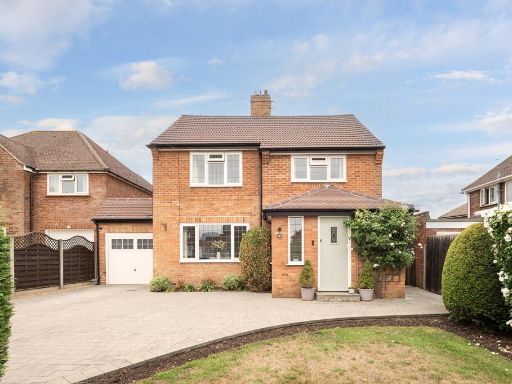 4 bedroom detached house for sale in Sefton Close, West End, Woking, GU24 — £1,150,000 • 4 bed • 2 bath • 1860 ft²
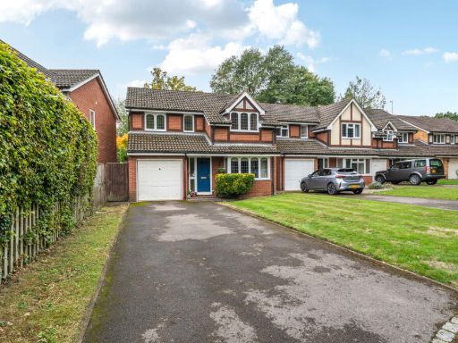 4 bedroom detached house for sale in Rubus Close, West End, Woking, Surrey, GU24 — £699,950 • 4 bed • 2 bath • 1071 ft²
 3 bedroom link detached house for sale in Mahonia Close, West End, Woking, Surrey, GU24 — £625,000 • 3 bed • 2 bath • 1231 ft²
 5 bedroom detached house for sale in Abelia Close, West End, Woking, GU24 — £600,000 • 5 bed • 2 bath • 1334 ft²
Meta
- {
"@context": "https://schema.org",
"@type": "Residence",
"name": "3 bedroom semidetached house for sale in Holly Ridge, Fenns…",
"description": "",
"url": "https://propertypiper.co.uk/property/6ad48a7b-5786-4ad8-a6cd-1d2d0b904fce",
"image": "https://image-a.propertypiper.co.uk/8b8eb43c-1d0b-4d7f-803b-a60a81ccb9b6-1024.jpeg",
"address": {
"@type": "PostalAddress",
"streetAddress": "HOLLY RIDGE 1 FENNS LANE WEST END WOKING",
"postalCode": "GU24 9QE",
"addressLocality": "Surrey Heath",
"addressRegion": "Surrey Heath",
"addressCountry": "England"
},
"geo": {
"@type": "GeoCoordinates",
"latitude": 51.33762862330653,
"longitude": -0.6503621243182904
},
"numberOfRooms": 3,
"numberOfBathroomsTotal": 2,
"floorSize": {
"@type": "QuantitativeValue",
"value": 3166,
"unitCode": "FTK"
},
"offers": {
"@type": "Offer",
"price": 1250000,
"priceCurrency": "GBP",
"availability": "https://schema.org/InStock"
},
"additionalProperty": [
{
"@type": "PropertyValue",
"name": "Feature",
"value": "suburban"
},
{
"@type": "PropertyValue",
"name": "Feature",
"value": "detached houses"
},
{
"@type": "PropertyValue",
"name": "Feature",
"value": "pitched roofs"
},
{
"@type": "PropertyValue",
"name": "Feature",
"value": "driveway"
},
{
"@type": "PropertyValue",
"name": "Feature",
"value": "gardens"
},
{
"@type": "PropertyValue",
"name": "Feature",
"value": "green spaces"
},
{
"@type": "PropertyValue",
"name": "Feature",
"value": "family-friendly neighborhood"
},
{
"@type": "PropertyValue",
"name": "Feature",
"value": "contemporary"
},
{
"@type": "PropertyValue",
"name": "Feature",
"value": "kitchen"
},
{
"@type": "PropertyValue",
"name": "Feature",
"value": "island"
},
{
"@type": "PropertyValue",
"name": "Feature",
"value": "skylight"
},
{
"@type": "PropertyValue",
"name": "Feature",
"value": "garden"
},
{
"@type": "PropertyValue",
"name": "Feature",
"value": "patio"
},
{
"@type": "PropertyValue",
"name": "Feature",
"value": "modern"
},
{
"@type": "PropertyValue",
"name": "Feature",
"value": "open-plan"
},
{
"@type": "PropertyValue",
"name": "Feature",
"value": "bright"
}
]
}
High Res Floorplan Images
Compatible Floorplan Images
FloorplanImages Thumbnail