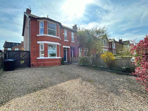
M33 2WH - 3 bedroom semidetached house for sale in Arnesby Avenue, Sa…
View on Property Piper
3 bedroom semi-detached house for sale in Arnesby Avenue, Sale, Greater Manchester, M33
Property Details
- Price: £375000
- Bedrooms: 3
- Bathrooms: 1
- Property Type: undefined
- Property SubType: undefined
Image Descriptions
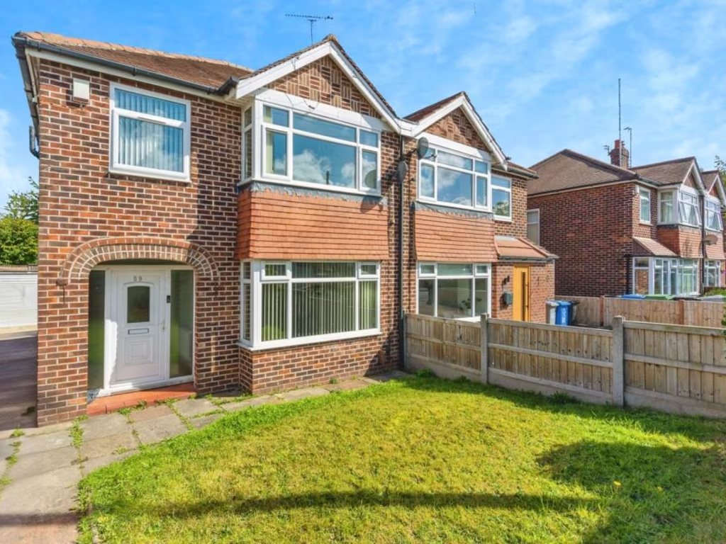
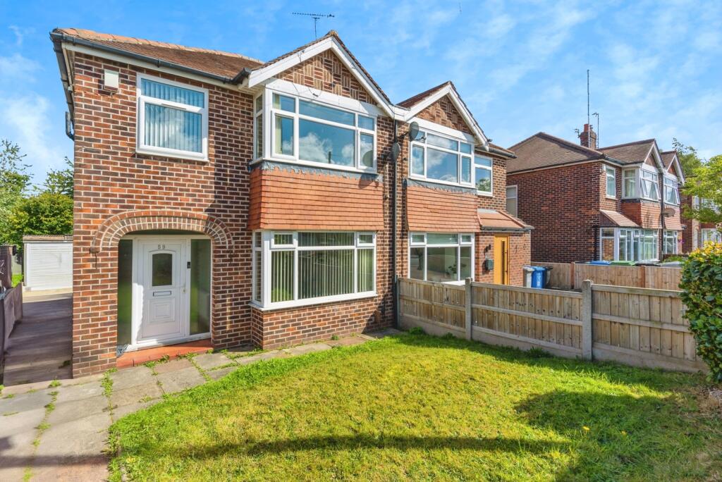
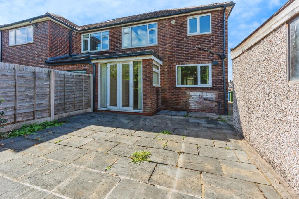
- exterior of a semi-detached house 1930s suburban semi-detached
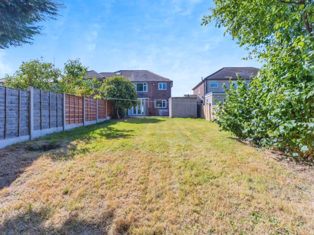
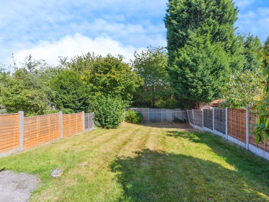
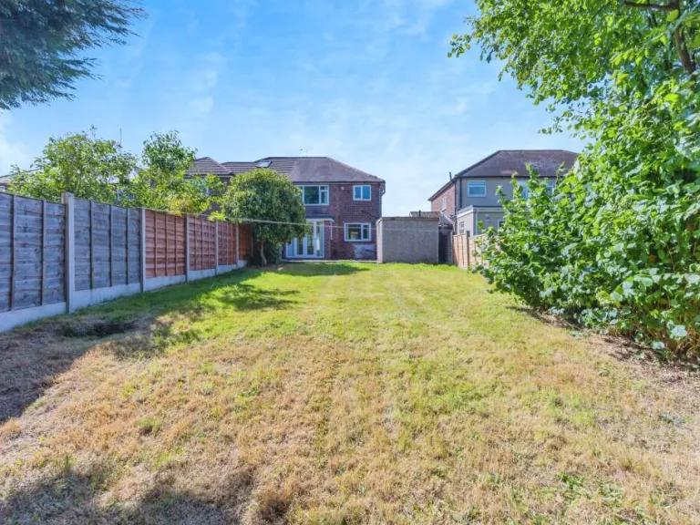
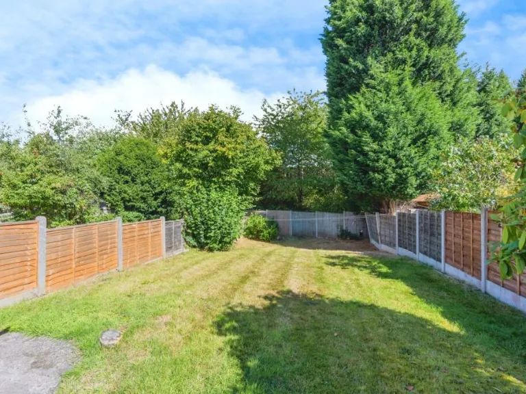
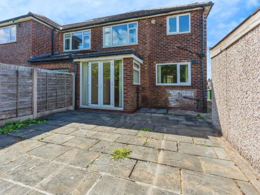
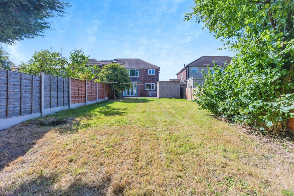
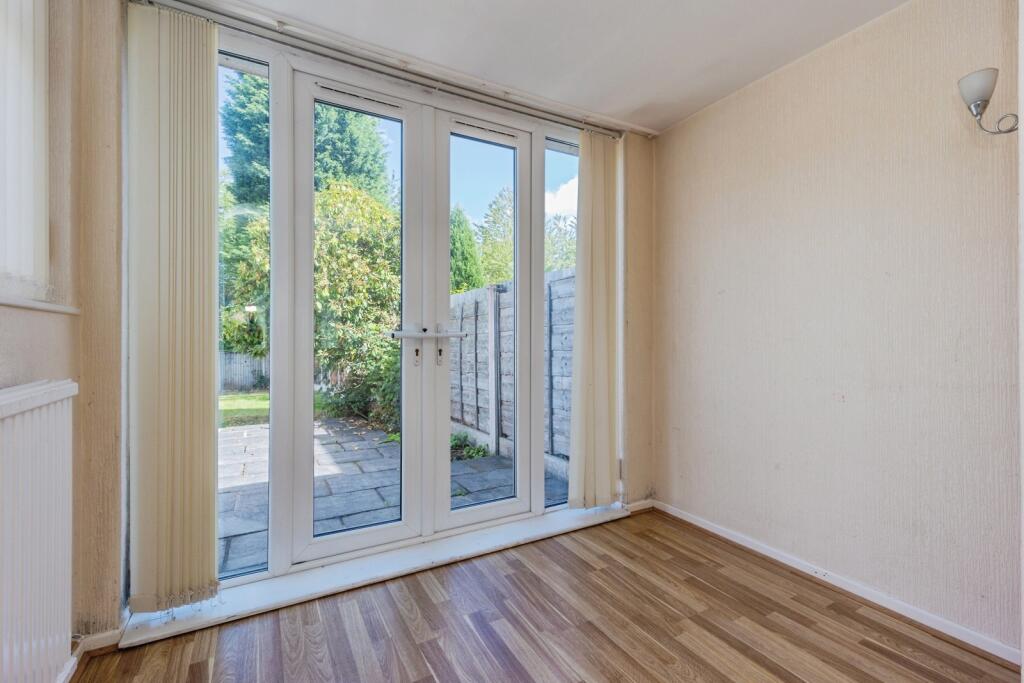
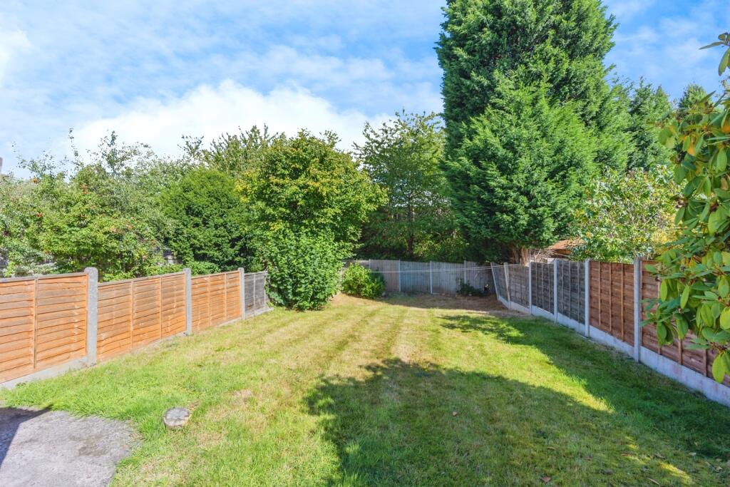
- back view of the property with garden semi-detached
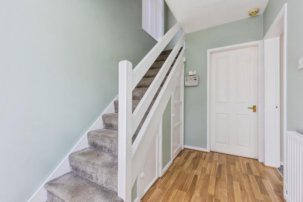
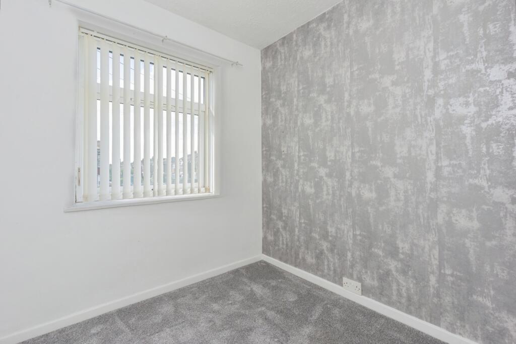
Rooms
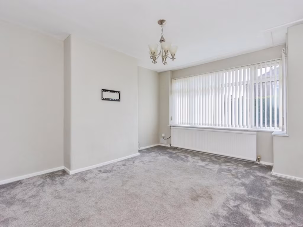
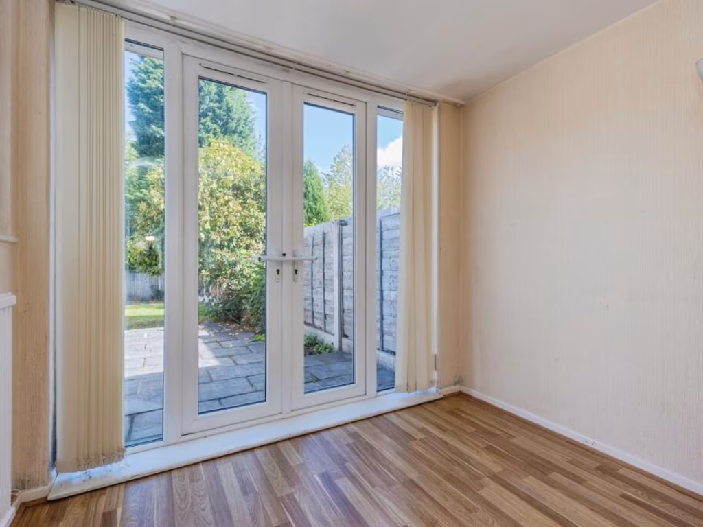
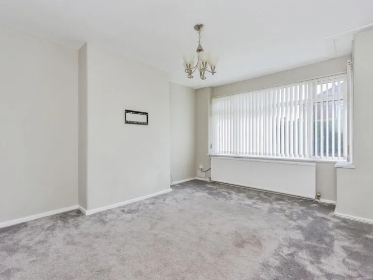
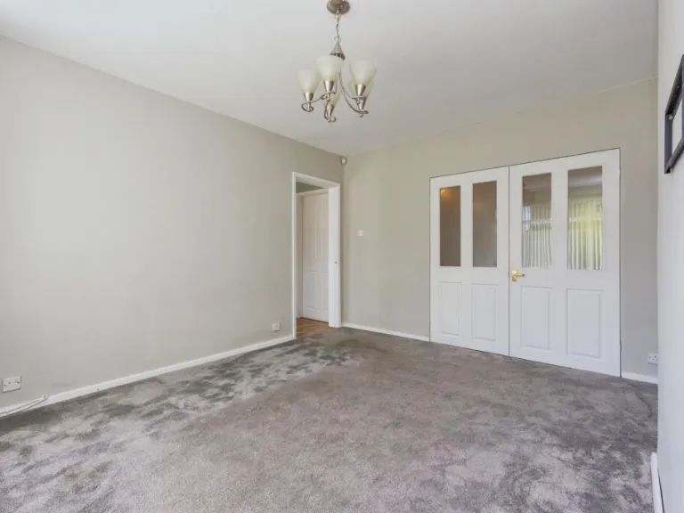
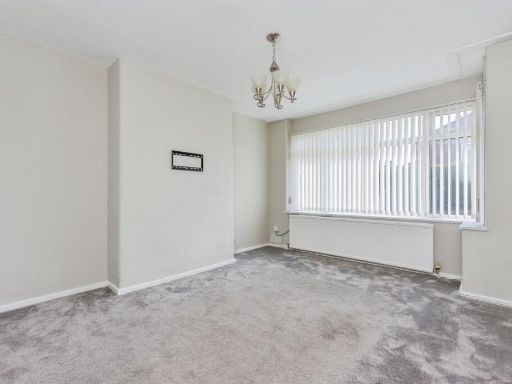
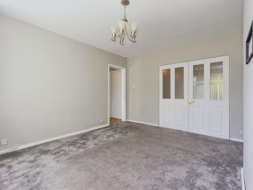
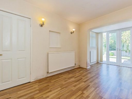
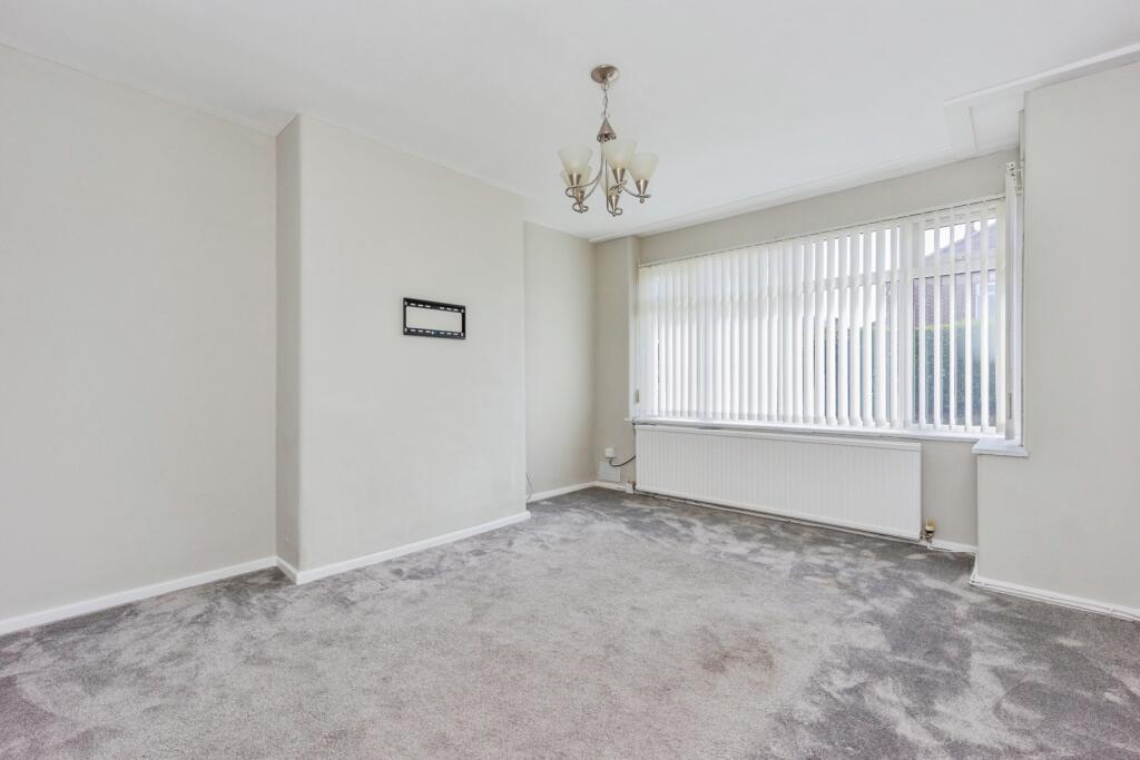
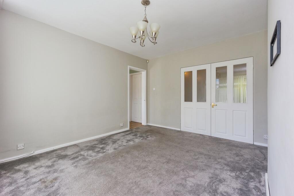
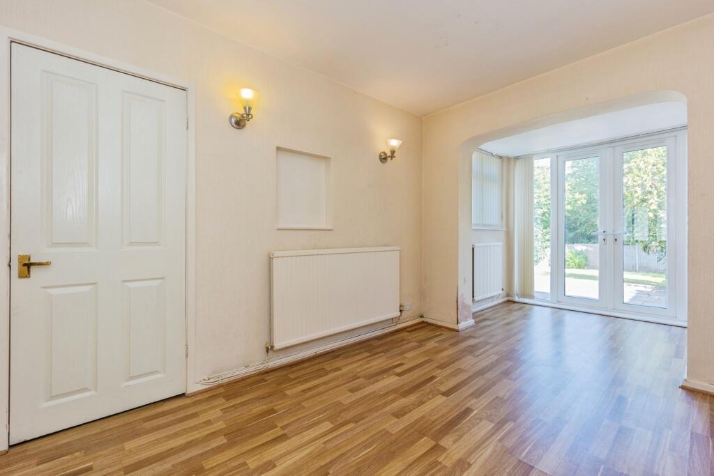
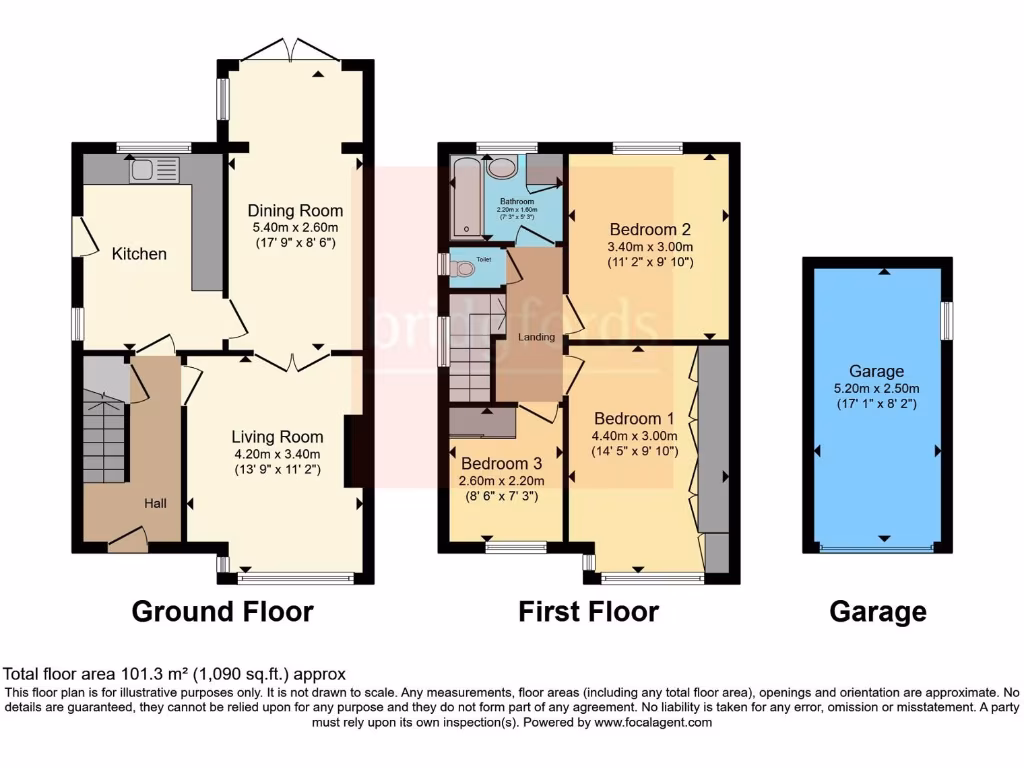
- Dining Room:
- Living Room:
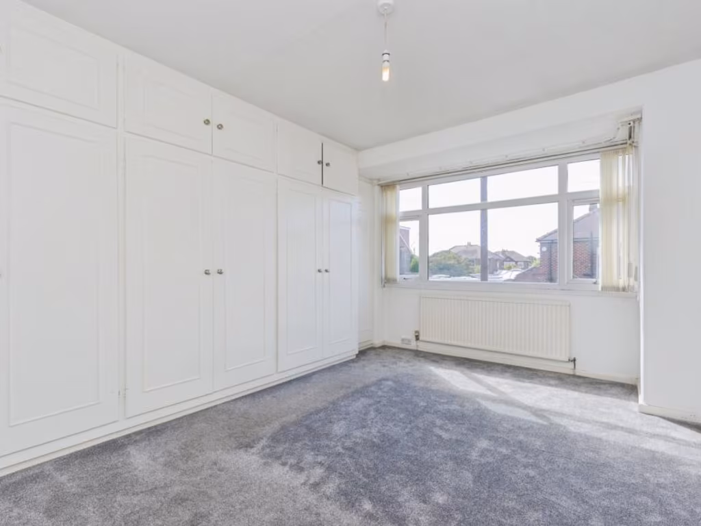
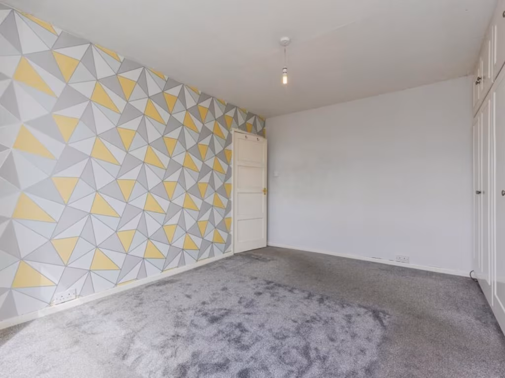
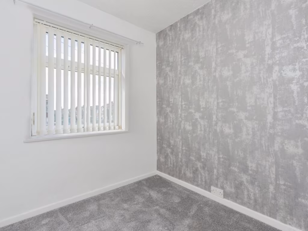
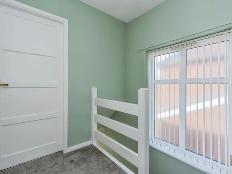
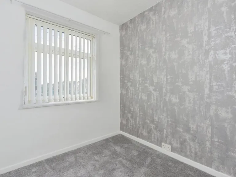
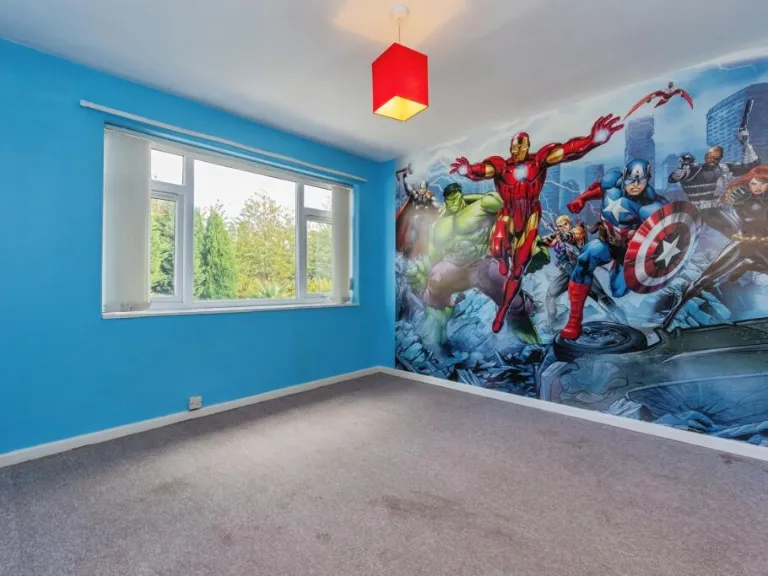
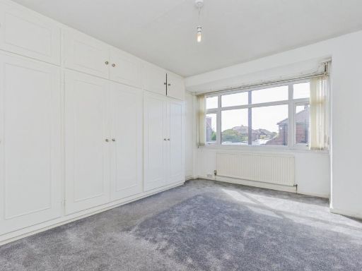
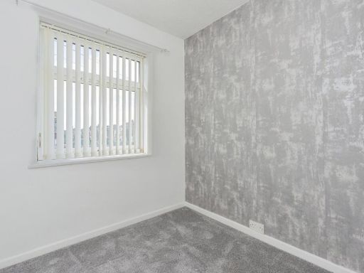
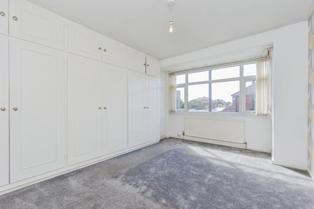
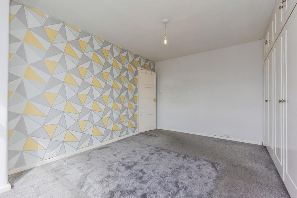
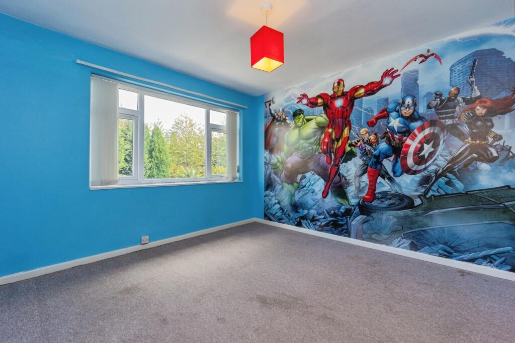
- Bedroom 1:
- Bedroom 2:
- Bedroom 3:
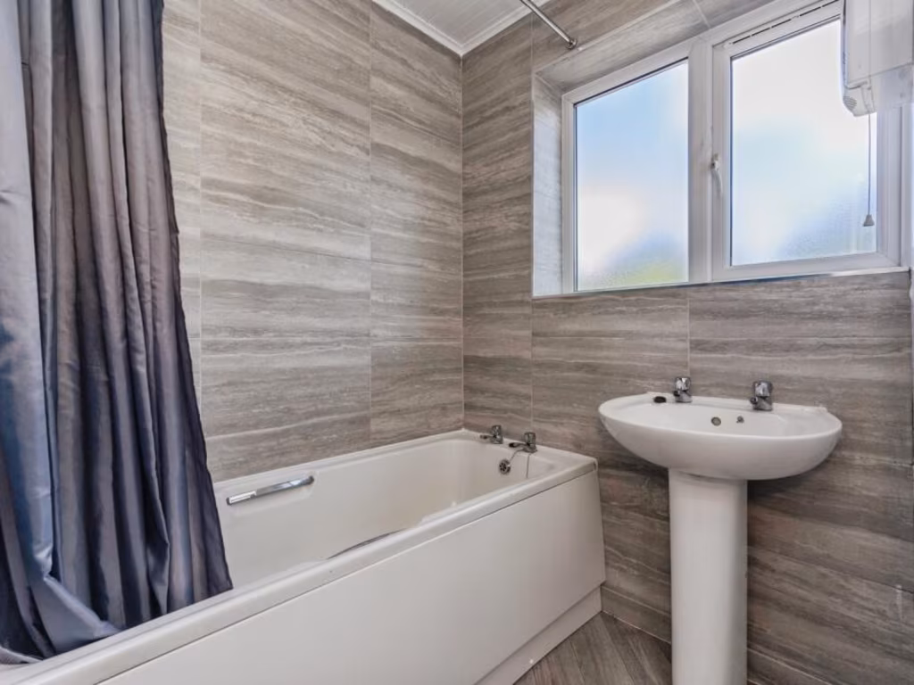
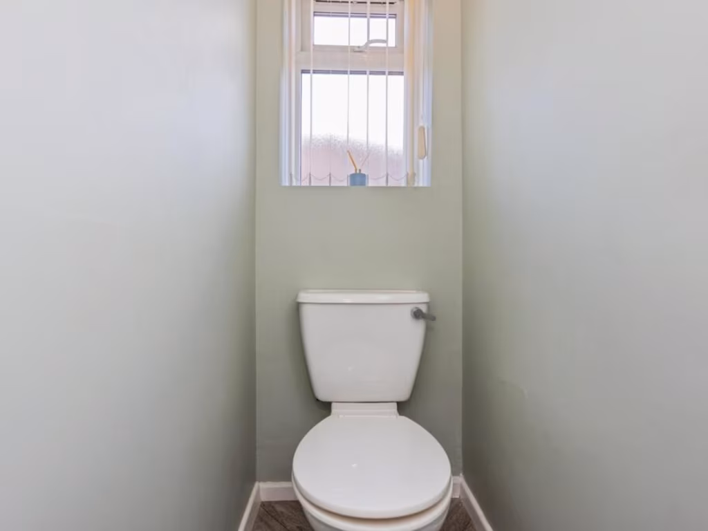
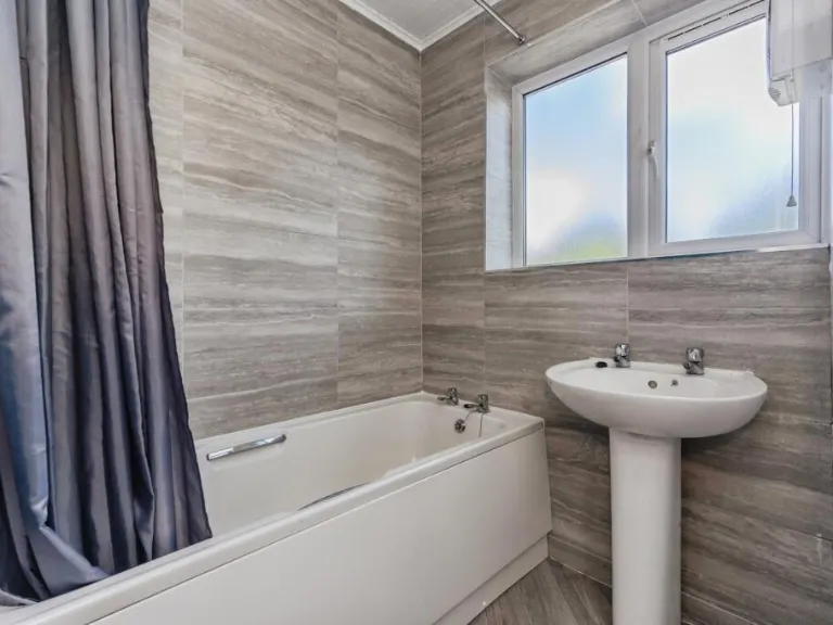
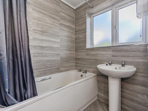
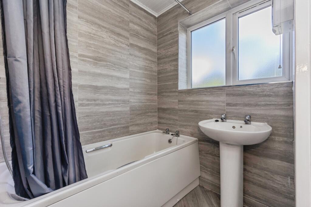
- Bathroom:
Textual Property Features
Detected Visual Features
- 1930s
- semi-detached
- brick
- suburban
- family home
- double glazed
- front garden
- residential
- gated entrance
- traditional
- bay windows
- back garden
- lawn
- fencing
- brick exterior
- two-story
EPC Details
- Fully double glazed
- Cavity wall, filled cavity
- Boiler and radiators, mains gas
- Low energy lighting in 50% of fixed outlets
- Solid, no insulation (assumed)
Nearby Schools
- Sale Grammar School
- Barlow Hall Primary School
- St Matthew's CofE Primary School
- St John's RC Primary School
- St Ann's RC Primary School
- Victoria Park Junior School
- St Anne's CofE Primary School
- Springfield Primary School
- Chorlton CofE Primary School
- Oswald Road Primary School
- Gorse Hill Primary School
- Lime Tree Primary Academy
- Manchester Islamic Grammar School for Girls
- Brookburn Community School
- Victoria Park Infant School
- St Teresa's RC Primary School
- Dixons Brooklands Academy
- Sandilands Primary School
- Rack House Primary School
- Button Lane Primary School
- Sale High School
- Worthington Primary School
- Holy Family Catholic Primary School
- St Joseph's Catholic Primary School, a Voluntary Academy
- Templemoor Infant and Nursery School
- Moorlands Junior School
- Chorlton Park Primary
- Stretford Grammar School
Nearest General Shops
- Id: 497454485
- Tags:
- Addr:
- City: Sale
- Housenumber: 101
- Postcode: M33 2FE
- Street: Northenden Road
- Building: yes
- Name: Auto Tech
- Phone: +44 161 969 1117
- Shop: car_repair
- TagsNormalized:
- Lat: 53.4207461
- Lon: -2.3055683
- FullGeoHash: gcqrgscnkkge
- PartitionGeoHash: gcqr
- Images:
- FoodStandards: null
- Distance: 1026.2
,- Id: 1121907681
- Tags:
- Addr:
- City: Sale
- Housenumber: 49
- Postcode: M33 2HT
- Street: Old Hall Road
- Building: yes
- Name: Mels Computer Care
- Shop: computer
- TagsNormalized:
- Lat: 53.4209432
- Lon: -2.3006903
- FullGeoHash: gcqrgsuxw18f
- PartitionGeoHash: gcqr
- Images:
- FoodStandards: null
- Distance: 895.1
,- Id: 847060439
- Tags:
- Check_date:
- Opening_hours: 2021-08-18
- Name: Velo Times
- Opening_hours: "See website"
- Phone: +44 161 258 8434
- Service:
- Shop: bicycle
- Website: https://www.velotimes.com/
- TagsNormalized:
- Lat: 53.4299593
- Lon: -2.2874901
- FullGeoHash: gcqrgywk1d7c
- PartitionGeoHash: gcqr
- Images:
- FoodStandards: null
- Distance: 717.7
}
Nearest Grocery shops
- Id: 497454487
- Tags:
- Brand: Mace
- Brand:wikidata: Q75240338
- Building: yes
- Name: Mace
- Shop: convenience
- TagsNormalized:
- Lat: 53.4208168
- Lon: -2.3058121
- FullGeoHash: gcqrgsbyydjb
- PartitionGeoHash: gcqr
- Images:
- FoodStandards: null
- Distance: 1027.2
,- Id: 1272542184
- Tags:
- Name: Delaney's Village Convenience Store
- Phone: +44 161 969 1125
- Shop: convenience
- TagsNormalized:
- Lat: 53.4199481
- Lon: -2.2989702
- FullGeoHash: gcqrgsvcy05d
- PartitionGeoHash: gcqr
- Images:
- FoodStandards: null
- Distance: 991.4
,- Id: 1272542186
- Tags:
- Addr:
- Country: GB
- Housenumber: 94
- Postcode: M33 2HZ
- Street: Old Hall Road
- Brand: Morrisons Daily
- Brand:wikidata: Q99752411
- Contact:
- Website: https://my.morrisons.com/storefinder/31265
- Fhrs:
- Name: Morrisons Daily
- Old_name: Cottage News Off Licence
- Operator: McColl's
- Operator:website: https://www.mccolls.co.uk/storelocator/sale-old-hall-road/
- Operator:wikidata: Q16997477
- Shop: convenience
- TagsNormalized:
- morrisons
- morrisons daily
- convenience
- shop
- Lat: 53.4226362
- Lon: -2.2965682
- FullGeoHash: gcqrgtr9qj4t
- PartitionGeoHash: gcqr
- Images:
- FoodStandards: null
- Distance: 699.1
}
Nearest Supermarkets
- Id: 4760133
- Tags:
- Brand: Sainsbury's
- Brand:wikidata: Q152096
- Brand:wikipedia: en:Sainsbury's
- Building: retail
- Name: Sainsbury's
- Shop: supermarket
- Wheelchair: yes
- TagsNormalized:
- sainsburys
- retail
- supermarket
- shop
- Lat: 53.4261115
- Lon: -2.3232878
- FullGeoHash: gcqrgjujxmp0
- PartitionGeoHash: gcqr
- Images:
- FoodStandards: null
- Distance: 1692.4
,- Id: 8137323708
- Tags:
- Brand: Co-op Food
- Brand:wikidata: Q3277439
- Brand:wikipedia: en:Co-op Food
- Name: Co-op Food
- Shop: supermarket
- TagsNormalized:
- co-op
- co-op food
- food
- supermarket
- shop
- Lat: 53.4298155
- Lon: -2.3206568
- FullGeoHash: gcqrgnw5hz8b
- PartitionGeoHash: gcqr
- Images:
- FoodStandards: null
- Distance: 1494.2
,- Id: 2632354121
- Tags:
- Brand:
- Name: B&M
- Shop: supermarket
- TagsNormalized:
- Lat: 53.4250928
- Lon: -2.316555
- FullGeoHash: gcqrgm9psr5k
- PartitionGeoHash: gcqr
- Images:
- FoodStandards: null
- Distance: 1288.3
}
Nearest Religious buildings
- Id: 195819367
- Tags:
- Amenity: pub
- Name: The Temple Inn
- Real_ale: yes
- TagsNormalized:
- Lat: 53.42046
- Lon: -2.3052408
- FullGeoHash: gcqrgsckezxb
- PartitionGeoHash: gcqr
- Images:
- FoodStandards: null
- Distance: 1044.3
,- Id: 1125016425
- Tags:
- Addr:
- City: Sale
- Housenumber: 12
- Postcode: M33 2GB
- Street: Baguley Road
- Amenity: place_of_worship
- Building: yes
- Denomination: catholic
- Name: Holy Family Catholic Church
- Religion: christian
- TagsNormalized:
- place of worship
- catholic
- church
- christian
- Lat: 53.4207047
- Lon: -2.3001151
- FullGeoHash: gcqrgsvn5mju
- PartitionGeoHash: gcqr
- Images:
- FoodStandards: null
- Distance: 915.1
,- Id: 435330439
- Tags:
- Addr:
- City: Sale
- Country: GB
- Postcode: M33 2EG
- Street: Nursery Close
- Amenity: school
- Name: Templemoor Infant and Nursery School
- Phone: +44 161 969 1622
- Ref:
- Source:
- Addr: edubase
- Geometry: OS_Open_Map_Local_FunctionalSite
- Name: edubase
- Website: www.templemoor.trafford.sch.uk
- Wikidata: Q66135772
- TagsNormalized:
- Lat: 53.4221546
- Lon: -2.3023537
- FullGeoHash: gcqrgt5qx72t
- PartitionGeoHash: gcqr
- Images:
- FoodStandards: null
- Distance: 794.7
}
Nearest Medical buildings
- Id: 307627349
- Tags:
- Amenity: pharmacy
- Brand: Superdrug
- Brand:wikidata: Q7643261
- Brand:wikipedia: en:Superdrug
- Building: yes
- Contact:
- Website: https://www.superdrug.com/store/sale
- Healthcare: pharmacy
- Name: Superdrug
- Wheelchair: yes
- TagsNormalized:
- pharmacy
- superdrug
- health
- healthcare
- Lat: 53.4251
- Lon: -2.3231881
- FullGeoHash: gcqrgjsrcb3r
- PartitionGeoHash: gcqr
- Images:
- FoodStandards: null
- Distance: 1709.8
,- Id: 1266049174
- Tags:
- Amenity: doctors
- Healthcare: doctor
- Name: The Surgery
- TagsNormalized:
- doctor
- doctors
- health
- healthcare
- surgery
- Lat: 53.4169284
- Lon: -2.3101255
- FullGeoHash: gcqrgkmb4jjt
- PartitionGeoHash: gcqr
- Images:
- FoodStandards: null
- Distance: 1544.7
,- Id: 497397737
- Tags:
- Amenity: doctors
- Building: yes
- Healthcare: doctor
- TagsNormalized:
- doctor
- doctors
- health
- healthcare
- Lat: 53.4166365
- Lon: -2.3041028
- FullGeoHash: gcqrgs4nqwb2
- PartitionGeoHash: gcqr
- Images:
- FoodStandards: null
- Distance: 1414.1
,- Id: 1272542179
- Tags:
- Amenity: veterinary
- Name: Southfields Veterinary Surgery
- Phone: +44 161 905 2863
- TagsNormalized:
- Lat: 53.419933
- Lon: -2.2988013
- FullGeoHash: gcqrgsy1dj38
- PartitionGeoHash: gcqr
- Images:
- FoodStandards: null
- Distance: 992.6
}
Nearest Airports
- Id: 1224469
- Tags:
- Addr:
- City: Manchester
- Country: GB
- Postcode: M90 1QX
- Aerodrome: international
- Aeroway: aerodrome
- Arp: yes
- Atis: 128.175
- Iata: MAN
- Icao: EGCC
- Name: Manchester Airport
- Note: rough sketched outline referring to Yahoo imagery - true boundary is where?
- Old_name: Ringway
- Operator: Manchester Airport PLC
- Size: 18720000
- Source:
- Tower_frequency: 118.625,119.400
- Type: multipolygon
- Website: https://www.manchesterairport.co.uk/
- Wikidata: Q8694
- Wikipedia: en:Manchester Airport
- TagsNormalized:
- airport
- international airport
- Lat: 53.3503197
- Lon: -2.2798822
- FullGeoHash: gcqrs05u4ukt
- PartitionGeoHash: gcqr
- Images:
- FoodStandards: null
- Distance: 8816
}
Nearest Leisure Facilities
- Id: 497144323
- Tags:
- TagsNormalized:
- Lat: 53.4252269
- Lon: -2.3010317
- FullGeoHash: gcqrgtu2w04k
- PartitionGeoHash: gcqr
- Images:
- FoodStandards: null
- Distance: 445.6
,- Id: 158247293
- Tags:
- Leisure: pitch
- Sport: soccer
- Surface: grass
- TagsNormalized:
- Lat: 53.4267624
- Lon: -2.3030912
- FullGeoHash: gcqrgw4cqn6e
- PartitionGeoHash: gcqr
- Images:
- FoodStandards: null
- Distance: 400.8
,- Id: 158247294
- Tags:
- Leisure: pitch
- Sport: soccer
- Surface: grass
- TagsNormalized:
- Lat: 53.4272395
- Lon: -2.3027772
- FullGeoHash: gcqrgw5hjrkc
- PartitionGeoHash: gcqr
- Images:
- FoodStandards: null
- Distance: 354.4
,- Id: 497144327
- Tags:
- Access: private
- Leisure: pitch
- Name: Sale Sports Club Tennis Court
- Sport: tennis
- Surface: grass
- TagsNormalized:
- pitch
- leisure
- club
- sports
- tennis
- Lat: 53.4281973
- Lon: -2.3026882
- FullGeoHash: gcqrgw71z3z5
- PartitionGeoHash: gcqr
- Images:
- FoodStandards: null
- Distance: 308.6
,- Id: 9671982472
- Tags:
- Addr:
- Leisure: water_park
- Name: Trafford Watersports Centre
- TagsNormalized:
- water
- water park
- leisure
- sports
- sports centre
- Lat: 53.4313693
- Lon: -2.3000357
- FullGeoHash: gcqrgwvhm31h
- PartitionGeoHash: gcqr
- Images:
- FoodStandards: null
- Distance: 306.3
}
Nearest Tourist attractions
- Id: 740110419
- Tags:
- Name: Victoria Park Guest House
- Tourism: guest_house
- TagsNormalized:
- Lat: 53.4474375
- Lon: -2.3139388
- FullGeoHash: gcw253g1ck6p
- PartitionGeoHash: gcw2
- Images:
- FoodStandards: null
- Distance: 2315.9
,- Id: 952421444
- Tags:
- TagsNormalized:
- Lat: 53.4473822
- Lon: -2.2925734
- FullGeoHash: gcw25cf9e4jm
- PartitionGeoHash: gcw2
- Images:
- FoodStandards: null
- Distance: 2093.5
,- Id: 567587115
- Tags:
- Barrier: fence
- Name: Pets corner
- Tourism: zoo
- Zoo: petting_zoo
- TagsNormalized:
- Lat: 53.4472033
- Lon: -2.2919281
- FullGeoHash: gcw25cg0d0yd
- PartitionGeoHash: gcw2
- Images:
- FoodStandards: null
- Distance: 2082
}
Nearest Train stations
- Id: 6414583141
- Tags:
- Name: Chassen Road
- Naptan:
- Network: National Rail
- Public_transport: station
- Railway: station
- Ref:
- Train: yes
- Wheelchair: yes
- Wikidata: Q2312347
- Wikipedia: en:Chassen Road railway station
- TagsNormalized:
- Lat: 53.4461647
- Lon: -2.3678327
- FullGeoHash: gcw241ef3rpy
- PartitionGeoHash: gcw2
- Images:
- FoodStandards: null
- Distance: 5000.4
,- Id: 292004869
- Tags:
- Name: Navigation Road
- Naptan:
- Network: National Rail
- Public_transport: station
- Railway: station
- Ref:
- Wikipedia: en:Navigation Road station
- TagsNormalized:
- Lat: 53.3957446
- Lon: -2.3432686
- FullGeoHash: gcqrf8msvbhr
- PartitionGeoHash: gcqr
- Images:
- FoodStandards: null
- Distance: 4742.3
,- Id: 6414583142
- Tags:
- Name: Urmston
- Name:lt: Ermstonas
- Naptan:
- Network: National Rail
- Public_transport: station
- Railway: station
- Ref:
- Train: yes
- Wheelchair: limited
- Wikidata: Q2753494
- Wikipedia: en:Urmston railway station
- TagsNormalized:
- Lat: 53.4483208
- Lon: -2.3536565
- FullGeoHash: gcw243yp5c4s
- PartitionGeoHash: gcw2
- Images:
- FoodStandards: null
- Distance: 4266
,- Id: 6414583139
- Tags:
- Name: Humphrey Park
- Naptan:
- Network: National Rail
- Public_transport: station
- Railway: station
- Ref:
- Train: yes
- Wikidata: Q1957035
- Wikipedia: en:Humphrey Park railway station
- TagsNormalized:
- Lat: 53.4523337
- Lon: -2.3272609
- FullGeoHash: gcw2549q6vhq
- PartitionGeoHash: gcw2
- Images:
- FoodStandards: null
- Distance: 3245.4
,- Id: 6414583138
- Tags:
- Name: Trafford Park
- Naptan:
- Network: National Rail
- Public_transport: station
- Railway: station
- Ref:
- Train: yes
- Wikidata: Q3932222
- Wikipedia: en:Trafford Park railway station
- TagsNormalized:
- Lat: 53.4547767
- Lon: -2.3116958
- FullGeoHash: gcw257hstsde
- PartitionGeoHash: gcw2
- Images:
- FoodStandards: null
- Distance: 3018.9
}
Nearest Hotels
- Id: 952261202
- Tags:
- Brand: Travelodge
- Brand:wikidata: Q9361374
- Brand:wikipedia: en:Travelodge UK
- Building: yes
- Internet_access: wlan
- Internet_access:fee: customers
- Internet_access:ssid: Travelodge WiFi
- Name: Travelodge
- Tourism: hotel
- TagsNormalized:
- Lat: 53.4332852
- Lon: -2.3176935
- FullGeoHash: gcqrgr0r3y63
- PartitionGeoHash: gcqr
- Images:
- FoodStandards: null
- Distance: 1384.7
,- Id: 307434611
- Tags:
- Amenity: pub
- Name: The Bowling Green Hotel
- Real_ale: yes
- TagsNormalized:
- Lat: 53.437301
- Lon: -2.283024
- FullGeoHash: gcqrupcwcdvu
- PartitionGeoHash: gcqr
- Images:
- FoodStandards: null
- Distance: 1374.2
,- Id: 183968424
- Tags:
- Building: hotel
- Name: Lennox Lee Hotel
- Tourism: hotel
- Website: http://lennoxlea.co.uk/
- TagsNormalized:
- Lat: 53.4243527
- Lon: -2.3135089
- FullGeoHash: gcqrgme77m4t
- PartitionGeoHash: gcqr
- Images:
- FoodStandards: null
- Distance: 1133.2
}
Tags
- 1930s
- semi-detached
- brick
- suburban
- family home
- double glazed
- front garden
- residential
- gated entrance
- traditional
- bay windows
- semi-detached
- back garden
- lawn
- fencing
- brick exterior
- two-story
- suburban
- residential
Local Market Stats
- Average Price/sqft: £360
- Avg Income: £50700
- Rental Yield: 3.9%
- Social Housing: 10%
- Planning Success Rate: 91%
AirBnB Data
- 1km average: £95/night
- Listings in 1km: 1
Similar Properties
 3 bedroom semi-detached house for sale in Priory Road, Sale, M33 — £575,000 • 3 bed • 2 bath • 1200 ft²
 3 bedroom semi-detached house for sale in Shrewsbury Road, Sale, M33 — £470,000 • 3 bed • 1 bath • 1072 ft²
 3 bedroom semi-detached house for sale in Vyner Grove, Sale, M33 — £465,000 • 3 bed • 1 bath • 1089 ft²
 3 bedroom semi-detached house for sale in Greenway Close, Sale, M33 — £625,000 • 3 bed • 2 bath • 1612 ft²
 3 bedroom terraced house for sale in Gawsworth Road, Sale, Greater Manchester, M33 — £350,000 • 3 bed • 2 bath • 989 ft²
 3 bedroom semi-detached house for sale in Arnesby Avenue, Sale, M33 — £395,000 • 3 bed • 1 bath • 873 ft²
Meta
- {
"@context": "https://schema.org",
"@type": "Residence",
"name": "3 bedroom semidetached house for sale in Arnesby Avenue, Sa…",
"description": "",
"url": "https://propertypiper.co.uk/property/6ab10bfc-3676-4980-abe6-482bca5eaa3e",
"image": "https://image-a.propertypiper.co.uk/0a85f713-b2bb-4e29-a547-895386488eb7-1024.jpeg",
"address": {
"@type": "PostalAddress",
"streetAddress": "59 ARNESBY AVENUE SALE ",
"postalCode": "M33 2WH",
"addressLocality": "Trafford",
"addressRegion": "Wythenshawe and Sale East",
"addressCountry": "England"
},
"geo": {
"@type": "GeoCoordinates",
"latitude": 53.4288512,
"longitude": -2.2981616
},
"numberOfRooms": 3,
"numberOfBathroomsTotal": 1,
"floorSize": {
"@type": "QuantitativeValue",
"value": 1090,
"unitCode": "FTK"
},
"offers": {
"@type": "Offer",
"price": 375000,
"priceCurrency": "GBP",
"availability": "https://schema.org/InStock"
},
"additionalProperty": [
{
"@type": "PropertyValue",
"name": "Feature",
"value": "1930s"
},
{
"@type": "PropertyValue",
"name": "Feature",
"value": "semi-detached"
},
{
"@type": "PropertyValue",
"name": "Feature",
"value": "brick"
},
{
"@type": "PropertyValue",
"name": "Feature",
"value": "suburban"
},
{
"@type": "PropertyValue",
"name": "Feature",
"value": "family home"
},
{
"@type": "PropertyValue",
"name": "Feature",
"value": "double glazed"
},
{
"@type": "PropertyValue",
"name": "Feature",
"value": "front garden"
},
{
"@type": "PropertyValue",
"name": "Feature",
"value": "residential"
},
{
"@type": "PropertyValue",
"name": "Feature",
"value": "gated entrance"
},
{
"@type": "PropertyValue",
"name": "Feature",
"value": "traditional"
},
{
"@type": "PropertyValue",
"name": "Feature",
"value": "bay windows"
},
{
"@type": "PropertyValue",
"name": "Feature",
"value": "semi-detached"
},
{
"@type": "PropertyValue",
"name": "Feature",
"value": "back garden"
},
{
"@type": "PropertyValue",
"name": "Feature",
"value": "lawn"
},
{
"@type": "PropertyValue",
"name": "Feature",
"value": "fencing"
},
{
"@type": "PropertyValue",
"name": "Feature",
"value": "brick exterior"
},
{
"@type": "PropertyValue",
"name": "Feature",
"value": "two-story"
},
{
"@type": "PropertyValue",
"name": "Feature",
"value": "suburban"
},
{
"@type": "PropertyValue",
"name": "Feature",
"value": "residential"
}
]
}
High Res Floorplan Images
Compatible Floorplan Images
FloorplanImages Thumbnail