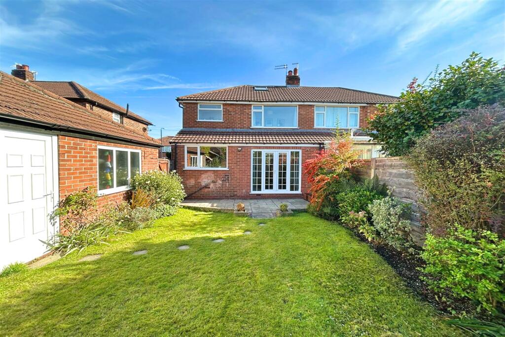
M33 3TP - 3 bedroom semidetached house for sale in Shrewsbury Road, S…
View on Property Piper
3 bedroom semi-detached house for sale in Shrewsbury Road, Sale, M33
Property Details
- Price: £470000
- Bedrooms: 3
- Bathrooms: 1
- Property Type: undefined
- Property SubType: undefined
Image Descriptions
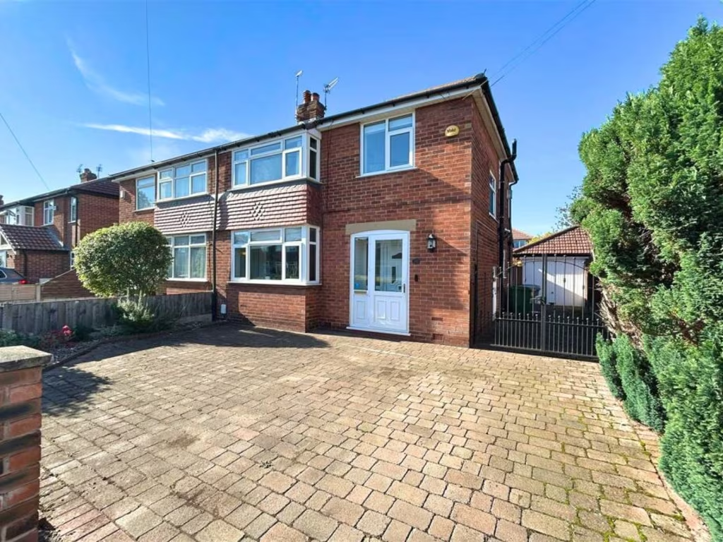
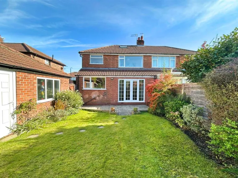
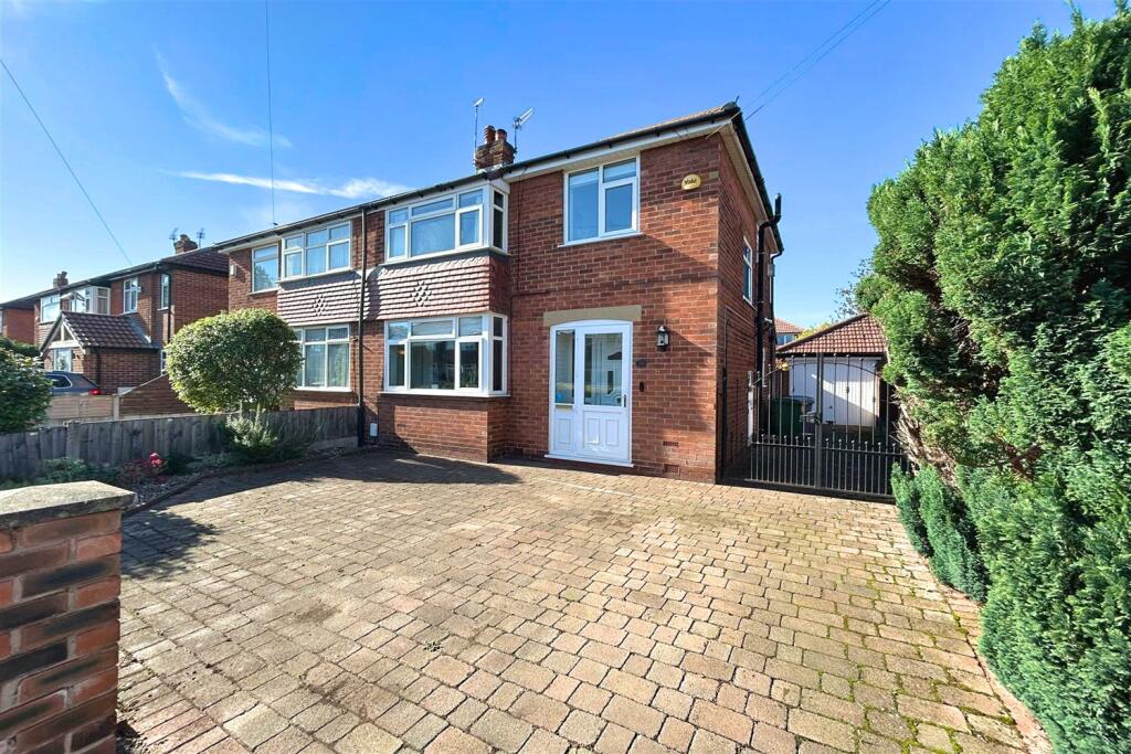
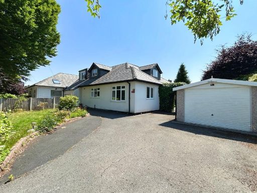
- semi-detached house mid-20th century
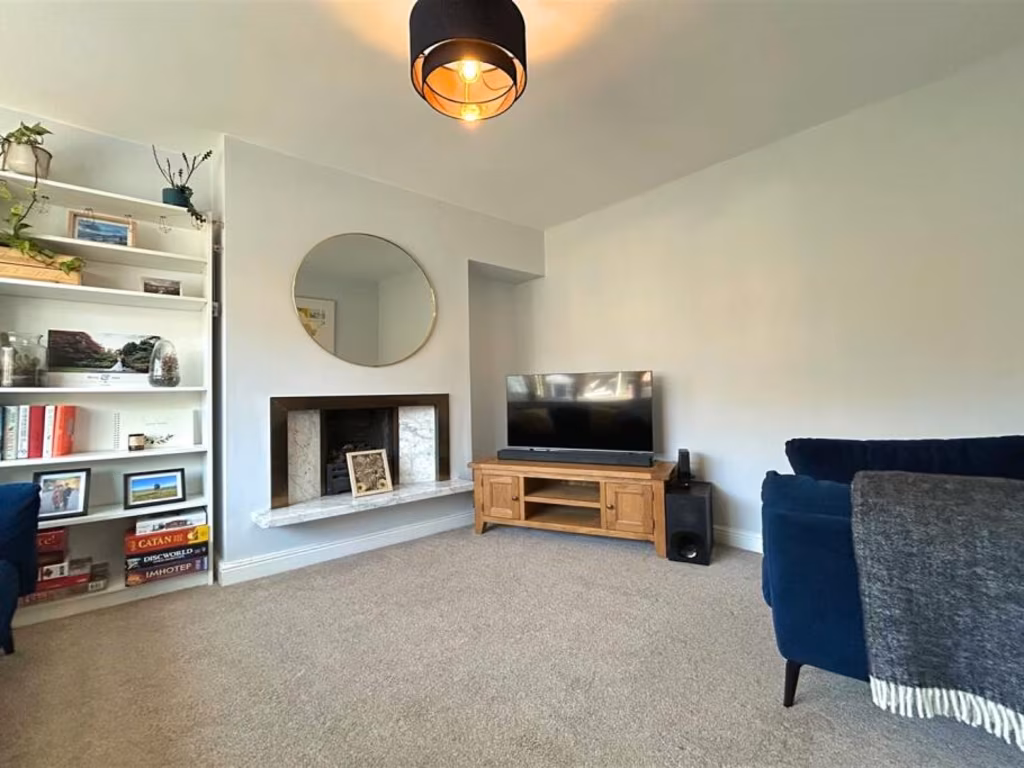
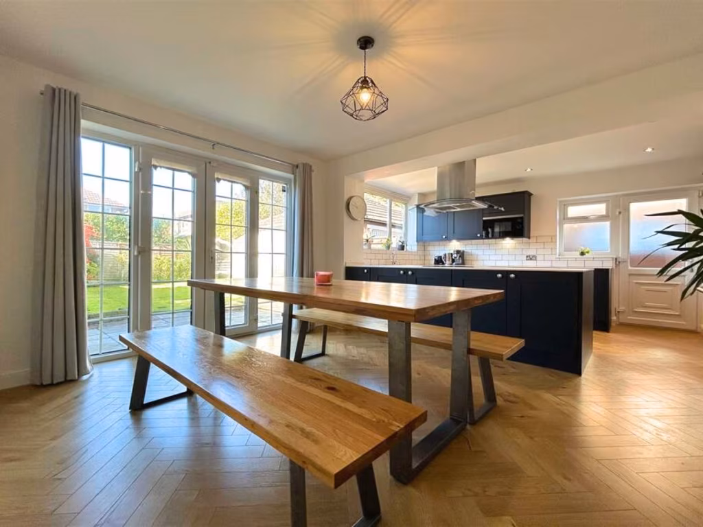
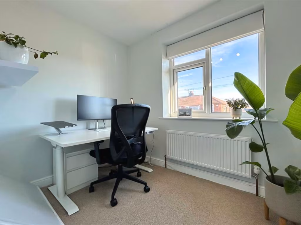
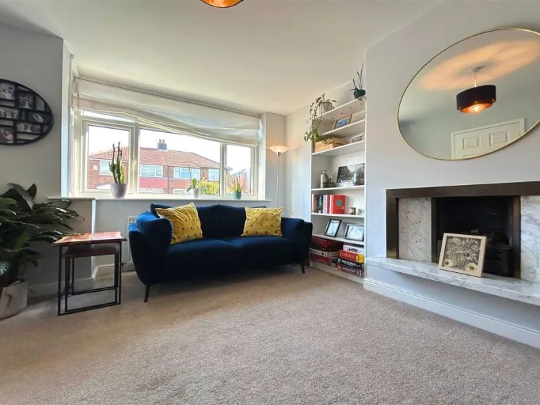
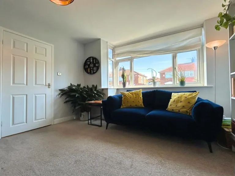
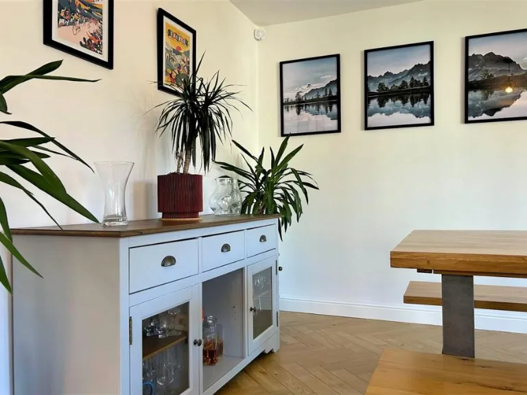
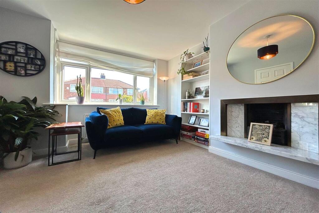
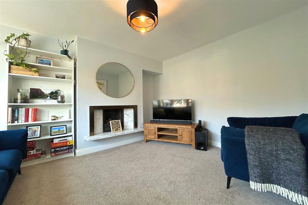
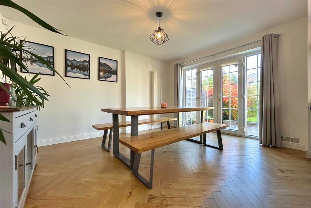
- living room contemporary
Floorplan Description
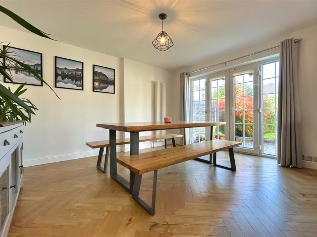
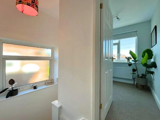
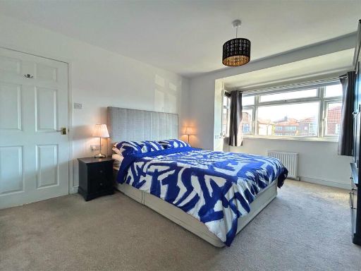
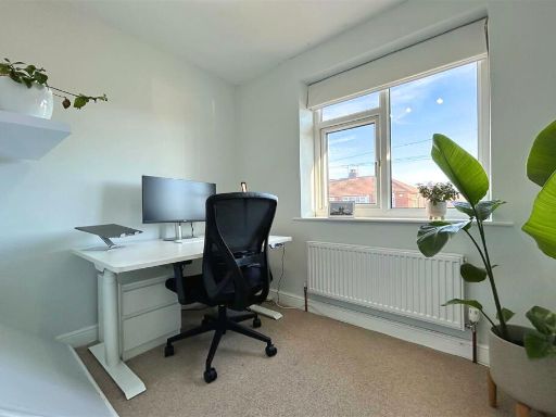
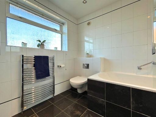
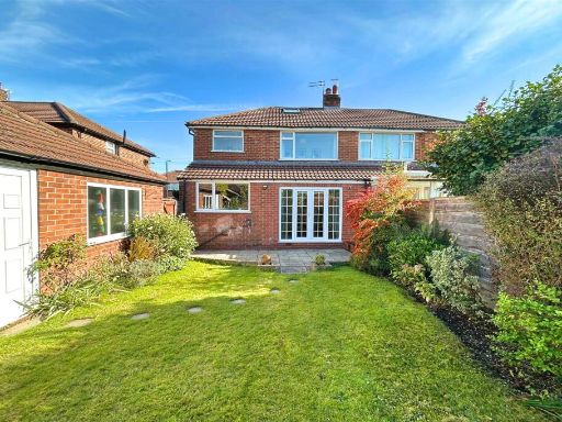
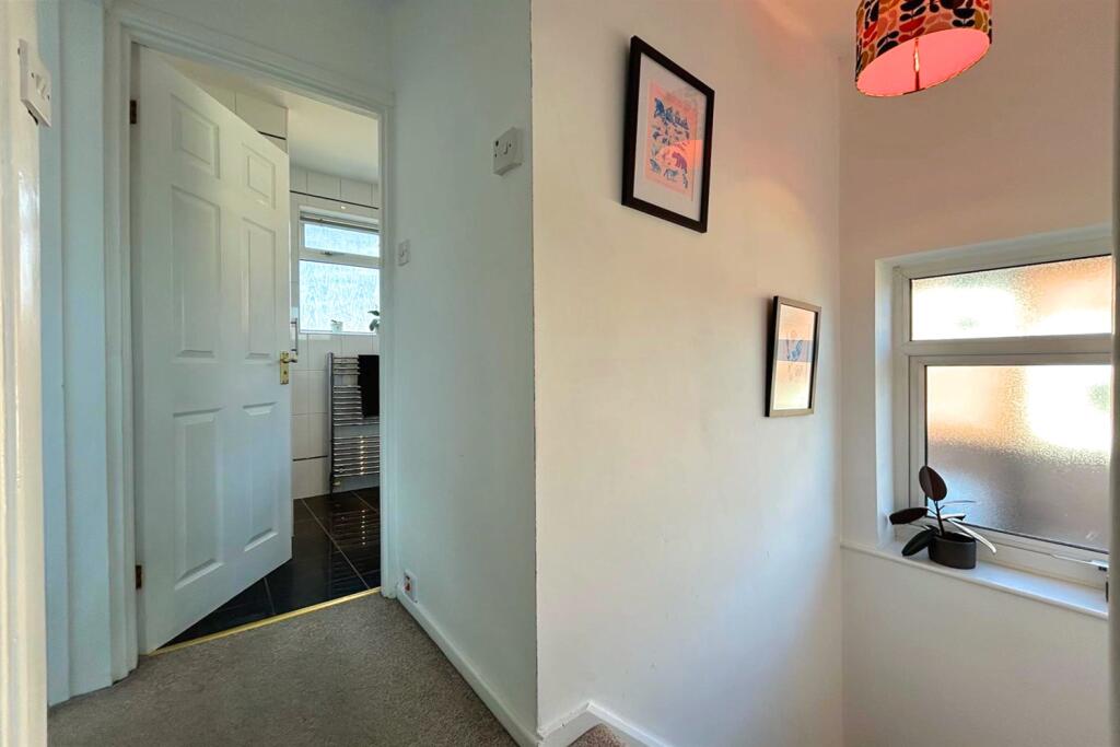
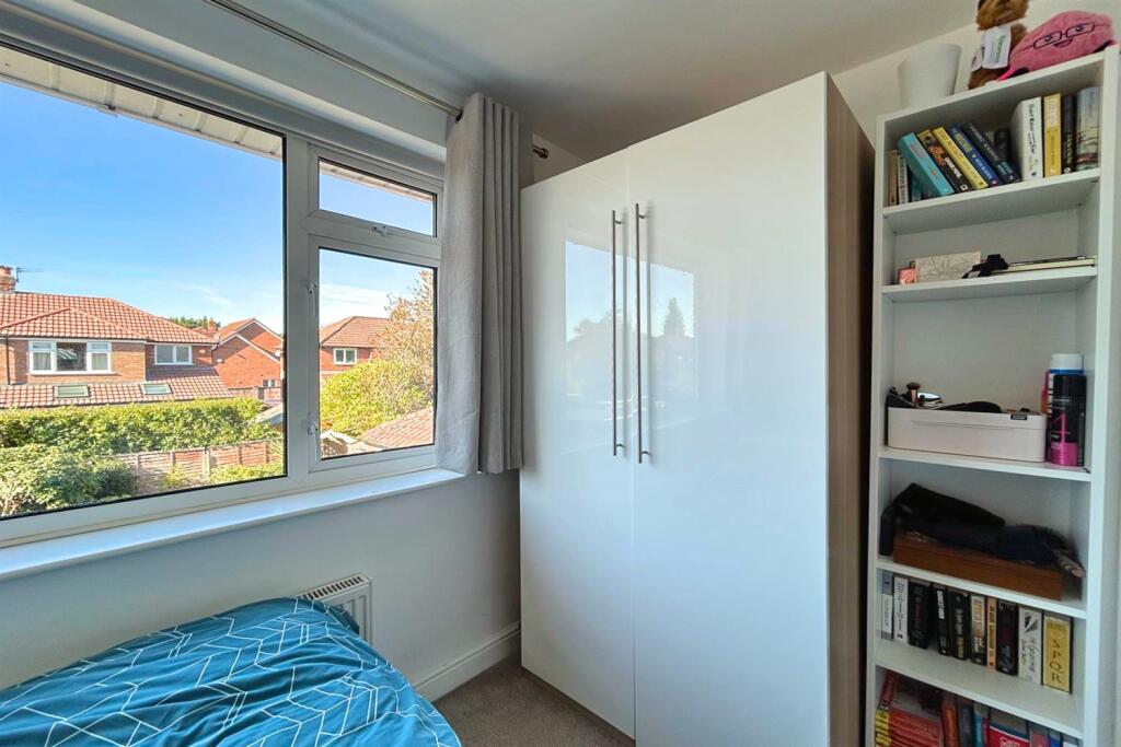
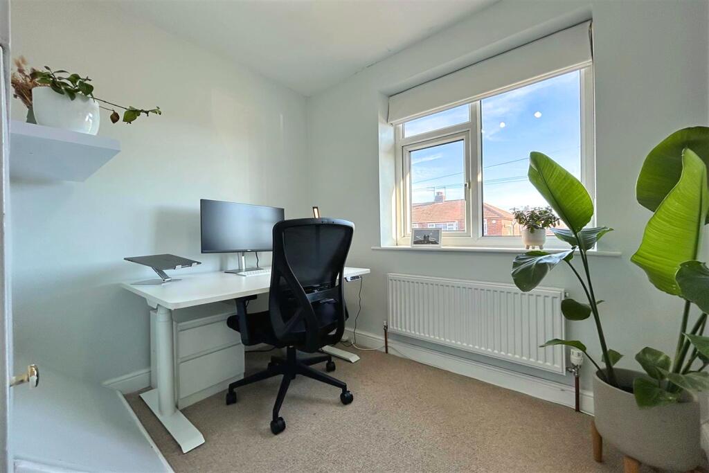
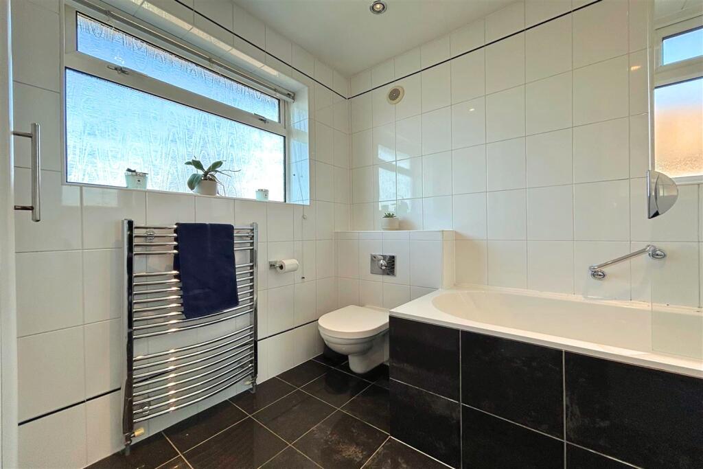
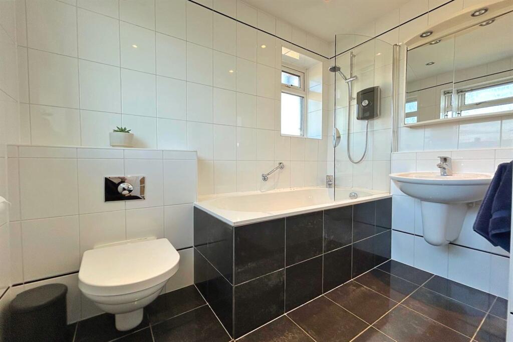
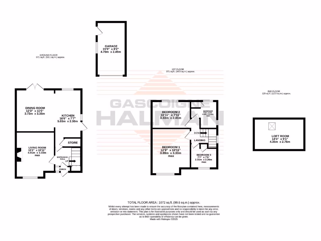
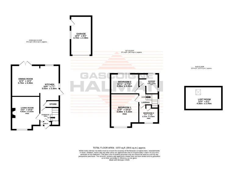
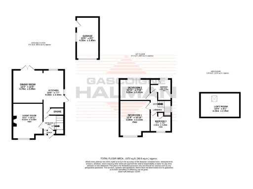
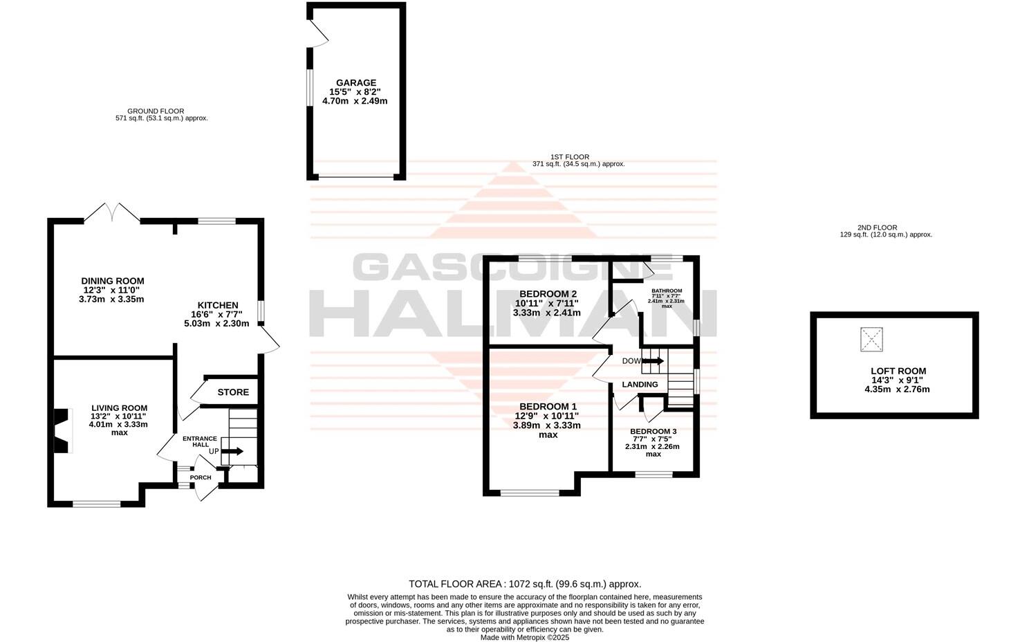
- Three-storey property with living room, dining room, kitchen, three bedrooms, bathroom and loft.
Rooms
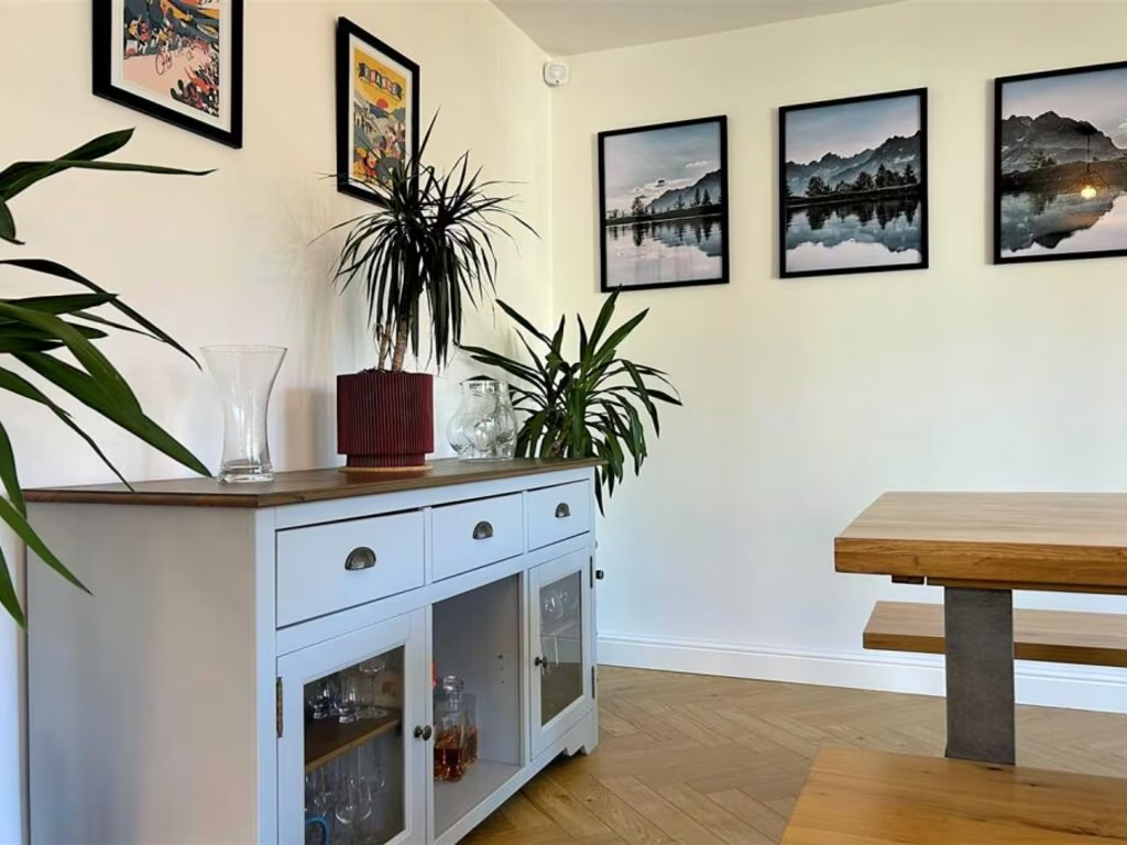
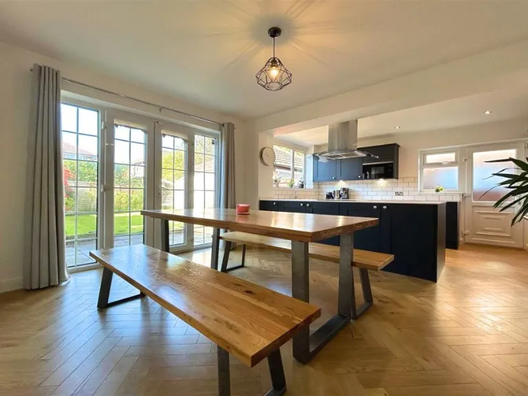
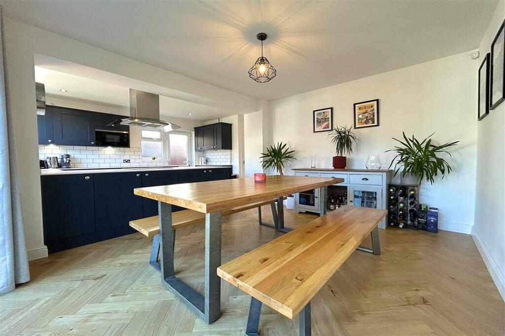
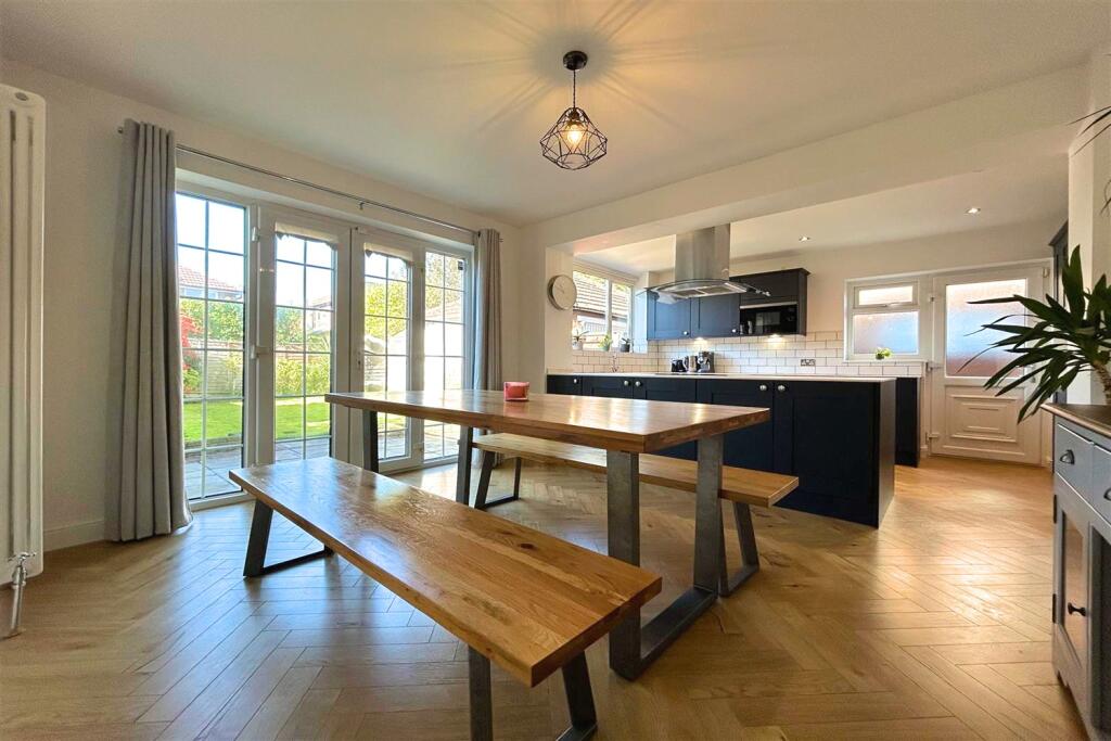
- DINING ROOM: average
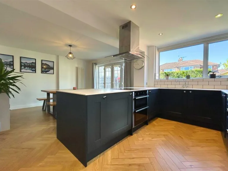
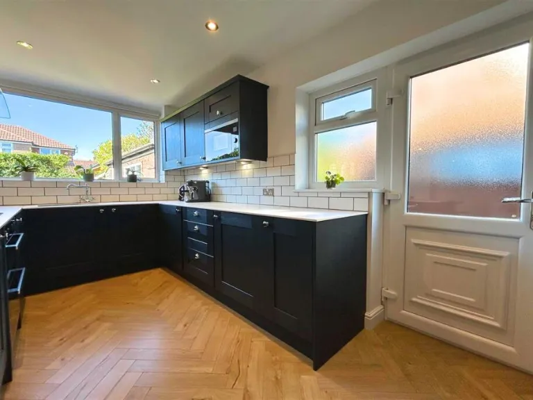
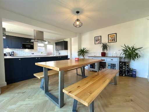
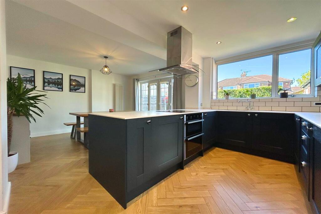
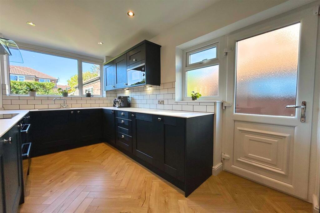
- KITCHEN: average
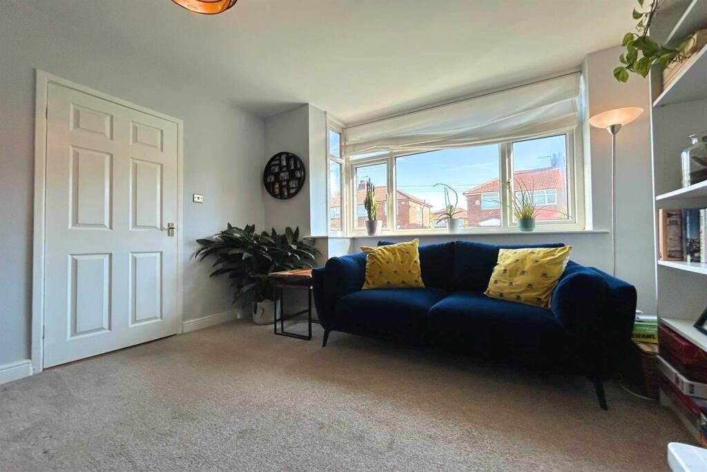
- LIVING ROOM: average
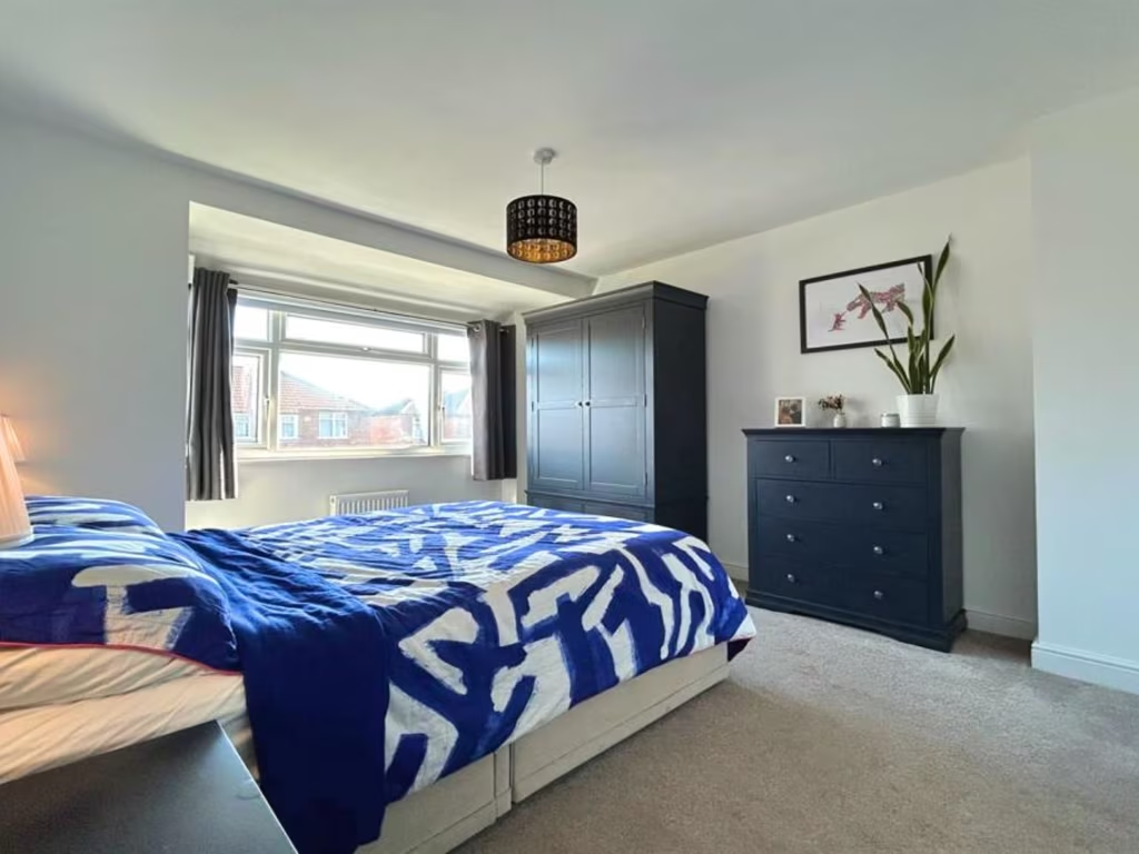
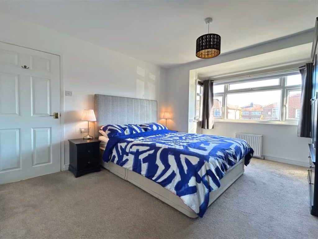
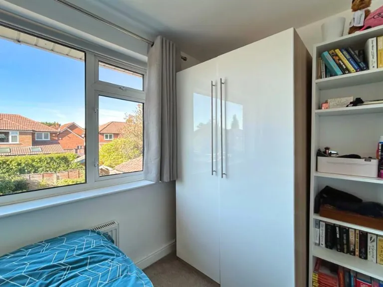
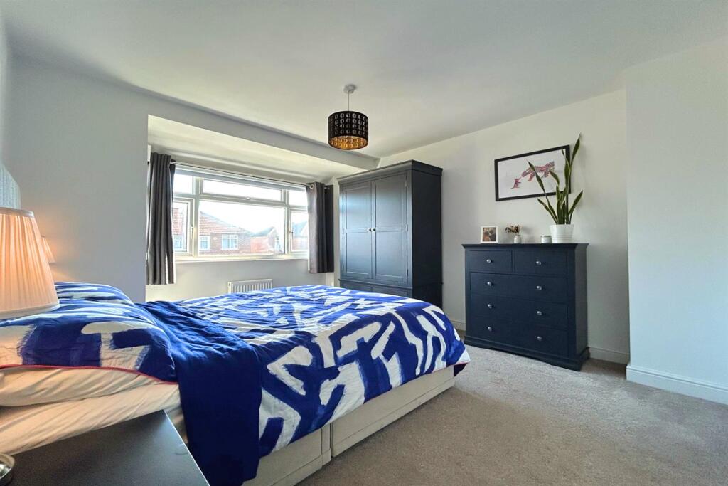
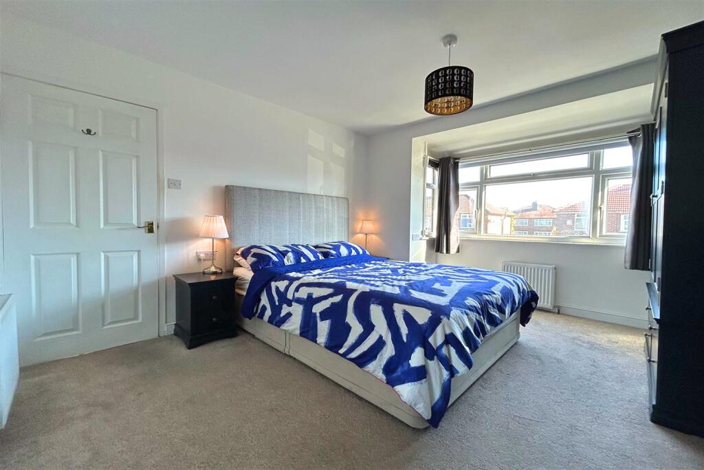
- BEDROOM 1: average
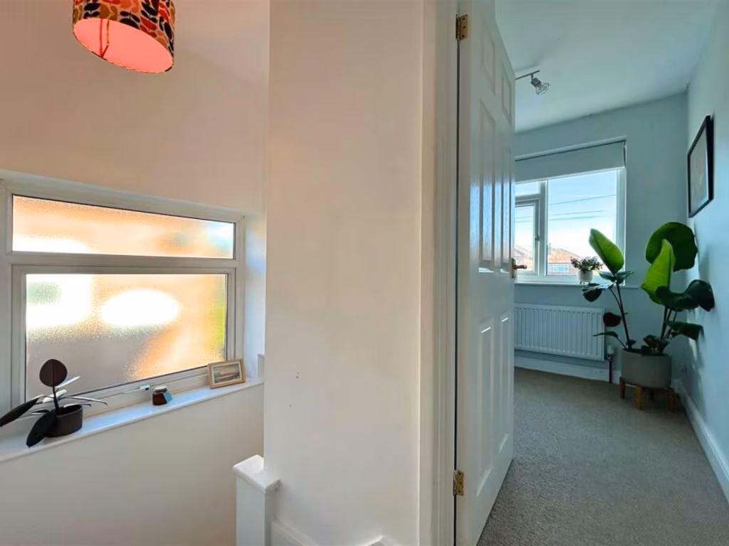
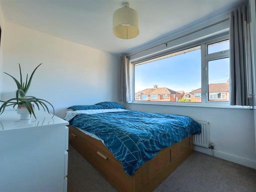
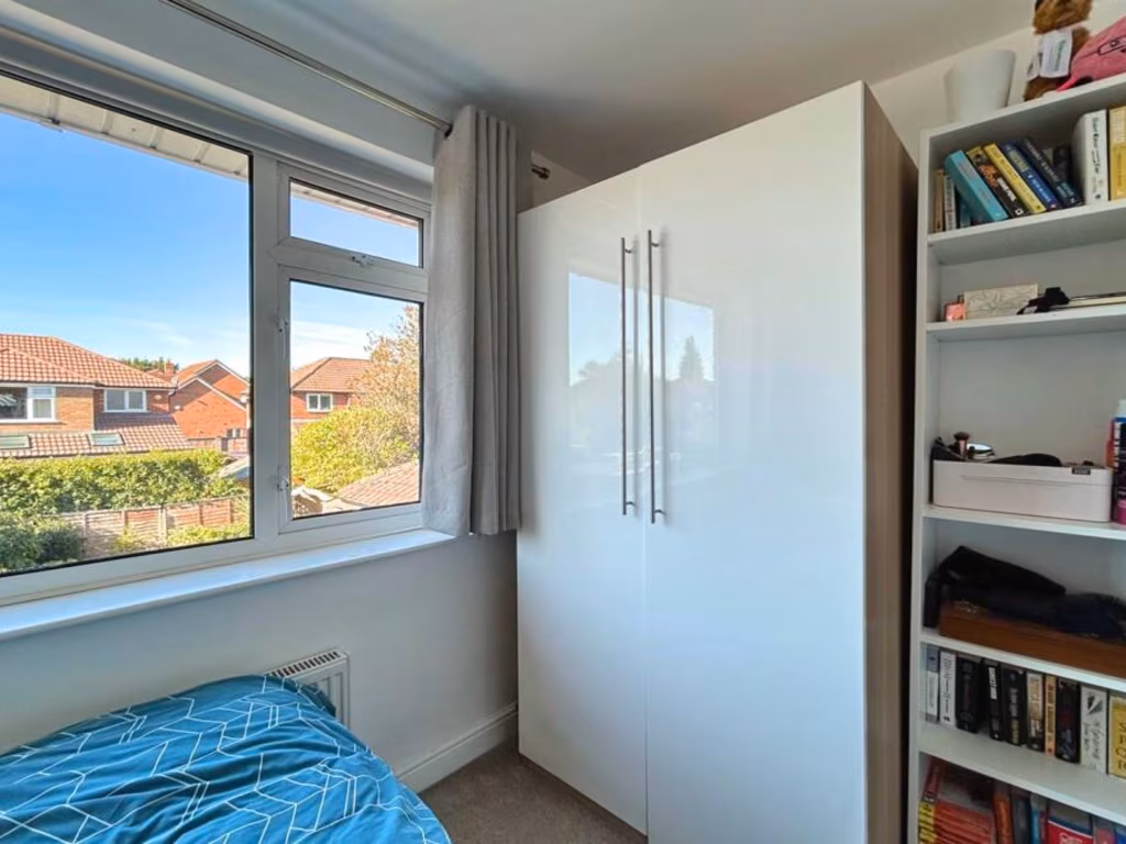
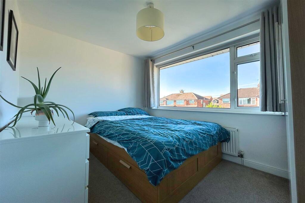
- BEDROOM 2: small
- BEDROOM 3: small
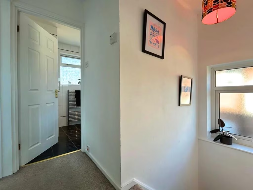
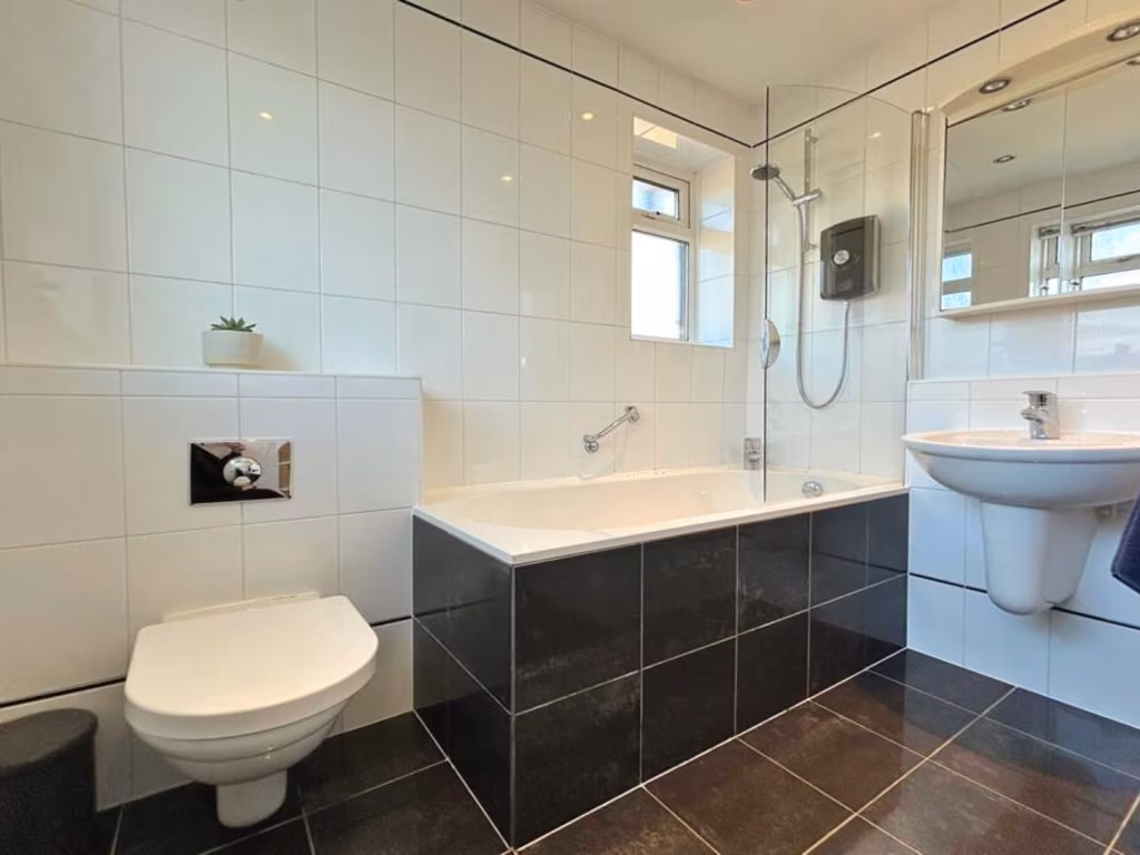
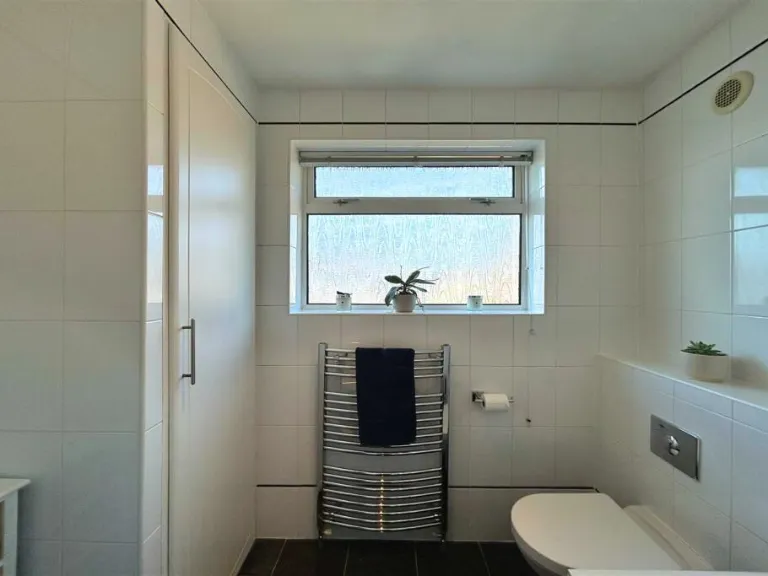
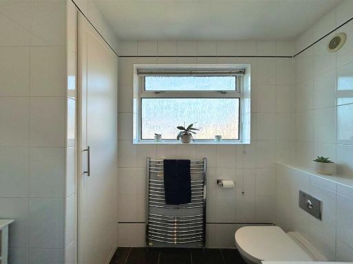
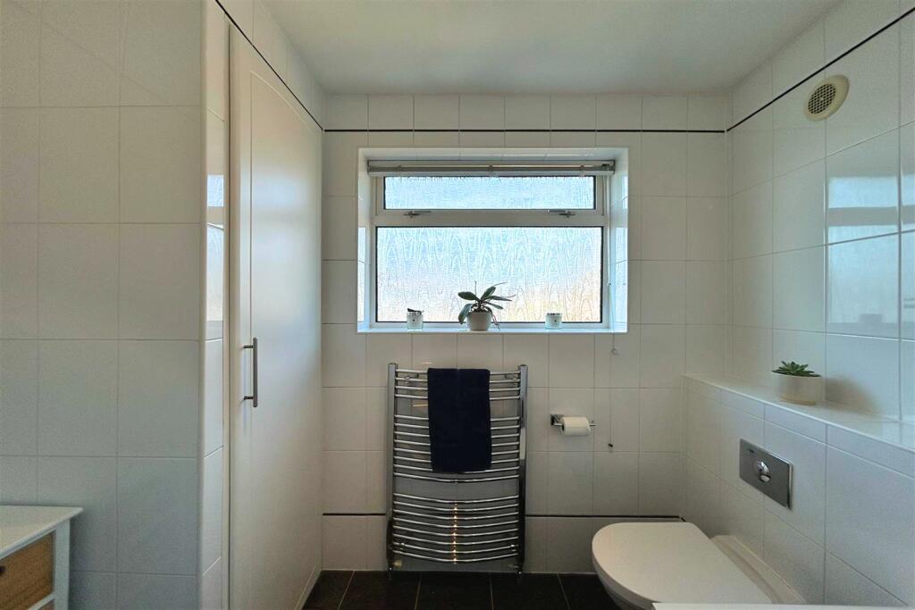
- BATHROOM: small
- LOFT ROOM: average
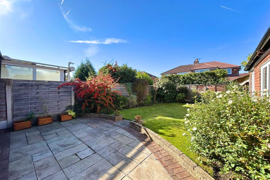
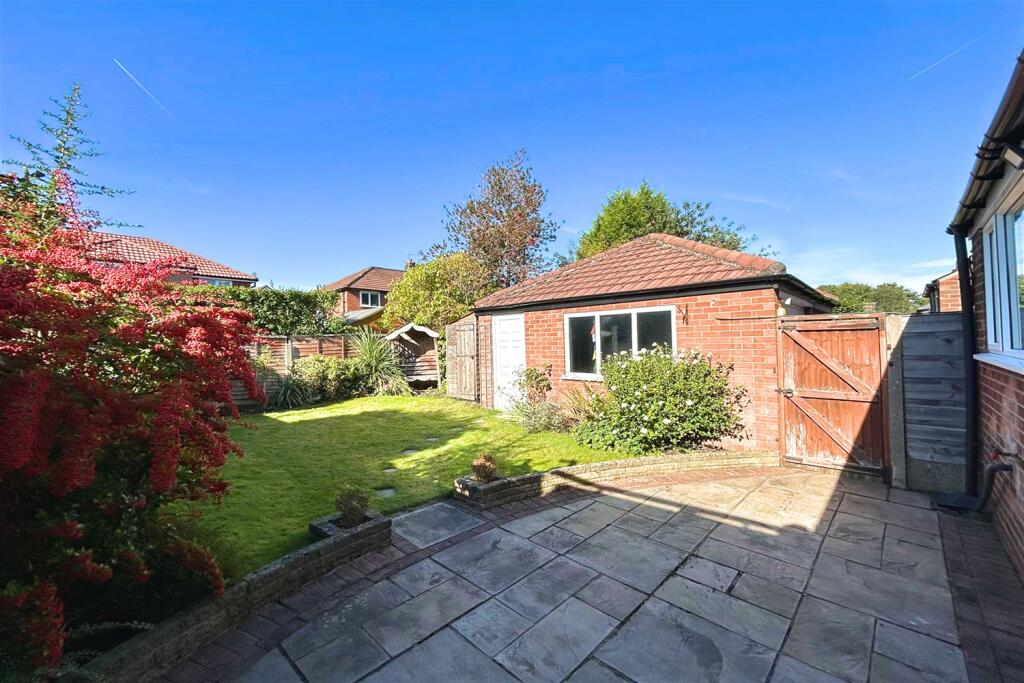
Textual Property Features
Detected Visual Features
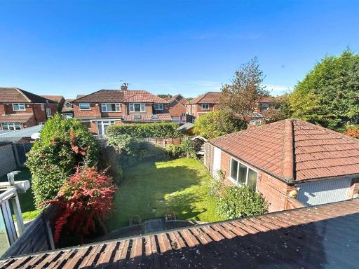
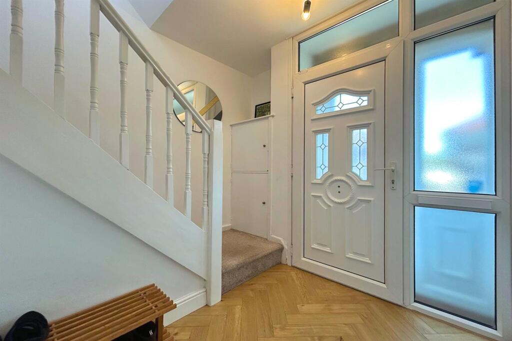
- semi-detached
- brick exterior
- mid-20th century
- family home
- driveway
- private entrance
- residential
- suburban
- contemporary
- living room
- medium-sized room
- large window
- fireplace
- built-in shelves
- natural light
Nearby Schools
- Blessed Thomas Holford Catholic College
- St Vincent's Catholic Primary School
- Cloverlea Primary School
- Sale Grammar School
- Forest Park Preparatory School
- Wellfield Junior School
- Forest School
- St Hugh's Catholic Primary School
- Heyes Lane Primary School
- Park Road Academy Primary School
- Ashton-on-Mersey School
- St Anne's CofE Primary School
- Firs Primary School
- Springfield Primary School
- Altrincham College
- Tyntesfield Primary School
- Brooklands Primary School
- Woodheys Primary School
- Wellfield Infant and Nursery School
- Park Road Sale Primary School
- Wellington School
- Navigation Primary School
- Willows Primary School
- Sandilands Primary School
- St Margaret Ward Catholic Primary School
- Sale High School
- St Joseph's Catholic Primary School, a Voluntary Academy
- St Mary's CofE Primary School
Nearest General Shops
- Id: 2973810736
- Tags:
- Name: Sanctuary
- Phone: +44 161 980 5000
- Shop: beauty
- TagsNormalized:
- Lat: 53.4072064
- Lon: -2.3225892
- FullGeoHash: gcqrg4kxx8zg
- PartitionGeoHash: gcqr
- Images:
- FoodStandards: null
- Distance: 633.7
,- Id: 496474080
- Tags:
- Addr:
- City: Sale
- Housename: Total Hair Concept
- Housenumber: 8
- Postcode: M33 3SQ
- Street: Framingham Road
- Building: yes
- Name: Total Hair Concept
- Opening_hours: Mo-We 09:30-17:45; Th-Fr 09:30-20:00; Sa 09:00-17:00
- Phone: +44 161 969 2828
- Shop: hairdresser
- Website: totalhairconcept.com
- TagsNormalized:
- Lat: 53.4165009
- Lon: -2.3251544
- FullGeoHash: gcqrgh4vevrp
- PartitionGeoHash: gcqr
- Images:
- FoodStandards: null
- Distance: 629.5
,- Id: 2973810734
- Tags:
- Name: creations
- Phone: +44 161 973 2400
- Shop: hairdresser
- TagsNormalized:
- Lat: 53.4072747
- Lon: -2.3227617
- FullGeoHash: gcqrg4kxgtx7
- PartitionGeoHash: gcqr
- Images:
- FoodStandards: null
- Distance: 620.3
}
Nearest Grocery shops
- Id: 979838504
- Tags:
- Brand: Mace
- Brand:wikidata: Q75240338
- Name: Mace
- Shop: convenience
- TagsNormalized:
- Lat: 53.4109863
- Lon: -2.3402464
- FullGeoHash: gcqrfepvs33z
- PartitionGeoHash: gcqr
- Images:
- FoodStandards: null
- Distance: 737.7
,- Id: 496474081
- Tags:
- Addr:
- City: Sale
- Housename: McColl's
- Housenumber: 04
- Postcode: M33 3SH
- Street: Framingham Road
- Brand: McColl's
- Brand:wikidata: Q16997477
- Brand:wikipedia: en:McColl's
- Building: yes
- Name: McColl's
- Operator: McColl's
- Shop: convenience
- TagsNormalized:
- Lat: 53.4166051
- Lon: -2.3250693
- FullGeoHash: gcqrgh4ymbyt
- PartitionGeoHash: gcqr
- Images:
- FoodStandards: null
- Distance: 642.4
,- Id: 2973810735
- Tags:
- Name: Walk In Stores
- Shop: convenience
- TagsNormalized:
- Lat: 53.4072388
- Lon: -2.3226772
- FullGeoHash: gcqrg4kxtwyk
- PartitionGeoHash: gcqr
- Images:
- FoodStandards: null
- Distance: 627.1
}
Nearest Supermarkets
- Id: 135756109
- Tags:
- Brand: ALDI
- Brand:wikidata: Q41171672
- Brand:wikipedia: en:Aldi
- Building: yes
- Contact:
- Website: https://stores.aldi.co.uk/sale/school-road
- Name: ALDI
- Parking: rooftop
- Shop: supermarket
- Wheelchair: yes
- TagsNormalized:
- Lat: 53.4250086
- Lon: -2.3236082
- FullGeoHash: gcqrgjsp0p2j
- PartitionGeoHash: gcqr
- Images:
- FoodStandards: null
- Distance: 1561.2
,- Id: 60738437
- Tags:
- Brand: Marks & Spencer
- Brand:wikidata: Q714491
- Building: yes
- Contact:
- Website: https://www.marksandspencer.com/stores/sale-simply-food-6538
- Name: Marks & Spencer
- Shop: supermarket
- Wheelchair: yes
- TagsNormalized:
- marks & spencer
- supermarket
- shop
- Lat: 53.4244432
- Lon: -2.3259637
- FullGeoHash: gcqrgjd7cn5c
- PartitionGeoHash: gcqr
- Images:
- FoodStandards: null
- Distance: 1469.8
,- Id: 60738436
- Tags:
- Brand: Tesco
- Brand:wikidata: Q487494
- Brand:wikipedia: en:Tesco
- Building: yes
- Contact:
- Website: https://www.tesco.com/store-locator/sale/hereford-st
- Name: Tesco
- Note: 3hr free parking when spending £5
- Parking: rooftop
- Shop: supermarket
- Wheelchair: yes
- TagsNormalized:
- Lat: 53.4242839
- Lon: -2.3245791
- FullGeoHash: gcqrgje712k4
- PartitionGeoHash: gcqr
- Images:
- FoodStandards: null
- Distance: 1468.4
}
Nearest Religious buildings
- Id: 496650138
- Tags:
- Addr:
- City: Sale
- Housenumber: 206
- Postcode: M33 3NE
- Street: Marsland Road
- Amenity: place_of_worship
- Building: yes
- Denomination: Christadelphian
- Name: Sale Christadelphian Hall
- Religion: christian
- Website: http://www.sale-christadelphians.net/index.html
- Wheelchair: yes
- TagsNormalized:
- place of worship
- christian
- church
- Lat: 53.4179249
- Lon: -2.3210751
- FullGeoHash: gcqrghmvgnbv
- PartitionGeoHash: gcqr
- Images:
- FoodStandards: null
- Distance: 904.5
,- Id: 414784220
- Tags:
- Addr:
- City: Sale
- Postcode: M33 3PB
- Street: Brooklands Road
- Amenity: place_of_worship
- Building: church
- Building:levels: 1
- Denomination: anglican
- Hearing_aid_service: yes
- Name: St John the Divine
- Phone: +44 161 973 5947
- Religion: christian
- Website: http://www.stjohnsbrooklands.org.uk/
- Wheelchair: yes
- Wikidata: Q17550111
- TagsNormalized:
- place of worship
- church
- anglican
- christian
- Lat: 53.4091497
- Lon: -2.3187458
- FullGeoHash: gcqrg4zdc71g
- PartitionGeoHash: gcqr
- Images:
- FoodStandards: null
- Distance: 731.1
,- Id: 979881972
- Tags:
- Amenity: place_of_worship
- Denomination: baptist
- Name: Sale Baptist Church
- Religion: christian
- TagsNormalized:
- place of worship
- baptist
- church
- christian
- Lat: 53.416625
- Lon: -2.3347765
- FullGeoHash: gcqrfu5y7u87
- PartitionGeoHash: gcqr
- Images:
- FoodStandards: null
- Distance: 694.7
}
Nearest Medical buildings
- Id: 979838475
- Tags:
- Addr:
- City: Sale
- Housenumber: 2
- Postcode: M33 4DX
- Street: Eastway
- Amenity: pharmacy
- Healthcare: pharmacy
- Name: Sale Pharmacy
- TagsNormalized:
- Lat: 53.4111163
- Lon: -2.3407534
- FullGeoHash: gcqrfepw23xz
- PartitionGeoHash: gcqr
- Images:
- FoodStandards: null
- Distance: 770.6
,- Id: 963912549
- Tags:
- Amenity: dentist
- Healthcare: dentist
- Healthcare:speciality: orthodontics
- Name: Turret Orthodontics
- TagsNormalized:
- dentist
- health
- healthcare
- orthodontics
- Lat: 53.4167981
- Lon: -2.3355216
- FullGeoHash: gcqrfu5r6kuu
- PartitionGeoHash: gcqr
- Images:
- FoodStandards: null
- Distance: 738.1
,- Id: 963912496
- Tags:
- Amenity: doctors
- Healthcare: doctor
- Name: 1 Stop Travel Clinic
- TagsNormalized:
- doctor
- doctors
- health
- healthcare
- clinic
- Lat: 53.4161879
- Lon: -2.3365713
- FullGeoHash: gcqrfu4ecgnh
- PartitionGeoHash: gcqr
- Images:
- FoodStandards: null
- Distance: 728.8
,- Id: 963912576
- Tags:
- Amenity: dentist
- Healthcare: dentist
- Name: Sale Dental Care
- TagsNormalized:
- dentist
- health
- healthcare
- dental
- Lat: 53.4161987
- Lon: -2.3363714
- FullGeoHash: gcqrfu4eyt5h
- PartitionGeoHash: gcqr
- Images:
- FoodStandards: null
- Distance: 720.8
}
Nearest Airports
- Id: 1224469
- Tags:
- Addr:
- City: Manchester
- Country: GB
- Postcode: M90 1QX
- Aerodrome: international
- Aeroway: aerodrome
- Arp: yes
- Atis: 128.175
- Iata: MAN
- Icao: EGCC
- Name: Manchester Airport
- Note: rough sketched outline referring to Yahoo imagery - true boundary is where?
- Old_name: Ringway
- Operator: Manchester Airport PLC
- Size: 18720000
- Source:
- Tower_frequency: 118.625,119.400
- Type: multipolygon
- Website: https://www.manchesterairport.co.uk/
- Wikidata: Q8694
- Wikipedia: en:Manchester Airport
- TagsNormalized:
- airport
- international airport
- Lat: 53.3503197
- Lon: -2.2798822
- FullGeoHash: gcqrs05u4ukt
- PartitionGeoHash: gcqr
- Images:
- FoodStandards: null
- Distance: 7532.6
}
Nearest Leisure Facilities
- Id: 423039803
- Tags:
- Leisure: pitch
- Source: bing
- Sport: tennis
- Surface: paved
- TagsNormalized:
- Lat: 53.4136351
- Lon: -2.3308314
- FullGeoHash: gcqrfgwszxq0
- PartitionGeoHash: gcqr
- Images:
- FoodStandards: null
- Distance: 276.8
,- Id: 497144294
- Tags:
- Leisure: pitch
- Sport: basketball
- TagsNormalized:
- pitch
- leisure
- basketball
- sports
- Lat: 53.4135707
- Lon: -2.3306411
- FullGeoHash: gcqrfgwus5k0
- PartitionGeoHash: gcqr
- Images:
- FoodStandards: null
- Distance: 265.3
,- Id: 8715015862
- Tags:
- TagsNormalized:
- picnic
- picnic table
- leisure
- Lat: 53.4136169
- Lon: -2.3302232
- FullGeoHash: gcqrfgxhvgge
- PartitionGeoHash: gcqr
- Images:
- FoodStandards: null
- Distance: 261.1
,- Id: 414491960
- Tags:
- Leisure: playground
- Name: Young children Playpark
- TagsNormalized:
- Lat: 53.4134761
- Lon: -2.3303687
- FullGeoHash: gcqrfgxh43x5
- PartitionGeoHash: gcqr
- Images:
- FoodStandards: null
- Distance: 249.1
,- Id: 414496038
- Tags:
- Leisure: pitch
- Sport: bowls
- Surface: grass
- TagsNormalized:
- Lat: 53.4131603
- Lon: -2.3309915
- FullGeoHash: gcqrfgwd5yyb
- PartitionGeoHash: gcqr
- Images:
- FoodStandards: null
- Distance: 235
}
Nearest Tourist attractions
- Id: 309064458
- Tags:
- Name: Seasonal Fairground
- Tourism: theme_park
- TagsNormalized:
- Lat: 53.4017995
- Lon: -2.2773245
- FullGeoHash: gcqru1t8n2zy
- PartitionGeoHash: gcqr
- Images:
- FoodStandards: null
- Distance: 3595.1
,- Id: 5035608614
- Tags:
- Addr:
- City: Altrincham
- Street: Stamford New Road
- Artwork_type: contemporary
- Name: The Contemporary
- Tourism: gallery
- TagsNormalized:
- Lat: 53.3857996
- Lon: -2.3509563
- FullGeoHash: gcqrdw84fdrg
- PartitionGeoHash: gcqr
- Images:
- FoodStandards: null
- Distance: 3189.3
,- Id: 5284195331
- Tags:
- Name: Cornbrooke Gue
- Name:en: Cornbrooke Gue
- Tourism: guest_house
- TagsNormalized:
- Lat: 53.393364
- Lon: -2.3525079
- FullGeoHash: gcqrdryyys6y
- PartitionGeoHash: gcqr
- Images:
- FoodStandards: null
- Distance: 2530.9
}
Nearest Train stations
- Id: 6414583139
- Tags:
- Name: Humphrey Park
- Naptan:
- Network: National Rail
- Public_transport: station
- Railway: station
- Ref:
- Train: yes
- Wikidata: Q1957035
- Wikipedia: en:Humphrey Park railway station
- TagsNormalized:
- Lat: 53.4523337
- Lon: -2.3272609
- FullGeoHash: gcw2549q6vhq
- PartitionGeoHash: gcw2
- Images:
- FoodStandards: null
- Distance: 4557.7
,- Id: 6414583142
- Tags:
- Name: Urmston
- Name:lt: Ermstonas
- Naptan:
- Network: National Rail
- Public_transport: station
- Railway: station
- Ref:
- Train: yes
- Wheelchair: limited
- Wikidata: Q2753494
- Wikipedia: en:Urmston railway station
- TagsNormalized:
- Lat: 53.4483208
- Lon: -2.3536565
- FullGeoHash: gcw243yp5c4s
- PartitionGeoHash: gcw2
- Images:
- FoodStandards: null
- Distance: 4419.3
,- Id: 6334988574
- Tags:
- Name: Hale
- Naptan:
- Network: National Rail
- Operator: Northern Rail
- Public_transport: station
- Railway: station
- Ref:
- Wheelchair: yes
- Wikipedia: en:Hale railway station
- TagsNormalized:
- Lat: 53.3785218
- Lon: -2.3474975
- FullGeoHash: gcqrdt687mdv
- PartitionGeoHash: gcqr
- Images:
- FoodStandards: null
- Distance: 3849.1
,- Id: 6334988573
- Tags:
- Name: Altrincham
- Naptan:
- Network: National Rail
- Old_name: Altrincham and Bowdon
- Public_transport: station
- Railway: station
- Ref:
- Wikidata: Q1921455
- Wikipedia: en:Altrincham Interchange
- TagsNormalized:
- Lat: 53.3876561
- Lon: -2.3470824
- FullGeoHash: gcqrdwfvth2t
- PartitionGeoHash: gcqr
- Images:
- FoodStandards: null
- Distance: 2891.9
,- Id: 292004869
- Tags:
- Name: Navigation Road
- Naptan:
- Network: National Rail
- Public_transport: station
- Railway: station
- Ref:
- Wikipedia: en:Navigation Road station
- TagsNormalized:
- Lat: 53.3957446
- Lon: -2.3432686
- FullGeoHash: gcqrf8msvbhr
- PartitionGeoHash: gcqr
- Images:
- FoodStandards: null
- Distance: 1973.1
}
Nearest Hotels
- Id: 963912578
- Tags:
- Name: Cornerstones Hotel
- Tourism: hotel
- TagsNormalized:
- Lat: 53.4190374
- Lon: -2.3330123
- FullGeoHash: gcqrfuthky7f
- PartitionGeoHash: gcqr
- Images:
- FoodStandards: null
- Distance: 891.5
,- Id: 1012904383
- Tags:
- Building: yes
- Name: Cornerstones Hotel
- Tourism: hotel
- TagsNormalized:
- Lat: 53.4189782
- Lon: -2.3331216
- FullGeoHash: gcqrfuth4763
- PartitionGeoHash: gcqr
- Images:
- FoodStandards: null
- Distance: 887.3
,- Id: 1266048982
- Tags:
- Name: The Belmore
- Tourism: hotel
- TagsNormalized:
- Lat: 53.4122865
- Lon: -2.319823
- FullGeoHash: gcqrg5qv05ye
- PartitionGeoHash: gcqr
- Images:
- FoodStandards: null
- Distance: 625.7
}
Tags
- semi-detached
- brick exterior
- mid-20th century
- family home
- driveway
- private entrance
- residential
- suburban
- contemporary
- living room
- medium-sized room
- large window
- fireplace
- built-in shelves
- natural light
Local Market Stats
- Average Price/sqft: £360
- Avg Income: £50700
- Rental Yield: 3.9%
- Social Housing: 10%
- Planning Success Rate: 91%
Similar Properties
 4 bedroom semi-detached house for sale in Woodbourne Road, Sale, M33 — £725,000 • 4 bed • 4 bath • 2000 ft²
 3 bedroom semi-detached house for sale in Brookside Road, Sale, M33 — £500,000 • 3 bed • 1 bath • 1203 ft²
 3 bedroom semi-detached house for sale in Arcadia Avenue, Sale, M33 — £435,000 • 3 bed • 1 bath • 1111 ft²
 4 bedroom semi-detached house for sale in 9 Alston Avenue, Sale, M33 — £639,950 • 4 bed • 4 bath • 1652 ft²
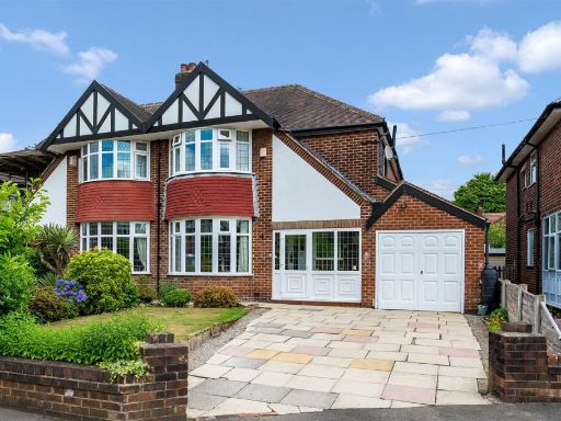 3 bedroom semi-detached house for sale in Greenway Close, Sale, M33 — £625,000 • 3 bed • 2 bath • 1612 ft²
 3 bedroom semi-detached house for sale in Brookside Road, Sale, M33 — £650,000 • 3 bed • 1 bath • 1627 ft²
Meta
- {
"@context": "https://schema.org",
"@type": "Residence",
"name": "3 bedroom semidetached house for sale in Shrewsbury Road, S…",
"description": "",
"url": "https://propertypiper.co.uk/property/6dfc42a1-c782-48dd-9555-016336e435fa",
"image": "https://image-a.propertypiper.co.uk/289961c0-4aa8-4dde-94ab-6b50f57c670c-1024.jpeg",
"address": {
"@type": "PostalAddress",
"streetAddress": "22 SHREWSBURY ROAD SALE",
"postalCode": "M33 3TP",
"addressLocality": "Trafford",
"addressRegion": "Wythenshawe and Sale East",
"addressCountry": "England"
},
"geo": {
"@type": "GeoCoordinates",
"latitude": 53.411360327241,
"longitude": -2.3291339828858373
},
"numberOfRooms": 3,
"numberOfBathroomsTotal": 1,
"floorSize": {
"@type": "QuantitativeValue",
"value": 1072,
"unitCode": "FTK"
},
"offers": {
"@type": "Offer",
"price": 470000,
"priceCurrency": "GBP",
"availability": "https://schema.org/InStock"
},
"additionalProperty": [
{
"@type": "PropertyValue",
"name": "Feature",
"value": "semi-detached"
},
{
"@type": "PropertyValue",
"name": "Feature",
"value": "brick exterior"
},
{
"@type": "PropertyValue",
"name": "Feature",
"value": "mid-20th century"
},
{
"@type": "PropertyValue",
"name": "Feature",
"value": "family home"
},
{
"@type": "PropertyValue",
"name": "Feature",
"value": "driveway"
},
{
"@type": "PropertyValue",
"name": "Feature",
"value": "private entrance"
},
{
"@type": "PropertyValue",
"name": "Feature",
"value": "residential"
},
{
"@type": "PropertyValue",
"name": "Feature",
"value": "suburban"
},
{
"@type": "PropertyValue",
"name": "Feature",
"value": "contemporary"
},
{
"@type": "PropertyValue",
"name": "Feature",
"value": "living room"
},
{
"@type": "PropertyValue",
"name": "Feature",
"value": "medium-sized room"
},
{
"@type": "PropertyValue",
"name": "Feature",
"value": "large window"
},
{
"@type": "PropertyValue",
"name": "Feature",
"value": "fireplace"
},
{
"@type": "PropertyValue",
"name": "Feature",
"value": "built-in shelves"
},
{
"@type": "PropertyValue",
"name": "Feature",
"value": "natural light"
}
]
}
High Res Floorplan Images
Compatible Floorplan Images
FloorplanImages Thumbnail