TF2 6SN - 3 bedroom terraced house for sale in Maple Close, Telford,…
View on Property Piper
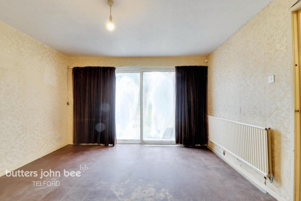
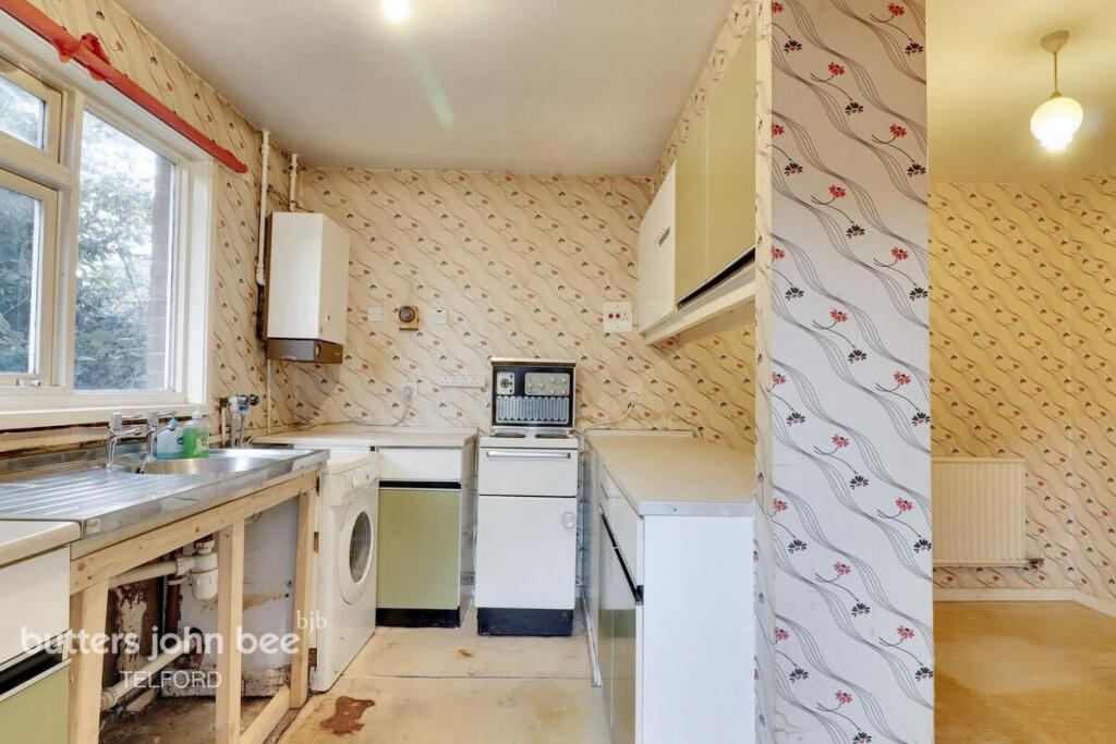
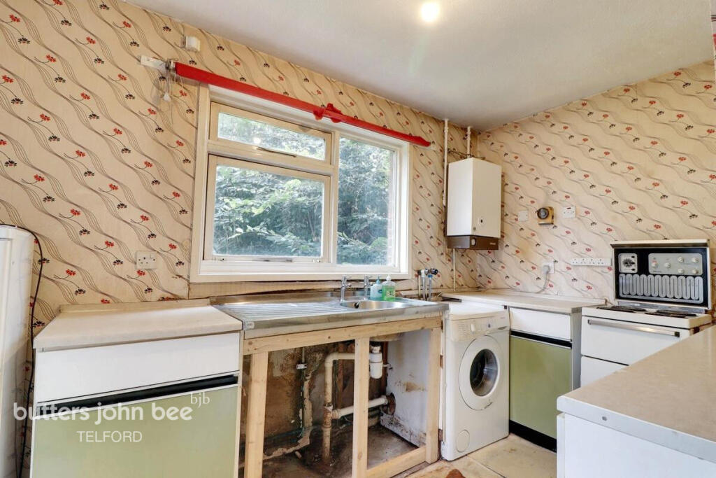
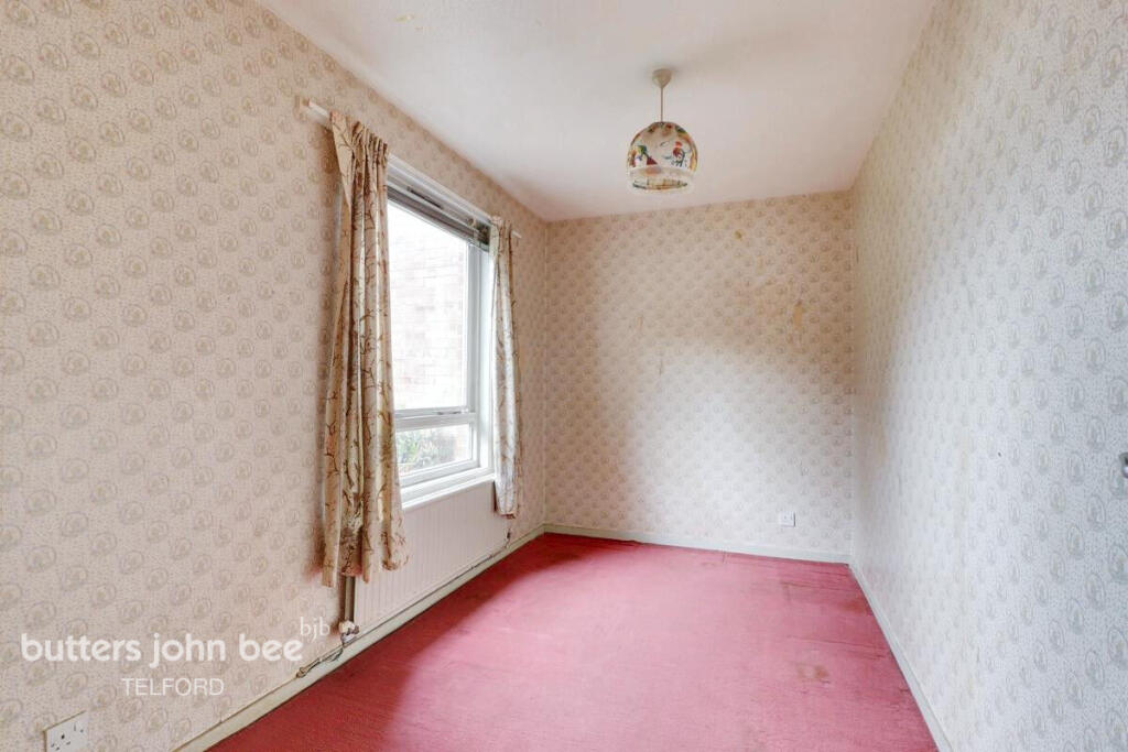
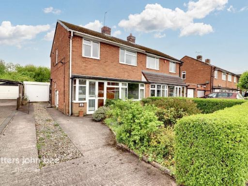
3 bedroom terraced house for sale in Maple Close, Telford, TF2
Property Details
- Price: £110000
- Bedrooms: 3
- Bathrooms: 2
- Property Type: undefined
- Property SubType: undefined
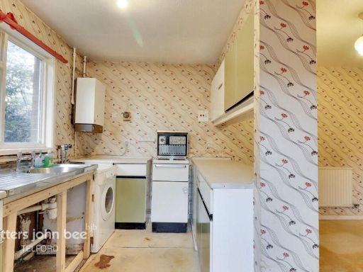
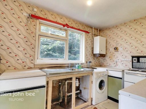
Image Descriptions
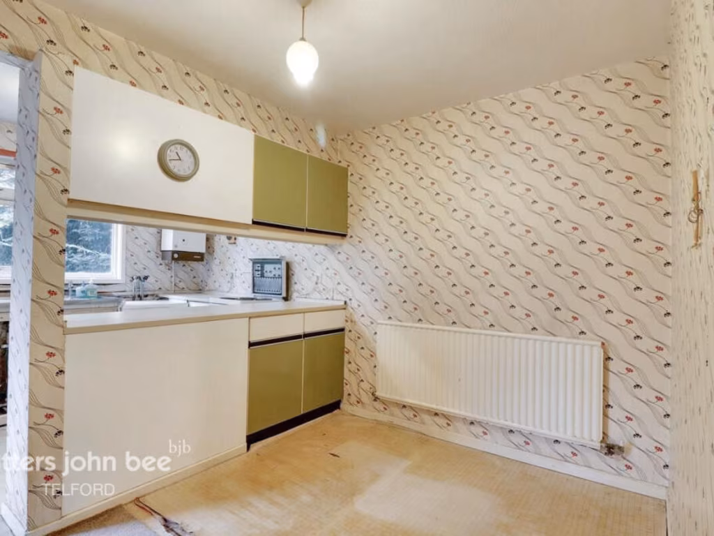
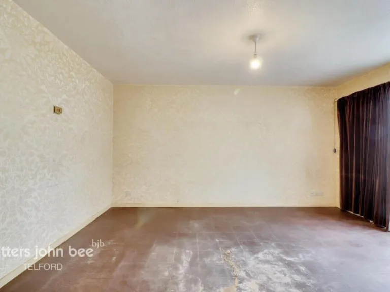
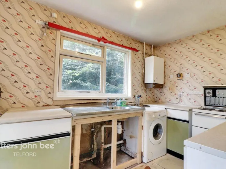
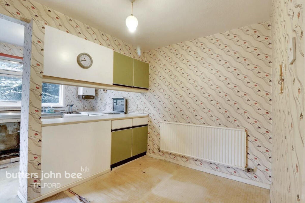
- kitchen mid-century
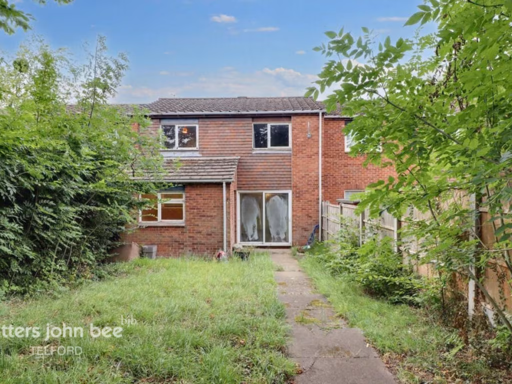
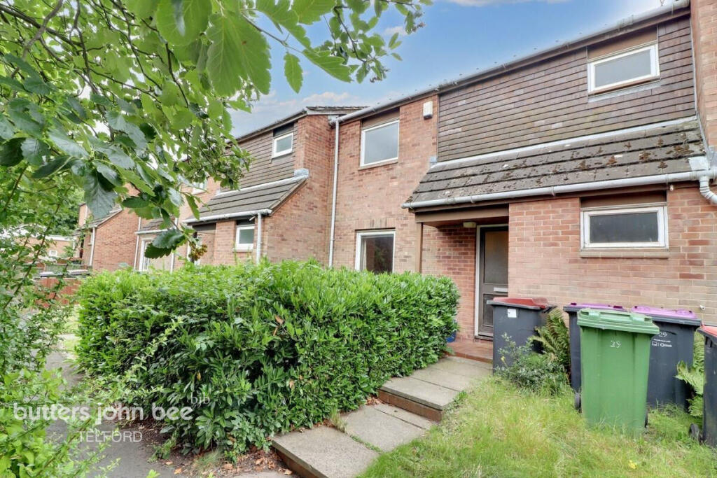
- two-story townhouse mid-century modern
Textual Property Features
- Is Public Notice
- Is Auction
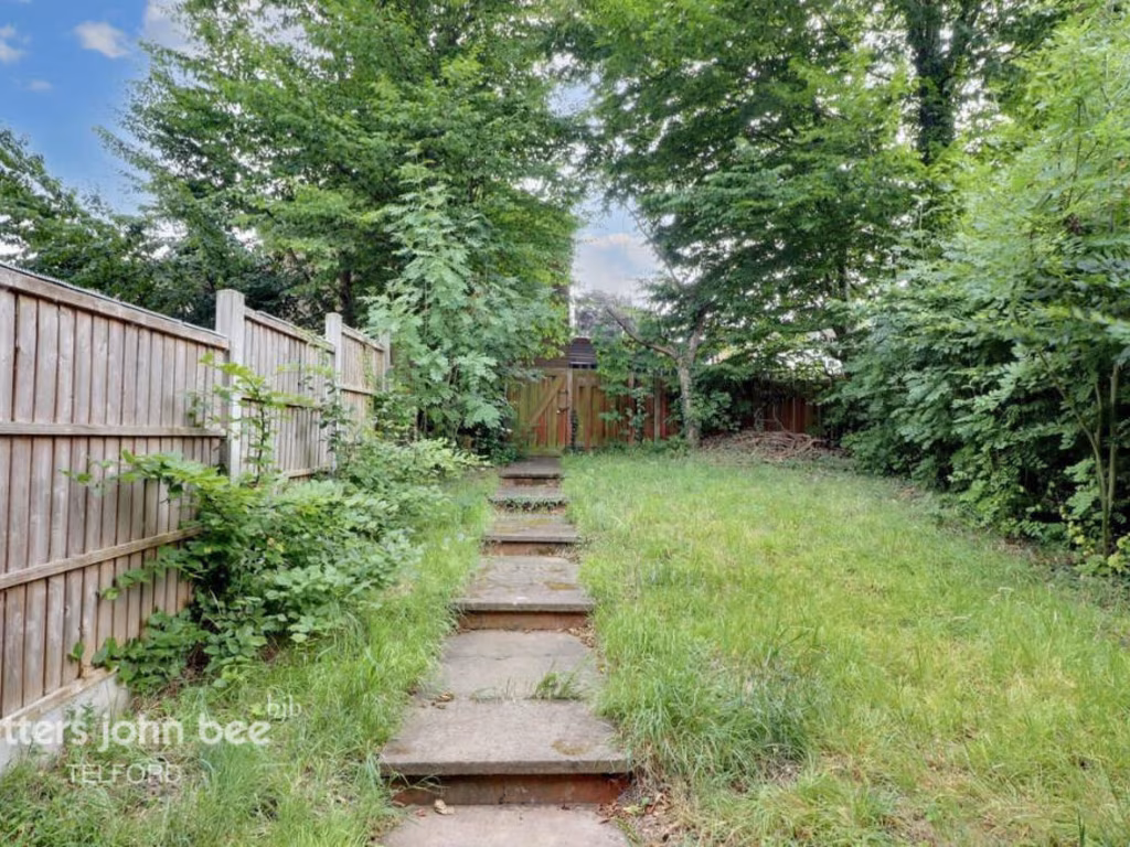
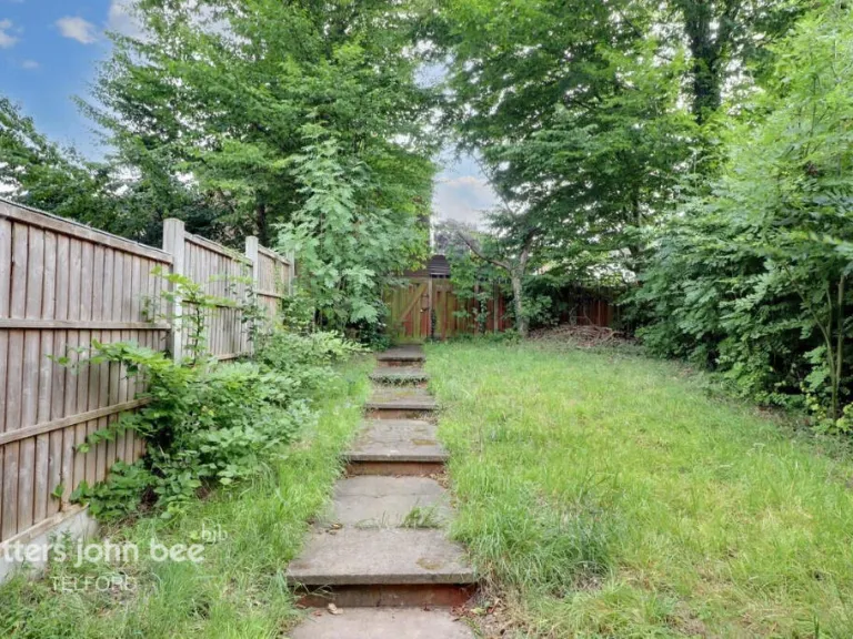
- Has Garden
- Success
Detected Visual Features
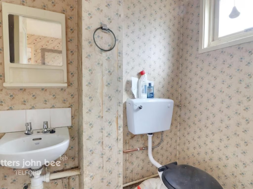
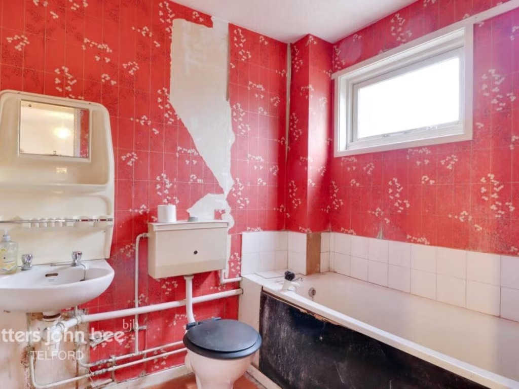
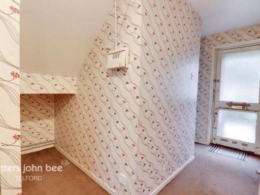
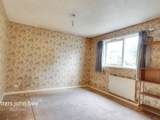
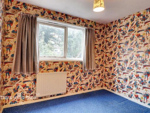
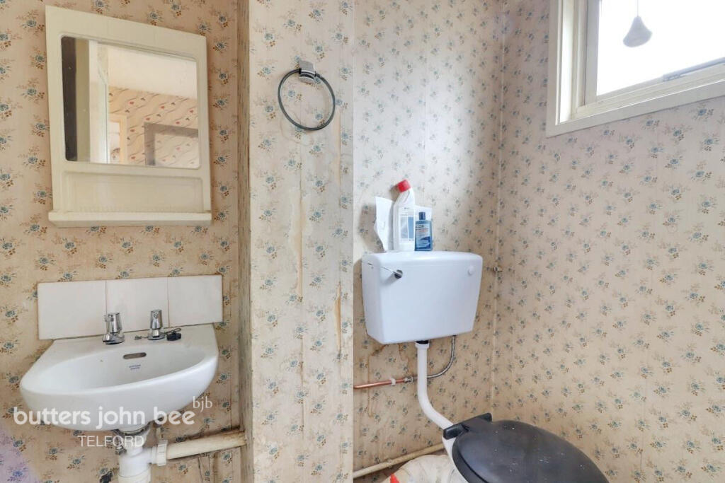
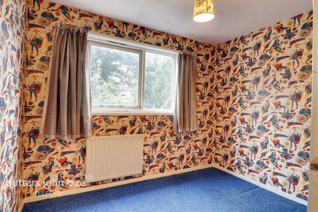
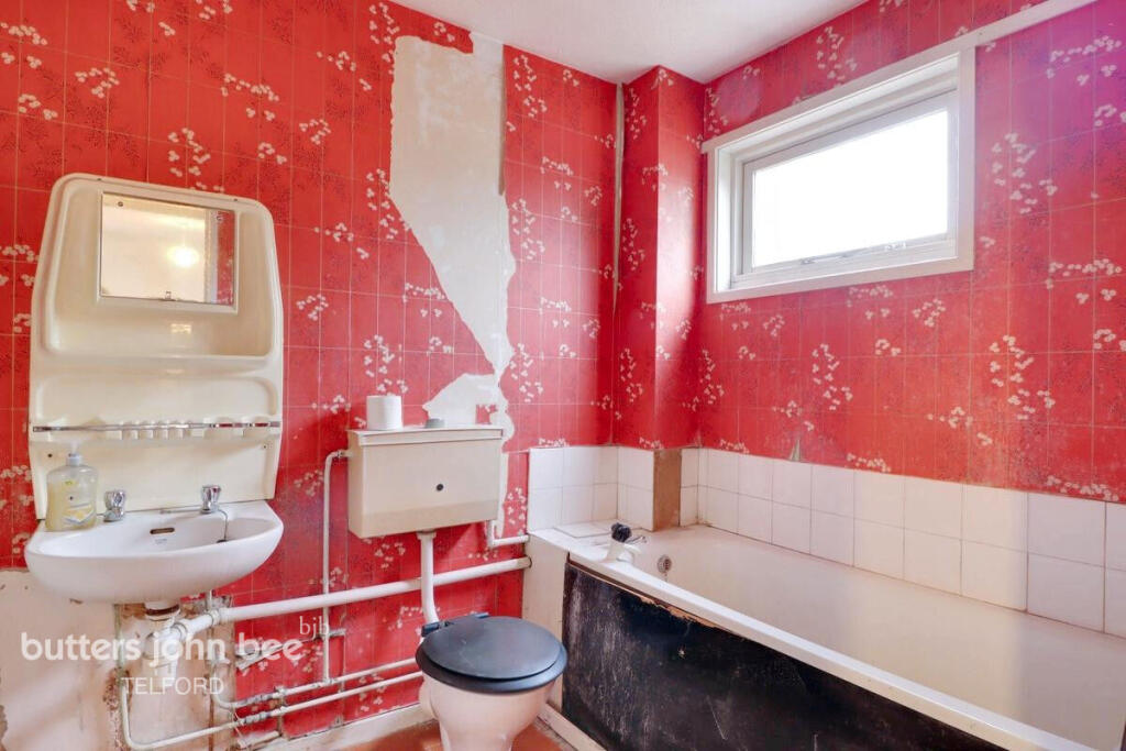
- kitchen
- mid-century
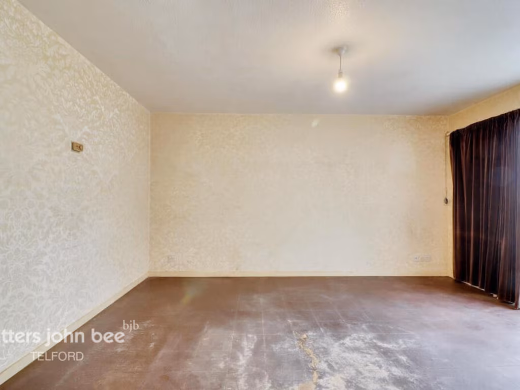
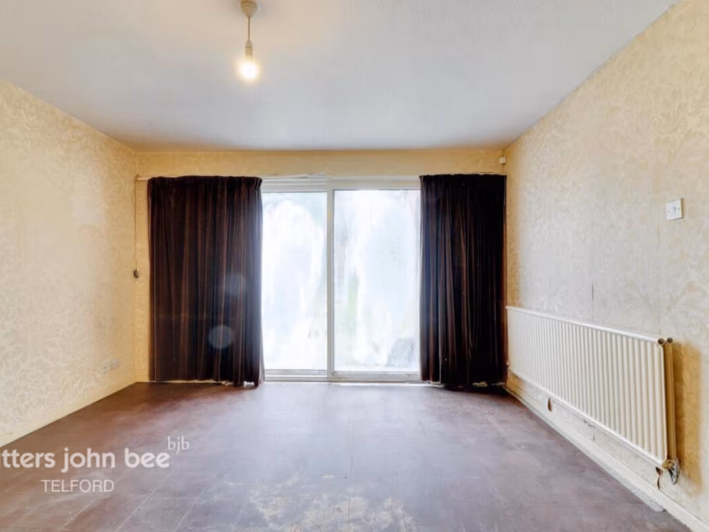
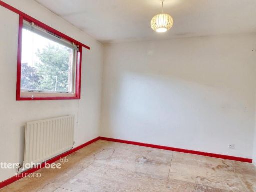
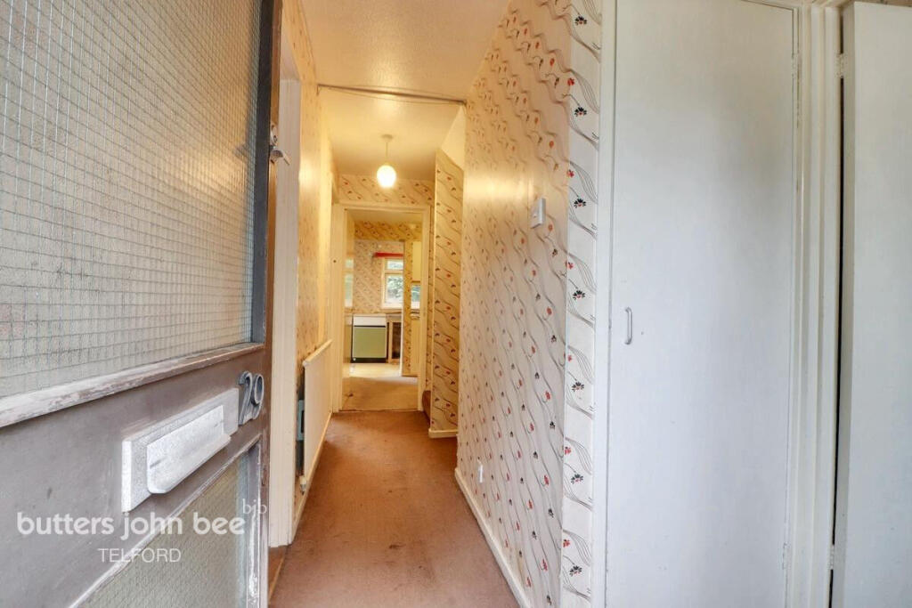
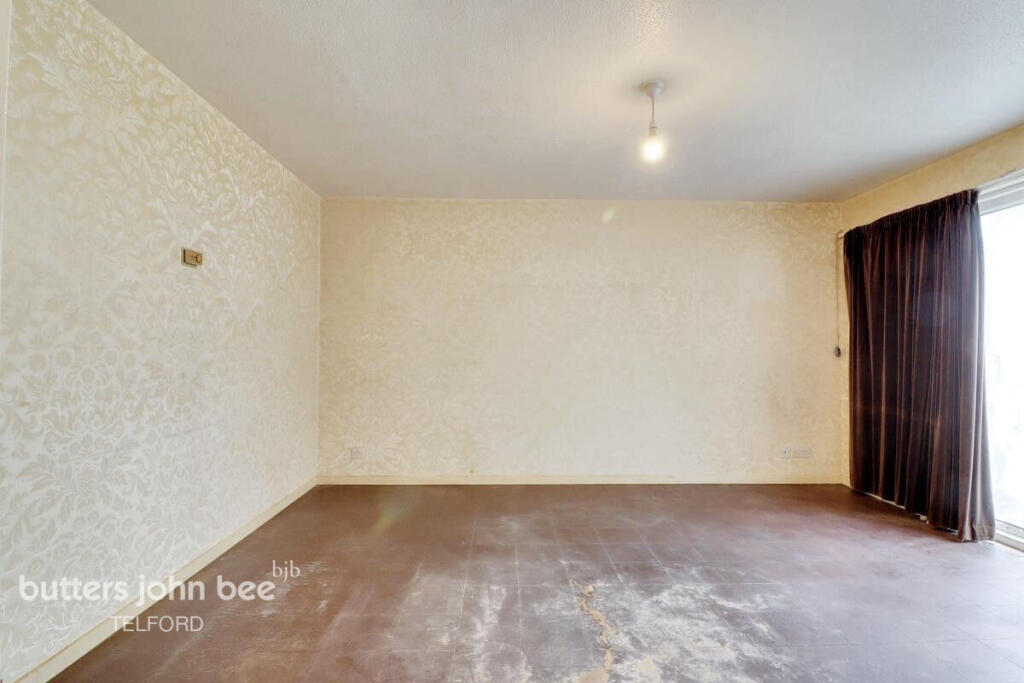
- dated
- needs modernization
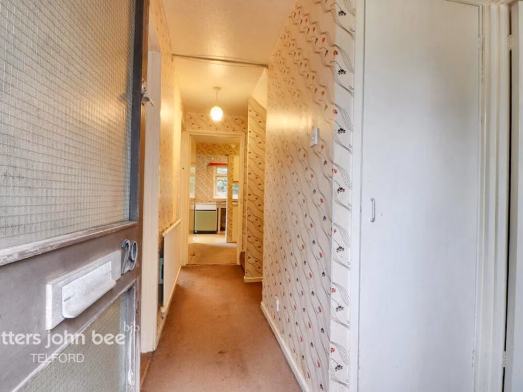
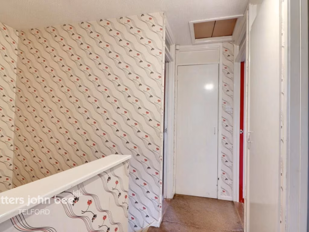
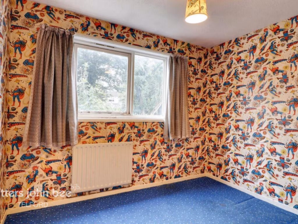
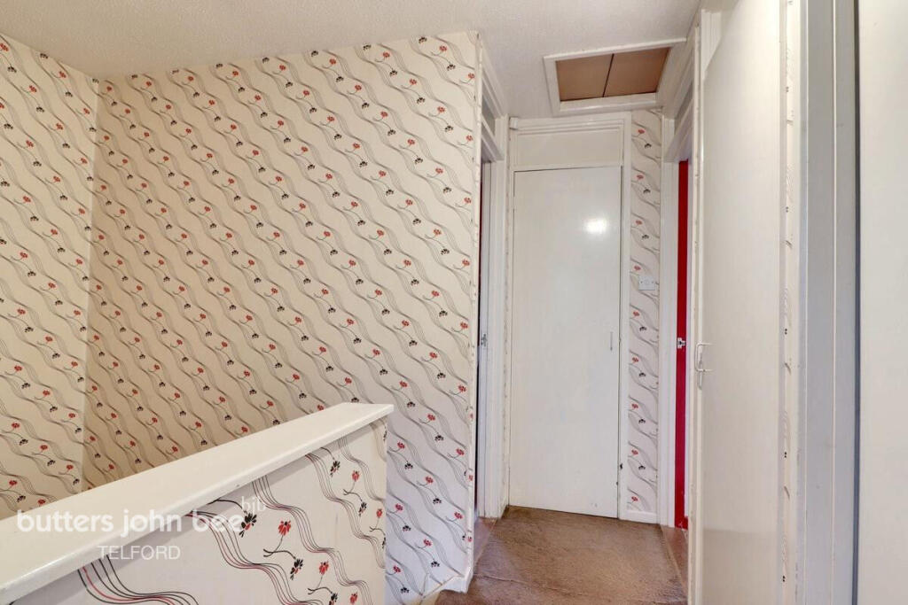
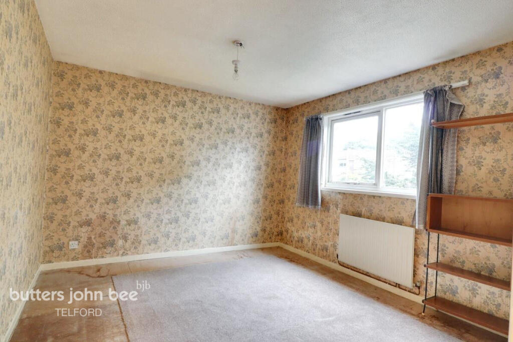
- wallpaper
- vinyl flooring
- laminate cabinets
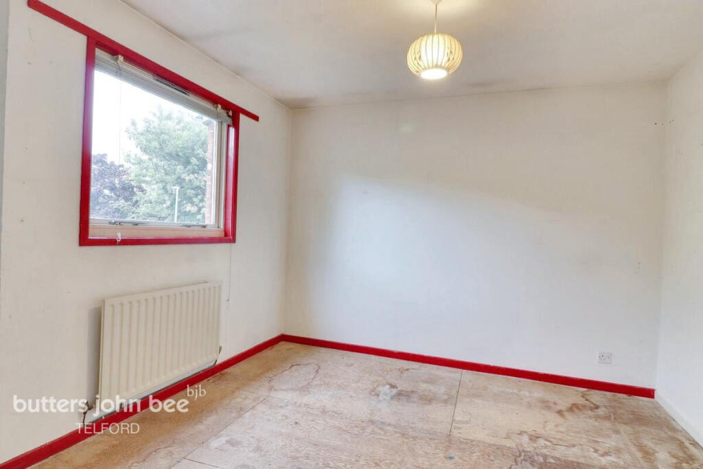
- paint peeling
- unrenovated
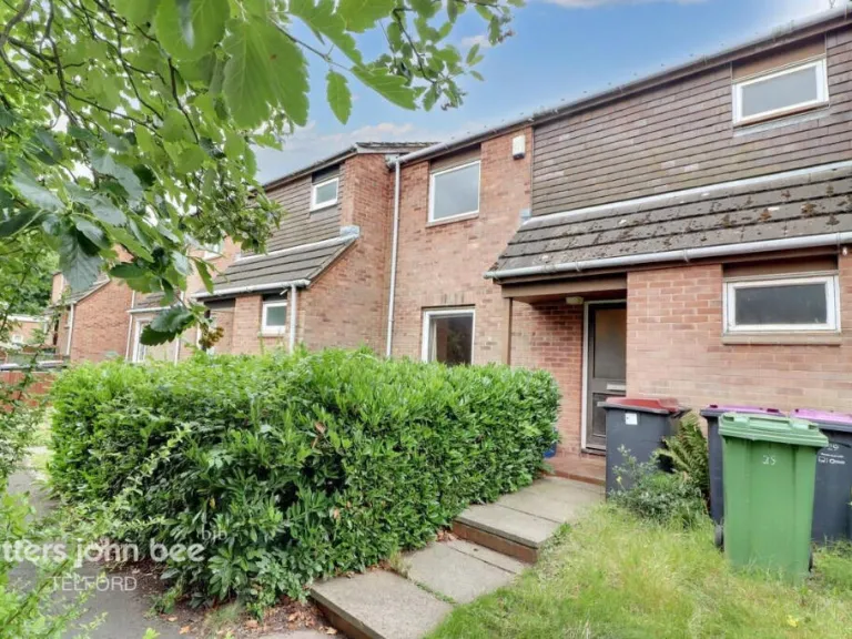
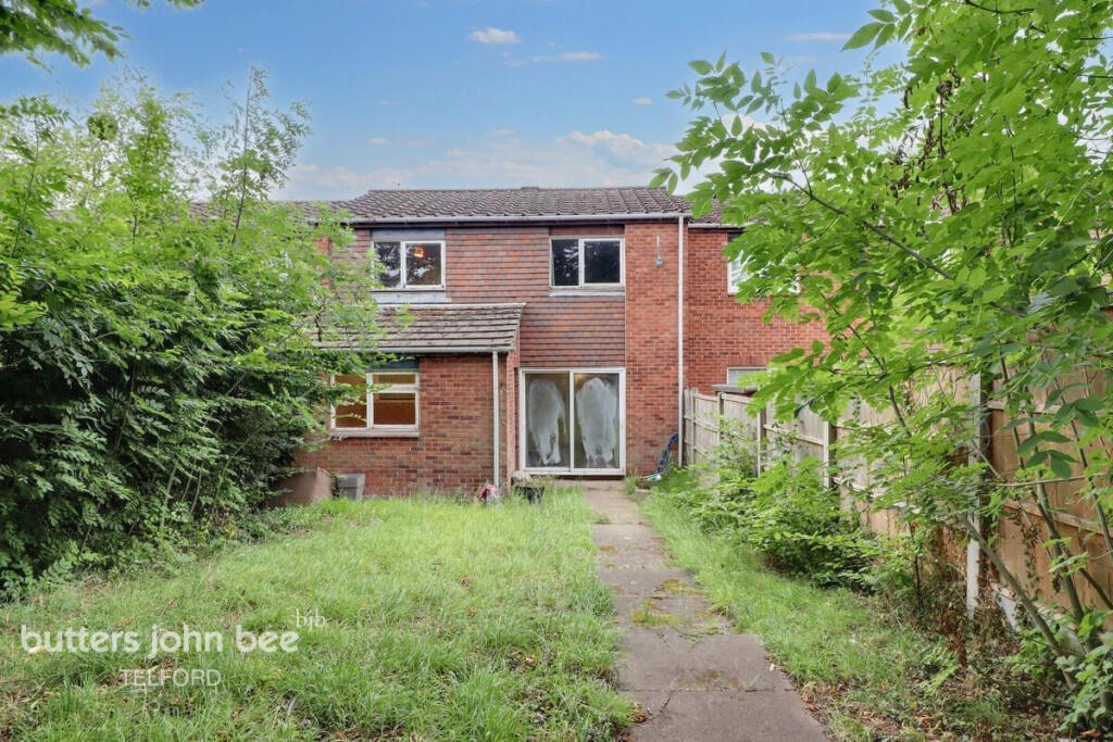
- mid-century modern
- two-story
- townhouse
- brick exterior
- sloped roof
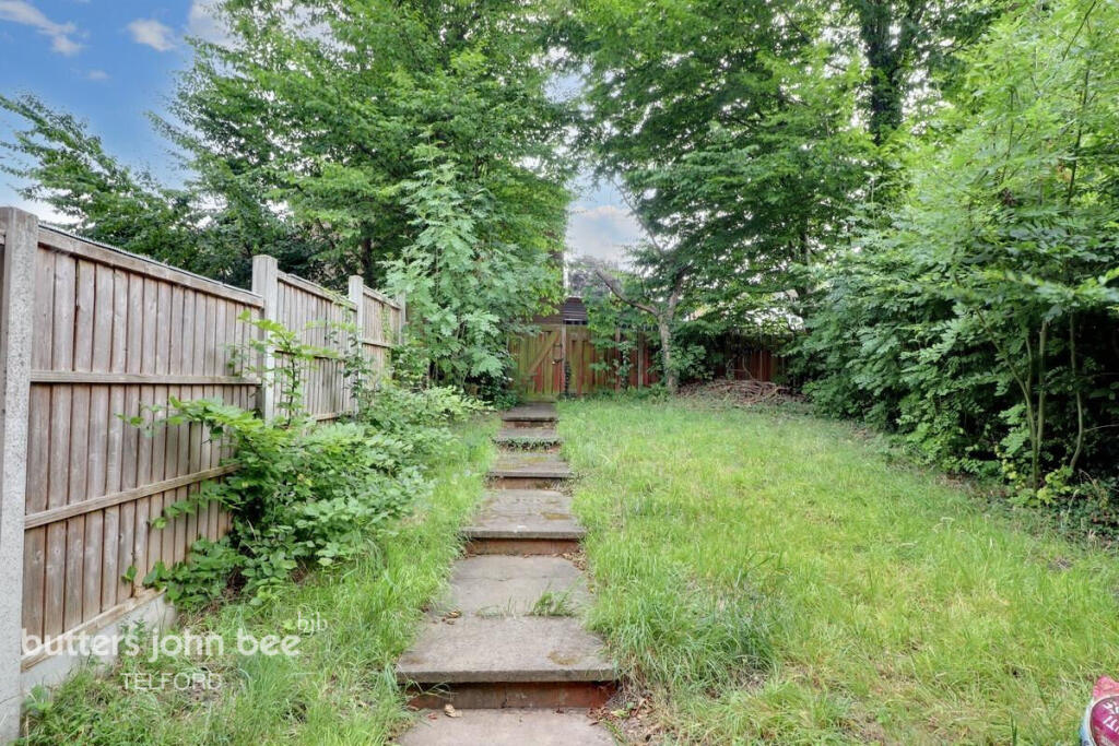
- greenery
- low-maintenance garden
EPC Details
- Fully double glazed
- Timber frame, as built, partial insulation (assumed)
- Boiler and radiators, mains gas
- Low energy lighting in 83% of fixed outlets
- Solid, no insulation (assumed)
Nearby Schools
- Lawley Village Academy
- Kickstart Academy
- Priorslee Academy
- Meadows Primary School and Nursery
- Hadley Learning Community - Primary Phase
- Wrockwardine Wood Infant School and Nursery
- Wrockwardine Wood Church of England Junior School
- Donnington Wood CofE Voluntary Controlled Junior School
- St Lawrence Church of England Voluntary Controlled Primary School
- The Telford Langley School
- Ladygrove Primary School
- Old Park Primary School
- Newdale Primary School & Nursery
- Lantern Academy
- Millbrook Primary School
- Donnington Wood Infant School and Nursery Centre
- Hollinswood Primary School
- Lawley Primary School
- St George's Church of England Primary School
- Wombridge Primary School
- Teagues Bridge Primary School
- Thomas Telford School
- Redhill Primary Academy
- Hadley Learning Community - Secondary Phase
- St Matthew's Church of England Aided Primary School and Nursery Centre
- Muxton Primary School
Nearest General Shops
- Id: 802362485
- Tags:
- TagsNormalized:
- Lat: 52.7086447
- Lon: -2.4445066
- FullGeoHash: gcq7b77fngeb
- PartitionGeoHash: gcq7
- Images:
- FoodStandards: null
- Distance: 918.3
,- Id: 5090584499
- Tags:
- Name: Perfection
- Shop: hairdresser
- TagsNormalized:
- Lat: 52.7137315
- Lon: -2.4543745
- FullGeoHash: gcq7bhhz8zv8
- PartitionGeoHash: gcq7
- Images:
- FoodStandards: null
- Distance: 876.8
,- Id: 5090584498
- Tags:
- Brand: Betfred
- Brand:wikidata: Q4897425
- Name: Betfred
- Shop: bookmaker
- TagsNormalized:
- Lat: 52.7137133
- Lon: -2.45447
- FullGeoHash: gcq7bhhxwsqs
- PartitionGeoHash: gcq7
- Images:
- FoodStandards: null
- Distance: 873.3
}
Nearest Grocery shops
- Id: 448314320
- Tags:
- TagsNormalized:
- Lat: 52.7150366
- Lon: -2.44548
- FullGeoHash: gcq7bk7r25jc
- PartitionGeoHash: gcq7
- Images:
- FoodStandards: null
- Distance: 1282.6
,- Id: 388720062
- Tags:
- Building: yes
- Name: Forge Stores
- Opening_hours: Mo-Su 09:00-21:00
- Shop: convenience
- TagsNormalized:
- Lat: 52.7113746
- Lon: -2.4432498
- FullGeoHash: gcq7b7ufh0kv
- PartitionGeoHash: gcq7
- Images:
- FoodStandards: null
- Distance: 1124.3
,- Id: 5090584493
- Tags:
- Addr:
- Housenumber: 107
- Postcode: TF2 7DP
- Street: Trench Road
- Brand: One Stop
- Brand:wikidata: Q65954217
- Fhrs:
- Name: One Stop
- Shop: convenience
- Source:
- TagsNormalized:
- Lat: 52.7136961
- Lon: -2.4546257
- FullGeoHash: gcq7bhhxe14m
- PartitionGeoHash: gcq7
- Images:
- FoodStandards: null
- Distance: 869.1
}
Nearest Religious buildings
- Id: 878871902
- Tags:
- Amenity: place_of_worship
- Building: church
- Denomination: anglican
- Name: Holy Trinity
- Religion: christian
- Wikidata: Q26635053
- TagsNormalized:
- place of worship
- church
- anglican
- christian
- Lat: 52.7105686
- Lon: -2.4464204
- FullGeoHash: gcq7b7dt660t
- PartitionGeoHash: gcq7
- Images:
- FoodStandards: null
- Distance: 896.2
,- Id: 400209492
- Tags:
- Addr:
- Postcode: TF2 7HG
- Street: Church Road
- Amenity: school
- Fhrs:
- Name: Wrockwardine Wood Church of England Junior School
- Ref:
- Source: bing
- Website: http://www.wrockwardinewoodjunior.org.uk/
- Wikidata: Q66163764
- TagsNormalized:
- Lat: 52.7116785
- Lon: -2.4524123
- FullGeoHash: gcq7b5y5y9hf
- PartitionGeoHash: gcq7
- Images:
- FoodStandards:
- Id: 249332
- FHRSID: 249332
- LocalAuthorityBusinessID: 04640/2019/2/000
- BusinessName: Wrockwardine Wood C Of E Junior School
- BusinessType: School/college/university
- BusinessTypeID: 7845
- AddressLine1: Wrockwardine Wood Infant School Church Road
- AddressLine2: Wrockwardine Wood
- AddressLine3: Telford
- AddressLine4: Shropshire
- PostCode: TF2 7AH
- RatingValue: 5
- RatingKey: fhrs_5_en-GB
- RatingDate: 2023-01-13
- LocalAuthorityCode: 900
- LocalAuthorityName: Telford and Wrekin Council
- LocalAuthorityWebSite: http://www.telford.gov.uk/
- LocalAuthorityEmailAddress: Food@telford.gov.uk
- Scores:
- Hygiene: 0
- Structural: 5
- ConfidenceInManagement: 0
- NewRatingPending: false
- Geocode:
- Longitude: null
- Latitude: null
- Distance: 710.2
,- Id: 495905510
- Tags:
- Amenity: place_of_worship
- Building: church
- Denomination: anglican
- Name: St Mary and St Leonard
- Religion: christian
- Wikidata: Q105081086
- TagsNormalized:
- place of worship
- church
- anglican
- christian
- Lat: 52.7013954
- Lon: -2.4587812
- FullGeoHash: gcq7b1cxfhpv
- PartitionGeoHash: gcq7
- Images:
- FoodStandards: null
- Distance: 527.5
}
Nearest Medical buildings
- Id: 3635693013
- Tags:
- Amenity: clinic
- Healthcare: clinic
- Name: Back to Health
- TagsNormalized:
- Lat: 52.6954425
- Lon: -2.4489255
- FullGeoHash: gcq7b2btpyky
- PartitionGeoHash: gcq7
- Images:
- FoodStandards: null
- Distance: 1314.3
,- Id: 3635756699
- Tags:
- Amenity: pharmacy
- Healthcare: pharmacy
- Name: Kendrick's
- TagsNormalized:
- Lat: 52.6958476
- Lon: -2.4504661
- FullGeoHash: gcq7b0zxs1bp
- PartitionGeoHash: gcq7
- Images:
- FoodStandards: null
- Distance: 1230.5
,- Id: 358583328
- Tags:
- Addr:
- Housenumber: 27
- Street: Limes Walk
- Amenity: doctors
- Building: yes
- Description: Extended hours are available via larger surgery network by calling 03300 536 456.
- Healthcare: doctor
- Name: Oakengates Medical Practice
- Opening_hours: Mo, Tu, Th, Fr 08:00-18:00; We 08:00-20:00
- Phone: +44 3300 536 456
- Source: bing
- Website: https://www.teldoc.org/oakengates-medical-centre
- TagsNormalized:
- doctor
- doctors
- health
- healthcare
- Lat: 52.6959701
- Lon: -2.4503427
- FullGeoHash: gcq7b1p8qbu1
- PartitionGeoHash: gcq7
- Images:
- FoodStandards: null
- Distance: 1221.2
,- Id: 358191990
- Tags:
- Amenity: doctors
- Building: yes
- Healthcare: doctor
- Name: Oakengates Clinic
- Source: bing
- TagsNormalized:
- doctor
- doctors
- health
- healthcare
- clinic
- Lat: 52.6961611
- Lon: -2.4505534
- FullGeoHash: gcq7b1p93uqv
- PartitionGeoHash: gcq7
- Images:
- FoodStandards: null
- Distance: 1196.1
}
Nearest Leisure Facilities
- Id: 661126294
- Tags:
- TagsNormalized:
- Lat: 52.7065445
- Lon: -2.4654809
- FullGeoHash: gcq5zfutyhh0
- PartitionGeoHash: gcq5
- Images:
- FoodStandards: null
- Distance: 543.1
,- Id: 448216087
- Tags:
- TagsNormalized:
- Lat: 52.7017519
- Lon: -2.4599847
- FullGeoHash: gcq7b409ynw7
- PartitionGeoHash: gcq7
- Images:
- FoodStandards: null
- Distance: 509.5
,- Id: 448364294
- Tags:
- TagsNormalized:
- Lat: 52.7082408
- Lon: -2.4524231
- FullGeoHash: gcq7b5npy2hz
- PartitionGeoHash: gcq7
- Images:
- FoodStandards: null
- Distance: 416.3
,- Id: 552160630
- Tags:
- TagsNormalized:
- Lat: 52.7063844
- Lon: -2.4587939
- FullGeoHash: gcq7b4cscynm
- PartitionGeoHash: gcq7
- Images:
- FoodStandards: null
- Distance: 96.5
,- Id: 552160627
- Tags:
- TagsNormalized:
- Lat: 52.7060572
- Lon: -2.458586
- FullGeoHash: gcq7b4cenc1m
- PartitionGeoHash: gcq7
- Images:
- FoodStandards: null
- Distance: 76
}
Nearest Tourist attractions
- Id: 10595819493
- Tags:
- TagsNormalized:
- Lat: 52.7166751
- Lon: -2.412474
- FullGeoHash: gcq7chg2ck3p
- PartitionGeoHash: gcq7
- Images:
- FoodStandards: null
- Distance: 3251.7
,- Id: 6713290826
- Tags:
- Addr:
- City: Telford
- Place: Preston on the Weald Moors
- Postcode: TF6 6DJ
- Street: Humber Lane
- Name: Hoo Farm Animal Kingdom
- Phone: +44 1952 677917
- Tourism: zoo
- Website: https://www.hoo-zoo.com/
- TagsNormalized:
- Lat: 52.7309694
- Lon: -2.4573836
- FullGeoHash: gcq7bp6s4v1u
- PartitionGeoHash: gcq7
- Images:
- FoodStandards: null
- Distance: 2768.6
,- Id: 443541045
- Tags:
- Name: Furnace House Bed & Breakfast
- Tourism: guest_house
- TagsNormalized:
- Lat: 52.7145316
- Lon: -2.4450776
- FullGeoHash: gcq7bk7s3scv
- PartitionGeoHash: gcq7
- Images:
- FoodStandards: null
- Distance: 1257.3
}
Nearest Train stations
- Id: 814684302
- Tags:
- Name: Spring Village
- Public_transport: station
- Railway: station
- Usage: tourism
- TagsNormalized:
- Lat: 52.6628632
- Lon: -2.4825389
- FullGeoHash: gcq5xdbr2thz
- PartitionGeoHash: gcq5
- Images:
- FoodStandards: null
- Distance: 5093.2
,- Id: 367981086
- Tags:
- Name: Horsehay & Dawley
- Public_transport: station
- Railway: station
- Usage: tourism
- Wikidata: Q28970323
- TagsNormalized:
- Lat: 52.6629789
- Lon: -2.4816699
- FullGeoHash: gcq5xe0bhfuc
- PartitionGeoHash: gcq5
- Images:
- FoodStandards: null
- Distance: 5061.9
,- Id: 3711424258
- Tags:
- Name: Wellington
- Naptan:
- Network: National Rail
- Public_transport: station
- Railway: station
- Ref:
- Wheelchair: yes
- Wikidata: Q1851350
- Wikipedia: en:Wellington railway station (Shropshire)
- TagsNormalized:
- Lat: 52.7014362
- Lon: -2.5167193
- FullGeoHash: gcq5ydp2h5y0
- PartitionGeoHash: gcq5
- Images:
- FoodStandards: null
- Distance: 4025.9
,- Id: 3711941422
- Tags:
- Name: Telford Central
- Naptan:
- Network: National Rail
- Public_transport: station
- Railway: station
- Ref:
- Wikipedia: en:Telford Central railway station
- TagsNormalized:
- Lat: 52.6811135
- Lon: -2.441178
- FullGeoHash: gcq78qq3srmf
- PartitionGeoHash: gcq7
- Images:
- FoodStandards: null
- Distance: 2984.2
,- Id: 3711941420
- Tags:
- Name: Oakengates
- Naptan:
- Network: National Rail
- Public_transport: station
- Railway: station
- Ref:
- Wikidata: Q2384836
- Wikipedia: en:Oakengates railway station
- TagsNormalized:
- Lat: 52.6930906
- Lon: -2.450188
- FullGeoHash: gcq7b0rzd2p2
- PartitionGeoHash: gcq7
- Images:
- FoodStandards: null
- Distance: 1524.2
}
Nearest Bus stations and stops
- Id: 9654356818
- Tags:
- Bus: yes
- Highway: bus_stop
- Public_transport: platform
- TagsNormalized:
- Lat: 52.7135703
- Lon: -2.4545203
- FullGeoHash: gcq7bhhwv99p
- PartitionGeoHash: gcq7
- Images:
- FoodStandards: null
- Distance: 857.1
,- Id: 9654356817
- Tags:
- Bus: yes
- Highway: bus_stop
- Public_transport: platform
- TagsNormalized:
- Lat: 52.7134558
- Lon: -2.4545391
- FullGeoHash: gcq7bhhwjh6u
- PartitionGeoHash: gcq7
- Images:
- FoodStandards: null
- Distance: 844.4
,- Id: 9654357176
- Tags:
- Bus: yes
- Highway: bus_stop
- Public_transport: platform
- TagsNormalized:
- Lat: 52.7110801
- Lon: -2.4658795
- FullGeoHash: gcq5zgu2kcdb
- PartitionGeoHash: gcq5
- Images:
- FoodStandards: null
- Distance: 795.1
,- Id: 9654357175
- Tags:
- Bus: yes
- Highway: bus_stop
- Public_transport: platform
- TagsNormalized:
- Lat: 52.71115
- Lon: -2.4654074
- FullGeoHash: gcq5zgu8xye1
- PartitionGeoHash: gcq5
- Images:
- FoodStandards: null
- Distance: 778.3
,- Id: 9654357171
- Tags:
- Bus: yes
- Highway: bus_stop
- Public_transport: platform
- TagsNormalized:
- Lat: 52.7128326
- Lon: -2.4594717
- FullGeoHash: gcq7bh14d0hy
- PartitionGeoHash: gcq7
- Images:
- FoodStandards: null
- Distance: 764
}
Nearest Hotels
- Id: 358442031
- Tags:
- Brand: Premier Inn
- Brand:wikidata: Q2108626
- Building: yes
- Name: Premier Inn
- Source: Local Knowledge/Bing Aerial
- Tourism: hotel
- TagsNormalized:
- Lat: 52.7245027
- Lon: -2.4346859
- FullGeoHash: gcq7bw5n7xwt
- PartitionGeoHash: gcq7
- Images:
- FoodStandards: null
- Distance: 2560
,- Id: 522633734
- Tags:
- Building: yes
- Name: Hadley Park House Hotel
- Tourism: hotel
- TagsNormalized:
- Lat: 52.717609
- Lon: -2.4807244
- FullGeoHash: gcq5zscw6ftf
- PartitionGeoHash: gcq5
- Images:
- FoodStandards: null
- Distance: 2025.5
,- Id: 670722811
- Tags:
- Building: hotel
- Tourism: hotel
- TagsNormalized:
- Lat: 52.7173162
- Lon: -2.4764031
- FullGeoHash: gcq5zsusxsh0
- PartitionGeoHash: gcq5
- Images:
- FoodStandards: null
- Distance: 1786.7
}
Tags
- kitchen
- mid-century
- dated
- needs modernization
- wallpaper
- vinyl flooring
- laminate cabinets
- paint peeling
- unrenovated
- mid-century modern
- two-story
- townhouse
- brick exterior
- sloped roof
- greenery
- low-maintenance garden
Local Market Stats
- Average Price/sqft: £233
- Avg Income: £42800
- Rental Yield: 4.5%
- Social Housing: 17%
- Planning Success Rate: 92%
AirBnB Data
- 1km average: £75/night
- Listings in 1km: 2
Similar Properties
 3 bedroom semi-detached house for sale in Garden Close, Telford, TF2 — £140,000 • 3 bed • 1 bath
 3 bedroom semi-detached house for sale in Hilltop Road, Telford, TF2 — £90,000 • 3 bed • 1 bath
 3 bedroom semi-detached house for sale in 2 Queenswood Close, Ketley Bank, Telford, Shropshire TF2 0BB, TF2 — £120,000 • 3 bed • 1 bath • 883 ft²
 2 bedroom town house for sale in 6 Lodge Court, Donnington Wood, Telford TF2 7SE, TF2 — £110,000 • 2 bed • 1 bath • 582 ft²
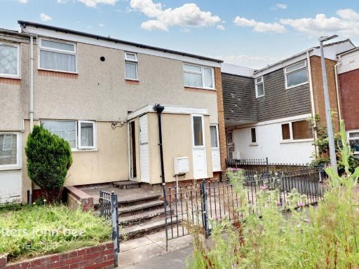 3 bedroom end of terrace house for sale in Selbourne, Telford, TF7 — £110,000 • 3 bed • 1 bath • 872 ft²
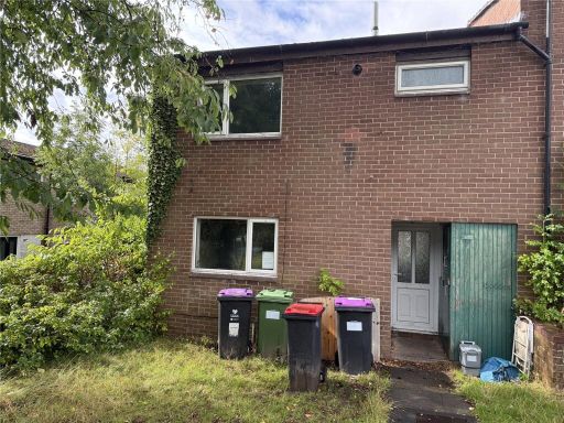 3 bedroom end of terrace house for sale in Brindley Ford, Telford, Shropshire, TF3 — £90,000 • 3 bed • 1 bath
Meta
- {
"@context": "https://schema.org",
"@type": "Residence",
"name": "3 bedroom terraced house for sale in Maple Close, Telford,…",
"description": "",
"url": "https://propertypiper.co.uk/property/6872f05e-cb64-472b-8a68-253dceb0daf8",
"image": "https://image-a.propertypiper.co.uk/8322344d-49f4-4d60-b1ed-eb02b02bdf15-1024.jpeg",
"address": {
"@type": "PostalAddress",
"streetAddress": "39, MAPLE CLOSE",
"postalCode": "TF2 6SN",
"addressLocality": "Telford and Wrekin",
"addressRegion": "Telford",
"addressCountry": "England"
},
"geo": {
"@type": "GeoCoordinates",
"latitude": 52.70607083140913,
"longitude": -2.4574585043775197
},
"numberOfRooms": 3,
"numberOfBathroomsTotal": 2,
"offers": {
"@type": "Offer",
"price": 110000,
"priceCurrency": "GBP",
"availability": "https://schema.org/InStock"
},
"additionalProperty": [
{
"@type": "PropertyValue",
"name": "Feature",
"value": "kitchen"
},
{
"@type": "PropertyValue",
"name": "Feature",
"value": "mid-century"
},
{
"@type": "PropertyValue",
"name": "Feature",
"value": "dated"
},
{
"@type": "PropertyValue",
"name": "Feature",
"value": "needs modernization"
},
{
"@type": "PropertyValue",
"name": "Feature",
"value": "wallpaper"
},
{
"@type": "PropertyValue",
"name": "Feature",
"value": "vinyl flooring"
},
{
"@type": "PropertyValue",
"name": "Feature",
"value": "laminate cabinets"
},
{
"@type": "PropertyValue",
"name": "Feature",
"value": "paint peeling"
},
{
"@type": "PropertyValue",
"name": "Feature",
"value": "unrenovated"
},
{
"@type": "PropertyValue",
"name": "Feature",
"value": "mid-century modern"
},
{
"@type": "PropertyValue",
"name": "Feature",
"value": "two-story"
},
{
"@type": "PropertyValue",
"name": "Feature",
"value": "townhouse"
},
{
"@type": "PropertyValue",
"name": "Feature",
"value": "brick exterior"
},
{
"@type": "PropertyValue",
"name": "Feature",
"value": "sloped roof"
},
{
"@type": "PropertyValue",
"name": "Feature",
"value": "greenery"
},
{
"@type": "PropertyValue",
"name": "Feature",
"value": "low-maintenance garden"
}
]
}