TN23 3JY - 6 bedroom detached house for sale in Juniper Close, Ashford…
View on Property Piper
6 bedroom detached house for sale in Juniper Close, Ashford, TN23
Property Details
- Price: £549995
- Bedrooms: 6
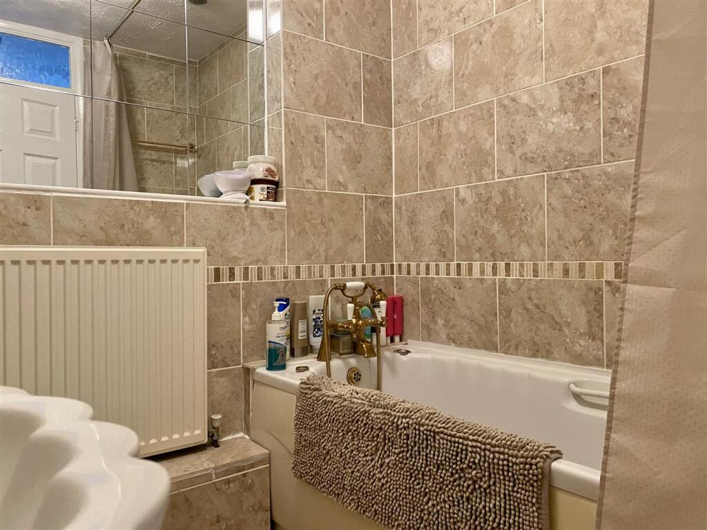
- Bathrooms: 3
- Property Type: undefined
- Property SubType: undefined
Brochure Descriptions
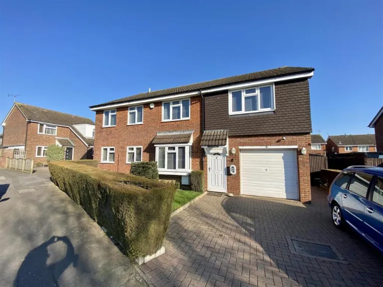
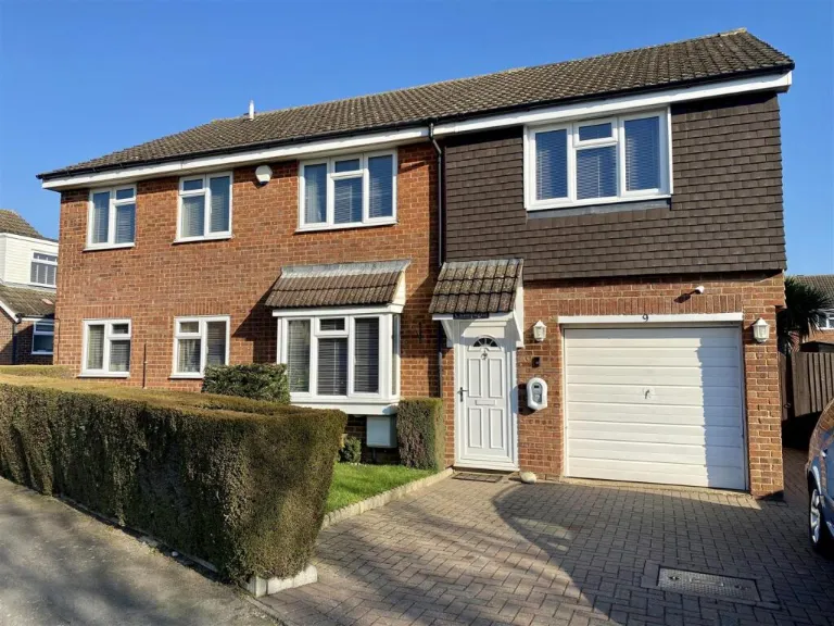
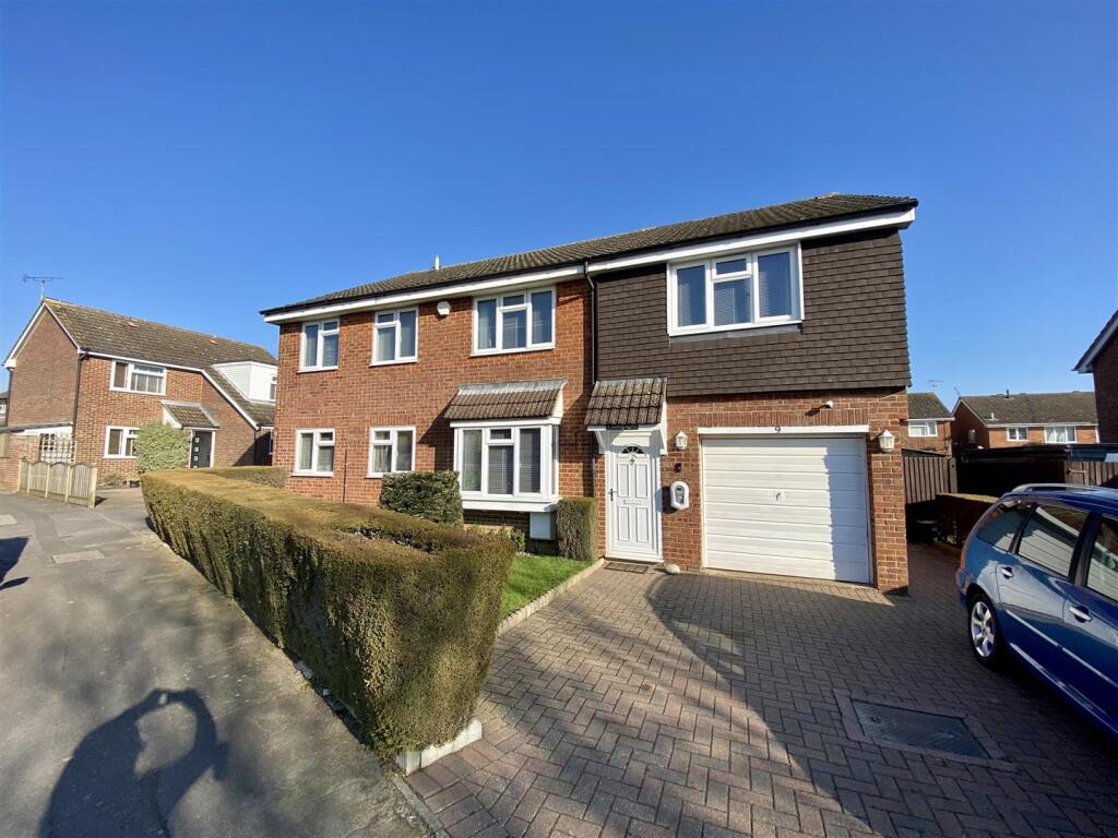
- Two-storey, brick-built family house with integral single garage and block-paved drive providing off-street parking. Property appears to be a semi-detached/linked family home (adjoining to the left) with a projecting ground-floor bay window and an entrance porch. Exterior finishes include brick ground floor with tile-hanging or cladding to the first-floor front elevation. Front garden is small and neatly hedged; likely to have an average-sized rear garden typical of suburban plots. No notable long-distance views visible (residential street setting). Overall plot and building footprint indicate a mid-sized suburban family property suitable for 3–4 bedrooms, with attached garage and private driveway. Total square footage not shown in the images.
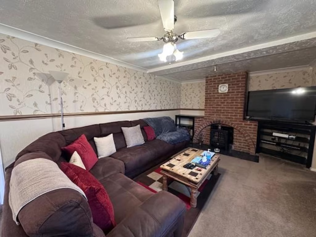
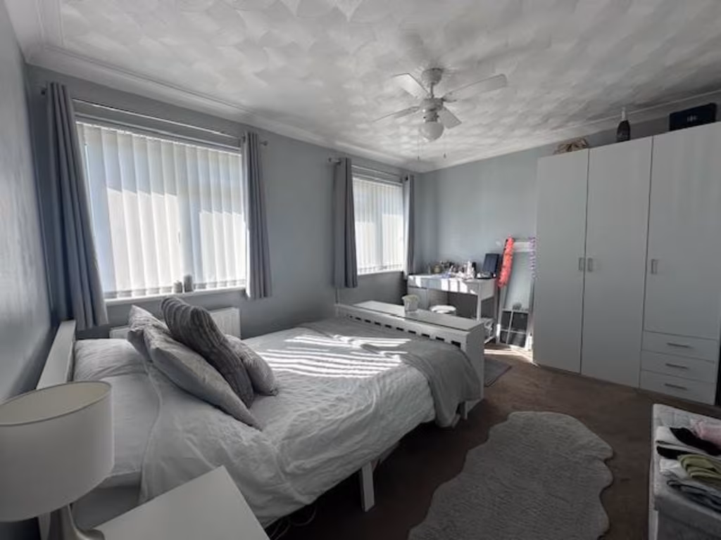
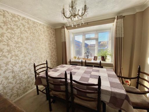
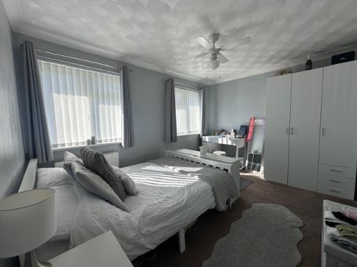
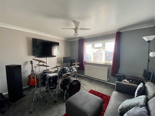
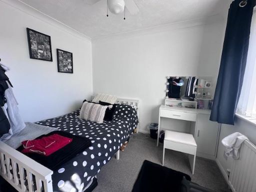
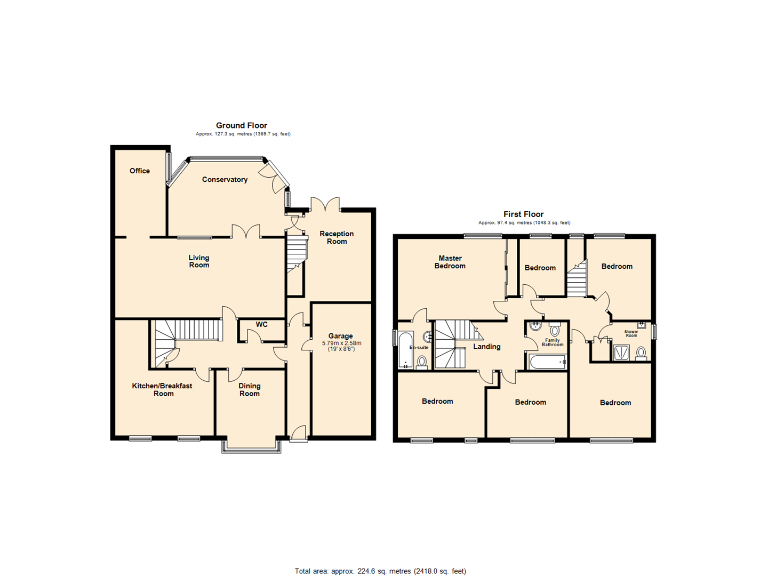
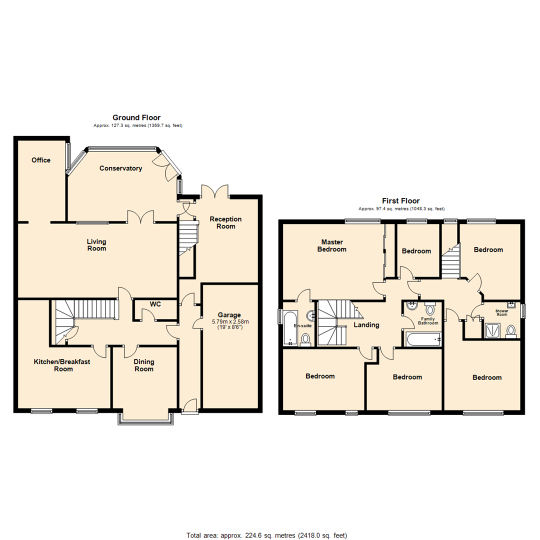
- Detached, substantial two-storey residential property shown as a large family house on a floorplan. Ground floor accommodation includes a kitchen/breakfast room, separate dining room, large living room with adjoining conservatory, reception room, office, cloakroom/WC and integral garage. First floor provides multiple bedrooms including a master bedroom and several further bedrooms served by a family bathroom and additional shower/WC. The layout indicates generous internal circulation and a large footprint suitable for a family or home-office usage (office shown on ground floor). The overall plot/garden size cannot be accurately determined from the plan alone but room sizes and the presence of a conservatory and garage suggest an average-to-large suburban plot. Overall property size is substantial for its type.
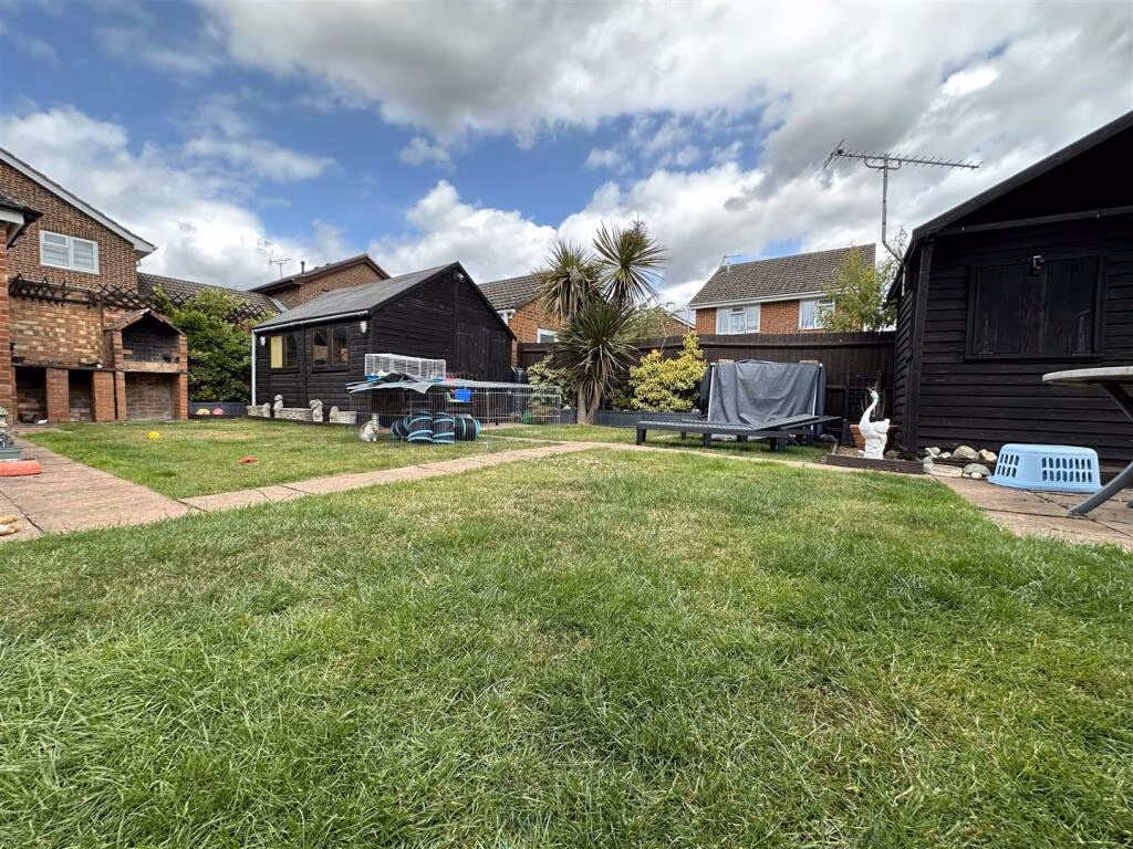
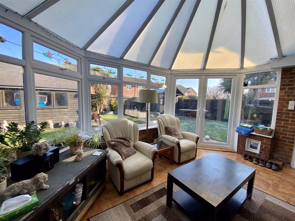
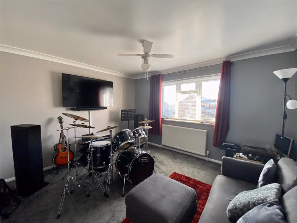
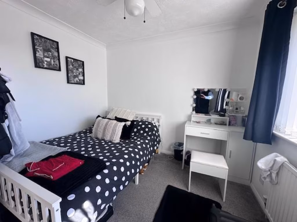
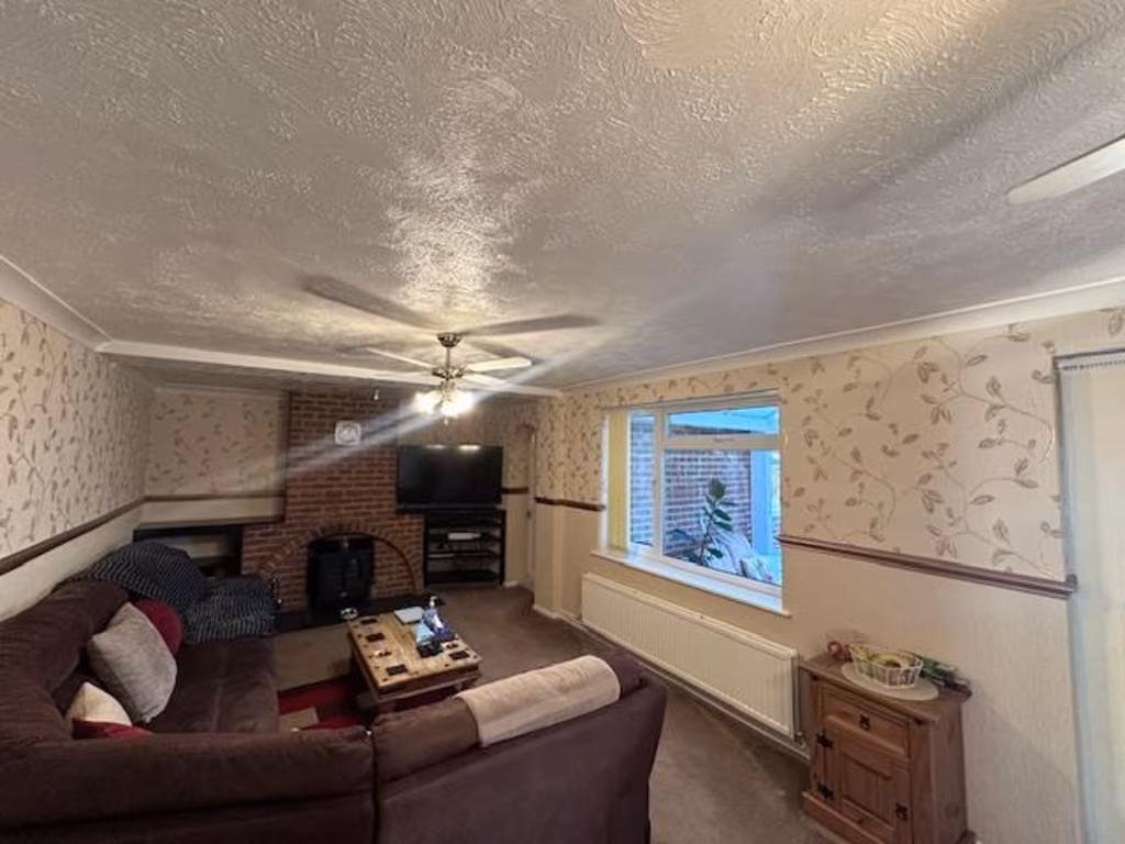
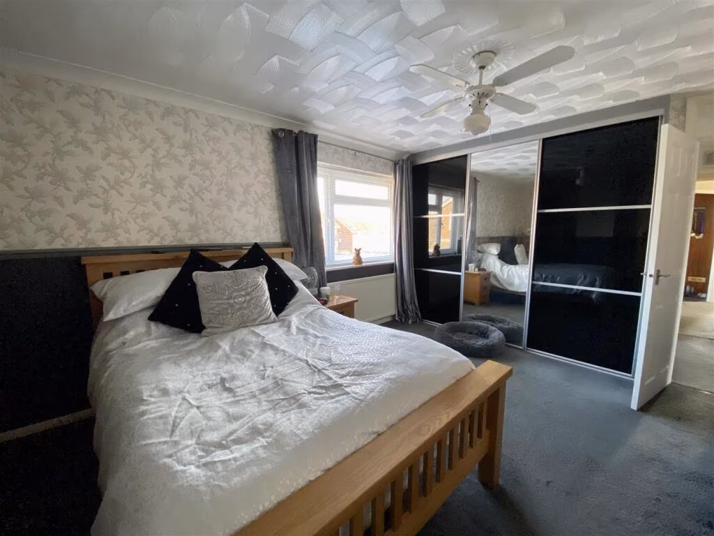
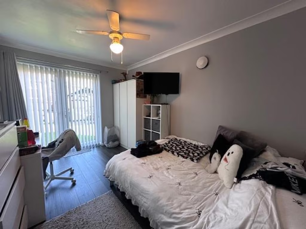
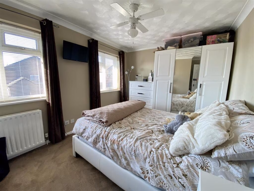
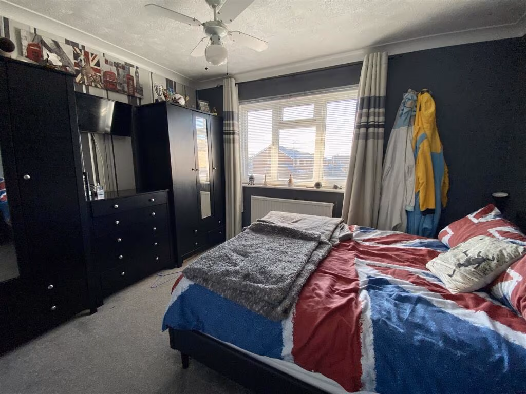
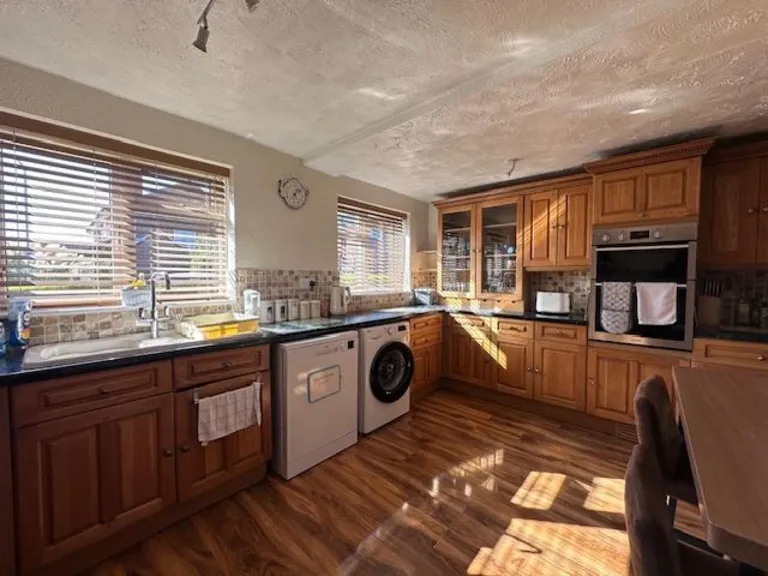
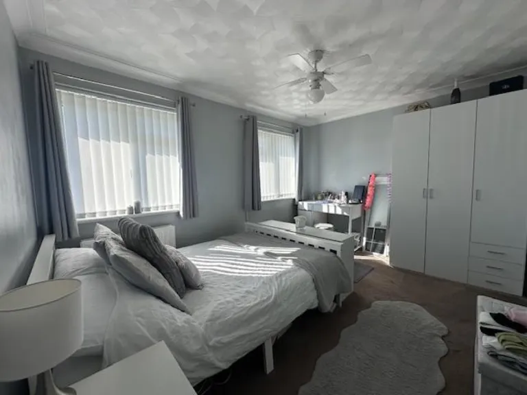
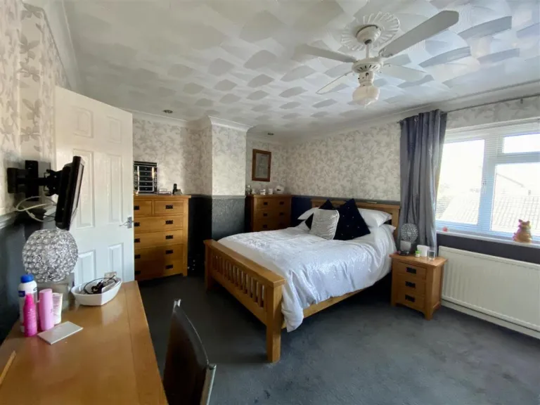
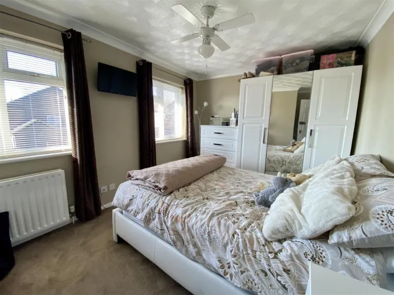
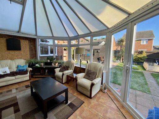
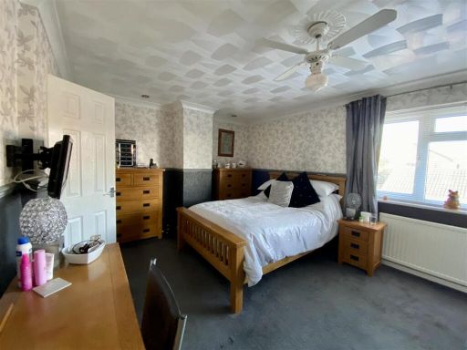
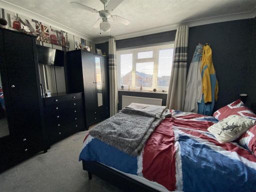
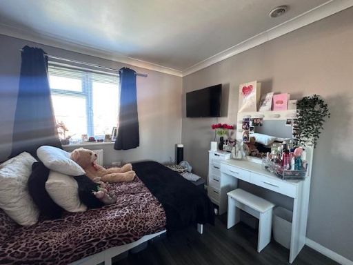
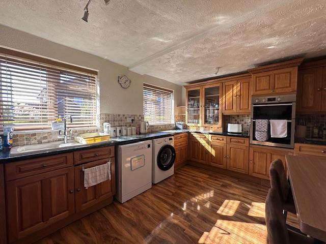
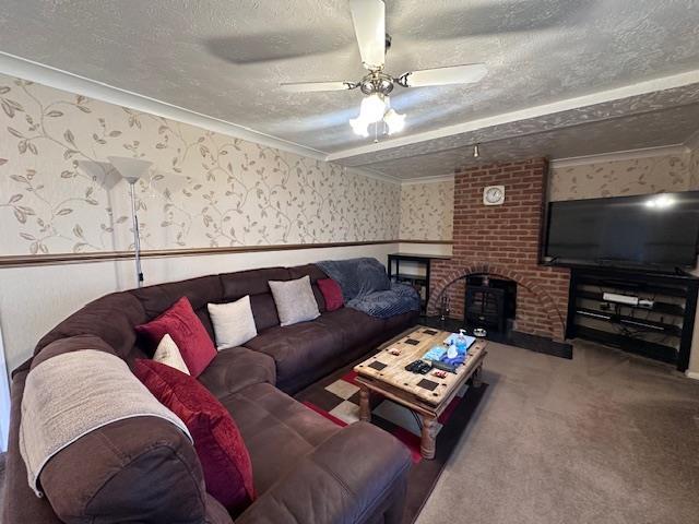
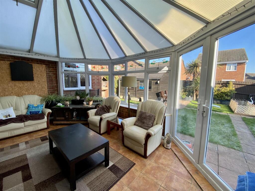
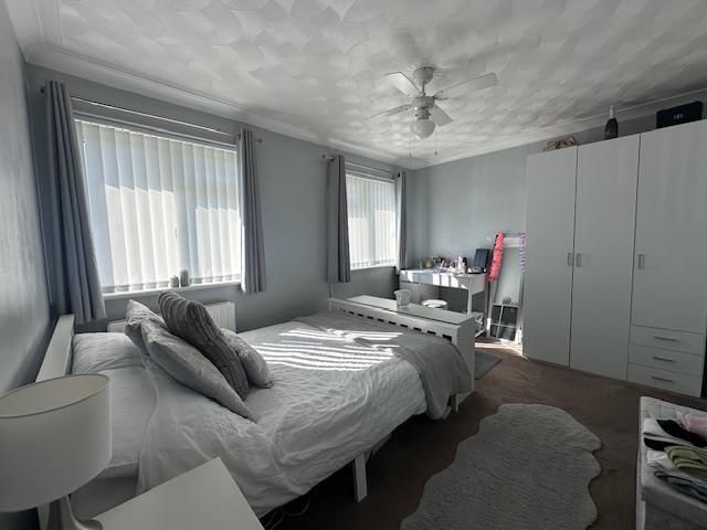
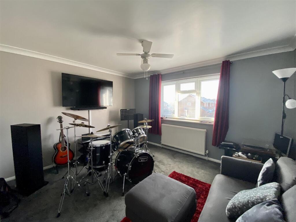
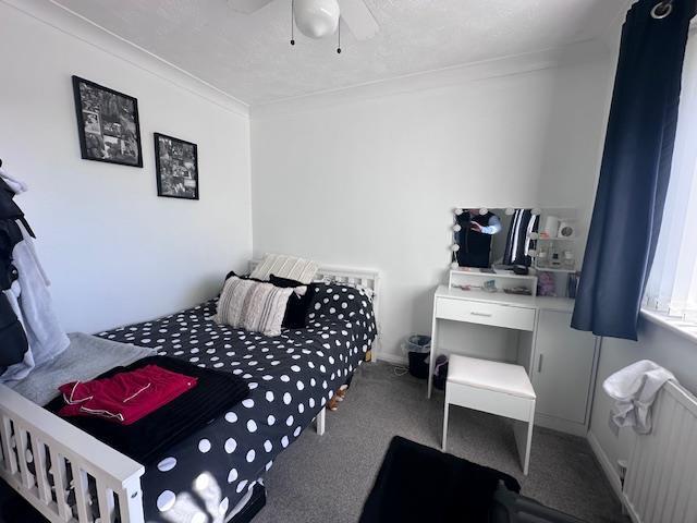
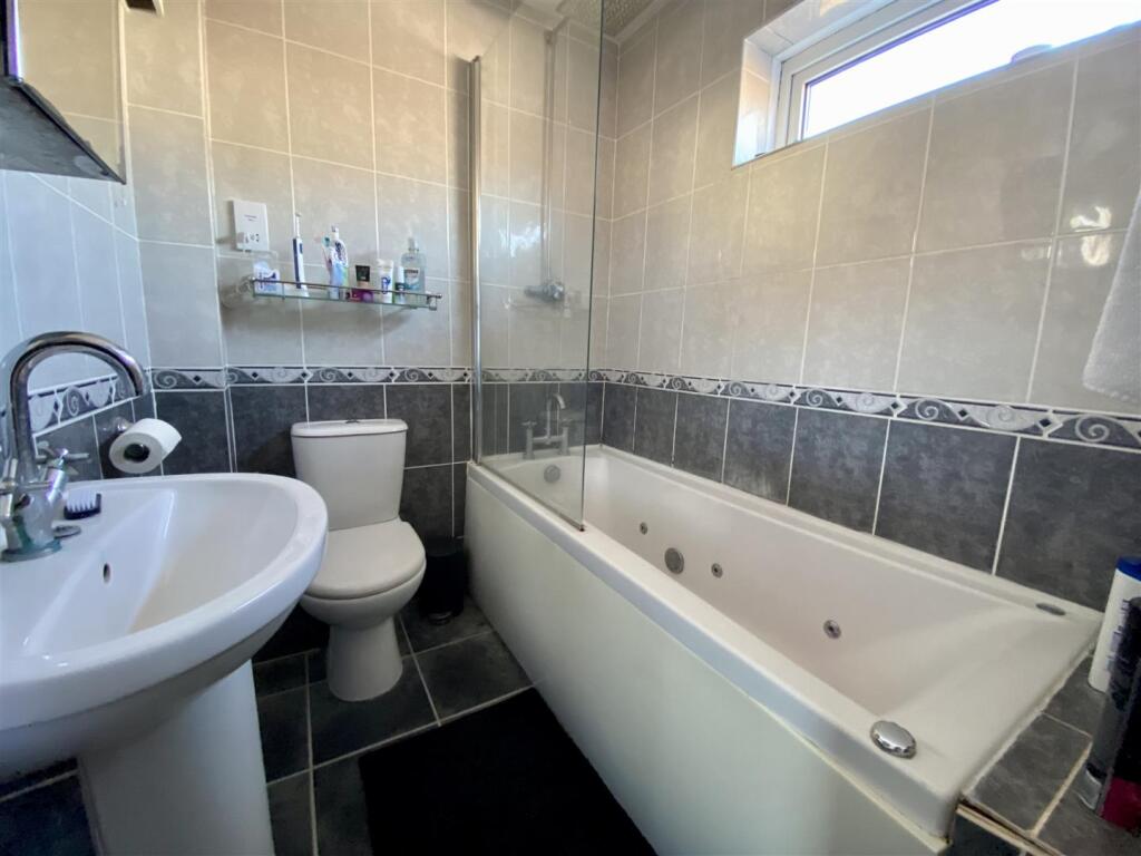
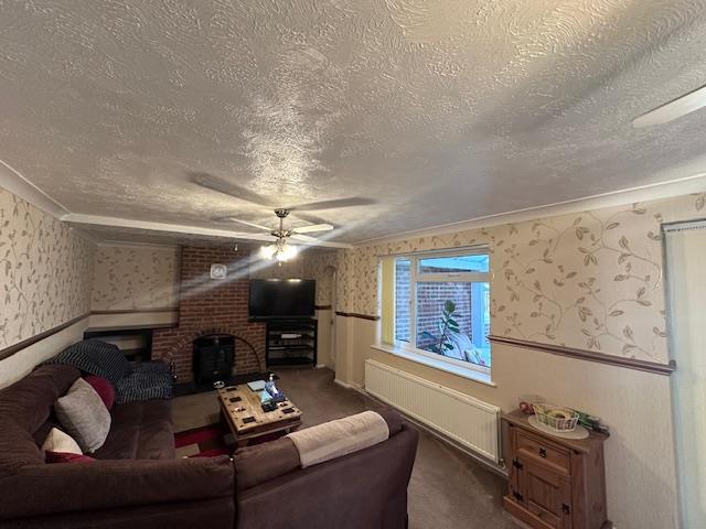
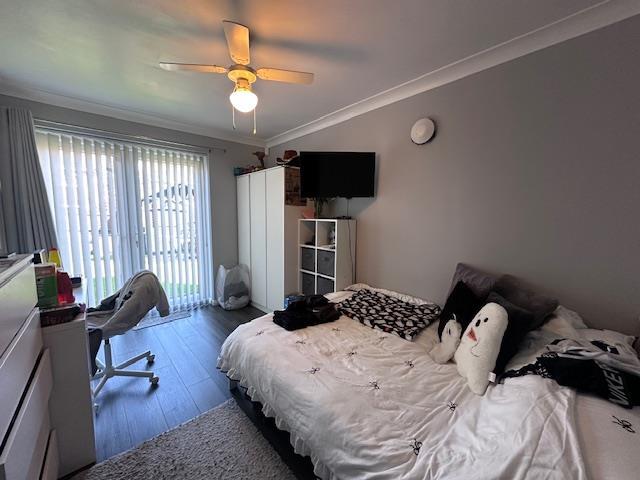
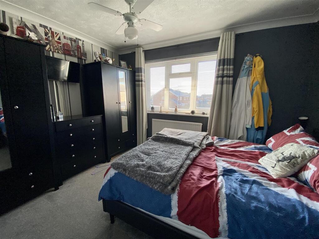
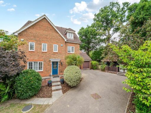
- Six-bedroom detached family house on the Godinton Park development offering approximately 2,400 sq ft of accommodation. The property includes an integral garage, a conservatory (shown in images) with generous glazing overlooking a rear garden and neighbouring houses, an office and multiple reception rooms. Ground floor layout comprises entrance hallway, lounge, dining room, study/reception room and a fitted kitchen; first floor contains six bedrooms, a family bathroom, a shower room and an en suite to the master. The conservatory is large and provides an exceptional light-filled living space with direct access to an average-to-large sized rear garden. Overall the property presents as a substantial, adaptable family home in a residential setting with private garden and good natural light from the conservatory.
Image Descriptions
- detached house modern
- backyard
Textual Property Features
Detected Visual Features
- detached house
- modern style
- brick construction
- attached garage
- double glazing
- well-maintained hedges
- driveway parking
- family home
- residential area
- garden
- backyard
- lawn
- detached
- shed
- patio
- suburban
- semi-detached
- residential
EPC Details
- Fully double glazed
- Cavity wall, filled cavity
- Boiler and radiators, mains gas
- Low energy lighting in 83% of fixed outlets
- Solid, no insulation (assumed)
Nearby Schools
- The John Wallis Church of England Academy
- Beaver Green Primary School
- Great Chart Primary School
- Chilmington Green School
- Ashford School
- Ashford, St Mary's Church of England Primary School
- Phoenix Community Primary School
- Kennington Church of England Academy
- Towers School and Sixth Form Centre
- Kingsnorth Church of England Primary School
- Chilmington Green Primary School
- Ashford Oaks Community Primary School
- Godinton Primary School
- The John Wesley Church of England Methodist Voluntary Aided Primary School
- St Simon of England Roman Catholic Primary School, Ashford
- The Norton Knatchbull School
- Furley Park Primary Academy
- Finberry Primary School
- East Stour Primary School
- The North School
- Victoria Road Primary School
- Highworth Grammar School
- St Teresa's Catholic Primary School
- Repton Manor Primary School
- Downs View Infant School
- Goat Lees Primary School
Nearest Bars And Restaurants
- Id: 843632040
- Tags:
- Amenity: restaurant
- Building: yes
- Name: Crusader Kebab / Fish Inn
- TagsNormalized:
- Lat: 51.1402025
- Lon: 0.8535705
- FullGeoHash: u10dgmv938sq
- PartitionGeoHash: u10d
- Images:
- FoodStandards: null
- Distance: 1181.9
,- Id: 1656223597
- Tags:
- Amenity: fast_food
- Cuisine: chinese
- Name: Lam's Garden
- Source: local knowledge
- TagsNormalized:
- Lat: 51.1496914
- Lon: 0.8632439
- FullGeoHash: u10dgxs8e196
- PartitionGeoHash: u10d
- Images:
- FoodStandards: null
- Distance: 983.2
,- Id: 2205545698
- Tags:
- Addr:
- Postcode: TN23 3RT
- Street: Sir Bernard Paget Avenue
- Amenity: cafe
- Cuisine: coffee_shop
- Name: Waitrose coffee shop
- Website: https://www.waitrose.com/
- TagsNormalized:
- Lat: 51.1556502
- Lon: 0.8573624
- FullGeoHash: u10e58873bre
- PartitionGeoHash: u10e
- Images:
- FoodStandards: null
- Distance: 809.5
,- Id: 97862309
- Tags:
- Amenity: pub
- Building: yes
- Name: The New Chimneys
- Source: Bing
- TagsNormalized:
- Lat: 51.1543537
- Lon: 0.8460277
- FullGeoHash: u10e52259yev
- PartitionGeoHash: u10e
- Images:
- FoodStandards: null
- Distance: 485.1
,- Id: 6780714783
- Tags:
- Amenity: fast_food
- Name: Burger Van
- TagsNormalized:
- Lat: 51.1510945
- Lon: 0.852561
- FullGeoHash: u10dgrubdp5e
- PartitionGeoHash: u10d
- Images:
- FoodStandards: null
- Distance: 244.2
}
Nearest General Shops
- Id: 28133085
- Tags:
- Brand: Matalan
- Brand:wikidata: Q12061509
- Brand:wikipedia: en:Matalan
- Name: Matalan
- Operator: Matalan
- Shop: clothes
- TagsNormalized:
- Lat: 51.1470365
- Lon: 0.8476099
- FullGeoHash: u10dgr11ndxv
- PartitionGeoHash: u10d
- Images:
- FoodStandards: null
- Distance: 397.9
,- Id: 103848965
- Tags:
- Building: yes
- Name: Ashford Self Storage
- Shop: storage_rental
- Source: Bing
- TagsNormalized:
- storage
- storage rental
- shop
- Lat: 51.1509427
- Lon: 0.853577
- FullGeoHash: u10dgrtxcfc4
- PartitionGeoHash: u10d
- Images:
- FoodStandards: null
- Distance: 309.5
,- Id: 103848958
- Tags:
- Building: yes
- Name: VJ Technology
- Shop: doityourself
- Source: Bing
- TagsNormalized:
- Lat: 51.1506213
- Lon: 0.8526021
- FullGeoHash: u10dgrsvgnfj
- PartitionGeoHash: u10d
- Images:
- FoodStandards: null
- Distance: 237.6
}
Nearest Grocery shops
- Id: 10600812150
- Tags:
- Brand: McColl's
- Brand:wikidata: Q16997477
- Name: McColl's
- Shop: convenience
- TagsNormalized:
- Lat: 51.1400612
- Lon: 0.8395538
- FullGeoHash: u10dgjg27n2e
- PartitionGeoHash: u10d
- Images:
- FoodStandards: null
- Distance: 1339.2
,- Id: 1656223594
- Tags:
- Name: Min's Convenience Store
- Shop: convenience
- Source: local knowledge
- TagsNormalized:
- Lat: 51.1494836
- Lon: 0.8641478
- FullGeoHash: u10dgxmr24g6
- PartitionGeoHash: u10d
- Images:
- FoodStandards: null
- Distance: 1048.2
,- Id: 544405701
- Tags:
- Building: yes
- Name: Co-Op
- Shop: convenience
- TagsNormalized:
- Lat: 51.154123
- Lon: 0.8463315
- FullGeoHash: u10e52262gwt
- PartitionGeoHash: u10e
- Images:
- FoodStandards: null
- Distance: 452.7
}
Nearest Supermarkets
- Id: 55854168
- Tags:
- Addr:
- Postcode: TN24 8YN
- Street: Simone Weil Avenue
- Brand: Sainsbury's
- Brand:wikidata: Q152096
- Brand:wikipedia: en:Sainsbury's
- Building: yes
- Name: Sainsbury's
- Shop: supermarket
- TagsNormalized:
- sainsburys
- supermarket
- shop
- Lat: 51.1586113
- Lon: 0.8673902
- FullGeoHash: u10e59pse8m5
- PartitionGeoHash: u10e
- Images:
- FoodStandards: null
- Distance: 1558.2
,- Id: 184350706
- Tags:
- Addr:
- Housenumber: 41-51
- Postcode: TN24 8TT
- Street: New Street
- Brand: Lidl
- Brand:wikidata: Q151954
- Brand:wikipedia: en:Lidl
- Building: yes
- Fhrs:
- Name: Lidl
- Shop: supermarket
- Source:
- Housenumber: FHRS Open Data
- TagsNormalized:
- Lat: 51.1504166
- Lon: 0.8681697
- FullGeoHash: u10dgz8hvbf0
- PartitionGeoHash: u10d
- Images:
- FoodStandards:
- Id: 264804
- FHRSID: 264804
- LocalAuthorityBusinessID: PI/000017108
- BusinessName: Lidl
- BusinessType: Retailers - supermarkets/hypermarkets
- BusinessTypeID: 7840
- AddressLine1: 41-51 New Street
- AddressLine2: Ashford
- AddressLine3: Kent
- AddressLine4: null
- PostCode: TN24 8TN
- RatingValue: 5
- RatingKey: fhrs_5_en-GB
- RatingDate: 2016-03-14
- LocalAuthorityCode: 179
- LocalAuthorityName: Ashford
- LocalAuthorityWebSite: http://www.ashford.gov.uk
- LocalAuthorityEmailAddress: envhealth@ashford.gov.uk
- Scores:
- Hygiene: 0
- Structural: 5
- ConfidenceInManagement: 5
- NewRatingPending: false
- Geocode:
- Longitude: 0.86996500000000
- Latitude: 51.15015500000000
- Distance: 1322.9
,- Id: 184336465
- Tags:
- Addr:
- Postcode: TN23 3RT
- Street: Sir Bernard Paget Avenue
- Brand: Waitrose
- Brand:wikidata: Q771734
- Brand:wikipedia: en:Waitrose & Partners
- Building: yes
- Name: Waitrose
- Operator: Waitrose & Partners
- Payment:
- Cash: yes
- Contactless: yes
- Credit_cards: yes
- Debit_cards: yes
- Shop: supermarket
- Source: www.waitrose.com
- Website: https://www.waitrose.com/
- TagsNormalized:
- Lat: 51.1555601
- Lon: 0.8574917
- FullGeoHash: u10e5886tp84
- PartitionGeoHash: u10e
- Images:
- FoodStandards: null
- Distance: 808.8
}
Nearest Religious buildings
- Id: 1231008255
- Tags:
- Amenity: place_of_worship
- Denomination: pentecostal
- Name: Ashford Pentecostal Church
- Postal_code: TN23 4QE
- Religion: christian
- Url: http://www.icmashford.org.uk/
- TagsNormalized:
- place of worship
- pentecostal
- church
- christian
- Lat: 51.1408131
- Lon: 0.8601085
- FullGeoHash: u10dgtfkcfx2
- PartitionGeoHash: u10d
- Images:
- FoodStandards: null
- Distance: 1316.2
,- Id: 88525948
- Tags:
- Amenity: place_of_worship
- Denomination: catholic
- Name: St. Teresa of Avila
- Postal_code: TN24 8TX
- Religion: christian
- TagsNormalized:
- place of worship
- catholic
- christian
- church
- Lat: 51.1522376
- Lon: 0.8662557
- FullGeoHash: u10dgxyz3hpn
- PartitionGeoHash: u10d
- Images:
- FoodStandards: null
- Distance: 1205.5
,- Id: 871490084
- Tags:
- Amenity: place_of_worship
- Building: yes
- Denomination: Grace_Fellowship
- Name: Grace Fellowship Ashford
- Religion: christian
- TagsNormalized:
- place of worship
- christian
- church
- Lat: 51.143265
- Lon: 0.8369576
- FullGeoHash: u10dgn37ne8g
- PartitionGeoHash: u10d
- Images:
- FoodStandards: null
- Distance: 1171.3
}
Nearest Medical buildings
- Id: 1203038590
- Tags:
- Amenity: dentist
- Healthcare: dentist
- Name: Singleton Medical Centre & Dental Surgery
- TagsNormalized:
- dentist
- health
- healthcare
- dental
- surgery
- Lat: 51.1397492
- Lon: 0.8395846
- FullGeoHash: u10dgjeqespw
- PartitionGeoHash: u10d
- Images:
- FoodStandards: null
- Distance: 1368.2
,- Id: 339863074
- Tags:
- Amenity: doctors
- Healthcare: doctor
- Name: Singleton Medical Centre & Dental Surgery
- TagsNormalized:
- doctor
- doctors
- health
- healthcare
- dental
- surgery
- Lat: 51.1398771
- Lon: 0.8394743
- FullGeoHash: u10dgjer3hj3
- PartitionGeoHash: u10d
- Images:
- FoodStandards: null
- Distance: 1359.7
,- Id: 1203038572
- Tags:
- Amenity: pharmacy
- Brand: Lloyds Pharmacy
- Brand:wikidata: Q6662870
- Dispensing: yes
- Healthcare: pharmacy
- Name: Lloyds Pharmacy
- Operator: Lloyds
- TagsNormalized:
- pharmacy
- lloyds pharmacy
- health
- healthcare
- Lat: 51.1400483
- Lon: 0.8394577
- FullGeoHash: u10dgjg22gcn
- PartitionGeoHash: u10d
- Images:
- FoodStandards: null
- Distance: 1343.8
,- Id: 253956762
- Tags:
- Amenity: veterinary
- Name: Barrow Hill Veterinary Hospital
- Postal_code: TN24 8TY
- Source: local_knowledge
- TagsNormalized:
- Lat: 51.1525617
- Lon: 0.8648012
- FullGeoHash: u10e58j9r2ds
- PartitionGeoHash: u10e
- Images:
- FoodStandards: null
- Distance: 1112.4
}
Nearest Leisure Facilities
- Id: 12025041
- Tags:
- Leisure: park
- Type: multipolygon
- TagsNormalized:
- Lat: 51.1558309
- Lon: 0.8495671
- FullGeoHash: u10e52dsk651
- PartitionGeoHash: u10e
- Images:
- FoodStandards: null
- Distance: 596.4
,- Id: 3130188299
- Tags:
- TagsNormalized:
- Lat: 51.155811
- Lon: 0.8495729
- FullGeoHash: u10e52dshqr6
- PartitionGeoHash: u10e
- Images:
- FoodStandards: null
- Distance: 594.2
,- Id: 697993563
- Tags:
- Leisure: park
- Name: Repton Park Walk
- TagsNormalized:
- Lat: 51.1545909
- Lon: 0.8525027
- FullGeoHash: u10e52kv0fbh
- PartitionGeoHash: u10e
- Images:
- FoodStandards: null
- Distance: 512.5
,- Id: 97870355
- Tags:
- Leisure: playground
- Source: Bing
- TagsNormalized:
- Lat: 51.1518663
- Lon: 0.8473266
- FullGeoHash: u10dgrcj0nux
- PartitionGeoHash: u10d
- Images:
- FoodStandards: null
- Distance: 202.9
,- Id: 97870364
- Tags:
- Leisure: park
- Source: Bing
- TagsNormalized:
- Lat: 51.1517031
- Lon: 0.8475923
- FullGeoHash: u10dgrchq2dd
- PartitionGeoHash: u10d
- Images:
- FoodStandards: null
- Distance: 177.1
}
Nearest Train stations
- Id: 6688385699
- Tags:
- Name: Chilham
- Naptan:
- Network: National Rail
- Platforms: 2
- Public_transport: station
- Railway: station
- Ref:
- Wikidata: Q3333628
- Wikipedia: en:Chilham railway station
- TagsNormalized:
- Lat: 51.2444245
- Lon: 0.9760562
- FullGeoHash: u10ew0y8rv07
- PartitionGeoHash: u10e
- Images:
- FoodStandards: null
- Distance: 13684.6
,- Id: 7158803343
- Tags:
- Name: Ham Street
- Naptan:
- Network: National Rail
- Public_transport: station
- Railway: station
- Ref:
- Wikidata: Q2453414
- Wikipedia: en:Ham Street railway station
- TagsNormalized:
- Lat: 51.0681986
- Lon: 0.8545851
- FullGeoHash: u10de2wmc60y
- PartitionGeoHash: u10d
- Images:
- FoodStandards: null
- Distance: 9156.1
,- Id: 6692612521
- Tags:
- Name: Charing
- Naptan:
- Network: National Rail
- Public_transport: station
- Railway: station
- Ref:
- Wikidata: Q2199062
- Wikipedia: en:Charing railway station
- TagsNormalized:
- Lat: 51.2082021
- Lon: 0.7898686
- FullGeoHash: u10e3fpjmkb8
- PartitionGeoHash: u10e
- Images:
- FoodStandards: null
- Distance: 7636.3
,- Id: 3518996541
- Tags:
- Name: Wye
- Naptan:
- Network: National Rail
- Platforms: 2
- Public_transport: station
- Railway: station
- Ref:
- Wikidata: Q2011884
- Wikipedia: en:Wye railway station
- TagsNormalized:
- Lat: 51.1853805
- Lon: 0.9294965
- FullGeoHash: u10ejnhb6y6z
- PartitionGeoHash: u10e
- Images:
- FoodStandards: null
- Distance: 6812.3
,- Id: 7998566986
- Tags:
- Name: Ashford International
- Naptan:
- Network: National Rail
- Platforms: 6
- Postal_code: TN23 1EZ
- Public_transport: station
- Railway: station
- Ref:
- Crs: AFK
- Crs_Eurostar: ASI
- Toilets:
- Train: yes
- Wheelchair: yes
- Wikidata: Q800406
- Wikipedia: en:Ashford International railway station
- TagsNormalized:
- Lat: 51.143379
- Lon: 0.8752323
- FullGeoHash: u10dgym7f2ue
- PartitionGeoHash: u10d
- Images:
- FoodStandards: null
- Distance: 1979.6
}
Nearest Hotels
- Id: 324010918
- Tags:
- Addr:
- Housenumber: 68
- Postcode: TN24 8TB
- Street: High Street
- Fhrs:
- Name: The George Hotel
- Tourism: hotel
- Website: http://www.thegeorgehotelashford.co.uk/
- Wikidata: Q26325988
- TagsNormalized:
- Lat: 51.1494385
- Lon: 0.8722202
- FullGeoHash: u10dgz7ph4qt
- PartitionGeoHash: u10d
- Images:
- FoodStandards: null
- Distance: 1609.5
,- Id: 656355271
- Tags:
- Addr:
- Country: GB
- Housename: Elwick Place
- Postcode: TN23 1AX
- Street: Elwick Road
- Brand: Travelodge
- Brand:wikidata: Q9361374
- Brand:wikipedia: en:Travelodge UK
- Building: yes
- Fhrs:
- Authority: Ashford
- Id: 1086068
- Local_authority_id: PI/000094409
- Internet_access: wlan
- Internet_access:fee: customers
- Internet_access:ssid: Travelodge WiFi
- Name: Travelodge
- Operator: Endell Group Holdings
- Tourism: hotel
- TagsNormalized:
- Lat: 51.1463715
- Lon: 0.8700061
- FullGeoHash: u10dgyct0wew
- PartitionGeoHash: u10d
- Images:
- FoodStandards: null
- Distance: 1521
,- Id: 55854219
- Tags:
- Addr:
- Country: GB
- Housename: Ashford International Hotel
- Postcode: TN24 8UX
- Street: Simone Weil Avenue
- Building: yes
- Fhrs:
- Name: Ashford International Hotel
- Rooms: 179
- Tourism: hotel
- TagsNormalized:
- Lat: 51.1581462
- Lon: 0.8650638
- FullGeoHash: u10e59jcv3wk
- PartitionGeoHash: u10e
- Images:
- FoodStandards: null
- Distance: 1397
}
Tags
- detached house
- modern style
- brick construction
- attached garage
- double glazing
- well-maintained hedges
- driveway parking
- family home
- residential area
- garden
- backyard
- lawn
- detached
- shed
- patio
- suburban
- semi-detached
- residential
Local Market Stats
- Average Price/sqft: £325
- Avg Income: £48200
- Rental Yield: 4.7%
- Social Housing: 12%
- Planning Success Rate: 88%
Similar Properties
 6 bedroom detached house for sale in Holly Meadows, Ashford TN23 — £625,000 • 6 bed • 4 bath • 1872 ft²
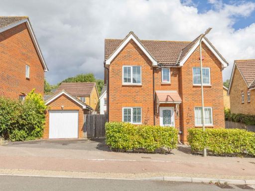 4 bedroom detached house for sale in Spindlewood End, Ashford, Kent, TN23 — £475,000 • 4 bed • 4 bath • 1338 ft²
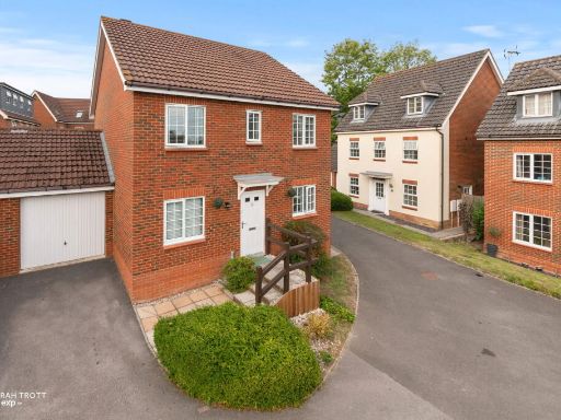 4 bedroom detached house for sale in Spindlewood End, Ashford, TN23 3RR, TN23 — £525,000 • 4 bed • 3 bath • 1536 ft²
 6 bedroom detached house for sale in Sweet Bay Crescent, Ashford, TN23 — £580,000 • 6 bed • 4 bath • 1680 ft²
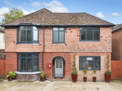 6 bedroom detached house for sale in Maidstone Road, Ashford, TN24 8UA, TN24 — £750,000 • 6 bed • 5 bath • 2303 ft²
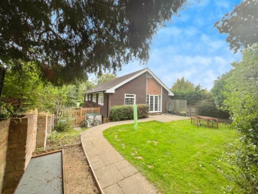 6 bedroom detached house for sale in Tenterden, TN30 — £550,000 • 6 bed • 2 bath • 1659 ft²
Meta
- {
"@context": "https://schema.org",
"@type": "Residence",
"name": "6 bedroom detached house for sale in Juniper Close, Ashford…",
"description": "",
"url": "https://propertypiper.co.uk/property/5dfbb45d-98aa-4632-9791-4fde30b8f895",
"image": "https://image-a.propertypiper.co.uk/1deb9f77-b12e-4c57-8d4f-85437647bc1a-1024.jpeg",
"address": {
"@type": "PostalAddress",
"streetAddress": "9 JUNIPER CLOSE ASHFORD",
"postalCode": "TN23 3JY",
"addressLocality": "Ashford",
"addressRegion": "Ashford",
"addressCountry": "England"
},
"geo": {
"@type": "GeoCoordinates",
"latitude": 51.15047242855809,
"longitude": 0.849203530601959
},
"numberOfRooms": 6,
"numberOfBathroomsTotal": 3,
"floorSize": {
"@type": "QuantitativeValue",
"value": 2400,
"unitCode": "FTK"
},
"offers": {
"@type": "Offer",
"price": 549995,
"priceCurrency": "GBP",
"availability": "https://schema.org/InStock"
},
"additionalProperty": [
{
"@type": "PropertyValue",
"name": "Feature",
"value": "detached house"
},
{
"@type": "PropertyValue",
"name": "Feature",
"value": "modern style"
},
{
"@type": "PropertyValue",
"name": "Feature",
"value": "brick construction"
},
{
"@type": "PropertyValue",
"name": "Feature",
"value": "attached garage"
},
{
"@type": "PropertyValue",
"name": "Feature",
"value": "double glazing"
},
{
"@type": "PropertyValue",
"name": "Feature",
"value": "well-maintained hedges"
},
{
"@type": "PropertyValue",
"name": "Feature",
"value": "driveway parking"
},
{
"@type": "PropertyValue",
"name": "Feature",
"value": "family home"
},
{
"@type": "PropertyValue",
"name": "Feature",
"value": "residential area"
},
{
"@type": "PropertyValue",
"name": "Feature",
"value": "garden"
},
{
"@type": "PropertyValue",
"name": "Feature",
"value": "backyard"
},
{
"@type": "PropertyValue",
"name": "Feature",
"value": "lawn"
},
{
"@type": "PropertyValue",
"name": "Feature",
"value": "detached"
},
{
"@type": "PropertyValue",
"name": "Feature",
"value": "shed"
},
{
"@type": "PropertyValue",
"name": "Feature",
"value": "patio"
},
{
"@type": "PropertyValue",
"name": "Feature",
"value": "suburban"
},
{
"@type": "PropertyValue",
"name": "Feature",
"value": "semi-detached"
},
{
"@type": "PropertyValue",
"name": "Feature",
"value": "residential"
}
]
}
High Res Floorplan Images
Compatible Floorplan Images
FloorplanImages Thumbnail