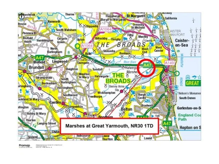
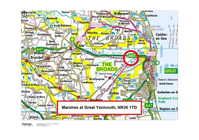
NR30 1TD - Farm land for sale in Grazing Marshes, Acle New Road, Great…
View on Property Piper
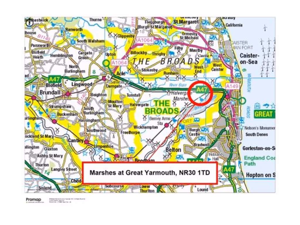
Farm land for sale in Grazing Marshes, Acle New Road, Great Yarmouth, Norfolk, NR30
Property Details
- Price: £290000
- Bedrooms: 1
- Bathrooms: 1
- Property Type: undefined
- Property SubType: undefined
Brochure Descriptions
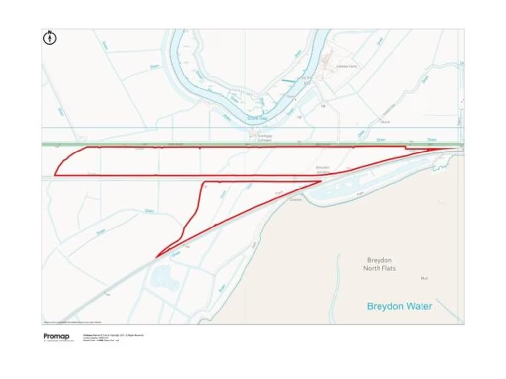
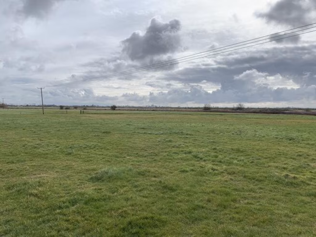
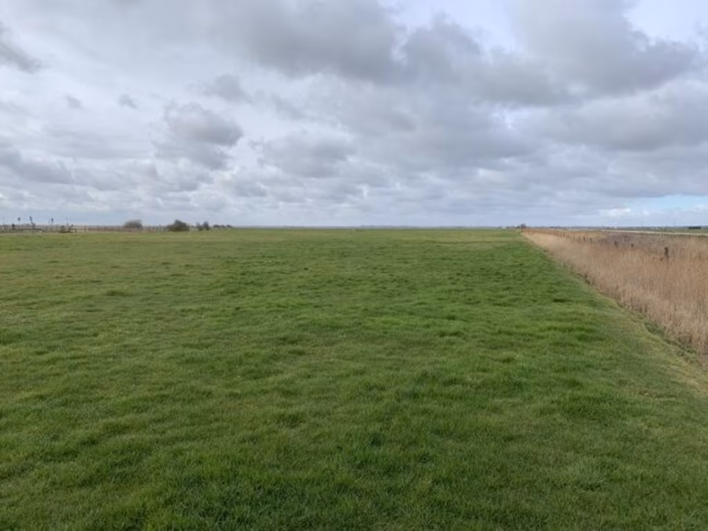
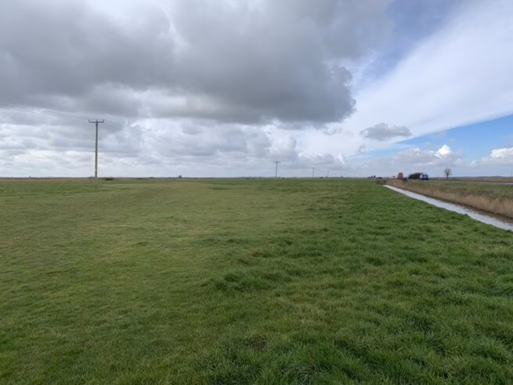
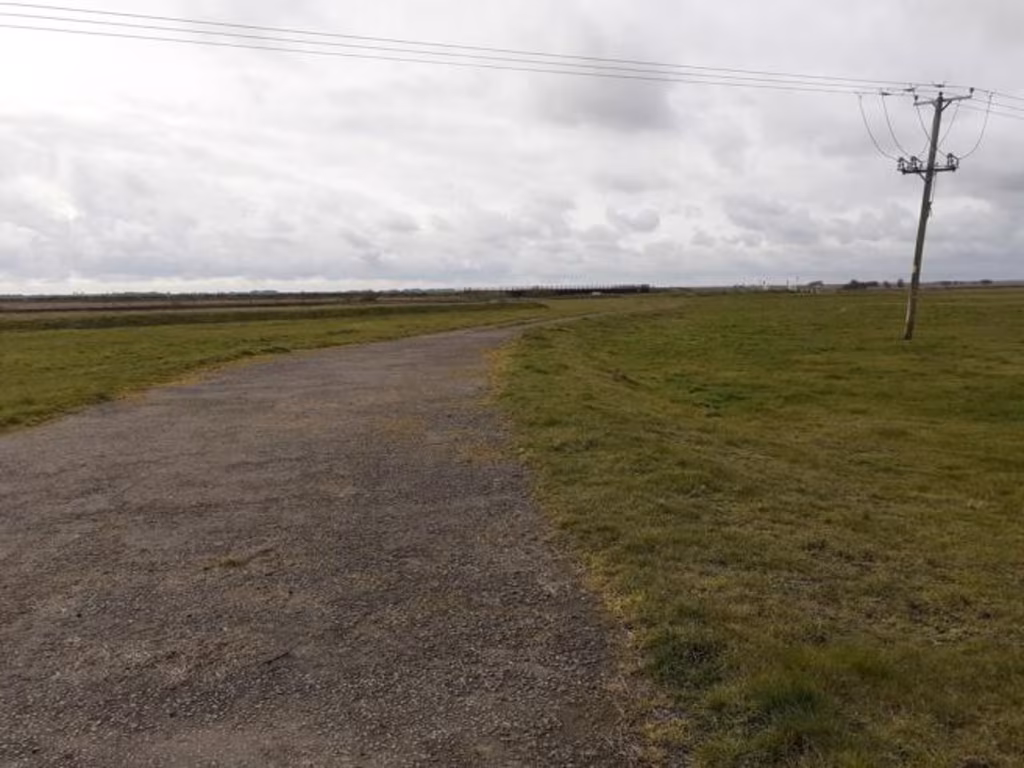
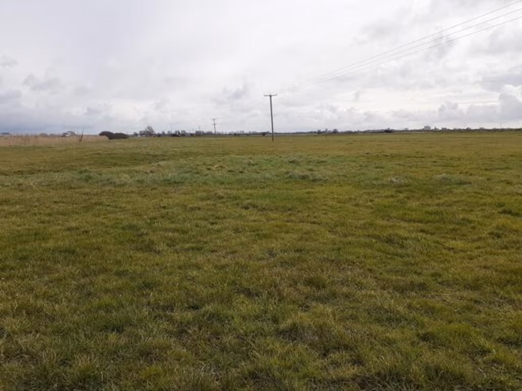
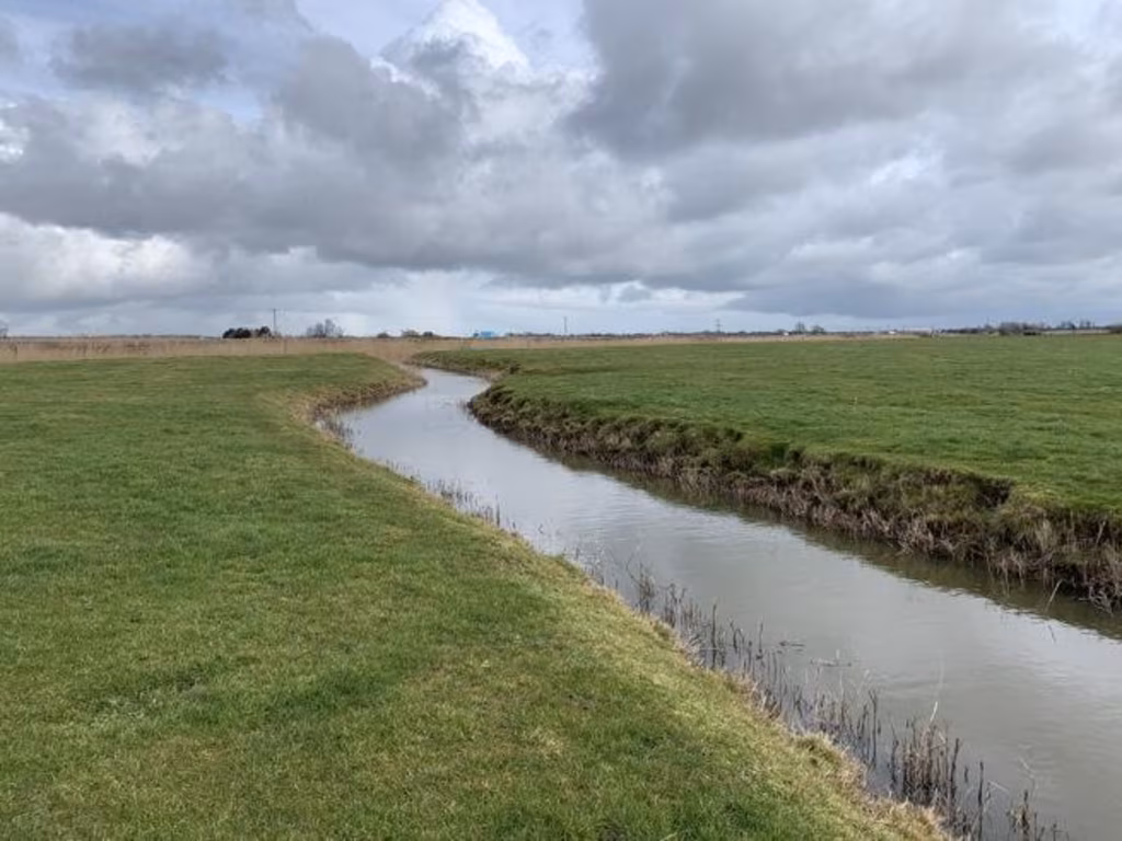
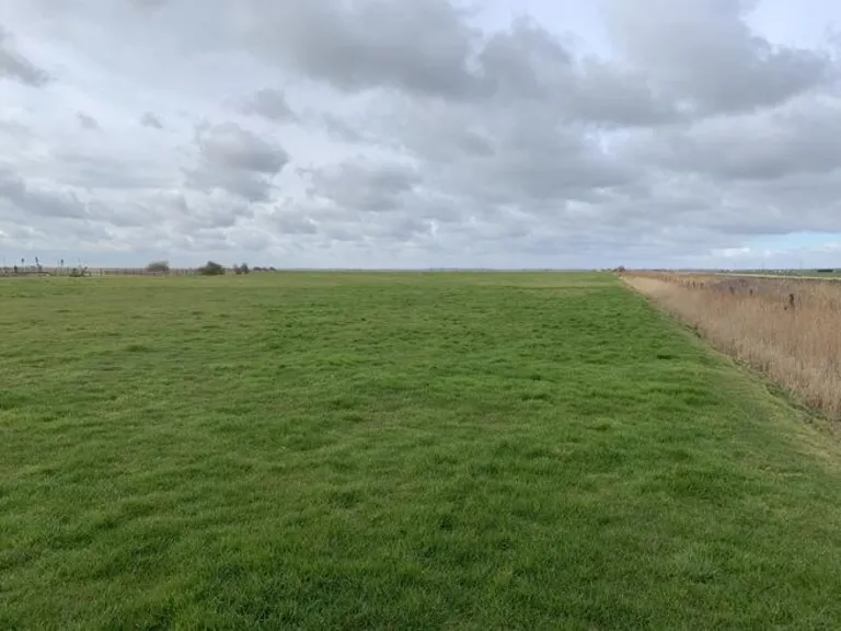
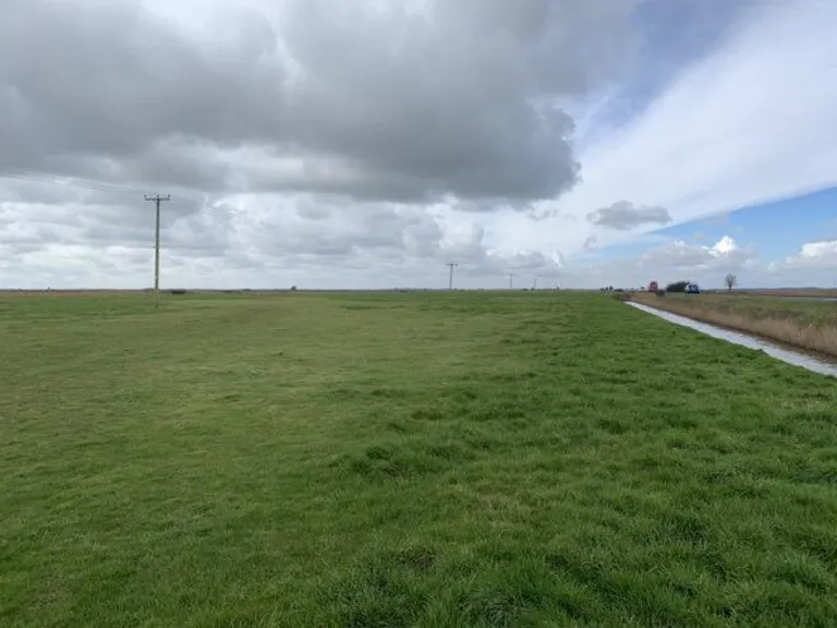
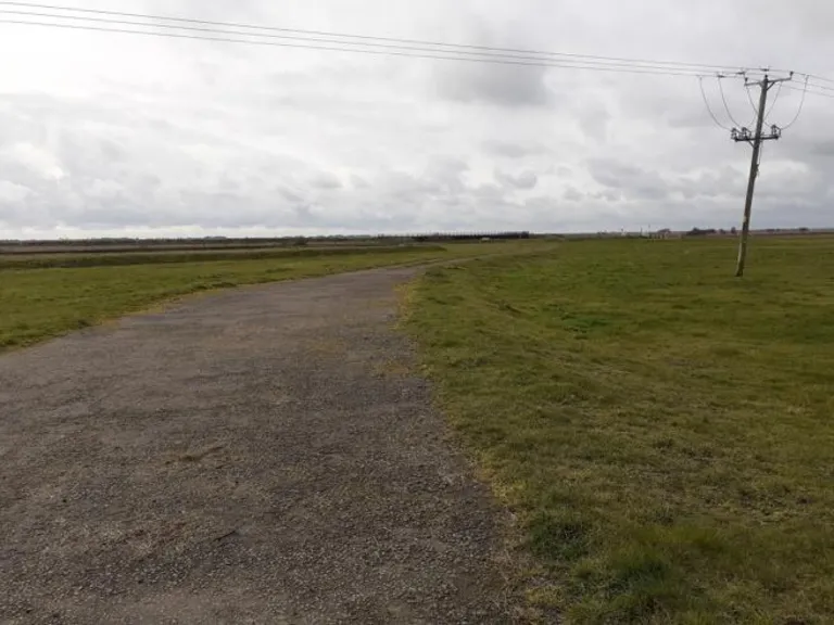
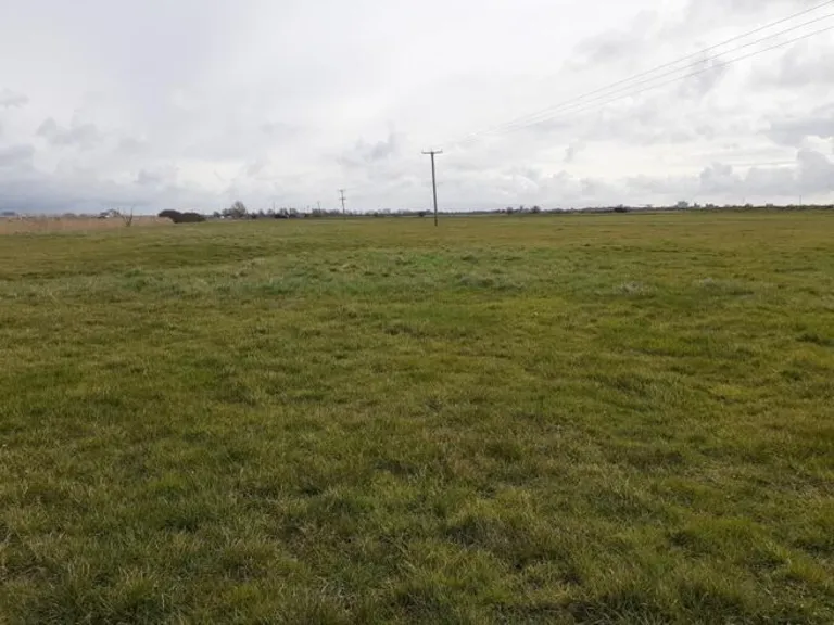
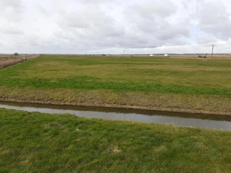
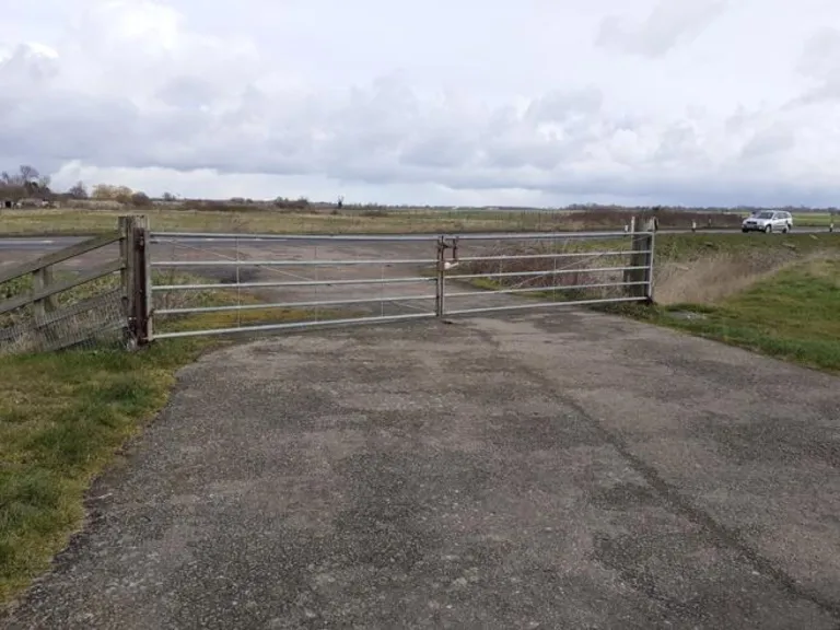
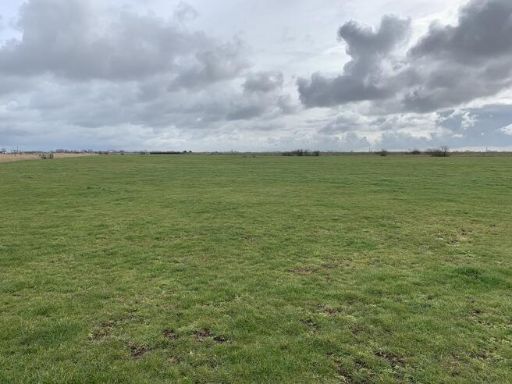
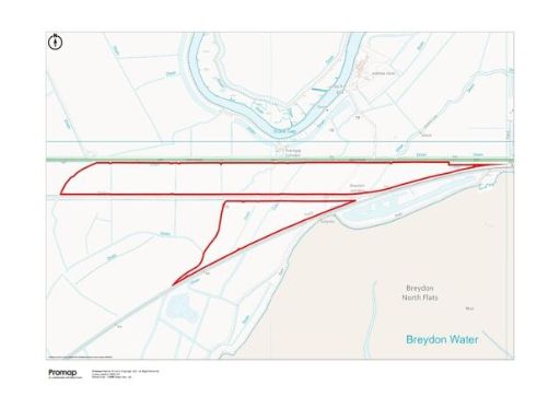
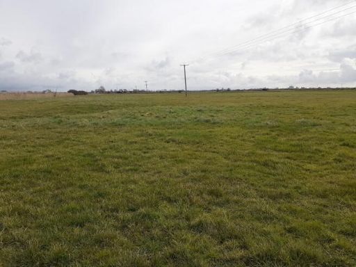
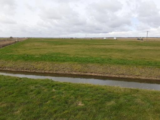
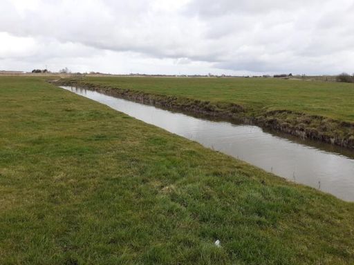
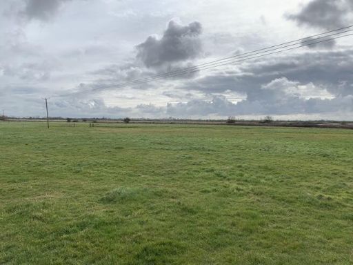
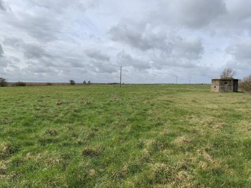
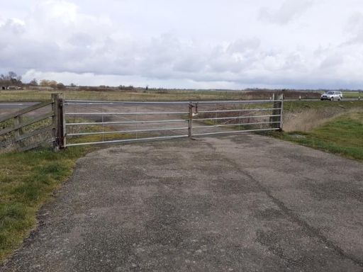
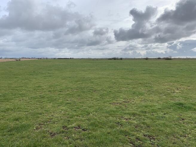
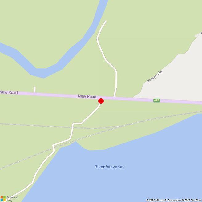
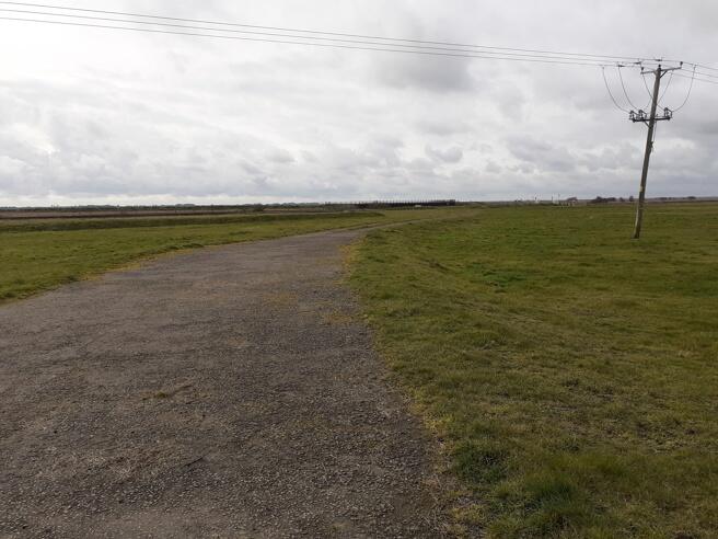
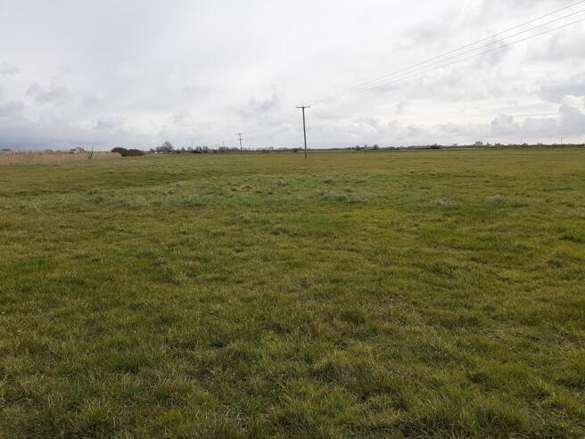
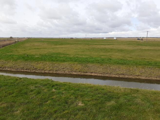
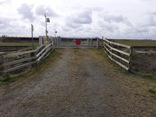
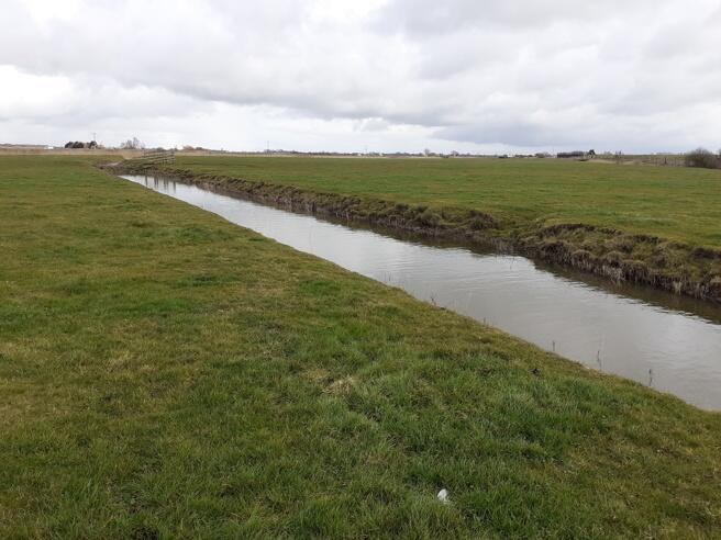
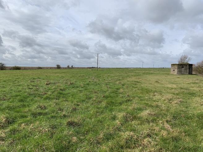
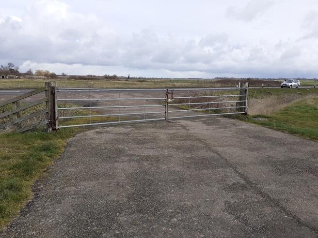
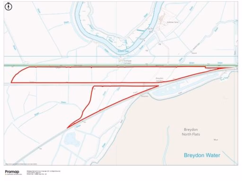
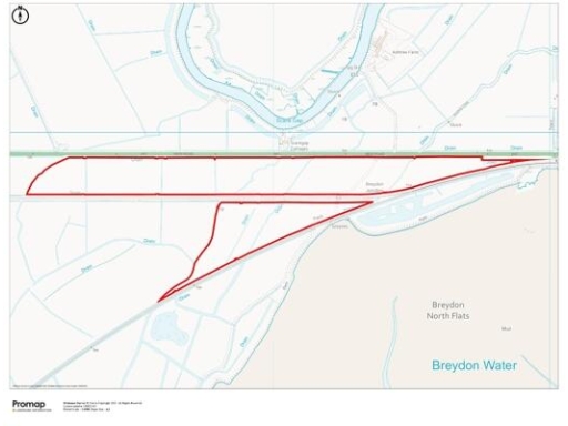
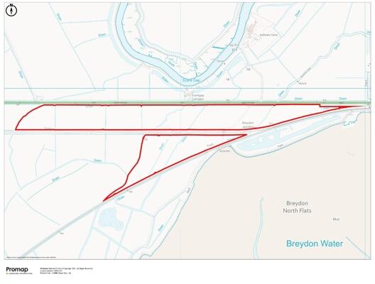
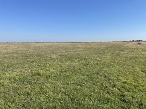
- The property comprises expansive grazing marshes covering an area of 29.06 hectares (71.81 acres). The land is predominantly flat with lush, green fields, suitable for agricultural or grazing purposes. It extends over a substantial, open landscape with unobstructed views, indicative of a rural setting possibly near water, enhancing its natural beauty. The property size is remarkably huge, offering vast open spaces, ideal for agricultural development or pasture.
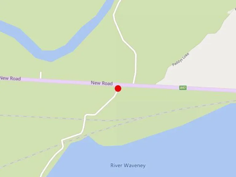
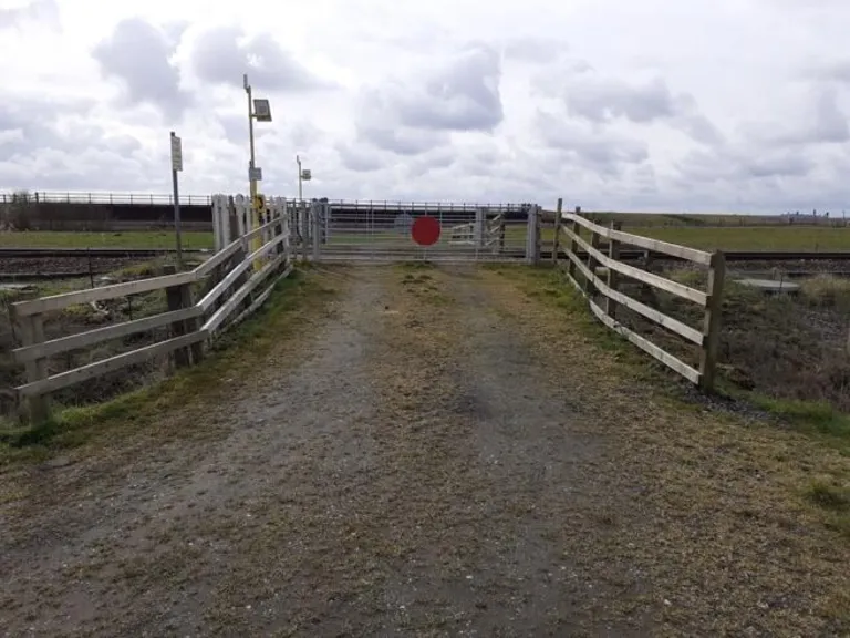
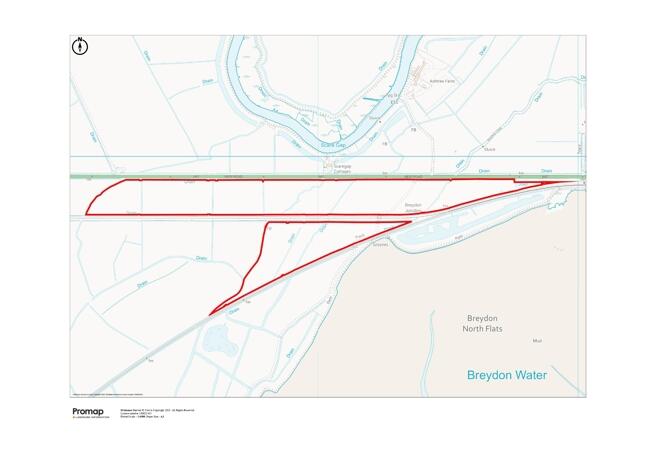
- The property comprises approximately 29.06 hectares (71.81 acres) of marshland. Situated within an extensive area of grazing marshes popular with graziers, the land lies between the road and the mainline railway with additional land south of the railway. It offers a unique setting with expansive views of adjacent marshes and is characterized by its clayey and coarse silty soil, recognized as marine alluvium. The access is via a private track leading from the A47 New Road, indicative of a large property with extensive land coverage.
Image Descriptions
- land vacant land
- land plan
Textual Property Features
Detected Visual Features
- land
- vacant
- development opportunity
- rural
- open space
- potential
- investment
- large area
- plot
- development
- agricultural
- Breydon Water
- Breydon North Flats
Nearby Schools
- Woodlands Primary Academy
- Hillside Primary School
- Lynn Grove Academy
- St Nicholas Priory CofE VA Primary School
- Caister Junior School
- Caister Academy
- St Mary and St Peter Catholic Primary School
- Cobholm Primary Academy
- Northgate Primary School
- North Denes Primary School and Nursery
- Caister Infant With Nursery School
- Ormesby Village Junior School
- Ormiston Venture Academy
- Peterhouse CofE Primary Academy
- Homefield VC CofE Primary School
- Wroughton Infant Academy
- Wroughton Junior Academy
- Great Yarmouth Primary Academy
- Edward Worlledge Ormiston Academy
- Southtown Primary School
- St George's Primary School & St. George's Nursery School, Great Yarmouth
- Great Yarmouth Charter Academy
- Ormesby Village Infant School
- Ormiston Herman Academy
- Stradbroke Primary Academy
Nearest Bars And Restaurants
- Id: 2408062913
- Tags:
- Amenity: fast_food
- Cuisine: burger
- Name: Americana
- TagsNormalized:
- Lat: 52.6181164
- Lon: 1.7176058
- FullGeoHash: u135r4fdxpgd
- PartitionGeoHash: u135
- Images:
- FoodStandards: null
- Distance: 1701
,- Id: 2408062914
- Tags:
- Amenity: fast_food
- Cuisine: fish_and_chips
- Name: Ocean Drive
- TagsNormalized:
- Lat: 52.6180602
- Lon: 1.7174529
- FullGeoHash: u135r4fd7t3e
- PartitionGeoHash: u135
- Images:
- FoodStandards: null
- Distance: 1692
,- Id: 2408062076
- Tags:
- Amenity: fast_food
- Cuisine: kebab
- Name: Jade Kebabs
- TagsNormalized:
- Lat: 52.6183086
- Lon: 1.7174487
- FullGeoHash: u135r4feg7ws
- PartitionGeoHash: u135
- Images:
- FoodStandards: null
- Distance: 1686.9
,- Id: 2408063579
- Tags:
- TagsNormalized:
- Lat: 52.6179699
- Lon: 1.7172315
- FullGeoHash: u135r4f3yks8
- PartitionGeoHash: u135
- Images:
- FoodStandards: null
- Distance: 1679.2
,- Id: 2408062028
- Tags:
- Amenity: fast_food
- Cuisine: pizza
- Name: Giovanni's
- TagsNormalized:
- Lat: 52.618386
- Lon: 1.7173535
- FullGeoHash: u135r4fs34pd
- PartitionGeoHash: u135
- Images:
- FoodStandards: null
- Distance: 1679.1
}
Nearest General Shops
- Id: 5167310113
- Tags:
- TagsNormalized:
- Lat: 52.6120719
- Lon: 1.7207887
- FullGeoHash: u135r1tp9311
- PartitionGeoHash: u135
- Images:
- FoodStandards: null
- Distance: 2125.5
,- Id: 175903174
- Tags:
- TagsNormalized:
- Lat: 52.6119659
- Lon: 1.7196457
- FullGeoHash: u135r1snytkc
- PartitionGeoHash: u135
- Images:
- FoodStandards: null
- Distance: 2062.8
,- Id: 7492355583
- Tags:
- Brand: Asda
- Brand:wikidata: Q297410
- Brand:wikipedia: en:Asda
- Contact:
- Phone: +44 1493 336812
- Website: https://storelocator.asda.com/east-of-england/great-yarmouth/acle-new-road-runham-vauxhall/opticians
- Fixme: Location not accurate
- Name: Asda Opticians
- Opening_hours:
- Covid19: Mo-Th, Sa 09:00-18:00; Fr off; Su 10:00-16:00
- Operator: Asda Stores Ltd
- Shop: optician
- TagsNormalized:
- Lat: 52.6131271
- Lon: 1.7183503
- FullGeoHash: u135r1gm8myb
- PartitionGeoHash: u135
- Images:
- FoodStandards: null
- Distance: 1925.6
}
Nearest Grocery shops
- Id: 233704501
- Tags:
- Building: yes
- Name: Blencowe's
- Shop: convenience
- TagsNormalized:
- Lat: 52.6157487
- Lon: 1.7275009
- FullGeoHash: u135r63uvwqn
- PartitionGeoHash: u135
- Images:
- FoodStandards: null
- Distance: 2409.3
,- Id: 2262670698
- Tags:
- Brand: Co-op Food
- Brand:wikidata: Q3277439
- Brand:wikipedia: en:Co-op Food
- Name: Co-op Food
- Operator: The Co-operative Group
- Operator:wikidata: Q117202
- Shop: convenience
- TagsNormalized:
- co-op
- co-op food
- food
- convenience
- shop
- Lat: 52.606444
- Lon: 1.7168594
- FullGeoHash: u135r0dntxzj
- PartitionGeoHash: u135
- Images:
- FoodStandards: null
- Distance: 2279.8
,- Id: 2408062915
- Tags:
- Addr:
- City: Great Yarmouth
- Postcode: NR30 1TB
- Street: Acle New Road
- Fhrs:
- Shop: convenience
- Source:
- TagsNormalized:
- Lat: 52.6179447
- Lon: 1.7176977
- FullGeoHash: u135r4fc9rb4
- PartitionGeoHash: u135
- Images:
- FoodStandards: null
- Distance: 1710.6
}
Nearest Religious buildings
- Id: 210614659
- Tags:
- Amenity: place_of_worship
- Building: yes
- Denomination: anglican
- Listed_status: no
- Material: brick
- Name: Saint Pauls Church
- Religion: christian
- Short_name: Saint Paul
- Tower: no
- Website: https://www.achurchnearyou.com/great-yarmouth-st-paul/
- Wikidata: Q105089953
- TagsNormalized:
- place of worship
- anglican
- church
- christian
- Lat: 52.6201592
- Lon: 1.7285424
- FullGeoHash: u135r74wtuws
- PartitionGeoHash: u135
- Images:
- FoodStandards: null
- Distance: 2413.3
,- Id: 175967812
- Tags:
- Amenity: place_of_worship
- Building: yes
- Denomination: jehovahs_witness
- Name: Kingdom Hall of Witnesses
- Religion: christian
- TagsNormalized:
- place of worship
- jehovah
- jehovahs witness
- christian
- church
- Lat: 52.6096368
- Lon: 1.722
- FullGeoHash: u135r1mcme07
- PartitionGeoHash: u135
- Images:
- FoodStandards: null
- Distance: 2331.2
,- Id: 511447010
- Tags:
- Amenity: place_of_worship
- Building: church
- Denomination: methodist
- Listed_status: no
- Material: brick
- Name: The Tabernacle
- Note: Sold to Upper Room Christian Fellowship in 1990
- Religion: christian
- Start_date: 1924
- Website: https://en-gb.facebook.com/UpperRoomChristianFellowshipCobholm/
- TagsNormalized:
- place of worship
- church
- methodist
- tabernacle
- christian
- Lat: 52.6072068
- Lon: 1.718485
- FullGeoHash: u135r0g75w5k
- PartitionGeoHash: u135
- Images:
- FoodStandards: null
- Distance: 2302.5
}
Nearest Medical buildings
- Id: 231789767
- Tags:
- Amenity: pharmacy
- Building: yes
- Healthcare: pharmacy
- Name: Day Lewis Chemist
- TagsNormalized:
- pharmacy
- health
- healthcare
- chemist
- Lat: 52.619665
- Lon: 1.7278359
- FullGeoHash: u135r745v2xb
- PartitionGeoHash: u135
- Images:
- FoodStandards: null
- Distance: 2368.1
,- Id: 210620778
- Tags:
- Amenity: doctors
- Building: yes
- Healthcare: doctor
- Name: Newtown Surgery
- TagsNormalized:
- doctor
- doctors
- health
- healthcare
- surgery
- Lat: 52.6202781
- Lon: 1.7268345
- FullGeoHash: u135r71rq4v1
- PartitionGeoHash: u135
- Images:
- FoodStandards: null
- Distance: 2297.7
,- Id: 210616832
- Tags:
- Amenity: veterinary
- Building: yes
- Name: RSPCA Clinic
- TagsNormalized:
- Lat: 52.6207021
- Lon: 1.7266942
- FullGeoHash: u135r733fcud
- PartitionGeoHash: u135
- Images:
- FoodStandards: null
- Distance: 2287.4
,- Id: 7492355582
- Tags:
- Amenity: pharmacy
- Brand: Asda
- Brand:wikidata: Q297410
- Brand:wikipedia: en:Asda
- Contact:
- Phone: +44 1493 336819
- Website: https://storelocator.asda.com/east-of-england/great-yarmouth/acle-new-road-runham-vauxhall/pharmacy
- Fixme: Location not accurate
- Healthcare: pharmacy
- Name: Asda
- Opening_hours:
- Covid19: Mo-We, Sa 08:30-20:00; Th 08:30-21:00; Fr 09:00-18:00; Su 10:30-16:30
- Operator: Asda Stores Ltd
- TagsNormalized:
- pharmacy
- asda
- health
- healthcare
- Lat: 52.6131638
- Lon: 1.7182158
- FullGeoHash: u135r1gjvkde
- PartitionGeoHash: u135
- Images:
- FoodStandards: null
- Distance: 1915.6
}
Nearest Leisure Facilities
- Id: 9163216
- Tags:
- Leisure: swimming_pool
- Type: multipolygon
- TagsNormalized:
- swimming
- swimming pool
- pool
- leisure
- Lat: 52.6182996
- Lon: 1.7179151
- FullGeoHash: u135r4fgy3fr
- PartitionGeoHash: u135
- Images:
- FoodStandards: null
- Distance: 1718.1
,- Id: 232454485
- Tags:
- Building: yes
- Leisure: swimming_pool
- Name: Swimming Complex
- Sport: swimming
- TagsNormalized:
- swimming
- swimming pool
- pool
- leisure
- sports
- Lat: 52.6185915
- Lon: 1.7175578
- FullGeoHash: u135r4fttbru
- PartitionGeoHash: u135
- Images:
- FoodStandards: null
- Distance: 1689.2
,- Id: 946576075
- Tags:
- TagsNormalized:
- Lat: 52.6194479
- Lon: 1.7143858
- FullGeoHash: u135r506s049
- PartitionGeoHash: u135
- Images:
- FoodStandards: null
- Distance: 1464.7
,- Id: 946576073
- Tags:
- Leisure: pitch
- Sport: tennis
- TagsNormalized:
- Lat: 52.6195226
- Lon: 1.71408
- FullGeoHash: u135r504uvyw
- PartitionGeoHash: u135
- Images:
- FoodStandards: null
- Distance: 1443.3
,- Id: 946576074
- Tags:
- TagsNormalized:
- Lat: 52.6195908
- Lon: 1.7137801
- FullGeoHash: u135qgpgmfxj
- PartitionGeoHash: u135
- Images:
- FoodStandards: null
- Distance: 1422.4
}
Nearest Tourist attractions
- Id: 742177798
- Tags:
- Name: 218
- Tourism: camp_pitch
- TagsNormalized:
- Lat: 52.6194004
- Lon: 1.7150044
- FullGeoHash: u135r50f4rpv
- PartitionGeoHash: u135
- Images:
- FoodStandards: null
- Distance: 1506.8
,- Id: 742177786
- Tags:
- Name: Super 220
- Tourism: camp_pitch
- TagsNormalized:
- Lat: 52.6195702
- Lon: 1.7150019
- FullGeoHash: u135r50g4qy4
- PartitionGeoHash: u135
- Images:
- FoodStandards: null
- Distance: 1504.7
,- Id: 742177785
- Tags:
- Name: Super 219
- Tourism: camp_pitch
- TagsNormalized:
- Lat: 52.6194956
- Lon: 1.7149019
- FullGeoHash: u135r50fb0gt
- PartitionGeoHash: u135
- Images:
- FoodStandards: null
- Distance: 1498.8
}
Nearest Train stations
- Id: 252745593
- Tags:
- Name: Oulton Broad North
- Naptan:
- Network: National Rail
- Public_transport: station
- Railway: station
- Ref:
- Source: NPE
- Wikidata: Q2854239
- Wikipedia: en:Oulton Broad North railway station
- TagsNormalized:
- Lat: 52.4777293
- Lon: 1.7161761
- FullGeoHash: u134x138vvc8
- PartitionGeoHash: u134
- Images:
- FoodStandards: null
- Distance: 15991
,- Id: 253006650
- Tags:
- Name: Buckenham
- Naptan:
- Network: National Rail
- Public_transport: station
- Railway: station
- Ref:
- Request_stop: yes
- Source: NPE
- Toilets:
- Wikidata: Q2064742
- Wikipedia: en:Buckenham railway station
- TagsNormalized:
- Lat: 52.5977147
- Lon: 1.4701518
- FullGeoHash: u1351rnech8t
- PartitionGeoHash: u135
- Images:
- FoodStandards: null
- Distance: 15252.7
,- Id: 283317149
- Tags:
- Name: Cantley
- Naptan:
- Network: National Rail
- Public_transport: station
- Railway: station
- Ref:
- Source: NPE
- Wikidata: Q2149282
- Wikipedia: en:Cantley railway station
- TagsNormalized:
- Lat: 52.5787207
- Lon: 1.5136275
- FullGeoHash: u13547wjnpfm
- PartitionGeoHash: u135
- Images:
- FoodStandards: null
- Distance: 12976
,- Id: 263373156
- Tags:
- Name: Somerleyton
- Naptan:
- Network: National Rail
- Public_transport: station
- Railway: station
- Ref:
- Source: NPE
- Wikidata: Q1920909
- Wikipedia: en:Somerleyton railway station
- TagsNormalized:
- Lat: 52.5101587
- Lon: 1.6521998
- FullGeoHash: u134tx5jg513
- PartitionGeoHash: u134
- Images:
- FoodStandards: null
- Distance: 12609.1
,- Id: 1699243929
- Tags:
- Name: Great Yarmouth
- Name:lt: Didysis Jarmutas
- Naptan:
- Network: National Rail
- Operator: Greater Anglia
- Platforms: 4
- Public_transport: station
- Railway: station
- Ref:
- Wikidata: Q280999
- Wikipedia: en:Great Yarmouth railway station
- TagsNormalized:
- Lat: 52.6119213
- Lon: 1.7206879
- FullGeoHash: u135r1sywuvz
- PartitionGeoHash: u135
- Images:
- FoodStandards: null
- Distance: 2127.2
}
Nearest Hotels
- Id: 2388948810
- Tags:
- Name: Wellesley Park Hotel
- Tourism: hotel
- TagsNormalized:
- Lat: 52.6132008
- Lon: 1.7349602
- FullGeoHash: u135r3zq5e2p
- PartitionGeoHash: u135
- Images:
- FoodStandards: null
- Distance: 2969.6
,- Id: 175552797
- Tags:
- Addr:
- City: Great Yarmouth
- Housenumber: 24
- Postcode: NR30 1HP
- Street: Hall Quay
- Building: yes
- Fhrs:
- Name: The Star Hotel
- Source: Bing
- Source:addr: FHRS Open Data
- Tourism: hotel
- Wikidata: Q7600747
- TagsNormalized:
- Lat: 52.6067784
- Lon: 1.7248295
- FullGeoHash: u135r0zbxqq0
- PartitionGeoHash: u135
- Images:
- FoodStandards: null
- Distance: 2667.8
,- Id: 640580635
- Tags:
- Brand: Premier Inn
- Brand:wikidata: Q2108626
- Brand:wikipedia: en:Premier Inn
- Building: yes
- Internet_access: wlan
- Internet_access:fee: customers
- Internet_access:operator: Virgin Media
- Internet_access:ssid: Premier Inn Free Wi-Fi
- Name: Premier Inn
- Tourism: hotel
- TagsNormalized:
- Lat: 52.6158331
- Lon: 1.7205199
- FullGeoHash: u135r4kv7n0w
- PartitionGeoHash: u135
- Images:
- FoodStandards: null
- Distance: 1951.7
}
Tags
- land
- vacant
- development opportunity
- rural
- open space
- potential
- investment
- large area
- land
- plot
- development
- agricultural
- investment
- Breydon Water
- Breydon North Flats
Local Market Stats
- Average Price/sqft: £191
- Avg Income: £33400
- Rental Yield: 4.3%
- Social Housing: 13%
- Planning Success Rate: 87%
Similar Properties
 Farm land for sale in Grazing Marsh, A47 Acle New Road, Great Yarmouth, Norfolk, NR30 — £70,000 • 1 bed • 1 bath
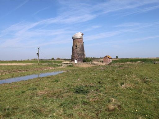 Land for sale in Grazing Marshes at Runham, Norfolk, NR30 — £450,000 • 1 bed • 1 bath
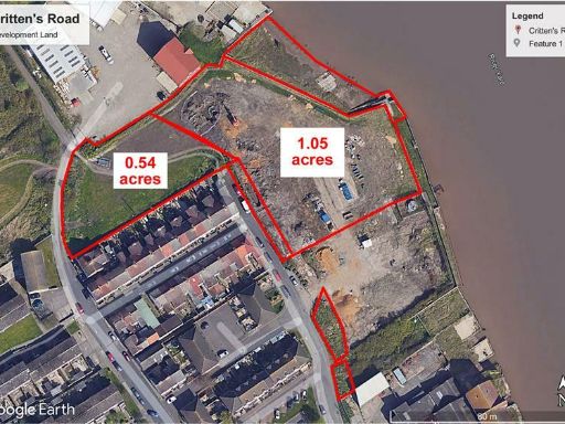 Land for sale in Land In, Crittens Road, Great Yarmouth, Norfolk, NR31 0AG, NR31 — £495,000 • 1 bed • 1 bath
 Land for sale in Riverside Road, Great Yarmouth, Norfolk, NR31 — £1,900,000 • 1 bed • 1 bath
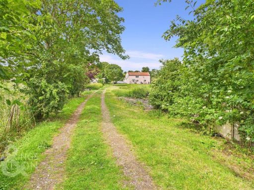 4 bedroom farm house for sale in Low Road, Norton Subcourse, Norwich, NR14 — £612,500 • 4 bed • 1 bath • 1190 ft²
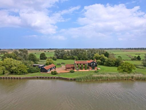 7 bedroom detached house for sale in Acle, NR13 — £1,250,000 • 7 bed • 4 bath • 2467 ft²
Meta
- {
"@context": "https://schema.org",
"@type": "Residence",
"name": "Farm land for sale in Grazing Marshes, Acle New Road, Great…",
"description": "",
"url": "https://propertypiper.co.uk/property/5666ba31-137a-43f1-b80d-f8f819391a9b",
"image": "https://image-a.propertypiper.co.uk/2da1bfef-7b54-435a-8ee8-de6048f0a650-1024.jpeg",
"address": {
"@type": "PostalAddress",
"streetAddress": "Grazing Marshes, Acle New Road, Great Yarmouth, Norfolk, NR30",
"postalCode": "NR30 1TD",
"addressLocality": "Great Yarmouth",
"addressRegion": "Great Yarmouth",
"addressCountry": "England"
},
"geo": {
"@type": "GeoCoordinates",
"latitude": 52.620836,
"longitude": 1.6928095
},
"numberOfRooms": 1,
"numberOfBathroomsTotal": 1,
"offers": {
"@type": "Offer",
"price": 290000,
"priceCurrency": "GBP",
"availability": "https://schema.org/InStock"
},
"additionalProperty": [
{
"@type": "PropertyValue",
"name": "Feature",
"value": "land"
},
{
"@type": "PropertyValue",
"name": "Feature",
"value": "vacant"
},
{
"@type": "PropertyValue",
"name": "Feature",
"value": "development opportunity"
},
{
"@type": "PropertyValue",
"name": "Feature",
"value": "rural"
},
{
"@type": "PropertyValue",
"name": "Feature",
"value": "open space"
},
{
"@type": "PropertyValue",
"name": "Feature",
"value": "potential"
},
{
"@type": "PropertyValue",
"name": "Feature",
"value": "investment"
},
{
"@type": "PropertyValue",
"name": "Feature",
"value": "large area"
},
{
"@type": "PropertyValue",
"name": "Feature",
"value": "land"
},
{
"@type": "PropertyValue",
"name": "Feature",
"value": "plot"
},
{
"@type": "PropertyValue",
"name": "Feature",
"value": "development"
},
{
"@type": "PropertyValue",
"name": "Feature",
"value": "agricultural"
},
{
"@type": "PropertyValue",
"name": "Feature",
"value": "investment"
},
{
"@type": "PropertyValue",
"name": "Feature",
"value": "Breydon Water"
},
{
"@type": "PropertyValue",
"name": "Feature",
"value": "Breydon North Flats"
}
]
}
High Res Floorplan Images
Compatible Floorplan Images
FloorplanImages Thumbnail