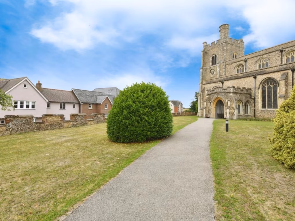
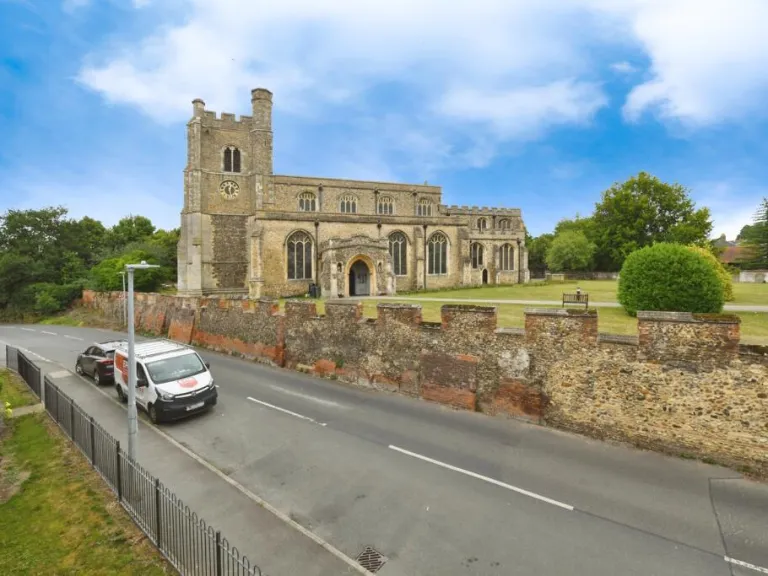
CM7 5GS - 4 bedroom terraced house for sale in Bovingdon Road, Braint…
View on Property Piper
4 bedroom terraced house for sale in Bovingdon Road, Braintree, Essex, CM7
Property Details
- Price: £400000
- Bedrooms: 4
- Bathrooms: 3
- Property Type: undefined
- Property SubType: undefined
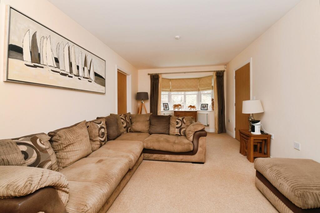
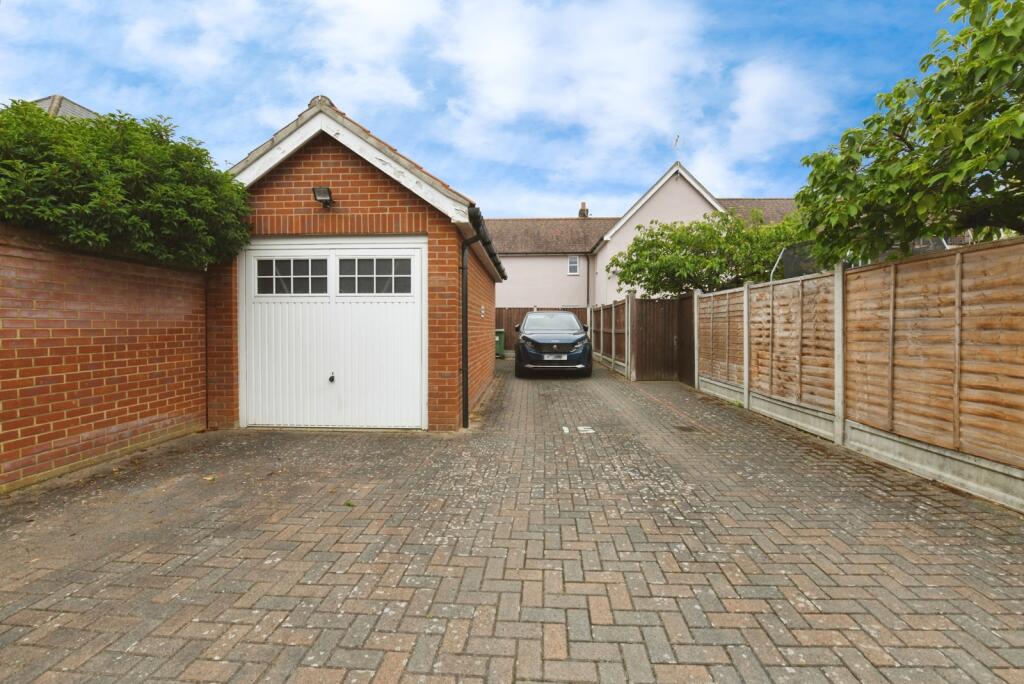
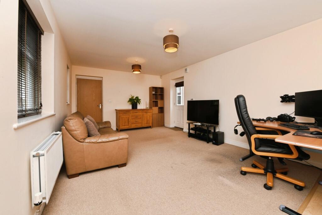
Image Descriptions
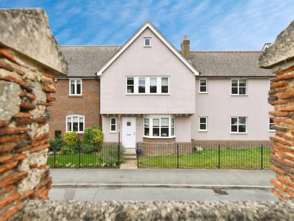
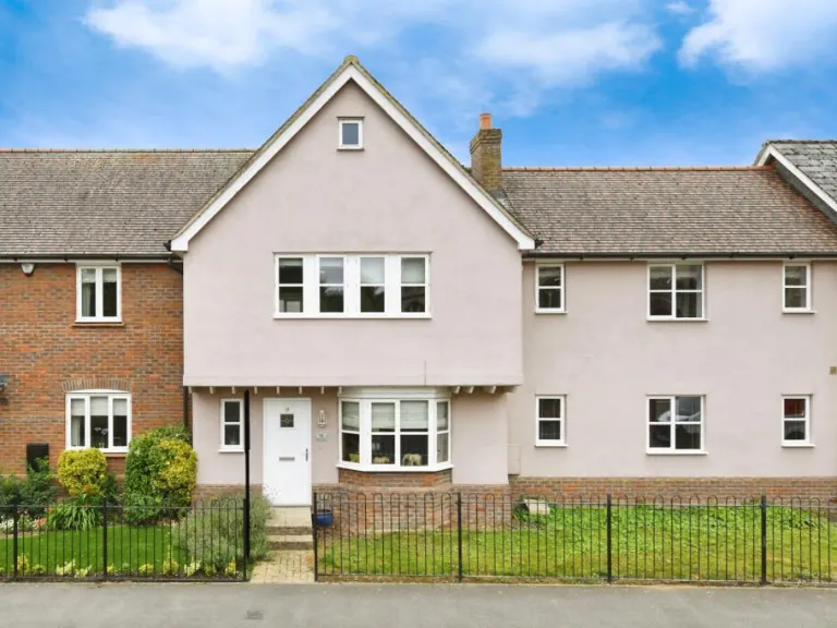
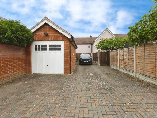
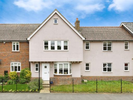
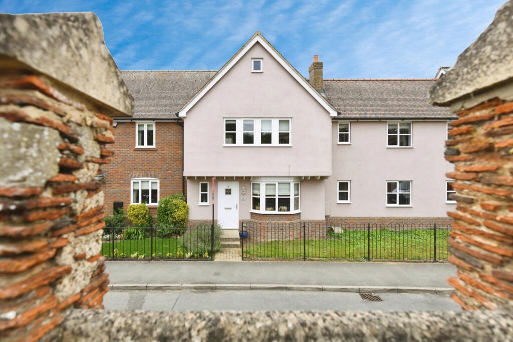
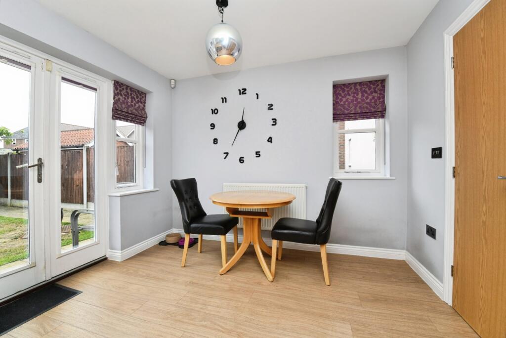
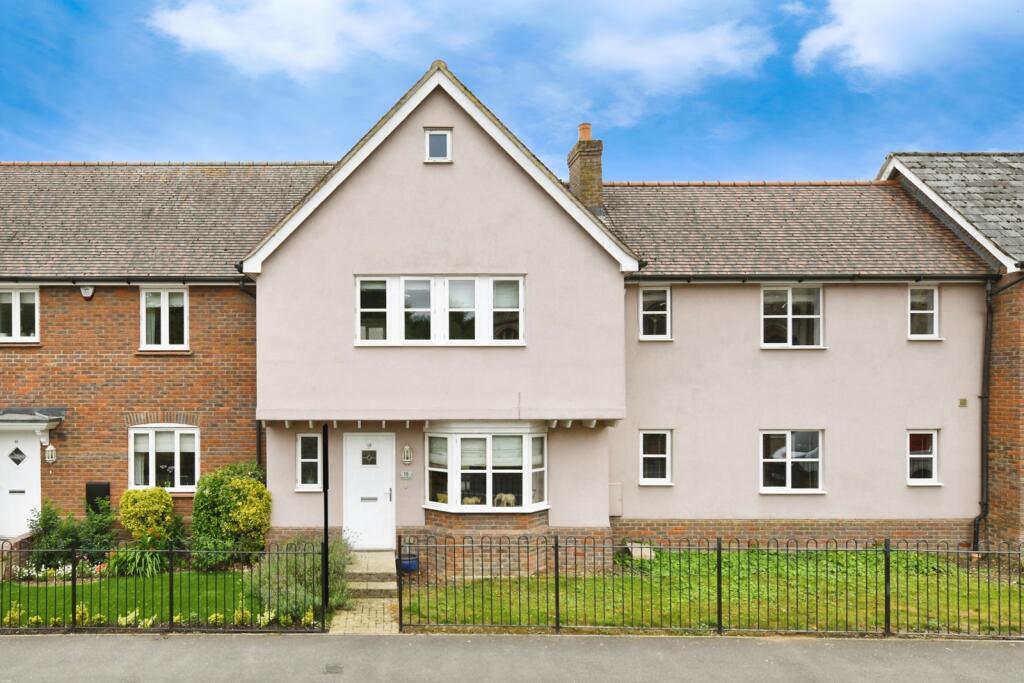
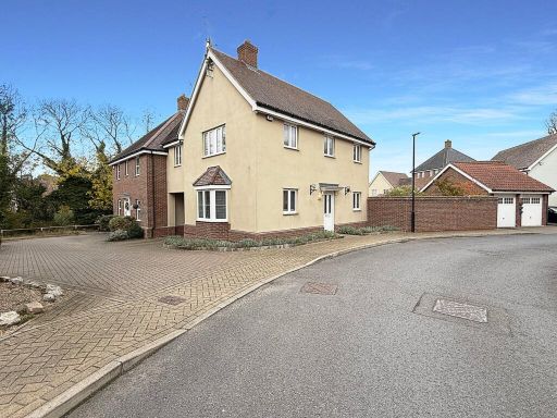
- detached house modern
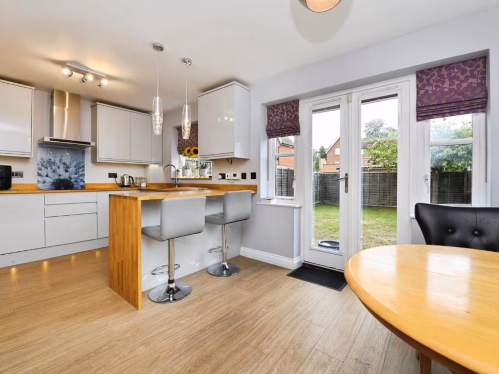
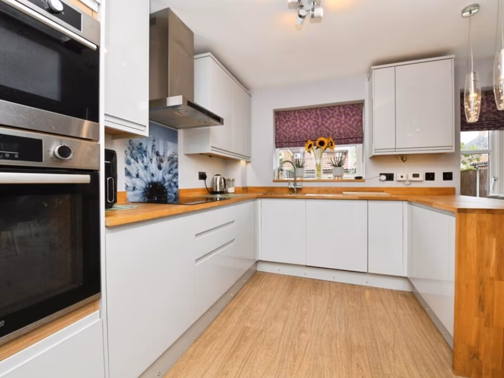
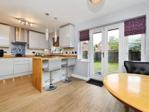
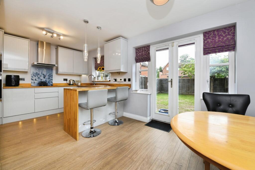
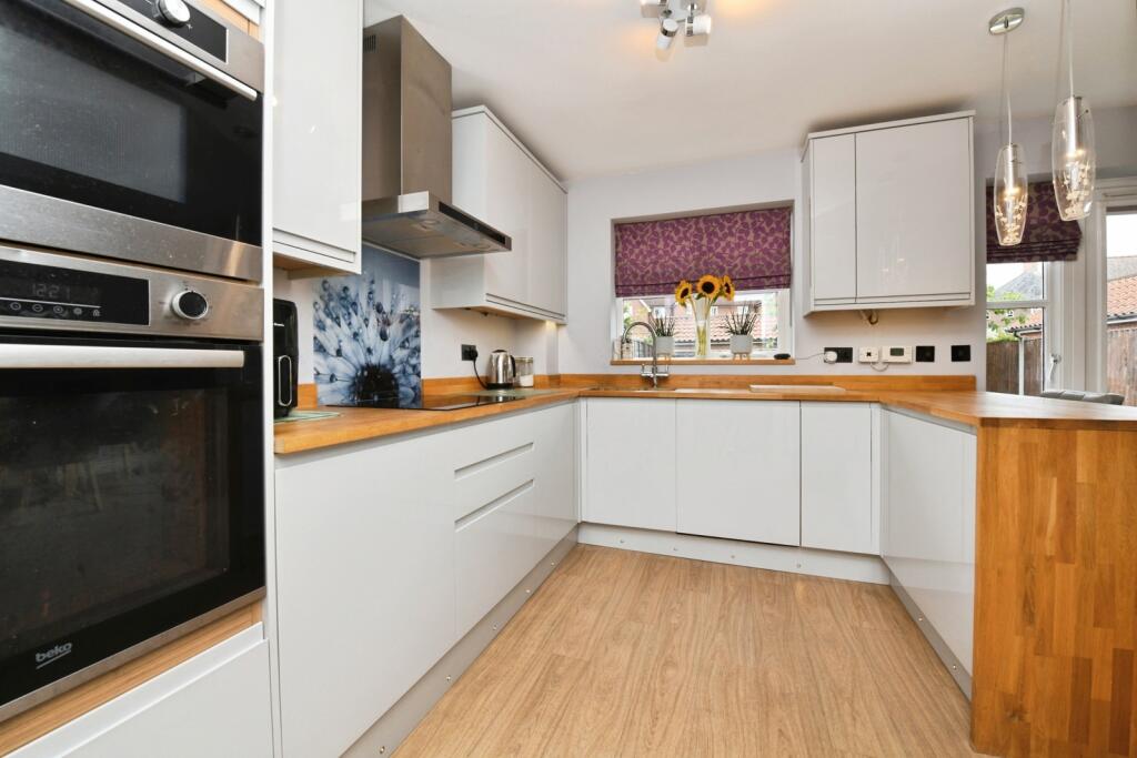
- kitchen modern
Floorplan Description
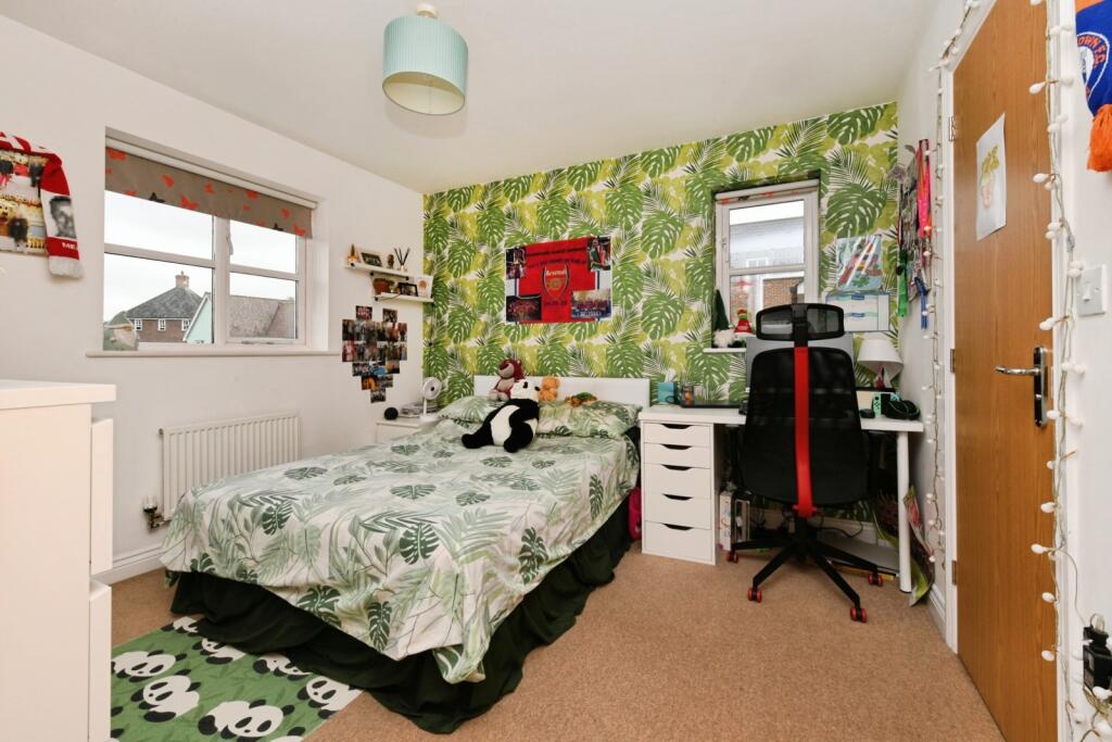
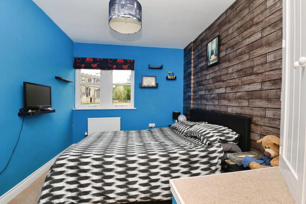
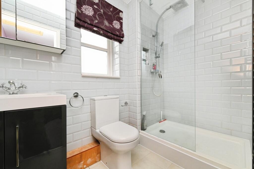
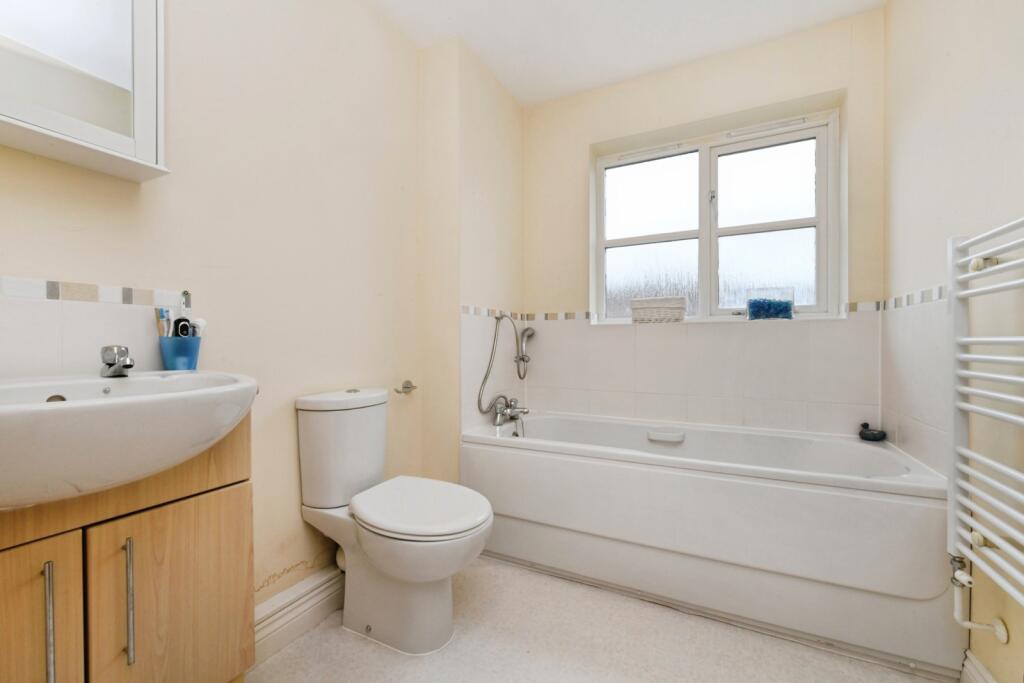
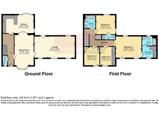
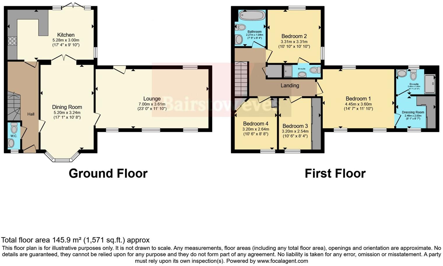
- A two-story property with four bedrooms, two en-suites, and spacious kitchen and lounge areas.
Rooms
- Kitchen: Large
- Dining Room: Average
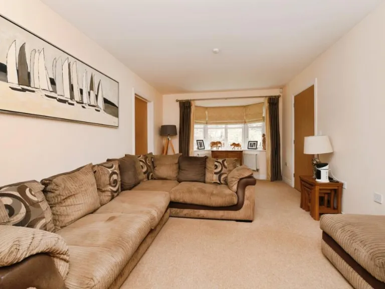
- Lounge: Large
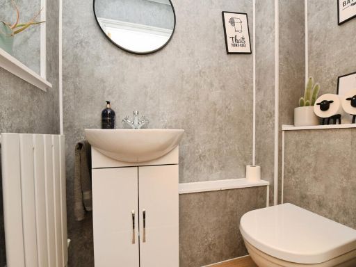
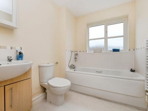
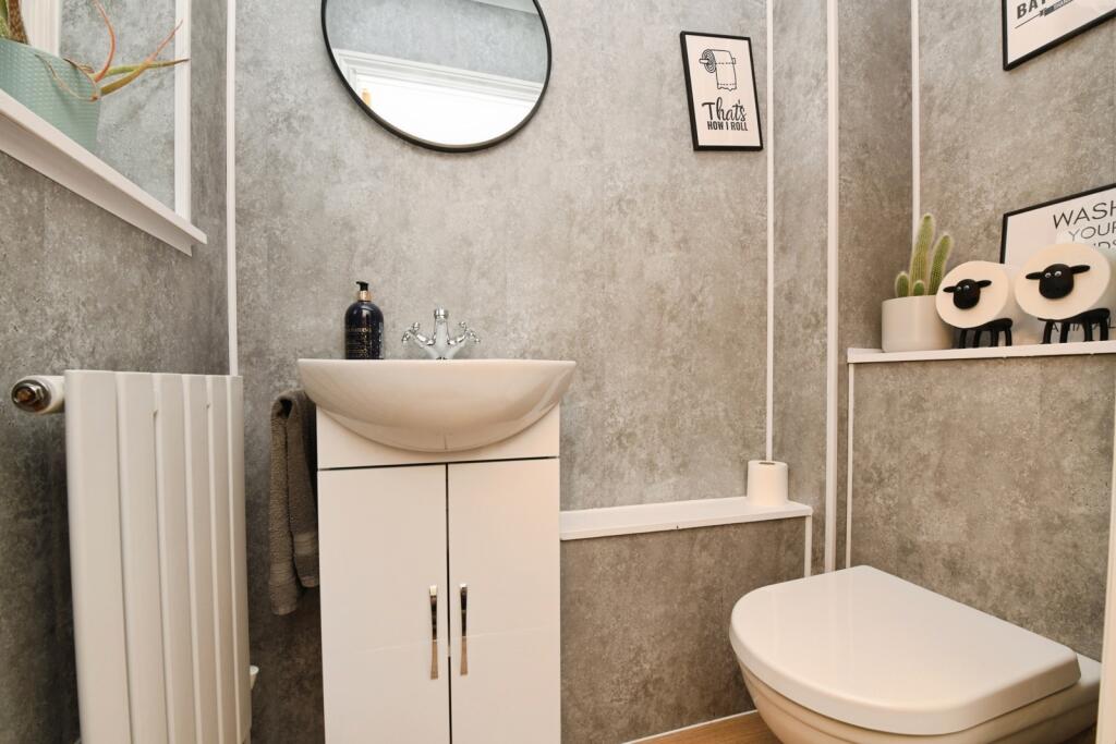
- W.C.: Small
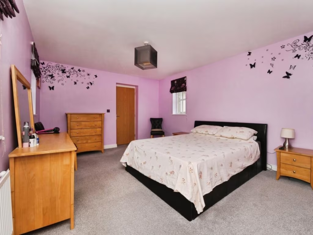
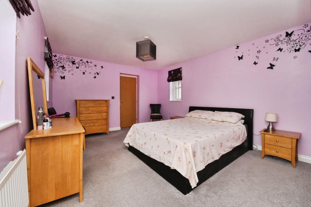
- Bedroom 1: Large
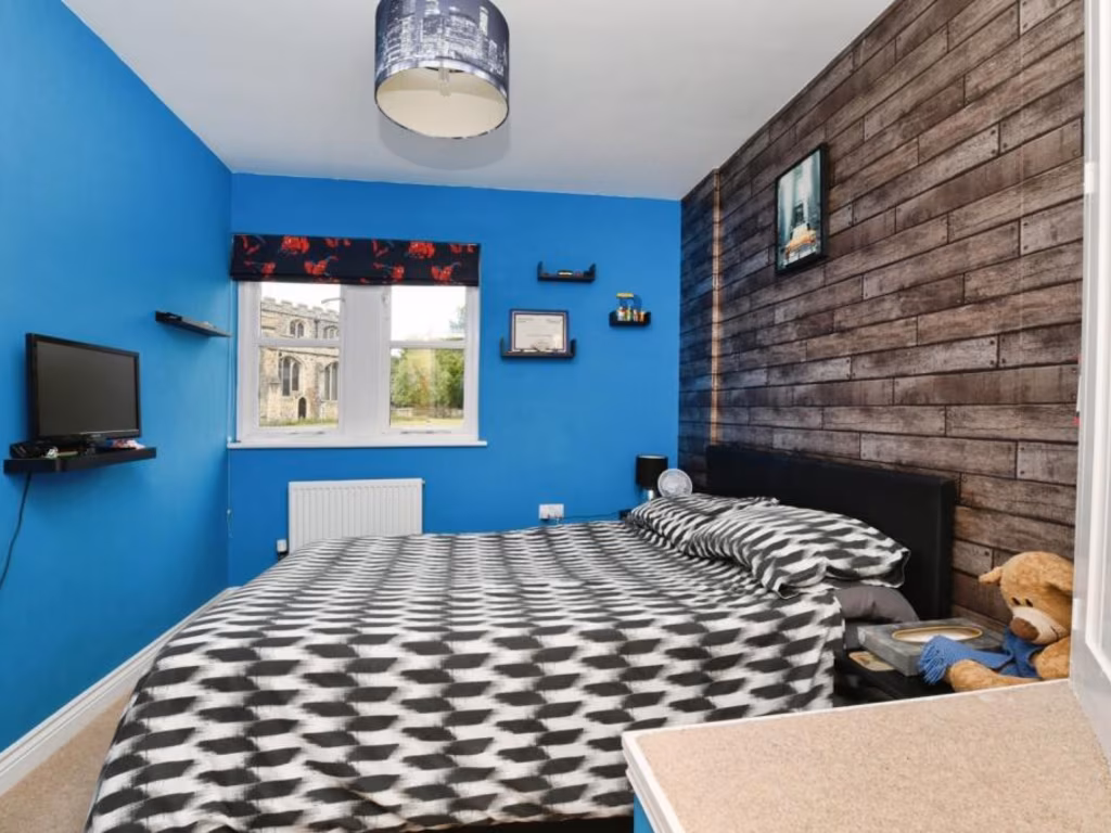
- Bedroom 2: Average
- Bedroom 3: Average
- Bedroom 4: Average
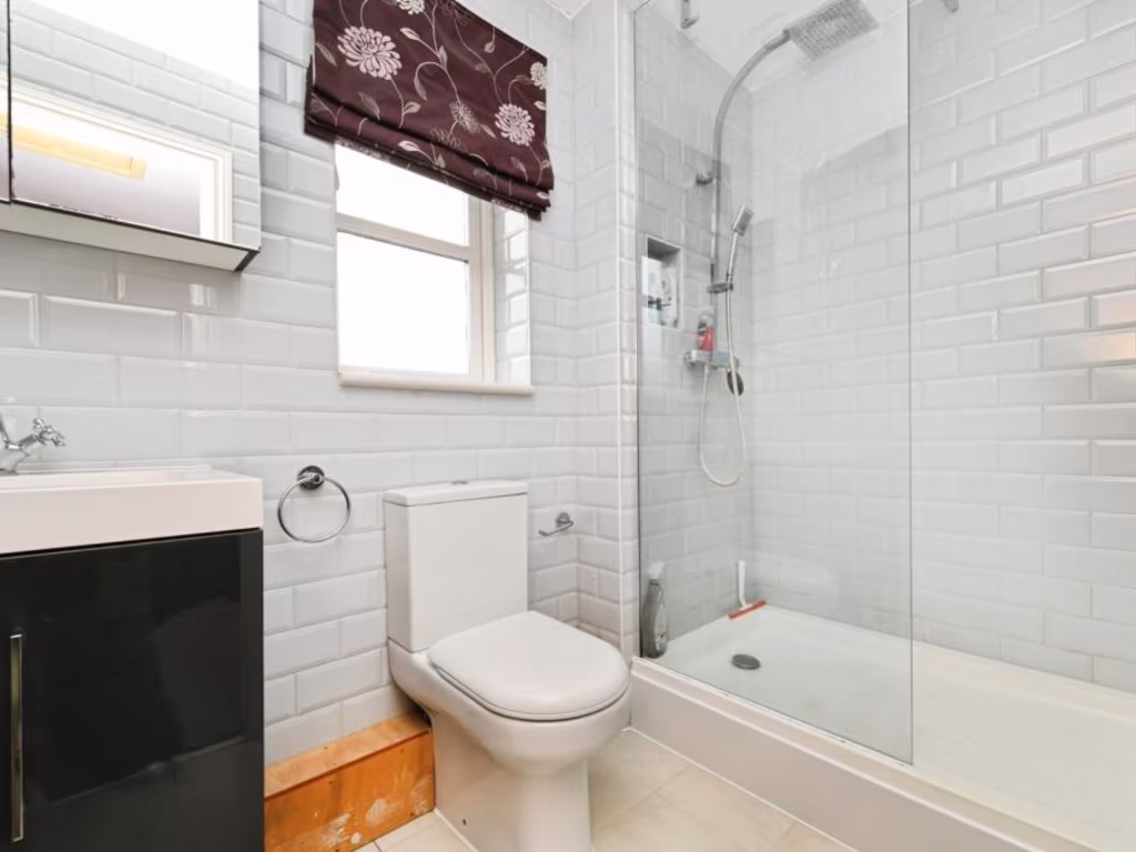
- Bathroom: Small
- Dressing Room: Small
- En-suite (Bedroom 1): Small
- En-suite (Bedroom 2): Small
Textual Property Features
Detected Visual Features
- detached house
- modern style
- two-story
- bay window
- brick facade
- off-street parking
- residential
- suburban
- family home
- modern kitchen
- breakfast bar
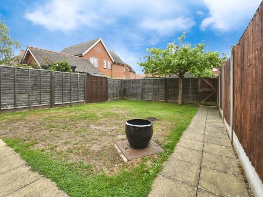
- garden access
- laminate flooring
- white cabinets
- open layout
- bi-fold doors
- natural light
EPC Details
- Fully double glazed
- Cavity wall, as built, insulated (assumed)
- Boiler and radiators, mains gas
- Low energy lighting in 29% of fixed outlets
- Suspended, insulated (assumed)
Nearby Schools
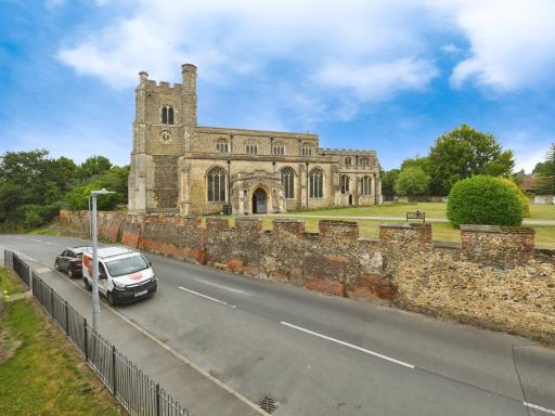
- Beckers Green Primary School
- Gosfield Community Primary School
- St Margaret's Preparatory School
- Richard de Clare Community Academy
- White Notley Church of England Voluntary Controlled Primary School
- St Michael's Church of England Voluntary Aided Primary School
- Rayne Primary and Nursery School
- Great Bradfords Junior School
- Great Bradfords Infant and Nursery School
- Tabor Academy
- Stisted Church of England Primary Academy
- The Ramsey Academy, Halstead
- Cressing Primary School
- Notley Green Primary School
- John Ray Junior School
- Lyons Hall School
- Bocking Primary School
- Wethersfield CofE VC Primary School
- Silver End Academy
- White Court School
- Notley High School and Braintree Sixth Form
- Alec Hunter Academy
- St Francis Catholic Primary School, Braintree
- John Bunyan Primary School and Nursery
- Shalford Primary School
- Holy Trinity Church of England Voluntary Controlled Primary School, Halstead
- Gosfield School
- St Andrew's Church of England Primary School, Halstead
Nearest Bars And Restaurants
- Id: 2204370004
- Tags:
- Amenity: pub
- Name: The Hare and Hounds
- TagsNormalized:
- Lat: 51.9103596
- Lon: 0.5781746
- FullGeoHash: u10rm1vpb2qh
- PartitionGeoHash: u10r
- Images:
- FoodStandards: null
- Distance: 2028.1
,- Id: 6214772836
- Tags:
- Amenity: pub
- Floor:
- Name: The Angel
- Real_ale: Courage and Butcombe (may vary)
- Wikidata: Q26415663
- TagsNormalized:
- Lat: 51.8859075
- Lon: 0.5568545
- FullGeoHash: u10rhtt3rdhy
- PartitionGeoHash: u10r
- Images:
- FoodStandards: null
- Distance: 1760.4
,- Id: 852836968
- Tags:
- Amenity: pub
- Name: Bocking Village Club
- TagsNormalized:
- Lat: 51.9042779
- Lon: 0.5569497
- FullGeoHash: u10rk8vs3fev
- PartitionGeoHash: u10r
- Images:
- FoodStandards: null
- Distance: 442.7
,- Id: 210631528
- Tags:
- Amenity: pub
- Building: yes
- Name: The Rose and Crown
- Wikidata: Q26415642
- TagsNormalized:
- Lat: 51.9025824
- Lon: 0.5550731
- FullGeoHash: u10rk8s4qnse
- PartitionGeoHash: u10r
- Images:
- FoodStandards: null
- Distance: 223.3
,- Id: 2207147619
- Tags:
- Amenity: pub
- Name: The Retreat
- TagsNormalized:
- Lat: 51.9014897
- Lon: 0.5537743
- FullGeoHash: u10rk87hpfuj
- PartitionGeoHash: u10r
- Images:
- FoodStandards: null
- Distance: 98.4
}
Nearest General Shops
- Id: 6224020578
- Tags:
- TagsNormalized:
- Lat: 51.8798266
- Lon: 0.552704
- FullGeoHash: u10rhs6myutu
- PartitionGeoHash: u10r
- Images:
- FoodStandards: null
- Distance: 2409.2
,- Id: 5237864143
- Tags:
- Addr:
- Housenumber: 36
- Postcode: CM7 2YW
- Street: Warner Drive
- Name: Searing Motorcycles
- Shop: motorcycle
- Website: http://searings.com/
- TagsNormalized:
- Lat: 51.8836882
- Lon: 0.5346038
- FullGeoHash: u10rhjjk3hmr
- PartitionGeoHash: u10r
- Images:
- FoodStandards: null
- Distance: 2323.9
,- Id: 5705576666
- Tags:
- Addr:
- City: Braintree
- Country: GB
- Postcode: CM7 2YN
- Street: Springwood Drive
- Unit: 29
- Description: Fancy Dress Hire
- Name: Chameleon Costumes Fancy Dress
- Shop: clothes
- Website: http://chameleoncostumes.co.uk/contact-us.html
- TagsNormalized:
- Lat: 51.8877399
- Lon: 0.5386243
- FullGeoHash: u10rhmb5yzg2
- PartitionGeoHash: u10r
- Images:
- FoodStandards: null
- Distance: 1795.6
}
Nearest Grocery shops
- Id: 353334275
- Tags:
- Brand: Co-op Food
- Brand:wikidata: Q3277439
- Brand:wikipedia: en:Co-op Food
- Name: Co-op Food
- Operator: The Co-operative Group
- Operator:wikidata: Q117202
- Shop: convenience
- TagsNormalized:
- co-op
- co-op food
- food
- convenience
- shop
- Lat: 51.8829724
- Lon: 0.5449632
- FullGeoHash: u10rhmhb4x41
- PartitionGeoHash: u10r
- Images:
- FoodStandards: null
- Distance: 2120.6
,- Id: 346286449
- Tags:
- Brand: One Stop
- Brand:wikidata: Q65954217
- Name: One Stop
- Shop: convenience
- TagsNormalized:
- Lat: 51.8888642
- Lon: 0.5509805
- FullGeoHash: u10rhw14wc2g
- PartitionGeoHash: u10r
- Images:
- FoodStandards: null
- Distance: 1407.3
,- Id: 457095502
- Tags:
- Addr:
- City: Bocking Churchstreet
- Housenumber: 62
- Postcode: CM7 5JY
- Street: Church Street
- Building: yes
- Name: The Co-operative Food
- Opening_hours: Mo-Su 07:00-22:00
- Shop: supermarket
- TagsNormalized:
- the co-operative food
- food
- shop
- Lat: 51.901955
- Lon: 0.5544454
- FullGeoHash: u10rk87wz98m
- PartitionGeoHash: u10r
- Images:
- FoodStandards: null
- Distance: 153.4
}
Nearest Religious buildings
- Id: 147586656
- Tags:
- Amenity: place_of_worship
- Denomination: anglican
- Name: St Mary and St Christopher, Panfield
- Religion: christian
- Wikidata: Q17557312
- TagsNormalized:
- place of worship
- anglican
- christian
- church
- Lat: 51.8995494
- Lon: 0.5256715
- FullGeoHash: u10r7bnbc11p
- PartitionGeoHash: u10r
- Images:
- FoodStandards: null
- Distance: 1842.4
,- Id: 210584412
- Tags:
- Amenity: school
- Building: yes
- Name: Bocking Church Street Community Primary School
- TagsNormalized:
- Lat: 51.9037427
- Lon: 0.5558468
- FullGeoHash: u10rk8uc0nvm
- PartitionGeoHash: u10r
- Images:
- FoodStandards: null
- Distance: 347.2
,- Id: 145349386
- Tags:
- Amenity: place_of_worship
- Denomination: anglican
- Name: Saint Mary the Virgin, Bocking
- Religion: christian
- Wikidata: Q17535793
- TagsNormalized:
- place of worship
- anglican
- christian
- church
- Lat: 51.901986
- Lon: 0.5522951
- FullGeoHash: u10rk86nvrmn
- PartitionGeoHash: u10r
- Images:
- FoodStandards: null
- Distance: 55
}
Nearest Medical buildings
- Id: 56954536
- Tags:
- Amenity: parking
- Capacity: 60
- Capacity:disabled: yes
- Fee: no
- Name: Elizabeth Courtauld Surgery
- Parking: surface
- TagsNormalized:
- Lat: 51.9418829
- Lon: 0.635886
- FullGeoHash: u10rqrxp3hyb
- PartitionGeoHash: u10r
- Images:
- FoodStandards: null
- Distance: 7280
,- Id: 130073956
- Tags:
- Addr:
- City: Braintree
- Country: GB
- Housename: St Michael's House
- Postcode: CM7 1EY
- Street: St Michael's Lane
- Amenity: dentist
- Building: yes
- Healthcare: dentist
- Name: Dr R Patel
- TagsNormalized:
- Lat: 51.8777261
- Lon: 0.5504731
- FullGeoHash: u10rhs0cdvn6
- PartitionGeoHash: u10r
- Images:
- FoodStandards: null
- Distance: 2645.8
,- Id: 546893183
- Tags:
- Addr:
- City: Braintree
- Postcode: CM7 2AE
- Street: Mace Avenue
- Amenity: doctors
- Building: yes
- Healthcare: doctor
- Name: Blandford Medical Centre
- Opening_hours: Mo-Fr 08:00-18:30; Sa-Su off
- Operator: NHS England
- Phone: +44 1376 347100
- Website: http://www.blandfordmedicalcentre.co.uk/
- TagsNormalized:
- doctor
- doctors
- health
- healthcare
- Lat: 51.8789889
- Lon: 0.5408255
- FullGeoHash: u10rhk3c40kx
- PartitionGeoHash: u10r
- Images:
- FoodStandards: null
- Distance: 2624
,- Id: 715548760
- Tags:
- Addr:
- City: Braintree
- Street: Chadwick Drive
- Amenity: hospital
- Emergency: no
- Healthcare: hospital
- Healthcare:speciality: maternity
- Name: Braintree Community Hospital
- Operator: NHS
- Operator:type: government
- Operator:wikidata: Q918396
- TagsNormalized:
- hospital
- health
- healthcare
- maternity
- Lat: 51.8795775
- Lon: 0.5408639
- FullGeoHash: u10rhk3u7n1q
- PartitionGeoHash: u10r
- Images:
- FoodStandards: null
- Distance: 2560.9
}
Nearest Airports
- Id: 495488524
- Tags:
- Aerodrome: international
- Aerodrome:type: public
- Aeroway: aerodrome
- Alt_name: Stansted
- Iata: STN
- Icao: EGSS
- Is_in: Essex,England,UK
- Name: London Stansted Airport
- Ref: STN
- Source: Gagravarr_Airports
- Website: https://www.stanstedairport.com/
- Wikidata: Q8709
- Wikipedia: en:London Stansted Airport
- TagsNormalized:
- airport
- international airport
- Lat: 51.8869677
- Lon: 0.2429264
- FullGeoHash: u10pjt8zkxg4
- PartitionGeoHash: u10p
- Images:
- FoodStandards: null
- Distance: 21293.3
}
Nearest Leisure Facilities
- Id: 405297676
- Tags:
- Building: yes
- Leisure: sports_centre
- Name: Towerlands Leisure Centre
- TagsNormalized:
- sports
- sports centre
- leisure
- Lat: 51.8979587
- Lon: 0.543199
- FullGeoHash: u10rhrex92ww
- PartitionGeoHash: u10r
- Images:
- FoodStandards: null
- Distance: 740.1
,- Id: 31723470
- Tags:
- TagsNormalized:
- Lat: 51.8961044
- Lon: 0.5465277
- FullGeoHash: u10rhrmuxp09
- PartitionGeoHash: u10r
- Images:
- FoodStandards: null
- Distance: 719.7
,- Id: 31723561
- Tags:
- Landuse: quarry
- Leisure: sports_centre
- Name: Braintree BMX Track
- TagsNormalized:
- sports
- sports centre
- leisure
- bmx
- track
- Lat: 51.8965812
- Lon: 0.545854
- FullGeoHash: u10rhrmrrrfj
- PartitionGeoHash: u10r
- Images:
- FoodStandards: null
- Distance: 704.4
,- Id: 911543962
- Tags:
- Leisure: pitch
- Sport: bowls
- TagsNormalized:
- Lat: 51.9021174
- Lon: 0.5570918
- FullGeoHash: u10rk8mxtpvy
- PartitionGeoHash: u10r
- Images:
- FoodStandards: null
- Distance: 333.4
,- Id: 888289167
- Tags:
- TagsNormalized:
- Lat: 51.9015965
- Lon: 0.5484139
- FullGeoHash: u10rk2rkdyz4
- PartitionGeoHash: u10r
- Images:
- FoodStandards: null
- Distance: 269.6
}
Nearest Tourist attractions
- Id: 4195908298
- Tags:
- Name: John Ray Garden
- Tourism: attraction
- TagsNormalized:
- Lat: 51.8837687
- Lon: 0.5539758
- FullGeoHash: u10rht5kue6r
- PartitionGeoHash: u10r
- Images:
- FoodStandards: null
- Distance: 1974
,- Id: 4195908299
- Tags:
- Name: Wildlife Area
- Tourism: attraction
- TagsNormalized:
- Lat: 51.884406
- Lon: 0.5538161
- FullGeoHash: u10rht728f71
- PartitionGeoHash: u10r
- Images:
- FoodStandards: null
- Distance: 1902.6
,- Id: 145348981
- Tags:
- Man_made: windmill
- Name: Bocking Windmill
- Tourism: attraction
- Wikidata: Q4936285
- TagsNormalized:
- Lat: 51.9043432
- Lon: 0.5614006
- FullGeoHash: u10rkbbu9wfe
- PartitionGeoHash: u10r
- Images:
- FoodStandards: null
- Distance: 697.8
}
Nearest Train stations
- Id: 55420748
- Tags:
- Name: Cressing
- Naptan:
- Network: National Rail
- Public_transport: station
- Railway: station
- Ref:
- Train: yes
- Wikidata: Q1886114
- Wikipedia: en:Cressing railway station
- TagsNormalized:
- Lat: 51.852306
- Lon: 0.5779203
- FullGeoHash: u10qvpkvdd2t
- PartitionGeoHash: u10q
- Images:
- FoodStandards: null
- Distance: 5744.2
,- Id: 187038971
- Tags:
- Amenity: shelter
- Building: train_station
- TagsNormalized:
- shelter
- station
- train
- train station
- Lat: 51.8692466
- Lon: 0.5682988
- FullGeoHash: u10rhftb626k
- PartitionGeoHash: u10r
- Images:
- FoodStandards: null
- Distance: 3749.1
,- Id: 55420882
- Tags:
- Addr:
- Postcode: CM77 8YH
- Street: Chapel Hill Retail Park
- Name: Braintree Freeport
- Naptan:
- Network: National Rail
- Note: FIXME location approximate, judged from landsat
- Public_transport: station
- Railway: station
- Ref:
- Train: yes
- Wikidata: Q2540597
- Wikipedia: en:Braintree Freeport railway station
- TagsNormalized:
- Lat: 51.8692939
- Lon: 0.5681965
- FullGeoHash: u10rhft8xcnn
- PartitionGeoHash: u10r
- Images:
- FoodStandards: null
- Distance: 3742
,- Id: 1997260503
- Tags:
- Name: Braintree
- Name:lt: Breintris
- Naptan:
- Network: National Rail
- Old_name: Braintree and Bocking
- Public_transport: station
- Railway: station
- Ref:
- Train: yes
- Wikidata: Q2716690
- Wikipedia: en:Braintree railway station (England)
- TagsNormalized:
- Lat: 51.8753105
- Lon: 0.5567303
- FullGeoHash: u10rhet7sfb0
- PartitionGeoHash: u10r
- Images:
- FoodStandards: null
- Distance: 2926.8
,- Id: 187033767
- Tags:
- Amenity: cafe
- Building: train_station
- Name: Cafe Alexander
- TagsNormalized:
- cafe
- station
- train
- train station
- Lat: 51.8753588
- Lon: 0.5565999
- FullGeoHash: u10rhet7ceyb
- PartitionGeoHash: u10r
- Images:
- FoodStandards: null
- Distance: 2920.6
}
Nearest Hotels
- Id: 104310066
- Tags:
- Brand: Premier Inn
- Brand:wikidata: Q2108626
- Brand:wikipedia: en:Premier Inn
- Building: yes
- Internet_access: wlan
- Internet_access:fee: customers
- Internet_access:operator: Virgin Media
- Internet_access:ssid: Premier Inn Free Wi-Fi
- Name: Premier Inn
- Tourism: hotel
- Wheelchair: yes
- TagsNormalized:
- Lat: 51.8691903
- Lon: 0.5819277
- FullGeoHash: u10rj4rxzvus
- PartitionGeoHash: u10r
- Images:
- FoodStandards: null
- Distance: 4126.1
,- Id: 146338280
- Tags:
- Addr:
- Brand: Holiday Inn Express
- Brand:wikidata: Q5880423
- Brand:wikipedia: en:Holiday Inn Express
- Building: hotel
- Key: FLP BP Alt Tues
- Name: Holiday Inn Express
- Source:
- Tourism: hotel
- TagsNormalized:
- Lat: 51.8684265
- Lon: 0.5365901
- FullGeoHash: u10rh4qerrqx
- PartitionGeoHash: u10r
- Images:
- FoodStandards: null
- Distance: 3832.3
,- Id: 10661255737
- Tags:
- Brand: Travelodge
- Brand:wikidata: Q9361374
- Internet_access: wlan
- Internet_access:fee: customers
- Internet_access:ssid: Travelodge WiFi
- Name: Travelodge
- Tourism: hotel
- TagsNormalized:
- Lat: 51.8774746
- Lon: 0.5545117
- FullGeoHash: u10rhs5b1n1y
- PartitionGeoHash: u10r
- Images:
- FoodStandards: null
- Distance: 2674.8
}
Tags
- detached house
- modern style
- two-story
- bay window
- brick facade
- off-street parking
- residential
- suburban
- family home
- modern kitchen
- breakfast bar
- garden access
- laminate flooring
- white cabinets
- open layout
- bi-fold doors
- natural light
Local Market Stats
- Average Price/sqft: £343
- Avg Income: £45800
- Rental Yield: 4.2%
- Social Housing: 9%
- Planning Success Rate: 73%
Similar Properties
 4 bedroom link detached house for sale in Samuel Courtauld Avenue, Braintree, CM7 — £425,000 • 4 bed • 3 bath • 1023 ft²
 4 bedroom detached house for sale in Canterbury Grange, Braintree, CM7 — £450,000 • 4 bed • 1 bath • 1012 ft²
 4 bedroom link detached house for sale in Samuel Courtauld Avenue, Braintree, Essex, CM7 — £425,000 • 4 bed • 2 bath • 707 ft²
 4 bedroom link detached house for sale in Dyers Mead, Braintree, CM7 — £475,000 • 4 bed • 2 bath • 1443 ft²
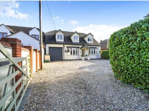 5 bedroom detached house for sale in High Garrett, Braintree, CM7 — £650,000 • 5 bed • 3 bath • 2120 ft²
 3 bedroom semi-detached house for sale in Samuel Courtauld Avenue, Braintree, CM7 — £365,000 • 3 bed • 1 bath
Meta
- {
"@context": "https://schema.org",
"@type": "Residence",
"name": "4 bedroom terraced house for sale in Bovingdon Road, Braint…",
"description": "",
"url": "https://propertypiper.co.uk/property/53325efb-6435-4365-bb79-3090cc2a84e4",
"image": "https://image-a.propertypiper.co.uk/154728b0-b549-4d15-856c-02cb8f78c40d-1024.jpeg",
"address": {
"@type": "PostalAddress",
"streetAddress": "Bovingdon Road, Braintree, Essex, CM7",
"postalCode": "CM7 5GS",
"addressLocality": "Braintree",
"addressRegion": "Braintree",
"addressCountry": "England"
},
"geo": {
"@type": "GeoCoordinates",
"latitude": 51.901492126766605,
"longitude": 0.5523396925467591
},
"numberOfRooms": 4,
"numberOfBathroomsTotal": 3,
"floorSize": {
"@type": "QuantitativeValue",
"value": 1600,
"unitCode": "FTK"
},
"offers": {
"@type": "Offer",
"price": 400000,
"priceCurrency": "GBP",
"availability": "https://schema.org/InStock"
},
"additionalProperty": [
{
"@type": "PropertyValue",
"name": "Feature",
"value": "detached house"
},
{
"@type": "PropertyValue",
"name": "Feature",
"value": "modern style"
},
{
"@type": "PropertyValue",
"name": "Feature",
"value": "two-story"
},
{
"@type": "PropertyValue",
"name": "Feature",
"value": "bay window"
},
{
"@type": "PropertyValue",
"name": "Feature",
"value": "brick facade"
},
{
"@type": "PropertyValue",
"name": "Feature",
"value": "off-street parking"
},
{
"@type": "PropertyValue",
"name": "Feature",
"value": "residential"
},
{
"@type": "PropertyValue",
"name": "Feature",
"value": "suburban"
},
{
"@type": "PropertyValue",
"name": "Feature",
"value": "family home"
},
{
"@type": "PropertyValue",
"name": "Feature",
"value": "modern kitchen"
},
{
"@type": "PropertyValue",
"name": "Feature",
"value": "breakfast bar"
},
{
"@type": "PropertyValue",
"name": "Feature",
"value": "garden access"
},
{
"@type": "PropertyValue",
"name": "Feature",
"value": "laminate flooring"
},
{
"@type": "PropertyValue",
"name": "Feature",
"value": "white cabinets"
},
{
"@type": "PropertyValue",
"name": "Feature",
"value": "open layout"
},
{
"@type": "PropertyValue",
"name": "Feature",
"value": "bi-fold doors"
},
{
"@type": "PropertyValue",
"name": "Feature",
"value": "natural light"
}
]
}
High Res Floorplan Images
Compatible Floorplan Images
FloorplanImages Thumbnail