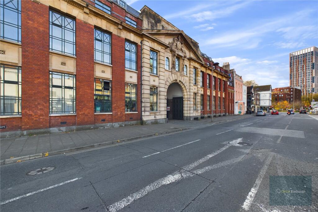
BS2 0EH - 2 bedroom maisonette for sale in The Old Drill Hall, BS2
View on Property Piper
2 bedroom maisonette for sale in The Old Drill Hall, BS2
Property Details
- Price: £225000
- Bedrooms: 2
- Bathrooms: 1
- Property Type: undefined
- Property SubType: undefined
Image Descriptions
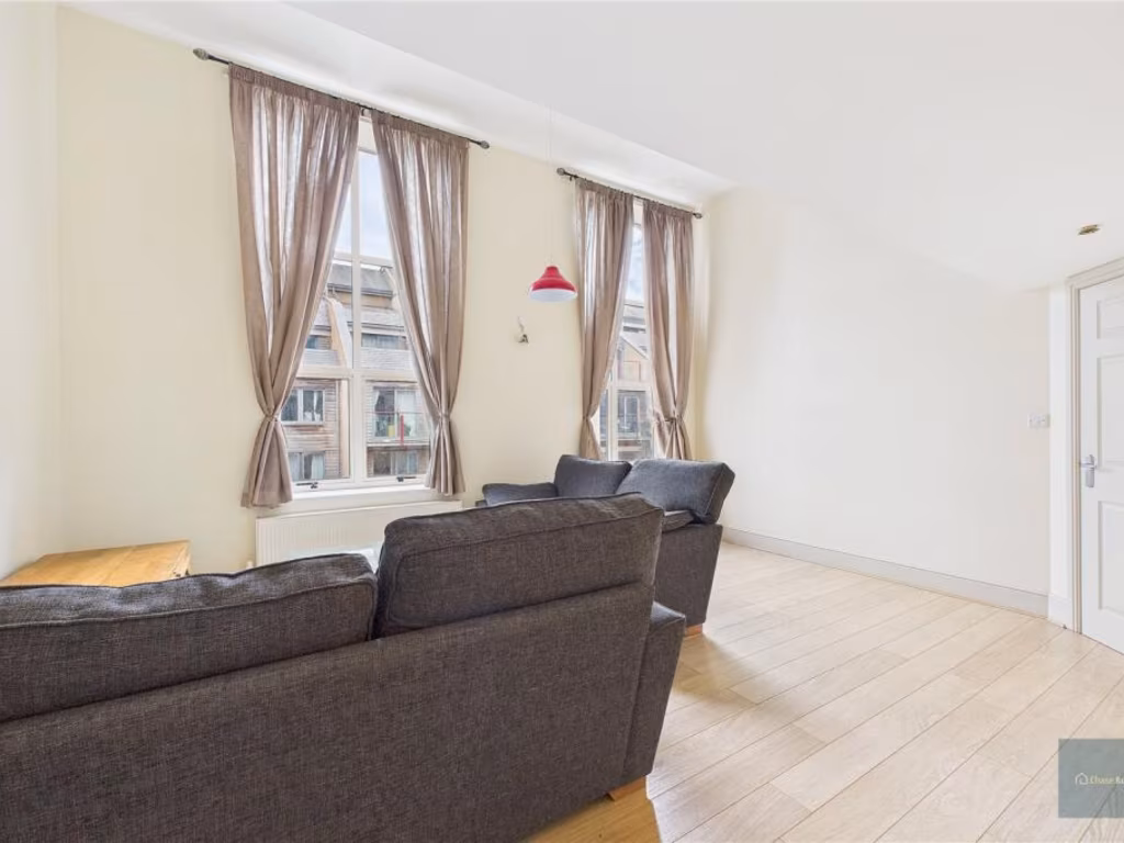
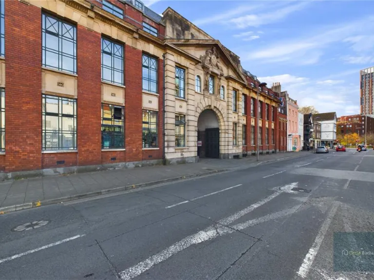
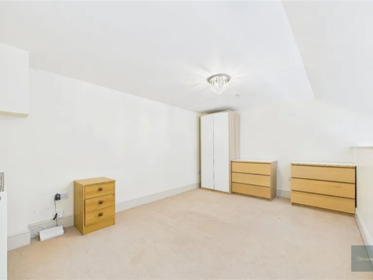
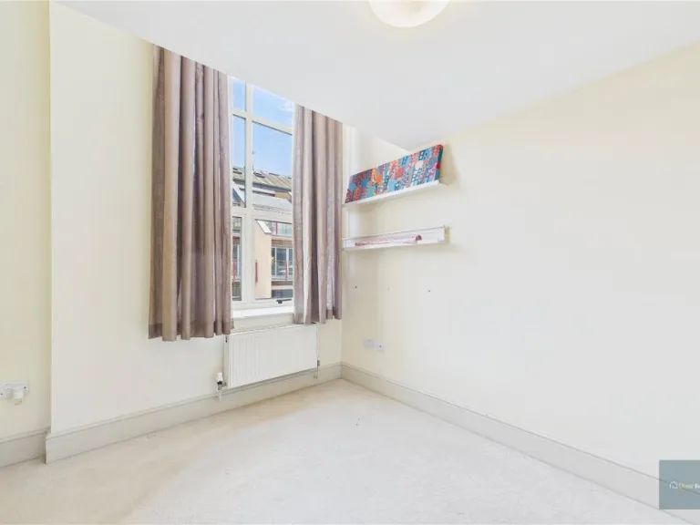
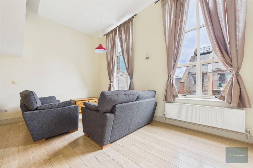
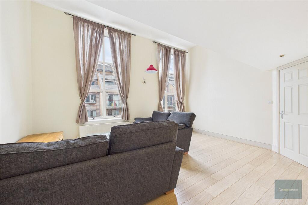
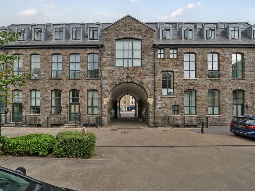
- converted warehouse industrial
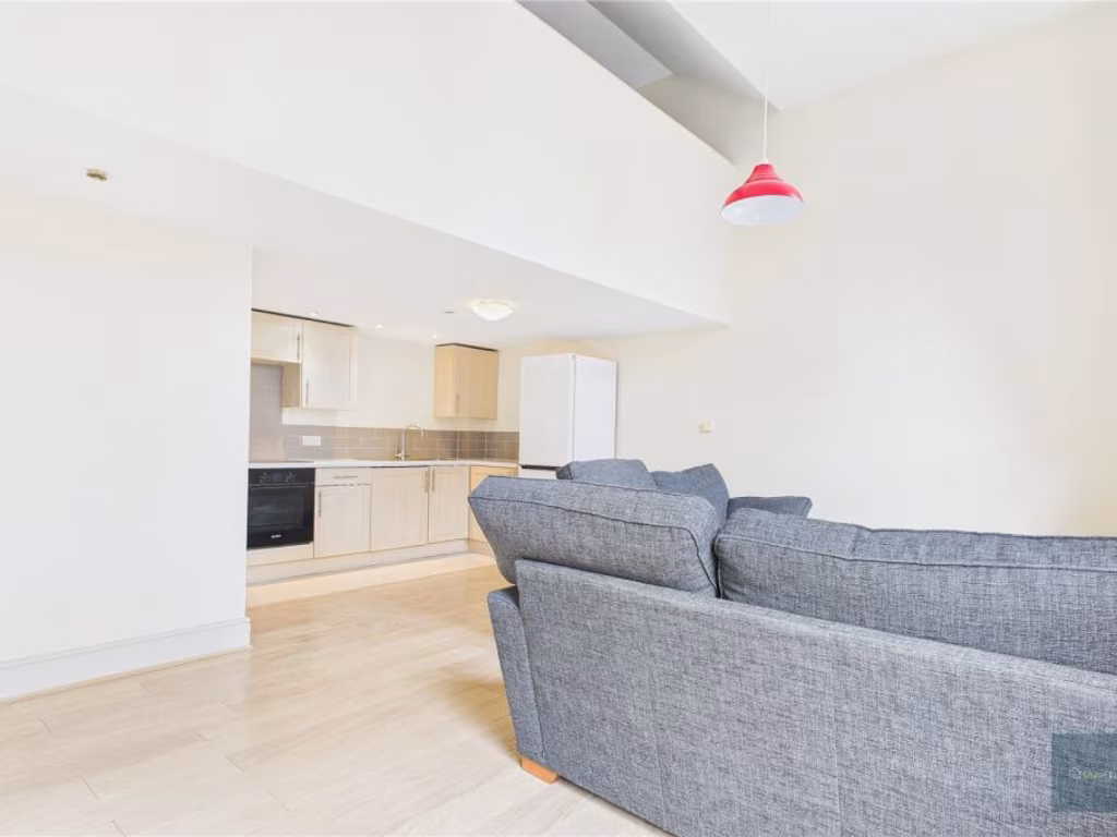
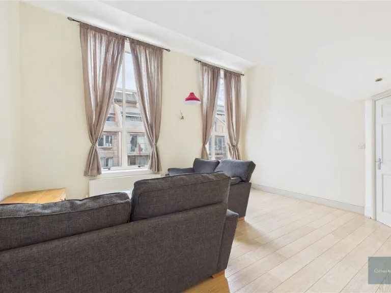
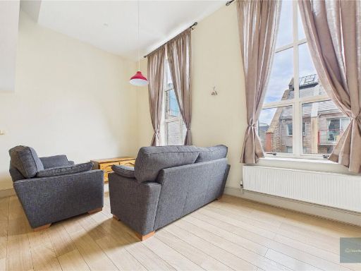
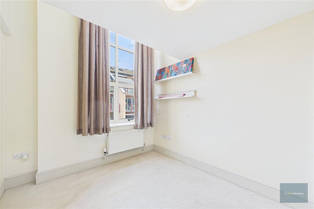
- living room industrial
Floorplan Description
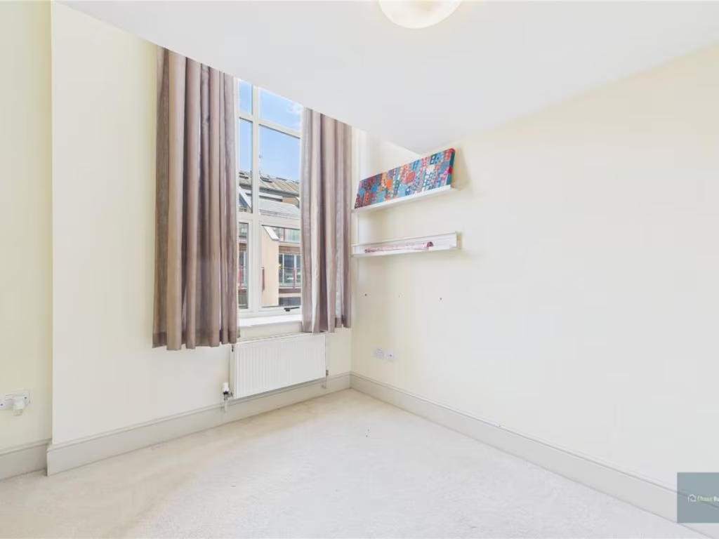
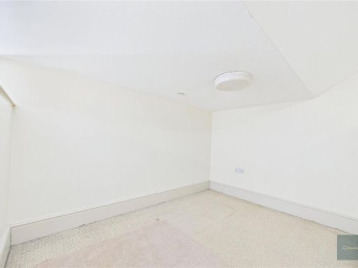
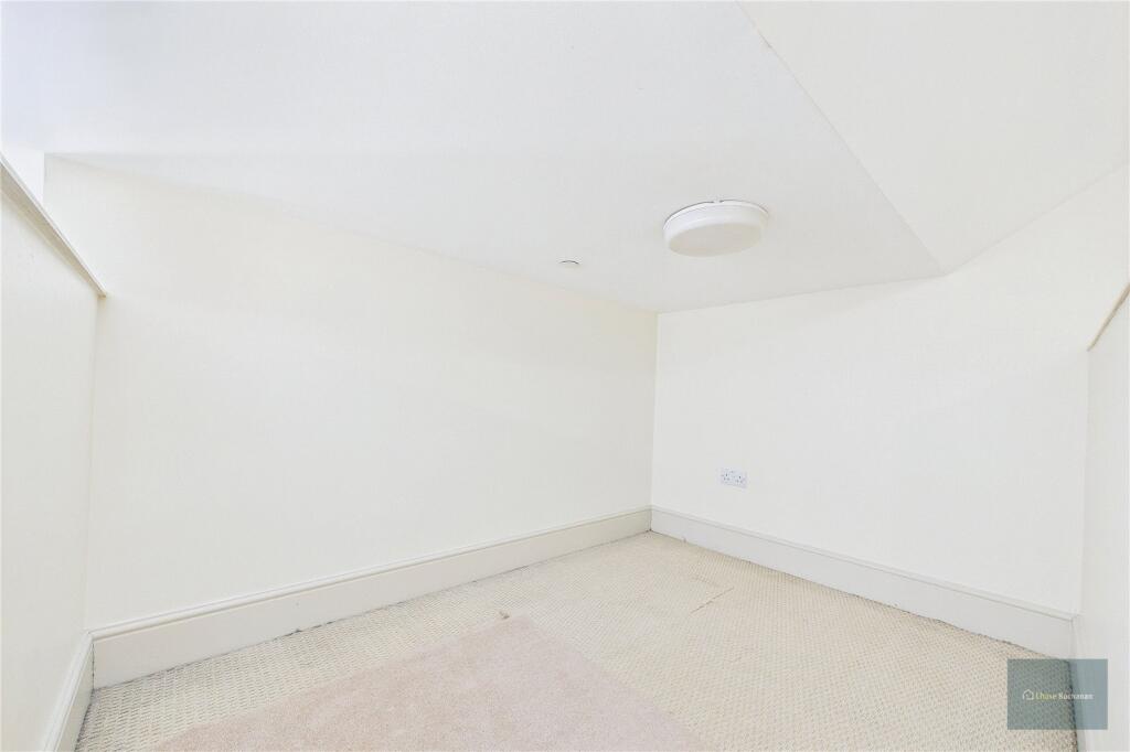
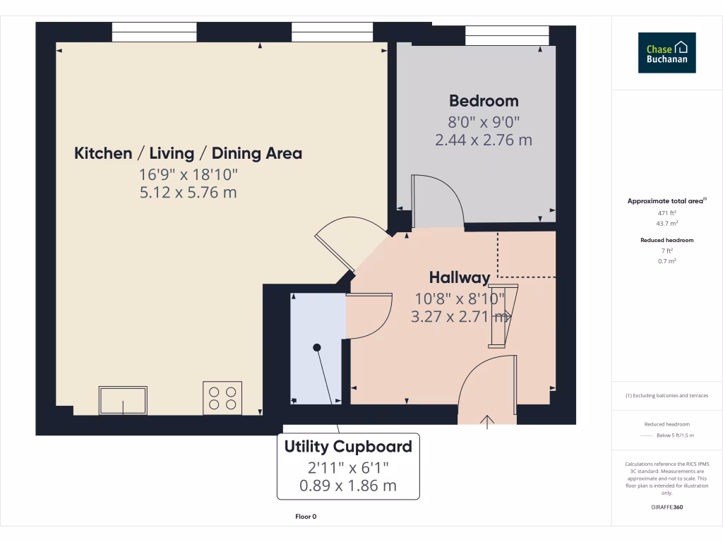
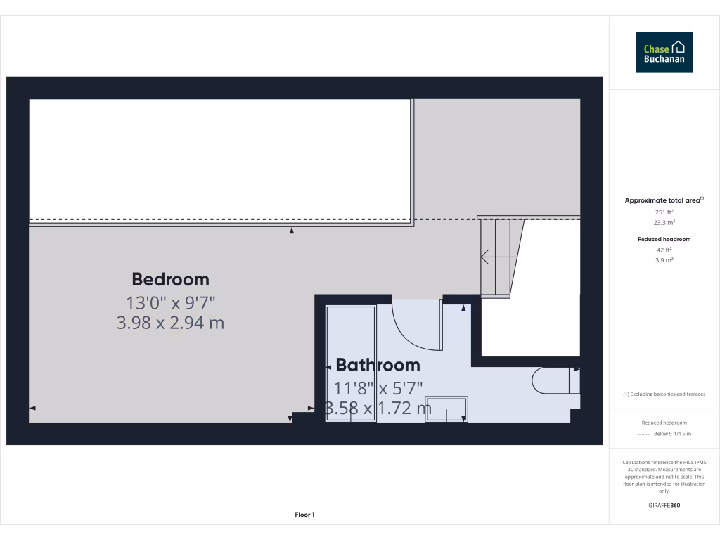
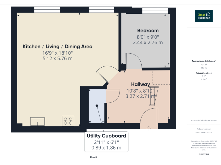
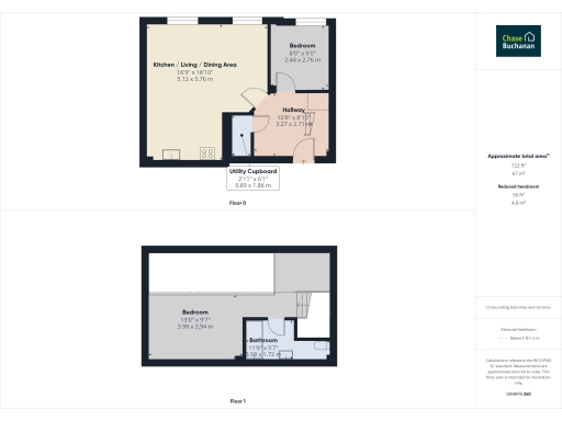
- A single-level property with a bedroom and bathroom, featuring reduced headroom in some areas.
Rooms
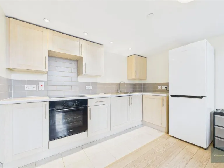
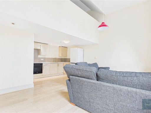
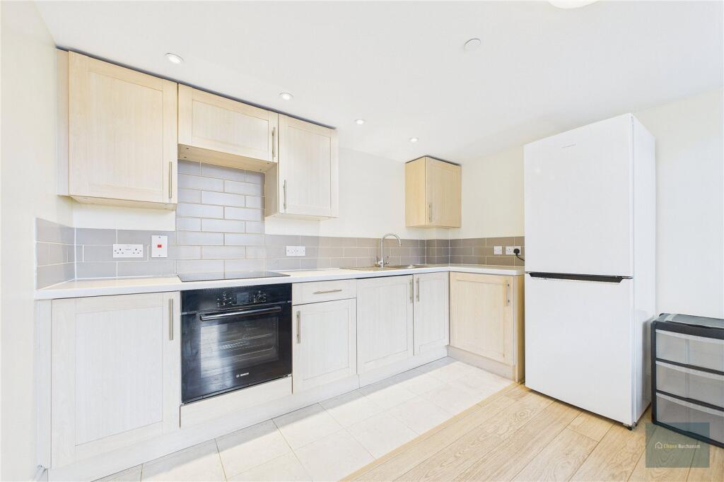
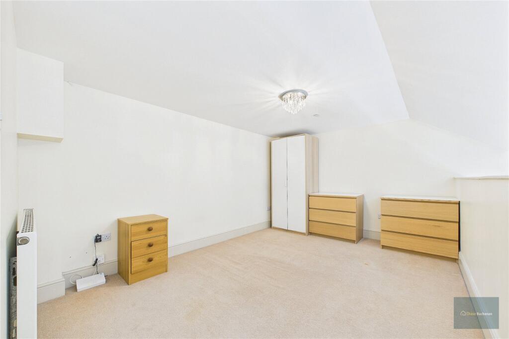
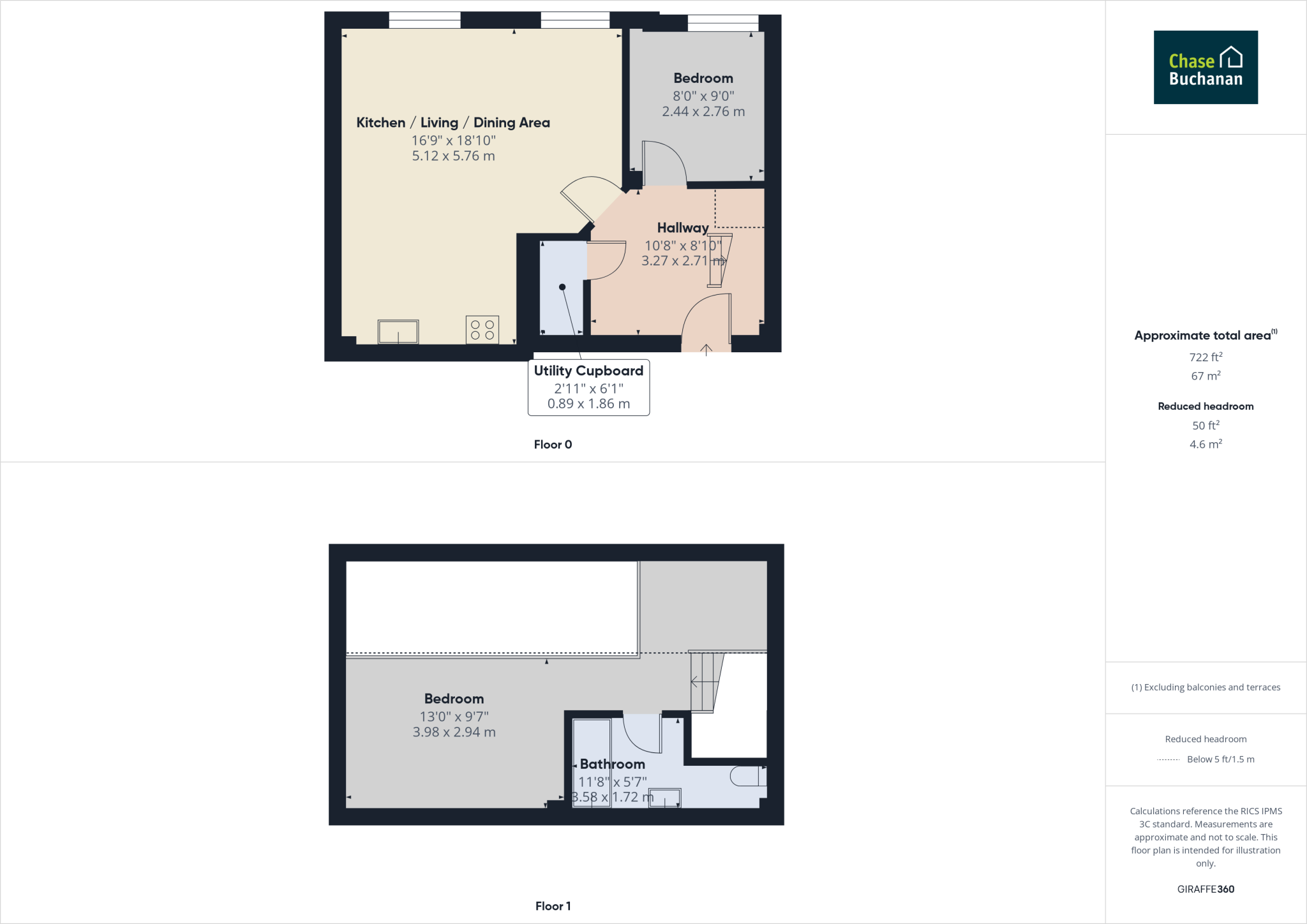
- Kitchen / Living / Dining Area:
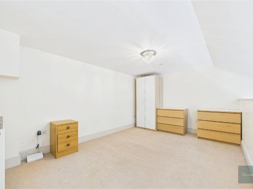
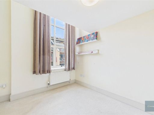
- Bedroom:
- Hallway:
- Utility Cupboard:
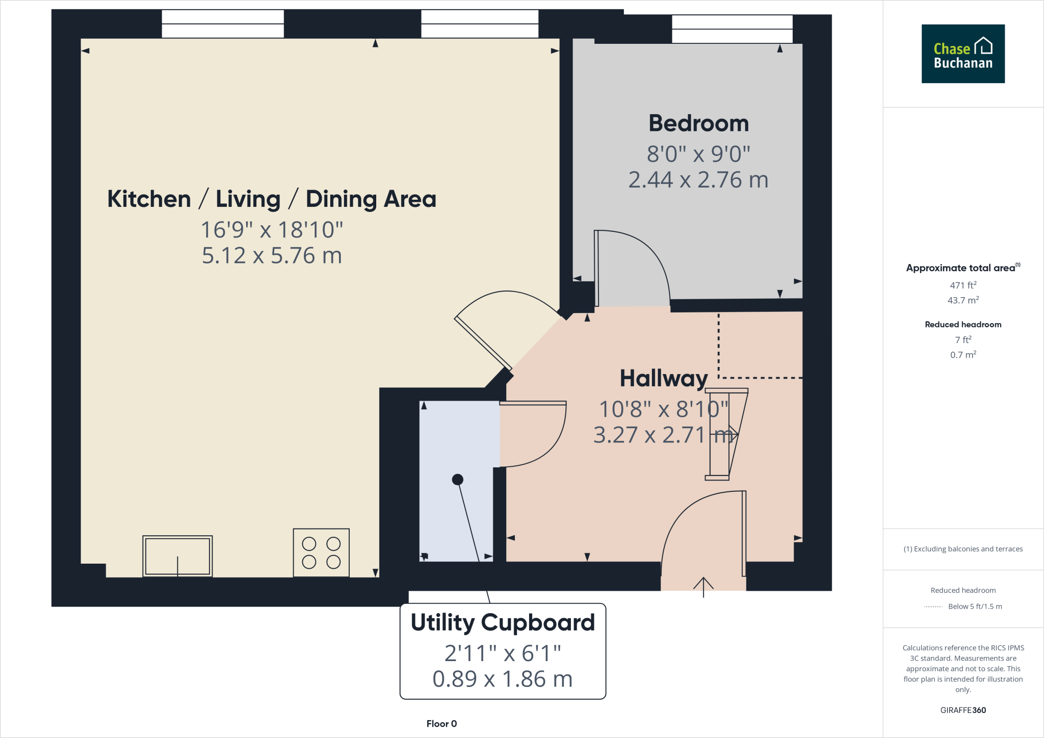
- Bedroom:
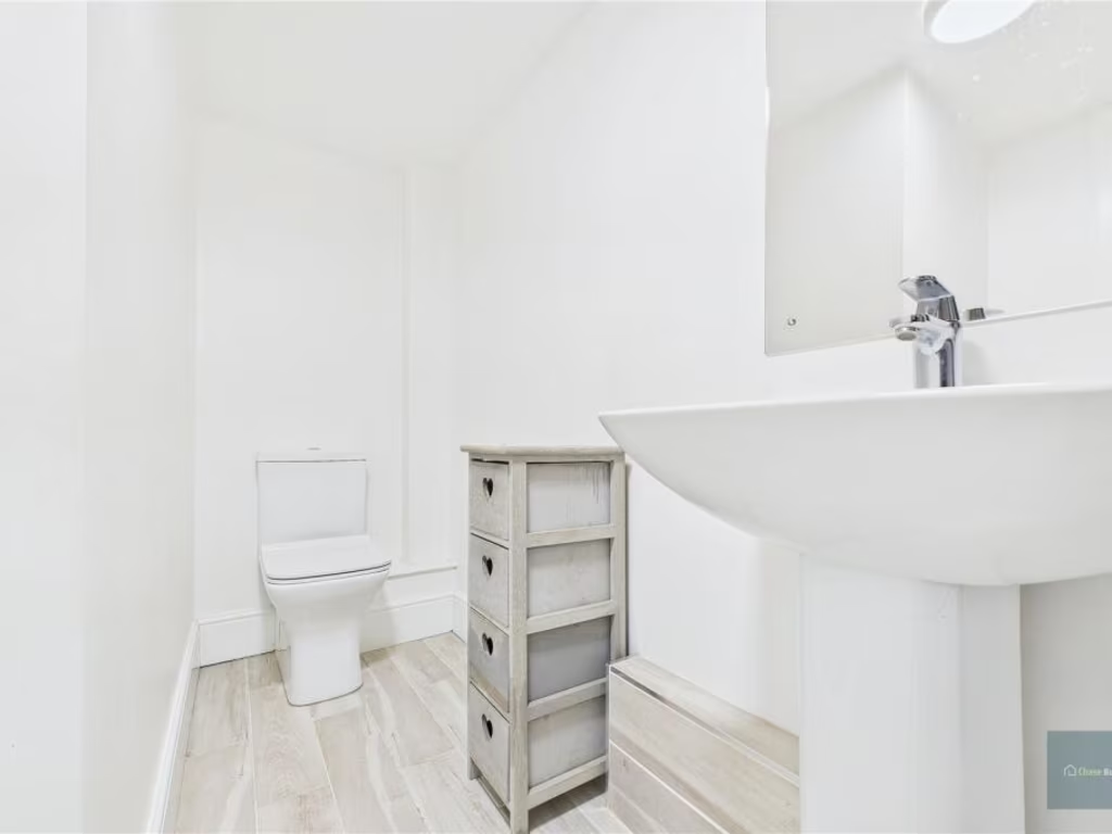
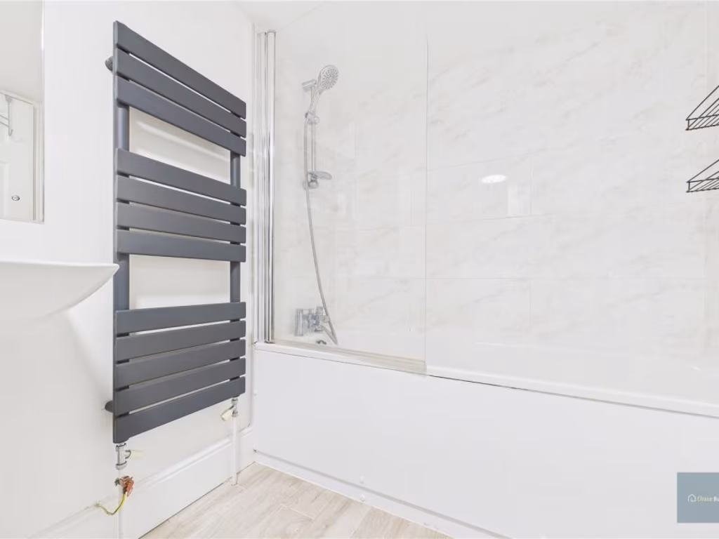
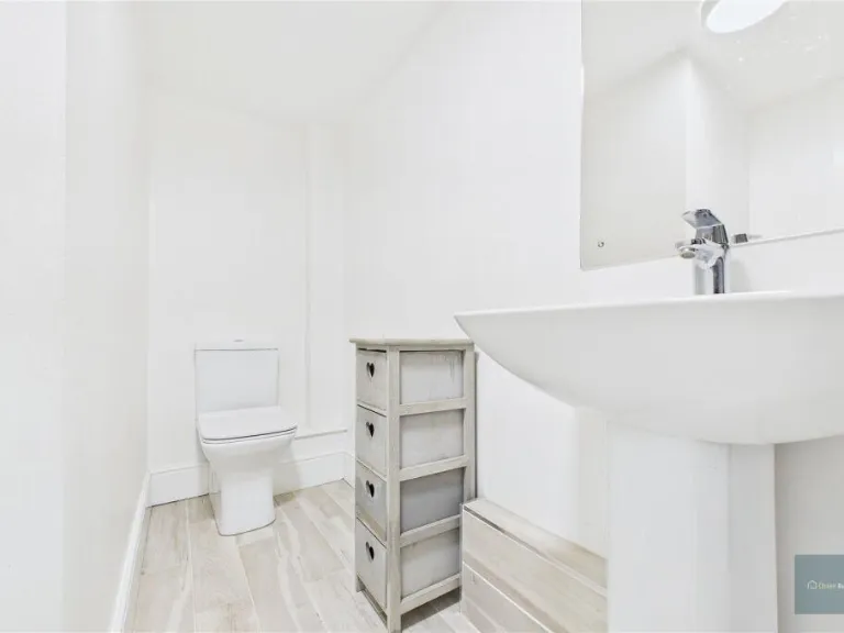
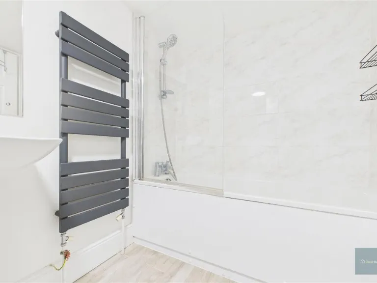
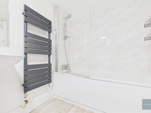
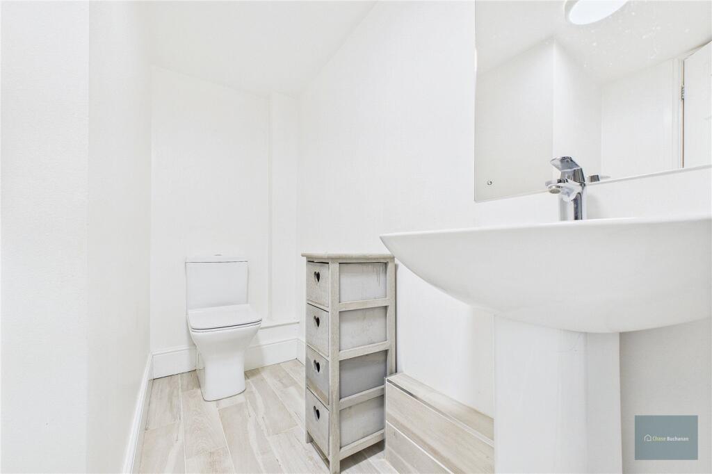
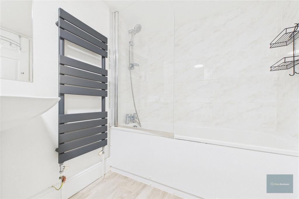
- Bathroom:
- Kitchen / Living / Dining Area:
- Bedroom:
- Hallway:
- Utility Cupboard:
- Bedroom: large
- Bathroom: large
Textual Property Features
Detected Visual Features
- industrial
- converted warehouse
- high ceilings
- large windows
- urban
- historic
- red brick
- stonework
- living room
- natural light
- wood flooring
- modern
EPC Details
- Fully double glazed
- Sandstone or limestone, with internal insulation
- Boiler and radiators, electric
- Low energy lighting in all fixed outlets
- (another dwelling below)
Nearby Schools
- LPW Independent School
- St Mary Redcliffe and Temple School
- Bristol Cathedral Choir School
- Hannah More Primary School
- St Nicholas of Tolentine Catholic Primary School
- Bannerman Road Community Academy
- Brunel Field Primary School
- Hillcrest Primary School
- Oasis Academy Temple Quarter
- Cathedral Primary School
- Easton Church of England Academy
- Cabot Primary School
- Cotham Gardens Primary School
- Victoria Park Primary School
- St Mary Redcliffe Church of England Primary School
- Willow Park CofE Primary School
- The City Academy Bristol
- Cotham School
- Evergreen Primary Academy
- Fairlawn Primary School
- St Werburgh's Primary School
- Sefton Park Infant School
- Holy Cross RC Primary School
- Snowdon Village
- Bristol Grammar School
- The Dolphin School
- Sefton Park Junior School
Nearest General Shops
- Id: 403192926
- Tags:
- Addr:
- City: Bristol
- Suburb: St Philip's
- Building: yes
- Name: Hounsfield Printing
- Shop: copyshop
- TagsNormalized:
- Lat: 51.4559667
- Lon: -2.5811827
- FullGeoHash: gcnhtr22wp6t
- PartitionGeoHash: gcnh
- Images:
- FoodStandards: null
- Distance: 45.3
,- Id: 290998531
- Tags:
- HE_ref: 1202394
- Addr:
- City: Bristol
- Country: GB
- Housenumber: 32
- Postcode: BS2 0HB
- Street: Old Market Street
- Suburb: St Philip's
- Building: retail
- Building:levels: 3
- Listed_status: Grade II
- Name: Bangs
- Roof:
- Shop: hairdresser
- TagsNormalized:
- Lat: 51.4561936
- Lon: -2.5818645
- FullGeoHash: gcnhtprfn1wq
- PartitionGeoHash: gcnh
- Images:
- FoodStandards: null
- Distance: 44.9
,- Id: 403192939
- Tags:
- Addr:
- City: Bristol
- Housenumber: 61
- Postcode: BS2 0EJ
- Street: Old Market Street
- Suburb: St Philip's
- Building: yes
- Name: Glitch
- Shop: hairdresser
- Source:
- TagsNormalized:
- Lat: 51.4557701
- Lon: -2.5814965
- FullGeoHash: gcnhtr0pwfb8
- PartitionGeoHash: gcnh
- Images:
- FoodStandards: null
- Distance: 19.4
}
Nearest Grocery shops
- Id: 9591999712
- Tags:
- Brand: Sainsbury's Local
- Brand:wikidata: Q13218434
- Brand:wikipedia: en:Sainsbury's Local
- Name: Sainsbury's Local
- Shop: convenience
- TagsNormalized:
- sainsburys
- sainsburys local
- convenience
- shop
- Lat: 51.4529534
- Lon: -2.5816259
- FullGeoHash: gcnhtq8p5v8n
- PartitionGeoHash: gcnh
- Images:
- FoodStandards: null
- Distance: 316
,- Id: 3940436646
- Tags:
- Addr:
- City: Bristol
- Housenumber: 1
- Postcode: BS2 0BY
- Street: Temple Way
- Suburb: Redcliffe
- Brand: McColl's
- Brand:wikidata: Q16997477
- Brand:wikipedia: en:McColl's
- Contact:
- Website: https://www.mccolls.co.uk/storelocator/bristol-temple-way/
- Entrance: yes
- Level: 0
- Location: indoor
- Name: McColl's
- Shop: convenience
- Wheelchair: no
- TagsNormalized:
- Lat: 51.454452
- Lon: -2.5828624
- FullGeoHash: gcnhtnzpyvn1
- PartitionGeoHash: gcnh
- Images:
- FoodStandards: null
- Distance: 167.2
,- Id: 290998526
- Tags:
- Addr:
- City: Bristol
- Country: GB
- Housenumber: 42a
- Postcode: BS2 0EZ
- Street: Old Market Street
- Suburb: St Philip's
- Building: retail
- Building:levels: 2
- Fhrs:
- Name: Localz Store
- Shop: convenience
- TagsNormalized:
- Lat: 51.4564122
- Lon: -2.580948
- FullGeoHash: gcnhtr2e7d3w
- PartitionGeoHash: gcnh
- Images:
- FoodStandards:
- Id: 607826
- FHRSID: 607826
- LocalAuthorityBusinessID: 111316
- BusinessName: The Local
- BusinessType: Retailers - other
- BusinessTypeID: 4613
- AddressLine1: null
- AddressLine2: 42a Old Market Street
- AddressLine3: St Philips
- AddressLine4: Bristol
- PostCode: BS2 0EZ
- RatingValue: 4
- RatingKey: fhrs_4_en-GB
- RatingDate: 2018-10-04
- LocalAuthorityCode: 855
- LocalAuthorityName: Bristol
- LocalAuthorityWebSite: http://www.bristol.gov.uk
- LocalAuthorityEmailAddress: food.safety@bristol.gov.uk
- Scores:
- Hygiene: 0
- Structural: 5
- ConfidenceInManagement: 10
- NewRatingPending: false
- Geocode:
- Longitude: -2.58116000000000
- Latitude: 51.45639000000000
- Distance: 89.5
}
Nearest Religious buildings
- Id: 353946710
- Tags:
- Addr:
- City: Bristol
- Housename: Bristol City Mission
- Suburb: St Paul's
- Amenity: place_of_worship
- Building: church
- Building:levels: 3
- Name: Great George Street Church
- Religion: christian
- TagsNormalized:
- place of worship
- church
- christian
- Lat: 51.4579505
- Lon: -2.5821525
- FullGeoHash: gcnhtpxsr3px
- PartitionGeoHash: gcnh
- Images:
- FoodStandards: null
- Distance: 241.3
,- Id: 87978249
- Tags:
- Addr:
- City: Bristol
- Postcode: BS2 0ET
- Street: Tower Hill
- Suburb: Saint Philips
- Amenity: place_of_worship
- Building: church
- Denomination: anglican
- Layer: 1
- Name: Central
- Official_name: St Philip And St Jacob Church
- Old_name: Pip'n'Jay
- Religion: christian
- Source:
- Addr: FHRS Open Data
- Outline: Bing
- Wikidata: Q7595403
- Wikipedia: en:St Philip and St Jacob, Bristol
- TagsNormalized:
- place of worship
- church
- anglican
- christian
- Lat: 51.4545512
- Lon: -2.584411
- FullGeoHash: gcnhtpn06ze3
- PartitionGeoHash: gcnh
- Images:
- FoodStandards: null
- Distance: 229.1
,- Id: 289799815
- Tags:
- Addr:
- City: Bristol
- Housenumber: 1A
- Street: Unity Street
- Suburb: St Philip's
- Building: yes
- Leisure: sports_centre
- Name: Templegate Dojo
- Sport: aikido; judo
- TagsNormalized:
- sports
- sports centre
- leisure
- temple
- dojo
- Lat: 51.4553267
- Lon: -2.5804574
- FullGeoHash: gcnhtr0vnbpe
- PartitionGeoHash: gcnh
- Images:
- FoodStandards: null
- Distance: 105
}
Nearest Airports
- Id: 47483196
- Tags:
- Aerodrome: international
- Aeroway: aerodrome
- Iata: BRS
- Icao: EGGD
- Internet_access: wlan
- Internet_access:fee: no
- Name: Bristol Airport
- Type: public
- Website: https://www.bristolairport.co.uk/
- Wikidata: Q8725
- Wikipedia: en:Bristol Airport
- TagsNormalized:
- airport
- international airport
- Lat: 51.3830799
- Lon: -2.7186615
- FullGeoHash: gcnh64h24s74
- PartitionGeoHash: gcnh
- Images:
- FoodStandards: null
- Distance: 12469
}
Nearest Leisure Facilities
- Id: 5834930851
- Tags:
- TagsNormalized:
- picnic
- picnic table
- leisure
- Lat: 51.4573107
- Lon: -2.582865
- FullGeoHash: gcnhtpx0wcuq
- PartitionGeoHash: gcnh
- Images:
- FoodStandards: null
- Distance: 184.8
,- Id: 112681162
- Tags:
- Leisure: park
- Name: St Matthias Park
- TagsNormalized:
- Lat: 51.4572371
- Lon: -2.5828121
- FullGeoHash: gcnhtpx20h5x
- PartitionGeoHash: gcnh
- Images:
- FoodStandards: null
- Distance: 175.9
,- Id: 5834930858
- Tags:
- TagsNormalized:
- picnic
- picnic table
- leisure
- Lat: 51.457246
- Lon: -2.5826518
- FullGeoHash: gcnhtpx25vgh
- PartitionGeoHash: gcnh
- Images:
- FoodStandards: null
- Distance: 172.6
,- Id: 191919861
- Tags:
- TagsNormalized:
- Lat: 51.4559514
- Lon: -2.5799098
- FullGeoHash: gcnhtr32esxf
- PartitionGeoHash: gcnh
- Images:
- FoodStandards: null
- Distance: 130.3
,- Id: 191919864
- Tags:
- TagsNormalized:
- Lat: 51.4561219
- Lon: -2.5800691
- FullGeoHash: gcnhtr338h35
- PartitionGeoHash: gcnh
- Images:
- FoodStandards: null
- Distance: 123.6
}
Nearest Tourist attractions
- Id: 108841679
- Tags:
- HE_ref: 1282188
- Addr:
- City: Bristol
- Country: GB
- Housenumber: 1
- Postcode: BS1 3PR
- Street: North Street
- Suburb: City Centre
- Amenity: pub
- Building: yes
- Email: info@fullmoonbristol.co.uk
- Fax: +44 117 9245 017
- Fhrs:
- Food: yes
- Listed_status: Grade II
- Name: Full Moon
- Phone: +44 117 9245 007
- Source:
- Toilets:
- Tourism: hostel
- Website: http://www.fmbristol.co.uk/
- Wheelchair: yes
- Wikidata: Q26571174
- TagsNormalized:
- Lat: 51.4605057
- Lon: -2.5904096
- FullGeoHash: gcnhv01epjd9
- PartitionGeoHash: gcnh
- Images:
- FoodStandards: null
- Distance: 795.3
,- Id: 9950785417
- Tags:
- Name: The Bearpit
- Tourism: attraction
- TagsNormalized:
- Lat: 51.4594393
- Lon: -2.5907595
- FullGeoHash: gcnhtpckyyv8
- PartitionGeoHash: gcnh
- Images:
- FoodStandards: null
- Distance: 742.9
,- Id: 9950785418
- Tags:
- Name: Bristol Shopping Quarter
- Tourism: attraction
- TagsNormalized:
- Lat: 51.4577128
- Lon: -2.5890764
- FullGeoHash: gcnhtpddyhut
- PartitionGeoHash: gcnh
- Images:
- FoodStandards: null
- Distance: 549.1
}
Nearest Train stations
- Id: 278435766
- Tags:
- Name: Filton Abbey Wood
- Naptan:
- Network: National Rail
- Postal_code: BS34 7JW
- Public_transport: station
- Railway: station
- Ref:
- Train: yes
- Wheelchair: yes
- Wikidata: Q2311503
- Wikipedia: en:Filton Abbey Wood railway station
- TagsNormalized:
- Lat: 51.503393
- Lon: -2.563826
- FullGeoHash: gcnhvxvj482f
- PartitionGeoHash: gcnh
- Images:
- FoodStandards: null
- Distance: 5436.8
,- Id: 7167219010
- Tags:
- Name: Sea Mills
- Naptan:
- Network: National Rail
- Public_transport: station
- Railway: station
- Ref:
- Toilets:
- Wheelchair: yes
- Wikidata: Q2672919
- Wikipedia: en:Sea Mills railway station
- TagsNormalized:
- Lat: 51.4795006
- Lon: -2.6496514
- FullGeoHash: gcnhgew9fdkw
- PartitionGeoHash: gcnh
- Images:
- FoodStandards: null
- Distance: 5390.4
,- Id: 1097293785
- Tags:
- Name: Butterfly Junction
- Public_transport: station
- Railway: station
- Usage: tourism
- TagsNormalized:
- Lat: 51.4465304
- Lon: -2.6199792
- FullGeoHash: gcnhsms1y03g
- PartitionGeoHash: gcnh
- Images:
- FoodStandards: null
- Distance: 2840.7
,- Id: 151002947
- Tags:
- Name: SS Great Britain
- Public_transport: station
- Railway: station
- Usage: tourism
- Wheelchair: yes
- TagsNormalized:
- Lat: 51.4480613
- Lon: -2.605539
- FullGeoHash: gcnhstydwt9r
- PartitionGeoHash: gcnh
- Images:
- FoodStandards: null
- Distance: 1857.7
,- Id: 7167271113
- Tags:
- Addr:
- City: Bristol
- Postcode: BS1 6QF
- Alt_name: Temple Meads
- Name: Bristol Temple Meads
- Name:cy: Temple Meads Bryste
- Name:en: Bristol Temple Meads
- Naptan:
- Network: National Rail
- Operator: Network Rail
- Public_transport: station
- Railway: station
- Ref:
- Crs: BRI
- Stanox: 81700
- Tiploc: BRSTLTM
- Wikidata: Q800579
- Wikipedia: en:Bristol Temple Meads railway station
- TagsNormalized:
- Lat: 51.4490991
- Lon: -2.5804029
- FullGeoHash: gcnhtq108r0n
- PartitionGeoHash: gcnh
- Images:
- FoodStandards: null
- Distance: 750.4
}
Nearest Hotels
- Id: 112718578
- Tags:
- Addr:
- City: Bristol
- Postcode: BS1 3EN
- Street: Cabot Circus
- Suburb: St Paul's
- Alt_name: Cabot House Hotel
- Building: yes
- Building:levels: 7
- Fhrs:
- Name: Future Inn
- Source:
- Tourism: hotel
- TagsNormalized:
- Lat: 51.4581923
- Lon: -2.5834814
- FullGeoHash: gcnhtpwv8w29
- PartitionGeoHash: gcnh
- Images:
- FoodStandards: null
- Distance: 291.8
,- Id: 965976901
- Tags:
- Addr:
- City: Bristol
- Country: GB
- Housenumber: 3
- Postcode: BS2 0GS
- Street: Temple Way
- Brand: Leonardo Hotel
- Brand:wikidata: Q1819101
- Brand:wikipedia: de:Leonardo Hotels
- Building: hotel
- Building:levels: 9
- Fhrs:
- Name: Leonardo Hotel
- Tourism: hotel
- TagsNormalized:
- Lat: 51.4539288
- Lon: -2.5832339
- FullGeoHash: gcnhtnyuy790
- PartitionGeoHash: gcnh
- Images:
- FoodStandards: null
- Distance: 230.7
,- Id: 68801120
- Tags:
- Addr:
- City: Bristol
- Housenumber: 2
- Postcode: BS1 3AD
- Street: Lower Castle Street
- Suburb: City Centre
- Brand: Delta Hotels
- Brand:wikidata: Q5254663
- Building: yes
- Building:levels: 1
- Building:material: brick
- Fhrs:
- Name: Delta Hotels
- Operator: Marriott
- Roof:
- Material: concrete
- Shape: flat
- Stars: 4
- Tourism: hotel
- Wheelchair: yes
- TagsNormalized:
- Lat: 51.4560542
- Lon: -2.5847226
- FullGeoHash: gcnhtpmc5xep
- PartitionGeoHash: gcnh
- Images:
- FoodStandards: null
- Distance: 206.3
}
Tags
- industrial
- converted warehouse
- high ceilings
- large windows
- urban
- historic
- red brick
- stonework
- industrial
- living room
- high ceilings
- large windows
- natural light
- wood flooring
- urban
- modern
AirBnB Data
- 1km average: £106/night
- Listings in 1km: 43
Similar Properties
 2 bedroom apartment for sale in Old Market Street, Bristol, BS2 — £265,000 • 2 bed • 1 bath • 816 ft²
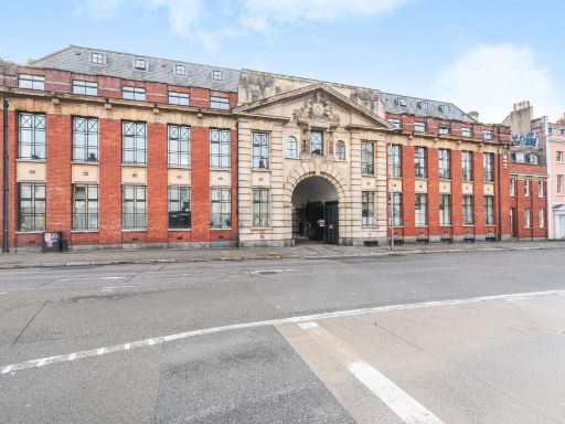 1 bedroom apartment for sale in Old Market Street, Bristol, BS2 — £199,995 • 1 bed • 1 bath • 461 ft²
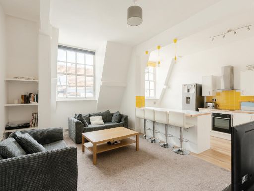 2 bedroom flat for sale in Central Hall, 15 Redcross Street, Bristol, BS2 — £300,000 • 2 bed • 1 bath • 915 ft²
 Studio flat for sale in Braggs Lane, Old Market, BS2 — £215,000 • 1 bed • 1 bath • 350 ft²
 Studio flat for sale in Jacob Street, Bristol, BS2 — £170,000 • 1 bed • 1 bath • 490 ft²
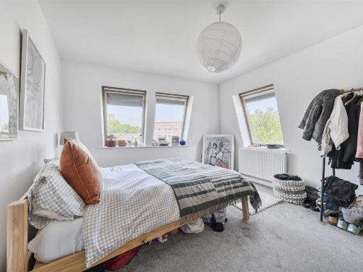 2 bedroom flat for sale in Braggs Lane, Old Market, BS2 — £260,000 • 2 bed • 1 bath • 591 ft²
Meta
- {
"@context": "https://schema.org",
"@type": "Residence",
"name": "2 bedroom maisonette for sale in The Old Drill Hall, BS2",
"description": "",
"url": "https://propertypiper.co.uk/property/4def0b69-fafc-47b1-8847-ce98d8b9e11b",
"image": "https://image-a.propertypiper.co.uk/6bfe8d60-262a-47dc-a245-a4a90a7dfa42-1024.jpeg",
"address": {
"@type": "PostalAddress",
"streetAddress": "THE DRILL HALL, 65 FLAT 26 OLD MARKET STREET BRISTOL ",
"postalCode": "BS2 0EH",
"addressLocality": "Bristol, City of",
"addressRegion": "Bristol West",
"addressCountry": "England"
},
"geo": {
"@type": "GeoCoordinates",
"latitude": 51.455793734629104,
"longitude": -2.5817739589085145
},
"numberOfRooms": 2,
"numberOfBathroomsTotal": 1,
"floorSize": {
"@type": "QuantitativeValue",
"value": 722,
"unitCode": "FTK"
},
"offers": {
"@type": "Offer",
"price": 225000,
"priceCurrency": "GBP",
"availability": "https://schema.org/InStock"
},
"additionalProperty": [
{
"@type": "PropertyValue",
"name": "Feature",
"value": "industrial"
},
{
"@type": "PropertyValue",
"name": "Feature",
"value": "converted warehouse"
},
{
"@type": "PropertyValue",
"name": "Feature",
"value": "high ceilings"
},
{
"@type": "PropertyValue",
"name": "Feature",
"value": "large windows"
},
{
"@type": "PropertyValue",
"name": "Feature",
"value": "urban"
},
{
"@type": "PropertyValue",
"name": "Feature",
"value": "historic"
},
{
"@type": "PropertyValue",
"name": "Feature",
"value": "red brick"
},
{
"@type": "PropertyValue",
"name": "Feature",
"value": "stonework"
},
{
"@type": "PropertyValue",
"name": "Feature",
"value": "industrial"
},
{
"@type": "PropertyValue",
"name": "Feature",
"value": "living room"
},
{
"@type": "PropertyValue",
"name": "Feature",
"value": "high ceilings"
},
{
"@type": "PropertyValue",
"name": "Feature",
"value": "large windows"
},
{
"@type": "PropertyValue",
"name": "Feature",
"value": "natural light"
},
{
"@type": "PropertyValue",
"name": "Feature",
"value": "wood flooring"
},
{
"@type": "PropertyValue",
"name": "Feature",
"value": "urban"
},
{
"@type": "PropertyValue",
"name": "Feature",
"value": "modern"
}
]
}
High Res Floorplan Images
Compatible Floorplan Images
FloorplanImages Thumbnail