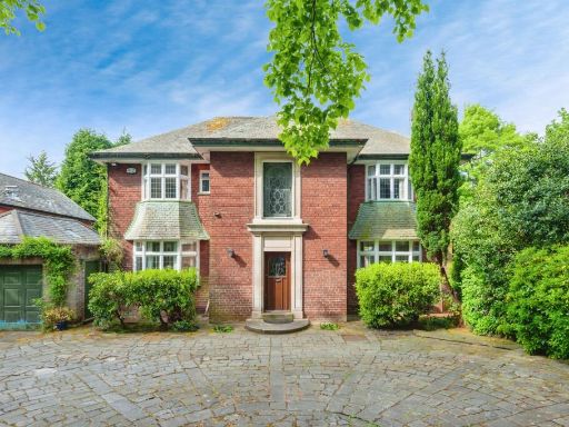
L25 6DY - 5 bedroom detached house for sale in Quarry Street, Liverpo…
View on Property Piper
5 bedroom detached house for sale in Quarry Street, Liverpool, L25
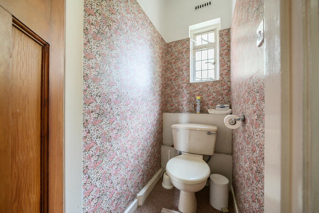
Property Details
- Price: £2000000
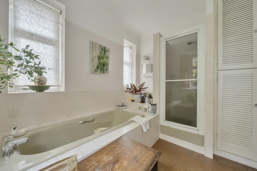
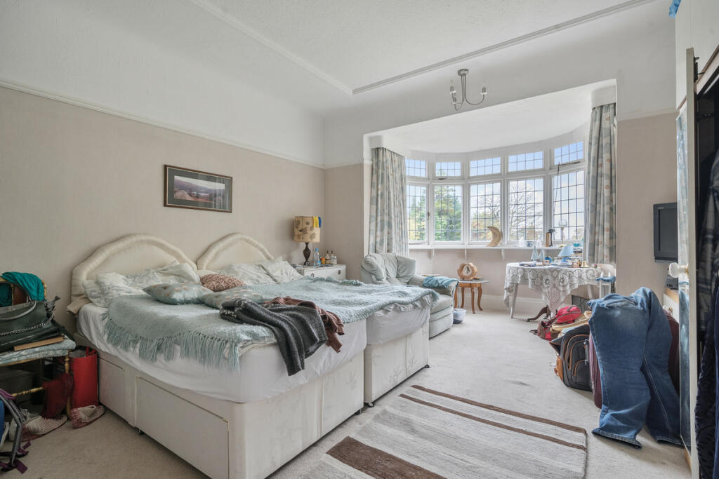
- Bedrooms: 5
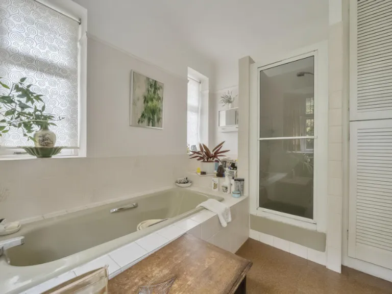
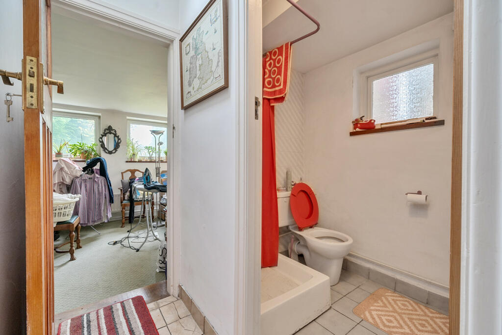
- Bathrooms: 3
- Property Type: undefined
- Property SubType: undefined
Image Descriptions
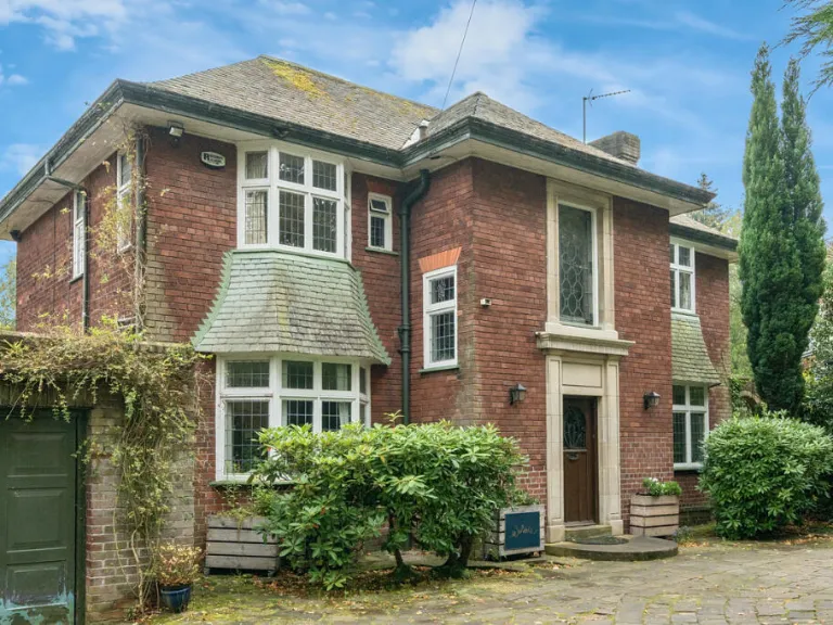
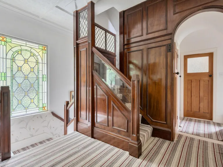
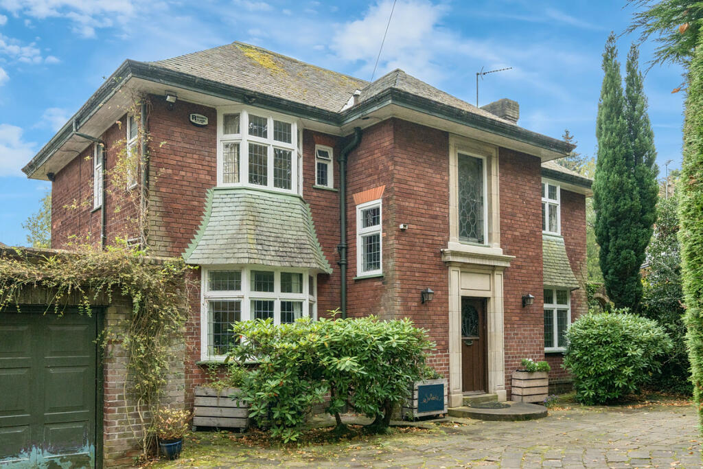
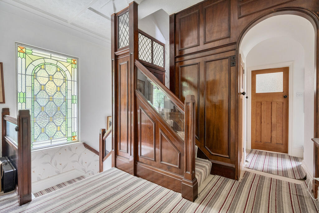
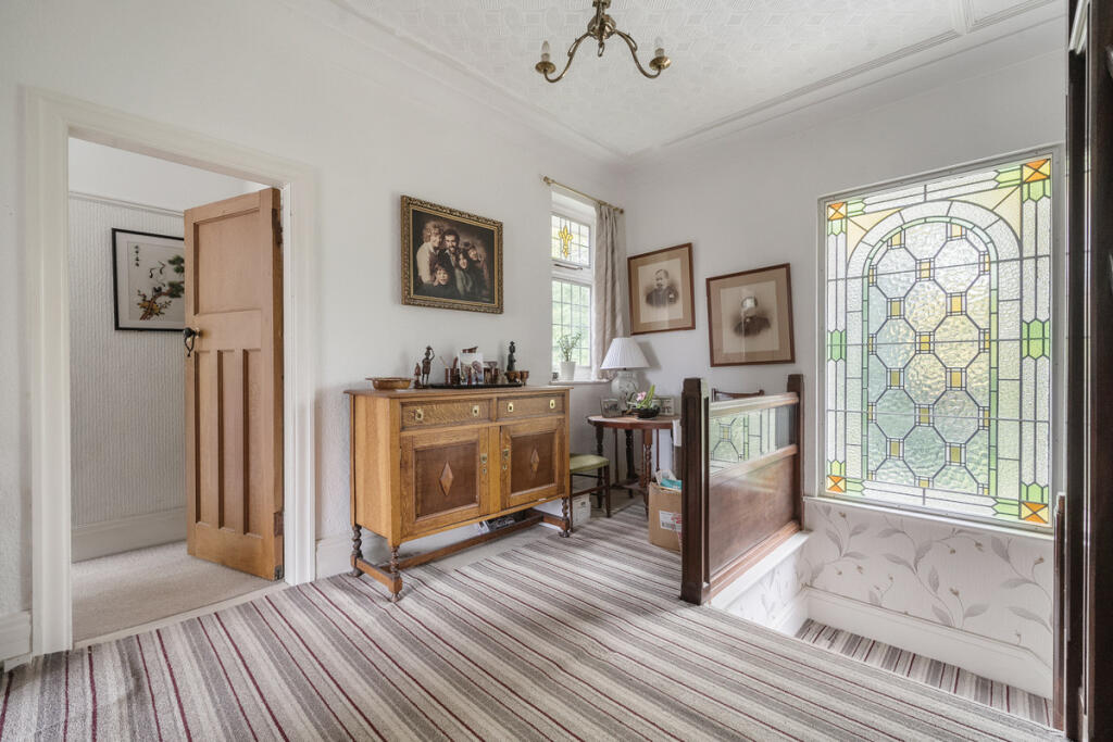
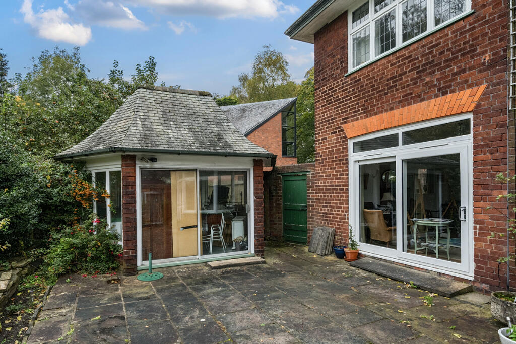
- house exterior Tudor Revival
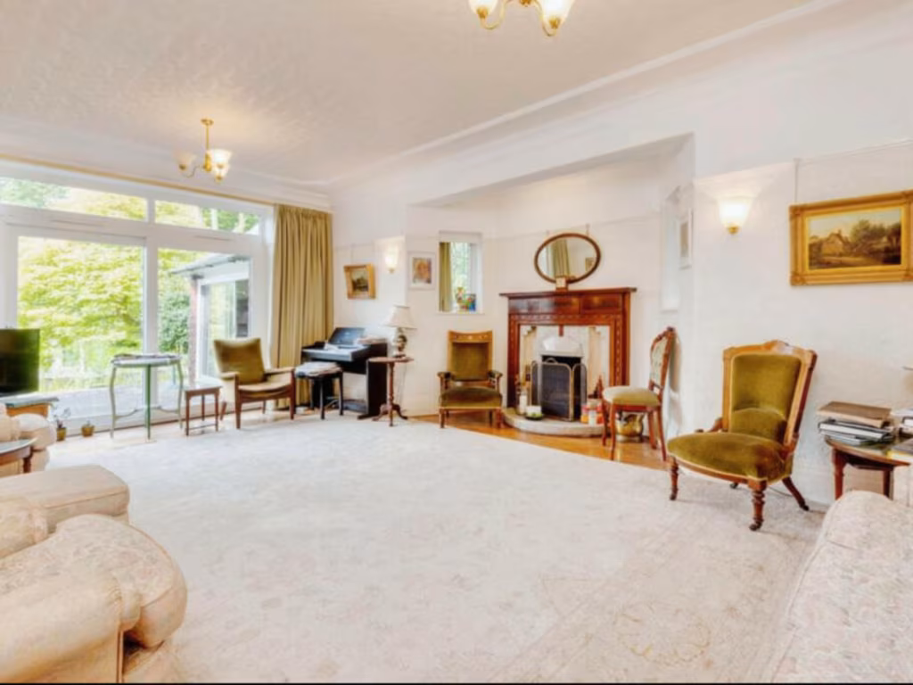
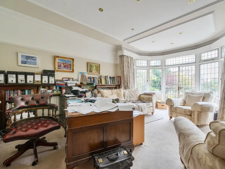
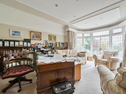
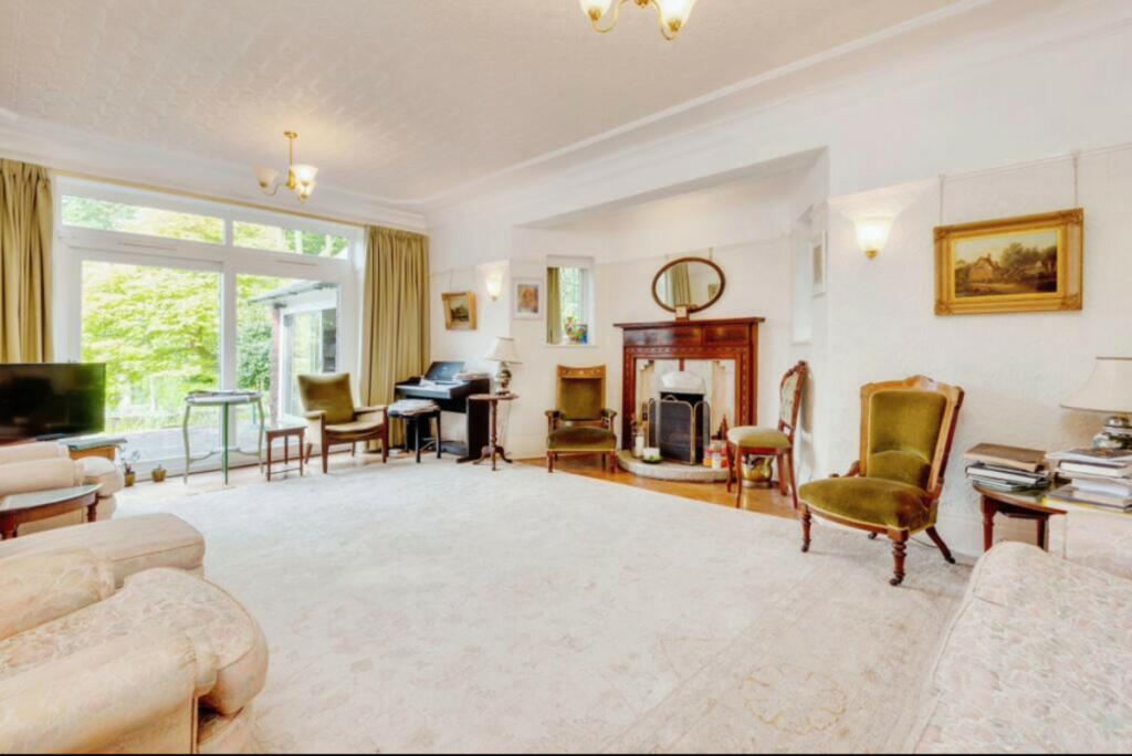
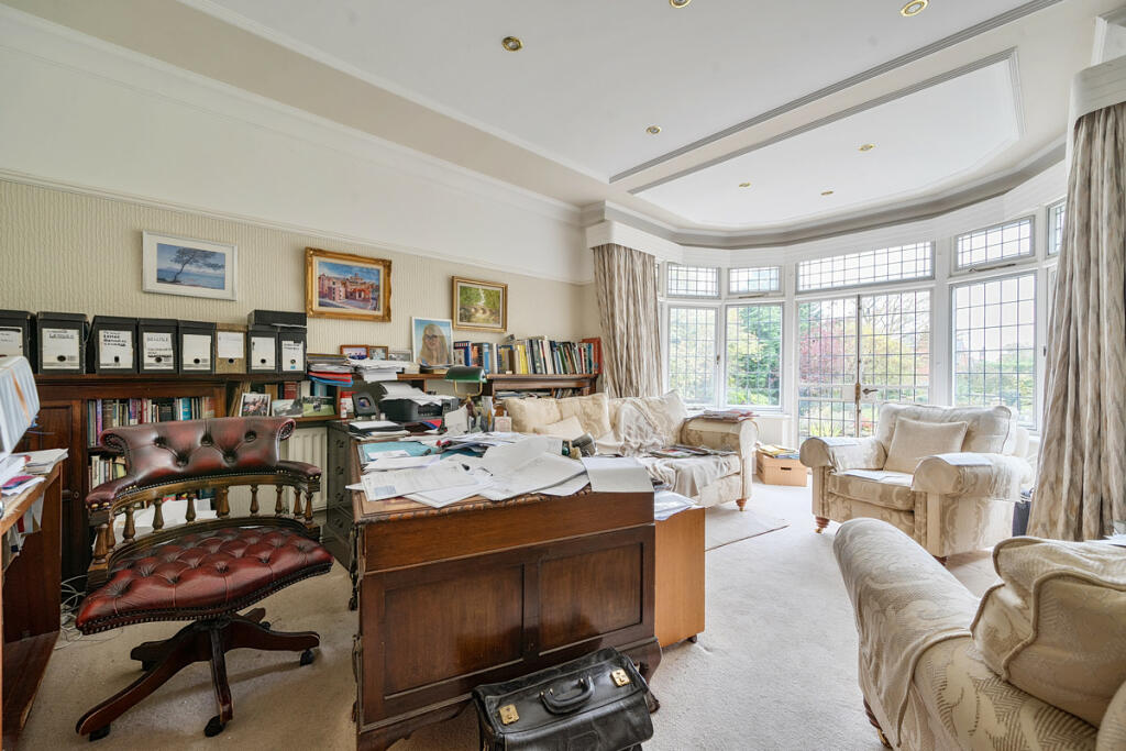
- living room traditional
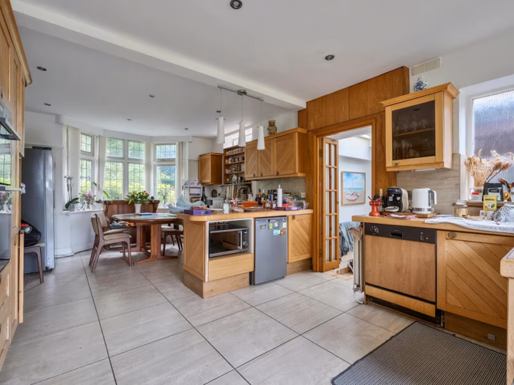
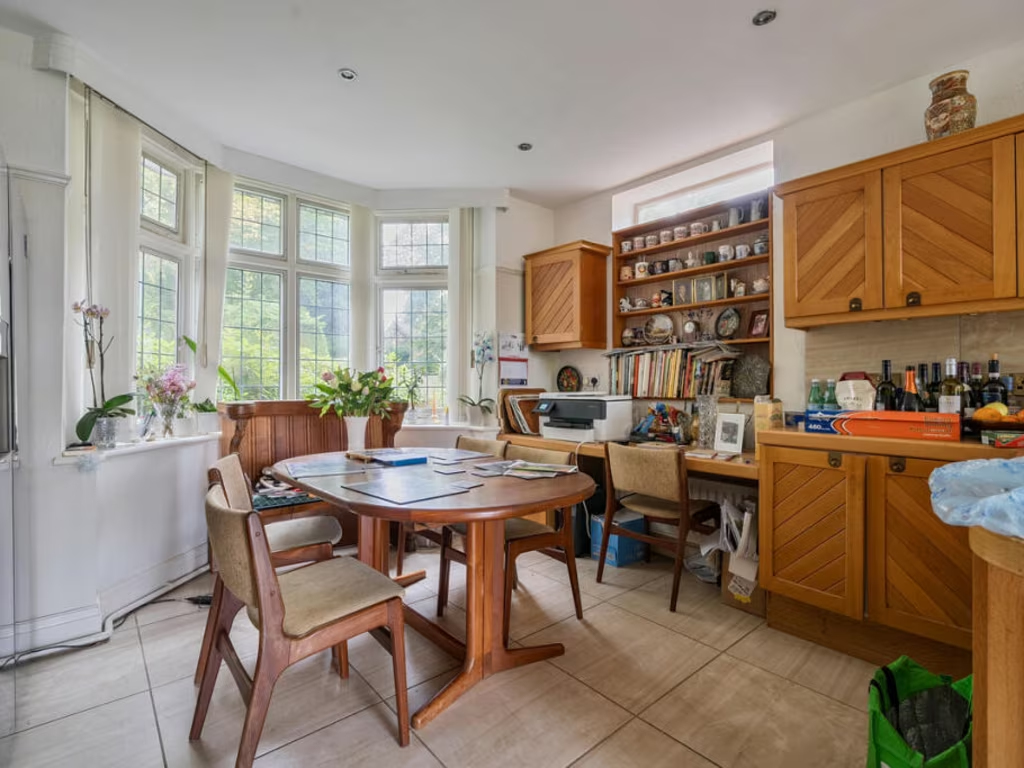
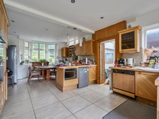
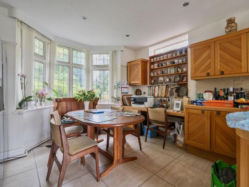
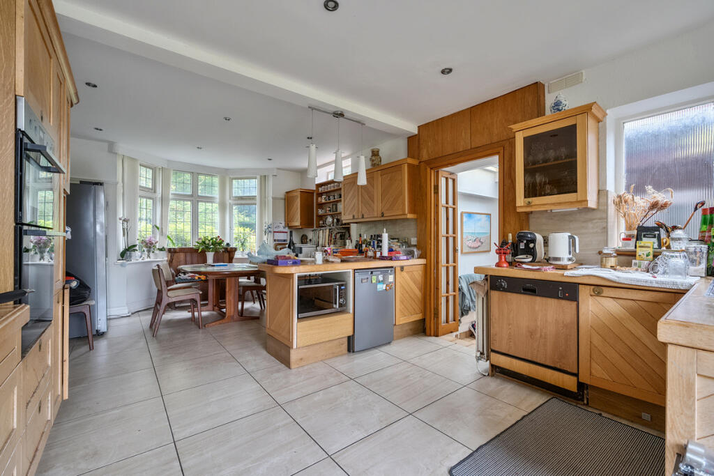
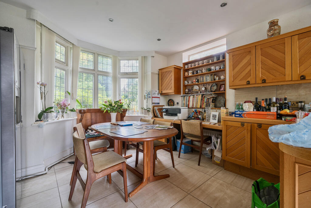
- kitchen contemporary
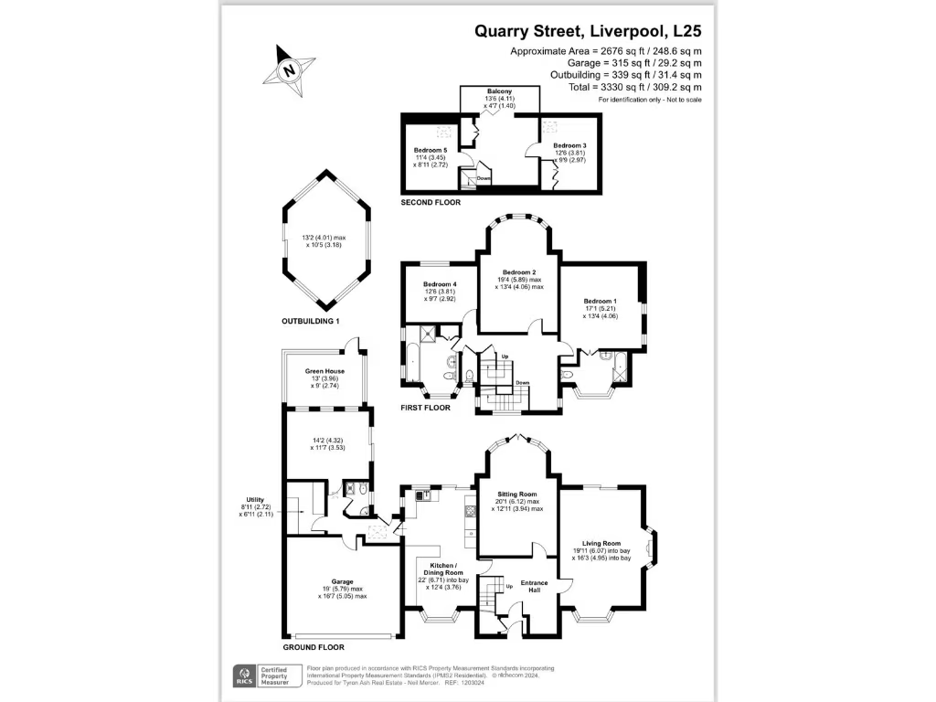
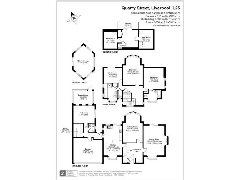
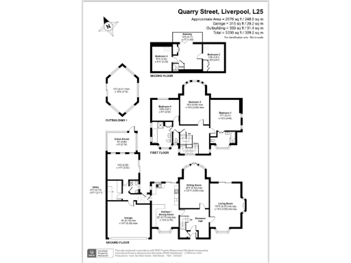
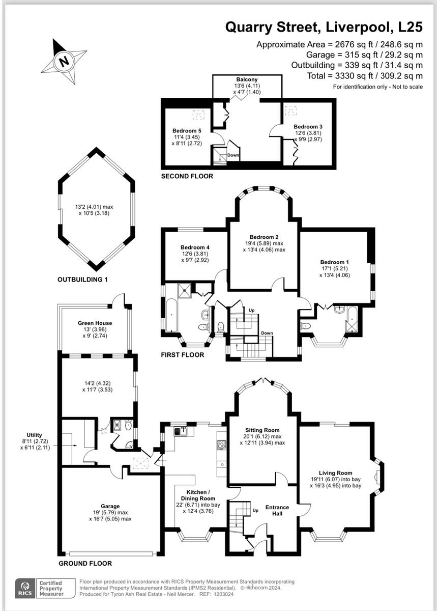
Floorplan Description
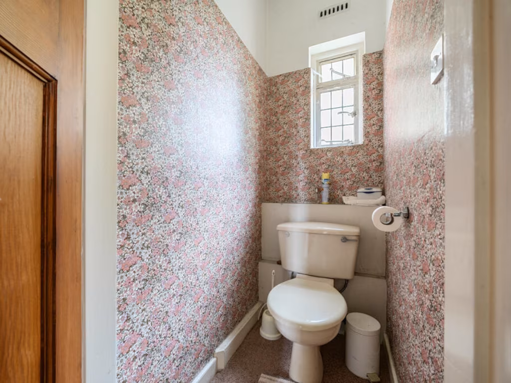
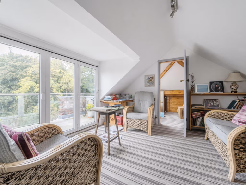
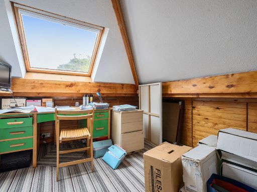
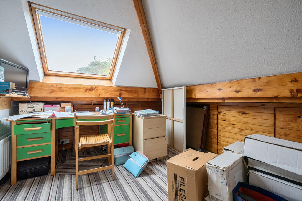
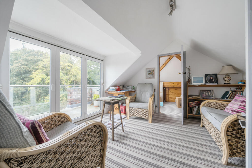
- A multi-story property with five bedrooms and multiple living areas.
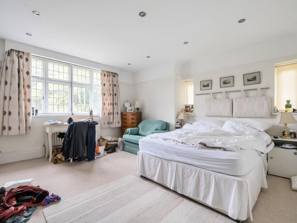
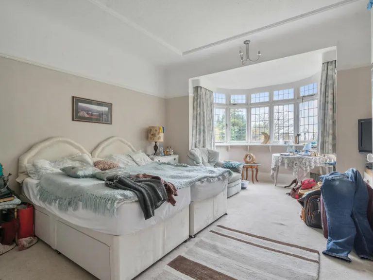
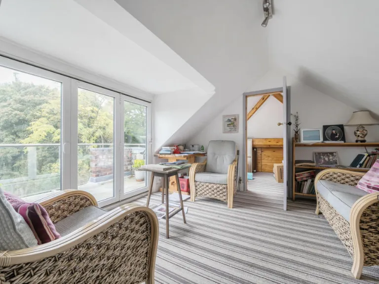
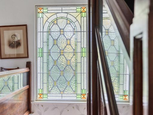
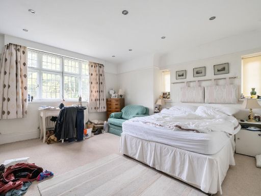
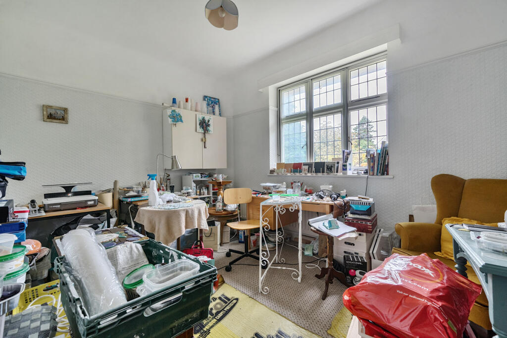
Rooms
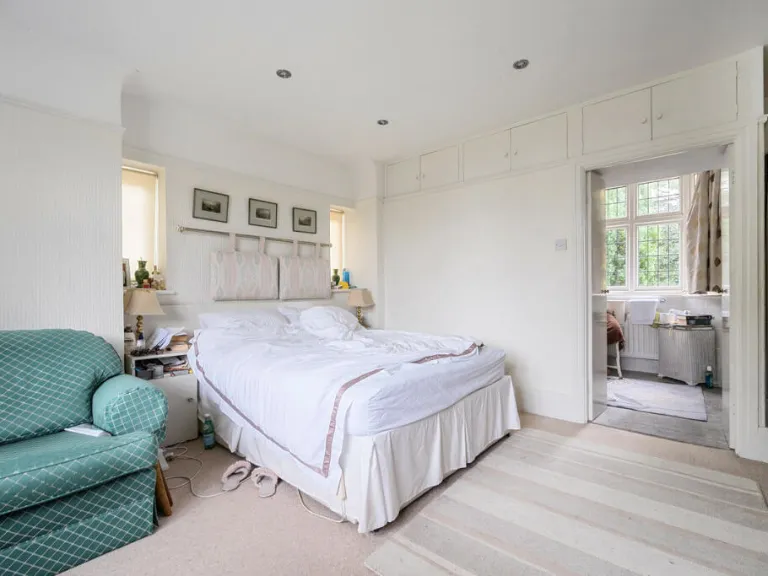
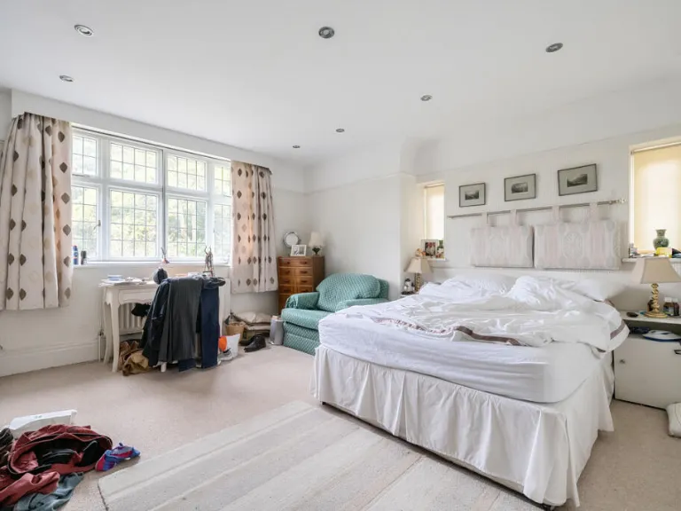
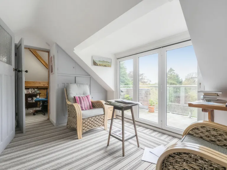
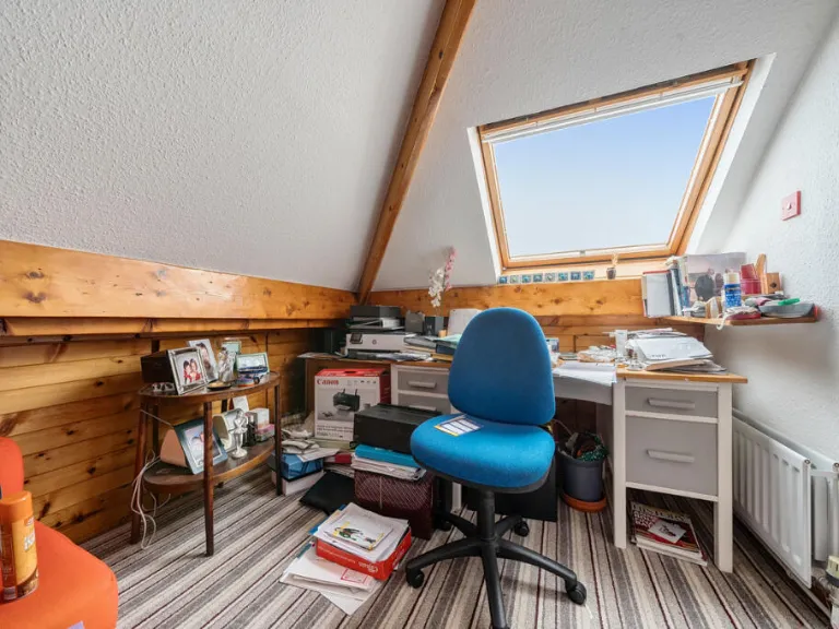
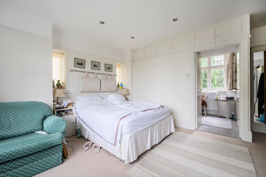
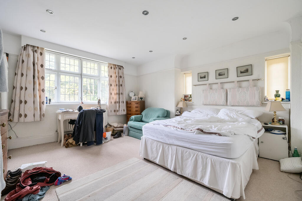
- Bedroom 5: Average
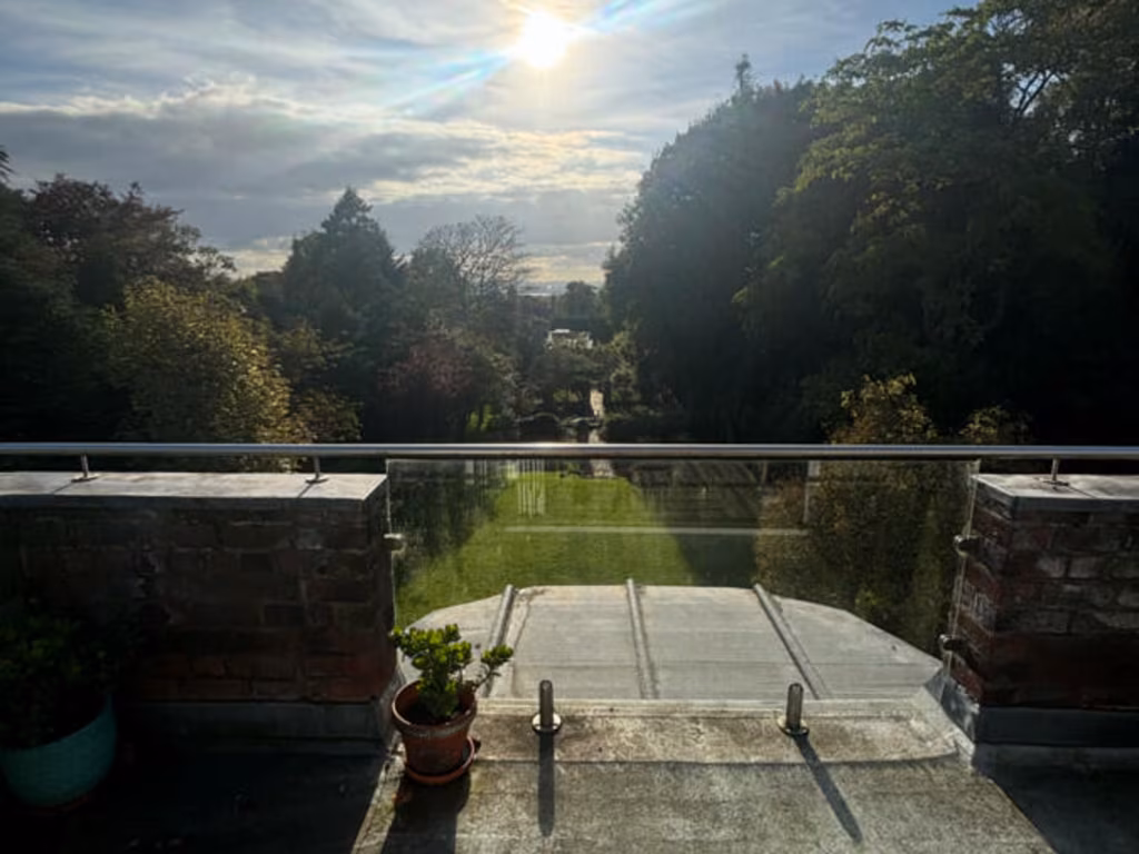
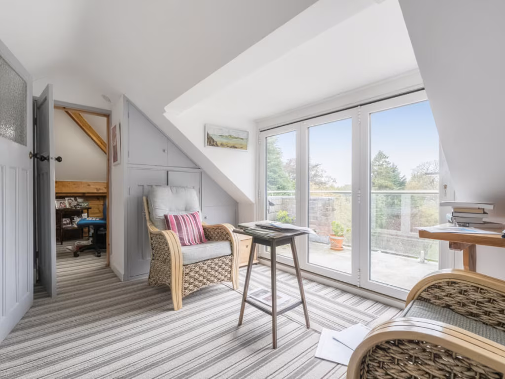
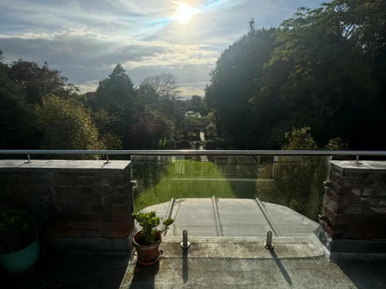
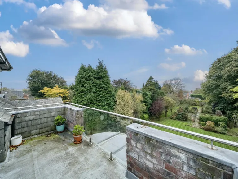
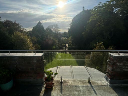
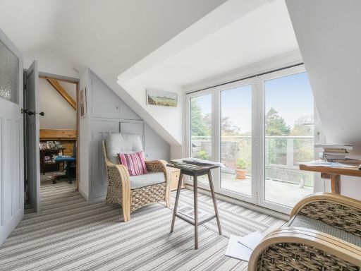
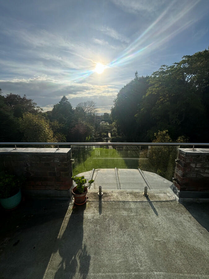
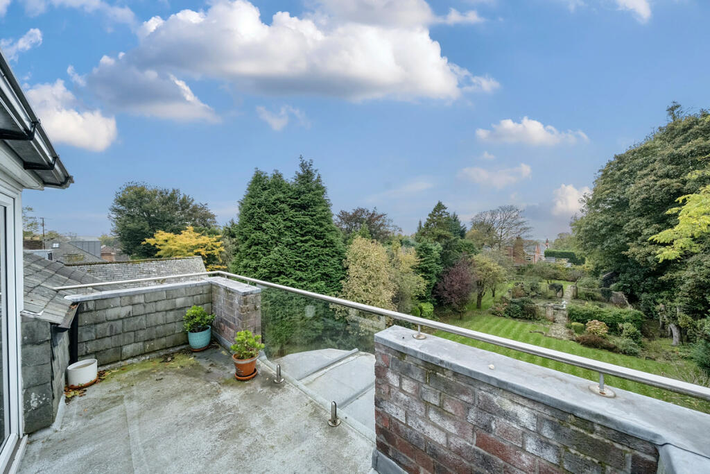
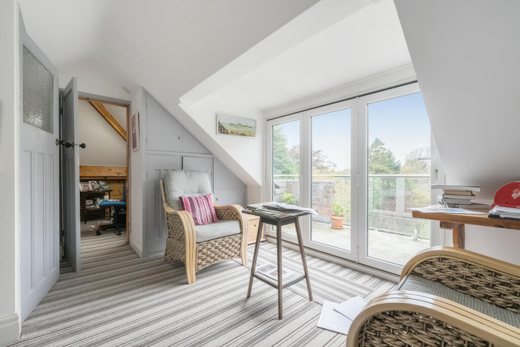
- Balcony: Small
- Bedroom 3: Average
- Bedroom 4: Average
- Bedroom 2: Large
- Bedroom 1: Large
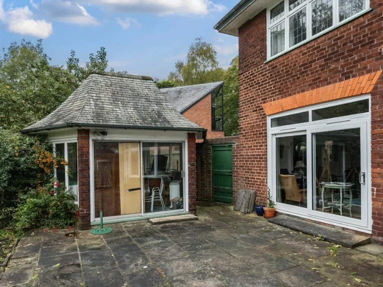
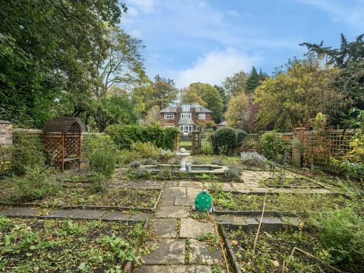
- Green House: Average
- Sitting Room: Large
- Living Room: Large
- Kitchen / Dining Room: Large
Textual Property Features
Detected Visual Features
- Tudor Revival
- brick exterior
- lead windows
- bay windows
- pitched roof
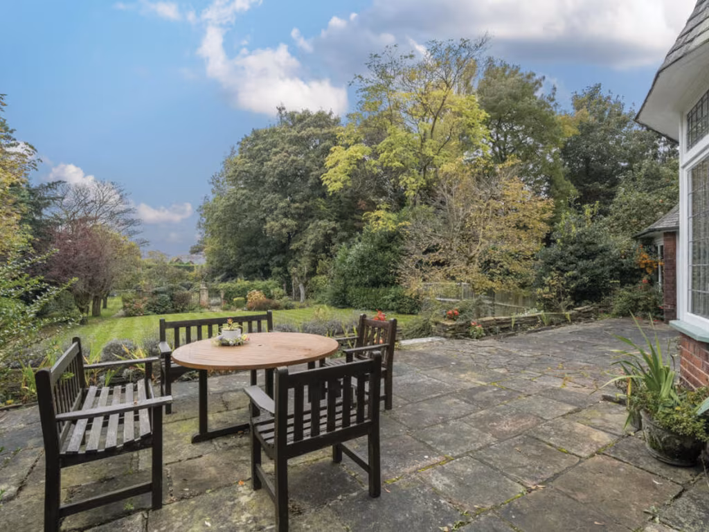
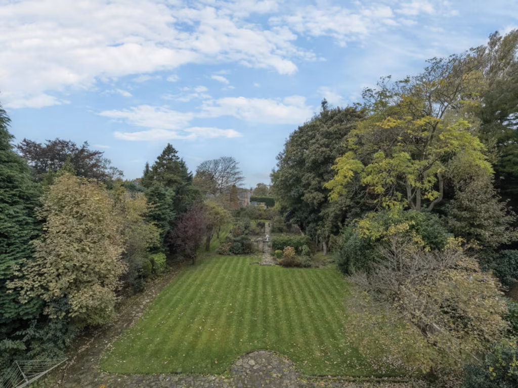
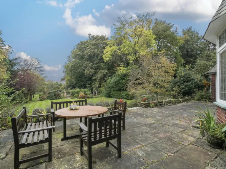
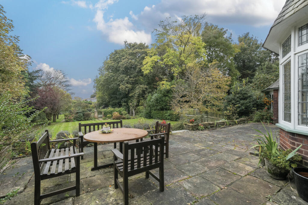
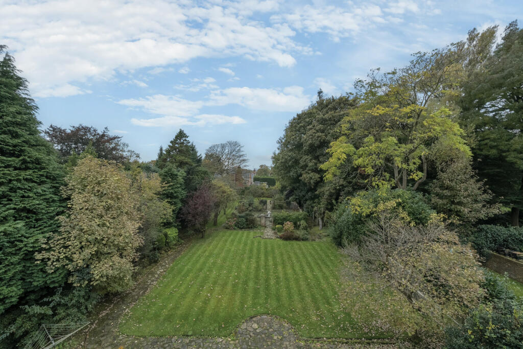
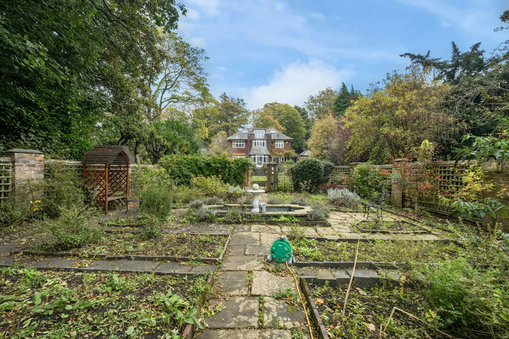
- mature garden
- historic style
- period features
- detached house
- slate roof
- residential
- desirable location
- traditional
- living room
- fireplace
- large windows
- bright
- arched alcove
- carpeted
- vintage chairs
- decorative molding
- contemporary kitchen
- open plan
- wooden cabinetry
- eat-in island
- pendant lighting
- natural light
- modern finishes
- tiled floor
EPC Details
- Fully double glazed
- Solid brick, as built, no insulation (assumed)
- Boiler and radiators, mains gas
- Low energy lighting in 86% of fixed outlets
- Solid, no insulation (assumed)
Nearby Schools
- Booker Avenue Infant School
- Bishop Martin Church of England Primary School, Woolton
- Our Lady of the Assumption Catholic Primary School
- St Paschal Baylon Catholic Primary School
- Booker Avenue Junior School
- Much Woolton Catholic Primary School
- Childwall Church of England Primary School
- King David High School
- King David Primary School
- The Academy of St Nicholas
- Garston Church of England Primary School
- Springwood Heath Primary School
- Carleton House Preparatory School
- Rudston Primary School
- St Julie's Catholic High School
- Woolton Primary School
- Calderstones School
- Belle Vale Community Primary School
- Our Lady's Bishop Eton Catholic Primary School
- Childwall Valley Primary School
- Childwall Sports & Science Academy
- Christ The King Catholic Primary School
Nearest Bars And Restaurants
- Id: 286374773
- Tags:
- Addr:
- Amenity: pub
- Name: The White Horse
- TagsNormalized:
- Lat: 53.3760423
- Lon: -2.8672668
- FullGeoHash: gcmzwub1gz6y
- PartitionGeoHash: gcmz
- Images:
- FoodStandards: null
- Distance: 972.8
,- Id: 844287577
- Tags:
- Amenity: pub
- Building: pub
- Name: The Grapes
- TagsNormalized:
- Lat: 53.3739632
- Lon: -2.8702922
- FullGeoHash: gcmzwsmvv7gh
- PartitionGeoHash: gcmz
- Images:
- FoodStandards: null
- Distance: 957.4
,- Id: 1524481296
- Tags:
- TagsNormalized:
- Lat: 53.3813635
- Lon: -2.8938433
- FullGeoHash: gcmzwjubbx6h
- PartitionGeoHash: gcmz
- Images:
- FoodStandards: null
- Distance: 919.7
,- Id: 844287869
- Tags:
- Amenity: pub
- Building: yes
- Name: The Victoria Pub
- TagsNormalized:
- Lat: 53.3745081
- Lon: -2.8719706
- FullGeoHash: gcmzwss9n1rw
- PartitionGeoHash: gcmz
- Images:
- FoodStandards: null
- Distance: 838.3
,- Id: 25316477
- Tags:
- Addr:
- Amenity: pub
- Name: Gardeners Arms
- TagsNormalized:
- Lat: 53.3759181
- Lon: -2.8775161
- FullGeoHash: gcmzwsb9m023
- PartitionGeoHash: gcmz
- Images:
- FoodStandards: null
- Distance: 514.5
}
Nearest General Shops
- Id: 6841770974
- Tags:
- Brand: Barnardo's
- Brand:wikidata: Q2884670
- Brand:wikipedia: en:Barnardo's
- Name: Barnardo's
- Shop: charity
- TagsNormalized:
- Lat: 53.3916564
- Lon: -2.8722445
- FullGeoHash: gcmzwxskzy5k
- PartitionGeoHash: gcmz
- Images:
- FoodStandards: null
- Distance: 1367.8
,- Id: 4737389725
- Tags:
- Name: Arogs
- Shop: catalogue
- TagsNormalized:
- Lat: 53.3756403
- Lon: -2.8656703
- FullGeoHash: gcmzwu9r9h92
- PartitionGeoHash: gcmz
- Images:
- FoodStandards: null
- Distance: 1087.2
,- Id: 2104138321
- Tags:
- Name: Gateacre Garden Centre
- Shop: garden_centre
- TagsNormalized:
- Lat: 53.3816049
- Lon: -2.8661894
- FullGeoHash: gcmzwvbfkuqk
- PartitionGeoHash: gcmz
- Images:
- FoodStandards: null
- Distance: 934.1
}
Nearest Grocery shops
- Id: 9438233816
- Tags:
- Addr:
- City: Liverpool
- Country: GB
- Housename: Belle Vale Shopping Centre
- Postcode: L25 2RQ
- Street: Childwall Valley Road
- Unit: 50,51
- Brand: Farmfoods
- Brand:wikidata: Q5435841
- Brand:wikipedia: en:Farmfoods
- Fhrs:
- Name: Farmfoods
- Operator: Farmfoods Ltd
- Shop: frozen_food
- TagsNormalized:
- farmfoods
- frozen food
- food
- shop
- Lat: 53.3901295
- Lon: -2.859554
- FullGeoHash: gcmzwzmsp93z
- PartitionGeoHash: gcmz
- Images:
- FoodStandards:
- Id: 497571
- FHRSID: 497571
- LocalAuthorityBusinessID: PI/000178566
- BusinessName: Farmfoods Freezer Centre
- BusinessType: Retailers - supermarkets/hypermarkets
- BusinessTypeID: 7840
- AddressLine1: 50 - 51, Belle Vale Shopping Centre Childwall Valley Road
- AddressLine2: null
- AddressLine3: Liverpool
- AddressLine4: null
- PostCode: L25 2RQ
- RatingValue: 5
- RatingKey: fhrs_5_en-GB
- RatingDate: 2019-03-21
- LocalAuthorityCode: 414
- LocalAuthorityName: Liverpool
- LocalAuthorityWebSite: http://www.liverpool.gov.uk
- LocalAuthorityEmailAddress: environmental.health@liverpool.gov.uk
- Scores:
- Hygiene: 0
- Structural: 0
- ConfidenceInManagement: 0
- NewRatingPending: false
- Geocode:
- Longitude: -2.85899500000000
- Latitude: 53.39103090000000
- Distance: 1747.9
,- Id: 293643560
- Tags:
- Brand: McColl's
- Brand:wikidata: Q16997477
- Brand:wikipedia: en:McColl's
- Name: McColl's
- Shop: convenience
- TagsNormalized:
- Lat: 53.3943074
- Lon: -2.8916511
- FullGeoHash: gcmzy0nk7skd
- PartitionGeoHash: gcmz
- Images:
- FoodStandards: null
- Distance: 1737.7
,- Id: 293645453
- Tags:
- Brand: Londis
- Brand:wikidata: Q21008564
- Brand:wikipedia: en:Londis (United Kingdom)
- Name: Londis
- Operator: londis
- Shop: convenience
- TagsNormalized:
- Lat: 53.3943841
- Lon: -2.8907499
- FullGeoHash: gcmzy0phbdse
- PartitionGeoHash: gcmz
- Images:
- FoodStandards: null
- Distance: 1719.9
}
Nearest Supermarkets
- Id: 729739681
- Tags:
- Brand: ALDI
- Brand:wikidata: Q41171672
- Brand:wikipedia: en:Aldi
- Building: yes
- Contact:
- Website: https://stores.aldi.co.uk/gateacre/gateacre-park-drive
- Name: ALDI
- Operator: ALDI
- Shop: supermarket
- TagsNormalized:
- Lat: 53.3912691
- Lon: -2.8721372
- FullGeoHash: gcmzwxsddmgm
- PartitionGeoHash: gcmz
- Images:
- FoodStandards: null
- Distance: 1330.9
,- Id: 325413344
- Tags:
- Addr:
- City: Liverpool
- Housename: Sainsbury's Centre
- Housenumber: 1
- Postcode: L25 5QA
- Street: James Road
- Alt_name: Sainsbury's Woolton Superstore
- Brand: Sainsbury's
- Brand:wikidata: Q152096
- Brand:wikipedia: en:Sainsbury's
- Building: yes
- Name: Sainsbury's
- Shop: supermarket
- TagsNormalized:
- sainsburys
- supermarket
- shop
- Lat: 53.3755495
- Lon: -2.8655636
- FullGeoHash: gcmzwu9r5e8f
- PartitionGeoHash: gcmz
- Images:
- FoodStandards: null
- Distance: 1098.2
,- Id: 25994582
- Tags:
- Addr:
- City: Liverpool
- Postcode: L25 7SF
- Street: Allerton Road
- Alt_name: Tesco Liverpool Woolton Superstore
- Brand: Tesco
- Brand:wikidata: Q487494
- Brand:wikipedia: en:Tesco
- Building: yes
- Contact:
- Website: https://www.tesco.com/store-locator/liverpool/allerton-rd
- Name: Tesco
- Shop: supermarket
- TagsNormalized:
- Lat: 53.3737191
- Lon: -2.8731845
- FullGeoHash: gcmzws7u3yqk
- PartitionGeoHash: gcmz
- Images:
- FoodStandards: null
- Distance: 861.8
}
Nearest Religious buildings
- Id: 421152412
- Tags:
- Amenity: place_of_worship
- Building: church
- Denomination: anglican
- Name: Saint Peter's Church
- Religion: christian
- Wikidata: Q7591335
- Wikipedia: en:St Peter's Church, Woolton, Liverpool
- TagsNormalized:
- place of worship
- church
- anglican
- christian
- Lat: 53.3759661
- Lon: -2.8694751
- FullGeoHash: gcmzwsy983hr
- PartitionGeoHash: gcmz
- Images:
- FoodStandards: null
- Distance: 852.4
,- Id: 442251358
- Tags:
- Addr:
- City: Liverpool
- Country: GB
- Postcode: L25 5JF
- Street: Church Road
- Amenity: school
- Name: Bishop Martin Church of England Primary School, Woolton
- Phone: +44 151 428 6295
- Ref:
- Source:
- Addr: edubase
- Geometry: OS_Open_Map_Local_FunctionalSite
- Name: edubase
- Website: bishopmartince.co.uk
- Wikidata: Q66141297
- TagsNormalized:
- Lat: 53.3759851
- Lon: -2.8707939
- FullGeoHash: gcmzwsv99suc
- PartitionGeoHash: gcmz
- Images:
- FoodStandards: null
- Distance: 780.4
,- Id: 4354258425
- Tags:
- Amenity: place_of_worship
- Denomination: salvation_army
- Name: Strawberry Field
- Religion: christian
- Social_facility: group_home
- Social_facility:for: orphan
- Was:
- Wikidata: Q1320698
- Wikipedia: en:Strawberry Field
- TagsNormalized:
- place of worship
- salvation army
- christian
- church
- Lat: 53.3800681
- Lon: -2.8853732
- FullGeoHash: gcmzwmdcmvvv
- PartitionGeoHash: gcmz
- Images:
- FoodStandards: null
- Distance: 350.8
}
Nearest Medical buildings
- Id: 293644350
- Tags:
- Amenity: pharmacy
- Brand: Boots
- Brand:wikidata: Q6123139
- Brand:wikipedia: en:Boots (company)
- Healthcare: pharmacy
- Name: Boots
- TagsNormalized:
- pharmacy
- boots
- health
- healthcare
- Lat: 53.3943585
- Lon: -2.8910932
- FullGeoHash: gcmzy0nu8tud
- PartitionGeoHash: gcmz
- Images:
- FoodStandards: null
- Distance: 1726.8
,- Id: 6841770976
- Tags:
- Amenity: pharmacy
- Dispensing: yes
- Healthcare: pharmacy
- TagsNormalized:
- Lat: 53.3917859
- Lon: -2.8722402
- FullGeoHash: gcmzwxsmxyq2
- PartitionGeoHash: gcmz
- Images:
- FoodStandards: null
- Distance: 1381.2
,- Id: 2014032943
- Tags:
- Amenity: dentist
- Healthcare: dentist
- Name: Gateacre Dental Centre
- TagsNormalized:
- dentist
- health
- healthcare
- dental
- Lat: 53.3825148
- Lon: -2.8611271
- FullGeoHash: gcmzwvuxdyj0
- PartitionGeoHash: gcmz
- Images:
- FoodStandards: null
- Distance: 1282.4
,- Id: 7513870485
- Tags:
- Addr:
- City: Liverpool
- Postcode: L25 8QA
- Street: Speke Road
- Amenity: hospital
- Healthcare: hospital
- Name: Marie Curie Hospice
- Name:en: Marie Curie Hospice, Liverpool
- Phone: +441518011400
- Website: https://www.mariecurie.org.uk/help/hospice-care/hospices/liverpool
- TagsNormalized:
- hospital
- health
- healthcare
- hospice
- marie curie
- Lat: 53.3737218
- Lon: -2.8643534
- FullGeoHash: gcmzwu6hrwzk
- PartitionGeoHash: gcmz
- Images:
- FoodStandards: null
- Distance: 1273.8
}
Nearest Airports
- Id: 116737532
- Tags:
- Addr:
- City: Liverpool
- Country: GB
- Postcode: L24 1YD
- Street: Speke Hall Avenue
- Aerodrome: international
- Aerodrome:type: public
- Aeroway: aerodrome
- Iata: LPL
- Icao: EGGP
- Is_in: Liverpool,England,UK
- Name: Liverpool John Lennon Airport
- Old_name: Speke Airport
- Operator: Liverpool Airport plc
- Source: wikipedia
- Website: https://www.liverpoolairport.com/
- Wikidata: Q8727
- Wikipedia: en:Liverpool John Lennon Airport
- TagsNormalized:
- airport
- international airport
- Lat: 53.3357677
- Lon: -2.8518179
- FullGeoHash: gcmzrj7r7gdr
- PartitionGeoHash: gcmz
- Images:
- FoodStandards: null
- Distance: 5293.5
}
Nearest Leisure Facilities
- Id: 461591640
- Tags:
- TagsNormalized:
- Lat: 53.3853414
- Lon: -2.8769659
- FullGeoHash: gcmzww901uft
- PartitionGeoHash: gcmz
- Images:
- FoodStandards: null
- Distance: 599.7
,- Id: 5116094
- Tags:
- Leisure: park
- Name: Reynolds Park
- Wikidata: Q15272403
- Wikipedia: en:Reynolds Park
- TagsNormalized:
- Lat: 53.3799163
- Lon: -2.8715279
- FullGeoHash: gcmzwtt0899e
- PartitionGeoHash: gcmz
- Images:
- FoodStandards: null
- Distance: 569.8
,- Id: 4240937
- Tags:
- TagsNormalized:
- Lat: 53.3839484
- Lon: -2.8743863
- FullGeoHash: gcmzww6bjcq0
- PartitionGeoHash: gcmz
- Images:
- FoodStandards: null
- Distance: 556.5
,- Id: 457051460
- Tags:
- TagsNormalized:
- Lat: 53.3826448
- Lon: -2.877765
- FullGeoHash: gcmzww02rnnz
- PartitionGeoHash: gcmz
- Images:
- FoodStandards: null
- Distance: 304.9
,- Id: 457051452
- Tags:
- TagsNormalized:
- Lat: 53.3824706
- Lon: -2.8777748
- FullGeoHash: gcmzwtbrqvz8
- PartitionGeoHash: gcmz
- Images:
- FoodStandards: null
- Distance: 288
}
Nearest Tourist attractions
- Id: 9982633056
- Tags:
- Name: Weed Woods
- Tourism: attraction
- TagsNormalized:
- Lat: 53.3761821
- Lon: -2.8869447
- FullGeoHash: gcmzwkcfc3d0
- PartitionGeoHash: gcmz
- Images:
- FoodStandards: null
- Distance: 643.6
,- Id: 516128867
- Tags:
- Addr:
- City: Liverpool
- Housenumber: 251
- Street: Menlove Avenue
- Alt_name: John Lennon's Childhood Home
- Building: house
- Building:levels: 2
- Name: Mendips
- Operator: National Trust
- Tourism: attraction
- Wikidata: Q2702874
- Wikipedia: en:251 Menlove Avenue
- TagsNormalized:
- Lat: 53.377244
- Lon: -2.8813923
- FullGeoHash: gcmzwmjbfxqn
- PartitionGeoHash: gcmz
- Images:
- FoodStandards: null
- Distance: 348.5
,- Id: 516127182
- Tags:
- Access: no
- Barrier: gate
- Name: Strawberry Field
- Tourism: attraction
- TagsNormalized:
- Lat: 53.380343
- Lon: -2.8840159
- FullGeoHash: gcmzwmegj91v
- PartitionGeoHash: gcmz
- Images:
- FoodStandards: null
- Distance: 260.1
}
Nearest Train stations
- Id: 152294619
- Tags:
- Name: Broad Green
- Naptan:
- Network: National Rail
- Public_transport: station
- Railway: station
- Ref:
- Wikidata: Q2629741
- Wikipedia: en:Broad Green railway station
- TagsNormalized:
- Lat: 53.4065083
- Lon: -2.8933889
- FullGeoHash: gcmzy4m57nsz
- PartitionGeoHash: gcmz
- Images:
- FoodStandards: null
- Distance: 3046.5
,- Id: 4796770277
- Tags:
- Name: Hunts Cross
- Naptan:
- Network: National Rail
- Operator: Merseyrail
- Public_transport: station
- Railway: station
- Ref:
- Wikidata: Q1867593
- Wikipedia: en:Hunts Cross railway station
- TagsNormalized:
- Lat: 53.3607333
- Lon: -2.8554087
- FullGeoHash: gcmzx40bb1su
- PartitionGeoHash: gcmz
- Images:
- FoodStandards: null
- Distance: 2721.7
,- Id: 7140201331
- Tags:
- Name: Liverpool South Parkway
- Naptan:
- Network: National Rail
- Public_transport: station
- Railway: station
- Ref:
- Train: yes
- Wikidata: Q2653302
- Wikipedia: en:Liverpool South Parkway railway station
- TagsNormalized:
- Lat: 53.3576179
- Lon: -2.8892004
- FullGeoHash: gcmzw32nsubh
- PartitionGeoHash: gcmz
- Images:
- FoodStandards: null
- Distance: 2591.5
,- Id: 6414583116
- Tags:
- Name: Mossley Hill
- Naptan:
- Network: National Rail
- Postal_code: L18 8AG
- Public_transport: station
- Railway: station
- Ref:
- Wheelchair: yes
- Wikidata: Q1998870
- Wikipedia: en:Mossley Hill railway station
- TagsNormalized:
- Lat: 53.3785566
- Lon: -2.914829
- FullGeoHash: gcmzttm2xs1u
- PartitionGeoHash: gcmz
- Images:
- FoodStandards: null
- Distance: 2311.8
,- Id: 6414583117
- Tags:
- Name: West Allerton
- Naptan:
- Network: National Rail
- Public_transport: station
- Railway: station
- Ref:
- Wheelchair: no
- Wikidata: Q2787611
- Wikipedia: en:West Allerton railway station
- TagsNormalized:
- Lat: 53.3693253
- Lon: -2.9071937
- FullGeoHash: gcmztge4c7r6
- PartitionGeoHash: gcmz
- Images:
- FoodStandards: null
- Distance: 2171.5
}
Nearest Hotels
- Id: 559723977
- Tags:
- Brand: Premier Inn
- Brand:wikidata: Q2108626
- Brand:wikipedia: en:Premier Inn
- Building: yes
- Internet_access: wlan
- Internet_access:fee: customers
- Internet_access:operator: Virgin Media
- Internet_access:ssid: Premier Inn Free Wi-Fi
- Name: Premier Inn
- Tourism: hotel
- TagsNormalized:
- Lat: 53.4084558
- Lon: -2.8582066
- FullGeoHash: gcmzyfwwycy8
- PartitionGeoHash: gcmz
- Images:
- FoodStandards: null
- Distance: 3452.7
,- Id: 26398719
- Tags:
- Amenity: pub
- Name: Wellington Hotel
- TagsNormalized:
- Lat: 53.3547539
- Lon: -2.8987467
- FullGeoHash: gcmzw0cjyr1b
- PartitionGeoHash: gcmz
- Images:
- FoodStandards: null
- Distance: 3096.6
,- Id: 842125629
- Tags:
- Brand: Travelodge
- Brand:wikidata: Q9361374
- Building: hotel
- Internet_access: wlan
- Internet_access:fee: customers
- Internet_access:ssid: Travelodge WiFi
- Name: Travelodge
- Tourism: hotel
- TagsNormalized:
- Lat: 53.3635991
- Lon: -2.9156791
- FullGeoHash: gcmztdsc7zb5
- PartitionGeoHash: gcmz
- Images:
- FoodStandards: null
- Distance: 3002.3
}
Tags
- Tudor Revival
- brick exterior
- lead windows
- bay windows
- pitched roof
- mature garden
- historic style
- period features
- detached house
- slate roof
- residential
- desirable location
- traditional
- living room
- fireplace
- large windows
- bright
- arched alcove
- carpeted
- vintage chairs
- decorative molding
- contemporary kitchen
- open plan
- wooden cabinetry
- large windows
- eat-in island
- pendant lighting
- natural light
- modern finishes
- tiled floor
Local Market Stats
- Average Price/sqft: £256
- Avg Income: £40100
- Rental Yield: 4.2%
- Social Housing: 17%
- Planning Success Rate: 94%
AirBnB Data
- 1km average: £88/night
- Listings in 1km: 2
Similar Properties
 6 bedroom detached house for sale in Quarry Street, Liverpool, Merseyside, L25 — £2,400,000 • 6 bed • 3 bath • 3319 ft²
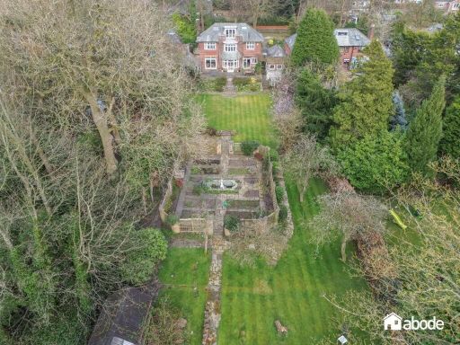 5 bedroom detached house for sale in Quarry Street, Woolton, Liverpool, L25 — £2,400,000 • 5 bed • 3 bath • 3222 ft²
 4 bedroom detached house for sale in Mather Avenue, Liverpool, Merseyside, L18 — £775,000 • 4 bed • 2 bath • 1857 ft²
 4 bedroom detached house for sale in Old Town Lane, Formby, L37 — £1,500,000 • 4 bed • 4 bath • 4400 ft²
 5 bedroom detached house for sale in Menlove Avenue, Calderstones, Liverpool, L18 — £1,395,000 • 5 bed • 3 bath • 2961 ft²
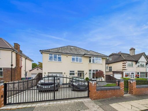 5 bedroom detached house for sale in Ballantrae Road, Calderstones, Liverpool., L18 — £1,150,000 • 5 bed • 4 bath • 3005 ft²
Meta
- {
"@context": "https://schema.org",
"@type": "Residence",
"name": "5 bedroom detached house for sale in Quarry Street, Liverpo…",
"description": "",
"url": "https://propertypiper.co.uk/property/4d6a68c1-dcdf-4d9d-99e1-03f81052ea8a",
"image": "https://image-a.propertypiper.co.uk/e525aefa-47a2-4869-a663-aef6075bc378-1024.jpeg",
"address": {
"@type": "PostalAddress",
"streetAddress": "167 Quarry Street",
"postalCode": "L25 6DY",
"addressLocality": "Liverpool",
"addressRegion": "Garston and Halewood",
"addressCountry": "England"
},
"geo": {
"@type": "GeoCoordinates",
"latitude": 53.38028170332923,
"longitude": -2.880096284697967
},
"numberOfRooms": 5,
"numberOfBathroomsTotal": 3,
"floorSize": {
"@type": "QuantitativeValue",
"value": 3330,
"unitCode": "FTK"
},
"offers": {
"@type": "Offer",
"price": 2000000,
"priceCurrency": "GBP",
"availability": "https://schema.org/InStock"
},
"additionalProperty": [
{
"@type": "PropertyValue",
"name": "Feature",
"value": "Tudor Revival"
},
{
"@type": "PropertyValue",
"name": "Feature",
"value": "brick exterior"
},
{
"@type": "PropertyValue",
"name": "Feature",
"value": "lead windows"
},
{
"@type": "PropertyValue",
"name": "Feature",
"value": "bay windows"
},
{
"@type": "PropertyValue",
"name": "Feature",
"value": "pitched roof"
},
{
"@type": "PropertyValue",
"name": "Feature",
"value": "mature garden"
},
{
"@type": "PropertyValue",
"name": "Feature",
"value": "historic style"
},
{
"@type": "PropertyValue",
"name": "Feature",
"value": "period features"
},
{
"@type": "PropertyValue",
"name": "Feature",
"value": "detached house"
},
{
"@type": "PropertyValue",
"name": "Feature",
"value": "slate roof"
},
{
"@type": "PropertyValue",
"name": "Feature",
"value": "residential"
},
{
"@type": "PropertyValue",
"name": "Feature",
"value": "desirable location"
},
{
"@type": "PropertyValue",
"name": "Feature",
"value": "traditional"
},
{
"@type": "PropertyValue",
"name": "Feature",
"value": "living room"
},
{
"@type": "PropertyValue",
"name": "Feature",
"value": "fireplace"
},
{
"@type": "PropertyValue",
"name": "Feature",
"value": "large windows"
},
{
"@type": "PropertyValue",
"name": "Feature",
"value": "bright"
},
{
"@type": "PropertyValue",
"name": "Feature",
"value": "arched alcove"
},
{
"@type": "PropertyValue",
"name": "Feature",
"value": "carpeted"
},
{
"@type": "PropertyValue",
"name": "Feature",
"value": "vintage chairs"
},
{
"@type": "PropertyValue",
"name": "Feature",
"value": "decorative molding"
},
{
"@type": "PropertyValue",
"name": "Feature",
"value": "contemporary kitchen"
},
{
"@type": "PropertyValue",
"name": "Feature",
"value": "open plan"
},
{
"@type": "PropertyValue",
"name": "Feature",
"value": "wooden cabinetry"
},
{
"@type": "PropertyValue",
"name": "Feature",
"value": "large windows"
},
{
"@type": "PropertyValue",
"name": "Feature",
"value": "eat-in island"
},
{
"@type": "PropertyValue",
"name": "Feature",
"value": "pendant lighting"
},
{
"@type": "PropertyValue",
"name": "Feature",
"value": "natural light"
},
{
"@type": "PropertyValue",
"name": "Feature",
"value": "modern finishes"
},
{
"@type": "PropertyValue",
"name": "Feature",
"value": "tiled floor"
}
]
}
High Res Floorplan Images
Compatible Floorplan Images
FloorplanImages Thumbnail