SG18 9DW - 4 bedroom detached house for sale in Brook Close, Upper Cal…
View on Property Piper
4 bedroom detached house for sale in Brook Close, Upper Caldecote, Biggleswade, Bedfordshire, SG18
Property Details
- Price: £450000
- Bedrooms: 4
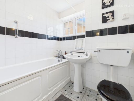
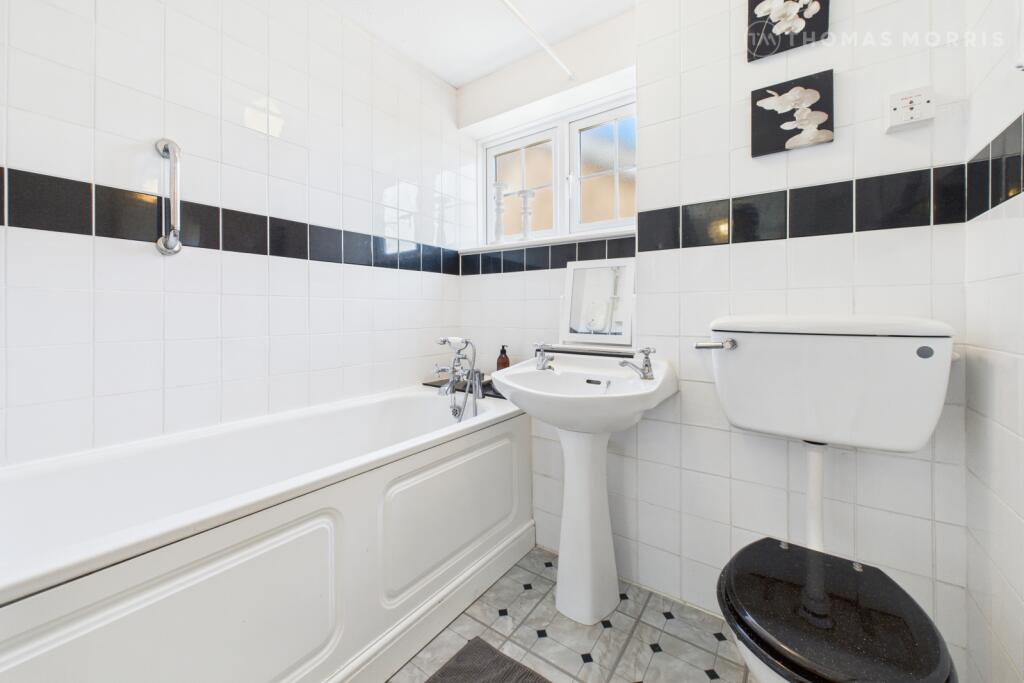
- Bathrooms: 1
- Property Type: undefined
- Property SubType: undefined
Brochure Descriptions
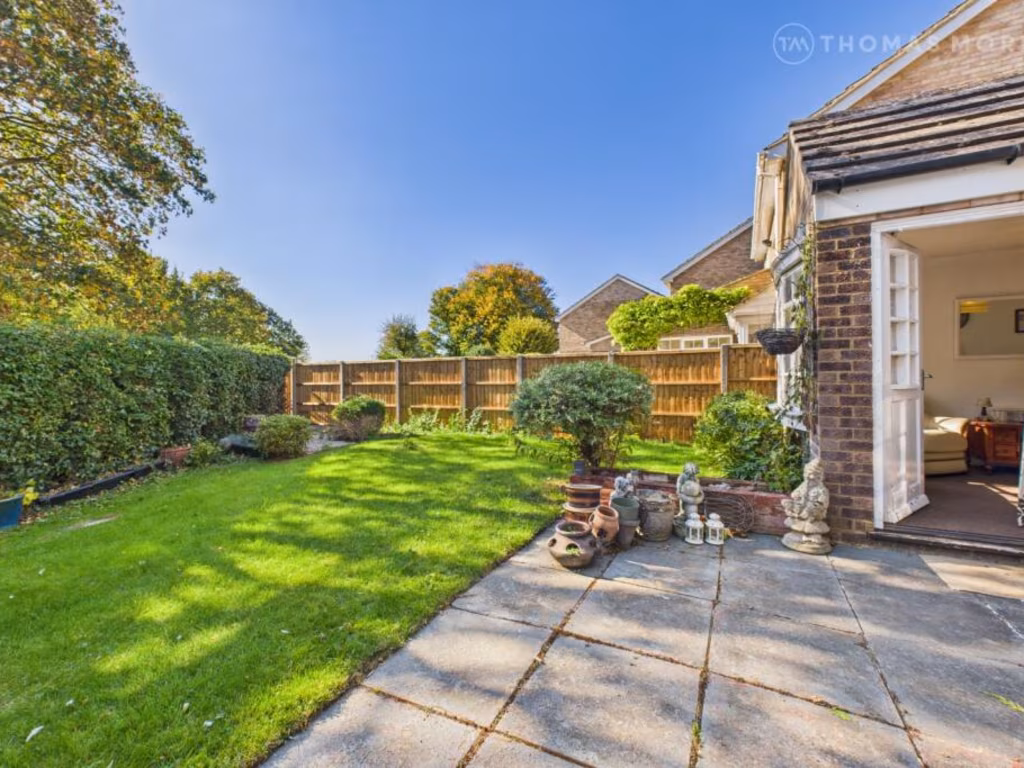
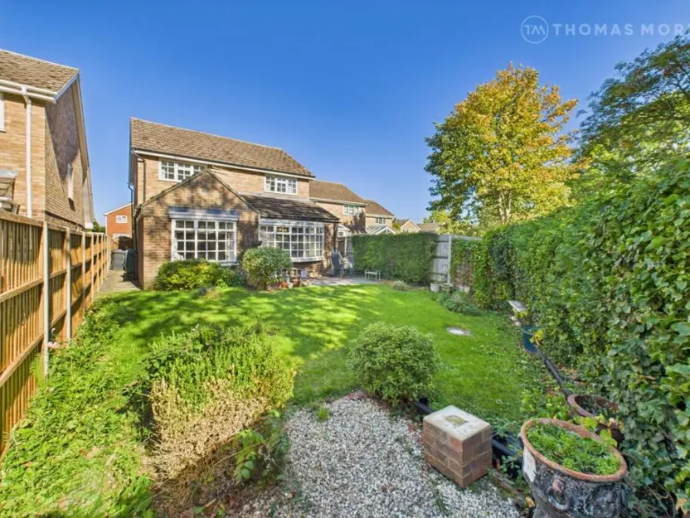
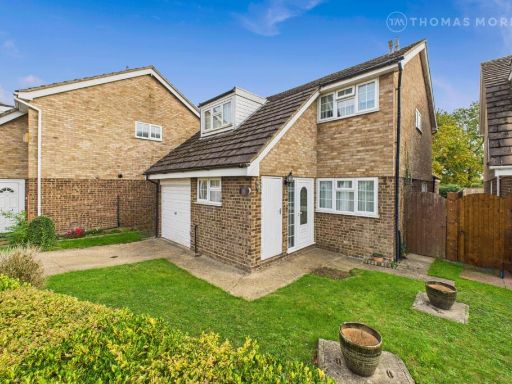
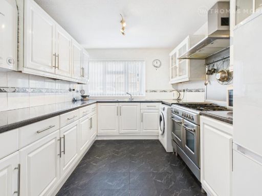
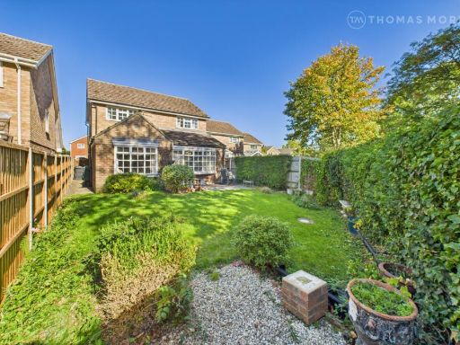
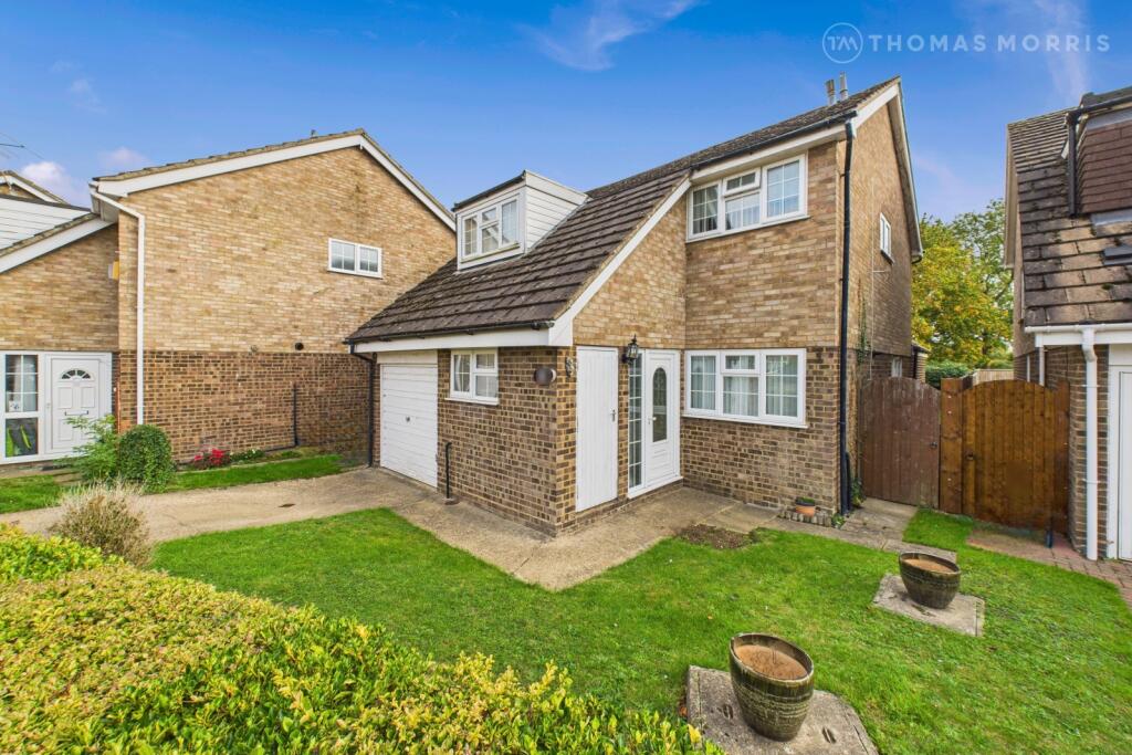
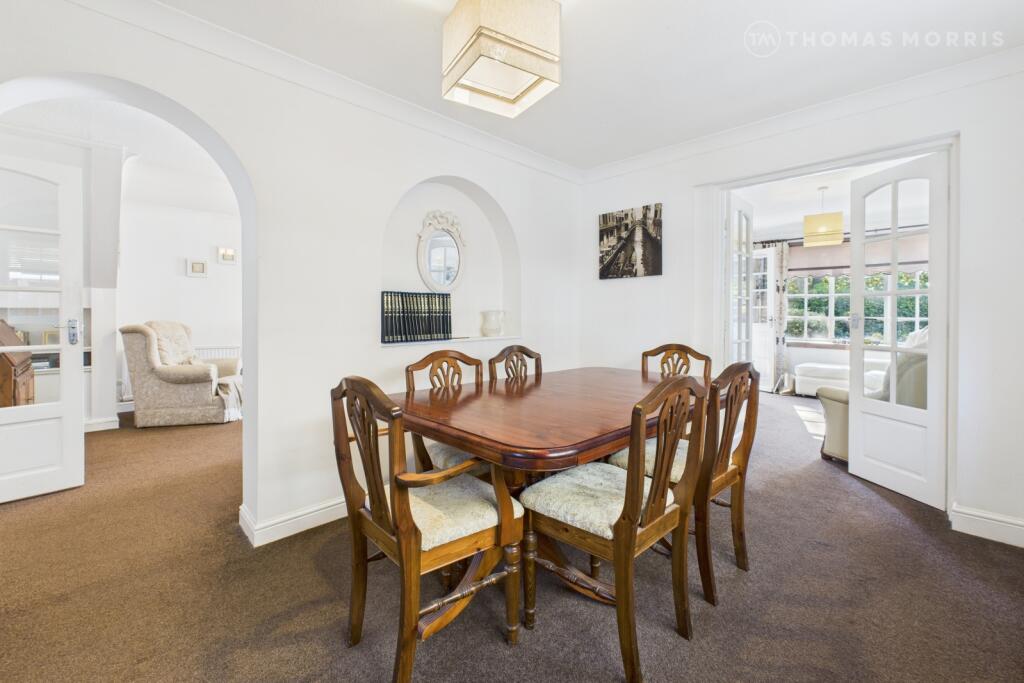
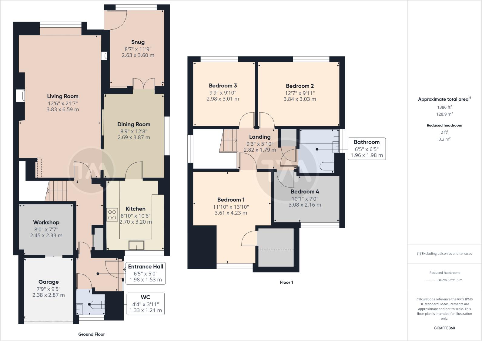
- Detached two-storey brick-built family house with attached single garage and driveway. The frontage shows a small, well-kept lawn and paved pathway with gated side access to the rear. The property occupies a residential close with neighbouring similar houses and limited street view; no wide or exceptional vistas are visible. The house footprint and plot appear to be of average size for a suburban family home; front garden is small, overall plot and accommodation likely medium/average in size. Construction appears to be traditional brick with pitched roof and dormer element above the garage.
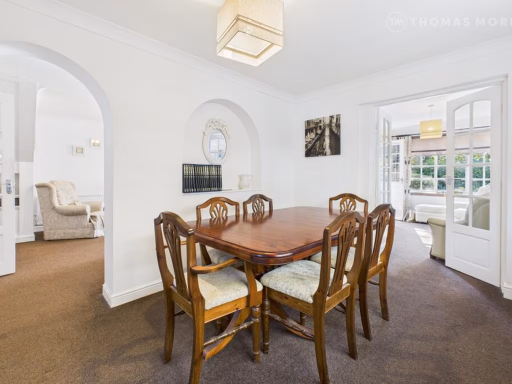
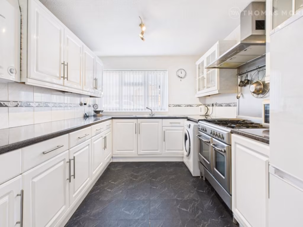
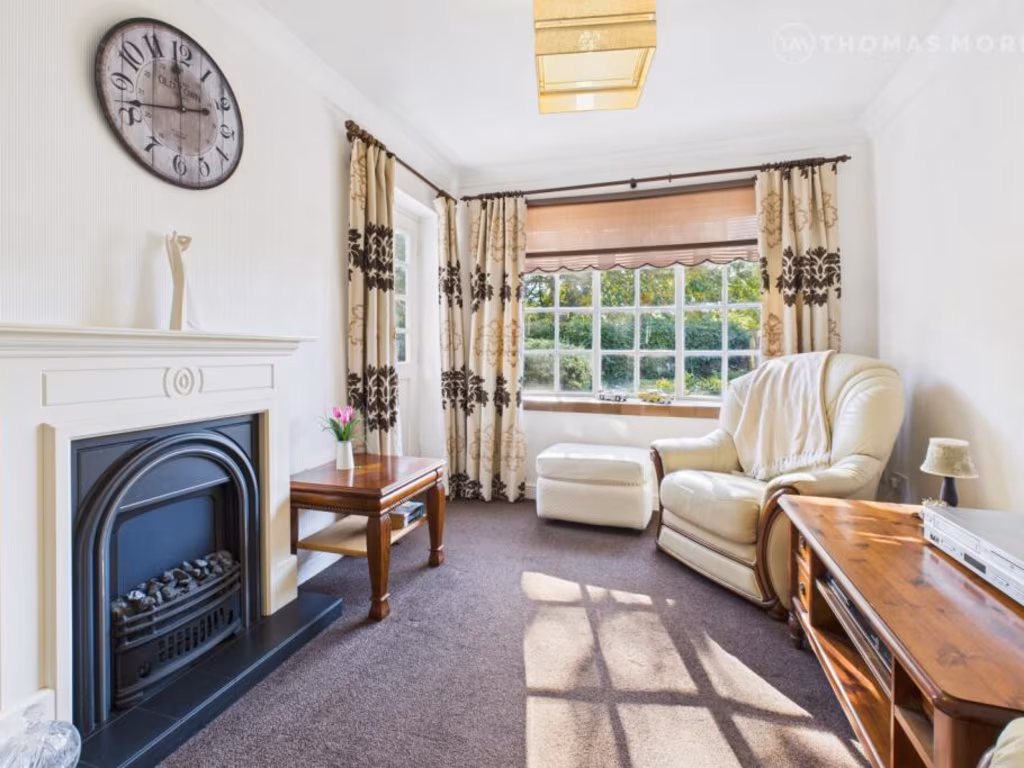
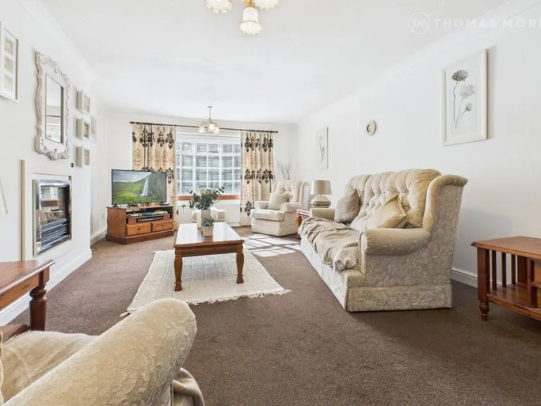
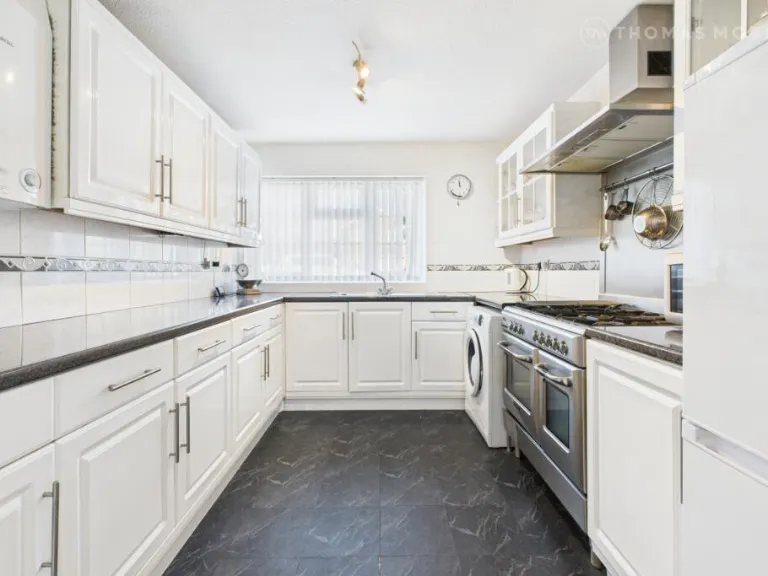
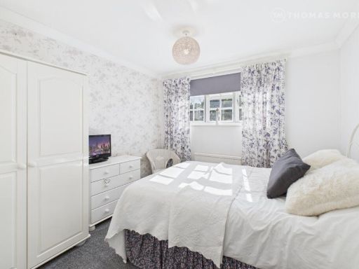
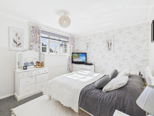
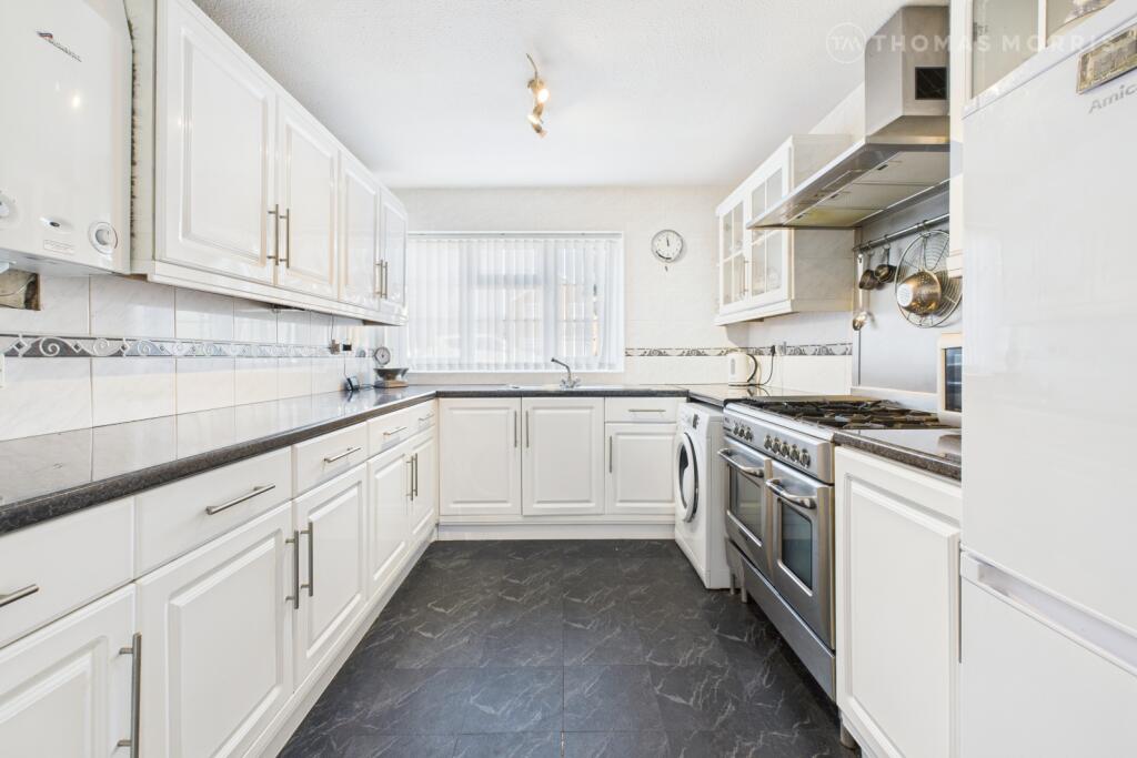
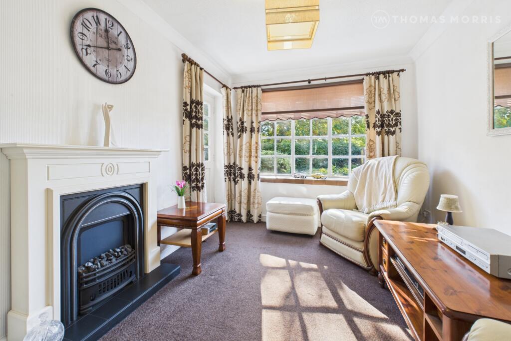
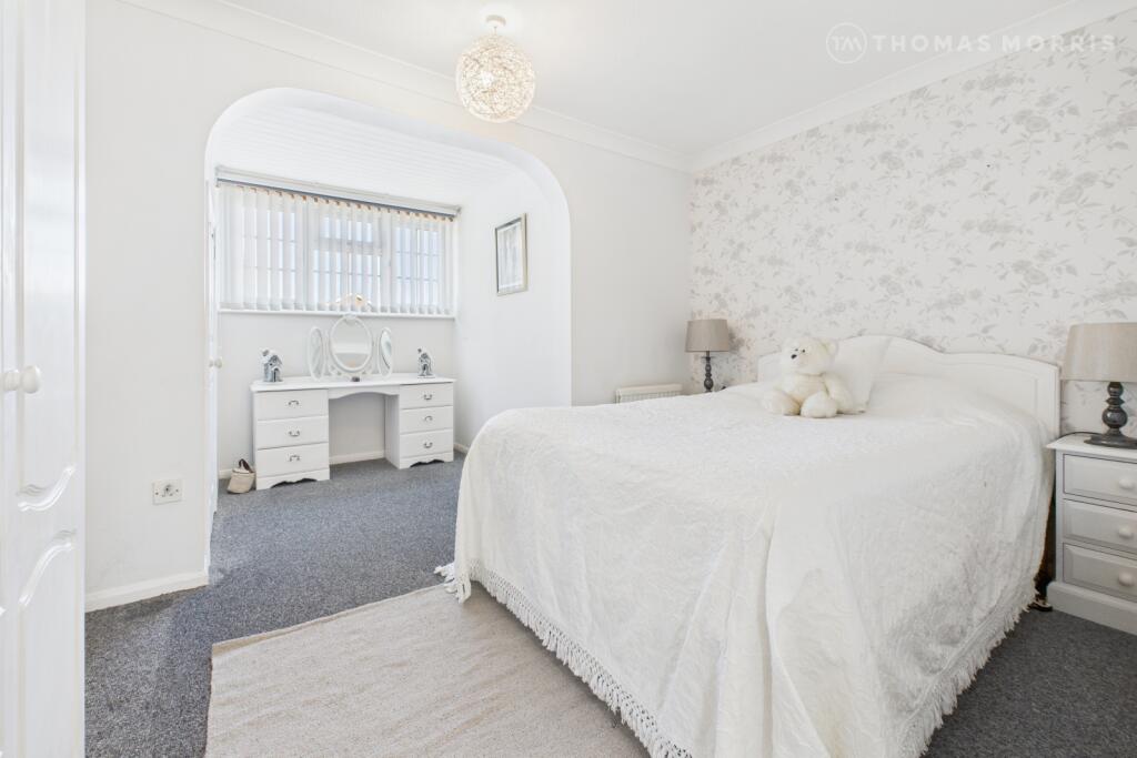
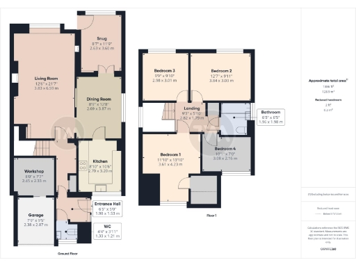
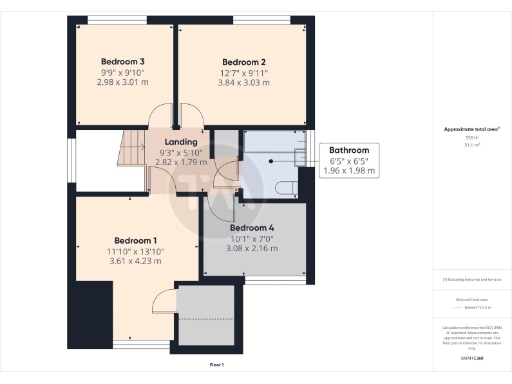
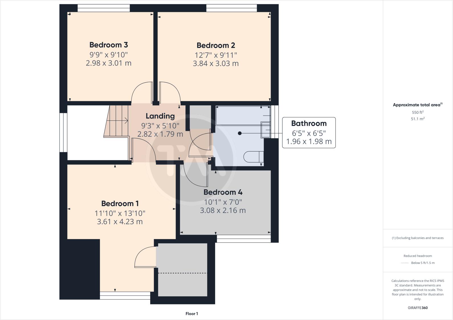
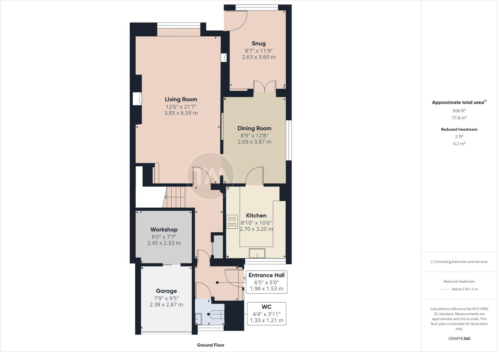
- Two-storey family house illustrated by a detailed floorplan. Ground floor layout shows an entrance hall, large living room, separate dining room, kitchen, snug, ground-floor WC, workshop/utility area and an attached garage. First floor provides four bedrooms and a family bathroom. The plan indicates a reasonably generous internal layout consistent with a mid-to-large sized family home; room sizes shown suggest comfortable principal rooms (large living room and dining room) and a master bedroom of above-average proportion. External aspects are not depicted beyond an attached garage and workshop; no specific views (sea, river, forest, city) are visible from the plan. Overall impression: a mid-to-large, well-proportioned detached/semi-detached family property with flexible ground-floor space and four decent first-floor bedrooms, suitable for family occupation. Room and garden sizes: internal rooms range from average to large; external garden size cannot be established from the provided images.
Image Descriptions
- detached house 1970s modern
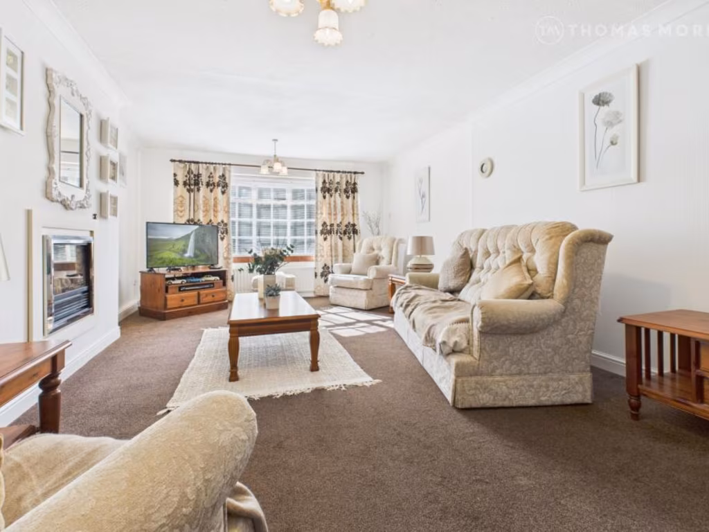
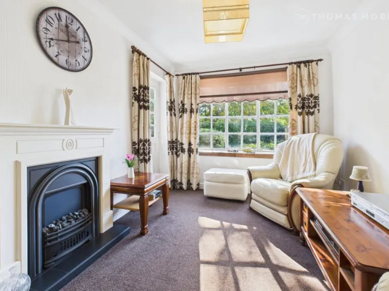
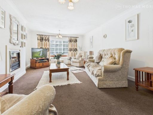
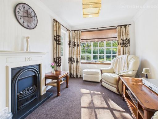
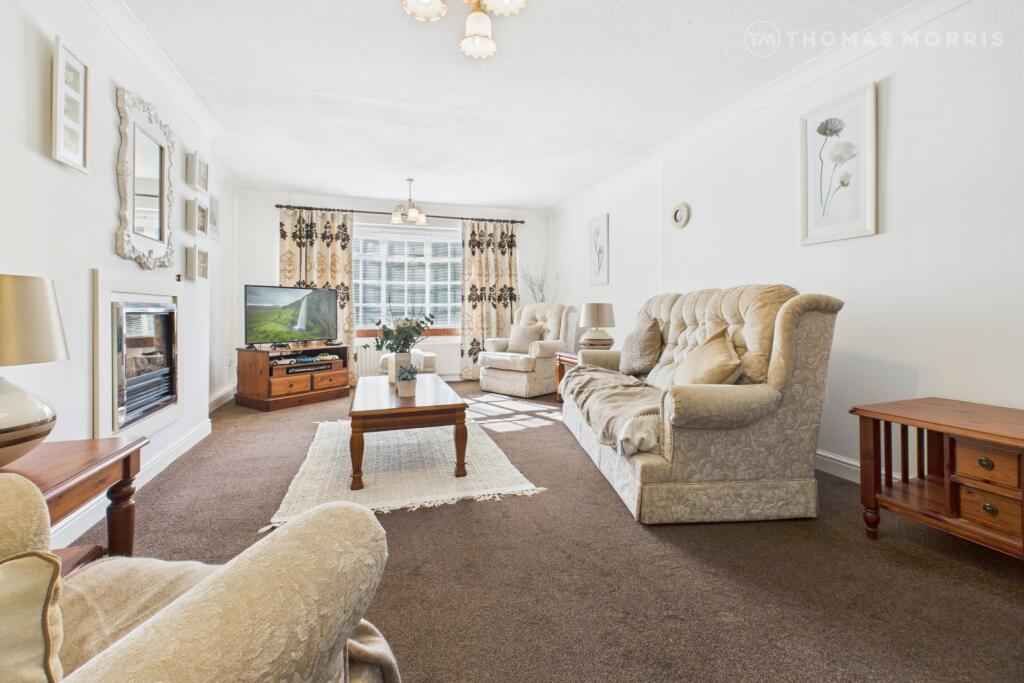
- living room contemporary
Floorplan Description
- Two-storey residential property with living/dining/kitchen and utility spaces on the ground floor and four bedrooms on the first floor.
- First-floor plan with four bedrooms, bathroom and landing.
- Ground floor plan with living room, snug, dining room, kitchen, workshop, garage, entrance hall and WC
Rooms
- Living Room:
- Dining Room:
- Snug:
- Kitchen:
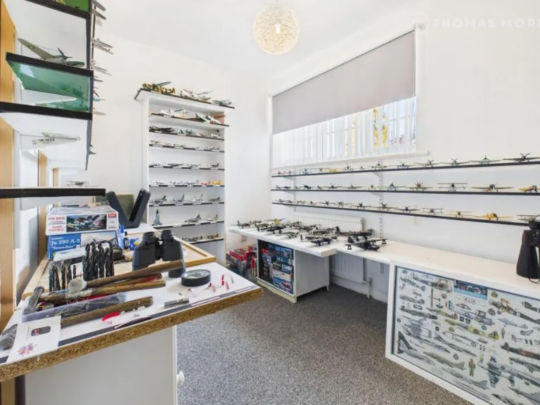
- Workshop:
- Entrance Hall:
- WC:
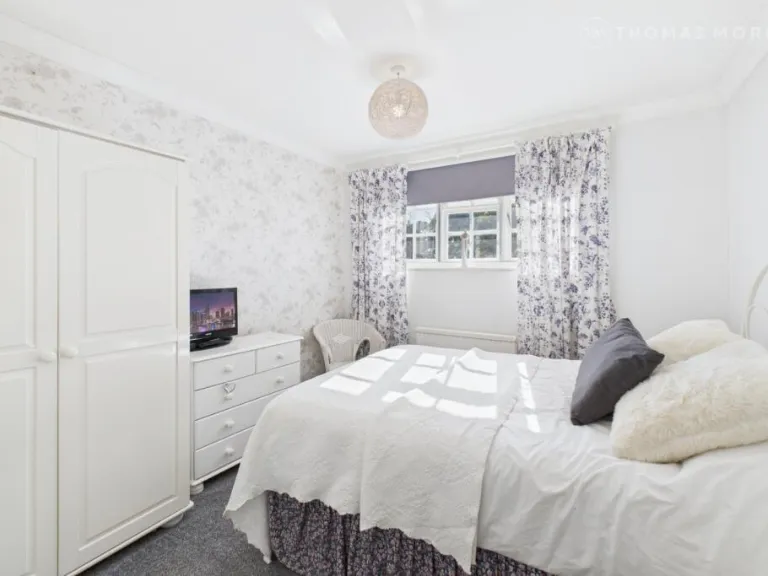
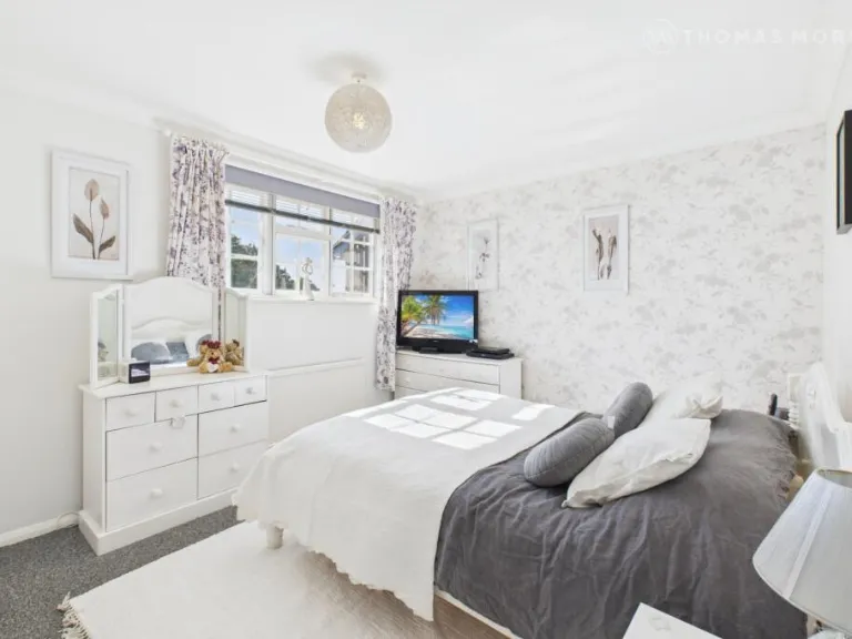
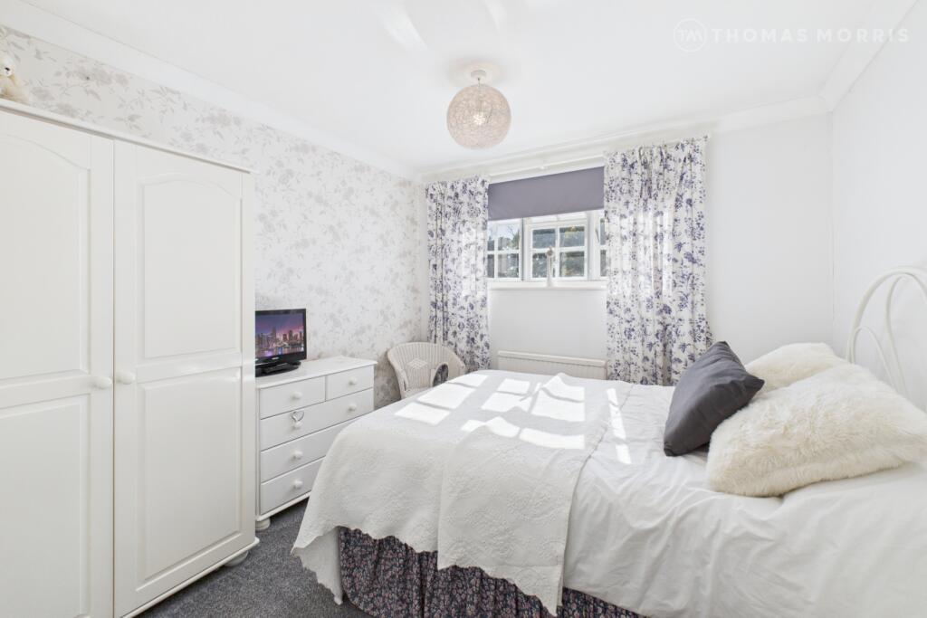
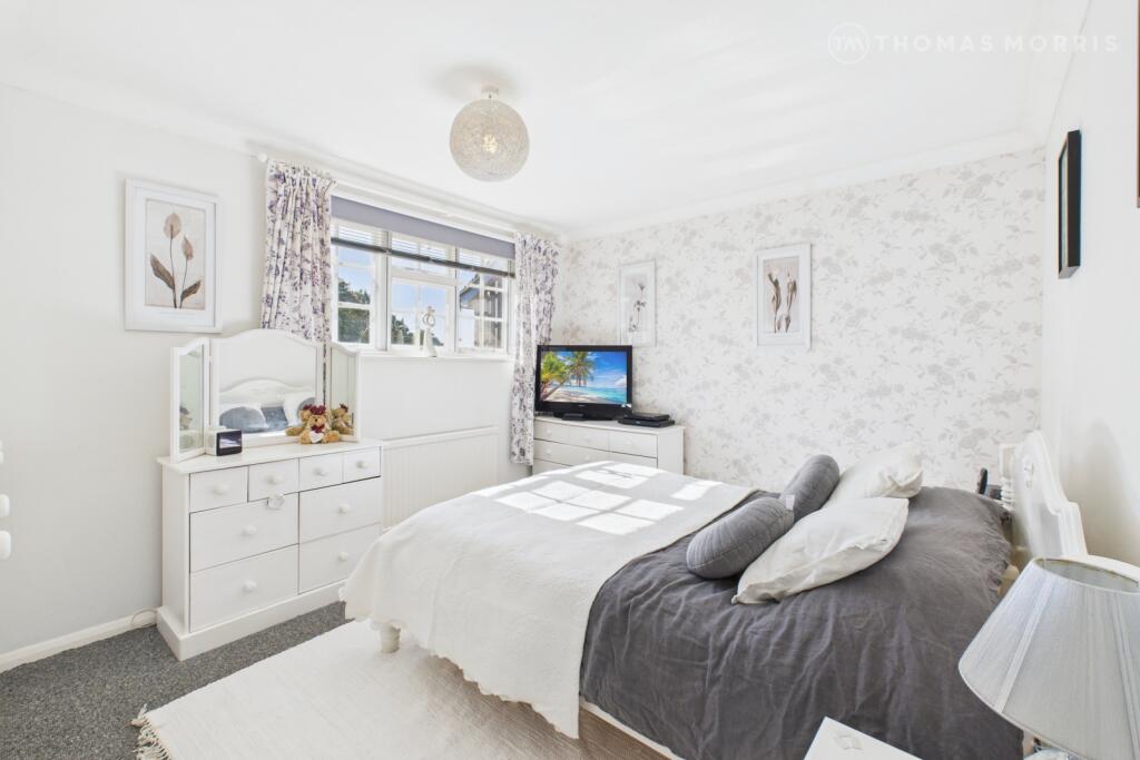
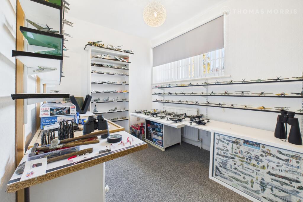
- Bedroom 1:
- Bedroom 2:
- Bedroom 3:
- Bedroom 4:
- Landing:
- Bathroom:
- Bedroom 3:
- Bedroom 2:
- Landing:
- Bathroom:
- Bedroom 1:
- Bedroom 4:
- Living Room:
- Snug:
- Dining Room:
- Kitchen:
- Workshop:
- Garage:
- Entrance Hall:
- WC:
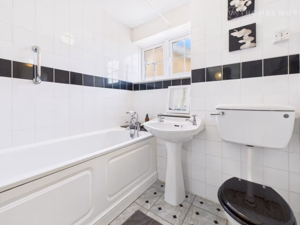
Textual Property Features
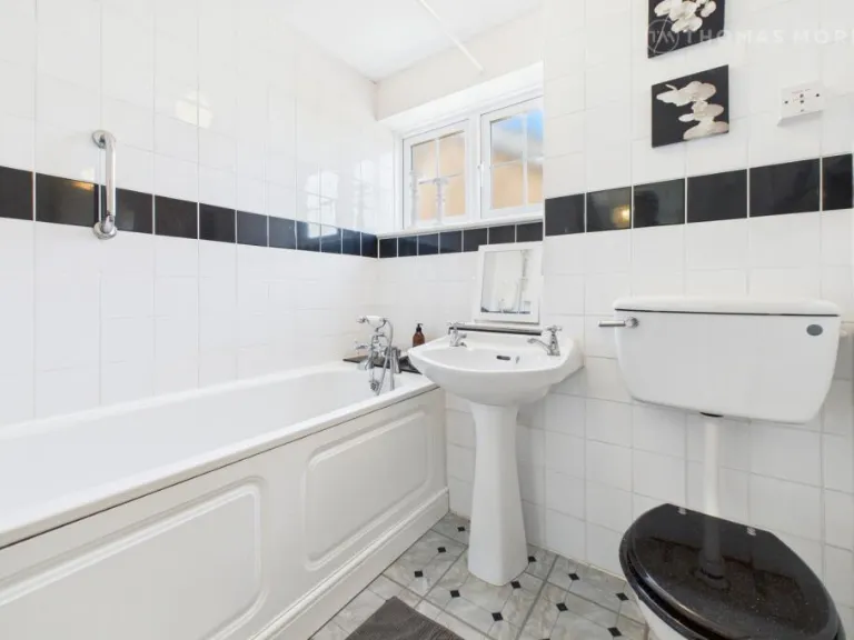
- Has Garden
- Chain Free
- Success
Detected Visual Features
- detached house
- 1970s modern
- brick exterior
- residential area
- two-story
- garage
- garden
- potential
- suburban
- contemporary living room
- medium room size
- standard ceiling
- brown carpet
- curtains
- ceiling lights
- natural light
Nearby Schools
- Clifton All Saints Academy
- Samuel Whitbread Academy
- Langford Village Academy
- Biggleswade Academy
- Stratton Upper School
- Lawnside Academy
- Edward Peake CofE VC Middle School
- St Swithun's Church of England VC Primary School
- Potton Primary School
- Moggerhanger Primary School
- Great Barford Church of England Primary Academy
- Henlow Church of England Academy
- Southill Lower School
- St Andrew's CofE VC Lower School
- OneSchool Global UK - Biggleswade Campus
- Raynsford Church of England Academy
- Caldecote Church of England Academy
- Northill CofE Academy
- Robert Peel Primary School
- Campton Academy
- Robert Bloomfield Academy
- Shefford Lower School
- Sutton CofE VA Lower School
- Sheerhatch Primary School
- Sandy Secondary School
- Maple Tree Primary School
- Everton Heath Primary School
- John Donne Church of England Primary School
Nearest General Shops
- Id: 6760857509
- Tags:
- Addr:
- City: Biggleswade
- Housenumber: 72
- Postcode: SG18 0AP
- Street: Shortmead Street
- Name: Pedals
- Opening_hours: Tu-Fr 09:30-13:15,14:30-17:00; Sa 09:30-12:30,13:30-16:00
- Opening_hours:covid19: Tu-Fr 09:30-13:15,14:30-17:00; Sa 09:30-12:30,13:30-16:00; Mo,Su 10:00-12:00
- Phone: +44 1767 313418
- Shop: bicycle
- Website: http://www.pedalsbiggleswade.co.uk
- TagsNormalized:
- Lat: 52.0894546
- Lon: -0.2672714
- FullGeoHash: gcrb3ft7h45g
- PartitionGeoHash: gcrb
- Images:
- FoodStandards: null
- Distance: 2082.7
,- Id: 4800485985
- Tags:
- TagsNormalized:
- Lat: 52.0898586
- Lon: -0.2673685
- FullGeoHash: gcrb3ftm3v7t
- PartitionGeoHash: gcrb
- Images:
- FoodStandards: null
- Distance: 2057.7
,- Id: 323874409
- Tags:
- Addr:
- City: Biggleswade
- Postcode: SG18 0FE
- Building: yes
- Name: Biggleswade MOT Centre
- Shop: car_repair
- TagsNormalized:
- Lat: 52.092196
- Lon: -0.2687393
- FullGeoHash: gcrb3gh71cjm
- PartitionGeoHash: gcrb
- Images:
- FoodStandards: null
- Distance: 1874.9
}
Nearest Airports
- Id: 495488524
- Tags:
- Aerodrome: international
- Aerodrome:type: public
- Aeroway: aerodrome
- Alt_name: Stansted
- Iata: STN
- Icao: EGSS
- Is_in: Essex,England,UK
- Name: London Stansted Airport
- Ref: STN
- Source: Gagravarr_Airports
- Website: https://www.stanstedairport.com/
- Wikidata: Q8709
- Wikipedia: en:London Stansted Airport
- TagsNormalized:
- airport
- international airport
- Lat: 51.8869677
- Lon: 0.2429264
- FullGeoHash: u10pjt8zkxg4
- PartitionGeoHash: u10p
- Images:
- FoodStandards: null
- Distance: 43631.1
,- Id: 110273499
- Tags:
- Addr:
- Country: GB
- Postcode: LU2 9LY
- Aerodrome: international
- Aerodrome:type: public
- Aeroway: aerodrome
- Alt_name: London Luton
- Iata: LTN
- Icao: EGGW
- Name: London Luton Airport
- Website: https://www.london-luton.co.uk/
- Wikidata: Q8712
- Wikipedia: en:Luton Airport
- TagsNormalized:
- airport
- international airport
- Lat: 51.8780363
- Lon: -0.3701408
- FullGeoHash: gcpxps47rngh
- PartitionGeoHash: gcpx
- Images:
- FoodStandards: null
- Distance: 24947.8
}
Nearest Leisure Facilities
- Id: 1045061098
- Tags:
- Leisure: pitch
- Sport: equestrian
- TagsNormalized:
- pitch
- leisure
- equestrian
- sports
- Lat: 52.1006303
- Lon: -0.277805
- FullGeoHash: gcrb3stsntmt
- PartitionGeoHash: gcrb
- Images:
- FoodStandards: null
- Distance: 1208.5
,- Id: 121142922
- Tags:
- Leisure: pitch
- Sport: netball
- TagsNormalized:
- pitch
- leisure
- netball
- sports
- Lat: 52.0969607
- Lon: -0.2894116
- FullGeoHash: gcrb37vqb1r5
- PartitionGeoHash: gcrb
- Images:
- FoodStandards: null
- Distance: 371.6
,- Id: 121142927
- Tags:
- Leisure: pitch
- Sport: tennis
- TagsNormalized:
- Lat: 52.0969417
- Lon: -0.2896385
- FullGeoHash: gcrb37vndvvf
- PartitionGeoHash: gcrb
- Images:
- FoodStandards: null
- Distance: 356.7
,- Id: 121142928
- Tags:
- Leisure: pitch
- Sport: cricket_nets
- TagsNormalized:
- pitch
- leisure
- cricket
- cricket nets
- sports
- Lat: 52.0971174
- Lon: -0.2897243
- FullGeoHash: gcrb37vp8ytf
- PartitionGeoHash: gcrb
- Images:
- FoodStandards: null
- Distance: 347.8
,- Id: 121142923
- Tags:
- Leisure: pitch
- Sport: soccer
- TagsNormalized:
- Lat: 52.0969723
- Lon: -0.29047
- FullGeoHash: gcrb37uqze9b
- PartitionGeoHash: gcrb
- Images:
- FoodStandards: null
- Distance: 300.4
}
Nearest Tourist attractions
- Id: 262450552
- Tags:
- Name: The Shuttleworth Collection
- Tourism: attraction
- Wikidata: Q2280439
- TagsNormalized:
- Lat: 52.0897365
- Lon: -0.3227495
- FullGeoHash: gcrb2dsuxqst
- PartitionGeoHash: gcrb
- Images:
- FoodStandards: null
- Distance: 2099.4
,- Id: 2145227774
- Tags:
- Man_made: maypole
- Name: Ickwell Maypole
- Tourism: attraction
- TagsNormalized:
- Lat: 52.0963424
- Lon: -0.3230801
- FullGeoHash: gcrb2euepwn5
- PartitionGeoHash: gcrb
- Images:
- FoodStandards: null
- Distance: 1938.6
,- Id: 5194510868
- Tags:
- TagsNormalized:
- Lat: 52.0930406
- Lon: -0.2687217
- FullGeoHash: gcrb3ghrfqde
- PartitionGeoHash: gcrb
- Images:
- FoodStandards: null
- Distance: 1848.4
}
Nearest Train stations
- Id: 20981580
- Tags:
- Name: Baldock
- Naptan:
- Network: National Rail
- Public_transport: station
- Railway: station
- Ref:
- Wheelchair: no
- Wikidata: Q19953
- Wikipedia: en:Baldock railway station
- TagsNormalized:
- Lat: 51.9929714
- Lon: -0.1875624
- FullGeoHash: gcpzg9p3j2r7
- PartitionGeoHash: gcpz
- Images:
- FoodStandards: null
- Distance: 13746.3
,- Id: 4292877922
- Tags:
- Addr:
- City: Bedford
- Postcode: MK40 1DS
- Street: Ashburnham Road
- Name: Bedford
- Naptan:
- Network: National Rail
- Operator: Thameslink
- Public_transport: station
- Railway: station
- Ref:
- Train: yes
- Wikidata: Q2290621
- Wikimedia_commons: Category:Bedford railway station
- Wikipedia: en:Bedford railway station
- TagsNormalized:
- Lat: 52.1361826
- Lon: -0.4797291
- FullGeoHash: gcr8t54em8b5
- PartitionGeoHash: gcr8
- Images:
- FoodStandards: null
- Distance: 13339.9
,- Id: 26237649
- Tags:
- Name: Bedford St Johns
- Naptan:
- Network: National Rail
- Public_transport: station
- Railway: station
- Ref:
- Wikidata: Q2567167
- Wikimedia_commons: Category:Bedford St Johns railway station
- Wikipedia: en:Bedford St Johns railway station
- TagsNormalized:
- Lat: 52.1293364
- Lon: -0.4676146
- FullGeoHash: gcr8t3g7ru9k
- PartitionGeoHash: gcr8
- Images:
- FoodStandards: null
- Distance: 12320.8
,- Id: 21264536
- Tags:
- Name: Arlesey
- Naptan:
- Network: National Rail
- Public_transport: station
- Railway: station
- Ref:
- Source:
- Wikidata: Q4567224
- Wikipedia: en:Arlesey railway station
- TagsNormalized:
- Lat: 52.0258212
- Lon: -0.266464
- FullGeoHash: gcpzczjbqgyp
- PartitionGeoHash: gcpz
- Images:
- FoodStandards: null
- Distance: 8206.6
,- Id: 7209357138
- Tags:
- Name: Sandy
- Naptan:
- Network: National Rail
- Public_transport: station
- Railway: station
- Ref:
- Wikidata: Q3151015
- Wikipedia: en:Sandy railway station
- TagsNormalized:
- Lat: 52.1249106
- Lon: -0.2809477
- FullGeoHash: gcrb9953t7w5
- PartitionGeoHash: gcrb
- Images:
- FoodStandards: null
- Distance: 3186.1
}
Nearest Bus stations and stops
- Id: 3306439671
- Tags:
- Bench: yes
- Bin: yes
- Highway: bus_stop
- Public_transport: platform
- Shelter: yes
- TagsNormalized:
- Lat: 52.0925237
- Lon: -0.271461
- FullGeoHash: gcrb3g4kfw0p
- PartitionGeoHash: gcrb
- Images:
- FoodStandards: null
- Distance: 1687.2
,- Id: 3306439670
- Tags:
- Highway: bus_stop
- Public_transport: platform
- TagsNormalized:
- Lat: 52.0925047
- Lon: -0.2724172
- FullGeoHash: gcrb3g1su4xn
- PartitionGeoHash: gcrb
- Images:
- FoodStandards: null
- Distance: 1626.4
,- Id: 9062433367
- Tags:
- Bus: yes
- Highway: bus_stop
- Public_transport: platform
- TagsNormalized:
- Lat: 52.1060337
- Lon: -0.2800026
- FullGeoHash: gcrb3ts5ekwy
- PartitionGeoHash: gcrb
- Images:
- FoodStandards: null
- Distance: 1381.4
,- Id: 9062433336
- Tags:
- Bus: yes
- Highway: bus_stop
- Public_transport: platform
- TagsNormalized:
- Lat: 52.0969619
- Lon: -0.2749583
- FullGeoHash: gcrb3ezyc184
- PartitionGeoHash: gcrb
- Images:
- FoodStandards: null
- Distance: 1354.8
,- Id: 9062433366
- Tags:
- Bus: yes
- Highway: bus_stop
- Public_transport: platform
- TagsNormalized:
- Lat: 52.1005766
- Lon: -0.2769742
- FullGeoHash: gcrb3sw7f53j
- PartitionGeoHash: gcrb
- Images:
- FoodStandards: null
- Distance: 1261.4
}
Nearest Hotels
- Id: 951325996
- Tags:
- Building: yes
- Building:levels: 2
- Building:min_level: 1
- Layer: 1
- Roof:
- Tourism: hotel
- TagsNormalized:
- Lat: 52.0869621
- Lon: -0.2648742
- FullGeoHash: gcrb3fphecrr
- PartitionGeoHash: gcrb
- Images:
- FoodStandards: null
- Distance: 2357
,- Id: 8805542190
- Tags:
- Addr:
- Amenity: pub
- Bar: yes
- Brand: Wetherspoon
- Brand:wikidata: Q6109362
- Brand:wikipedia: en:Wetherspoons
- Internet_access: wlan
- Name: The Crown Hotel
- Rooms: 9
- Tourism: hotel
- TagsNormalized:
- bar
- pub
- wetherspoon
- hotel
- tourism
- Lat: 52.0869612
- Lon: -0.2649804
- FullGeoHash: gcrb3fph9926
- PartitionGeoHash: gcrb
- Images:
- FoodStandards: null
- Distance: 2350.7
,- Id: 951318819
- Tags:
- Addr:
- City: Biggleswade
- Country: GB
- Housenumber: 23
- Postcode: SG18 0JE
- Street: High Street
- Amenity: pub
- Brand: Wetherspoon
- Brand:wikidata: Q6109362
- Brand:wikipedia: en:Wetherspoons
- Building: yes
- Fhrs:
- Authority: Central Bedfordshire
- Id: 964728
- Local_authority_id: 153343
- Name: The Crown Hotel
- Toilets:
- TagsNormalized:
- Lat: 52.0871137
- Lon: -0.265075
- FullGeoHash: gcrb3fnvrm9z
- PartitionGeoHash: gcrb
- Images:
- FoodStandards: null
- Distance: 2336.7
}
Tags
- detached house
- 1970s modern
- brick exterior
- residential area
- two-story
- garage
- garden
- potential
- suburban
- contemporary living room
- medium room size
- standard ceiling
- brown carpet
- curtains
- ceiling lights
- natural light
Local Market Stats
- Average Price/sqft: £360
- Avg Income: £51000
- Rental Yield: 3.7%
- Social Housing: 14%
- Planning Success Rate: 91%
Similar Properties
 3 bedroom semi-detached house for sale in Shakespeare Drive, Upper Caldecote, Biggleswade, Bedfordshire, SG18 — £450,000 • 3 bed • 1 bath • 1092 ft²
 3 bedroom detached house for sale in Dene Way, Upper Caldecote, Biggleswade, Bedfordshire, SG18 — £425,000 • 3 bed • 1 bath • 981 ft²
 4 bedroom semi-detached house for sale in Hitchin Road, Upper Caldecote, SG18 — £535,000 • 4 bed • 2 bath • 1443 ft²
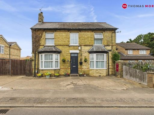 4 bedroom detached house for sale in Hitchin Road, Upper Caldecote, Biggleswade, Bedfordshire, SG18 — £650,000 • 4 bed • 2 bath • 2357 ft²
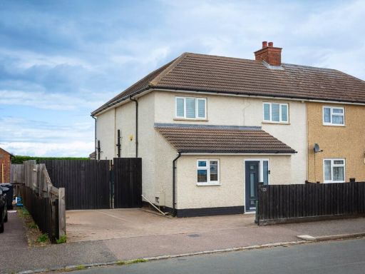 4 bedroom semi-detached house for sale in Biggleswade Road, Upper Caldecote, Biggleswade, SG18 — £475,000 • 4 bed • 2 bath • 1355 ft²
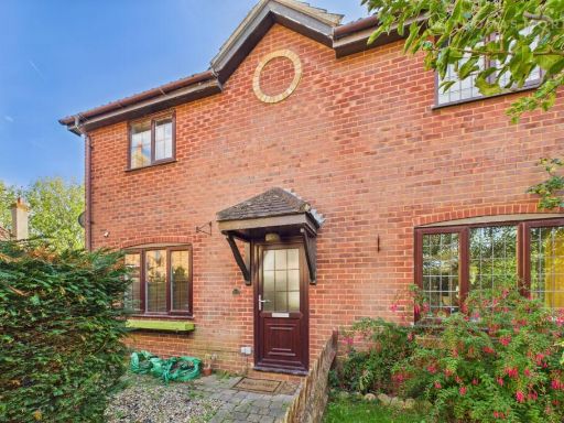 3 bedroom end of terrace house for sale in The Grange, Lower Caldecote, Biggleswade, Bedfordshire, SG18 — £315,000 • 3 bed • 1 bath • 685 ft²
Meta
- {
"@context": "https://schema.org",
"@type": "Residence",
"name": "4 bedroom detached house for sale in Brook Close, Upper Cal…",
"description": "",
"url": "https://propertypiper.co.uk/property/49aa93e9-6355-4924-920d-96cdb523b8fa",
"image": "https://image-a.propertypiper.co.uk/fb3ffa79-52c4-4eed-8161-c558ec3015ed-1024.jpeg",
"address": {
"@type": "PostalAddress",
"streetAddress": "8, BROOK CLOSE, BIGGLESWADE, UPPER CALDECOTE",
"postalCode": "SG18 9DW",
"addressLocality": "Central Bedfordshire",
"addressRegion": "North East Bedfordshire",
"addressCountry": "England"
},
"geo": {
"@type": "GeoCoordinates",
"latitude": 52.0975436,
"longitude": -0.2947683
},
"numberOfRooms": 4,
"numberOfBathroomsTotal": 1,
"floorSize": {
"@type": "QuantitativeValue",
"value": 1234,
"unitCode": "FTK"
},
"offers": {
"@type": "Offer",
"price": 450000,
"priceCurrency": "GBP",
"availability": "https://schema.org/InStock"
},
"additionalProperty": [
{
"@type": "PropertyValue",
"name": "Feature",
"value": "detached house"
},
{
"@type": "PropertyValue",
"name": "Feature",
"value": "1970s modern"
},
{
"@type": "PropertyValue",
"name": "Feature",
"value": "brick exterior"
},
{
"@type": "PropertyValue",
"name": "Feature",
"value": "residential area"
},
{
"@type": "PropertyValue",
"name": "Feature",
"value": "two-story"
},
{
"@type": "PropertyValue",
"name": "Feature",
"value": "garage"
},
{
"@type": "PropertyValue",
"name": "Feature",
"value": "garden"
},
{
"@type": "PropertyValue",
"name": "Feature",
"value": "potential"
},
{
"@type": "PropertyValue",
"name": "Feature",
"value": "suburban"
},
{
"@type": "PropertyValue",
"name": "Feature",
"value": "contemporary living room"
},
{
"@type": "PropertyValue",
"name": "Feature",
"value": "medium room size"
},
{
"@type": "PropertyValue",
"name": "Feature",
"value": "standard ceiling"
},
{
"@type": "PropertyValue",
"name": "Feature",
"value": "brown carpet"
},
{
"@type": "PropertyValue",
"name": "Feature",
"value": "curtains"
},
{
"@type": "PropertyValue",
"name": "Feature",
"value": "ceiling lights"
},
{
"@type": "PropertyValue",
"name": "Feature",
"value": "natural light"
}
]
}
High Res Floorplan Images
Compatible Floorplan Images
FloorplanImages Thumbnail