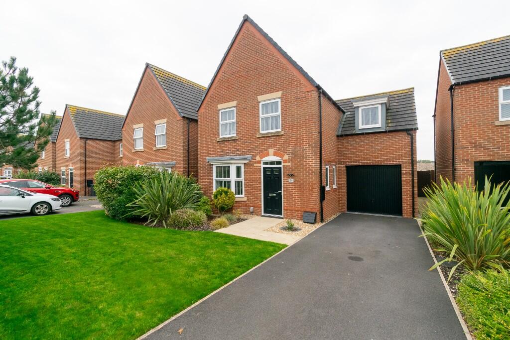
PR8 6UX - 4 bedroom detached house for sale in Blowick Moss Lane, Sou…
View on Property Piper
4 bedroom detached house for sale in Blowick Moss Lane, Southport, Merseyside, PR8
Property Details
- Price: £375000
- Bedrooms: 4
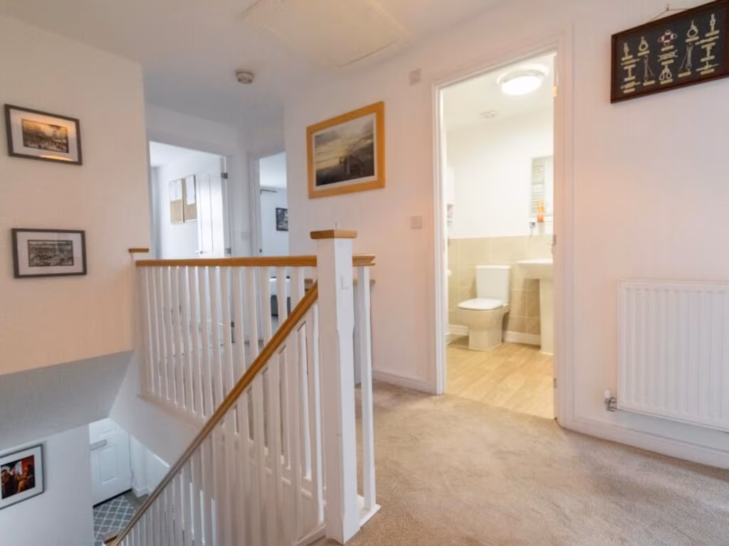
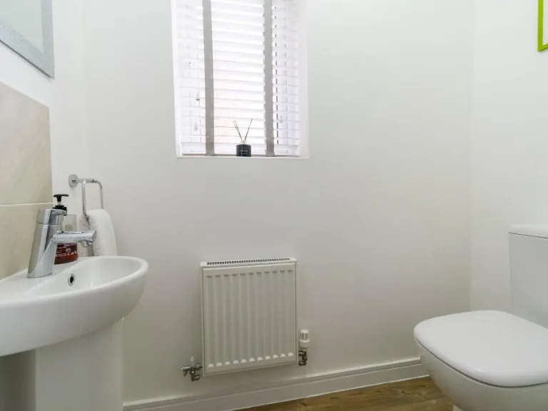
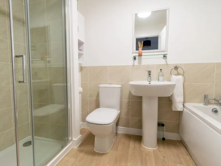
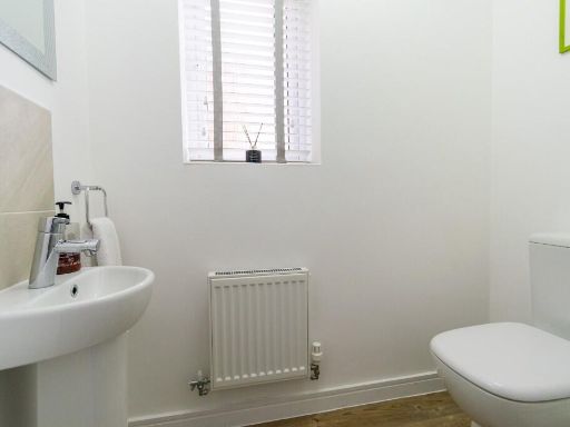
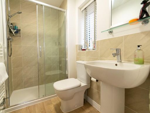
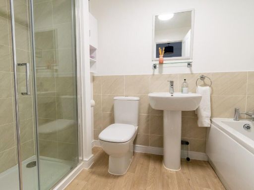
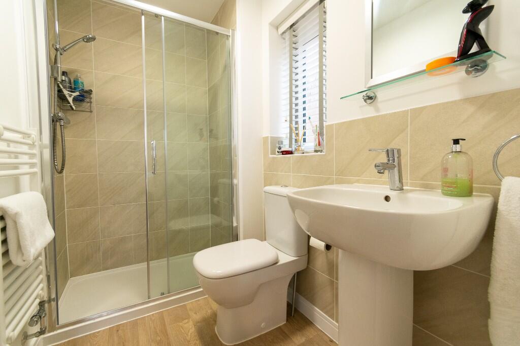
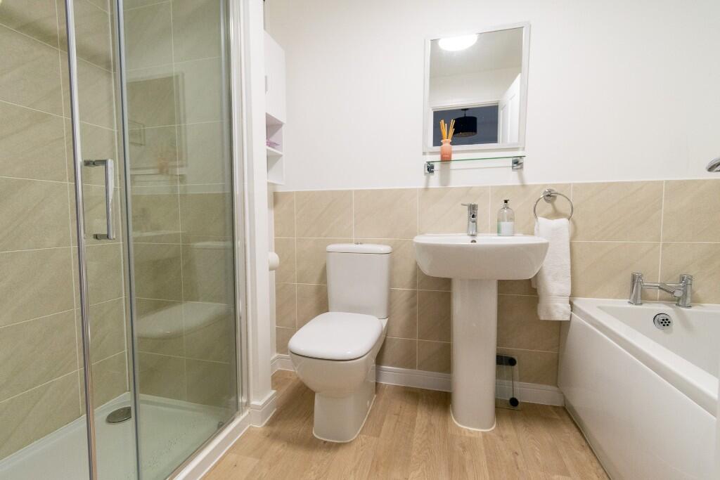
- Bathrooms: 2
- Property Type: undefined
- Property SubType: undefined
Image Descriptions
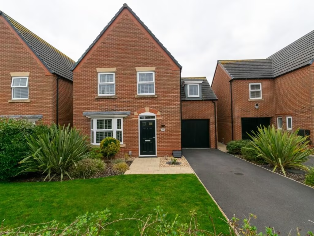
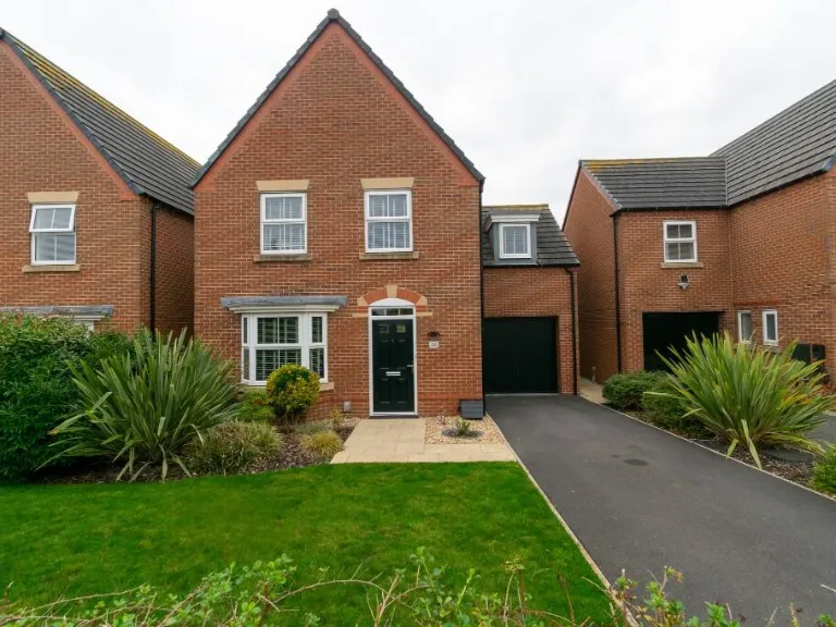
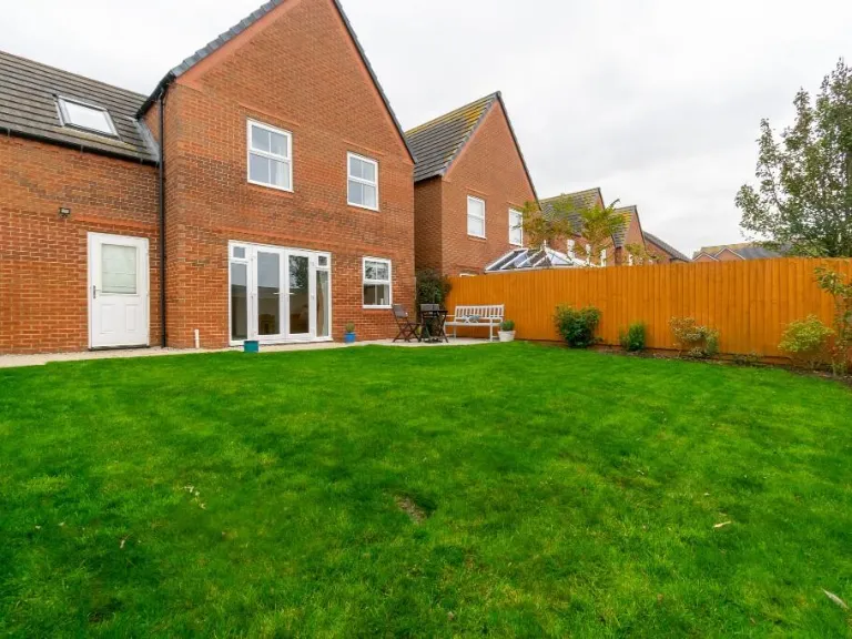
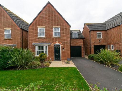
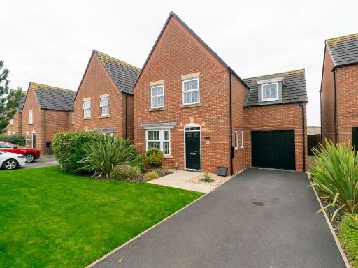
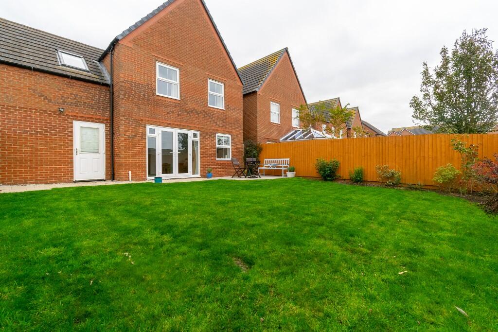
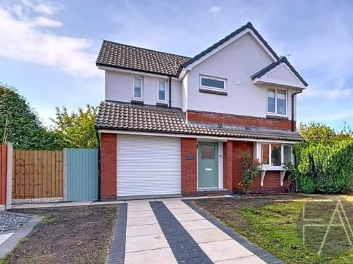
- modern detached house modern
- detached house modern
Floorplan Description
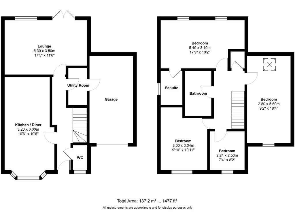
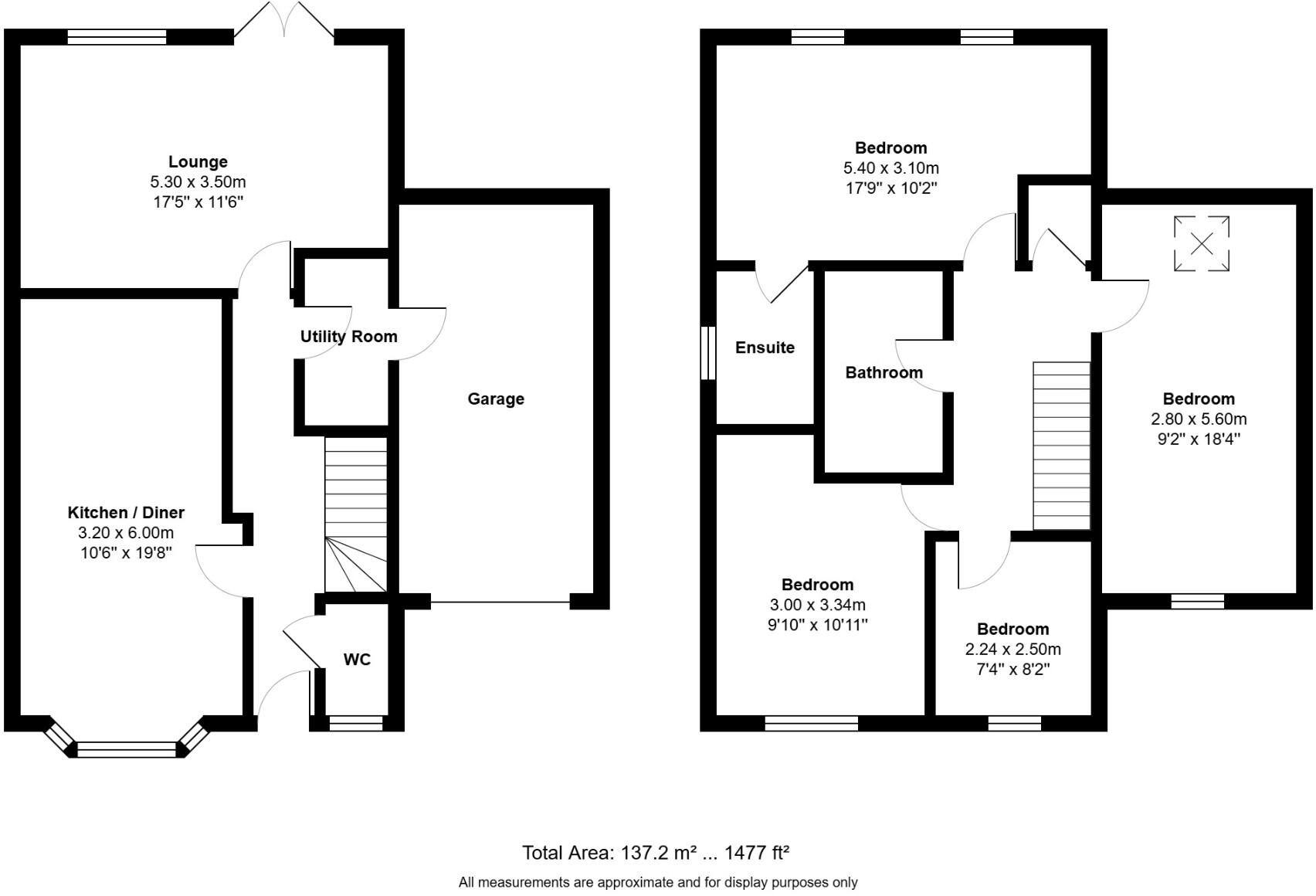
- Floor plan showing ground (0) and first (1) floors with labelled rooms and garage.
Rooms
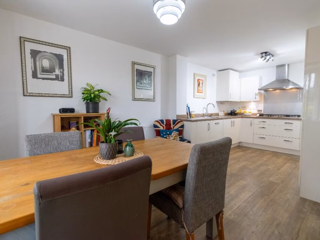
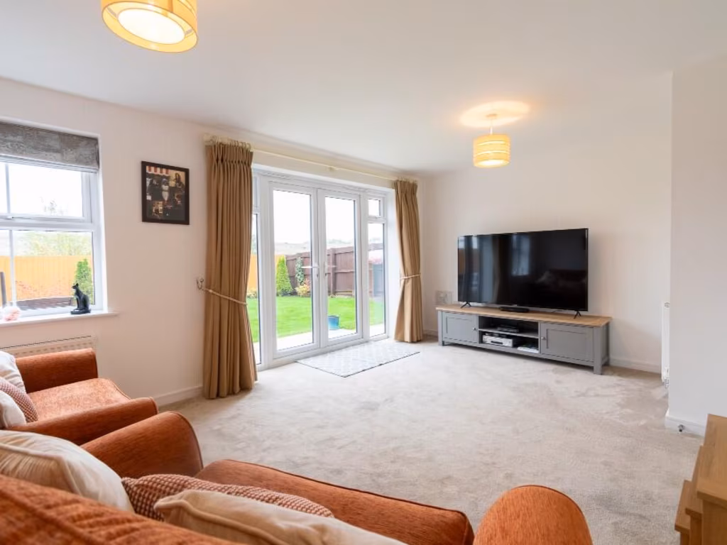
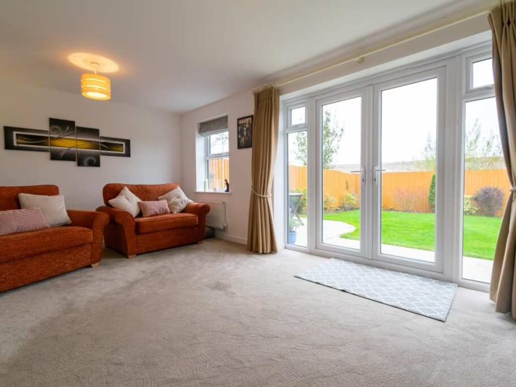
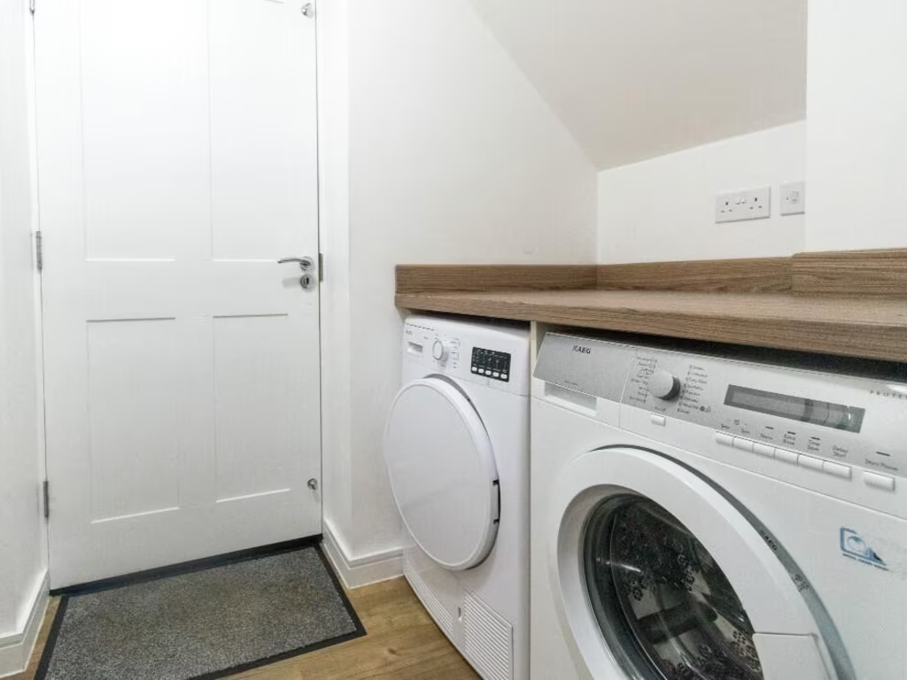
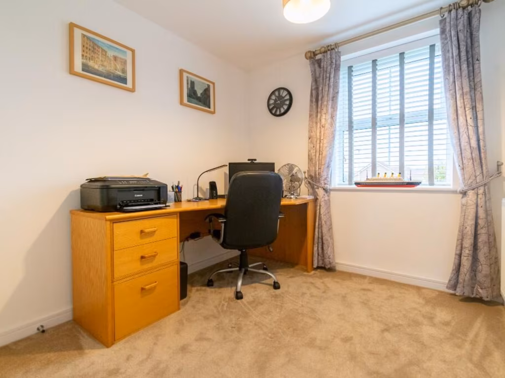
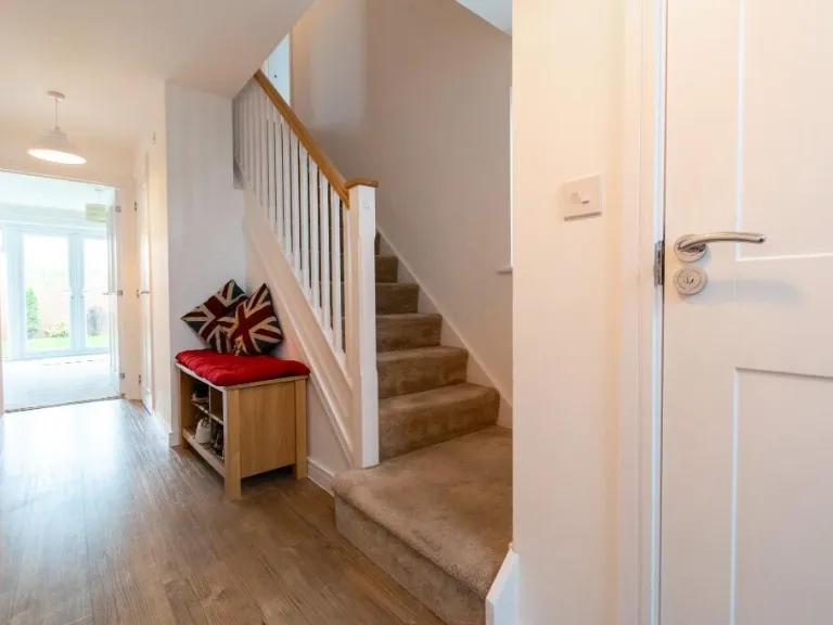
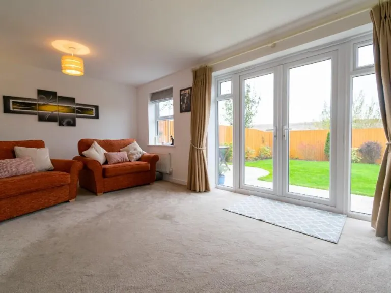
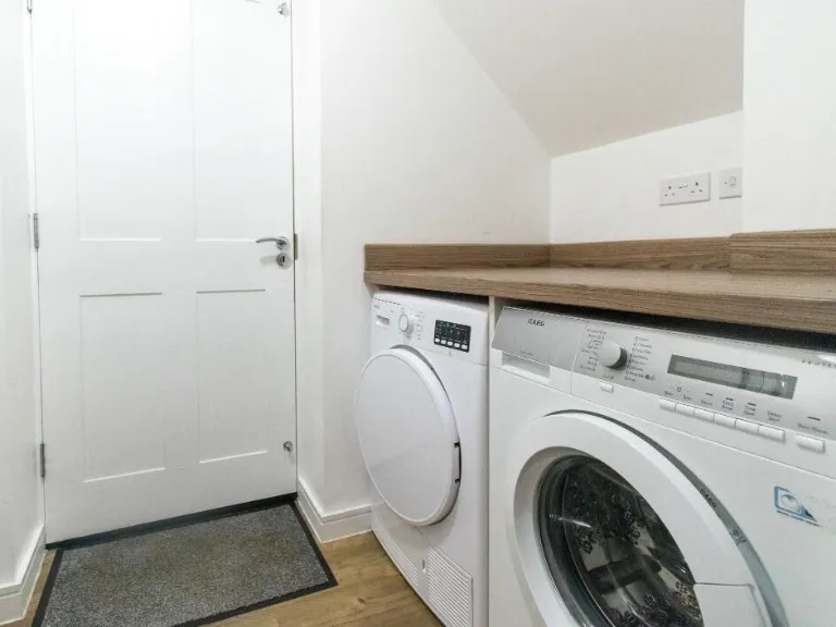
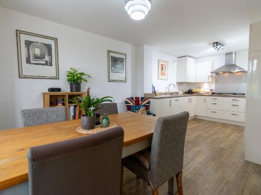
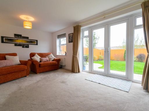
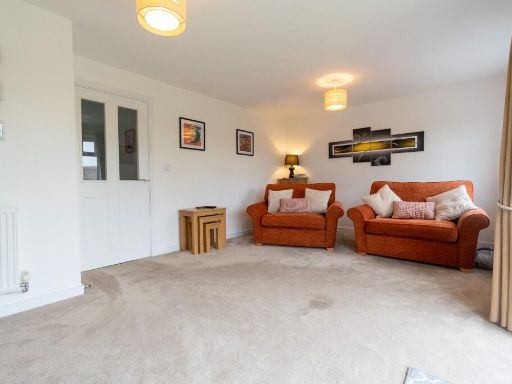
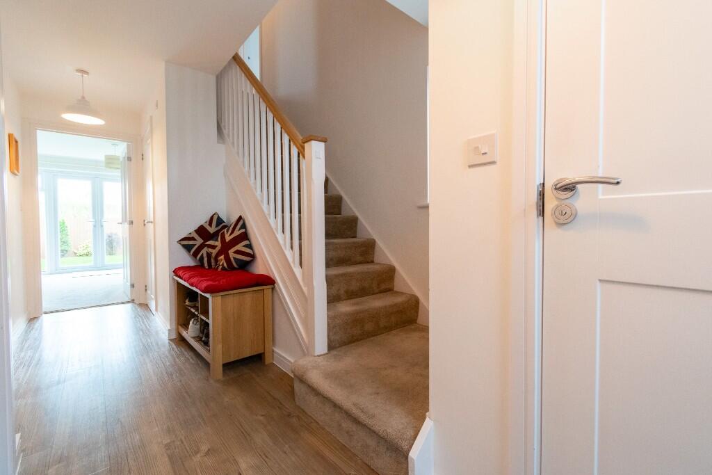
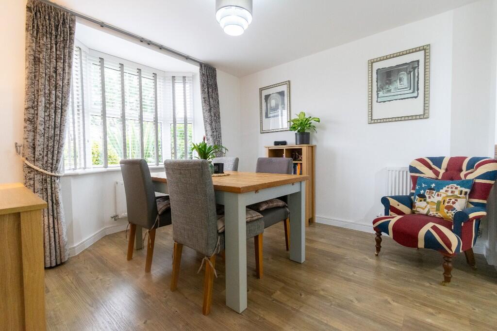
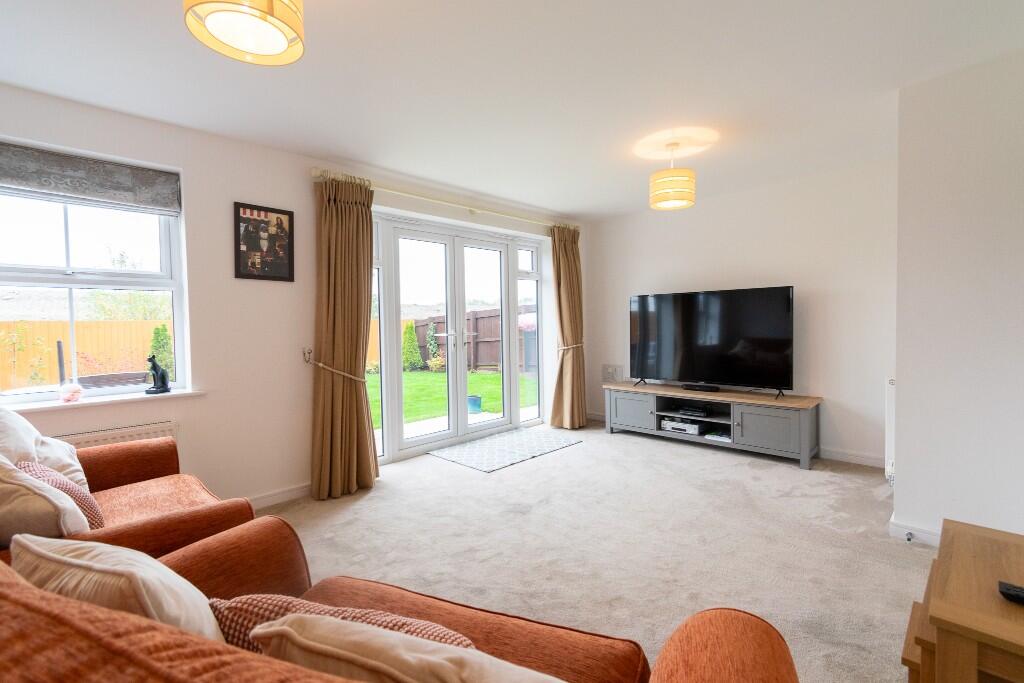
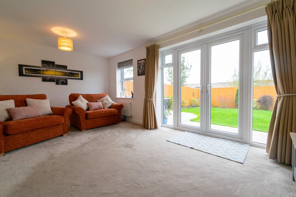
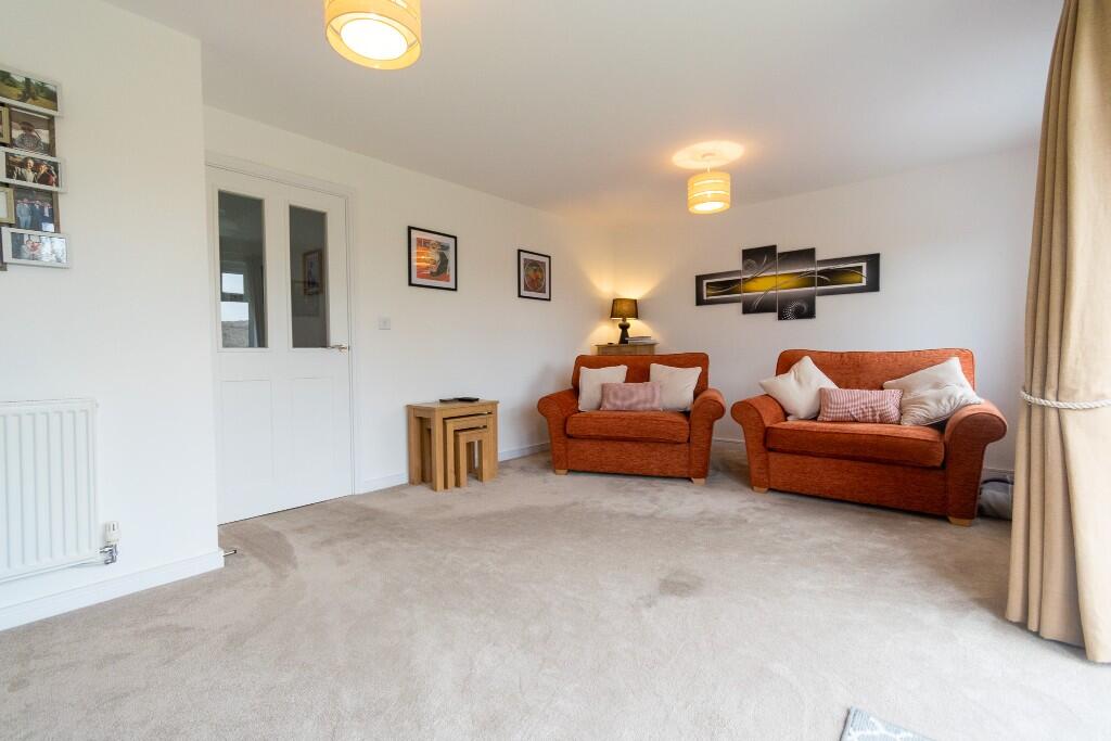
- Lounge:
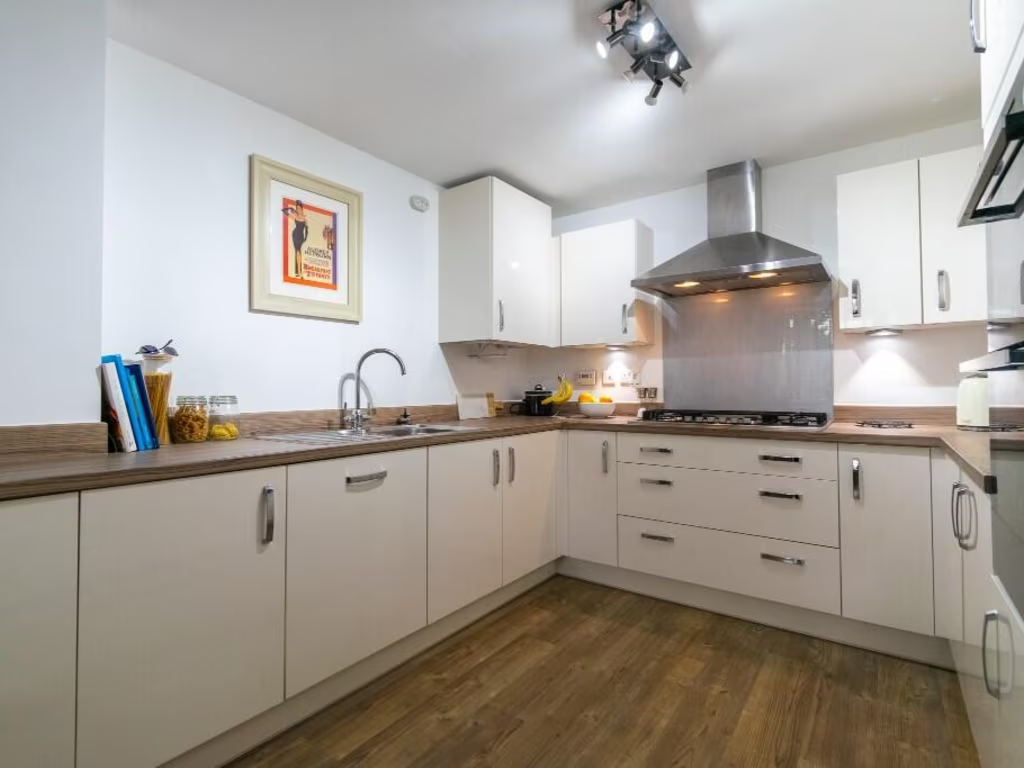
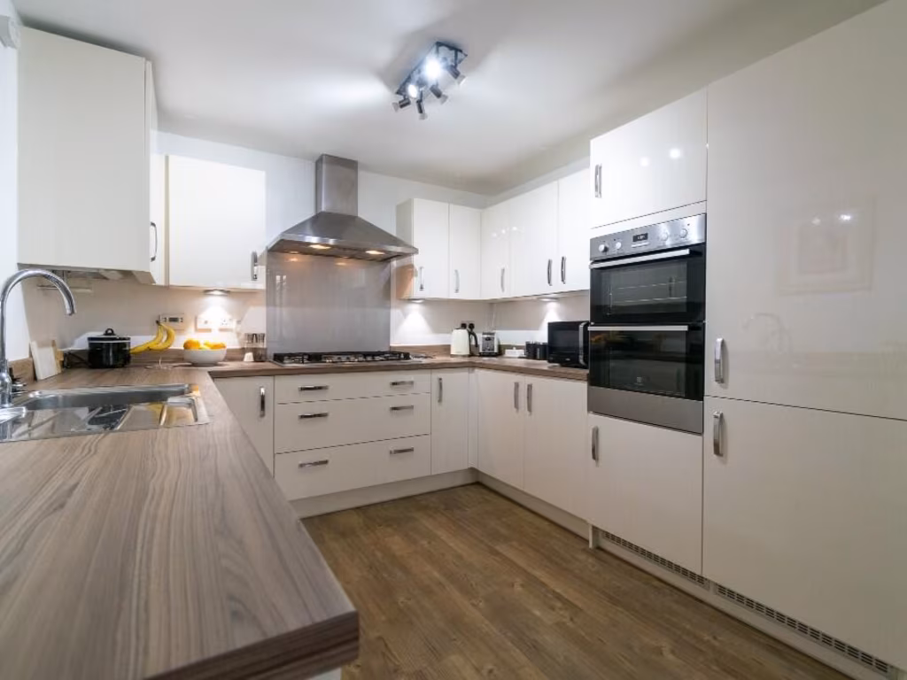
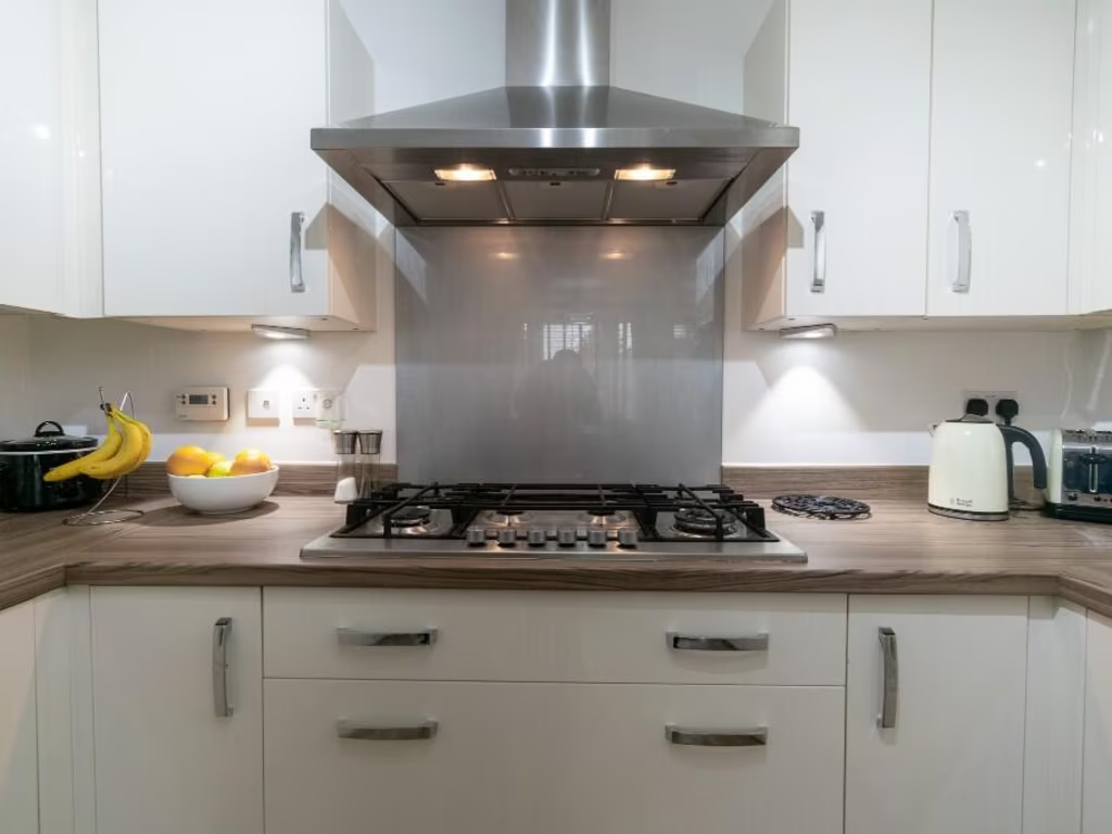
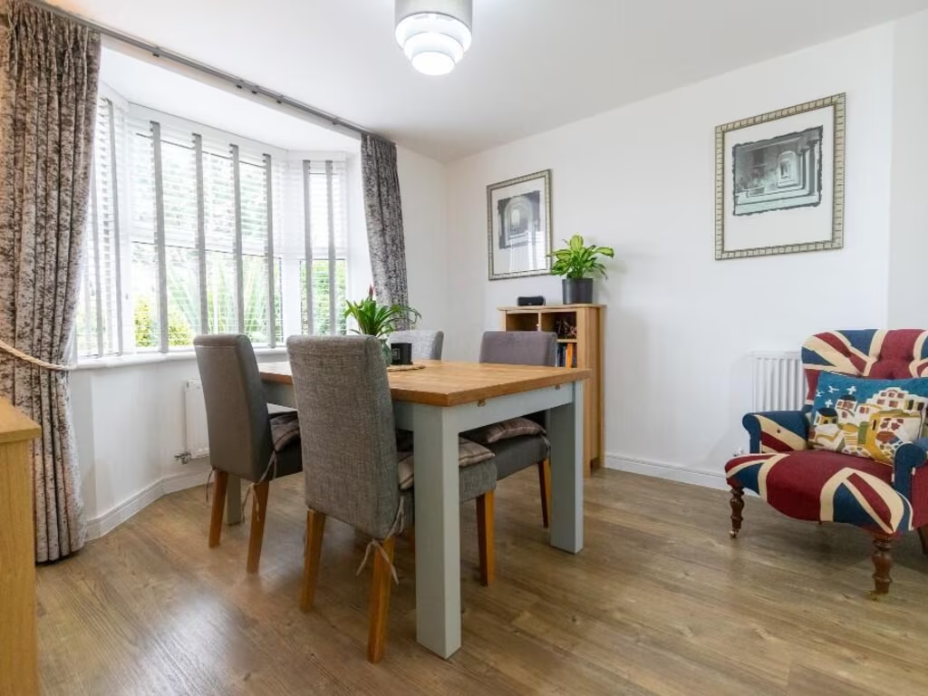
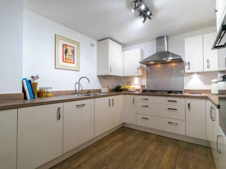
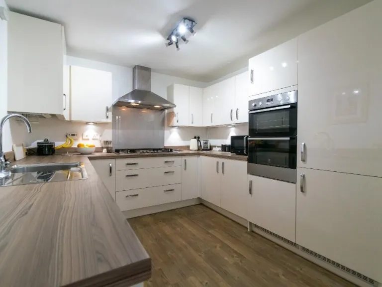
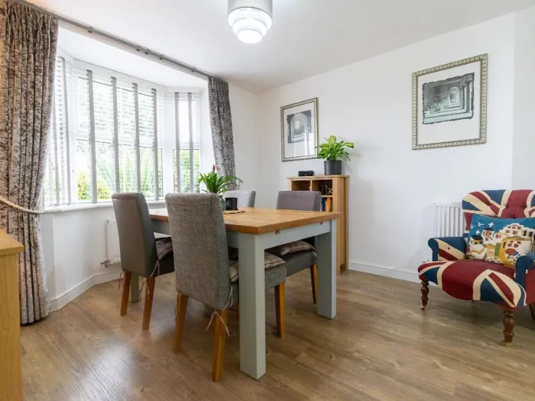
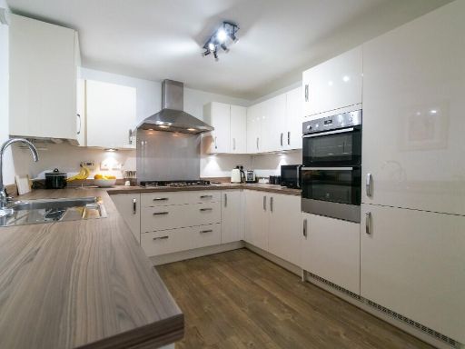
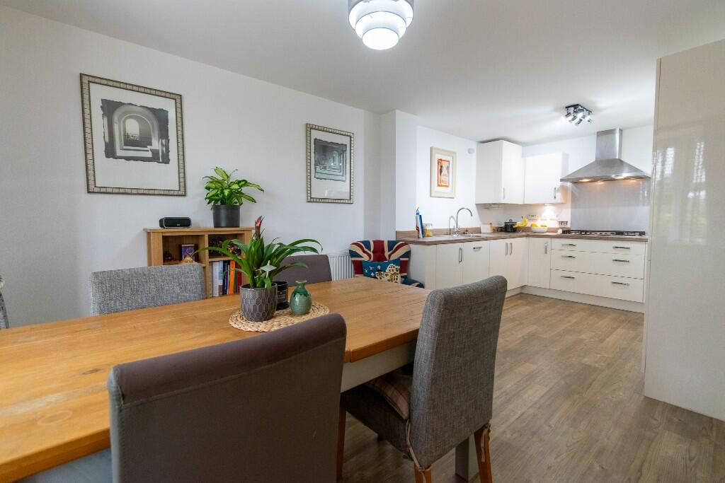
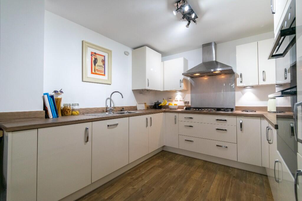
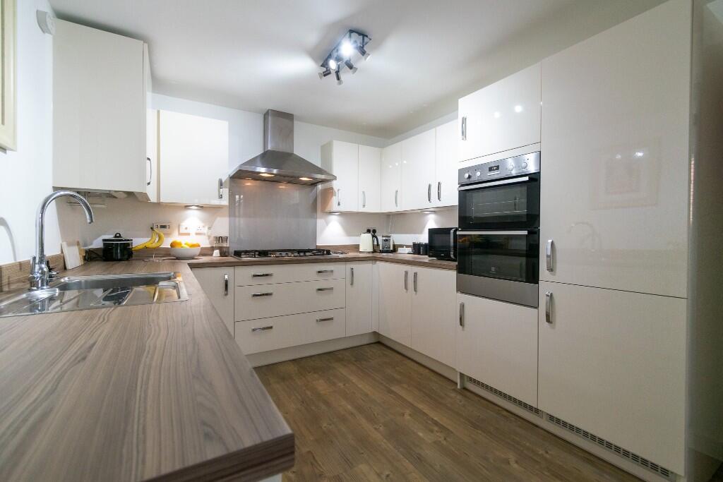
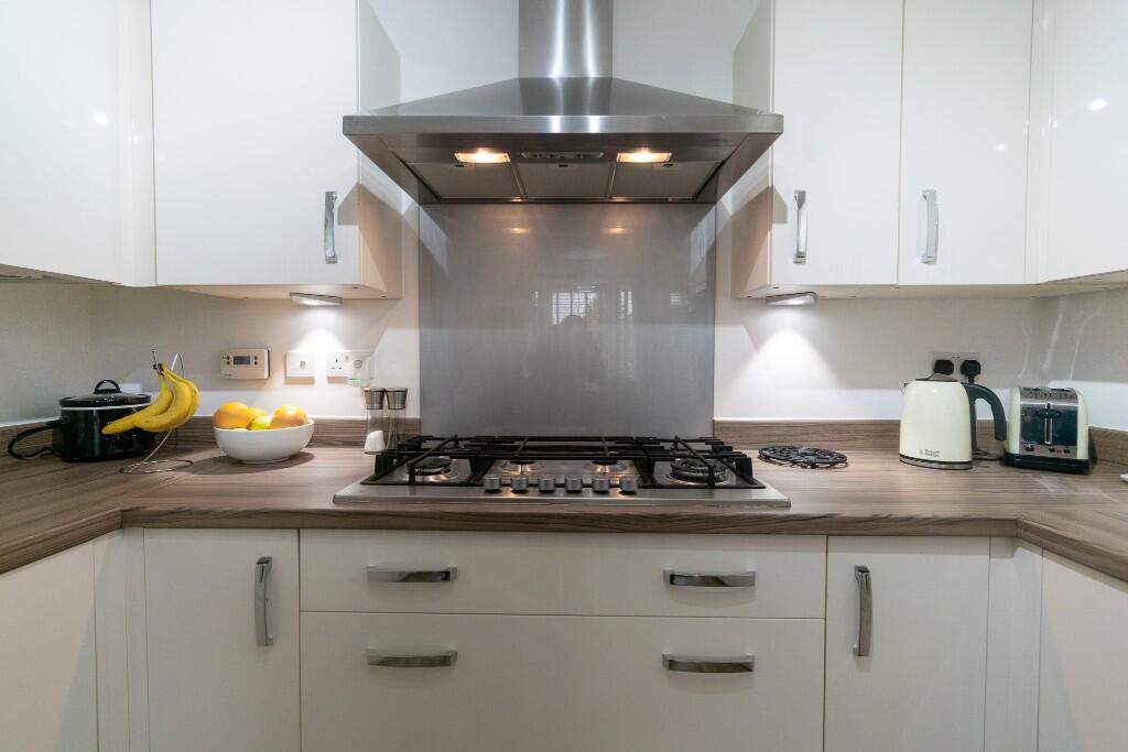
- Kitchen / Diner:
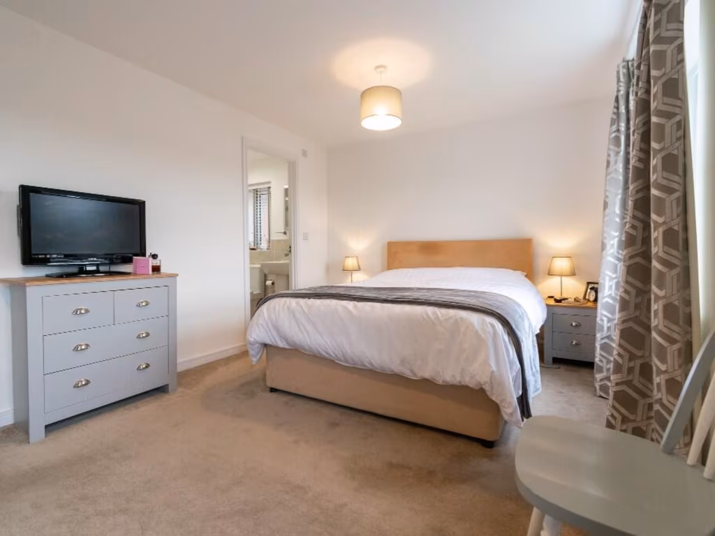
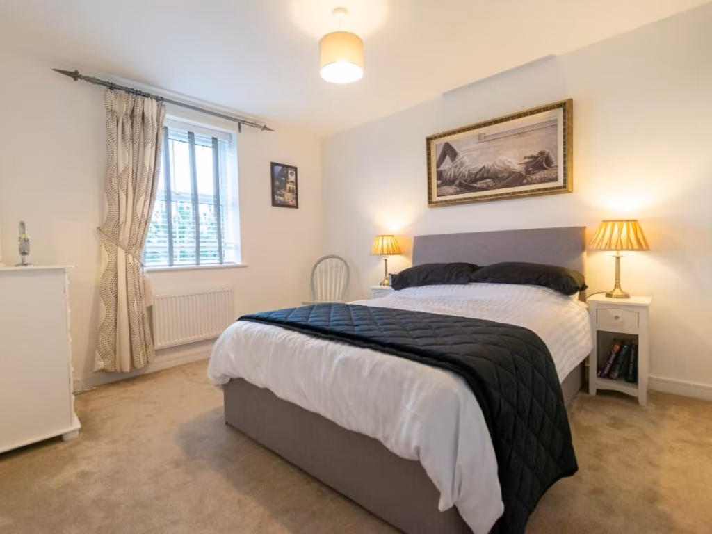
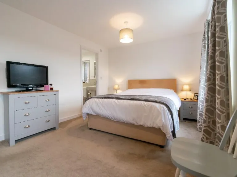
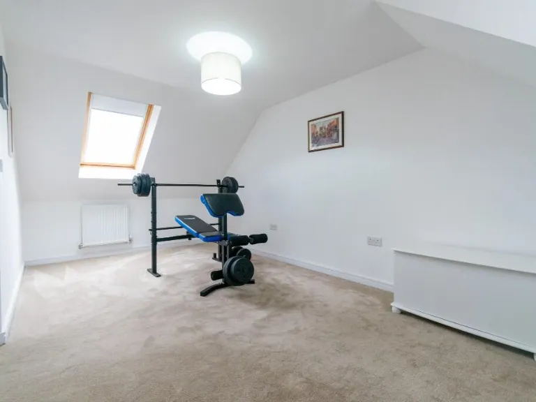
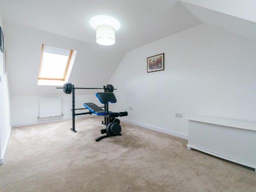
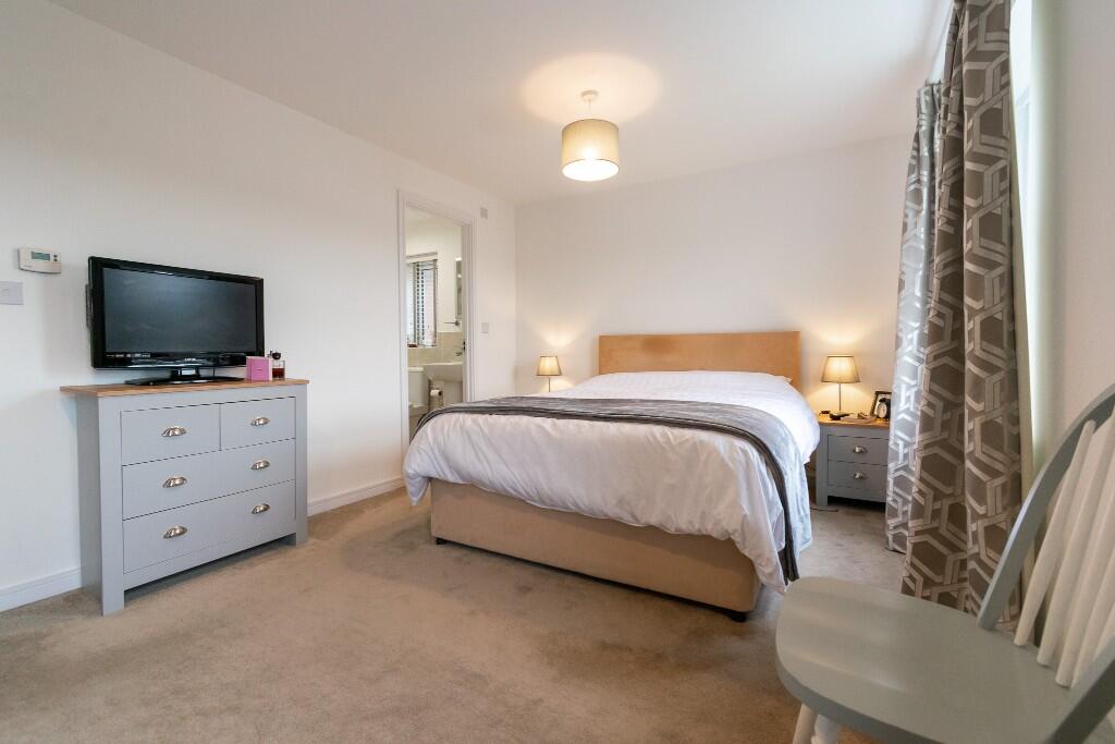
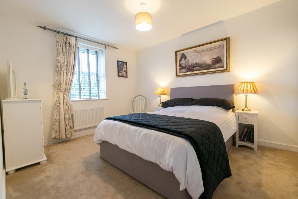
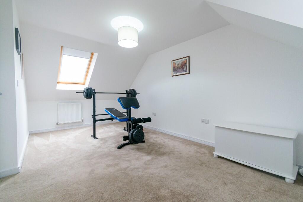
- Bedroom:
- Bedroom:
- Bedroom:
- Bedroom:
Textual Property Features
Detected Visual Features
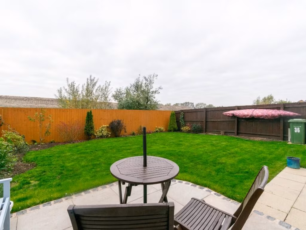
- modern
- detached
- brick exterior
- garage
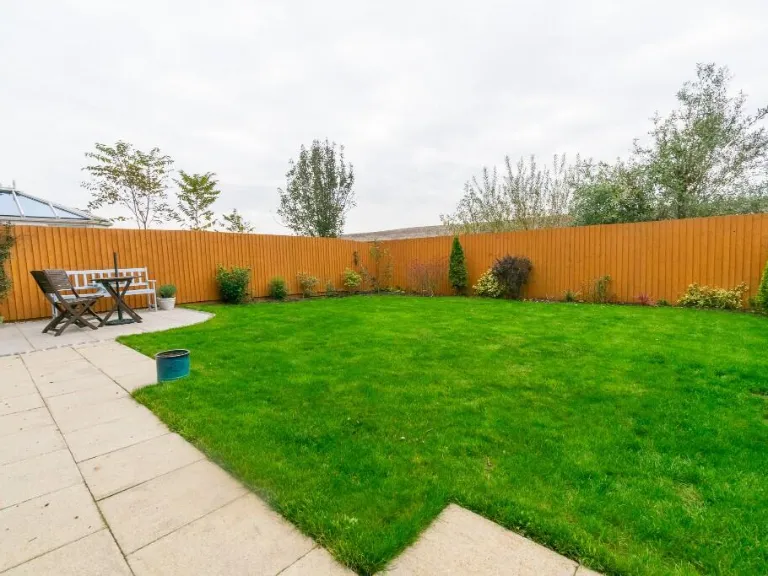
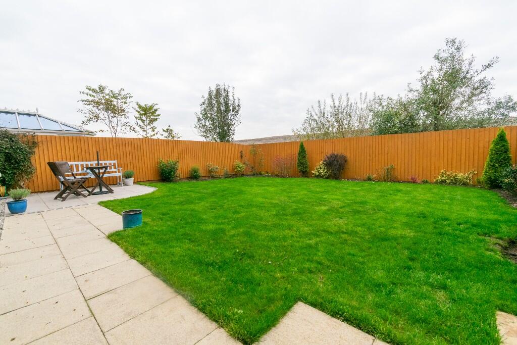
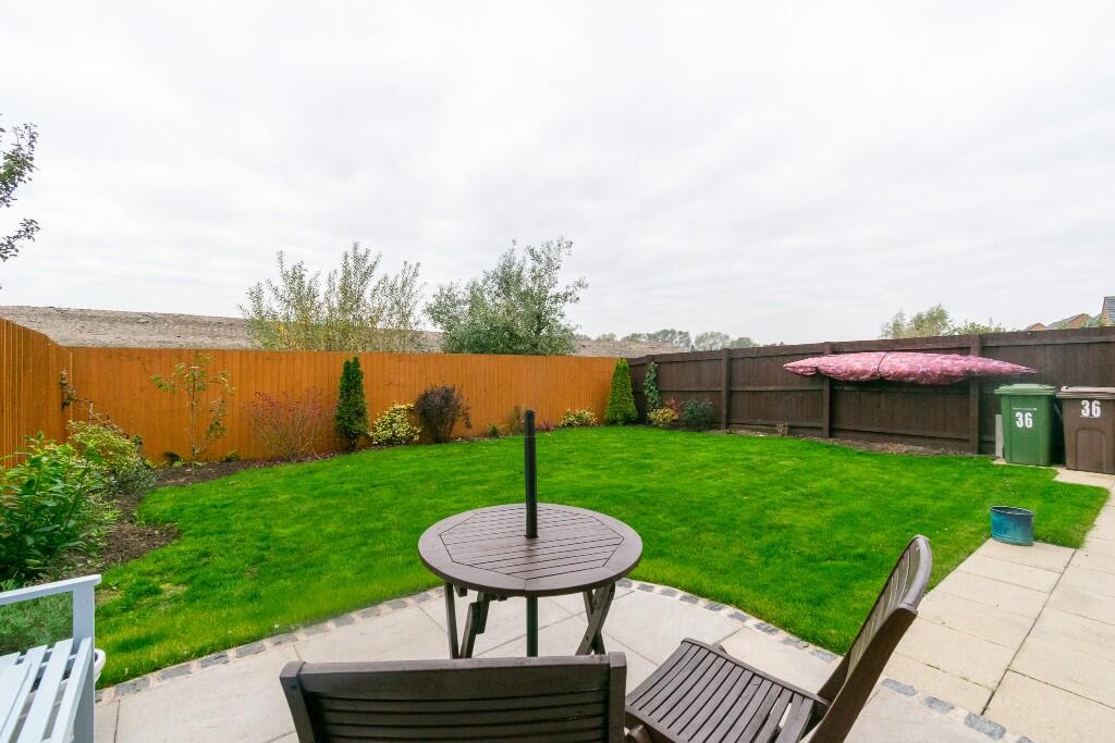
- garden
- driveway
- curb appeal
- detached house
- brick facade
- arched doorway
- well-maintained
- residential area
Nearby Schools
- Scarisbrick Hall School
- St Mary's Catholic Primary School, Scarisbrick
- St Philip's Church of England Primary School
- Larkfield Primary School
- Marshside Primary School
- St John's Church of England Primary School
- Kings Meadow Primary School and Early Years Education Centre
- Birkdale Primary School
- Scarisbrick St Mark's Church of England Primary School
- Holy Trinity Church of England Primary School, Southport
- Farnborough Road Junior School
- Halsall St Cuthbert's Church of England Primary School
- Meols Cop High School
- Churchtown Primary School
- St Patrick's Catholic Primary School
- Farnborough Road Infant School
- Christ The King Catholic High School and Sixth Form Centre
- Kew Woods Primary School
- Norwood Primary School
- Holy Family Catholic Primary School
- Bishop David Sheppard Church of England Primary School
- Stanley High School
- Birkdale High School
- Greenbank High School
Nearest Bars And Restaurants
- Id: 751647732
- Tags:
- Amenity: pub
- Building: yes
- Name: The Old Duke
- TagsNormalized:
- Lat: 53.6316799
- Lon: -2.9689353
- FullGeoHash: gctch7q54vc2
- PartitionGeoHash: gctc
- Images:
- FoodStandards: null
- Distance: 1107.3
,- Id: 370037226
- Tags:
- Addr:
- City: Southport
- Street: Scarisbrick New Road
- Amenity: pub
- Building: yes
- Name: The Richmond
- TagsNormalized:
- Lat: 53.6339455
- Lon: -2.9736895
- FullGeoHash: gctch7f8kh07
- PartitionGeoHash: gctc
- Images:
- FoodStandards: null
- Distance: 1046.9
,- Id: 838554404
- Tags:
- Addr:
- City: Southport
- Postcode: PR8 4HX
- Street: Bentham's Way
- Amenity: cafe
- Name: Dobbies Garden Centre
- TagsNormalized:
- Lat: 53.628555
- Lon: -2.9965227
- FullGeoHash: gctc5fcbzznx
- PartitionGeoHash: gctc
- Images:
- FoodStandards: null
- Distance: 913.4
,- Id: 3737546835
- Tags:
- Addr:
- City: Southport
- Housenumber: 45
- Postcode: PR8 6JW
- Street: Ovington Drive
- Amenity: fast_food
- Cuisine: fish_and_chips
- Name: Mike's Plaice
- Phone: +44 1704 539203
- Takeaway: only
- TagsNormalized:
- fast food
- food
- fish
- takeaway
- Lat: 53.6295348
- Lon: -2.9772906
- FullGeoHash: gctch6bn8jgh
- PartitionGeoHash: gctc
- Images:
- FoodStandards: null
- Distance: 521.7
,- Id: 370027844
- Tags:
- Addr:
- City: Southport
- Housenumber: 70
- Postcode: PR8 5PH
- Street: Folkestone Road
- Amenity: restaurant
- Building: yes
- Cuisine: bbq;burger;fried_chicken
- Name: Hickory's Smokehouse
- Phone: +44 1704 333 855
- TagsNormalized:
- restaurant
- bbq
- burgers
- chicken
- Lat: 53.6290221
- Lon: -2.9767991
- FullGeoHash: gctch6b7ew39
- PartitionGeoHash: gctc
- Images:
- FoodStandards: null
- Distance: 511.6
}
Nearest General Shops
- Id: 3737557173
- Tags:
- Addr:
- City: Southport
- Street: Ovington Drive
- Brand: Spar
- Brand:wikidata: Q610492
- Brand:wikipedia: en:Spar (retailer)
- Name: Spar
- Payment:
- Cash: yes
- Coins: yes
- Credit_cards: yes
- Debit_cards: yes
- Mastercard: yes
- Visa: yes
- Shop: supermarket
- TagsNormalized:
- Lat: 53.6292953
- Lon: -2.9770945
- FullGeoHash: gctch6bjk9jr
- PartitionGeoHash: gctc
- Images:
- FoodStandards: null
- Distance: 514.2
,- Id: 3737557176
- Tags:
- Addr:
- City: Southport
- Housenumber: 55
- Postcode: PR8 6JW
- Street: Ovington Drive
- Name: Quartz Hair
- Phone: +44 1704 544618
- Shop: hairdresser
- TagsNormalized:
- Lat: 53.6292246
- Lon: -2.9770314
- FullGeoHash: gctch6bhyhh3
- PartitionGeoHash: gctc
- Images:
- FoodStandards: null
- Distance: 512.6
,- Id: 3737557177
- Tags:
- Addr:
- City: Southport
- Street: Ovington Drive
- Shop: beauty
- TagsNormalized:
- Lat: 53.6291803
- Lon: -2.9769847
- FullGeoHash: gctch6bhx5z3
- PartitionGeoHash: gctc
- Images:
- FoodStandards: null
- Distance: 512.1
}
Nearest Grocery shops
- Id: 3742688016
- Tags:
- Brand: McColl's
- Brand:wikidata: Q16997477
- Brand:wikipedia: en:McColl's
- Name: McColl's
- Shop: convenience
- TagsNormalized:
- Lat: 53.6377588
- Lon: -2.9984915
- FullGeoHash: gctc5u2wd4fw
- PartitionGeoHash: gctc
- Images:
- FoodStandards: null
- Distance: 1618.6
,- Id: 370707559
- Tags:
- Addr:
- City: Southport
- Street: Cemetery Road
- Brand: Costcutter
- Brand:wikidata: Q5175072
- Brand:wikipedia: en:Costcutter
- Building: yes
- Contact:
- Website: https://store-locator.costcutter.co.uk/costcutter-576271db3824
- Name: Costcutter
- Shop: convenience
- TagsNormalized:
- costcutter
- convenience
- shop
- Lat: 53.6342834
- Lon: -3.0023637
- FullGeoHash: gctc5evdrg56
- PartitionGeoHash: gctc
- Images:
- FoodStandards: null
- Distance: 1540.6
,- Id: 4488997409
- Tags:
- Name: News Food & Booze
- Shop: convenience
- TagsNormalized:
- Lat: 53.6389014
- Lon: -2.9773185
- FullGeoHash: gctchhxvpryq
- PartitionGeoHash: gctc
- Images:
- FoodStandards: null
- Distance: 1443.6
}
Nearest Supermarkets
- Id: 919664160
- Tags:
- Brand: ALDI
- Brand:wikidata: Q41171672
- Brand:wikipedia: en:Aldi
- Building: yes
- Contact:
- Website: https://stores.aldi.co.uk/birkdale/174-liverpool-road
- Name: Aldi
- Shop: supermarket
- TagsNormalized:
- Lat: 53.6234379
- Lon: -3.014366
- FullGeoHash: gctc53v50jmf
- PartitionGeoHash: gctc
- Images:
- FoodStandards: null
- Distance: 2083.8
,- Id: 30142581
- Tags:
- Brand: ALDI
- Brand:wikidata: Q41171672
- Brand:wikipedia: en:Aldi
- Building: yes
- Contact:
- Website: https://stores.aldi.co.uk/southport/unit-8-meol-cop-centre
- Name: Aldi
- Shop: supermarket
- TagsNormalized:
- Lat: 53.6343386
- Lon: -2.969138
- FullGeoHash: gctch7vfwj65
- PartitionGeoHash: gctc
- Images:
- FoodStandards: null
- Distance: 1279.2
,- Id: 30142559
- Tags:
- Addr:
- Brand: Tesco Extra
- Brand:wikidata: Q25172225
- Brand:wikipedia: en:Tesco Extra
- Building: yes
- Contact:
- Website: https://www.tesco.com/store-locator/southport/town-lane
- Name: Tesco Extra
- Shop: supermarket
- TagsNormalized:
- tesco
- tesco extra
- supermarket
- shop
- Lat: 53.6315841
- Lon: -2.9715948
- FullGeoHash: gctch7k4sgfk
- PartitionGeoHash: gctc
- Images:
- FoodStandards: null
- Distance: 956.7
}
Nearest Religious buildings
- Id: 370571241
- Tags:
- Addr:
- City: Southport
- Street: Cemetery Road
- Amenity: place_of_worship
- Building: yes
- Name: Southport Community Church
- Religion: christian
- TagsNormalized:
- place of worship
- church
- christian
- Lat: 53.6388646
- Lon: -2.9949652
- FullGeoHash: gctc5uejh304
- PartitionGeoHash: gctc
- Images:
- FoodStandards: null
- Distance: 1590.5
,- Id: 370027851
- Tags:
- Addr:
- City: Southport
- Street: Folkestone Road
- Amenity: place_of_worship
- Building: yes
- Name: Kew Evangelical Church
- Religion: christian
- TagsNormalized:
- place of worship
- church
- evangelical
- christian
- Lat: 53.6298406
- Lon: -2.9749153
- FullGeoHash: gctch718rqyk
- PartitionGeoHash: gctc
- Images:
- FoodStandards: null
- Distance: 665.5
,- Id: 370027847
- Tags:
- Addr:
- City: Southport
- Street: Folkestone Road
- Amenity: place_of_worship
- Building: yes
- Denomination: anglican
- Name: Church of Saint Francis of Assisi
- Religion: christian
- Wikidata: Q105099554
- TagsNormalized:
- place of worship
- anglican
- church
- christian
- Lat: 53.6295136
- Lon: -2.9761366
- FullGeoHash: gctch6bydczt
- PartitionGeoHash: gctc
- Images:
- FoodStandards: null
- Distance: 579
}
Nearest Medical buildings
- Id: 370570079
- Tags:
- Addr:
- City: Southport
- Housenumber: 5
- Postcode: PR8 6PL
- Street: Curzon Road
- Amenity: doctors
- Building: yes
- Healthcare: doctor
- Name: Curzon Road Medical Practice
- Phone: +44 1704 531114
- Website: http://www.curzonroadmedicalpractice.co.uk/
- TagsNormalized:
- doctor
- doctors
- health
- healthcare
- Lat: 53.6395367
- Lon: -2.9851075
- FullGeoHash: gctchhf2cyqe
- PartitionGeoHash: gctc
- Images:
- FoodStandards: null
- Distance: 1467.5
,- Id: 527852334
- Tags:
- Addr:
- City: Southport
- Street: Chestnut Street
- Amenity: pharmacy
- Healthcare: pharmacy
- Name: Numark NHS Pharmacy
- TagsNormalized:
- pharmacy
- health
- healthcare
- nhs
- Lat: 53.63781
- Lon: -2.9932125
- FullGeoHash: gctc5ukqvh6z
- PartitionGeoHash: gctc
- Images:
- FoodStandards: null
- Distance: 1432.4
,- Id: 41756730
- Tags:
- Amenity: hospital
- Emergency: yes
- Healthcare: hospital
- Name: Southport and Formby District General Hospital
- Source: local_knowledge
- Wikidata: Q30280717
- Wikipedia: en:Southport and Formby District General Hospital
- TagsNormalized:
- hospital
- health
- healthcare
- general
- Lat: 53.6335846
- Lon: -2.9785671
- FullGeoHash: gctch5xn62g6
- PartitionGeoHash: gctc
- Images:
- FoodStandards: null
- Distance: 855.5
,- Id: 582088527
- Tags:
- Addr:
- City: Southport
- Postcode: PR8 6RG
- Street: Town Lane Kew
- Amenity: doctors
- Building: yes
- Fax: +44 1704 540486
- Healthcare: doctor
- Name: Kew Surgery
- Phone: +44 1704 546800
- Website: https://www.kewsurgery-southport.nhs.uk/
- TagsNormalized:
- doctor
- doctors
- health
- healthcare
- surgery
- Lat: 53.631832
- Lon: -2.9835161
- FullGeoHash: gctch57kp415
- PartitionGeoHash: gctc
- Images:
- FoodStandards: null
- Distance: 605.6
}
Nearest Leisure Facilities
- Id: 425796523
- Tags:
- Leisure: pitch
- Sport: soccer
- Surface: grass
- TagsNormalized:
- Lat: 53.6340256
- Lon: -2.9908671
- FullGeoHash: gctc5gy0gepb
- PartitionGeoHash: gctc
- Images:
- FoodStandards: null
- Distance: 989.5
,- Id: 425796525
- Tags:
- Leisure: pitch
- Sport: soccer
- Surface: grass
- TagsNormalized:
- Lat: 53.6333262
- Lon: -2.9916596
- FullGeoHash: gctc5gtsc28u
- PartitionGeoHash: gctc
- Images:
- FoodStandards: null
- Distance: 953.3
,- Id: 4429031774
- Tags:
- TagsNormalized:
- Lat: 53.6329627
- Lon: -2.9850684
- FullGeoHash: gctch5d6dugs
- PartitionGeoHash: gctc
- Images:
- FoodStandards: null
- Distance: 741.6
,- Id: 370029585
- Tags:
- TagsNormalized:
- Lat: 53.6303743
- Lon: -2.9775071
- FullGeoHash: gctch5pge43u
- PartitionGeoHash: gctc
- Images:
- FoodStandards: null
- Distance: 579.1
,- Id: 37011292
- Tags:
- TagsNormalized:
- Lat: 53.6296233
- Lon: -2.9803257
- FullGeoHash: gctch4vz1qkh
- PartitionGeoHash: gctc
- Images:
- FoodStandards: null
- Distance: 405.3
}
Nearest Tourist attractions
- Id: 3742778894
- Tags:
- Addr:
- City: Southport
- Housenumber: 106-114
- Postcode: PR8 5AJ
- Street: Shakespeare Street
- Name: British Lawnmower Museum
- Phone: +44 1704 501336
- Tourism: museum
- Website: www.lawnmowerworld.co.uk
- Wikidata: Q4970236
- Wikipedia: en:British Lawnmower Museum
- TagsNormalized:
- Lat: 53.6390967
- Lon: -3.0054973
- FullGeoHash: gctc5seqqu6g
- PartitionGeoHash: gctc
- Images:
- FoodStandards: null
- Distance: 2040.9
,- Id: 8225443470
- Tags:
- Access: customers
- Addr:
- City: West Lancashire
- Housename: Century House
- Street: Turning Lane
- Internet_access: no
- Name: Century House Camp Site
- Power_supply: yes
- Shower: yes
- Stars: 5
- Toilets: yes
- Toilets:wheelchair: yes
- Tourism: camp_site
- Website: https://centuryhousecampsite.co.uk/
- TagsNormalized:
- Lat: 53.6201916
- Lon: -2.9644254
- FullGeoHash: gctch9327bhj
- PartitionGeoHash: gctc
- Images:
- FoodStandards: null
- Distance: 1414.9
,- Id: 468400637
- Tags:
- Caravans: no
- Tourism: chalet
- TagsNormalized:
- Lat: 53.6264347
- Lon: -2.9629789
- FullGeoHash: gctchd6ktefz
- PartitionGeoHash: gctc
- Images:
- FoodStandards: null
- Distance: 1330.9
}
Nearest Train stations
- Id: 2438848043
- Tags:
- Name: Southport Princes Park
- Public_transport: station
- Railway: station
- Usage: tourism
- TagsNormalized:
- Lat: 53.6485824
- Lon: -3.014695
- FullGeoHash: gctc5qkv8s87
- PartitionGeoHash: gctc
- Images:
- FoodStandards: null
- Distance: 3226.7
,- Id: 3773194174
- Tags:
- Name: Hillside
- Naptan:
- Network: National Rail
- Note:
- Location: NPE and other maps are wrong, platform is on the south side of the bridge
- Public_transport: station
- Railway: station
- Ref:
- Source: local knowledge
- Wikidata: Q2398739
- Wikipedia: en:Hillside railway station
- TagsNormalized:
- Lat: 53.6215448
- Lon: -3.0254312
- FullGeoHash: gctc51sbnk6v
- PartitionGeoHash: gctc
- Images:
- FoodStandards: null
- Distance: 2839.2
,- Id: 29974833
- Tags:
- Name: Southport
- Naptan:
- Network: National Rail
- Old_name: Chapel Street
- Public_transport: station
- Railway: station
- Ref:
- Source: npe
- Wheelchair: yes
- Wikidata: Q650633
- Wikipedia: en:Southport railway station
- TagsNormalized:
- Lat: 53.6468651
- Lon: -3.0028279
- FullGeoHash: gctc5wj7th3p
- PartitionGeoHash: gctc
- Images:
- FoodStandards: null
- Distance: 2620
,- Id: 8476787417
- Tags:
- Name: Meols Cop
- Naptan:
- Network: National Rail
- Public_transport: station
- Railway: station
- Ref:
- Source: npe
- Wheelchair: no
- Wikidata: Q3247481
- Wikipedia: en:Meols Cop railway station
- TagsNormalized:
- Lat: 53.6460131
- Lon: -2.9752779
- FullGeoHash: gctchmcqxj8j
- PartitionGeoHash: gctc
- Images:
- FoodStandards: null
- Distance: 2243.1
,- Id: 3773194170
- Tags:
- Name: Birkdale
- Naptan:
- Network: National Rail
- Public_transport: station
- Railway: station
- Ref:
- Source: npe
- Wikidata: Q2470223
- Wikipedia: en:Birkdale railway station
- TagsNormalized:
- Lat: 53.6338886
- Lon: -3.0146159
- FullGeoHash: gctc57ub437r
- PartitionGeoHash: gctc
- Images:
- FoodStandards: null
- Distance: 2235.4
}
Nearest Hotels
- Id: 371134770
- Tags:
- Addr:
- City: Southport
- Housenumber: 3
- Postcode: PR8 1LL
- Street: Portland Street
- Building: yes
- Name: Metro Hotel
- Phone: +44 1704 536836
- Tourism: hotel
- Website: http://www.themetrosouthport.co.uk/
- TagsNormalized:
- Lat: 53.6451065
- Lon: -3.0083174
- FullGeoHash: gctc5tc3mhev
- PartitionGeoHash: gctc
- Images:
- FoodStandards: null
- Distance: 2661.2
,- Id: 371874833
- Tags:
- Addr:
- City: Southport
- Housenumber: 23-25
- Postcode: PR8 1LR
- Street: Talbot Street
- Building: yes
- Name: Talbot Hotel
- Phone: +44 1704 533975
- Tourism: hotel
- Website: https://www.thetalbothotelsouthport.co.uk/
- TagsNormalized:
- Lat: 53.6440009
- Lon: -3.0068359
- FullGeoHash: gctc5td6zws9
- PartitionGeoHash: gctc
- Images:
- FoodStandards: null
- Distance: 2504.2
,- Id: 370551592
- Tags:
- Addr:
- City: Southport
- Housenumber: 36
- Postcode: PR8 2ED
- Street: Weld Parade
- Amenity: pub
- Building: yes
- Name: Park Hotel
- Phone: +44 1704 569941
- TagsNormalized:
- Lat: 53.6341647
- Lon: -3.015391
- FullGeoHash: gctc57u38kcw
- PartitionGeoHash: gctc
- Images:
- FoodStandards: null
- Distance: 2294.2
}
Tags
- modern
- detached
- brick exterior
- garage
- garden
- driveway
- curb appeal
- detached house
- modern
- garage
- garden
- brick facade
- arched doorway
- well-maintained
- driveway
- residential area
Local Market Stats
- Average Price/sqft: £205
- Avg Income: £42000
- Rental Yield: 3.8%
- Social Housing: 7%
- Planning Success Rate: 96%
Similar Properties
 4 bedroom detached house for sale in Altham Road, Southport, Merseyside, PR8 6XL, PR8 — £375,000 • 4 bed • 2 bath • 1015 ft²
 4 bedroom detached house for sale in Thirlmere Drive, Southport, Merseyside, PR8 3TY, PR8 — £475,000 • 4 bed • 3 bath • 2146 ft²
 5 bedroom detached house for sale in Norwood Avenue, Southport, Merseyside, PR9 7EQ, PR9 — £500,000 • 5 bed • 2 bath • 2125 ft²
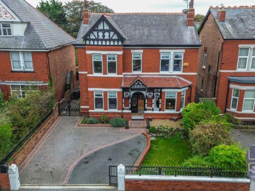 4 bedroom detached house for sale in Cumberland Road, Southport, Merseyside, PR8 6NY, PR8 — £485,000 • 4 bed • 3 bath • 2316 ft²
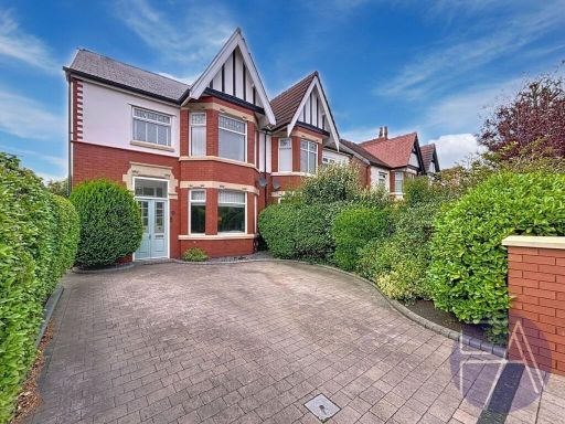 4 bedroom semi-detached house for sale in Norwood Crescent, Southport, Merseyside, PR9 7DU, PR9 — £375,000 • 4 bed • 2 bath • 2140 ft²
 6 bedroom detached house for sale in Liverpool Road, Southport, Merseyside, PR8 — £425,000 • 6 bed • 2 bath • 2878 ft²
Meta
- {
"@context": "https://schema.org",
"@type": "Residence",
"name": "4 bedroom detached house for sale in Blowick Moss Lane, Sou…",
"description": "",
"url": "https://propertypiper.co.uk/property/48d7a404-92b2-4856-961a-638e0c8f7193",
"image": "https://image-a.propertypiper.co.uk/4b4c44ff-be8a-4151-ac1e-940e77d3b0b7-1024.jpeg",
"address": {
"@type": "PostalAddress",
"streetAddress": "Blowick Moss Lane, Southport, Merseyside, PR8",
"postalCode": "PR8 6UX",
"addressLocality": "Sefton",
"addressRegion": "Southport",
"addressCountry": "England"
},
"geo": {
"@type": "GeoCoordinates",
"latitude": 53.6263898,
"longitude": -2.9831618
},
"numberOfRooms": 4,
"numberOfBathroomsTotal": 2,
"floorSize": {
"@type": "QuantitativeValue",
"value": 1477,
"unitCode": "FTK"
},
"offers": {
"@type": "Offer",
"price": 375000,
"priceCurrency": "GBP",
"availability": "https://schema.org/InStock"
},
"additionalProperty": [
{
"@type": "PropertyValue",
"name": "Feature",
"value": "modern"
},
{
"@type": "PropertyValue",
"name": "Feature",
"value": "detached"
},
{
"@type": "PropertyValue",
"name": "Feature",
"value": "brick exterior"
},
{
"@type": "PropertyValue",
"name": "Feature",
"value": "garage"
},
{
"@type": "PropertyValue",
"name": "Feature",
"value": "garden"
},
{
"@type": "PropertyValue",
"name": "Feature",
"value": "driveway"
},
{
"@type": "PropertyValue",
"name": "Feature",
"value": "curb appeal"
},
{
"@type": "PropertyValue",
"name": "Feature",
"value": "detached house"
},
{
"@type": "PropertyValue",
"name": "Feature",
"value": "modern"
},
{
"@type": "PropertyValue",
"name": "Feature",
"value": "garage"
},
{
"@type": "PropertyValue",
"name": "Feature",
"value": "garden"
},
{
"@type": "PropertyValue",
"name": "Feature",
"value": "brick facade"
},
{
"@type": "PropertyValue",
"name": "Feature",
"value": "arched doorway"
},
{
"@type": "PropertyValue",
"name": "Feature",
"value": "well-maintained"
},
{
"@type": "PropertyValue",
"name": "Feature",
"value": "driveway"
},
{
"@type": "PropertyValue",
"name": "Feature",
"value": "residential area"
}
]
}
High Res Floorplan Images
Compatible Floorplan Images
FloorplanImages Thumbnail