WN8 8BP - 4 bedroom detached house for sale in Derby Road, Skelmersda…
View on Property Piper
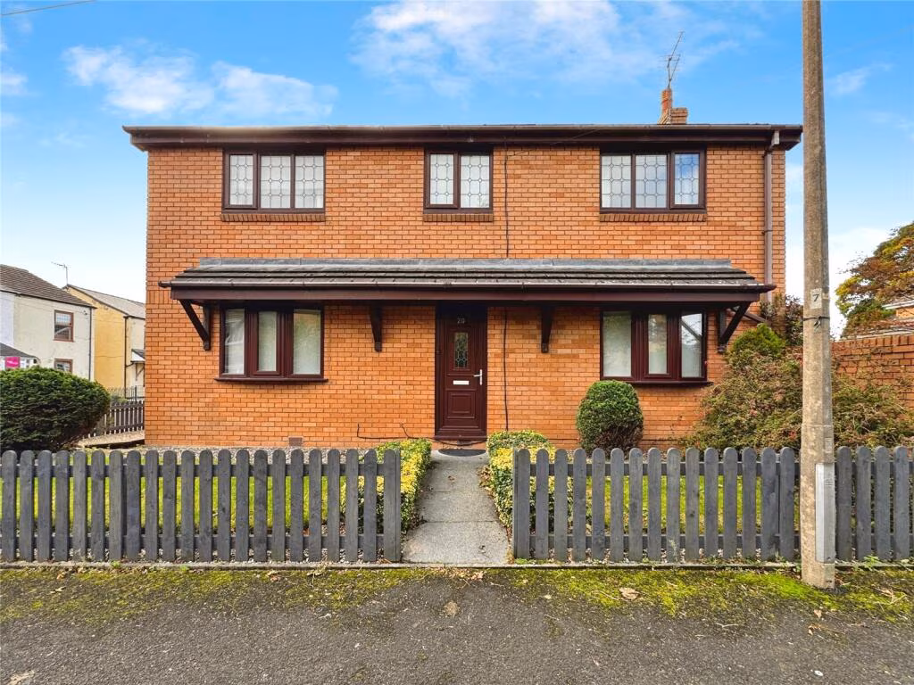
4 bedroom detached house for sale in Derby Road, Skelmersdale, Lancashire, WN8
Property Details
- Price: £250000
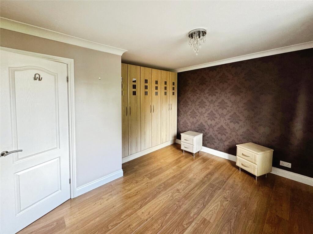
- Bedrooms: 4
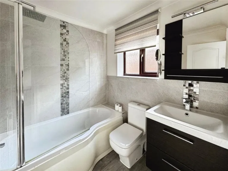
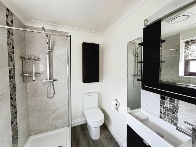
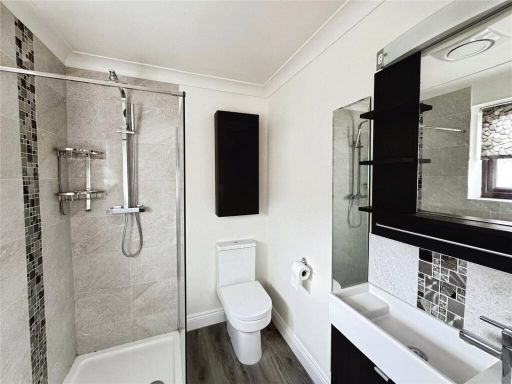
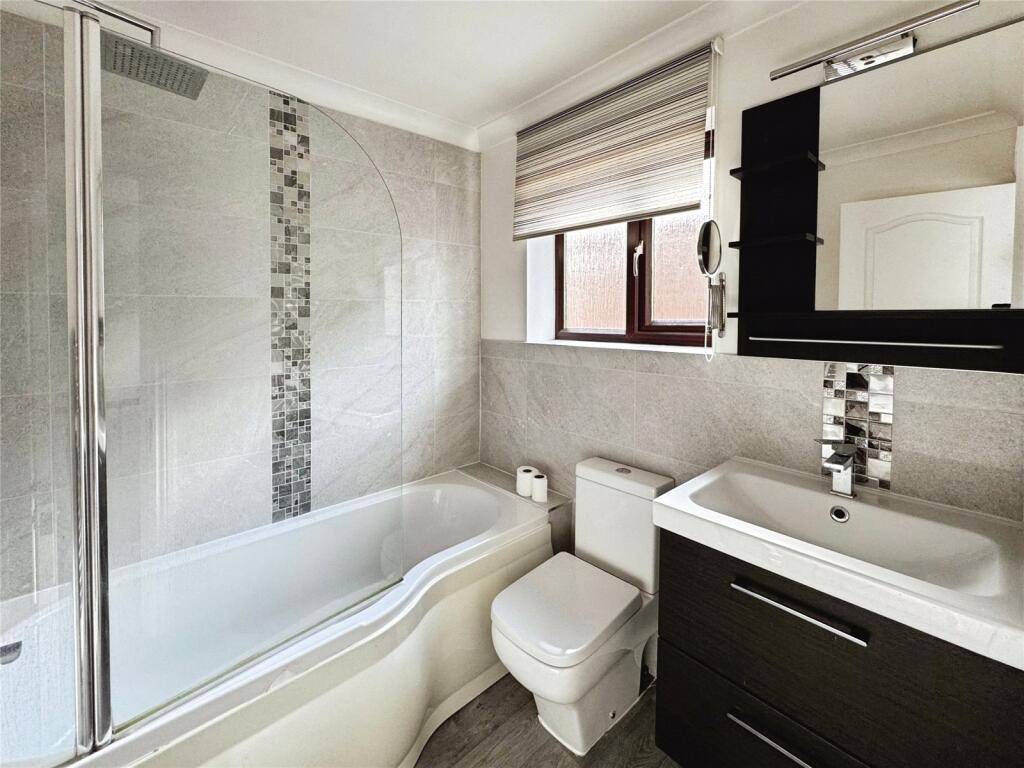
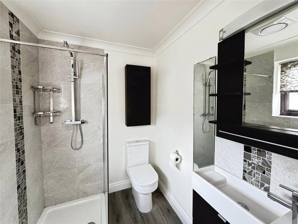
- Bathrooms: 2
- Property Type: undefined
- Property SubType: undefined
Image Descriptions
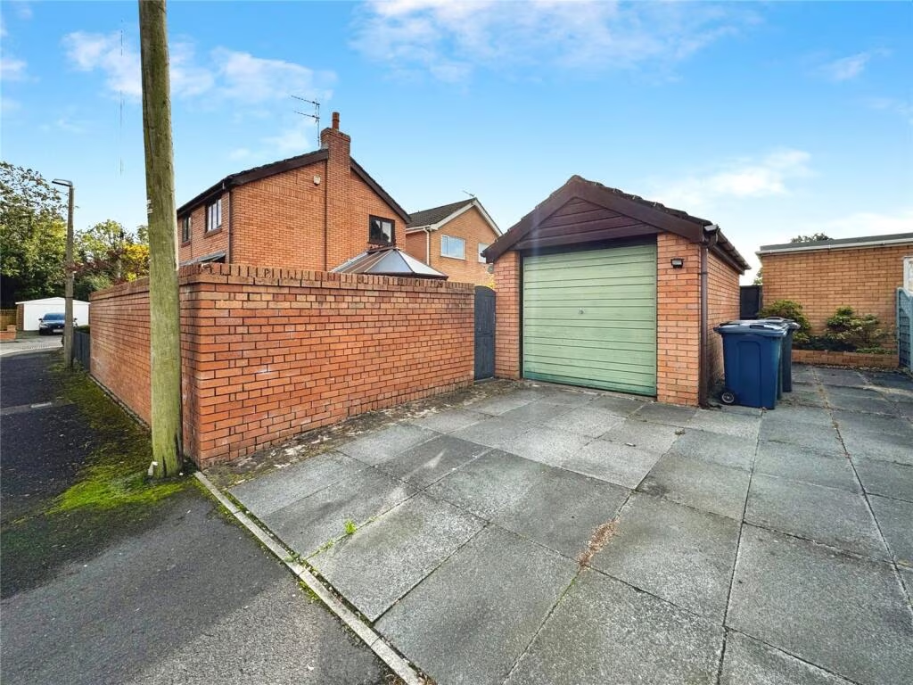
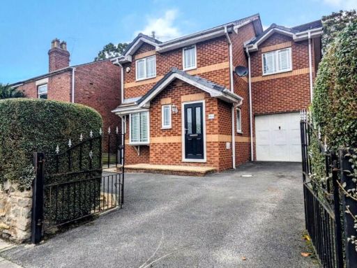
- property exterior Modern
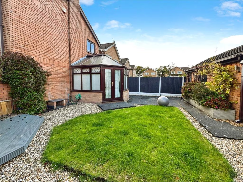
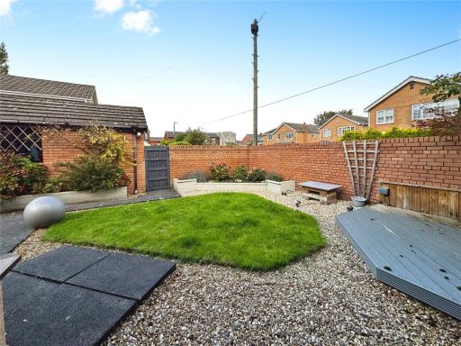
- garden
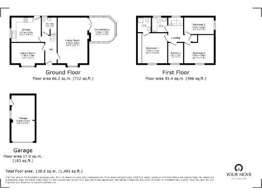
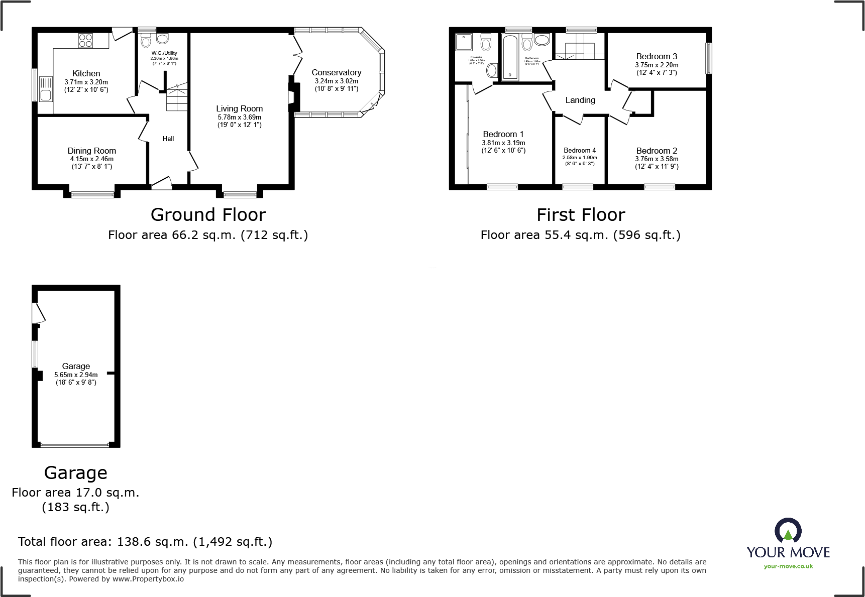
Floorplan Description
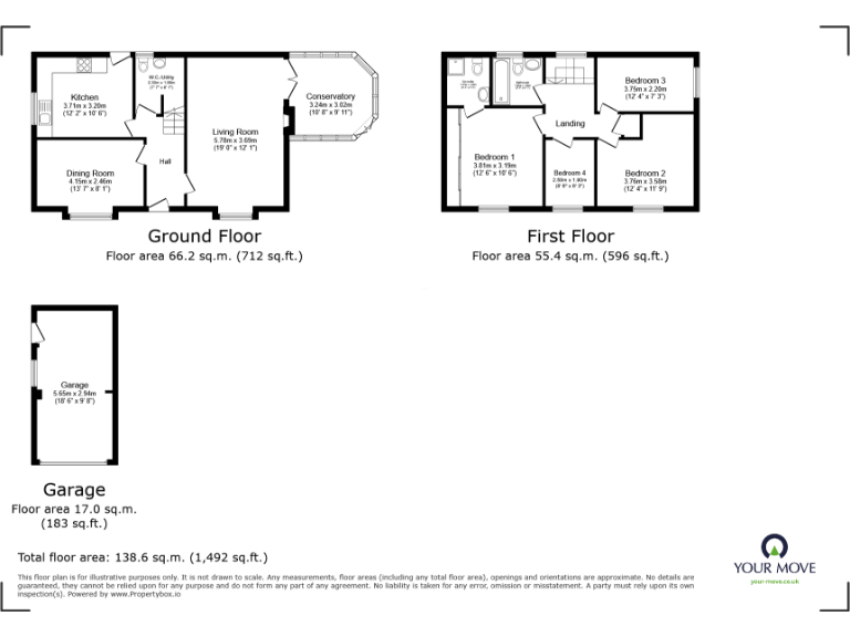
- Two-storey residence with four bedrooms and ground-floor living/dining spaces.
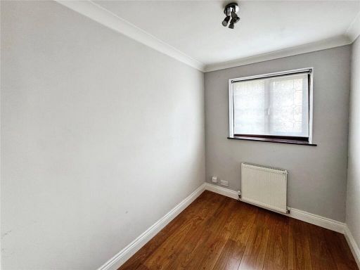
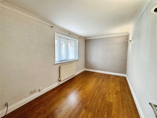
Rooms
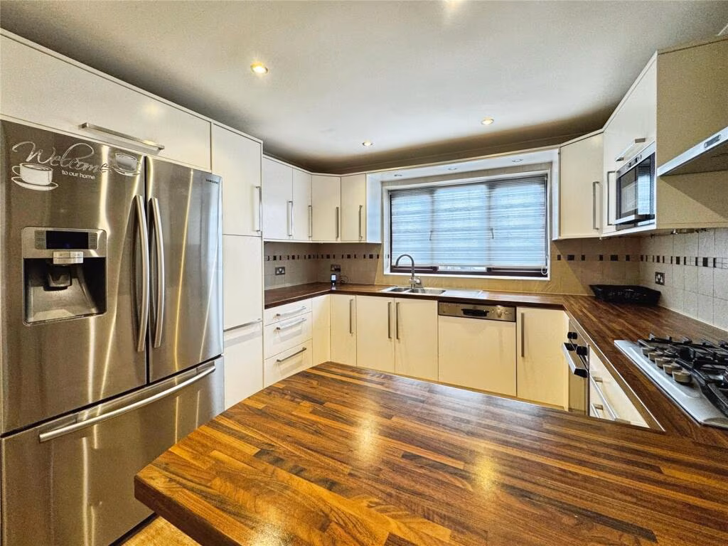
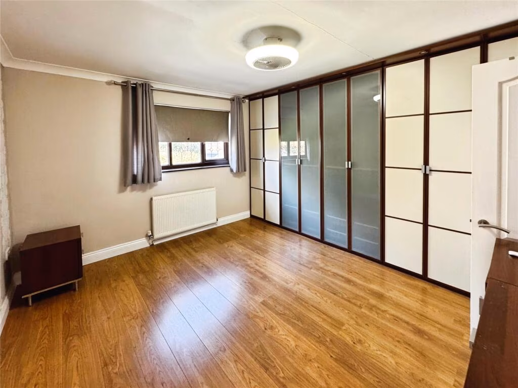
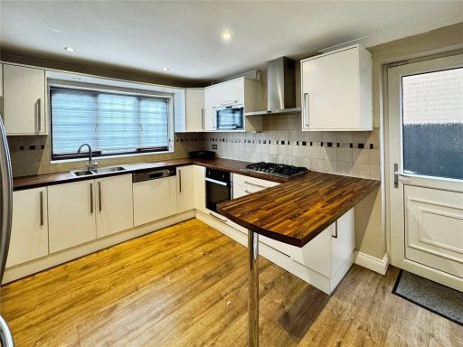
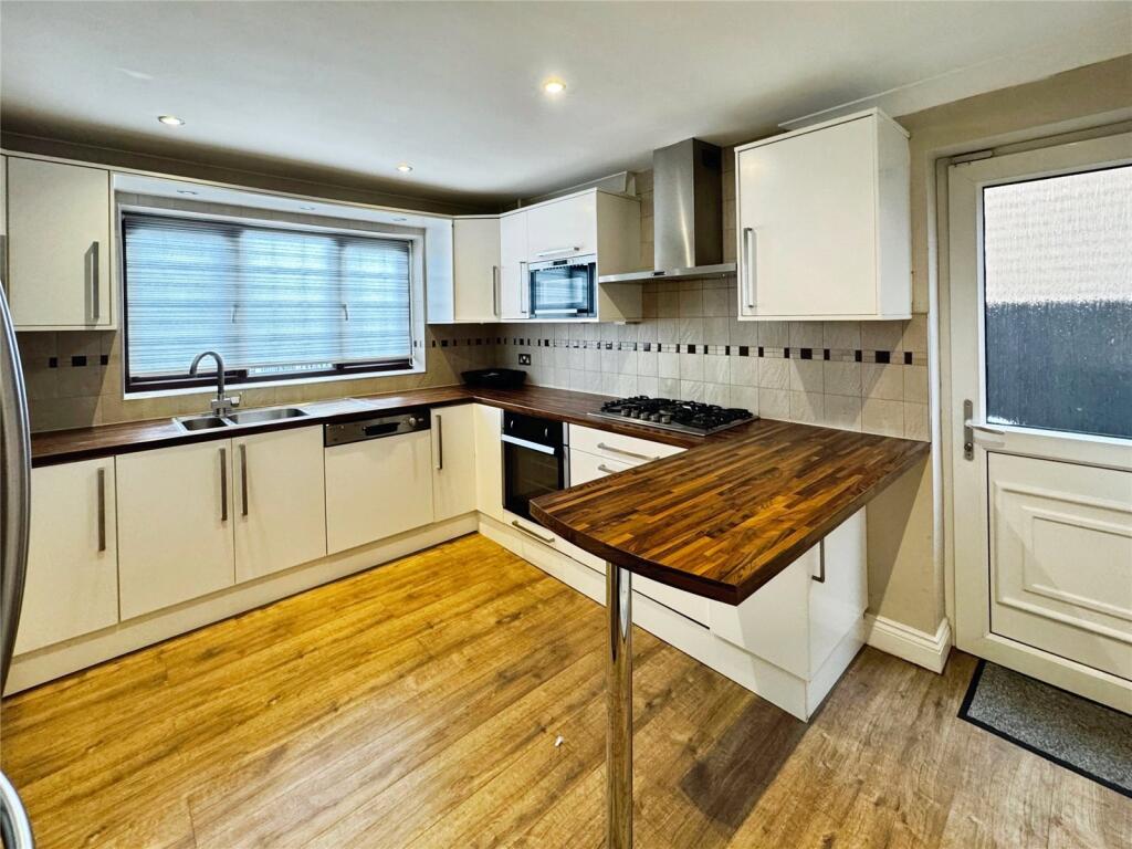
- Kitchen: Average
- Dining Room: Average
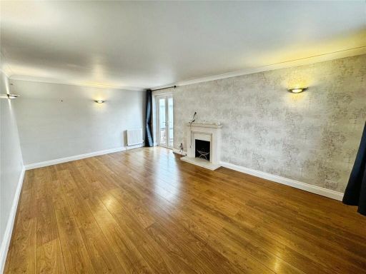
- Living Room: Large
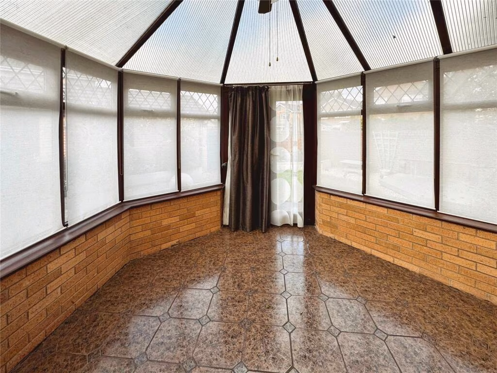
- Conservatory: Average
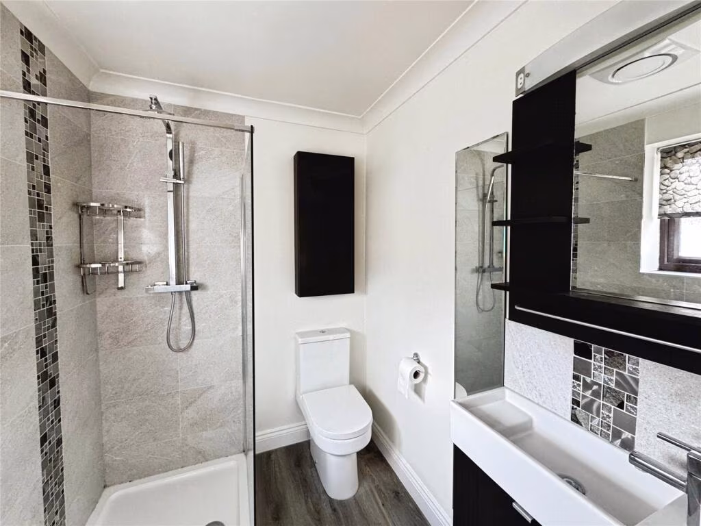
- W.C./Utility: Small
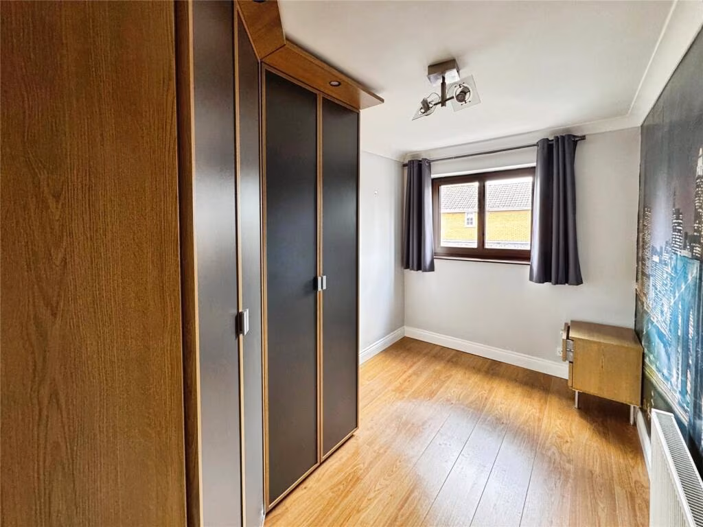
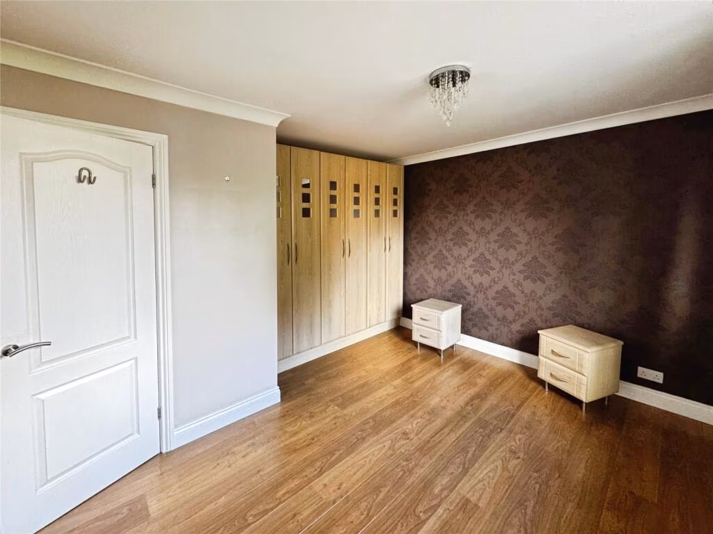
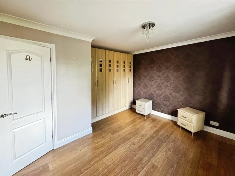
- Bedroom 1: Average
- Bedroom 2: Average
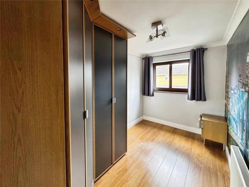
- Bedroom 3: Small
- Bedroom 4: Small
Textual Property Features
Detected Visual Features
- modern
- brick
- detached
- family home
- suburban
- fenced
- two-story
- well-maintained
- garden
- outdoor
- paved
- gravel
- low maintenance
- hedge
- bench
- urban
EPC Details
- Fully double glazed
- Cavity wall, filled cavity
- Boiler and radiators, mains gas
- Low energy lighting in all fixed outlets
- Solid, no insulation (assumed)
Nearby Schools
- Corpus Christi Catholic Primary School
- Delph Side Community Primary School
- Hillside Community Primary School
- St Richard's Catholic Primary School, Skelmersdale
- St John's Catholic Primary School, Skelmersdale
- Brookfield Park Primary School
- Lathom High School : A Technology College
- Our Lady Queen of Peace Catholic Engineering College
- Dalton St Michael's Church of England Primary School
- Newburgh Church of England Primary School
- Bishop Martin Church of England Primary School
- St Francis of Assisi Catholic Primary School
- Cobbs Brow School
- St James' Catholic Primary School, Skelmersdale
- Ormskirk Lathom Park Church of England Primary School
- Rainford CofE Primary School
- Rainford High School
- Trinity Church of England/Methodist School
- Crow Orchard Primary School
- Westhead Lathom St James' Church of England Primary School
- Rainford Brook Lodge Community Primary School
- Bickerstaffe Voluntary Controlled Church of England School
- Little Digmoor Primary School
- St Edmund's Catholic Primary School
- Woodlands Community Primary School
- Maharishi Free School
Nearest General Shops
- Id: 248480495
- Tags:
- Addr:
- City: Skelmersdale
- Housename: Supplement Centre
- Postcode: WN8 9SX
- Street: Gladden Place
- Building: yes
- Name: Supplement Centre
- Phone: +44 844 871 0444
- Shop: sports
- Source: BVG Airflo
- Website: https://www.supplementcentre.com/
- TagsNormalized:
- Lat: 53.5453076
- Lon: -2.7997502
- FullGeoHash: gcw0879k10fc
- PartitionGeoHash: gcw0
- Images:
- FoodStandards: null
- Distance: 691.2
,- Id: 13207538
- Tags:
- Addr:
- City: Skelmersdale
- Street: Sandy Lane
- Building: yes
- Building:use:retail: yes
- Name: Sandy Lane Centre
- Shop: mall
- Type: multipolygon
- TagsNormalized:
- Lat: 53.5488887
- Lon: -2.8047074
- FullGeoHash: gcw08hm8vs6e
- PartitionGeoHash: gcw0
- Images:
- FoodStandards: null
- Distance: 603.8
,- Id: 1596954228
- Tags:
- Brand: National Tyres and Autocare
- Brand:wikidata: Q6979055
- Brand:wikipedia: en:National Tyres and Autocare
- Name: National Tyres and Autocare
- Shop: car_repair
- Short_name: National Tyres
- TagsNormalized:
- national tyres and autocare
- tyres
- car repair
- repair
- shop
- Lat: 53.5456429
- Lon: -2.8030943
- FullGeoHash: gcw085wvgpm3
- PartitionGeoHash: gcw0
- Images:
- FoodStandards: null
- Distance: 481.2
}
Nearest Grocery shops
- Id: 1080146119
- Tags:
- Brand: Shell Select
- Brand:wikidata: Q110716465
- Building: yes
- Name: Shell Select
- Shop: convenience
- TagsNormalized:
- shell
- shell select
- convenience
- shop
- Lat: 53.5459736
- Lon: -2.7829864
- FullGeoHash: gcw08etrzsyy
- PartitionGeoHash: gcw0
- Images:
- FoodStandards: null
- Distance: 1800.5
,- Id: 7402583478
- Tags:
- Addr:
- City: Lancashire
- Postcode: WN8 9TW
- Street: Maple View
- Unit: 3a-3b
- Fhrs:
- Name: All About Food
- Shop: wholesale
- TagsNormalized:
- Lat: 53.5370812
- Lon: -2.7926114
- FullGeoHash: gcw086nkp7q0
- PartitionGeoHash: gcw0
- Images:
- FoodStandards: null
- Distance: 1422.3
,- Id: 1088046277
- Tags:
- Brand: Asda on the Move
- Brand:wikidata: Q105221621
- Building: yes
- Name: Asda On The Move
- Shop: convenience
- TagsNormalized:
- Lat: 53.5506287
- Lon: -2.8086296
- FullGeoHash: gcw08hdg40ty
- PartitionGeoHash: gcw0
- Images:
- FoodStandards: null
- Distance: 686.9
}
Nearest Supermarkets
- Id: 1056841752
- Tags:
- Addr:
- Housename: Atkinson Business Park
- Postcode: L39 2ZA
- Street: Atkinson Road
- Brand: Lidl
- Brand:wikidata: Q151954
- Brand:wikipedia: en:Lidl
- Building: yes
- Fhrs:
- Name: Lidl
- Shop: supermarket
- TagsNormalized:
- Lat: 53.5716113
- Lon: -2.8797226
- FullGeoHash: gctby2rj385j
- PartitionGeoHash: gctb
- Images:
- FoodStandards:
- Id: 1450079
- FHRSID: 1450079
- LocalAuthorityBusinessID: PI/000159488
- BusinessName: Lidl
- BusinessType: Retailers - supermarkets/hypermarkets
- BusinessTypeID: 7840
- AddressLine1: Atkinson Business Park
- AddressLine2: Atkinson Road
- AddressLine3: Ormskirk
- AddressLine4: Lancashire
- PostCode: L39 2ZA
- RatingValue: 5
- RatingKey: fhrs_5_en-GB
- RatingDate: 2022-01-17
- LocalAuthorityCode: 206
- LocalAuthorityName: West Lancashire
- LocalAuthorityWebSite: http://www.westlancs.gov.uk
- LocalAuthorityEmailAddress: EnvHealth.Admin@westlancs.gov.uk
- Scores:
- Hygiene: 0
- Structural: 5
- ConfidenceInManagement: 0
- NewRatingPending: false
- Geocode:
- Longitude: -2.88005110000000
- Latitude: 53.57185120000000
- Distance: 5496.3
,- Id: 1065117148
- Tags:
- Brand: Lidl
- Brand:wikidata: Q151954
- Building: yes
- Layer: 1
- Name: Lidl
- Shop: supermarket
- TagsNormalized:
- Lat: 53.5518046
- Lon: -2.7764051
- FullGeoHash: gcw08uf3c5fm
- PartitionGeoHash: gcw0
- Images:
- FoodStandards: null
- Distance: 2370.7
,- Id: 118910188
- Tags:
- Addr:
- City: Skelmersdale
- Country: GB
- Postcode: WN8 6LU
- Street: Ingram
- Brand: Asda
- Brand:wikidata: Q297410
- Brand:wikipedia: en:Asda
- Building: yes
- Contact:
- Website: https://storelocator.asda.com/north-west/skelmersdale/ingram-road
- Name: Asda
- Opening_hours: Mo-Fr 06:00-24:00; Sa 06:00-22:00; Su 10:30-16:30
- Operator: Asda Stores Ltd
- Shop: supermarket
- TagsNormalized:
- Lat: 53.5540432
- Lon: -2.7780382
- FullGeoHash: gcw08v1ngj0x
- PartitionGeoHash: gcw0
- Images:
- FoodStandards: null
- Distance: 2369.8
}
Nearest Religious buildings
- Id: 335070544
- Tags:
- Amenity: place_of_worship
- Building: yes
- Denomination: anglican
- Name: St Paul's Church
- Religion: christian
- Wikidata: Q7595142
- TagsNormalized:
- place of worship
- anglican
- church
- christian
- Lat: 53.5500242
- Lon: -2.7924236
- FullGeoHash: gcw08kqxeb40
- PartitionGeoHash: gcw0
- Images:
- FoodStandards: null
- Distance: 1320.2
,- Id: 335071393
- Tags:
- Addr:
- Amenity: school
- Capacity: 250
- Denomination: anglican;methodist
- Diocese: Diocese of Liverpool
- Isced:
- Max_age: 11
- Min_age: 2
- Name: Trinity Church of England/Methodist School
- Phone: +44 1695 723878
- Ref:
- Religion: christian
- School:
- Boarding: no
- Gender: mixed
- Selective: no
- Trust: no
- Type: voluntary_controlled
- Website: https://www.trinity.lancs.sch.uk/
- Wikidata: Q66137614
- TagsNormalized:
- school
- anglican
- methodist
- church
- christian
- Lat: 53.5508006
- Lon: -2.7939585
- FullGeoHash: gcw08kts00c8
- PartitionGeoHash: gcw0
- Images:
- FoodStandards: null
- Distance: 1276.4
,- Id: 923404074
- Tags:
- Amenity: place_of_worship
- Building: yes
- Religion: christian
- TagsNormalized:
- place of worship
- christian
- church
- Lat: 53.544645
- Lon: -2.814132
- FullGeoHash: gctbxgwb1vr0
- PartitionGeoHash: gctb
- Images:
- FoodStandards: null
- Distance: 265.1
}
Nearest Medical buildings
- Id: 1117270615
- Tags:
- Addr:
- Housenumber: 164
- Postcode: WN8 0AB
- Street: Ormskirk Road
- Amenity: doctors
- Building: yes
- Healthcare: doctor
- Healthcare:speciality: general
- Name: Hall Green Surgery
- Opening_hours: Mo-Fr 08:00-18:30
- Phone: +44 1695 317251
- Website: https://www.hallgreensurgery.nhs.uk
- TagsNormalized:
- doctor
- doctors
- health
- healthcare
- general
- surgery
- Lat: 53.54077
- Lon: -2.7404801
- FullGeoHash: gcw09du3w4vv
- PartitionGeoHash: gcw0
- Images:
- FoodStandards: null
- Distance: 4620.7
,- Id: 8764771603
- Tags:
- Addr:
- City: Skelmersdale
- Housename: 21
- Postcode: WN8 6UJ
- Street: Lyndale
- Amenity: pharmacy
- Brand: Rowlands Pharmacy
- Brand:wikidata: Q62663235
- Dispensing: yes
- Healthcare: pharmacy
- Name: Rowlands Pharmacy
- TagsNormalized:
- pharmacy
- rowlands pharmacy
- health
- healthcare
- Lat: 53.5631899
- Lon: -2.7734223
- FullGeoHash: gcw08yuknw63
- PartitionGeoHash: gcw0
- Images:
- FoodStandards: null
- Distance: 3192.2
,- Id: 768381733
- Tags:
- Addr:
- City: Skelmersdale
- Street: Northway
- Brand: Bannatyne Health Club
- Brand:wikidata: Q24993691
- Building: yes
- Leisure: fitness_centre
- Name: Bannatyne Health Club
- TagsNormalized:
- health
- club
- fitness
- fitness centre
- leisure
- Lat: 53.5535909
- Lon: -2.7753208
- FullGeoHash: gcw08v5h62fv
- PartitionGeoHash: gcw0
- Images:
- FoodStandards: null
- Distance: 2511.1
,- Id: 7500263868
- Tags:
- Amenity: pharmacy
- Brand: Asda
- Brand:wikidata: Q297410
- Brand:wikipedia: en:Asda
- Contact:
- Phone: +44 1695 567010
- Website: https://storelocator.asda.com/north-west/skelmersdale/ingram-road/pharmacy
- Healthcare: pharmacy
- Name: Asda
- Operator: Asda Stores Ltd
- TagsNormalized:
- pharmacy
- asda
- health
- healthcare
- Lat: 53.5537978
- Lon: -2.7776527
- FullGeoHash: gcw08v1mkp2p
- PartitionGeoHash: gcw0
- Images:
- FoodStandards: null
- Distance: 2380.7
}
Nearest Airports
- Id: 1224469
- Tags:
- Addr:
- City: Manchester
- Country: GB
- Postcode: M90 1QX
- Aerodrome: international
- Aeroway: aerodrome
- Arp: yes
- Atis: 128.175
- Iata: MAN
- Icao: EGCC
- Name: Manchester Airport
- Note: rough sketched outline referring to Yahoo imagery - true boundary is where?
- Old_name: Ringway
- Operator: Manchester Airport PLC
- Size: 18720000
- Source:
- Tower_frequency: 118.625,119.400
- Type: multipolygon
- Website: https://www.manchesterairport.co.uk/
- Wikidata: Q8694
- Wikipedia: en:Manchester Airport
- TagsNormalized:
- airport
- international airport
- Lat: 53.3503197
- Lon: -2.2798822
- FullGeoHash: gcqrs05u4ukt
- PartitionGeoHash: gcqr
- Images:
- FoodStandards: null
- Distance: 41222.6
,- Id: 116737532
- Tags:
- Addr:
- City: Liverpool
- Country: GB
- Postcode: L24 1YD
- Street: Speke Hall Avenue
- Aerodrome: international
- Aerodrome:type: public
- Aeroway: aerodrome
- Iata: LPL
- Icao: EGGP
- Is_in: Liverpool,England,UK
- Name: Liverpool John Lennon Airport
- Old_name: Speke Airport
- Operator: Liverpool Airport plc
- Source: wikipedia
- Website: https://www.liverpoolairport.com/
- Wikidata: Q8727
- Wikipedia: en:Liverpool John Lennon Airport
- TagsNormalized:
- airport
- international airport
- Lat: 53.3357677
- Lon: -2.8518179
- FullGeoHash: gcmzrj7r7gdr
- PartitionGeoHash: gcmz
- Images:
- FoodStandards: null
- Distance: 23375.4
}
Nearest Leisure Facilities
- Id: 1082135866
- Tags:
- TagsNormalized:
- Lat: 53.5525337
- Lon: -2.8091769
- FullGeoHash: gcw08hfqj7vf
- PartitionGeoHash: gcw0
- Images:
- FoodStandards: null
- Distance: 893.8
,- Id: 911851505
- Tags:
- Leisure: pitch
- Sport: bowls
- TagsNormalized:
- Lat: 53.5495377
- Lon: -2.8032956
- FullGeoHash: gcw08hqswmr6
- PartitionGeoHash: gcw0
- Images:
- FoodStandards: null
- Distance: 718
,- Id: 492711481
- Tags:
- Leisure: park
- Name: Coronation Park
- TagsNormalized:
- Lat: 53.5491674
- Lon: -2.8033046
- FullGeoHash: gcw08hqdw229
- PartitionGeoHash: gcw0
- Images:
- FoodStandards: null
- Distance: 686
,- Id: 972620520
- Tags:
- Leisure: playground
- Name: Coronation Park
- TagsNormalized:
- Lat: 53.5488752
- Lon: -2.8032547
- FullGeoHash: gcw08hq8z3vf
- PartitionGeoHash: gcw0
- Images:
- FoodStandards: null
- Distance: 664.1
,- Id: 960019612
- Tags:
- TagsNormalized:
- Lat: 53.5440094
- Lon: -2.807779
- FullGeoHash: gcw0857kqnb1
- PartitionGeoHash: gcw0
- Images:
- FoodStandards: null
- Distance: 165
}
Nearest Tourist attractions
- Id: 186637453
- Tags:
- Name: Tawd Vale Scout Camp
- Natural: wood
- Tourism: camp_site
- TagsNormalized:
- Lat: 53.5811971
- Lon: -2.8010741
- FullGeoHash: gcw0b60m45pf
- PartitionGeoHash: gcw0
- Images:
- FoodStandards: null
- Distance: 4122.4
,- Id: 6761862688
- Tags:
- Addr:
- Caravans: yes
- Name: Bridge Farm Rainford
- Name:en: Bridge Farm Rainford
- Phone: +44 1744 882524
- Tents: yes
- Tourism: camp_site
- Website: https://www.bridgefarmrainford.co.uk/campsite
- TagsNormalized:
- Lat: 53.5159897
- Lon: -2.7892183
- FullGeoHash: gcw02w2cnx81
- PartitionGeoHash: gcw0
- Images:
- FoodStandards: null
- Distance: 3459.9
,- Id: 413167125
- Tags:
- TagsNormalized:
- Lat: 53.5414576
- Lon: -2.8421238
- FullGeoHash: gctbx6fmteng
- PartitionGeoHash: gctb
- Images:
- FoodStandards: null
- Distance: 2141.4
}
Nearest Train stations
- Id: 3713687528
- Tags:
- Name: Parbold
- Naptan:
- Network: National Rail
- Public_transport: station
- Railway: station
- Ref:
- Wikidata: Q2024428
- Wikipedia: en:Parbold railway station
- TagsNormalized:
- Lat: 53.5908551
- Lon: -2.7711373
- FullGeoHash: gcw0bgyj7g6q
- PartitionGeoHash: gcw0
- Images:
- FoodStandards: null
- Distance: 5760.1
,- Id: 3773093432
- Tags:
- Name: Aughton Park
- Naptan:
- Network: National Rail
- Public_transport: station
- Railway: station
- Ref:
- Source: NPE
- Wikipedia: en:Aughton Park railway station
- TagsNormalized:
- Lat: 53.5541643
- Lon: -2.8953003
- FullGeoHash: gctbwj5xweg9
- PartitionGeoHash: gctb
- Images:
- FoodStandards: null
- Distance: 5728.3
,- Id: 7149987543
- Tags:
- Name: Ormskirk
- Naptan:
- Network: National Rail
- Platforms: 2
- Public_transport: station
- Railway: station
- Ref:
- Train: yes
- Wheelchair: yes
- Wikipedia: en:Ormskirk railway station
- TagsNormalized:
- Lat: 53.5694489
- Lon: -2.8810819
- FullGeoHash: gctby2n09vj9
- PartitionGeoHash: gctb
- Images:
- FoodStandards: null
- Distance: 5445.4
,- Id: 30581723
- Tags:
- Name: Upholland
- Naptan:
- Network: National Rail
- Public_transport: station
- Railway: station
- Ref:
- Source: npe
- Wikipedia: en:Upholland railway station
- TagsNormalized:
- Lat: 53.5284097
- Lon: -2.7410475
- FullGeoHash: gcw098s18fyc
- PartitionGeoHash: gcw0
- Images:
- FoodStandards: null
- Distance: 4903.8
,- Id: 30581728
- Tags:
- Name: Rainford
- Naptan:
- Network: National Rail
- Operator: Northern Rail
- Platforms: 2
- Public_transport: station
- Railway: station
- Ref:
- Source: npe
- Wheelchair: no
- Wikipedia: en:Rainford railway station
- TagsNormalized:
- Lat: 53.5171092
- Lon: -2.7885785
- FullGeoHash: gcw02w3rv2jp
- PartitionGeoHash: gcw0
- Images:
- FoodStandards: null
- Distance: 3363.8
}
Nearest Bus stations and stops
- Id: 9130749826
- Tags:
- Bus: yes
- Departures_board: timetable
- Highway: bus_stop
- Public_transport: platform
- Shelter: no
- TagsNormalized:
- Lat: 53.5473225
- Lon: -2.7996718
- FullGeoHash: gcw087crfbmk
- PartitionGeoHash: gcw0
- Images:
- FoodStandards: null
- Distance: 758
,- Id: 9130749818
- Tags:
- Bus: yes
- Departures_board: timetable
- Highway: bus_stop
- Public_transport: platform
- Shelter: no
- TagsNormalized:
- Lat: 53.5456112
- Lon: -2.8000933
- FullGeoHash: gcw0879jc17h
- PartitionGeoHash: gcw0
- Images:
- FoodStandards: null
- Distance: 674
,- Id: 9130749823
- Tags:
- Bus: yes
- Departures_board: no
- Highway: bus_stop
- Public_transport: platform
- Shelter: no
- TagsNormalized:
- Lat: 53.5474632
- Lon: -2.8020893
- FullGeoHash: gcw08hp8dddu
- PartitionGeoHash: gcw0
- Images:
- FoodStandards: null
- Distance: 624
,- Id: 9130749819
- Tags:
- Bus: yes
- Departures_board: timetable
- Highway: bus_stop
- Public_transport: platform
- Shelter: no
- TagsNormalized:
- Lat: 53.545293
- Lon: -2.8010915
- FullGeoHash: gcw08787cy4f
- PartitionGeoHash: gcw0
- Images:
- FoodStandards: null
- Distance: 603.2
,- Id: 9130749824
- Tags:
- Bus: yes
- Departures_board: no
- Highway: bus_stop
- Public_transport: platform
- Shelter: yes
- TagsNormalized:
- Lat: 53.5474024
- Lon: -2.8027163
- FullGeoHash: gcw08hp05zr3
- PartitionGeoHash: gcw0
- Images:
- FoodStandards: null
- Distance: 585.4
}
Nearest Hotels
- Id: 1119993823
- Tags:
- Name: Douglas Valley Hotel
- Tourism: hotel
- TagsNormalized:
- Lat: 53.5902397
- Lon: -2.7702293
- FullGeoHash: gcw0bgycbbxr
- PartitionGeoHash: gcw0
- Images:
- FoodStandards: null
- Distance: 5726.4
,- Id: 146575196
- Tags:
- Amenity: pub
- Building: yes
- Name: Red Lion Hotel
- Source: local_knowledge
- TagsNormalized:
- Lat: 53.5864963
- Lon: -2.7809621
- FullGeoHash: gcw0bengyyum
- PartitionGeoHash: gcw0
- Images:
- FoodStandards: null
- Distance: 5049.7
,- Id: 4775104688
- Tags:
- Name: Red Lion Hotel
- Tourism: hotel
- TagsNormalized:
- Lat: 53.5863961
- Lon: -2.7809221
- FullGeoHash: gcw0bengru4p
- PartitionGeoHash: gcw0
- Images:
- FoodStandards: null
- Distance: 5040.4
}
Tags
- modern
- brick
- detached
- family home
- suburban
- fenced
- two-story
- well-maintained
- garden
- outdoor
- brick
- paved
- gravel
- low maintenance
- hedge
- bench
- urban
- fenced
Local Market Stats
- Average Price/sqft: £172
- Avg Income: £38500
- Rental Yield: 3.9%
- Social Housing: 8%
- Planning Success Rate: 100%
Similar Properties
 4 bedroom detached house for sale in Ormskirk Road, Skelmersdale, WN8 9NP, WN8 — £250,000 • 4 bed • 3 bath • 956 ft²
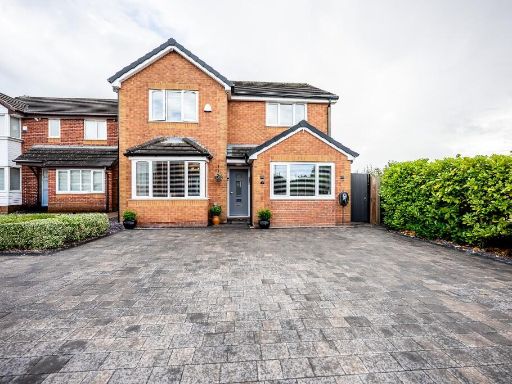 4 bedroom detached house for sale in Edenhurst, Skelmersdale, Lancashire, WN8 — £290,000 • 4 bed • 2 bath • 1206 ft²
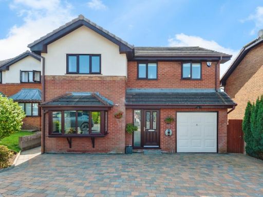 4 bedroom detached house for sale in Kingsbury Court, Skelmersdale, Lancashire, WN8 — £350,000 • 4 bed • 2 bath • 1642 ft²
 4 bedroom semi-detached house for sale in Ormskirk Road, Skelmersdale, Lancashire, WN8 — £189,995 • 4 bed • 1 bath • 1012 ft²
 3 bedroom detached house for sale in Ambergate, Skelmersdale, Lancashire, WN8 — £275,000 • 3 bed • 2 bath • 1248 ft²
 4 bedroom detached house for sale in Elmers Green, Skelmersdale, WN8 — £335,000 • 4 bed • 2 bath • 1175 ft²
Meta
- {
"@context": "https://schema.org",
"@type": "Residence",
"name": "4 bedroom detached house for sale in Derby Road, Skelmersda…",
"description": "",
"url": "https://propertypiper.co.uk/property/480ad04e-8b64-4d79-a5b9-0b332048541e",
"image": "https://image-a.propertypiper.co.uk/fecf1159-6143-4de4-8f26-0733e6f4151f-1024.jpeg",
"address": {
"@type": "PostalAddress",
"streetAddress": "20 DERBY ROAD SKELMERSDALE",
"postalCode": "WN8 8BP",
"addressLocality": "West Lancashire",
"addressRegion": "West Lancashire",
"addressCountry": "England"
},
"geo": {
"@type": "GeoCoordinates",
"latitude": 53.544515760656836,
"longitude": -2.810126160616148
},
"numberOfRooms": 4,
"numberOfBathroomsTotal": 2,
"floorSize": {
"@type": "QuantitativeValue",
"value": 1308,
"unitCode": "FTK"
},
"offers": {
"@type": "Offer",
"price": 250000,
"priceCurrency": "GBP",
"availability": "https://schema.org/InStock"
},
"additionalProperty": [
{
"@type": "PropertyValue",
"name": "Feature",
"value": "modern"
},
{
"@type": "PropertyValue",
"name": "Feature",
"value": "brick"
},
{
"@type": "PropertyValue",
"name": "Feature",
"value": "detached"
},
{
"@type": "PropertyValue",
"name": "Feature",
"value": "family home"
},
{
"@type": "PropertyValue",
"name": "Feature",
"value": "suburban"
},
{
"@type": "PropertyValue",
"name": "Feature",
"value": "fenced"
},
{
"@type": "PropertyValue",
"name": "Feature",
"value": "two-story"
},
{
"@type": "PropertyValue",
"name": "Feature",
"value": "well-maintained"
},
{
"@type": "PropertyValue",
"name": "Feature",
"value": "garden"
},
{
"@type": "PropertyValue",
"name": "Feature",
"value": "outdoor"
},
{
"@type": "PropertyValue",
"name": "Feature",
"value": "brick"
},
{
"@type": "PropertyValue",
"name": "Feature",
"value": "paved"
},
{
"@type": "PropertyValue",
"name": "Feature",
"value": "gravel"
},
{
"@type": "PropertyValue",
"name": "Feature",
"value": "low maintenance"
},
{
"@type": "PropertyValue",
"name": "Feature",
"value": "hedge"
},
{
"@type": "PropertyValue",
"name": "Feature",
"value": "bench"
},
{
"@type": "PropertyValue",
"name": "Feature",
"value": "urban"
},
{
"@type": "PropertyValue",
"name": "Feature",
"value": "fenced"
}
]
}
High Res Floorplan Images
Compatible Floorplan Images
FloorplanImages Thumbnail