TQ7 1QL - 2 bedroom apartment for sale in Scholars Walk, Kingsbridge,…
View on Property Piper
2 bedroom apartment for sale in Scholars Walk, Kingsbridge, TQ7
Property Details
- Price: £169950
- Bedrooms: 2
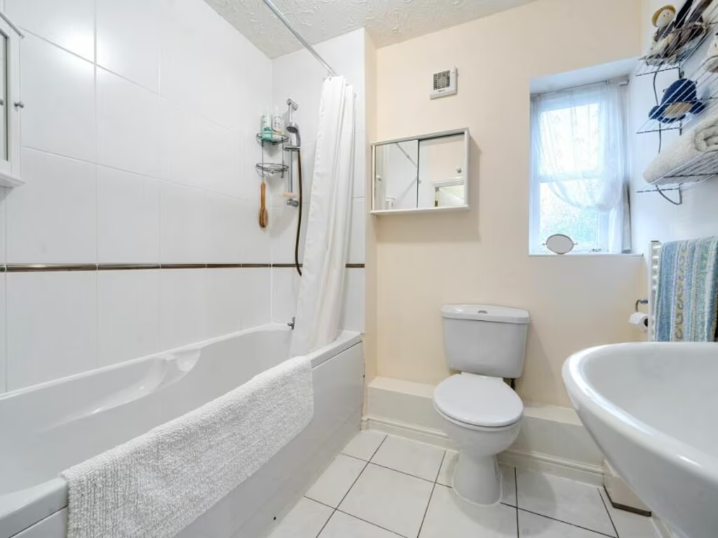
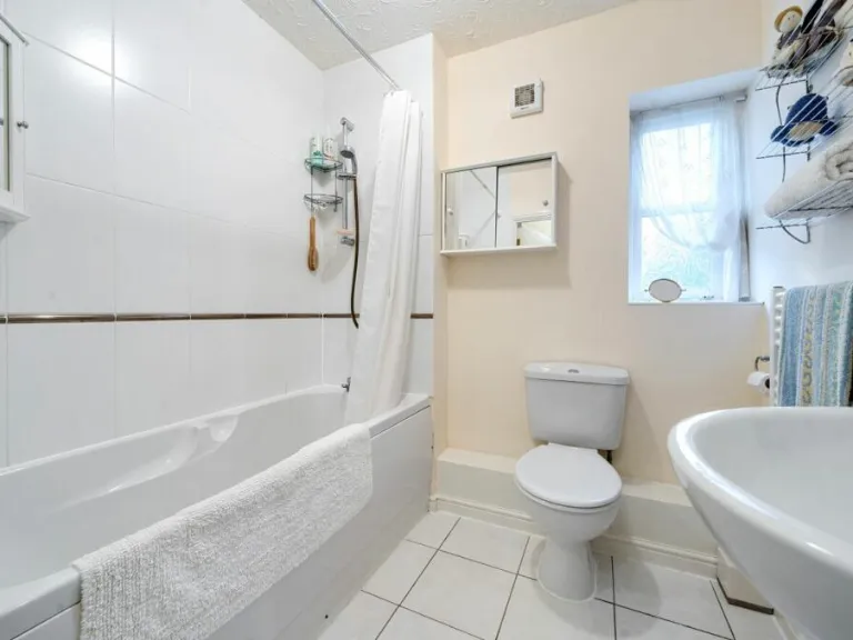
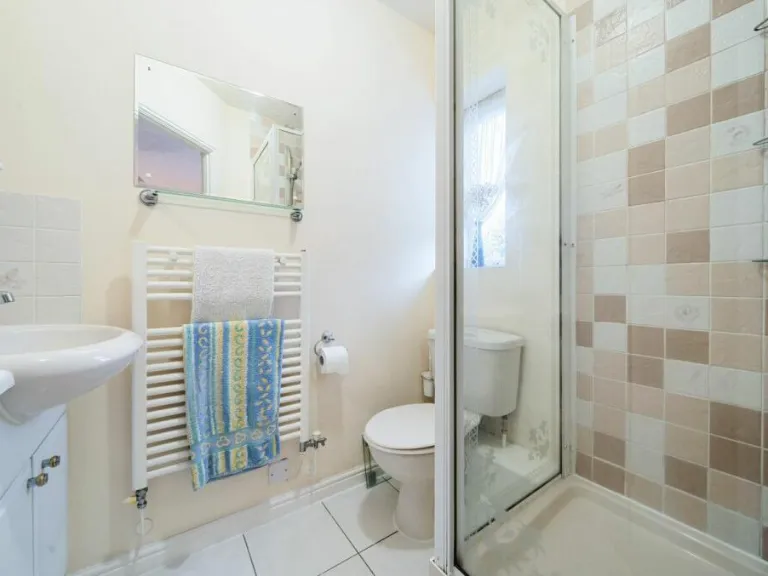
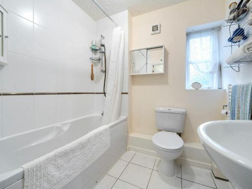
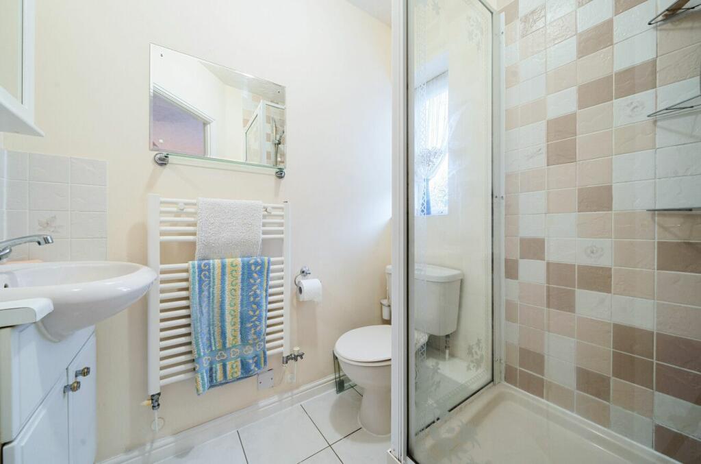
- Bathrooms: 2
- Property Type: undefined
- Property SubType: undefined
Brochure Descriptions
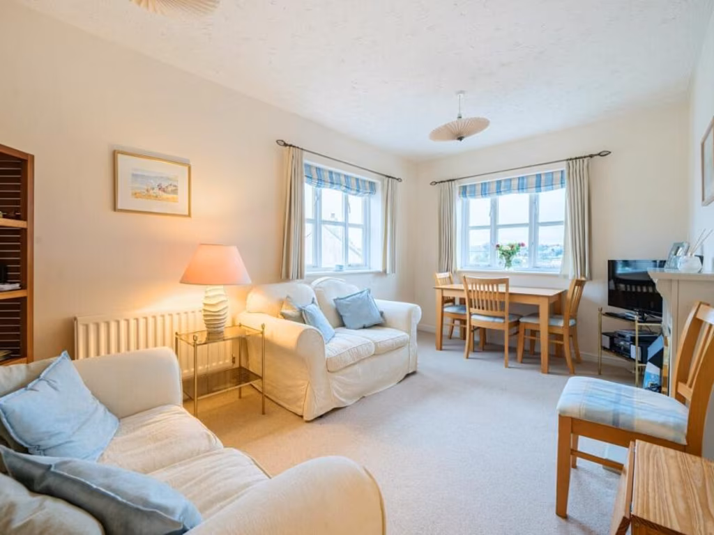
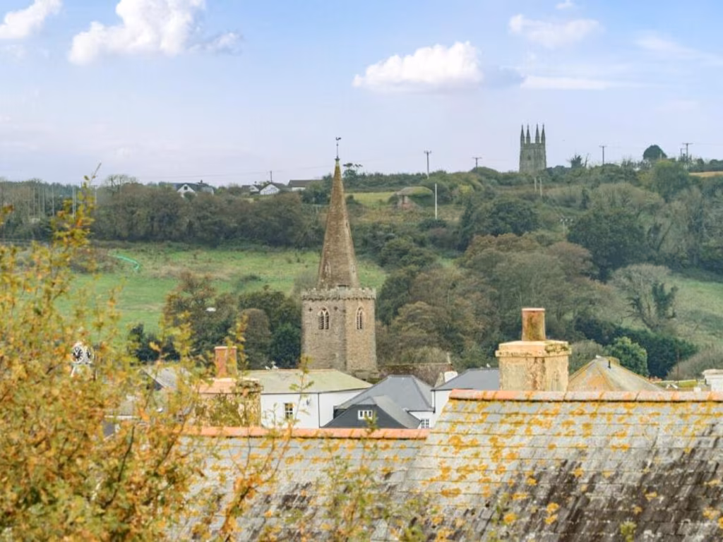
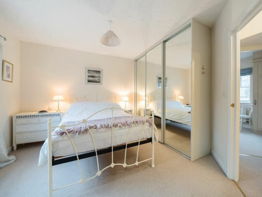
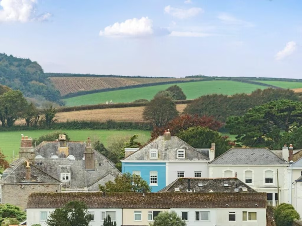
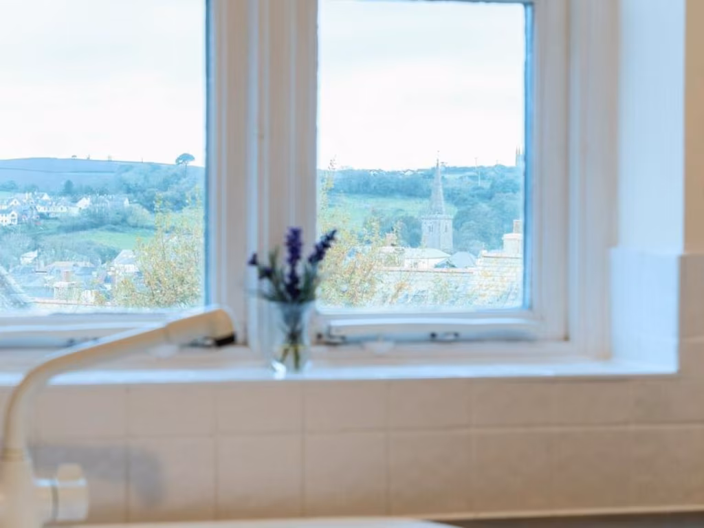
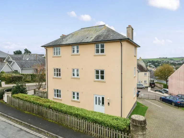
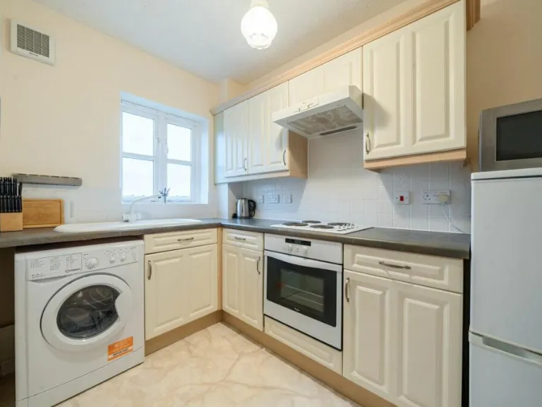
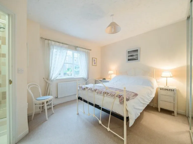
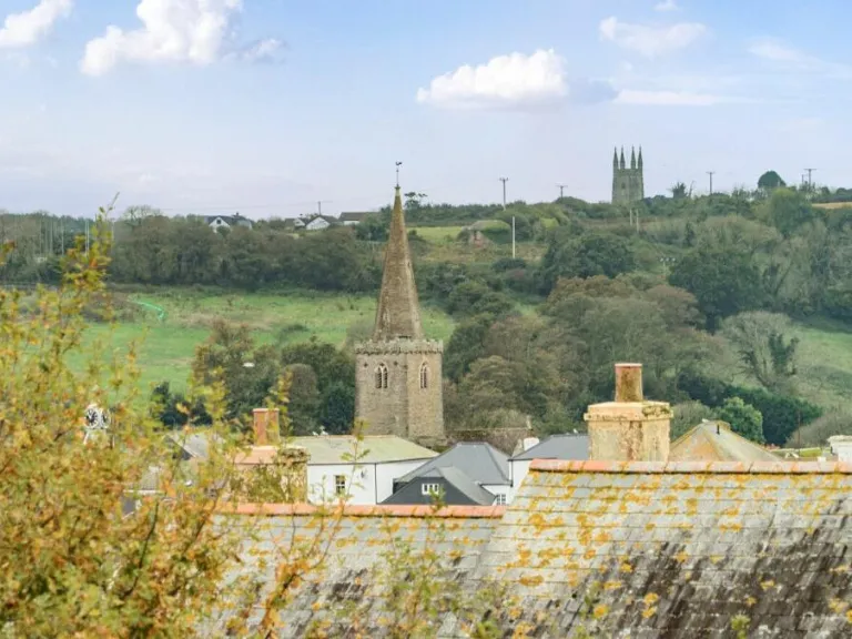
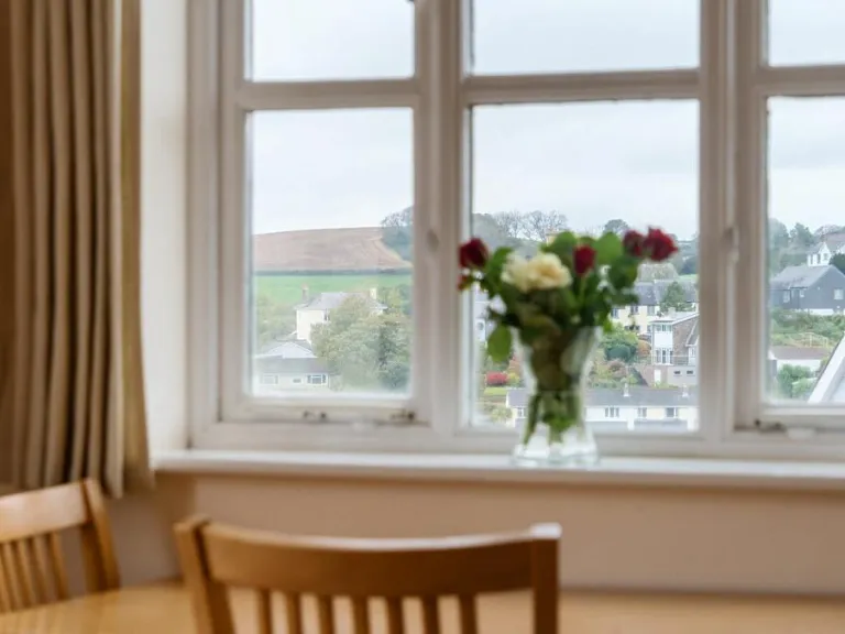
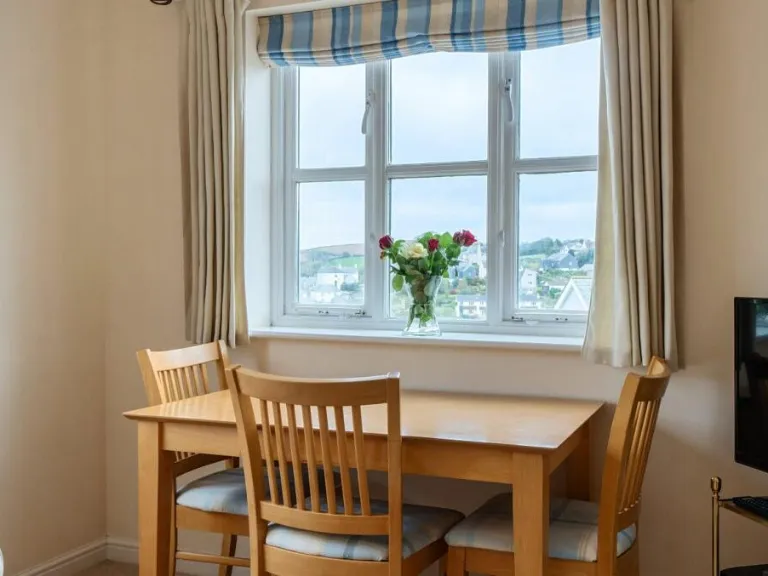
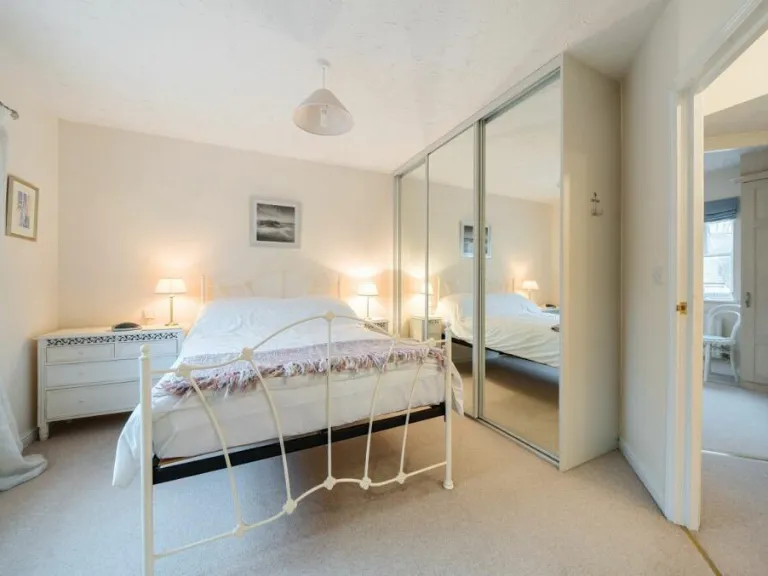
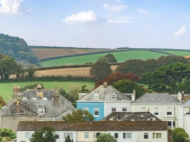
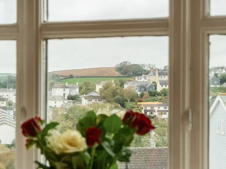
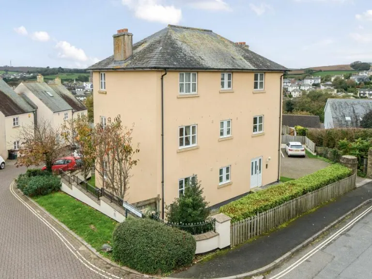
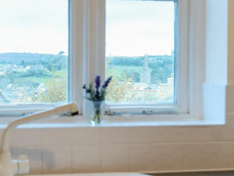
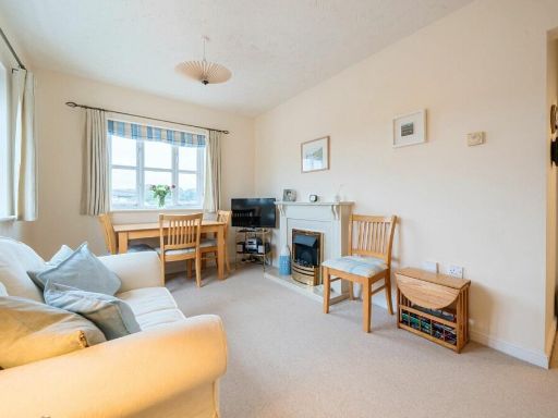
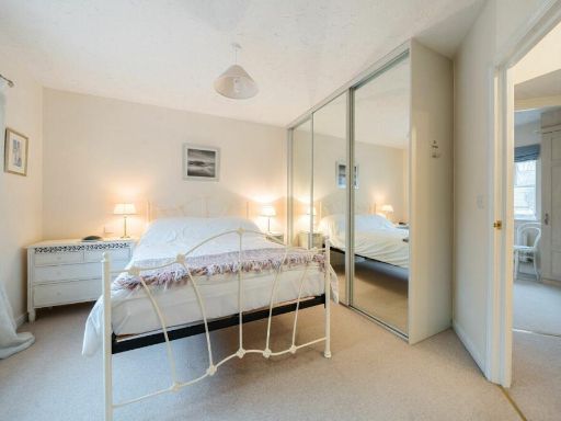
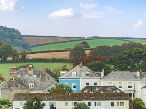
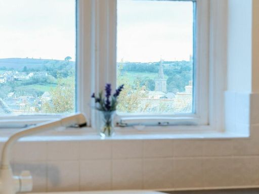
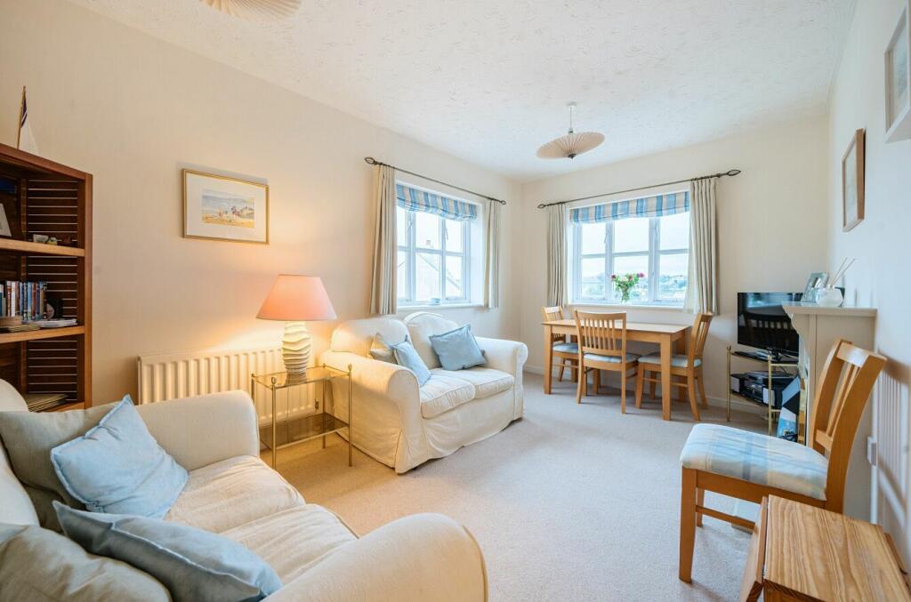
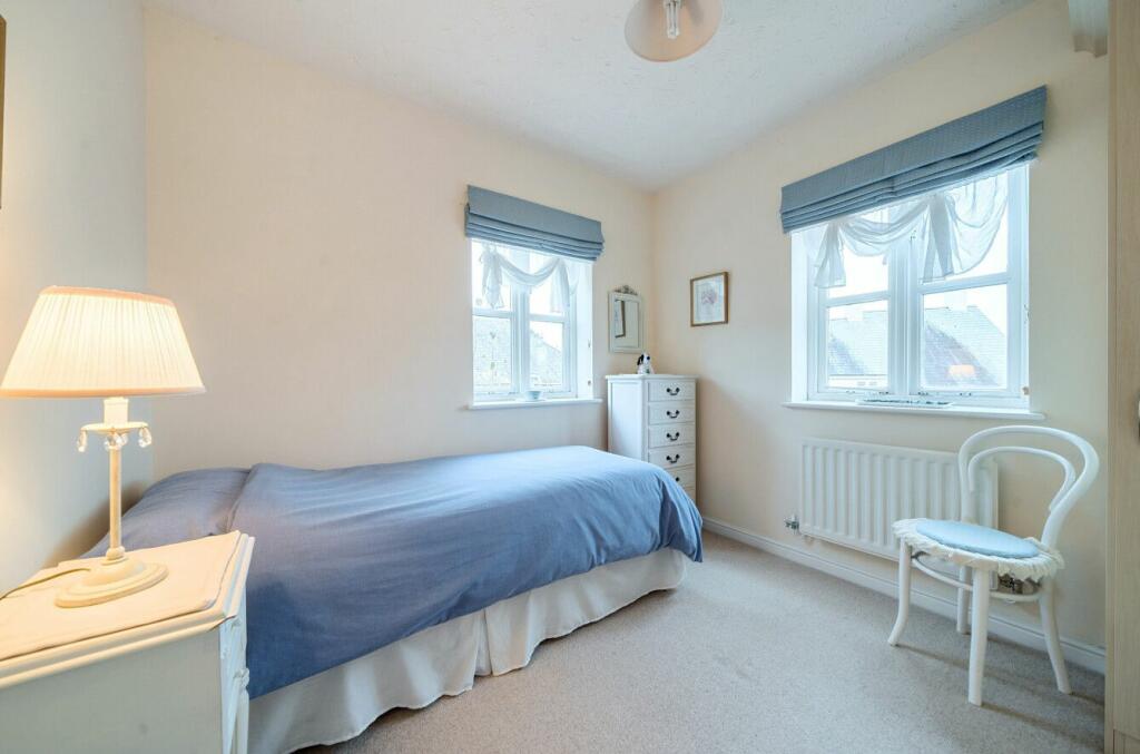
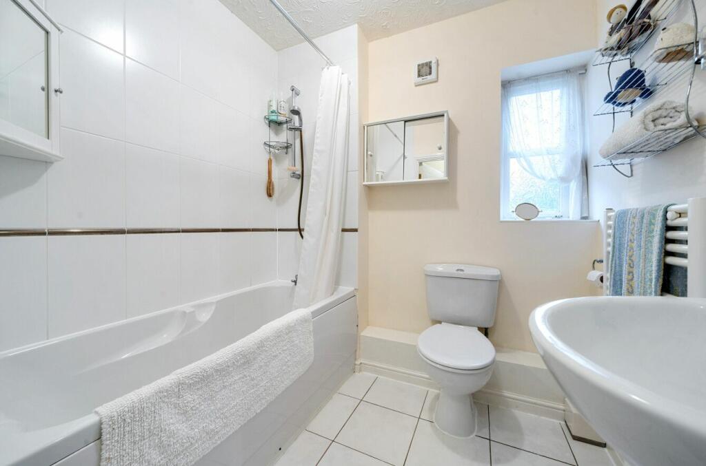
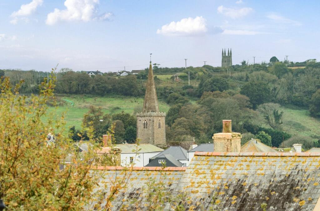
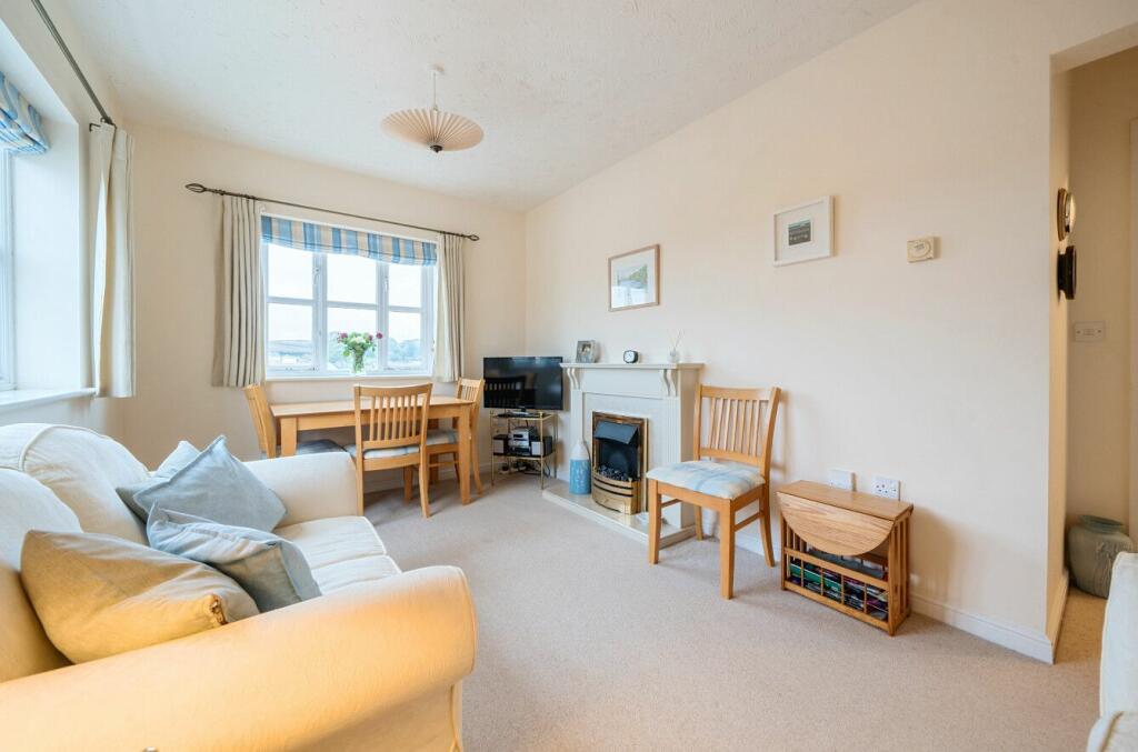
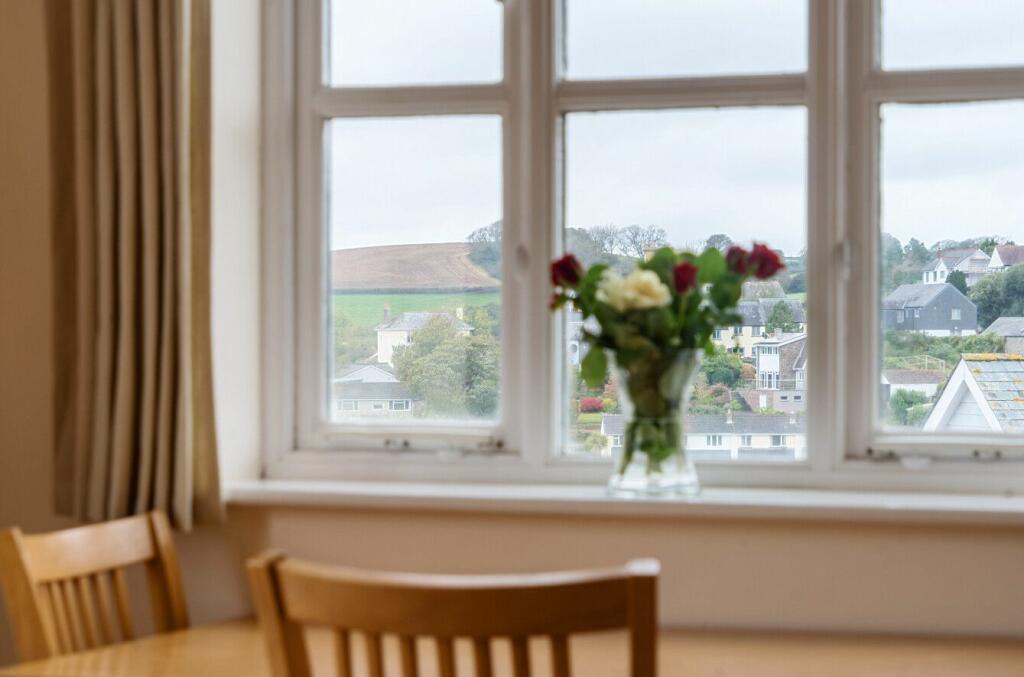
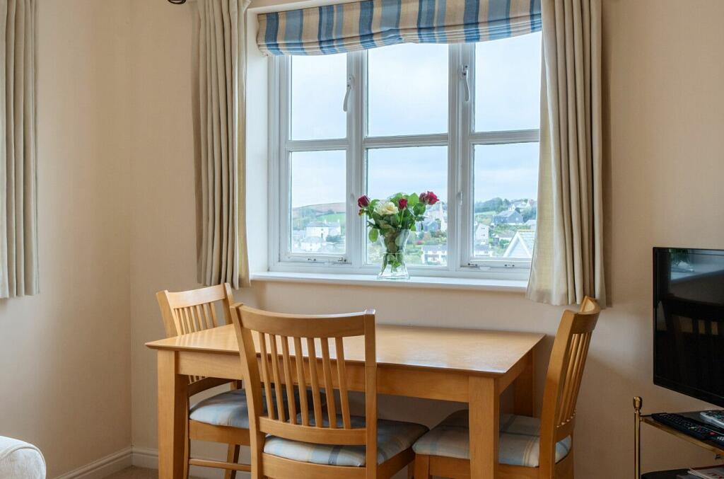
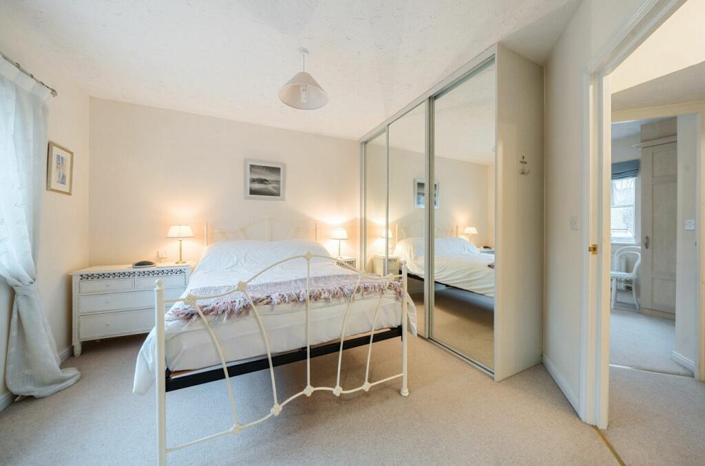
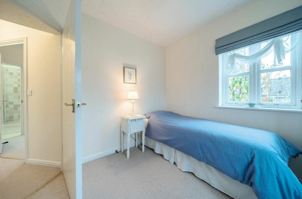
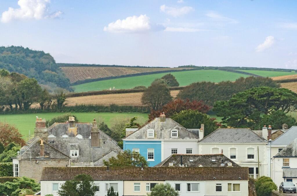
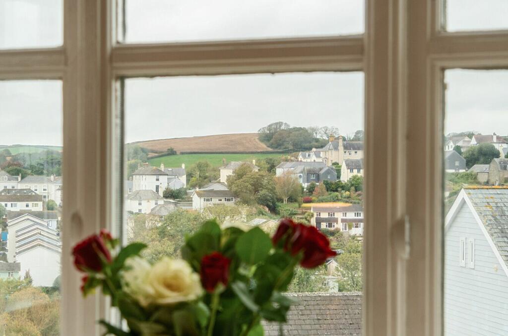
- This is a well-presented two-bedroom apartment located in the heart of Kingsbridge. The property features stunning views, likely due to its elevated position, and offers private parking, making it ideal for those seeking convenience. The apartment consists of two bathrooms, contributing to its practicality for a small family or as a shared space. The rooms appear average in size, and the presence of an ensuite in the main bedroom further enhances its appeal. Being situated in a central location, this property is close to local amenities, providing easy access to the town's offerings.
Image Descriptions
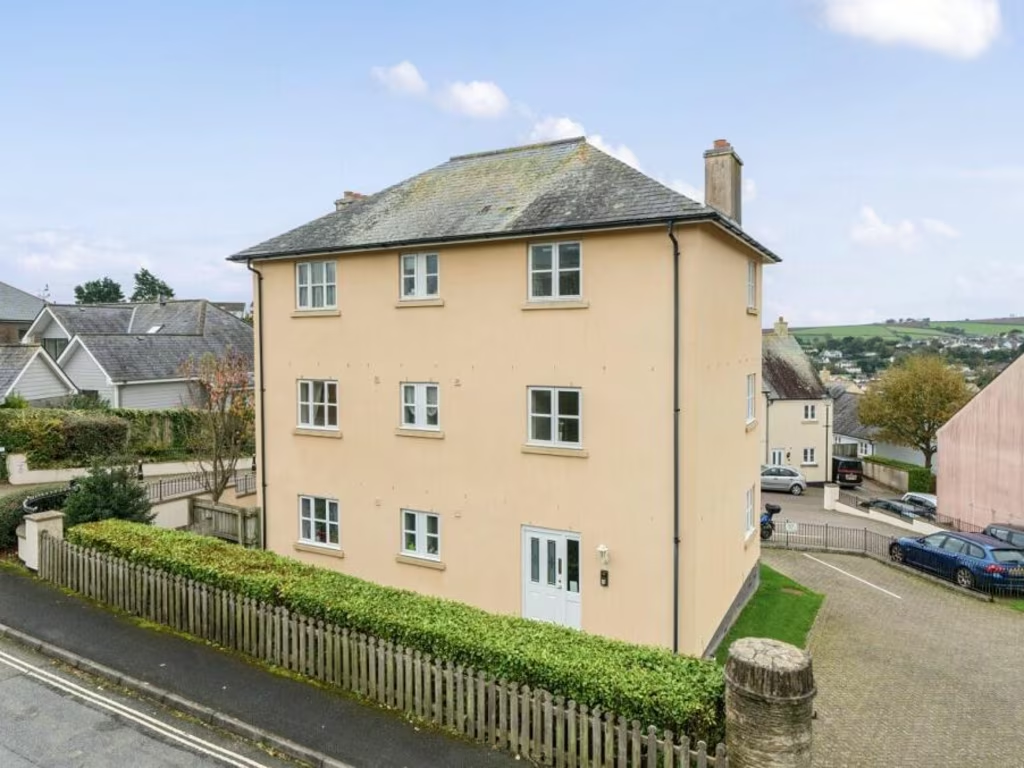
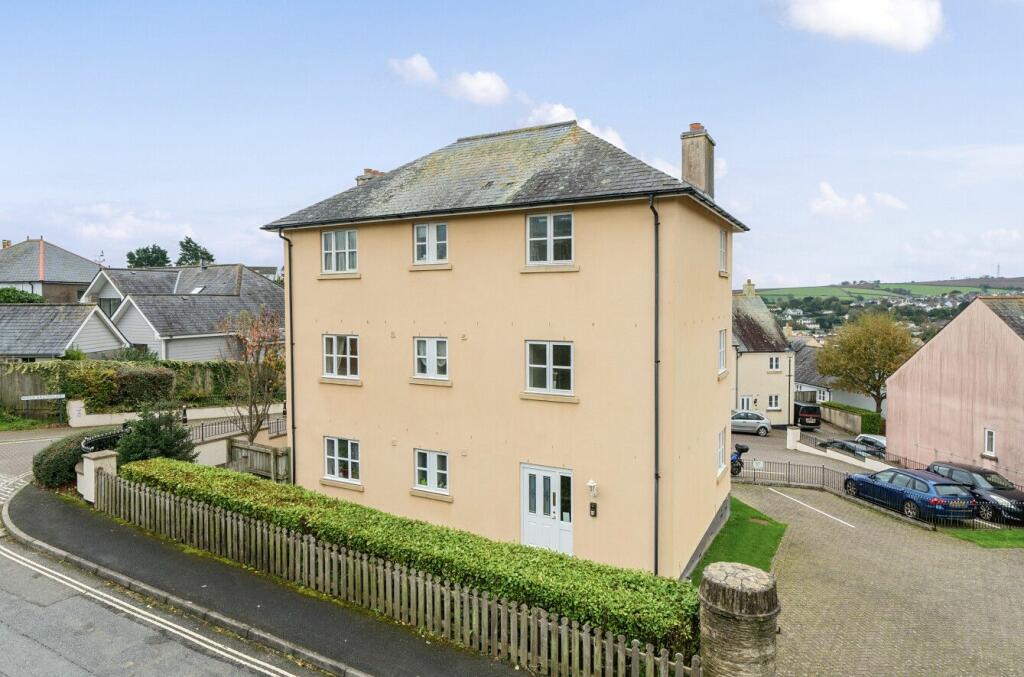
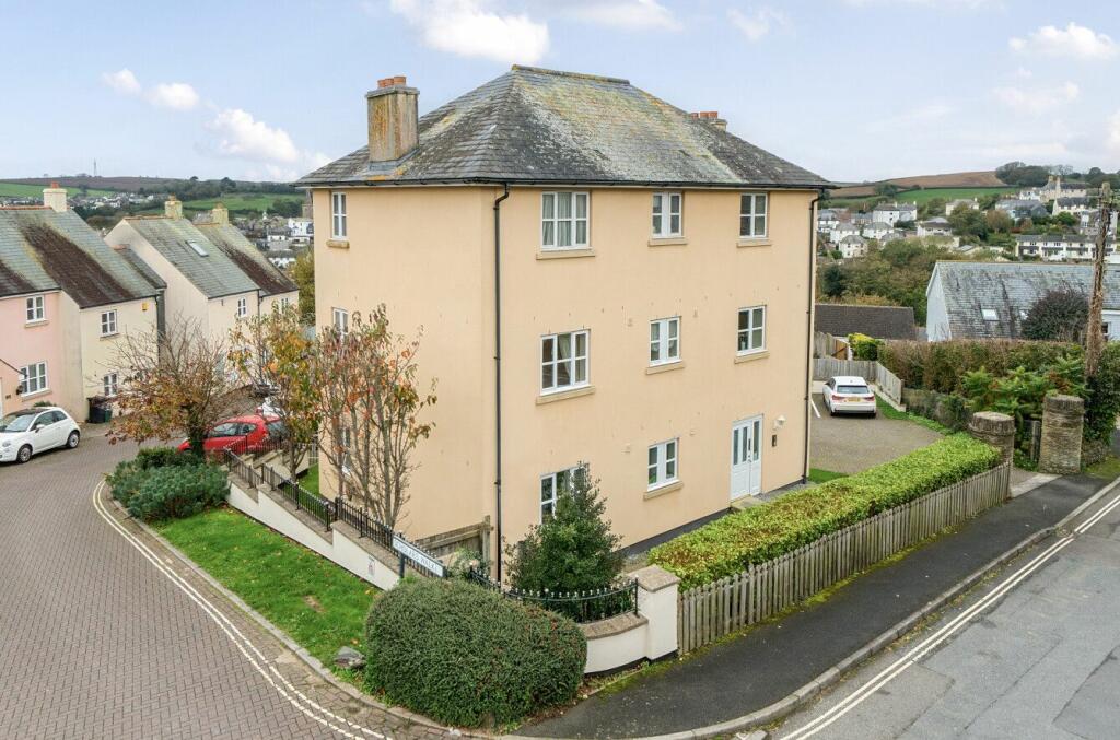
- a detached house modern
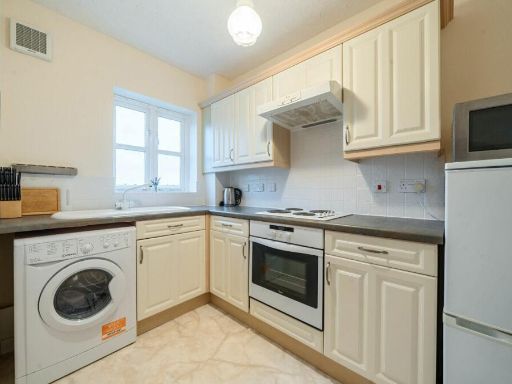
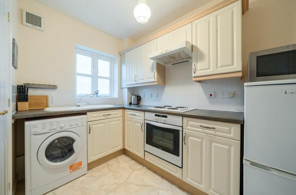
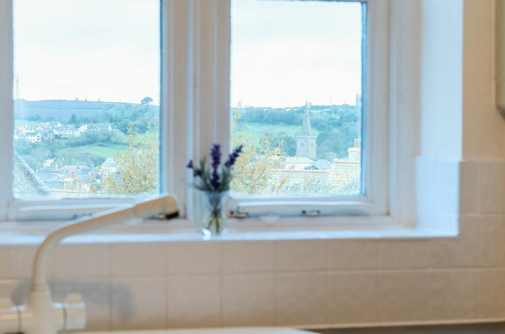
- kitchen modern
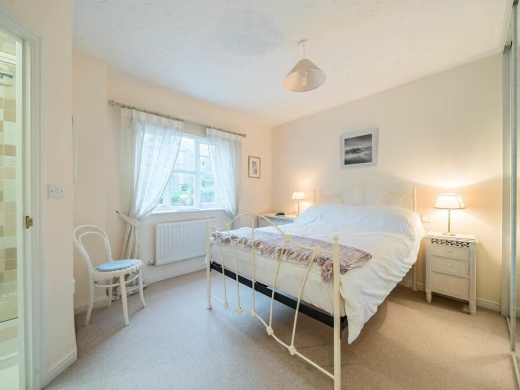
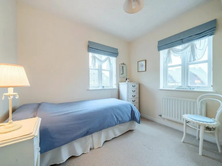
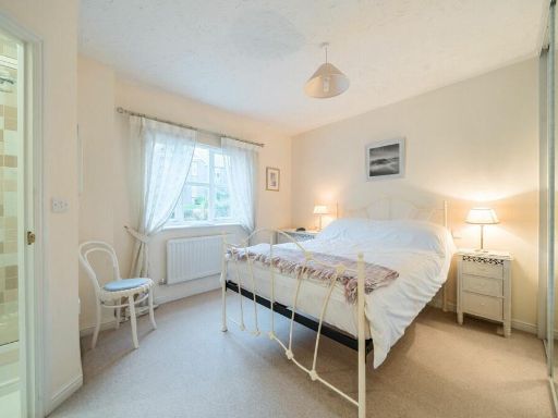
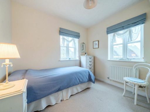
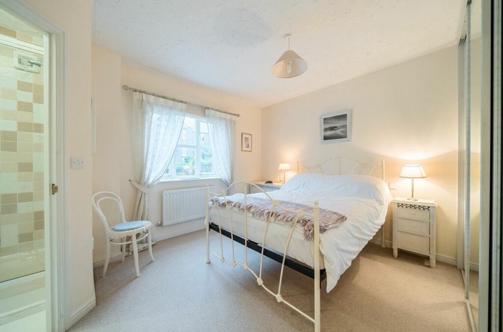
- bedroom modern
Floorplan Description
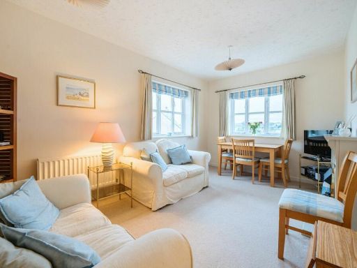
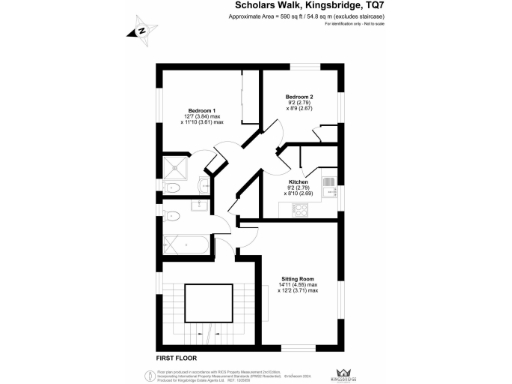
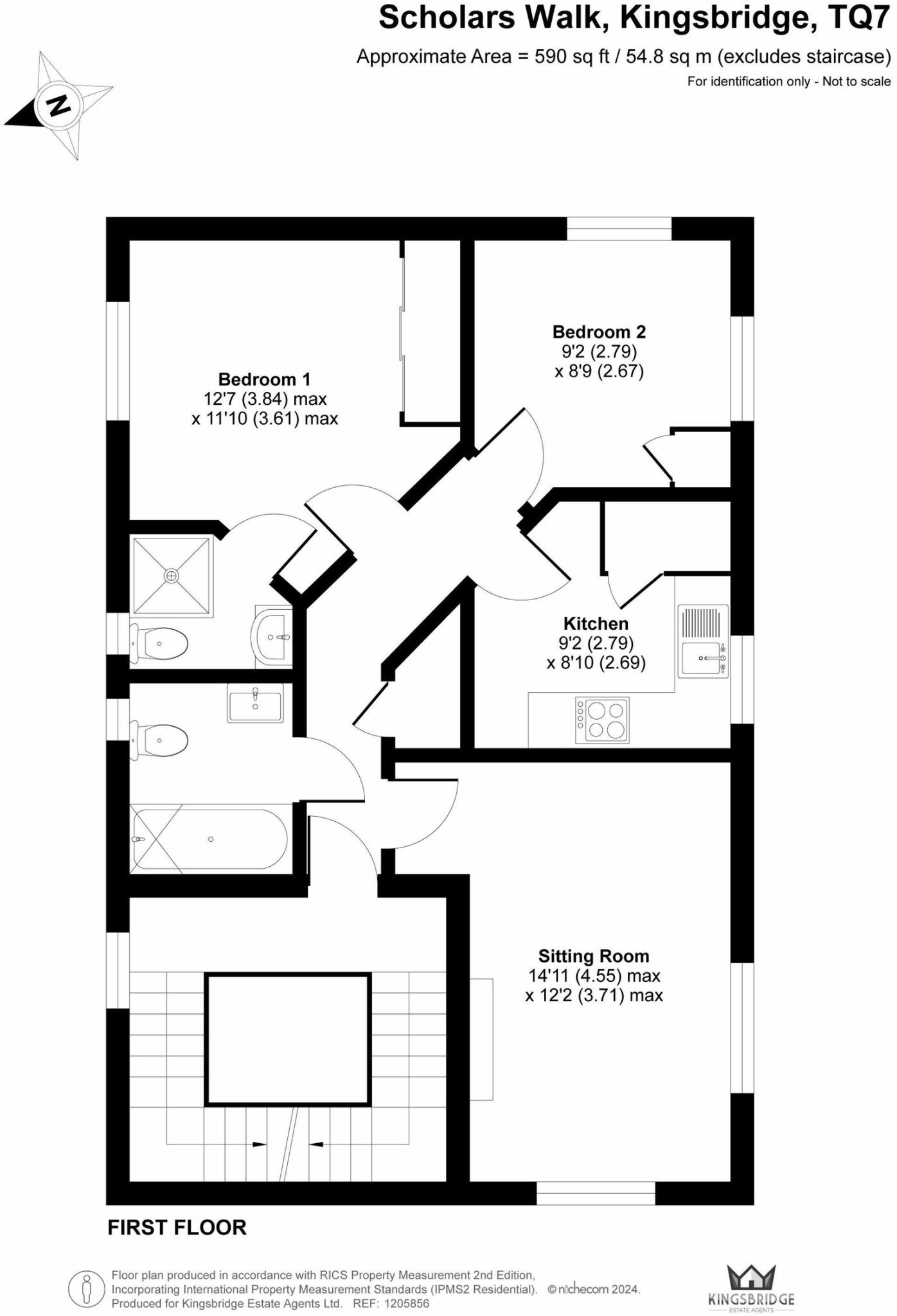
- A first floor layout with two bedrooms, a kitchen, and a sitting room.
Rooms
- Bedroom 1: Average
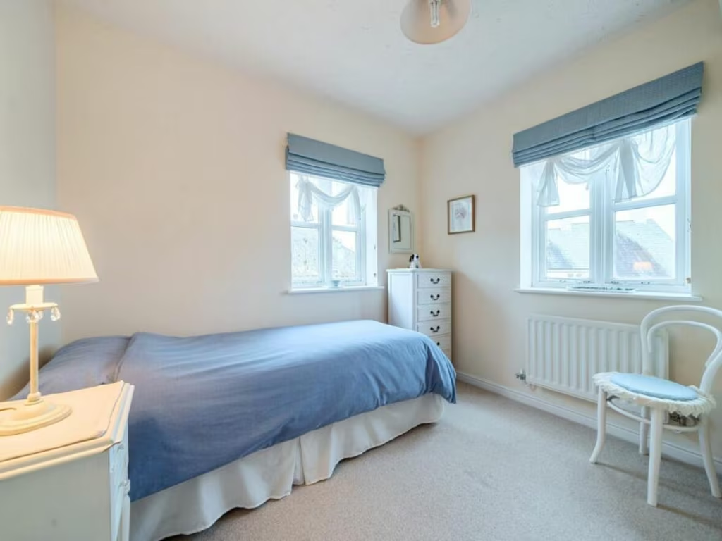
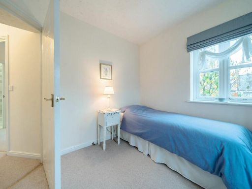
- Bedroom 2: Small
- Kitchen: Small
- Sitting Room: Large
Textual Property Features
Detected Visual Features
- detached
- modern
- three-story
- white windows
- residential
- fence
- urban
- slate roof
- chimney
- modern kitchen
- fitted cabinets
- integrated appliances
- neutral colors
- compact kitchen
- kitchen hood
- bright
- bedroom
- medium size
- standard ceiling
- natural light
EPC Details
- Fully double glazed
- Cavity wall, as built, insulated (assumed)
- Boiler and radiators, mains gas
- Low energy lighting in all fixed outlets
- (another dwelling below)
Nearby Schools
- Malborough with South Huish Church of England Primary School
- Charleton Church of England Academy
- Thurlestone All Saints Church of England Academy
- Kingsbridge Academy
- Blackawton Primary School
- Stokenham Area Primary School
- West Alvington Church of England Academy
- Salcombe Church of England Primary School
- Aveton Gifford CofE Primary School
- Loddiswell Primary School
- East Allington Primary School
Nearest Bars And Restaurants
- Id: 1132925268
- Tags:
- Amenity: pub
- Name: The Quay
- Wikidata: Q80476187
- TagsNormalized:
- Lat: 50.2837895
- Lon: -3.7767947
- FullGeoHash: gbvq41cu63cb
- PartitionGeoHash: gbvq
- Images:
- FoodStandards: null
- Distance: 567.1
,- Id: 1132986136
- Tags:
- Addr:
- City: Kingsbridge
- Housenumber: 17
- Street: Fore Street
- Amenity: cafe
- TagsNormalized:
- Lat: 50.2841898
- Lon: -3.7773213
- FullGeoHash: gbvq41cqwh35
- PartitionGeoHash: gbvq
- Images:
- FoodStandards: null
- Distance: 551.5
,- Id: 1132993092
- Tags:
- Addr:
- City: Kingsbridge
- Housenumber: 28a
- Postcode: TQ7 1NY
- Street: Fore Street
- Amenity: cafe
- Name: Kingsbridge Creamery
- TagsNormalized:
- Lat: 50.2846534
- Lon: -3.7777562
- FullGeoHash: gbvq44117fuc
- PartitionGeoHash: gbvq
- Images:
- FoodStandards: null
- Distance: 532.1
,- Id: 1132926341
- Tags:
- Amenity: pub
- Name: King Of Prussia
- Wikidata: Q79837672
- TagsNormalized:
- Lat: 50.2841659
- Lon: -3.7762316
- FullGeoHash: gbvq41fnrrvt
- PartitionGeoHash: gbvq
- Images:
- FoodStandards: null
- Distance: 510.7
,- Id: 189047458
- Tags:
- Addr:
- Postcode: TQ7 1DB
- Street: Church Street
- Amenity: pub
- Building: yes
- Name: Dodbrooke Inn
- Wikidata: Q79837657
- TagsNormalized:
- Lat: 50.2868053
- Lon: -3.7731753
- FullGeoHash: gbvq44kmyeuw
- PartitionGeoHash: gbvq
- Images:
- FoodStandards: null
- Distance: 153.3
}
Nearest General Shops
- Id: 219007428
- Tags:
- Addr:
- Housenumber: 49
- Postcode: TQ7 1PW
- Street: Fore Street
- Building: yes
- Name: Donovan's
- Shop: department_store
- TagsNormalized:
- Lat: 50.2851326
- Lon: -3.777498
- FullGeoHash: gbvq441k1uj7
- PartitionGeoHash: gbvq
- Images:
- FoodStandards: null
- Distance: 481.3
,- Id: 377295249
- Tags:
- Addr:
- Building: yes
- Name: Kings Market
- Shop: mall
- Source:
- Postcode: ons_opendata_postcodes
- TagsNormalized:
- Lat: 50.2861756
- Lon: -3.7784129
- FullGeoHash: gbvq442dhwe1
- PartitionGeoHash: gbvq
- Images:
- FoodStandards: null
- Distance: 465.6
,- Id: 2282146262
- Tags:
- Addr:
- Housenumber: 99
- Postcode: TQ7 1AB
- Street: Fore Street
- Drive_through: no
- Name: Kingsbridge Wine Room
- Shop: alcohol
- TagsNormalized:
- Lat: 50.2863158
- Lon: -3.7776688
- FullGeoHash: gbvq4435jbty
- PartitionGeoHash: gbvq
- Images:
- FoodStandards: null
- Distance: 411.8
}
Nearest Grocery shops
- Id: 6131556372
- Tags:
- Addr:
- Housename: Strand House
- Postcode: TQ7 1JA
- Street: The Promenade
- Brand: McColl's
- Brand:wikidata: Q16997477
- Brand:wikipedia: en:McColl's
- Contact:
- Website: https://www.mccolls.co.uk/storelocator/kingsbridge-the-promenade/
- Name: McColl's
- Shop: convenience
- TagsNormalized:
- Lat: 50.2834035
- Lon: -3.7763967
- FullGeoHash: gbvq41f459f9
- PartitionGeoHash: gbvq
- Images:
- FoodStandards: null
- Distance: 590.8
,- Id: 1706523035
- Tags:
- Name: Alan's Apple
- Shop: greengrocer
- TagsNormalized:
- Lat: 50.2845667
- Lon: -3.7777202
- FullGeoHash: gbvq4410udxs
- PartitionGeoHash: gbvq
- Images:
- FoodStandards: null
- Distance: 537.4
,- Id: 1706523039
- Tags:
- Addr:
- Housenumber: 71-73
- Postcode: TQ7 1AB
- Street: Fore Street
- Brand: McColl's
- Brand:wikidata: Q16997477
- Brand:wikipedia: en:McColl's
- Contact:
- Website: https://www.mccolls.co.uk/storelocator/kingsbridge-fore-street/
- Name: McColl's
- Shop: convenience
- TagsNormalized:
- Lat: 50.2856577
- Lon: -3.777692
- FullGeoHash: gbvq441pjqh8
- PartitionGeoHash: gbvq
- Images:
- FoodStandards: null
- Distance: 453.6
}
Nearest Supermarkets
- Id: 35048758
- Tags:
- Addr:
- City: Dartmouth
- Postcode: TQ6 9AH
- Street: Nelson Road
- Alt_name: Sainsbury's Dartmouth Superstore
- Brand: Sainsbury's
- Brand:wikidata: Q152096
- Building: yes
- Fhrs:
- Name: Sainsbury's
- Shop: supermarket
- TagsNormalized:
- sainsburys
- supermarket
- shop
- Lat: 50.3474641
- Lon: -3.6031886
- FullGeoHash: gbvqqj2ppxec
- PartitionGeoHash: gbvq
- Images:
- FoodStandards: null
- Distance: 13720
,- Id: 654347224
- Tags:
- Addr:
- City: Kingsbridge
- Country: GB
- County: Devon
- Parentstreet: Cookworthy Road
- Postcode: TQ7 1TP
- Street: Lime Grove
- Alt_name: Morrisons Kingsbridge
- Brand: Morrisons
- Brand:wikidata: Q922344
- Brand:wikipedia: en:Morrisons
- Building: yes
- Name: Morrisons
- Opening_hours: Mo-Sa 07:00-22:00; Su 10:00-16:00
- Phone: +44 1548 855614
- Shop: supermarket
- Source: OS_OpenData_OpenMapLocal
- Toilets:
- Website: https://my.morrisons.com/storefinder/499
- Wheelchair: yes
- TagsNormalized:
- Lat: 50.2837978
- Lon: -3.7822511
- FullGeoHash: gbvq1cvu75m1
- PartitionGeoHash: gbvq
- Images:
- FoodStandards: null
- Distance: 837.2
,- Id: 654346863
- Tags:
- Addr:
- City: Kingsbridge
- Postcode: TQ7 1QN
- Street: Cookworthy Road
- Alt_name: Tesco Kingsbridge Superstore
- Brand: Tesco
- Brand:wikidata: Q487494
- Brand:wikipedia: en:Tesco
- Building: yes
- Contact:
- Website: https://www.tesco.com/store-locator/devon/cookworthy-rd
- Name: Tesco
- Opening_hours: Mo-We,Sa 08:00-20:00; Th-Fr 08:00-21:00; Su 10:00-16:00
- Shop: supermarket
- Source: OS_OpenData_OpenMapLocal
- Toilets:
- Wheelchair: yes
- TagsNormalized:
- Lat: 50.2857375
- Lon: -3.7797161
- FullGeoHash: gbvq1fpxwhzk
- PartitionGeoHash: gbvq
- Images:
- FoodStandards: null
- Distance: 570.3
}
Nearest Religious buildings
- Id: 172267816
- Tags:
- Amenity: place_of_worship
- Building: church
- Denomination: anglican
- Name: St Edmund, King & Martyr
- Religion: christian
- Wikidata: Q17527017
- TagsNormalized:
- place of worship
- church
- anglican
- christian
- Lat: 50.2859301
- Lon: -3.7782393
- FullGeoHash: gbvq442bb8u9
- PartitionGeoHash: gbvq
- Images:
- FoodStandards: null
- Distance: 468.5
,- Id: 172267565
- Tags:
- Amenity: place_of_worship
- Denomination: methodist
- Name: South Devon Methodist Church
- Religion: christian
- TagsNormalized:
- place of worship
- methodist
- church
- christian
- Lat: 50.2870447
- Lon: -3.7785032
- FullGeoHash: gbvq442x62xf
- PartitionGeoHash: gbvq
- Images:
- FoodStandards: null
- Distance: 435.1
,- Id: 158460524
- Tags:
- Amenity: place_of_worship
- Building: church
- Denomination: anglican
- Name: St Thomas a Beckett
- Religion: christian
- Wikidata: Q17527184
- TagsNormalized:
- place of worship
- church
- anglican
- christian
- Lat: 50.2871318
- Lon: -3.7709066
- FullGeoHash: gbvq44qpg8b1
- PartitionGeoHash: gbvq
- Images:
- FoodStandards: null
- Distance: 165.5
}
Nearest Medical buildings
- Id: 733812199
- Tags:
- Amenity: doctors
- Name: Norton Brook Medical Center
- TagsNormalized:
- Lat: 50.2887019
- Lon: -3.7820809
- FullGeoHash: gbvq1fvbzjkp
- PartitionGeoHash: gbvq
- Images:
- FoodStandards: null
- Distance: 674.8
,- Id: 172266680
- Tags:
- Addr:
- Postcode: TQ7 1AE
- Street: Kingsworthy Road
- Amenity: doctors
- Building: yes
- Healthcare: doctor
- Name: Norton Brook Medical Centre
- TagsNormalized:
- doctor
- doctors
- health
- healthcare
- Lat: 50.2886945
- Lon: -3.7819969
- FullGeoHash: gbvq1fy0ch4e
- PartitionGeoHash: gbvq
- Images:
- FoodStandards: null
- Distance: 668.8
,- Id: 1132949841
- Tags:
- Addr:
- Housename: The Quay
- Postcode: TQ7 1HN
- Street: Ilbert Road
- Amenity: pharmacy
- Brand: Well Pharmacy
- Brand:wikidata: Q7726524
- Brand:wikipedia: en:Well Pharmacy
- Dispensing: yes
- Healthcare: pharmacy
- Name: Well Pharmacy
- TagsNormalized:
- pharmacy
- well pharmacy
- health
- healthcare
- Lat: 50.283029
- Lon: -3.7774086
- FullGeoHash: gbvq419rggzz
- PartitionGeoHash: gbvq
- Images:
- FoodStandards: null
- Distance: 662.1
,- Id: 733812094
- Tags:
- Addr:
- Postcode: TQ7 1DX
- Street: Prince of Wales Road
- Alt_name: Boots Kingsbridge - Prince of Wales Road
- Amenity: pharmacy
- Brand: Boots
- Brand:wikidata: Q6123139
- Brand:wikipedia: en:Boots UK
- Dispensing: yes
- Healthcare: pharmacy
- Name: Boots
- Wheelchair: yes
- TagsNormalized:
- pharmacy
- boots
- health
- healthcare
- Lat: 50.2833251
- Lon: -3.7770535
- FullGeoHash: gbvq41c9s70v
- PartitionGeoHash: gbvq
- Images:
- FoodStandards: null
- Distance: 620.9
}
Nearest Leisure Facilities
- Id: 172270324
- Tags:
- TagsNormalized:
- Lat: 50.288469
- Lon: -3.768307
- FullGeoHash: gbvq468p844d
- PartitionGeoHash: gbvq
- Images:
- FoodStandards: null
- Distance: 308.8
,- Id: 172270332
- Tags:
- TagsNormalized:
- Lat: 50.2879399
- Lon: -3.7686706
- FullGeoHash: gbvq44xsrx7w
- PartitionGeoHash: gbvq
- Images:
- FoodStandards: null
- Distance: 281.7
,- Id: 190517432
- Tags:
- Leisure: park
- Name: Duncombe Park
- TagsNormalized:
- Lat: 50.2865696
- Lon: -3.7755528
- FullGeoHash: gbvq446sx0pb
- PartitionGeoHash: gbvq
- Images:
- FoodStandards: null
- Distance: 271.6
,- Id: 158458808
- Tags:
- TagsNormalized:
- Lat: 50.2883321
- Lon: -3.7690564
- FullGeoHash: gbvq44xqy8ec
- PartitionGeoHash: gbvq
- Images:
- FoodStandards: null
- Distance: 254.3
,- Id: 172269934
- Tags:
- TagsNormalized:
- Lat: 50.2881028
- Lon: -3.776198
- FullGeoHash: gbvq44dm2jy9
- PartitionGeoHash: gbvq
- Images:
- FoodStandards: null
- Distance: 254
}
Nearest Tourist attractions
- Id: 7807272155
- Tags:
- Guest_house: bed_and_breakfast
- Internet_access: yes
- Internet_access:fee: customers
- Name: Estuary View Farm
- Operator: Estuary View Farm
- Rooms: 3
- Tourism: guest_house
- TagsNormalized:
- Lat: 50.2728816
- Lon: -3.7814115
- FullGeoHash: gbvmczyky8r5
- PartitionGeoHash: gbvm
- Images:
- FoodStandards: null
- Distance: 1807.7
,- Id: 10090615918
- Tags:
- Currency:
- Name: Red Propeller Gallery
- Payment:
- Lightning: yes
- Lightning_contactless: no
- Onchain: yes
- Phone: +44 7525 338233
- Tourism: gallery
- Website: www.redpropeller.co.uk
- TagsNormalized:
- Lat: 50.2863721
- Lon: -3.7779835
- FullGeoHash: gbvq442gqe5m
- PartitionGeoHash: gbvq
- Images:
- FoodStandards: null
- Distance: 428.5
,- Id: 733812217
- Tags:
- Addr:
- City: Kingsbridge
- Housenumber: 108
- Postcode: TQ7 1AW
- Street: Fore Street
- Email: hello@kingsbridgemuseum.org.uk
- Name: Cookworthy Museum
- Tourism: museum
- Website: http://kingsbridgemuseum.org.uk/
- TagsNormalized:
- Lat: 50.2872834
- Lon: -3.7780328
- FullGeoHash: gbvq448btmnd
- PartitionGeoHash: gbvq
- Images:
- FoodStandards: null
- Distance: 395.9
}
Nearest Train stations
- Id: 6605728697
- Tags:
- Name: Totnes
- Naptan:
- Network: National Rail
- Public_transport: station
- Railway: station
- Ref:
- Wheelchair: yes
- Wikipedia: en:Totnes railway station
- TagsNormalized:
- Lat: 50.4359143
- Lon: -3.6887478
- FullGeoHash: gbvquj9fmzy7
- PartitionGeoHash: gbvq
- Images:
- FoodStandards: null
- Distance: 17475.9
,- Id: 7352763796
- Tags:
- Addr:
- City: Dartmouth
- Postcode: TQ6 0AE
- Name: Kingswear
- Naptan:
- Public_transport: station
- Railway: station
- Source: OS_OpenData_StreetView
- Source:postcode: ons_opendata_postcodes
- Usage: tourism
- TagsNormalized:
- Lat: 50.34888
- Lon: -3.5723937
- FullGeoHash: gbvqqtwxmpw0
- PartitionGeoHash: gbvq
- Images:
- FoodStandards: null
- Distance: 15739.2
,- Id: 29264839
- Tags:
- Name: Ivybridge
- Naptan:
- Network: National Rail
- Public_transport: station
- Railway: station
- Ref:
- Wheelchair: yes
- Wikipedia: en:Ivybridge railway station
- TagsNormalized:
- Lat: 50.393467
- Lon: -3.9050319
- FullGeoHash: gbvnxju7npj5
- PartitionGeoHash: gbvn
- Images:
- FoodStandards: null
- Distance: 15015.6
,- Id: 7821383480
- Tags:
- Name: Kingsbridge Park Side
- Operator: Kingsbridge and District Light Railway
- Public_transport: station
- Railway: station
- Train: yes
- Usage: tourism
- TagsNormalized:
- Lat: 50.2804378
- Lon: -3.7745489
- FullGeoHash: gbvq4172y8uq
- PartitionGeoHash: gbvq
- Images:
- FoodStandards: null
- Distance: 867.1
,- Id: 7821403685
- Tags:
- Name: Kingsbridge Ria End
- Operator: Kingsbridge and District Light Railway
- Public_transport: station
- Railway: station
- Train: yes
- Usage: tourism
- TagsNormalized:
- Lat: 50.2822448
- Lon: -3.7755403
- FullGeoHash: gbvq41der9c1
- PartitionGeoHash: gbvq
- Images:
- FoodStandards: null
- Distance: 687.3
}
Nearest Bus stations and stops
- Id: 9933688492
- Tags:
- Bus: yes
- Highway: bus_stop
- Public_transport: platform
- Shelter: yes
- TagsNormalized:
- Lat: 50.2923109
- Lon: -3.6532927
- FullGeoHash: gbvqhg7vbn78
- PartitionGeoHash: gbvq
- Images:
- FoodStandards: null
- Distance: 8490.2
,- Id: 9180397910
- Tags:
- Bench: no
- Bin: no
- Bus: yes
- Highway: bus_stop
- Public_transport: platform
- Shelter: no
- TagsNormalized:
- Lat: 50.2448987
- Lon: -3.8001397
- FullGeoHash: gbvmcdbcdrfr
- PartitionGeoHash: gbvm
- Images:
- FoodStandards: null
- Distance: 5190.6
,- Id: 3060003187
- Tags:
- Bench: yes
- Bus: yes
- Highway: bus_stop
- Public_transport: platform
- Shelter: no
- TagsNormalized:
- Lat: 50.2697419
- Lon: -3.8260506
- FullGeoHash: gbvmbzmfqx1f
- PartitionGeoHash: gbvm
- Images:
- FoodStandards: null
- Distance: 4312.5
,- Id: 2973810626
- Tags:
- Bus: yes
- Highway: bus_stop
- Public_transport: platform
- TagsNormalized:
- Lat: 50.3227355
- Lon: -3.7995883
- FullGeoHash: gbvq38cppjvd
- PartitionGeoHash: gbvq
- Images:
- FoodStandards: null
- Distance: 4297.4
,- Id: 733812172
- Tags:
- Amenity: bus_station
- Bus: yes
- Highway: bus_stop
- Name: Kingsbridge Bus Station
- Naptan:
- Public_transport: station
- Shelter: yes
- TagsNormalized:
- bus
- bus station
- station
- bus stop
- Lat: 50.2830528
- Lon: -3.7769825
- FullGeoHash: gbvq41c8jbmt
- PartitionGeoHash: gbvq
- Images:
- FoodStandards: null
- Distance: 644.7
}
Nearest Hotels
- Id: 5150632192
- Tags:
- Name: Salcombe Harbour Hotel and Spa
- Tourism: hotel
- TagsNormalized:
- Lat: 50.2351154
- Lon: -3.7687211
- FullGeoHash: gbvmf1p8y2jz
- PartitionGeoHash: gbvm
- Images:
- FoodStandards: null
- Distance: 5902.4
,- Id: 552684312
- Tags:
- Building: yes
- Name: Brightham House
- Tourism: hotel
- TagsNormalized:
- Lat: 50.2440335
- Lon: -3.8131349
- FullGeoHash: gbvmc4xkew8w
- PartitionGeoHash: gbvm
- Images:
- FoodStandards: null
- Distance: 5687.1
,- Id: 657343235
- Tags:
- Addr:
- Housename: Buckland Tout-Saints Hotel
- Postcode: TQ7 2DS
- Street: Goveton
- Building: yes
- Name: Buckland Tout-Saints Hotel
- Rooms: 16
- Source: os_opendata_openmaplocal
- Tourism: hotel
- Wikidata: Q17533664
- TagsNormalized:
- Lat: 50.3012746
- Lon: -3.7433476
- FullGeoHash: gbvq4v44jtjw
- PartitionGeoHash: gbvq
- Images:
- FoodStandards: null
- Distance: 2541.4
}
Tags
- detached
- modern
- three-story
- white windows
- residential
- fence
- urban
- slate roof
- chimney
- modern kitchen
- fitted cabinets
- integrated appliances
- neutral colors
- compact kitchen
- kitchen hood
- bright
- bedroom
- modern
- medium size
- standard ceiling
- natural light
- neutral colors
Local Market Stats
- Average Price/sqft: £377
- Avg Income: £43300
- Rental Yield: 2.6%
- Social Housing: 8%
- Planning Success Rate: 87%
AirBnB Data
- 1km average: £82/night
- Listings in 1km: 11
Similar Properties
 2 bedroom apartment for sale in Scholars Walk, Kingsbridge, TQ7 — £175,000 • 2 bed • 1 bath • 738 ft²
 2 bedroom flat for sale in Scholars Walk, Kingsbridge, TQ7 — £230,000 • 2 bed • 2 bath • 785 ft²
 2 bedroom flat for sale in Scholars Walk, Kingsbridge, TQ7 — £172,250 • 2 bed • 2 bath • 581 ft²
 2 bedroom flat for sale in Retreat Close, Kingsbridge, TQ7 — £169,950 • 2 bed • 1 bath • 629 ft²
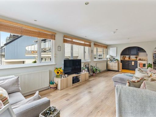 2 bedroom apartment for sale in Embankment Road, Kingsbridge, TQ7 — £350,000 • 2 bed • 2 bath • 776 ft²
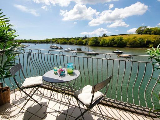 2 bedroom apartment for sale in Embankment Road, Kingsbridge, TQ7 — £325,000 • 2 bed • 1 bath • 649 ft²
Meta
- {
"@context": "https://schema.org",
"@type": "Residence",
"name": "2 bedroom apartment for sale in Scholars Walk, Kingsbridge,…",
"description": "",
"url": "https://propertypiper.co.uk/property/47ca80d9-14dd-43e0-8940-0c07c8b5e89c",
"image": "https://image-a.propertypiper.co.uk/a8970e53-a86c-4471-82b1-a000fb4f8bc8-1024.jpeg",
"address": {
"@type": "PostalAddress",
"streetAddress": "63 SCHOLARS WALK KINGSBRIDGE ",
"postalCode": "TQ7 1QL",
"addressLocality": "South Hams",
"addressRegion": "Totnes",
"addressCountry": "England"
},
"geo": {
"@type": "GeoCoordinates",
"latitude": 50.2881381,
"longitude": -3.7726232
},
"numberOfRooms": 2,
"numberOfBathroomsTotal": 2,
"floorSize": {
"@type": "QuantitativeValue",
"value": 590,
"unitCode": "FTK"
},
"offers": {
"@type": "Offer",
"price": 169950,
"priceCurrency": "GBP",
"availability": "https://schema.org/InStock"
},
"additionalProperty": [
{
"@type": "PropertyValue",
"name": "Feature",
"value": "detached"
},
{
"@type": "PropertyValue",
"name": "Feature",
"value": "modern"
},
{
"@type": "PropertyValue",
"name": "Feature",
"value": "three-story"
},
{
"@type": "PropertyValue",
"name": "Feature",
"value": "white windows"
},
{
"@type": "PropertyValue",
"name": "Feature",
"value": "residential"
},
{
"@type": "PropertyValue",
"name": "Feature",
"value": "fence"
},
{
"@type": "PropertyValue",
"name": "Feature",
"value": "urban"
},
{
"@type": "PropertyValue",
"name": "Feature",
"value": "slate roof"
},
{
"@type": "PropertyValue",
"name": "Feature",
"value": "chimney"
},
{
"@type": "PropertyValue",
"name": "Feature",
"value": "modern kitchen"
},
{
"@type": "PropertyValue",
"name": "Feature",
"value": "fitted cabinets"
},
{
"@type": "PropertyValue",
"name": "Feature",
"value": "integrated appliances"
},
{
"@type": "PropertyValue",
"name": "Feature",
"value": "neutral colors"
},
{
"@type": "PropertyValue",
"name": "Feature",
"value": "compact kitchen"
},
{
"@type": "PropertyValue",
"name": "Feature",
"value": "kitchen hood"
},
{
"@type": "PropertyValue",
"name": "Feature",
"value": "bright"
},
{
"@type": "PropertyValue",
"name": "Feature",
"value": "bedroom"
},
{
"@type": "PropertyValue",
"name": "Feature",
"value": "modern"
},
{
"@type": "PropertyValue",
"name": "Feature",
"value": "medium size"
},
{
"@type": "PropertyValue",
"name": "Feature",
"value": "standard ceiling"
},
{
"@type": "PropertyValue",
"name": "Feature",
"value": "natural light"
},
{
"@type": "PropertyValue",
"name": "Feature",
"value": "neutral colors"
}
]
}
High Res Floorplan Images
Compatible Floorplan Images
FloorplanImages Thumbnail