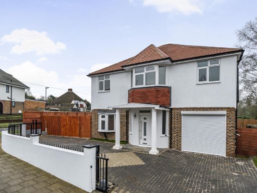
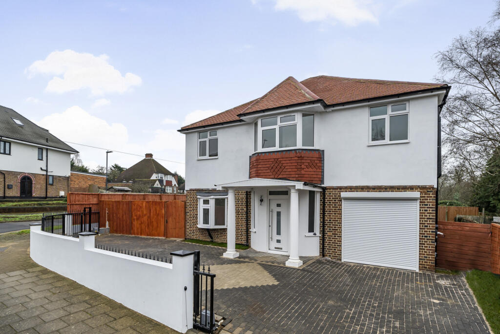
HA5 1JY - 5 bedroom detached house for sale in Hill Road, Pinner, HA5
View on Property Piper
5 bedroom detached house for sale in Hill Road, Pinner, HA5
Property Details
- Price: £1195000
- Bedrooms: 5
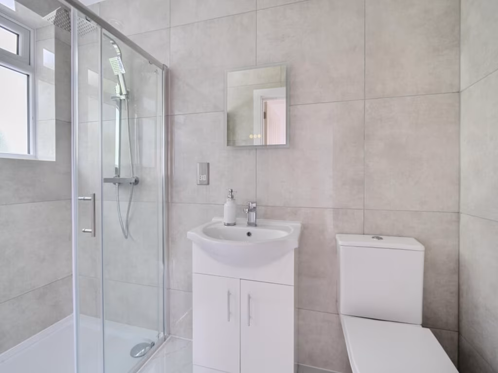
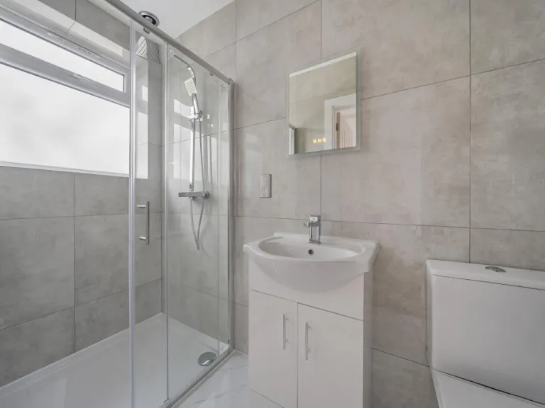
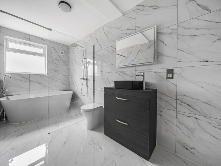
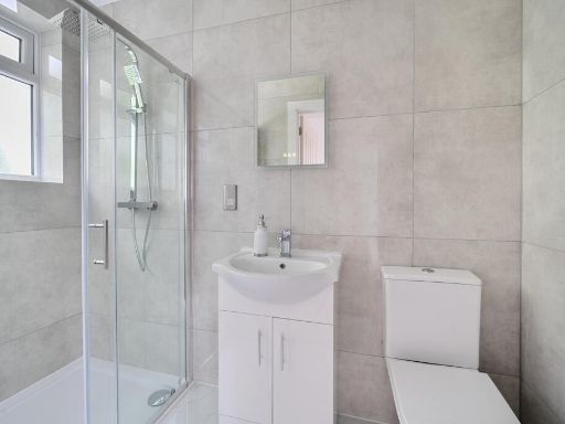
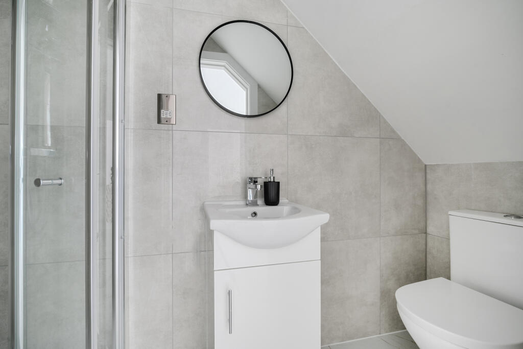
- Bathrooms: 4
- Property Type: undefined
- Property SubType: undefined
Brochure Descriptions
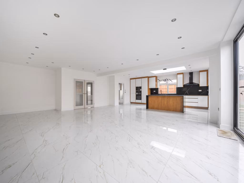
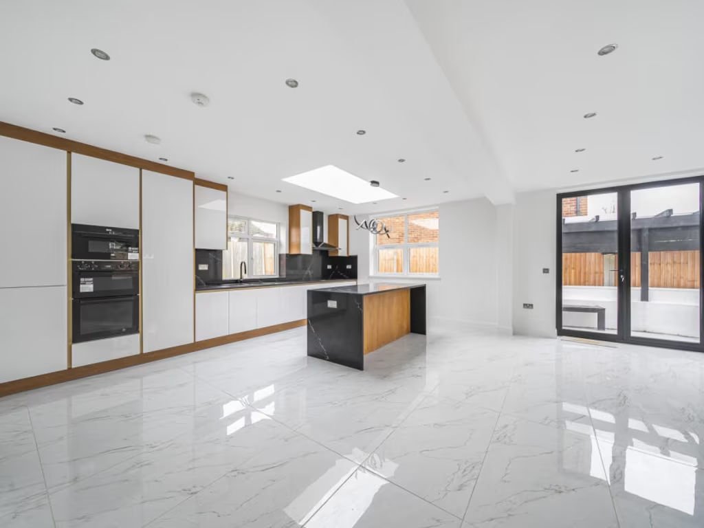
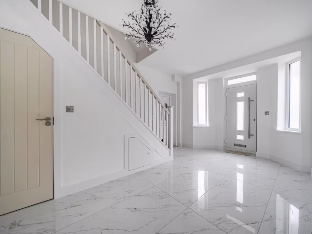
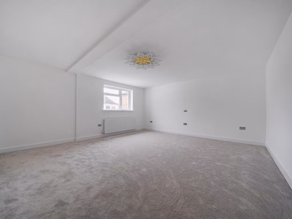
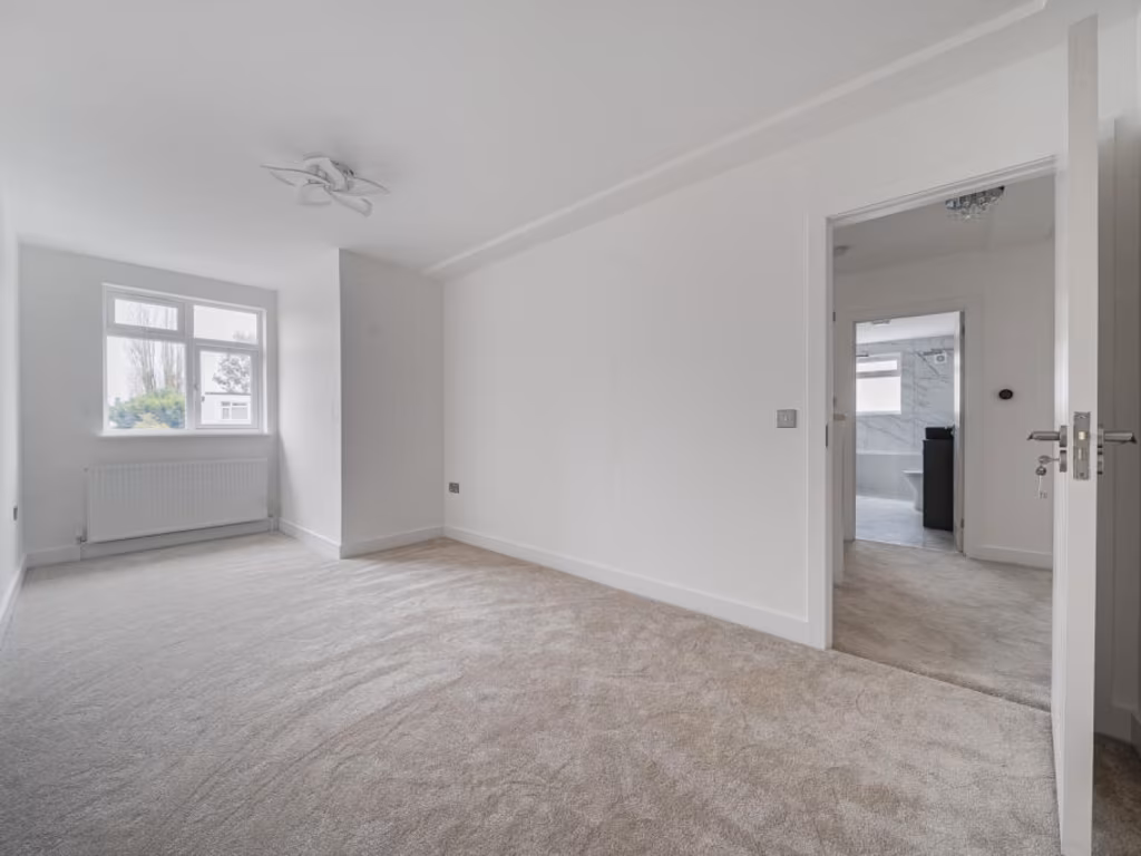
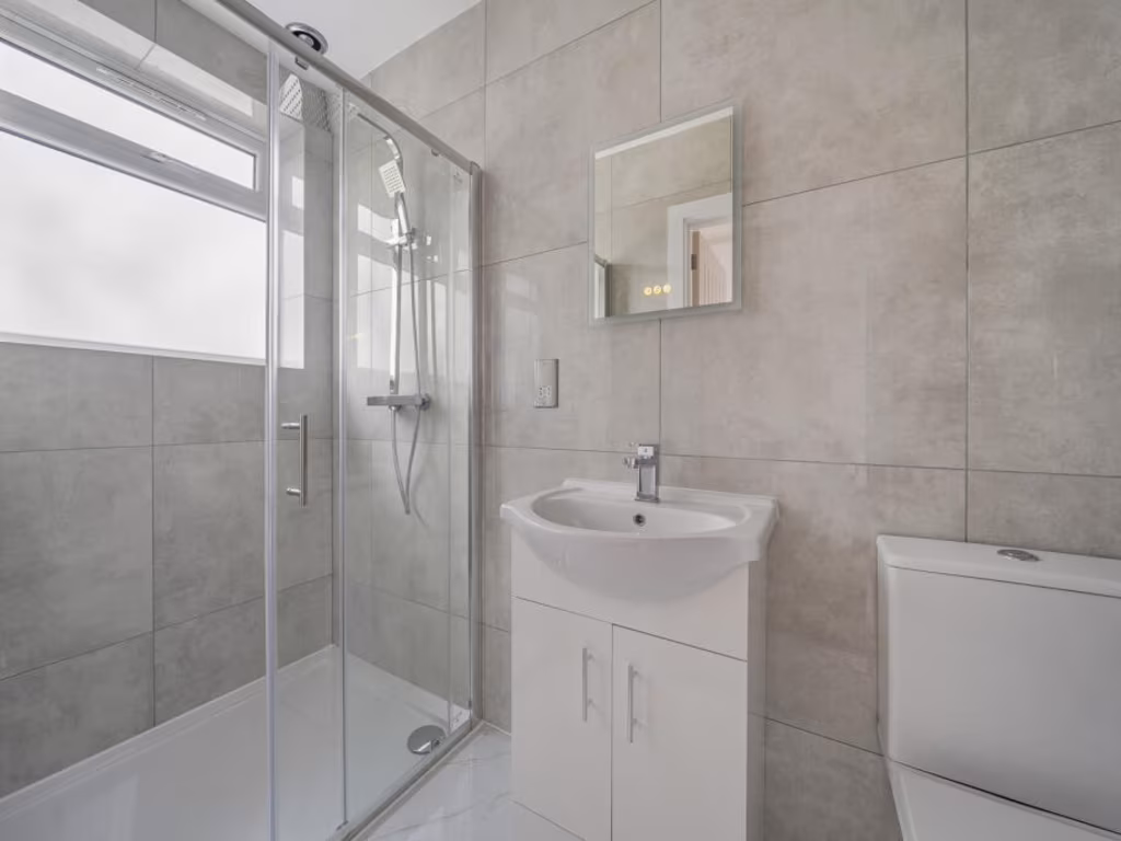
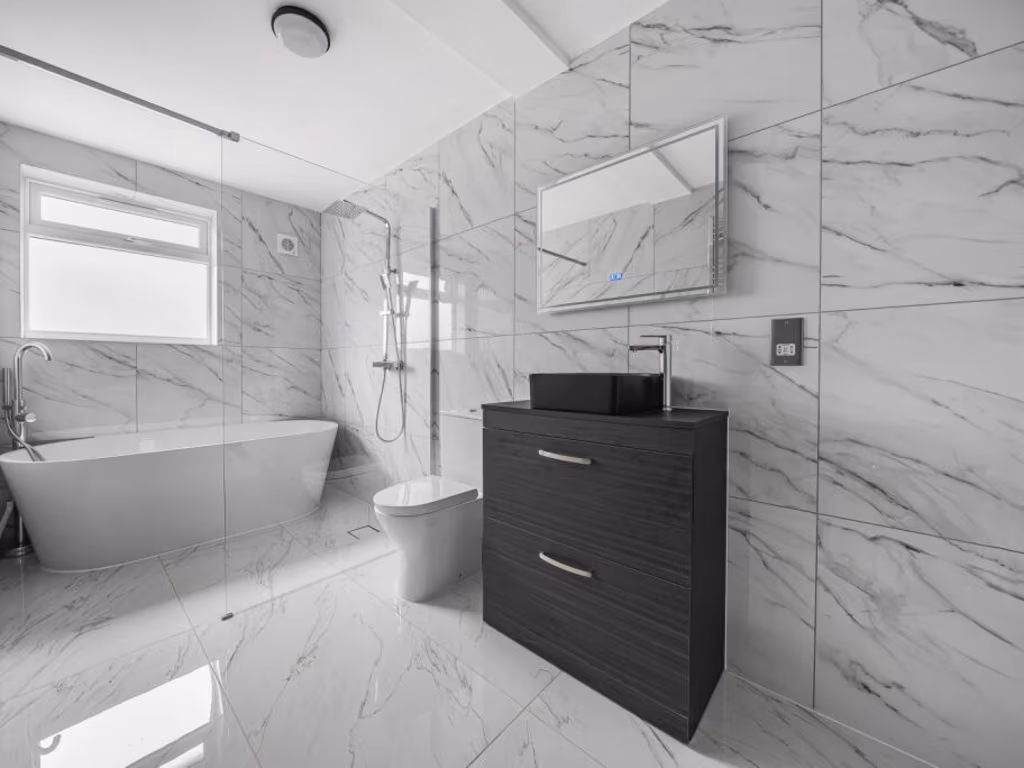
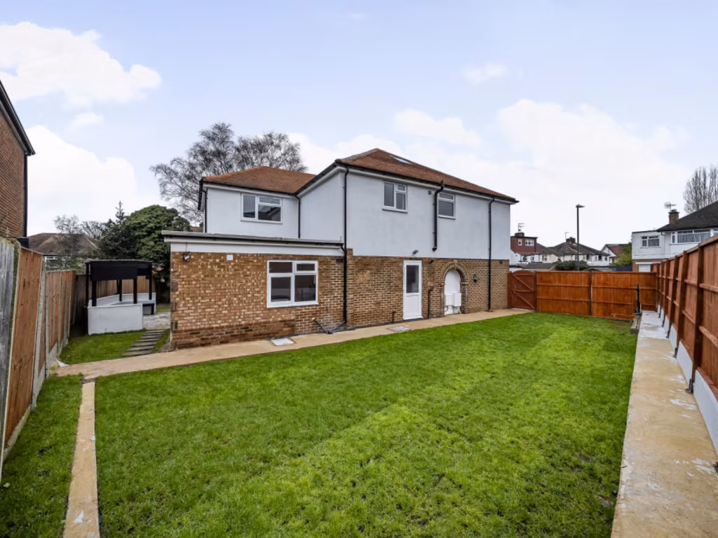
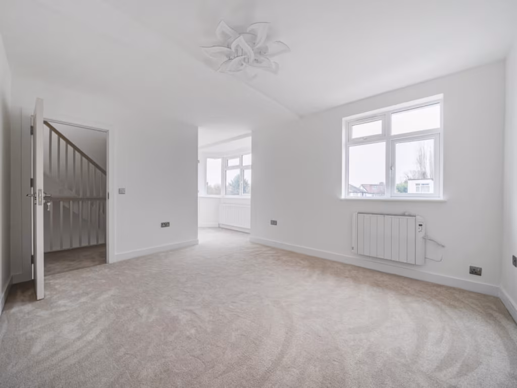
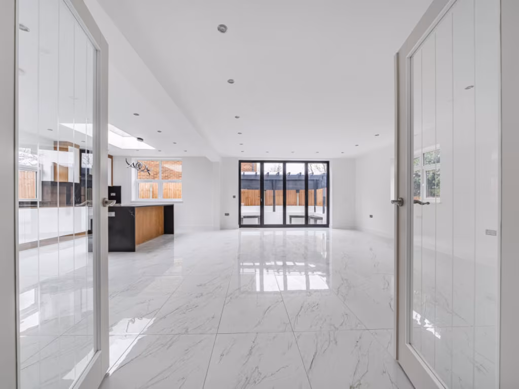
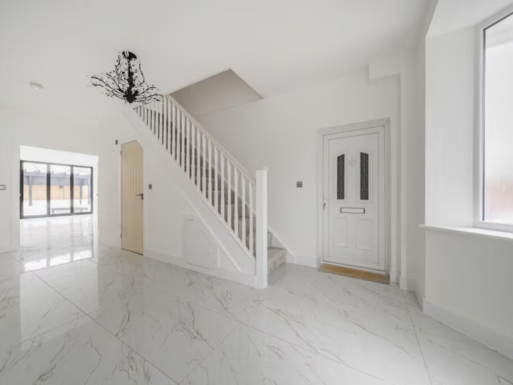
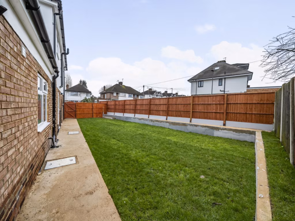
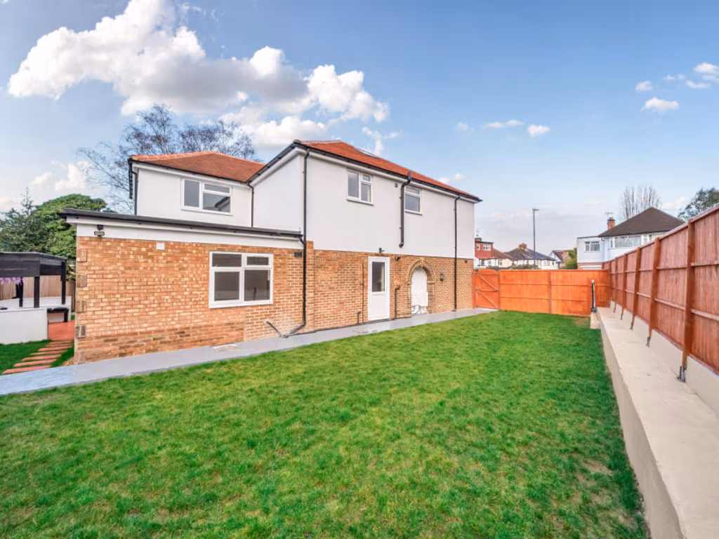
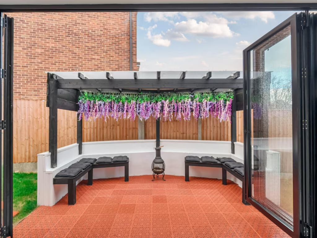
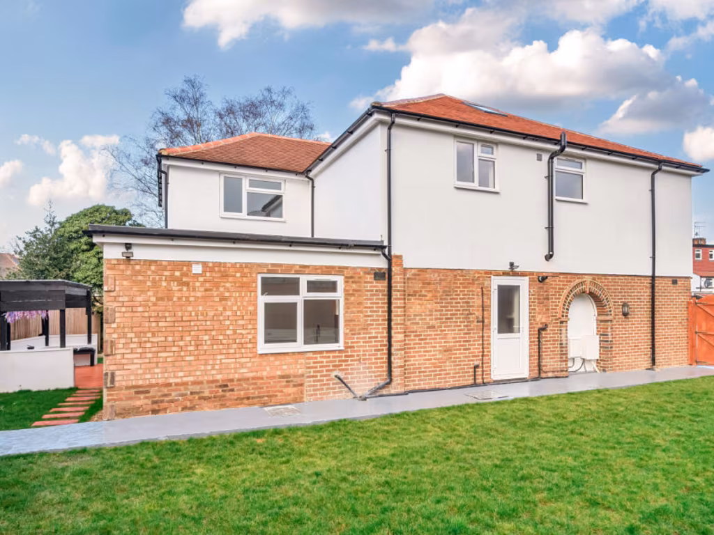
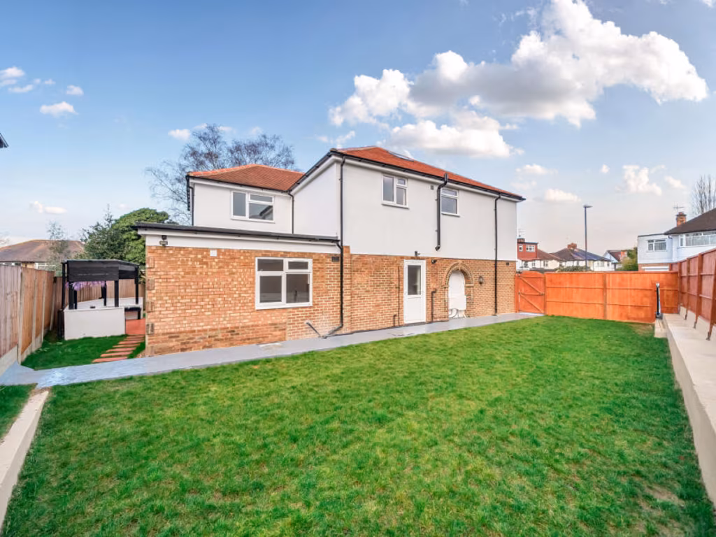
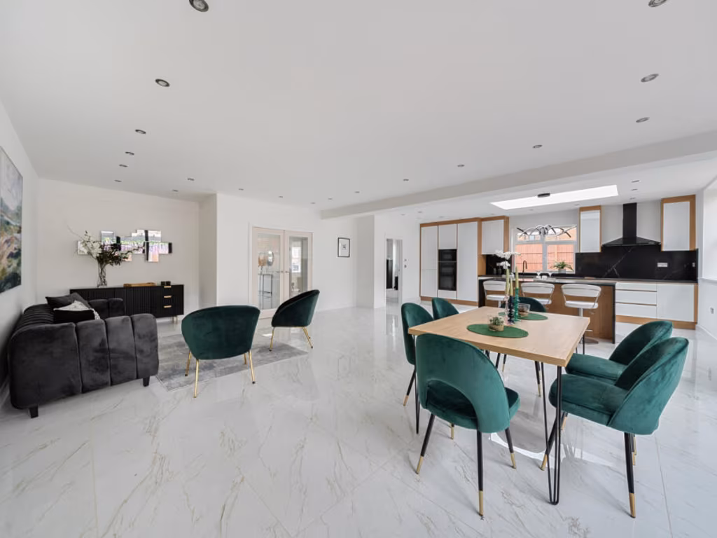
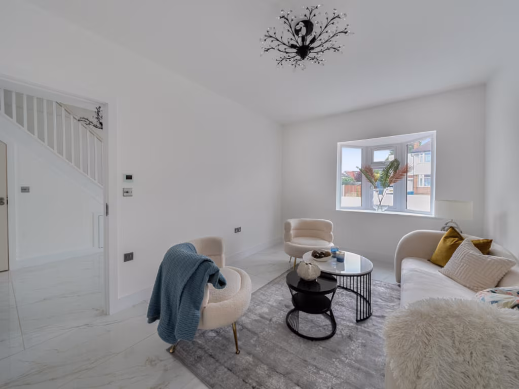
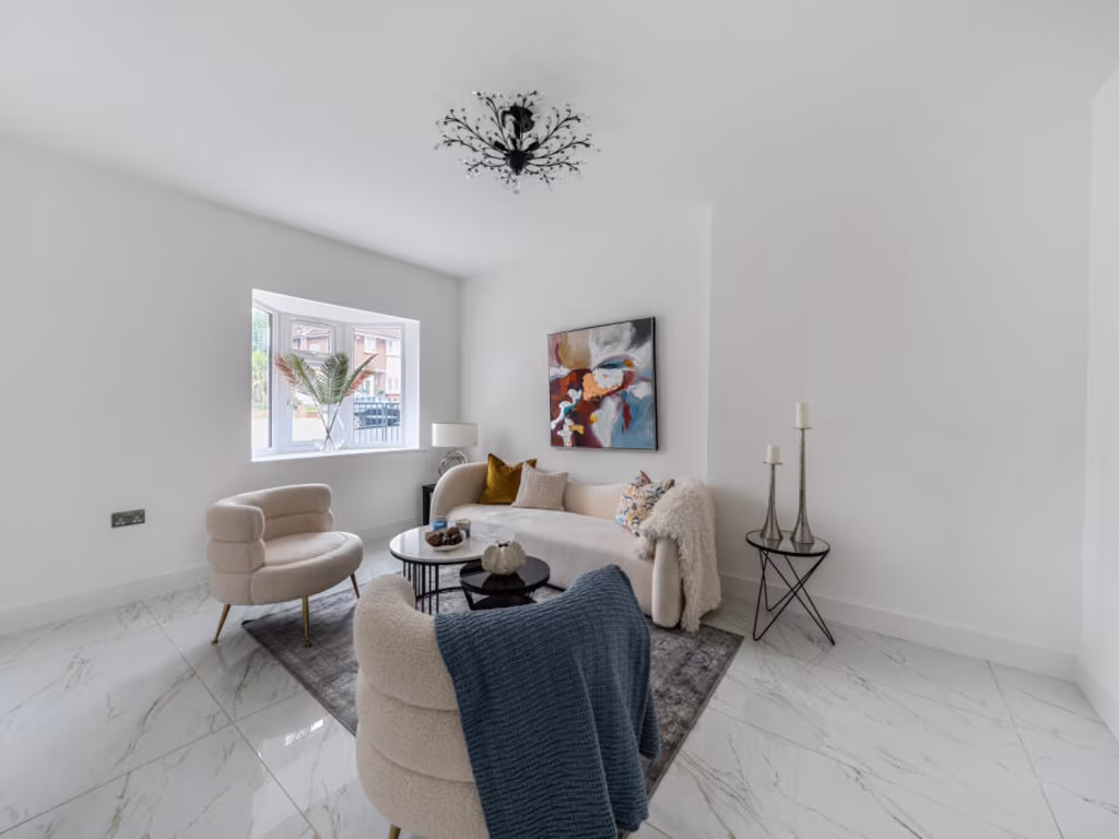
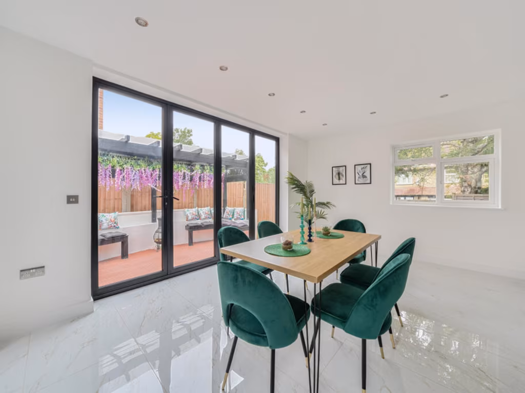
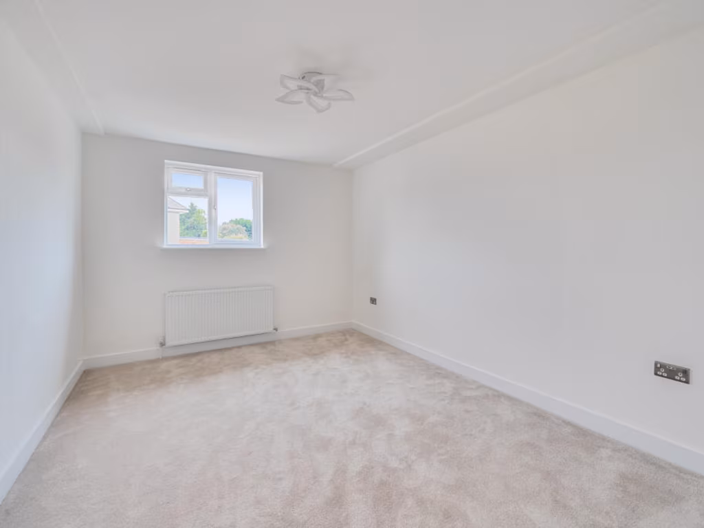
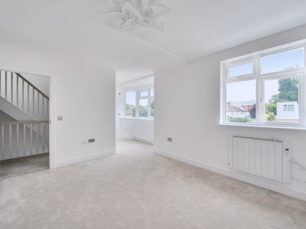
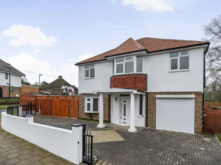
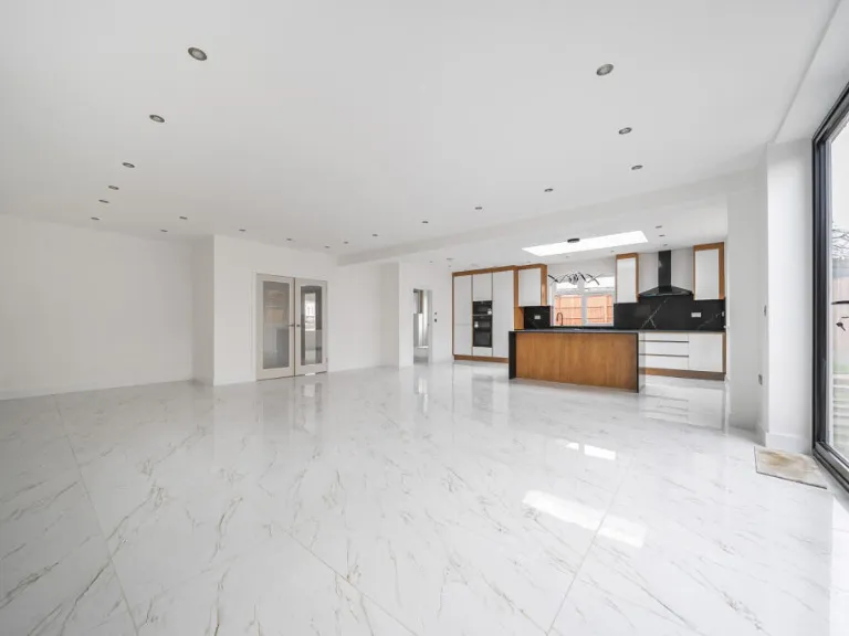
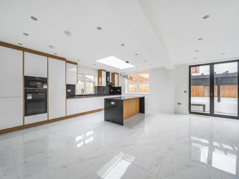
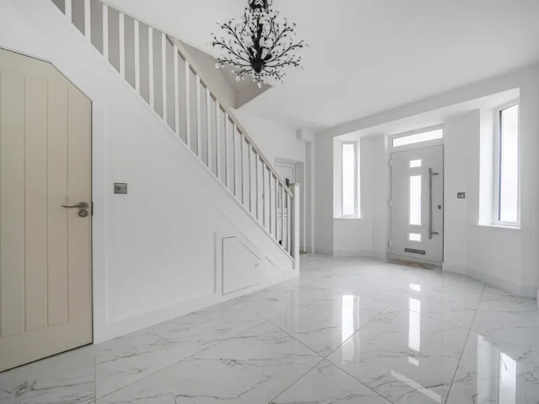
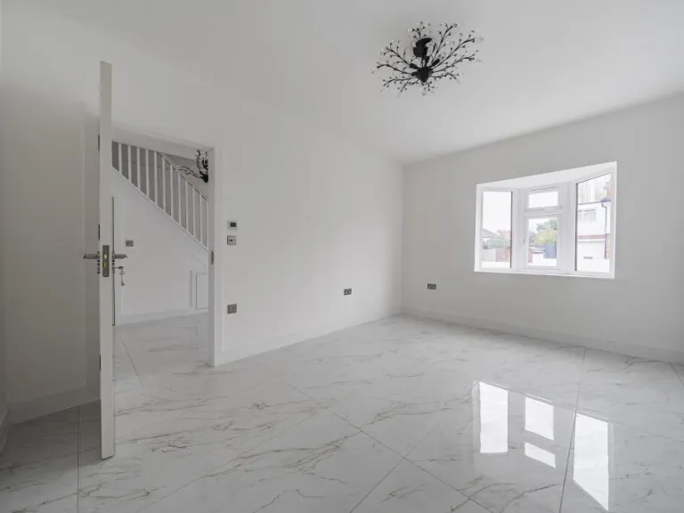
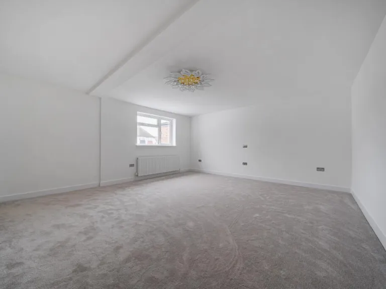
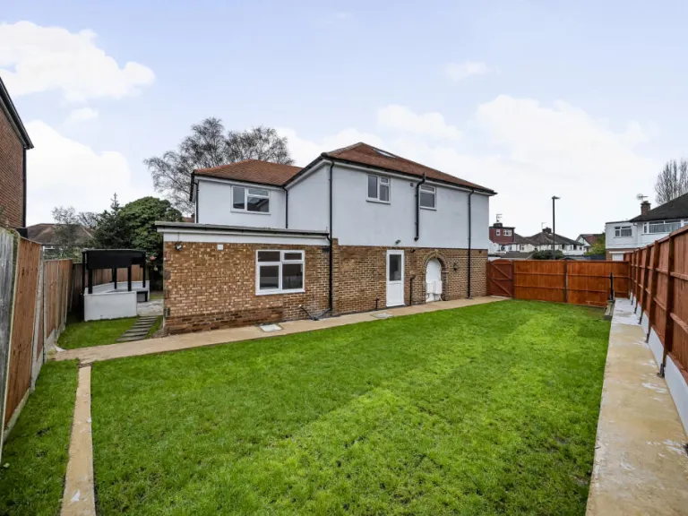
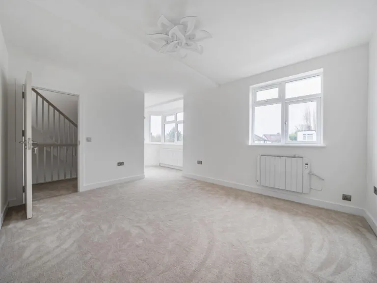
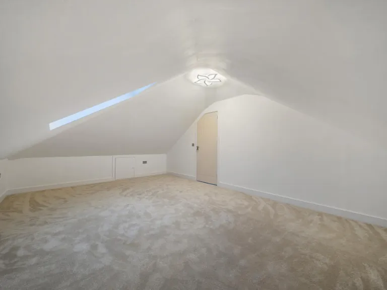
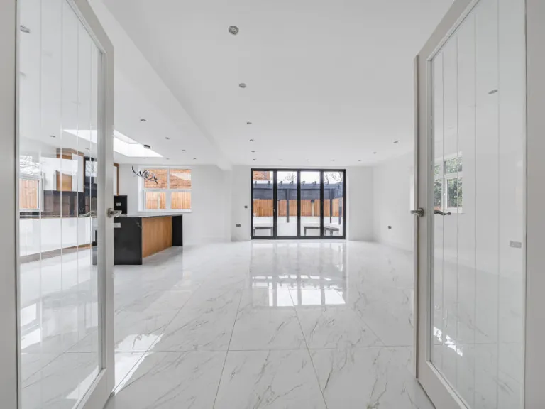
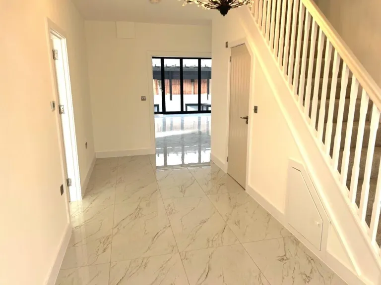
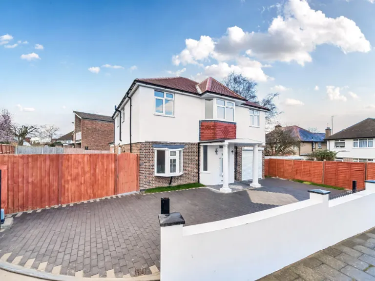
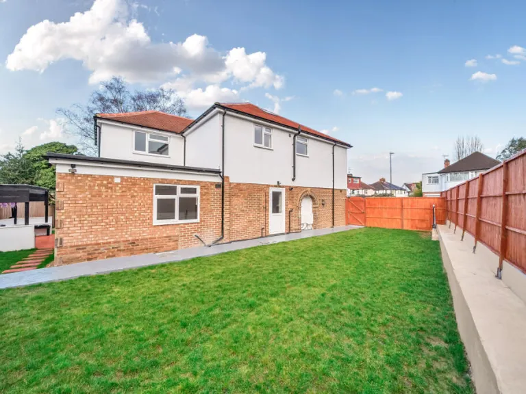
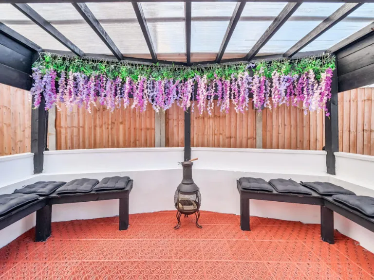
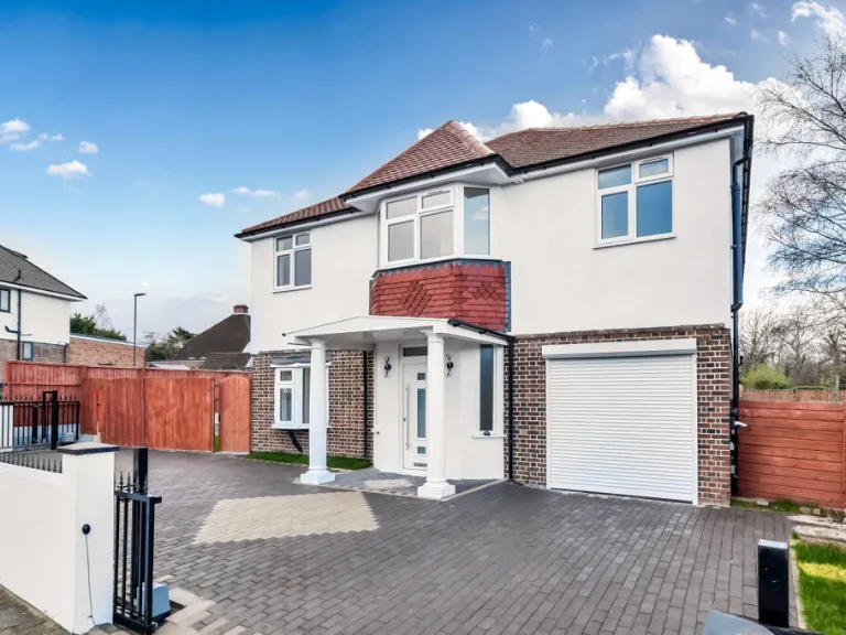
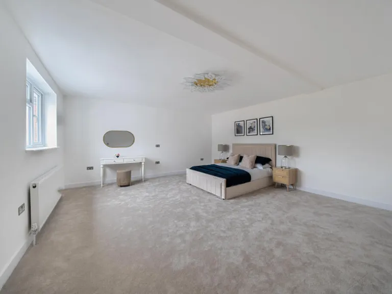
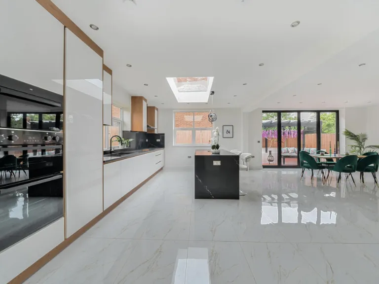
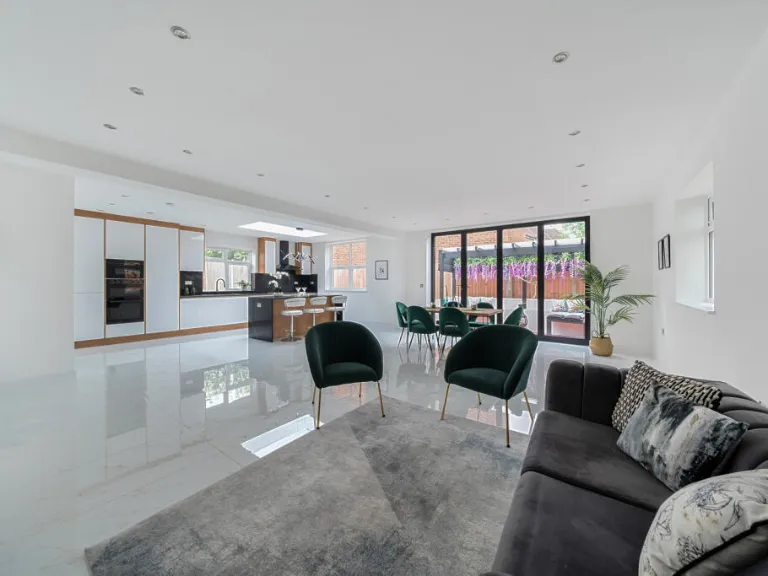
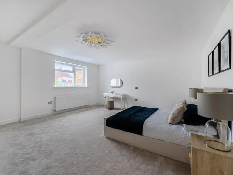
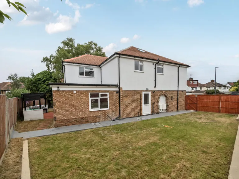
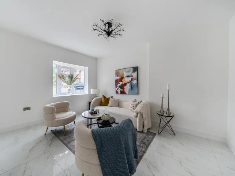
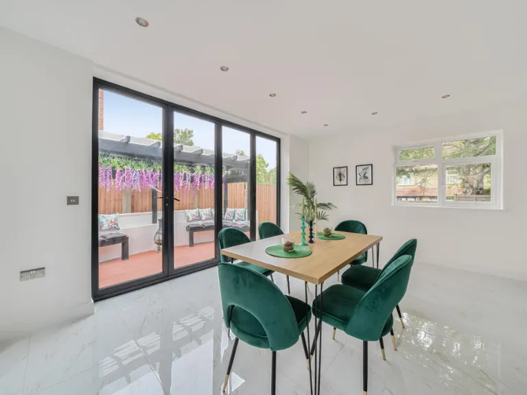
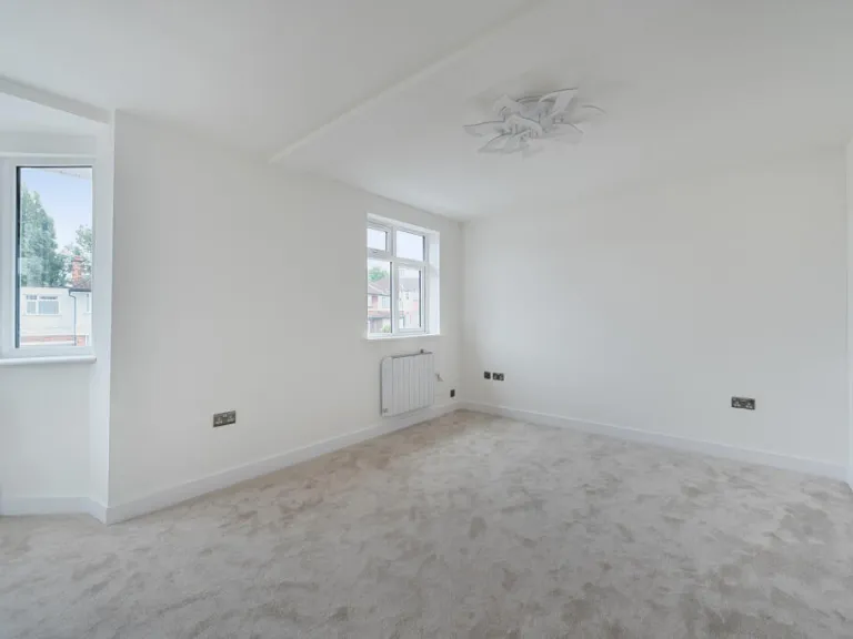
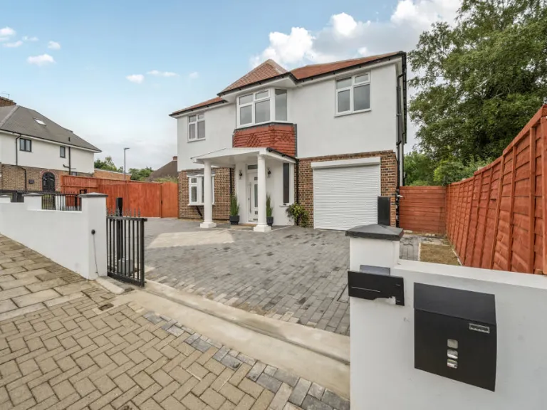
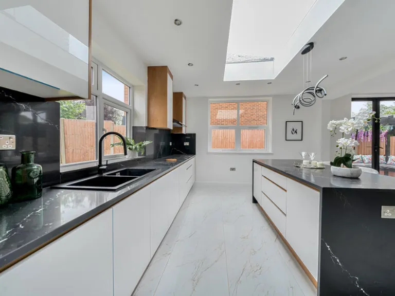
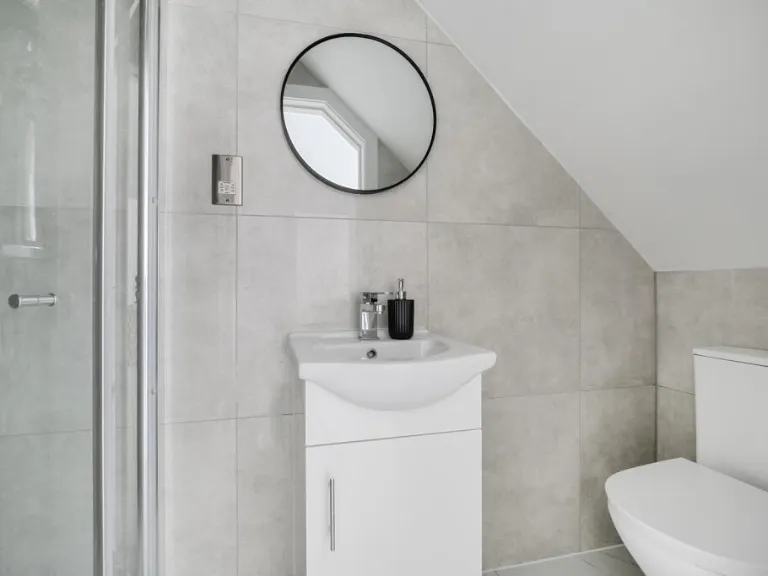
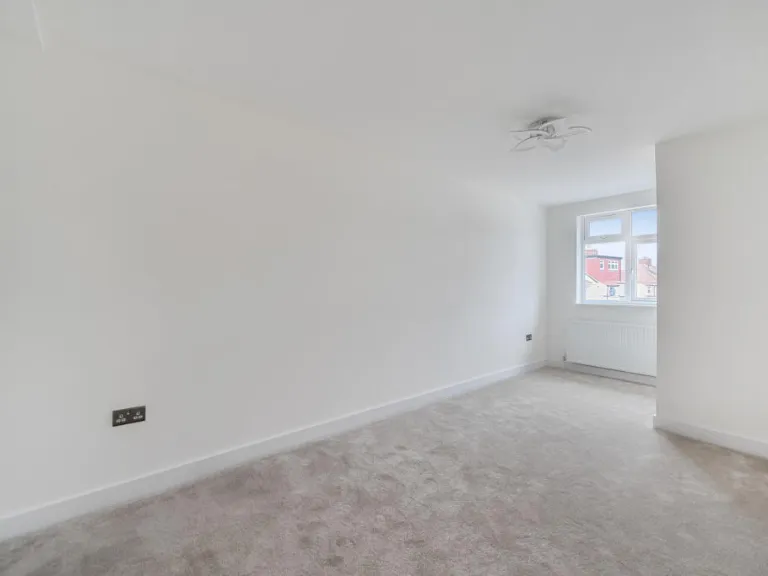
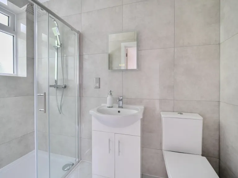
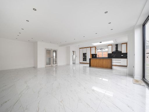
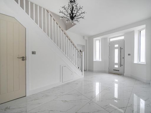
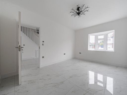
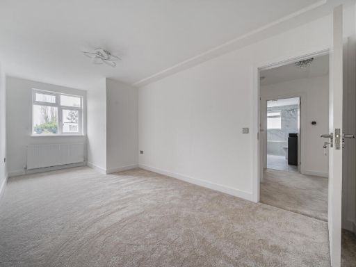
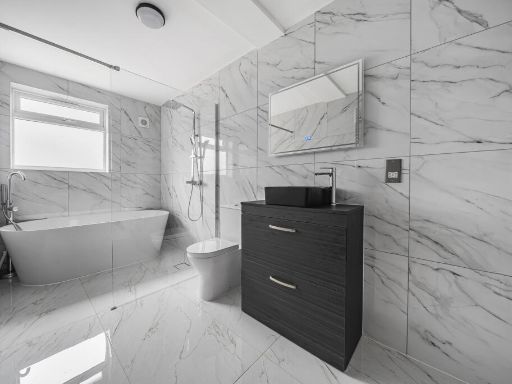
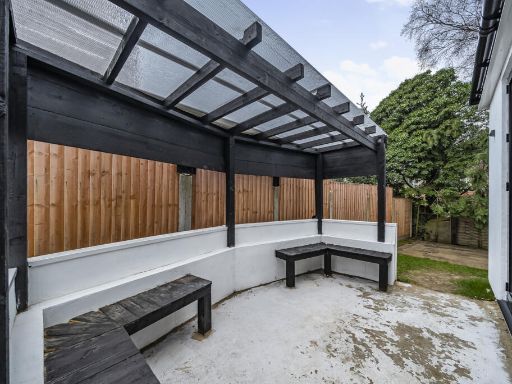
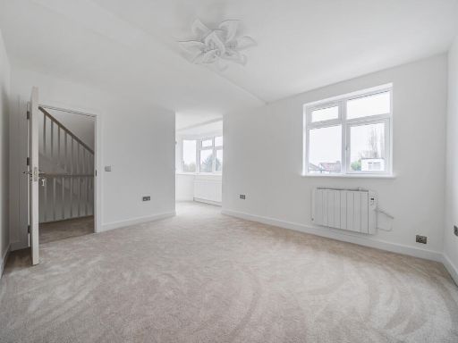
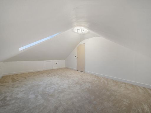
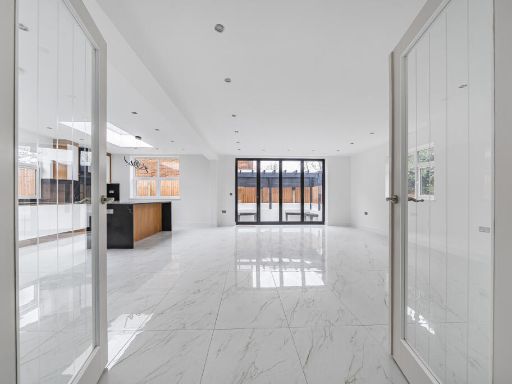
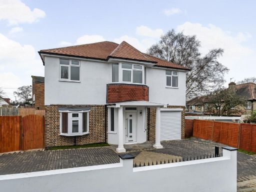
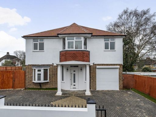
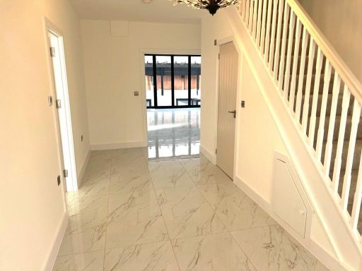
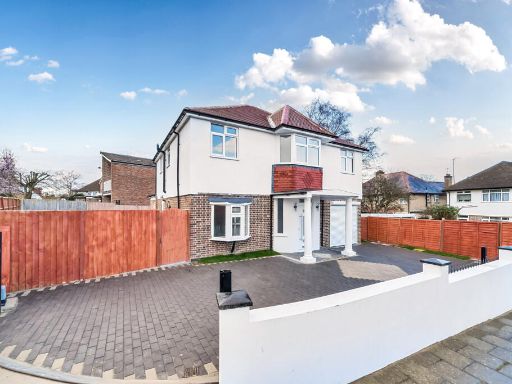
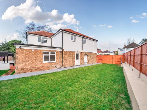
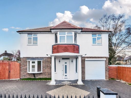
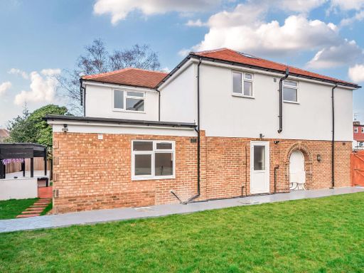
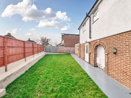
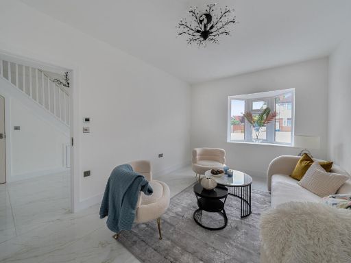
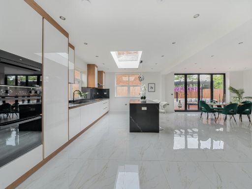
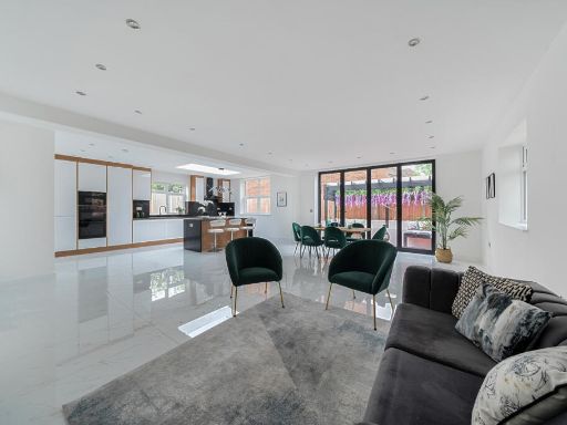
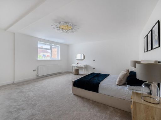
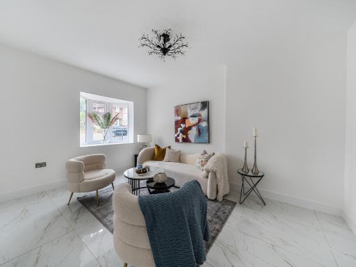
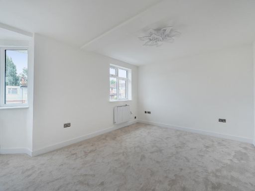
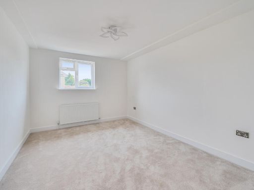
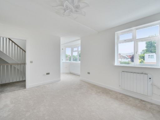
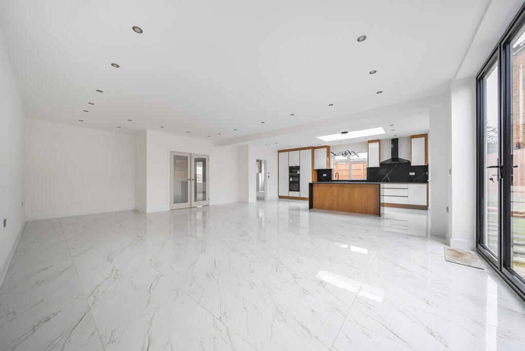
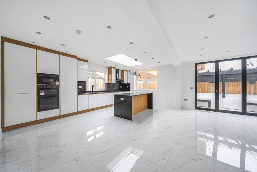
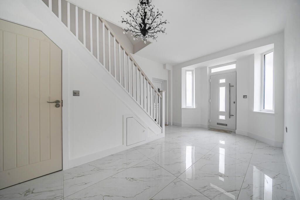
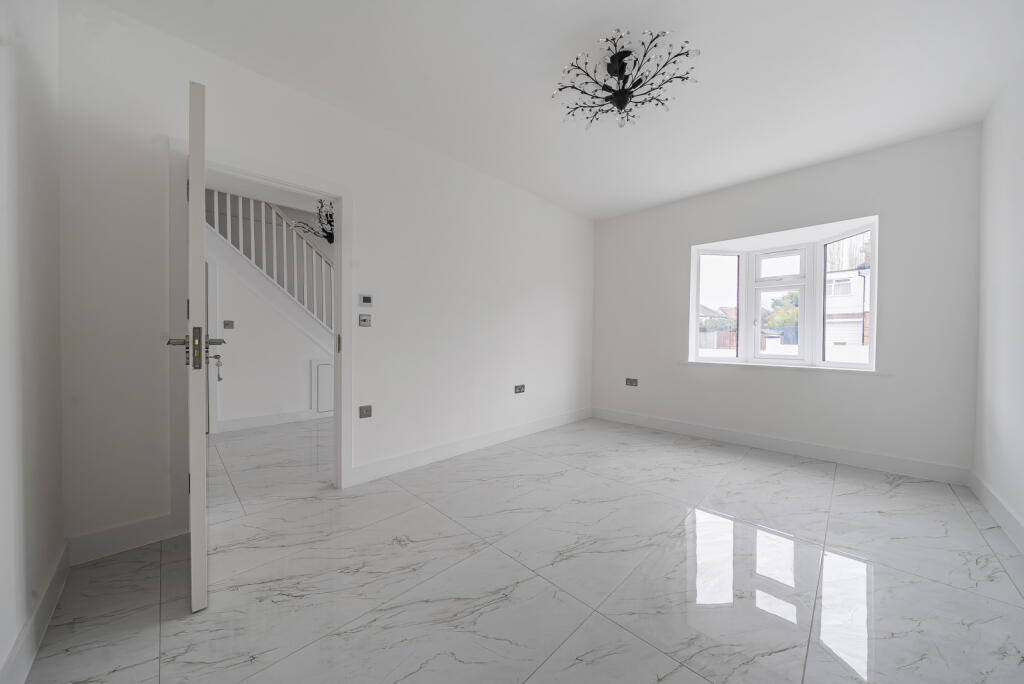
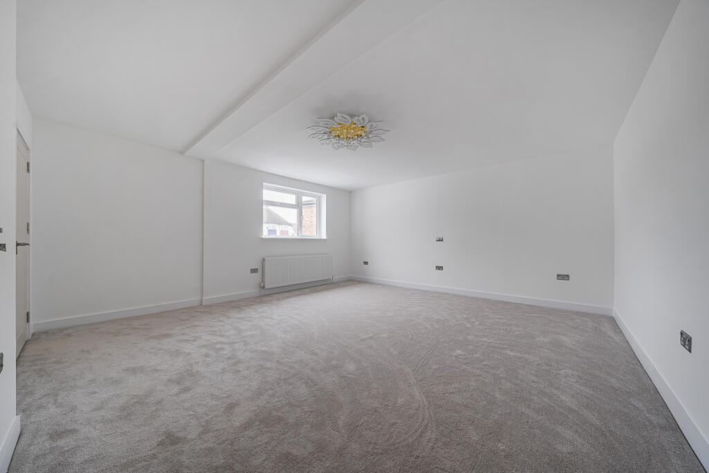
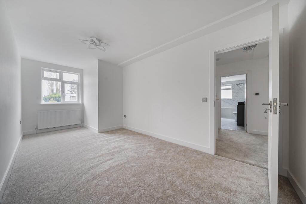
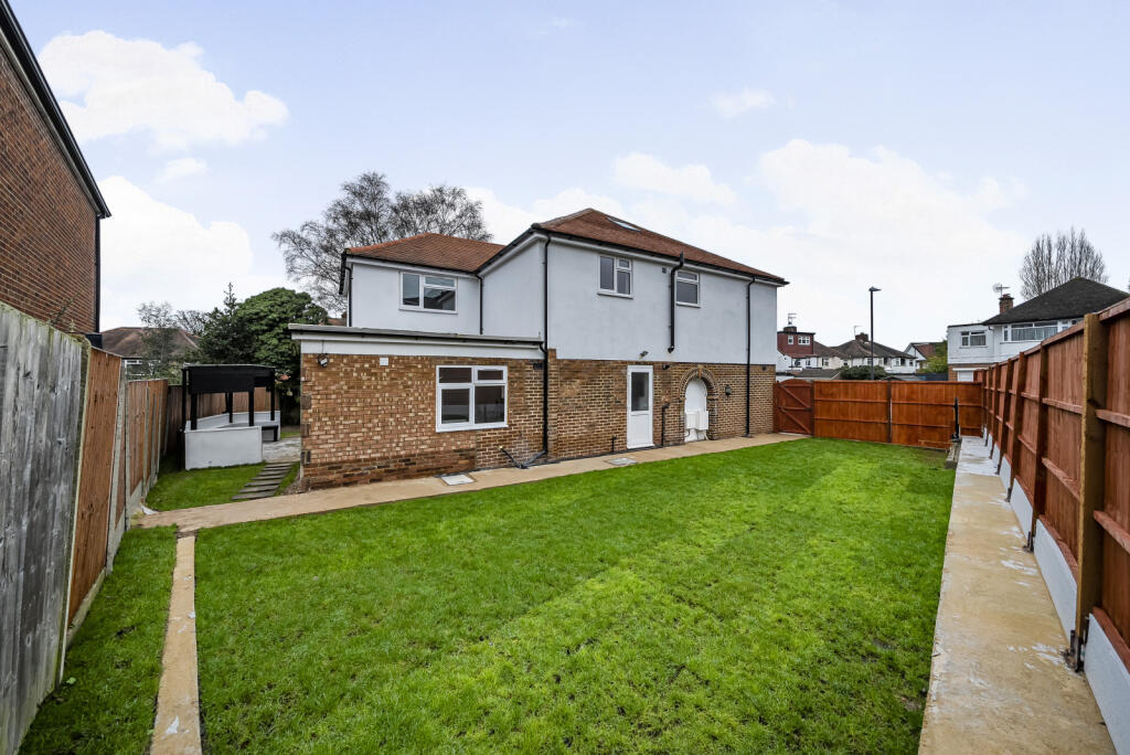
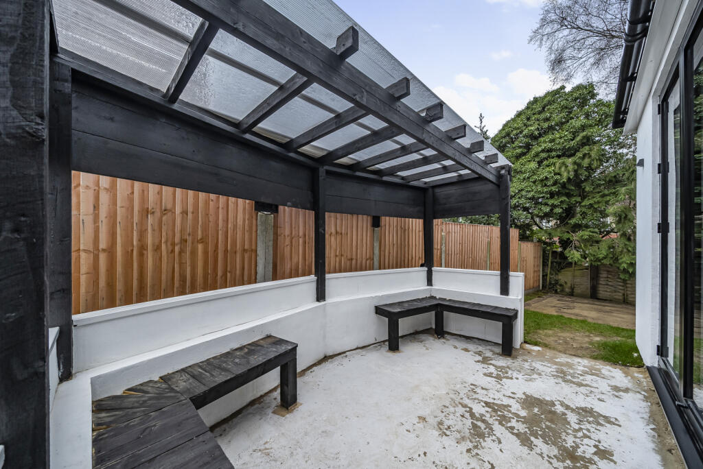
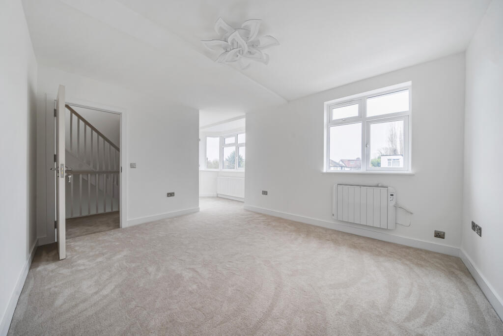
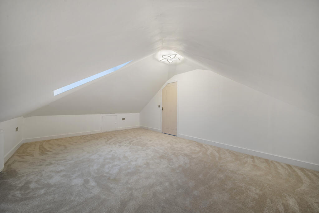
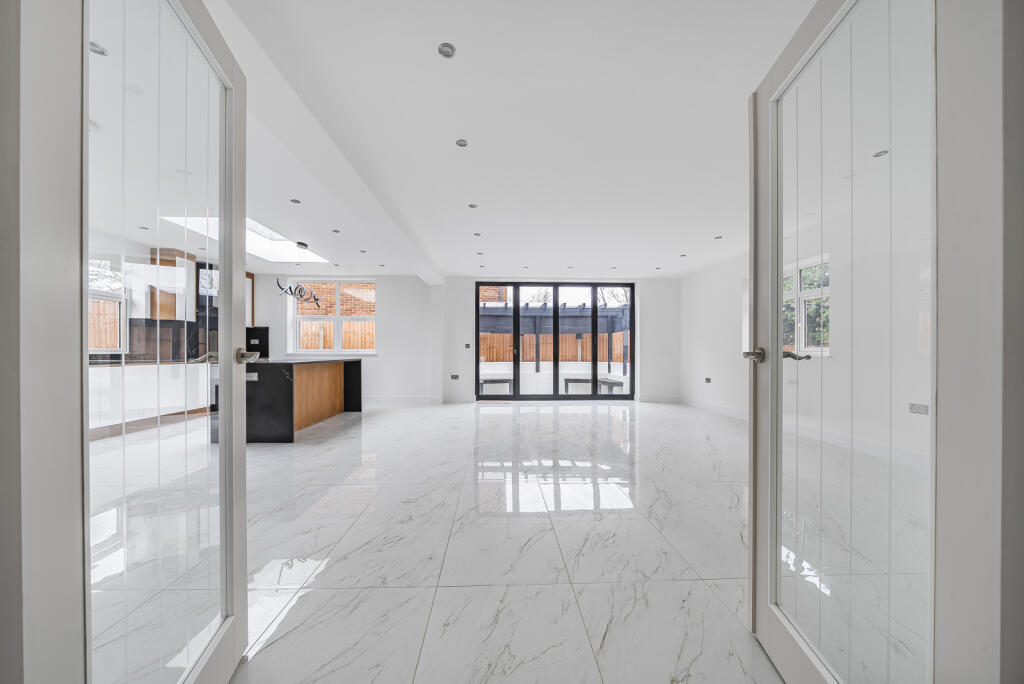
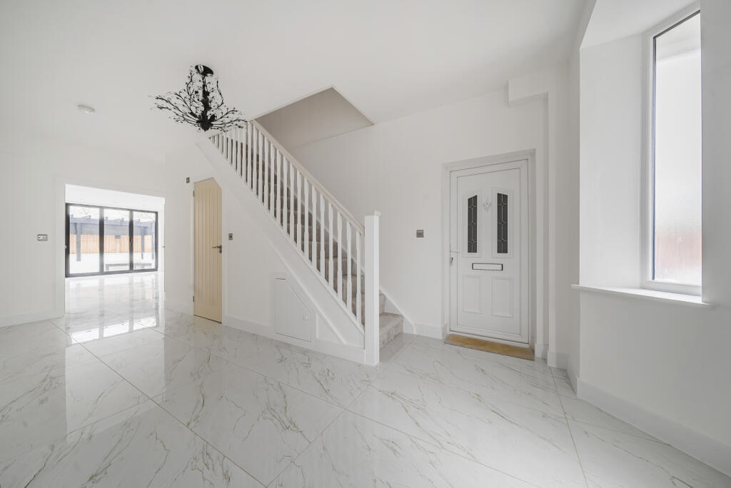
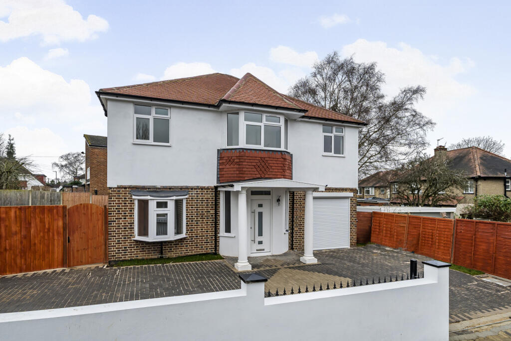
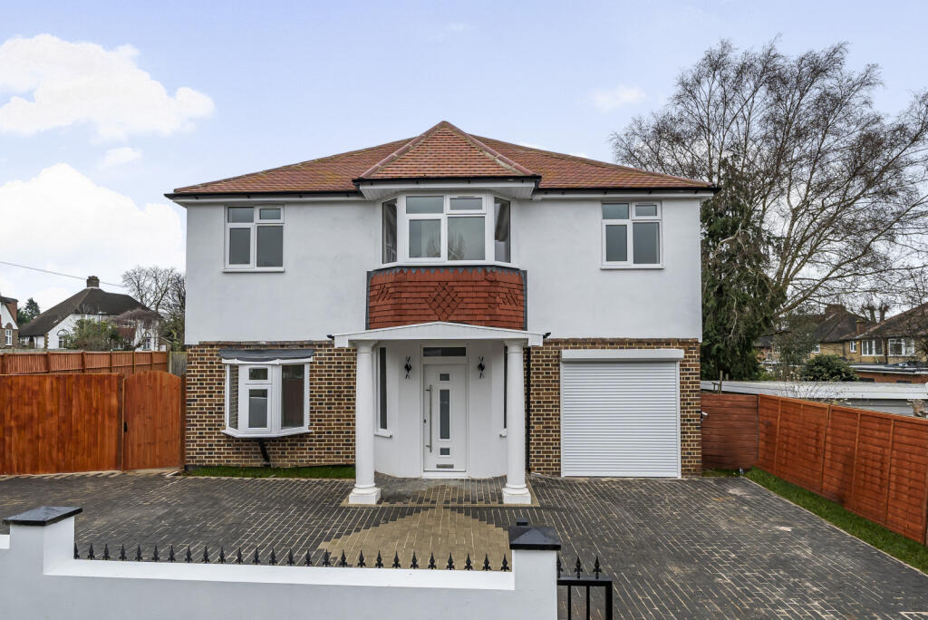
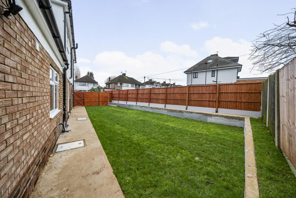
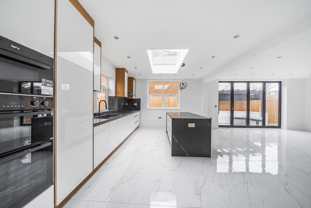
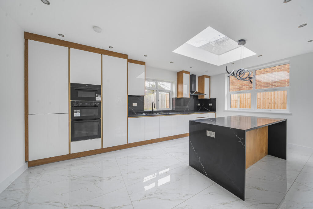
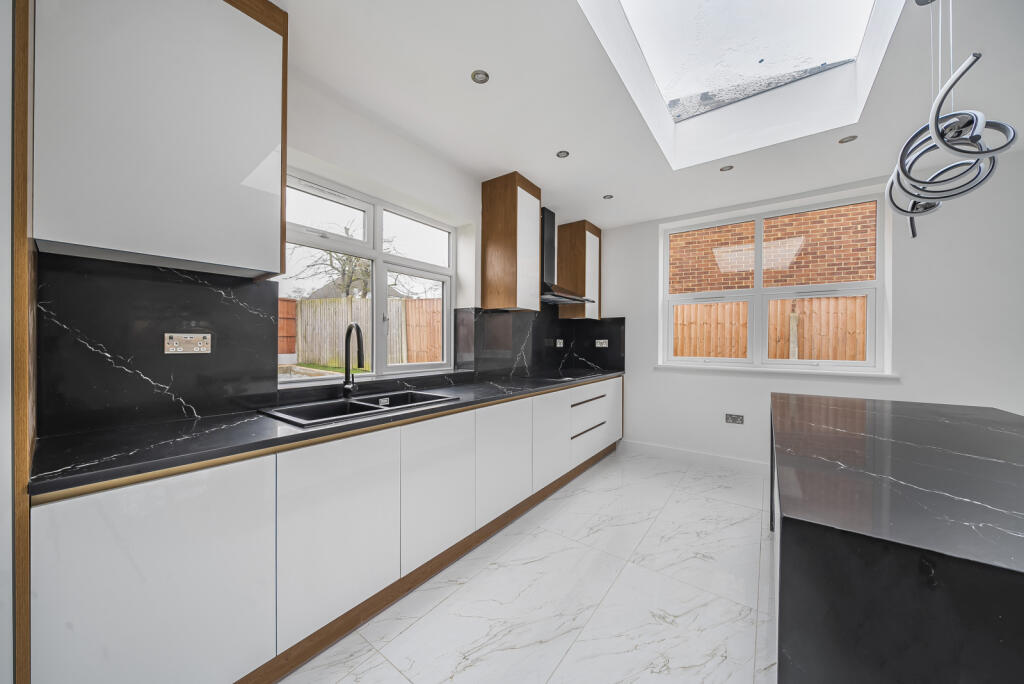
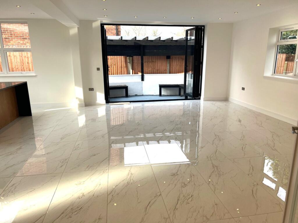
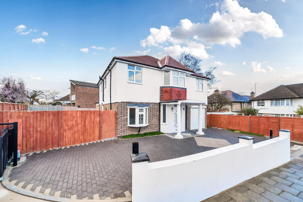
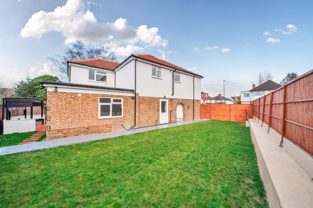
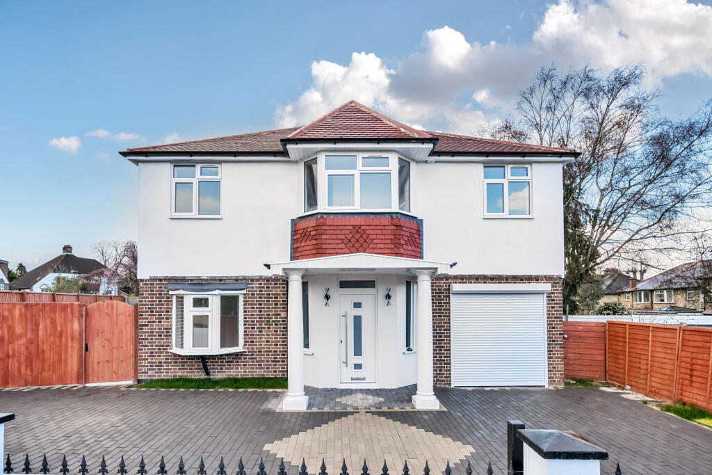
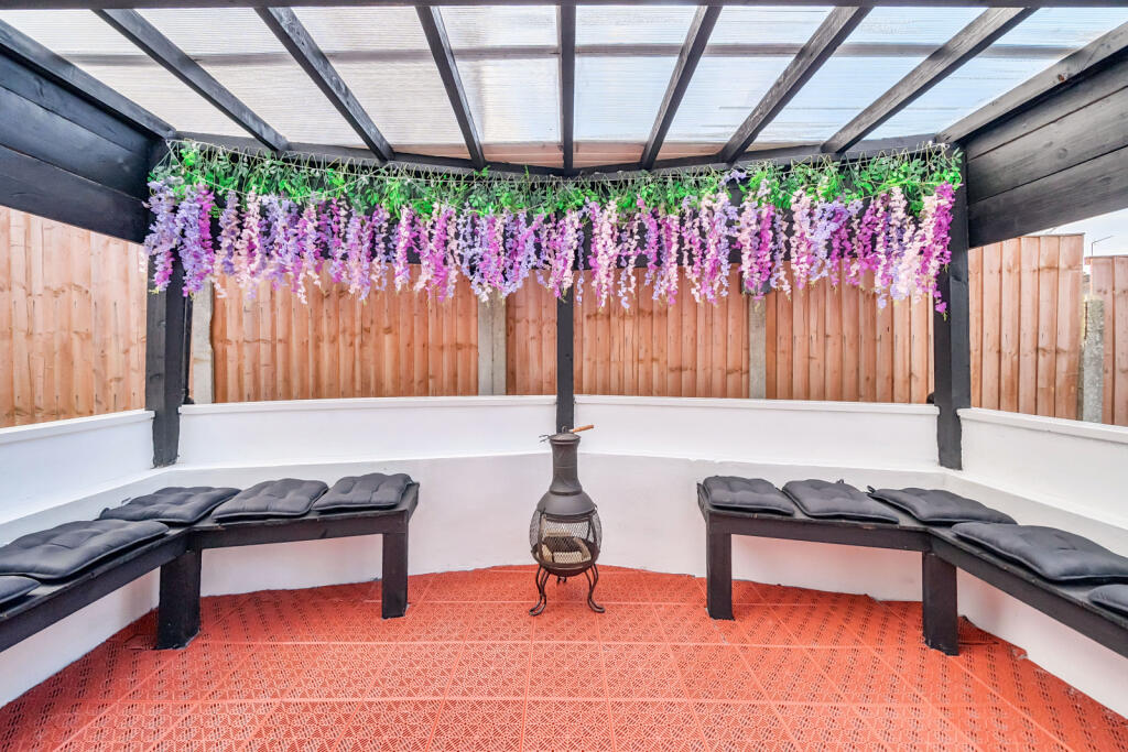
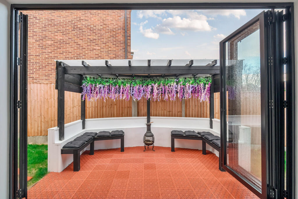
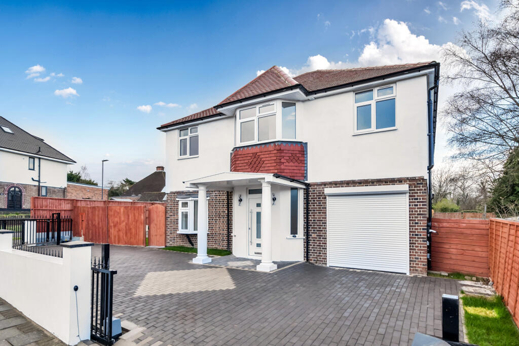
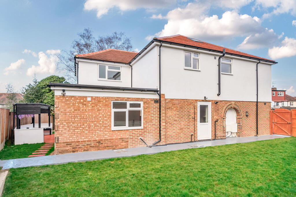
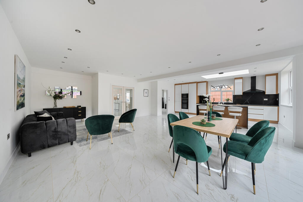
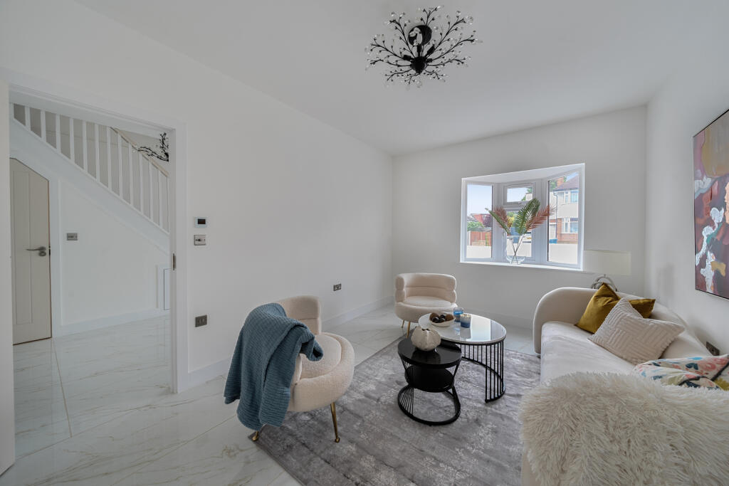
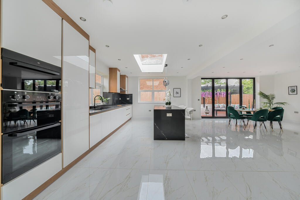
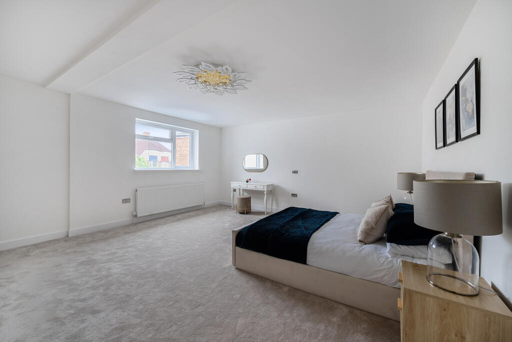
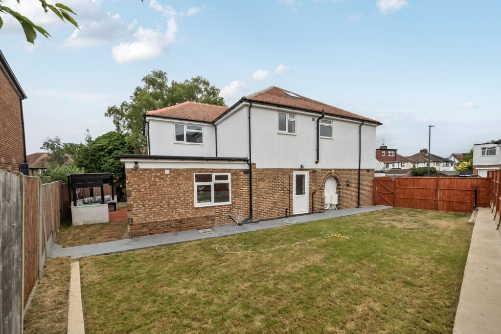
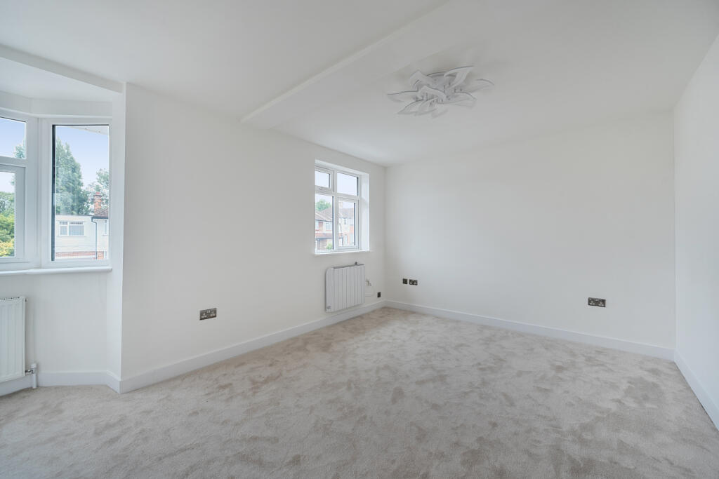
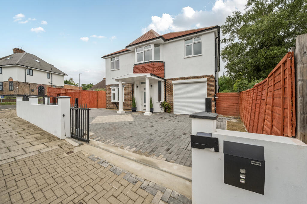
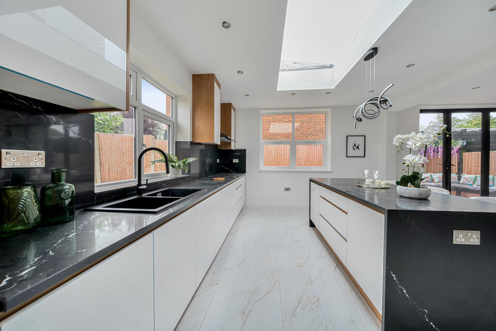
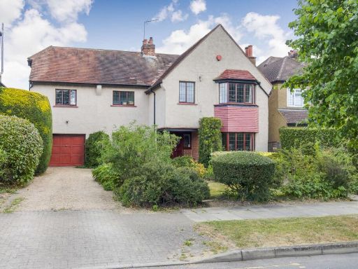
- This is a large detached property meticulously maintained in a desirable suburban area. The exterior showcases a contemporary design with a tiled roof and modern windows. The home offers expansive interior spaces, as visible from the floor plan, suggesting a generous living area, multiple bedrooms, and flexible use rooms. The front features a neatly paved driveway providing ample parking. The property is complemented by a private backyard likely suitable for moderate family gatherings or gardening enthusiasts. The overall property size appears to accommodate substantial living space ideal for a sizable family.
Image Descriptions
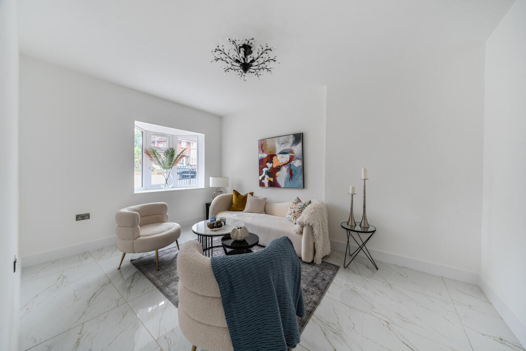
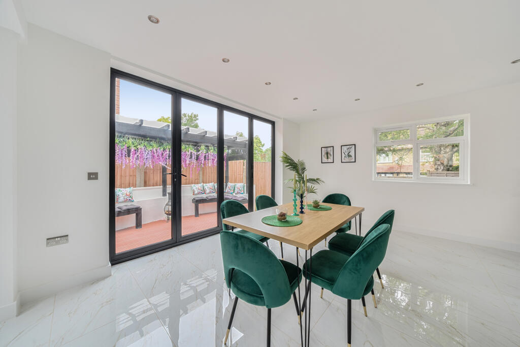
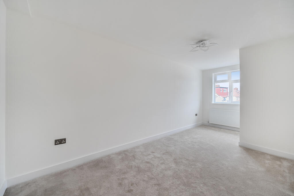
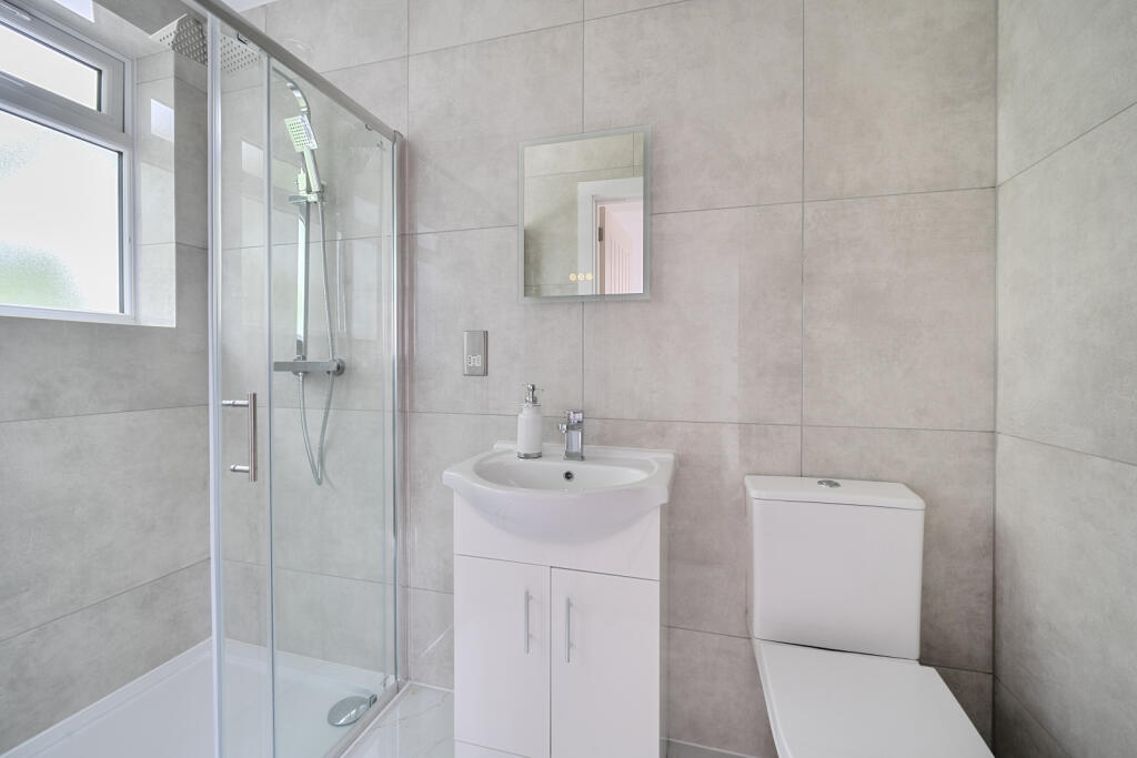
- detached house Modern
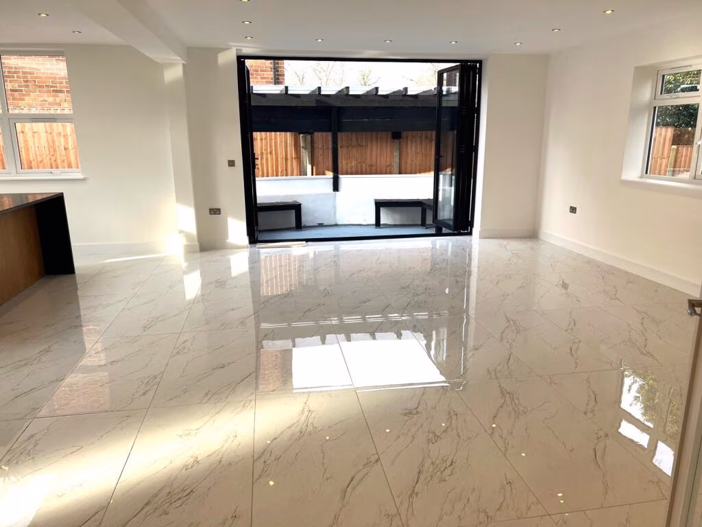
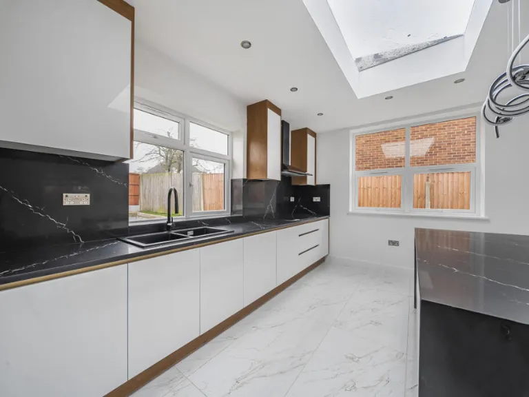
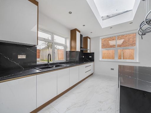
- modern open-plan interior contemporary
Floorplan Description
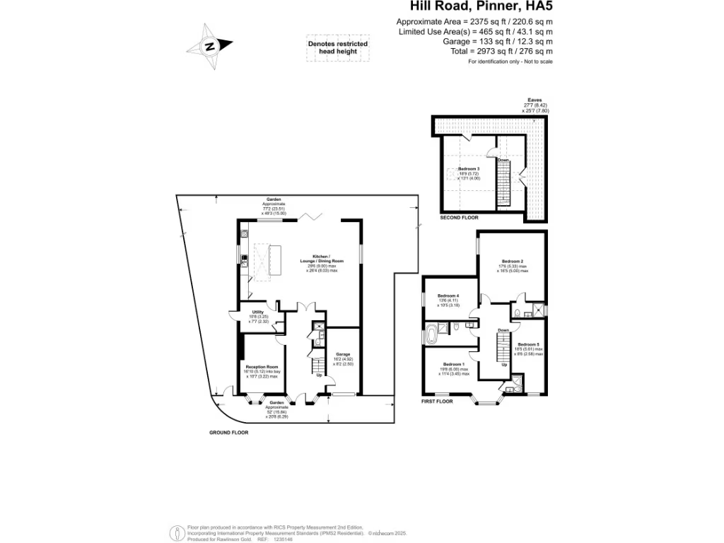
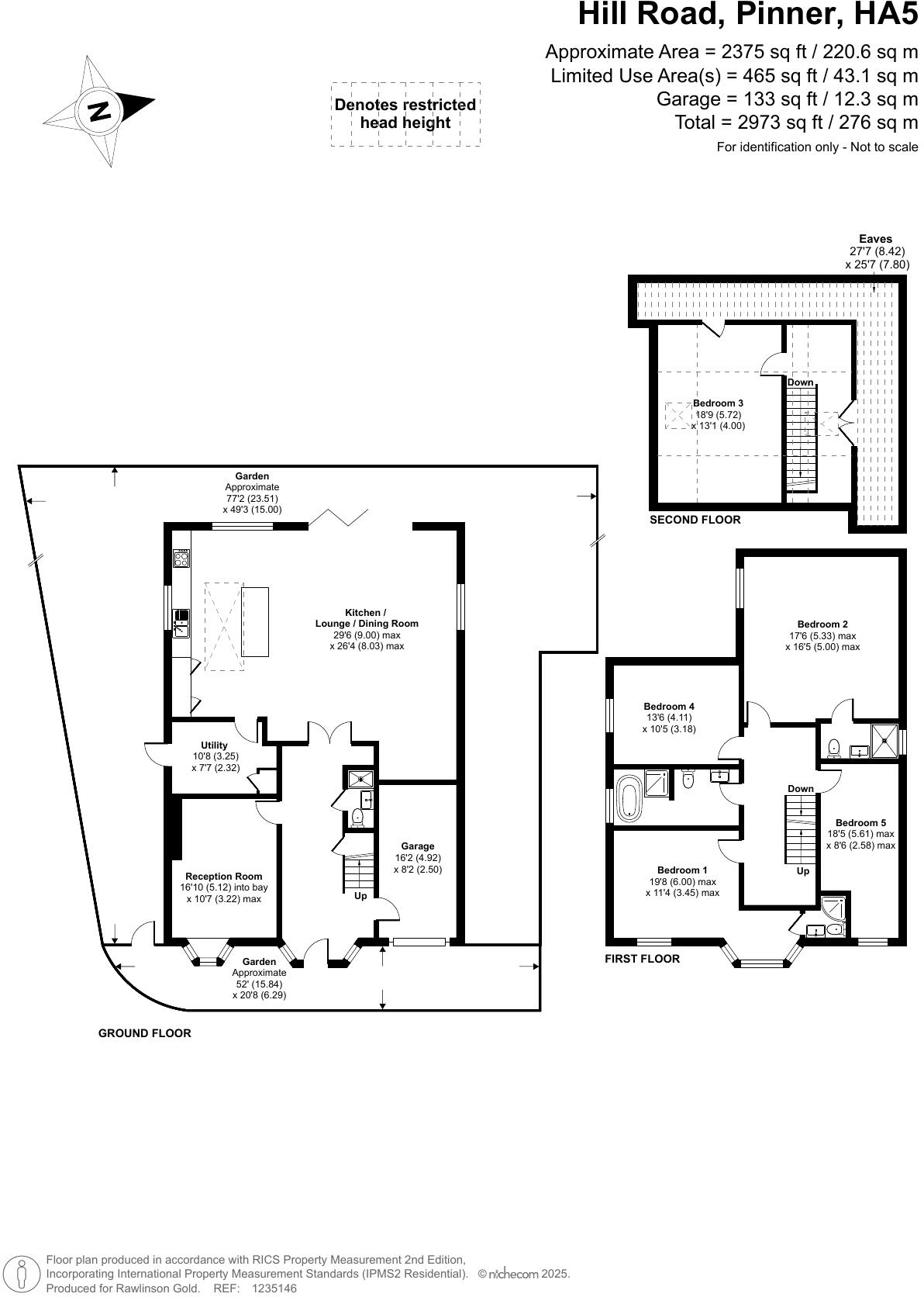
- A multi-story residential property located on Hill Road, Pinner, featuring a large kitchen/lounge/dining room and multiple bedrooms and utilities across three floors.
Rooms
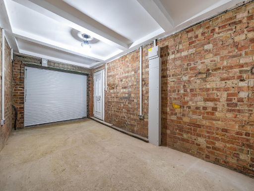
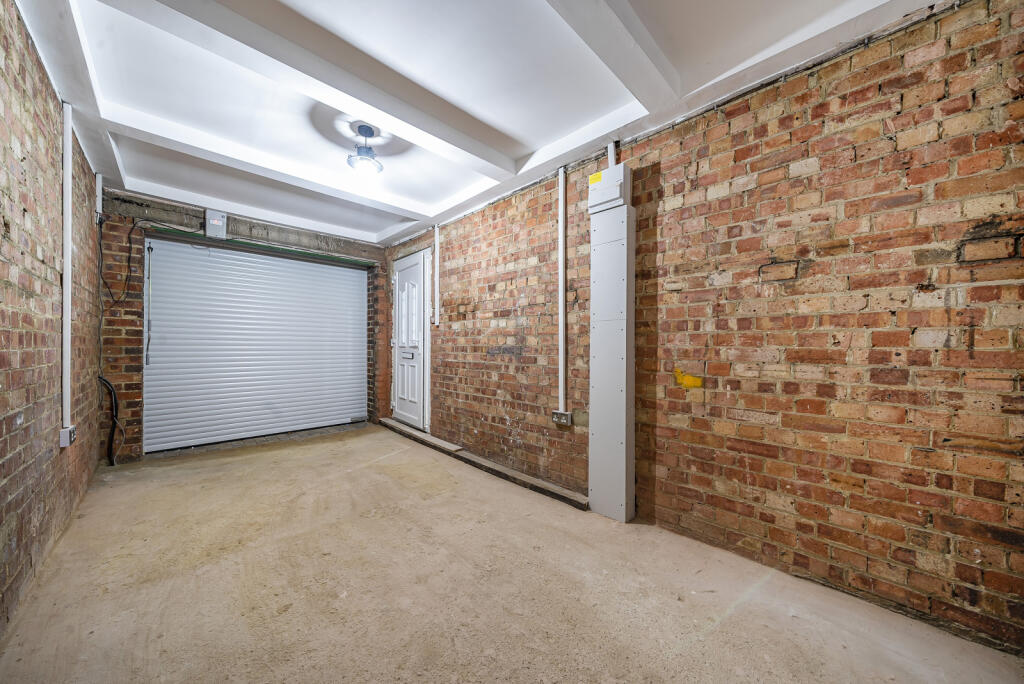
- Garage: Small
- Kitchen / Lounge / Dining Room: Large
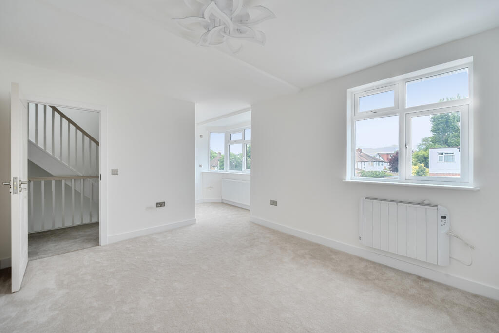
- Reception Room: Average
- Utility: Small
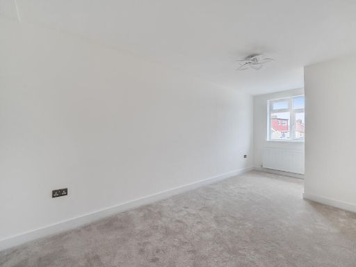
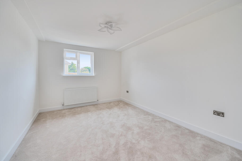
- Bedroom 1: Average
- Bedroom 2: Average
- Bedroom 3: Average
- Bedroom 4: Average
- Bedroom 5: Average
Textual Property Features
Detected Visual Features
- detached house
- modern
- garage
- garden
- two-storey
- bay window
- white exterior
- brick accents
- driveway
- suburban
- open-plan
- contemporary
- large room
- bright
- spacious
- kitchen
- high specification
- tiled floor
EPC Details
- Fully double glazed
- Cavity wall, as built, no insulation (assumed)
- Boiler and radiators, mains gas
- Low energy lighting in all fixed outlets
- Suspended, no insulation (assumed)
Nearby Schools
- Rooks Heath School
- Field End Junior School
- Coteford Infant School
- Reddiford School
- Harlyn Primary School
- Pinner Park Primary School
- UTC Heathrow
- St Swithun Wells Catholic Primary School
- Roxbourne Primary School
- Newnham Junior School
- Longfield Primary School
- Nower Hill High School
- Deanesfield Primary School
- Field End Infant School
- Newton Farm Nursery, Infant and Junior School
- Grange Primary School
- Northwood School
- Pinner Wood School
- Heathland School
- Newnham Infant and Nursery School
- Bishop Ramsey Church of England School
- Pinner High School
- Buckingham Preparatory School
- Vaughan Primary School
- Cannon Lane Primary School
- St John Fisher Catholic Primary School
- West Lodge Primary School
- Grimsdyke School
Nearest Bars And Restaurants
- Id: 1290649083
- Tags:
- Addr:
- Country: GB
- Housenumber: 137
- Street: Marsh Road
- Amenity: cafe
- Brand:
- Former_amenity: fast_food
- Name: Costa
- Old_name: KFC
- TagsNormalized:
- Lat: 51.5914475
- Lon: -0.3812133
- FullGeoHash: gcptrrfmvnfg
- PartitionGeoHash: gcpt
- Images:
- FoodStandards: null
- Distance: 742.7
,- Id: 623115300
- Tags:
- Amenity: pub
- Building: yes
- Name: Pinner Arms
- Opening_hours: Mo-Su 11:00-21:00+
- Toilets: yes
- Toilets:access: customers
- TagsNormalized:
- Lat: 51.5862267
- Lon: -0.3811724
- FullGeoHash: gcptrqfrw19k
- PartitionGeoHash: gcpt
- Images:
- FoodStandards: null
- Distance: 228
,- Id: 4681575455
- Tags:
- Amenity: vacant
- Level: 0
- Name: Fast Food Corner
- Takeaway: yes
- TagsNormalized:
- Lat: 51.5858663
- Lon: -0.3815877
- FullGeoHash: gcptrqfjkq7w
- PartitionGeoHash: gcpt
- Images:
- FoodStandards: null
- Distance: 181.2
,- Id: 5169048355
- Tags:
- Amenity: restaurant
- Cuisine: indian
- Level: 0
- Name: Gate of India
- Takeaway: yes
- TagsNormalized:
- Lat: 51.5854589
- Lon: -0.3817504
- FullGeoHash: gcptrqf50dd2
- PartitionGeoHash: gcpt
- Images:
- FoodStandards: null
- Distance: 150
,- Id: 5178568885
- Tags:
- Amenity: fast_food
- Cuisine: chinese
- Level: 0
- Name: Pinner Chef
- Takeaway: only
- TagsNormalized:
- fast food
- food
- chinese
- takeaway
- Lat: 51.5851693
- Lon: -0.3818435
- FullGeoHash: gcptrqccqksb
- PartitionGeoHash: gcpt
- Images:
- FoodStandards: null
- Distance: 135
}
Nearest General Shops
- Id: 4770679174
- Tags:
- Level: 0
- Name: Diamond Hair Design
- Shop: beauty
- TagsNormalized:
- Lat: 51.5858679
- Lon: -0.3815565
- FullGeoHash: gcptrqfjmnfb
- PartitionGeoHash: gcpt
- Images:
- FoodStandards: null
- Distance: 183.1
,- Id: 5109300716
- Tags:
- Addr:
- Housenumber: 74;76
- Street: Cannon Lane
- Level: 0
- Name: Ananna
- Shop: vacant
- TagsNormalized:
- Lat: 51.5858099
- Lon: -0.3816985
- FullGeoHash: gcptrqfj1gby
- PartitionGeoHash: gcpt
- Images:
- FoodStandards: null
- Distance: 171.4
,- Id: 5141528244
- Tags:
- Level: 0
- Name: Drinking Works
- Shop: hardware
- TagsNormalized:
- Lat: 51.5855589
- Lon: -0.38182
- FullGeoHash: gcptrqcgwvnm
- PartitionGeoHash: gcpt
- Images:
- FoodStandards: null
- Distance: 150.1
}
Nearest Grocery shops
- Id: 9399338745
- Tags:
- Addr:
- Housenumber: 74
- Postcode: HA5 5JX
- Street: Whittington Way
- Brand: Tesco Express
- Brand:wikidata: Q98456772
- Contact:
- Website: https://www.tesco.com/store-locator/pinner/74-whittington-way
- Fhrs:
- Name: Tesco Express
- Shop: convenience
- TagsNormalized:
- tesco
- tesco express
- convenience
- shop
- Lat: 51.5851724
- Lon: -0.3805143
- FullGeoHash: gcptrqfcmm5g
- PartitionGeoHash: gcpt
- Images:
- FoodStandards:
- Id: 1279005
- FHRSID: 1279005
- LocalAuthorityBusinessID: PI/000110378
- BusinessName: Tesco
- BusinessType: Retailers - supermarkets/hypermarkets
- BusinessTypeID: 7840
- AddressLine1: 74 Whittington Way
- AddressLine2: Pinner
- AddressLine3: null
- AddressLine4: null
- PostCode: null
- RatingValue: 5
- RatingKey: fhrs_5_en-GB
- RatingDate: 2020-02-07
- LocalAuthorityCode: 515
- LocalAuthorityName: Harrow
- LocalAuthorityWebSite: http://www.harrow.gov.uk
- LocalAuthorityEmailAddress: envhealth@harrow.gov.uk
- Scores:
- Hygiene: 5
- Structural: 0
- ConfidenceInManagement: 0
- NewRatingPending: false
- Geocode:
- Longitude: -0.38053370000000
- Latitude: 51.58517830000000
- Distance: 226
,- Id: 4706545159
- Tags:
- Level: 0
- Name: AJ Food City
- Shop: convenience
- TagsNormalized:
- Lat: 51.5863908
- Lon: -0.3815495
- FullGeoHash: gcptrr40t20p
- PartitionGeoHash: gcpt
- Images:
- FoodStandards: null
- Distance: 220.9
,- Id: 4693286262
- Tags:
- Brand: Londis
- Brand:wikidata: Q21008564
- Level: 0
- Name: Londis
- Shop: convenience
- TagsNormalized:
- Lat: 51.5852827
- Lon: -0.3818162
- FullGeoHash: gcptrqcfp19j
- PartitionGeoHash: gcpt
- Images:
- FoodStandards: null
- Distance: 139.5
}
Nearest Supermarkets
- Id: 627732387
- Tags:
- Brand: M&S Foodhall
- Brand:wikidata: Q714491
- Brand:wikipedia: en:Marks & Spencer
- Building: yes
- Contact:
- Website: https://www.marksandspencer.com/stores/pinner-simply-food-181
- Layer: 1
- Name: M&S Foodhall
- Shop: supermarket
- TagsNormalized:
- m&s foodhall
- supermarket
- shop
- Lat: 51.594884
- Lon: -0.3816844
- FullGeoHash: gcptx2d1fp7r
- PartitionGeoHash: gcpt
- Images:
- FoodStandards: null
- Distance: 1112.9
,- Id: 9405520532
- Tags:
- Addr:
- Housenumber: 4
- Street: Bishops Walk
- Name: M&S Foodhall
- Shop: supermarket
- TagsNormalized:
- m&s foodhall
- supermarket
- shop
- Lat: 51.5941553
- Lon: -0.3811969
- FullGeoHash: gcptx26mtrwu
- PartitionGeoHash: gcpt
- Images:
- FoodStandards: null
- Distance: 1037.8
,- Id: 484919611
- Tags:
- Addr:
- City: Pinner
- Housenumber: 12
- Postcode: HA5 5LU
- Street: Barters Walk
- Brand: Sainsbury's
- Brand:wikidata: Q152096
- Building: retail
- Name: Sainsbury's
- Opening_hours: Mo-Sa 07:00-22:00; Su 10:00-16:00; PH 09:00-19:00
- Phone: +44 20 8868 1399
- Shop: supermarket
- Website: https://stores.sainsburys.co.uk/0504/pinner
- TagsNormalized:
- sainsburys
- retail
- supermarket
- shop
- Lat: 51.593358
- Lon: -0.3807717
- FullGeoHash: gcptx269p7h0
- PartitionGeoHash: gcpt
- Images:
- FoodStandards: null
- Distance: 956.5
}
Nearest Religious buildings
- Id: 4756123397
- Tags:
- Amenity: place_of_worship
- Name: New Testament Church of God
- Religion: christian
- TagsNormalized:
- place of worship
- church
- christian
- Lat: 51.5775923
- Lon: -0.3827588
- FullGeoHash: gcptrm3m3046
- PartitionGeoHash: gcpt
- Images:
- FoodStandards: null
- Distance: 822.2
,- Id: 1319476810
- Tags:
- Amenity: place_of_worship
- Name: Pinner Synagogue
- Religion: jewish
- TagsNormalized:
- place of worship
- synagogue
- jewish
- Lat: 51.5917459
- Lon: -0.3808724
- FullGeoHash: gcptrrfxtn2z
- PartitionGeoHash: gcpt
- Images:
- FoodStandards: null
- Distance: 780.7
,- Id: 4693286257
- Tags:
- Amenity: place_of_worship
- Building: church
- Denomination: methodist
- Name: Cannon Lane Methodist Church
- Religion: christian
- TagsNormalized:
- place of worship
- church
- methodist
- christian
- Lat: 51.5801818
- Lon: -0.3814131
- FullGeoHash: gcptrmfk26vc
- PartitionGeoHash: gcpt
- Images:
- FoodStandards: null
- Distance: 555.6
}
Nearest Medical buildings
- Id: 52994804
- Tags:
- Addr:
- Postcode: HA5 1TG
- Street: Abbotsbury Gardens
- Alt_name: The Devonshire Lodge Practice
- Amenity: public_building
- Building: yes
- Name: Eastcote Health Centre
- TagsNormalized:
- public building
- health
- health centre
- Lat: 51.5792569
- Lon: -0.3974618
- FullGeoHash: gcptqvwwfqrh
- PartitionGeoHash: gcpt
- Images:
- FoodStandards: null
- Distance: 1139
,- Id: 5375414528
- Tags:
- Amenity: dentist
- Healthcare: dentist
- Level: 0
- Name: Apple Dental Studios
- TagsNormalized:
- dentist
- health
- healthcare
- dental
- studio
- Lat: 51.5924924
- Lon: -0.3818564
- FullGeoHash: gcptx21un1eh
- PartitionGeoHash: gcpt
- Images:
- FoodStandards: null
- Distance: 847.9
,- Id: 1312678756
- Tags:
- Addr:
- Amenity: pharmacy
- Dispensing: yes
- Name: GOR Pharmacy
- TagsNormalized:
- Lat: 51.5916748
- Lon: -0.3815594
- FullGeoHash: gcptrrfpm10x
- PartitionGeoHash: gcpt
- Images:
- FoodStandards: null
- Distance: 762.1
,- Id: 5291648498
- Tags:
- Amenity: dentist
- Healthcare: dentist
- Level: 0
- TagsNormalized:
- Lat: 51.5851142
- Lon: -0.3818592
- FullGeoHash: gcptrqccn430
- PartitionGeoHash: gcpt
- Images:
- FoodStandards: null
- Distance: 133
}
Nearest Airports
- Id: 14001268
- Tags:
- Access: yes
- Aerodrome: international
- Aerodrome:type: public
- Aeroway: aerodrome
- Alt_name: London Heathrow
- Alt_name_2: London Heathrow Airport
- Ele: 25
- Iata: LHR
- Icao: EGLL
- Int_name: Heathrow Airport
- Name: London Heathrow Airport
- Note: area still approx
- Old_name: London Airport
- Operator: Heathrow Airport Limited
- Rank_aci:
- Ref: LHR
- Short_name: Heathrow
- Type: multipolygon
- Website: https://www.heathrow.com/
- Wikidata: Q8691
- Wikipedia: en:Heathrow Airport
- TagsNormalized:
- airport
- international airport
- Lat: 51.4677522
- Lon: -0.4547736
- FullGeoHash: gcpsv9kv7h2h
- PartitionGeoHash: gcps
- Images:
- FoodStandards: null
- Distance: 13927.9
}
Nearest Leisure Facilities
- Id: 747924253
- Tags:
- TagsNormalized:
- Lat: 51.5893161
- Lon: -0.3919517
- FullGeoHash: gcptrpd9dce9
- PartitionGeoHash: gcpt
- Images:
- FoodStandards: null
- Distance: 744.6
,- Id: 109246190
- Tags:
- Leisure: pitch
- Name: West End Lawn Tennis Club
- Sport: tennis
- TagsNormalized:
- pitch
- leisure
- tennis
- club
- sports
- Lat: 51.5904347
- Lon: -0.3895389
- FullGeoHash: gcptrpu2544d
- PartitionGeoHash: gcpt
- Images:
- FoodStandards: null
- Distance: 727.8
,- Id: 36882861
- Tags:
- TagsNormalized:
- Lat: 51.579212
- Lon: -0.3794865
- FullGeoHash: gcptrmewtq42
- PartitionGeoHash: gcpt
- Images:
- FoodStandards: null
- Distance: 704.2
,- Id: 45695255
- Tags:
- Leisure: pitch
- Sport: tennis
- TagsNormalized:
- Lat: 51.590093
- Lon: -0.3822219
- FullGeoHash: gcptrr9wjd6e
- PartitionGeoHash: gcpt
- Images:
- FoodStandards: null
- Distance: 580.7
,- Id: 11842463
- Tags:
- Leisure: park
- Name: Pinner Village Gardens
- TagsNormalized:
- Lat: 51.5873291
- Lon: -0.3778754
- FullGeoHash: gcptrrhvfz5s
- PartitionGeoHash: gcpt
- Images:
- FoodStandards: null
- Distance: 484.9
}
Nearest Tourist attractions
- Id: 559262652
- Tags:
- Addr:
- Name: Harrow Museum
- Tourism: museum
- Wikidata: Q15223102
- Wikipedia: en:Harrow Museum
- TagsNormalized:
- Lat: 51.5945827
- Lon: -0.3543766
- FullGeoHash: gcptxbtbnrmd
- PartitionGeoHash: gcpt
- Images:
- FoodStandards: null
- Distance: 2295.1
,- Id: 438245354
- Tags:
- Building: yes
- Name: Heath Robinson Museum
- Source: bing; survey
- Tourism: museum
- Wikidata: Q26689465
- TagsNormalized:
- Lat: 51.5927152
- Lon: -0.3866848
- FullGeoHash: gcptx0nmme4y
- PartitionGeoHash: gcpt
- Images:
- FoodStandards: null
- Distance: 885.6
,- Id: 4324851538
- Tags:
- TagsNormalized:
- Lat: 51.5927205
- Lon: -0.3864747
- FullGeoHash: gcptx0nt6kpt
- PartitionGeoHash: gcpt
- Images:
- FoodStandards: null
- Distance: 883
}
Nearest Hotels
- Id: 374134558
- Tags:
- Building: yes
- Name: The Barn Hotel
- Tourism: hotel
- TagsNormalized:
- Lat: 51.5702877
- Lon: -0.4220013
- FullGeoHash: gcptqkhdwwmh
- PartitionGeoHash: gcpt
- Images:
- FoodStandards: null
- Distance: 3105.2
,- Id: 135560983
- Tags:
- Addr:
- Housenumber: 56-60
- Postcode: HA2 0DW
- Street: Northolt Road
- Suburb: South Harrow
- Building:
- Email: premierharrow@eurotravellerhotel.com
- Fax: +44 20 8515 0829
- Fhrs:
- Name: Eurotraveller Premier Hotel @ Harrow
- Phone: +44 20 8515 0820
- Source:
- Tourism: hotel
- Website: http://www.eurotravellerhotel.com/premier-hotel-harrow.html
- TagsNormalized:
- Lat: 51.5687982
- Lon: -0.3480998
- FullGeoHash: gcpv25fd08tz
- PartitionGeoHash: gcpv
- Images:
- FoodStandards: null
- Distance: 3050.3
,- Id: 3296315868
- Tags:
- Addr:
- City: Harrow
- Housename: Harrow Hotel
- Housenumber: 12-22
- Postcode: HA1 4HZ
- Street: Pinner Road
- Name: Harrow Hotel
- Note: May be changing hands or shutting down. http://www.harrow-hotel.co.uk/about/index.htm
- Source: survey,Bing, http://www.harrow-hotel.co.uk/about/index.htm
- Tourism: hotel
- TagsNormalized:
- Lat: 51.5811585
- Lon: -0.3428417
- FullGeoHash: gcpv2nn650ye
- PartitionGeoHash: gcpv
- Images:
- FoodStandards: null
- Distance: 2859.1
}
Tags
- detached house
- modern
- garage
- garden
- two-storey
- bay window
- white exterior
- brick accents
- driveway
- suburban
- modern
- open-plan
- contemporary
- large room
- bright
- spacious
- kitchen
- high specification
- tiled floor
Local Market Stats
- Average Price/sqft: £595
- Avg Income: £64900
- Rental Yield: 3.4%
- Social Housing: 8%
- Planning Success Rate: 75%
AirBnB Data
- 1km average: £65/night
- Listings in 1km: 1
Similar Properties
 5 bedroom detached house for sale in High View, Pinner, HA5 — £1,650,000 • 5 bed • 3 bath • 2421 ft²
 5 bedroom detached house for sale in Hillcroft Avenue, Pinner, HA5 — £1,150,000 • 5 bed • 3 bath • 2100 ft²
 5 bedroom detached house for sale in Eastcote Road, Pinner, HA5 — £1,298,000 • 5 bed • 4 bath • 2587 ft²
 4 bedroom detached house for sale in Potter Street Hill, Pinner, HA5 — £2,000,000 • 4 bed • 4 bath • 2500 ft²
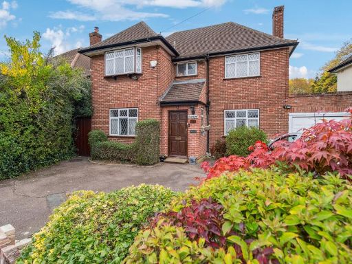 5 bedroom detached house for sale in Cuckoo Hill Drive, Pinner HA5 — £1,250,000 • 5 bed • 2 bath • 1538 ft²
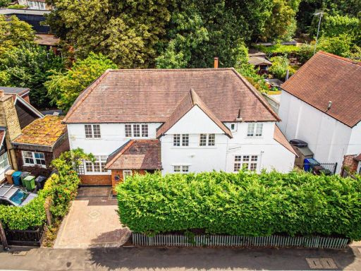 5 bedroom detached house for sale in Eastcote Road, Pinner, HA5 — £1,195,000 • 5 bed • 3 bath • 2099 ft²
Meta
- {
"@context": "https://schema.org",
"@type": "Residence",
"name": "5 bedroom detached house for sale in Hill Road, Pinner, HA5",
"description": "",
"url": "https://propertypiper.co.uk/property/43976eac-a54d-47e5-b849-c62791bf5a08",
"image": "https://image-a.propertypiper.co.uk/eb688e13-cf52-437f-83dc-12dcfd5b47d3-1024.jpeg",
"address": {
"@type": "PostalAddress",
"streetAddress": "29, Hill Road, PINNER",
"postalCode": "HA5 1JY",
"addressLocality": "Harrow",
"addressRegion": "Ruislip, Northwood and Pinner",
"addressCountry": "England"
},
"geo": {
"@type": "GeoCoordinates",
"latitude": 51.58495960970544,
"longitude": -0.3837674460215289
},
"numberOfRooms": 5,
"numberOfBathroomsTotal": 4,
"floorSize": {
"@type": "QuantitativeValue",
"value": 2375,
"unitCode": "FTK"
},
"offers": {
"@type": "Offer",
"price": 1195000,
"priceCurrency": "GBP",
"availability": "https://schema.org/InStock"
},
"additionalProperty": [
{
"@type": "PropertyValue",
"name": "Feature",
"value": "detached house"
},
{
"@type": "PropertyValue",
"name": "Feature",
"value": "modern"
},
{
"@type": "PropertyValue",
"name": "Feature",
"value": "garage"
},
{
"@type": "PropertyValue",
"name": "Feature",
"value": "garden"
},
{
"@type": "PropertyValue",
"name": "Feature",
"value": "two-storey"
},
{
"@type": "PropertyValue",
"name": "Feature",
"value": "bay window"
},
{
"@type": "PropertyValue",
"name": "Feature",
"value": "white exterior"
},
{
"@type": "PropertyValue",
"name": "Feature",
"value": "brick accents"
},
{
"@type": "PropertyValue",
"name": "Feature",
"value": "driveway"
},
{
"@type": "PropertyValue",
"name": "Feature",
"value": "suburban"
},
{
"@type": "PropertyValue",
"name": "Feature",
"value": "modern"
},
{
"@type": "PropertyValue",
"name": "Feature",
"value": "open-plan"
},
{
"@type": "PropertyValue",
"name": "Feature",
"value": "contemporary"
},
{
"@type": "PropertyValue",
"name": "Feature",
"value": "large room"
},
{
"@type": "PropertyValue",
"name": "Feature",
"value": "bright"
},
{
"@type": "PropertyValue",
"name": "Feature",
"value": "spacious"
},
{
"@type": "PropertyValue",
"name": "Feature",
"value": "kitchen"
},
{
"@type": "PropertyValue",
"name": "Feature",
"value": "high specification"
},
{
"@type": "PropertyValue",
"name": "Feature",
"value": "tiled floor"
}
]
}
High Res Floorplan Images
Compatible Floorplan Images
FloorplanImages Thumbnail