SO41 6DN - Equestrian facility for sale in Flexford Lane, Sway, Lyming…
View on Property Piper
Equestrian facility for sale in Flexford Lane, Sway, Lymington, Hampshire, SO41
Property Details
- Price: £1100000
- Bedrooms: 4
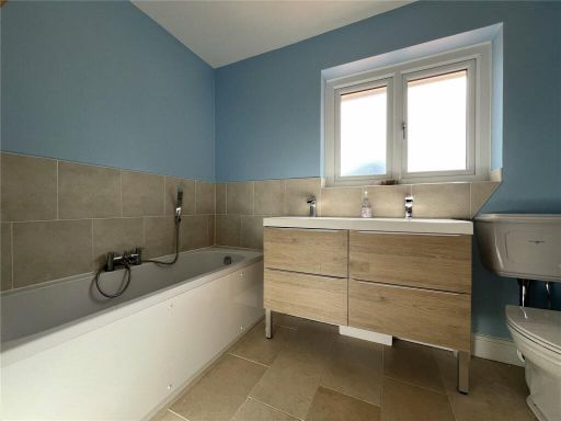
- Bathrooms: 2
- Property Type: undefined
- Property SubType: undefined
Brochure Descriptions
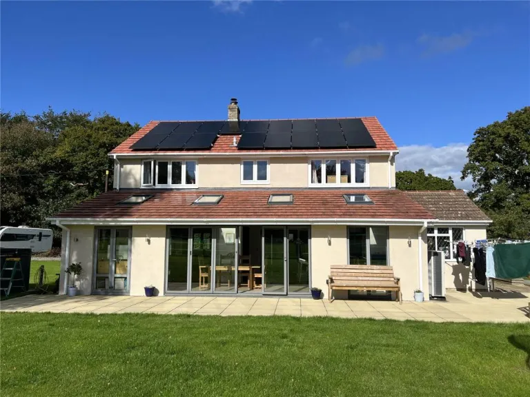
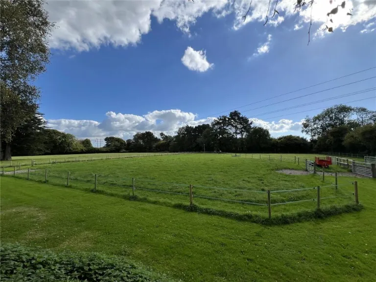
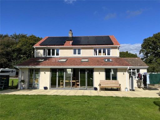
- This is a detached property situated on a large plot with surrounding greenery, offering expansive views of the countryside. The house features a modern design with a prominent use of solar panels on the roof. The building is two stories high, with substantial glass elements and sliding doors that suggest a bright and airy interior. The garden size is large, providing ample outdoor space.
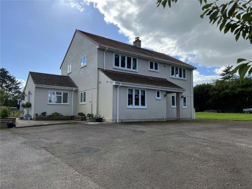
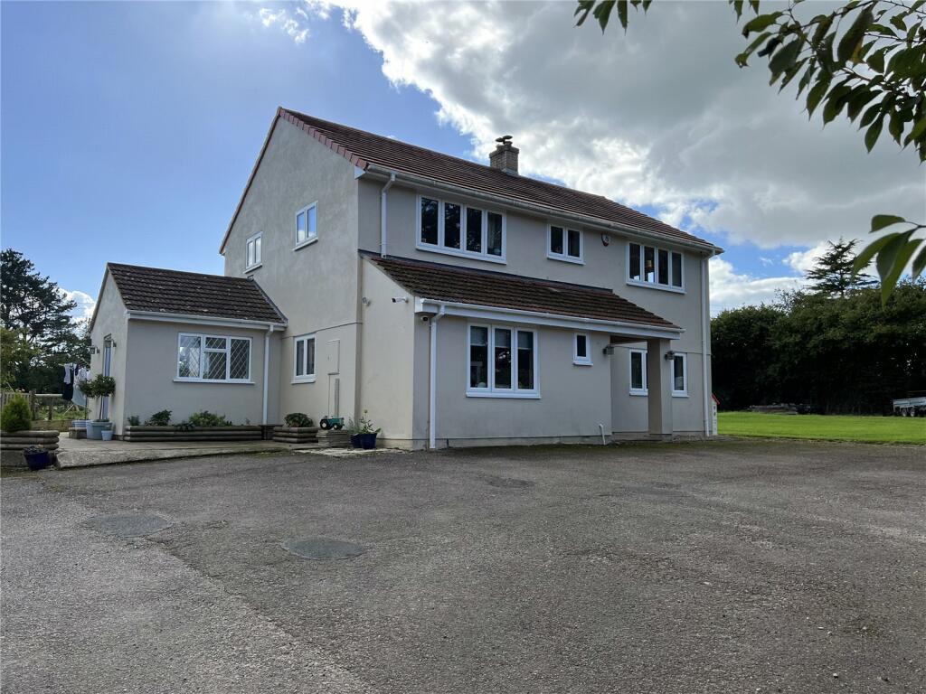
- The property is a substantial two-story detached house with a traditional design, featuring a large footprint. The exterior is finished with a light-colored plaster and a tiled roof. The house is surrounded by a large driveway and front yard, offering ample parking space. The grounds are expansive, bordered by mature trees, providing privacy and a serene view of the surrounding greenery.
Image Descriptions
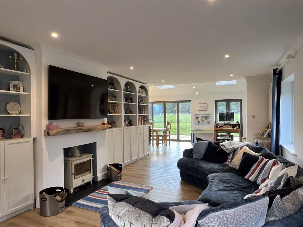
- modern house contemporary
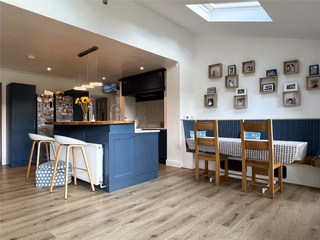
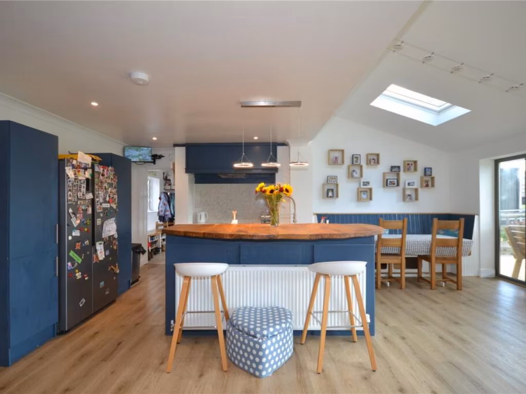
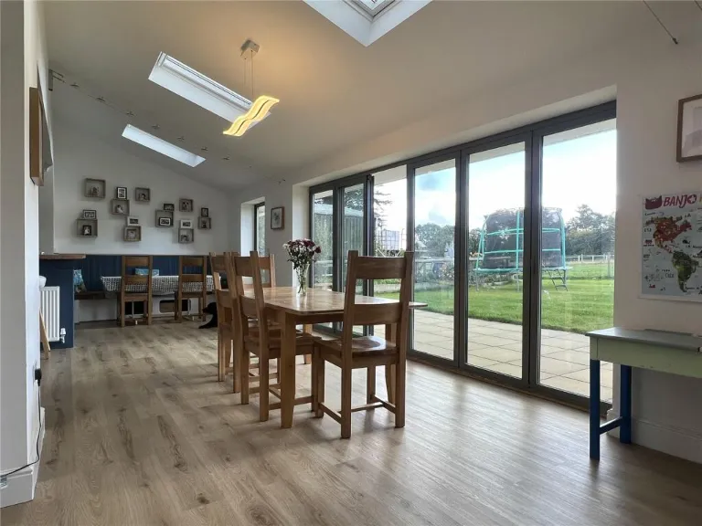
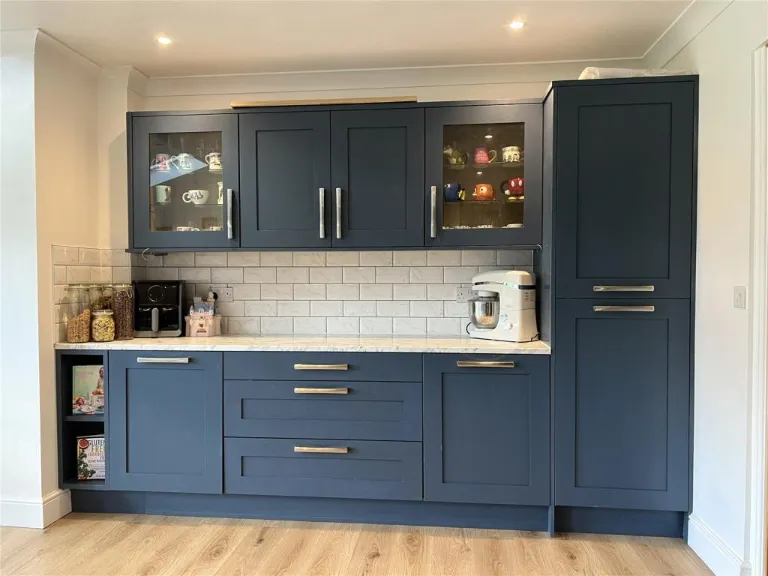
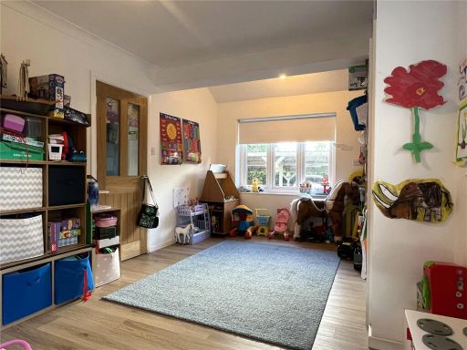
- dining area modern
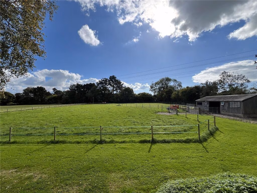
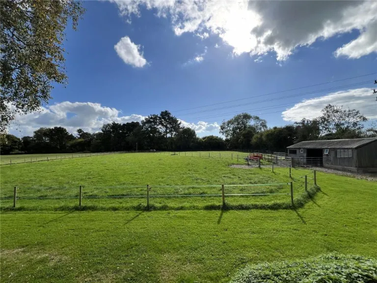
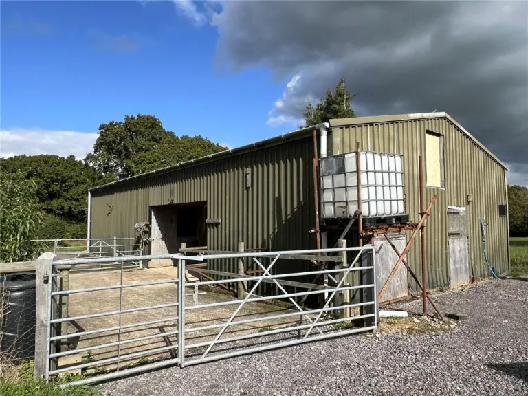
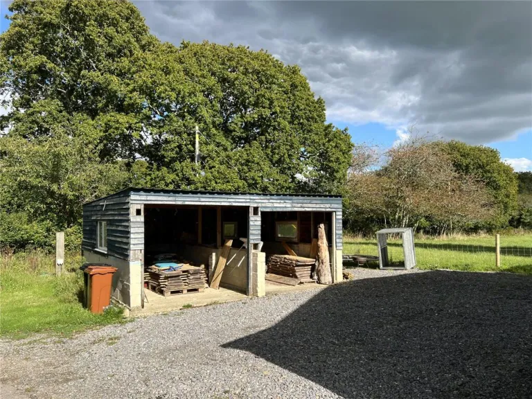
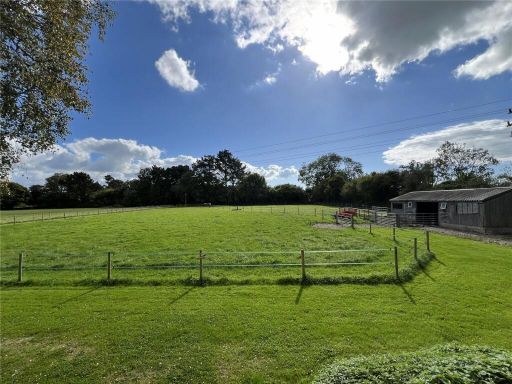
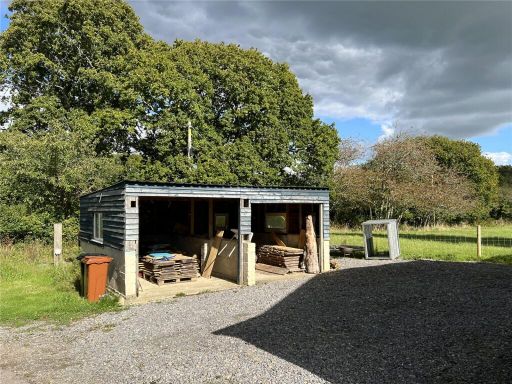
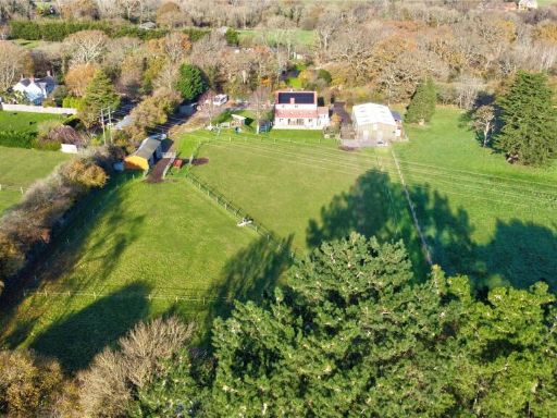
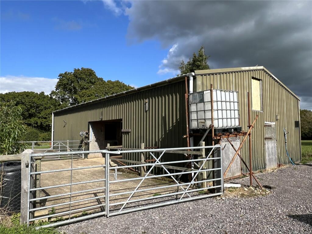
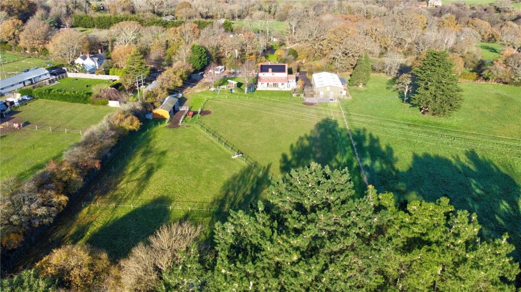
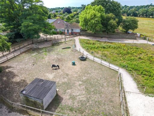
- rural land with outbuildings rural
Floorplan Description
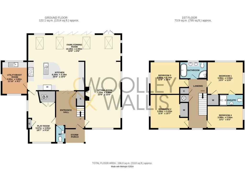
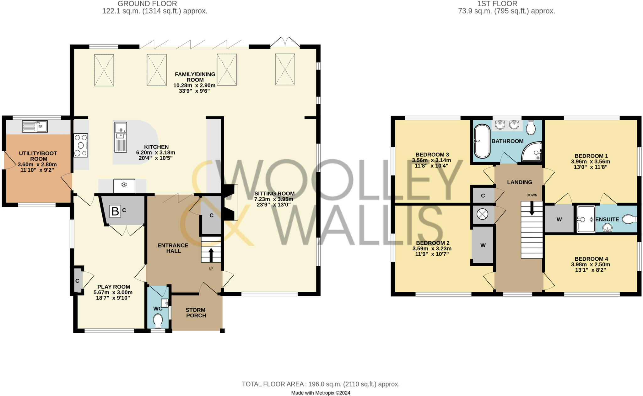
- A spacious multi-story property with a mix of large and average-sized rooms.
Rooms
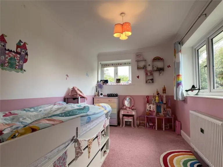
- Utility/Boot Room: Small
- Play Room: Average
- Family/Dining Room: Large
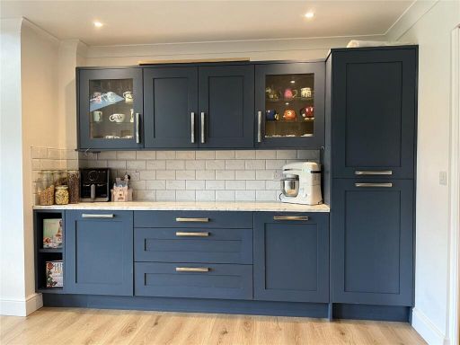
- Kitchen: Average
- Sitting Room: Large
- Bedroom 1: Average
- Bedroom 2: Average
- Bedroom 3: Small
- Bedroom 4: Small
Textual Property Features
Detected Visual Features
- modern
- contemporary
- two-story
- solar panels
- sliding doors
- patio
- energy-efficient
- landscaped garden
- dining room
- bi-fold doors
- skylights
- wood flooring
- garden view
- spacious
- rural
- land
- paddock
- outbuildings
- fencing
- countryside
- agricultural
EPC Details
- Fully double glazed
- Cavity wall, filled cavity
- Boiler and radiators, oil
- Low energy lighting in 32% of fixed outlets
- Solid, no insulation (assumed)
Nearby Schools
- Durlston Court School
- The Arnewood School
- Ashley Junior School
- Our Lady and St Joseph Catholic Primary School
- Ballard School
- Walhampton School
- Milford-on-Sea Church of England Primary School
- New Milton Infant School
- Pennington Infant School
- Hordle CofE (VA) Primary School
- South Baddesley Church of England Primary School & Nursery
- William Gilpin Church of England Primary School
- Brockenhurst Church of England Primary School & Pre-School
- Highcliffe St Mark Primary School
- New Milton Junior School
- The Eaglewood School
- Pennington Church of England Junior School
- St Luke's Church of England Primary School
- Burley Primary School
- Priestlands School
- Ashley Infant School
- Lymington Church of England Infant School
- Lymington Junior School
- Tiptoe Primary School
Nearest Bars And Restaurants
- Id: 1965450080
- Tags:
- Amenity: cafe
- Cuisine: coffee_shop
- Name: Sway Deli & Coffee Shop
- TagsNormalized:
- Lat: 50.7864063
- Lon: -1.609327
- FullGeoHash: gcnbgmkh7bqf
- PartitionGeoHash: gcnb
- Images:
- FoodStandards: null
- Distance: 1953.4
,- Id: 271300
- Tags:
- Amenity: pub
- Name: Hare and Hounds
- TagsNormalized:
- Lat: 50.7868975
- Lon: -1.5997844
- FullGeoHash: gcnbgt7p47fk
- PartitionGeoHash: gcnb
- Images:
- FoodStandards: null
- Distance: 1890.9
,- Id: 1108970731
- Tags:
- Amenity: pub
- Name: The Three Bells
- TagsNormalized:
- Lat: 50.7615262
- Lon: -1.6210896
- FullGeoHash: gcnbg0ge3f7f
- PartitionGeoHash: gcnb
- Images:
- FoodStandards: null
- Distance: 1759.6
,- Id: 1965450209
- Tags:
- Amenity: pub
- Name: The Silver Hind
- TagsNormalized:
- Lat: 50.7844478
- Lon: -1.6080476
- FullGeoHash: gcnbgmj0cg0z
- PartitionGeoHash: gcnb
- Images:
- FoodStandards: null
- Distance: 1718
,- Id: 1108969509
- Tags:
- Amenity: pub
- Name: Wheel Inn
- TagsNormalized:
- Lat: 50.768729
- Lon: -1.5794637
- FullGeoHash: gcnbu41v7c48
- PartitionGeoHash: gcnb
- Images:
- FoodStandards: null
- Distance: 1439.6
}
Nearest General Shops
- Id: 202339569
- Tags:
- Addr:
- City: Lymington
- Country: GB
- Postcode: SO41 0JZ
- Street: Farmers Walk
- Building: yes
- Name: Everton Nurseries Garden Centre
- Shop: garden_centre
- Website: https://www.evertonnurseries.co.uk/
- TagsNormalized:
- garden centre
- nurseries
- shop
- Lat: 50.7450082
- Lon: -1.5993598
- FullGeoHash: gcnbetg7h5nu
- PartitionGeoHash: gcnb
- Images:
- FoodStandards: null
- Distance: 2767.2
,- Id: 892562714
- Tags:
- Name: Scats
- Shop: garden_centre
- TagsNormalized:
- Lat: 50.7715946
- Lon: -1.5606217
- FullGeoHash: gcnbu6xtfzhn
- PartitionGeoHash: gcnb
- Images:
- FoodStandards: null
- Distance: 2765.3
,- Id: 5354974660
- Tags:
- Name: New forest Koi
- Phone: +44 1590 682010
- Shop: pet
- Website: www.newforestkoi.co.uk
- TagsNormalized:
- Lat: 50.7734368
- Lon: -1.6057505
- FullGeoHash: gcnbg7n8xq9s
- PartitionGeoHash: gcnb
- Images:
- FoodStandards: null
- Distance: 572.2
}
Nearest Grocery shops
- Id: 187018336
- Tags:
- Addr:
- City: Lymington
- Country: GB
- Postcode: SO41 0JQ
- Street: West Lane
- Village: Everton
- Brand: Londis
- Brand:wikidata: Q21008564
- Building: yes
- Name: Londis
- Opening_hours: Mo-Sa 06:30-19:30; Su 07:00-17:00
- Shop: convenience
- TagsNormalized:
- Lat: 50.7471247
- Lon: -1.5896452
- FullGeoHash: gcnbey4rqtdw
- PartitionGeoHash: gcnb
- Images:
- FoodStandards: null
- Distance: 2631.5
,- Id: 1245081563
- Tags:
- Addr:
- City: Lymington
- Country: GB
- Housename: 44-52
- Postcode: SO41 0GL
- Street: Stopples Lane
- Name: The Co-Operayive Food
- Shop: convenience
- TagsNormalized:
- Lat: 50.7588041
- Lon: -1.6228853
- FullGeoHash: gcnbg0672nch
- PartitionGeoHash: gcnb
- Images:
- FoodStandards: null
- Distance: 2035.8
,- Id: 1977784428
- Tags:
- Addr:
- City: Hordle
- Postcode: SO41 0FN
- Street: Ashley Lane
- Brand: Spar
- Brand:wikidata: Q610492
- Brand:wikipedia: en:SPAR (retailer)
- Name: Spar
- Opening_hours: Mo-Su 06:30-20:00
- Shop: convenience
- TagsNormalized:
- Lat: 50.761437
- Lon: -1.6216479
- FullGeoHash: gcnbg0g4ucew
- PartitionGeoHash: gcnb
- Images:
- FoodStandards: null
- Distance: 1798.3
}
Nearest Supermarkets
- Id: 157939445
- Tags:
- Addr:
- City: New Milton
- Postcode: BH25 6BP
- Street: Caird Avenue
- Alt_name: Tesco New Milton Superstore
- Brand: Tesco
- Brand:wikidata: Q487494
- Brand:wikipedia: en:Tesco
- Building: yes
- Contact:
- Website: https://www.tesco.com/store-locator/new-milton/caird-ave
- Hearing_impaired:
- Name: Tesco
- Opening_hours: Mo-Sa 06:00-00:00, Su 10:00-16:00
- Organic: yes
- Phone: +44 345 677 9489
- Shop: supermarket
- TagsNormalized:
- Lat: 50.7506248
- Lon: -1.6454789
- FullGeoHash: gcnbdwcgcd4j
- PartitionGeoHash: gcnb
- Images:
- FoodStandards: null
- Distance: 3858.7
,- Id: 1105785999
- Tags:
- Brand: ALDI
- Brand:wikidata: Q41171672
- Building: yes
- Name: ALDI
- Shop: supermarket
- TagsNormalized:
- Lat: 50.749335
- Lon: -1.6428765
- FullGeoHash: gcnbdwesq1wr
- PartitionGeoHash: gcnb
- Images:
- FoodStandards: null
- Distance: 3792.6
,- Id: 152074601
- Tags:
- Addr:
- City: Lymington
- Country: GB
- Postcode: SO41 9GF
- Street: Stanford Road
- Alt_name: Waitrose Lymington
- Brand: Waitrose
- Brand:wikidata: Q771734
- Brand:wikipedia: en:Waitrose & Partners
- Building: retail
- Building:levels: 1
- Fhrs:
- Name: Waitrose
- Official_name: Waitrose & Partners
- Opening_hours: Mo-Sa 07:30-20:00; Fr 07:30-21:00; Su 10:00-16:00
- Operator: Waitrose & Partners
- Shop: supermarket
- Wheelchair: yes
- TagsNormalized:
- waitrose
- retail
- supermarket
- shop
- Lat: 50.7577878
- Lon: -1.550287
- FullGeoHash: gcnbu8pje9qn
- PartitionGeoHash: gcnb
- Images:
- FoodStandards:
- Id: 547702
- FHRSID: 547702
- LocalAuthorityBusinessID: 46
- BusinessName: WAITROSE
- BusinessType: Retailers - supermarkets/hypermarkets
- BusinessTypeID: 7840
- AddressLine1: STANFORD ROAD
- AddressLine2: LYMINGTON
- AddressLine3: null
- AddressLine4: null
- PostCode: SO41 9GF
- RatingValue: 5
- RatingKey: fhrs_5_en-GB
- RatingDate: 2022-02-22
- LocalAuthorityCode: 138
- LocalAuthorityName: New Forest
- LocalAuthorityWebSite: http://www.newforest.gov.uk
- LocalAuthorityEmailAddress: hygiene.rating@nfdc.gov.uk
- Scores:
- Hygiene: 0
- Structural: 5
- ConfidenceInManagement: 0
- NewRatingPending: false
- Geocode:
- Longitude: -1.54962900000000
- Latitude: 50.75715600000000
- Distance: 3736.8
}
Nearest Religious buildings
- Id: 166931956
- Tags:
- Addr:
- City: Lymington
- Country: GB
- Postcode: SO41 6AE
- Street: Westbeams Road
- Amenity: school
- Contact:
- Phone: +44 1590 682431
- Website: https://www.st-lukes.hants.sch.uk/
- Denomination: anglican
- Max_age: 11
- Min_age: 4
- Name: St Luke's Church of England Primary School
- Ref:
- Religion: christian
- Wikidata: Q67148719
- TagsNormalized:
- school
- anglican
- church
- christian
- Lat: 50.7856186
- Lon: -1.6052328
- FullGeoHash: gcnbgmppem7x
- PartitionGeoHash: gcnb
- Images:
- FoodStandards: null
- Distance: 1789.2
,- Id: 305742563
- Tags:
- Amenity: place_of_worship
- Building: church
- Denomination: anglican
- Name: St Luke's Church
- Religion: christian
- Wikidata: Q105105017
- TagsNormalized:
- place of worship
- church
- anglican
- christian
- Lat: 50.7839877
- Lon: -1.6060551
- FullGeoHash: gcnbgkyw0jqw
- PartitionGeoHash: gcnb
- Images:
- FoodStandards: null
- Distance: 1626.9
,- Id: 9372903516
- Tags:
- Name: The Old Chapel
- Tourism: apartment
- TagsNormalized:
- Lat: 50.7840003
- Lon: -1.5945585
- FullGeoHash: gcnbgsyyhpg1
- PartitionGeoHash: gcnb
- Images:
- FoodStandards: null
- Distance: 1612.3
}
Nearest Medical buildings
- Id: 1109162059
- Tags:
- Amenity: pharmacy
- Name: Pennington Pharmacy
- Opening_hours: Mo-Fr 09:00-17:30; Sa 09:00-13:00
- TagsNormalized:
- Lat: 50.7531964
- Lon: -1.5602582
- FullGeoHash: gcnbsrrfg3e1
- PartitionGeoHash: gcnb
- Images:
- FoodStandards: null
- Distance: 3346.9
,- Id: 1977784598
- Tags:
- Amenity: pharmacy
- Name: Ashley Pharmacy
- TagsNormalized:
- Lat: 50.7576771
- Lon: -1.6382186
- FullGeoHash: gcnbf8phfsz9
- PartitionGeoHash: gcnb
- Images:
- FoodStandards: null
- Distance: 3021
,- Id: 1108972124
- Tags:
- Amenity: pharmacy
- Dispensing: yes
- Drive_through: no
- Healthcare: pharmacy
- Name: Hordle Pharmacy
- TagsNormalized:
- Lat: 50.7612673
- Lon: -1.6233162
- FullGeoHash: gcnbg0ccvfpd
- PartitionGeoHash: gcnb
- Images:
- FoodStandards: null
- Distance: 1908.7
,- Id: 305742745
- Tags:
- Amenity: pharmacy
- Building: yes
- Healthcare: pharmacy
- TagsNormalized:
- Lat: 50.7842987
- Lon: -1.6073644
- FullGeoHash: gcnbgkvxcxqj
- PartitionGeoHash: gcnb
- Images:
- FoodStandards: null
- Distance: 1686.8
}
Nearest Airports
- Id: 386864426
- Tags:
- Aerodrome: international
- Aeroway: aerodrome
- Alt_name: Bournemouth International Airport
- Ele: 12
- Iata: BOH
- Icao: EGHH
- Int_name: B
- Name: Bournemouth Airport
- Old_name: Hurn Airport
- Ref: EGHH
- Source: wikipedia
- Wikidata: Q580409
- Wikipedia: en:Bournemouth Airport
- TagsNormalized:
- airport
- international airport
- Lat: 50.7825186
- Lon: -1.84232
- FullGeoHash: gcn8yhdmwgde
- PartitionGeoHash: gcn8
- Images:
- FoodStandards: null
- Distance: 17106.7
,- Id: 100647893
- Tags:
- Aerodrome: international
- Aerodrome:type: public
- Aeroway: aerodrome
- Contact:
- Vhf:
- Approach: 120.225 MHz
- Tower: 118.2 MHz
- Ele: 44ft
- Iata: SOU
- Icao: EGHI
- Is_in: Hampshire, England,UK
- Name: Southampton Airport
- Operator: Southampton International Airport Limited
- Source: Bing;Gagravarr_Airports
- Wikidata: Q8988
- Wikipedia: en:Southampton Airport
- TagsNormalized:
- airport
- international airport
- Lat: 50.9513872
- Lon: -1.3516684
- FullGeoHash: gcp1c5rtrffz
- PartitionGeoHash: gcp1
- Images:
- FoodStandards: null
- Distance: 26659.3
}
Nearest Leisure Facilities
- Id: 956543391
- Tags:
- TagsNormalized:
- swimming
- swimming pool
- pool
- leisure
- Lat: 50.7810612
- Lon: -1.6018069
- FullGeoHash: gcnbgs3t55yj
- PartitionGeoHash: gcnb
- Images:
- FoodStandards: null
- Distance: 1249.5
,- Id: 957067922
- Tags:
- TagsNormalized:
- Lat: 50.7779027
- Lon: -1.6085395
- FullGeoHash: gcnbg7udwr4h
- PartitionGeoHash: gcnb
- Images:
- FoodStandards: null
- Distance: 1080.1
,- Id: 325740534
- Tags:
- Leisure: pitch
- Sport: equestrian
- TagsNormalized:
- pitch
- leisure
- equestrian
- sports
- Lat: 50.7707702
- Lon: -1.5912595
- FullGeoHash: gcnbgf930vwc
- PartitionGeoHash: gcnb
- Images:
- FoodStandards: null
- Distance: 612.1
,- Id: 961970304
- Tags:
- Leisure: pitch
- Sport: tennis
- TagsNormalized:
- Lat: 50.7720478
- Lon: -1.5960661
- FullGeoHash: gcnbgdvb8gwy
- PartitionGeoHash: gcnb
- Images:
- FoodStandards: null
- Distance: 358.2
,- Id: 961970305
- Tags:
- TagsNormalized:
- swimming
- swimming pool
- pool
- leisure
- Lat: 50.7715146
- Lon: -1.5955372
- FullGeoHash: gcnbgdwjt231
- PartitionGeoHash: gcnb
- Images:
- FoodStandards: null
- Distance: 353
}
Nearest Tourist attractions
- Id: 188339538
- Tags:
- Building: yes
- Name: Meadows Cottage B&B
- Tourism: guest_house
- TagsNormalized:
- Lat: 50.7797389
- Lon: -1.6038002
- FullGeoHash: gcnbgs0jktrv
- PartitionGeoHash: gcnb
- Images:
- FoodStandards: null
- Distance: 1129.6
,- Id: 2047233434
- Tags:
- Name: Homefield
- Tourism: caravan_site
- TagsNormalized:
- Lat: 50.7621469
- Lon: -1.5971483
- FullGeoHash: gcnbg8uyzwpc
- PartitionGeoHash: gcnb
- Images:
- FoodStandards: null
- Distance: 882
,- Id: 2047233431
- Tags:
- Name: Lightfoot's Farm Touring Caravan Park
- Tourism: caravan_site
- TagsNormalized:
- Lat: 50.762096
- Lon: -1.5996266
- FullGeoHash: gcnbg8gntuxc
- PartitionGeoHash: gcnb
- Images:
- FoodStandards: null
- Distance: 867
}
Nearest Hotels
- Id: 1108970605
- Tags:
- Brand: Premier Inn
- Brand:wikidata: Q2108626
- Brand:wikipedia: en:Premier Inn
- Internet_access: wlan
- Internet_access:fee: customers
- Internet_access:operator: Virgin Media
- Internet_access:ssid: Premier Inn Free Wi-Fi
- Name: Premier Inn Hordle
- Tourism: hotel
- TagsNormalized:
- Lat: 50.7613802
- Lon: -1.6209824
- FullGeoHash: gcnbg0gdkr5g
- PartitionGeoHash: gcnb
- Images:
- FoodStandards: null
- Distance: 1761.9
,- Id: 305742565
- Tags:
- Building: hotel
- Name: The Sway Manor
- Tourism: hotel
- TagsNormalized:
- Lat: 50.783772
- Lon: -1.6078925
- FullGeoHash: gcnbgkvhvmhr
- PartitionGeoHash: gcnb
- Images:
- FoodStandards: null
- Distance: 1643.7
,- Id: 2047233080
- Tags:
- Accommodation: yes
- Name: The Mill at Gordleton
- Tourism: hotel
- TagsNormalized:
- Lat: 50.7644458
- Lon: -1.5872858
- FullGeoHash: gcnbgckhmd9f
- PartitionGeoHash: gcnb
- Images:
- FoodStandards: null
- Distance: 1071.3
}
Tags
- modern
- contemporary
- two-story
- solar panels
- sliding doors
- patio
- energy-efficient
- landscaped garden
- modern
- dining room
- bi-fold doors
- skylights
- wood flooring
- garden view
- spacious
- rural
- land
- paddock
- outbuildings
- fencing
- countryside
- spacious
- agricultural
Local Market Stats
- Average Price/sqft: £473
- Avg Income: £48000
- Rental Yield: 3.3%
- Social Housing: 5%
- Planning Success Rate: 47%
AirBnB Data
- 1km average: £141/night
- Listings in 1km: 8
Similar Properties
 4 bedroom bungalow for sale in Wootton Road, Tiptoe, Lymington, Hampshire, SO41 — £1,075,000 • 4 bed • 3 bath • 2657 ft²
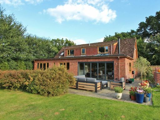 Equestrian facility for sale in Linnies Lane, Sway, Lymington, Hampshire, SO41 — £1,450,000 • 4 bed • 2 bath • 2664 ft²
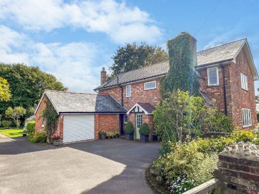 4 bedroom detached house for sale in Main Road, East Boldre, Brockenhurst, SO42 — £1,500,000 • 4 bed • 2 bath • 1907 ft²
 7 bedroom detached house for sale in Walhampton, Lymington, SO41 — £2,850,000 • 7 bed • 7 bath • 5850 ft²
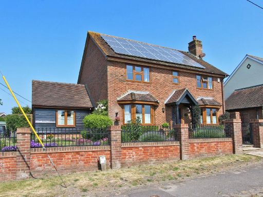 4 bedroom detached house for sale in Durnstown, Sway, Lymington, Hampshire, SO41 — £775,000 • 4 bed • 3 bath • 1909 ft²
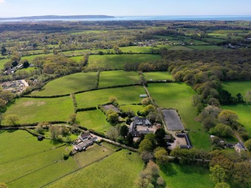 9 bedroom country house for sale in Flexford Lane, Sway, New Forest, SO41 — £3,000,000 • 9 bed • 8 bath • 2002 ft²
Meta
- {
"@context": "https://schema.org",
"@type": "Residence",
"name": "Equestrian facility for sale in Flexford Lane, Sway, Lyming…",
"description": "",
"url": "https://propertypiper.co.uk/property/3f11c08c-2bc3-46ed-aa8a-3c74304146c1",
"image": "https://image-a.propertypiper.co.uk/9ca8a5ad-6657-405d-a244-8f11bb83378d-1024.jpeg",
"address": {
"@type": "PostalAddress",
"streetAddress": "LITTLE PLACE FLEXFORD LANE SWAY LYMINGTON",
"postalCode": "SO41 6DN",
"addressLocality": "New Forest",
"addressRegion": "New Forest East",
"addressCountry": "England"
},
"geo": {
"@type": "GeoCoordinates",
"latitude": 50.769892103675375,
"longitude": -1.5998519233369284
},
"numberOfRooms": 4,
"numberOfBathroomsTotal": 2,
"floorSize": {
"@type": "QuantitativeValue",
"value": 2110,
"unitCode": "FTK"
},
"offers": {
"@type": "Offer",
"price": 1100000,
"priceCurrency": "GBP",
"availability": "https://schema.org/InStock"
},
"additionalProperty": [
{
"@type": "PropertyValue",
"name": "Feature",
"value": "modern"
},
{
"@type": "PropertyValue",
"name": "Feature",
"value": "contemporary"
},
{
"@type": "PropertyValue",
"name": "Feature",
"value": "two-story"
},
{
"@type": "PropertyValue",
"name": "Feature",
"value": "solar panels"
},
{
"@type": "PropertyValue",
"name": "Feature",
"value": "sliding doors"
},
{
"@type": "PropertyValue",
"name": "Feature",
"value": "patio"
},
{
"@type": "PropertyValue",
"name": "Feature",
"value": "energy-efficient"
},
{
"@type": "PropertyValue",
"name": "Feature",
"value": "landscaped garden"
},
{
"@type": "PropertyValue",
"name": "Feature",
"value": "modern"
},
{
"@type": "PropertyValue",
"name": "Feature",
"value": "dining room"
},
{
"@type": "PropertyValue",
"name": "Feature",
"value": "bi-fold doors"
},
{
"@type": "PropertyValue",
"name": "Feature",
"value": "skylights"
},
{
"@type": "PropertyValue",
"name": "Feature",
"value": "wood flooring"
},
{
"@type": "PropertyValue",
"name": "Feature",
"value": "garden view"
},
{
"@type": "PropertyValue",
"name": "Feature",
"value": "spacious"
},
{
"@type": "PropertyValue",
"name": "Feature",
"value": "rural"
},
{
"@type": "PropertyValue",
"name": "Feature",
"value": "land"
},
{
"@type": "PropertyValue",
"name": "Feature",
"value": "paddock"
},
{
"@type": "PropertyValue",
"name": "Feature",
"value": "outbuildings"
},
{
"@type": "PropertyValue",
"name": "Feature",
"value": "fencing"
},
{
"@type": "PropertyValue",
"name": "Feature",
"value": "countryside"
},
{
"@type": "PropertyValue",
"name": "Feature",
"value": "spacious"
},
{
"@type": "PropertyValue",
"name": "Feature",
"value": "agricultural"
}
]
}
High Res Floorplan Images
Compatible Floorplan Images
FloorplanImages Thumbnail