ME14 5RU - 3 bedroom terraced house for sale in Newenden Close, Maidst…
View on Property Piper
3 bedroom terraced house for sale in Newenden Close, Maidstone, ME14
Property Details
- Price: £350000
- Bedrooms: 3
- Bathrooms: 1
- Property Type: undefined
- Property SubType: undefined
Brochure Descriptions
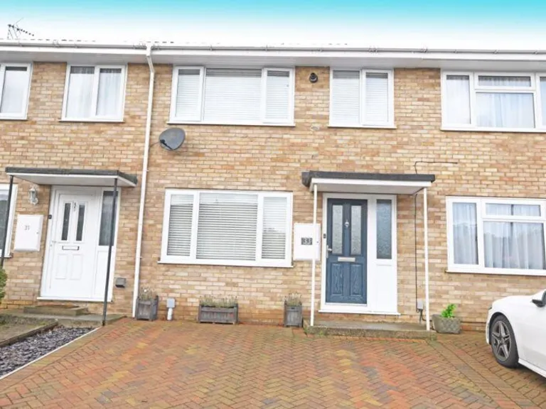
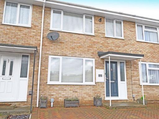
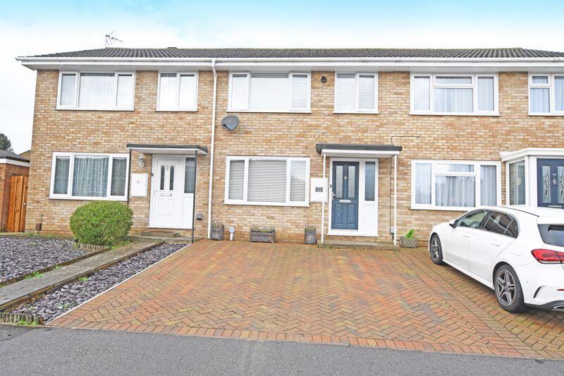
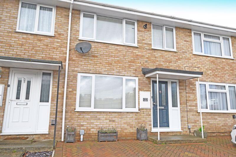
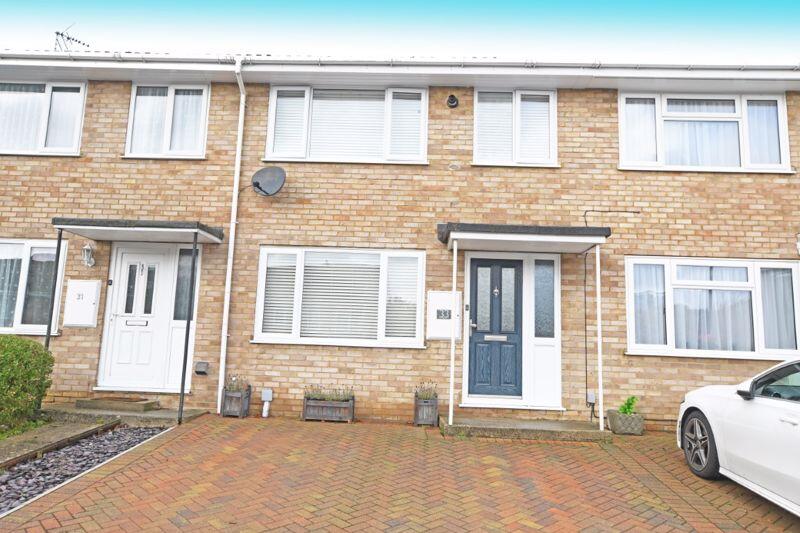
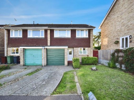
- Two-storey mid-terraced brick-built residential property located on a suburban close. The façade presents a typical late-20th century construction with rendered/brick elevations and uPVC double-glazed windows. The property benefits from a wide, block-paved driveway providing parking for two vehicles and a small, low-maintenance front garden area with slate chippings and a planted shrub. A covered porch shelters the principal entrance. The immediate outlook is onto a residential street/close with neighbouring similar houses; no notable long-distance views are visible. Based on external appearance, the property footprint and street context suggest an average-sized family home for this development; the front garden is small and the overall plot size appears average. Overall condition externally appears well maintained.
Image Descriptions
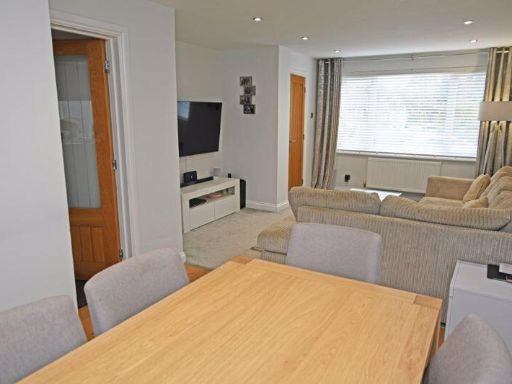
- terraced house modern
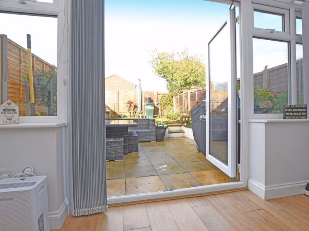
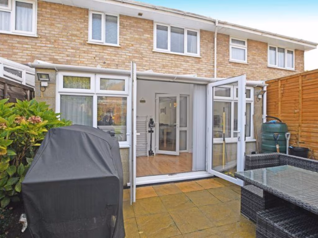
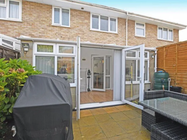
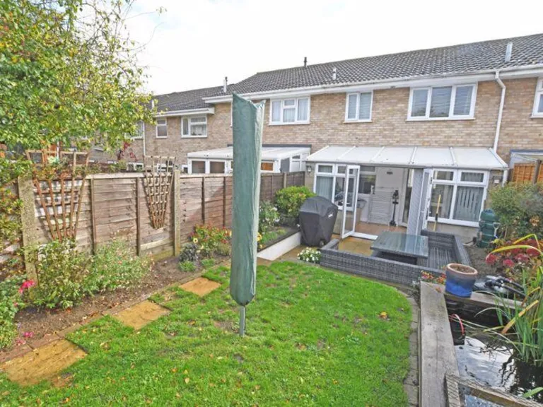
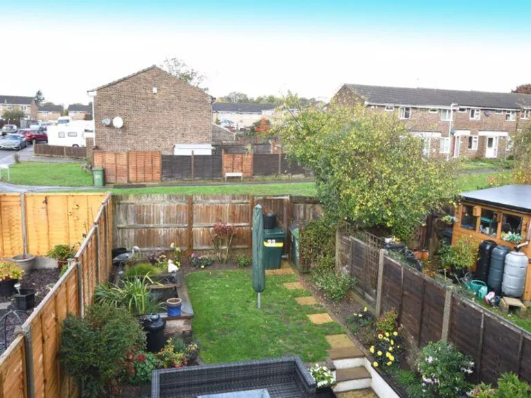
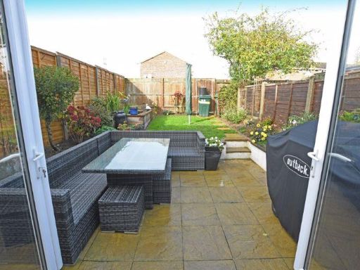
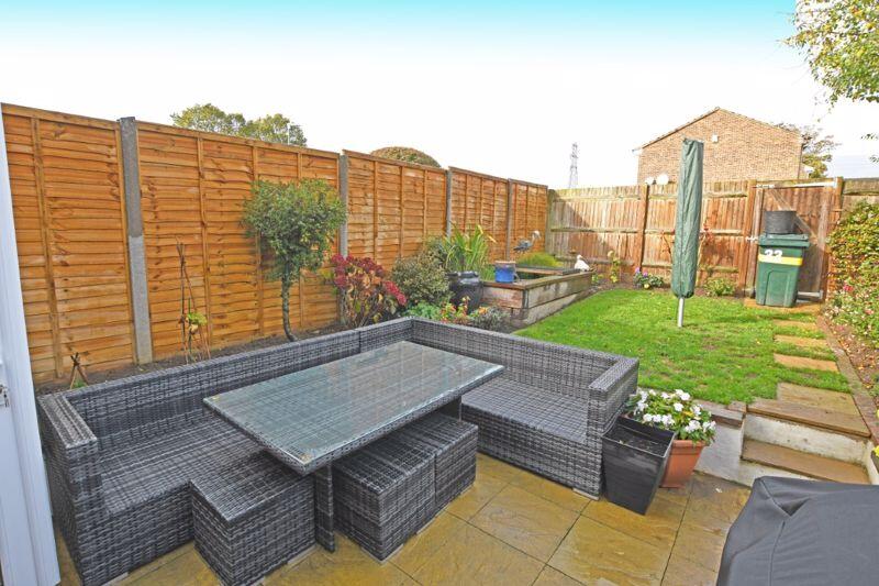
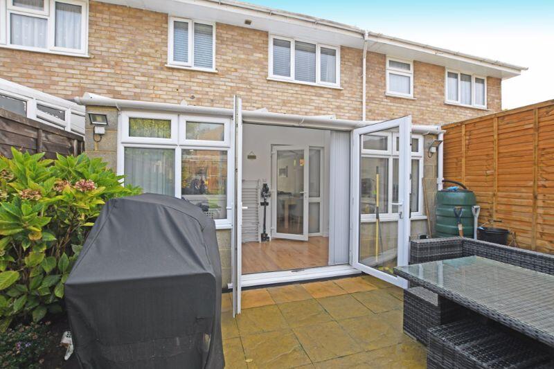
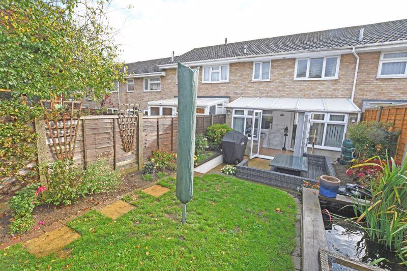
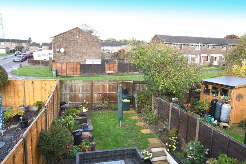
- back garden Contemporary
Floorplan Description
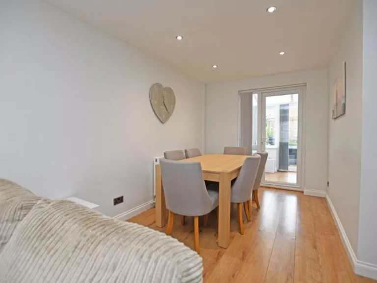
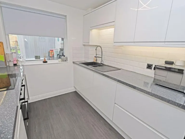
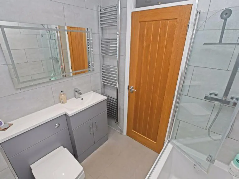
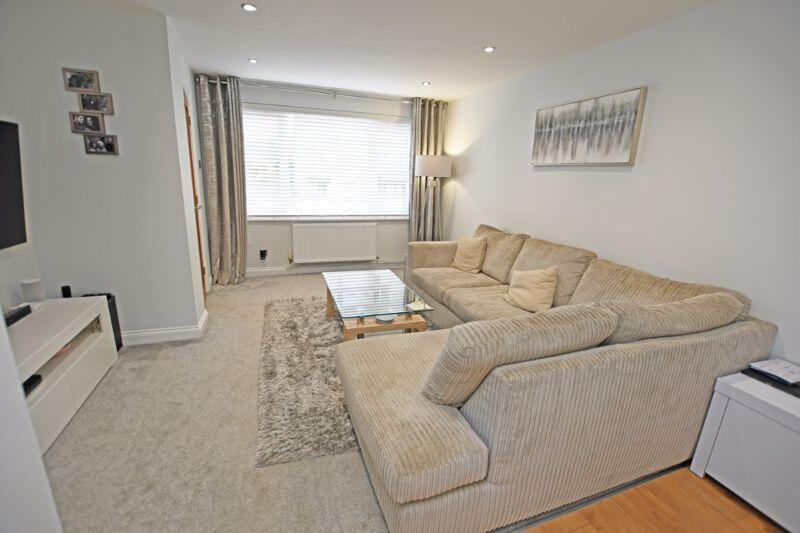
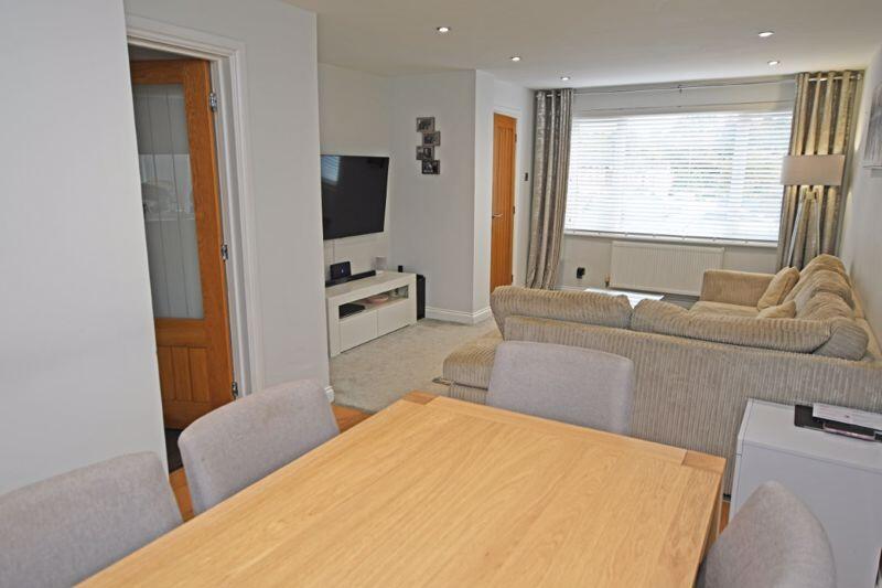
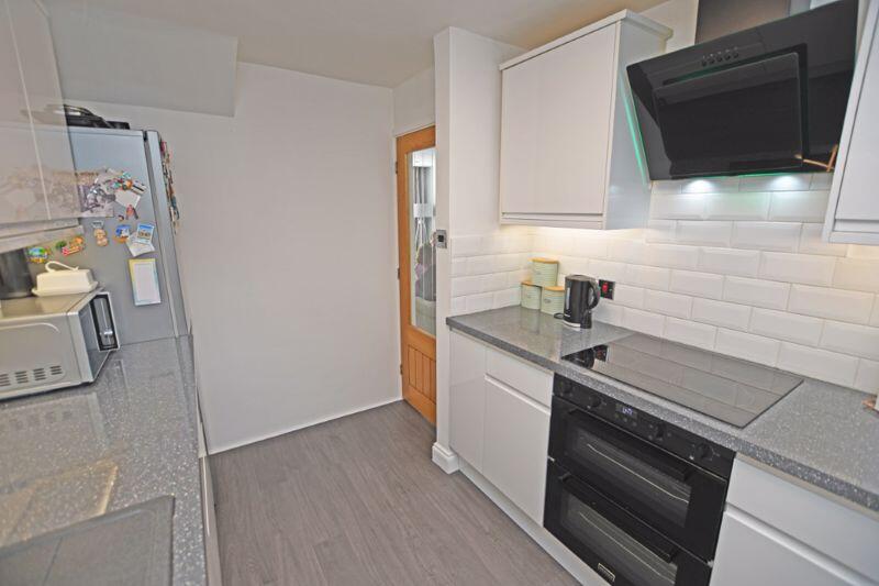
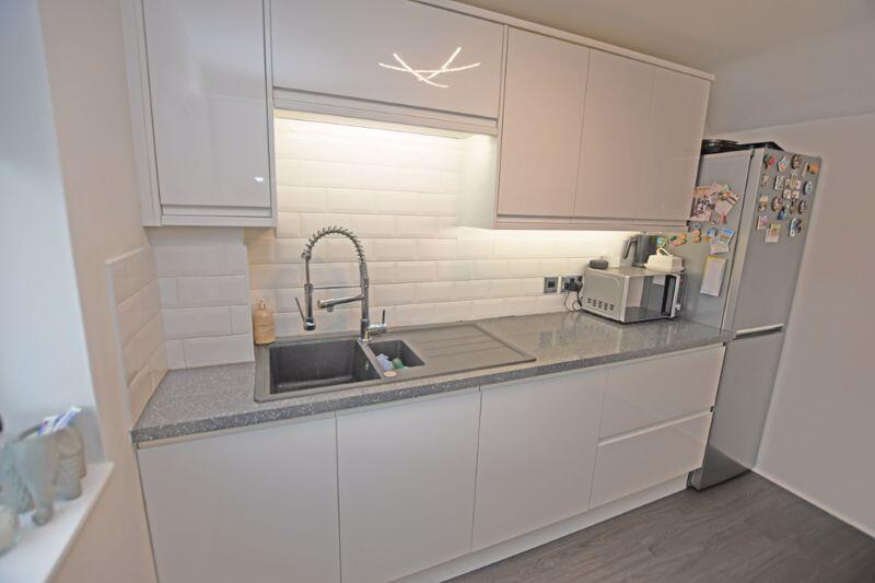
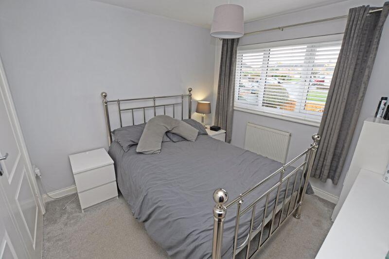
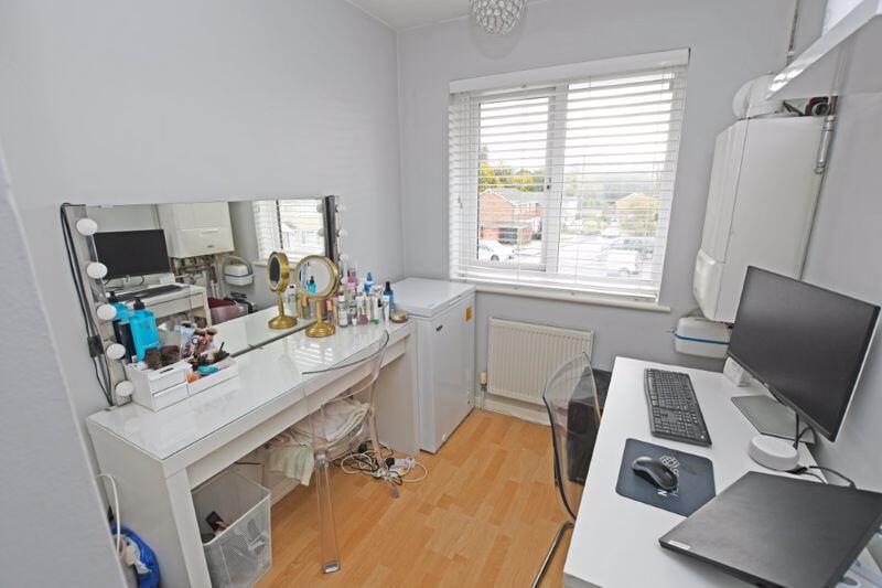
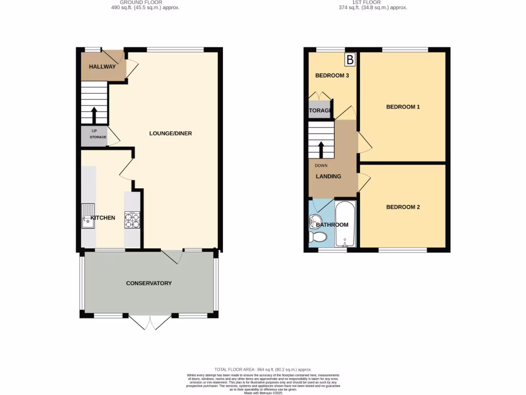
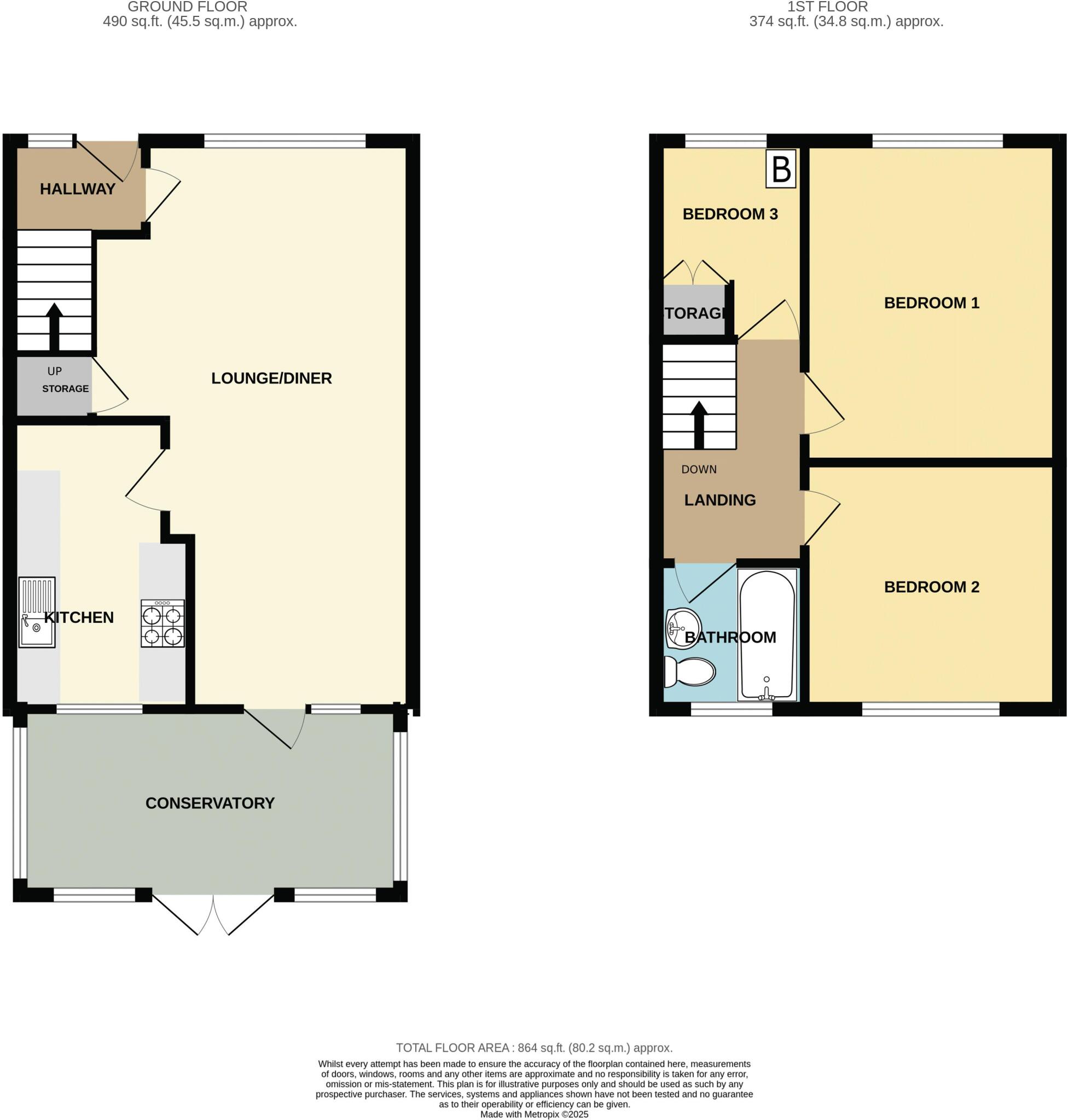
- Two-storey property with lounge/diner, kitchen and conservatory on ground floor and three bedrooms plus bathroom on first floor.
Rooms
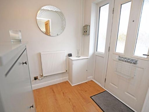
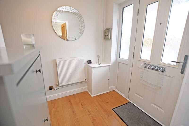
- HALLWAY:
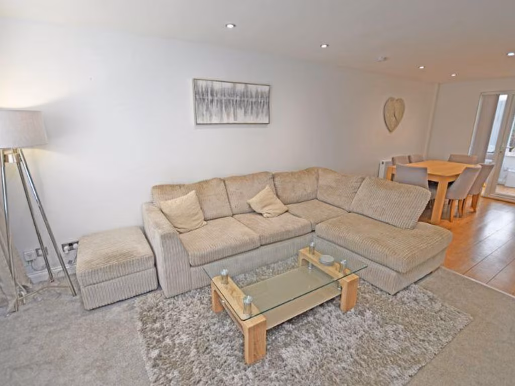
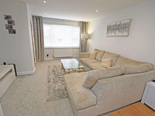
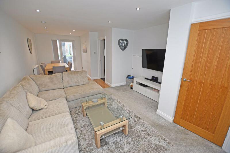
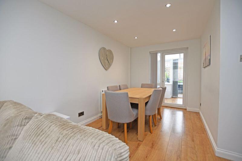
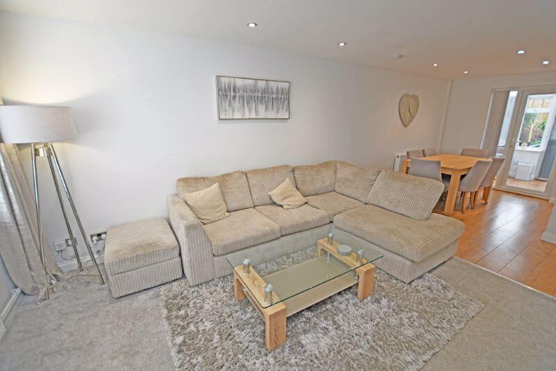
- LOUNGE/DINER:
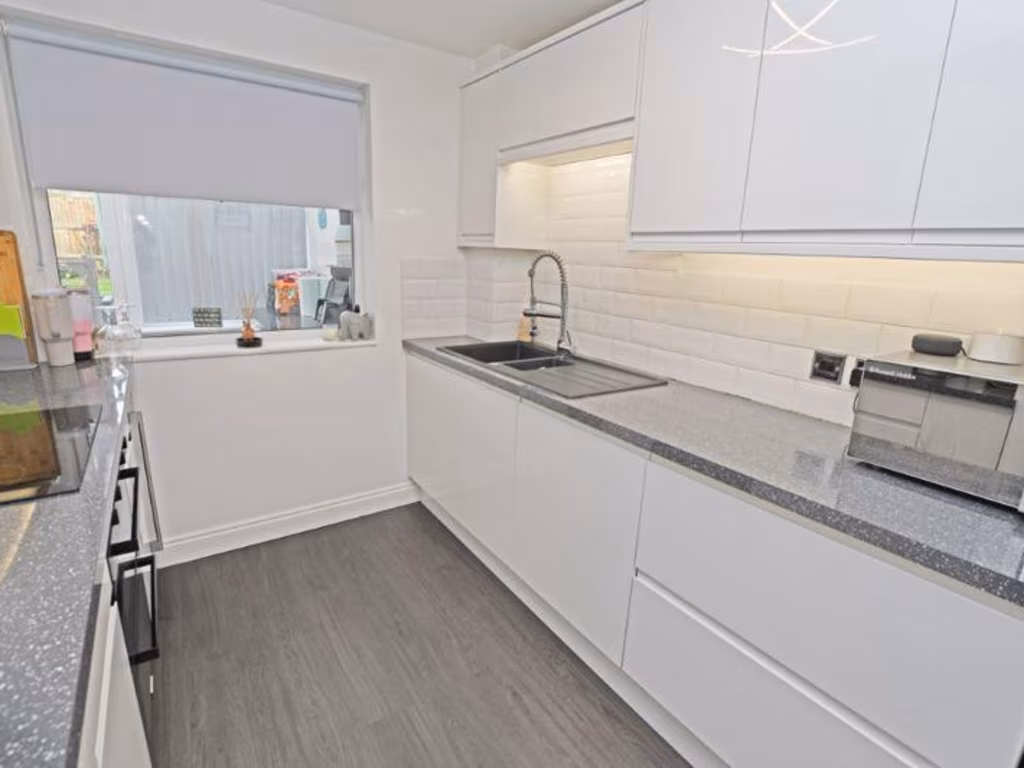
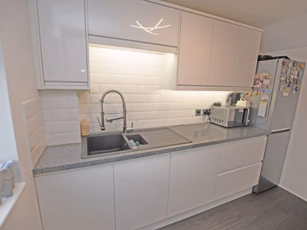
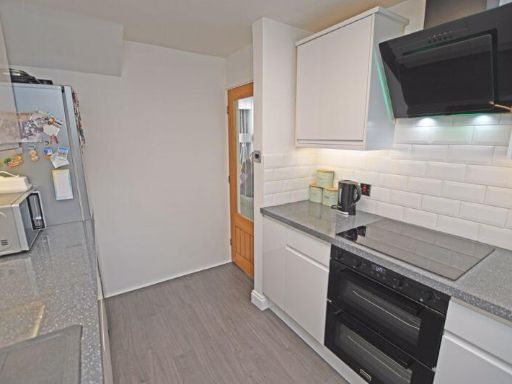
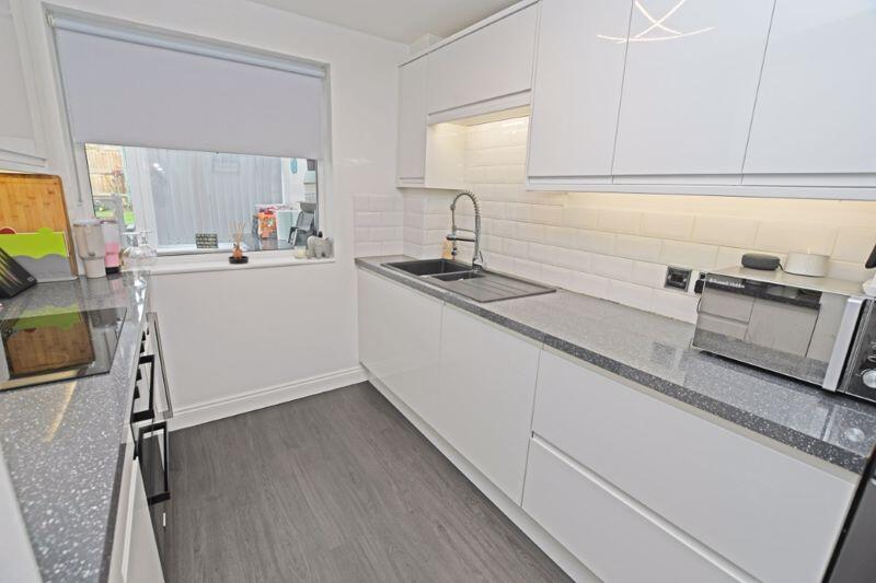
- KITCHEN:
- CONSERVATORY:
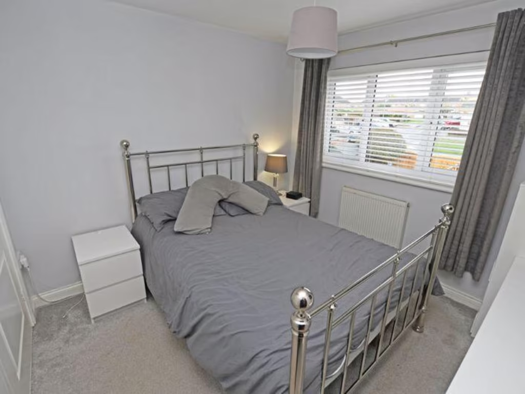
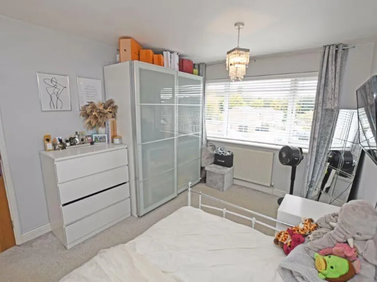
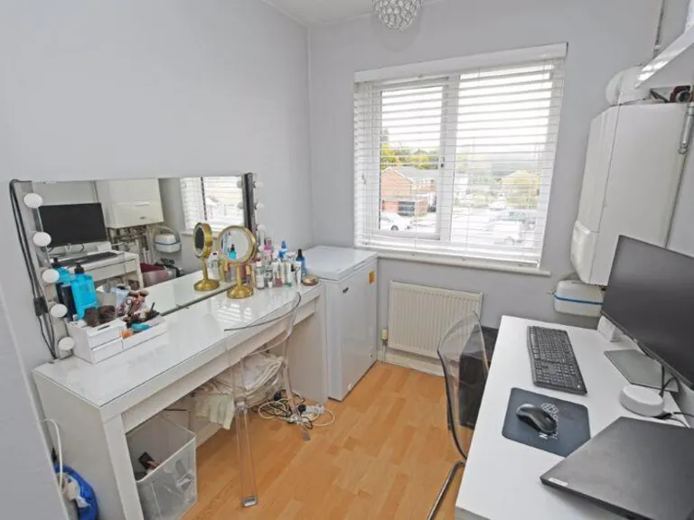
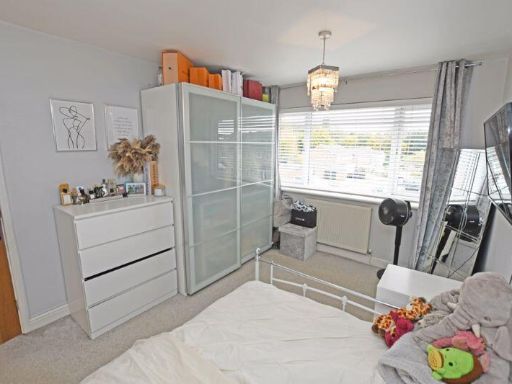
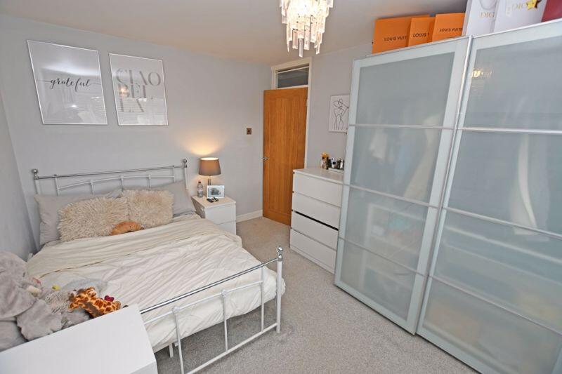
- BEDROOM 3:
- TORAG:
- LANDING:
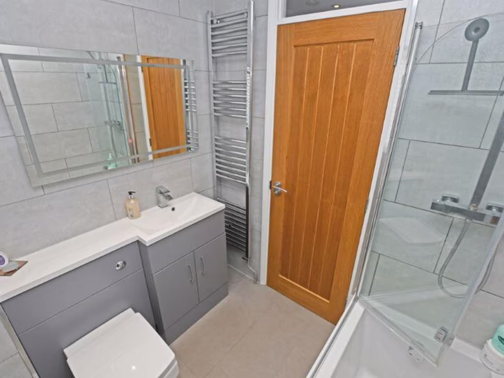
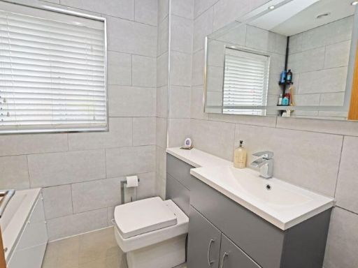
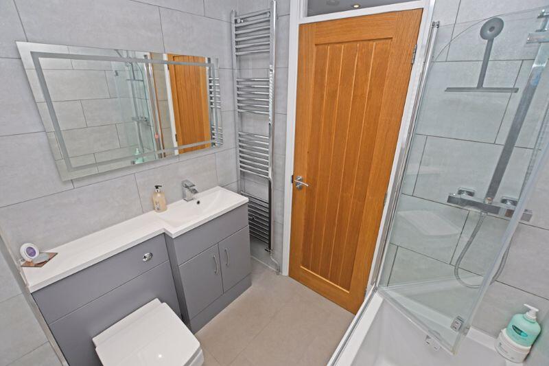
- BATHROOM:
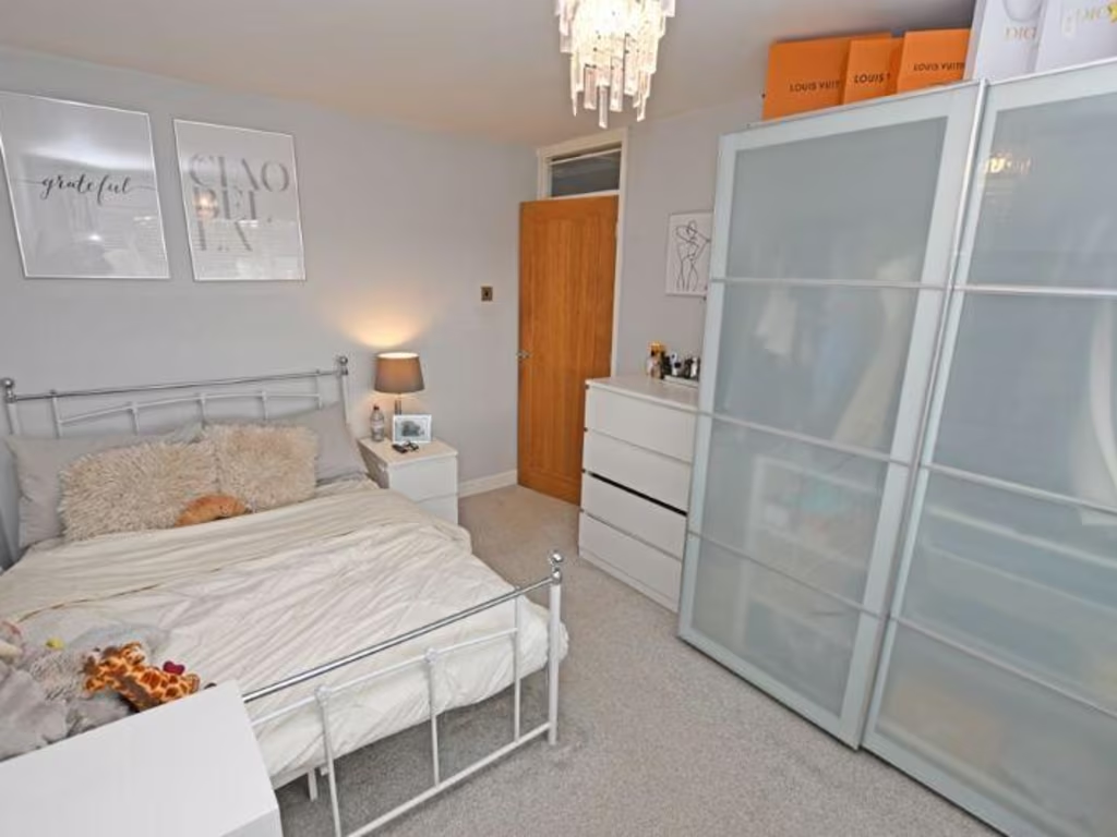
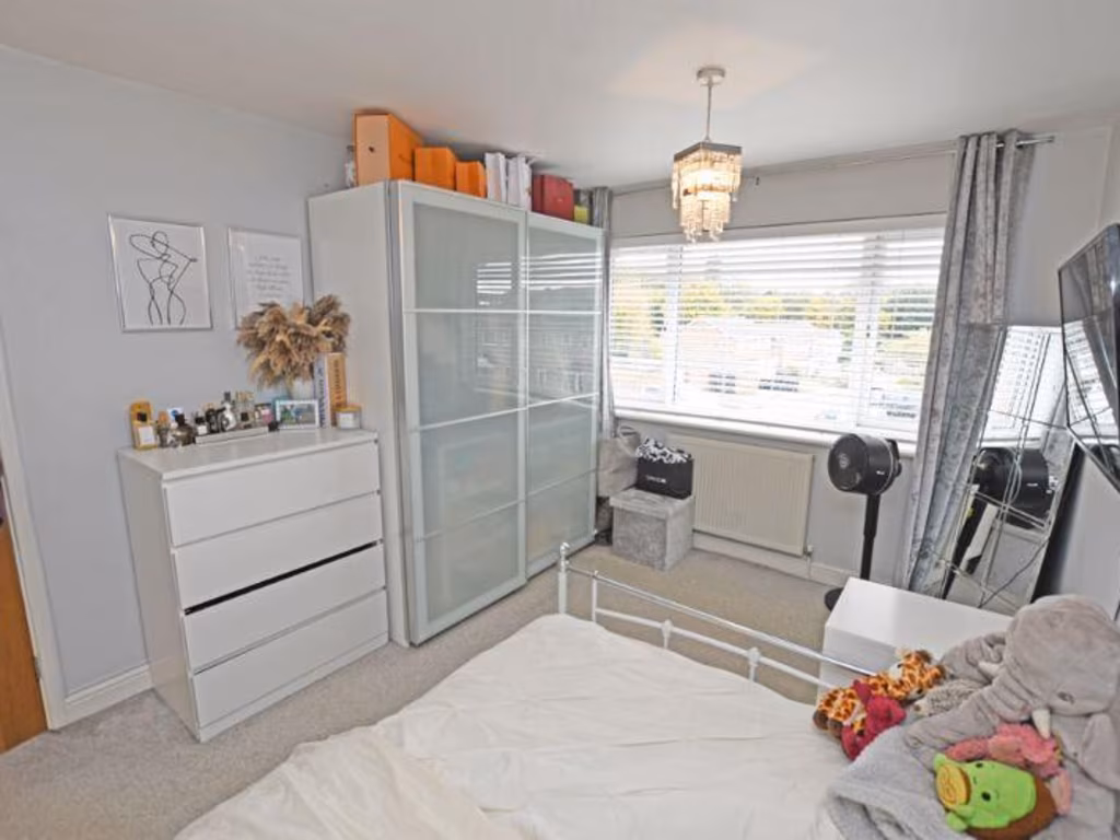
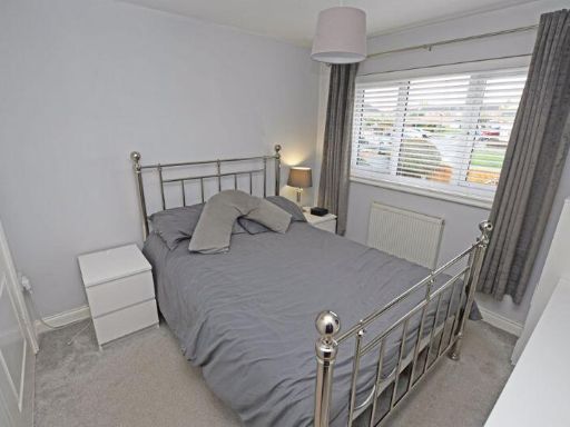
- BEDROOM 1:
- BEDROOM 2:
Textual Property Features
Detected Visual Features
- terraced
- brick
- modern build
- driveway
- car parking
- residential
- urban
- family home
- close neighbors
- back garden
- outdoor space
- contemporary garden
- fence
- patio
- tiled patio
- lawn
- low maintenance
- privacy
EPC Details
- Fully double glazed
- Cavity wall, filled cavity
- Boiler and radiators, mains gas
- Low energy lighting in all fixed outlets
- Solid, no insulation (assumed)
Nearby Schools
- Molehill Primary Academy
- South Borough Primary School
- St Michael's Church of England Infant School Maidstone
- School of Science and Technology Maidstone
- Maidstone, St John's Church of England Primary School
- MEPA ACADEMY
- Brunswick House Primary School
- Maidstone Grammar School for Girls
- New Line Learning Academy
- Oaks Primary Academy
- Park Way Primary School
- Maidstone Grammar School
- Roseacre Junior School
- Valley Invicta Primary School At East Borough
- The Maplesden Noakes School
- St Paul's Infant School
- Sandling Primary School
- Greenfields Community Primary School
- Madginford Primary School
- Archbishop Courtenay Primary School
- Thurnham Church of England Infant School
- Valley Park School
- Invicta Grammar School
- Maidstone, St Michael's Church of England Junior School
- Bearsted Primary Academy
- North Borough Junior School
Nearest General Shops
- Id: 5722391058
- Tags:
- Brand: The Edinburgh Woollen Mill
- Brand:wikidata: Q16834657
- Brand:wikipedia: en:Edinburgh Woollen Mill
- Name: The Edinburgh Woollen Mill
- Shop: clothes
- TagsNormalized:
- Lat: 51.2842154
- Lon: 0.5516622
- FullGeoHash: u107u818nwtj
- PartitionGeoHash: u107
- Images:
- FoodStandards: null
- Distance: 616.6
,- Id: 221719873
- Tags:
- Addr:
- Building: yes
- Name: Notcutts
- Operator: Notcutts
- Shop: garden_centre
- TagsNormalized:
- Lat: 51.2844943
- Lon: 0.5514654
- FullGeoHash: u107u819f4dk
- PartitionGeoHash: u107
- Images:
- FoodStandards: null
- Distance: 613.1
,- Id: 706203320
- Tags:
- Addr:
- City: Maidstone
- Postcode: ME14 3EN
- Street: Sittingbourne Road
- Branch: Home and Fashion
- Brand: Next
- Brand:wikidata: Q246655
- Brand:wikipedia: en:Next plc
- Building: yes
- Building:levels: 2
- Clothes: men;women;children
- Name: Next
- Operator: Next
- Shop: clothes
- Source: Local Knowldge;aerial imagery
- TagsNormalized:
- Lat: 51.2851239
- Lon: 0.5484174
- FullGeoHash: u107u2pme018
- PartitionGeoHash: u107
- Images:
- FoodStandards: null
- Distance: 457.6
}
Nearest Grocery shops
- Id: 5030801048
- Tags:
- Addr:
- City: Maidstone
- Housenumber: 327
- Postcode: ME14 2HN
- Street: Boxley Road
- Brand: McColl's
- Brand:wikidata: Q16997477
- Brand:wikipedia: en:McColl's
- Contact:
- Website: https://www.mccolls.co.uk/storelocator/penenden-heath-boxley-road/
- Fhrs:
- Name: McColl's
- Shop: convenience
- TagsNormalized:
- Lat: 51.2886523
- Lon: 0.5355256
- FullGeoHash: u107u0vfn9ub
- PartitionGeoHash: u107
- Images:
- FoodStandards:
- Id: 721135
- FHRSID: 721135
- LocalAuthorityBusinessID: PI/000075995/MA
- BusinessName: McColls
- BusinessType: Retailers - other
- BusinessTypeID: 4613
- AddressLine1: 327 Boxley Road
- AddressLine2: Maidstone
- AddressLine3: Kent
- AddressLine4: null
- PostCode: ME14 2HN
- RatingValue: 5
- RatingKey: fhrs_5_en-GB
- RatingDate: 2020-09-09
- LocalAuthorityCode: 185
- LocalAuthorityName: Maidstone
- LocalAuthorityWebSite: http://www.maidstone.gov.uk/
- LocalAuthorityEmailAddress: EHAdmin@midkent.gov.uk
- Scores:
- Hygiene: 0
- Structural: 0
- ConfidenceInManagement: 0
- NewRatingPending: false
- Geocode:
- Longitude: 0.53547900000000
- Latitude: 51.28849600000000
- Distance: 852.5
,- Id: 5030801061
- Tags:
- Brand: Londis
- Brand:wikidata: Q21008564
- Name: Londis
- Shop: convenience
- Wheelchair: yes
- TagsNormalized:
- Lat: 51.2884523
- Lon: 0.5356402
- FullGeoHash: u107u0y0ck6r
- PartitionGeoHash: u107
- Images:
- FoodStandards: null
- Distance: 830.2
,- Id: 4198770793
- Tags:
- Addr:
- City: Maidstone
- Housenumber: 1
- Postcode: ME14 5HE
- Street: Hatherall Road
- Fhrs:
- Authority: Maidstone
- Id: 720877
- Inspectiondate: 2015-05-20
- Rating: Exempt
- Name: Foley Park News
- Shop: convenience
- TagsNormalized:
- Lat: 51.2820915
- Lon: 0.5323818
- FullGeoHash: u107speev6sx
- PartitionGeoHash: u107
- Images:
- FoodStandards: null
- Distance: 752
}
Nearest Religious buildings
- Id: 791281491
- Tags:
- Amenity: place_of_worship
- Building: yes
- Denomination: evangelical
- Name: Maidstone Family Church
- Religion: christian
- TagsNormalized:
- place of worship
- evangelical
- church
- christian
- Lat: 51.2823958
- Lon: 0.5270535
- FullGeoHash: u107ezxv95rw
- PartitionGeoHash: u107
- Images:
- FoodStandards: null
- Distance: 1120.3
,- Id: 879339245
- Tags:
- Addr:
- City: Maidstone
- County: Kent
- Housenumber: 130
- Postcode: ME14 2AH
- Street: Boxley Road
- Amenity: place_of_worship
- Building: church
- Denomination: anglican
- Fhrs:
- Authority: Maidstone
- Id: 720882
- Inspectiondate: 2014-10-13
- Rating: 5
- Name: St Paul's Church
- Religion: christian
- Wikidata: Q105092626
- TagsNormalized:
- place of worship
- church
- anglican
- christian
- Lat: 51.2843173
- Lon: 0.5289632
- FullGeoHash: u107u010v9xs
- PartitionGeoHash: u107
- Images:
- FoodStandards:
- Id: 720882
- FHRSID: 720882
- LocalAuthorityBusinessID: PI/000048062/MA
- BusinessName: St Pauls Church Halls C/o St Pauls Church
- BusinessType: Other catering premises
- BusinessTypeID: 7841
- AddressLine1: 130 Boxley Road
- AddressLine2: Maidstone
- AddressLine3: Kent
- AddressLine4: null
- PostCode: ME14 2AH
- RatingValue: 5
- RatingKey: fhrs_5_en-GB
- RatingDate: 2014-10-13
- LocalAuthorityCode: 185
- LocalAuthorityName: Maidstone
- LocalAuthorityWebSite: http://www.maidstone.gov.uk/
- LocalAuthorityEmailAddress: EHAdmin@midkent.gov.uk
- Scores:
- Hygiene: 0
- Structural: 5
- ConfidenceInManagement: 0
- NewRatingPending: false
- Geocode:
- Longitude: 0.53041000000000
- Latitude: 51.28474700000000
- Distance: 1004.3
,- Id: 882314899
- Tags:
- Amenity: place_of_worship
- Building: church
- Denomination: anglican
- Name: Parish Church of St Luke the Evangelist
- Religion: christian
- Wikidata: Q26376525
- TagsNormalized:
- place of worship
- church
- anglican
- evangelist
- parish
- christian
- Lat: 51.2799107
- Lon: 0.5298218
- FullGeoHash: u107sp1z1spy
- PartitionGeoHash: u107
- Images:
- FoodStandards: null
- Distance: 976.3
}
Nearest Leisure Facilities
- Id: 28578333
- Tags:
- Area: yes
- Leisure: park
- Name: Vinters Valley Nature Reserve
- Wikidata: Q55099067
- Wikipedia: en:Vinters Valley Park
- TagsNormalized:
- Lat: 51.2776284
- Lon: 0.5460307
- FullGeoHash: u107sqv9g6vb
- PartitionGeoHash: u107
- Images:
- FoodStandards: null
- Distance: 593.3
,- Id: 28374867
- Tags:
- TagsNormalized:
- Lat: 51.2773998
- Lon: 0.5417509
- FullGeoHash: u107sqf2x8ns
- PartitionGeoHash: u107
- Images:
- FoodStandards: null
- Distance: 592.2
,- Id: 1117650874
- Tags:
- TagsNormalized:
- swimming
- swimming pool
- pool
- leisure
- Lat: 51.280302
- Lon: 0.5360353
- FullGeoHash: u107spq36t0u
- PartitionGeoHash: u107
- Images:
- FoodStandards: null
- Distance: 560
,- Id: 152834159
- Tags:
- TagsNormalized:
- Lat: 51.2862301
- Lon: 0.5440379
- FullGeoHash: u107u2k5vn0p
- PartitionGeoHash: u107
- Images:
- FoodStandards: null
- Distance: 402.5
,- Id: 28385463
- Tags:
- TagsNormalized:
- Lat: 51.2846377
- Lon: 0.5421631
- FullGeoHash: u107u24f9m6h
- PartitionGeoHash: u107
- Images:
- FoodStandards: null
- Distance: 231.3
}
Nearest Tourist attractions
- Id: 907788417
- Tags:
- Building: yes
- Museum: history
- Name: Museum of Carriages
- Tourism: museum
- Wikidata: Q17964487
- TagsNormalized:
- Lat: 51.2712896
- Lon: 0.5221334
- FullGeoHash: u107evshyt4g
- PartitionGeoHash: u107
- Images:
- FoodStandards: null
- Distance: 1932.6
,- Id: 252113538
- Tags:
- Building: yes
- Name: Maidstone Museum
- Tourism: museum
- Wikidata: Q6735528
- Wikipedia: en:Maidstone Museum
- TagsNormalized:
- Lat: 51.2760603
- Lon: 0.5205925
- FullGeoHash: u107eye0dwmv
- PartitionGeoHash: u107
- Images:
- FoodStandards: null
- Distance: 1732.2
,- Id: 311644153
- Tags:
- Name: Grove Green
- Tourism: village_sign
- TagsNormalized:
- Lat: 51.2788554
- Lon: 0.5532128
- FullGeoHash: u107sx4bfz3r
- PartitionGeoHash: u107
- Images:
- FoodStandards: null
- Distance: 817
}
Nearest Train stations
- Id: 6692612526
- Tags:
- Name: Barming
- Naptan:
- Network: National Rail
- Public_transport: station
- Railway: station
- Ref:
- Source: NPE
- Wikidata: Q4861272
- Wikipedia: en:Barming railway station
- TagsNormalized:
- Lat: 51.2848536
- Lon: 0.4792926
- FullGeoHash: u107fbj5bmdk
- PartitionGeoHash: u107
- Images:
- FoodStandards: null
- Distance: 4448.4
,- Id: 6692612517
- Tags:
- Addr:
- Postcode: ME14 4PH
- Street: Ware Street
- Name: Bearsted
- Naptan:
- Network: National Rail
- Public_transport: station
- Railway: station
- Ref:
- Wikidata: Q2513832
- Wikipedia: en:Bearsted railway station
- TagsNormalized:
- Lat: 51.2759153
- Lon: 0.577672
- FullGeoHash: u107tnkxuerm
- PartitionGeoHash: u107
- Images:
- FoodStandards: null
- Distance: 2514.9
,- Id: 6688355480
- Tags:
- Name: Maidstone West
- Naptan:
- Network: National Rail
- Postal_code: ME16 8RJ
- Public_transport: station
- Railway: station
- Ref:
- Source: NPE
- Wikipedia: en:Maidstone West railway station
- TagsNormalized:
- Lat: 51.2703088
- Lon: 0.5157564
- FullGeoHash: u107etrx1yrb
- PartitionGeoHash: u107
- Images:
- FoodStandards: null
- Distance: 2348.7
,- Id: 6688355481
- Tags:
- Name: Maidstone Barracks
- Naptan:
- Network: National Rail
- Postal_code: ME16 0SQ
- Public_transport: station
- Railway: station
- Ref:
- Wikidata: Q2913119
- Wikipedia: en:Maidstone Barracks railway station
- TagsNormalized:
- Lat: 51.2770433
- Lon: 0.5141731
- FullGeoHash: u107ewwqmjem
- PartitionGeoHash: u107
- Images:
- FoodStandards: null
- Distance: 2110.2
,- Id: 6692612534
- Tags:
- Name: Maidstone East
- Naptan:
- Network: National Rail
- Postal_code: ME14 1QN
- Public_transport: station
- Railway: station
- Ref:
- Wikidata: Q952299
- Wikipedia: en:Maidstone East railway station
- TagsNormalized:
- Lat: 51.2776262
- Lon: 0.5199007
- FullGeoHash: u107eyf9fd64
- PartitionGeoHash: u107
- Images:
- FoodStandards: null
- Distance: 1711.3
}
Nearest Hotels
- Id: 238965514
- Tags:
- Access: customers
- Amenity: parking
- Capacity:
- Fee: no
- Name: Travelodge Maidstone Central Hotel
- Park_ride: no
- Parking: surface
- Source: survey,Bing
- TagsNormalized:
- Lat: 51.2729682
- Lon: 0.5166374
- FullGeoHash: u107evbnww0b
- PartitionGeoHash: u107
- Images:
- FoodStandards: null
- Distance: 2135.9
,- Id: 255074827
- Tags:
- Addr:
- Name: Stone Court Hotel
- Tourism: hotel
- TagsNormalized:
- Lat: 51.2715769
- Lon: 0.5247389
- FullGeoHash: u107evwne69t
- PartitionGeoHash: u107
- Images:
- FoodStandards: null
- Distance: 1777
,- Id: 13354805
- Tags:
- Addr:
- City: Maidstone
- Postcode: ME14 5AA
- Street: Bearsted Road
- Brand: Orida
- Building: yes
- Email: reservations.maidstone@oridahotels.com
- Name: Orida
- Phone: +44 1622 734322
- Start_date: 2022-01-01
- Tourism: hotel
- Type: multipolygon
- Website: https://oridahotels.com/
- TagsNormalized:
- Lat: 51.2854697
- Lon: 0.5464182
- FullGeoHash: u107u2jzs2qz
- PartitionGeoHash: u107
- Images:
- FoodStandards: null
- Distance: 386.8
}
Tags
- terraced
- brick
- modern build
- driveway
- car parking
- residential
- urban
- family home
- close neighbors
- back garden
- outdoor space
- contemporary garden
- fence
- patio
- tiled patio
- lawn
- low maintenance
- privacy
Local Market Stats
- Average Price/sqft: £356
- Avg Income: £58500
- Rental Yield: 3.8%
- Social Housing: 5%
- Planning Success Rate: 80%
AirBnB Data
- 1km average: £76/night
- Listings in 1km: 4
Similar Properties
 3 bedroom semi-detached house for sale in Cudham Close, MAIDSTONE, Kent, ME14 — £375,000 • 3 bed • 1 bath • 988 ft²
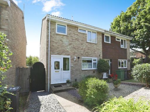 3 bedroom semi-detached house for sale in Hampton Road, Maidstone, Kent, ME14 — £350,000 • 3 bed • 1 bath • 813 ft²
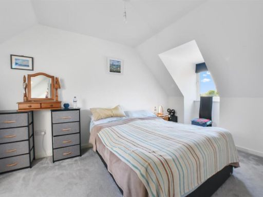 3 bedroom terraced house for sale in Whatman Drive, Maidstone, ME14 — £310,000 • 3 bed • 2 bath • 813 ft²
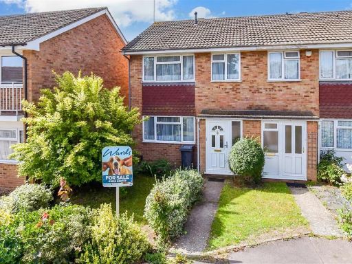 3 bedroom end of terrace house for sale in Bedgebury Close, Maidstone, Kent, ME14 — £350,000 • 3 bed • 1 bath • 678 ft²
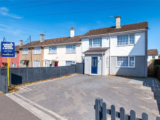 3 bedroom end of terrace house for sale in Westmorland Road, Maidstone, Kent, ME15 — £350,000 • 3 bed • 2 bath • 1176 ft²
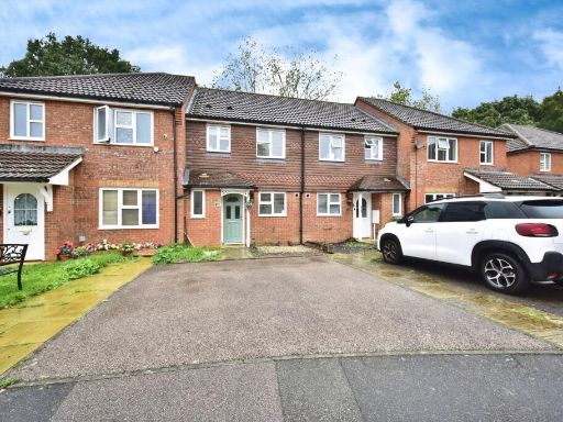 3 bedroom terraced house for sale in Morris Close, MAIDSTONE, Kent, ME17 — £325,000 • 3 bed • 1 bath • 721 ft²
Meta
- {
"@context": "https://schema.org",
"@type": "Residence",
"name": "3 bedroom terraced house for sale in Newenden Close, Maidst…",
"description": "",
"url": "https://propertypiper.co.uk/property/335f4ba0-22e9-4888-b69e-449a8982a063",
"image": "https://image-a.propertypiper.co.uk/5234f1bc-4e56-4e9f-8944-b074b0752cb8-1024.jpeg",
"address": {
"@type": "PostalAddress",
"streetAddress": "33 NEWENDEN CLOSE MAIDSTONE ",
"postalCode": "ME14 5RU",
"addressLocality": "Maidstone",
"addressRegion": "Maidstone and The Weald",
"addressCountry": "England"
},
"geo": {
"@type": "GeoCoordinates",
"latitude": 51.2826523,
"longitude": 0.5431563
},
"numberOfRooms": 3,
"numberOfBathroomsTotal": 1,
"floorSize": {
"@type": "QuantitativeValue",
"value": 864,
"unitCode": "FTK"
},
"offers": {
"@type": "Offer",
"price": 350000,
"priceCurrency": "GBP",
"availability": "https://schema.org/InStock"
},
"additionalProperty": [
{
"@type": "PropertyValue",
"name": "Feature",
"value": "terraced"
},
{
"@type": "PropertyValue",
"name": "Feature",
"value": "brick"
},
{
"@type": "PropertyValue",
"name": "Feature",
"value": "modern build"
},
{
"@type": "PropertyValue",
"name": "Feature",
"value": "driveway"
},
{
"@type": "PropertyValue",
"name": "Feature",
"value": "car parking"
},
{
"@type": "PropertyValue",
"name": "Feature",
"value": "residential"
},
{
"@type": "PropertyValue",
"name": "Feature",
"value": "urban"
},
{
"@type": "PropertyValue",
"name": "Feature",
"value": "family home"
},
{
"@type": "PropertyValue",
"name": "Feature",
"value": "close neighbors"
},
{
"@type": "PropertyValue",
"name": "Feature",
"value": "back garden"
},
{
"@type": "PropertyValue",
"name": "Feature",
"value": "outdoor space"
},
{
"@type": "PropertyValue",
"name": "Feature",
"value": "contemporary garden"
},
{
"@type": "PropertyValue",
"name": "Feature",
"value": "fence"
},
{
"@type": "PropertyValue",
"name": "Feature",
"value": "patio"
},
{
"@type": "PropertyValue",
"name": "Feature",
"value": "tiled patio"
},
{
"@type": "PropertyValue",
"name": "Feature",
"value": "lawn"
},
{
"@type": "PropertyValue",
"name": "Feature",
"value": "low maintenance"
},
{
"@type": "PropertyValue",
"name": "Feature",
"value": "privacy"
}
]
}
High Res Floorplan Images
Compatible Floorplan Images
FloorplanImages Thumbnail