NR31 9TS - 4 bedroom detached house for sale in Seafields Drive, Hopto…
View on Property Piper
4 bedroom detached house for sale in Seafields Drive, Hopton, Great Yarmouth, NR31
Property Details
- Price: £375000
- Bedrooms: 4
- Bathrooms: 2
- Property Type: undefined
- Property SubType: undefined
Brochure Descriptions
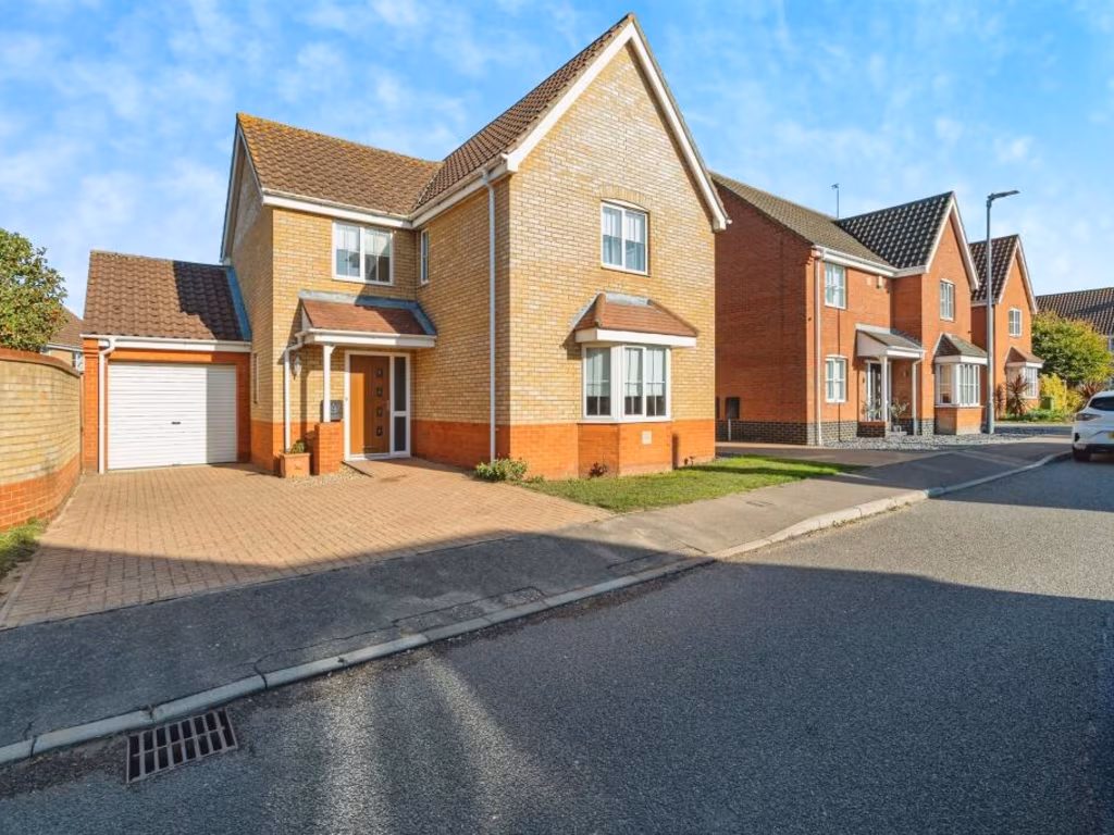
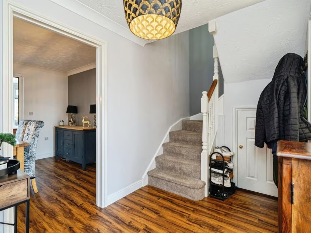
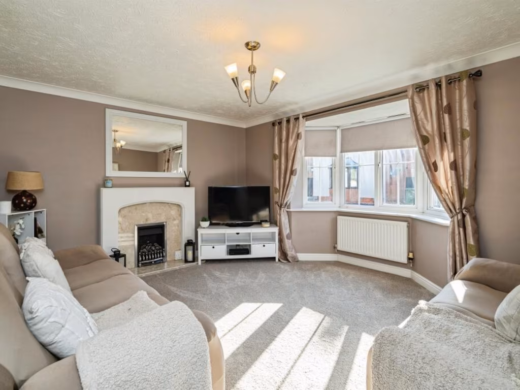
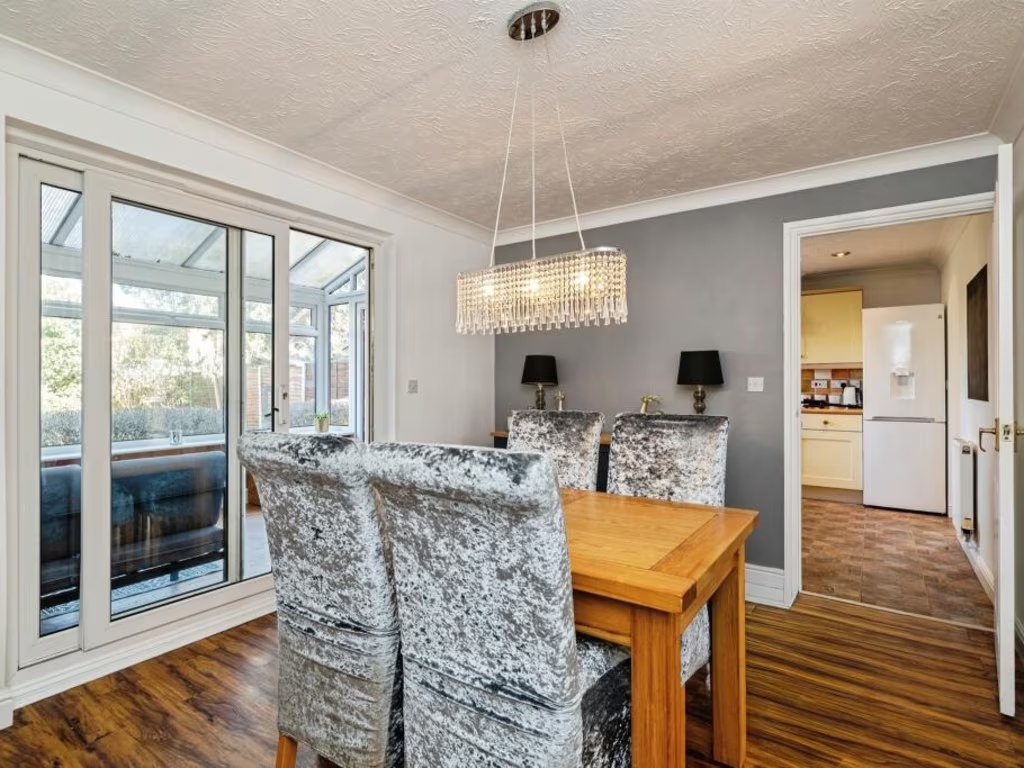
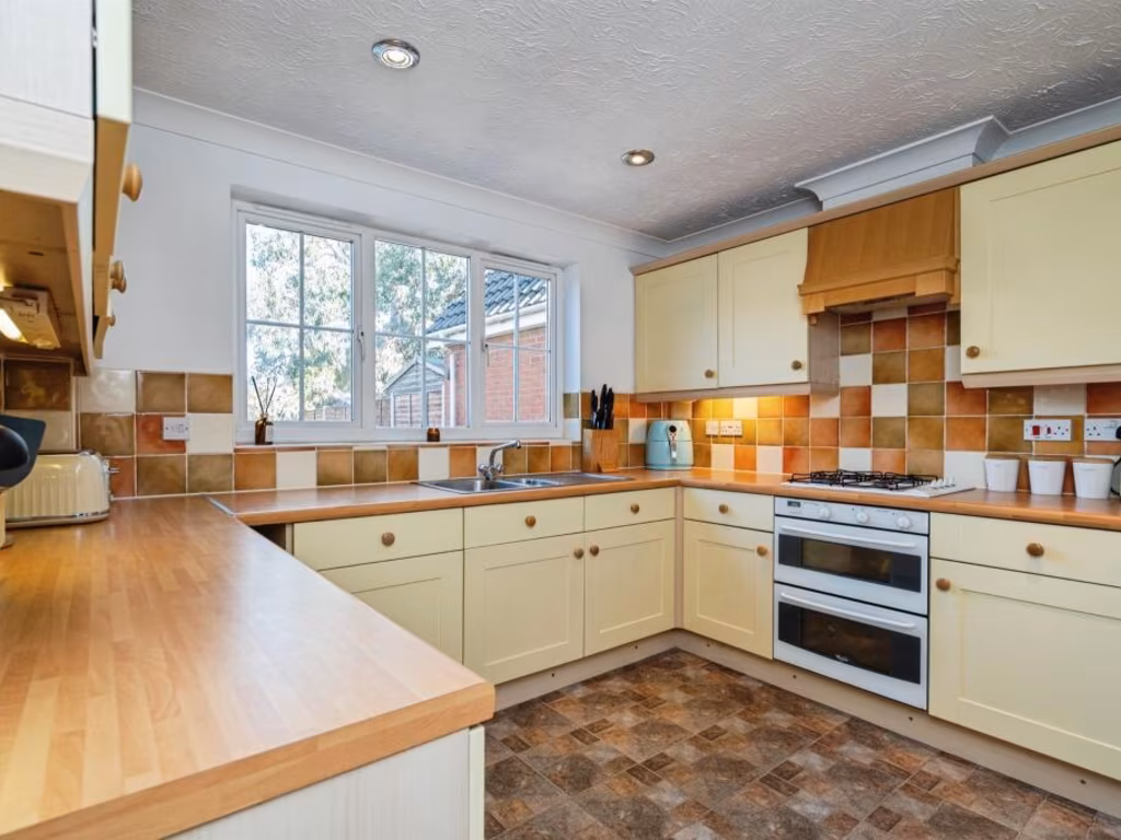
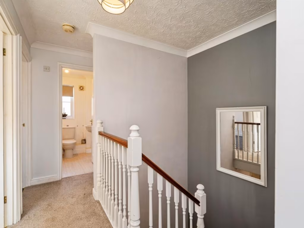
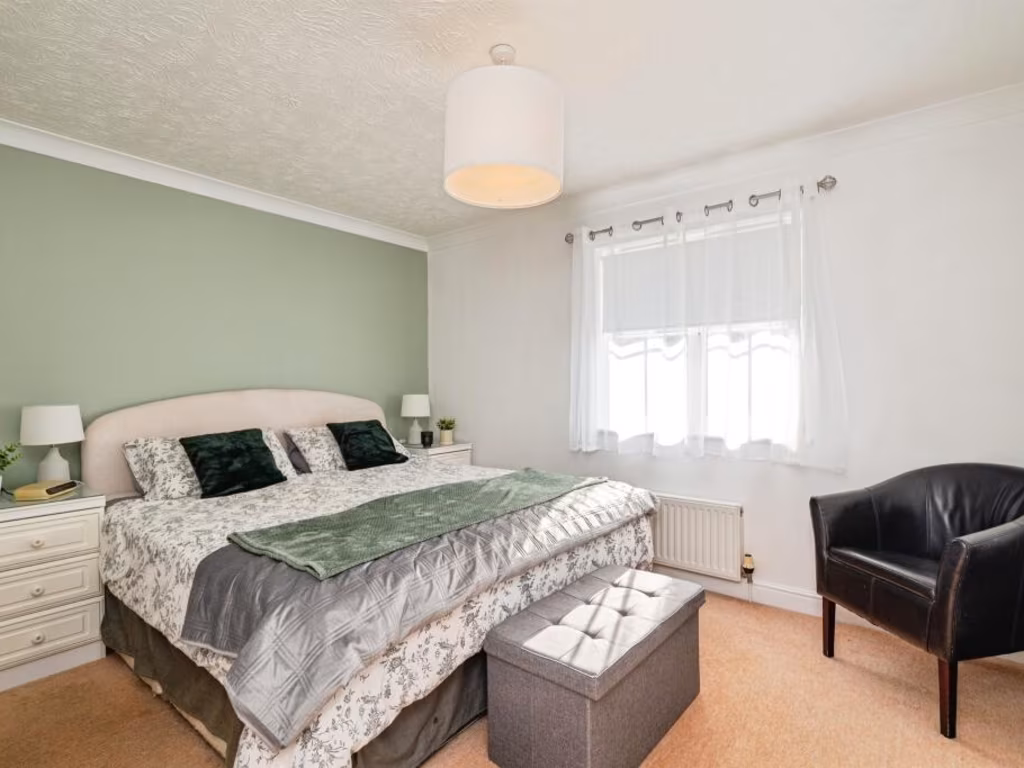
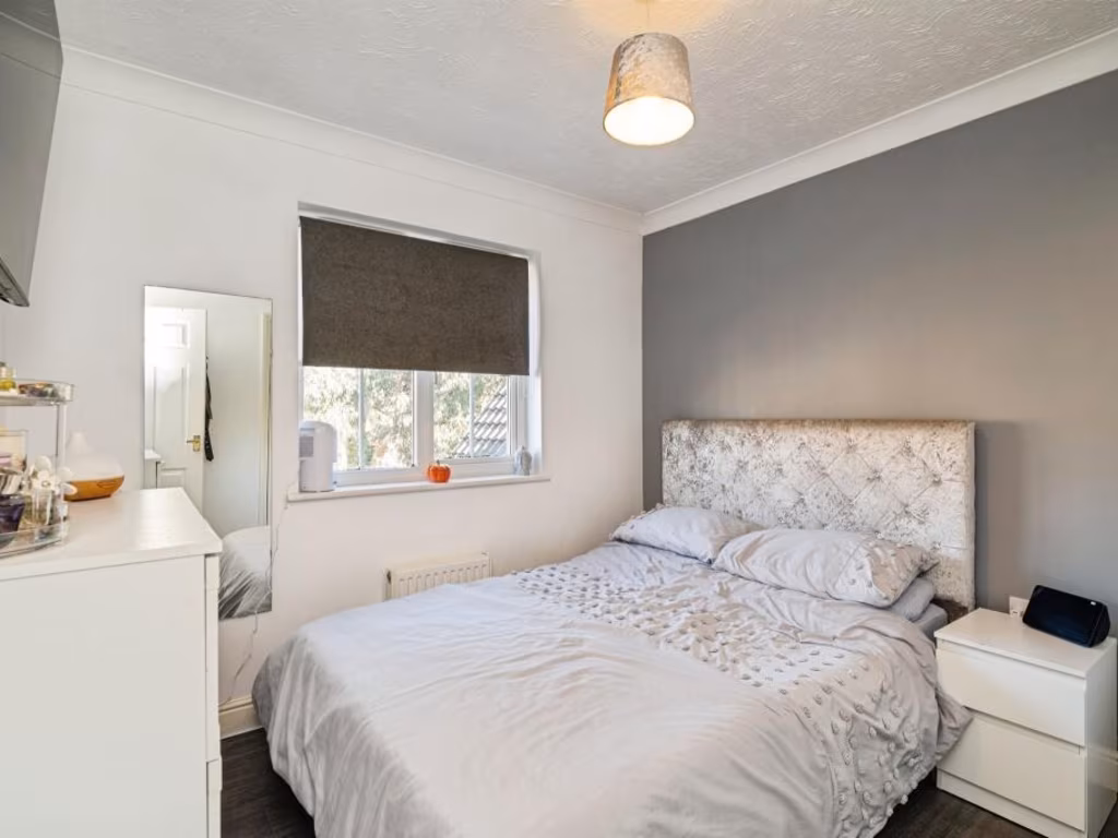
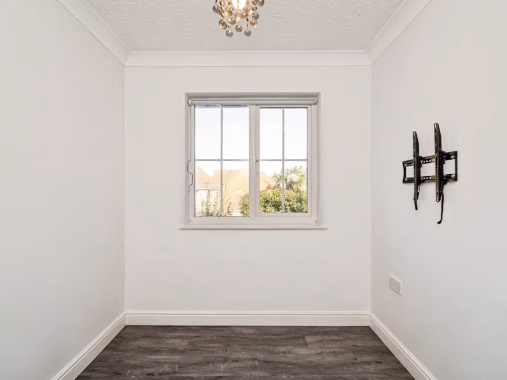
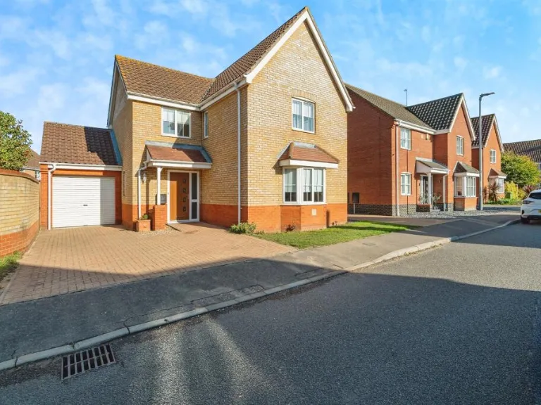
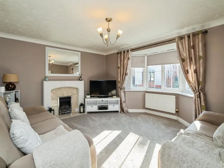
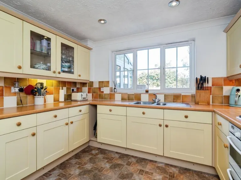
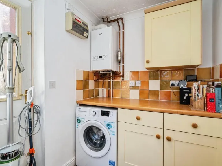
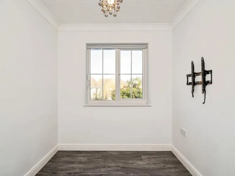
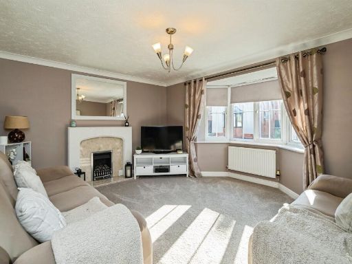
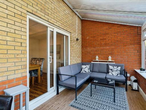
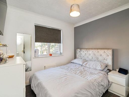
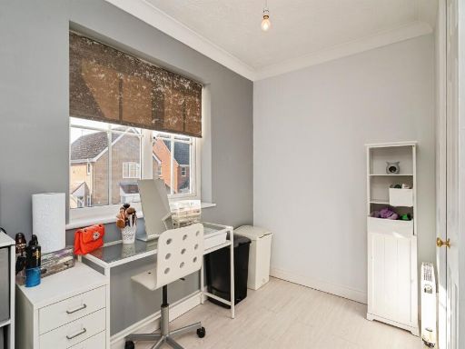
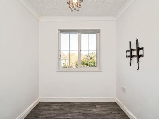
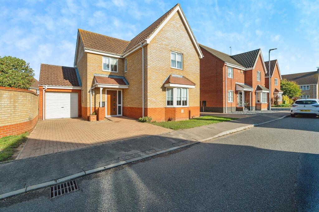
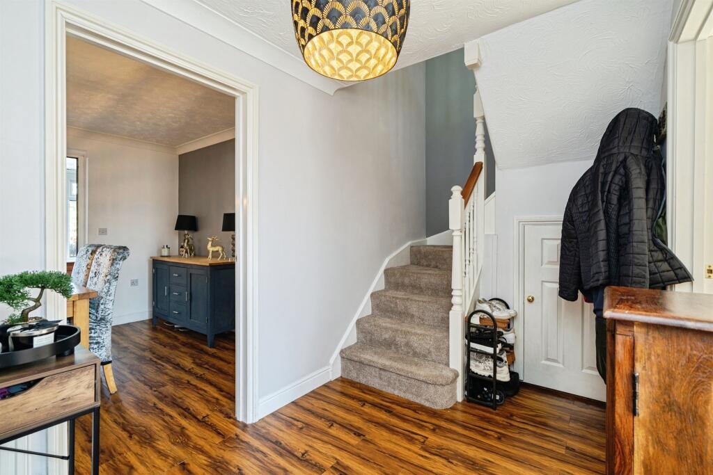
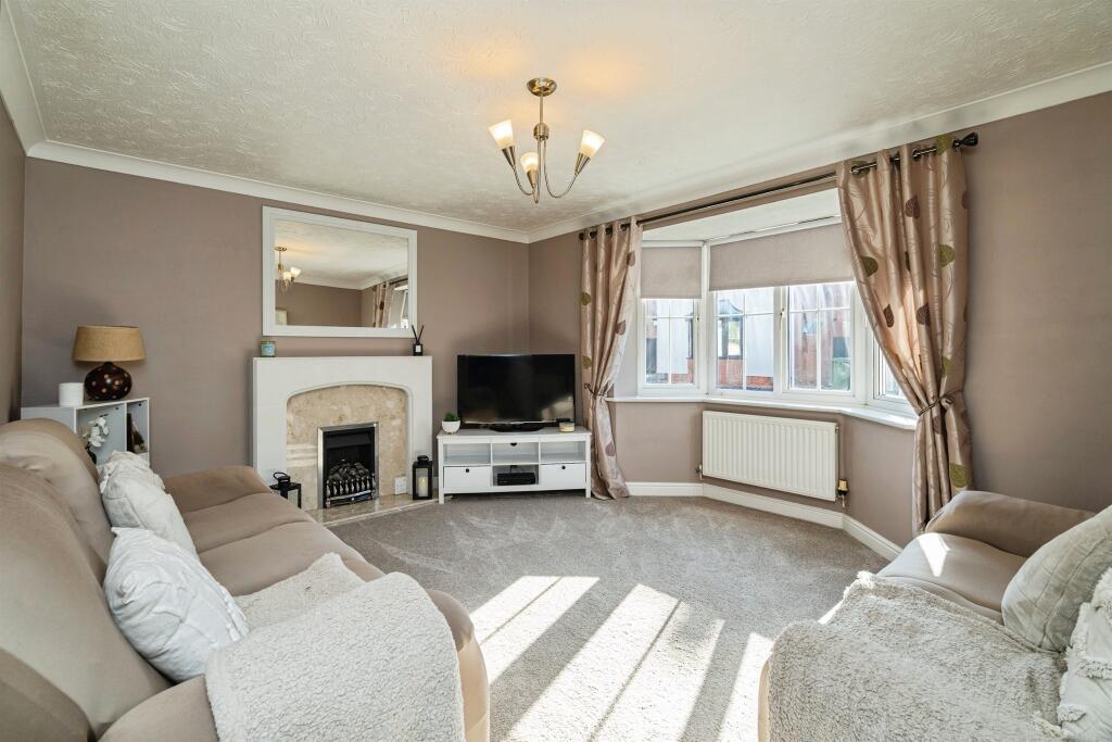
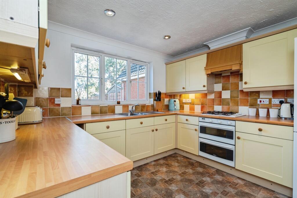
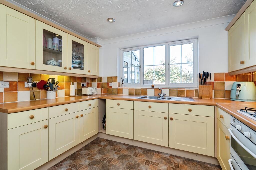
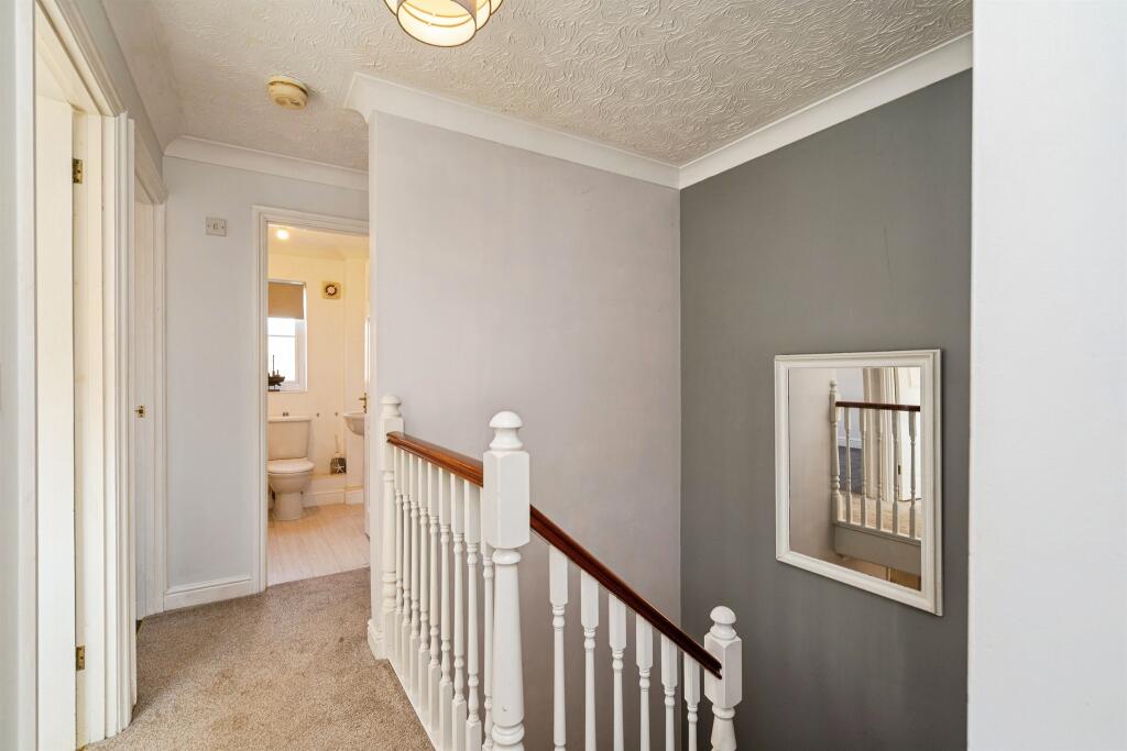
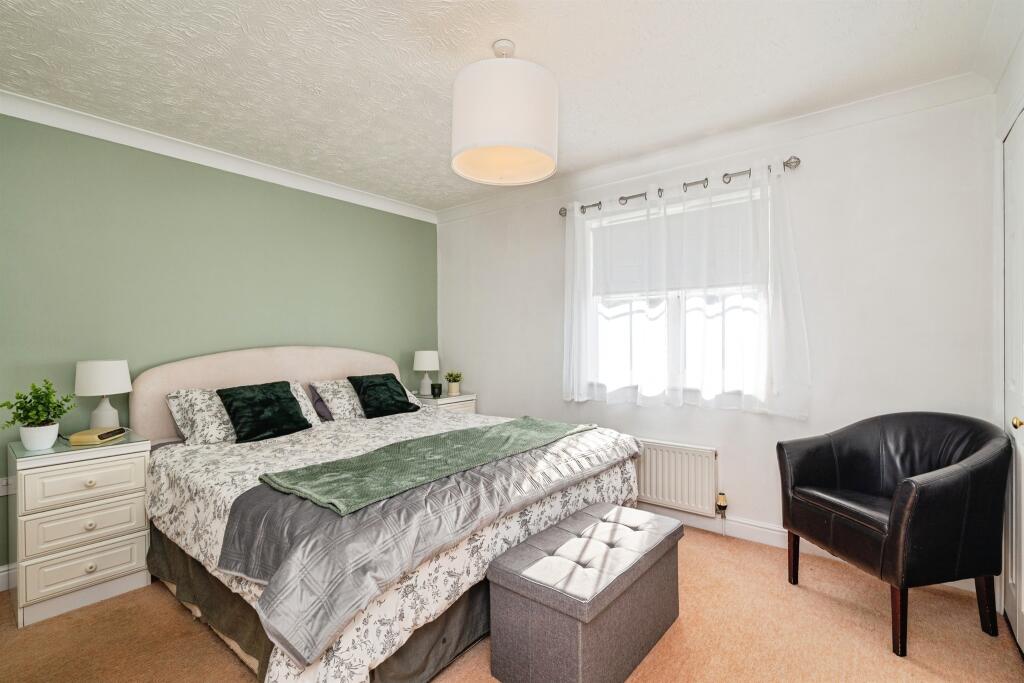
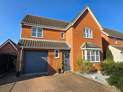
- Detached two-storey modern family house located on a residential street in Hopton (Great Yarmouth). Exterior features a single integral garage, paved driveway for off-street parking and a small front lawn. Interior photos show an entrance hall with stairs, a carpeted, well-proportioned living room with bay window providing good natural light, and a fitted kitchen/dining area (visible in hallway view). Standard modern finishes throughout (wood-effect flooring in hall, neutral decor), suggesting good overall presentation and move-in condition. Plot and room sizes appear to be average for a family house — suitable for commuters or families seeking a low-maintenance suburban home. No notable external views (typical residential street).
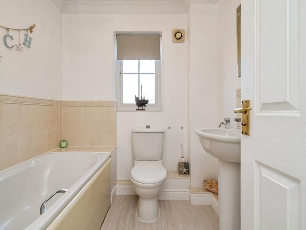
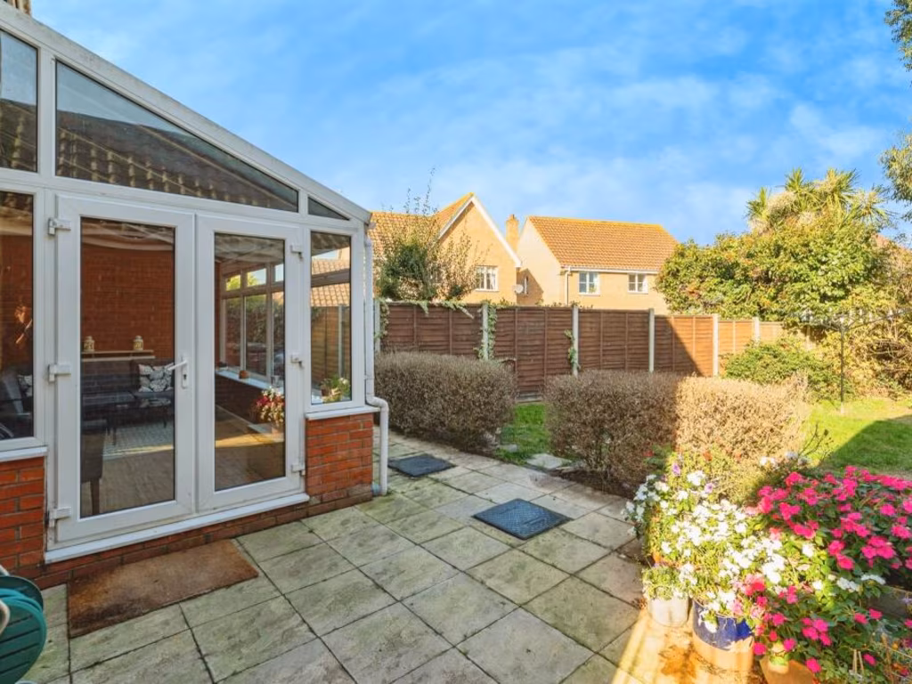
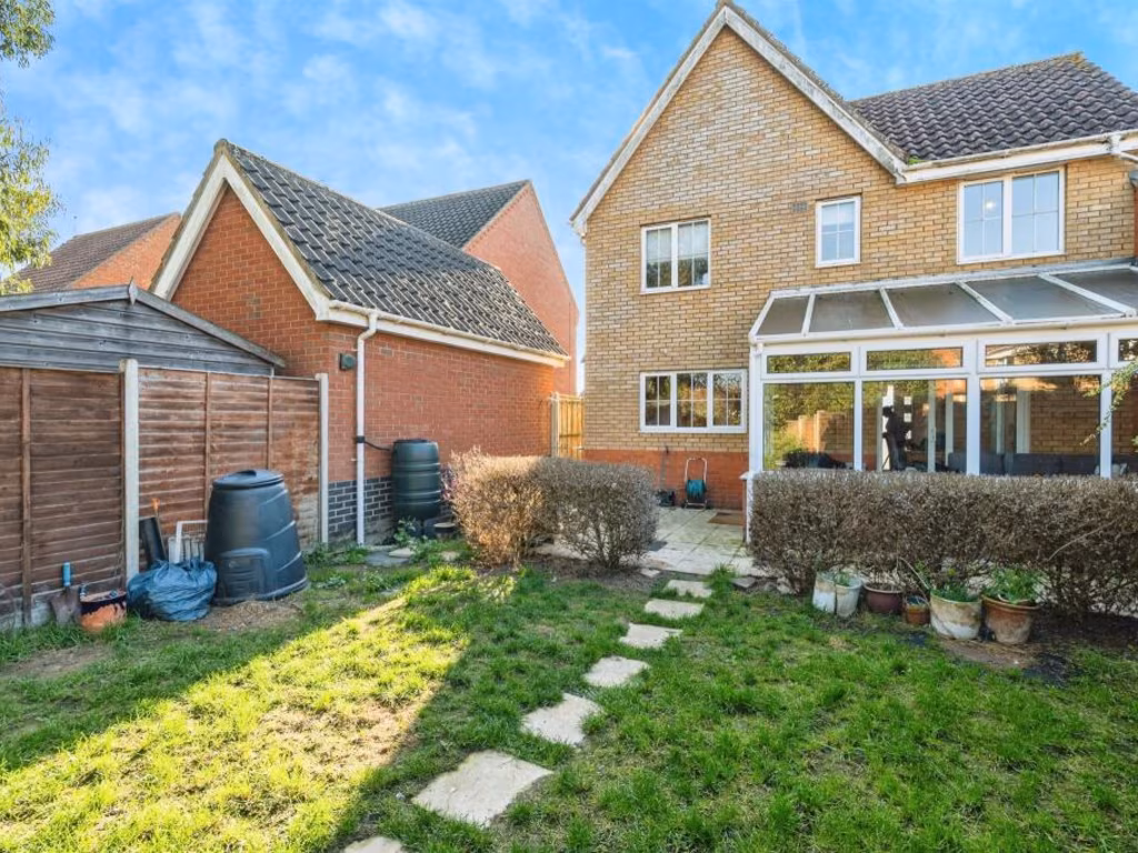
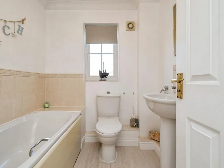
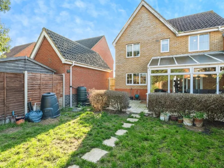
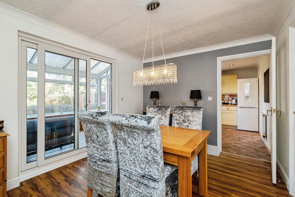
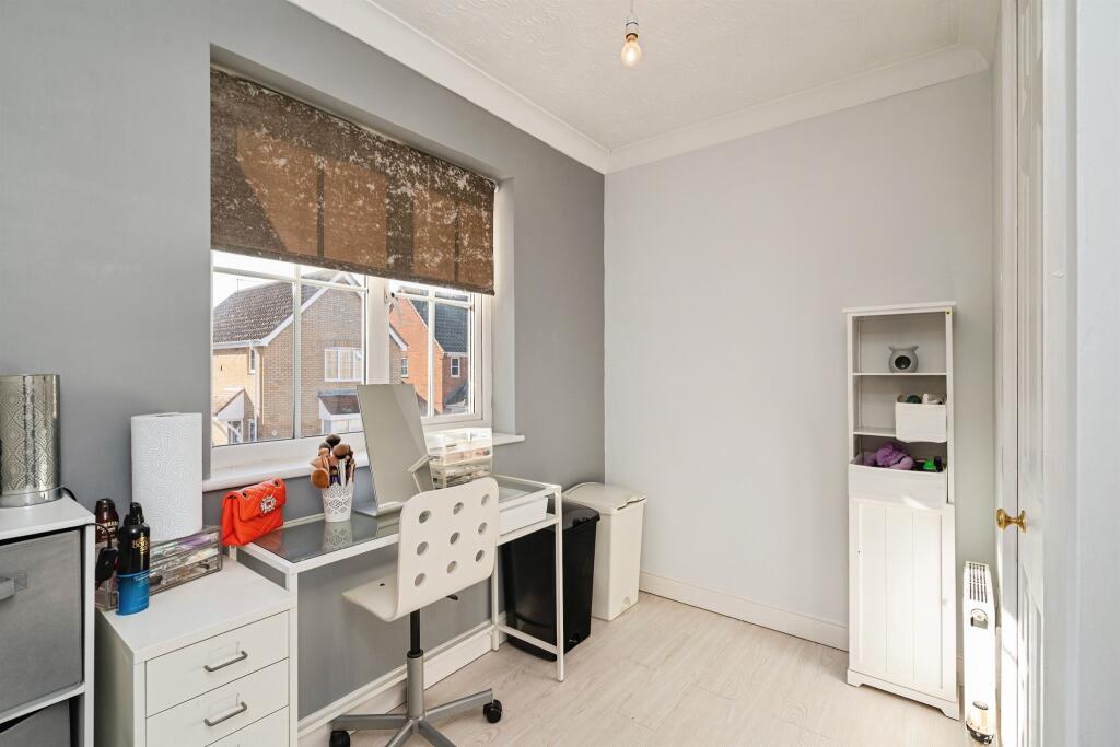
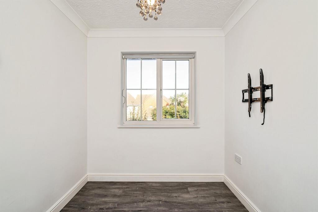
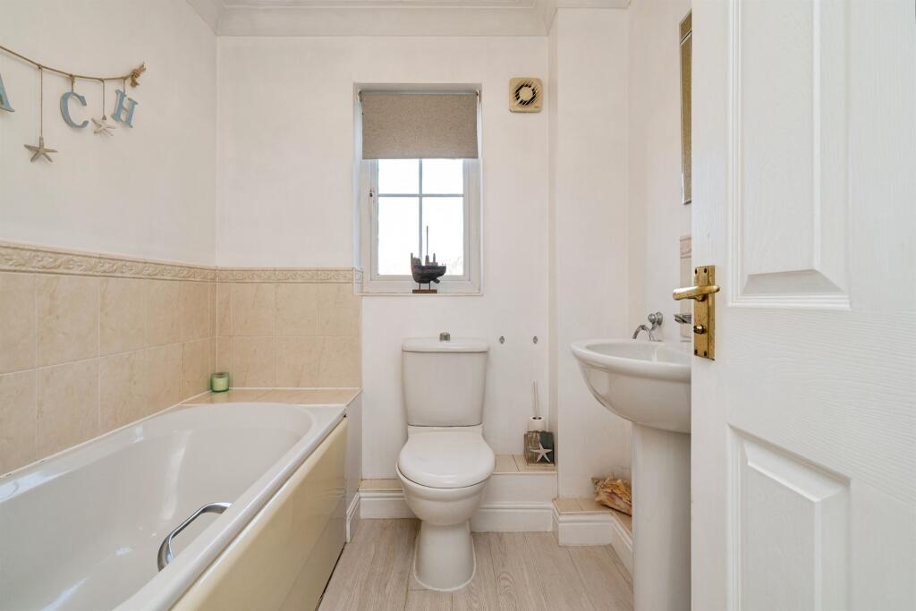
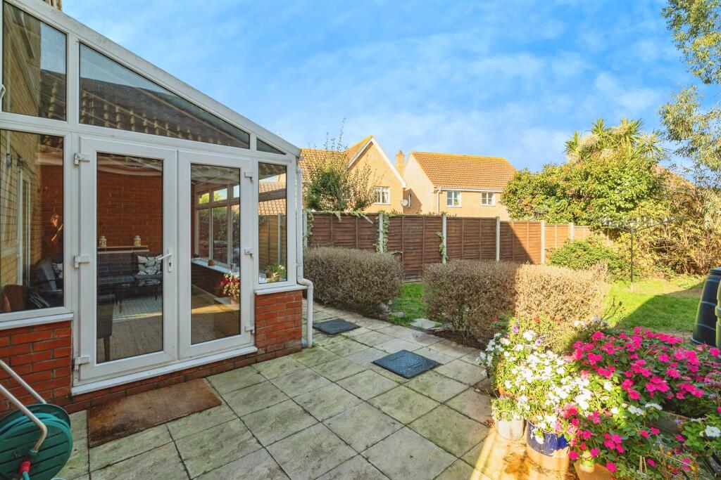
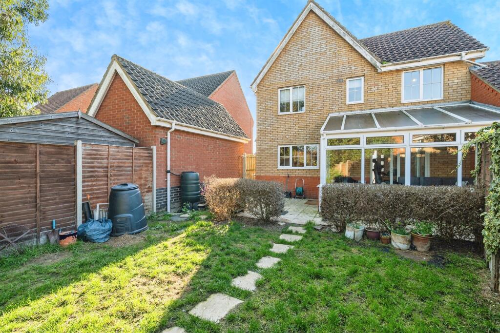
- A four-bedroom detached family home offered Freehold, occupying a residential plot on Seafields Drive in Hopton, Great Yarmouth. The property presents spacious reception rooms and an expansive rear garden (large), together with garage and off-road parking to the front. Benefits include double glazing and gas central heating. Tenure: Freehold. EPC: Awaited. Council Tax Band: D. Layout and finishes appear suited to family occupation; overall plot size is generous to the rear while internal living space appears of average-to-large scale for a 4-bedroom detached property. No notable external view (sea/river/woodland) is evident from the images provided.
Image Descriptions
- detached house modern
- hallway and staircase contemporary
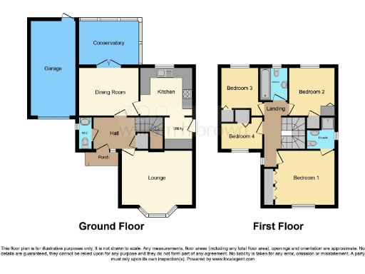
Rooms
- Garage:
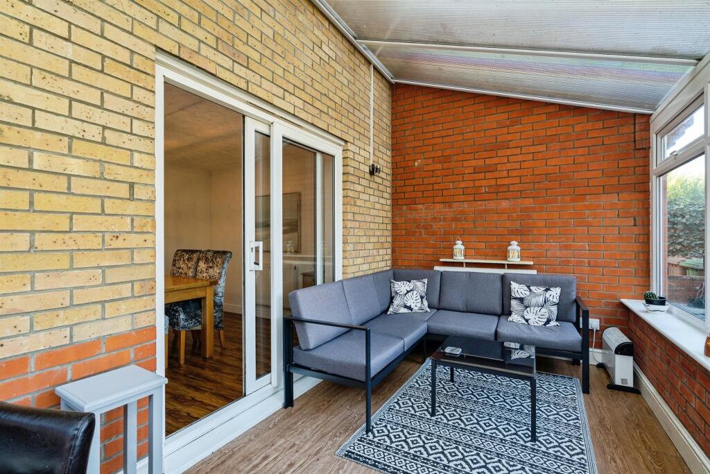
- Conservatory:
- Dining Room:
- Kitchen:
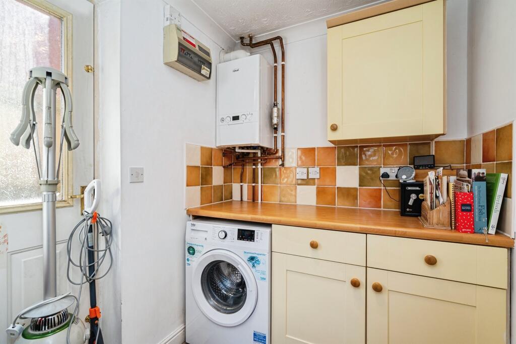
- Utility:
- W.C.:
- Hall:
- Porch:
- Lounge:
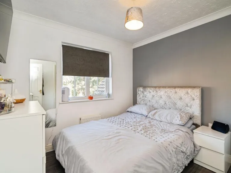
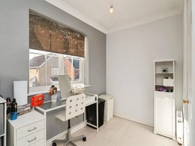
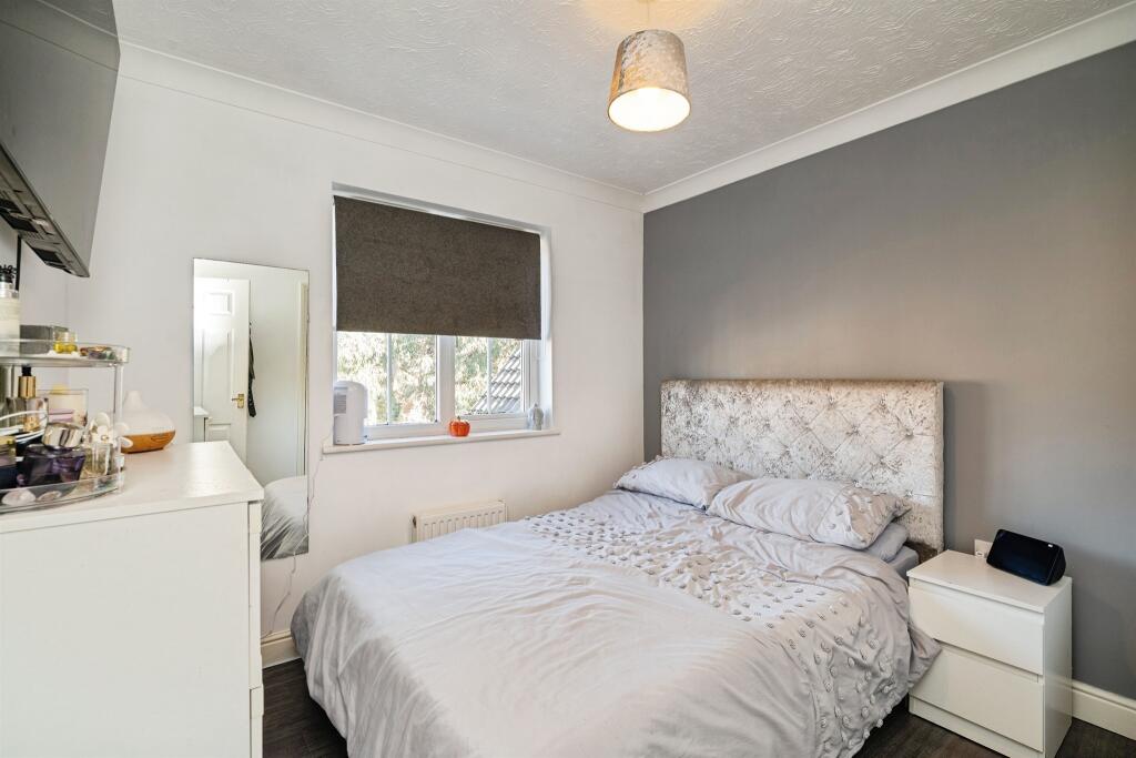
- Bedroom 3:
- Bedroom 2:
- Landing:
- Bedroom 4:
- Bedroom 1:
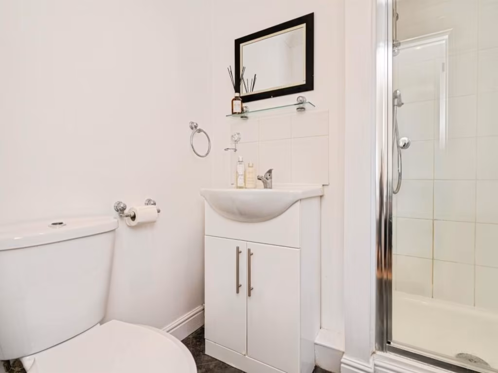
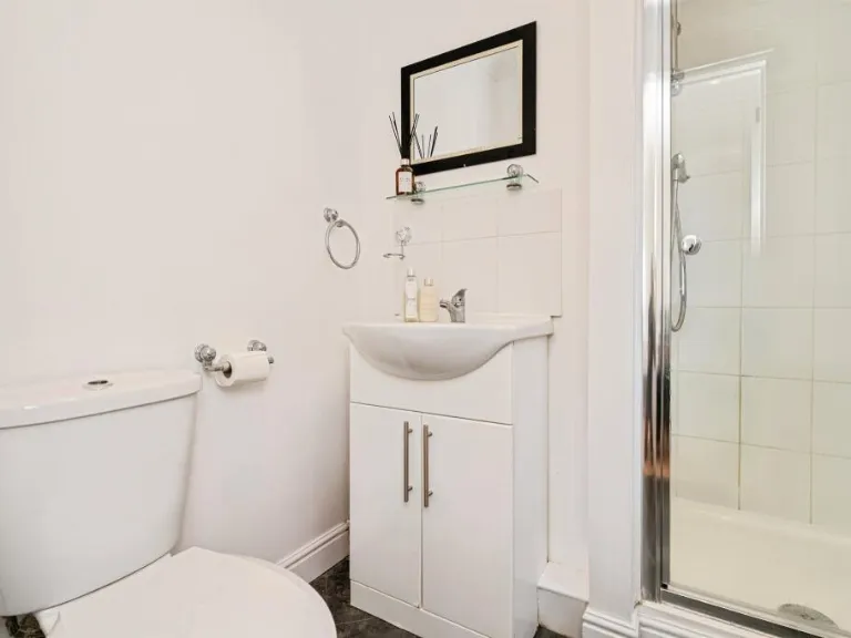
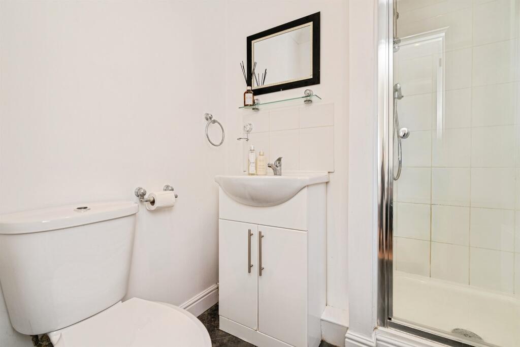
- Bathroom:
- En-suite:
Textual Property Features
Detected Visual Features
- modern detached house
- two-story
- brick construction
- suburban
- paved driveway
- attached garage
- gable roof
- new construction
- residential area
- contemporary
- hallway
- staircase
- wood flooring
- small staircase
- neutral colors
- modern light fixture
Nearby Schools
- Northfield St Nicholas Primary Academy
- Blundeston Church of England Voluntary Controlled Primary School
- Ormiston Cliff Park Primary Academy
- Cliff Park Ormiston Academy
- Woodlands Primary Academy
- Hillside Primary School
- Lynn Grove Academy
- Oulton Broad Primary School
- St Margaret's Primary Academy
- Woods Loke Primary School
- Poplars Community Primary School
- The Limes Primary Academy
- Gunton Primary Academy
- Hopton Church of England Primary Academy
- St Mary and St Peter Catholic Primary School
- Ormiston Denes Academy
- Corton Church of England Voluntary Aided Primary School
- Ormiston Venture Academy
- Peterhouse CofE Primary Academy
- Homefield VC CofE Primary School
- Wroughton Infant Academy
- Wroughton Junior Academy
- Great Yarmouth Primary Academy
- Include Suffolk
- Benjamin Britten Academy of Music and Mathematics
- Ormiston Herman Academy
- Stradbroke Primary Academy
Nearest General Shops
- Id: 1006178549
- Tags:
- Addr:
- City: Hopton-on-Sea
- Postcode: NR31 9BN
- Street: Warren Road
- Building: yes
- Name: Hopton Pharmacy
- Shop: chemist
- Source:
- Addr:
- Postcode: code-point_open
- TagsNormalized:
- Lat: 52.5398756
- Lon: 1.7316783
- FullGeoHash: u134zksfzn8v
- PartitionGeoHash: u134
- Images:
- FoodStandards: null
- Distance: 568.4
,- Id: 1006178560
- Tags:
- Addr:
- City: Hopton-on-Sea
- Postcode: NR31 9BN
- Street: Warren Road
- Building: yes
- Shop: hairdresser
- Source:
- Addr:
- Postcode: code-point_open
- TagsNormalized:
- Lat: 52.5398129
- Lon: 1.7315955
- FullGeoHash: u134zksft4gp
- PartitionGeoHash: u134
- Images:
- FoodStandards: null
- Distance: 560.1
,- Id: 226929670
- Tags:
- Addr:
- Building: yes
- Name: Cottage Loaf
- Shop: bakery
- TagsNormalized:
- Lat: 52.5391698
- Lon: 1.728134
- FullGeoHash: u134zk6qu7n5
- PartitionGeoHash: u134
- Images:
- FoodStandards: null
- Distance: 324.5
}
Nearest Grocery shops
- Id: 3441810948
- Tags:
- Name: Corton Village Stores
- Shop: convenience
- TagsNormalized:
- Lat: 52.5165444
- Lon: 1.7466289
- FullGeoHash: u134z8rg53kv
- PartitionGeoHash: u134
- Images:
- FoodStandards: null
- Distance: 2764.6
,- Id: 226929280
- Tags:
- Addr:
- Housenumber: 35
- Postcode: NR31 9BH
- Street: Station Road
- Village: Hopton-On-Sea
- Brand: McColl's
- Brand:wikidata: Q16997477
- Brand:wikipedia: en:McColl's
- Building: yes
- Contact:
- Website: https://www.mccolls.co.uk/storelocator/hopton-on-sea-station-rd/
- Fhrs:
- Name: McColl's
- Shop: convenience
- Source:
- Addr: FSA Food Hygiene Ratings Database
- TagsNormalized:
- Lat: 52.5395455
- Lon: 1.7282355
- FullGeoHash: u134zkd3nc1u
- PartitionGeoHash: u134
- Images:
- FoodStandards:
- Id: 708286
- FHRSID: 708286
- LocalAuthorityBusinessID: 33570
- BusinessName: McColls
- BusinessType: Retailers - other
- BusinessTypeID: 4613
- AddressLine1: null
- AddressLine2: 35 Station Road
- AddressLine3: Hopton-On-Sea
- AddressLine4: Norfolk
- PostCode: NR31 9BH
- RatingValue: 5
- RatingKey: fhrs_5_en-GB
- RatingDate: 2019-12-30
- LocalAuthorityCode: 229
- LocalAuthorityName: Great Yarmouth
- LocalAuthorityWebSite: http://www.great-yarmouth.gov.uk/live/index.htm
- LocalAuthorityEmailAddress: health@great-yarmouth.gov.uk
- Scores:
- Hygiene: 0
- Structural: 5
- ConfidenceInManagement: 0
- NewRatingPending: false
- Geocode:
- Longitude: 1.72792100000000
- Latitude: 52.53950300000000
- Distance: 356.7
,- Id: 226929808
- Tags:
- Building: yes
- Name: The Co-Operative Food
- Shop: convenience
- TagsNormalized:
- the co-operative food
- food
- convenience
- shop
- Lat: 52.5379764
- Lon: 1.7219179
- FullGeoHash: u134zhjzgseh
- PartitionGeoHash: u134
- Images:
- FoodStandards: null
- Distance: 176.6
}
Nearest Religious buildings
- Id: 388309030
- Tags:
- Amenity: place_of_worship
- Building: church
- Denomination: anglican
- Name: St Bartholomew, Corton
- Religion: christian
- Wikidata: Q17547016
- TagsNormalized:
- place of worship
- church
- anglican
- christian
- Lat: 52.5212739
- Lon: 1.7403996
- FullGeoHash: u134z95qd704
- PartitionGeoHash: u134
- Images:
- FoodStandards: null
- Distance: 2094.9
,- Id: 227483666
- Tags:
- Addr:
- City: Great Yarmouth
- Country: GB
- Housename: Hopton Church of England Primary School
- Postcode: NR31 9BT
- Street: Coast Road
- Village: Hopton-on-Sea
- Amenity: school
- Barrier: fence
- Email: office@hopton.norfolk.sch.uk
- Max_age: 11
- Min_age: 4
- Name: Hopton Church of England Primary Academy
- Phone: +44 1502 730489
- Ref:
- Website: http://www.hopton.norfolk.sch.uk/
- Wikidata: Q66169080
- TagsNormalized:
- Lat: 52.5383613
- Lon: 1.730049
- FullGeoHash: u134zk7f1h6h
- PartitionGeoHash: u134
- Images:
- FoodStandards: null
- Distance: 401.1
,- Id: 227096326
- Tags:
- Amenity: place_of_worship
- Building: church
- Denomination: anglican
- Listed_status: Grade II*
- Material: stone
- Name: Saint Margaret
- Religion: christian
- Tower: square
- Website: https://www.achurchnearyou.com/hopton-st-margaret/
- Wikidata: Q17554367
- TagsNormalized:
- place of worship
- church
- anglican
- christian
- Lat: 52.539681
- Lon: 1.7208047
- FullGeoHash: u134zht1cdkv
- PartitionGeoHash: u134
- Images:
- FoodStandards: null
- Distance: 349.9
}
Nearest Medical buildings
- Id: 221378858
- Tags:
- Amenity: doctors
- Building: yes
- Name: Falkland's Surgery
- TagsNormalized:
- Lat: 52.5727765
- Lon: 1.7014365
- FullGeoHash: u135ndwfw7g5
- PartitionGeoHash: u135
- Images:
- FoodStandards: null
- Distance: 4229.2
,- Id: 2286053092
- Tags:
- Addr:
- City: Great Yarmouth
- Housenumber: 77
- Postcode: NR31 7AA
- Street: Magdalen Way
- Town: Gorleston
- Amenity: pharmacy
- Brand: Lloyds Pharmacy
- Brand:wikidata: Q6662870
- Brand:wikipedia: en:LloydsPharmacy
- Healthcare: pharmacy
- Name: Lloyds Pharmacy
- Source:
- Wheelchair: yes
- TagsNormalized:
- pharmacy
- lloyds pharmacy
- health
- healthcare
- Lat: 52.573885
- Lon: 1.7145821
- FullGeoHash: u135p4b90dmp
- PartitionGeoHash: u135
- Images:
- FoodStandards: null
- Distance: 4112.1
,- Id: 323733
- Tags:
- Name: James Paget Hospital
- Naptan:
- StopAreaCode: 290G10101
- StopAreaType: GPBS
- Verified: no
- Public_transport: stop_area
- Source: naptan_import
- Type: public_transport
- TagsNormalized:
- Lat: 52.5625653
- Lon: 1.7216984
- FullGeoHash: u135p0txnkr7
- PartitionGeoHash: u135
- Images:
- FoodStandards: null
- Distance: 2805.8
,- Id: 220773458
- Tags:
- Amenity: hospital
- Healthcare: hospital
- Name: James Paget University Hospital
- Wikidata: Q14956745
- Wikipedia: en:James Paget University Hospital
- TagsNormalized:
- hospital
- health
- healthcare
- university
- Lat: 52.5617039
- Lon: 1.7154957
- FullGeoHash: u135p094jgy2
- PartitionGeoHash: u135
- Images:
- FoodStandards: null
- Distance: 2769.7
}
Nearest Leisure Facilities
- Id: 227097863
- Tags:
- TagsNormalized:
- Lat: 52.5407402
- Lon: 1.7215602
- FullGeoHash: u134zhtxgrb7
- PartitionGeoHash: u134
- Images:
- FoodStandards: null
- Distance: 418
,- Id: 227097862
- Tags:
- TagsNormalized:
- Lat: 52.5410122
- Lon: 1.7234323
- FullGeoHash: u134zhycwfs3
- PartitionGeoHash: u134
- Images:
- FoodStandards: null
- Distance: 408.2
,- Id: 907317719
- Tags:
- Leisure: pitch
- Sport: bowls
- TagsNormalized:
- Lat: 52.5396648
- Lon: 1.7201687
- FullGeoHash: u134zhs9dz6s
- PartitionGeoHash: u134
- Images:
- FoodStandards: null
- Distance: 379.4
,- Id: 227097867
- Tags:
- TagsNormalized:
- Lat: 52.5406365
- Lon: 1.7228864
- FullGeoHash: u134zhwx6ht0
- PartitionGeoHash: u134
- Images:
- FoodStandards: null
- Distance: 374.9
,- Id: 487057689
- Tags:
- TagsNormalized:
- Lat: 52.5382584
- Lon: 1.7248546
- FullGeoHash: u134zk21810y
- PartitionGeoHash: u134
- Images:
- FoodStandards: null
- Distance: 103.3
}
Nearest Tourist attractions
- Id: 976484808
- Tags:
- Name: Haven Hopton Holiday Village
- Tourism: caravan_site
- TagsNormalized:
- Lat: 52.5414956
- Lon: 1.7322548
- FullGeoHash: u134zkvkkkwv
- PartitionGeoHash: u134
- Images:
- FoodStandards: null
- Distance: 704
,- Id: 1625186
- Tags:
- Name: Hopton Holiday Village
- Tourism: caravan_site
- Type: multipolygon
- Website: http://www.hoptonholidayvillage.co.uk/
- TagsNormalized:
- Lat: 52.5414956
- Lon: 1.7322548
- FullGeoHash: u134zkvkkkwv
- PartitionGeoHash: u134
- Images:
- FoodStandards: null
- Distance: 704
,- Id: 1006178574
- Tags:
- TagsNormalized:
- Lat: 52.5412898
- Lon: 1.732188
- FullGeoHash: u134zkv74ykc
- PartitionGeoHash: u134
- Images:
- FoodStandards: null
- Distance: 685.8
}
Nearest Train stations
- Id: 1699243929
- Tags:
- Name: Great Yarmouth
- Name:lt: Didysis Jarmutas
- Naptan:
- Network: National Rail
- Operator: Greater Anglia
- Platforms: 4
- Public_transport: station
- Railway: station
- Ref:
- Wikidata: Q280999
- Wikipedia: en:Great Yarmouth railway station
- TagsNormalized:
- Lat: 52.6119213
- Lon: 1.7206879
- FullGeoHash: u135r1sywuvz
- PartitionGeoHash: u135
- Images:
- FoodStandards: null
- Distance: 8291.9
,- Id: 263373872
- Tags:
- Name: Oulton Broad South
- Naptan:
- Network: National Rail
- Old_name: Carlton Colville
- Public_transport: station
- Railway: station
- Ref:
- Wikidata: Q1870239
- Wikipedia: en:Oulton Broad South railway station
- TagsNormalized:
- Lat: 52.4695869
- Lon: 1.7074886
- FullGeoHash: u134qzg37rgv
- PartitionGeoHash: u134
- Images:
- FoodStandards: null
- Distance: 7624.4
,- Id: 252753813
- Tags:
- Name: Lowestoft
- Naptan:
- Network: National Rail
- Old_name: Lowestoft Central
- Public_transport: station
- Railway: station
- Ref:
- Wheelchair: yes
- Wikidata: Q2008297
- Wikipedia: en:Lowestoft railway station
- TagsNormalized:
- Lat: 52.47424
- Lon: 1.7499873
- FullGeoHash: u134xbdk9em4
- PartitionGeoHash: u134
- Images:
- FoodStandards: null
- Distance: 7232.6
,- Id: 252745593
- Tags:
- Name: Oulton Broad North
- Naptan:
- Network: National Rail
- Public_transport: station
- Railway: station
- Ref:
- Source: NPE
- Wikidata: Q2854239
- Wikipedia: en:Oulton Broad North railway station
- TagsNormalized:
- Lat: 52.4777293
- Lon: 1.7161761
- FullGeoHash: u134x138vvc8
- PartitionGeoHash: u134
- Images:
- FoodStandards: null
- Distance: 6656.2
,- Id: 263373156
- Tags:
- Name: Somerleyton
- Naptan:
- Network: National Rail
- Public_transport: station
- Railway: station
- Ref:
- Source: NPE
- Wikidata: Q1920909
- Wikipedia: en:Somerleyton railway station
- TagsNormalized:
- Lat: 52.5101587
- Lon: 1.6521998
- FullGeoHash: u134tx5jg513
- PartitionGeoHash: u134
- Images:
- FoodStandards: null
- Distance: 5743.2
}
Nearest Hotels
- Id: 223804728
- Tags:
- Addr:
- City: Great Yarmouth
- Postcode: NR31 6DH
- Street: Cliff Hill
- Town: Gorleston-On-Sea
- Building: yes
- Name: Cliff Hotel
- Tourism: hotel
- Website: https://www.thecliffhotel.co.uk/
- Wheelchair: yes
- TagsNormalized:
- Lat: 52.5707166
- Lon: 1.7310896
- FullGeoHash: u135p6hw97cg
- PartitionGeoHash: u135
- Images:
- FoodStandards: null
- Distance: 3734.5
,- Id: 207742637
- Tags:
- Addr:
- Brand: Travelodge
- Brand:wikidata: Q9361374
- Brand:wikipedia: en:Travelodge UK
- Building: hotel
- Fhrs:
- Internet_access: wlan
- Internet_access:fee: customers
- Internet_access:ssid: Travelodge WiFi
- Name: Travelodge
- Tourism: hotel
- TagsNormalized:
- Lat: 52.556437
- Lon: 1.7152648
- FullGeoHash: u134zp952tfn
- PartitionGeoHash: u134
- Images:
- FoodStandards: null
- Distance: 2205.8
,- Id: 227046934
- Tags:
- Name: Potter's Leisure Resort
- Tourism: hotel
- TagsNormalized:
- leisure
- resort
- hotel
- tourism
- Lat: 52.5347648
- Lon: 1.7347655
- FullGeoHash: u134z7xjnvyy
- PartitionGeoHash: u134
- Images:
- FoodStandards: null
- Distance: 762.9
}
Tags
- modern detached house
- two-story
- brick construction
- suburban
- paved driveway
- attached garage
- gable roof
- new construction
- residential area
- contemporary
- hallway
- staircase
- wood flooring
- small staircase
- neutral colors
- modern light fixture
Local Market Stats
- Average Price/sqft: £237
- Avg Income: £36700
- Rental Yield: 4.1%
- Social Housing: 6%
- Planning Success Rate: 86%
AirBnB Data
- 1km average: £79/night
- Listings in 1km: 1
Similar Properties
 4 bedroom detached house for sale in Seafields Drive, Hopton, NR31 — £385,000 • 4 bed • 2 bath • 1391 ft²
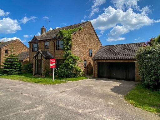 4 bedroom detached house for sale in Pebble View Walk, Hopton, NR31 — £375,000 • 4 bed • 2 bath • 1387 ft²
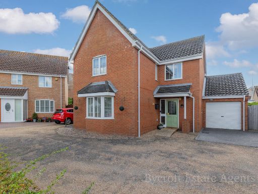 4 bedroom detached house for sale in Freeman Close, Hopton, NR31 — £340,000 • 4 bed • 2 bath • 898 ft²
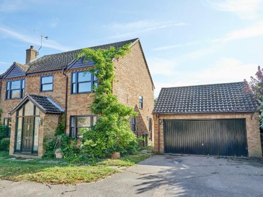 4 bedroom detached house for sale in Pebble View Walk, Hopton, NR31 — £375,000 • 4 bed • 2 bath • 1475 ft²
 4 bedroom detached house for sale in Watsons Close, Hopton, Great Yarmouth, NR31 — £315,000 • 4 bed • 2 bath • 1152 ft²
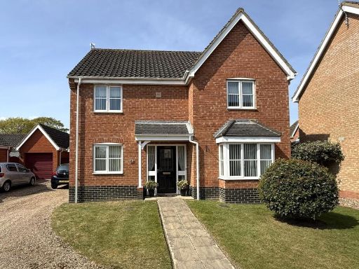 4 bedroom detached house for sale in Kidds Close, Hopton, NR31 — £385,000 • 4 bed • 2 bath • 1100 ft²
Meta
- {
"@context": "https://schema.org",
"@type": "Residence",
"name": "4 bedroom detached house for sale in Seafields Drive, Hopto…",
"description": "",
"url": "https://propertypiper.co.uk/property/2fb0ce14-ed5c-49cf-957c-538b9c1fea41",
"image": "https://image-a.propertypiper.co.uk/ac7b0303-0701-4aa2-8364-670ab570a087-1024.jpeg",
"address": {
"@type": "PostalAddress",
"streetAddress": "38 SEAFIELDS DRIVE HOPTON GREAT YARMOUTH",
"postalCode": "NR31 9TS",
"addressLocality": "Great Yarmouth",
"addressRegion": "Great Yarmouth",
"addressCountry": "England"
},
"geo": {
"@type": "GeoCoordinates",
"latitude": 52.5373832,
"longitude": 1.7243404
},
"numberOfRooms": 4,
"numberOfBathroomsTotal": 2,
"floorSize": {
"@type": "QuantitativeValue",
"value": 1105,
"unitCode": "FTK"
},
"offers": {
"@type": "Offer",
"price": 375000,
"priceCurrency": "GBP",
"availability": "https://schema.org/InStock"
},
"additionalProperty": [
{
"@type": "PropertyValue",
"name": "Feature",
"value": "modern detached house"
},
{
"@type": "PropertyValue",
"name": "Feature",
"value": "two-story"
},
{
"@type": "PropertyValue",
"name": "Feature",
"value": "brick construction"
},
{
"@type": "PropertyValue",
"name": "Feature",
"value": "suburban"
},
{
"@type": "PropertyValue",
"name": "Feature",
"value": "paved driveway"
},
{
"@type": "PropertyValue",
"name": "Feature",
"value": "attached garage"
},
{
"@type": "PropertyValue",
"name": "Feature",
"value": "gable roof"
},
{
"@type": "PropertyValue",
"name": "Feature",
"value": "new construction"
},
{
"@type": "PropertyValue",
"name": "Feature",
"value": "residential area"
},
{
"@type": "PropertyValue",
"name": "Feature",
"value": "contemporary"
},
{
"@type": "PropertyValue",
"name": "Feature",
"value": "hallway"
},
{
"@type": "PropertyValue",
"name": "Feature",
"value": "staircase"
},
{
"@type": "PropertyValue",
"name": "Feature",
"value": "wood flooring"
},
{
"@type": "PropertyValue",
"name": "Feature",
"value": "small staircase"
},
{
"@type": "PropertyValue",
"name": "Feature",
"value": "neutral colors"
},
{
"@type": "PropertyValue",
"name": "Feature",
"value": "modern light fixture"
}
]
}
High Res Floorplan Images
Compatible Floorplan Images
FloorplanImages Thumbnail